Narrow Results By
- Peter and Catharine Whyte fonds 60
- Alpine Club of Canada fonds 18
- Bruno Engler fonds 17
- Arthur Oliver Wheeler fonds 14
- Byron Harmon fonds 4
- Underwood and Underwood Publishers fonds 4
- Edward Feuz fonds 3
- Soapy Smith fonds 3
- Elliott Barnes fonds 2
- Bert Riggall fonds 1
- Bob Hind fonds 1
- Brett family fonds 1
A. W. Drinnan photographs
https://archives.whyte.org/en/permalink/descriptions7237
- Part Of
- Alpine Club of Canada fonds
- Scope & Content
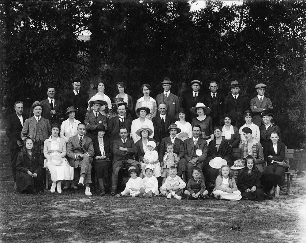
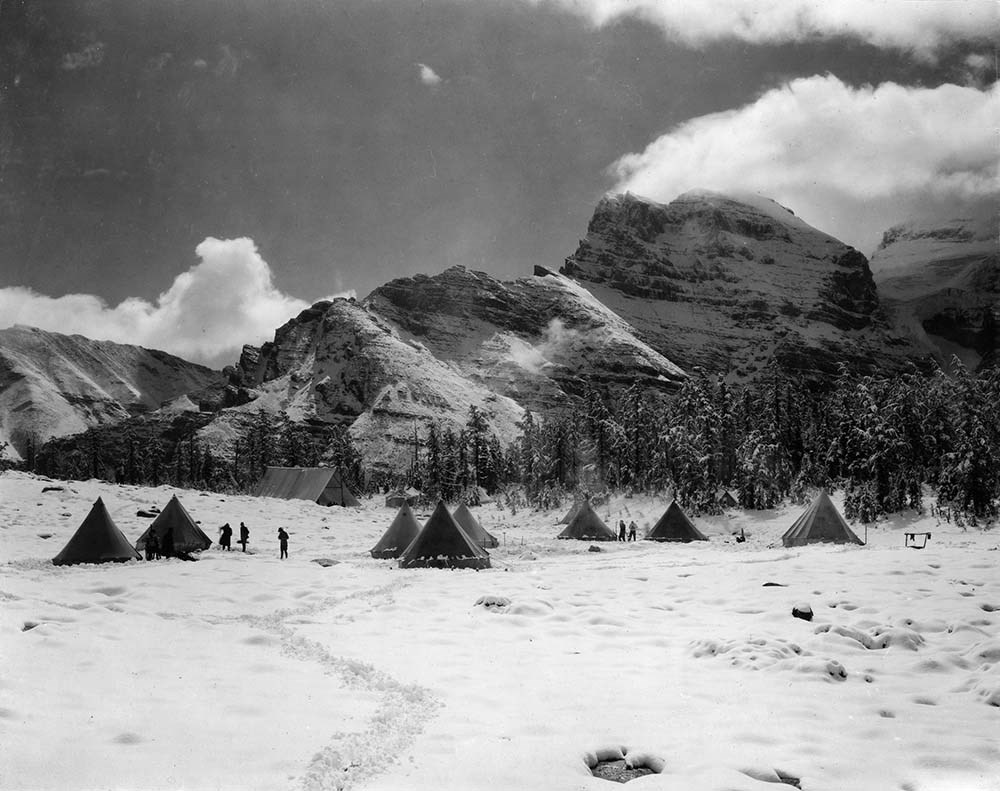
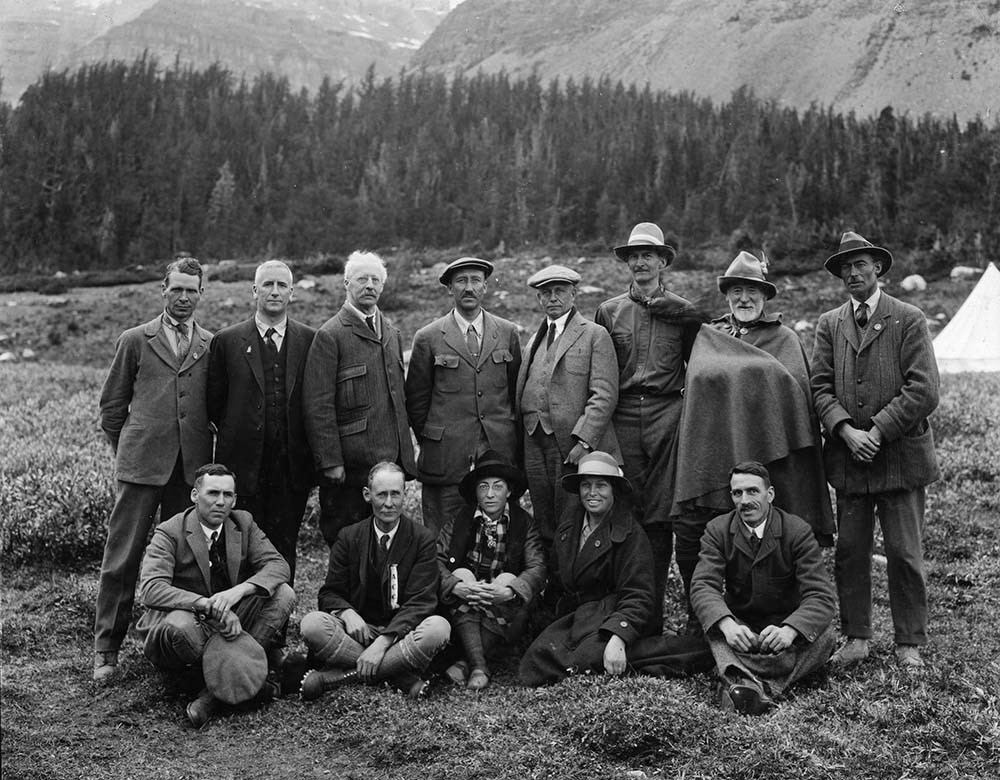
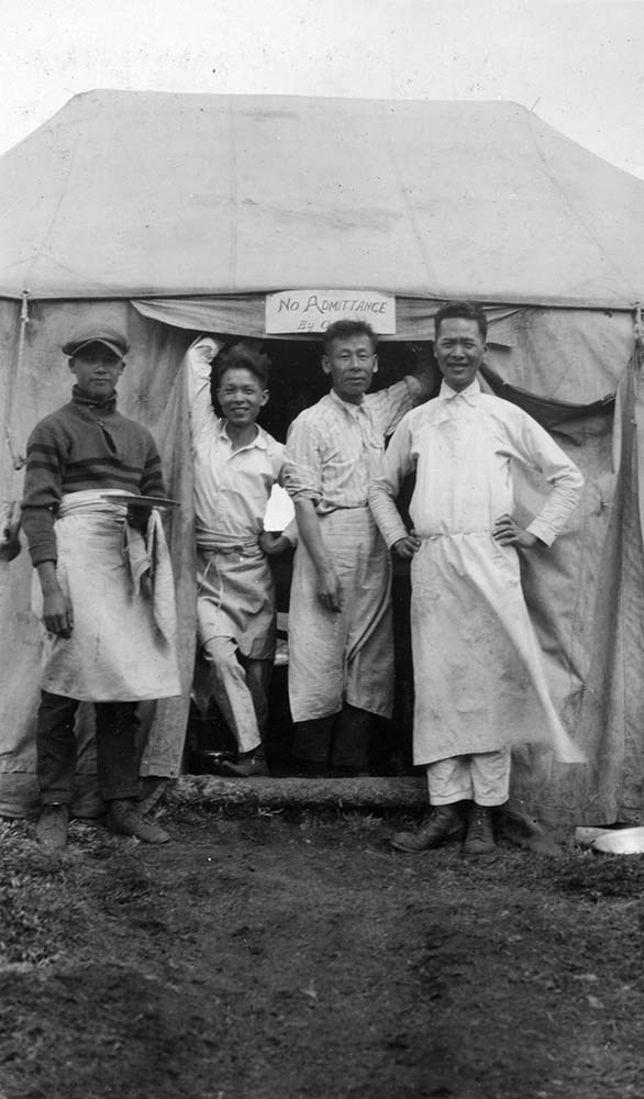
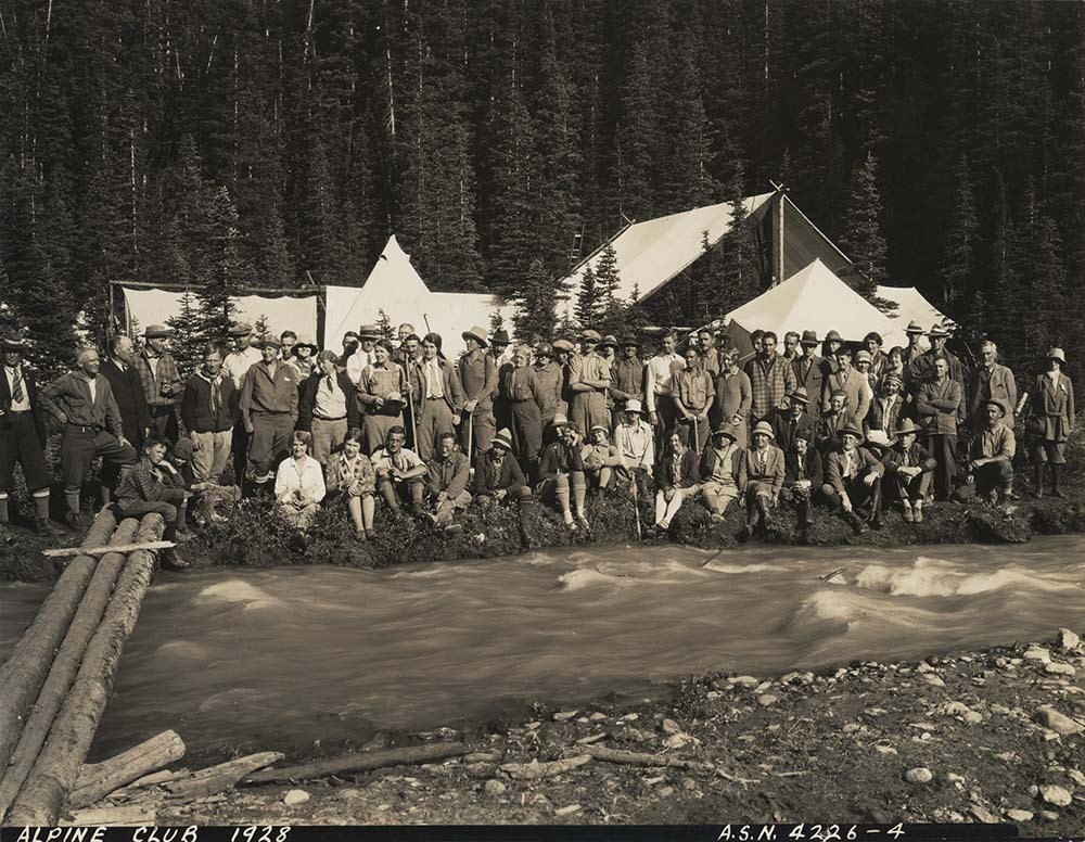
- Album and loose accompanying prints pertain to alpine club camps and activities.
- Date Range
- [ca. 1917-1928]
- Reference Code
- V14 / AC 192P / 01-10
- Description Level
- 5 / File
- GMD
- Photograph
- Photograph print
21 images
- Part Of
- Alpine Club of Canada fonds
- Description Level
- 5 / File
- Fonds Number
- M200 / S6 / V14
- Series
- III. Personal papers and photographs
- Sous-Fonds
- V14
- Accession Number
- 5200
- Reference Code
- V14 / AC 192P / 01-10
- Responsibility
- Album was assembled by A.W. Drinnan; includes many views by H. Pollard.
- Date Range
- [ca. 1917-1928]
- Physical Description
- 1 photograph album (ca.180 prints). -- 9 photographs : prints
- Scope & Content
- Album and loose accompanying prints pertain to alpine club camps and activities.
- Name Access
- Alpine Club of Canada
- Drinnan, A. W.
- Subject Access
- Abbot Pass Hut
- Activities
- Administration
- Advertising
- Alpine Club of Canada
- Alpine Club House
- Cabins
- Cabins and shelters
- Camps
- Club
- Competition
- Discovery and exploration
- Environment
- Environment and Nature
- Exploration
- Guide
- Guides
- Hiking
- Huts
- Mountain
- Mountain guides
- Mountaineering
- Mountaineers
- Mountains
- National parks and reserves
- Organizations
- Photography
- Scenery
- Sports and recreation
- Summit
- Geographic Access
- Banff National Park
- Jasper National Park
- Yoho National Park
- Alberta
- British Columbia
- Canada
- Language
- English
- Title Source
- Title based on album
- Processing Status
- Processed
Images


This material is presented as originally created; it may contain outdated cultural descriptions and
potentially offensive content.
Read more.
Abbot Pass Hut Registers
https://archives.whyte.org/en/permalink/descriptions57635
- Part Of
- Alpine Club of Canada fonds
- Scope & Content
- Sub-series of hut registers from Abbot Hut produced by the Alpine Club of Canada between 1954 and 2017. Registers include entries from visitors to the huts which pertain to individuals' hiking and climbing trips; details of specific events which occurred while staying at the hut, wildlife sightings…
- Date Range
- 1954 - 1970
- 1972 - 1983
- 1987 - 2009
- 2011 - 2018
- Reference Code
- M200 / IV / A
- Description Level
- 4 / Sub-series
- GMD
- Organization record
- Textual record
1 image
1 Electronic Resource
- Part Of
- Alpine Club of Canada fonds
- Description Level
- 4 / Sub-series
- Fonds Number
- M200
- V14
- S6
- Series
- M200 / IV: Hut Registers
- Sous-Fonds
- M200
- Sub-Series
- M200 / IV / A: Abbot Pass Hut Registers
- Accession Number
- accn. 2023.19
- accn. 8002
- accn. 2023.20
- accn. 2023.32
- accn. 1299
- accn. 1040
- accn. 2141
- accn. 3298
- accn. 3757
- accn. 6376
- accn. 6465
- accn. 6623
- accn. 7779
- accn. 2023.10
- accn. 2024.20
- Reference Code
- M200 / IV / A
- Responsibility
- Registers produced by Alpine Club of Canada
- Date Range
- 1954 - 1970
- 1972 - 1983
- 1987 - 2009
- 2011 - 2018
- Physical Description
- 53 cm of textual records (26 volumes)
- History / Biographical
- Abbot Pass Hut was built in 1922 and sits at an elevation of 2,926 meters. It is one of the highest structures in Canada. The hut was named after Philip Stanley Abbot who had died from a fall during the first known attempt to reach the summit of Mount Lefroy. The hut was a national historic site, but the hut was closed to visitors in 2018 due to the erosion of the slope beneath the hut. On June 30, 2022 Parks Canada officially removed Abbot Pass Hut, due to those environmental factors.
- Scope & Content
- Sub-series of hut registers from Abbot Hut produced by the Alpine Club of Canada between 1954 and 2017. Registers include entries from visitors to the huts which pertain to individuals' hiking and climbing trips; details of specific events which occurred while staying at the hut, wildlife sightings, custodial issues and updates, and related topics. The sub-series is separated into individual hut registers, arranged by date:
- M200 / IV / A / 1: Abbot Pass Hut register [1954 - 1960]
- M200 / IV / A / 2: [Abbot Pass Hut Register 1954 - 1970]
- M200 / IV / A / 3: [Abbot Pass Hut? loose register 1972 - 1974]
- M200 / IV / A / 4: [Abbot] Pass Hut [register 1974 - 1978]
- M200 / IV / A / 5: Abbot Hut [register 1979 - 1980]
- M200 / IV / A / 6: [Abbot]'s Hut Registry [1980 - 1982]
- M200 / IV / A / 7: [Abbot Pass Hut Register 1982 - 1983]
- M200 / IV / A / 8: [Abbot Pass register 1983]
- M200 / IV / A / 9: [Abbot Hut Register 1987]
- M200 / IV / A / 10: Abbot's Hut Bible [register, 1988 - 1992]
- M200 / IV / A / 11: Abbot Pass Hut 1992 - 93
- M200 / IV / A / 12: "Abbot Pass Hut Log Book" Aug. 24, 1993 - July 20, 1995
- M200 / IV / A / 13: Abbot Pass hut register Aug. 11, 1995 - July 30, 1996.
- M200 / IV / A / 14: [Abbot Pass] hut register July 30, 1996 - May 4, 1997
- M200 / IV / A / 15: "Abbot Pass Hut Register" June 26, 1997 - September 3, 1998
- M200 / IV / A / 16: Abbot Pass Hut [1998- 2000]
- M200 / IV / A / 17: Abbot Pass Sep 6, 2000 - July 26, 2002
- M200 / IV / A / 18: Abbot Hut Register 2002 - 2003
- M200 / IV / A / 19: Abbot Pass Aug 31, 2003 - Aug 20, 2005
- M200 / IV / A / 20: Abbot Pass Register 2004 - 2007
- M200 / IV / A / 21: Abbot Hut Register 2007 - 2009
- M200 / IV / A / 22: [2011 Abbot Hut Register]
- M200 / IV / A / 23: Abbot Hut Register [2012 - 2014]
- M200 / IV / A / 24: Abbot Pass Hut Register [2014 - 2016]
- M200 / IV / A / 25: Abbot Pass Hut Register, 2016 - 2017
- M200 / IV / A / 26: [Abbot Pass Hut Register: 2017-2018]
- Name Access
- Alpine Club of Canada
- Subject Access
- Abbot Pass Hut
- Cabins
- Cabins and shelters
- Climbing
- Environment
- Exploration
- Huts
- Mountains
- Geographic Access
- Canada
- Alberta
- British Columbia
- Canadian Rocky Mountains
- Access Restrictions
- Restrictions may apply
- Reproduction Restrictions
- Contains personal information
- Language
- English
- French
- Spanish
- Japanese
- German
- Conservation
- Some registers have been placed in mylar
- Biographical Source Notes
- The Alpine Club of Canada website: https://www.alpineclubofcanada.ca/abbot-pass-hut/ The Government of Canada website: https://parks.canada.ca/pn-np/bc/yoho/culture/abbot
- Title Source
- Title based on contents of sub-series
- Processing Status
- Processed
Electronic Resources

Images

This material is presented as originally created; it may contain outdated cultural descriptions and
potentially offensive content.
Read more.
ACMG [Association of Canadian Mountain Guides] - File, Mountain Guide training
https://archives.whyte.org/en/permalink/descriptions56715
- Part Of
- Bruno Engler fonds
- Scope & Content
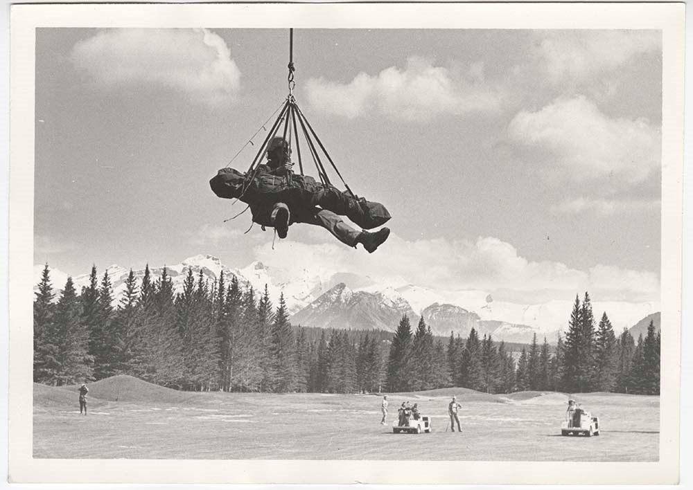
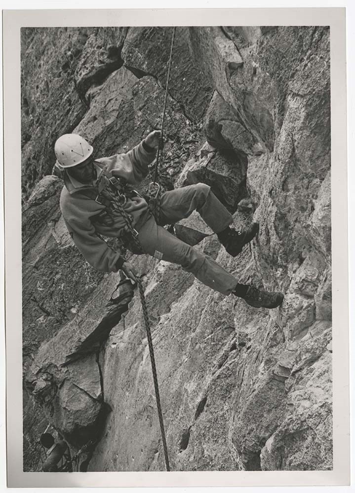
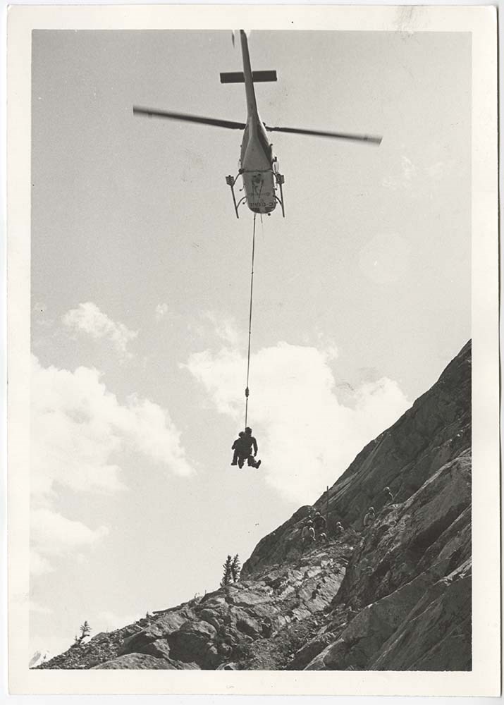
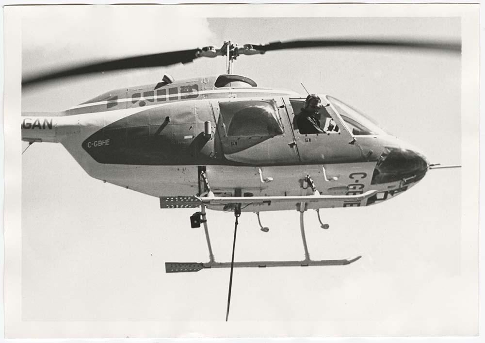
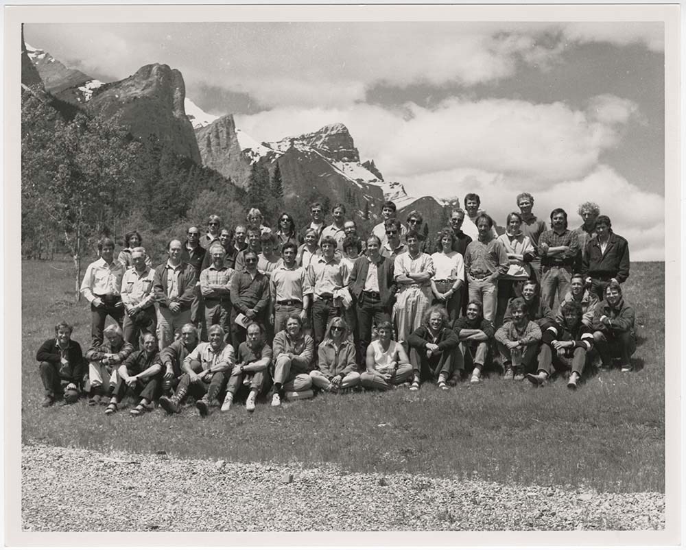
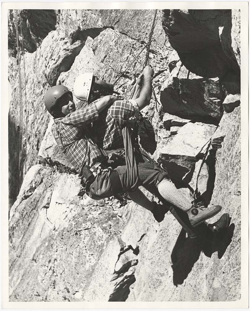
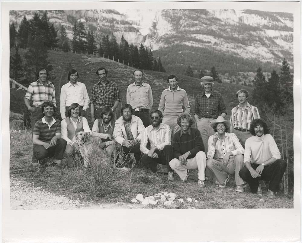
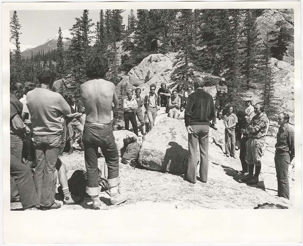
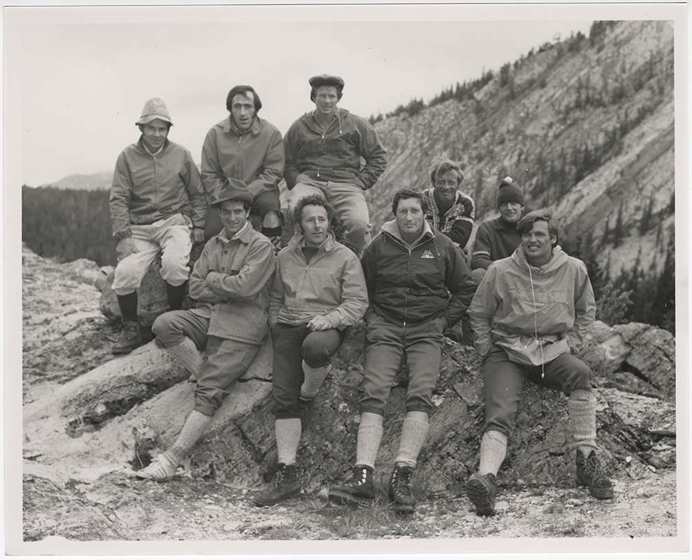
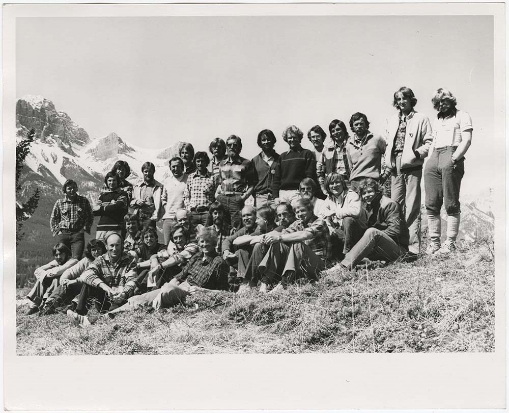
- File pertains to 34 b&w prints of the Association of Canadian Mountain Guides training courses and members. Includes shots of potential members participating in training courses [usually on Tunnel Mountain] as well as posed group shots of ACMG members.
- Date Range
- 1980-1992
- Reference Code
- V190 / VI / A / v / PA - 01 to PA - 34
- Description Level
- 5 / File
- GMD
- Photograph
- Photograph print
12 images
- Part Of
- Bruno Engler fonds
- Description Level
- 5 / File
- Fonds Number
- M323 / S40 / V190
- Series
- VI : Retained file, A : Alphabetical order
- Sous-Fonds
- V190
- Sub-Series
- v : ACMG
- Accession Number
- 7436
- Reference Code
- V190 / VI / A / v / PA - 01 to PA - 34
- Date Range
- 1980-1992
- Physical Description
- 34 photographs : col. & b&w ; 25.5 x 20.5 cm or smaller
- History / Biographical
- See fonds level description
- Scope & Content
- File pertains to 34 b&w prints of the Association of Canadian Mountain Guides training courses and members. Includes shots of potential members participating in training courses [usually on Tunnel Mountain] as well as posed group shots of ACMG members.
- Notes
- Identities of people in PA - 27 from left to right [back row]: Rüdi Geitsch, Tim Auger, Peter Schlunegger, Bernie Schiesser, Hans Gmoser, [unidentified], Lloyd "Kiwi" Gallagher ; [front row]: [unidentified], [unidentified], Scott Flavelle, Clair Israelson, Dave Cochrane?, [unidentified], Phil Heim, Dan Griffith. Identities of people in PA - 29, from left to right [back row]: Frank Stark, Rüdi Geitsch, Lloyd "Kiwi" Gallagher ; [front row]: Leo Gullmair, [unidentified], Hans Gmoser, [unidentified], Pierre Lentire?, Sepp Renner. Identifications provided by Chic Scott
- Subject Access
- Climbing
- Helicopters
- Guides
- Guiding
- Mountaineering
- Mountaineers
- Mountains
- Portrait
- Geographic Access
- Banff
- Banff National Park
- Alberta
- Language
- English
- Related Material
- V190 / VI / A / v / NA - 01 to NA - 33
- Creator
- Engler, Bruno
- Title Source
- Original title kept
- Processing Status
- Processed
Images


This material is presented as originally created; it may contain outdated cultural descriptions and
potentially offensive content.
Read more.
A.L. Harkness photograph album
https://archives.whyte.org/en/permalink/descriptions7229
- Part Of
- Alpine Club of Canada fonds
- Scope & Content
- Album contains miscellaneous views.
- Date Range
- 1917
- Reference Code
- V14 / AC 055P / 30
- Description Level
- 5 / File
- GMD
- Photograph
- Photograph print
1 image
- Part Of
- Alpine Club of Canada fonds
- Description Level
- 5 / File
- Fonds Number
- M200 / S6 / V14
- Series
- III. Personal papers and photographs
- Sous-Fonds
- V14
- Accession Number
- 5200
- Reference Code
- V14 / AC 055P / 30
- Date Range
- 1917
- Physical Description
- 1 photograph album (27 prints)
- Scope & Content
- Album contains miscellaneous views.
- Name Access
- Alpine Club of Canada
- Harkness, A.L.
- Subject Access
- Abbot Pass Hut
- Activities
- Administration
- Advertising
- Alpine Club of Canada
- Alpine Club House
- Cabins
- Cabins and shelters
- Camps
- Club
- Competition
- Discovery and exploration
- Environment
- Environment and Nature
- Exploration
- Guide
- Guides
- Hiking
- Huts
- Mountain
- Mountain guides
- Mountaineering
- Mountaineers
- Mountains
- National parks and reserves
- Organizations
- Photography
- Scenery
- Sports and recreation
- Summit
- Geographic Access
- Banff National Park
- Jasper National Park
- Yoho National Park
- Alberta
- British Columbia
- Canada
- Language
- English
- Title Source
- Title based on preliminary inventory
- Processing Status
- Processed
Images

This material is presented as originally created; it may contain outdated cultural descriptions and
potentially offensive content.
Read more.
Alberta- British Columbia Boundary Commission. Photographs by A.O. Wheeler. Album 3.1916 [369 - 554]
https://archives.whyte.org/en/permalink/descriptions22805
- Part Of
- Arthur Oliver Wheeler fonds
- Scope & Content
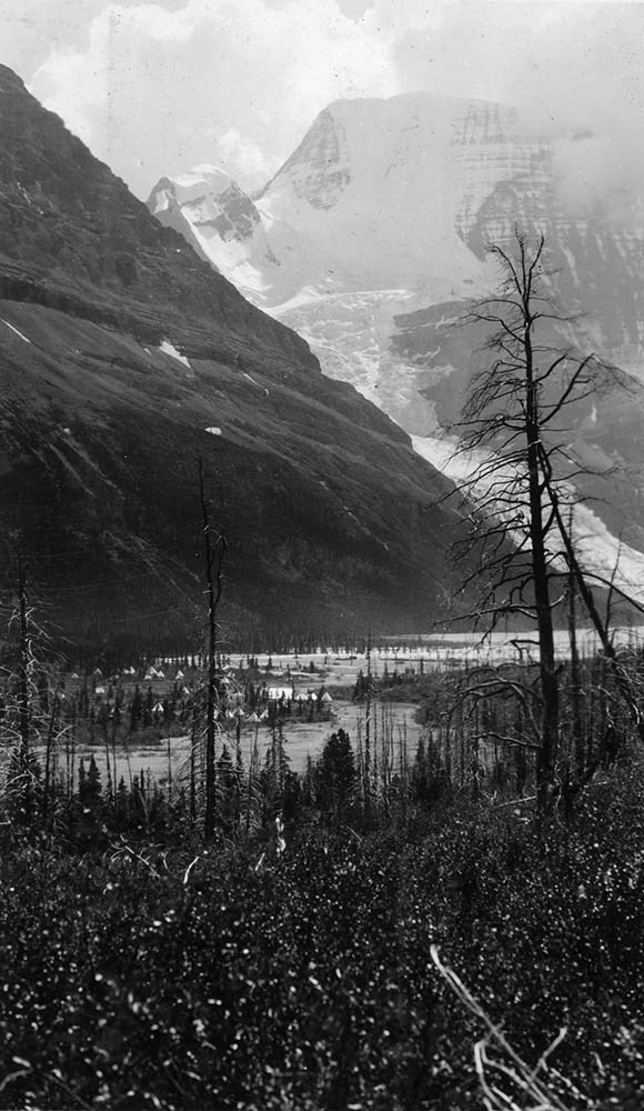
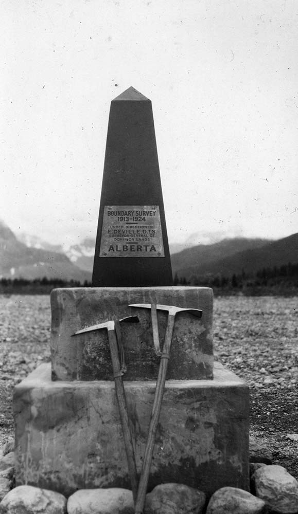
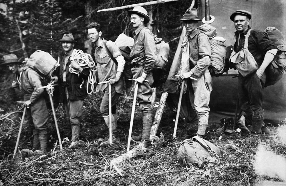
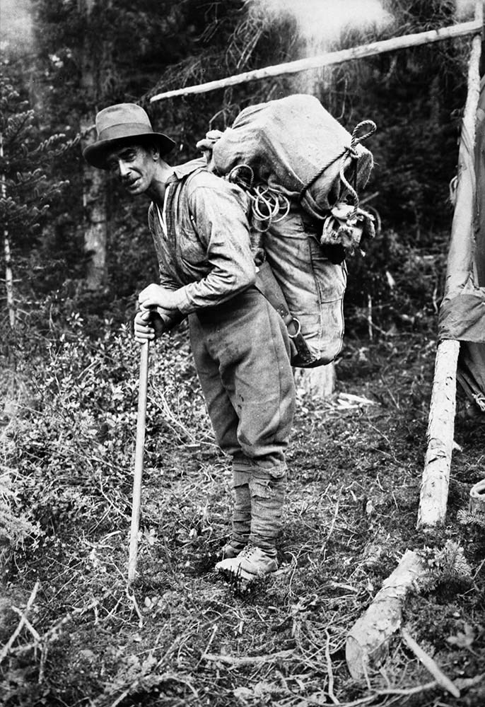
- Alberta- British Columbia Boundary Commission. Photographs by A.O. Wheeler. Album 3. Includes list of stations with bearings and coordinates for each related photograph.
- Date Range
- 1916
- Reference Code
- V771 / PD -7
- Description Level
- 5 / File
1 image
- Part Of
- Arthur Oliver Wheeler fonds
- Description Level
- 5 / File
- Fonds Number
- V771
- Sous-Fonds
- V771
- Accession Number
- 8144
- Reference Code
- V771 / PD -7
- Date Range
- 1916
- Physical Description
- 1 photograph album: 190 pages 1 map affixed to second page
- Scope & Content
- Alberta- British Columbia Boundary Commission. Photographs by A.O. Wheeler. Album 3. Includes list of stations with bearings and coordinates for each related photograph.
- Subject Access
- Surveying/ Cartography
- Mountains
- Title Source
- Title taken from source.
- Processing Status
- Processed
Images
This material is presented as originally created; it may contain outdated cultural descriptions and
potentially offensive content.
Read more.
Alberta- British Columbia Boundary Commission. Photographs by A.O. Wheeler. B. C. L. S.1918. vol.1A, Stations 49 -56
https://archives.whyte.org/en/permalink/descriptions22812
- Part Of
- Arthur Oliver Wheeler fonds
- Scope & Content
- Alberta- British Columbia Boundary Commission. Photographs by A.O. Wheeler. Vol 1A. Stations 49 -56. Includes list of stations with bearings and coordinates for each related photograph. Annotations appear on some photographs and descriptions underneath photographs. Front cover has page taped to cov…
- Date Range
- 1918
- Reference Code
- V771 / PD -14
- Description Level
- 5 / File
4 images
- Part Of
- Arthur Oliver Wheeler fonds
- Description Level
- 5 / File
- Fonds Number
- V771
- Sous-Fonds
- V771
- Accession Number
- 8144
- Reference Code
- V771 / PD -14
- Date Range
- 1918
- Physical Description
- 1 photograph album: 27 pages
- Scope & Content
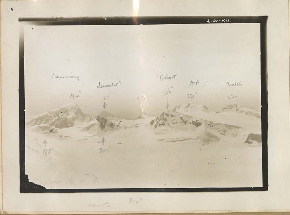
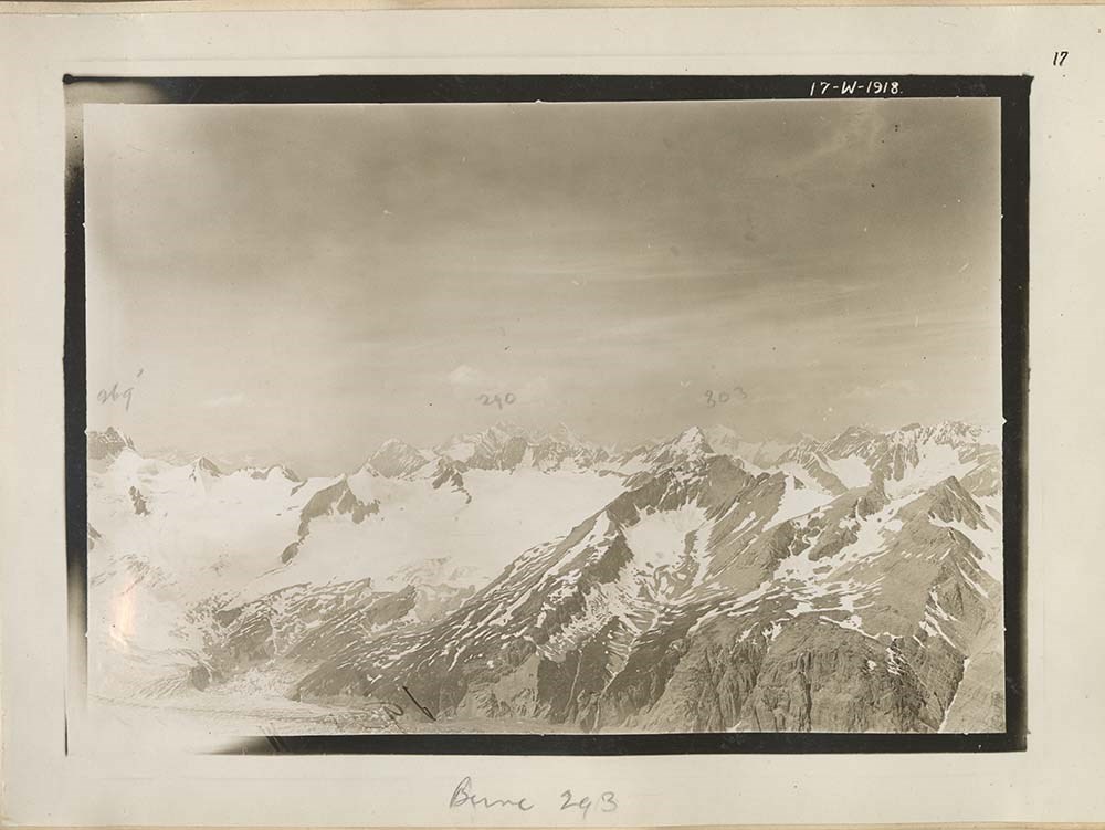
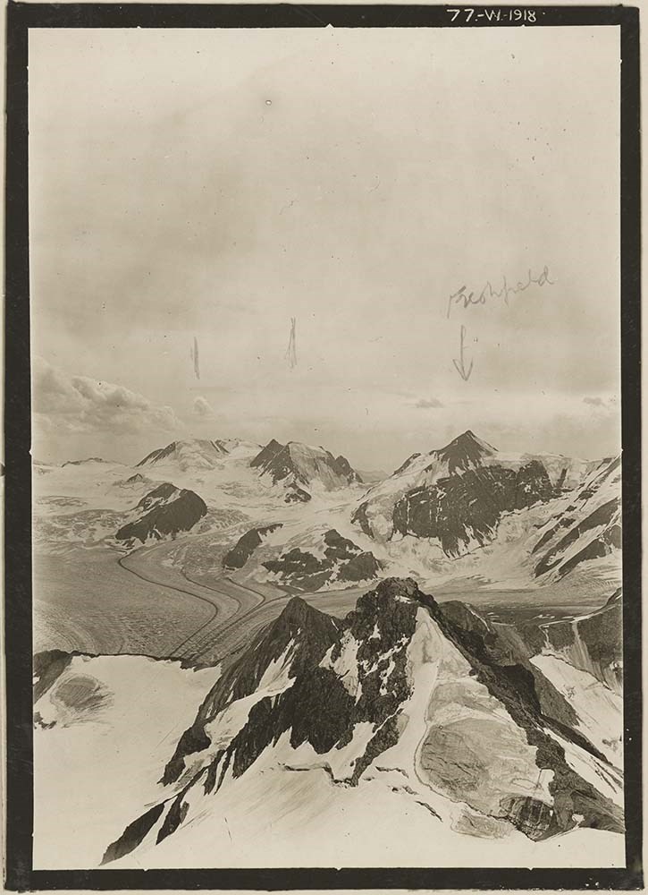
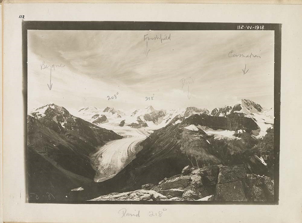
- Alberta- British Columbia Boundary Commission. Photographs by A.O. Wheeler. Vol 1A. Stations 49 -56. Includes list of stations with bearings and coordinates for each related photograph. Annotations appear on some photographs and descriptions underneath photographs. Front cover has page taped to cover, " Alan Campbell, Arras ant SE end, Freshfield from W, PKs S of Bluewater G.".
- Subject Access
- Surveying/ Cartography
- Mountains
- Title Source
- Title taken from source.
- Processing Status
- Processed
Images


This material is presented as originally created; it may contain outdated cultural descriptions and
potentially offensive content.
Read more.
Alberta- British Columbia Boundary Commission. Photographs by A.O. Wheeler. B. C. L. S.1918. vol.1B, Stations 56 -61
https://archives.whyte.org/en/permalink/descriptions22813
- Part Of
- Arthur Oliver Wheeler fonds
- Scope & Content
- Alberta- British Columbia Boundary Commission. Photographs by A.O. Wheeler. Vol 1B. Stations 56 -61. Includes list of stations with bearings and coordinates for each related photograph. Annotations appear on some descriptions underneath photographs. Clear plastic has been taped onto portions of som…
- Date Range
- 1918
- Reference Code
- V771 / PD -15
- Description Level
- 5 / File
3 images
- Part Of
- Arthur Oliver Wheeler fonds
- Description Level
- 5 / File
- Fonds Number
- V771
- Sous-Fonds
- V771
- Accession Number
- 8144
- Reference Code
- V771 / PD -15
- Date Range
- 1918
- Physical Description
- 1 photograph album: 27 pages
- Scope & Content
- Alberta- British Columbia Boundary Commission. Photographs by A.O. Wheeler. Vol 1B. Stations 56 -61. Includes list of stations with bearings and coordinates for each related photograph. Annotations appear on some descriptions underneath photographs. Clear plastic has been taped onto portions of some of the photographs. Front cover has page taped to cover, " Alan Campbell, Mons fault- S, Upper Bluewater w, [Arras Gaficline], Mummery N, Fairfield W.".
- Subject Access
- Surveying/ Cartography
- Mountains
- Title Source
- Title taken from source.
- Processing Status
- Processed
Images


This material is presented as originally created; it may contain outdated cultural descriptions and
potentially offensive content.
Read more.
Alberta- British Columbia Boundary Commission. Photographs by A.O. Wheeler. B. C. L. S.1918. vol.2A, Stations 61 -65
https://archives.whyte.org/en/permalink/descriptions22891
- Part Of
- Arthur Oliver Wheeler fonds
- Scope & Content
- Alberta- British Columbia Boundary Commission. Photographs by A.O. Wheeler. Vol 2A. Stations 61 -65.Stations 13-17 was originally typed, then crossed out and changed to 61-65 in handwriting. Includes list of stations with bearings and coordinates for each related photograph. Annotations appear on s…
- Date Range
- 1918
- Reference Code
- V771 / PD -16
- Description Level
- 5 / File
1 image
- Part Of
- Arthur Oliver Wheeler fonds
- Description Level
- 5 / File
- Fonds Number
- V771
- Sous-Fonds
- V771
- Accession Number
- 8144
- Reference Code
- V771 / PD -16
- Date Range
- 1918
- Physical Description
- 1 photograph album: 27 pages
- Scope & Content
- Alberta- British Columbia Boundary Commission. Photographs by A.O. Wheeler. Vol 2A. Stations 61 -65.Stations 13-17 was originally typed, then crossed out and changed to 61-65 in handwriting. Includes list of stations with bearings and coordinates for each related photograph. Annotations appear on some descriptions underneath photographs. Clear plastic has been taped onto portions of some of the photographs. Front cover has page taped to cover, "Cockscomb nat SE, Mons fault SE"
- Subject Access
- Surveying/ Cartography
- Mountains
- Title Source
- Title taken from source.
- Processing Status
- Processed
Images
This material is presented as originally created; it may contain outdated cultural descriptions and
potentially offensive content.
Read more.
Alberta- British Columbia Boundary Commission. Photographs by A.O. Wheeler. B. C. L. S.1918. vol.3A, Stations 72 -76
https://archives.whyte.org/en/permalink/descriptions22893
- Part Of
- Arthur Oliver Wheeler fonds
- Scope & Content
- Alberta- British Columbia Boundary Commission. Photographs by A.O. Wheeler. Vol 3A. Stations 72 -76.Stations 24-28 was originally typed, then crossed out and changed to 72-76 in handwriting. Includes list of stations with bearings and coordinates for each related photograph. Annotations appear on s…
- Date Range
- 1918
- Reference Code
- V771 / PD -18
- Description Level
- 5 / File
2 images
- Part Of
- Arthur Oliver Wheeler fonds
- Description Level
- 5 / File
- Fonds Number
- V771
- Sous-Fonds
- V771
- Accession Number
- 8144
- Reference Code
- V771 / PD -18
- Date Range
- 1918
- Physical Description
- 1 photograph album: 27 pages
- Scope & Content
- Alberta- British Columbia Boundary Commission. Photographs by A.O. Wheeler. Vol 3A. Stations 72 -76.Stations 24-28 was originally typed, then crossed out and changed to 72-76 in handwriting. Includes list of stations with bearings and coordinates for each related photograph. Annotations appear on some descriptions underneath photographs. Clear plastic has been taped onto portions of some of the photographs, this plastic has been written on in pen. Front cover has page taped to cover, "N end Mons fault, Mt. Bryce E, E of Re[?]i Br (syncline E of Cockscomb ont), W of Bush R."
- Subject Access
- Surveying/ Cartography
- Mountains
- Title Source
- Title taken from source.
- Processing Status
- Processed
Images


This material is presented as originally created; it may contain outdated cultural descriptions and
potentially offensive content.
Read more.
Assiniboine Area
https://archives.whyte.org/en/permalink/descriptions17526
- Part Of
- Bob Hind fonds
- Scope & Content
- File pertains to Mount Assiniboine area, landscapes, cars and camp 1950, climbing 1952, Mount Assiniboine Lodge 1985.
- Date Range
- 1950-1991
- Reference Code
- V46 / I / A / 35 / NS - 1 to 61
- Description Level
- 5 / File
- GMD
- Negative
- Transparency
1 image
- Part Of
- Bob Hind fonds
- Description Level
- 5 / File
- Fonds Number
- M7 / V46
- Series
- I.A. Mountain travel and recreation, western Canada : Trips and activities
- Sous-Fonds
- V46
- Accession Number
- 7181
- Reference Code
- V46 / I / A / 35 / NS - 1 to 61
- GMD
- Negative
- Transparency
- Date Range
- 1950-1991
- Physical Description
- 61 photographs : transparencies, 35mm, col
- History / Biographical
- See fonds level description.
- Scope & Content
- File pertains to Mount Assiniboine area, landscapes, cars and camp 1950, climbing 1952, Mount Assiniboine Lodge 1985.
- Name Access
- Hind, Bob
- Subject Access
- Activities
- Backpacking
- Cabins and shelters
- Environment
- Guide
- Guiding
- Mountaineering
- Mountains
- Professional and Personal Life
- Transportation
- Geographic Access
- Mount Assiniboine
- Assiniboine Provincial Park
- British Columbia
- Canada
- Language
- NA
- Title Source
- Title based on contents of file
- Processing Status
- Processed
Images

This material is presented as originally created; it may contain outdated cultural descriptions and
potentially offensive content.
Read more.
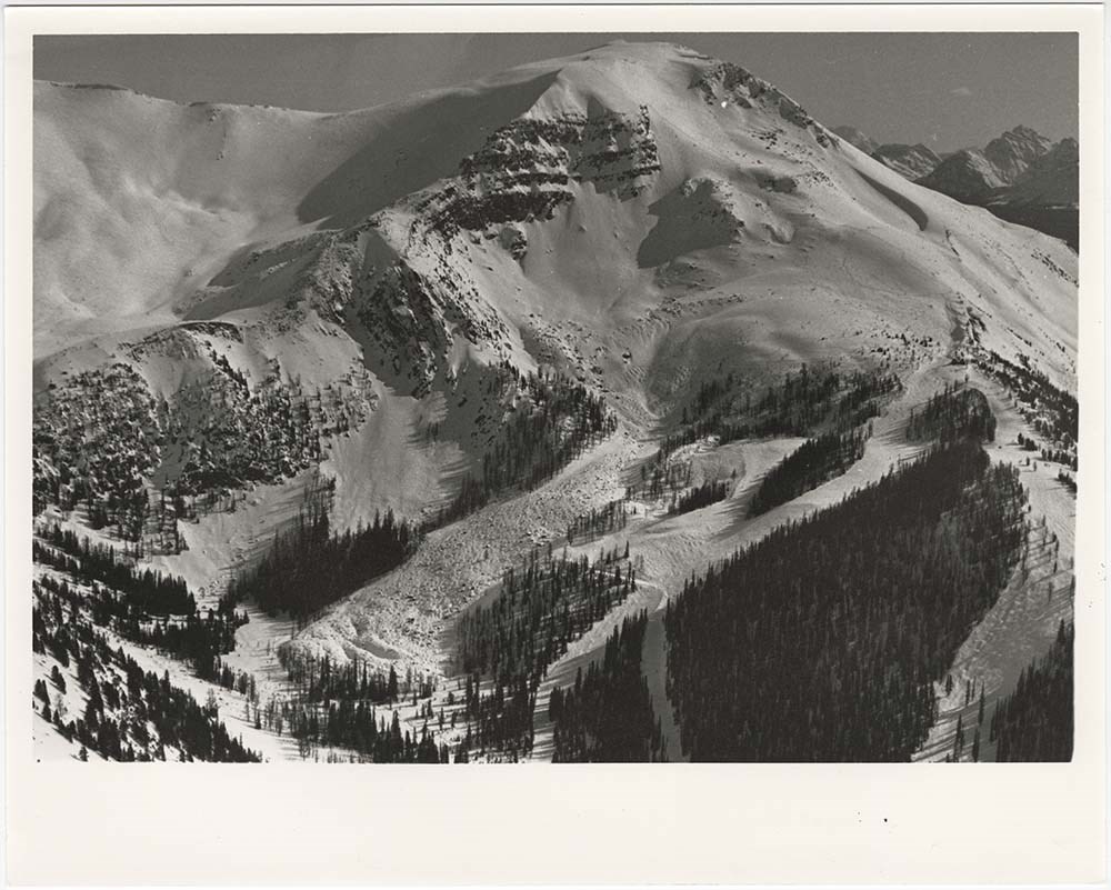
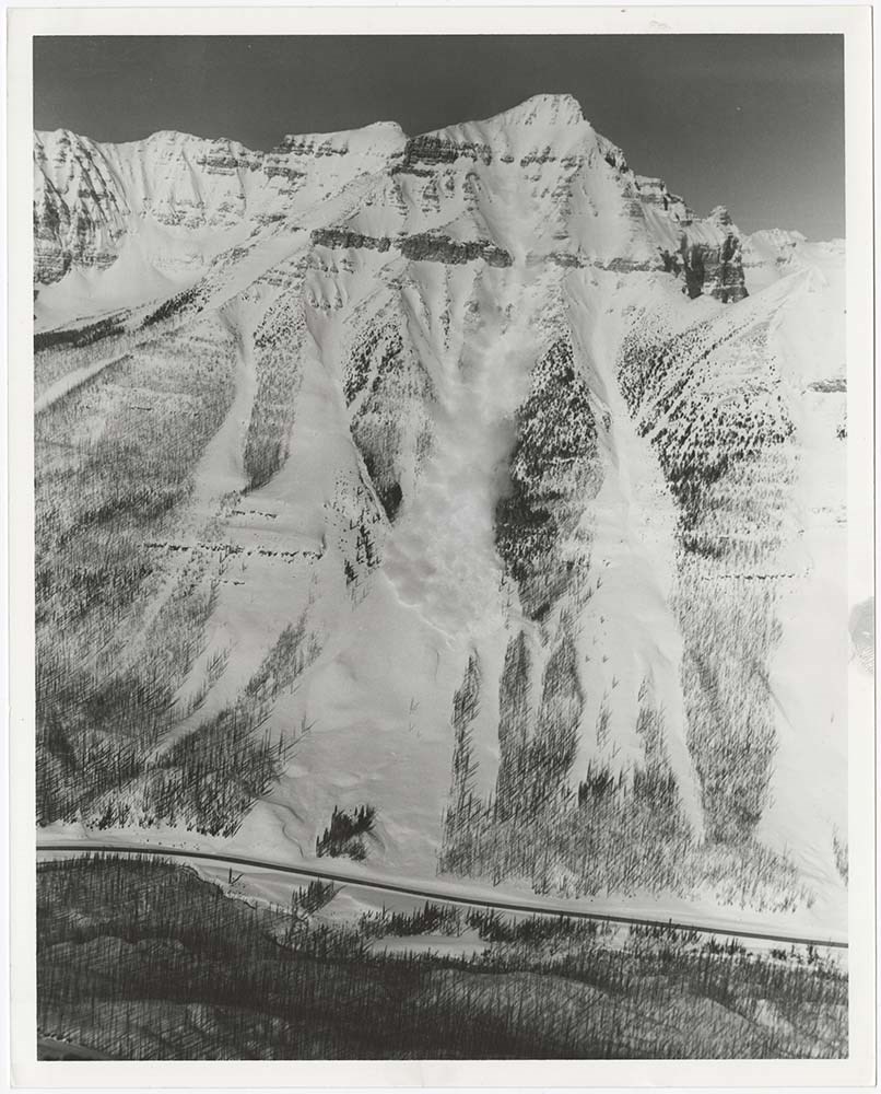
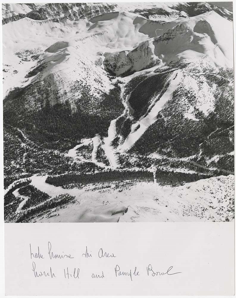
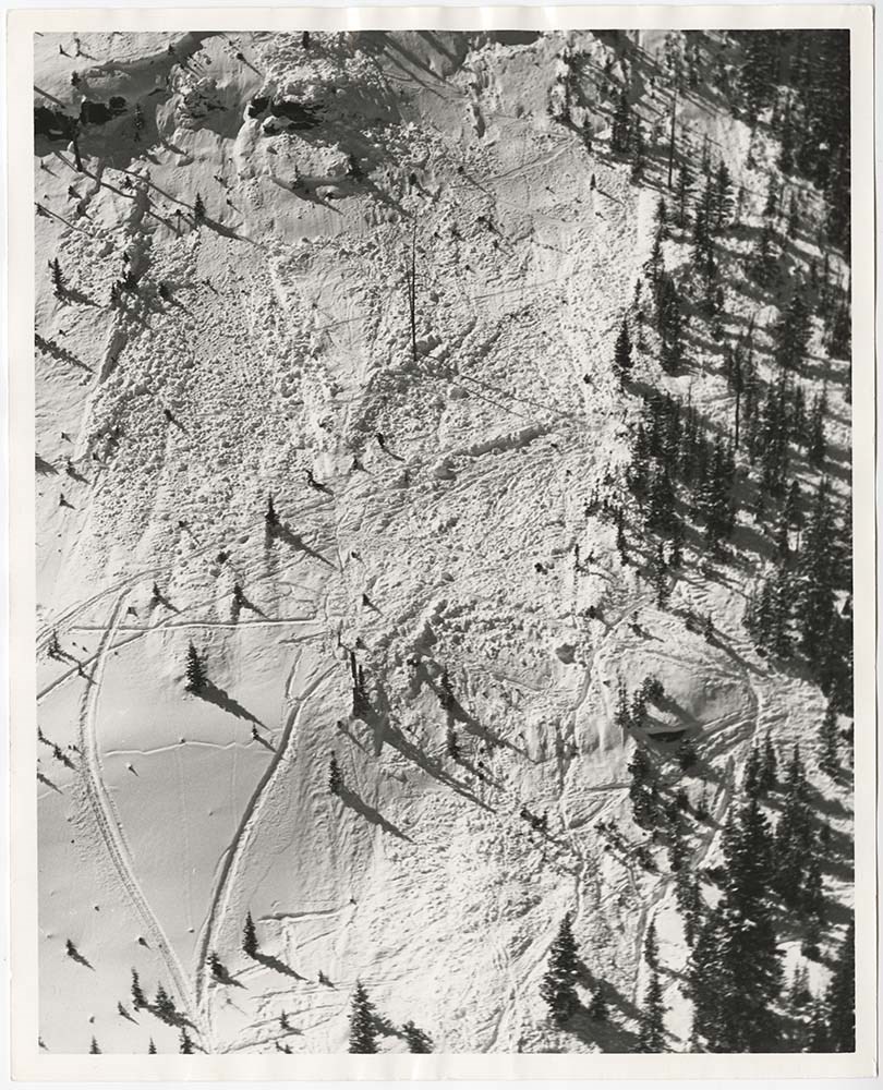
Avalanche Zones
https://archives.whyte.org/en/permalink/descriptions56753
- Part Of
- Bruno Engler fonds
- Scope & Content
- File pertains to 58 b&w prints of various avalanche areas and slides around Banff National Park, mostly focussed along stretches of highways and in and around ski areas, including backcountry ski areas like Assiniboine.
- Date Range
- [ca. 1977-1990]
- Reference Code
- V190 / VI / A / vi / d / PA - 01 to PA - 58
- Description Level
- 5 / File
- GMD
- Photograph
4 images
- Part Of
- Bruno Engler fonds
- Description Level
- 5 / File
- Fonds Number
- M323 / S40 / V190
- Series
- VI : Retained file, A : Alphabetical order
- Sous-Fonds
- V190
- Sub-Series
- vi : Avalanches, d : Zones
- Accession Number
- 7436
- Reference Code
- V190 / VI / A / vi / d / PA - 01 to PA - 58
- GMD
- Photograph
- Date Range
- [ca. 1977-1990]
- Physical Description
- 58 photographs : b&w ; 20.3 x 25.4 cm or smaller
- History / Biographical
- See fonds level description
- Scope & Content
- File pertains to 58 b&w prints of various avalanche areas and slides around Banff National Park, mostly focussed along stretches of highways and in and around ski areas, including backcountry ski areas like Assiniboine.
- Subject Access
- Aerial photography
- Avalanches
- Banff-Jasper Highway
- Backcountry skiing
- Lake Louise Ski Area
- Mountains
- Ski areas
- Sunshine Ski Resort
- Winter
- Geographic Access
- Banff National Park
- Alberta
- Mount Assiniboine
- Mount Assiniboine Provincial Park
- British Columbia
- Language
- English
- Related Material
- V190 / VI / A / vi / d / NA - 01 to NA - 09
- Creator
- Engler, Bruno
- Title Source
- Original title kept
- Processing Status
- Processed
Images
This material is presented as originally created; it may contain outdated cultural descriptions and
potentially offensive content.
Read more.
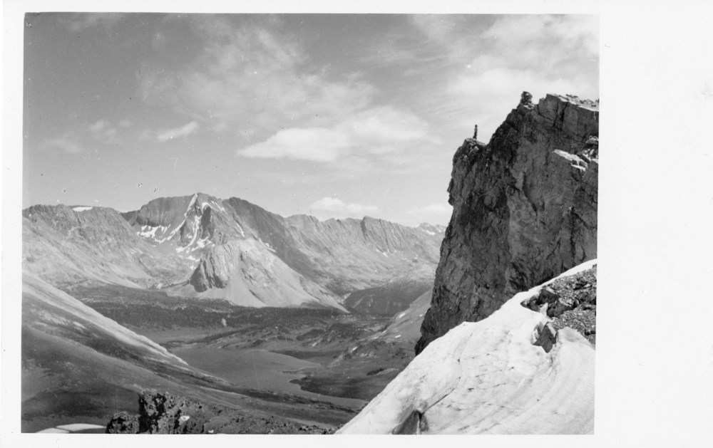
Baker Lake from Deception Mountain
https://archives.whyte.org/en/permalink/descriptions53156
- Part Of
- Peter and Catharine Whyte fonds
- Scope & Content
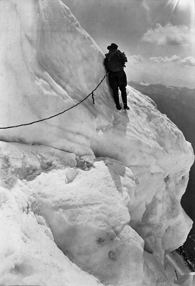
- Image of an unidentified person posed on a cliff on Mt. Deception with Baker Lake in the distance
- Date Range
- [ca. 1885-1945]
- Reference Code
- V683 / III / A / 15 / PA - 720
- Description Level
- 6 / Item
- GMD
- Photograph
- Postcard
2 images
- Part Of
- Peter and Catharine Whyte fonds
- Description Level
- 6 / Item
- Fonds Number
- M36 / V683 / S37
- Series
- V683 / III / A / 15 : Peter and Catharine Whyte: Collected Photographs
- Sous-Fonds
- V683
- Accession Number
- .
- Reference Code
- V683 / III / A / 15 / PA - 720
- GMD
- Photograph
- Postcard
- Date Range
- [ca. 1885-1945]
- Physical Description
- Photograph: 1 print (front and back) ; b&w.
- Scope & Content
- Image of an unidentified person posed on a cliff on Mt. Deception with Baker Lake in the distance
- Subject Access
- Baker Lake
- Mountains
- Mt. Deception
- Geographic Access
- Banff National Park
- Language
- English
- Title Source
- Title based on item
- Processing Status
- Processed
Images
This material is presented as originally created; it may contain outdated cultural descriptions and
potentially offensive content.
Read more.
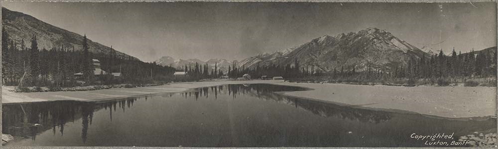
Banff and area scenic views, King Edward Hotel
https://archives.whyte.org/en/permalink/descriptions55027
- Part Of
- Luxton family fonds
- Scope & Content
- File consists of 14 b&w photograph prints [loose and on matboard]. Content pertains to local views near Banff, including Georgina Luxton riding in a carriage along Tunnel Mountain Trail, a hunting trip north of Banff with guide George Harrison[?], the King Edward Hotel building exterior and surroun…
- Date Range
- 1904-1905
- 1910
- [ca.1910-1920]
- Reference Code
- LUX / I / D6c / PA - 220 to 233
- Description Level
- 5 / File
- GMD
- Photograph
- Photograph print
2 images
- Part Of
- Luxton family fonds
- Description Level
- 5 / File
- Fonds Number
- LUX
- Series
- LUX / I / D : Professional and Personal
- Sous-Fonds
- LUX / I : Norman Luxton sous-fonds
- Sub-Series
- LUX / I / D6 : Other activities and interests
- Accession Number
- LUX
- Reference Code
- LUX / I / D6c / PA - 220 to 233
- Responsibility
- Items LUX/I/D6c/PA-232 and 233 produced by Norman Luxton
- Date Range
- 1904-1905
- 1910
- [ca.1910-1920]
- Physical Description
- 10 photographs : b&w ; 29.5 x 18 cm or smaller -- 4 photographs : b&w prints on matboard ; 35.5 x 14 cm and 25 x 21 cm
- Scope & Content
- File consists of 14 b&w photograph prints [loose and on matboard]. Content pertains to local views near Banff, including Georgina Luxton riding in a carriage along Tunnel Mountain Trail, a hunting trip north of Banff with guide George Harrison[?], the King Edward Hotel building exterior and surrounding property [1904-1910] and an event hosted in the hotel, and panoramic views of Banff and a waterfront area [Lake Minnewanka?] taken by Norman Luxton.
- Name Access
- Luxton, Norman
- Luxton, Georgina
- Harrison, George
- Subject Access
- Landscapes
- Horses
- Horseback riding
- Sports
- Recreation
- Hunting
- Family and personal life
- Businesses
- Hotels
- Construction
- Communities
- Land use
- Townsite development
- Mountains
- Trails
- Geographic Access
- Canada
- Alberta
- Banff
- Lake Minnewanka
- Language
- English
- Category
- Family and personal life
- Land, settlement and immigration
- Environment
- Sports, recreation and leisure
- Title Source
- Title based on contents of file
- Content Details
- Items stored in three file folders: PA-220 to 222 [Tunnel Mountain Trail and hunting trip]; PA-223 to 231 [King Edward Hotel]; and PA-232 to 233 [Banff & area panoramas]
- Processing Status
- Processed
Images

This material is presented as originally created; it may contain outdated cultural descriptions and
potentially offensive content.
Read more.
- Part Of
- Peter and Catharine Whyte fonds
- Scope & Content
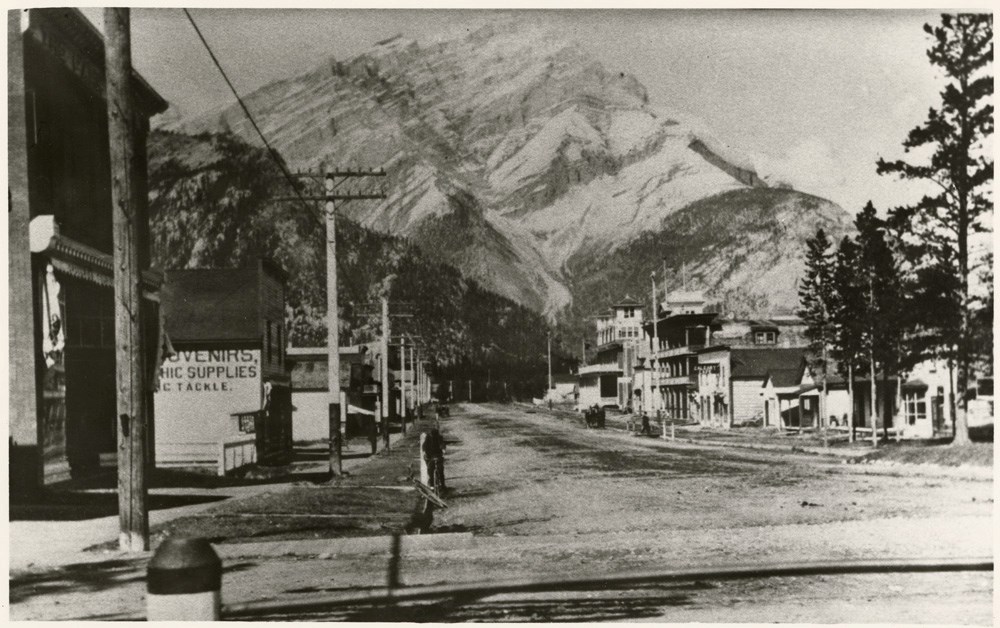
- Image of Banff Avenue with various buildings along both sides, looking towards Cascade Mountain - "Early Banff Avenue 1911 or 1912" written on the back in pencil
- Date Range
- [ca. 1911-1912]
- Reference Code
- V683 / III / A / 15 / PA - 673
- Description Level
- 6 / Item
- GMD
- Photograph
2 images
- Part Of
- Peter and Catharine Whyte fonds
- Description Level
- 6 / Item
- Fonds Number
- M36 / V683 / S37
- Series
- V683 / III / A / 15 : Peter and Catharine Whyte: Collected Photographs
- Sous-Fonds
- V683
- Accession Number
- .
- Reference Code
- V683 / III / A / 15 / PA - 673
- GMD
- Photograph
- Date Range
- [ca. 1911-1912]
- Physical Description
- Photograph: 1 print (front and back) ; b&w.
- Scope & Content
- Image of Banff Avenue with various buildings along both sides, looking towards Cascade Mountain - "Early Banff Avenue 1911 or 1912" written on the back in pencil
- Subject Access
- Banff townsite
- Buildings
- Businesses
- Cascade Mountain
- Mountains
- Geographic Access
- Banff
- Banff National Park
- Language
- English
- Title Source
- Title based on item
- Processing Status
- Processed
Images
This material is presented as originally created; it may contain outdated cultural descriptions and
potentially offensive content.
Read more.
Banff Avenue looking south
https://archives.whyte.org/en/permalink/descriptions53107
- Part Of
- Peter and Catharine Whyte fonds
- Scope & Content
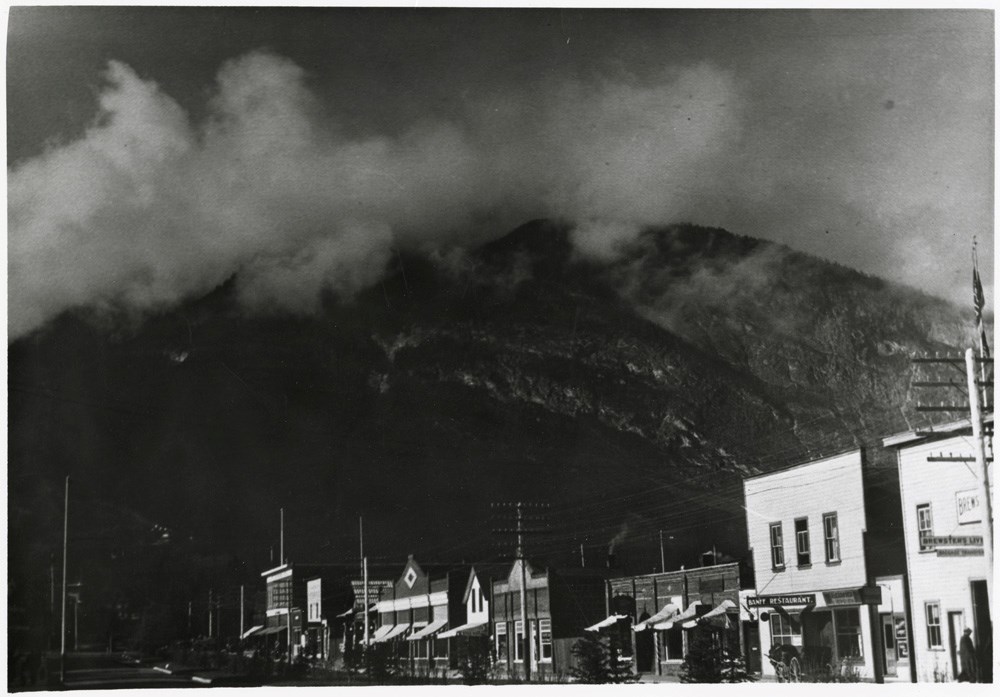
- Image of the shops along Banff Avenue looking towards Sulphur Mountain
- Date Range
- [ca. 1885-1945]
- Reference Code
- V683 / III / A / 15 / PA - 671
- Description Level
- 6 / Item
- GMD
- Photograph
2 images
- Part Of
- Peter and Catharine Whyte fonds
- Description Level
- 6 / Item
- Fonds Number
- M36 / V683 / S37
- Series
- V683 / III / A / 15 : Peter and Catharine Whyte: Collected Photographs
- Sous-Fonds
- V683
- Accession Number
- .
- Reference Code
- V683 / III / A / 15 / PA - 671
- GMD
- Photograph
- Date Range
- [ca. 1885-1945]
- Physical Description
- Photograph: 1 print (front and back) ; b&w.
- Scope & Content
- Image of the shops along Banff Avenue looking towards Sulphur Mountain
- Subject Access
- Buildings
- Businesses
- Banff townsite
- Mountains
- Sulphur Mountain
- Geographic Access
- Banff
- Banff National Park
- Language
- English
- Title Source
- Title based on item
- Processing Status
- Processed
Images
This material is presented as originally created; it may contain outdated cultural descriptions and
potentially offensive content.
Read more.
Banff Springs Hotel
https://archives.whyte.org/en/permalink/descriptions53188
- Part Of
- Peter and Catharine Whyte fonds
- Scope & Content
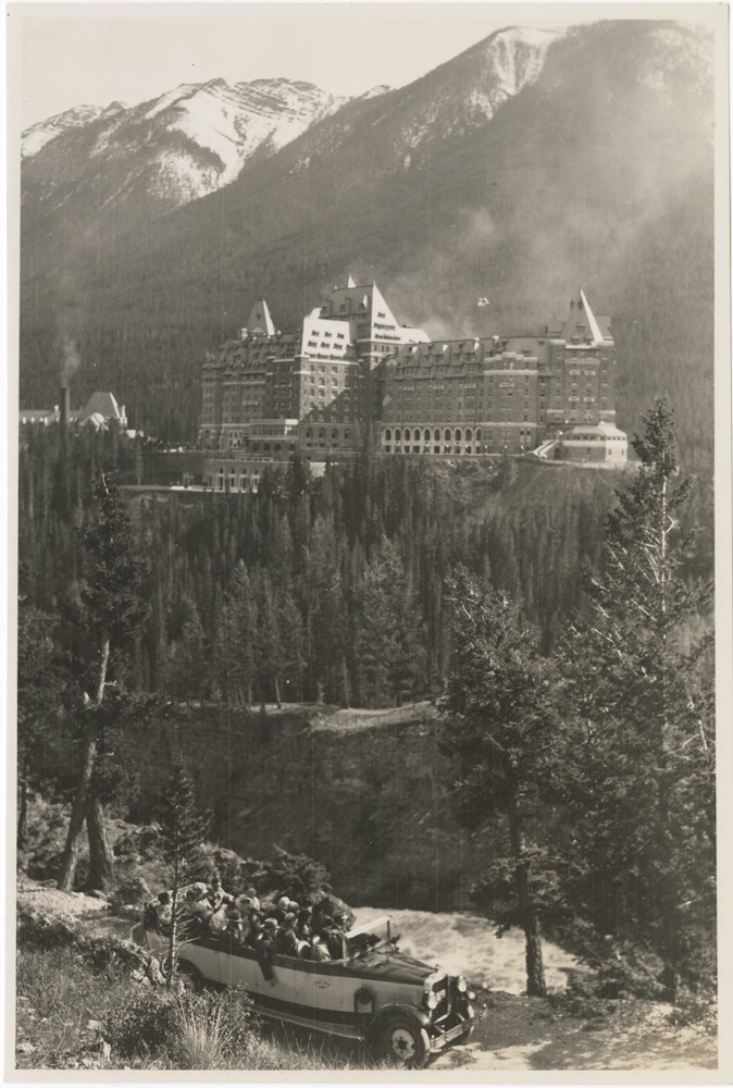
- Image of the Banff Springs Hotel with a Brewster open-top sightseeing bus in the foreground
- Date Range
- [ca. 1910-1925]
- Reference Code
- V683 / III / A / 15 / PA - 751
- Description Level
- 6 / Item
- GMD
- Photograph
2 images
- Part Of
- Peter and Catharine Whyte fonds
- Description Level
- 6 / Item
- Fonds Number
- M36 / V683 / S37
- Series
- V683 / III / A / 15 : Peter and Catharine Whyte: Collected Photographs
- Sous-Fonds
- V683
- Accession Number
- .
- Reference Code
- V683 / III / A / 15 / PA - 751
- GMD
- Photograph
- Date Range
- [ca. 1910-1925]
- Physical Description
- Photograph: 1 print (front and back); b&w.
- Scope & Content
- Image of the Banff Springs Hotel with a Brewster open-top sightseeing bus in the foreground
- Subject Access
- Automobiles
- Banff Springs Hotel
- Brewster Transport Company Ltd.
- Mountains
- Sulphur Mountain
- Tourism
- Geographic Access
- Banff National Park
- Language
- English
- Title Source
- Title based on item
- Processing Status
- Processed
Images
This material is presented as originally created; it may contain outdated cultural descriptions and
potentially offensive content.
Read more.
Bankhead Mine Tipple and Shops
https://archives.whyte.org/en/permalink/descriptions52042
- Part Of
- Peter and Catharine Whyte fonds
- Scope & Content
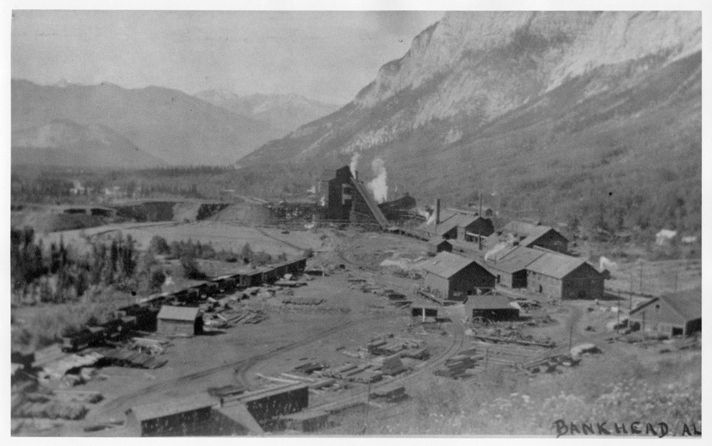
- Image of structures and mine infrastructure built along a railway - written along bottom in black ink "Bankhead, AL." Written on the back is "Bankhead Mine Tipple and Shops - Cascade Mt. on right, Tunnel Mt. on left, Sulphur Mt. in distance" in pencil
- Date Range
- [ca. 1889-1920]
- Reference Code
- V683 / III / A / 3 / PA - 263
- Description Level
- 6 / Item
- GMD
- Photograph
2 images
- Part Of
- Peter and Catharine Whyte fonds
- Description Level
- 6 / Item
- Fonds Number
- M36 / V683 / S37
- Series
- V683 / III / A / 3 : Peter and Catharine Whyte: Various Views of Banff and Area
- Sous-Fonds
- V683
- Accession Number
- .
- Reference Code
- V683 / III / A / 3 / PA - 263
- GMD
- Photograph
- Date Range
- [ca. 1889-1920]
- Physical Description
- Photograph: 1 print (front and back); b&w.
- Scope & Content
- Image of structures and mine infrastructure built along a railway - written along bottom in black ink "Bankhead, AL." Written on the back is "Bankhead Mine Tipple and Shops - Cascade Mt. on right, Tunnel Mt. on left, Sulphur Mt. in distance" in pencil
- Subject Access
- Buildings
- Coal and coal mines
- Mountains
- Trains
- Geographic Access
- Bankhead
- Language
- English
- Title Source
- Title based on item
- Processing Status
- Processed
Images
This material is presented as originally created; it may contain outdated cultural descriptions and
potentially offensive content.
Read more.
[Bow River and mountains in winter]
https://archives.whyte.org/en/permalink/descriptions51840
- Part Of
- Peter and Catharine Whyte fonds
- Scope & Content
- Image of mountain range - written on back in pencil "Norquay - left - Brewster - centre - Stoney Squaw - right - Bow River - foreground J.D."
- Date Range
- [ca. 1910-1935]
- Reference Code
- V683 / III / A / 3 / PA - 49
- Description Level
- 6 / Item
- GMD
- Photograph
1 image
- Part Of
- Peter and Catharine Whyte fonds
- Description Level
- 6 / Item
- Fonds Number
- M36 / V683 / S37
- Series
- V683 / III / A / 3 : Peter and Catharine Whyte: Various Views of Banff and Area
- Sous-Fonds
- V683
- Accession Number
- .
- Reference Code
- V683 / III / A / 3 / PA - 49
- GMD
- Photograph
- Date Range
- [ca. 1910-1935]
- Physical Description
- Photograph: 1 print; b&w.
- Scope & Content
- Image of mountain range - written on back in pencil "Norquay - left - Brewster - centre - Stoney Squaw - right - Bow River - foreground J.D."
- Geographic Access
- Banff National Park
- Language
- English
- Title Source
- Title based on item
- Processing Status
- Processed
Images

This material is presented as originally created; it may contain outdated cultural descriptions and
potentially offensive content.
Read more.
[Bow River and mountains in winter]
https://archives.whyte.org/en/permalink/descriptions51841
- Part Of
- Peter and Catharine Whyte fonds
- Scope & Content
- Image of mountain range - written on back in pencil "Norquay - left - Brewster - centre - Stoney Squaw - right - Bow River - foreground J.D."
- Date Range
- [ca. 1910-1935]
- Reference Code
- V683 / III / A / 3 / PA - 50
- Description Level
- 6 / Item
- GMD
- Photograph
1 image
- Part Of
- Peter and Catharine Whyte fonds
- Description Level
- 6 / Item
- Fonds Number
- M36 / V683 / S37
- Series
- V683 / III / A / 3 : Peter and Catharine Whyte: Various Views of Banff and Area
- Sous-Fonds
- V683
- Accession Number
- .
- Reference Code
- V683 / III / A / 3 / PA - 50
- GMD
- Photograph
- Date Range
- [ca. 1910-1935]
- Physical Description
- Photograph: 1 print; b&w.
- Scope & Content
- Image of mountain range - written on back in pencil "Norquay - left - Brewster - centre - Stoney Squaw - right - Bow River - foreground J.D."
- Geographic Access
- Banff National Park
- Language
- English
- Title Source
- Title based on item
- Processing Status
- Processed
Images

This material is presented as originally created; it may contain outdated cultural descriptions and
potentially offensive content.
Read more.
- Part Of
- Peter and Catharine Whyte fonds
- Scope & Content
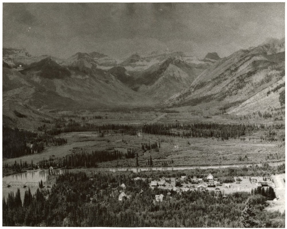
- Image of the Bow Valley from the top of Tunnel Mountain with the Banff townsite and original Bow River Bridge visible - marshland and mountain range visible in the distance
- Date Range
- [ca. 1900-1920]
- Reference Code
- V683 / III / A / 8 / PA - 653
- Description Level
- 6 / Item
- GMD
- Photograph
1 image
- Part Of
- Peter and Catharine Whyte fonds
- Description Level
- 6 / Item
- Fonds Number
- M36 / V683 / S37
- Series
- V683 / III / A / 8 : Peter and Catharine Whyte: Banff and Area Skiing
- Sous-Fonds
- V683
- Accession Number
- .
- Reference Code
- V683 / III / A / 8 / PA - 653
- GMD
- Photograph
- Date Range
- [ca. 1900-1920]
- Physical Description
- Photograph: 1 print; b&w.
- Scope & Content
- Image of the Bow Valley from the top of Tunnel Mountain with the Banff townsite and original Bow River Bridge visible - marshland and mountain range visible in the distance
- Subject Access
- Banff townsite
- Bow Valley
- Bow River
- Buildings
- Bridges
- Mountains
- Geographic Access
- Banff National Park
- Language
- English
- Title Source
- Title based on item
- Processing Status
- Processed
Images
This material is presented as originally created; it may contain outdated cultural descriptions and
potentially offensive content.
Read more.