Narrow Results By
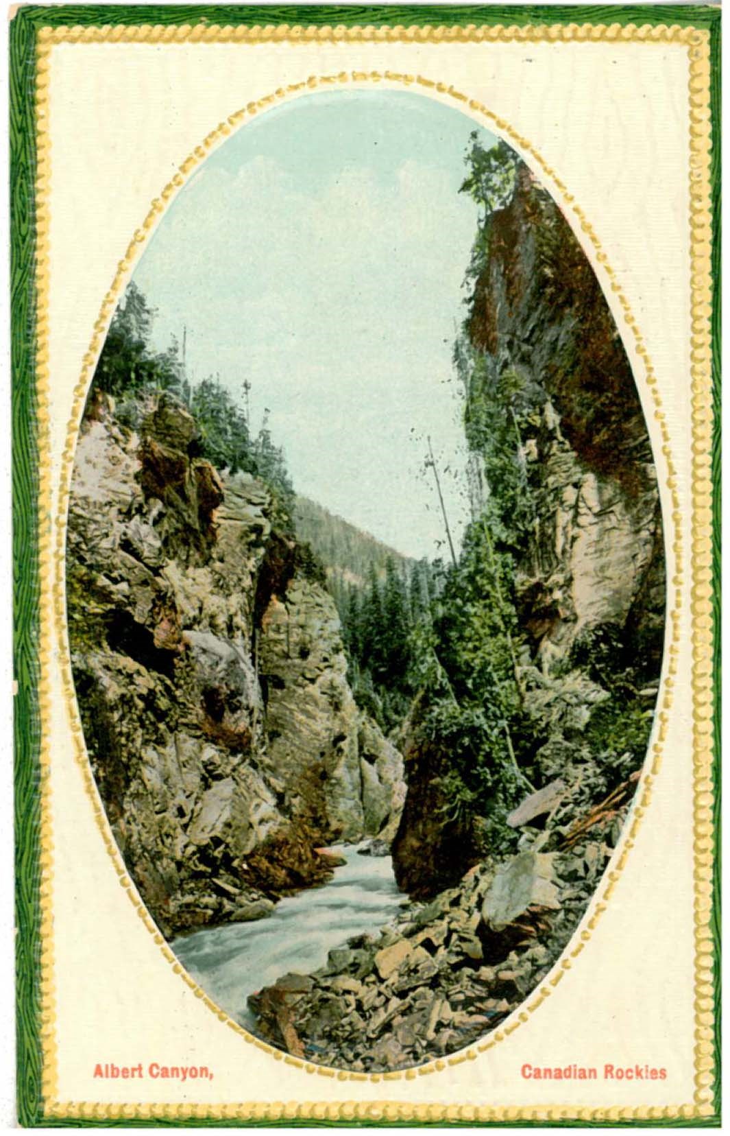
Albert Canyon, Canadian Rockies
https://archives.whyte.org/en/permalink/catalogue16950
- Place
- Printed in Great Britain
- Published Date
- 1916
- Medium
- Library - Postcard
- Abstract
- On back of postcard: Published exclusively for the Canadian Pacific Railway News Service
- Notes
- Annotated
- colour
- Includes postage stamp
- Accession Number
- 17500
- Call Number
- V466-PG-C16nr-2
Images

This material is presented as originally created; it may contain outdated cultural descriptions and
potentially offensive content.
Read more.
Albert Canyon, Canadian Rockies
https://archives.whyte.org/en/permalink/catalogue17195
- Place
- Printed in Great Britain
- Published Date
- ca. 1916
- Medium
- Library - Postcard
- Abstract
- On back of postcard: Published exclusively for the Canadian Pacific Railway News Service
- Notes
- Annotated
- colour
- Includes postage stamp
- Accession Number
- 17500
- Call Number
- V466/PG-C16ns-2
Images
This material is presented as originally created; it may contain outdated cultural descriptions and
potentially offensive content.
Read more.
Alberta : Athabaska sheet
https://archives.whyte.org/en/permalink/catalogue24415
- Medium
- Library - Maps and blueprints (unannotated; published)
- Map
- Published Date
- 1914
- Publisher
- Ottawa: Office of the Surveyor General
- Edition
- 2d ed.
- Call Number
- C9-2.4
- Edition
- 2d ed.
- Publisher
- Ottawa: Office of the Surveyor General
- Published Date
- 1914
- Physical Description
- 1 map
- Scale
- Scale: 1:190,080
- Subjects
- Athabaska River
- Notes
- Sectional map
- Accession Number
- 5576
- 4008
- Call Number
- C9-2.4
- Collection
- Archives Library
This material is presented as originally created; it may contain outdated cultural descriptions and
potentially offensive content.
Read more.
[Alberta] South-central portion
https://archives.whyte.org/en/permalink/catalogue24416
- Medium
- Library - Maps and blueprints (unannotated; published)
- Map
- Published Date
- 1910
- Publisher
- Dept. of the Interior, Ottawa
- Call Number
- C9-3.1
- Publisher
- Dept. of the Interior, Ottawa
- Published Date
- 1910
- Scale
- Bench marks
- Subjects
- Alberta
- Notes
- 1 duplicate in map room - Accn. 400
- Accession Number
- 400
- Call Number
- C9-3.1
- Collection
- Archives Library
This material is presented as originally created; it may contain outdated cultural descriptions and
potentially offensive content.
Read more.
(Athabaska River area) - junction with Snarling River
https://archives.whyte.org/en/permalink/catalogue24502
- Medium
- Library - Maps and blueprints (unannotated; published)
- Map
- Published Date
- February 24, 1911
- Publisher
- Department of the Interior
- Call Number
- C9-7.46
- Publisher
- Department of the Interior
- Published Date
- February 24, 1911
- Physical Description
- 1 map : black and white
- Scale
- 40 chains: 1 inch
- Accession Number
- SG7500
- Call Number
- C9-7.46
- Collection
- Archives Library
This material is presented as originally created; it may contain outdated cultural descriptions and
potentially offensive content.
Read more.
(Athabaska River-Talbot Lake area)
https://archives.whyte.org/en/permalink/catalogue24508
- Medium
- Library - Maps and blueprints (unannotated; published)
- Map
- Published Date
- October 19, 1911
- Publisher
- Department of the Interior
- Call Number
- C9-7.48
- Publisher
- Department of the Interior
- Published Date
- October 19, 1911
- Physical Description
- 1 map : black and white
- Scale
- 40 chains: 1 inch
- Accession Number
- SG7500
- Call Number
- C9-7.48
- Collection
- Archives Library
This material is presented as originally created; it may contain outdated cultural descriptions and
potentially offensive content.
Read more.
[Banff - Plan of resurvey of the town of Banff]
https://archives.whyte.org/en/permalink/catalogue23262
- Medium
- Library - Maps and blueprints (unannotated; published)
- Map
- Published Date
- 1914
- Publisher
- Dept. of the Interior
- Call Number
- C4-1.8
- Publisher
- Dept. of the Interior
- Published Date
- 1914
- Scale
- Scale: 1 inch = 150 ft.
- Notes
- Black and white
- Accession Number
- 718
- 2933 deaccessioned
- Call Number
- C4-1.8
- Collection
- Archives Library
This material is presented as originally created; it may contain outdated cultural descriptions and
potentially offensive content.
Read more.
[Banff - Proposed Electric Lighting Project]
https://archives.whyte.org/en/permalink/catalogue23257
- Medium
- Library - Maps and blueprints (unannotated; published)
- Map
- Published Date
- 1912
- Publisher
- Dept. of the Interior
- Call Number
- C4-1.4
- Publisher
- Dept. of the Interior
- Published Date
- 1912
- Physical Description
- 1 map : black and white
- Scale
- Scale: 400' = 1"
- Notes
- Photostatic copy from Public Archives
- Accession Number
- 675
- Call Number
- C4-1.4
- Collection
- Archives Library
This material is presented as originally created; it may contain outdated cultural descriptions and
potentially offensive content.
Read more.
[Banff - Townsite]
https://archives.whyte.org/en/permalink/catalogue21316
- Medium
- Library - Maps and blueprints (unannotated; published)
- Map
- Published Date
- 1912
- Call Number
- C4-1.13
- Published Date
- 1912
- Subjects
- Banff townsite
- Notes
- Black and white
- DAMAGED
- Accession Number
- 1113
- Call Number
- C4-1.13
- Collection
- Archives Library
This material is presented as originally created; it may contain outdated cultural descriptions and
potentially offensive content.
Read more.
[Banff: Bow River to Moose Street]
https://archives.whyte.org/en/permalink/catalogue23258
- Medium
- Library - Maps and blueprints (unannotated; published)
- Map
- Published Date
- 1913
- Author
- Walker, C.M.
- Publisher
- Ottawa: Dept. of the Interior
- Call Number
- C4-1.4
- Author
- Walker, C.M.
- Publisher
- Ottawa: Dept. of the Interior
- Published Date
- 1913
- Physical Description
- 1 map : black and white
- Scale
- Scale indeterminable
- Subjects
- Banff - Townsite development
- Walker, C.M.
- Notes
- Compiled from official surveys, December 17, 1912, by C.M. Walker
- Accession Number
- 5670
- Call Number
- C4-1.4
- Collection
- Archives Library
This material is presented as originally created; it may contain outdated cultural descriptions and
potentially offensive content.
Read more.
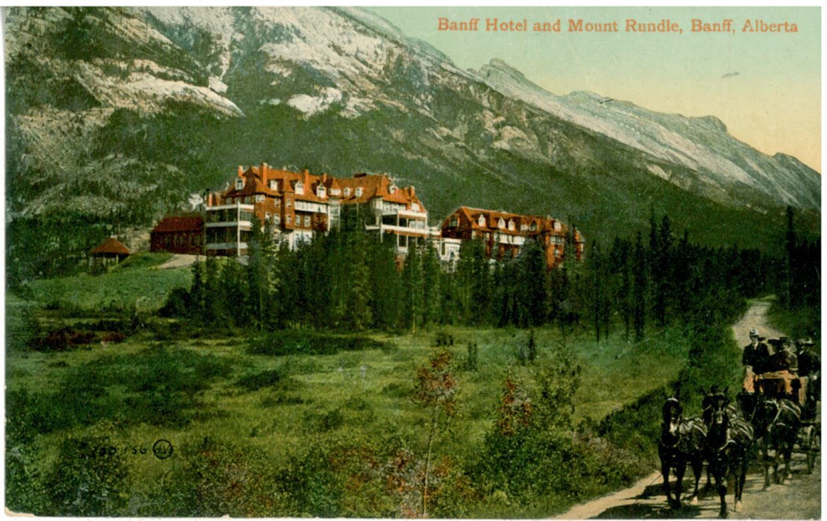
Banff Hotel and Mount Rundle, Banff, Alberta
https://archives.whyte.org/en/permalink/catalogue17438
- Medium
- Library - Postcard
- Published Date
- ca. 1911
- Publisher
- The Valentine & Sons' Publishing Co., Ltd.
- Call Number
- V466/PG-V33-27
1 image
- Place
- Montreal and Toronto Printed in Great Britain
- Publisher
- The Valentine & Sons' Publishing Co., Ltd.
- Published Date
- ca. 1911
- Medium
- Library - Postcard
- Notes
- Annotated
- colour
- Includes postage stamp
- Accession Number
- 7725
- Call Number
- V466/PG-V33-27
Images
This material is presented as originally created; it may contain outdated cultural descriptions and
potentially offensive content.
Read more.
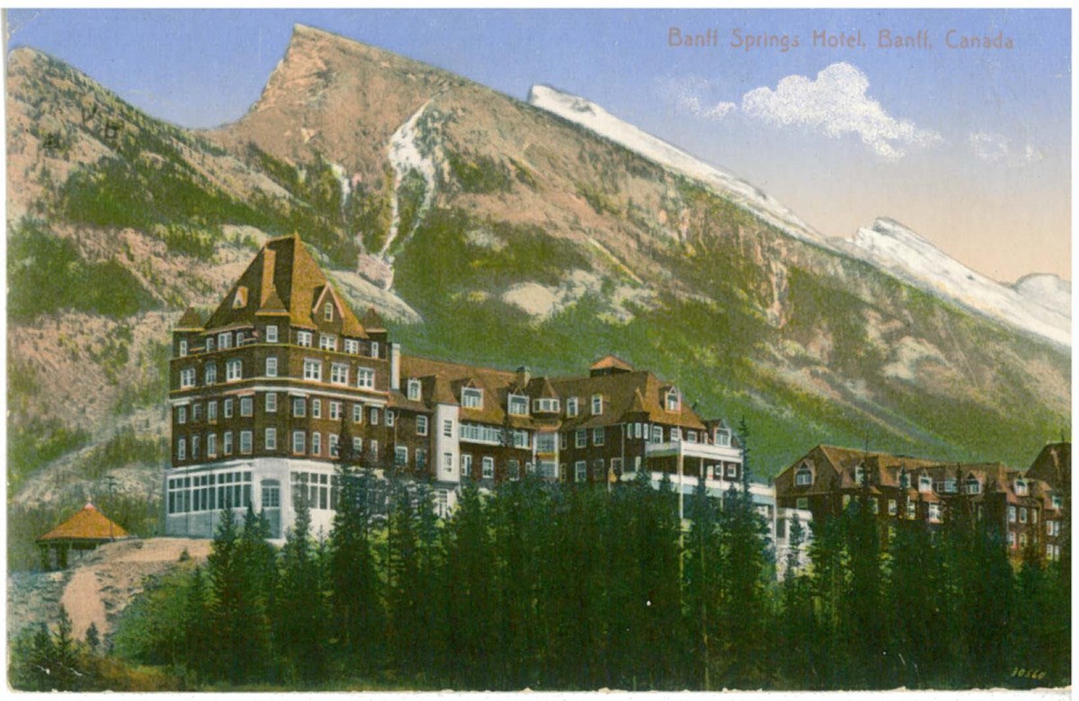
Banff Springs Hotel, Banff, Canada
https://archives.whyte.org/en/permalink/catalogue17018
- Medium
- Library - Postcard
- Published Date
- ca. 1913
- Publisher
- G. & W. Fear
- Call Number
- V466/PG-G11-1
1 image
- Place
- Banff, Canada Made in Germany
- Publisher
- G. & W. Fear
- Published Date
- ca. 1913
- Medium
- Library - Postcard
- Notes
- Annotated
- colour
- Includes postage stamp
- Accession Number
- 948
- Call Number
- V466/PG-G11-1
Images
This material is presented as originally created; it may contain outdated cultural descriptions and
potentially offensive content.
Read more.
Bathing, Hot Sulphur Springs, Winter, Banff
https://archives.whyte.org/en/permalink/catalogue10784
- Medium
- Library - Postcard
- Published Date
- [ca.1910]
- Author
- Harmon, Byron
- Call Number
- V160/PG-6
1 image
- Author
- Harmon, Byron
- Responsibility
- Byron Harmon
- Published Date
- [ca.1910]
- Medium
- Library - Postcard
- Call Number
- V160/PG-6
Images

This material is presented as originally created; it may contain outdated cultural descriptions and
potentially offensive content.
Read more.
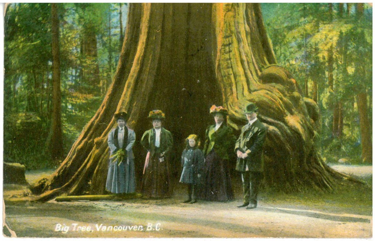
Big Tree, Vancouver, B.C.
https://archives.whyte.org/en/permalink/catalogue17464
- Medium
- Library - Postcard
- Published Date
- ca. 1910
- Publisher
- Novelty Post Card Co.
- Call Number
- V466/PG-N85p-1
1 image
- Place
- Vancouver, B.C. Made in Germany
- Publisher
- Novelty Post Card Co.
- Published Date
- ca. 1910
- Medium
- Library - Postcard
- Notes
- Annotated
- colour
- Includes postage stamp
- Accession Number
- 7715
- Call Number
- V466/PG-N85p-1
Images
This material is presented as originally created; it may contain outdated cultural descriptions and
potentially offensive content.
Read more.
[Boundary Between Alberta and B.C.]
https://archives.whyte.org/en/permalink/catalogue24662
- Medium
- Library - Maps and blueprints (unannotated; published)
- Map
- Published Date
- 1916
- Edition
- Sheet #12
- Call Number
- C3-9.13
- Edition
- Sheet #12
- Published Date
- 1916
- Scale
- Scale: 1:62,500
- Relief: Contour interval 100 ft.
- Series
- Sheet #12
- Notes
- 2 duplicates in Map Room
- 2 photostat copies showing outline of Mt. Assiniboine Provincial Park
- Duplicate in Boundary Atlas #1
- Accession Number
- 44
- 400
- 3349
- 2949
- Call Number
- C3-9.13
- Collection
- Archives Library
This material is presented as originally created; it may contain outdated cultural descriptions and
potentially offensive content.
Read more.
[Boundary Between Alberta and B.C.]
https://archives.whyte.org/en/permalink/catalogue24664
- Medium
- Library - Maps and blueprints (unannotated; published)
- Map
- Published Date
- 1916
- Call Number
- C3-9.15
- Published Date
- 1916
- Scale
- Scale: 1:62,500
- Relief: Contour interval 100 ft.
- Series
- Sheet #15
- Notes
- Duplicate in Map Room
- Duplicate in Boundary Atlas #1
- Accession Number
- 400
- Call Number
- C3-9.15
- Collection
- Archives Library
This material is presented as originally created; it may contain outdated cultural descriptions and
potentially offensive content.
Read more.
[Boundary Between Alberta and B.C.]
https://archives.whyte.org/en/permalink/catalogue24665
- Medium
- Library - Maps and blueprints (unannotated; published)
- Map
- Published Date
- 1917
- Call Number
- C3-9.17, -9.18
- Published Date
- 1917
- Scale
- Scale: 1:62,500
- Relief: Contour interval 100 ft.
- Series
- Sheet #17, Sheet #18
- Notes
- Duplicate in Boundary Atlas #2
- Accession Number
- 718
- Call Number
- C3-9.17, -9.18
- Collection
- Archives Library
This material is presented as originally created; it may contain outdated cultural descriptions and
potentially offensive content.
Read more.
Boundary between Alberta and British Columbia / Interprovincial Boundary Commission
https://archives.whyte.org/en/permalink/catalogue21452
- Medium
- Library - Maps and blueprints (unannotated; published)
- Map
- Published Date
- ca. 1915-1917
- Publisher
- Ottawa : Surveyor General's Office
- Call Number
- C3-9.1-29b
- Publisher
- Ottawa : Surveyor General's Office
- Published Date
- ca. 1915-1917
- Physical Description
- 25 maps : col
- Notes
- In this sequence: 1-3, 5, 6-13A, 15, 17-20, 21, 25, 29, 29B
- Accession Number
- 2949
- Call Number
- C3-9.1-29b
- Collection
- Archives Library
This material is presented as originally created; it may contain outdated cultural descriptions and
potentially offensive content.
Read more.
[Boundary Between Alta. & B.C.]
https://archives.whyte.org/en/permalink/catalogue24669
- Medium
- Library - Maps and blueprints (unannotated; published)
- Map
- Published Date
- 1917
- Call Number
- C3-9.29A, -9.29B
- Published Date
- 1917
- Scale
- Scale: 1:25,000
- Relief: Contour interval 100 ft.
- Series
- Sheets #29A & 29B
- Notes
- Duplicate in Boundary Atlas #3
- Call Number
- C3-9.29A, -9.29B
- Collection
- Archives Library
This material is presented as originally created; it may contain outdated cultural descriptions and
potentially offensive content.
Read more.
[Boundary Between Alta. and B.C.]
https://archives.whyte.org/en/permalink/catalogue24666
- Medium
- Library - Maps and blueprints (unannotated; published)
- Map
- Published Date
- 1917
- Call Number
- C3-9.18A
- Published Date
- 1917
- Scale
- Scale: 1:25,000
- Relief: Contour interval 100 ft.
- Series
- Sheet #18A
- Notes
- Duplicate in Boundary Atlas #2
- Accession Number
- 718
- Call Number
- C3-9.18A
- Collection
- Archives Library
This material is presented as originally created; it may contain outdated cultural descriptions and
potentially offensive content.
Read more.