Narrow Results By
- Luxton family fonds 323
- Peter and Catharine Whyte fonds 271
- Crosby family fonds 209
- George Noble fonds 182
- Nicholas Morant fonds 136
- Lloyd Harmon fonds 73
- Moore family fonds 64
- Jim and Dorothy Boyce fonds 56
- Bert Riggall fonds
- Pat Brewster fonds 39
- Kidney family fonds 35
- Dan and Mary McCowan fonds 25
Frederick and Fanny Riggall family papers
https://archives.whyte.org/en/permalink/descriptions16593
- Part Of
- Bert Riggall fonds
- Scope & Content
- File consists of personal and legal papers of Bert Riggall's parents, grandparents and English relatives, 1905-1956, 2 cm; and Fanny Neave diary, 1877-1880, [ca.1948], 1 v. (1 cm). Diary was written at age 17; later notes and footnotes were written in advance of being mailed to her son, Bert Rigga…
- Date Range
- 1877-1956
- Reference Code
- M376 / 177, 178
- Description Level
- 5 / File
- Part Of
- Bert Riggall fonds
- Description Level
- 5 / File
- Series
- VII. Riggall family series
- Reference Code
- M376 / 177, 178
- Date Range
- 1877-1956
- Physical Description
- 3 cm of textual records
- Scope & Content
- File consists of personal and legal papers of Bert Riggall's parents, grandparents and English relatives, 1905-1956, 2 cm; and Fanny Neave diary, 1877-1880, [ca.1948], 1 v. (1 cm). Diary was written at age 17; later notes and footnotes were written in advance of being mailed to her son, Bert Riggall, ca.1948. File also includes Doris (Babe) Riggall's notes on Riggall extended family
- Access Restrictions
- Access by appointment only
- Title Source
- Title based on contents of file
This material is presented as originally created; it may contain outdated cultural descriptions and
potentially offensive content.
Read more.
General notebooks
https://archives.whyte.org/en/permalink/descriptions16610
- Part Of
- Bert Riggall fonds
- Scope & Content
- File consists of notebooks pertaining to outfits, camps, horses, food, tools and supplies; travel and trips, itineraries re packtrain business, personal travel accounts; house and building construction; nature observations; hunting and gunsmithing; personal biography and illness; to-do lists; othe…
- Date Range
- 1900-1950
- Reference Code
- M376 / 8 to 17
- Description Level
- 5 / File
- Part Of
- Bert Riggall fonds
- Description Level
- 5 / File
- Series
- I. Personal and professional series
- Reference Code
- M376 / 8 to 17
- Date Range
- 1900-1950
- Physical Description
- 22 v. of textual records (11.5 cm)
- Scope & Content
- File consists of notebooks pertaining to outfits, camps, horses, food, tools and supplies; travel and trips, itineraries re packtrain business, personal travel accounts; house and building construction; nature observations; hunting and gunsmithing; personal biography and illness; to-do lists; other. Most volumes were used for several purposes and some are indexed
- Notes
- Unless otherwise indicated, notebook titles have been assigned by Archivist
- Some notebooks have titles added by Riggall's daughter, Doris (Babe) Burton
- Title Source
- Title based on contents of file
- Content Details
- LIST OF ITEMS (M376 / 8 to 17) :
- v.24 General notebook 1900-1904 (M376/8)
- v.25 General notebook 1905-1920 (M376/8)
- v.26 General notebook 1909-1922 (M376/9)
- v.27 General notebook: expenses, photography list, 1914, 1933 (M376/9)
- v.28 General notebook: trips, etc., 1909-1946 (M376/10)
- v.29 General notebook 1914-1947 (M376/10)
- v.30 General notebook 1927-1930 (M376/11)
- v.31 General notebook 1929, 1939 (M376/11)
- v.32 General notebook 1930, 1932 (M376/11)
- v.33 General notebook 1930, 1933; includes building log (M376/11)
- v.34 General notebook 1934 (M376/11)
- v.35 General notebook 1938, 1941; includes "Notes on the black bear", trip account, lists, bird notes, other (M376/12)
- v.36 General notebook 1942 (M376/13)
- v.37 General notebook 1948 (M376/13)
- v.38 "F.H.R.'s Idea Book" 1948; includes biographical notes to 1921 (M376/14)
- v.39 General notebook 1954; re health, gun, photography (M376/14)
- v.40 General notebook, no date (M376/15)
- v.41 General notebook, no date (M376/15)
- v.42 "House building" : [notebook], no date (M376/16)
- v.43 Notebook re building plans, no date (M376/16)
- v.44 Address notebook, no date (M376/17)
- v.45 Address notebook 1950 (M376/17)
This material is presented as originally created; it may contain outdated cultural descriptions and
potentially offensive content.
Read more.
Guiding and ranching lists
https://archives.whyte.org/en/permalink/descriptions16573
- Part Of
- Bert Riggall fonds
- Scope & Content
- File consists of grub lists, itineraries, horse lists, camp outfit lists, calculations pertaining to packtrips. Also includes financial calculations and wage figures for same and records of sheep and goats shot, as well as some later personal trip itineraries and notes
- Date Range
- 1913-1954
- Reference Code
- M376 / 63 to 83
- Description Level
- 5 / File
- Part Of
- Bert Riggall fonds
- Description Level
- 5 / File
- Series
- II. Business and financial series
- Reference Code
- M376 / 63 to 83
- Date Range
- 1913-1954
- Physical Description
- 4 cm of textual records
- Scope & Content
- File consists of grub lists, itineraries, horse lists, camp outfit lists, calculations pertaining to packtrips. Also includes financial calculations and wage figures for same and records of sheep and goats shot, as well as some later personal trip itineraries and notes
- Title Source
- Title based on contents of file
This material is presented as originally created; it may contain outdated cultural descriptions and
potentially offensive content.
Read more.
Guiding and ranching stationery
https://archives.whyte.org/en/permalink/descriptions16572
- Part Of
- Bert Riggall fonds
- Scope & Content
- Stationery is Riggall and Watmough Guides and Outfitters letterhead, envelope and business card; also F. H. Riggall business cards
- Date Range
- [ca.1915-ca.1930]
- Reference Code
- M376 / 62
- Description Level
- 5 / File
- Part Of
- Bert Riggall fonds
- Description Level
- 5 / File
- Series
- II. Business and financial series
- Reference Code
- M376 / 62
- Date Range
- [ca.1915-ca.1930]
- Physical Description
- 5 print material items
- Scope & Content
- Stationery is Riggall and Watmough Guides and Outfitters letterhead, envelope and business card; also F. H. Riggall business cards
- Title Source
- Title based on contents of file
This material is presented as originally created; it may contain outdated cultural descriptions and
potentially offensive content.
Read more.
Gunsmithing, shooting and loading business records
https://archives.whyte.org/en/permalink/descriptions16580
- Part Of
- Bert Riggall fonds
- Scope & Content
- File consists of letters, notes, clippings, financial records, targets and print material pertaining to Riggall's personal guns, scopes, loading, tools, target shooting and gunsmithing / loading business
- Date Range
- 1914-1955
- Reference Code
- M376 / 99 to 106
- Description Level
- 5 / File
- Part Of
- Bert Riggall fonds
- Description Level
- 5 / File
- Series
- II. Business and financial series
- Reference Code
- M376 / 99 to 106
- Date Range
- 1914-1955
- Physical Description
- 10 cm of textual records
- Scope & Content
- File consists of letters, notes, clippings, financial records, targets and print material pertaining to Riggall's personal guns, scopes, loading, tools, target shooting and gunsmithing / loading business
- Title Source
- Title based on contents of file
- Content Details
- Items from file: Gunsmithing, shooting and loading business records. -- 1914-1955. -- 10 cm of textual records. -- File consists of letters, notes, clippings, financial records, targets and print material pertaining to Riggall's personal guns, scopes, loading, tools, target shooting and gunsmithing / loading business. -- Title based on contents of file. -- Includes 12 oversize textual records. -- Location: M376 / 99 to 106. Held in oversize "H"
This material is presented as originally created; it may contain outdated cultural descriptions and
potentially offensive content.
Read more.
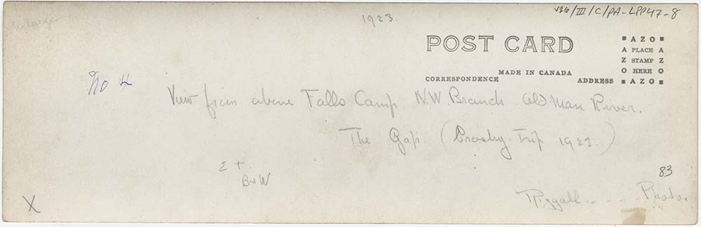
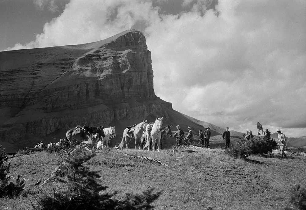
Large Panorama Prints
https://archives.whyte.org/en/permalink/descriptions25157
- Part Of
- Bert Riggall fonds
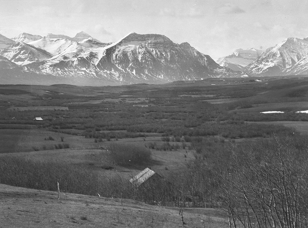
- Scope & Content
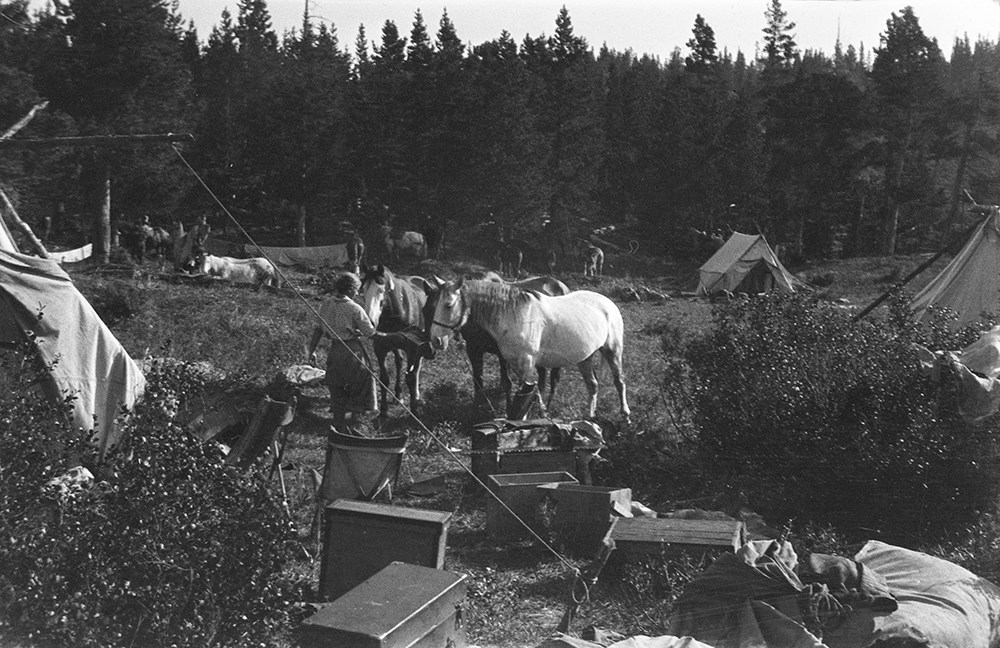
- File consists of 21 b&w photographs, some captioned. The photographs pertain to various panoramic views of the foothills and Southern Rockies. Subjects include Harry Nash at the Gap ranger Station; Riggall's Packtrain at the Gap ranger station; Kay and Babe Riggall at the Burton cabin; camp in the …
- Date Range
- [ca.1903 to ca.1959]
- Reference Code
- V26 / III / C / PA - LPP45-1 to LPP47-11
- Description Level
- 5 / File
- GMD
- Photograph
- Photograph print
6 images
- Part Of
- Bert Riggall fonds
- Description Level
- 5 / File
- Fonds Number
- M376 / V26
- Series
- V26 / III / C : Panorama Photographs
- Sous-Fonds
- V26
- Accession Number
- 7200
- Reference Code
- V26 / III / C / PA - LPP45-1 to LPP47-11
- Date Range
- [ca.1903 to ca.1959]
- Physical Description
- Photographs: 21 prints, b&w
- Scope & Content
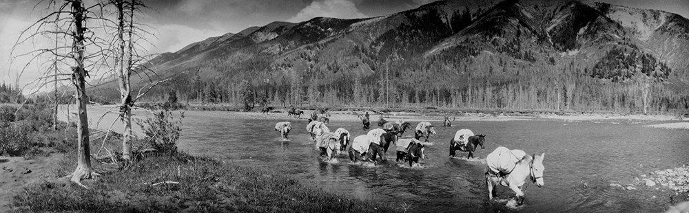
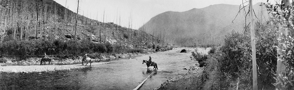
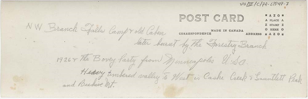
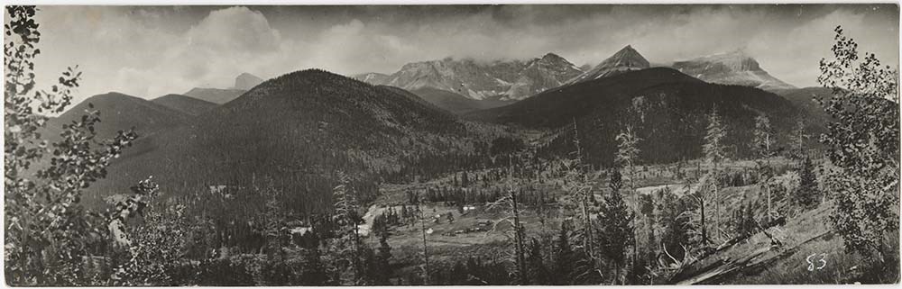
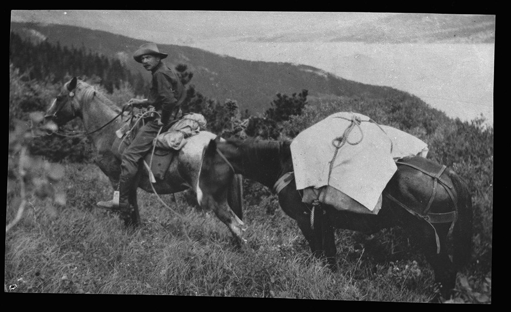
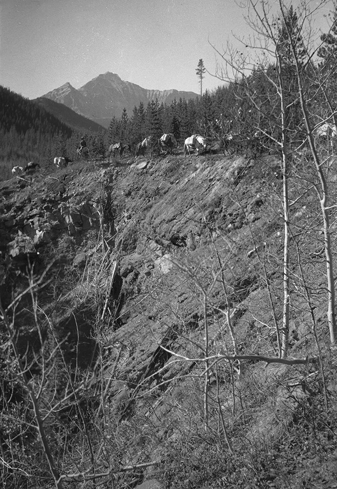
- File consists of 21 b&w photographs, some captioned. The photographs pertain to various panoramic views of the foothills and Southern Rockies. Subjects include Harry Nash at the Gap ranger Station; Riggall's Packtrain at the Gap ranger station; Kay and Babe Riggall at the Burton cabin; camp in the gathering pasture near the ranger station; Crosby children on horseback near the Burton lease; Riggall's packtrain near the Livinstone Gap; packtrain crossing the Northwest branch of the Oldman River; a view of Riggall's guests crossing the Northwest brach of the Oldman River showing the 1910 burn and the 1923 flood; McKnight camp near the Oldman River; Bovey party at the falls camp near the Oldman River.
- Subject Access
- Landscapes
- Guiding
- Mountains
- Title Source
- Title based on contents of file
- Content Details
- Bert Riggall's grandson, John Russell provided some identifications Caption on envelope that previously housed prints V26 / III / C / PA - LPP45-1 to LPP45-7: LPP45 Oldman Ranger Station, Burton cabin and lease area near the station Caption on envelope that previously housed prints V26 / III / C / PA - LPP46-1 to LPP46-3: LPP46 Oldman Area moving packtrain between home ranch and Gap area Caption on envelope that previously housed prints V26 / III / C / PA - LPP47-1 to LPP47-11: LPP47 Oldman River stem (camps along it)
- Processing Status
- Processed
Images

This material is presented as originally created; it may contain outdated cultural descriptions and
potentially offensive content.
Read more.
Lecture outlines
https://archives.whyte.org/en/permalink/descriptions16588
- Part Of
- Bert Riggall fonds
- Scope & Content
- File contains outlines for lectures and field trips entitled: The charm of the Rockies, Beauties and wonders of the S.W. Alberta Rockies, Geological notes for field day..., The mountains, Forest life in Waterton Lakes park
- Date Range
- [ca.1935-ca.1950]
- Reference Code
- M376 / 134
- Description Level
- 5 / File
- Part Of
- Bert Riggall fonds
- Description Level
- 5 / File
- Series
- IV. Writing series
- Reference Code
- M376 / 134
- Date Range
- [ca.1935-ca.1950]
- Physical Description
- 5 textual records (.5 cm)
- Scope & Content
- File contains outlines for lectures and field trips entitled: The charm of the Rockies, Beauties and wonders of the S.W. Alberta Rockies, Geological notes for field day..., The mountains, Forest life in Waterton Lakes park
- Title Source
- Title based on contents of file
This material is presented as originally created; it may contain outdated cultural descriptions and
potentially offensive content.
Read more.
- Part Of
- Bert Riggall fonds
- Scope & Content
- File consists mainly of hunting and rifle articles for submission to sport magazines. Articles are: Sport in the Canadian Rockies, A Tramp after Bighorns, An Iliad of the Imp (re grizzly bear), My Lucky Stone, Hunting the Black Bear, Hunting Mountain Sheep, Giants of the Highrock, Horse Packing, T…
- Date Range
- 1906-1950
- Reference Code
- M376 / 128 to 130
- Description Level
- 5 / File
- Part Of
- Bert Riggall fonds
- Description Level
- 5 / File
- Series
- IV. Writing series
- Reference Code
- M376 / 128 to 130
- Date Range
- 1906-1950
- Physical Description
- 3 cm of textual records
- Scope & Content
- File consists mainly of hunting and rifle articles for submission to sport magazines. Articles are: Sport in the Canadian Rockies, A Tramp after Bighorns, An Iliad of the Imp (re grizzly bear), My Lucky Stone, Hunting the Black Bear, Hunting Mountain Sheep, Giants of the Highrock, Horse Packing, The Ascent of Chief Mountain, Just One of Those Things. Includes holograph and typescript versions of most.
- Also includes poem "The King of the Rockies" and some drafts of out-going letters, 1906-1907
- Title Source
- Title based on contents of file
This material is presented as originally created; it may contain outdated cultural descriptions and
potentially offensive content.
Read more.
Maps of the northern Montana to northern Rocky Mountains area
https://archives.whyte.org/en/permalink/descriptions16611
- Part Of
- Bert Riggall fonds
- Scope & Content
- Cartographic materials are holograph maps and annotated published maps concerning the area from northern Montana to the northern Rocky Mountains. Features marked on maps may include ranch properties, trails, routes, camps, game, local names, elevations, hunting and special licence areas, revised p…
- Date Range
- 1928-1943
- Reference Code
- M376 / 87, 88
- Description Level
- 5 / File
- Part Of
- Bert Riggall fonds
- Description Level
- 5 / File
- Series
- II. Business and financial series
- Reference Code
- M376 / 87, 88
- Date Range
- 1928-1943
- Physical Description
- ca.15 cartographic records
- Scope & Content
- Cartographic materials are holograph maps and annotated published maps concerning the area from northern Montana to the northern Rocky Mountains. Features marked on maps may include ranch properties, trails, routes, camps, game, local names, elevations, hunting and special licence areas, revised park boundaries, other
- Creator
- File includes undated maps
- Title Source
- Title based on contents of file
- Content Details
- LIST OF ITEMS :
- * Laurier Pass country. -- [ca.1930]. -- 4 cartographic records. -- Letters transferred to correspondence series (M376/87)
- * Halfway River / Department of the Interior, Surveyor General, Ottawa. -- 1928 April. -- Scale 4 miles : inch (M376/87)
- * Prophet River, British Columbia / Department of the Interior, Surveyor General, Ottawa. -- 1928 April. -- Scale 4 miles : inch (M376/87)
- * Report of an exploratory trip in the area covered by Halfway River and Prophet River, sheets of the National Topographic Series in the Province of British Columbia. -- 1928. -- [ n.s.]. By McCuster, K.F., D.L.S., F.A. Ackland, Printer. Ottawa (M376/87)
- * Hudson Hope British Columbia / Department of the Interior, Surveyor General, Ottawa. -- 1929 February. -- Scale 8 miles : inch (M376/87)
- * Hand-drawn map. -- [n.d.]. -- Map of the area located north-east of Jasper Park boundary on a fork of the Hay River, northwest of Solomon Creek, showing game locations of caribou and sheep. Map is drawn on reverse of published map: Jasper Park in the Province of Alberta (M376/88)
- * Hand-drawn map. -- [n.d.] -- Map of sheep hunting territory north of Jasper Park boundary, near Hay River (M376/88)
- * Jasper Park, Alberta, Mount Robson, British Columbia, Canadian Rocky Mountains, Grand Trunk Pacific Railway / compiled in part from the Topographical Surveys by the Alpine Club of Canada. -- [n.d.]. -- Annotation reads: Indicates route Bert Riggall took on his 1911 trip, trails and stops marked. Scale: 5 miles to an inch (M376/88)
- * Province of Alberta, Canada / Department of Lands of Mine, Canada. -- 1941. -- Annotated, showing areas near Clearwater River and north of Jasper as "special license". Scale 16 miles : inch (M376/88)
- * Midnapore, Alberta showing (C.W. Peterson's Ranch) Craighurst Farm / Department of Mines and Resources, Canada. -- 1940. -- Annotation shows 1904 location of ranch. Scale 1 : 63,360 or 1 mile : inch (M376/88)
- * Mundy's pocket map of northwest Canada and part of Alaska / Mundy Map Co., Edmonton, Alberta. -- 1943. -- Resources map annotated with highlight of Mt. Logan area. Scale 62 miles : inch (M376/88)
- Laurier Pass country. -- [ca.1930]. -- 4 cartographic records. -- Letters transferred to correspondence series
- Part of file: Maps of the northern Montana to northern Rocky Mountains area Halfway River / Department of the Interior, Surveyor General, Ottawa. -- 1928 April. -- Scale 4 miles : inch
- Part of file: Maps of the northern Montana to northern Rocky Mountains area Prophet River, British Columbia / Department of the Interior, Surveyor General, Ottawa. -- 1928 April. -- Scale 4 miles : inch
- Part of file: Maps of the northern Montana to northern Rocky Mountains area Report of an exploratory trip in the area covered by Halfway River and Prophet River, sheets of the National Topographic Series in the Province of British Columbia. -- 1928. -- [ n.s.]. By McCuster, K.F., D.L.S., F.A. Ackland, Printer. Ottawa
- Part of file: Maps of the northern Montana to northern Rocky Mountains area Hudson Hope British Columbia / Department of the Interior, Surveyor General, Ottawa. -- 1929 February. -- Scale 8 miles : inch
- Part of file: Maps of the northern Montana to northern Rocky Mountains area Hand-drawn map. -- [n.d.]. -- Map of the area located north-east of Jasper Park boundary on a fork of the Hay River, northwest of Solomon Creek, showing game locations of caribou and sheep. Map is drawn on reverse of published map: Jasper Park in the Province of Alberta
- Part of file: Maps of the northern Montana to northern Rocky Mountains area Hand-drawn map. -- [n.d.] -- Map of sheep hunting territory north of Jasper Park boundary, near Hay River
- Part of file: Maps of the northern Montana to northern Rocky Mountains area Jasper Park, Alberta, Mount Robson, British Columbia, Canadian Rocky Mountains, Grand Trunk Pacific Railway / compiled in part from the Topographical Surveys by the Alpine Club of Canada. -- [n.d.]. -- Annotation reads: Indicates route Bert Riggall took on his 1911 trip, trails and stops marked. Scale: 5 miles to an inch
- Part of file: Maps of the northern Montana to northern Rocky Mountains area Province of Alberta, Canada / Department of Lands of Mine, Canada. -- 1941. -- Annotated, showing areas near Clearwater River and north of Jasper as "special license". Scale 16 miles : inch
- Part of file: Maps of the northern Montana to northern Rocky Mountains area Midnapore, Alberta showing (C.W. Peterson's Ranch) Craighurst Farm / Department of Mines and Resources, Canada. -- 1940. -- Annotation shows 1904 location of ranch. Scale 1 : 63,360 or 1 mile : inch
- Part of file: Maps of the northern Montana to northern Rocky Mountains area Mundy's pocket map of northwest Canada and part of Alaska / Mundy Map Co., Edmonton, Alberta. -- 1943. -- Resources map annotated with highlight of Mt. Logan area. Scale 62 miles : inch
- Part of file: Maps of the northern Montana to northern Rocky Mountains area Maps held in oversize "F"
This material is presented as originally created; it may contain outdated cultural descriptions and
potentially offensive content.
Read more.
Maps of the Waterton and upper Oldman River areas
https://archives.whyte.org/en/permalink/descriptions16603
- Part Of
- Bert Riggall fonds
- Scope & Content
- File consists of annotated published maps and holograph map pertaining to packtrain trips, expeditions and ranch properties, mainly in the Waterton and Upper Oldman River areas. Features marked on maps may include ranch properties, trails, routes, camps, game, local names, elevations, hunting and …
- Date Range
- [ca.1910]-1945
- Reference Code
- M376 / 84 to 86
- Description Level
- 5 / File
- Part Of
- Bert Riggall fonds
- Description Level
- 5 / File
- Series
- II. Business and financial series
- Reference Code
- M376 / 84 to 86
- Date Range
- [ca.1910]-1945
- Physical Description
- ca.23 cartographic records
- Scope & Content
- File consists of annotated published maps and holograph map pertaining to packtrain trips, expeditions and ranch properties, mainly in the Waterton and Upper Oldman River areas. Features marked on maps may include ranch properties, trails, routes, camps, game, local names, elevations, hunting and special licence areas, revised park boundaries, 1911 expedition to Jasper and Tete Jaune Cache, other
- Creator
- File includes undated maps
- Title Source
- Title based on contents of file
- Content Details
- LIST OF ITEMS (M376 / 84 to 86) :
- * Sketch map of s.e. BC, s.w. Alberta. -- 1913. -- 1 photograph : copy. -- Copy of hand-drawn map of area bounded by Kintla Peak, Montana; Waterton Lakes; Twin Butte; Oldman River. Original drawn by F. H. Riggall (M376/84)
- * Waterton Lakes Park, Alberta / Department of the Interior, Canada. -- 1918 January. -- Annotated showing location of Hawks Nest lodge and trails and elevations in the South Castle River area. -- Scale 1 : 100,000 or 1.58 miles : inch (M376/84)
- * Waterton, Alberta / Department of Mines and Resources. -- 1945. -- Annotated with F.H Riggall and A.K. Russell lands. * 2 copies (M376/84)
- * Waterton, Alberta / Department of Mines and Resources. -- 1945. -- Annotated with ranch locations, elevations and Hawks Nest lodge. * 2 copies.
- * Waterton Lakes Park Alberta from photographic surveys by M. P. Bridgland D.L.S. and A. O. Wheeler B.C.L.S. / Department of the Interior Canada. -- [n.d.]. -- Annotated, showing elevations, lake? and unidentified bounded area within park. Scale: 1/100000 or 1.58 miles to 1 inch (M376/84)
- * Waterton Lakes Park Alberta from photographic surveys by M. P. Bridgland D.L.S. and A. O. Wheeler B.C.L.S. / Department of the Interior Canada. -- [n.d.]. -- Annotated, showing cabin or campsites? and unidentified bounded area within park. Scale: 1/100000 or 1.58 miles to 1 inch (M376/84)
- * Waterton and north. -- [n.d.]. -- S.W. Alberta, Canada; South Castle River with trails and campsites marked. Annotated. Scale 1 : 40,000 (M376/84) (stored rolled)
- * Topographic map. -- [n.d.]. -- N.W. Montana, USA; Waterton Valley area between Flathead and St. Mary's rivers, south of Waterton Lake, Canada. Scale [1 : 50,000?]. -- Title based on map (M376/84) (stored rolled)
- * Northern part of the Crowsnest Forest Reserve, Alberta. -- 1913. -- Annotated, showing camps? near Coleman and Racehorse Creek. Scale 1: 40,000 ft. (M376/85)
- * South Castle River. --[n.d.]. -- Annotated with place names and elevations. Scale 4 miles : inch (M376/85)
- * Livingstone Range. -- [n.d.]. -- Annotated with place names, camps? and trails in North Boundary, Dutch Creek and north fork of Oldman River areas. Scale 1 mile : 1/2 inch (M376/85)
- * Lethbridge, west of fourth meridian / Office of the Surveyor General, Ottawa. -- 1924 May. -- S.W. Alberta, Canada, showing locations of Butcher Russell & Alberta Ranch. Scale 1 : 190,080 or 3 miles inch (M376/85)
- * Callum Creek / Department of Mines and Resources. -- 1943. --. Annotated with names of ranches and ranchers (M376/85)
- * Cowley, Alberta / Department of Mines and Resources. -- 1943 --. Annotated with names of ranches, ranchers and local schools (M376/85)
- * Beaver Mines, Alberta / Department of Mines and Resources. -- 1943. -- Annotated with location of Butcher's house and Cooks and Alberta ranches (M376/85)
- * Bow River Provincial Forest / Department of Lands and Mines, Forest Service, Government of the Province of Alberta. -- 1936 October 1. -- Camps, Crosby trip 1933, S.W. Alberta, Canada. Scale 3 miles : inch (M376/86)
- * Foothills of SW Alberta / Dept. of the Interior, Canada. -- [after 1910]. -- Map to accompany report of G.H. Edgecombe, BSc,B.Sc.F., on the Rocky Mountains Forest Reserve. SW Alberta, showing timber, woodland, open grazing, bare rock, coal seams, dwellings and sawmills. Annotated. Scale 6 miles : inch (M376/86)
- * Upper Elk and Upper Highwood Rivers, British Columbia and Alberta / Department of Mines, Canada. --1920 -- Annotated with place names, camps? and trails in Livingstone River and Upper Highwood River areas. Scale 4 miles : inch or 1 : 250,000 (M376/86)
- * British Columbia and Alberta Pincher Creek sheet west of fifth meridian / Surveyor General, Ottawa. -- 1916. -- Annotated with title: "Flathead Valley", campsites?, wells, games locations, personal contacts? (M376/86)
- * Boundary between Alberta and British Columbia / Surveyor General, Ottawa. -- 1914 (M376/86)
- * East and West Kootenay / British Columbia Dept. of Lands, Canada. -- 1911. -- Annotated with locations of camps? in Elk River Valley. Scale 8 miles : inch (M376/86)
- * Hand-drawn map. -- [n.d.]. -- Map shows camps and trails in the Kootenay area, SW British Columbia, indicates directions. Directions given on bottom (M376/86)
- Sketch map of s.e. BC, s.w. Alberta. -- 1913. -- 1 photograph : copy. -- Copy of hand-drawn map of area bounded by Kintla Peak, Montana; Waterton Lakes; Twin Butte; Oldman River. Original drawn by F. H. Riggall
- Part of file: Maps of the Waterton and upper Oldman River areas Waterton Lakes Park, Alberta / Department of the Interior, Canada. -- 1918 January. -- Annotated showing location of Hawks Nest lodge and trails and elevations in the South Castle River area. -- Scale 1 : 100,000 or 1.58 miles : inch
- Part of file: Maps of the Waterton and upper Oldman River areas Waterton, Alberta / Department of Mines and Resources. -- 1945. -- Annotated with F.H Riggall and A.K. Russell lands. * 2 copies
- Part of file: Maps of the Waterton and upper Oldman River areas Waterton, Alberta / Department of Mines and Resources. -- 1945. -- Annotated with ranch locations, elevations and Hawks Nest lodge. * 2 copies.
- Part of file: Maps of the Waterton and upper Oldman River areas Waterton Lakes Park Alberta from photographic surveys by M. P. Bridgland D.L.S. and A. O. Wheeler B.C.L.S. / Department of the Interior Canada. -- [n.d.]. -- Annotated, showing elevations, lake? and unidentified bounded area within park. Scale: 1/100000 or 1.58 miles to 1 inch
- Part of file: Maps of the Waterton and upper Oldman River areas Waterton Lakes Park Alberta from photographic surveys by M. P. Bridgland D.L.S. and A. O. Wheeler B.C.L.S. / Department of the Interior Canada. -- [n.d.]. -- Annotated, showing cabin or campsites? and unidentified bounded area within park. Scale: 1/100000 or 1.58 miles to 1 inch
- Part of file: Maps of the Waterton and upper Oldman River areas Waterton and north. -- [n.d.]. -- S.W. Alberta, Canada; South Castle River with trails and campsites marked. Annotated. Scale 1 : 40,000 (stored rolled)
- Part of file: Maps of the Waterton and upper Oldman River areas Topographic map. -- [n.d.]. -- N.W. Montana, USA; Waterton Valley area between Flathead and St. Mary's rivers, south of Waterton Lake, Canada. Scale [1 : 50,000?]. -- Title based on map
- Part of file: Maps of the Waterton and upper Oldman River areas Northern part of the Crowsnest Forest Reserve, Alberta. -- 1913. -- Annotated, showing camps? near Coleman and Racehorse Creek. Scale 1: 40,000 ft.
- Part of file: Maps of the Waterton and upper Oldman River areas South Castle River. -- [n.d.]. -- Annotated with place names and elevations. Scale 4 miles : inch
- Part of file: Maps of the Waterton and upper Oldman River areas Livingstone Range. -- [n.d.]. -- Annotated with place names, camps? and trails in North Boundary, Dutch Creek and north fork of Oldman River areas. Scale 1 mile : 1/2 inch
- Part of file: Maps of the Waterton and upper Oldman River areas Lethbridge, west of fourth meridian / Office of the Surveyor General, Ottawa. -- 1924 May. -- S.W. Alberta, Canada, showing locations of Butcher Russell & Alberta Ranch. Scale 1 : 190,080 or 3 miles inch
- Part of file: Maps of the Waterton and upper Oldman River areas Callum Creek / Department of Mines and Resources. -- 1943. --. Annotated with names of ranches and ranchers
- Part of file: Maps of the Waterton and upper Oldman River areas Cowley, Alberta / Department of Mines and Resources. -- 1943 -- Annotated with names of ranches, ranchers and local schools
- Part of file: Maps of the Waterton and upper Oldman River areas Beaver Mines, Alberta / Department of Mines and Resources. -- 1943. -- Annotated with location of Butcher's house and Cooks and Alberta ranches
- Part of file: Maps of the Waterton and upper Oldman River areas Bow River Provincial Forest / Department of Lands and Mines, Forest Service, Government of the Province of Alberta. -- 1936 October 1. -- Camps, Crosby trip 1933, S.W. Alberta, Canada. Scale 3 miles : inch
- Part of file: Maps of the Waterton and upper Oldman River areas Foothills of SW Alberta / Dept. of the Interior, Canada. -- [after 1910]. -- Map to accompany report of G.H. Edgecombe, BSc,B.Sc.F., on the Rocky Mountains Forest Reserve. SW Alberta, showing timber, woodland, open grazing, bare rock, coal seams, dwellings and sawmills. Annotated. Scale 6 miles : inch
- Part of file: Maps of the Waterton and upper Oldman River areas Upper Elk and Upper Highwood Rivers, British Columbia and Alberta / Department of Mines, Canada. --1920 -- Annotated with place names, camps? and trails in Livingstone River and Upper Highwood River areas. Scale 4 miles : inch or 1 : 250,000
- Part of file: Maps of the Waterton and upper Oldman River areas British Columbia and Alberta Pincher Creek sheet west of fifth meridian / Surveyor General, Ottawa. -- 1916. -- Annotated with title: "Flathead Valley", campsites?, wells, games locations, personal contacts?
- Part of file: Maps of the Waterton and upper Oldman River areas Boundary between Alberta and British Columbia / Surveyor General, Ottawa. -- 1914
- Part of file: Maps of the Waterton and upper Oldman River areas East and West Kootenay / British Columbia Dept. of Lands, Canada. -- 1911. -- Annotated with locations of camps? in Elk River Valley. Scale 8 miles : inch
- Part of file: Maps of the Waterton and upper Oldman River areas Hand-drawn map. -- [n.d.]. -- Map shows camps and trails in the Kootenay area, SW British Columbia, indicates directions. Directions given on bottom
- Part of file: Maps of the Waterton and upper Oldman River areas Maps held in oversize "F"
This material is presented as originally created; it may contain outdated cultural descriptions and
potentially offensive content.
Read more.
- Part Of
- Bert Riggall fonds
- Scope & Content
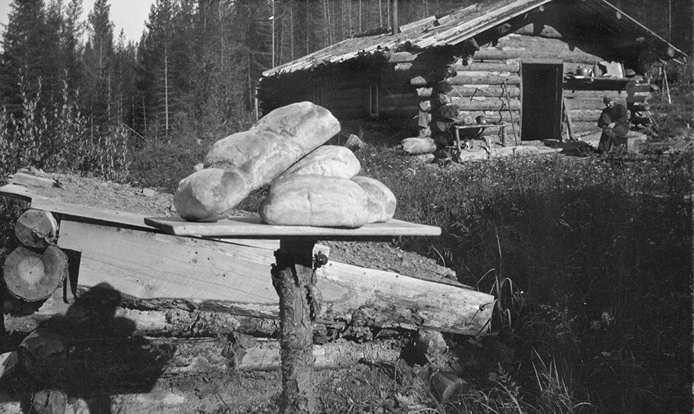
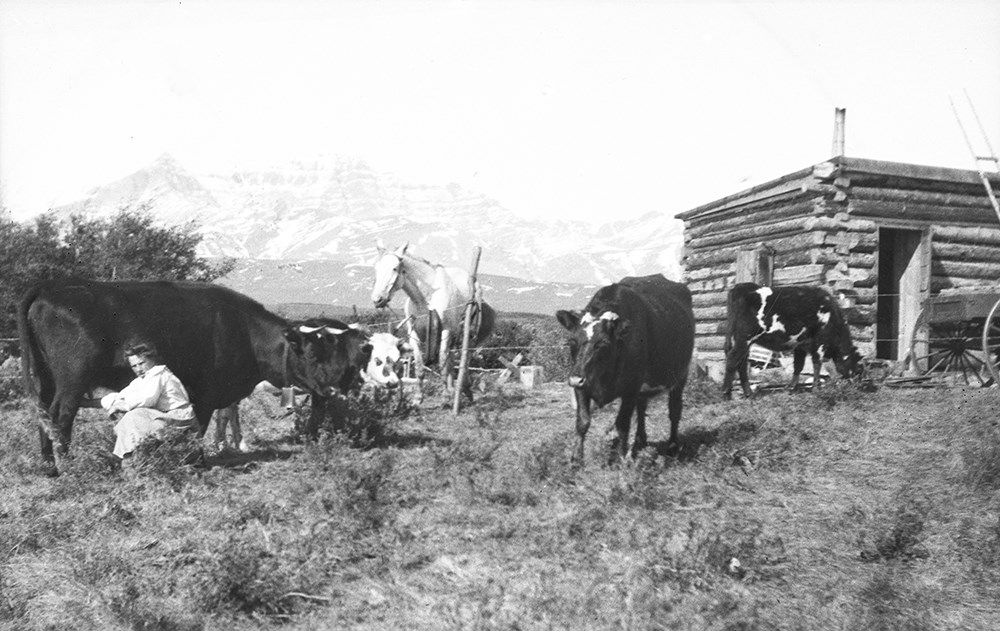
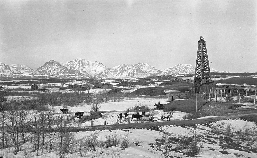
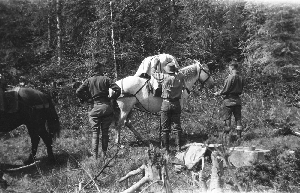
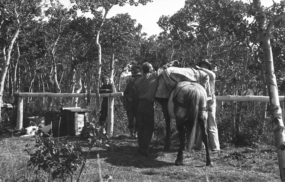
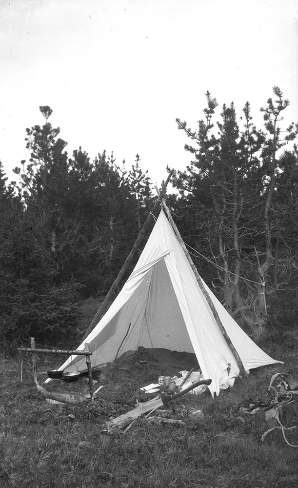
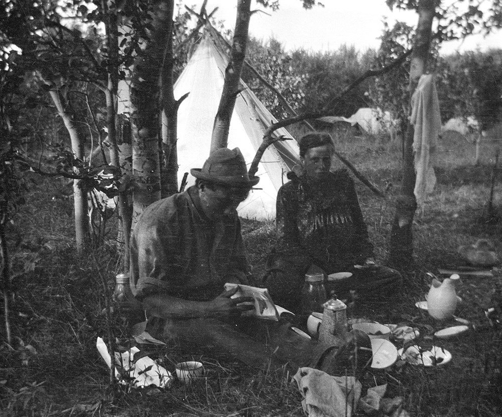
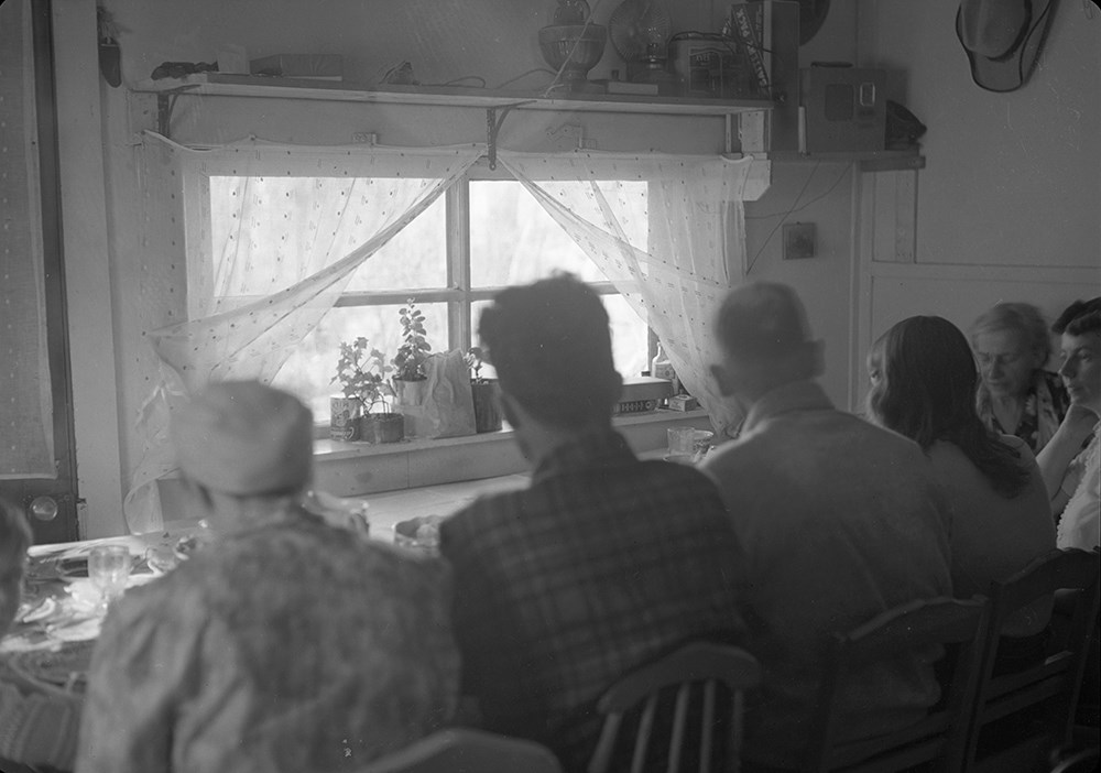
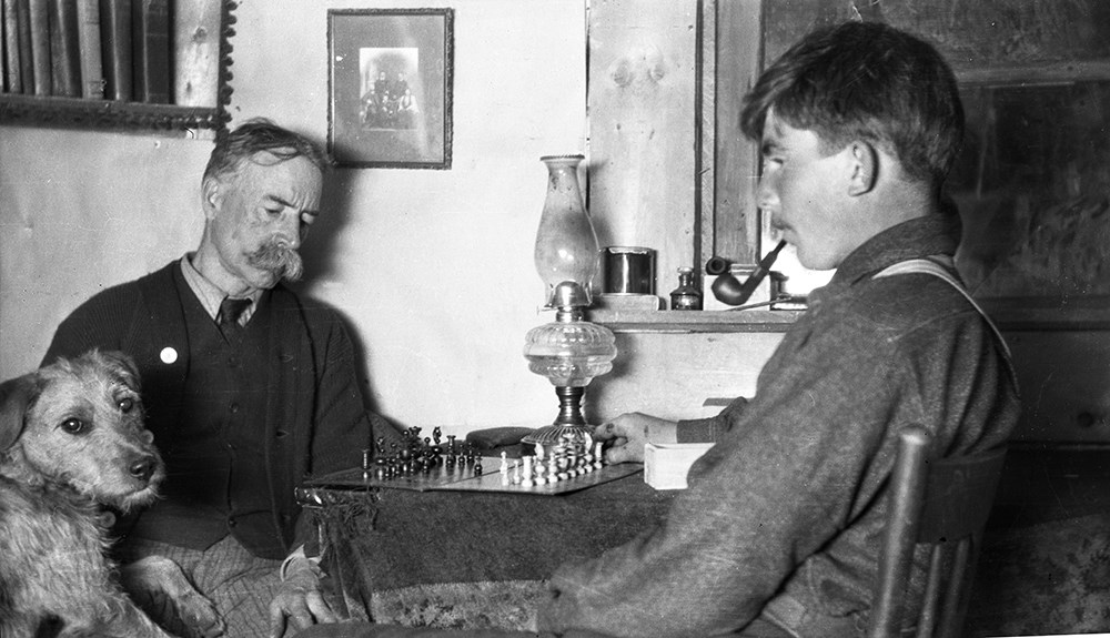
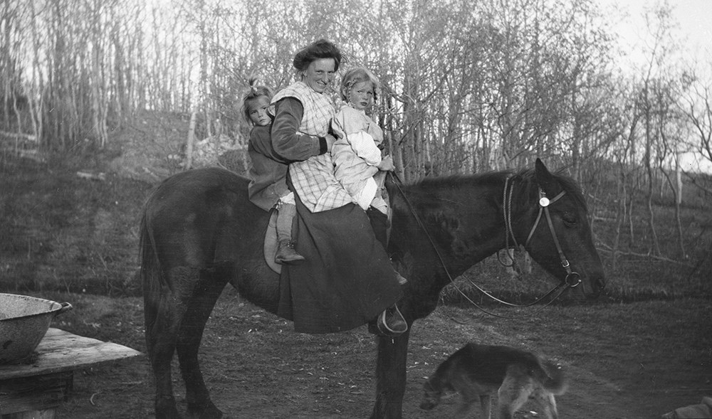
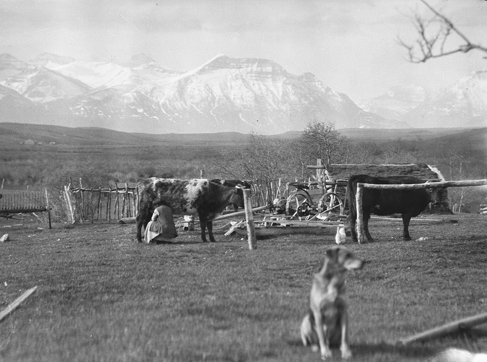
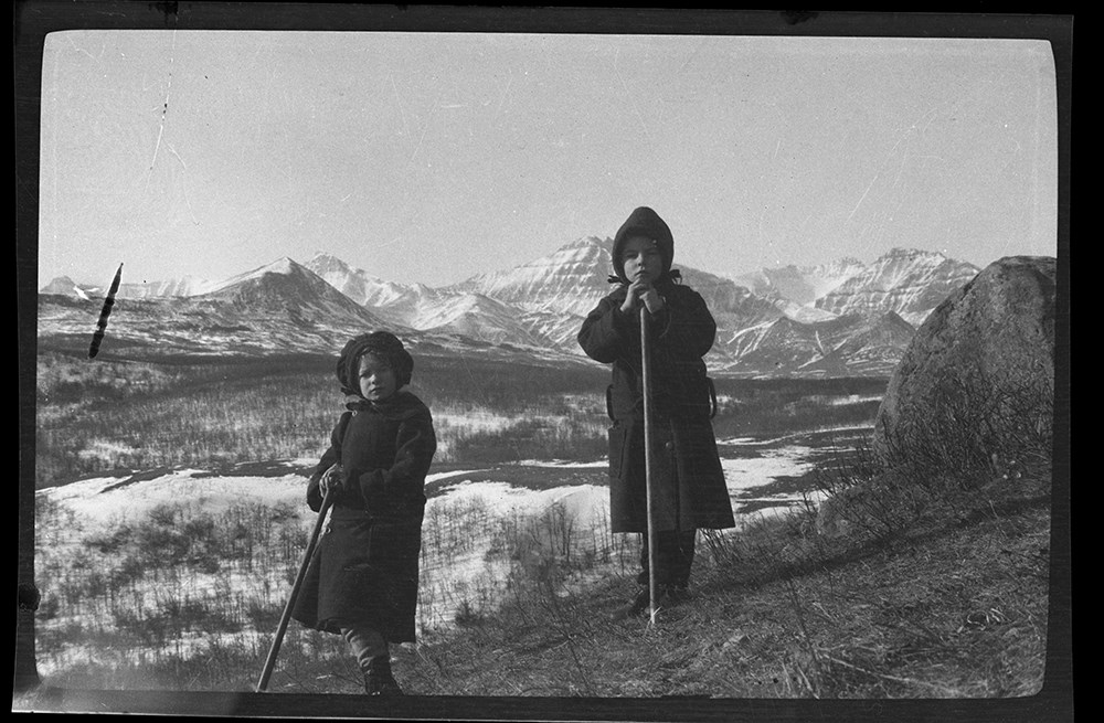
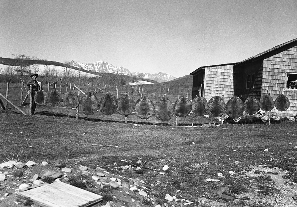
- File consists of 481 b&w negatives. The negatives pertain to Riggall pack trains and camps, the building of Cottonwood Canyon homes, Parkview school, Kay Russell (nee Riggall) and Doris "Babe" Burton as children and teens, homestead building, Gloyne's oil camp, Kootenay Brown, Dora cooking in camp,…
- Date Range
- [ca.1904 to ca.1959]
- Reference Code
- V26 / IX / A / NA (A1 to A59)
- Description Level
- 5 / File
- GMD
- Photograph
- Negative
11 images
- Part Of
- Bert Riggall fonds
- Description Level
- 5 / File
- Fonds Number
- M376 / V26
- Series
- IX. Riggall Negatives Scanned and Described
- Sous-Fonds
- V26
- Accession Number
- 7102
- Reference Code
- V26 / IX / A / NA (A1 to A59)
- GMD
- Photograph
- Negative
- Date Range
- [ca.1904 to ca.1959]
- Physical Description
- 481 photographs : b&w negatives
- Scope & Content
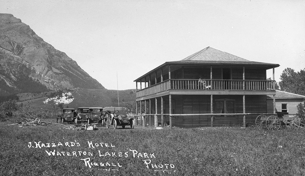
- File consists of 481 b&w negatives. The negatives pertain to Riggall pack trains and camps, the building of Cottonwood Canyon homes, Parkview school, Kay Russell (nee Riggall) and Doris "Babe" Burton as children and teens, homestead building, Gloyne's oil camp, Kootenay Brown, Dora cooking in camp, Cyril Watmough, Dora's cows, Chris William hauling logs, Dick Russell, Dora in Pincher creek, Doris "Babe" Burton in Vancouver, Jenkins ranch corralls, Riggall's log house on number 6, Riggall's dogs, flood at Cottonwood creek, various Riggall homes and picnics, hunting, fishing, Jack Hazzard's hotel, and Dora hiking and working.
- Subject Access
- Portrait
- Landscapes
- Hiking
- Packing
- Camping
- Fishing
- Animals
- Recreation
- Leisure
- Homestead
- Environment
- Family and personal life
- Geographic Access
- Canada
- Alberta
- Pincher Creek
- British Columbia
- Vancouver
- Language
- N/A
- Category
- Environment
- Exploration, discovery and travel
- Family and personal life
- Sports, recreation and leisure
- Title Source
- Title based on contents of file
- Content Details
- Reference scans available: V26 / IX / A / PA (A1 to A59)
- Processing Status
- Processed
Images


This material is presented as originally created; it may contain outdated cultural descriptions and
potentially offensive content.
Read more.
- Part Of
- Bert Riggall fonds
- Scope & Content
- File consists of 425 b&w negatives. The negatives pertain to Riggall packtrains and camps, bighorn sheep, hunting, hunting trophies, various landscapes, men posing with hunting trophies, portraits of the Cox family, portraits of Riggall cousins at Brooks, flowers (calipso orchid), Parkview school p…
- Date Range
- [ca.1904 to ca.1959]
- Reference Code
- V26 / IX / B / NA (B1 to B45)
- Description Level
- 5 / File
- GMD
- Photograph
- Negative
5 images
- Part Of
- Bert Riggall fonds
- Description Level
- 5 / File
- Fonds Number
- M376 / V26
- Series
- IX. Riggall Negatives Scanned and Described
- Sous-Fonds
- V26
- Accession Number
- 7102
- Reference Code
- V26 / IX / B / NA (B1 to B45)
- GMD
- Photograph
- Negative
- Date Range
- [ca.1904 to ca.1959]
- Physical Description
- 425 photographs : b&w negatives
- Scope & Content
- File consists of 425 b&w negatives. The negatives pertain to Riggall packtrains and camps, bighorn sheep, hunting, hunting trophies, various landscapes, men posing with hunting trophies, portraits of the Cox family, portraits of Riggall cousins at Brooks, flowers (calipso orchid), Parkview school picture, Hawk's nest, well drilling, clients fishing, and Riggall's cars.
- Subject Access
- Packing
- Pack trips
- Hunting
- Sports
- Recreation
- Portrait
- Family and personal life
- Animals
- Bighorn Sheep
- Environment and Nature
- Fishing
- Natural resources
- Geographic Access
- Canada
- Alberta
- Brooks
- Language
- N/A
- Category
- Environment
- Family and personal life
- Exploration, discovery and travel
- Sports, recreation and leisure
- Title Source
- Title based on contents of file
- Content Details
- Reference scans available: V26 / IX / B / PA (B1 to B45)
- Processing Status
- Processed
Images

This material is presented as originally created; it may contain outdated cultural descriptions and
potentially offensive content.
Read more.
- Part Of
- Bert Riggall fonds
- Scope & Content
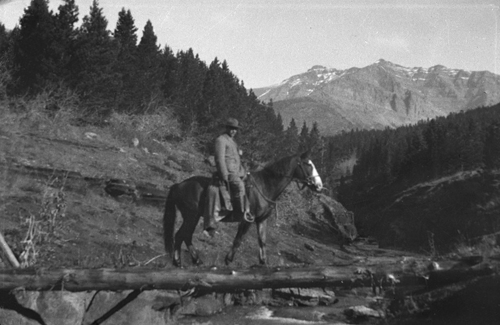
- File consists of 437 b&w negative photographs pertaining to Riggall pack trains and camps, and day trips in the Beehive, Kintla Creek, Mount Lyall, Yarrow Creek, Cache Creek and other areas.
- Date Range
- [ca.1904 to ca.1959]
- Reference Code
- V26 / IX / C / NA (C1 to C16)
- Description Level
- 5 / File
- GMD
- Photograph
- Negative
6 images
- Part Of
- Bert Riggall fonds
- Description Level
- 5 / File
- Fonds Number
- M376 / V26
- Series
- IX. Riggall Negatives Scanned and Described
- Sous-Fonds
- V26
- Accession Number
- 7102
- Reference Code
- V26 / IX / C / NA (C1 to C16)
- GMD
- Photograph
- Negative
- Date Range
- [ca.1904 to ca.1959]
- Physical Description
- 437 photographs : b&w negatives
- Scope & Content
- File consists of 437 b&w negative photographs pertaining to Riggall pack trains and camps, and day trips in the Beehive, Kintla Creek, Mount Lyall, Yarrow Creek, Cache Creek and other areas.
- Subject Access
- Packing
- Pack trips
- Exploration
- Travel
- Camping
- Recreation
- Leisure
- Landscapes
- Geographic Access
- Canada
- British Columbia
- Glacier National Park
- Mount Lyall
- United States of America
- Kintla Creek
- Language
- N/A
- Title Source
- Title based on contents of file
- Content Details
- Reference scans available: V26 / IX / C / PA (C1 to C16)
- Processing Status
- Processed
Images
This material is presented as originally created; it may contain outdated cultural descriptions and
potentially offensive content.
Read more.
- Part Of
- Bert Riggall fonds
- Scope & Content
- File consists of 440 b&w negatives. The negatives pertain to Riggall pack trains and camps, hunting trophies, Riggall's ram trophies, various birds, bison, Ed Burton, Doris "Babe" Burton (nee Riggall), Bob Burton, Kay Riggall, and Dora Riggall posing in front of the Burton's home, and interior view…
- Date Range
- [ca.1904 to ca.1959]
- Reference Code
- V26 / IX / D / NA (D1 to D 23)
- Description Level
- 5 / File
- GMD
- Photograph
- Negative
15 images
- Part Of
- Bert Riggall fonds
- Description Level
- 5 / File
- Fonds Number
- M376 / V26
- Series
- IX. Riggall Negatives Scanned and Described
- Sous-Fonds
- V26
- Accession Number
- 7102
- Reference Code
- V26 / IX / D / NA (D1 to D 23)
- GMD
- Photograph
- Negative
- Date Range
- [ca.1904 to ca.1959]
- Physical Description
- 440 photographs : b&w negatives
- Scope & Content
- File consists of 440 b&w negatives. The negatives pertain to Riggall pack trains and camps, hunting trophies, Riggall's ram trophies, various birds, bison, Ed Burton, Doris "Babe" Burton (nee Riggall), Bob Burton, Kay Riggall, and Dora Riggall posing in front of the Burton's home, and interior views of Riggall's gunsmithing shop.
- Name Access
- Burton, Doris
- Burton, Bob
- Riggall, Kay
- Riggall, Dora
- Burton, Ed
- Subject Access
- Packing
- Pack trips
- Hunting
- Sports
- Recreation
- Family and personal life
- Animals
- Buffalo
- Birds
- Environment and Nature
- Natural resources
- Gunsmithing
- Geographic Access
- Canada
- Canadian Rocky Mountains
- Language
- N/A
- Category
- Environment
- Exploration, discovery and travel
- Family and personal life
- Sports, recreation and leisure
- Title Source
- Title based on contents of file
- Content Details
- Reference scans available: V26 / IX / D / NA (D1 to D 23)
- Processing Status
- Processed
Images


This material is presented as originally created; it may contain outdated cultural descriptions and
potentially offensive content.
Read more.
- Part Of
- Bert Riggall fonds
- Scope & Content
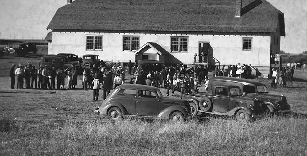
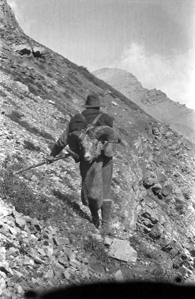
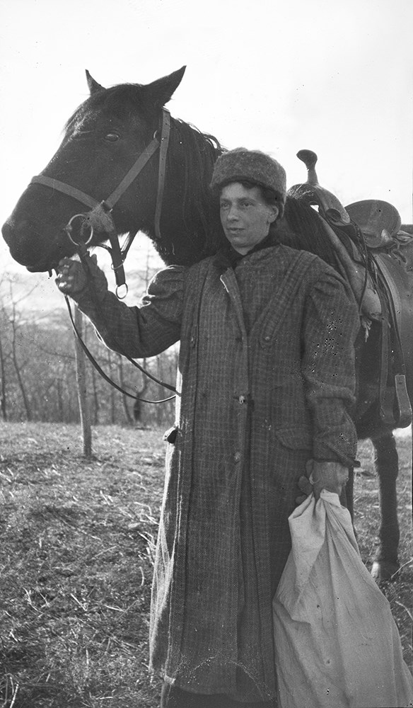
- File consists of 463 b&w negatives. The negatives pertain to Riggall pack trains and camps, hunting trophies, Riggall's ram trophies, negatives removed from two Riggall negative albums, early hunting and camping photographs, Riggall's parents posing with bear killed by Riggall, tourists on Waterton…
- Date Range
- [ca.1904 to ca.1959]
- Reference Code
- V26 / IX / E / NA (E1 to E21)
- Description Level
- 5 / File
- GMD
- Photograph
- Negative
5 images
- Part Of
- Bert Riggall fonds
- Description Level
- 5 / File
- Fonds Number
- M376 / V26
- Series
- IX. Riggall Negatives Scanned and Described
- Sous-Fonds
- V26
- Accession Number
- 7102
- Reference Code
- V26 / IX / E / NA (E1 to E21)
- GMD
- Photograph
- Negative
- Date Range
- [ca.1904 to ca.1959]
- Physical Description
- 463 photographs : b&w negatives
- Scope & Content
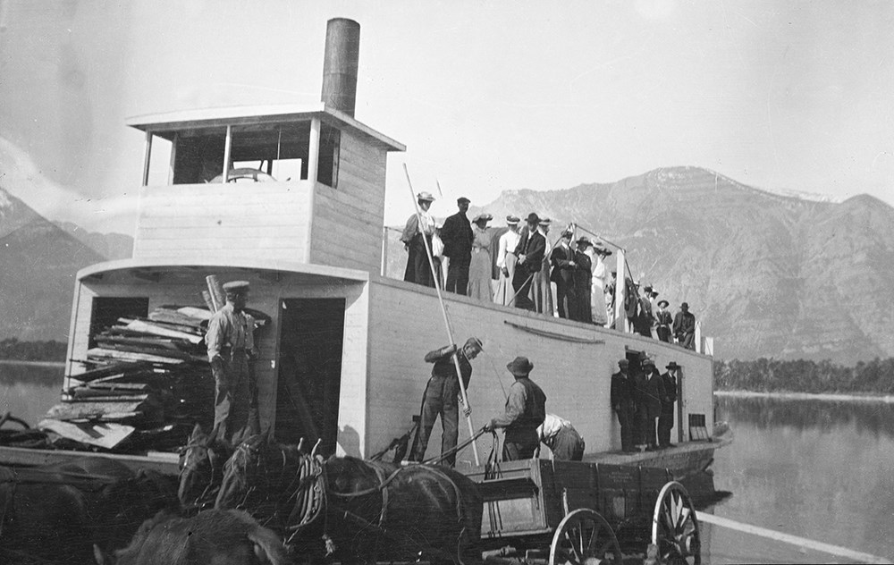
- File consists of 463 b&w negatives. The negatives pertain to Riggall pack trains and camps, hunting trophies, Riggall's ram trophies, negatives removed from two Riggall negative albums, early hunting and camping photographs, Riggall's parents posing with bear killed by Riggall, tourists on Waterton steam boat, Austin's Cochrane ranch, and the Castle River rodeo.
- Subject Access
- Hunting
- Animals
- Bear
- Boats
- Transportation
- Camping
- Sports
- Recreation
- Packing
- Pack trips
- Ranches
- Travel
- Family and personal life
- Geographic Access
- Canada
- Alberta
- Cochrane
- Waterton
- Language
- N/A
- Category
- Family and personal life
- Exploration, discovery and travel
- Sports, recreation and leisure
- Transportation
- Title Source
- Title based on contents of file
- Content Details
- Reference scans available: V26 / IX / E / NA (E1 to E21)
- Processing Status
- Processed
Images
This material is presented as originally created; it may contain outdated cultural descriptions and
potentially offensive content.
Read more.
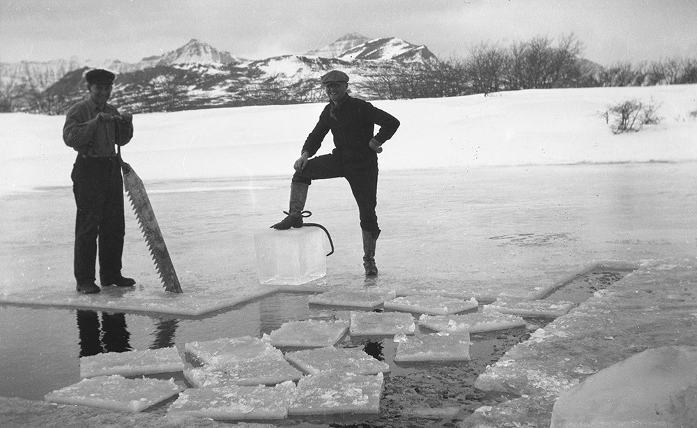
- Part Of
- Bert Riggall fonds
- Scope & Content
- File consists of 466 b&w negatives. The negatives pertain to Andy Russell and Kay Russell's (nee Riggall) wedding day, ice cutting, Bert and Dora on horseback during the time of their homesteading, young Doris "Babe" Burton (nee Riggall) and Kay Russell (nee Riggall), haying, Cottowood Creek flood,…
- Date Range
- [ca.1904 to ca.1959]
- Reference Code
- V26 / IX / F / NA (F1 to F51)
- Description Level
- 5 / File
- GMD
- Photograph
- Negative
26 images
- Part Of
- Bert Riggall fonds
- Description Level
- 5 / File
- Fonds Number
- M376 / V26
- Series
- IX. Riggall Negatives Scanned and Described
- Sous-Fonds
- V26
- Accession Number
- 7102
- Reference Code
- V26 / IX / F / NA (F1 to F51)
- GMD
- Photograph
- Negative
- Date Range
- [ca.1904 to ca.1959]
- Physical Description
- 466 photographs : b&w negatives
- Scope & Content
- File consists of 466 b&w negatives. The negatives pertain to Andy Russell and Kay Russell's (nee Riggall) wedding day, ice cutting, Bert and Dora on horseback during the time of their homesteading, young Doris "Babe" Burton (nee Riggall) and Kay Russell (nee Riggall), haying, Cottowood Creek flood, Chris Williams, Cyril Watmough, various views of Riggall pack trains and clients, Miss Allison (Parkview teacher) fishing, Fred Dupuy, Kay and Doris' pet owls, Dora skinning her deer, Parkview School meeting, Porcupine eating Bert's saddles, Bert's 1911 trip in B.C, picnics, Riggall camps, and some early Riggall photographs.
- Subject Access
- Family and personal life
- Weddings
- Leisure
- Recreation
- Horses
- Horseback riding
- Homestead
- Fishing
- Wildlife
- Picnics and picnicking
- Pack trips
- Packing
- Language
- English
- Title Source
- Title based on contents of file
- Content Details
- Reference scans available: V26 / IX / F / NA (F1 to F51)
- Processing Status
- Processed
Images


This material is presented as originally created; it may contain outdated cultural descriptions and
potentially offensive content.
Read more.
- Part Of
- Bert Riggall fonds
- Scope & Content
- File consists of 472 b&w negatives. The negatives pertain to breaking horses, packtrains and horses, the organizing of the Alberta Licensed Outfitters Association at Col. Snyder's ranch at Sundre, AB attended by Col. Henry Snyder, Major Fred Brewster, Raymond Patterson, Claude Brewster, Harold Ande…
- Date Range
- [ca.1904 to ca.1959]
- Reference Code
- V26 / IX / G / NA (G1 to G20)
- Description Level
- 5 / File
- GMD
- Photograph
- Negative
5 images
- Part Of
- Bert Riggall fonds
- Description Level
- 5 / File
- Fonds Number
- M376 / V26
- Series
- IX. Riggall Negatives Scanned and Described
- Sous-Fonds
- V26
- Accession Number
- 7102
- Reference Code
- V26 / IX / G / NA (G1 to G20)
- GMD
- Photograph
- Negative
- Date Range
- [ca.1904 to ca.1959]
- Physical Description
- 472 photographs : b&w negatives
- Scope & Content
- File consists of 472 b&w negatives. The negatives pertain to breaking horses, packtrains and horses, the organizing of the Alberta Licensed Outfitters Association at Col. Snyder's ranch at Sundre, AB attended by Col. Henry Snyder, Major Fred Brewster, Raymond Patterson, Claude Brewster, Harold Anderson, Nick Nickerson, and Riggall, various landscapes, hunting and hunting trophies, hiking, fishing, camps, and various birds
- Name Access
- Snyder, Henry
- Brewster, Fred
- Brewster, Claude
- Anderson, Harold
- Nickerson, Nick
- Patterson, Raymond
- Subject Access
- Sports
- Recreation
- Fishing
- Hunting
- Family and personal life
- Animals
- Camping
- Birds
- Horses
- Horseback riding
- Pack trips
- Outfitters
- Geographic Access
- Canada
- Alberta
- Sundre
- Language
- N/A
- Title Source
- Title based on contents of file
- Content Details
- Reference scans available: V26 / IX / G / PA (G1) to V26 / IX / H / PA (H9)
- Processing Status
- Processed
Images


This material is presented as originally created; it may contain outdated cultural descriptions and
potentially offensive content.
Read more.
- Part Of
- Bert Riggall fonds
- Scope & Content
- File consists of 309 b&w negatives. The negatives pertain to breaking horses, packtrains and horses, various landscapes, hunting and hunting trophies, hiking, fishing, camps, camp life, and birds.
- Date Range
- [ca.1904 to ca.1959]
- Reference Code
- V26 / IX / F / NA (H1 to H9)
- Description Level
- 5 / File
- GMD
- Photograph
- Negative
3 images
- Part Of
- Bert Riggall fonds
- Description Level
- 5 / File
- Fonds Number
- M376 / V26
- Series
- IX. Riggall Negatives Scanned and Described
- Sous-Fonds
- V26
- Accession Number
- 7102
- Reference Code
- V26 / IX / F / NA (H1 to H9)
- GMD
- Photograph
- Negative
- Date Range
- [ca.1904 to ca.1959]
- Physical Description
- 309 photographs : b&w negatives
- Scope & Content
- File consists of 309 b&w negatives. The negatives pertain to breaking horses, packtrains and horses, various landscapes, hunting and hunting trophies, hiking, fishing, camps, camp life, and birds.
- Subject Access
- Recreation
- Leisure
- Camping
- Sports
- Hunting
- Fishing
- Wildlife
- Birds
- Animals
- Horses
- Horseback riding
- Pack trips
- Packing
- Landscapes
- Family and personal life
- Language
- English
- Title Source
- Title based on contents of file
- Content Details
- Reference Scans available at: V26 / IX / G / PA (G1) to V26 / IX / H / PA (H9)
- Processing Status
- Processed
Images
This material is presented as originally created; it may contain outdated cultural descriptions and
potentially offensive content.
Read more.
- Part Of
- Bert Riggall fonds
- Scope & Content
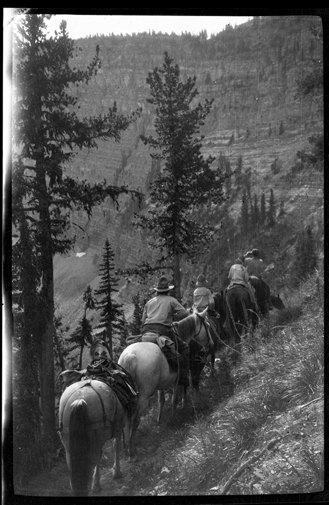
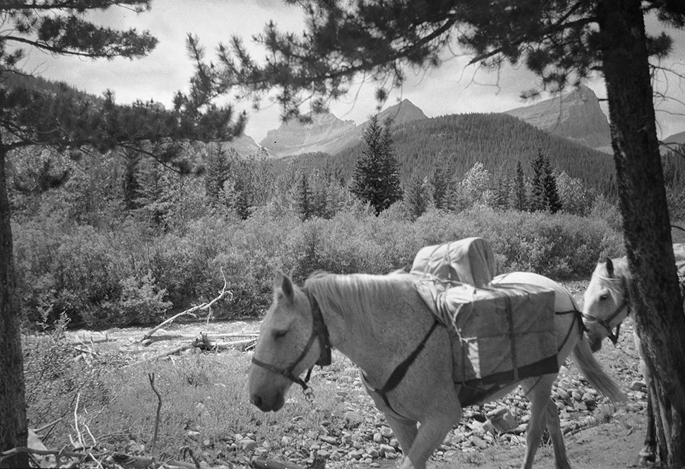
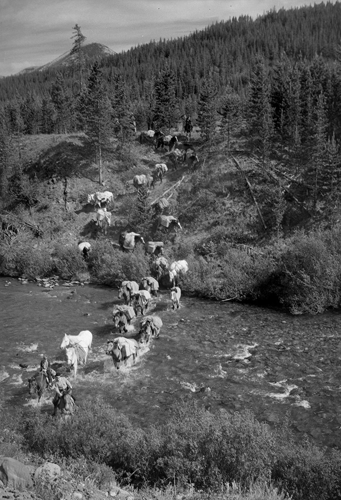
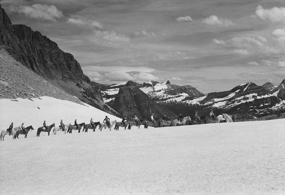
- File consists of 390 b&w negatives. The negatives pertain to Mount Chapman and Mount Custer; hunters checking slopes; hunters posed with a goat trophy; an unidentified man posed on slope of Belleview Hill; people on horses on Continental Divide North of Sage Pass; Cache Creek Falls; riders on a day…
- Date Range
- [ca.1904 to ca.1959]
- Reference Code
- V26 / IX / H / NA (H1-1) to V26 / IX / J / NA (J5-9)
- Description Level
- 5 / File
- GMD
- Photograph
- Negative
6 images
- Part Of
- Bert Riggall fonds
- Description Level
- 5 / File
- Fonds Number
- M376 / V26
- Series
- IX. Riggall Negatives Scanned and Described
- Sous-Fonds
- V26
- Accession Number
- 7102
- Reference Code
- V26 / IX / H / NA (H1-1) to V26 / IX / J / NA (J5-9)
- GMD
- Photograph
- Negative
- Date Range
- [ca.1904 to ca.1959]
- Physical Description
- 390 photographs :b&w negatives
- Scope & Content
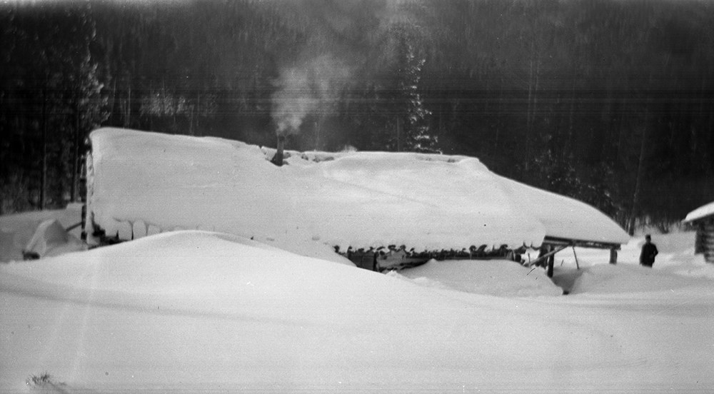
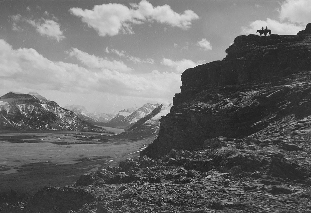
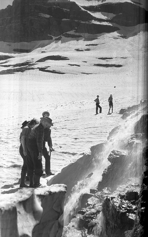
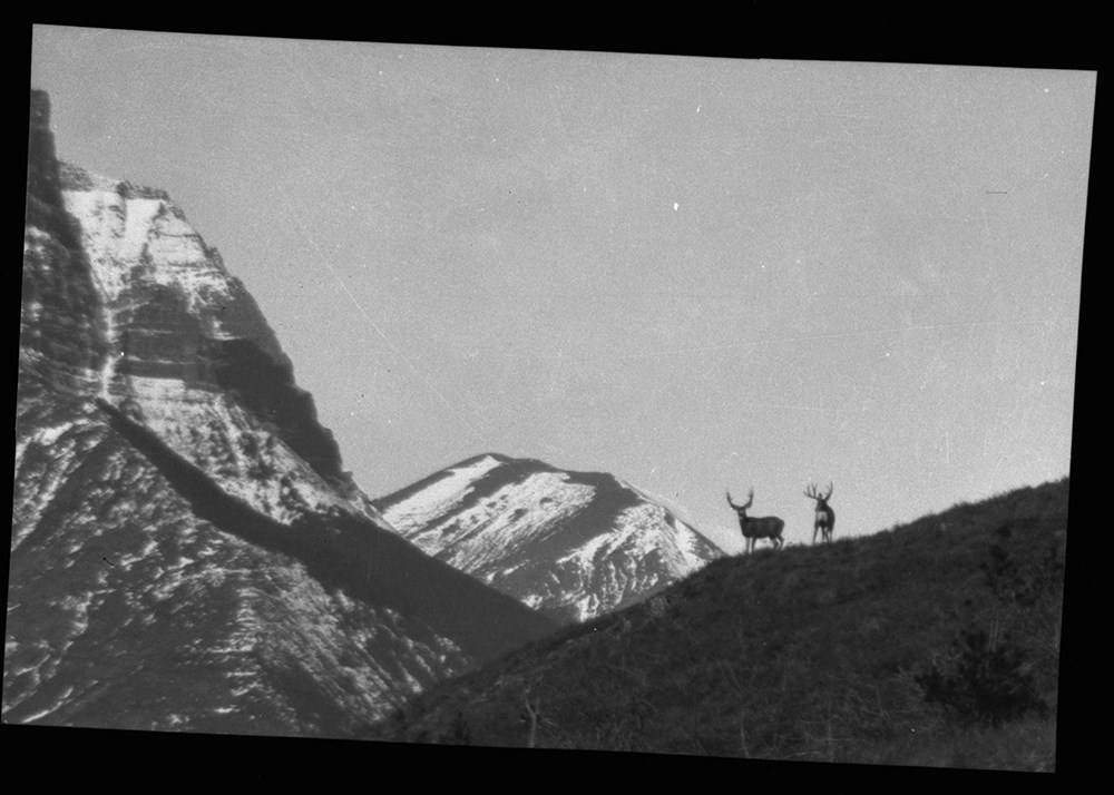
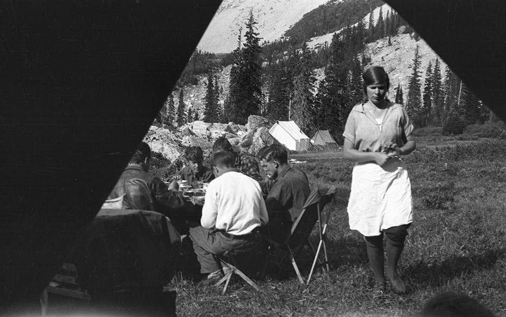
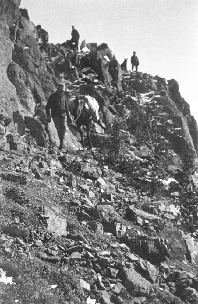
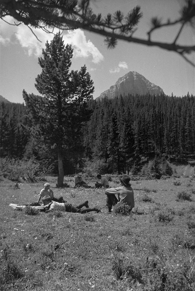
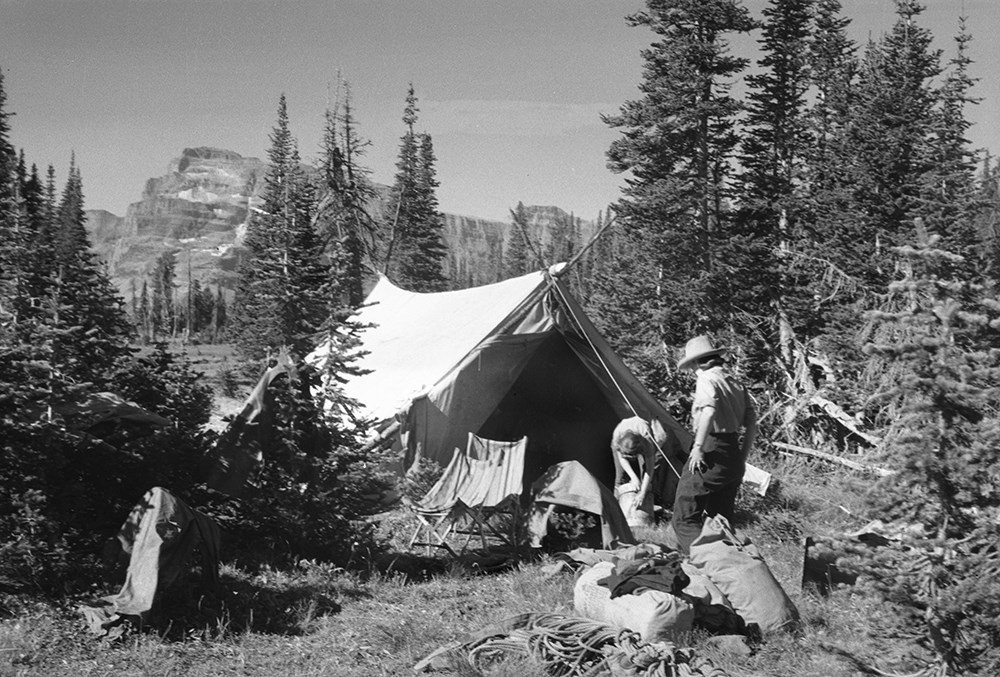
- File consists of 390 b&w negatives. The negatives pertain to Mount Chapman and Mount Custer; hunters checking slopes; hunters posed with a goat trophy; an unidentified man posed on slope of Belleview Hill; people on horses on Continental Divide North of Sage Pass; Cache Creek Falls; riders on a day trip; a camp scene of bedding being aired out; Mount Blackiston and Ruby Creek; the Beehive from Panorama Peak; various hunters; a red squirrel; fisherman, horses and tent at Crandell Lake; a mule deer on prairie part of Waterton Lakes National Park; two mule deer on slopes above Cameron Lake; woman on shore of Wall Lake; camp at Oyster Creek; Canadian two cent stamp; horses on ranch; hunters on vertical cliff; Summit Lake early in summer Mount Chapman; people and horses across from Beehive; two hunters in camp with deer trophy; packtrain below Broken Castle; Anderson Peak; mule deer buck; big horn ram on grassy slope; rams on a cliff; people on shore of Upper Kintla Lake, Long Knife Peak; rider at Oyster Creek camp; snow-covered camp scene; beaver dams and ponds on Dungarvin Creek; fisherman with large trout; McIntyre ranch buildings from Milk River Ridge; various camp scenes; Hawk's Nest cottage yard with trip supplies; packtrain wading up a river; packtrain in a meadow in the Oldman area; chicadee; gray-crowned rosy finches; downy woodpecker; columbia ground squirell; osprey nest near Oldman River; fisherman on Oldman River; A.O. Wheeler's mapping survey expeditions rock cairn; group on Tornado Pass; two people on Limestone Peak; Andy Russell and Jim Bennett on Tornado Mountain; andy Russell on top of cliff; Castle River rodeo; Sumner Crosby with a ram; lunch time on trip; Andy Russell field dressing a bull elk; guests on Mount Chimney; hunter on avalanche track; tents in snow; Lake Wurderman, Lake Nooney, and Mount Chapman; children eating on porch of Hawk's Nest; moving camp at Oyster Creek; limestone outcrop on corner of Lakeview Ridge; guest eatng at table in front of tent; Bert's car near Red Rock Canyon; saddle horses above South Kootenay Pass, Starvation Peak and King Edward; Mount Farquhar, Holcroft Mountain, Mount Scrimger; Jim Bennett with his movie camera near Beehive; Andy Russell and packtrain Oldman River valley; Lundbreck, Alberta; Pincher Creek and Castle Mountain; Upper Waterton Lake from Crandell; Andy and Kay Russell Wedding, 1938; Andy Russell snowshoeing; F.H.R's tipi; fishing at Wall Lake; Riggall's second Cottonwood Canyon house; Twin Lakes Camp; Kintla Lookout; Harwood Wedding.
- Subject Access
- Portraits
- Landscapes
- Hunting
- Guiding
- Pack trips
- Sports
- Recreation
- Wildlife
- Environment
- Snowshoes and snowshoeing
- Fishing
- Travel
- Geographic Access
- Canada
- Alberta
- Pincher Creek
- Canadian Rocky Mountains
- Waterton Lakes National Park
- Waterton
- Castle Mountain
- Language
- English
- Category
- Environment
- Exploration, discovery and travel
- Family and personal life
- Sports, recreation and leisure
- Title Source
- Title based on contents of file
- Content Details
- Reference scans available: V26 / IX / H / PA (H1) to V26 / IX / J / PA (J5)
- Processing Status
- Processed
Images

This material is presented as originally created; it may contain outdated cultural descriptions and
potentially offensive content.
Read more.
- Part Of
- Bert Riggall fonds
- Scope & Content
- File consists of articles and letters to the editor collected by Bert Riggall and pertaining to Waterton Lakes National Park, weather (especially snowfall), obituaries, cattle, ranching, wildlife, mountaineering, Andy Russell, Sam Clark. Newsclippings are mainly from Lethbridge Herald and Pincher …
- Date Range
- 1914-1957
- Reference Code
- M376 / 143 to 145
- Description Level
- 5 / File
- Part Of
- Bert Riggall fonds
- Description Level
- 5 / File
- Series
- VI. Other interests series
- Reference Code
- M376 / 143 to 145
- Date Range
- 1914-1957
- Physical Description
- 1 cm of print material
- Scope & Content
- File consists of articles and letters to the editor collected by Bert Riggall and pertaining to Waterton Lakes National Park, weather (especially snowfall), obituaries, cattle, ranching, wildlife, mountaineering, Andy Russell, Sam Clark. Newsclippings are mainly from Lethbridge Herald and Pincher Creek Echo
- Title Source
- Title based on contents of file
This material is presented as originally created; it may contain outdated cultural descriptions and
potentially offensive content.
Read more.