Narrow Results By
Bob Smith fonds
https://archives.whyte.org/en/permalink/descriptions55735
- Part Of
- Bob Smith fonds
- Scope & Content
- Fonds consists of personal photographs, biographical notes, memoir drafts and other collected materials pertaining to Robert Neville (Bob) Smith. Fonds also includes plans and maps pertaining to the development of land near Lake Minnewanka and the Cascade Power Plant project (1943).
- Date Range
- 1925-1995
- Reference Code
- M589 / V809
- Description Level
- 1 / Fonds
- GMD
- Map
- Newspaper clipping
- Photograph
- Plan
- Postcard
- Published record
- Textual record
- Part Of
- Bob Smith fonds
- Description Level
- 1 / Fonds
- Fonds Number
- M589
- V809
- Sous-Fonds
- M589
- V809
- Accession Number
- 2021.36
- Reference Code
- M589 / V809
- Date Range
- 1925-1995
- Physical Description
- ca.300 photographs : b&w and col. prints ; 12 x 18 cm or smaller -- 7 cm of textual records -- 7 topographical maps/plans -- 8 postcards
- History / Biographical
- Robert Neville (Bob) Smith (1926-2021) was born in Banff. He was the only child of parents Enoch Smith and Laurene Smith (nee Munson). Bob grew up near Lake Minnewanka until 1941, when a hydro dam was installed resulting in the intentional flooding of the area. The family moved to Banff, where Bob met his future wife, Mary Parkinson. The couple were married in 1953 and moved to Seebe, where they raised two daughters, Marjory and Shirley. Bob worked for Calgary Power Co. (later renamed TransAlta Utilities) from 1953 until his retirement in 1986. In his spare time, Bob founded the Bow Valley Camera Club and the Bow Valley Naturalists organization. In 1999, Bob was part of a successful project with the Bow Valley Naturalists to designate the Mount Yamnuska area as a Bow Valley Protected Area, following 25 years of lobbying with the Government of Alberta. Bob also formed the Meanderthals seniors hiking club in 1993 and led various local hiking trips in his later years.
- Scope & Content
- Fonds consists of personal photographs, biographical notes, memoir drafts and other collected materials pertaining to Robert Neville (Bob) Smith. Fonds also includes plans and maps pertaining to the development of land near Lake Minnewanka and the Cascade Power Plant project (1943).
- Name Access
- Smith, Enoch
- Smith, Robert Neville (Bob)
- Subject Access
- Family and personal life
- Labour
- Environment
- Natural resources
- Geographic Access
- Canada
- Alberta
- Banff
- Canmore
- Seebe
- Lake Minnewanka
- Language
- English
- Biographical Source Notes
- https://www.albertaprimetimes.com/obituaries/robert-neville-bob-smith-3238925
- Title Source
- Title based on contents of fonds
- Processing Status
- Processed
This material is presented as originally created; it may contain outdated cultural descriptions and
potentially offensive content.
Read more.
Dorothy Wardle fonds
https://archives.whyte.org/en/permalink/descriptions398
- Part Of
- Dorothy Wardle fonds
- Scope & Content
- Fonds consists of two sous-fonds: M521 and V75. M521 consists of four series, 154 cm, ca.1870-2002. Series I: Dorothy Wardle Personal Papers, 69.5 cm, ca.1870-2002 (includes Dorothy's written work and research and notes related to Banff). Series II: Wardle Family, 32.5 cm, 1872-1998 (including cor…
- Date Range
- ca.1870-2002
- Reference Code
- M521 / V75
- Description Level
- 1 / Fonds
- GMD
- Photograph
- Album
- Negative
- Photograph print
- Postcard
- Transparency
- Textual record
- Private record
- Published record
- Part Of
- Dorothy Wardle fonds
- Description Level
- 1 / Fonds
- Fonds Number
- M521
- V75
- Sous-Fonds
- M521
- V75
- Accession Number
- 5296, 5391, 7504
- Reference Code
- M521 / V75
- GMD
- Photograph
- Album
- Negative
- Photograph print
- Postcard
- Transparency
- Textual record
- Private record
- Published record
- Date Range
- ca.1870-2002
- Physical Description
- 154 cm of textual records. -- 1304 photographs (1190 prints, 95 negatives, 19 transparencies). -- 6 photograph albums.
- History / Biographical
- The Wardle family was comprised of husband and wife, James Morey Wardle (June 26,1888 - May 18,1971) and Maud Leette (Roney) Wardle (May 24,1889 - December 1,1969), and their one child, Dorothy Hope Wardle (May 23,1919 - July 20,2003). James Wardle, born in Chiliwack, British Columbia, was a civil engineer and public servant. He was the Superintendent of Banff National Park from 1918-1921, Chief Engineer for Parks Canada from 1921-1935, and Deputy Minister of the Interior from 1935-1936. He is primarily known as a highway design engineer, particularly for building the Banff-Windermere, Banff-Lake Louise, and Banff-Jasper highways. He was a councillor for the Municipality of Rockcliffe Park in Ontario and he was the President of the Trail Riders of the Canadian Rockies in Banff from 1925-1929. Mount Wardle in Vermillion was named after him in 1921. James married Leette on November 4, 1913, with whom he had one child, Dorothy. Born in Calgary, Alberta, Dorothy (also known as Dot and Dorie) grew up in Banff, Alberta and Ottawa, Ontario, due to her father's position with the federal government. She was educated at the Mountain School in Banff and at the Elmwood School in Ottawa. All three family members were graduates of Queen's University in Kingston, Ontario. James graduated in 1912 with a Bachelor of Science in Engineering, Leette graduated with a Bachelor's degree, and in 1942, Dorothy also earned a Bachelor's degree. Dorothy was prominent in student life and active in athletics. In 1941, Dorothy became the first woman elected as President of the Alma Mater Society and during her academic career, Dorothy was a member of the Levana Intercollegiate Debative, University Centenary Committee, and Queen’s War Aid Commission. Dorothy spent her career as a freelance writer however, upon graduation she served as the first Secretary-In-Charge of Records at Carleton College (now Carleton University) from 1942-1944 in Ottawa and in the mid-1950s worked as a secretary for the Glenbow Foundation in Calgary. Dorothy pursued a lifelong interest in traveling, art, and antiques. Although she was fiercely proud and protective of Banff and the Park, and remained a volunteer and patron of the Whyte Museum of the Canadian Rockies, Dorothy eventually settled in Sidney, British Columbia and shared an apartment with Sheila Iris Ritchie, with whom Dorothy travelled extensively. After her death in 2003, Dorothy, "Dorie," was laid to rest alongside her parents in the Old Banff Cemetery.
- Scope & Content
- Fonds consists of two sous-fonds: M521 and V75.
- M521 consists of four series, 154 cm, ca.1870-2002. Series I: Dorothy Wardle Personal Papers, 69.5 cm, ca.1870-2002 (includes Dorothy's written work and research and notes related to Banff). Series II: Wardle Family, 32.5 cm, 1872-1998 (including correspondence with Carl Rungius and Mrs. Helen Brett, and Christmas and other greeting cards from Peter and Catharine Whyte). Series III: Queen's University, 7.5 cm, 1911-1980 (including graduation certificates for each family member and records pertaining to Dorothy's participation on the Alma Mater Society). Series IV: Travel, 44.5 cm, ca.1950-1988 (includes hand-written notebooks meticulously detailing their travels).
- V75 consists of two series, 79.5 cm, ca. 1912-2001. Series I: Wardle Family, ca. 1912-1971, 6 albums, 31 cm of photograph prints and negatives (including family trips, trail rides in the Canadian Rocky Mountains, and family gatherings). Series II: Dorothy Wardle, 1972-2001, 34 cm of photograph prints, negatives, and transparencies (including Dorothy's travels in Alberta and British Columbia, overseas, and various outings with friends).
- Name Access
- Wardle, Dorothy
- Wardle, James
- Rungius, Carl
- Brett, Helen
- Keyte, Freeman
- Hart, E. J. (Ted)
- Harkin, J. B. (James Bernard)
- Brewster, Pat
- Peyto, Bill
- Brett, Robert George
- Sanson, Norman
- White, Clifford
- Drummond-Davies, Nora
- Mills, Ike
- McLean, George
- Walking Buffalo (George McLean)
- Kaquitts, Frank
- Oxborough, Dorothy
- Whyte, Jon
- Robinson, Dean
- Warren, Mary Schaffer
- Simpson, George
- Gibbon, John Murray
- Whyte, Catharine
- Whyte, Peter
- Greenham, Margaret
- Subject Access
- Arts
- Environment
- Personal and Family Life
- Banff
- Old Banff Cemetery
- Whyte Museum of the Canadian Rockies
- Cabins
- Travel
- Picnics and picnicking
- Holidays
- Scenery
- Christmas
- Dogs
- Horses
- Mountain
- Canoes and canoeing
- Hiking
- Wildlife
- War Memorial
- Highland Games
- Bow River Bridge
- Golfing
- Anniversary
- Horseback riding
- Indigenous Peoples
- Stoney Nakoda
- Education
- Snowshoes and snowshoeing
- Banff Winter Carnival
- Banff Winter Festival
- Women
- Trails
- Trail Riders of the Canadian Rockies
- Sports and leisure
- Skiing
- European travel
- Beach
- Calgary Herald
- Geography
- Government
- Newspaper
- Politics
- Research
- Banff Public Library
- National parks and reserves
- Park policy
- Parks Canada
- Wardens
- Ya-Ha-Tinda Ranch
- Community life
- Mines and mineral resources
- History
- Immigration and homesteading
- Settlement
- Organizations
- World War II
- Biographical
- Professional and Personal Life
- Grizzly Bears
- Fire fighters
- Sunshine Village
- Teahouses
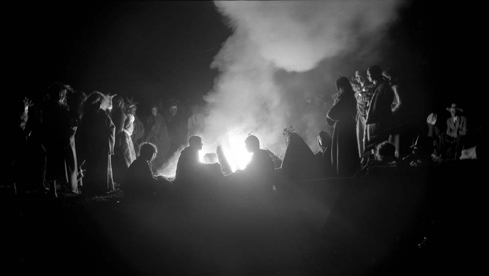
- Banff Indian Days
- Regalia
- Calgary Stampede
- Mountain guides
- Mountain School
- The Albertan
- Crag and Canyon newspaper
- Homestead Hotel
- Banff Centre
- Hot Springs
- Superintendents
- Automobiles
- Natural history
- Records
- Calendar
- Finances
- Leases
- Legal and Financial
- Property
- Recreation
- Geographic Access
- Banff
- Banff National Park
- Canmore
- Alberta
- Canada
- Canadian Rocky Mountains
- Castle Mountain
- Bankhead
- British Columbia
- Glacier National Park
- Kootenay National Park
- Silver City
- Victoria
- Scotland
- Revelstoke
- Yoho National Park
- Ottawa
- Ontario
- Prince Edward Island
- Plain of Six Glaciers
- Lake Agnes
- Lake Louise
- Lake Minnewanka
- Lake O'Hara
- Bow River
- Calgary
- Sidney
- San Francisco
- United States
- Europe
- Germany
- Switzerland
- France
- Spain
- Monaco
- Italy
- Denmark
- Austria
- Quebec
- Windermere
- New York
- Assiniboine
- Ghost River
- High River
- Quebec City
- New Brunswick
- Maine
- Great Divide
- Moraine Lake
- Maligne Lake
- Columbia Icefield
- Washington
- Philadelphia
- Atlantic City
- Larch Valley
- Cascade Mountain
- Panama
- Sulphur Mountain
- Field
- Emerald Lake
- Head Smashed In Buffalo Jump
- Takkakaw Falls
- Jasper National Park
- Athabasca Falls
- Okanagan
- Kananaskis
- Hoodoos
- Powell River
- Montreal
- Access Restrictions
- Some restriction/s on access
- Copyright, privacy, commercial use and other restrictions may apply
- Language
- Language is English
- Related Material
- Dorothy also donated artwork (by Carl Rungius) to Art and Heritage.
- James Morey Wardle fonds (Library and Archives Canada)
- Category
- Arts
- Environment
- Education
- Exploration, discovery and travel
- Family and personal life
- First nations
- Sports, recreation and leisure
- Title Source
- Title based on accession records and contents of fonds
- Processing Status
- Processed
This material is presented as originally created; it may contain outdated cultural descriptions and
potentially offensive content.
Read more.
Alberta historical photographs
https://archives.whyte.org/en/permalink/descriptions55340
- Part Of
- Luxton family fonds
- Scope & Content
- Album consists of 14 photographs and accompanying notes pertaining to various historical events in Alberta. Photographs in album pertain to the Ranchmen's Club in Calgary; an unidentified Stoney Nakoda chief receiving royalty payments for oil extraction in 1929; a group of police officers gathered …
- Date Range
- [1955-1960]
- Reference Code
- LUX / II / E / PD - 6
- Description Level
- 5 / File
- GMD
- Album
- Photograph
- Photograph print
- Part Of
- Luxton family fonds
- Description Level
- 5 / File
- Fonds Number
- LUX
- Series
- LUX / II / E : Travel and home records
- Sous-Fonds
- LUX / II : Eleanor Luxton sous-fonds
- Accession Number
- LUX
- Reference Code
- LUX / II / E / PD - 6
- Date Range
- [1955-1960]
- Physical Description
- 1 album (14 photographs : b&w ; 20 x 25 cm)
- Scope & Content
- Album consists of 14 photographs and accompanying notes pertaining to various historical events in Alberta. Photographs in album pertain to the Ranchmen's Club in Calgary; an unidentified Stoney Nakoda chief receiving royalty payments for oil extraction in 1929; a group of police officers gathered outside of a building [possibly the North-West Mounted Police Barracks in Canmore]; a cattle ranch, possibly located on a Blackfoot reserve; and other related subjects.
- Notes
- Photographs are copies of older images which were reproduced by Eleanor Luxton, ca.1955-1960. Dates and ownership details of original images is unknown.
- Subject Access
- Research
- History
- Animals
- Club
- Community life
- Environment
- Indigenous Peoples
- First Nations
- Land, settlement and immigration
- Natural resources
- Oil
- Organizations
- Ranchers and ranching
- Ranches
- Stoney Nakoda First Nations
- Geographic Access
- Canada
- Alberta
- Calgary
- Morley
- Canmore
- Reproduction Restrictions
- Copyright status unknown
- Language
- English
- Category
- Environment
- First nations
- Indigenous Peoples
- Land, settlement and immigration
- Natural resources
- Title Source
- Title based on contents of file
- Processing Status
- Processed
This material is presented as originally created; it may contain outdated cultural descriptions and
potentially offensive content.
Read more.
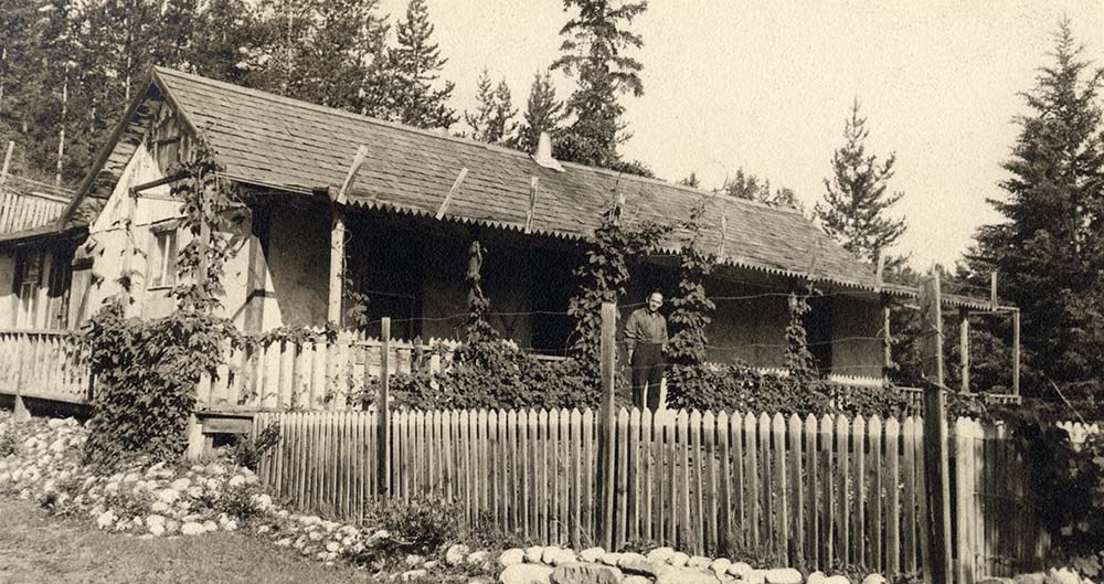
Canadian Rockies Photograph Album
https://archives.whyte.org/en/permalink/descriptions3599
- Part Of
- Lawrence Grassi fonds
- Scope & Content
- File pertains to a photo album that Includes an assortment of views of the Canadian Rockies; mainly duplicates of those images in Series I. Landscape Photographs. Item-level inventory available.
- Date Range
- [ca. 1930-1970]
- Reference Code
- V240 / II / A / PD - 624
- Description Level
- 5 / File
- GMD
- Album
- Photograph
6 images
- Part Of
- Lawrence Grassi fonds
- Description Level
- 5 / File
- Fonds Number
- M45 / V240
- Series
- II.A. Landscape photographs
- Sous-Fonds
- V240
- Accession Number
- 3159
- Reference Code
- V240 / II / A / PD - 624
- GMD
- Album
- Photograph
- Date Range
- [ca. 1930-1970]
- Physical Description
- 1 photograph album (180 prints)
- History / Biographical
- See fonds level description
- Scope & Content
- File pertains to a photo album that Includes an assortment of views of the Canadian Rockies; mainly duplicates of those images in Series I. Landscape Photographs. Item-level inventory available.
- Name Access
- Grassi, Lawrence
- Subject Access
- Activities
- Alpine Club of Canada
- Animals
- Cabins and shelters
- Camps
- Environment and Nature
- Exploration
- Family and personal life
- Grassi Lakes
- Home
- Kananaskis Country
- Lake O'Hara region
- Mountains
- Parks
- Provincial parks and reserves
- Scenery
- Trails
- Trail making
- Travel
- Geographic Access
- Canmore
- Lake Louise
- Lake O'Hara
- Banff
- Banff National Park
- Yoho National Park
- Kananaskis
- Alberta
- British Columbia
- Canada
- Language
- English
- Title Source
- Title based on contents of file
- Processing Status
- Processed
Images

This material is presented as originally created; it may contain outdated cultural descriptions and
potentially offensive content.
Read more.
Kananaskis and Spray Lakes
https://archives.whyte.org/en/permalink/descriptions55339
- Part Of
- Murray Hay fonds
- Scope & Content
- File consists of 2 original paintings : landscape (2 base, 2 overlays) ; 100 x 71.2 cm or smaller (one unfinished) - the complete painting has tracing paper overlay with annotations written in pencil (second overlay also tracing paper with annotations in ink, stored seperately). Also includes 1 map…
- Date Range
- [ca.1980-2000]
- Reference Code
- V795 / II / B / iii / 1
- Description Level
- 5 / File
- GMD
- Map
- Private record
- Part Of
- Murray Hay fonds
- Description Level
- 5 / File
- Fonds Number
- M570 / V795
- Series
- V795 / II : Unpublished Material
- Sous-Fonds
- V795
- Sub-Series
- V795 / II / B : Alberta / iii : Kananaskis
- Accession Number
- 2019.41
- Reference Code
- V795 / II / B / iii / 1
- GMD
- Map
- Private record
- Date Range
- [ca.1980-2000]
- Physical Description
- 2 paintings : landscape (2 base, 2 overlays) ; 100 x 71.2 cm or smaller
- 1 map (1 base, 1 overlay) : col., annotations, on mylar ; 101 x 70.1 cm
- 2 prints : col., annotations ; 35.5 x 27.8 cm
- Scope & Content
- File consists of 2 original paintings : landscape (2 base, 2 overlays) ; 100 x 71.2 cm or smaller (one unfinished) - the complete painting has tracing paper overlay with annotations written in pencil (second overlay also tracing paper with annotations in ink, stored seperately). Also includes 1 map (1 base, 1 overlay) : col., annotations, on mylar ; 101 x 70.1 cm of the Kananaskis/Canmore area and 2 prints : col., annotations ; 35.5 x 27.8 cm of the same area.
- Notes
- Prints have two different titles associated with them: "Portion of Kananaskis, Bow Valley, Spray Lake Area (cloudy portion is for story area)" and "Kanasakis Park, Mount Allen (Nakiska) Ski Area, Fortress Mtn Ski Area & Banff East Entrance (cloudy area for story line)." Prints are connected to the map.
- Name Access
- Hay, Murray
- Subject Access
- Artist
- Ski Maps
- Map
- Cartography
- Sports and recreation
- Tourism
- Winter
- Winter sports
- Geographic Access
- Banff National Park
- Alberta
- Canada
- Spray Lakes
- Spray Valley
- Bow Valley
- Kananaskis
- Canmore
- Language
- English
- Conservation
- Masking tape should be removed
- Creator
- Hay, Murray
- Title Source
- Title based on contents of file
- Processing Status
- Processed
This material is presented as originally created; it may contain outdated cultural descriptions and
potentially offensive content.
Read more.
Lake O'Hara Trails
https://archives.whyte.org/en/permalink/descriptions54776
- Part Of
- Murray Hay fonds
- Scope & Content
- File consists of 0.5 cm of textual records, 60.5 x 48.5 cm. File pertains to a trail map of the Lake O'Hara area created by Murray Hay. File consists of one published poster depicting a reproduced map of the trails at Lake O'Hara in Yoho National Park (British Columbia).
- Date Range
- ca.1970-ca.2015
- Reference Code
- M570 / III / A / iv / 1
- Description Level
- 5 / File
- GMD
- Map
- Poster
- Published record
- Textual record
- Part Of
- Murray Hay fonds
- Description Level
- 5 / File
- Fonds Number
- M570 / V795
- Series
- M570 / III : Murray Hay Portfolio (published material)
- Sous-Fonds
- M570
- Sub-Series
- M570 / III / A : British Columbia / iv : Lake O'Hara
- Accession Number
- 2019.41
- Reference Code
- M570 / III / A / iv / 1
- Date Range
- ca.1970-ca.2015
- Physical Description
- 0.5 cm of textual material (60.5 x 48.5 cm)
- Scope & Content
- File consists of 0.5 cm of textual records, 60.5 x 48.5 cm. File pertains to a trail map of the Lake O'Hara area created by Murray Hay. File consists of one published poster depicting a reproduced map of the trails at Lake O'Hara in Yoho National Park (British Columbia).
- Notes
- M570 / III / A / iv / 1 is oversize.
- Name Access
- Hay, Murray
- Subject Access
- Trails
- Hiking
- Cartography
- Advertising
- Artist
- Sports and recreation
- Travel
- Tourism
- Tourist information
- Geographic Access
- Lake O'Hara
- British Columbia
- Canada
- Canadian Rocky Mountains
- Yoho National Park
- Language
- English
- Title Source
- Title based on contents of file
- Processing Status
- Processed
This material is presented as originally created; it may contain outdated cultural descriptions and
potentially offensive content.
Read more.
Letter to Bruno about map in process
https://archives.whyte.org/en/permalink/descriptions4531
- Part Of
- George K. K. (Tommy) Link fonds
- Scope & Content
- Between Link and Austin Ford, Bruno Struck, the draftsman and the photographer regarding changes or additions to the map re boundaries, ways and topographical features on the Lake O'Hara Region South Area. Letters to and from Link, Lillian Gest and the map printers. The Map includes a magnified vi…
- Date Range
- 1957 - 1975
- Reference Code
- M60 / I / B / 38
- Description Level
- 5 / File
- GMD
- Map
- Private record
- Part Of
- George K. K. (Tommy) Link fonds
- Description Level
- 5 / File
- Fonds Number
- M60 / V276
- Series
- I. Writing, research and translation
- Sous-Fonds
- M60
- Sub-Series
- B. Map of Lake O'Hara region south area
- Accession Number
- 2019.36
- 2815
- Reference Code
- M60 / I / B / 38
- GMD
- Map
- Private record
- Date Range
- 1957 - 1975
- Physical Description
- 1 file of textual records (1 cm)
- Scope & Content
- Between Link and Austin Ford, Bruno Struck, the draftsman and the photographer regarding changes or additions to the map re boundaries, ways and topographical features on the Lake O'Hara Region South Area. Letters to and from Link, Lillian Gest and the map printers. The Map includes a magnified view of Lake O'Hara as well as detailed account of trails, geography, and other landmarks of interest in the O'Hara area.
- Name Access
- Auger, Tim
- Stuck, Bruno
- Gest, Lillian
- Link, George K.K.
- Subject Access
- Trails
- Trail guides
- Geographic Access
- Lake O'Hara
- Yoho National Park
- British Columbia
- Canada
- Language
- English
- Finding Aid
- In case file
- Title Source
- Title originated in contents
- Processing Status
- Processed
This material is presented as originally created; it may contain outdated cultural descriptions and
potentially offensive content.
Read more.
Operation Bow-Athabasca exhibit
https://archives.whyte.org/en/permalink/descriptions56253
- Part Of
- Ben Gadd fonds
- Scope & Content
- File consists of correspondence, maps and other documents pertaining to the Operation Bow-Athabasca exhibit, which was displayed at the Canmore Museum and Geoscience Centre in 2012. File includes a programme for the opening of the exhibition; geological maps and other research materials; a quote fo…
- Date Range
- 1973
- 2010-2012
- Reference Code
- M590 / III / D / 117
- Description Level
- 5 / File
- GMD
- Textual record
- Published record
- Map
- Part Of
- Ben Gadd fonds
- Description Level
- 5 / File
- Fonds Number
- M590
- V810
- S61
- Series
- M590 / III : Professional records
- Sous-Fonds
- M590
- Sub-Series
- M590 / III / D : Other contracts and projects
- Accession Number
- 2021.20
- Reference Code
- M590 / III / D / 117
- Date Range
- 1973
- 2010-2012
- Physical Description
- 1.5 cm of textual records -- 4 maps
- Scope & Content
- File consists of correspondence, maps and other documents pertaining to the Operation Bow-Athabasca exhibit, which was displayed at the Canmore Museum and Geoscience Centre in 2012. File includes a programme for the opening of the exhibition; geological maps and other research materials; a quote for the production of display signs for the exhibit; Ben Gadd's personal notes pertaining to the exhibit; and other related materials.
- Name Access
- Gadd, Ben
- Subject Access
- Natural history
- Geology
- Environment
- Research
- Public events
- Community events
- Publication
- Museums
- Geographic Access
- Canada
- Alberta
- Canmore
- Reproduction Restrictions
- Restrictions may apply
- Language
- English
- Category
- Environment
- Title Source
- Title based on contents of file
- Processing Status
- Processed
This material is presented as originally created; it may contain outdated cultural descriptions and
potentially offensive content.
Read more.
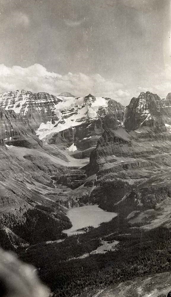
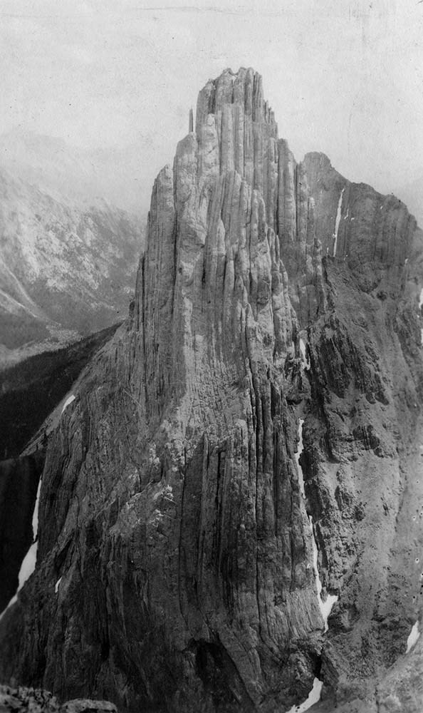
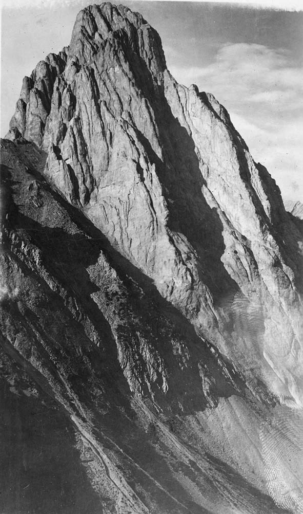
Photographs. -- 1894-1982
https://archives.whyte.org/en/permalink/descriptions7219
- Part Of
- Alpine Club of Canada fonds
- Scope & Content
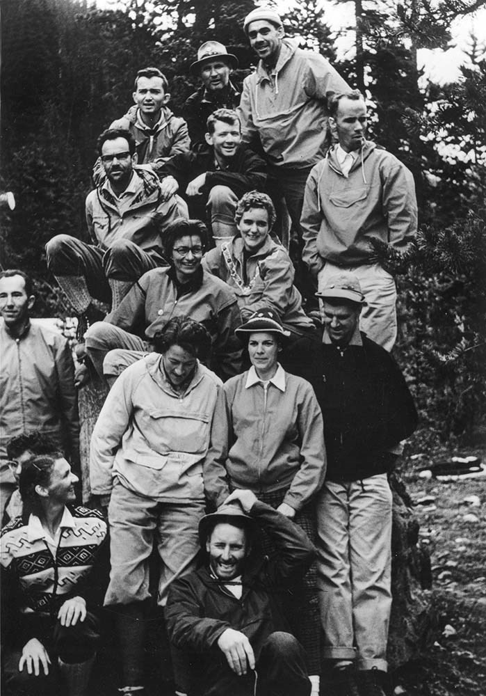
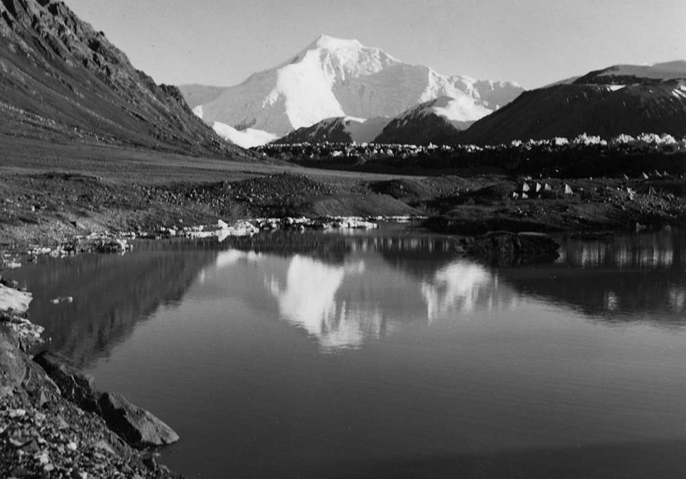
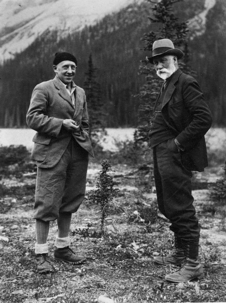
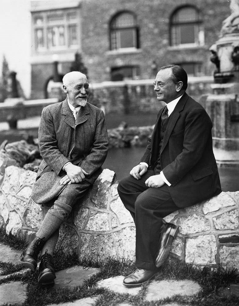
- Photographs pertain to mountain peaks, glaciers, landscapes and scenery; mountaineering and alpine recreation; mountaineers and personalities, including portraits; huts; events and other subjects. A significant portion pertain to Alpine Club camps (ca.225 prints, 8 negatives and 5 albums containin…
- Date Range
- [ca.1900-1960]
- Reference Code
- V14 / AC 0P / 001-002
- V14 / AC 0P / 010
- V14 / AC 0P / 019
- V14 / AC 0P / 023-024
- V14 / AC 0P / 039-044
- V14 / AC 0P / 071-072
- V14 / AC 0P / 074
- V14 / AC 0P / 076-081
- V14 / AC 0P / 124
- V14 / AC 0P / 220-244
- V14 / AC 0P / 254-264
- V14 / AC 0P / 345-346
- V14 / AC 0P / 361-364
- V14 / AC 0P / 369-407
- V14 / AC 0P / 631-632
- V14 / AC 0P / 634
- V14 / AC 0P / 636
- V14 / AC 0P / 642-707
- V14 / AC 0P / 717-718
- V14 / AC 0P / 721-725
- V14 / AC 0P / 773
- V14 / AC 0P / 776
- V14 / AC 0P / 778-779
- V14 / AC 0P / 802-807
- V14 / AC 0P / 810-811
- V14 / AC 0P / 815
- V14 / AC 001P / 01-08
- V14 / AC 004P / 01-03
- V14 / AC 011P / 01-02
- V14 / AC 015P / 1-55
- V14 / AC 024P / 01-12
- V14 / AC 024P / 25-35
- V14 / AC 027P / 01-15
- V14 / AC 027P / 16
- V14 / AC 027P / 17
- V14 / AC 027P / 18
- V14 / AC 027P / 19
- V14 / AC 027P / 20
- V14 / AC 031P / 1
- V14 / AC 033P / 001-037
- V14 / AC 033P / 046-115
- V14 / AC 042P / 1
- V14 / AC 049P / 3-5
- V14 / AC 050P / 1
- V14 / AC 055P / 39
- V14 / AC 055P / 46-48
- V14 / AC 055P / 60-66
- V14 / AC 064P / 01-51
- V14 / AC 067P / 1-4
- V14 / AC 090P / 1-4
- V14 / AC 093P / 1-2
- V14 / AC 121P / 1-3
- V14 / AC 123P / 20-27
- V14 / AC 124P / 01-16
- V14 / AC 148P / 94-97
- V14 / AC 175P / 1
- V14 / AC 176P / 01
- V14 / AC 176P / 11
- V14 / AC 195P / 1-2
- V14 / AC 199P / 1-60
- V14 / AC 217P / 1
- V14 / AC 229P / 1
- V14 / AC 239P / 1-2
- V14 / AC 312P / 1-3
- V14 / AC 345P / 4-7
- V14 / AC 371P / 1
- V14 / AC 375P / 1-25
- V14 / AC 379P / 1
- V14 / AC 381P / 1-7
- V14 / AC 395P / 1-4
- V14 / AC 397P / 1-5
- V14 / AC 399P / 1
- V14 / AC 405P / 1-5
- Description Level
- 5 / File
- GMD
- Photograph
- Photograph print
- Negative
- Transparency
- Album
19 images
- Part Of
- Alpine Club of Canada fonds
- Description Level
- 5 / File
- Fonds Number
- M200 / S6 / V14
- Series
- IV.B. Other material: photographic
- Sous-Fonds
- V14
- Accession Number
- 5200
- Reference Code
- V14 / AC 0P / 001-002
- V14 / AC 0P / 010
- V14 / AC 0P / 019
- V14 / AC 0P / 023-024
- V14 / AC 0P / 039-044
- V14 / AC 0P / 071-072
- V14 / AC 0P / 074
- V14 / AC 0P / 076-081
- V14 / AC 0P / 124
- V14 / AC 0P / 220-244
- V14 / AC 0P / 254-264
- V14 / AC 0P / 345-346
- V14 / AC 0P / 361-364
- V14 / AC 0P / 369-407
- V14 / AC 0P / 631-632
- V14 / AC 0P / 634
- V14 / AC 0P / 636
- V14 / AC 0P / 642-707
- V14 / AC 0P / 717-718
- V14 / AC 0P / 721-725
- V14 / AC 0P / 773
- V14 / AC 0P / 776
- V14 / AC 0P / 778-779
- V14 / AC 0P / 802-807
- V14 / AC 0P / 810-811
- V14 / AC 0P / 815
- V14 / AC 001P / 01-08
- V14 / AC 004P / 01-03
- V14 / AC 011P / 01-02
- V14 / AC 015P / 1-55
- V14 / AC 024P / 01-12
- V14 / AC 024P / 25-35
- V14 / AC 027P / 01-15
- V14 / AC 027P / 16
- V14 / AC 027P / 17
- V14 / AC 027P / 18
- V14 / AC 027P / 19
- V14 / AC 027P / 20
- V14 / AC 031P / 1
- V14 / AC 033P / 001-037
- V14 / AC 033P / 046-115
- V14 / AC 042P / 1
- V14 / AC 049P / 3-5
- V14 / AC 050P / 1
- V14 / AC 055P / 39
- V14 / AC 055P / 46-48
- V14 / AC 055P / 60-66
- V14 / AC 064P / 01-51
- V14 / AC 067P / 1-4
- V14 / AC 090P / 1-4
- V14 / AC 093P / 1-2
- V14 / AC 121P / 1-3
- V14 / AC 123P / 20-27
- V14 / AC 124P / 01-16
- V14 / AC 148P / 94-97
- V14 / AC 175P / 1
- V14 / AC 176P / 01
- V14 / AC 176P / 11
- V14 / AC 195P / 1-2
- V14 / AC 199P / 1-60
- V14 / AC 217P / 1
- V14 / AC 229P / 1
- V14 / AC 239P / 1-2
- V14 / AC 312P / 1-3
- V14 / AC 345P / 4-7
- V14 / AC 371P / 1
- V14 / AC 375P / 1-25
- V14 / AC 379P / 1
- V14 / AC 381P / 1-7
- V14 / AC 395P / 1-4
- V14 / AC 397P / 1-5
- V14 / AC 399P / 1
- V14 / AC 405P / 1-5
- Responsibility
- Most items, including the six photograph albums, were likely produced by private individuals and club members. Includes photographs by: M. E. Alford, L. M. S. Amery, Fred Armbrister, A. H. Bent, B. C. Government, Eric Brooks, Allan Carpe, P. A. Carson, W. M. Docharty, Mary Fallis, Marion Fawdry, E. Feuz, F. W. Godsal, Douglas Griffin, L. G. Grimble, Klaus Hahn, Don Harmon, E. W. D. Holway, Frank Jacobs, Wally Joyce, E. Mills, C. H. Mitchell, Elfreda Pigou, Jaroslav Ruza, Mary Schaffer, W. E. Stone, J. M. Thorington, W. J. Topley, Hap Trevelyan, Underwood and Underwood, Valentine and Sons, Charles Walcott, Bradford Washburn and A. G. Wehrli. Many items are not credited.
- Date Range
- [ca.1900-1960]
- Physical Description
- ca.720 photographs (ca.560 prints, ca.40 negatives, ca.120 transparencies, 6 albums of ca.350 prints)
- Scope & Content
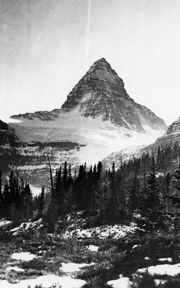
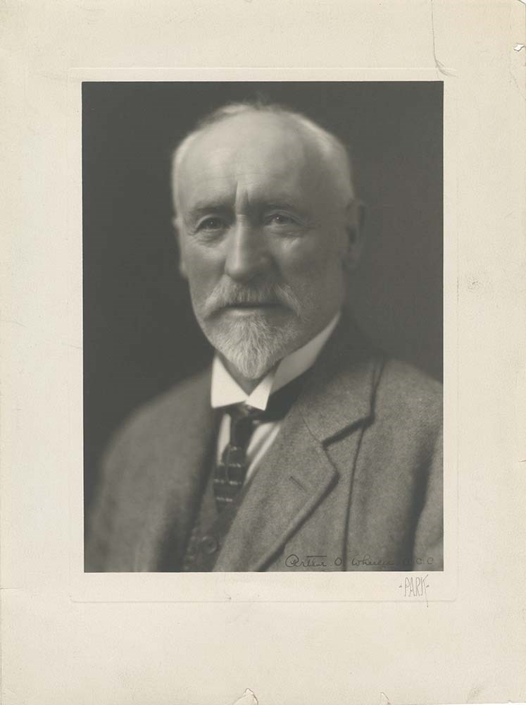
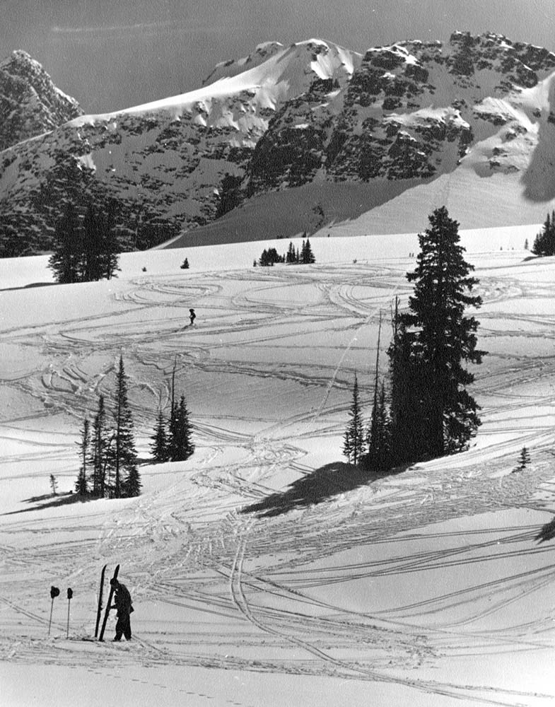
- Photographs pertain to mountain peaks, glaciers, landscapes and scenery; mountaineering and alpine recreation; mountaineers and personalities, including portraits; huts; events and other subjects. A significant portion pertain to Alpine Club camps (ca.225 prints, 8 negatives and 5 albums containing over 300 prints). Camps and expeditions documented include: Yoho Valley (1906) (1919); Paradise Valley (1907); Sherbrooke Lake (1911); Vermilion Pass (1912); Mount Robson (1913); Cathedral Mountain (1913); Upper Yoho Valley (1914); Ptarmigan Lake (1915); Healy Creek (1916); Lake of Hanging Glacier (1928); Coast Range (1952); Eremite Valley and others. Portraits include those of Charles Fay, Jean Habel, Frank R. Oastler, James F. Porter, H. E. Sampson, Charles D. Walcott and A. O. Wheeler. Includes series of British Columbia air photos of B.C. locations in the 1950s (AC 055 / 60-66). Contains many unidentified and undated items.
- Name Access
- Alpine Club of Canada
- Subject Access
- Abbot Pass Hut
- Activities
- Administration
- Advertising
- Alpine Club of Canada
- Alpine Club House
- Cabins
- Cabins and shelters
- Camps
- Club
- Competition
- Discovery and exploration
- Environment
- Environment and Nature
- Exploration
- Guide
- Guides
- Hiking
- Huts
- Mountain
- Mountain guides
- Mountaineering
- Mountaineers
- Mountains
- National parks and reserves
- Organizations
- Photography
- Scenery
- Sports and recreation
- Summit
- Geographic Access
- Banff National Park
- Jasper National Park
- Yoho National Park
- Alberta
- British Columbia
- Canada
- Access Restrictions
- Access to negatives is by appointment only
- Language
- English
- Finding Aid
- Inventory of the Alpine Club of Canada Collection, 1986, provides group or item-level description to this material
- Title Source
- Title based on material
- Processing Status
- Processed
Images


This material is presented as originally created; it may contain outdated cultural descriptions and
potentially offensive content.
Read more.
Published regional and trail maps
https://archives.whyte.org/en/permalink/descriptions54847
- Scope & Content
- File consists of maps depicting the Banff townsite and nearby travel routes. Includes a trail map for Banff, Yoho and Kootenay National Parks; a road map for Banff and nearby areas [1965]; a numbered townsite map of Banff marking local hotels and attractions; and a photocopied map of a trail route …
- Date Range
- [1950-1970]
- 1965
- Reference Code
- M545 / III / 29
- Description Level
- 5 / File
- GMD
- Textual record
- Published record
- Map
- Description Level
- 5 / File
- Fonds Number
- M545 / V635
- Series
- M545 / III : Published records
- Sous-Fonds
- M545
- Accession Number
- 5939
- Reference Code
- M545 / III / 29
- Date Range
- [1950-1970]
- 1965
- Physical Description
- 0.5 cm of textual records (4 maps ; 35.5 x 21.5 cm or smaller)
- Scope & Content
- File consists of maps depicting the Banff townsite and nearby travel routes. Includes a trail map for Banff, Yoho and Kootenay National Parks; a road map for Banff and nearby areas [1965]; a numbered townsite map of Banff marking local hotels and attractions; and a photocopied map of a trail route used by the Trail Riders of the Canadian Rockies [n.d.]
- Notes
- Banff townsite map has annotation marking the location of the Trail Ride Office on Caribou St.
- Subject Access
- Travel
- Trails
- Map
- Land, settlement and immigration
- Geography
- Geographic Access
- Canada
- Alberta
- Banff
- Banff National Park
- Yoho National Park
- Kootenay National Park
- Reproduction Restrictions
- Restrictions may apply
- Language
- English
- Title Source
- Title based on contents of file
- Processing Status
- Processed
This material is presented as originally created; it may contain outdated cultural descriptions and
potentially offensive content.
Read more.
Travel guides - Canmore, Kananaskis
https://archives.whyte.org/en/permalink/descriptions55910
- Part Of
- Ben Gadd fonds
- Scope & Content
- File consists of travel guides collected by Ben Gadd pertaining to areas near Canmore and Kananaskis.
- Date Range
- 1998
- 2006
- Reference Code
- M590 / I / A / i / 1 to 2
- Description Level
- 5 / File
- GMD
- Published record
- Textual record
- Map
- Part Of
- Ben Gadd fonds
- Description Level
- 5 / File
- Fonds Number
- M590
- V810
- S61
- Series
- M590 / I : Personal records
- Sous-Fonds
- M590
- Sub-Series
- M590 / I / A : Travel guides and maps
- Accession Number
- 2021.20
- Reference Code
- M590 / I / A / i / 1 to 2
- Date Range
- 1998
- 2006
- Physical Description
- 4 cm of textual records
- Scope & Content
- File consists of travel guides collected by Ben Gadd pertaining to areas near Canmore and Kananaskis.
- Subject Access
- Geography
- Travel
- Tourism
- Tourist information
- Geographic Access
- Canada
- Alberta
- Canmore
- Kananaskis
- Reproduction Restrictions
- Copyright restrictions may apply
- Language
- English
- Category
- Exploration, discovery and travel
- Title Source
- Title based on contents of file
- Processing Status
- Processed
This material is presented as originally created; it may contain outdated cultural descriptions and
potentially offensive content.
Read more.
Travel guides - Lake Louise, Yoho
https://archives.whyte.org/en/permalink/descriptions55913
- Part Of
- Ben Gadd fonds
- Scope & Content
- File consists of travel guides collected by Ben Gadd pertaining to areas near Lake Louise and Yoho National Park.
- Date Range
- 1998
- 2001
- Reference Code
- M590 / I / A / i / 3
- Description Level
- 5 / File
- GMD
- Published record
- Textual record
- Map
- Part Of
- Ben Gadd fonds
- Description Level
- 5 / File
- Fonds Number
- M590
- V810
- S61
- Series
- M590 / I : Personal records
- Sous-Fonds
- M590
- Sub-Series
- M590 / I / A : Travel guides and maps
- Accession Number
- 2021.20
- Reference Code
- M590 / I / A / i / 3
- Date Range
- 1998
- 2001
- Physical Description
- 2 cm of textual records
- Scope & Content
- File consists of travel guides collected by Ben Gadd pertaining to areas near Lake Louise and Yoho National Park.
- Subject Access
- Geography
- Travel
- Tourism
- Tourist information
- Geographic Access
- Canada
- Alberta
- British Columbia
- Lake Louise
- Yoho National Park
- Reproduction Restrictions
- Copyright restrictions may apply
- Language
- English
- Category
- Exploration, discovery and travel
- Title Source
- Title based on contents of file
- Processing Status
- Processed
This material is presented as originally created; it may contain outdated cultural descriptions and
potentially offensive content.
Read more.
Travel guides and maps
https://archives.whyte.org/en/permalink/descriptions56361
- Part Of
- Ben Gadd fonds
- Scope & Content
- Sub-series consists of travel brochures and maps which were collected and used by Ben Gadd. Sub-series contains five sub-sub series: M590 / I / A / i : Travel guides and pocket maps M590 / I / A / ii : Topographical maps M590 / I / A / iii : Geological maps M590 / I / A / iv : Highway maps M590 / …
- Date Range
- [ca.1920-2010]
- Reference Code
- M590 / I / A
- Description Level
- 4 / Sub-series
- GMD
- Map
- Textual record
- Part Of
- Ben Gadd fonds
- Description Level
- 4 / Sub-series
- Fonds Number
- M590
- V810
- S61
- Series
- M590 / I : Personal records
- Sous-Fonds
- M590
- Sub-Series
- M590 / I / A : Travel guides and maps
- Accession Number
- 2021.20
- Reference Code
- M590 / I / A
- GMD
- Map
- Textual record
- Date Range
- [ca.1920-2010]
- Physical Description
- ca. 274 maps -- ca. 61 travel guides, brochures
- Scope & Content
- Sub-series consists of travel brochures and maps which were collected and used by Ben Gadd. Sub-series contains five sub-sub series: M590 / I / A / i : Travel guides and pocket maps M590 / I / A / ii : Topographical maps M590 / I / A / iii : Geological maps M590 / I / A / iv : Highway maps M590 / I / A / v : Index maps, other
- Notes
- Some materials in sub-series are annotated with notes by Ben Gadd
- Name Access
- Gadd, Ben
- Subject Access
- Geography
- Geology
- Environment
- Map
- Tourism
- Tourist information
- Travel
- Trails
- Roads
- Transportation
- Natural history
- National parks and reserves
- Provincial parks and reserves
- Government
- Sports
- Recreation
- Hiking
- Geographic Access
- Canada
- Alberta
- British Columbia
- Banff National Park
- Jasper National Park
- Kootenay National Park
- Yoho National Park
- Waterton Lakes National Park
- Columbia Icefields
- United States of America
- Colorado
- Montana
- Yellowstone National Park
- Access Restrictions
- Restrictions may apply - some materials are fragile
- Reproduction Restrictions
- Restrictions may apply
- Language
- English
- Conservation
- Some fragile/torn materials stored in mylar
- Category
- Environment
- Exploration, discovery and travel
- Government
- Sports, recreation and leisure
- Transportation
- Tourism
- Title Source
- Title based on contents of sub-series
- Processing Status
- Processed
This material is presented as originally created; it may contain outdated cultural descriptions and
potentially offensive content.
Read more.