Narrow Results By
Banff National Park and Lake Louise maps
https://archives.whyte.org/en/permalink/descriptions54945
- Scope & Content
- File consists of two folded maps and a small clipping [possibly top or bottom portion from a different map or one of maps in file]. One map is of Banff National Park and one is of Lake Louise [1959]. Banff National Park map has black pencil tracings over trail section near the bottom of the map and…
- Date Range
- 1959
- [1960-1970]
- Reference Code
- M545 / V / 53
- Description Level
- 5 / File
- GMD
- Textual record
- Published record
- Map
- Description Level
- 5 / File
- Fonds Number
- M545 / V635
- Series
- M545 / V : Administrative records
- Sous-Fonds
- M545
- Accession Number
- 8235
- Reference Code
- M545 / V / 53
- Date Range
- 1959
- [1960-1970]
- Physical Description
- 0.5 cm of textual records (2 maps ; 60.5 x 57.5 and 60 x 56.5 cm)
- Scope & Content
- File consists of two folded maps and a small clipping [possibly top or bottom portion from a different map or one of maps in file]. One map is of Banff National Park and one is of Lake Louise [1959]. Banff National Park map has black pencil tracings over trail section near the bottom of the map and annotation in bottom right corner which reads "Natural Bridge". Lake Louise map produced by the Government of Canada.
- Subject Access
- Banff National Park
- Environment
- Geography
- Map
- Lake Louise
- Travel
- Government
- National parks and reserves
- Trails
- Geographic Access
- Canada
- Alberta
- Banff National Park
- Lake Louise
- Language
- English
- Conservation
- Clipping stored in mylar due to significant staining and residue from tape
- Items kept folded [not placed in mylar] due to mass production of content and minimal/no annotations
- Title Source
- Title based on contents of file
- Processing Status
- Processed
This material is presented as originally created; it may contain outdated cultural descriptions and
potentially offensive content.
Read more.
Banff National Park (general)
https://archives.whyte.org/en/permalink/descriptions55338
- Part Of
- Murray Hay fonds
- Scope & Content
- File consists of 4 prings : col. 35.1 x 24.8 cm or smaller and 4 maps (2 paper, 2 overlays) : col., on mylar ; 60.4 x 30. cm or smaller. File pertains to aerial views of Banff National Park, showing the towns of Banff and Lake Louise, ski hills (Norqay Ski Hill, Sunshine Village, and Lake Louise Sk…
- Date Range
- ca.1976-ca.2000
- Reference Code
- V795 / II / B / v / 1-2
- Description Level
- 5 / File
- GMD
- Map
- Private record
- Part Of
- Murray Hay fonds
- Description Level
- 5 / File
- Fonds Number
- M570 / V795
- Series
- V795 / II : Unpublished Material
- Sous-Fonds
- V795
- Sub-Series
- V795 / II / B : Alberta / v : Banff National Park
- Accession Number
- 2019.41
- Reference Code
- V795 / II / B / v / 1-2
- GMD
- Map
- Private record
- Date Range
- ca.1976-ca.2000
- Physical Description
- 4 prints : col. 35.1 x 24.8 cm or smaller
- 4 maps (2 paper, 2 overlays) : col., annotations, on mylar ; 60.4 x 30. cm or smaller
- Scope & Content
- File consists of 4 prings : col. 35.1 x 24.8 cm or smaller and 4 maps (2 paper, 2 overlays) : col., on mylar ; 60.4 x 30. cm or smaller. File pertains to aerial views of Banff National Park, showing the towns of Banff and Lake Louise, ski hills (Norqay Ski Hill, Sunshine Village, and Lake Louise Ski Resort), as well as other georgraphic features. The mylar overlays contain various amounts of detail and annotations - one consists of a dark red sheet overlayed with place names in negative.
- Notes
- Items not in oversize stored in downstairs vault.
- Name Access
- Hay, Murray
- Subject Access
- Advertising
- Artist
- Ski Maps
- Map
- Cartography
- Sports and recreation
- Tourism
- Tourist information
- Winter
- Winter sports
- Ski area
- Sunshine Village
- Norquay Ski Hill
- Lake Louise Ski Area
- Geographic Access
- Banff
- Lake Louise
- Banff National Park
- Alberta
- Canada
- Canadian Rocky Mountains
- Language
- English
- Creator
- Hay, Murray
- Title Source
- Title based on contents of file
- Processing Status
- Processed
This material is presented as originally created; it may contain outdated cultural descriptions and
potentially offensive content.
Read more.
Canadian Rockies
https://archives.whyte.org/en/permalink/descriptions54817
- Part Of
- Murray Hay fonds
- Scope & Content
- File consists of 1 cm of textual records, 10 x 22 cm. File pertains to tourist maps of the Canadian Rocky Mountains created by Murray Hay. File includes a brochure of titled "Canadian Rockies Access Maps" that, when unfolded, includes several maps of the various areas that make up the Canadian Rock…
- Date Range
- ca. 1990 - 1999
- 1999
- Reference Code
- M570 / III / D / i / 2
- Description Level
- 5 / File
- GMD
- Published record
- Map
- Textual record
- Part Of
- Murray Hay fonds
- Description Level
- 5 / File
- Fonds Number
- M570 / V795
- Series
- M570 / III : Murray Hay portfolio (published material)
- Sous-Fonds
- M570
- Sub-Series
- M570 / III / D : Miscellaneous / i : Canada (general)
- Accession Number
- 2019.41
- Reference Code
- M570 / III / D / i / 2
- Date Range
- ca. 1990 - 1999
- 1999
- Physical Description
- 1 cm of textual records (10 x 22 cm)
- Scope & Content
- File consists of 1 cm of textual records, 10 x 22 cm. File pertains to tourist maps of the Canadian Rocky Mountains created by Murray Hay. File includes a brochure of titled "Canadian Rockies Access Maps" that, when unfolded, includes several maps of the various areas that make up the Canadian Rocky Mountains, like Kananaskis Country, Canmore, Banff National Park, Jasper National Park, Yoho National Park, etc.
- Name Access
- Hay, Murray
- Subject Access
- Advertising
- Artist
- Banff
- Banff National Park
- Cartography
- Communications
- Lake Louise
- Kananaskis Country
- Map
- Mountains
- Tourism
- Tourist information
- Travel
- Geographic Access
- Canada
- Canadian Rocky Mountains
- Alberta
- British Columbia
- Yoho National Park
- Jasper National Park
- Banff National Park
- Glacier National Park
- Canmore
- Banff
- Jasper
- Lake Louise
- Kananaskis
- Kananaskis Country
- Kootenay National Park
- Language
- English
- Title Source
- Title based on contents of file
- Processing Status
- Processed
This material is presented as originally created; it may contain outdated cultural descriptions and
potentially offensive content.
Read more.
Lake O'Hara Trails
https://archives.whyte.org/en/permalink/descriptions54776
- Part Of
- Murray Hay fonds
- Scope & Content
- File consists of 0.5 cm of textual records, 60.5 x 48.5 cm. File pertains to a trail map of the Lake O'Hara area created by Murray Hay. File consists of one published poster depicting a reproduced map of the trails at Lake O'Hara in Yoho National Park (British Columbia).
- Date Range
- ca.1970-ca.2015
- Reference Code
- M570 / III / A / iv / 1
- Description Level
- 5 / File
- GMD
- Map
- Poster
- Published record
- Textual record
- Part Of
- Murray Hay fonds
- Description Level
- 5 / File
- Fonds Number
- M570 / V795
- Series
- M570 / III : Murray Hay Portfolio (published material)
- Sous-Fonds
- M570
- Sub-Series
- M570 / III / A : British Columbia / iv : Lake O'Hara
- Accession Number
- 2019.41
- Reference Code
- M570 / III / A / iv / 1
- Date Range
- ca.1970-ca.2015
- Physical Description
- 0.5 cm of textual material (60.5 x 48.5 cm)
- Scope & Content
- File consists of 0.5 cm of textual records, 60.5 x 48.5 cm. File pertains to a trail map of the Lake O'Hara area created by Murray Hay. File consists of one published poster depicting a reproduced map of the trails at Lake O'Hara in Yoho National Park (British Columbia).
- Notes
- M570 / III / A / iv / 1 is oversize.
- Name Access
- Hay, Murray
- Subject Access
- Trails
- Hiking
- Cartography
- Advertising
- Artist
- Sports and recreation
- Travel
- Tourism
- Tourist information
- Geographic Access
- Lake O'Hara
- British Columbia
- Canada
- Canadian Rocky Mountains
- Yoho National Park
- Language
- English
- Title Source
- Title based on contents of file
- Processing Status
- Processed
This material is presented as originally created; it may contain outdated cultural descriptions and
potentially offensive content.
Read more.
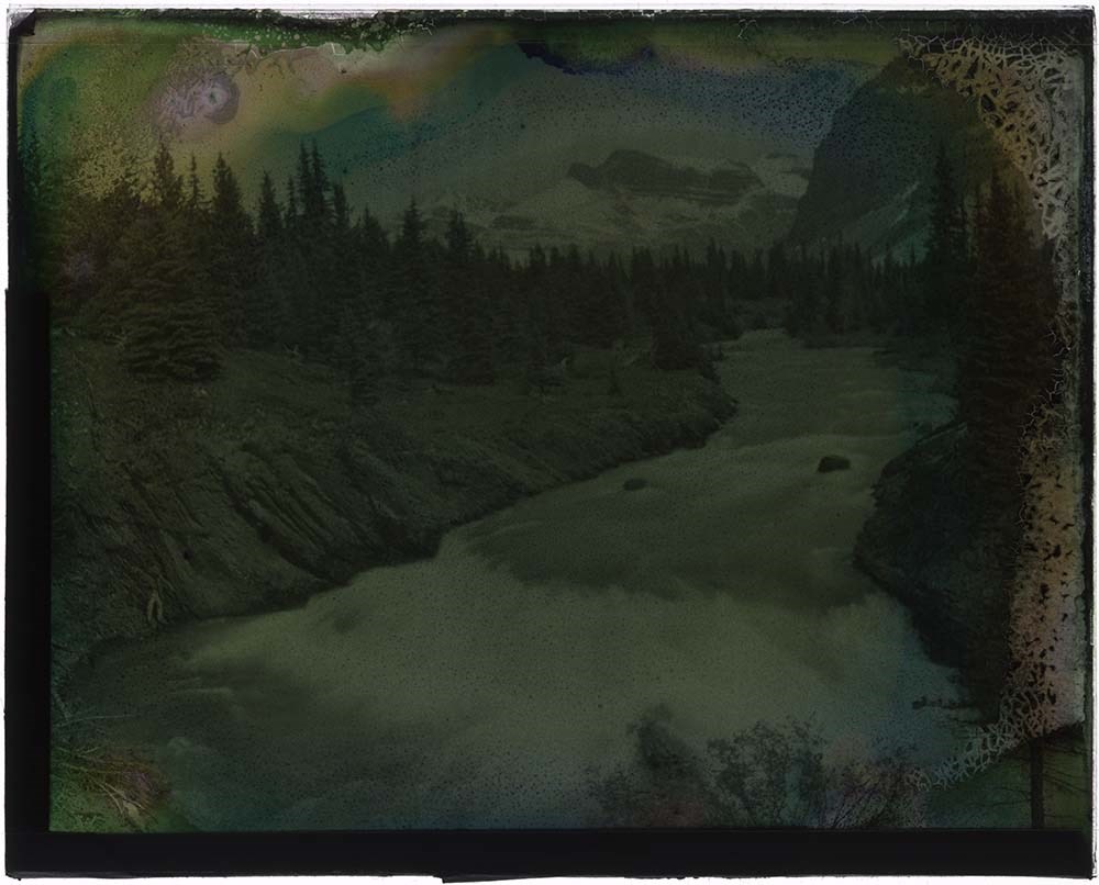
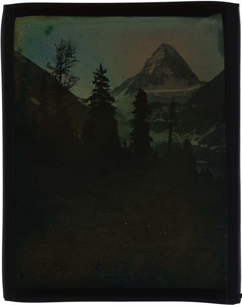
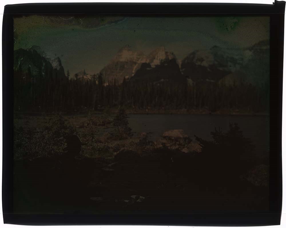
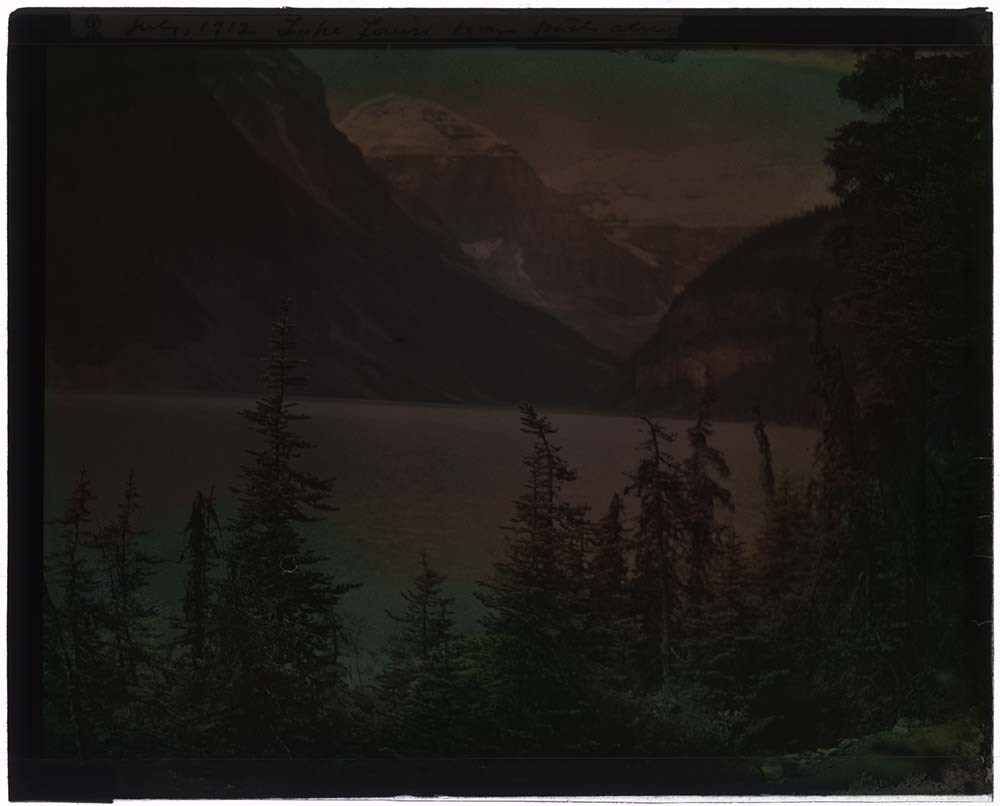
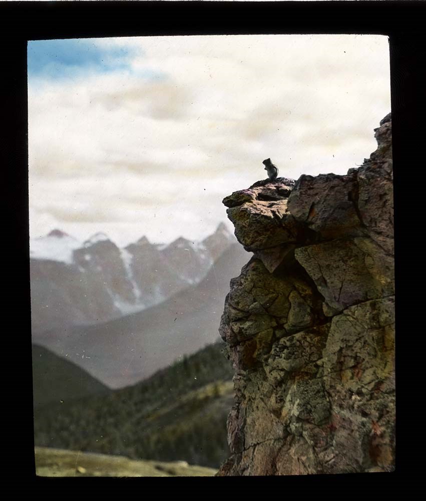
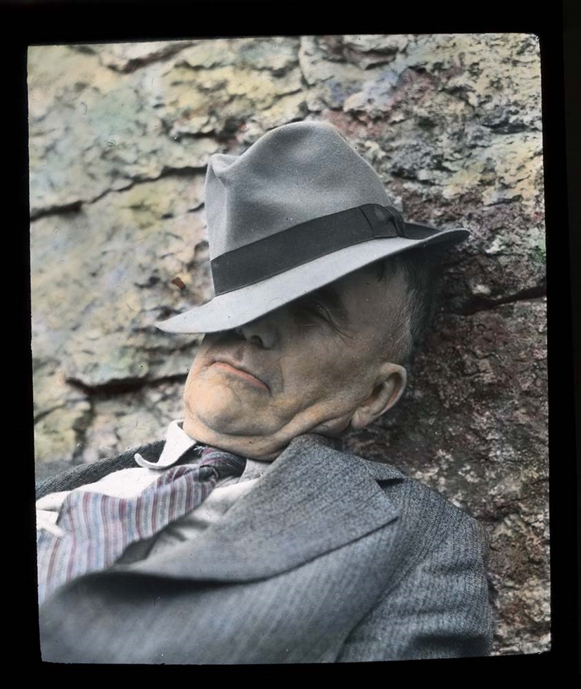
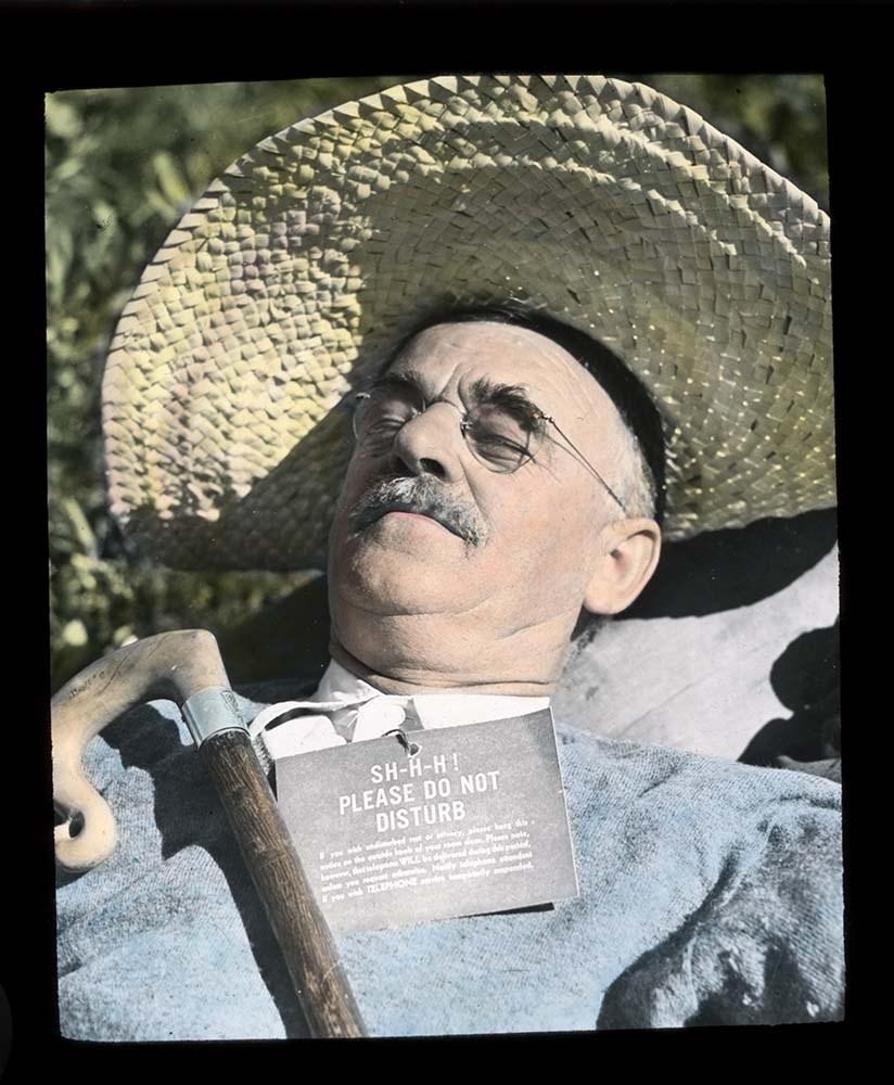
Lantern Slides
https://archives.whyte.org/en/permalink/descriptions54147
- Part Of
- Stan J. Carr fonds
- Scope & Content
- File consists of 8 colour lantern slides, some captioned. File subjects include an unidentified mountain scene, Mount Assiniboine, horse in unientified mountain scene, man posed in campsite in unidentified location, Lake Louise and Victoria Glacier, Hector Lake and Bow Peak, unidentified man in cam…
- Date Range
- ca. 1912
- Reference Code
- V127 / PS - 1 to 8
- Description Level
- 5 / File
- GMD
- Transparency
- Lantern slide
8 images
- Part Of
- Stan J. Carr fonds
- Description Level
- 5 / File
- Fonds Number
- M 179
- V 127
- Sous-Fonds
- V 127
- Accession Number
- 1072
- Reference Code
- V127 / PS - 1 to 8
- Date Range
- ca. 1912
- Physical Description
- 8 photographs : col. slides ; 10.5 x 14 cm
- History / Biographical
- Additive Colour Screen Plates, first theorized by James Clerk Maxwell in 1861, were the first forms of colour photography. Maxwell’s original process involved printing the same black and white image through different coloured screens onto transparencies and then projecting them overlapped in order to create a single full-colour image. In 1868 Louis Ducos du Hauron expanded on this method by placing a screen made up of microscopic coloured stripes in front of a light-sensitive emulsion before exposing it to light. During exposure, the colours in the screen attached to the developing picture so when viewed back through the screen in a projector the image appeared fully in colour. Neither of these methods were commercially popular during the 19th century since black and white processes were cheaper and more widely available. In 1907 the Lumiere brothers introduced the Autochrome process to wide commercial success. The Autochrome process involved a mix of tiny potato starch grains dyed green, orange-red, and blue-purple that were mixed thoroughly and applied to a glass slide coated in a sticky varnish that held the grains in an evenly-distributed layer. The grains were laminated into the varnish to make them smaller and more transparent, and then the whole thing was sealed with another layer of waterproof varnish. The entire process could be done by machines, which made the slides cheap to produce, easily available to the public and opened up the process to amateur photographers. Photographs developed on Autochrome plates created soft images with relatively natural colour rendering, making them popular with artists and photojournalists. Autochrome plates (which came to refer to all colour screen plates regardless of manufacturer) created one-of-a-kind positive images and required long exposure times. Once an image was complete, it had to be quickly covered with either a strong coating of varnish or another slide of glass and then sealed along the edges with binding tape. Because silver is an element of the sticky base varnish that holds the dyed grains, if moisture was allowed to access the image the layers of varnish could ripple or tear away from the glass, or the dye could bleed or fade. The silver base is highly sensative to oxygen and if improperly sealed images could begin to "mirror," a process in which the exposed parts of the slide become uniform and shiny, obscuring the image. Because of the random distribution of dyed colour grains throughout the image and the lines created by laminating those grains into the base varnish, Autochrome transparencies are often mistaken for hand-painted coloured slides. Autochrome can be identified by looking closely for small dots of colour in all parts of the image, rather than the solid blots of colour found on hand-painted slides.
- Scope & Content
- File consists of 8 colour lantern slides, some captioned. File subjects include an unidentified mountain scene, Mount Assiniboine, horse in unientified mountain scene, man posed in campsite in unidentified location, Lake Louise and Victoria Glacier, Hector Lake and Bow Peak, unidentified man in camp.
- Name Access
- Carr, Stan J.
- Subject Access
- Exploration
- Discovery and travel
- Lantern slide
- Geographic Access
- Mount Assiniboine
- Lake Louise
- Bow Summit
- Banff National Park
- Alberta
- Canada
- Access Restrictions
- No restrictions on access
- Language
- English
- Conservation
- Re-seal all slides appropriately; keep stored in cool, dry, dark area; refrain from exposing to further damage.
- Creator
- Carr, Stan J.
- Category
- Exploration, discovery and travel
- Biographical Source Notes
- http://www.graphicsatlas.org/identification/?process_id=286#overview
- https://psap.library.illinois.edu/collection-id-guide/slide#autochrome
- Title Source
- Title based on contents of file
- Processing Status
- Processed
Images


This material is presented as originally created; it may contain outdated cultural descriptions and
potentially offensive content.
Read more.
Maps of Banff and Western Canada
https://archives.whyte.org/en/permalink/descriptions54772
- Part Of
- Luxton family fonds
- Scope & Content
- File consists of 9 printed maps, b&w and col. [including zoning and topographical maps] depicting the Town of Banff and Banff National Park, the Rocky Mountains Forest Reserve, the Moose Mountain region, Medicine Hat, and the province of Alberta. File includes Trail Riders' Map of the Canadian Rock…
- Date Range
- 1912
- 1914
- 1924
- 1926
- 1932
- 1957
- [1970-1980]
- Reference Code
- LUX / II / C5 / 25
- Description Level
- 5 / File
- GMD
- Textual record
- Published record
- Map
- Part Of
- Luxton family fonds
- Description Level
- 5 / File
- Fonds Number
- LUX
- Series
- LUX / II / C : Personal
- Sous-Fonds
- LUX / II : Eleanor Luxton sous-fonds
- Sub-Series
- LUX / II / C5 : Other
- Accession Number
- LUX
- Reference Code
- LUX / II / C5 / 25
- Date Range
- 1912
- 1914
- 1924
- 1926
- 1932
- 1957
- [1970-1980]
- Physical Description
- 9 maps : b&w and col. ; 168 x 71 cm or smaller
- Scope & Content
- File consists of 9 printed maps, b&w and col. [including zoning and topographical maps] depicting the Town of Banff and Banff National Park, the Rocky Mountains Forest Reserve, the Moose Mountain region, Medicine Hat, and the province of Alberta. File includes Trail Riders' Map of the Canadian Rockies which has smaller maps of Waterton Lakes, Glacier, Revelstoke, and other national parks printed on the back. Map of Medicine Hat includes annotated storage envelope with dimensions written on the front.
- Subject Access
- Cartography
- Geography
- Land use
- Government
- Travel
- National parks and reserves
- Geographic Access
- Canada
- Alberta
- Banff
- Banff National Park
- Medicine Hat
- Rocky Mountains
- Glacier National Park
- Revelstoke
- Waterton Lakes National Park
- Reproduction Restrictions
- Restrictions may apply
- Language
- English
- Title Source
- Title based on contents of file
- Processing Status
- Processed
This material is presented as originally created; it may contain outdated cultural descriptions and
potentially offensive content.
Read more.
National Parks - Kootenay, Yoho, Glacier, Jasper, Waterton Lakes
https://archives.whyte.org/en/permalink/descriptions55243
- Part Of
- Malcolm Geddes fonds
- Scope & Content
- File consists of 70 lantern slide images pertaining to views from Kootenay, Yoho, Glacier, Jasper and Waterton Lakes National Parks. Specific locations include: Marble Canyon and Sinclair Canyon; Mount Stephen, Lake Oesa, Lake O'Hara, Lake McArthur, Takakkaw Falls, Twin Falls and Yoho Glacier; Ille…
- Date Range
- [ca.1925]
- Reference Code
- V756 / III / A / PS - 161 to 230
- Description Level
- 5 / File
- GMD
- Photograph
- Lantern slide
- Part Of
- Malcolm Geddes fonds
- Description Level
- 5 / File
- Fonds Number
- M39
- V756
- Series
- V756 / III : Personal and family records
- Sous-Fonds
- V756
- Sub-Series
- V756 / III / A : Travel and mountain expeditions
- Accession Number
- 6504
- Reference Code
- V756 / III / A / PS - 161 to 230
- Responsibility
- Some items issued by Department of the Interior Natural Resources Intelligence Branch and by Canadian National Railways
- Date Range
- [ca.1925]
- Physical Description
- 70 photographs : lantern slides
- Scope & Content
- File consists of 70 lantern slide images pertaining to views from Kootenay, Yoho, Glacier, Jasper and Waterton Lakes National Parks. Specific locations include: Marble Canyon and Sinclair Canyon; Mount Stephen, Lake Oesa, Lake O'Hara, Lake McArthur, Takakkaw Falls, Twin Falls and Yoho Glacier; Illecillewaet Glacier and surrounding area; Jasper town and Jasper Park Lodge; Maligne Lake, Maligne Canyon, Mount Edith Cavell and Mount Robson; and Waterton Lake area. Most items are captioned.
- Notes
- Slides are organized by location: V756 / III / A / PS - 161 to 167 : Kootenay V756 / III / A / PS - 168 to 185 : Yoho V756 / III / A / PS - 186 to 194 : Glacier V756 / III / A / PS - 195 to 226 : Jasper V756 / III / A / PS - 227 to 230 : Waterton Lakes
- Subject Access
- Travel
- Exploration
- Mountains
- Landscapes
- Glaciers
- Hotels
- Waterfalls
- National parks and reserves
- Tourism
- Recreation
- Geographic Access
- Canada
- Alberta
- British Columbia
- Canadian Rocky Mountains
- Kootenay National Park
- Yoho National Park
- Glacier National Park
- Jasper National Park
- Jasper
- Waterton Lakes National Park
- Waterton
- Access Restrictions
- Fragile - restrictions may apply
- Language
- English
- Title Source
- Title based on contents of file
- Processing Status
- Processed
This material is presented as originally created; it may contain outdated cultural descriptions and
potentially offensive content.
Read more.
Published regional and trail maps
https://archives.whyte.org/en/permalink/descriptions54847
- Scope & Content
- File consists of maps depicting the Banff townsite and nearby travel routes. Includes a trail map for Banff, Yoho and Kootenay National Parks; a road map for Banff and nearby areas [1965]; a numbered townsite map of Banff marking local hotels and attractions; and a photocopied map of a trail route …
- Date Range
- [1950-1970]
- 1965
- Reference Code
- M545 / III / 29
- Description Level
- 5 / File
- GMD
- Textual record
- Published record
- Map
- Description Level
- 5 / File
- Fonds Number
- M545 / V635
- Series
- M545 / III : Published records
- Sous-Fonds
- M545
- Accession Number
- 5939
- Reference Code
- M545 / III / 29
- Date Range
- [1950-1970]
- 1965
- Physical Description
- 0.5 cm of textual records (4 maps ; 35.5 x 21.5 cm or smaller)
- Scope & Content
- File consists of maps depicting the Banff townsite and nearby travel routes. Includes a trail map for Banff, Yoho and Kootenay National Parks; a road map for Banff and nearby areas [1965]; a numbered townsite map of Banff marking local hotels and attractions; and a photocopied map of a trail route used by the Trail Riders of the Canadian Rockies [n.d.]
- Notes
- Banff townsite map has annotation marking the location of the Trail Ride Office on Caribou St.
- Subject Access
- Travel
- Trails
- Map
- Land, settlement and immigration
- Geography
- Geographic Access
- Canada
- Alberta
- Banff
- Banff National Park
- Yoho National Park
- Kootenay National Park
- Reproduction Restrictions
- Restrictions may apply
- Language
- English
- Title Source
- Title based on contents of file
- Processing Status
- Processed
This material is presented as originally created; it may contain outdated cultural descriptions and
potentially offensive content.
Read more.
Sunshine Ski Area
https://archives.whyte.org/en/permalink/descriptions54780
- Part Of
- Murray Hay fonds
- Scope & Content
- File consists of 1.5 cm of textual records, 58 x 72.5 cm and 21.5 x 27.5 cm. File pertains to ski trail maps of Sunshine Ski Area created by Murray Hay. File includes two published reproductions of original trail maps in poster format made by Hay for the Husky World Downhill and Giant Slalom on Mar…
- Date Range
- ca.1985-1986
- 1986
- Reference Code
- M570 / III / B / i / 1-2
- Description Level
- 5 / File
- GMD
- Map
- Poster
- Textual record
- Published record
- Part Of
- Murray Hay fonds
- Description Level
- 5 / File
- Fonds Number
- M570 / V795
- Series
- M570 / III : Murray Hay Portfolio (published material)
- Sous-Fonds
- M570
- Sub-Series
- M570 / III / B : Alberta / i : Sunshine
- Accession Number
- 2019.41
- Reference Code
- M570 / III / B / i / 1-2
- Date Range
- ca.1985-1986
- 1986
- Physical Description
- 1.5 cm of textual records (58 x 72.5 cm and 21.5 x 27.5 cm)
- Scope & Content
- File consists of 1.5 cm of textual records, 58 x 72.5 cm and 21.5 x 27.5 cm. File pertains to ski trail maps of Sunshine Ski Area created by Murray Hay. File includes two published reproductions of original trail maps in poster format made by Hay for the Husky World Downhill and Giant Slalom on March 8-9, 1986.
- Notes
- M570 / III / B / i / 2 is oversize.
- Name Access
- Hay, Murray
- Subject Access
- Skiing
- Ski Maps
- Ski area
- Tourism
- Cartography
- Map
- Winter
- Winter sports
- Travel
- Sunshine Village
- Sunshine Ski Resort
- Sunshine area
- Sports and recreation
- Artist
- Advertising
- Geographic Access
- Banff National Park
- Alberta
- Canada
- Canadian Rocky Mountains
- Language
- English
- Related Material
- V795 / II / B / vi / 1-3
- Title Source
- Title based on contents of file
- Processing Status
- Processed
This material is presented as originally created; it may contain outdated cultural descriptions and
potentially offensive content.
Read more.
Sunshine Village
https://archives.whyte.org/en/permalink/descriptions54991
- Part Of
- Murray Hay fonds
- Scope & Content
- File consists of 9 prints : b&w and col. ; 35 x 28 cm or smaller, 2 maps (1 base, 4 overlays) : col., annotations, on mylar ; 26 x 35 cm and 23.5 x 31.5 cm, and 1 painting : landscape ; 46 x 43 cm. File pertains to ski trail maps and landscape maps/prints of Sunshine ski area created by Murray Hay.…
- Date Range
- ca.1980-ca.1999
- Reference Code
- V795 / II / B / vi / 1-3
- Description Level
- 5 / File
- GMD
- Map
- Painting
- Private record
- Part Of
- Murray Hay fonds
- Description Level
- 5 / File
- Fonds Number
- M570 / V795
- Series
- V795 / II : Unpublished Material
- Sous-Fonds
- V795
- Sub-Series
- V795 / II / B : Alberta / vi : Sunshine Village Ski Resort
- Accession Number
- 2019.41
- Reference Code
- V795 / II / B / vi / 1-3
- Date Range
- ca.1980-ca.1999
- Physical Description
- 9 prints : b&w and col. ; 35 x 28 cm or smaller
- 2 maps (1 base, 4 overlays) : col., annotations, on mylar ; 26 x 35 cm and 23.5 x 31.5 cm
- 1 painting : landscape ; 46 x 43 cm
- Scope & Content
- File consists of 9 prints : b&w and col. ; 35 x 28 cm or smaller, 2 maps (1 base, 4 overlays) : col., annotations, on mylar ; 26 x 35 cm and 23.5 x 31.5 cm, and 1 painting : landscape ; 46 x 43 cm. File pertains to ski trail maps and landscape maps/prints of Sunshine ski area created by Murray Hay. File includes 9 reproduced draft prints (various iterations), 2 reproduced maps with overlays held together with masking tape, and 1 original painting/drawing (unfinished).
- Name Access
- Hay, Murray
- Subject Access
- Advertising
- Artist
- Ski Maps
- Ski area
- Map
- Cartography
- Sports and recreation
- Tourism
- Tourist information
- Winter
- Winter sports
- Sunshine area
- Sunshine Village
- Sunshine Ski Resort
- Geographic Access
- Sunshine
- Alberta
- Canada
- Canadian Rocky Mountains
- Banff National Park
- Language
- English
- Related Material
- M570 / III / B / i / 1-2
- Creator
- Hay, Murray
- Title Source
- Title based on contents of file
- Processing Status
- Processed
This material is presented as originally created; it may contain outdated cultural descriptions and
potentially offensive content.
Read more.
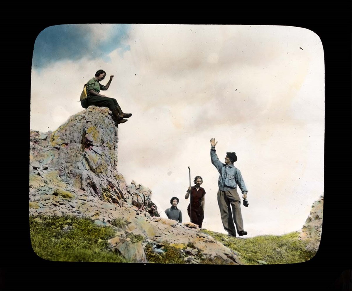
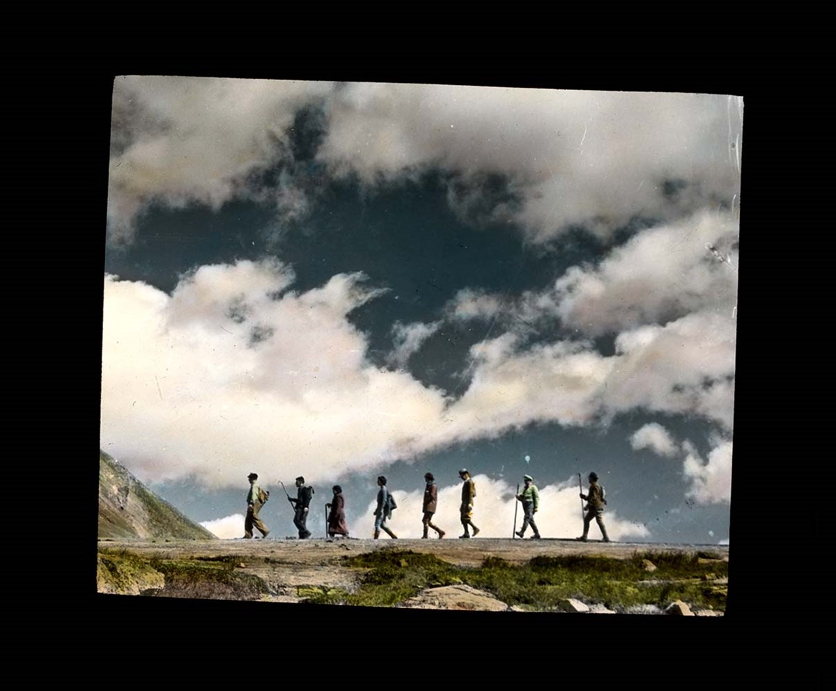
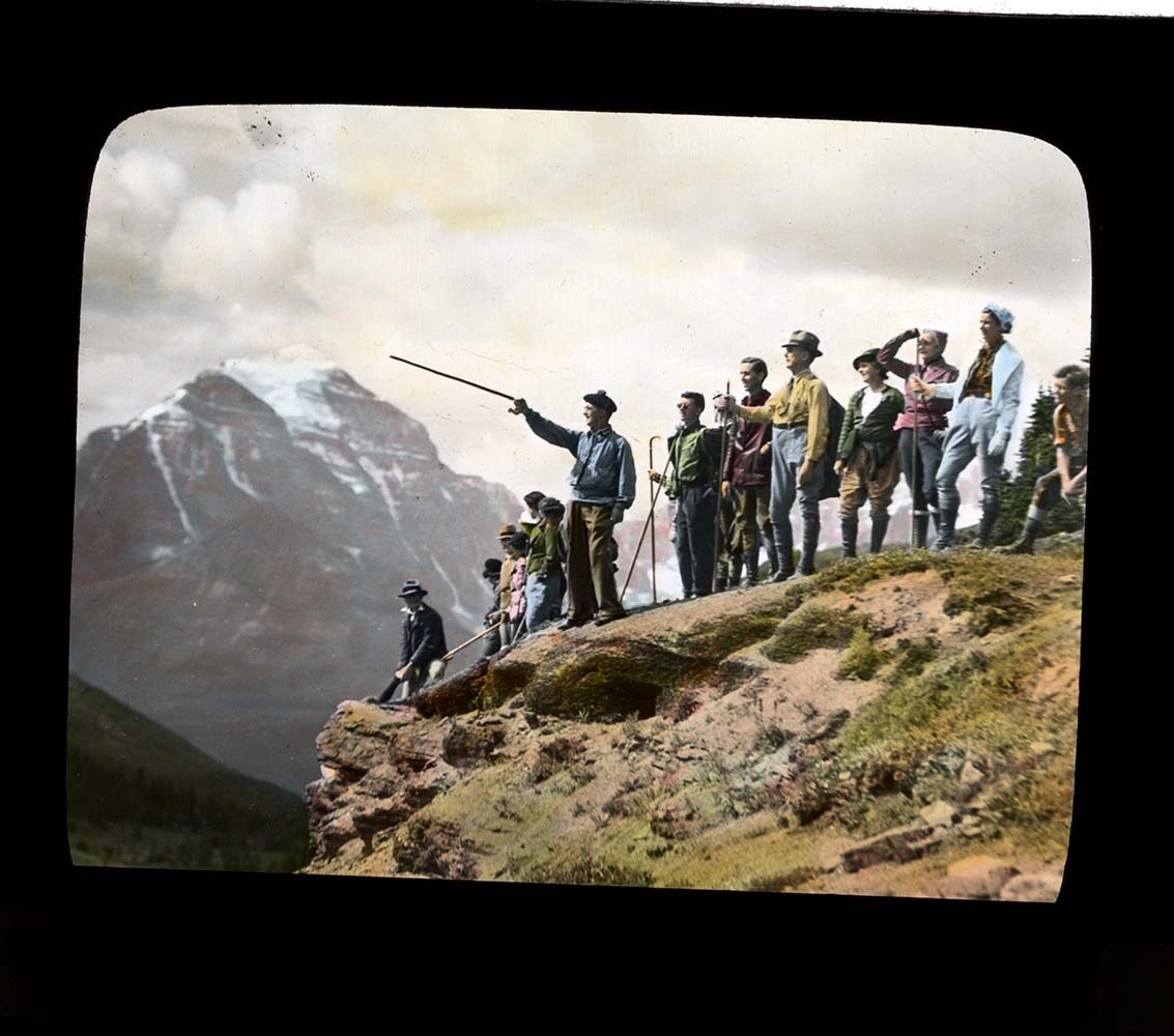
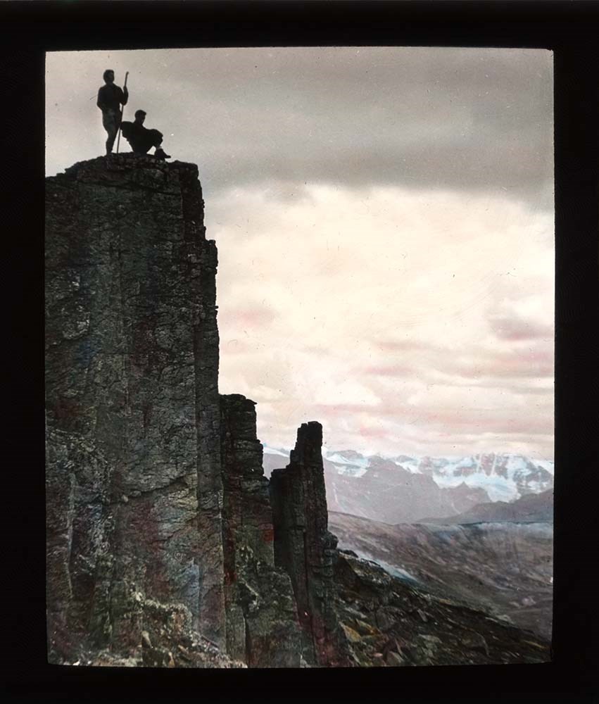
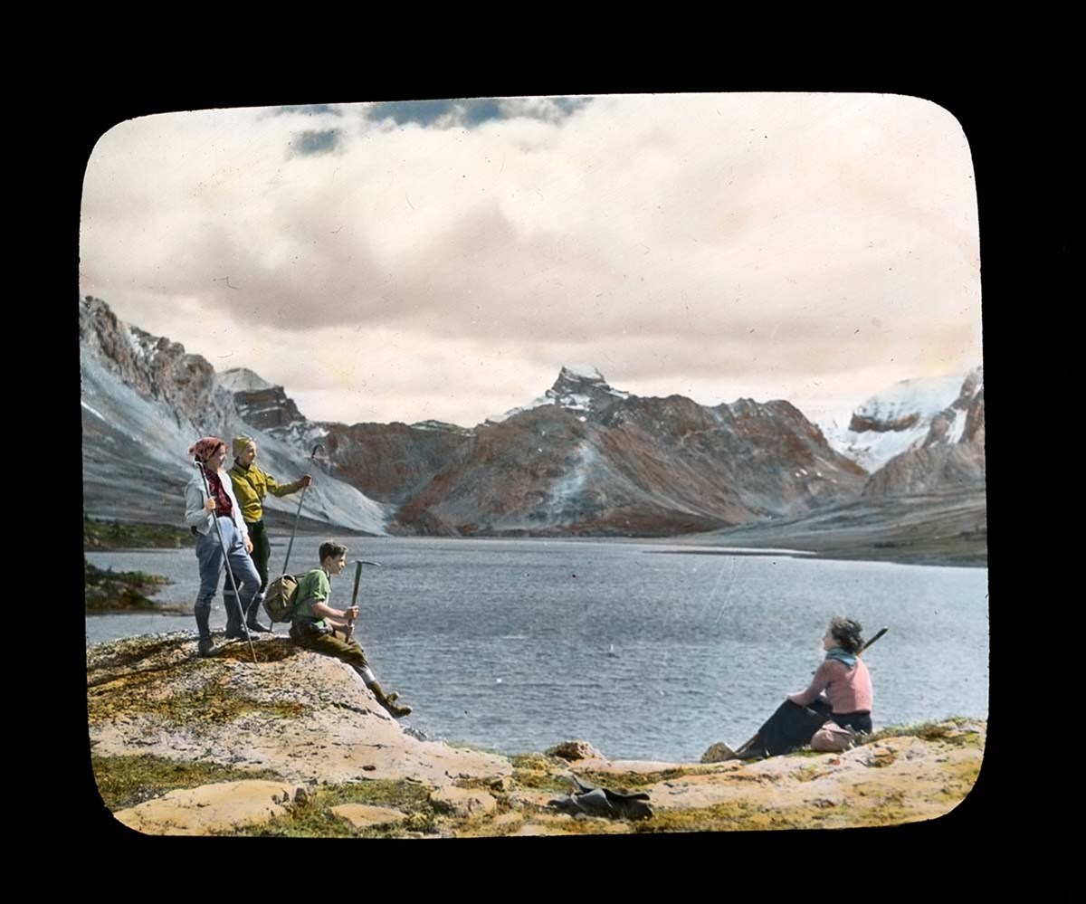
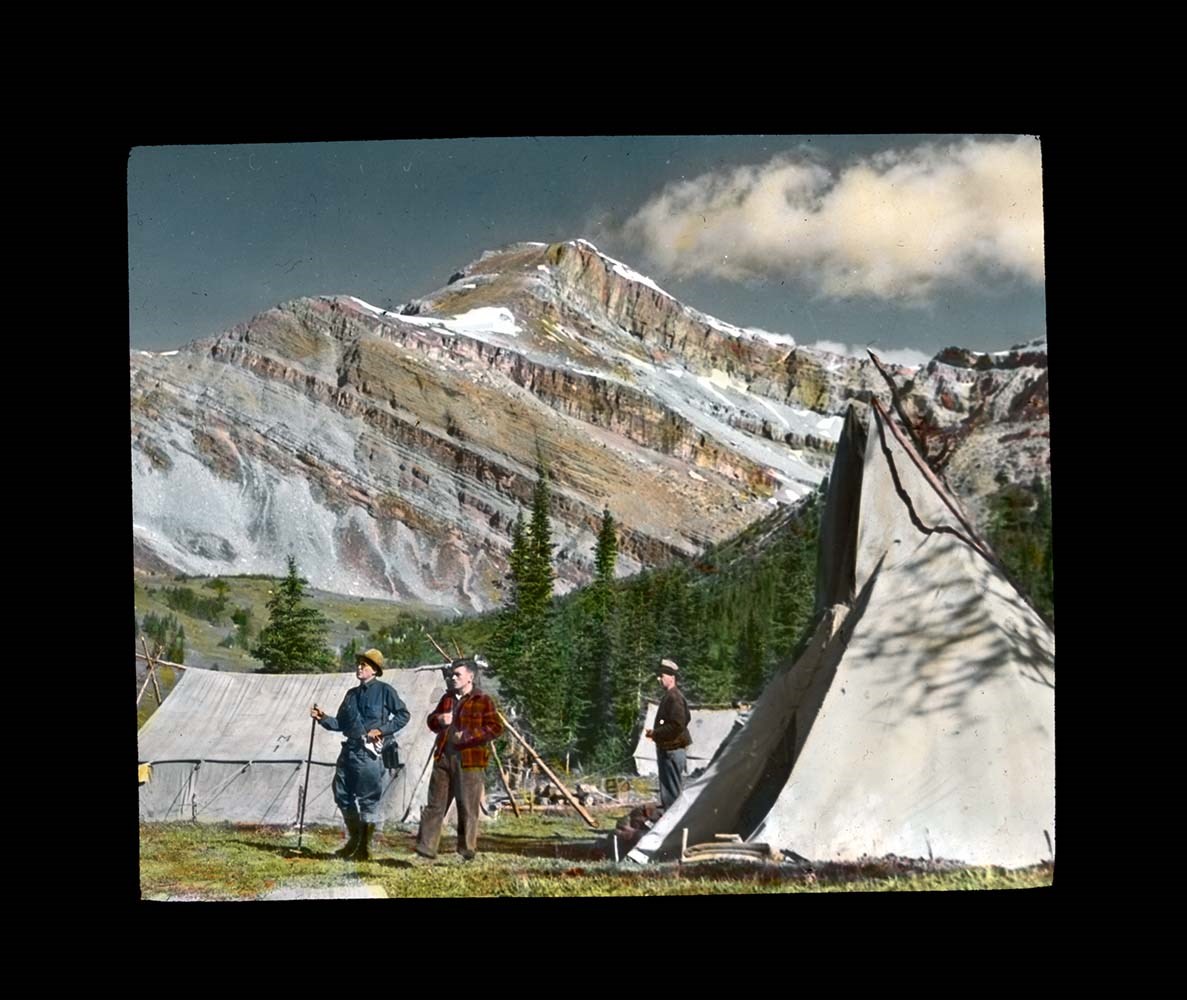
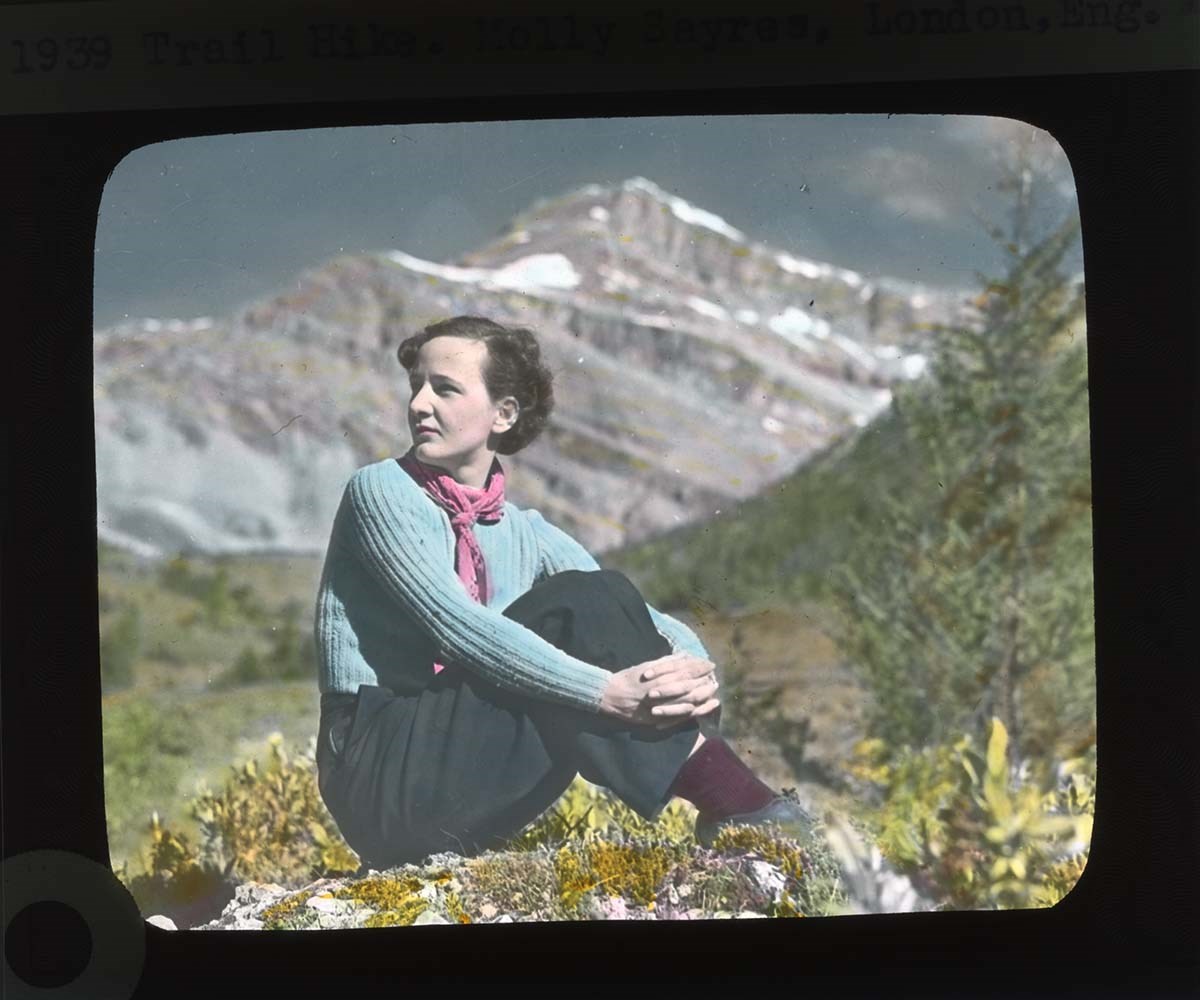
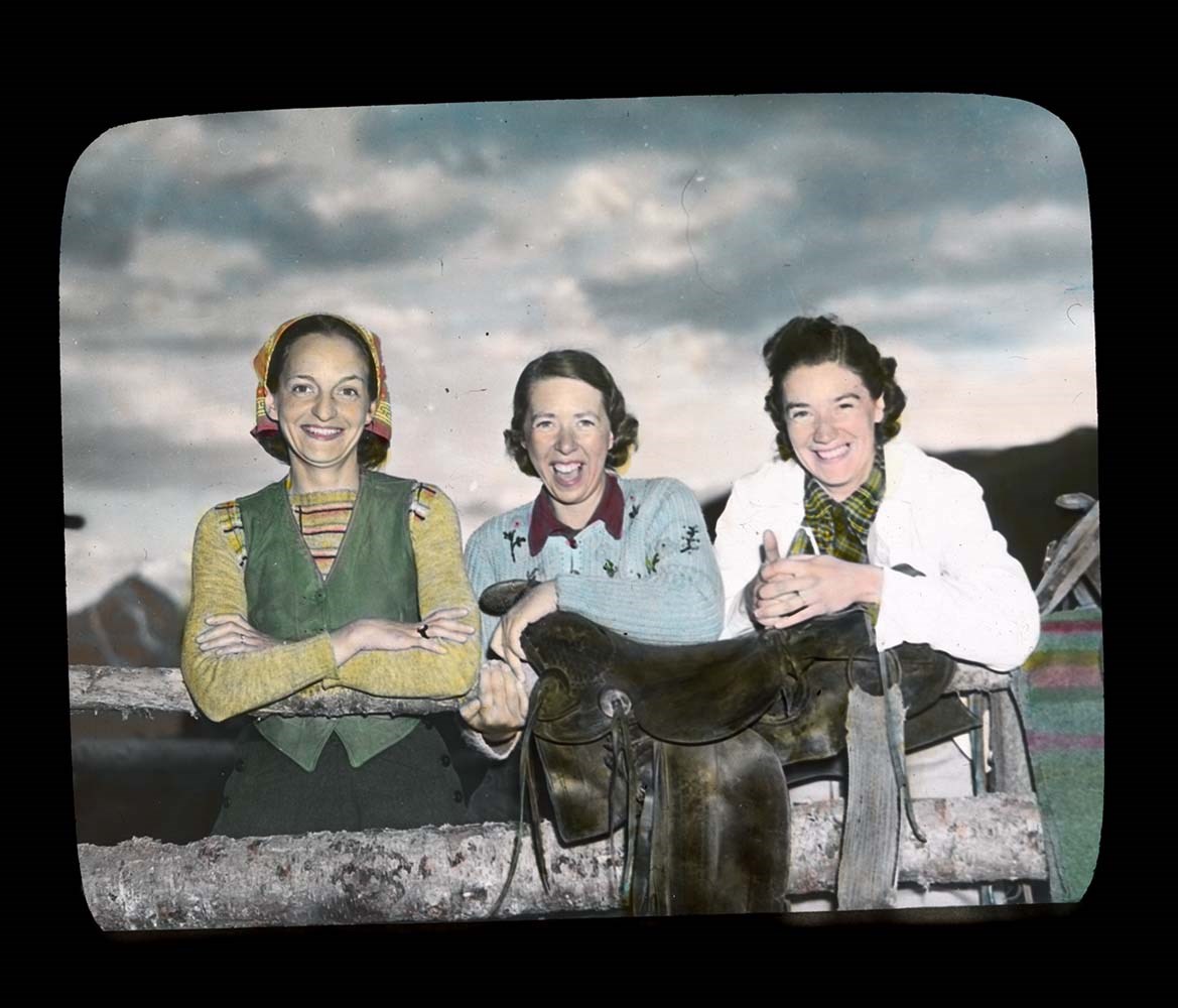
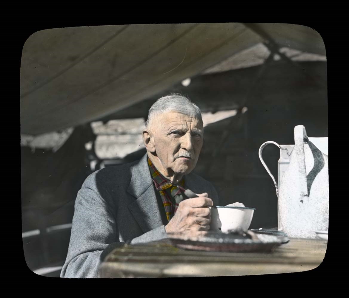
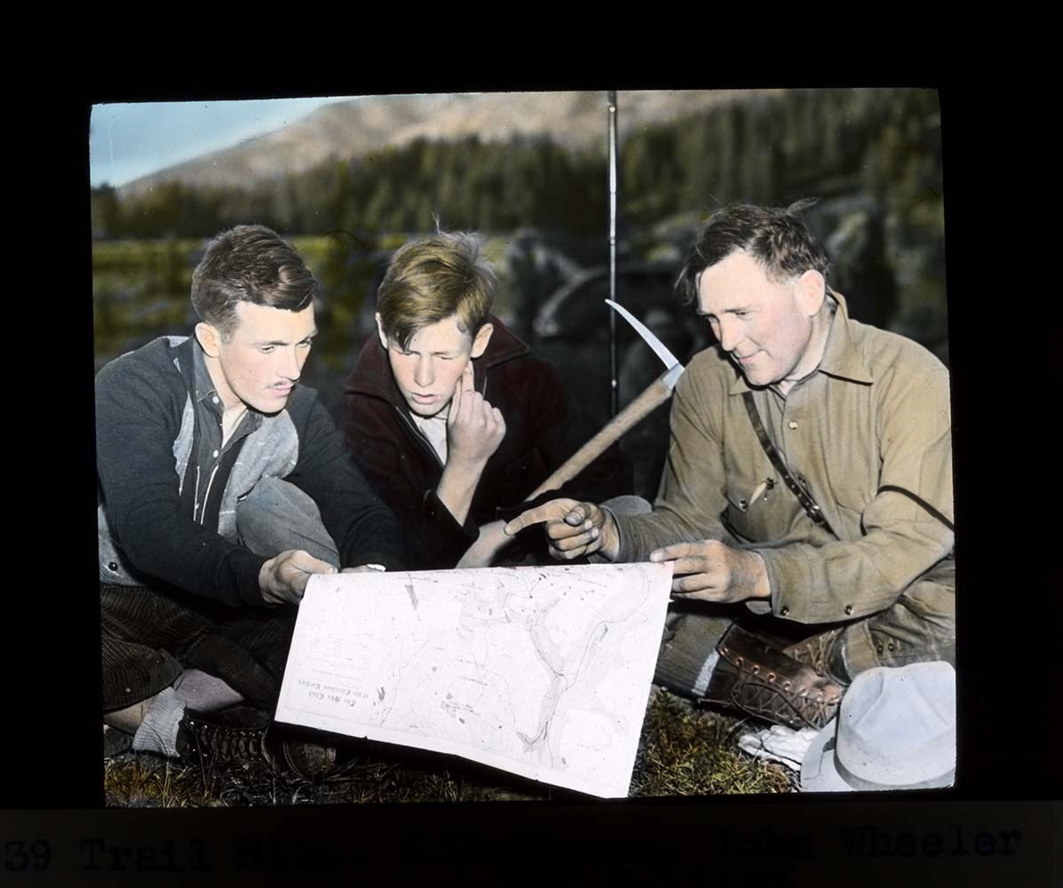
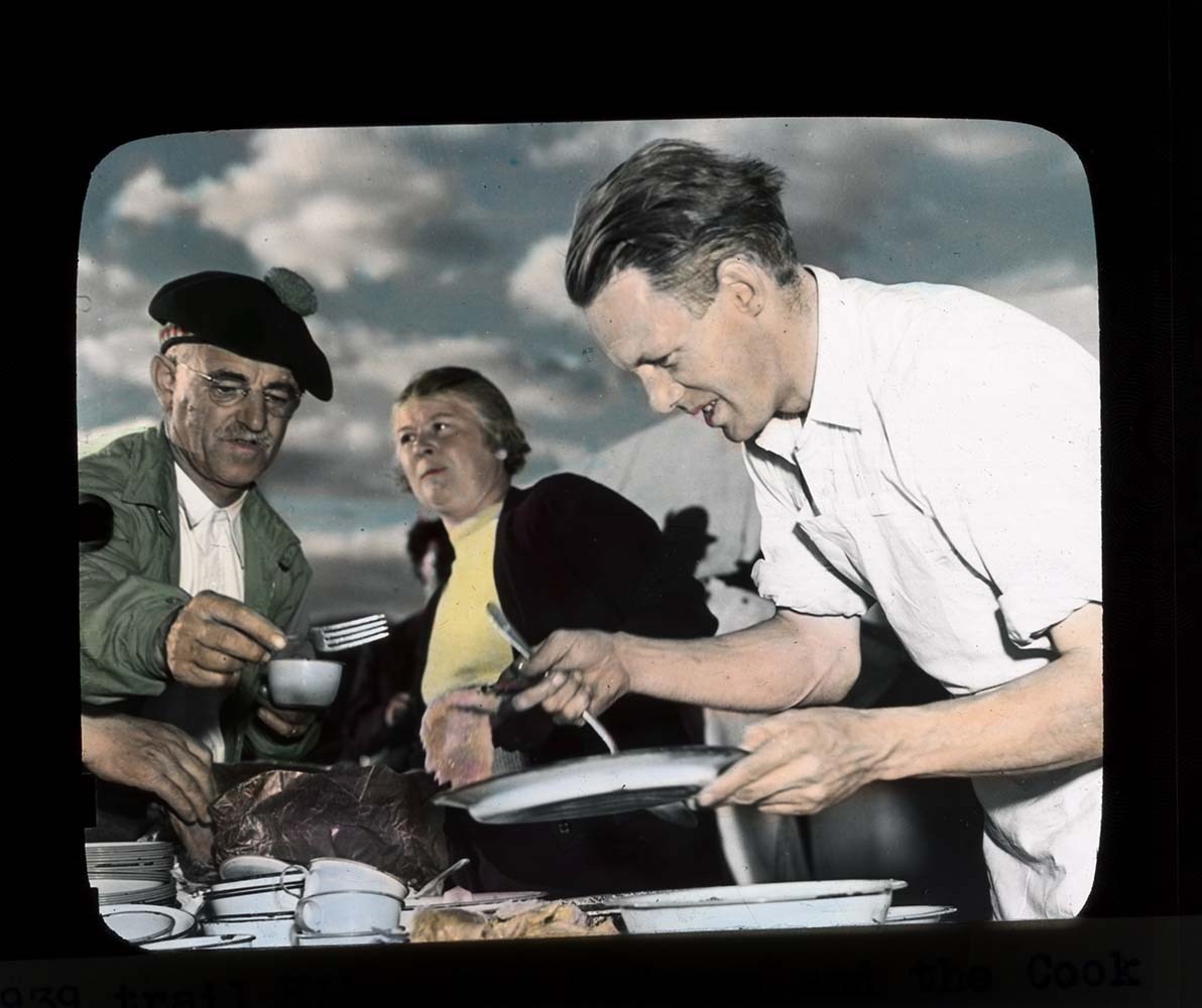
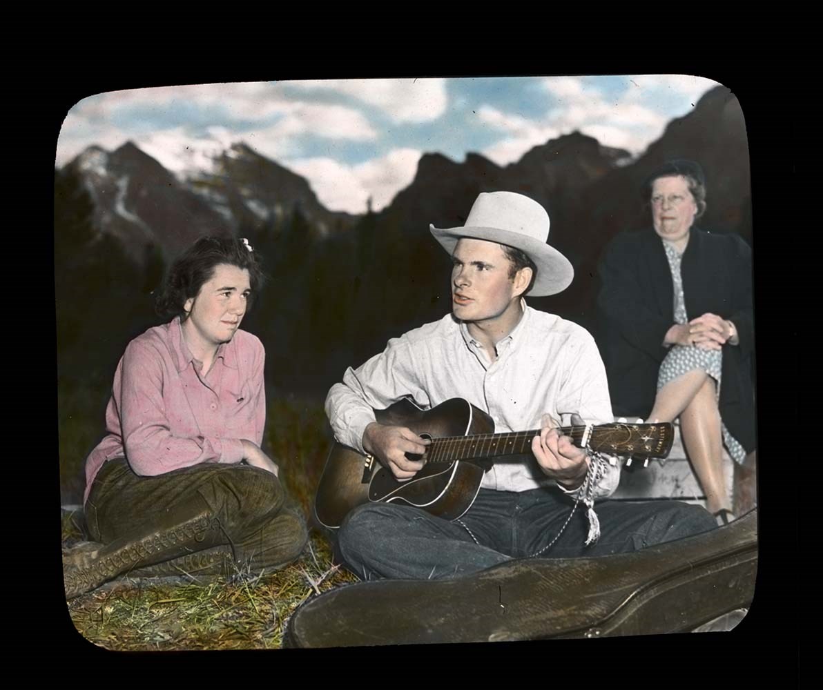
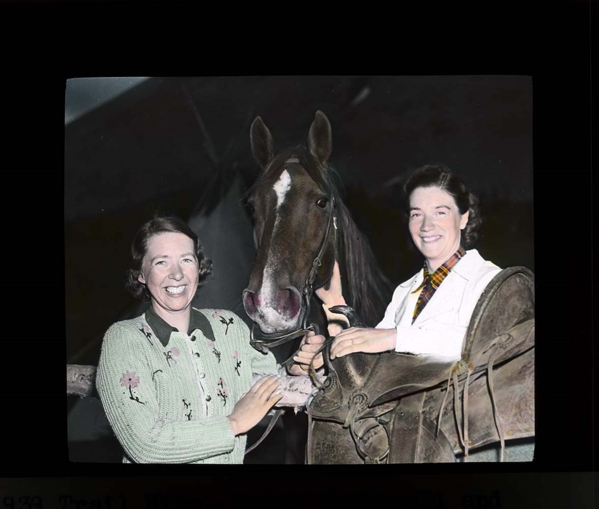
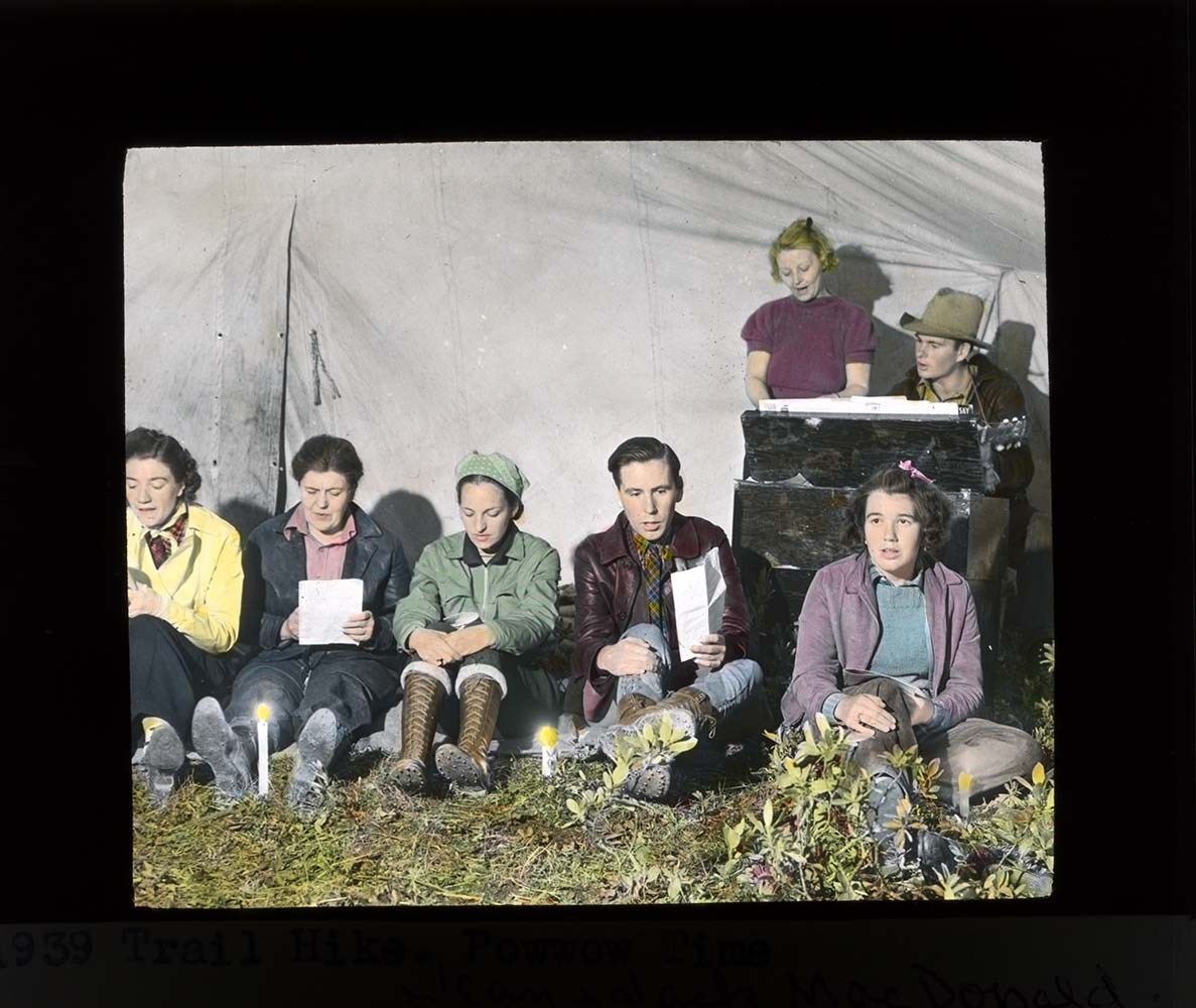
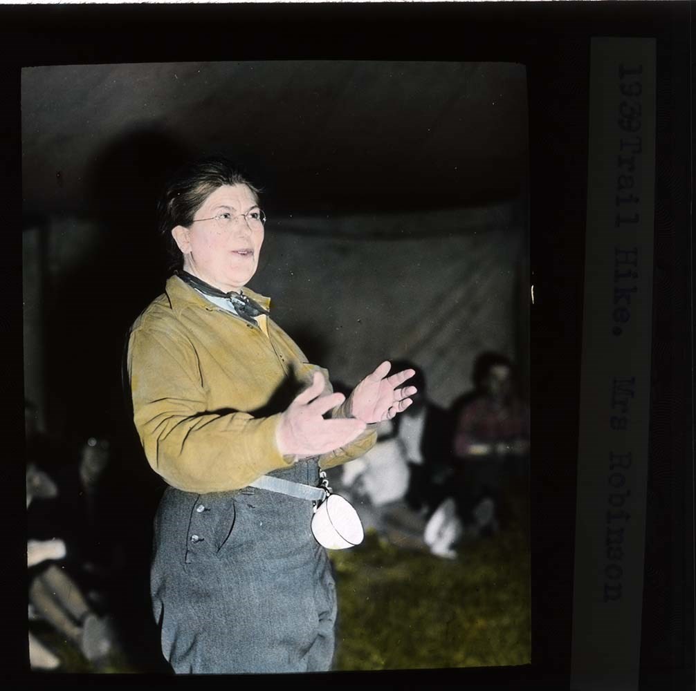
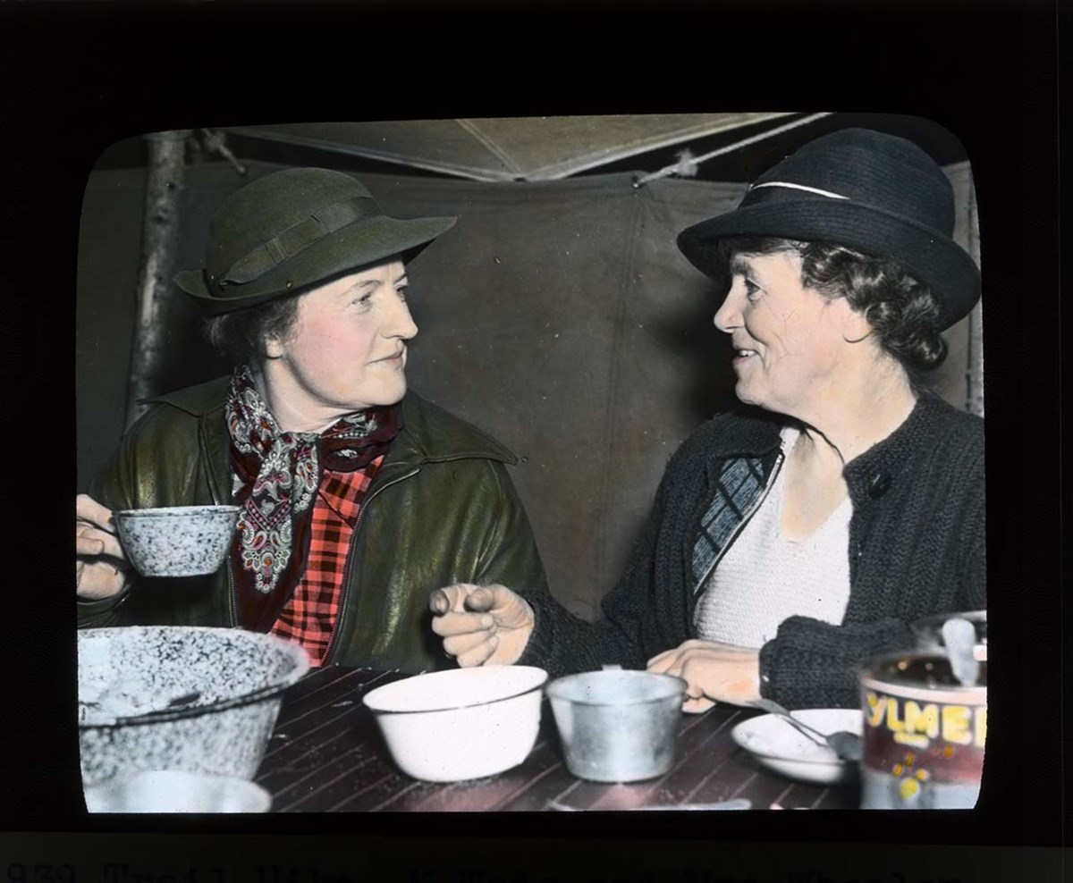
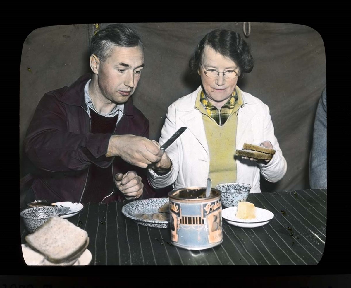
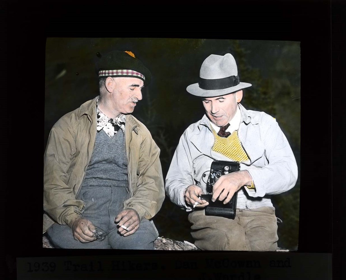
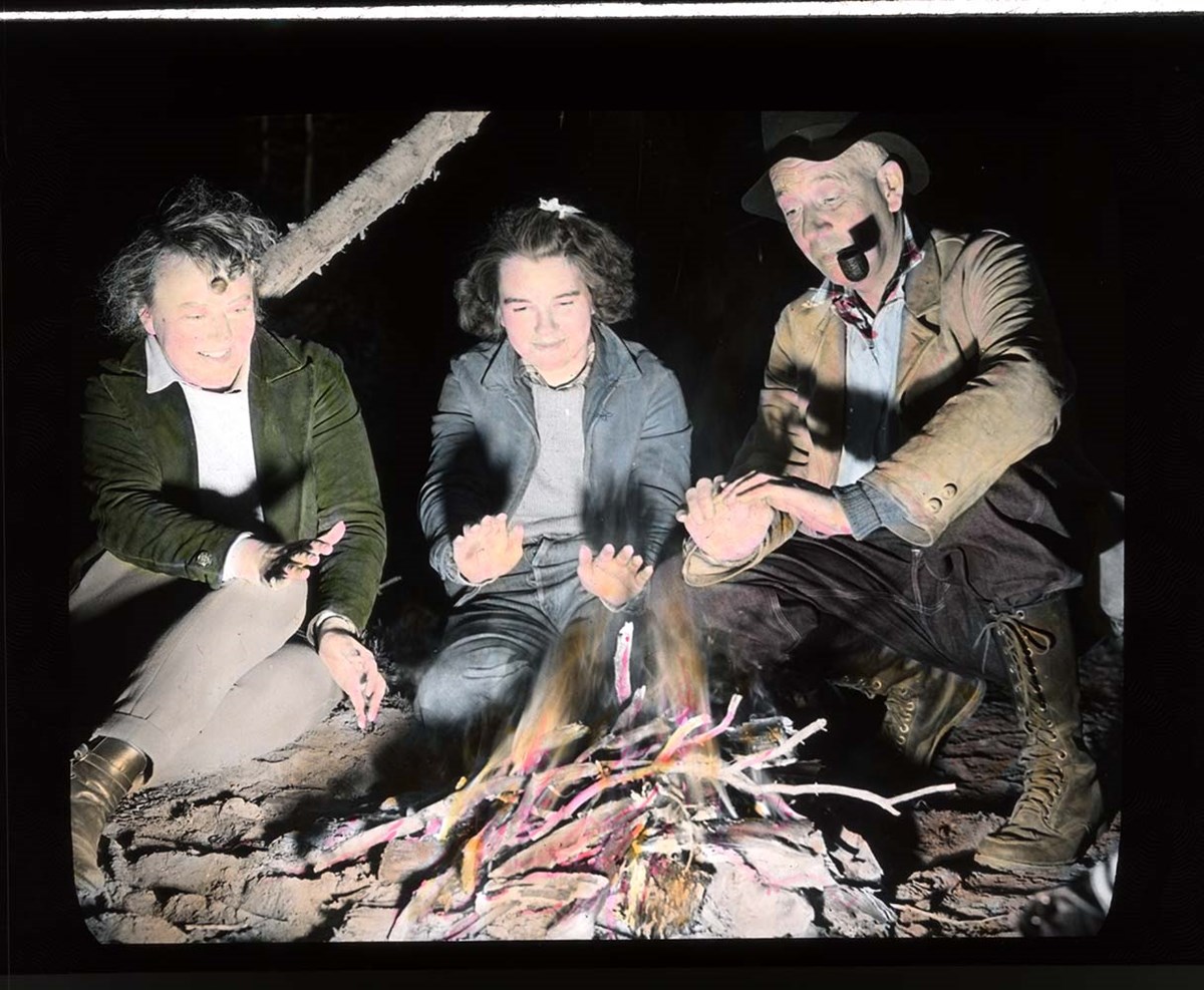
Trail Ride of 1939
https://archives.whyte.org/en/permalink/descriptions54698
- Part Of
- Jean A. Hembroff MacDonald fonds
- Scope & Content
- File consists of 33 colour photograph transparencies (lantern slides). File documents the official trail ride of the Skyline Trail Hikers of the Canadian Rockies, which Jean Hembroff MacDonald participated in. File pertains to the Ptarmigan Valley Camp, with landscape scenery and photographs of the…
- Date Range
- 1939
- Reference Code
- V797 / II / PS - 28 to 60
- Description Level
- 5 / File
- GMD
- Transparency
- Photograph
- Lantern slide
33 images
- Part Of
- Jean A. Hembroff MacDonald fonds
- Description Level
- 5 / File
- Fonds Number
- M573 / V797 / S60
- Series
- V797 / II : Lantern Slides
- Sous-Fonds
- V797
- Accession Number
- 2019.111
- Reference Code
- V797 / II / PS - 28 to 60
- Date Range
- 1939
- Physical Description
- 33 photographs : col. slides
- Scope & Content
- File consists of 33 colour photograph transparencies (lantern slides). File documents the official trail ride of the Skyline Trail Hikers of the Canadian Rockies, which Jean Hembroff MacDonald participated in. File pertains to the Ptarmigan Valley Camp, with landscape scenery and photographs of the hikers (singing, eating, etc). Places that are documented in this file are the Redoubt Lake trail, Hidden Lake, Ptarmigan Lake, Boulder Pass, and Skoki. Notable people include Jean Hembroff MacDonald, her husband, Jack MacDonald, and sister-in-law, Anna Cran; Dan McCowan; James M. Wardle; George Fisher; Norman Sanson; Betsy Struthers; and Emmeline Savatard and John Wheeler (A.O. Wheeler's wife and grandson).
- Notes
- Each slide is labelled.
- Jean wrote an article about her experience [see related material], and used this experience for future lectures
- Slides were stored with a note stating: "Slides taken by the C.P.R. of Trail Ride, 1936-1937."
- Name Access
- Hembroff MacDonald, Jean
- Wardle, James M.
- McCowan, Dan
- Sanson, Norman
- MacDonald, Jack
- Cran, Anna
- Savatard, Emmeline
- Struthers, Betsy
- Fisher, George
- Wheeler, John Oliver
- Subject Access
- Skyline Hikers of the Canadian Rockies
- Trails
- Trail guides
- Tourism
- Travel
- Hiking
- Horse packing
- Horseback riding
- Horses
- Geographic Access
- Banff National Park
- Canada
- Canadian Rocky Mountains
- Lake Louise
- Skoki
- Language
- English
- Related Material
- M573 / I / 18
- The Sky Line Trail, Vol. 6, No. 24 (October 1939)
- Title Source
- Title based on contents of file
- Processing Status
- Processed
Images


This material is presented as originally created; it may contain outdated cultural descriptions and
potentially offensive content.
Read more.
Travel guides - Banff National Park, Mount Assiniboine
https://archives.whyte.org/en/permalink/descriptions55921
- Part Of
- Ben Gadd fonds
- Scope & Content
- File consists of travel guides collected by Ben Gadd pertaining Banff National Park and Mount Assiniboine.
- Date Range
- [ca.2000]
- Reference Code
- M590 / I / A / i / 5
- Description Level
- 5 / File
- GMD
- Published record
- Textual record
- Map
- Part Of
- Ben Gadd fonds
- Description Level
- 5 / File
- Fonds Number
- M590
- V810
- S61
- Series
- M590 / I : Personal records
- Sous-Fonds
- M590
- Sub-Series
- M590 / I / A : Travel guides and maps
- Accession Number
- 2021.20
- Reference Code
- M590 / I / A / i / 5
- Date Range
- [ca.2000]
- Physical Description
- 2 cm of textual records
- Scope & Content
- File consists of travel guides collected by Ben Gadd pertaining Banff National Park and Mount Assiniboine.
- Subject Access
- Geography
- Travel
- Tourism
- Tourist information
- Geographic Access
- Canada
- Alberta
- Banff National Park
- Mount Assiniboine
- Reproduction Restrictions
- Copyright restrictions may apply
- Language
- English
- Category
- Exploration, discovery and travel
- Title Source
- Title based on contents of file
- Processing Status
- Processed
This material is presented as originally created; it may contain outdated cultural descriptions and
potentially offensive content.
Read more.
Travel guides - Lake Louise, Yoho
https://archives.whyte.org/en/permalink/descriptions55913
- Part Of
- Ben Gadd fonds
- Scope & Content
- File consists of travel guides collected by Ben Gadd pertaining to areas near Lake Louise and Yoho National Park.
- Date Range
- 1998
- 2001
- Reference Code
- M590 / I / A / i / 3
- Description Level
- 5 / File
- GMD
- Published record
- Textual record
- Map
- Part Of
- Ben Gadd fonds
- Description Level
- 5 / File
- Fonds Number
- M590
- V810
- S61
- Series
- M590 / I : Personal records
- Sous-Fonds
- M590
- Sub-Series
- M590 / I / A : Travel guides and maps
- Accession Number
- 2021.20
- Reference Code
- M590 / I / A / i / 3
- Date Range
- 1998
- 2001
- Physical Description
- 2 cm of textual records
- Scope & Content
- File consists of travel guides collected by Ben Gadd pertaining to areas near Lake Louise and Yoho National Park.
- Subject Access
- Geography
- Travel
- Tourism
- Tourist information
- Geographic Access
- Canada
- Alberta
- British Columbia
- Lake Louise
- Yoho National Park
- Reproduction Restrictions
- Copyright restrictions may apply
- Language
- English
- Category
- Exploration, discovery and travel
- Title Source
- Title based on contents of file
- Processing Status
- Processed
This material is presented as originally created; it may contain outdated cultural descriptions and
potentially offensive content.
Read more.