Narrow Results By
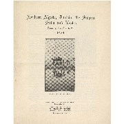
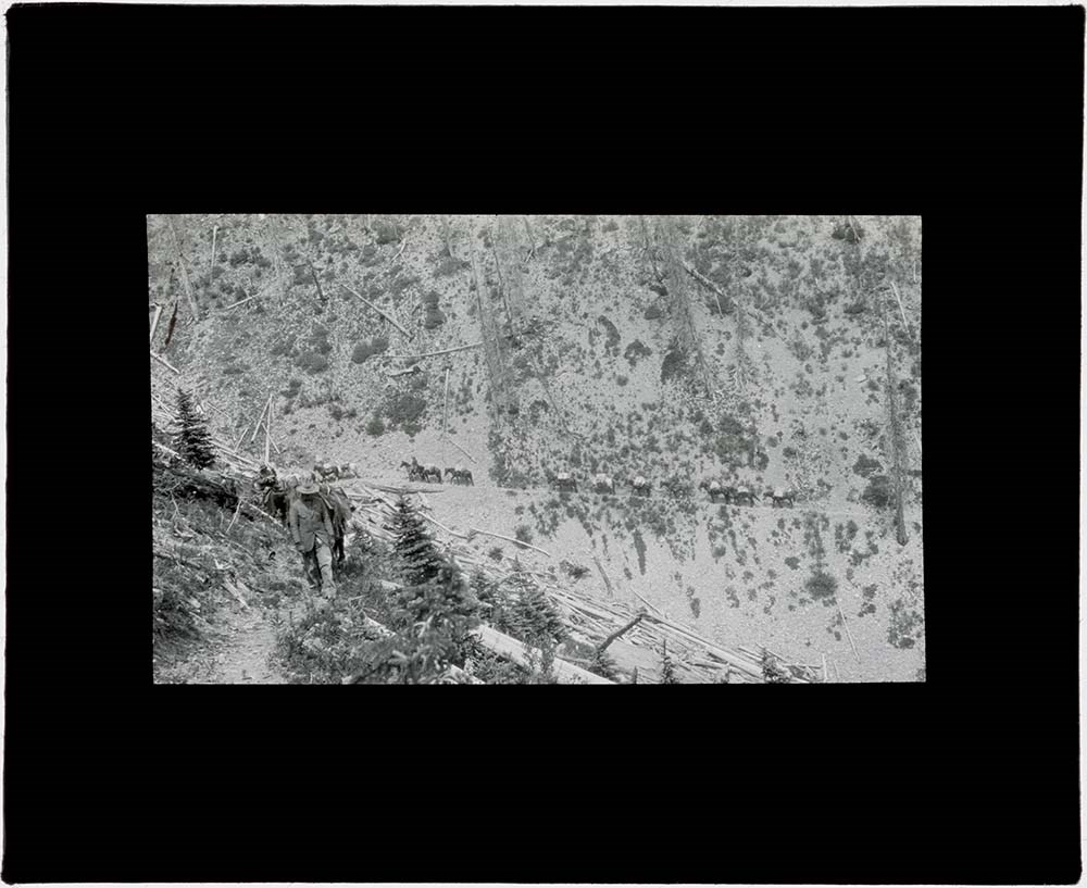
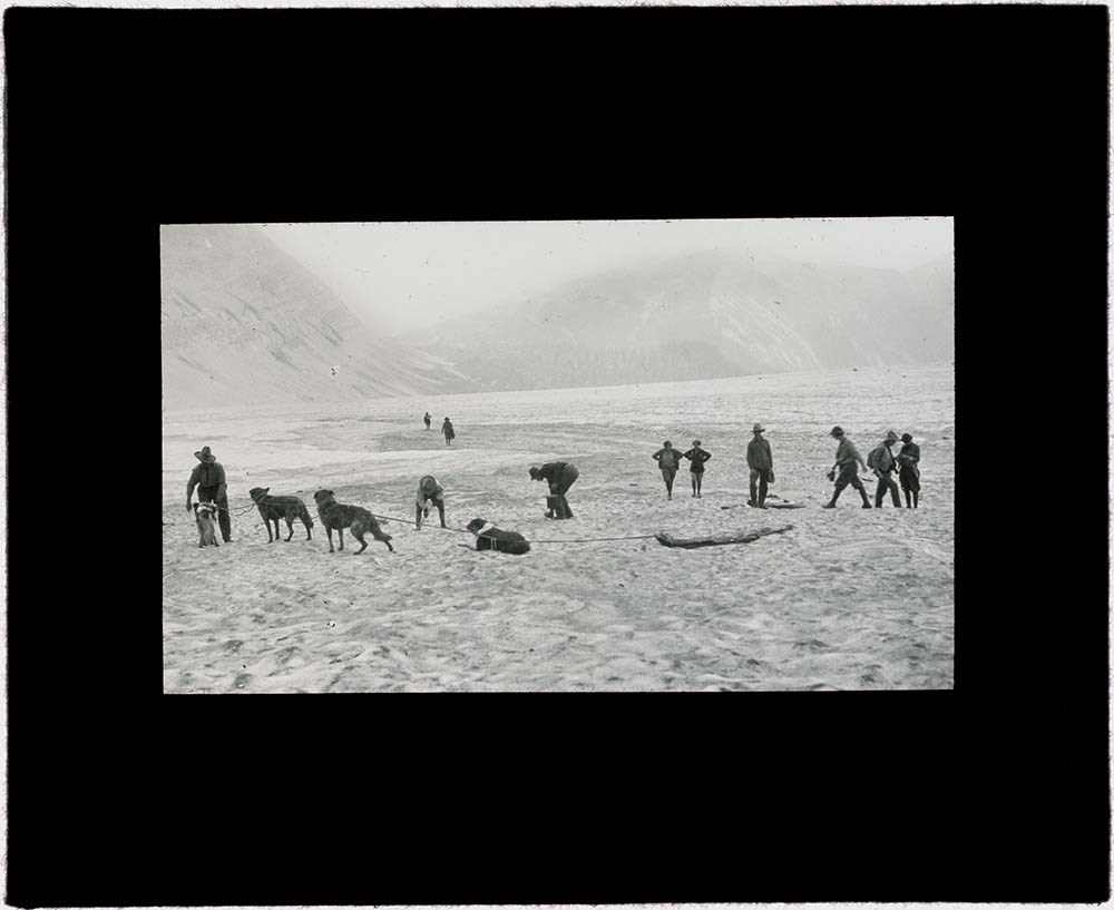
Algeria Trip Lantern Slides
https://archives.whyte.org/en/permalink/descriptions54683
- Part Of
- Caroline Hinman fonds
- Scope & Content
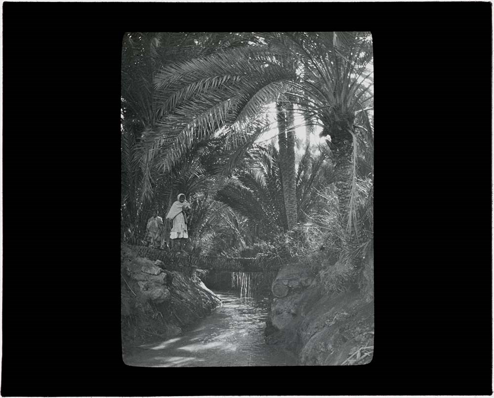
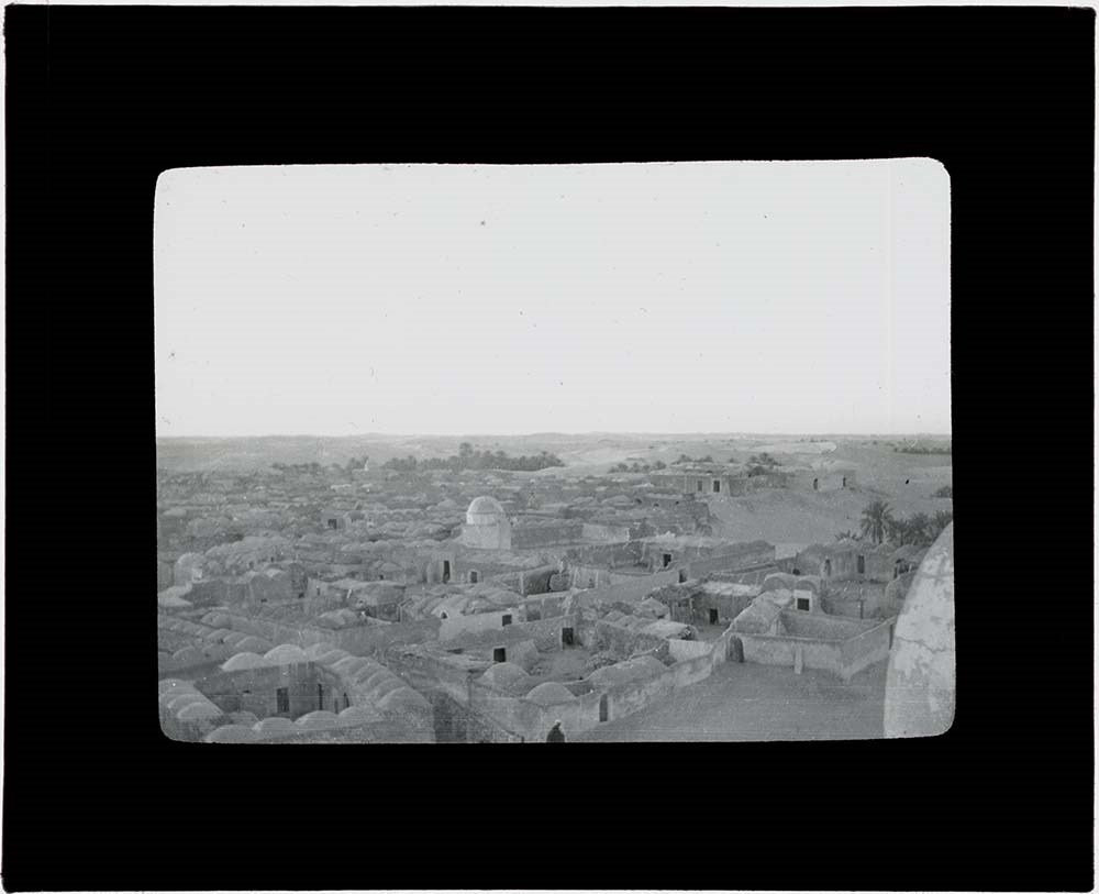
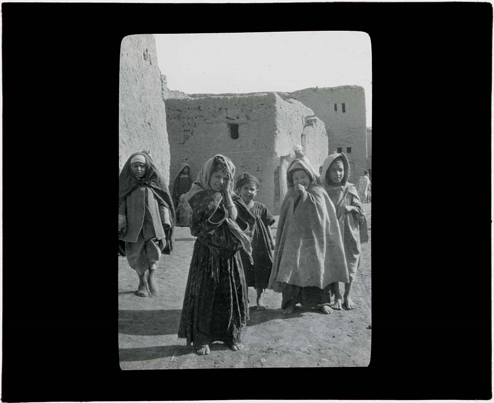
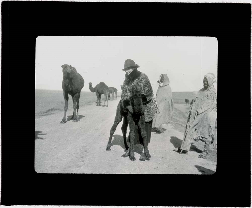
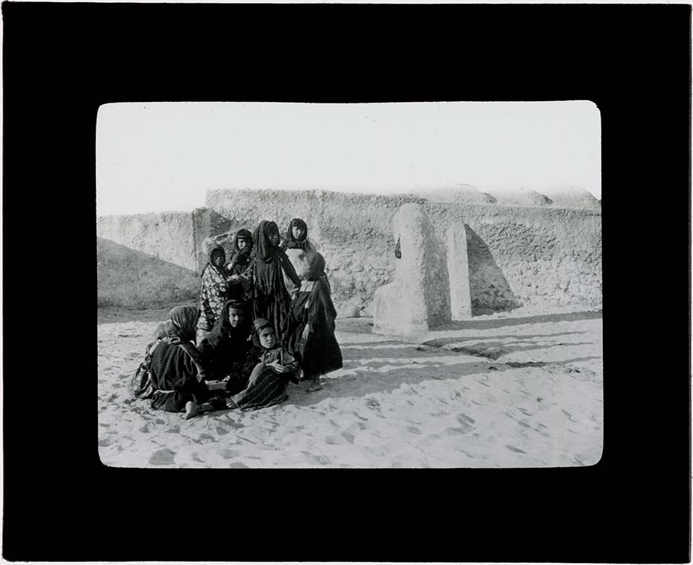
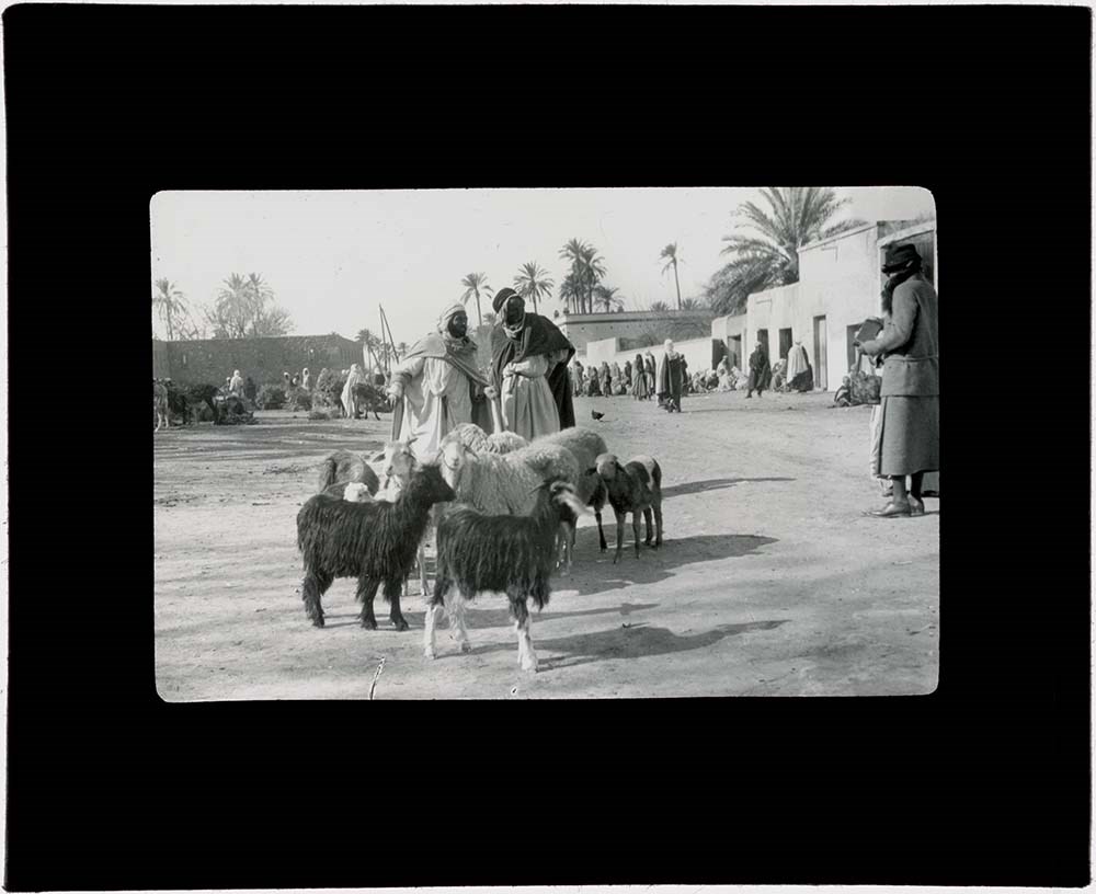
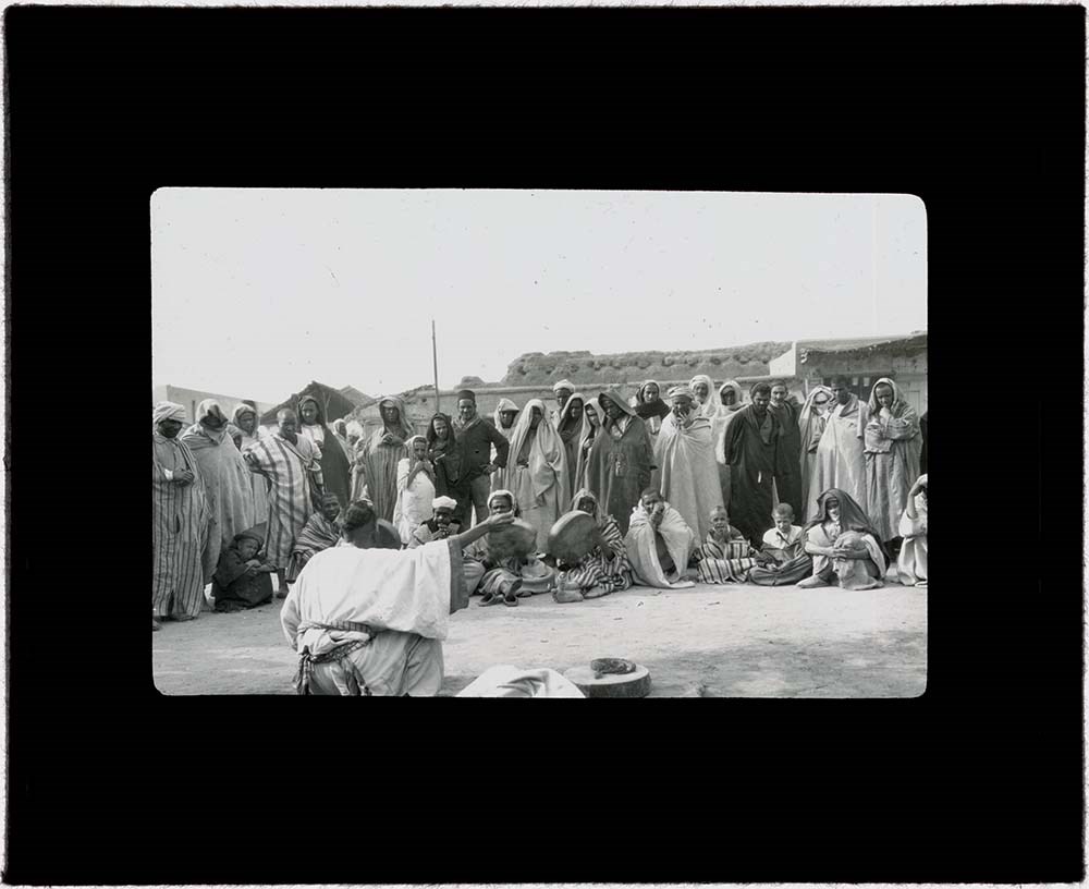
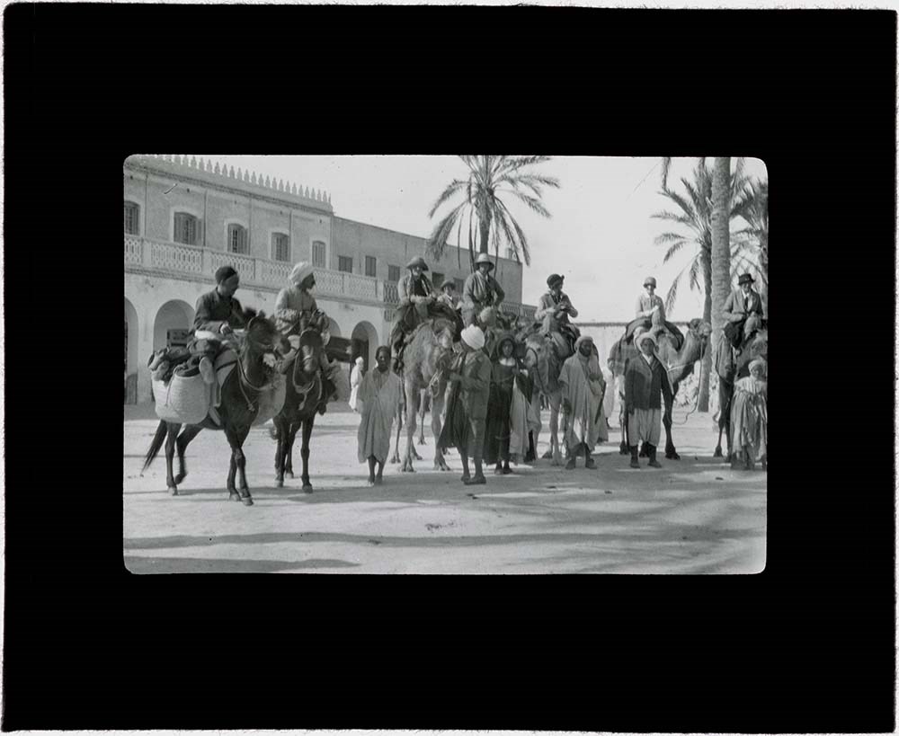
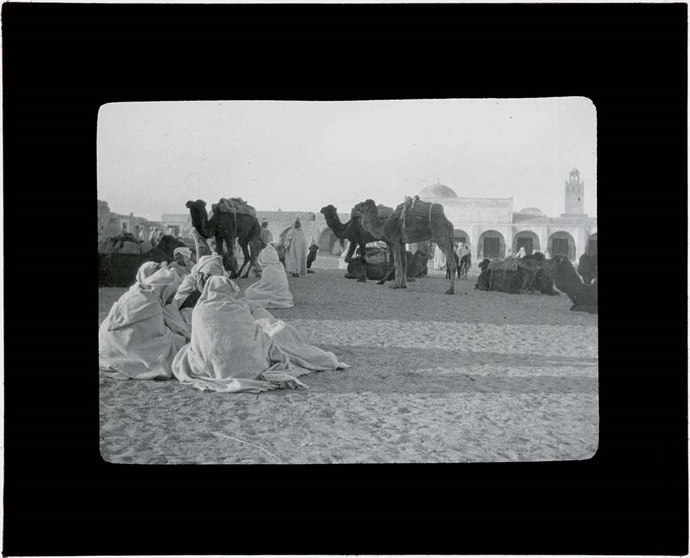
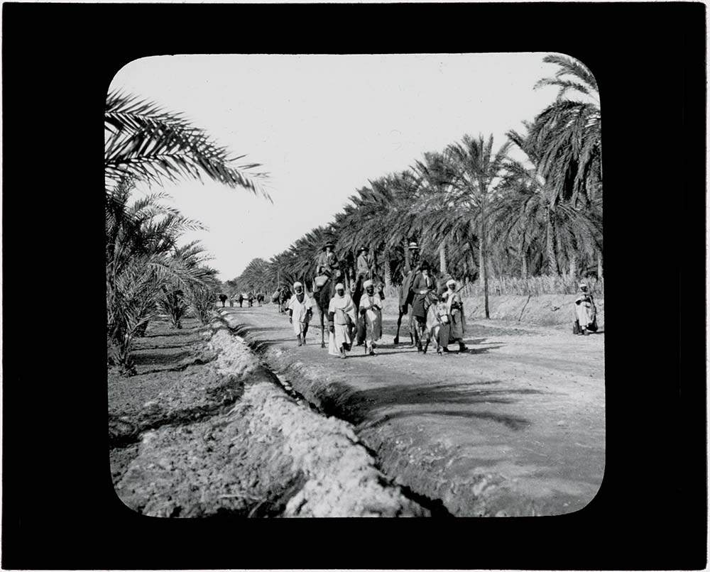
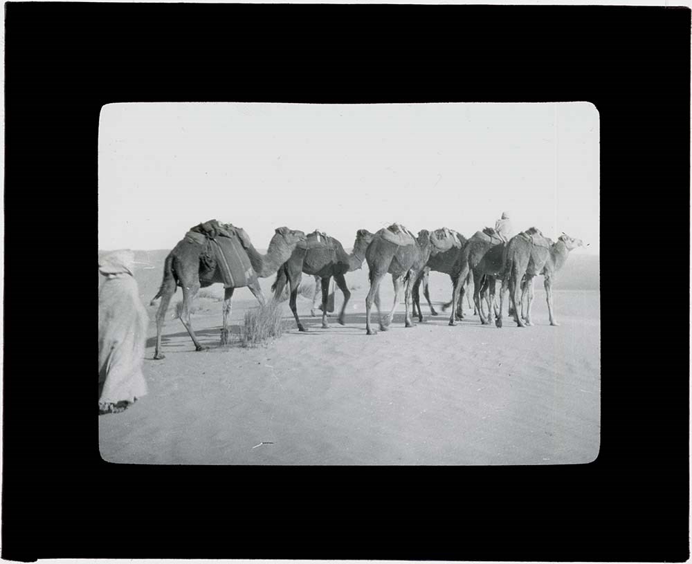
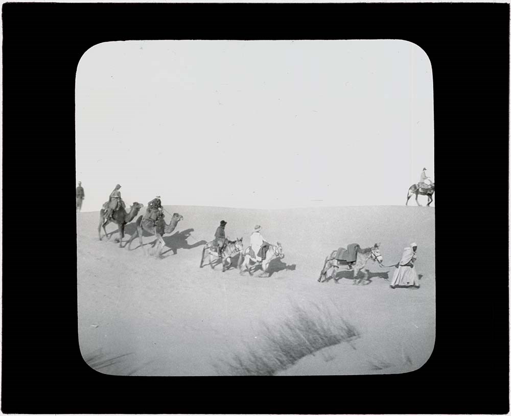
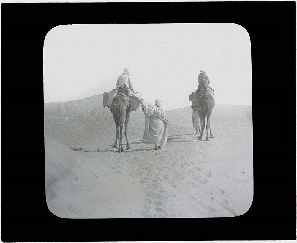
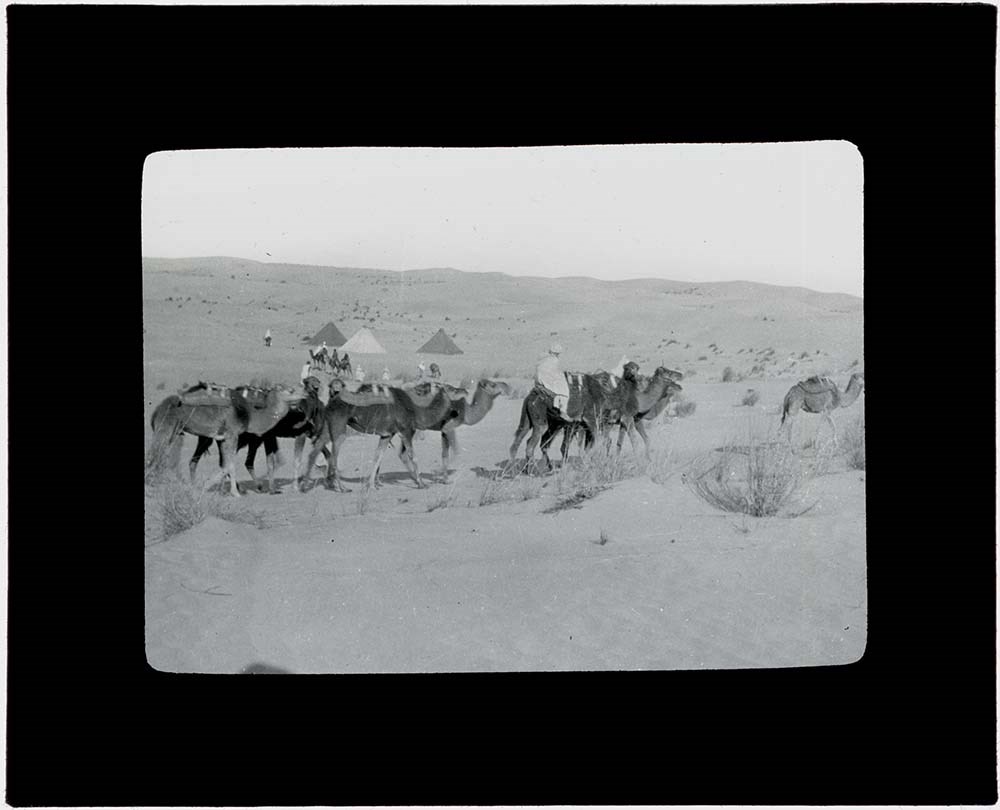
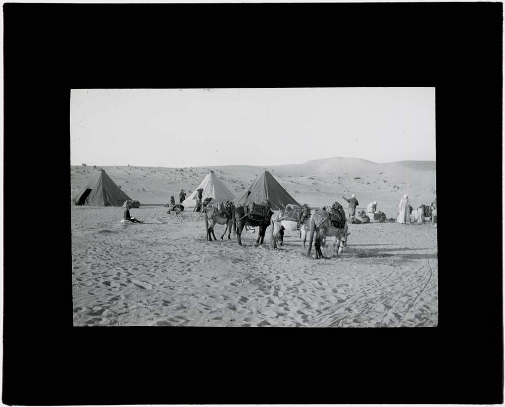
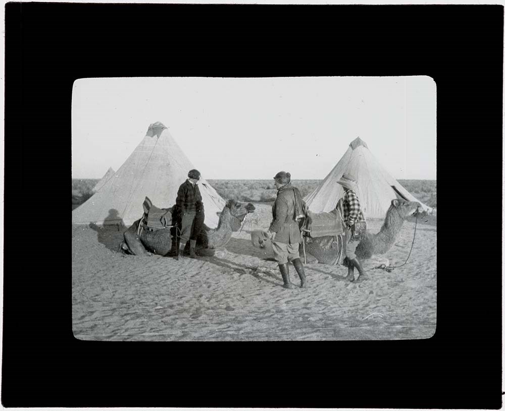
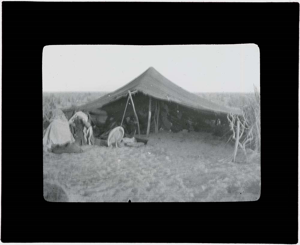
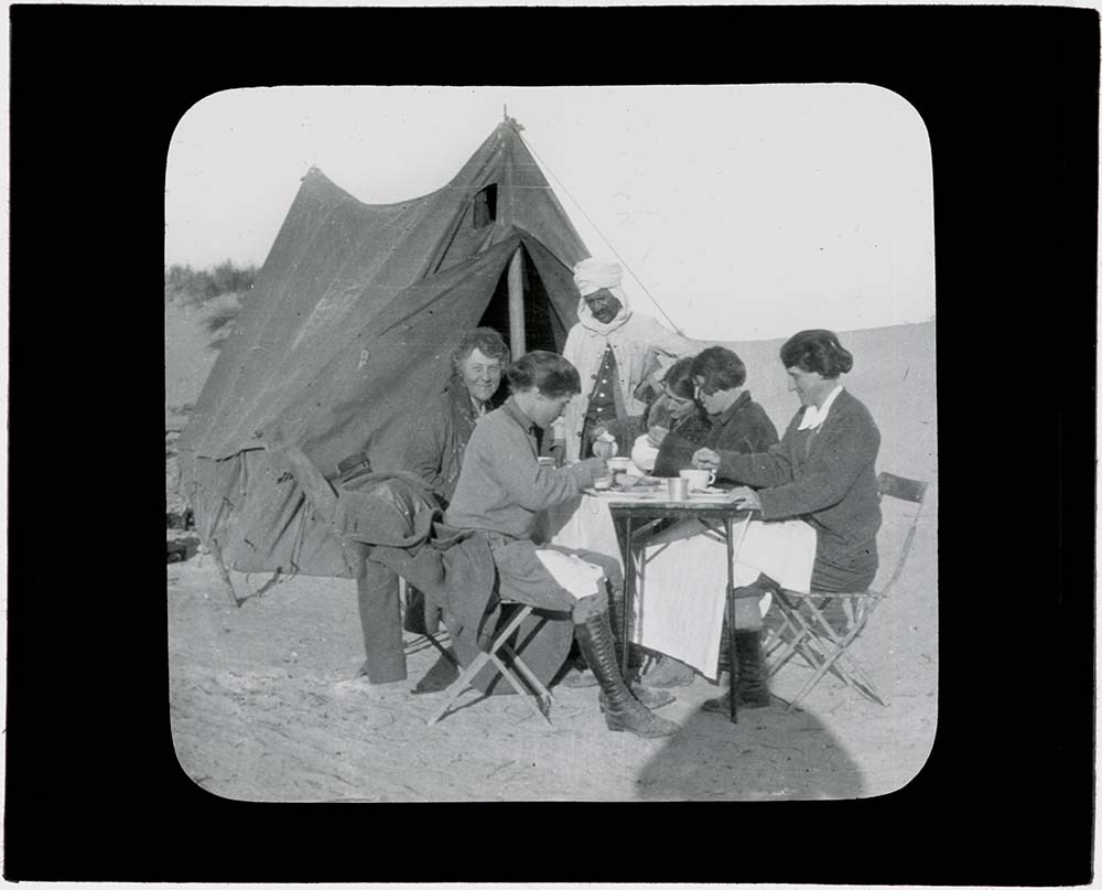
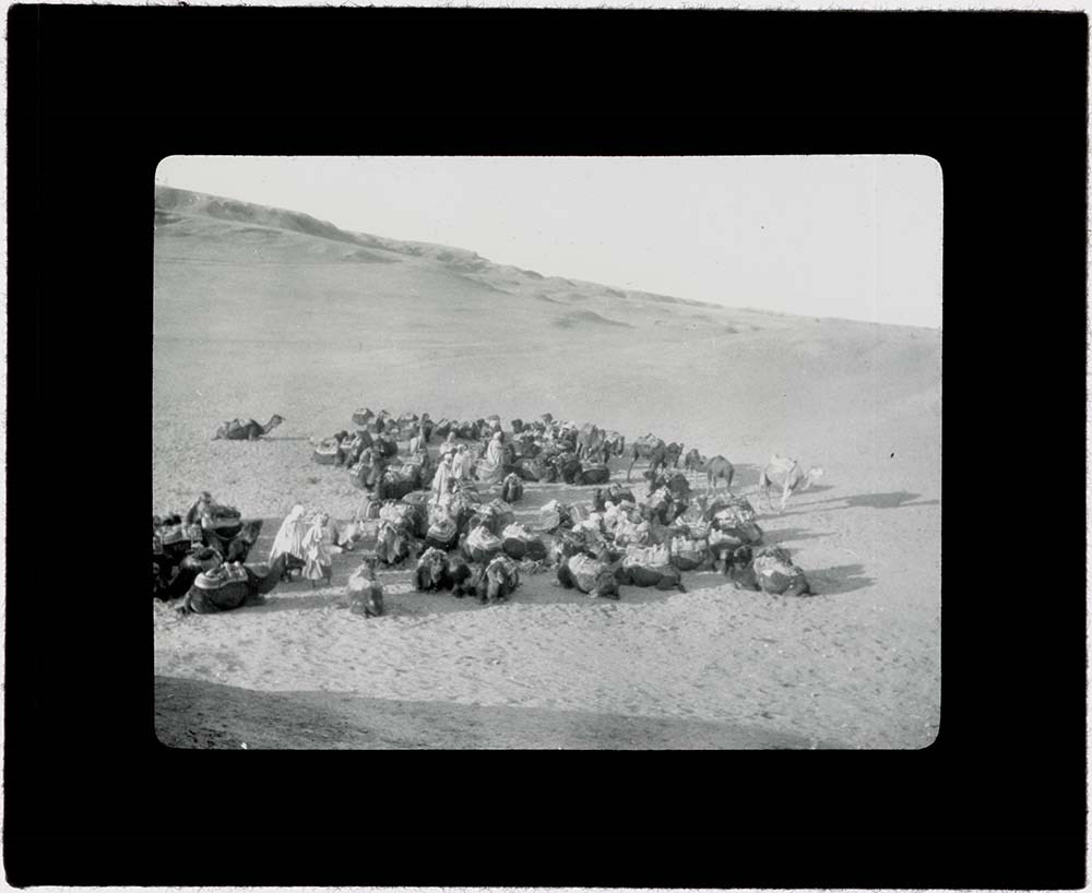
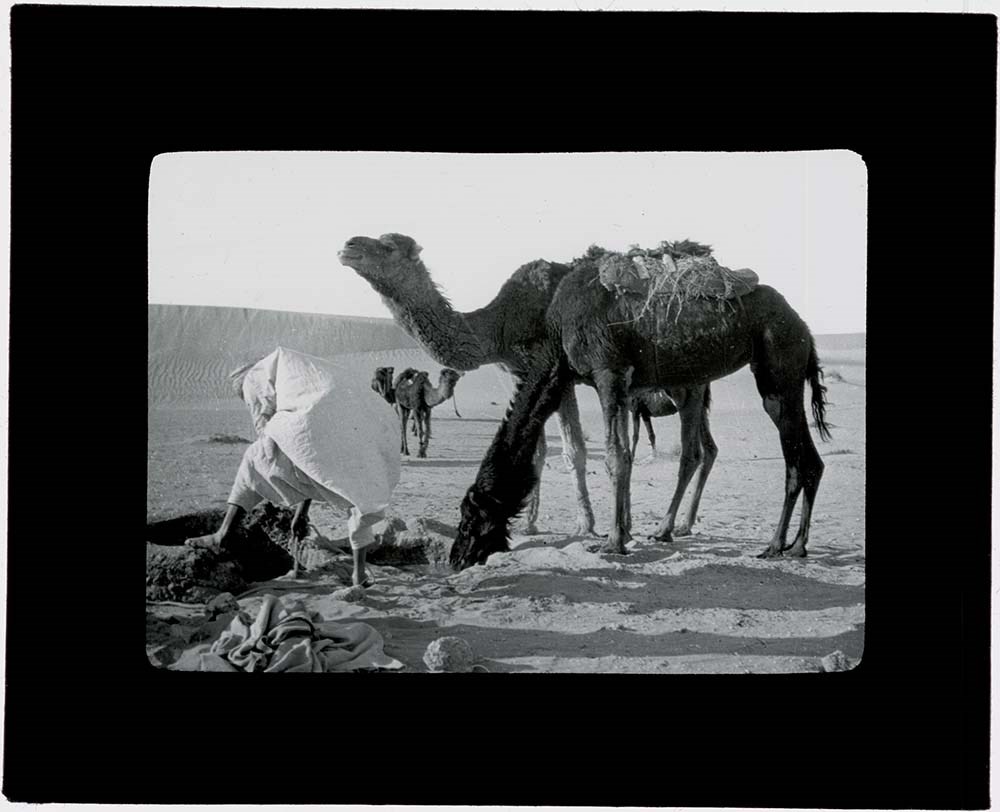
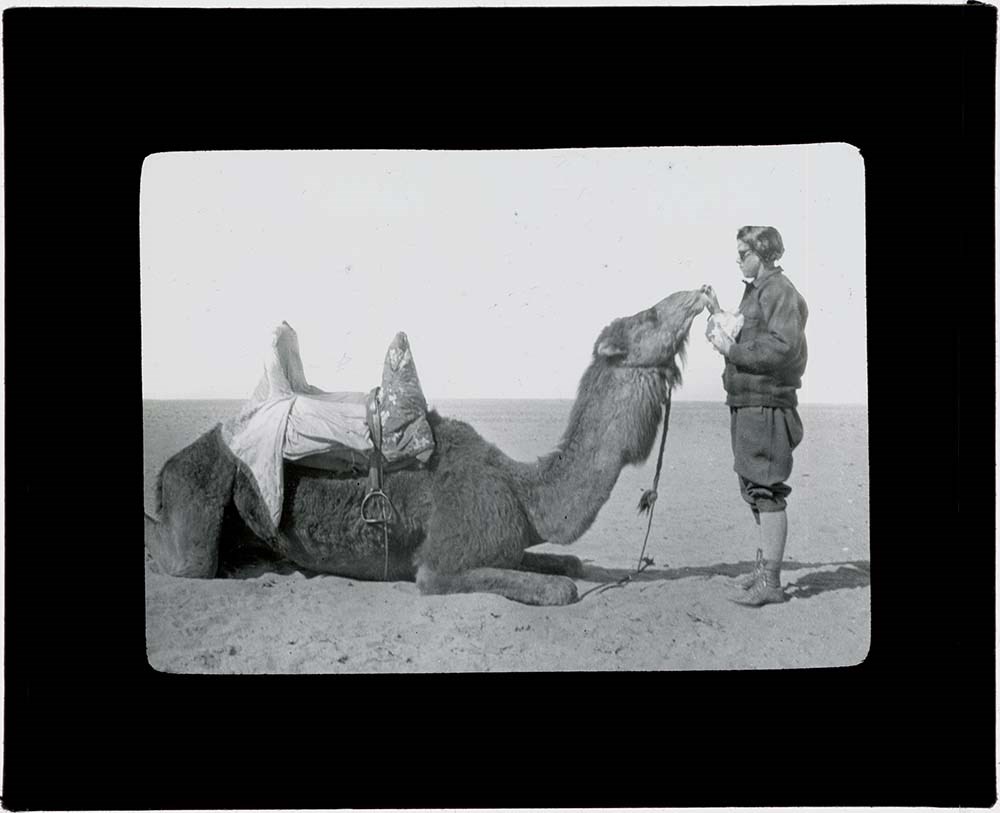
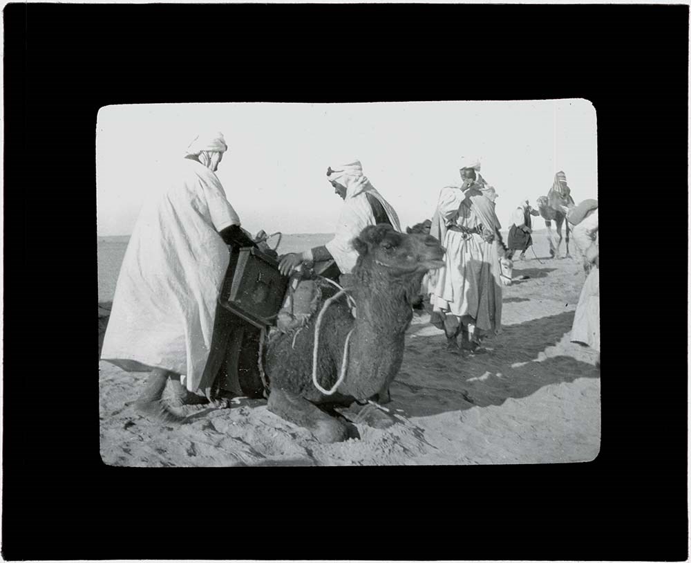
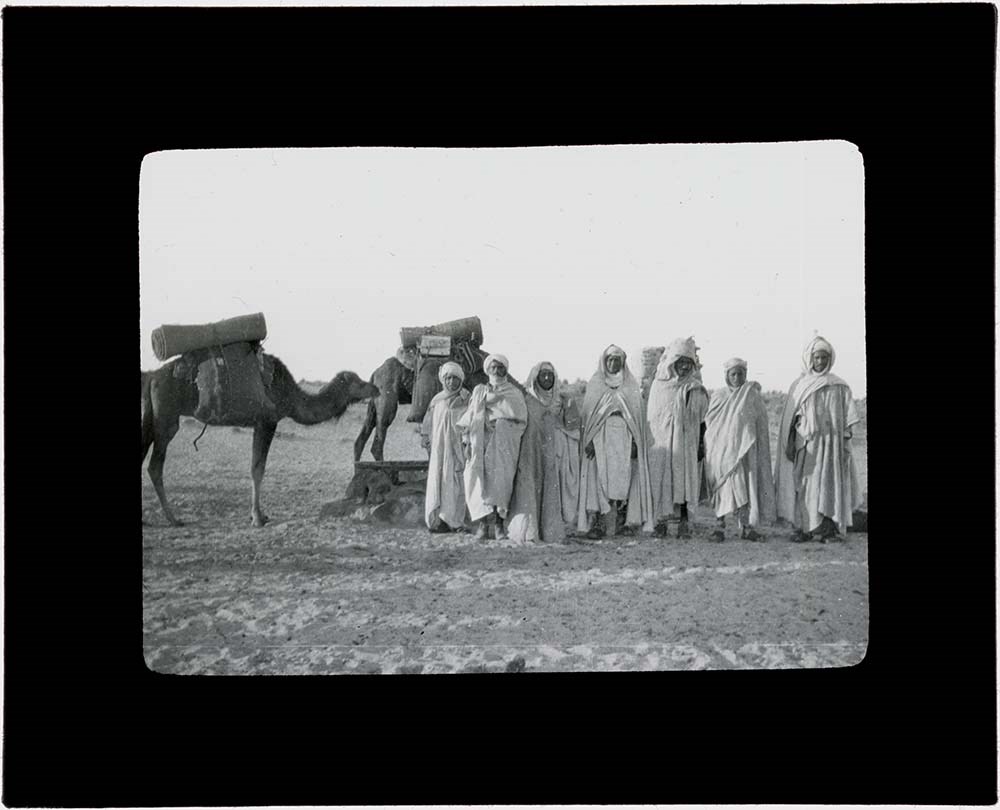
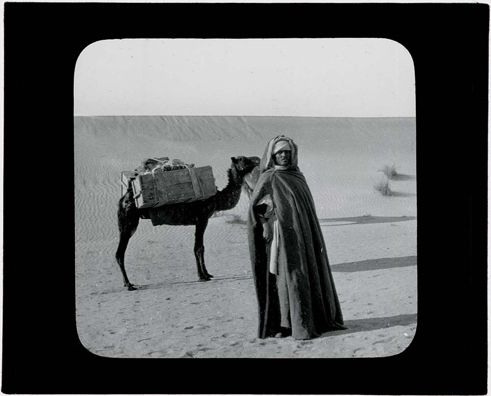
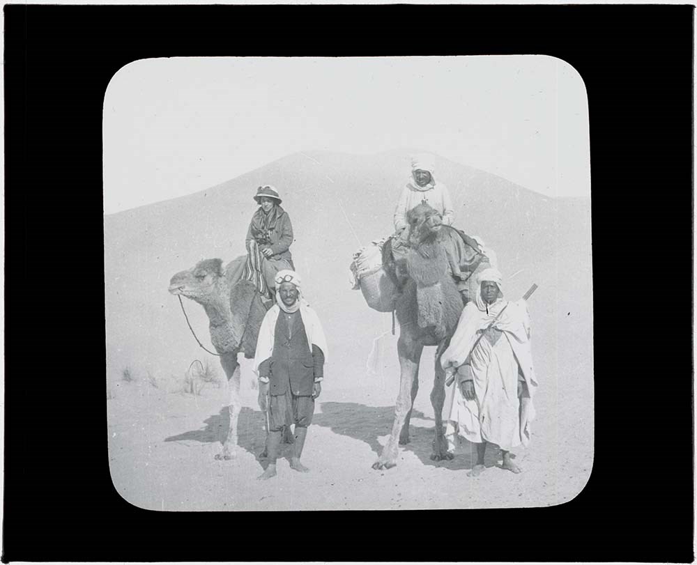
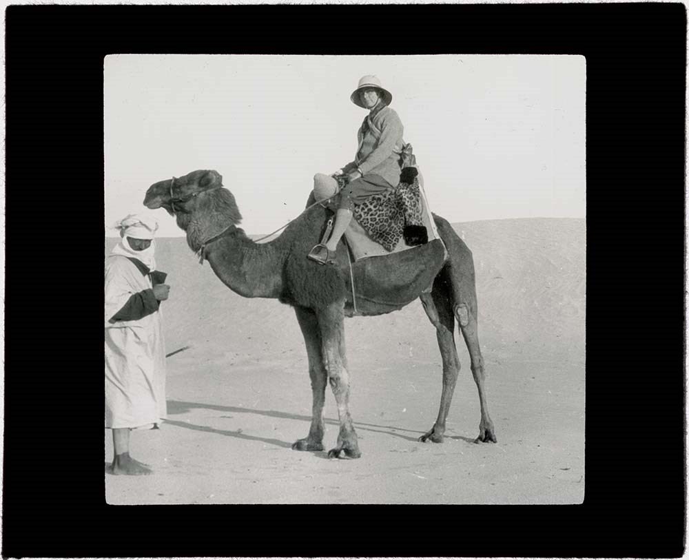
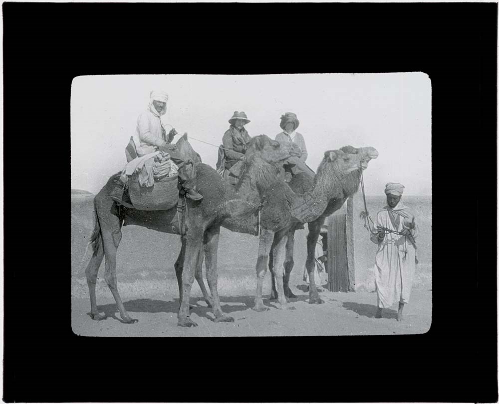
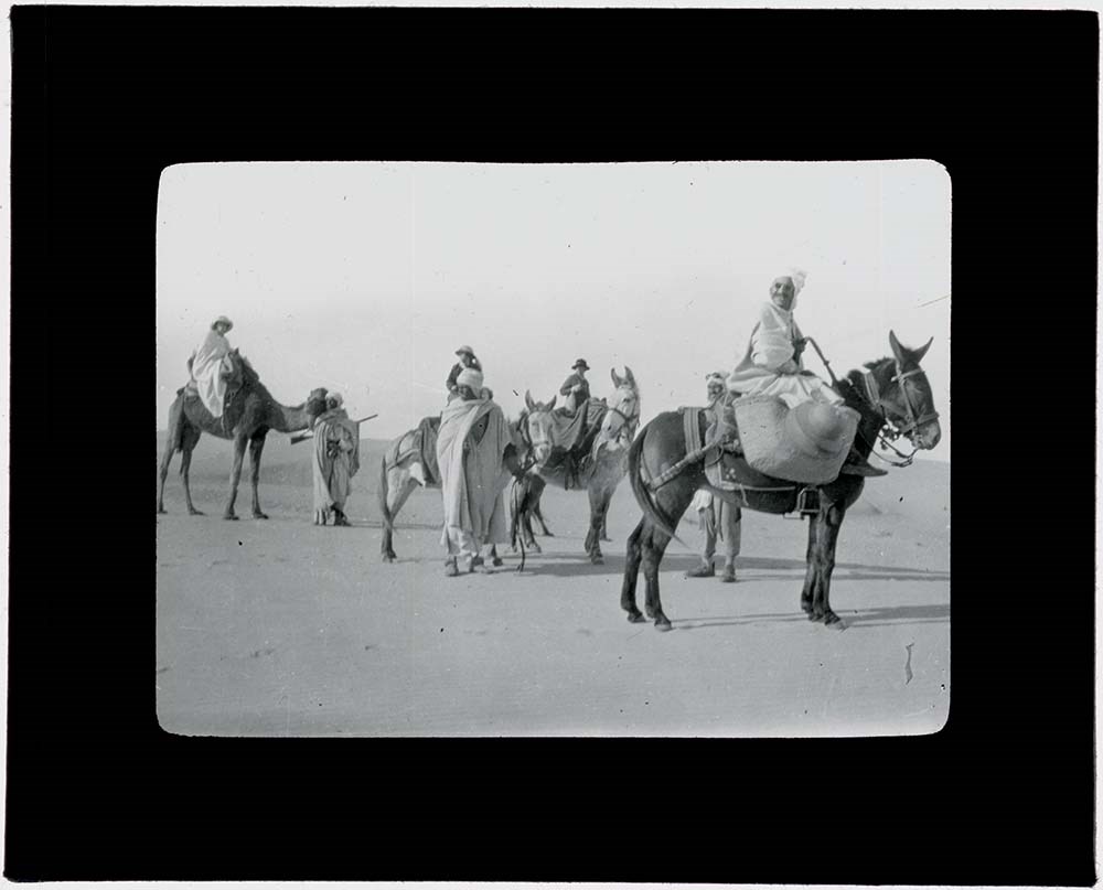
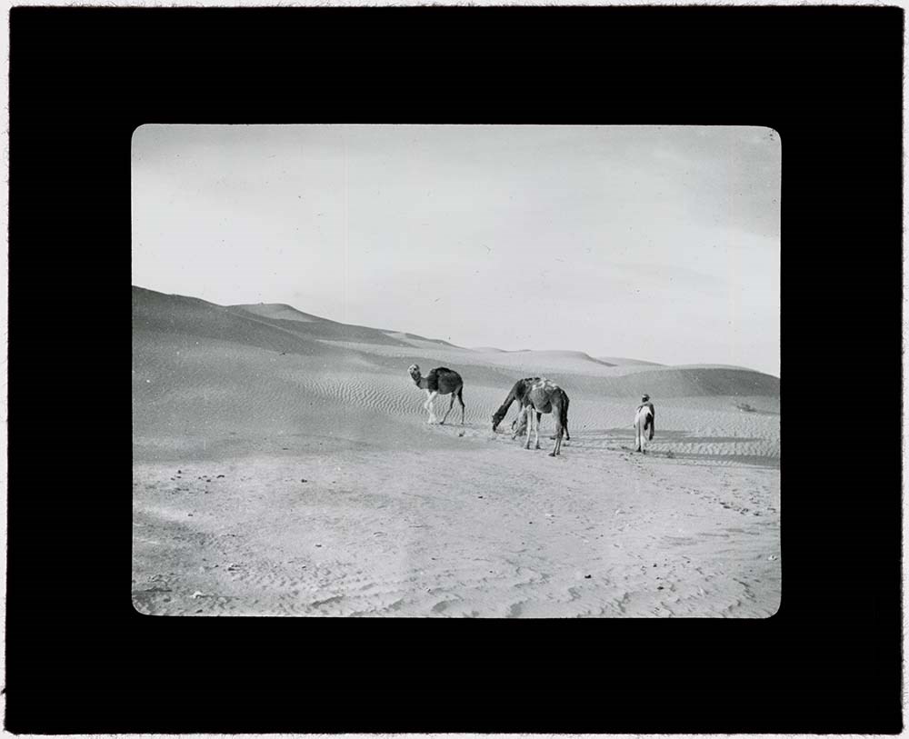
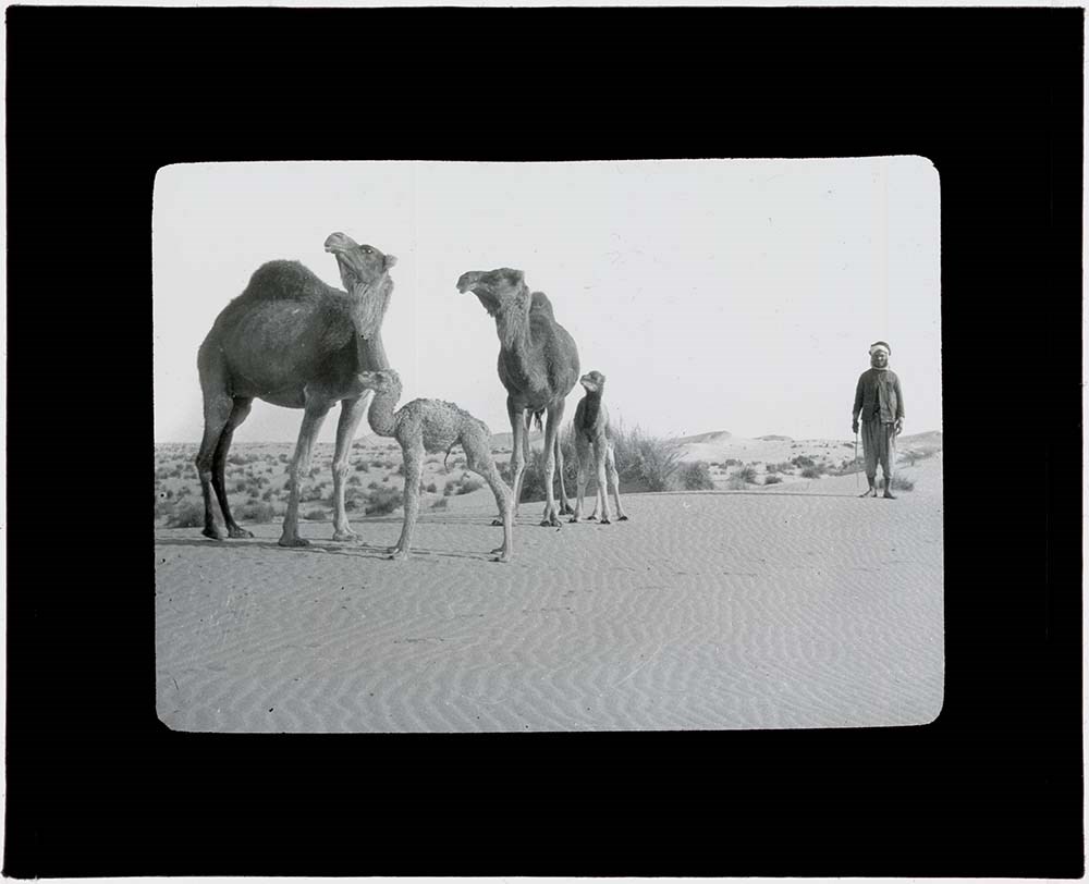
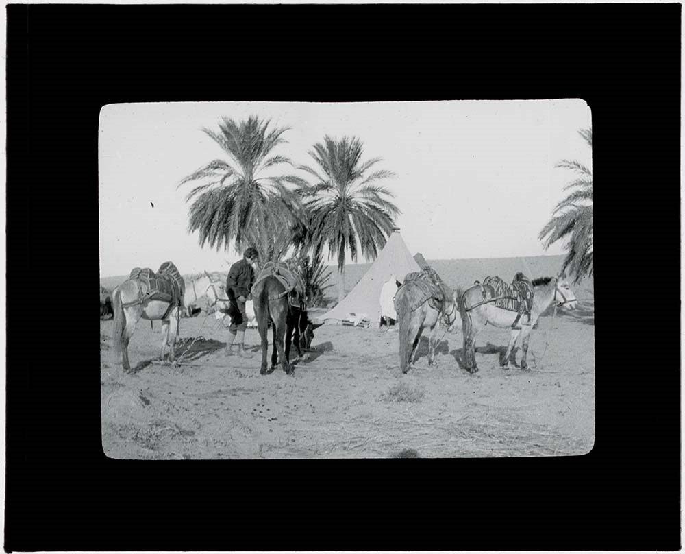
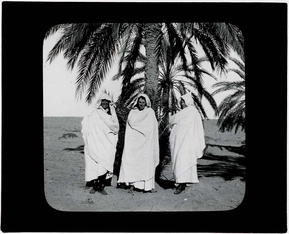
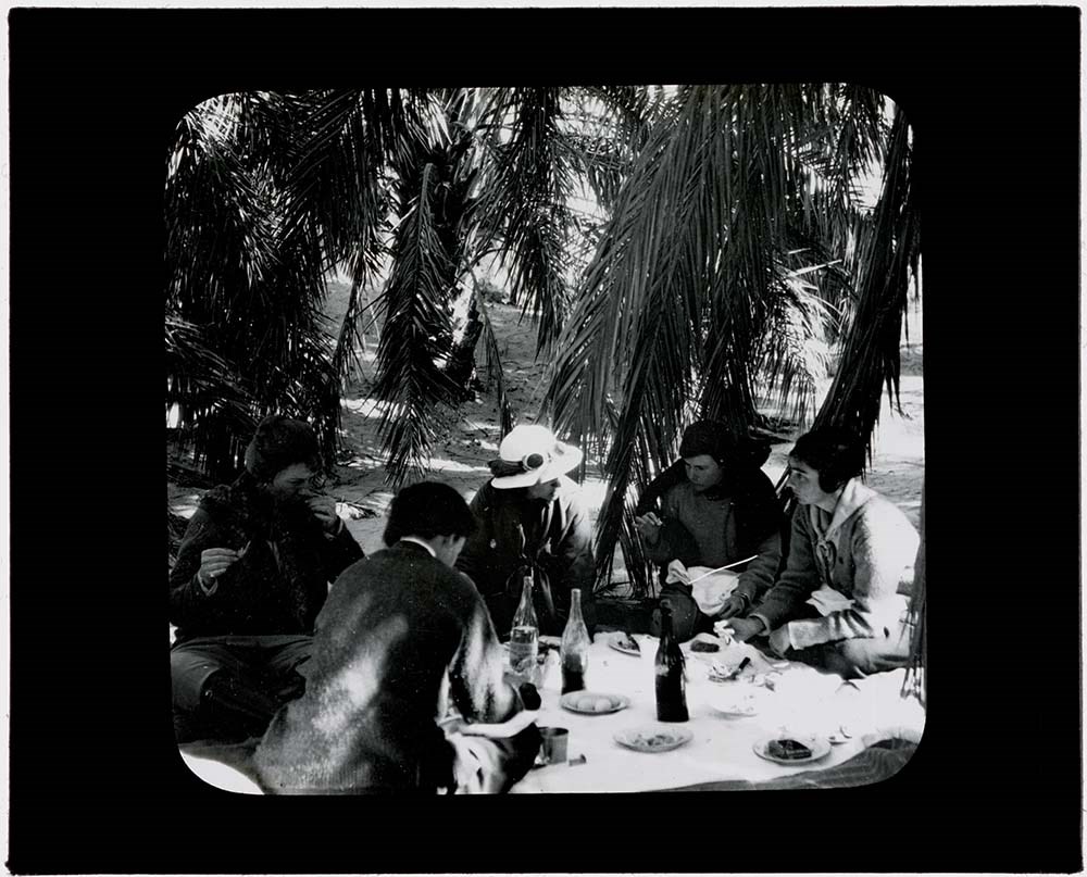
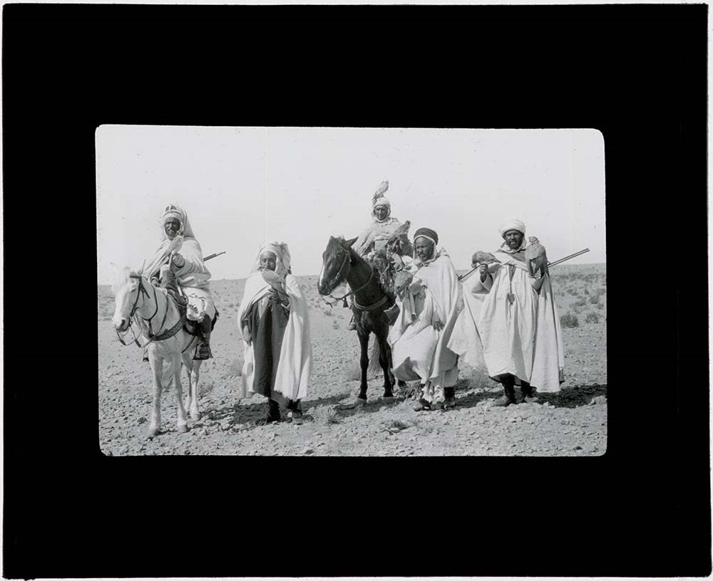
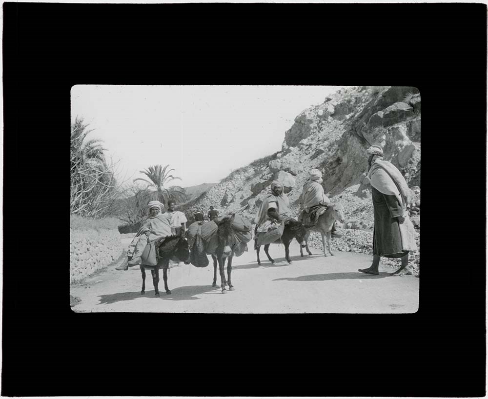
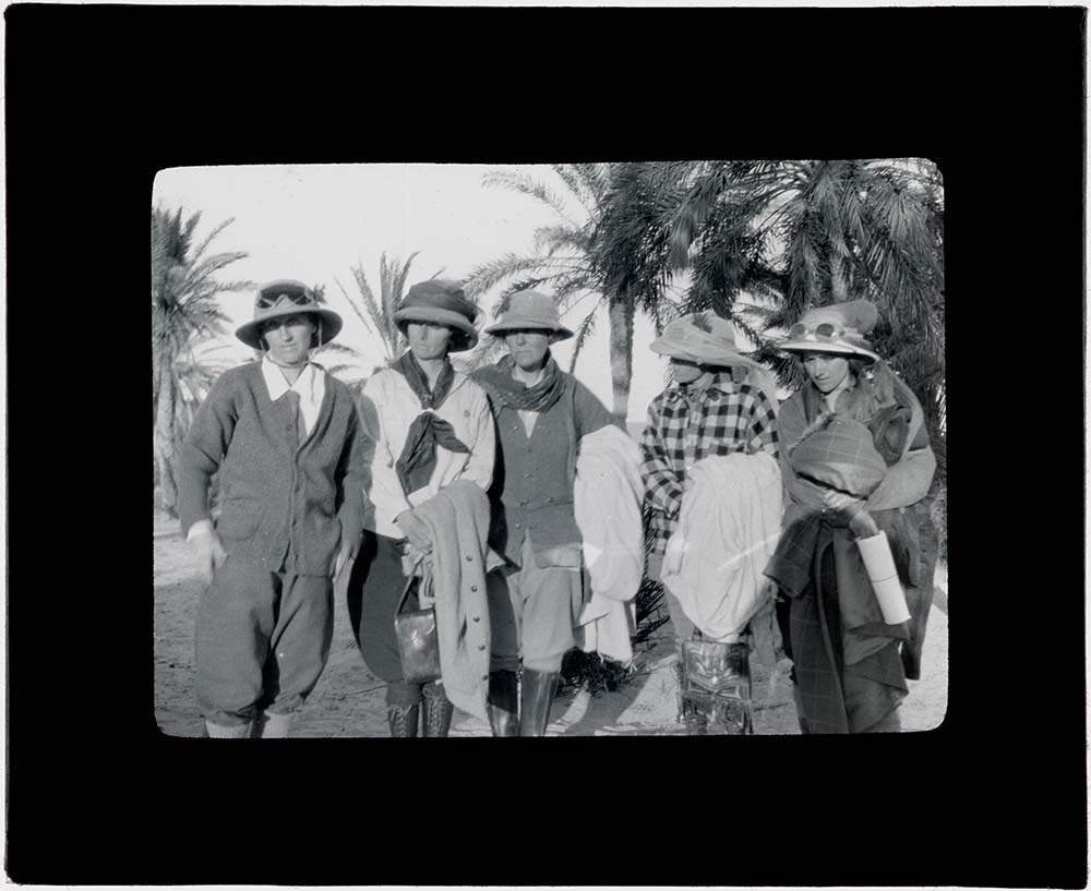
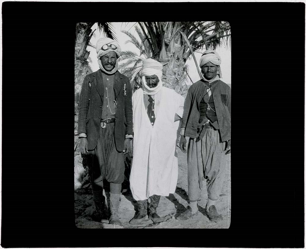
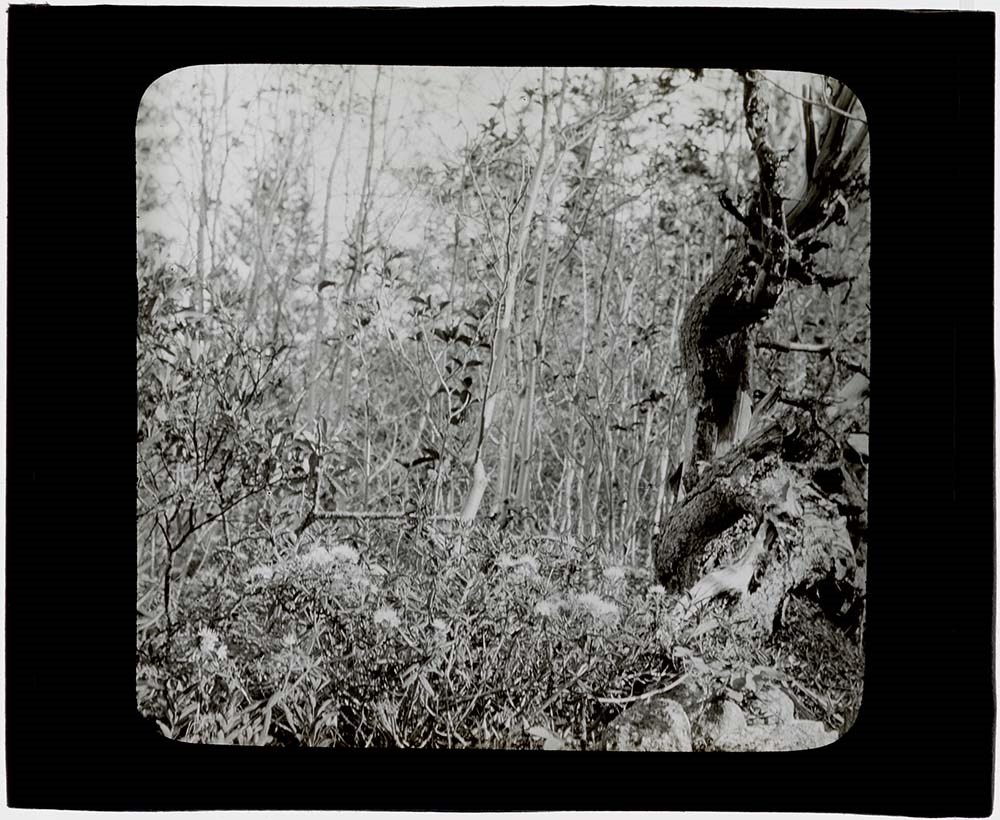
- File consists of lantern slides pertaining to the 1924 trip to Northern Algeria, Tunisia, the Sahara, Sicily and Naples led by Caroline Hinman. The contents of the slides depict desert and oasis scenes, with pack camel trains and tent camps, all taking place during a camping trip in northern Algeri…
- Date Range
- 1926
- Reference Code
- V282 / III / B / PS - 1 to PS - 52
- Description Level
- 5 / File
- GMD
- Transparency
- Lantern slide
52 images
1 Electronic Resource
- Part Of
- Caroline Hinman fonds
- Description Level
- 5 / File
- Fonds Number
- M236 / V282
- Series
- V282 / III: Photographs
- Sous-Fonds
- V282
- Sub-Series
- V282 / III / B: Transparencies
- Accession Number
- 1316, 1933
- Reference Code
- V282 / III / B / PS - 1 to PS - 52
- Date Range
- 1926
- Physical Description
- 52 photographs : b&w slides ; 10.2 x 8.2 cm
- History / Biographical
- The 52 photographs depict a pack camel camping trip in Algeria during the Eighth Trip "Off the Beaten Track" led by Caroline Hinman in 1924. Caroline Hinman, of New Jersey, organized and led tours to various European destinations during winter months and Canadian Rockies trips in the summers almost every year from the mid-1910s until the 1960s. In the years immediately following World War I Hinman wanted to do a camping trip in the Sahara Desert and, with the help of a French outfitter based in the area, she was able to put together a 3-month tour that would include such an excursion. It is not clear how many people partook in the entire tour, but it is known that the camping trip through the desert was optional and was attended by all women. The campers, 6 ladies with Hinman, were guided by locals from the town of Touggourt eastward to Tozeur from February 1-10. They were accompanied by guides, outfitters, cooks, camels, and donkeys. For a full description see the attached pdf of the trip advertisement.
- Scope & Content
- File consists of lantern slides pertaining to the 1924 trip to Northern Algeria, Tunisia, the Sahara, Sicily and Naples led by Caroline Hinman. The contents of the slides depict desert and oasis scenes, with pack camel trains and tent camps, all taking place during a camping trip in northern Algeria. The slides appear to be celluloid transparencies fixed between the panes of glass; lack of maker's marks on the transparencies indicates the images may have been developed onto a sheet and then individually cut out to form the slides.
- Name Access
- Hinman, Caroline
- Subject Access
- Travel
- Scenery
- Desert
- International travel
- Travel and Exploration
- Geographic Access
- Algeria
- Africa
- Language
- N/A
- Conservation
- All slides cleaned prior to scanning
- Biographical Source Notes
- M263 / 3 - Northern Algeria, Tunisia, the Sahara, Sicily and Naples brochure
- M236 / 4 - "On Horseback and Camel-Hump," by Caroline Avis, The Woman Citizen, December 13, 1924
- Title Source
- Title based on contents of file
- Processing Status
- Processed
Electronic Resources
Images


This material is presented as originally created; it may contain outdated cultural descriptions and
potentially offensive content.
Read more.
- Part Of
- Ben Gadd fonds
- Scope & Content
- Sub-sub-series consists of ca.50 maps of various regions in Western Canada and Alaska which were collected by Ben Gadd. Maps are arranged according to associated highways which the mapped regions depict.
- Date Range
- [ca.1970-2005]
- Reference Code
- M590 / I / A / iv
- Description Level
- 4.1 / Sub-sub-series
- GMD
- Map
- Part Of
- Ben Gadd fonds
- Description Level
- 4.1 / Sub-sub-series
- Fonds Number
- M590
- V810
- S61
- Series
- M590 / I : Personal records
- Sous-Fonds
- M590
- Sub-Series
- M590 / I / A / iv : Travel guides and maps : Highway maps
- Accession Number
- 2021.20
- Reference Code
- M590 / I / A / iv
- GMD
- Map
- Date Range
- [ca.1970-2005]
- Physical Description
- ca.50 maps -- 4 paper scans of maps
- Scope & Content
- Sub-sub-series consists of ca.50 maps of various regions in Western Canada and Alaska which were collected by Ben Gadd. Maps are arranged according to associated highways which the mapped regions depict.
- Notes
- Regions included in file: Highway 3 Highway 6 Highway 11 Highway 16 Highway 22 & 40 Highway 93 [To Jasper] Highway 93 [To Radium] Highway 97 [Pine Pass] Highway 97 [Alaska Highway]
- Name Access
- Gadd, Ben
- Geographic Access
- Canada
- Alberta
- British Columbia
- Canadian Rocky Mountains
- Alaska
- Reproduction Restrictions
- Restrictions may apply
- Language
- English
- Title Source
- Title based on contents of file
- Processing Status
- Processed
This material is presented as originally created; it may contain outdated cultural descriptions and
potentially offensive content.
Read more.
Jasper Trails Project - map publishers
https://archives.whyte.org/en/permalink/descriptions56241
- Part Of
- Ben Gadd fonds
- Scope & Content
- File consists of correspondence sent between Ben Gadd and various map publishing companies, and samples of previously published maps and travel guides. Correspondence pertains to the production of trail maps which were designed by the Friends of Jasper National Park and Parks Canada as part of the …
- Date Range
- 1994
- 1996-1997
- Reference Code
- M590 / III / D / 114
- Description Level
- 5 / File
- GMD
- Textual record
- Published record
- Map
- Part Of
- Ben Gadd fonds
- Description Level
- 5 / File
- Fonds Number
- M590
- V810
- S61
- Series
- M590 / III : Published records
- Sous-Fonds
- M590
- Sub-Series
- M590 / III / D : Other contracts and projects
- Accession Number
- 2021.20
- Reference Code
- M590 / III / D / 114
- Date Range
- 1994
- 1996-1997
- Physical Description
- 0.5 cm of textual records
- Scope & Content
- File consists of correspondence sent between Ben Gadd and various map publishing companies, and samples of previously published maps and travel guides. Correspondence pertains to the production of trail maps which were designed by the Friends of Jasper National Park and Parks Canada as part of the Jasper Trails Project.
- Name Access
- Gadd, Ben
- Subject Access
- Organization
- Trails
- Map
- Environment
- Geography
- Parks Canada
- Government
- Tourist information
- Publication
- Businesses
- Geographic Access
- Canada
- Alberta
- Jasper
- Jasper National Park
- Reproduction Restrictions
- Restrictions may apply
- Language
- English
- Category
- Environment
- Government
- Title Source
- Title based on contents of file
- Processing Status
- Processed
This material is presented as originally created; it may contain outdated cultural descriptions and
potentially offensive content.
Read more.
Jasper Trails Project - printed trail maps
https://archives.whyte.org/en/permalink/descriptions56152
- Part Of
- Ben Gadd fonds
- Scope & Content
- File consists of printed drafts of trail maps depicting regions near Pyramid Bench, Maligne Canyon, Wabasso Lake and Miette River; and quotes from three printing companies in Alberta. Materials pertain to the updating of trail signage and interpretive information through the Jasper Trails Project.
- Date Range
- 1997-1998
- Reference Code
- M590 / III / D / 106
- Description Level
- 5 / File
- GMD
- Textual record
- Map
- Part Of
- Ben Gadd fonds
- Description Level
- 5 / File
- Fonds Number
- M590
- V810
- S61
- Series
- M590 / III : Published records
- Sous-Fonds
- M590
- Sub-Series
- M590 / III / D : Other contracts and projects
- Accession Number
- 2021.20
- Reference Code
- M590 / III / D / 106
- GMD
- Textual record
- Map
- Date Range
- 1997-1998
- Physical Description
- 0.2 cm of textual records
- Scope & Content
- File consists of printed drafts of trail maps depicting regions near Pyramid Bench, Maligne Canyon, Wabasso Lake and Miette River; and quotes from three printing companies in Alberta. Materials pertain to the updating of trail signage and interpretive information through the Jasper Trails Project.
- Subject Access
- Organization
- Trails
- Research
- Map
- Environment
- Hiking
- Recreation
- Geography
- Parks Canada
- Government
- Geographic Access
- Canada
- Alberta
- Jasper
- Jasper National Park
- Edmonton
- Reproduction Restrictions
- Restrictions may apply
- Language
- English
- Title Source
- Title based on contents of file
- Processing Status
- Processed
This material is presented as originally created; it may contain outdated cultural descriptions and
potentially offensive content.
Read more.
Jasper Trails Project - sign location maps
https://archives.whyte.org/en/permalink/descriptions56154
- Part Of
- Ben Gadd fonds
- Scope & Content
- File consists of maps showing the locations of interpretive signs which were updated and installed as part of the Jasper Trails Project. File includes film positive copies of maps, and related notes and correspondence.
- Date Range
- 1995
- 1997
- Reference Code
- M590 / III / D / 107
- Description Level
- 5 / File
- GMD
- Textual record
- Map
- Part Of
- Ben Gadd fonds
- Description Level
- 5 / File
- Fonds Number
- M590
- V810
- S61
- Series
- M590 / III : Published records
- Sous-Fonds
- M590
- Sub-Series
- M590 / III / D : Other contracts and projects
- Accession Number
- 2021.20
- Reference Code
- M590 / III / D / 107
- GMD
- Textual record
- Map
- Date Range
- 1995
- 1997
- Physical Description
- 1 cm of textual records
- Scope & Content
- File consists of maps showing the locations of interpretive signs which were updated and installed as part of the Jasper Trails Project. File includes film positive copies of maps, and related notes and correspondence.
- Subject Access
- Organization
- Trails
- Research
- Map
- Environment
- Hiking
- Recreation
- Geography
- Parks Canada
- Government
- Geographic Access
- Canada
- Alberta
- Jasper
- Jasper National Park
- Reproduction Restrictions
- Restrictions may apply
- Language
- English
- Title Source
- Title based on contents of file
- Processing Status
- Processed
This material is presented as originally created; it may contain outdated cultural descriptions and
potentially offensive content.
Read more.
Maligne Lake fact sheet
https://archives.whyte.org/en/permalink/descriptions56072
- Part Of
- Ben Gadd fonds
- Scope & Content
- File consists of documents pertaining to a fact sheet about Maligne Lake which Ben Gadd produced for Parks Canada while working as a Seasonal Naturalist in Jasper. File includes cropped sections of a map depicting Maligne Lake and surrounding areas; research and planning notes written by Ben; a pro…
- Date Range
- [ca.1980-1984]
- Reference Code
- M590 / III / A / 9
- Description Level
- 5 / File
- GMD
- Textual record
- Map
- Part Of
- Ben Gadd fonds
- Description Level
- 5 / File
- Fonds Number
- M590
- V810
- S61
- Series
- M590 / III : Professional records
- Sous-Fonds
- M590
- Sub-Series
- M590 / III / A : Parks Canada records
- Accession Number
- 2021.20
- Reference Code
- M590 / III / A / 9
- GMD
- Textual record
- Map
- Responsibility
- Produced by Ben Gadd
- Date Range
- [ca.1980-1984]
- Physical Description
- 0.2 cm of textual records
- Scope & Content
- File consists of documents pertaining to a fact sheet about Maligne Lake which Ben Gadd produced for Parks Canada while working as a Seasonal Naturalist in Jasper. File includes cropped sections of a map depicting Maligne Lake and surrounding areas; research and planning notes written by Ben; a prospectus/summary of the project; and a scanned paper copy of film strips depicting images of Maligne Lake.
- Name Access
- Gadd, Ben
- Subject Access
- Parks Canada
- Government
- Environment
- Landscape
- Geography
- Geological formation
- Geology
- Natural history
- Geographic Access
- Canada
- Alberta
- Maligne Lake
- Jasper National Park
- Reproduction Restrictions
- Restrictions may apply
- Language
- English
- Category
- Environment
- Government
- Title Source
- Title based on contents of file
- Processing Status
- Processed
This material is presented as originally created; it may contain outdated cultural descriptions and
potentially offensive content.
Read more.
Maligne Lake tear-off map
https://archives.whyte.org/en/permalink/descriptions56073
- Part Of
- Ben Gadd fonds
- Scope & Content
- File consists of documents pertaining to the creation of a tear-off map of Maligne Lake, which Ben Gadd produced for Parks Canada while working as a Seasonal Naturalist in Jasper. File includes a project proposal, textual drafts, visual layout samples, correspondence, invoices and other related mat…
- Date Range
- [ca.1980-1984]
- Reference Code
- M590 / III / A / 10
- Description Level
- 5 / File
- GMD
- Textual record
- Map
- Part Of
- Ben Gadd fonds
- Description Level
- 5 / File
- Fonds Number
- M590
- V810
- S61
- Series
- M590 / III : Professional records
- Sous-Fonds
- M590
- Sub-Series
- M590 / III / A : Parks Canada records
- Accession Number
- 2021.20
- Reference Code
- M590 / III / A / 10
- GMD
- Textual record
- Map
- Responsibility
- Produced by Ben Gadd
- Date Range
- [ca.1980-1984]
- Physical Description
- 1 cm of textual records
- Scope & Content
- File consists of documents pertaining to the creation of a tear-off map of Maligne Lake, which Ben Gadd produced for Parks Canada while working as a Seasonal Naturalist in Jasper. File includes a project proposal, textual drafts, visual layout samples, correspondence, invoices and other related materials.
- Name Access
- Gadd, Ben
- Subject Access
- Parks Canada
- Government
- Environment
- Geography
- Geology
- Natural history
- Map
- Geographic Access
- Canada
- Alberta
- Maligne Lake
- Jasper National Park
- Reproduction Restrictions
- Restrictions may apply
- Language
- English
- Category
- Environment
- Government
- Title Source
- Title based on contents of file
- Processing Status
- Processed
This material is presented as originally created; it may contain outdated cultural descriptions and
potentially offensive content.
Read more.
Operation Bow-Athabasca exhibit
https://archives.whyte.org/en/permalink/descriptions56253
- Part Of
- Ben Gadd fonds
- Scope & Content
- File consists of correspondence, maps and other documents pertaining to the Operation Bow-Athabasca exhibit, which was displayed at the Canmore Museum and Geoscience Centre in 2012. File includes a programme for the opening of the exhibition; geological maps and other research materials; a quote fo…
- Date Range
- 1973
- 2010-2012
- Reference Code
- M590 / III / D / 117
- Description Level
- 5 / File
- GMD
- Textual record
- Published record
- Map
- Part Of
- Ben Gadd fonds
- Description Level
- 5 / File
- Fonds Number
- M590
- V810
- S61
- Series
- M590 / III : Professional records
- Sous-Fonds
- M590
- Sub-Series
- M590 / III / D : Other contracts and projects
- Accession Number
- 2021.20
- Reference Code
- M590 / III / D / 117
- Date Range
- 1973
- 2010-2012
- Physical Description
- 1.5 cm of textual records -- 4 maps
- Scope & Content
- File consists of correspondence, maps and other documents pertaining to the Operation Bow-Athabasca exhibit, which was displayed at the Canmore Museum and Geoscience Centre in 2012. File includes a programme for the opening of the exhibition; geological maps and other research materials; a quote for the production of display signs for the exhibit; Ben Gadd's personal notes pertaining to the exhibit; and other related materials.
- Name Access
- Gadd, Ben
- Subject Access
- Natural history
- Geology
- Environment
- Research
- Public events
- Community events
- Publication
- Museums
- Geographic Access
- Canada
- Alberta
- Canmore
- Reproduction Restrictions
- Restrictions may apply
- Language
- English
- Category
- Environment
- Title Source
- Title based on contents of file
- Processing Status
- Processed
This material is presented as originally created; it may contain outdated cultural descriptions and
potentially offensive content.
Read more.
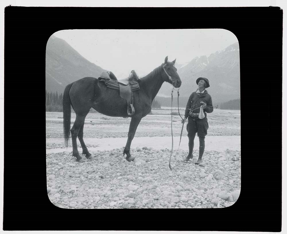
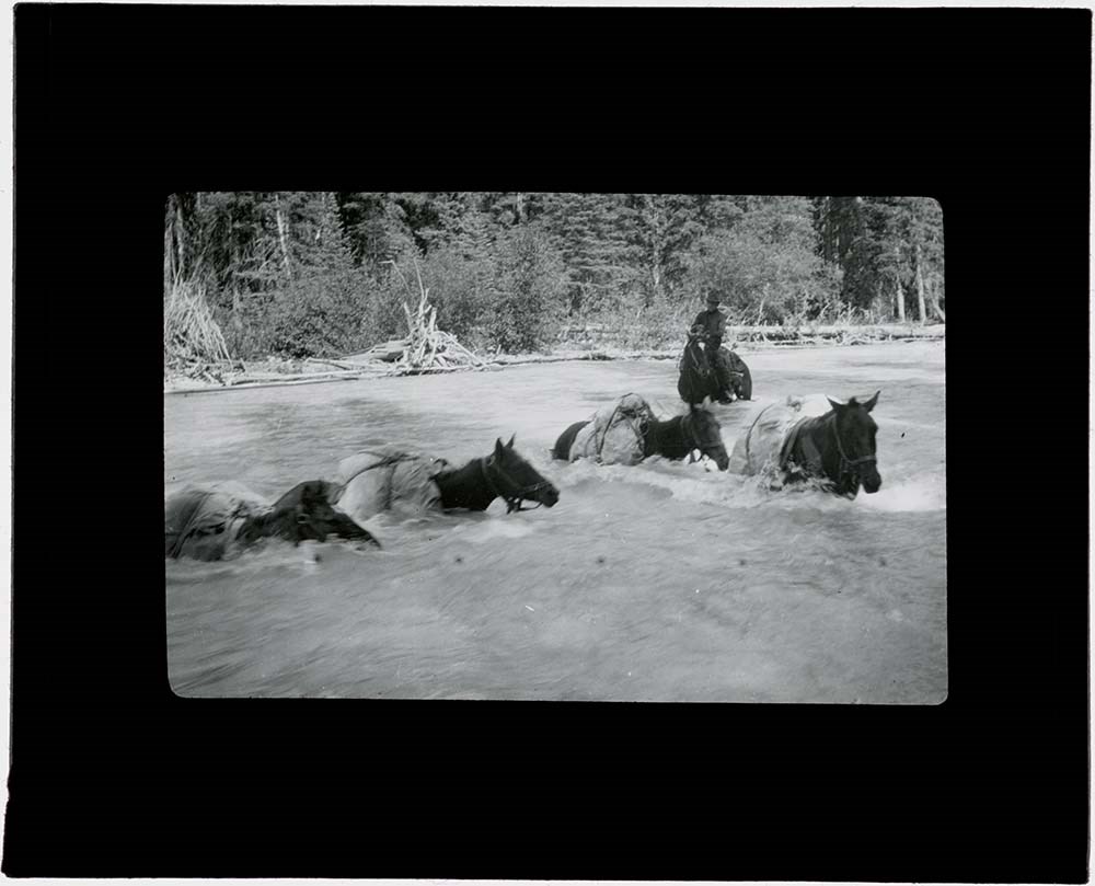
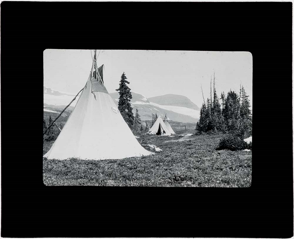
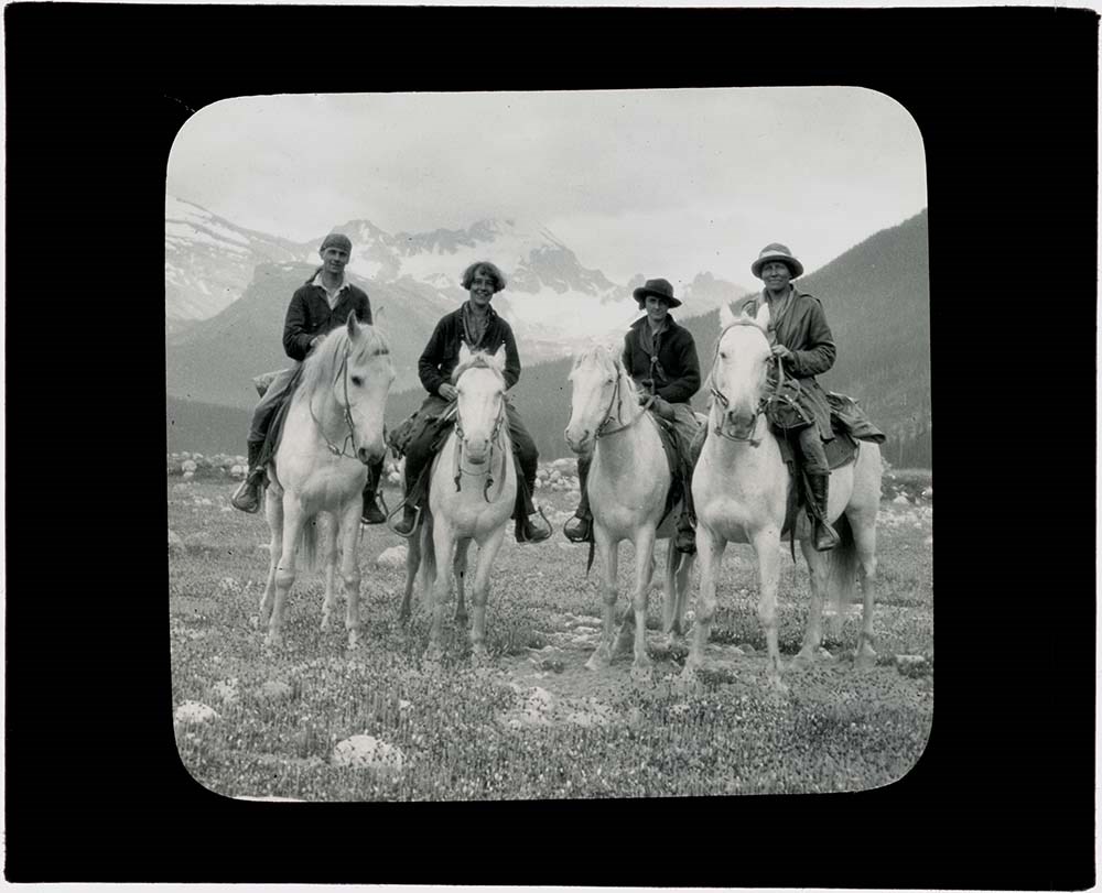
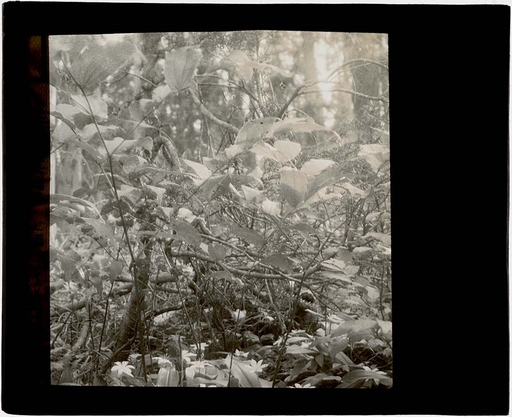
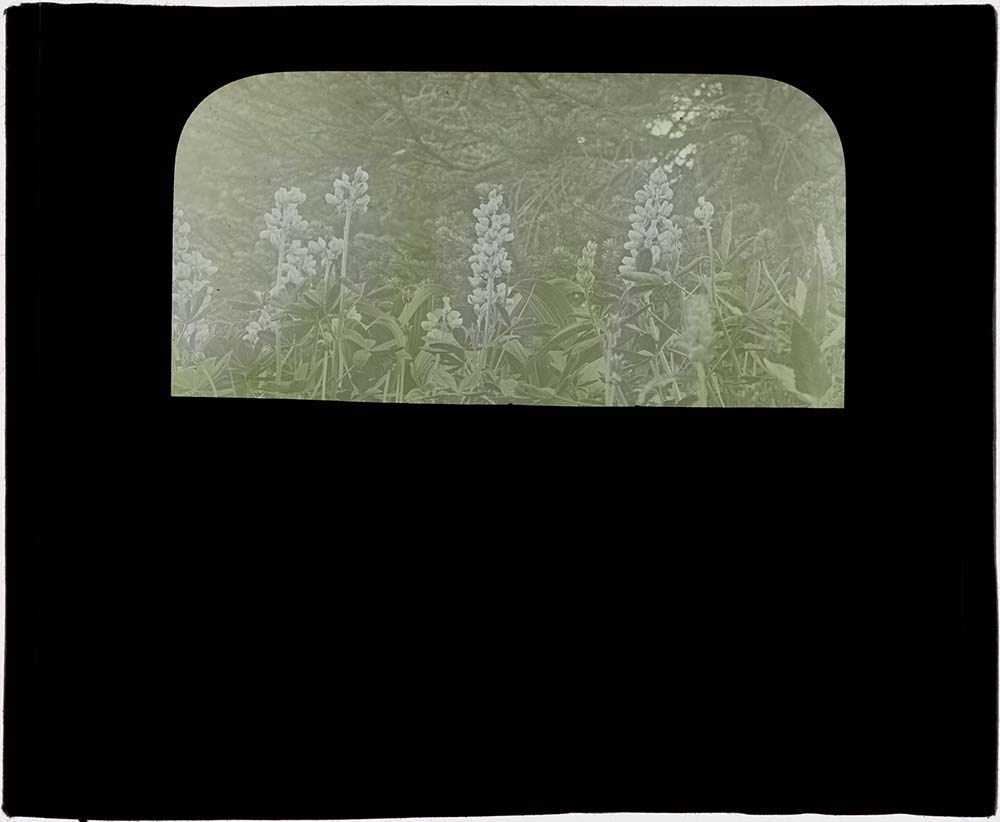
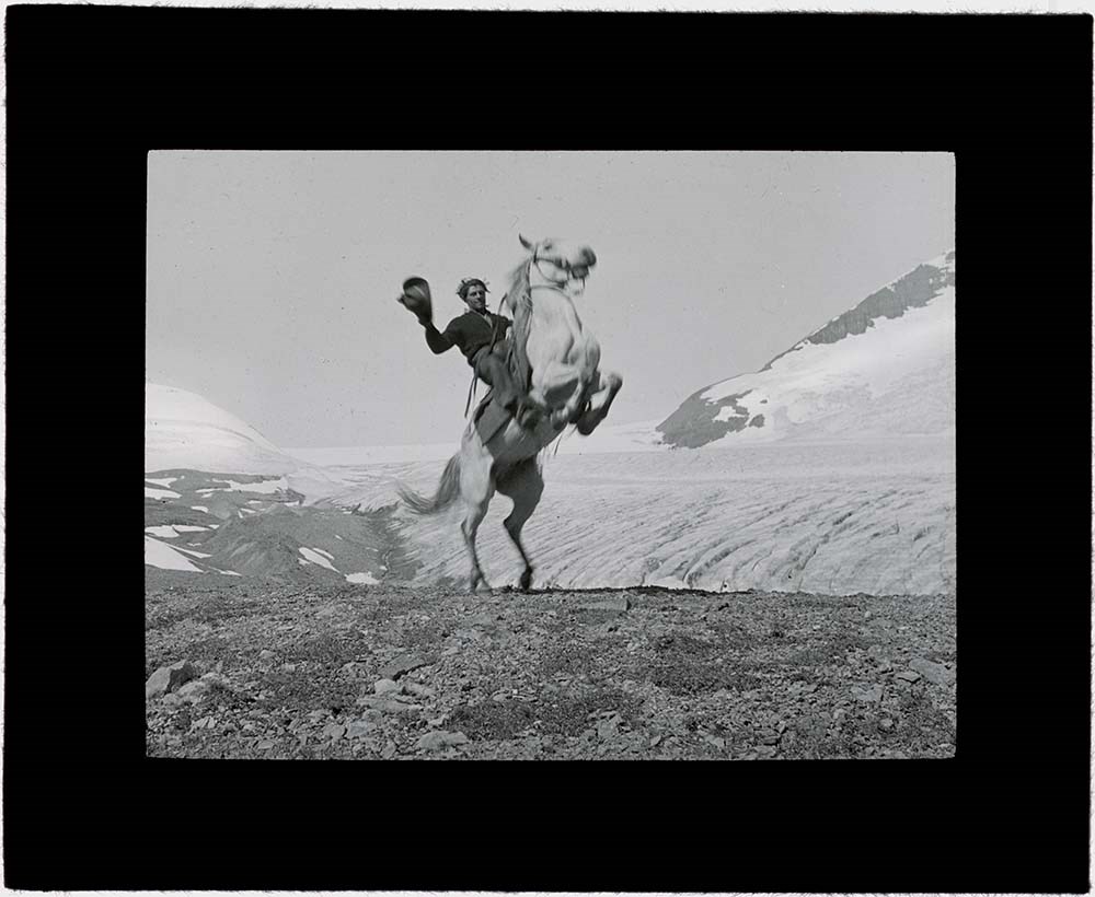
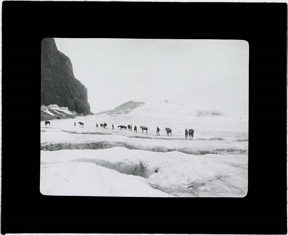
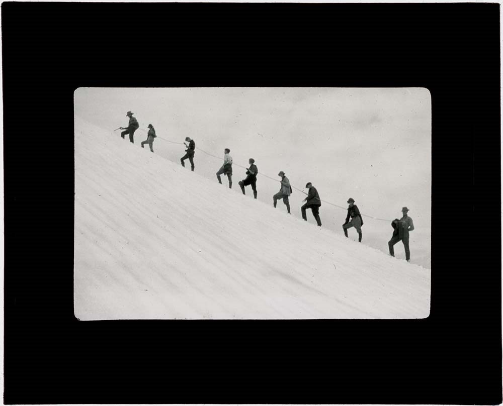
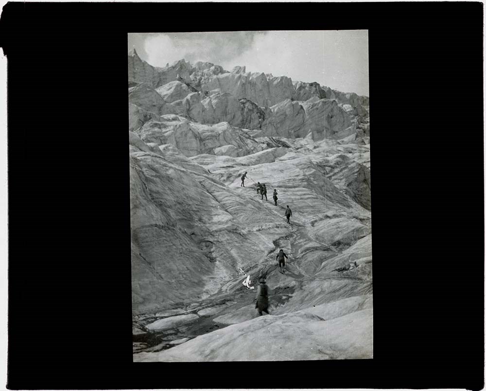
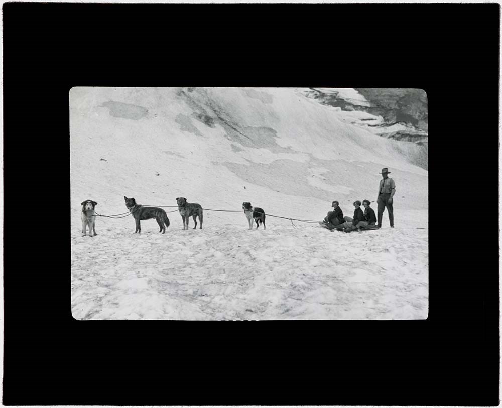
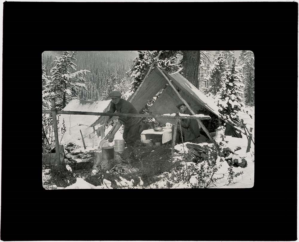
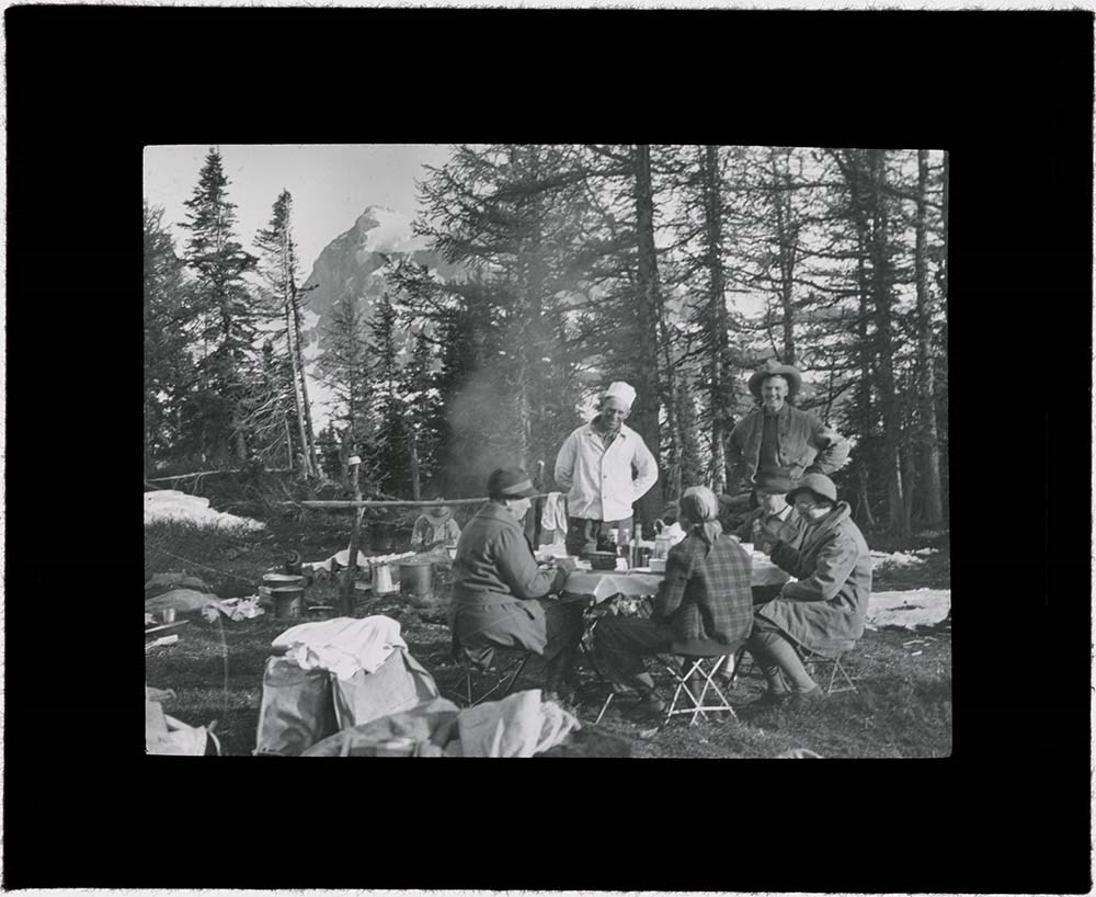
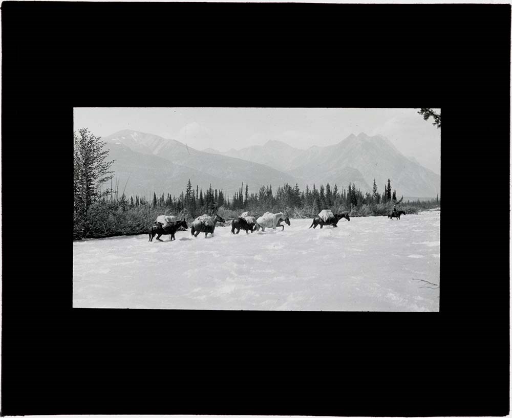
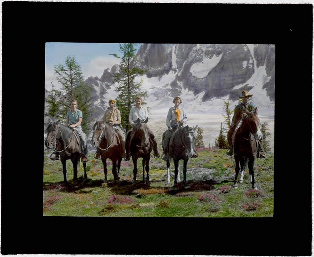
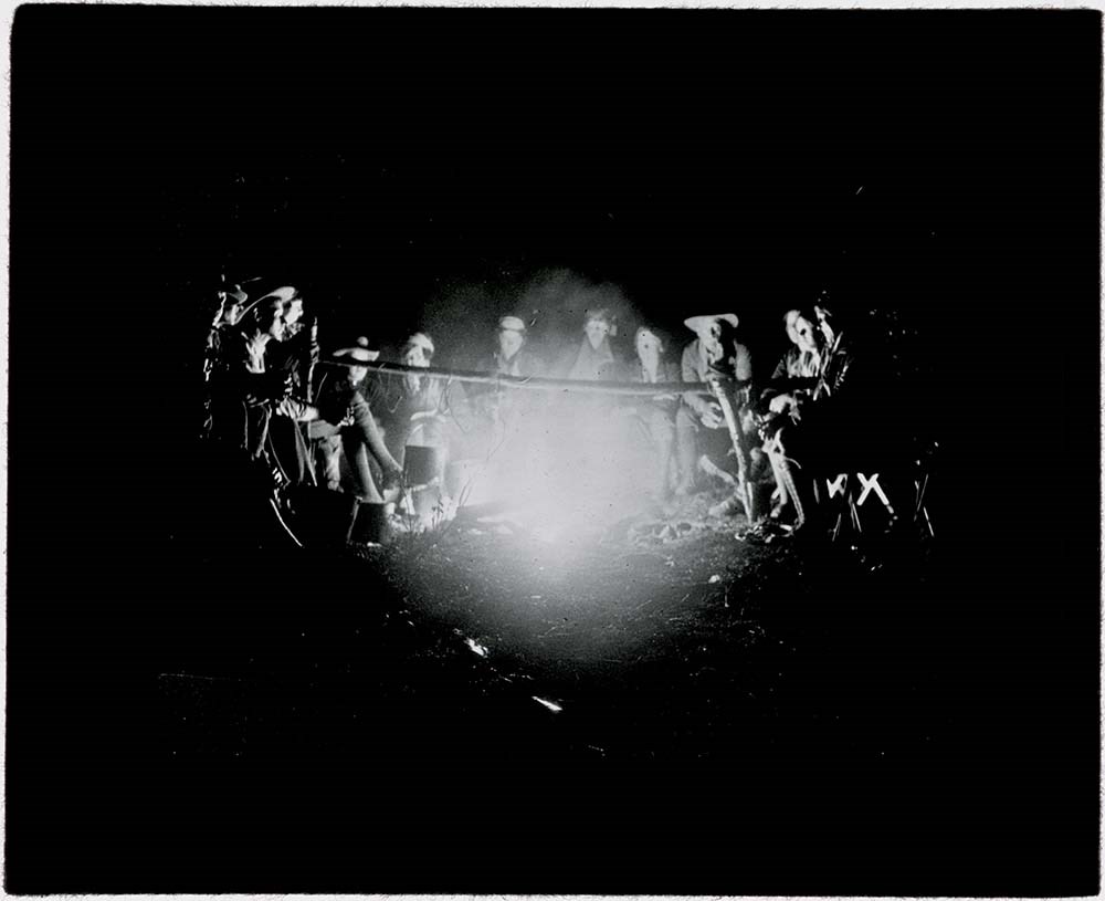
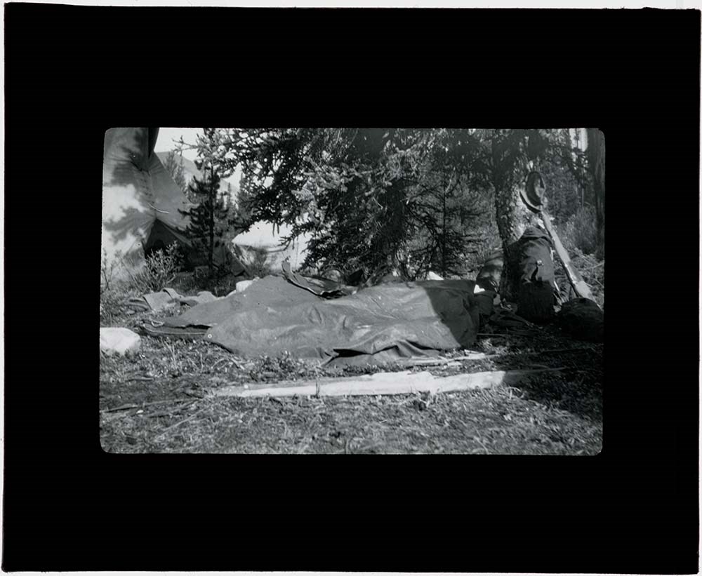
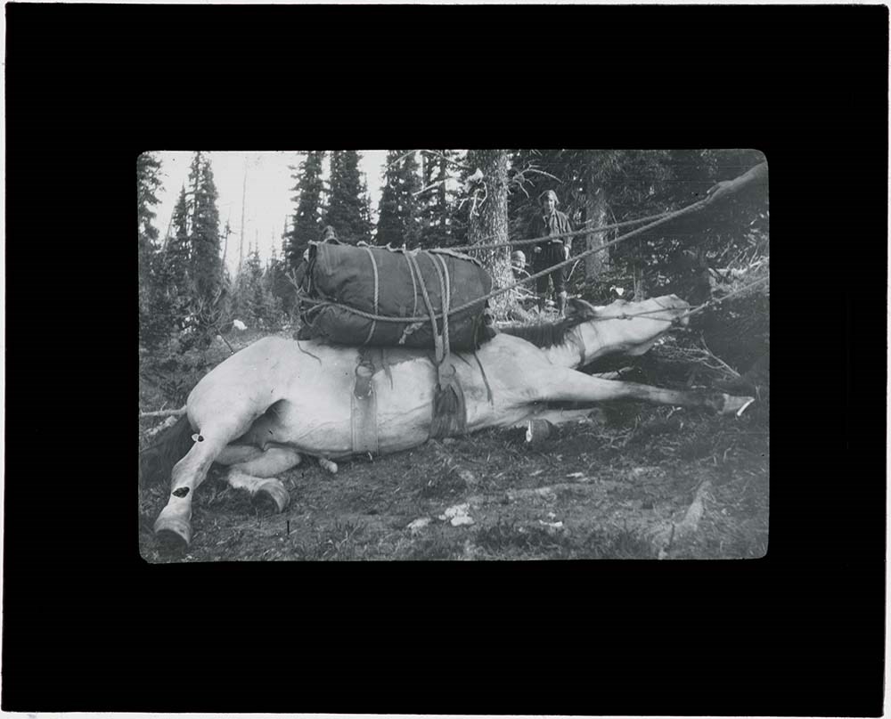
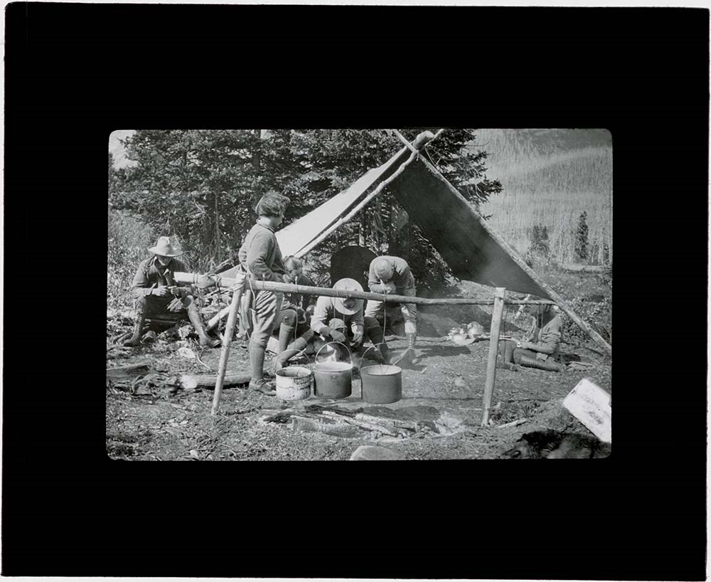
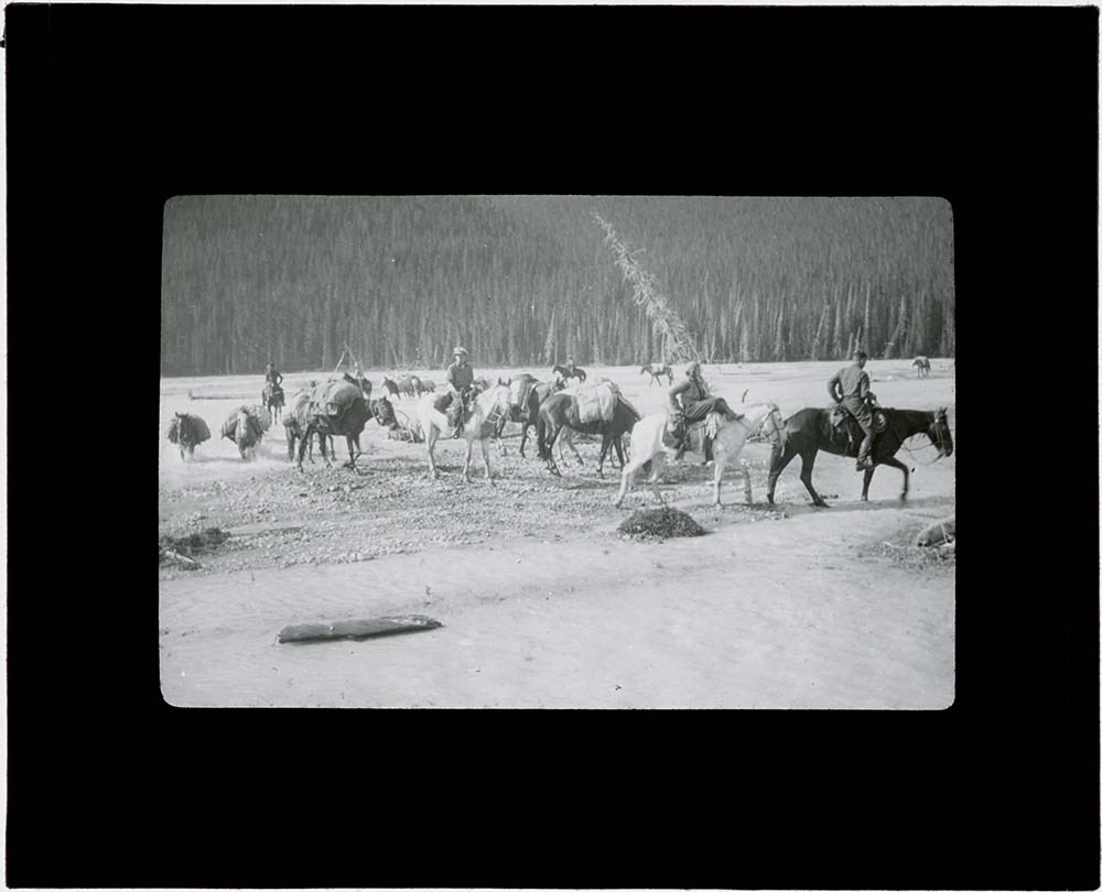
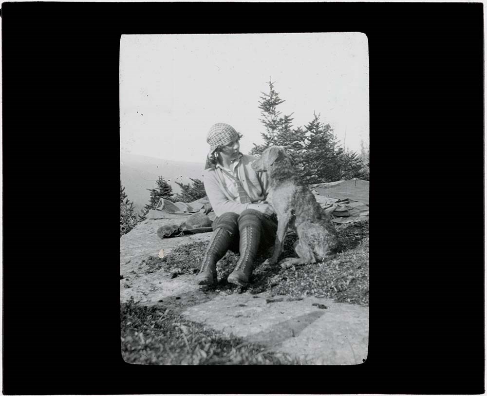
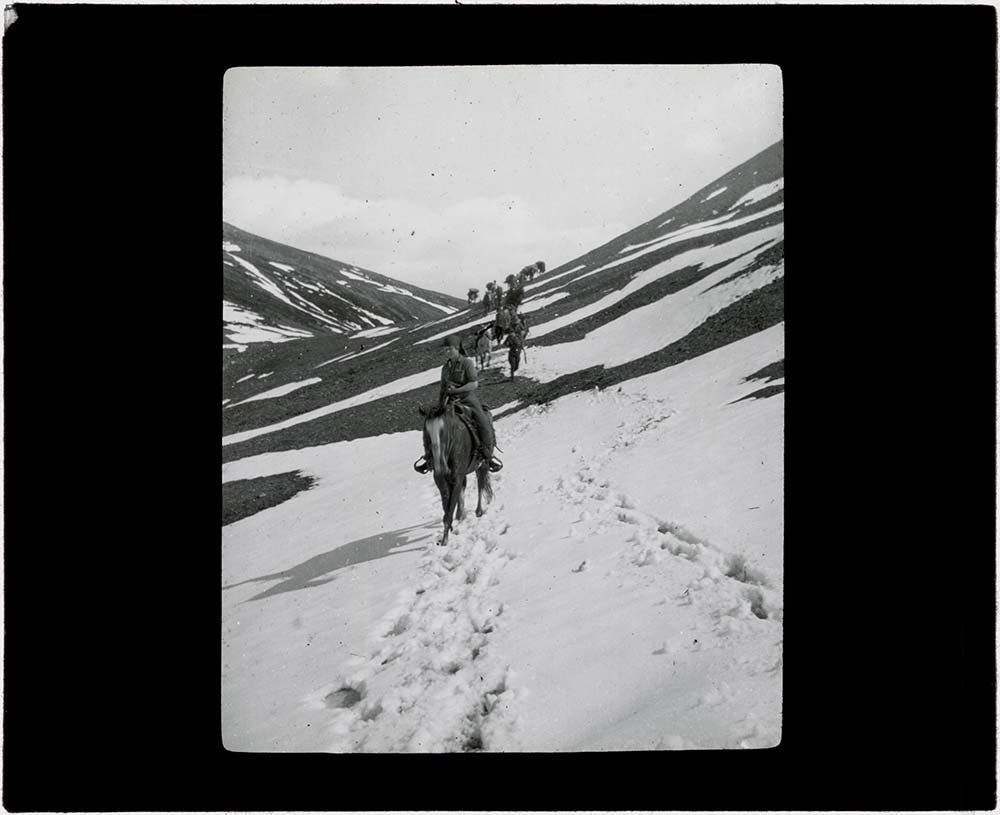
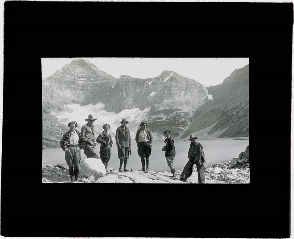
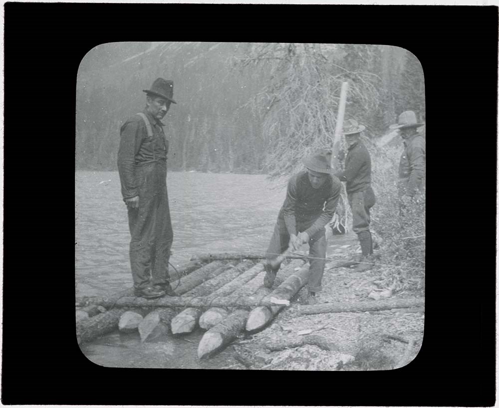
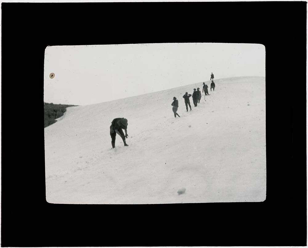
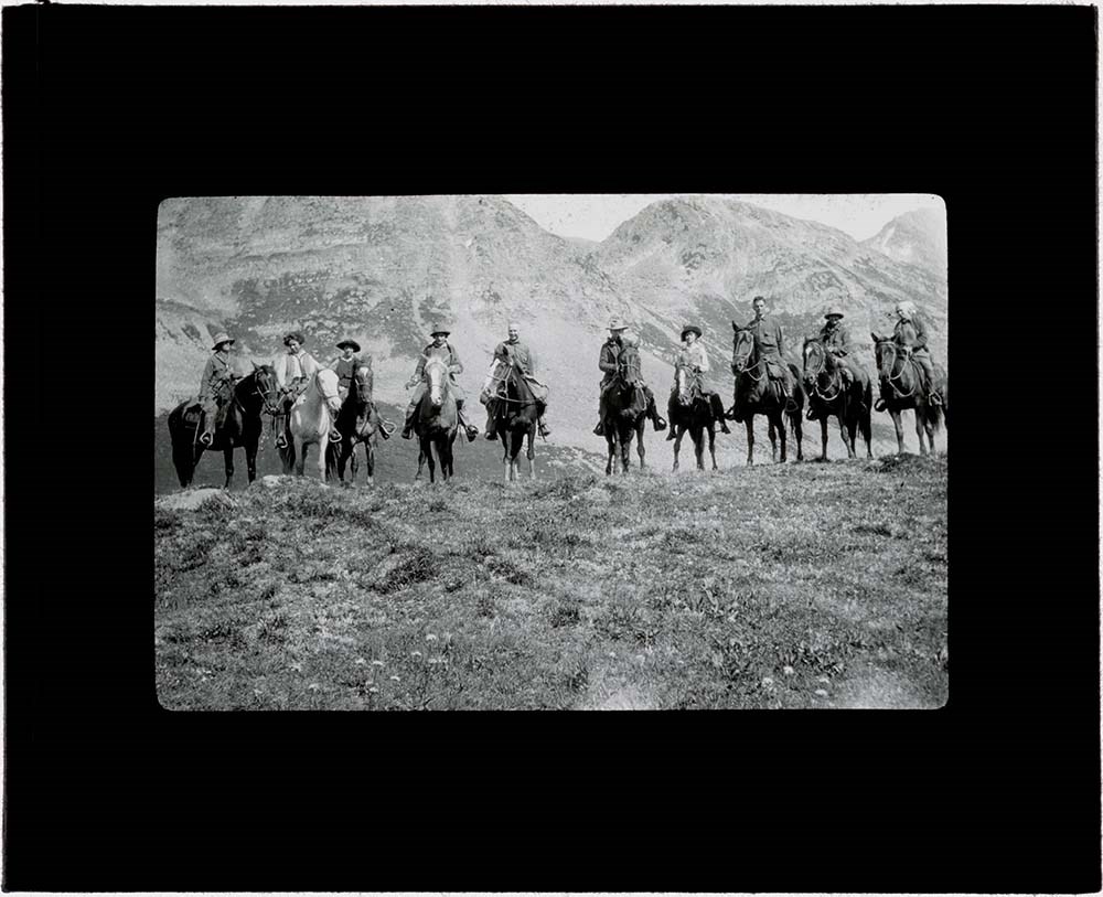
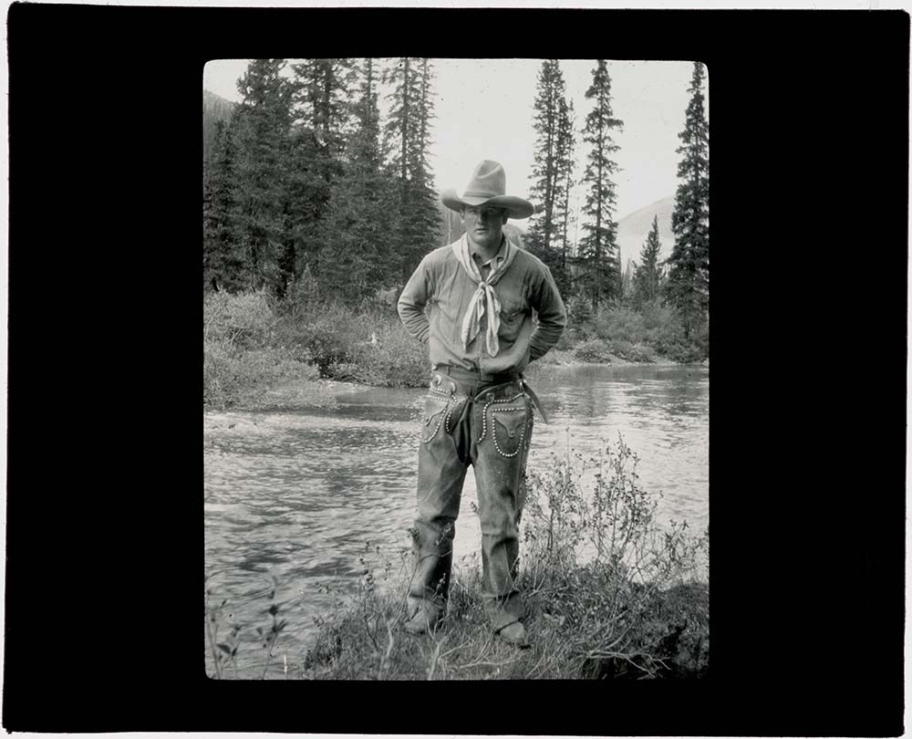
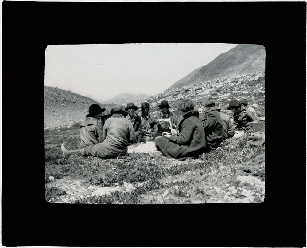
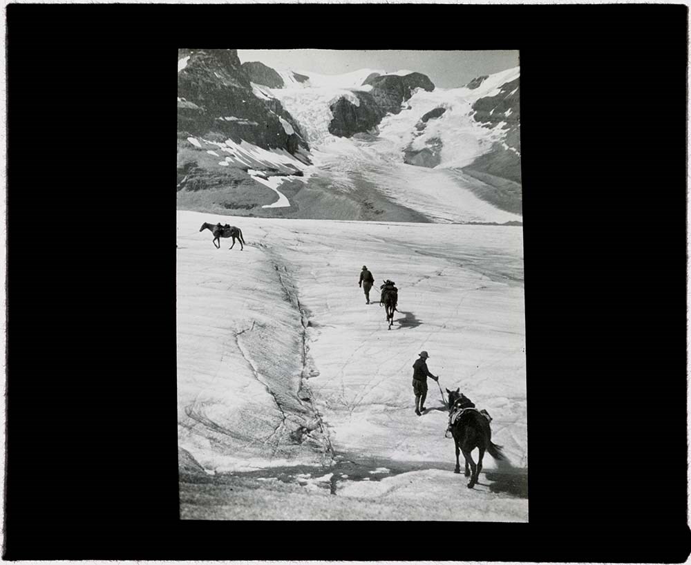
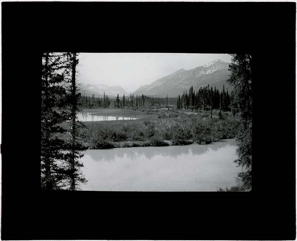
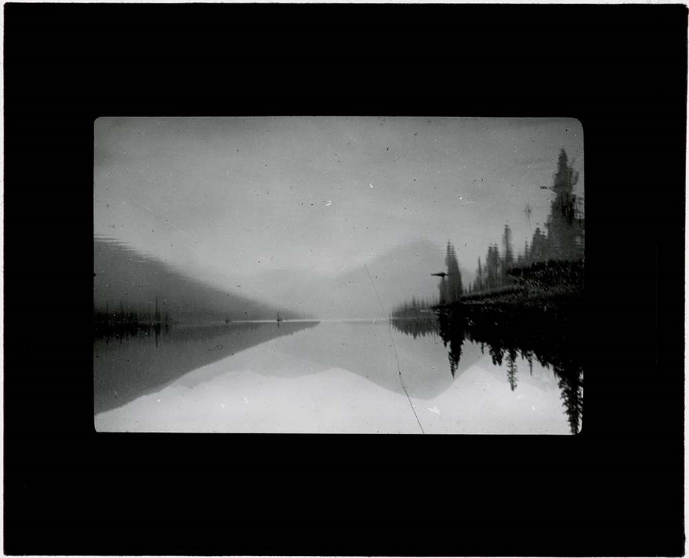
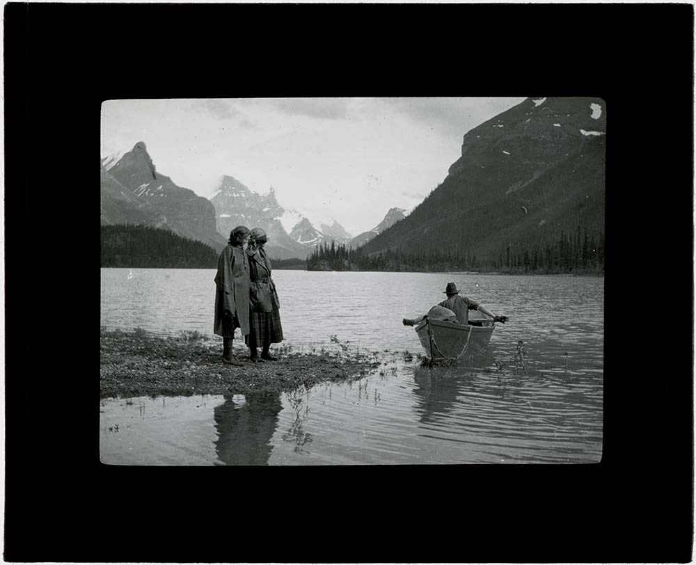
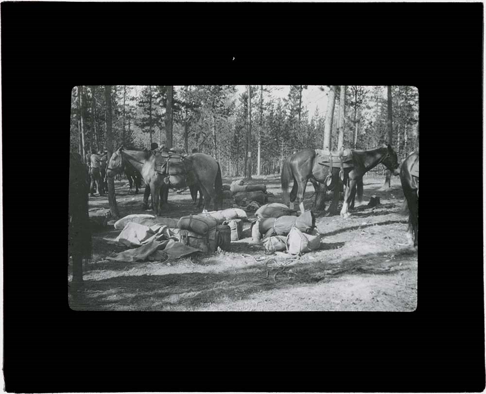
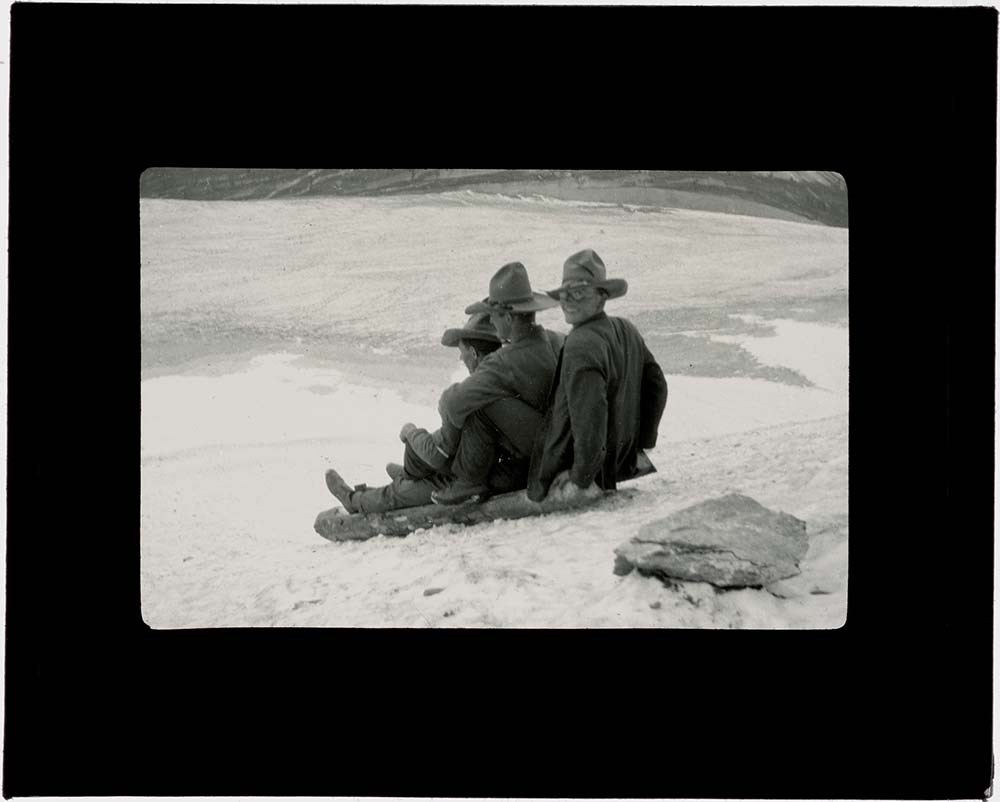
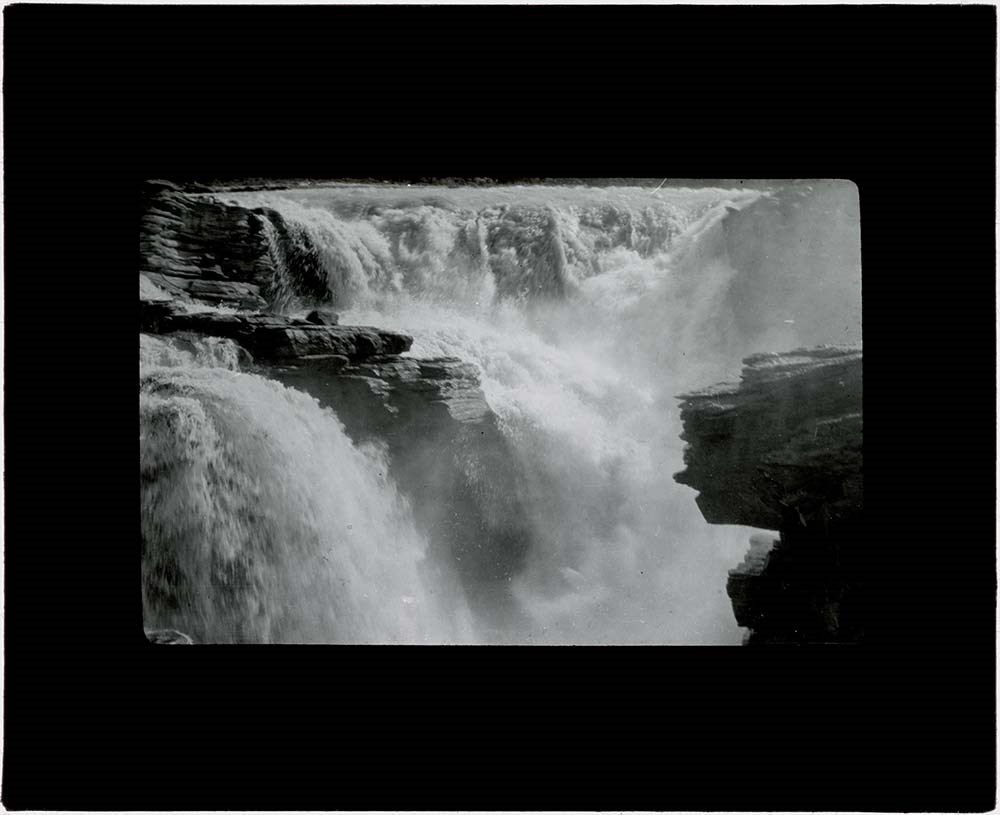
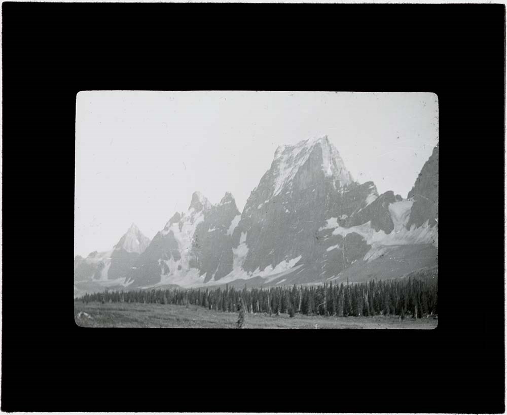
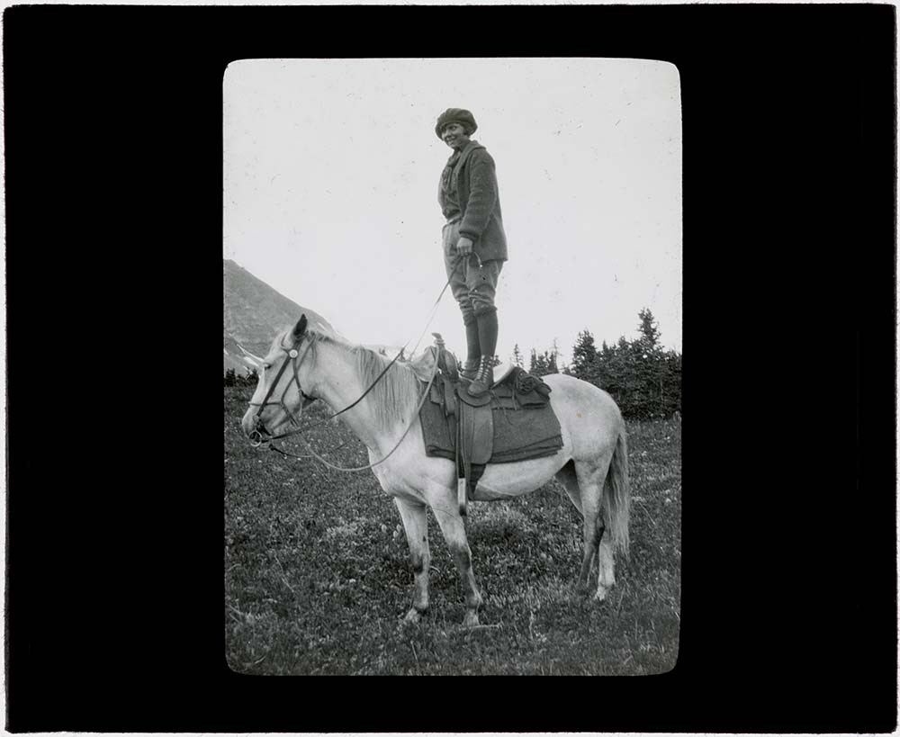
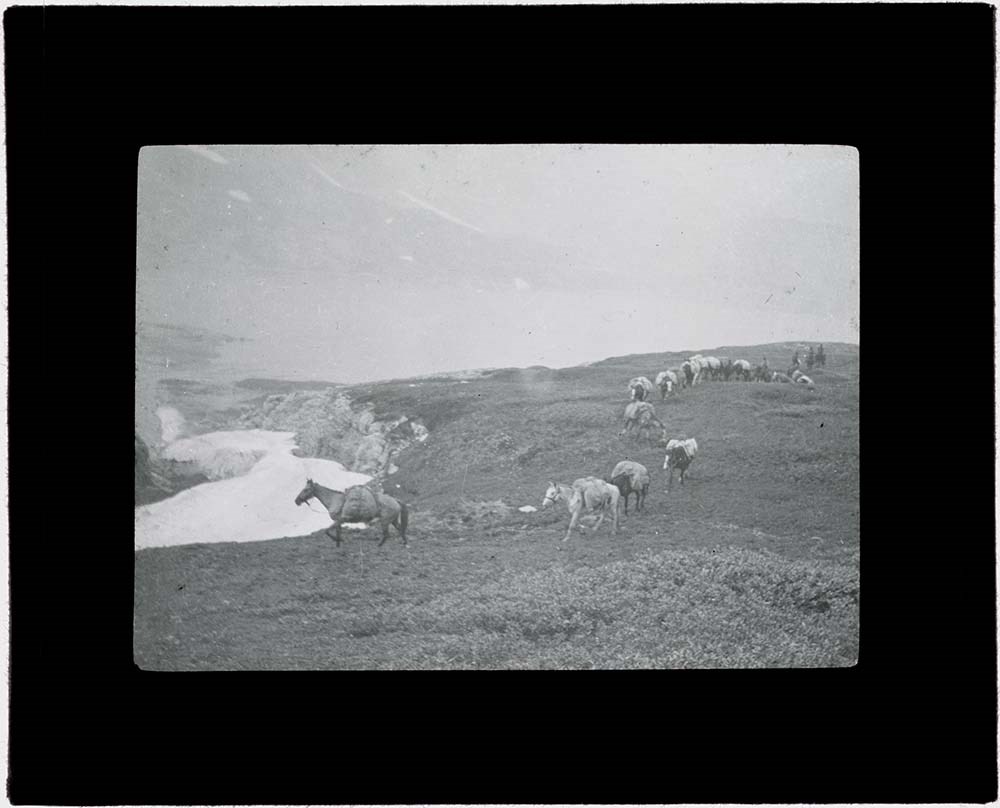
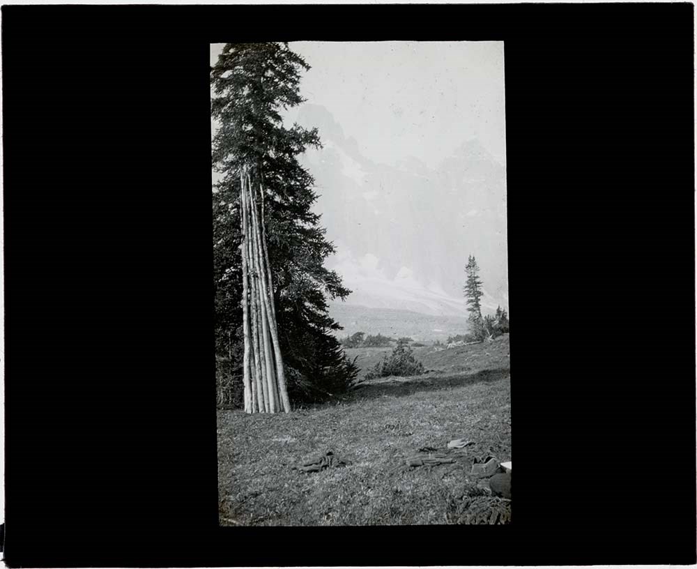
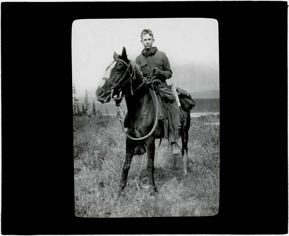
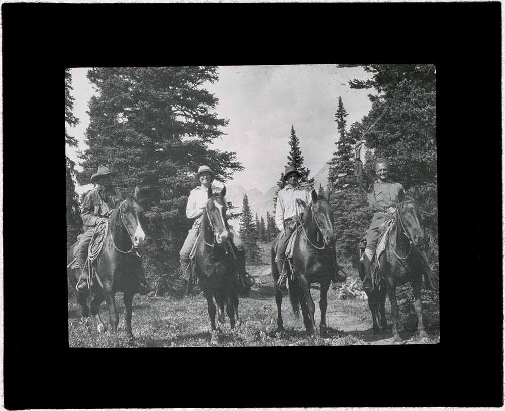
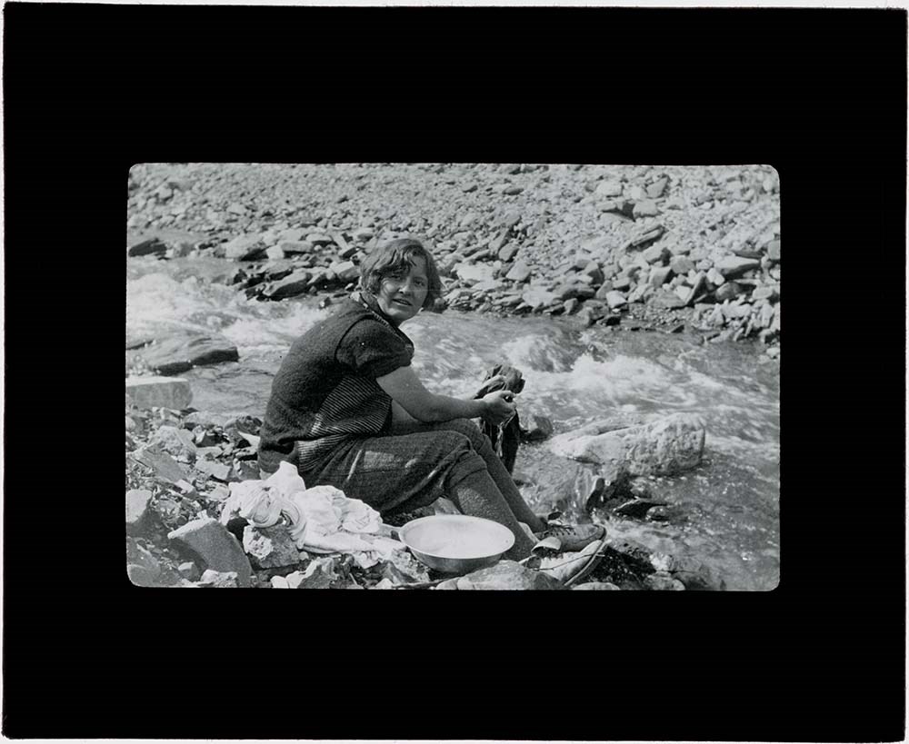
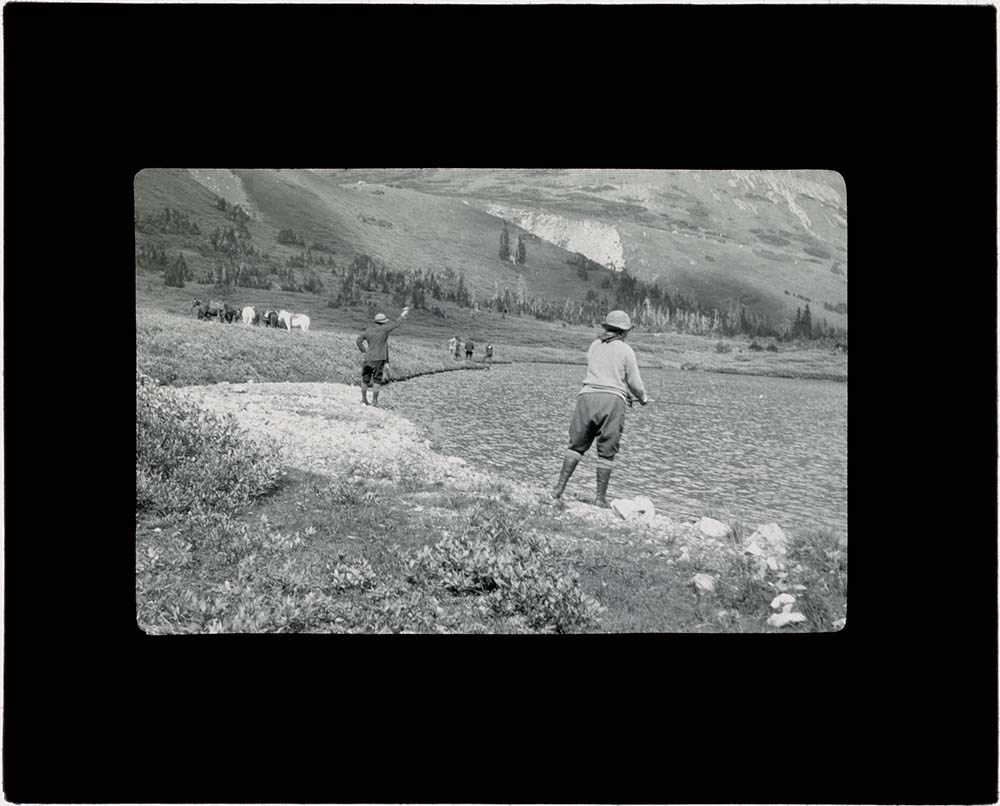
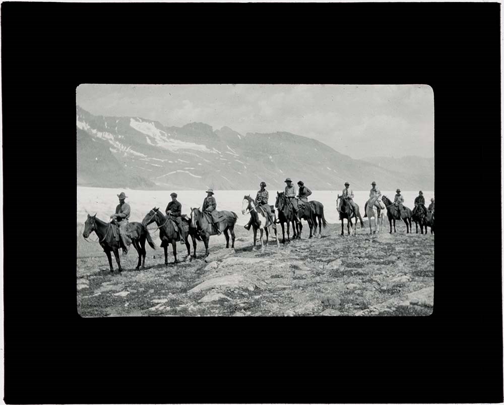
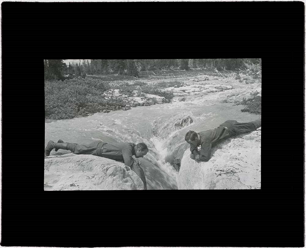
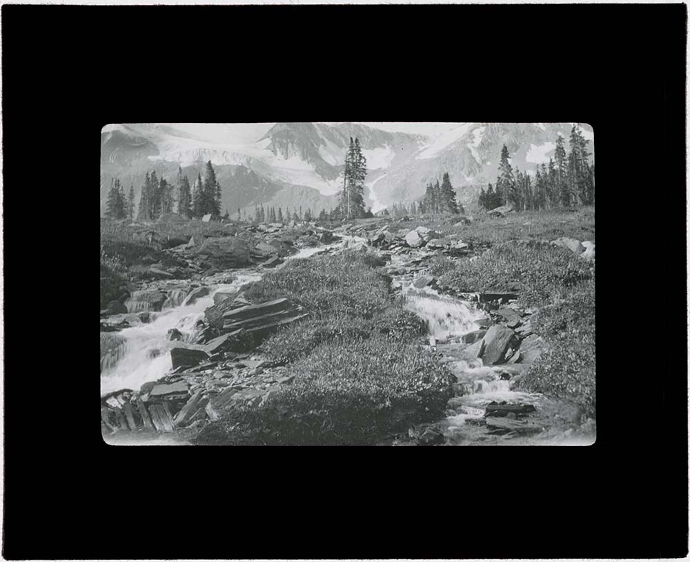
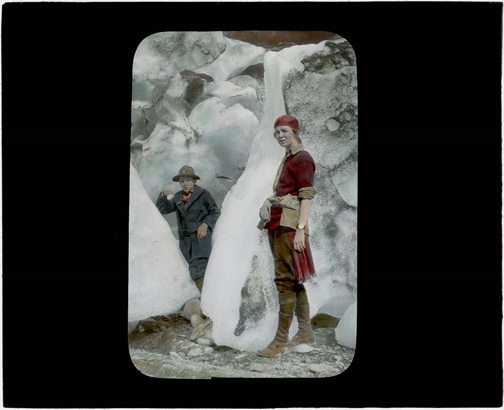
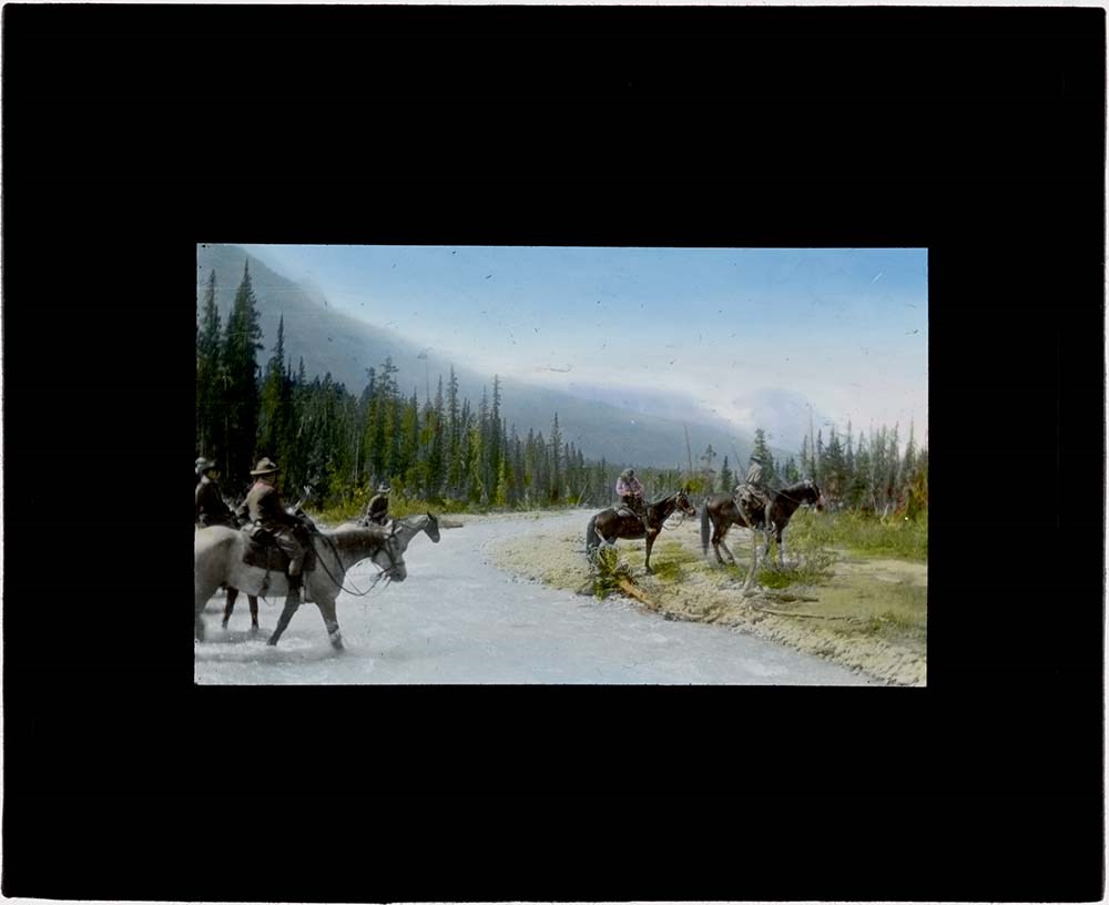
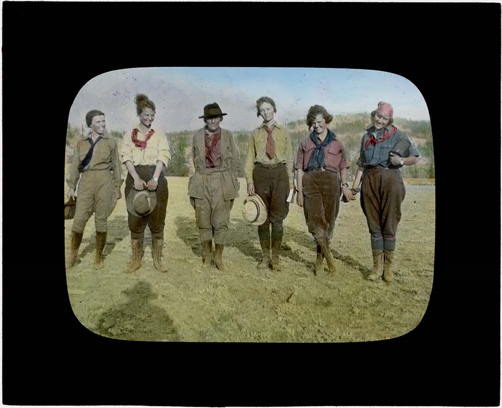
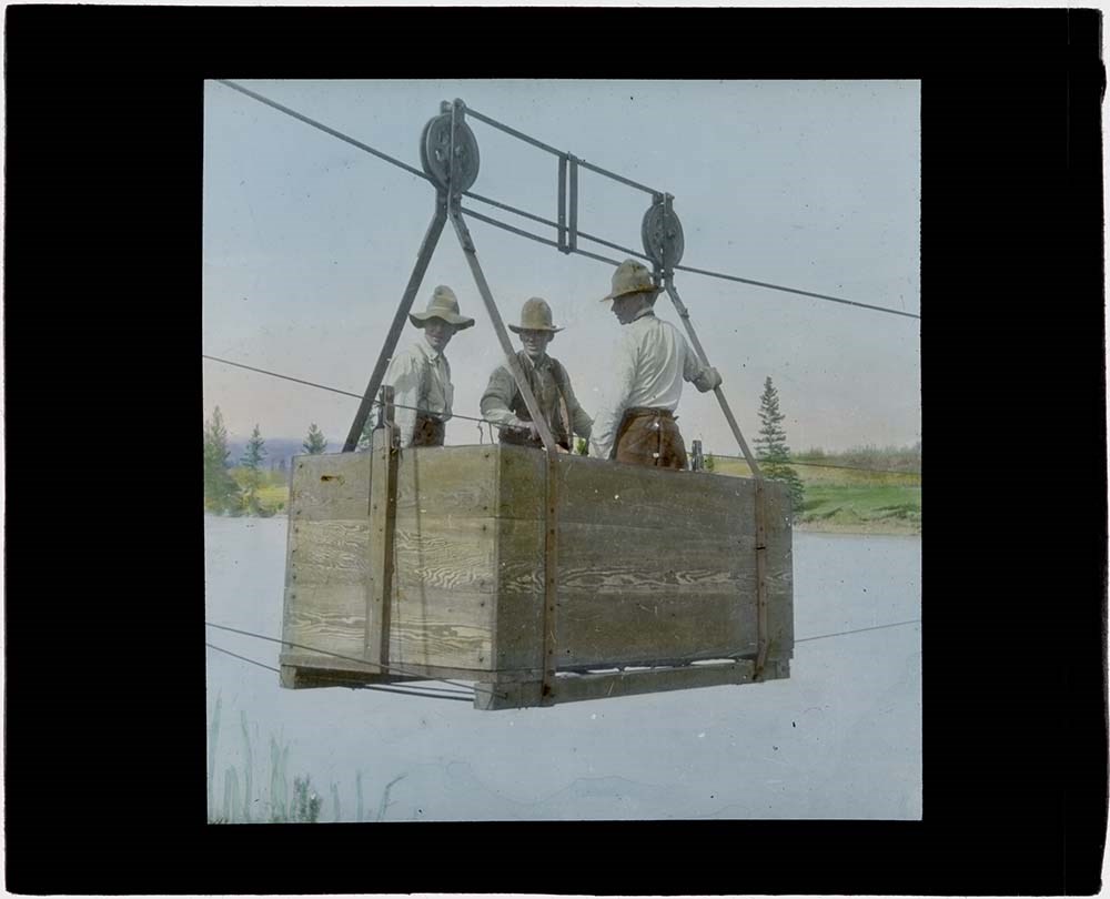
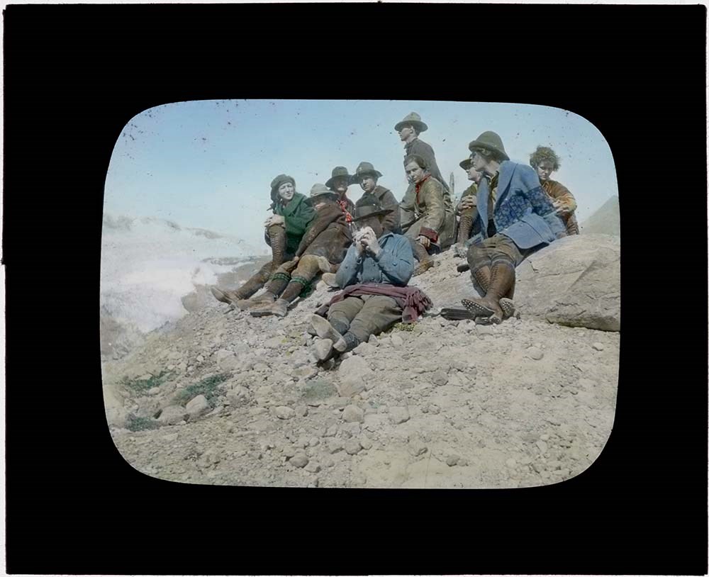
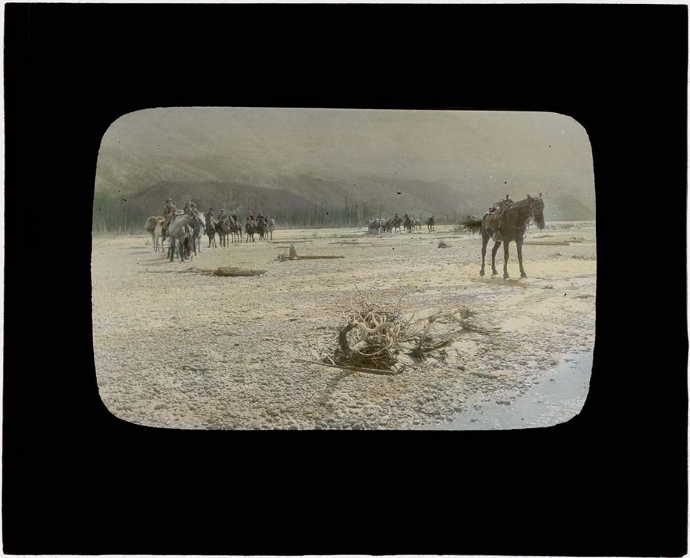
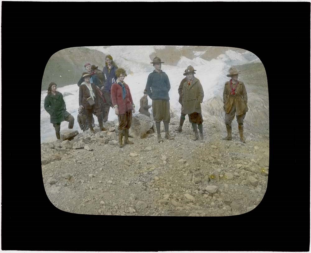
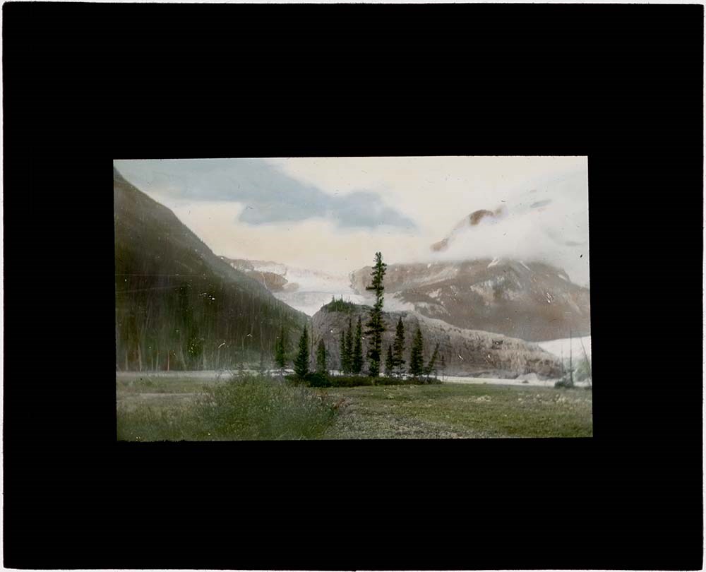
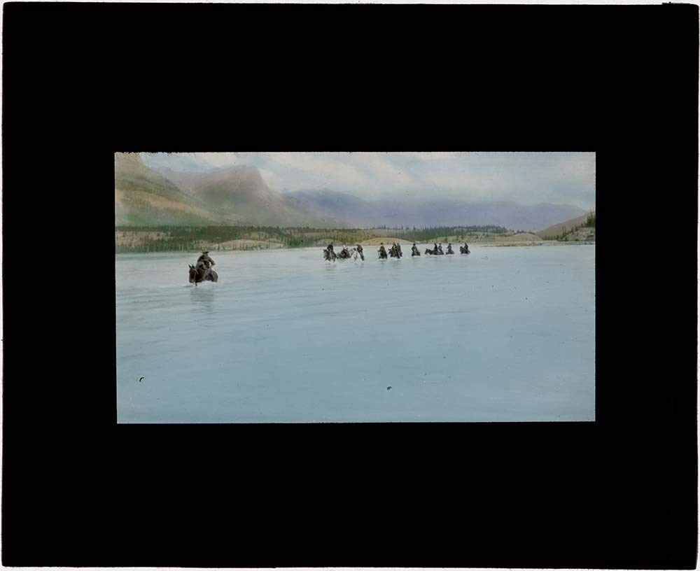
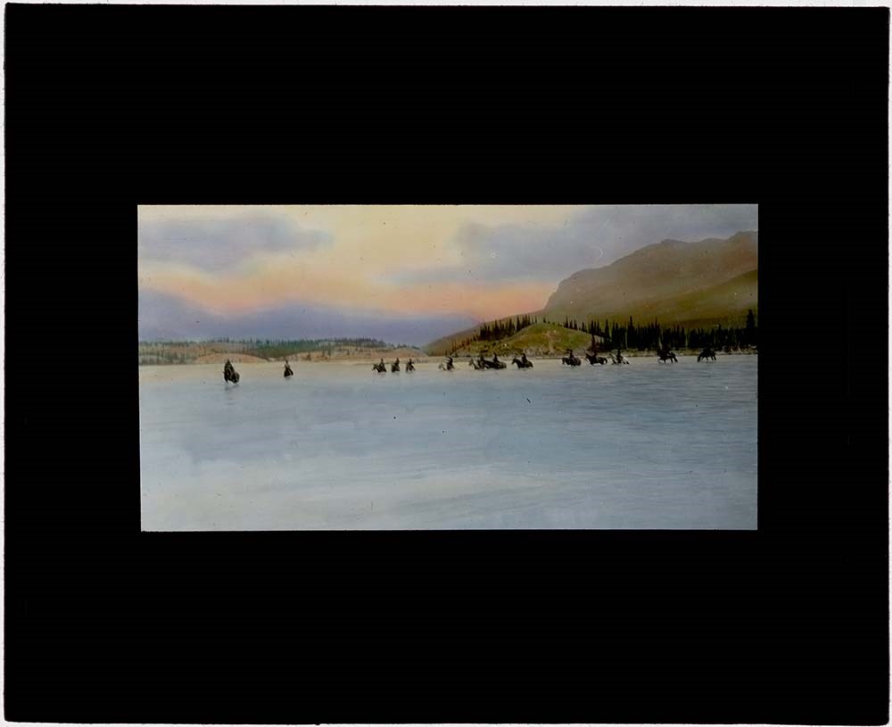
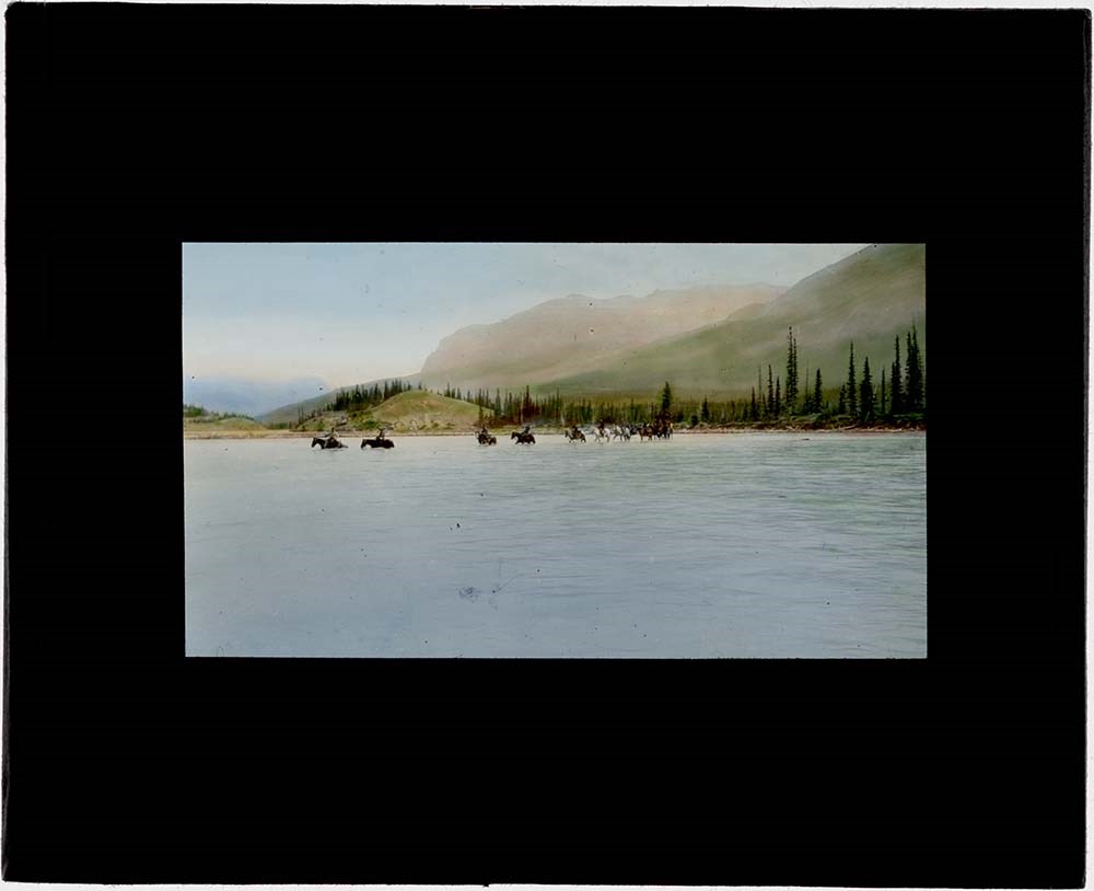
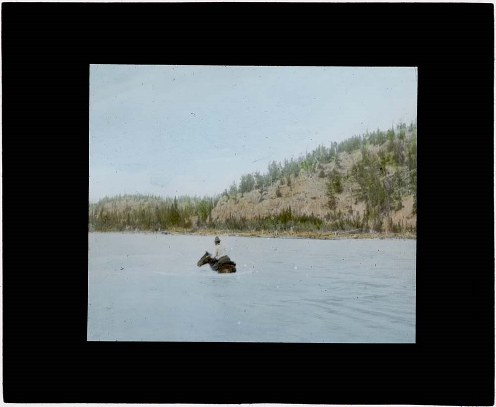
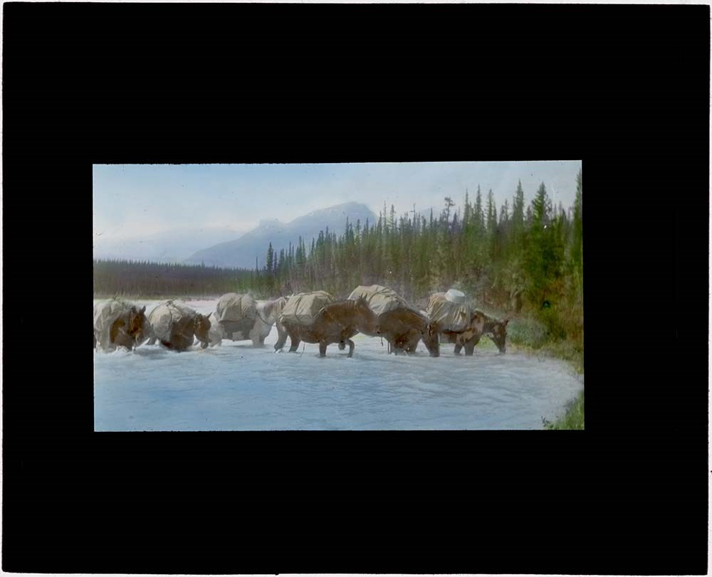
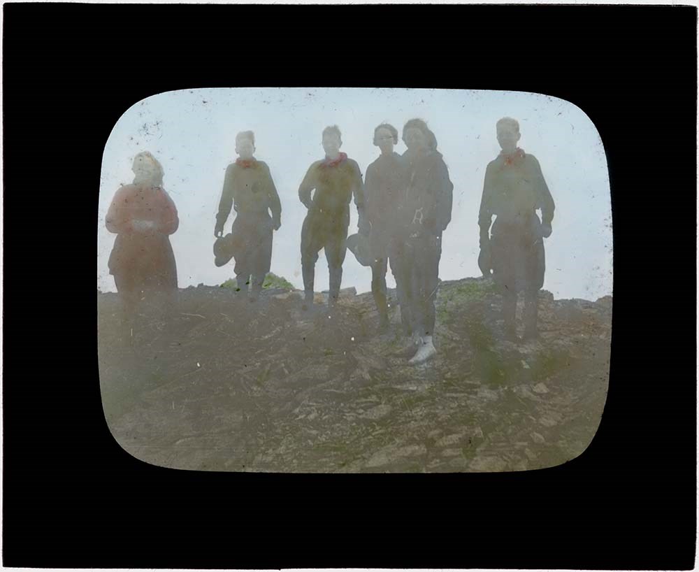
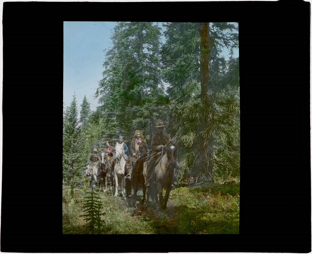
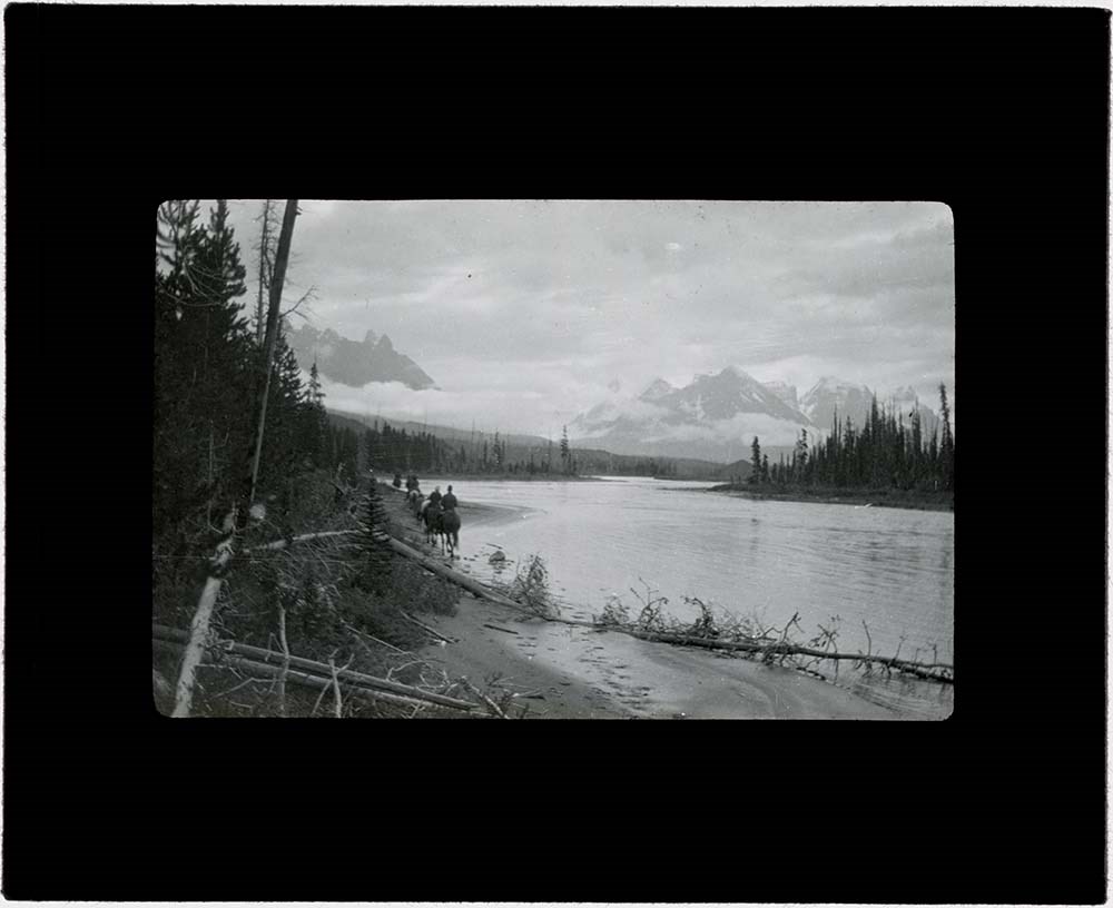
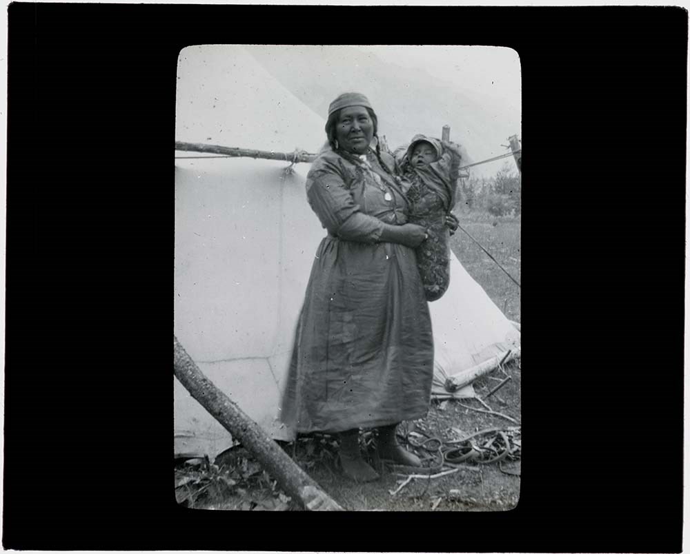
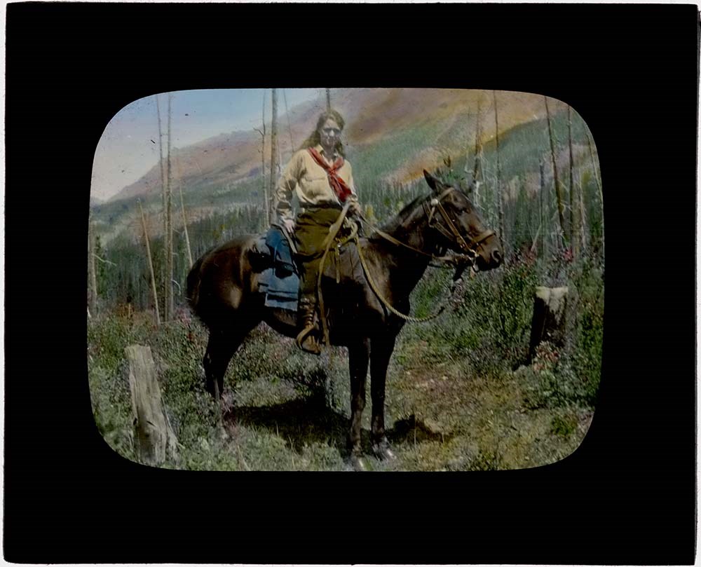
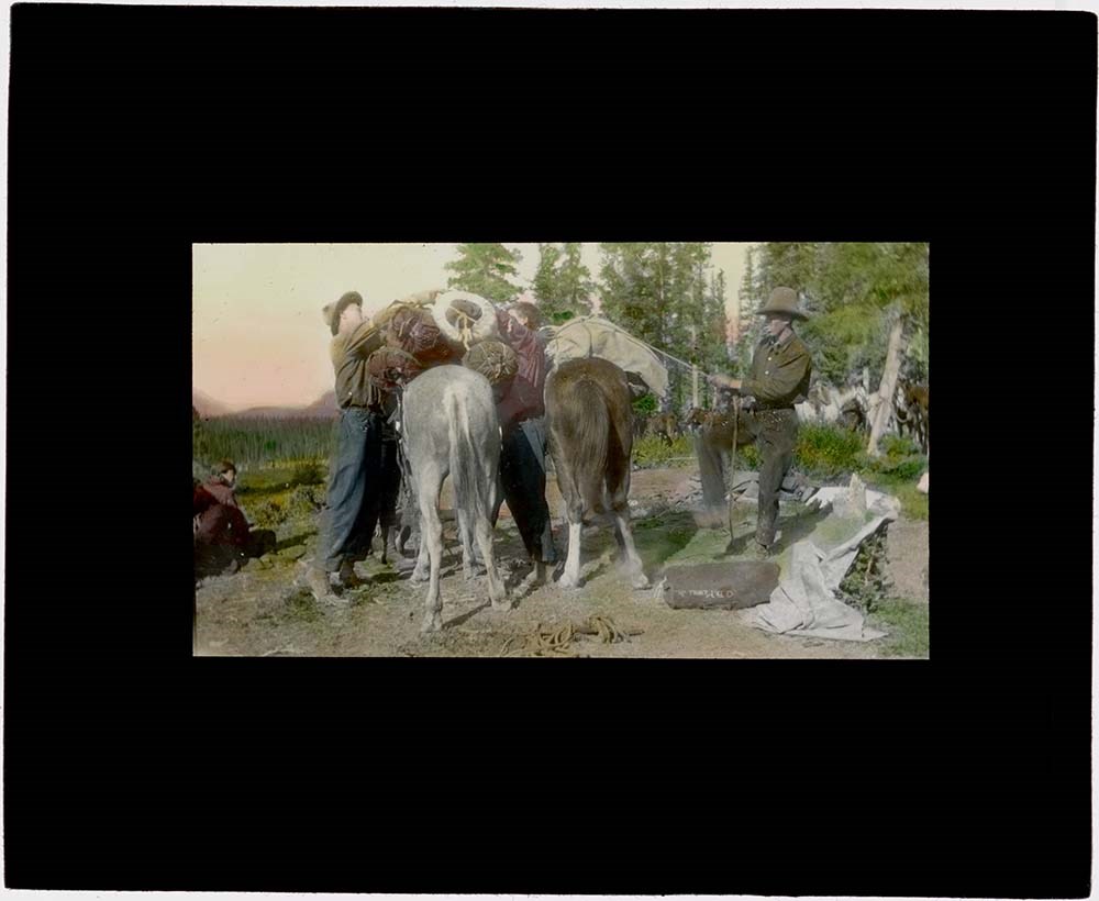
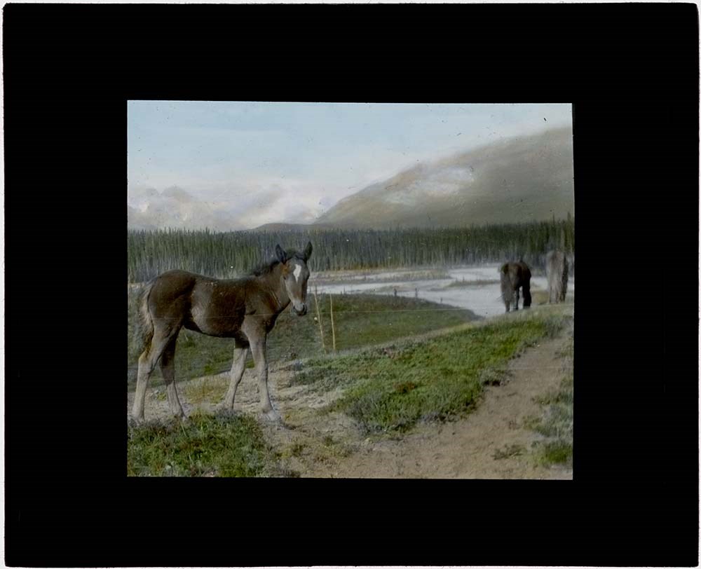
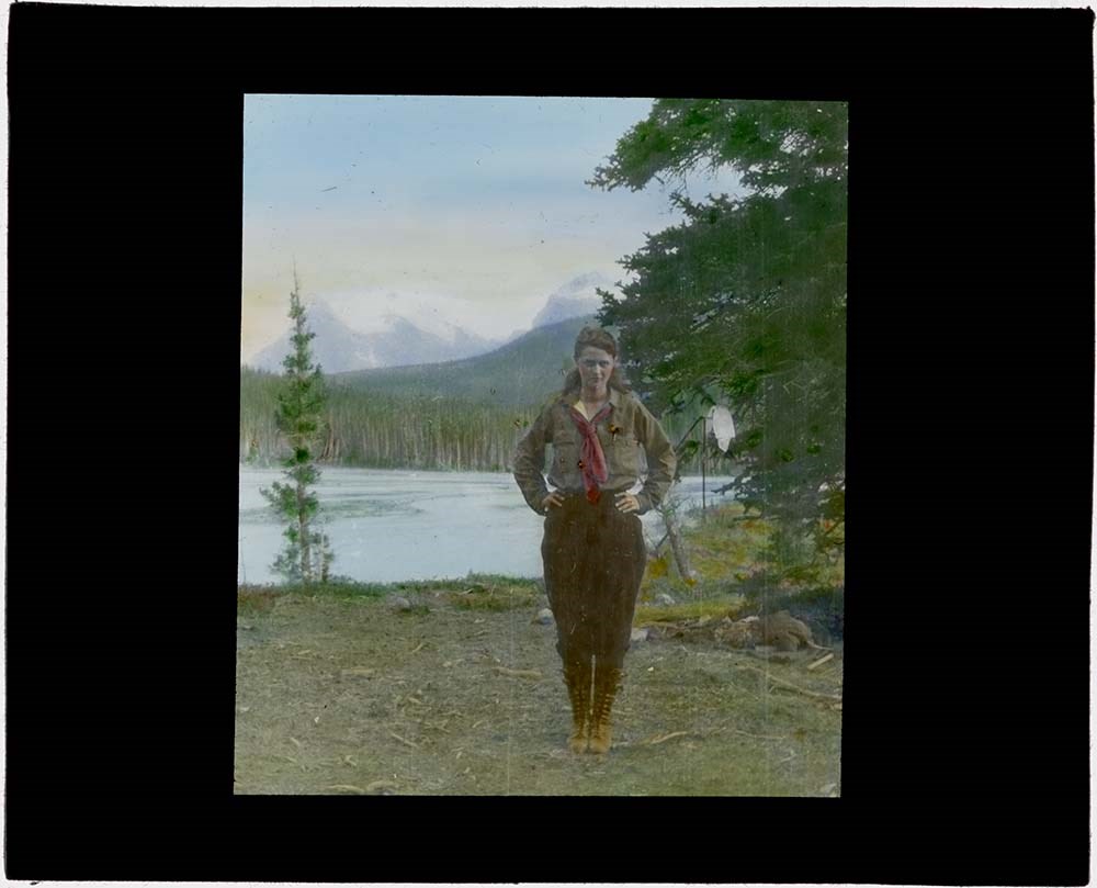
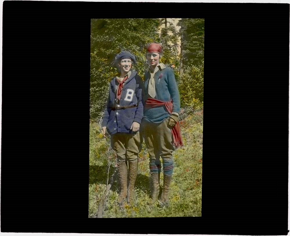
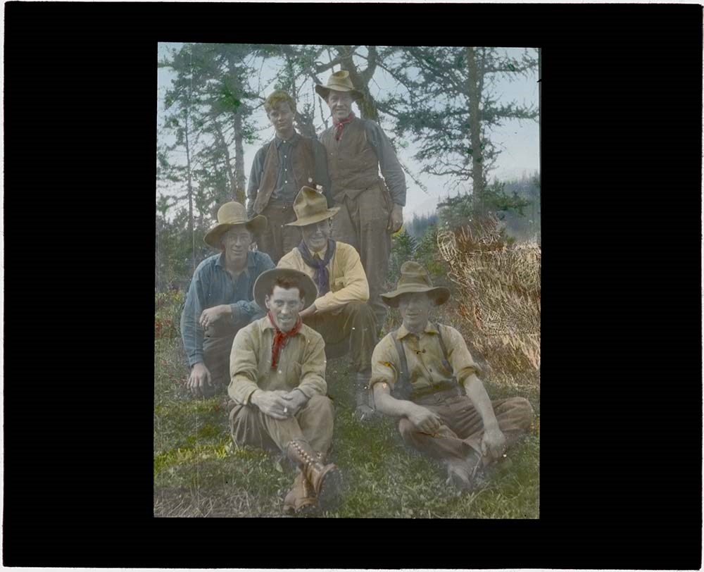
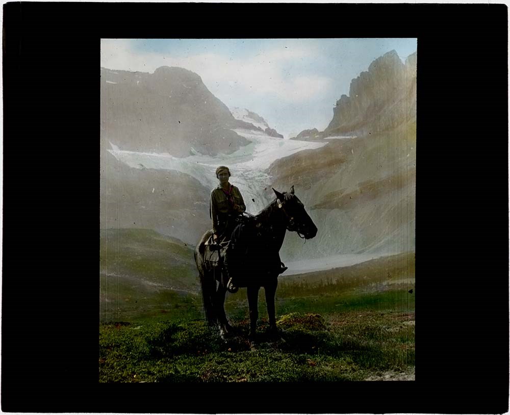
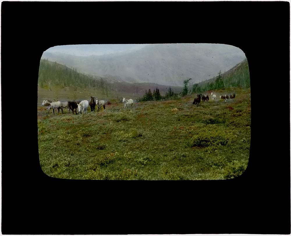
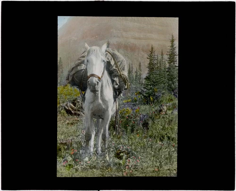
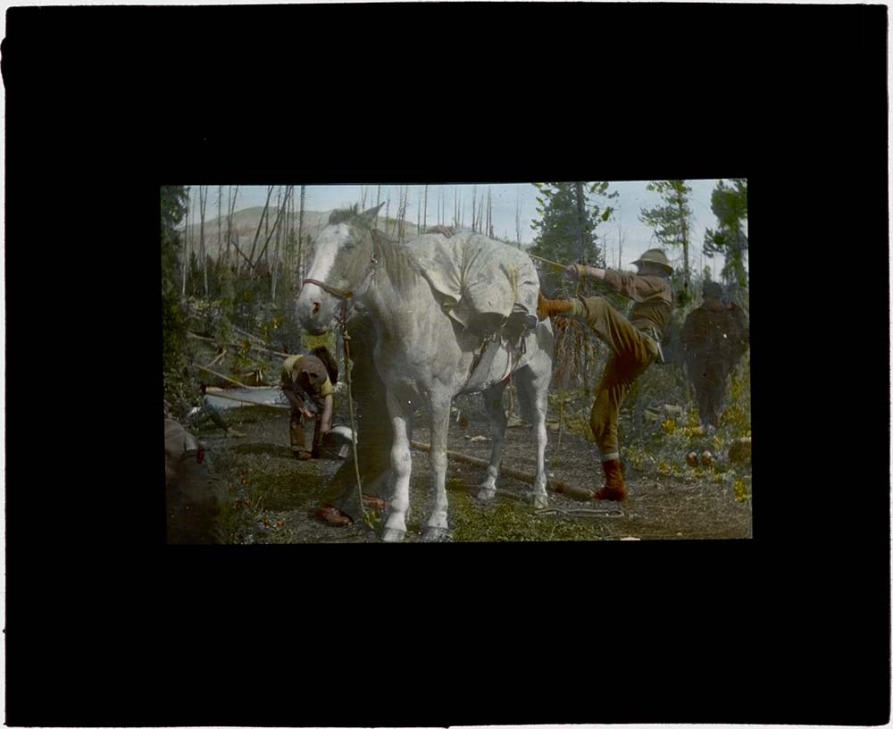
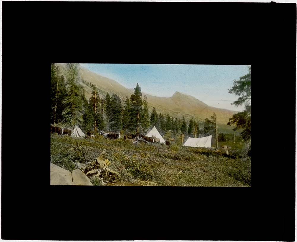
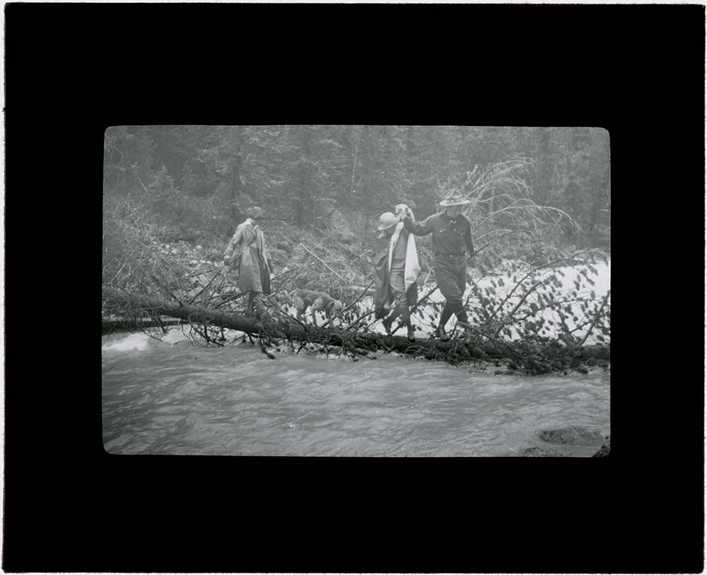
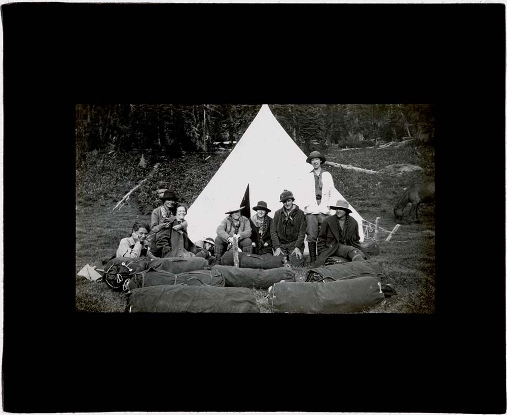
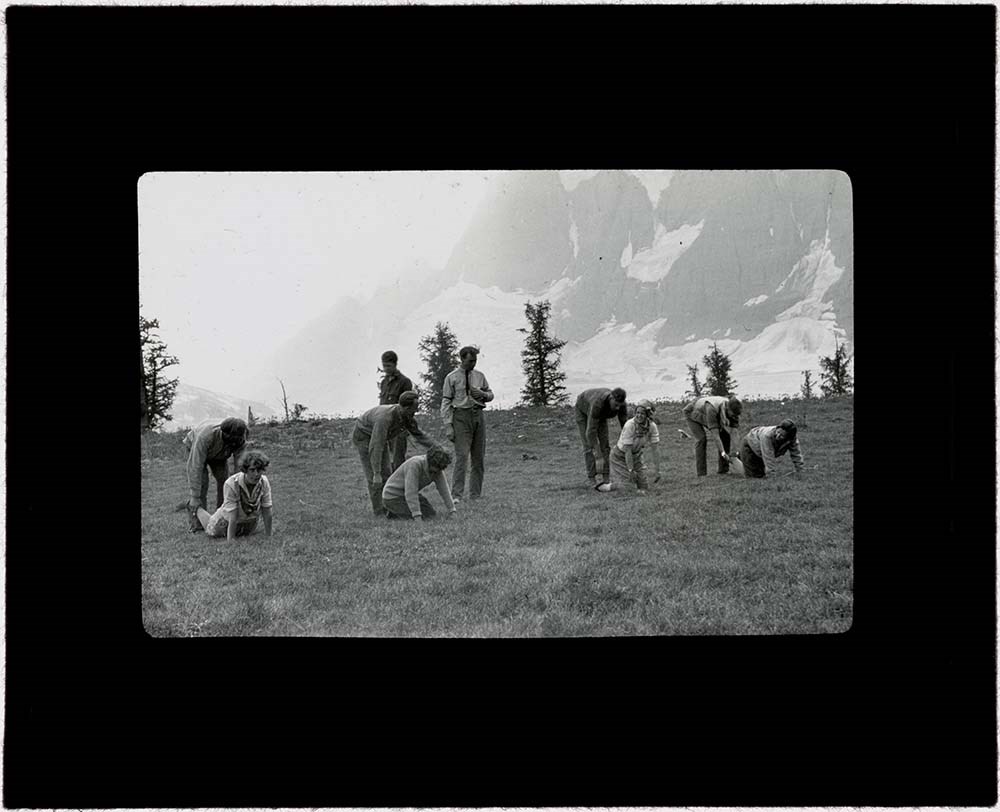
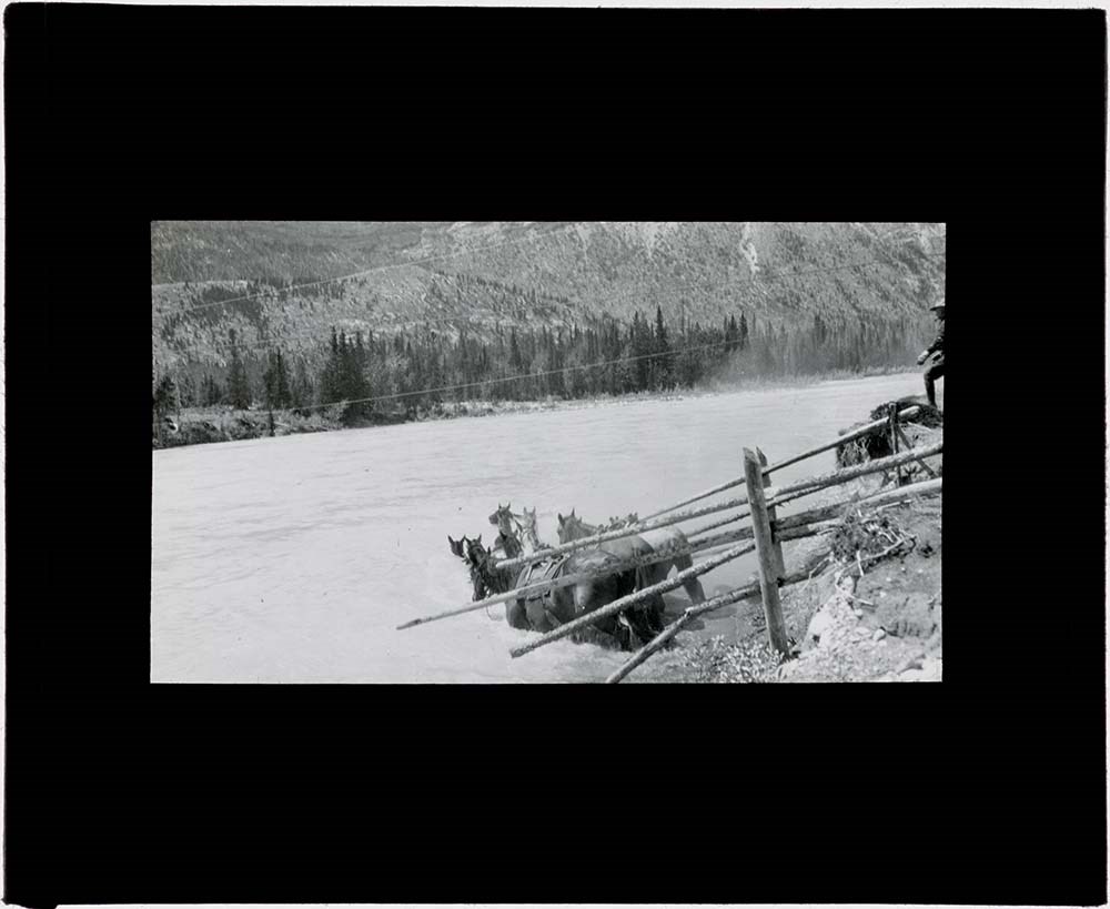
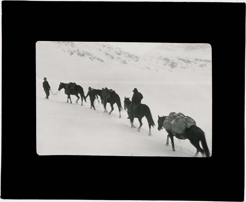
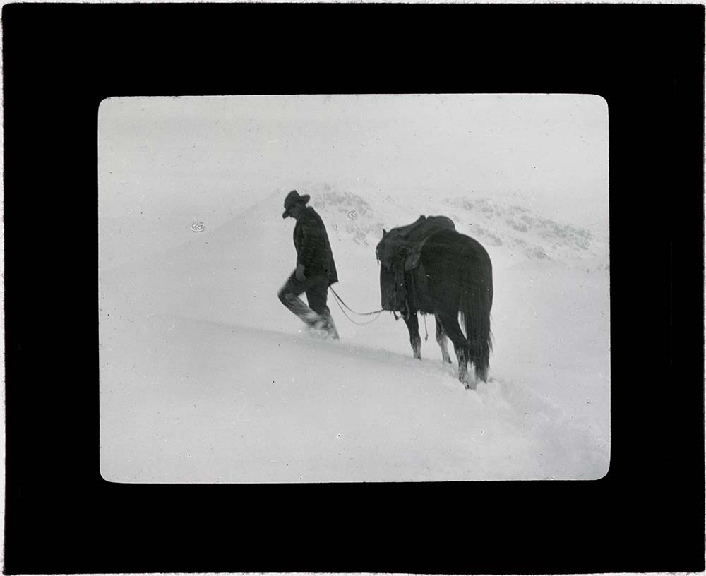
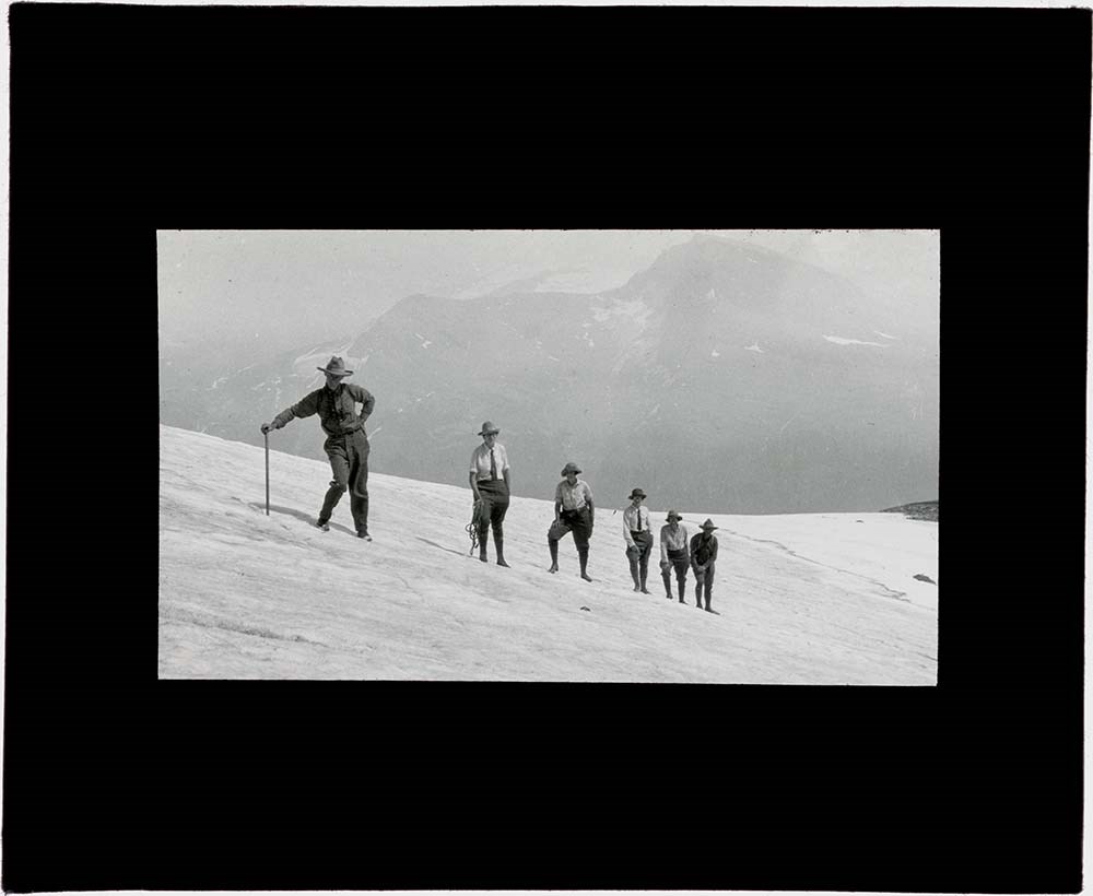
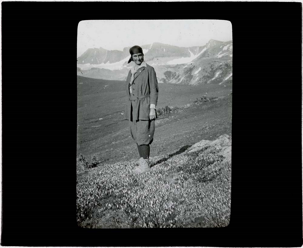
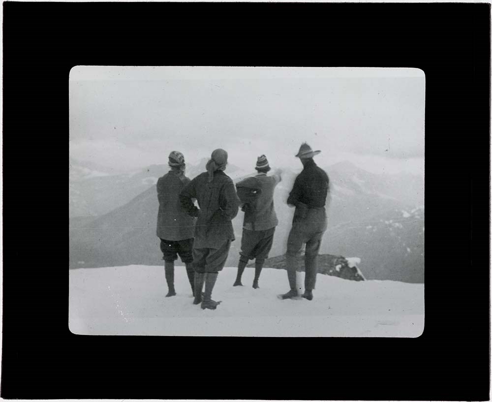
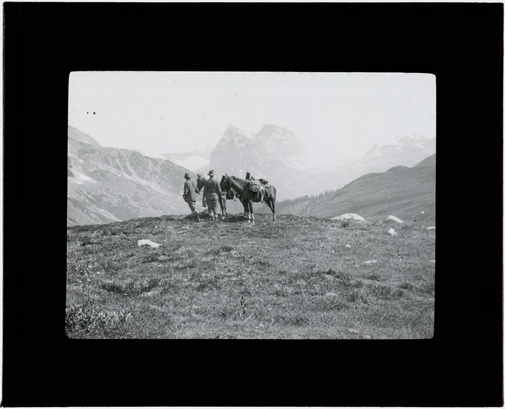
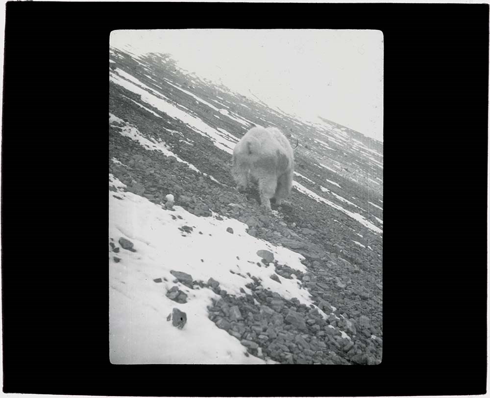
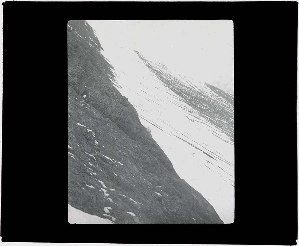
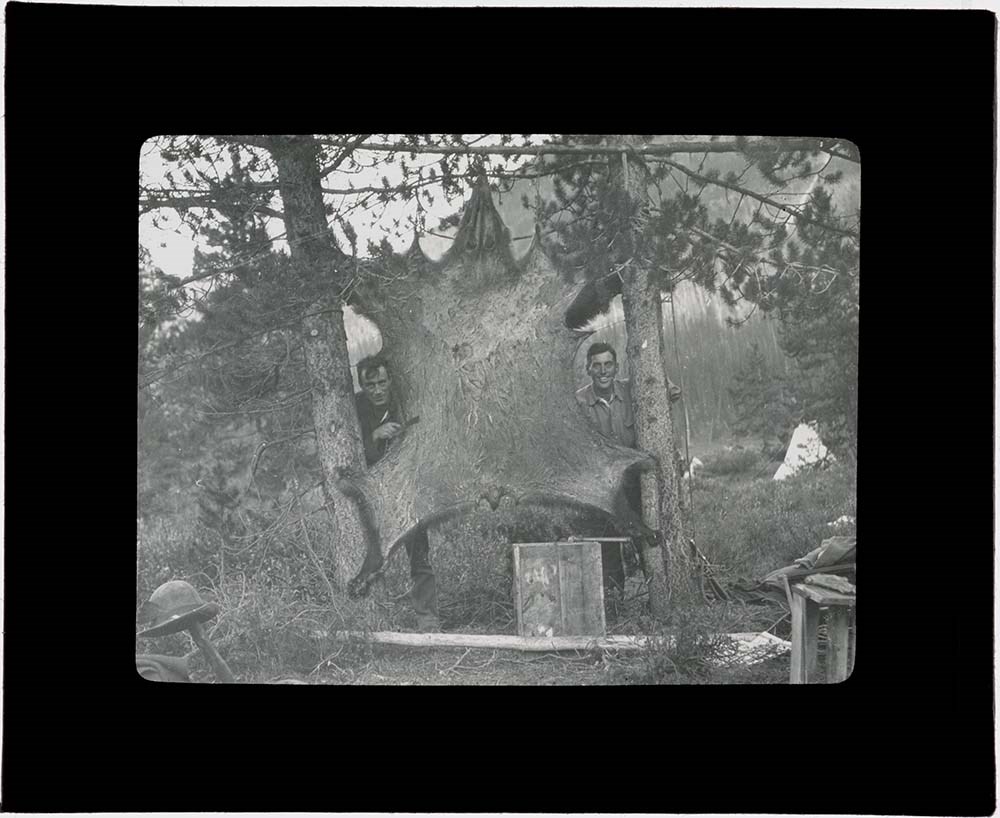
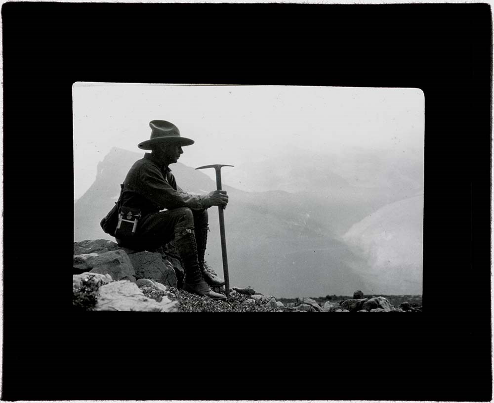
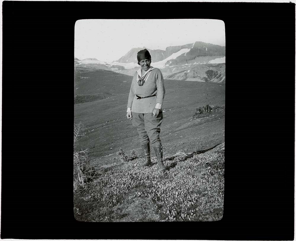
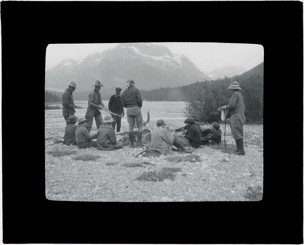
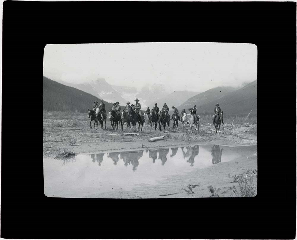
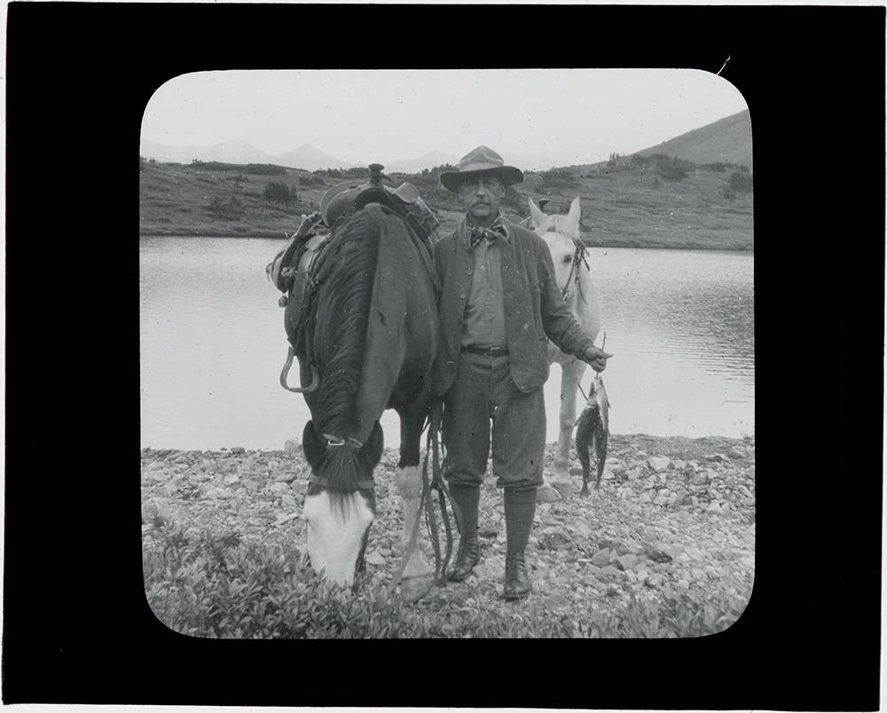
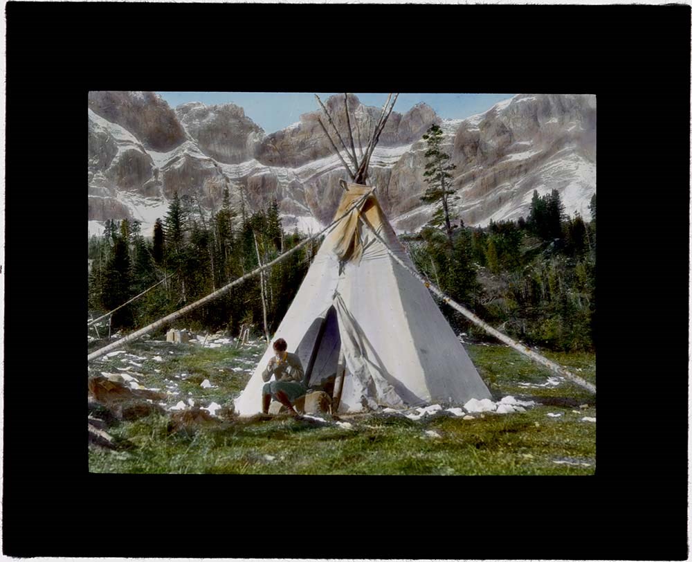
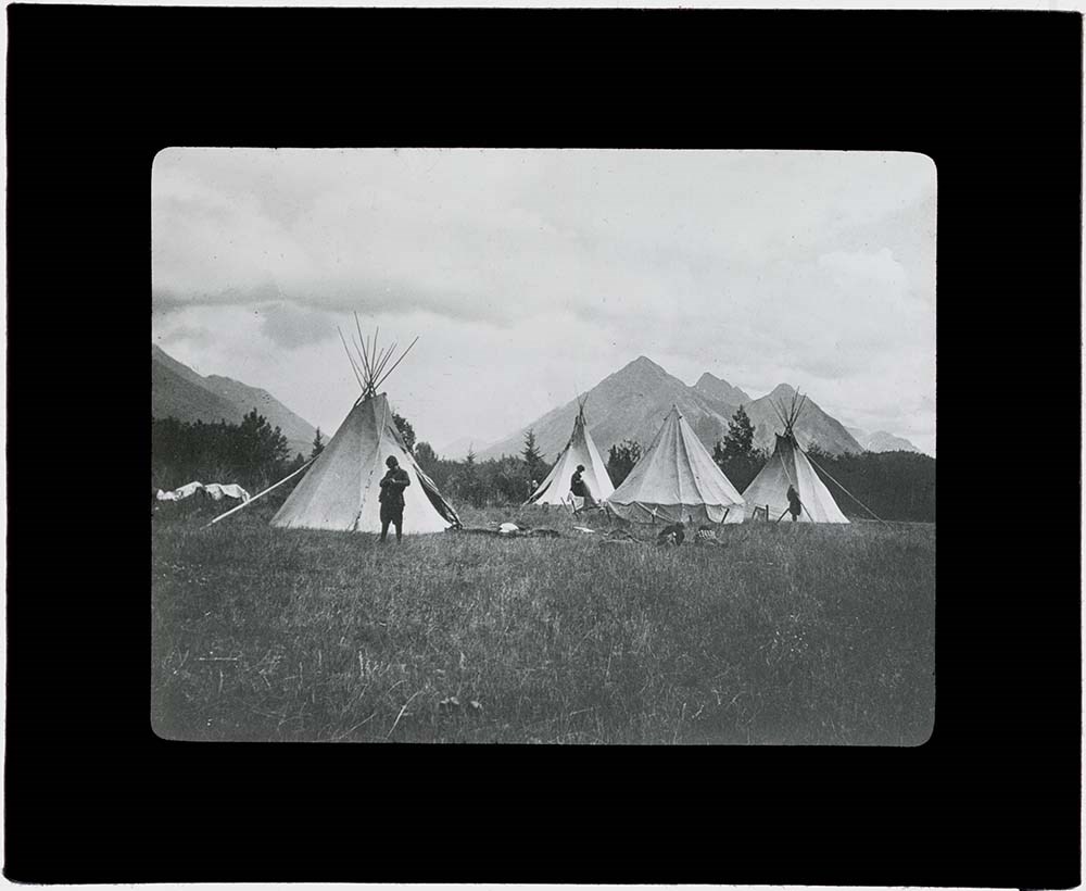
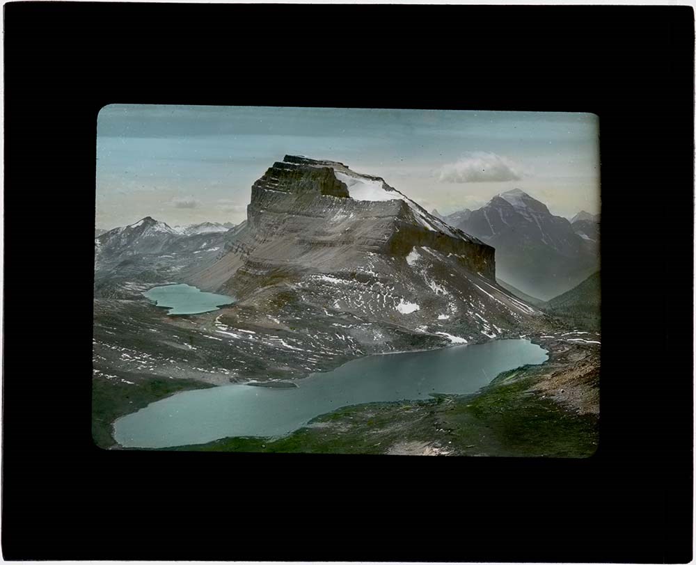
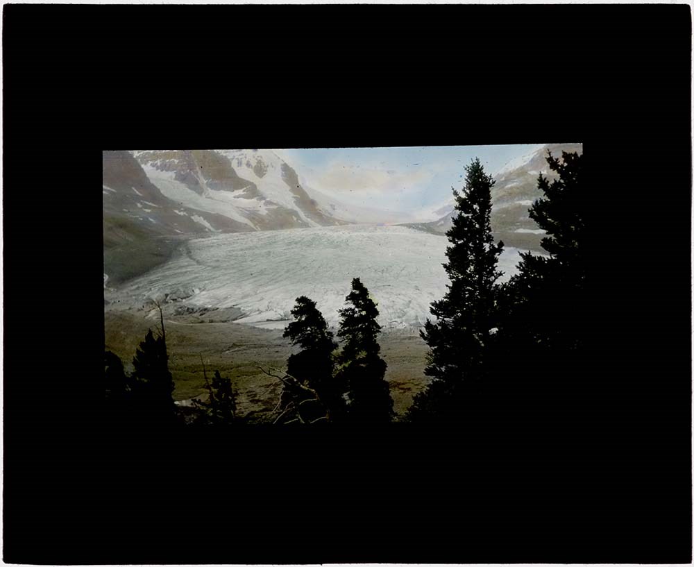
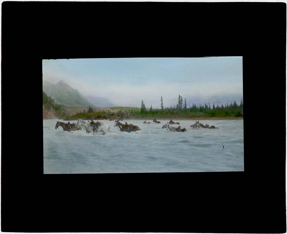
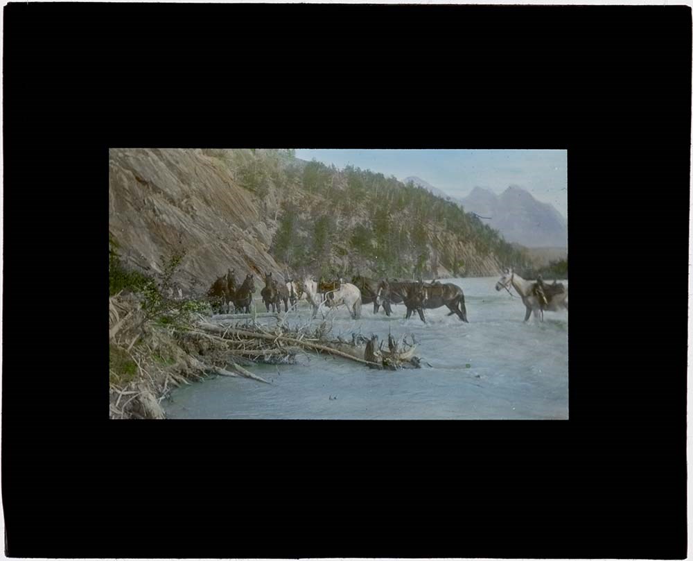
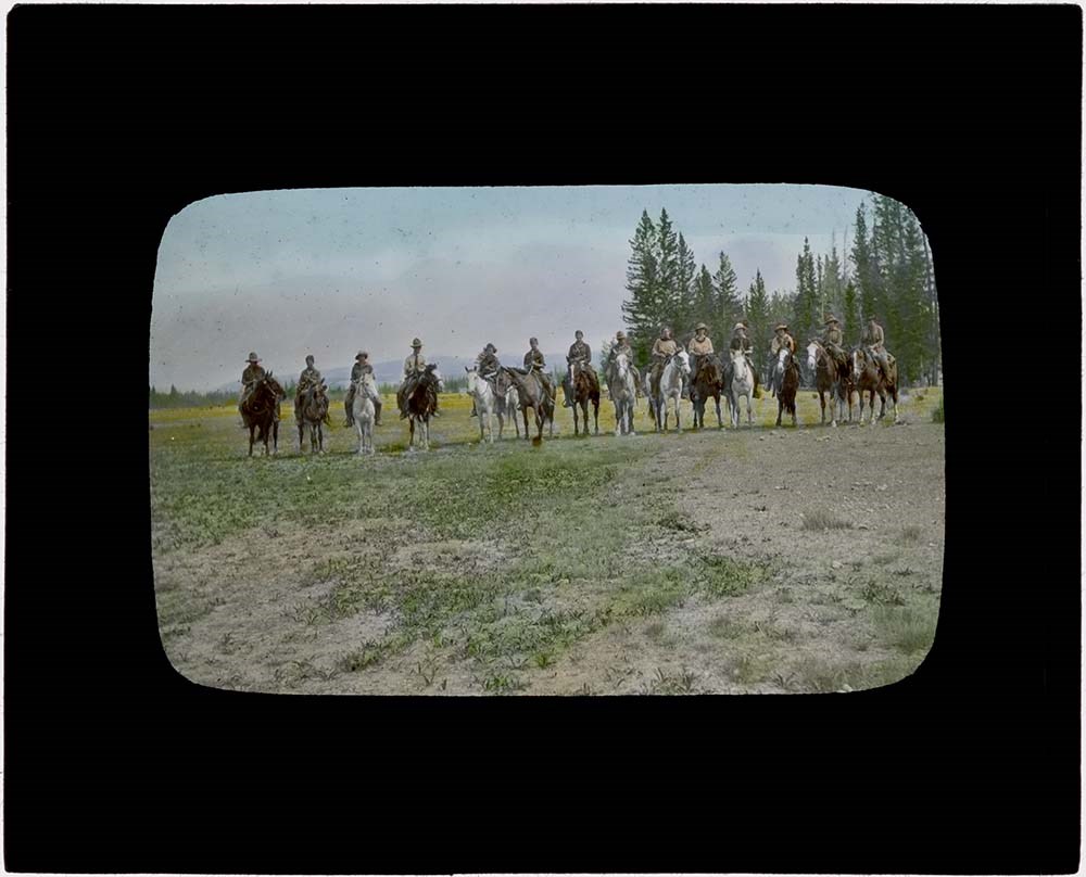
Rocky Mountain Trips Lantern Slides
https://archives.whyte.org/en/permalink/descriptions54688
- Part Of
- Caroline Hinman fonds
- Scope & Content
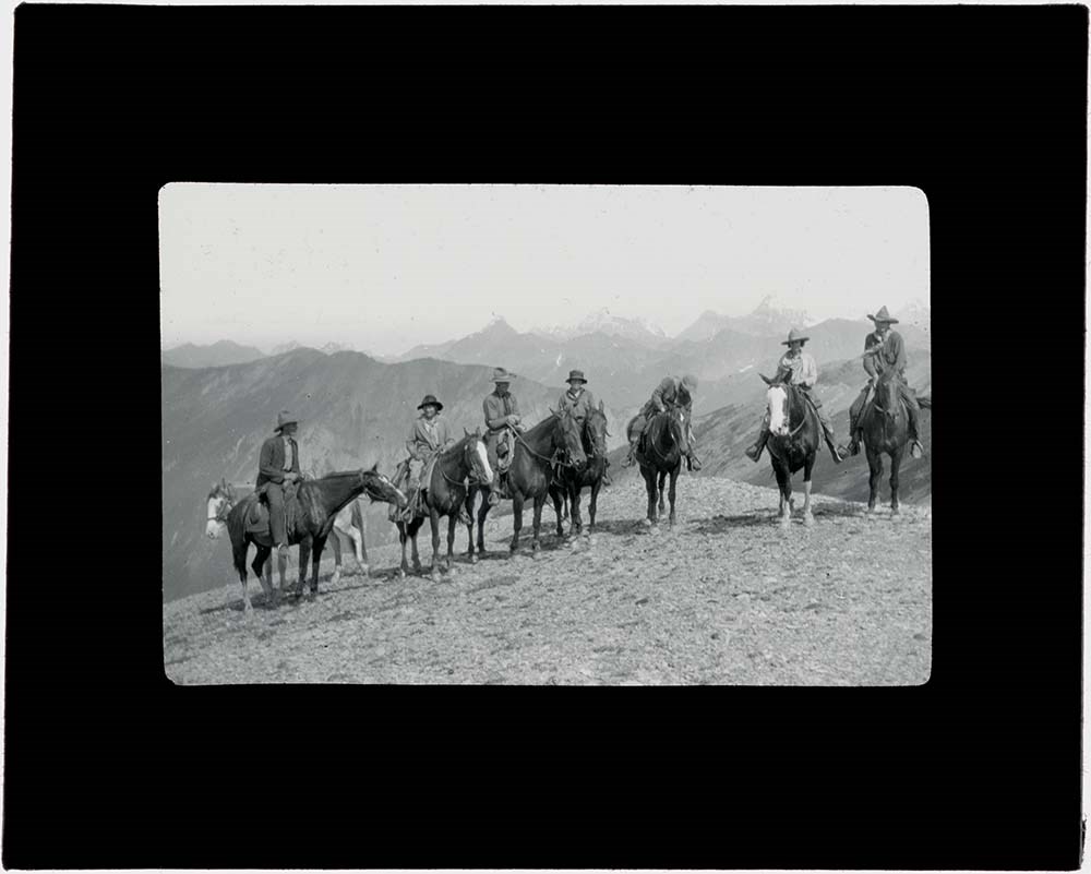
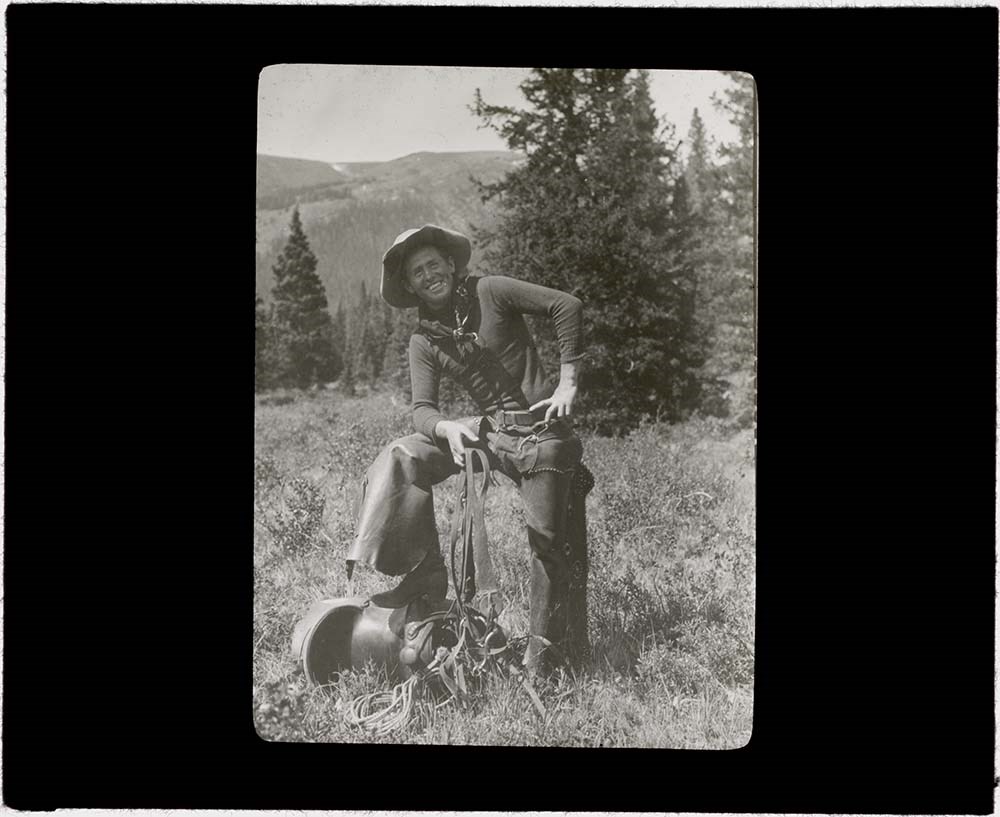
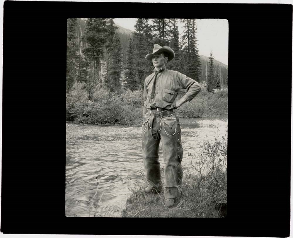
- File consists of lantern slides depicting various pack trips organized and led by Caroline Hinman during the summers between 1913 and 1958. The slides appear to be celluloid transparencies fixed between the panes of glass; lack of maker's marks on the transparencies indicates the images may have be…
- Date Range
- 1913 - 1958
- Reference Code
- V282 / III / B / PS - 53 to PS - 86
- Description Level
- 5 / File
- GMD
- Transparency
- Lantern slide
34 images
- Part Of
- Caroline Hinman fonds
- Description Level
- 5 / File
- Fonds Number
- M236 / V282
- Series
- V282 / III: Photography
- Sous-Fonds
- V282
- Sub-Series
- V282 / III / B: Photography: lantern slides
- Accession Number
- 1316, 1933
- Reference Code
- V282 / III / B / PS - 53 to PS - 86
- Date Range
- 1913 - 1958
- Physical Description
- 34 photographs : b&w and col. slides : 10.2 x 8.2 cm
- History / Biographical
- See fonds level description.
- Scope & Content
- File consists of lantern slides depicting various pack trips organized and led by Caroline Hinman during the summers between 1913 and 1958. The slides appear to be celluloid transparencies fixed between the panes of glass; lack of maker's marks on the transparencies indicates the images may have been developed onto a sheet and then individually cut out to form the slides.
- Name Access
- Hinman, Caroline
- Subject Access
- Photography
- Outfitters
- Outfitters, trail guides and packers
- Horse packing
- Horses
- Mount Assiniboine
- Travel
- Geographic Access
- Banff
- Lake Louise
- Jasper
- Mount Assiniboine
- Mount Assiniboine Park
- Banff National Park
- Jasper National Park
- Alberta
- British Columbia
- Canada
- Language
- English
- Conservation
- All slides cleaned prior to scanning
- Title Source
- Title based on contents of file
- Processing Status
- Processed
Images


This material is presented as originally created; it may contain outdated cultural descriptions and
potentially offensive content.
Read more.
Rocky Mountain Trips Lantern Slides
https://archives.whyte.org/en/permalink/descriptions54689
- Part Of
- Caroline Hinman fonds
- Scope & Content
- File consists of lantern slides depicting various pack trips organized and led by Caroline Hinman during the summers between 1913 and 1958. The slides appear to be celluloid transparencies fixed between the panes of glass; lack of maker's marks on the transparencies indicates the images may have be…
- Date Range
- 1913 - 1958
- Reference Code
- V282 / III / B / PS - 87 to PS - 131
- Description Level
- 5 / File
- GMD
- Transparency
- Lantern slide
45 images
- Part Of
- Caroline Hinman fonds
- Description Level
- 5 / File
- Fonds Number
- M236 / V282
- Series
- V282 / III: Photography
- Sous-Fonds
- V282
- Sub-Series
- V282 / III / B: Photography: lantern slides
- Accession Number
- 1316, 1933
- Reference Code
- V282 / III / B / PS - 87 to PS - 131
- Date Range
- 1913 - 1958
- Physical Description
- 45 photographs : b&w and col. slides : 10.2 x 8.2 cm
- History / Biographical
- See fonds level description.
- Scope & Content
- File consists of lantern slides depicting various pack trips organized and led by Caroline Hinman during the summers between 1913 and 1958. The slides appear to be celluloid transparencies fixed between the panes of glass; lack of maker's marks on the transparencies indicates the images may have been developed onto a sheet and then individually cut out to form the slides.
- Name Access
- Hinman, Caroline
- Subject Access
- Photography
- Outfitters
- Outfitters, trail guides and packers
- Horse packing
- Horses
- Mount Assiniboine
- Travel
- Geographic Access
- Banff
- Lake Louise
- Jasper
- Mount Assiniboine
- Mount Assiniboine Park
- Banff National Park
- Jasper National Park
- Alberta
- British Columbia
- Canada
- Language
- English
- Conservation
- All slides cleaned prior to scanning. Repair binding tape where needed.
- Title Source
- Title based on contents of file
- Processing Status
- Processed
Images


This material is presented as originally created; it may contain outdated cultural descriptions and
potentially offensive content.
Read more.
Rocky Mountain Trips Lantern Slides
https://archives.whyte.org/en/permalink/descriptions54690
- Part Of
- Caroline Hinman fonds
- Scope & Content
- File consists of lantern slides depicting various pack trips organized and led by Caroline Hinman during the summers between 1913 and 1958. The slides appear to be celluloid transparencies fixed between the panes of glass; lack of maker's marks on the transparencies indicates the images may have be…
- Date Range
- 1913 - 1958
- Reference Code
- V282 / III / B / PS - 132 to PS - 180
- Description Level
- 5 / File
- GMD
- Transparency
- Lantern slide
49 images
- Part Of
- Caroline Hinman fonds
- Description Level
- 5 / File
- Fonds Number
- M236 / V282
- Series
- V282 / III: Photography
- Sous-Fonds
- V282
- Sub-Series
- V282 / III / B: Photography: lantern slides
- Accession Number
- 1316, 1933
- Reference Code
- V282 / III / B / PS - 132 to PS - 180
- Date Range
- 1913 - 1958
- Physical Description
- 49 photographs : b&w and col. slides : 10.2 x 8.2 cm
- History / Biographical
- See fonds level description.
- Scope & Content
- File consists of lantern slides depicting various pack trips organized and led by Caroline Hinman during the summers between 1913 and 1958. The slides appear to be celluloid transparencies fixed between the panes of glass; lack of maker's marks on the transparencies indicates the images may have been developed onto a sheet and then individually cut out to form the slides.
- Name Access
- Hinman, Caroline
- Subject Access
- Photography
- Outfitters
- Outfitters, trail guides and packers
- Horse packing
- Horses
- Mount Assiniboine
- Travel
- Geographic Access
- Banff
- Lake Louise
- Jasper
- Mount Assiniboine
- Mount Assiniboine Park
- Banff National Park
- Jasper National Park
- Alberta
- British Columbia
- Canada
- Language
- English
- Conservation
- All slides cleaned prior to scanning. Repair binding tape where needed.
- Title Source
- Title based on contents of file
- Processing Status
- Processed
Images


This material is presented as originally created; it may contain outdated cultural descriptions and
potentially offensive content.
Read more.
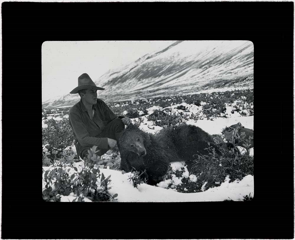
Rocky Mountain Trips Lantern Slides
https://archives.whyte.org/en/permalink/descriptions54691
- Part Of
- Caroline Hinman fonds
- Scope & Content
- File consists of lantern slides depicting various pack trips organized and led by Caroline Hinman during the summers between 1913 and 1958. The slides appear to be celluloid transparencies fixed between the panes of glass; lack of maker's marks on the transparencies indicates the images may have be…
- Date Range
- 1913 - 1958
- Reference Code
- V282 / III / B / PS - 181 to PS - 225
- Description Level
- 5 / File
- GMD
- Transparency
- Lantern slide
45 images
- Part Of
- Caroline Hinman fonds
- Description Level
- 5 / File
- Fonds Number
- M236 / V282
- Series
- V282 / III: Photography
- Sous-Fonds
- V282
- Sub-Series
- V282 / III / B: Photography: lantern slides
- Accession Number
- 1316, 1933
- Reference Code
- V282 / III / B / PS - 181 to PS - 225
- Date Range
- 1913 - 1958
- Physical Description
- 46 photographs : b&w and col. slides : 10.2 x 8.2 cm
- History / Biographical
- See fonds level description.
- Scope & Content
- File consists of lantern slides depicting various pack trips organized and led by Caroline Hinman during the summers between 1913 and 1958. The slides appear to be celluloid transparencies fixed between the panes of glass; lack of maker's marks on the transparencies indicates the images may have been developed onto a sheet and then individually cut out to form the slides.
- Name Access
- Hinman, Caroline
- Subject Access
- Photography
- Outfitters
- Outfitters, trail guides and packers
- Horse packing
- Horses
- Mount Assiniboine
- Travel
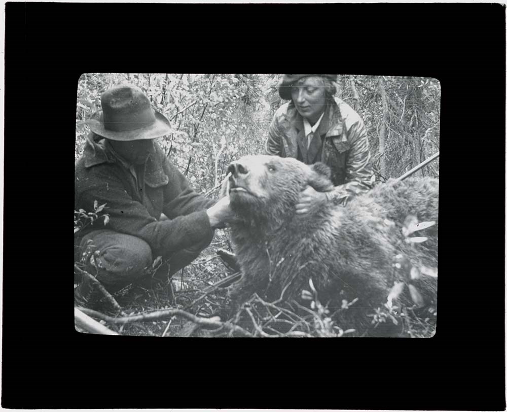
- Hunting
- Geographic Access
- Banff
- Lake Louise
- Jasper
- Mount Assiniboine
- Mount Assiniboine Park
- Banff National Park
- Jasper National Park
- Alberta
- British Columbia
- Canada
- Language
- English
- Conservation
- All slides cleaned prior to scanning. Repair binding tape where needed.
- Title Source
- Title based on contents of file
- Processing Status
- Processed
Images


This material is presented as originally created; it may contain outdated cultural descriptions and
potentially offensive content.
Read more.
Topographical maps
https://archives.whyte.org/en/permalink/descriptions56805
- Part Of
- Ben Gadd fonds
- Scope & Content
- Sub-sub series consists of topographical maps depicting various regions in Canada and the United States, which were collected by Ben Gadd. Includes ca.13 maps of regions in the United States (including Eagletail National Park in Arizona, Colorado Springs, and Montana); and ca.213 maps of regions in…
- Date Range
- [ca.1960-2005]
- Reference Code
- M590 / I / A / ii
- Description Level
- 4.1 / Sub-sub-series
- GMD
- Map
- Part Of
- Ben Gadd fonds
- Description Level
- 4.1 / Sub-sub-series
- Fonds Number
- M590
- V810
- S61
- Series
- M590 / I : Personal records
- Sous-Fonds
- M590
- Sub-Series
- M590 / I / A / ii : Travel guides and maps : Topographical maps
- Accession Number
- 2021.20
- Reference Code
- M590 / I / A / ii
- GMD
- Map
- Date Range
- [ca.1960-2005]
- Physical Description
- ca.226 topographical maps
- Scope & Content
- Sub-sub series consists of topographical maps depicting various regions in Canada and the United States, which were collected by Ben Gadd. Includes ca.13 maps of regions in the United States (including Eagletail National Park in Arizona, Colorado Springs, and Montana); and ca.213 maps of regions in Northern Canada, Western Canada and the Canadian Rockies (predominantly Alberta and British Columbia, as well as the Yukon).
- Notes
- Some maps include annotations by Ben Gadd
- Name Access
- Gadd, Ben
- Geographic Access
- Canada
- Alberta
- British Columbia
- Yukon
- Canadian Rocky Mountains
- Rocky Mountains
- Reproduction Restrictions
- Restrictions may apply
- Language
- English
- Category
- Exploration and travel
- Title Source
- Title based on contents of file
- Processing Status
- Processed
This material is presented as originally created; it may contain outdated cultural descriptions and
potentially offensive content.
Read more.
Travel guides - Alberta, British Columbia
https://archives.whyte.org/en/permalink/descriptions55920
- Part Of
- Ben Gadd fonds
- Scope & Content
- File consists of travel guides collected by Ben Gadd pertaining to various regions of Alberta and British Columbia.
- Date Range
- [ca.2000]
- 2008
- Reference Code
- M590 / I / A / i / 12
- Description Level
- 5 / File
- GMD
- Published record
- Textual record
- Map
- Part Of
- Ben Gadd fonds
- Description Level
- 5 / File
- Fonds Number
- M590
- V810
- S61
- Series
- M590 / I : Personal records
- Sous-Fonds
- M590
- Sub-Series
- M590 / I / A : Travel guides and maps
- Accession Number
- 2021.20
- Reference Code
- M590 / I / A / i / 12
- Date Range
- [ca.2000]
- 2008
- Physical Description
- 2 cm of textual records
- Scope & Content
- File consists of travel guides collected by Ben Gadd pertaining to various regions of Alberta and British Columbia.
- Notes
- Some items in file are annotated
- Subject Access
- Geography
- Travel
- Tourism
- Tourist information
- Geographic Access
- Canada
- Alberta
- British Columbia
- Reproduction Restrictions
- Copyright restrictions may apply
- Language
- English
- Category
- Exploration, discovery and travel
- Title Source
- Title based on contents of file
- Processing Status
- Processed
This material is presented as originally created; it may contain outdated cultural descriptions and
potentially offensive content.
Read more.
Travel guides - Banff National Park, Mount Assiniboine
https://archives.whyte.org/en/permalink/descriptions55921
- Part Of
- Ben Gadd fonds
- Scope & Content
- File consists of travel guides collected by Ben Gadd pertaining Banff National Park and Mount Assiniboine.
- Date Range
- [ca.2000]
- Reference Code
- M590 / I / A / i / 5
- Description Level
- 5 / File
- GMD
- Published record
- Textual record
- Map
- Part Of
- Ben Gadd fonds
- Description Level
- 5 / File
- Fonds Number
- M590
- V810
- S61
- Series
- M590 / I : Personal records
- Sous-Fonds
- M590
- Sub-Series
- M590 / I / A : Travel guides and maps
- Accession Number
- 2021.20
- Reference Code
- M590 / I / A / i / 5
- Date Range
- [ca.2000]
- Physical Description
- 2 cm of textual records
- Scope & Content
- File consists of travel guides collected by Ben Gadd pertaining Banff National Park and Mount Assiniboine.
- Subject Access
- Geography
- Travel
- Tourism
- Tourist information
- Geographic Access
- Canada
- Alberta
- Banff National Park
- Mount Assiniboine
- Reproduction Restrictions
- Copyright restrictions may apply
- Language
- English
- Category
- Exploration, discovery and travel
- Title Source
- Title based on contents of file
- Processing Status
- Processed
This material is presented as originally created; it may contain outdated cultural descriptions and
potentially offensive content.
Read more.
Travel guides - Bow Lake, Saskatchewan Crossing
https://archives.whyte.org/en/permalink/descriptions55922
- Part Of
- Ben Gadd fonds
- Scope & Content
- File consists of travel guides collected by Ben Gadd pertaining to Bow Lake and Saskatchwan Crossing.
- Date Range
- [ca.2000]
- Reference Code
- M590 / I / A / i / 10
- Description Level
- 5 / File
- GMD
- Published record
- Textual record
- Map
- Part Of
- Ben Gadd fonds
- Description Level
- 5 / File
- Fonds Number
- M590
- V810
- S61
- Series
- M590 / I : Personal records
- Sous-Fonds
- M590
- Sub-Series
- M590 / I / A : Travel guides and maps
- Accession Number
- 2021.20
- Reference Code
- M590 / I / A / i / 10
- Date Range
- [ca.2000]
- Physical Description
- 1 cm of textual records
- Scope & Content
- File consists of travel guides collected by Ben Gadd pertaining to Bow Lake and Saskatchwan Crossing.
- Subject Access
- Geography
- Travel
- Tourism
- Tourist information
- Geographic Access
- Canada
- Alberta
- Bow Lake
- Saskatchewan Crossing
- Reproduction Restrictions
- Copyright restrictions may apply
- Language
- English
- Category
- Exploration, discovery and travel
- Title Source
- Title based on contents of file
- Processing Status
- Processed
This material is presented as originally created; it may contain outdated cultural descriptions and
potentially offensive content.
Read more.
Travel guides - British Columbia
https://archives.whyte.org/en/permalink/descriptions55926
- Part Of
- Ben Gadd fonds
- Scope & Content
- File consists of travel guides collected by Ben Gadd pertaining to various locations in British Columbia, including Rogers Pass, Berg Lake Trail, Victoria and Vancouver.
- Date Range
- [ca.2000]
- 2003
- Reference Code
- M590 / I / A / i / 11
- Description Level
- 5 / File
- GMD
- Published record
- Textual record
- Map
- Part Of
- Ben Gadd fonds
- Description Level
- 5 / File
- Fonds Number
- M590
- V810
- S61
- Series
- M590 / I : Personal records
- Sous-Fonds
- M590
- Sub-Series
- M590 / I / A : Travel guides and maps
- Accession Number
- 2021.20
- Reference Code
- M590 / I / A / i / 11
- Date Range
- [ca.2000]
- 2003
- Physical Description
- 2 cm of textual records
- Scope & Content
- File consists of travel guides collected by Ben Gadd pertaining to various locations in British Columbia, including Rogers Pass, Berg Lake Trail, Victoria and Vancouver.
- Subject Access
- Geography
- Travel
- Tourism
- Tourist information
- Geographic Access
- Canada
- British Columbia
- Victoria
- Vancouver
- Rogers Pass
- Berg Lake
- Reproduction Restrictions
- Copyright restrictions may apply
- Language
- English
- Category
- Exploration, discovery and travel
- Title Source
- Title based on contents of file
- Processing Status
- Processed
This material is presented as originally created; it may contain outdated cultural descriptions and
potentially offensive content.
Read more.
Travel guides - Calgary, Bragg Creek, Edmonton
https://archives.whyte.org/en/permalink/descriptions55919
- Part Of
- Ben Gadd fonds
- Scope & Content
- File consists of travel guides collected by Ben Gadd pertaining to Calgary, Bragg Creek, Edmonton and surrounding areas.
- Date Range
- 1999
- 2003
- 2004
- Reference Code
- M590 / I / A / i / 9
- Description Level
- 5 / File
- GMD
- Published record
- Textual record
- Map
- Part Of
- Ben Gadd fonds
- Description Level
- 5 / File
- Fonds Number
- M590
- V810
- S61
- Series
- M590 / I : Personal records
- Sous-Fonds
- M590
- Sub-Series
- M590 / I / A : Travel guides and maps
- Accession Number
- 2021.20
- Reference Code
- M590 / I / A / i / 9
- Date Range
- 1999
- 2003
- 2004
- Physical Description
- 2 cm of textual records
- Scope & Content
- File consists of travel guides collected by Ben Gadd pertaining to Calgary, Bragg Creek, Edmonton and surrounding areas.
- Notes
- Some items in file are annotated
- Subject Access
- Geography
- Travel
- Tourism
- Tourist information
- Geographic Access
- Canada
- Alberta
- Calgary
- Bragg Creek
- Edmonton
- Reproduction Restrictions
- Copyright restrictions may apply
- Language
- English
- Category
- Exploration, discovery and travel
- Title Source
- Title based on contents of file
- Processing Status
- Processed
This material is presented as originally created; it may contain outdated cultural descriptions and
potentially offensive content.
Read more.
Travel guides - Canadian Rockies, Montana
https://archives.whyte.org/en/permalink/descriptions55927
- Part Of
- Ben Gadd fonds
- Scope & Content
- File consists of travel guides collected by Ben Gadd pertaining to the Canadian Rockies, as well as regions in Montana.
- Date Range
- [ca.2000]
- 2009
- Reference Code
- M590 / I / A / i / 13
- Description Level
- 5 / File
- GMD
- Published record
- Textual record
- Map
- Part Of
- Ben Gadd fonds
- Description Level
- 5 / File
- Fonds Number
- M590
- V810
- S61
- Series
- M590 / I : Personal records
- Sous-Fonds
- M590
- Sub-Series
- M590 / I / A : Travel guides and maps
- Accession Number
- 2021.20
- Reference Code
- M590 / I / A / i / 13
- Date Range
- [ca.2000]
- 2009
- Physical Description
- 1 cm of textual records
- Scope & Content
- File consists of travel guides collected by Ben Gadd pertaining to the Canadian Rockies, as well as regions in Montana.
- Notes
- Some items in file are annotated
- Subject Access
- Geography
- Travel
- Tourism
- Tourist information
- Geographic Access
- Canada
- Alberta
- British Columbia
- Canadian Rocky Mountains
- United States of America
- Montana
- Reproduction Restrictions
- Copyright restrictions may apply
- Language
- English
- Category
- Exploration, discovery and travel
- Title Source
- Title based on contents of file
- Processing Status
- Processed
This material is presented as originally created; it may contain outdated cultural descriptions and
potentially offensive content.
Read more.
Travel guides - Canmore, Kananaskis
https://archives.whyte.org/en/permalink/descriptions55910
- Part Of
- Ben Gadd fonds
- Scope & Content
- File consists of travel guides collected by Ben Gadd pertaining to areas near Canmore and Kananaskis.
- Date Range
- 1998
- 2006
- Reference Code
- M590 / I / A / i / 1 to 2
- Description Level
- 5 / File
- GMD
- Published record
- Textual record
- Map
- Part Of
- Ben Gadd fonds
- Description Level
- 5 / File
- Fonds Number
- M590
- V810
- S61
- Series
- M590 / I : Personal records
- Sous-Fonds
- M590
- Sub-Series
- M590 / I / A : Travel guides and maps
- Accession Number
- 2021.20
- Reference Code
- M590 / I / A / i / 1 to 2
- Date Range
- 1998
- 2006
- Physical Description
- 4 cm of textual records
- Scope & Content
- File consists of travel guides collected by Ben Gadd pertaining to areas near Canmore and Kananaskis.
- Subject Access
- Geography
- Travel
- Tourism
- Tourist information
- Geographic Access
- Canada
- Alberta
- Canmore
- Kananaskis
- Reproduction Restrictions
- Copyright restrictions may apply
- Language
- English
- Category
- Exploration, discovery and travel
- Title Source
- Title based on contents of file
- Processing Status
- Processed
This material is presented as originally created; it may contain outdated cultural descriptions and
potentially offensive content.
Read more.