Narrow Results By
Lantern slides -- 1925-1931
https://archives.whyte.org/en/permalink/descriptions54678
- Part Of
- Leonard Leacock fonds
- Scope & Content
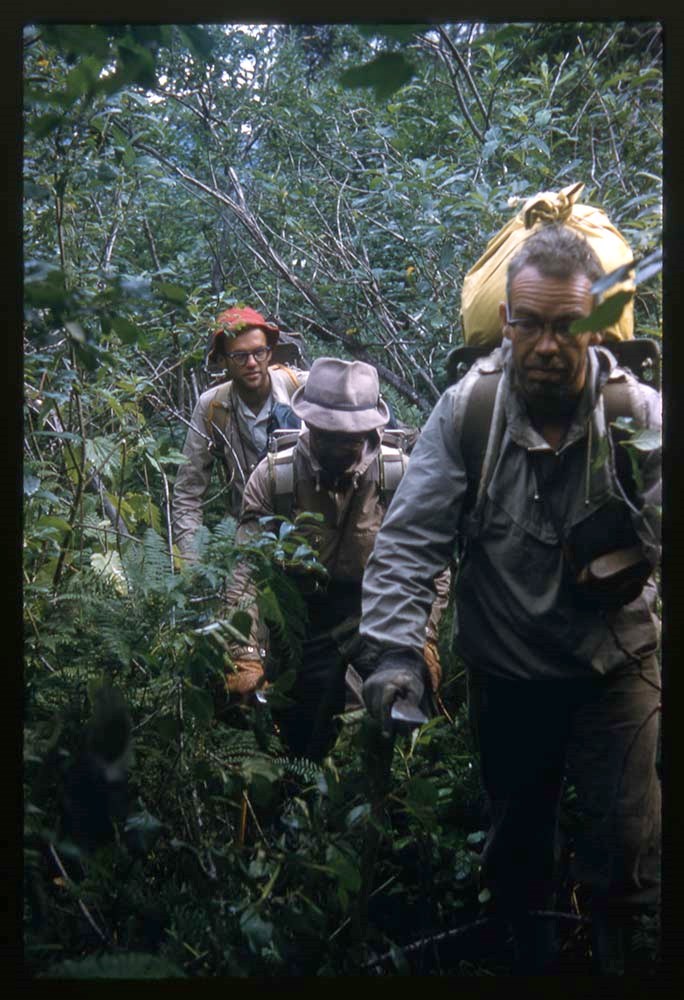
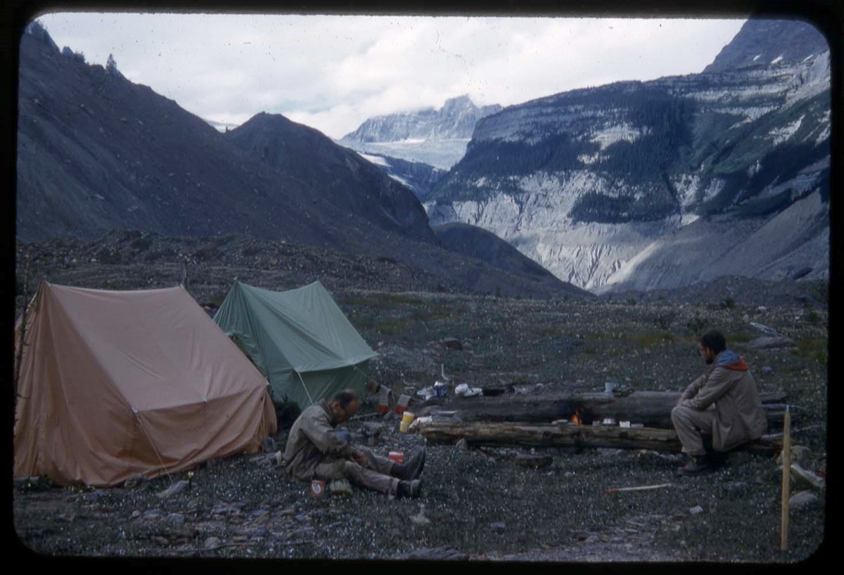
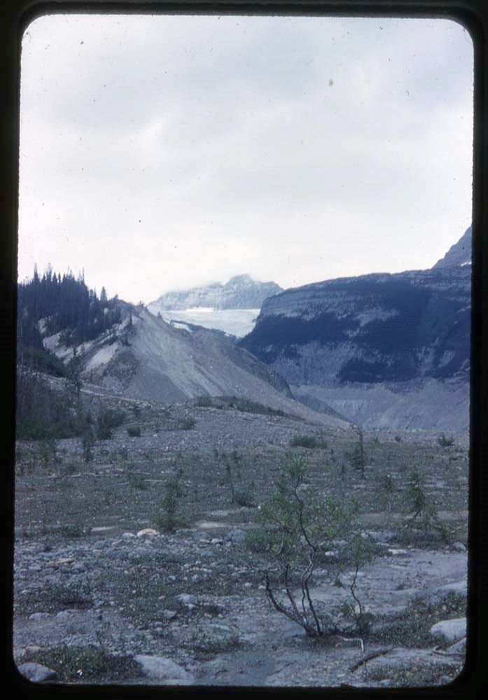
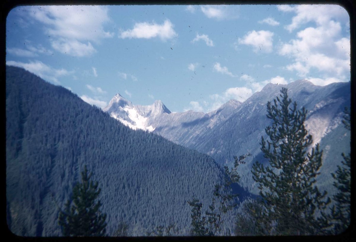
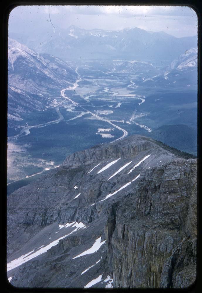
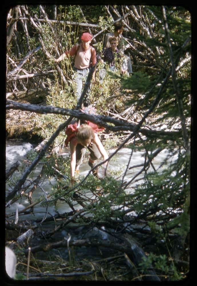
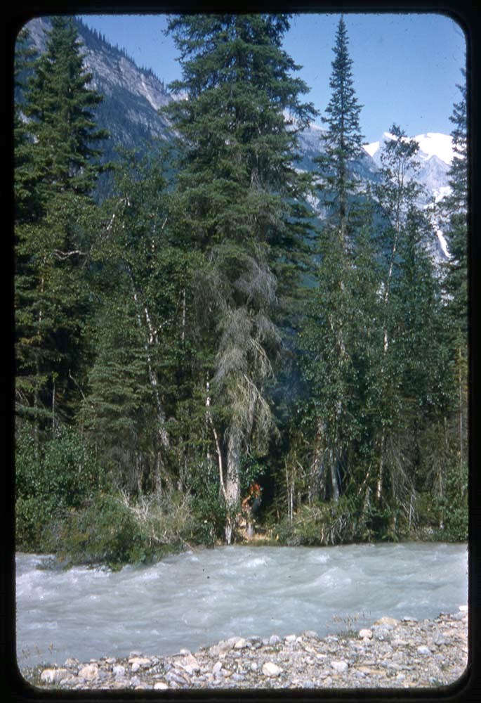
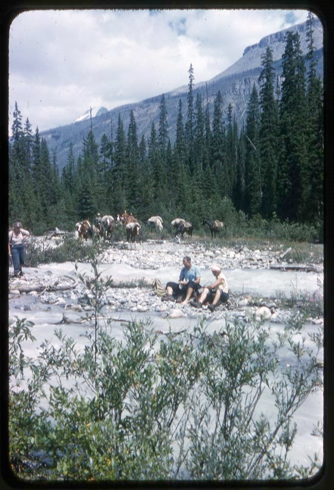
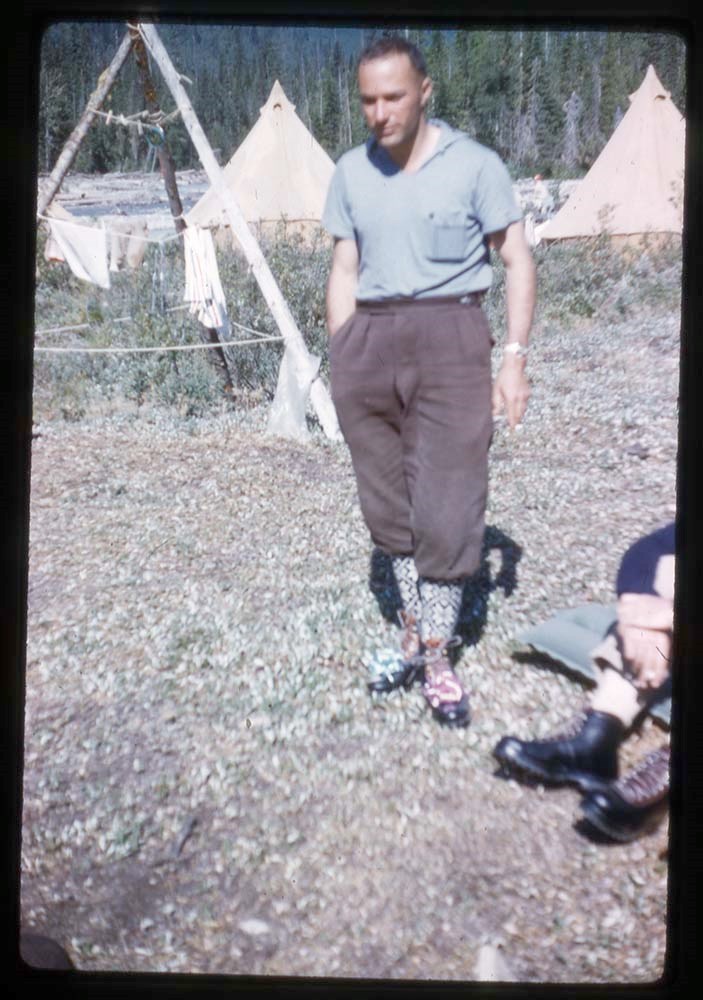
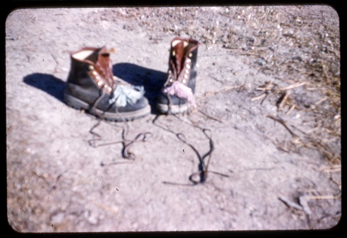
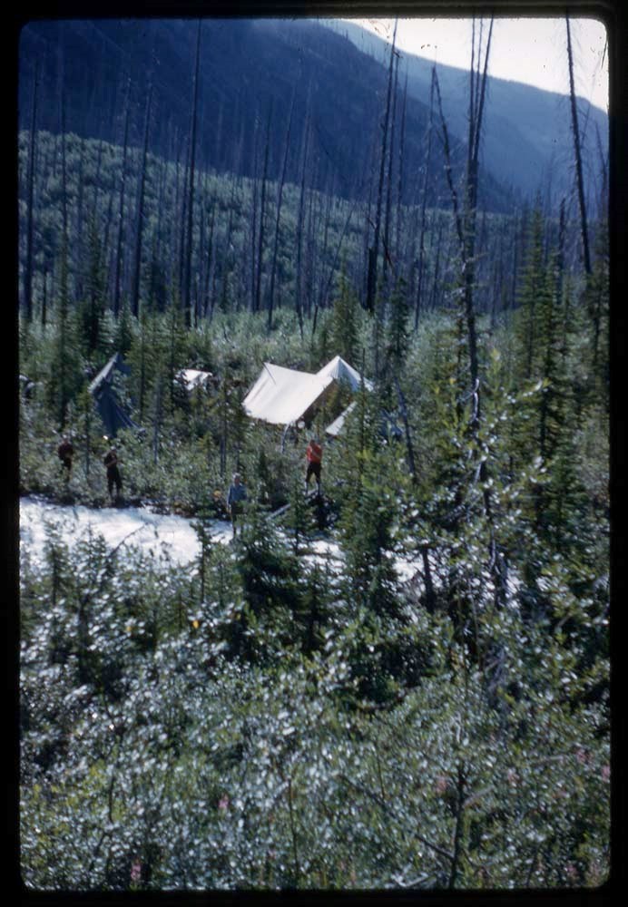
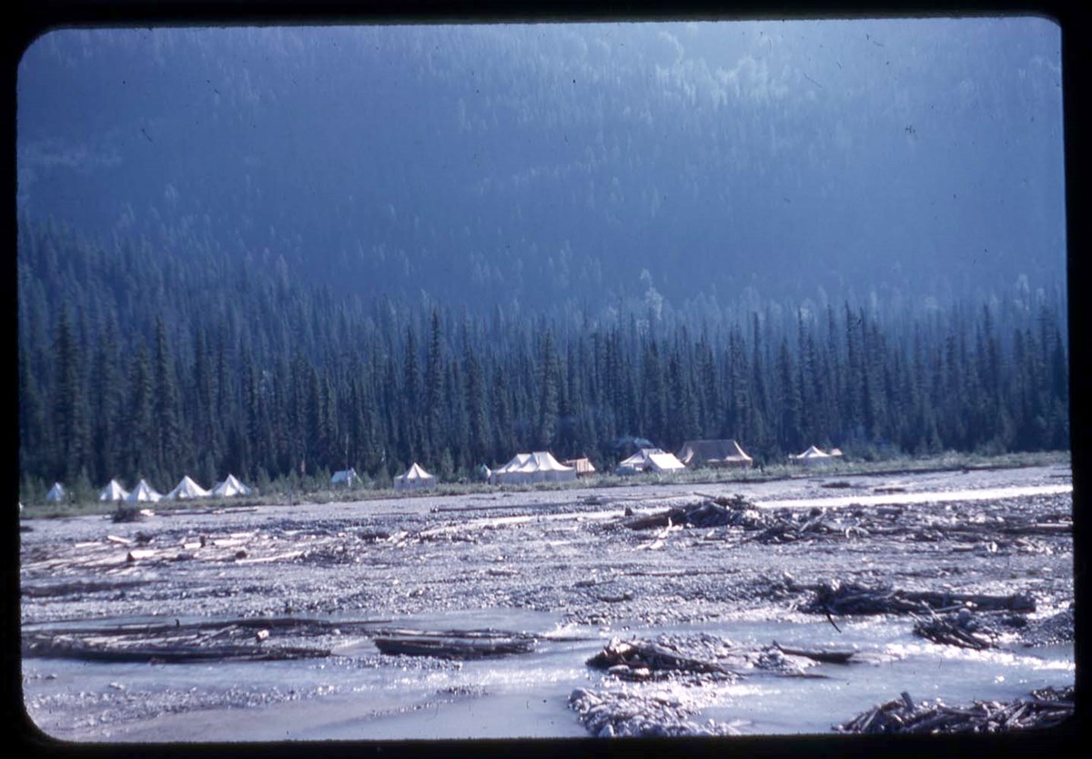
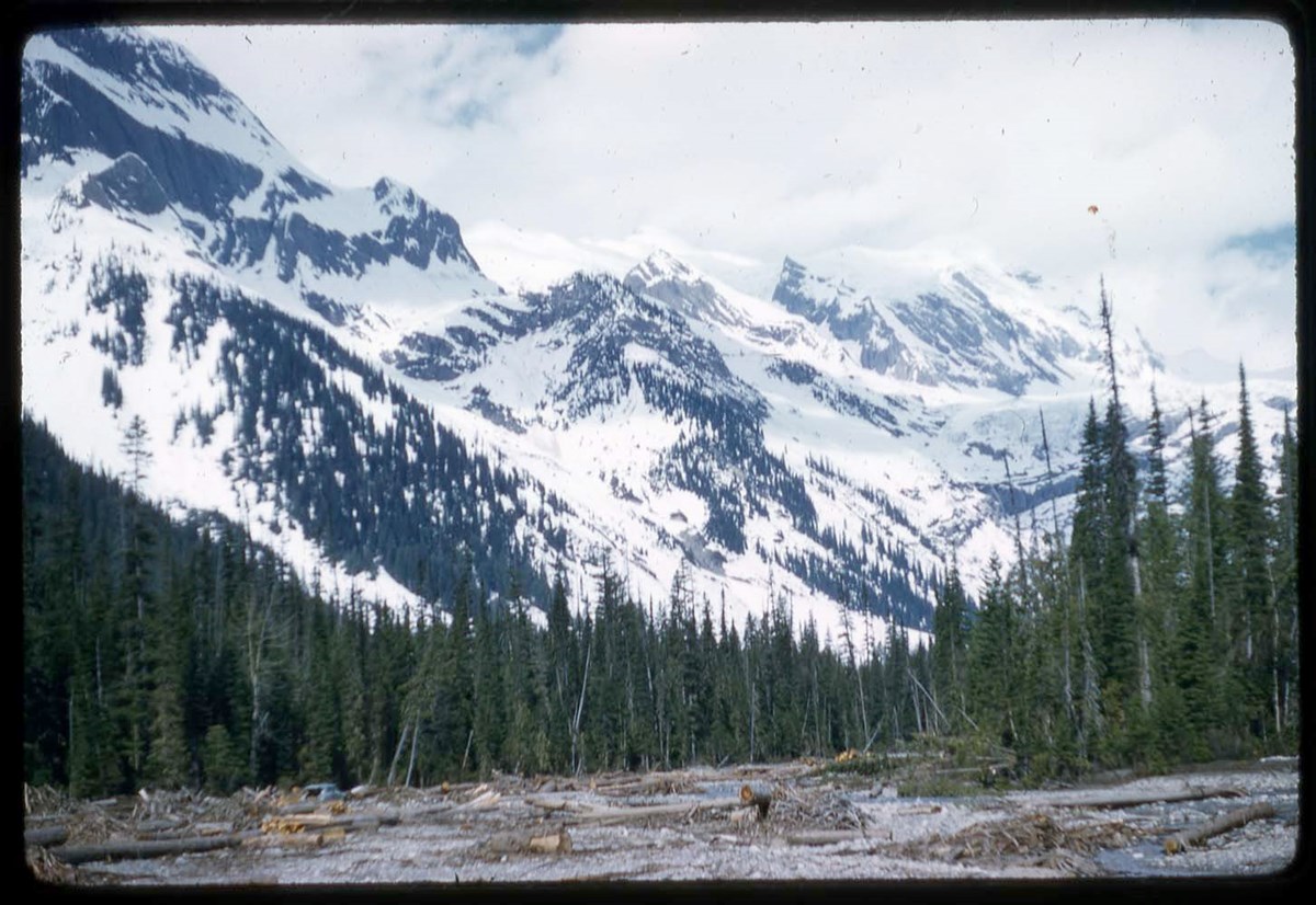
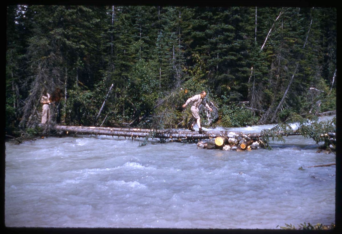
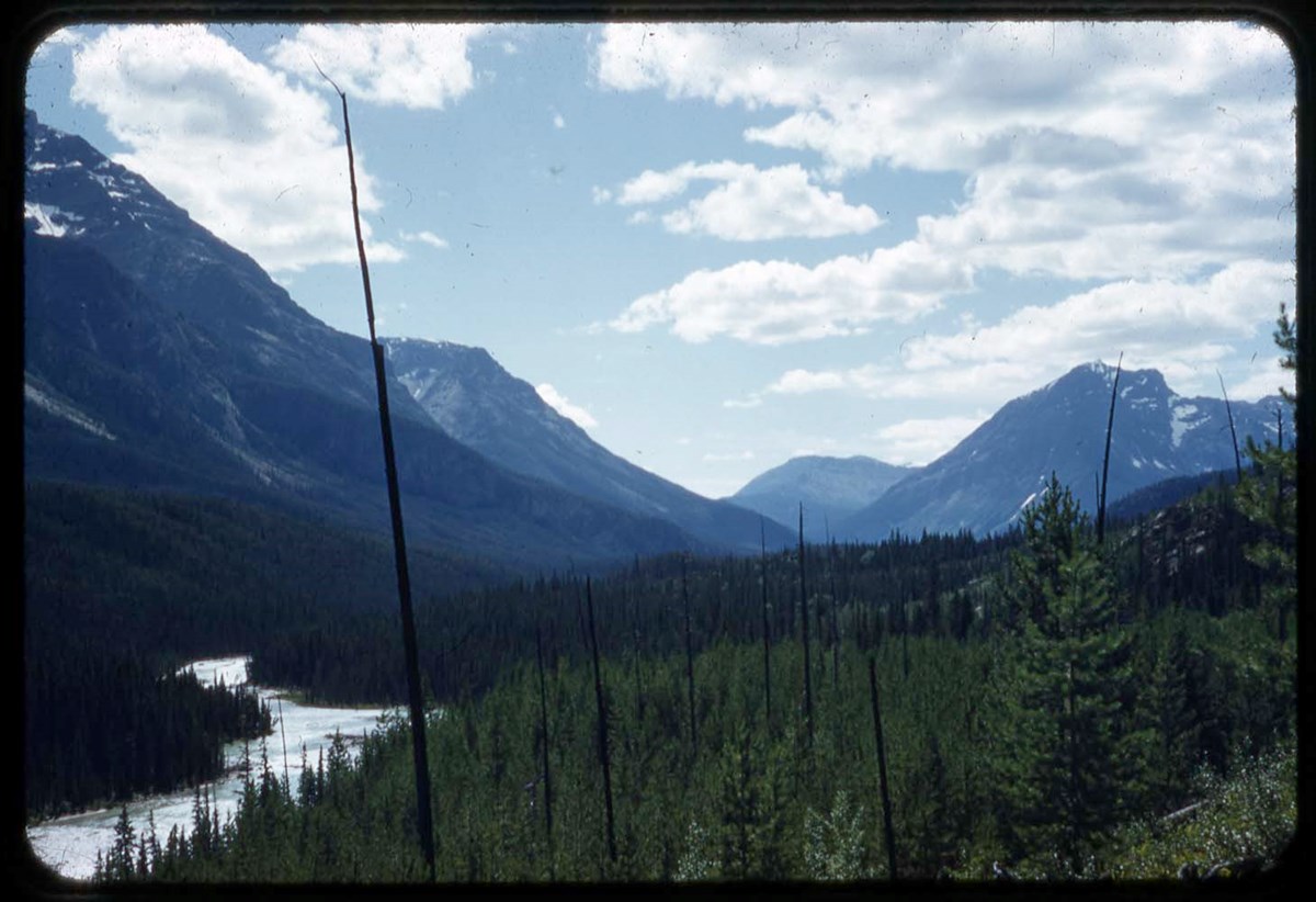
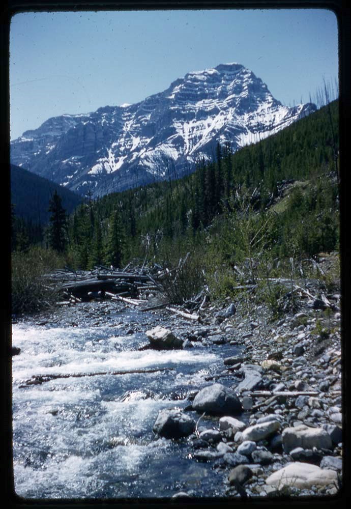
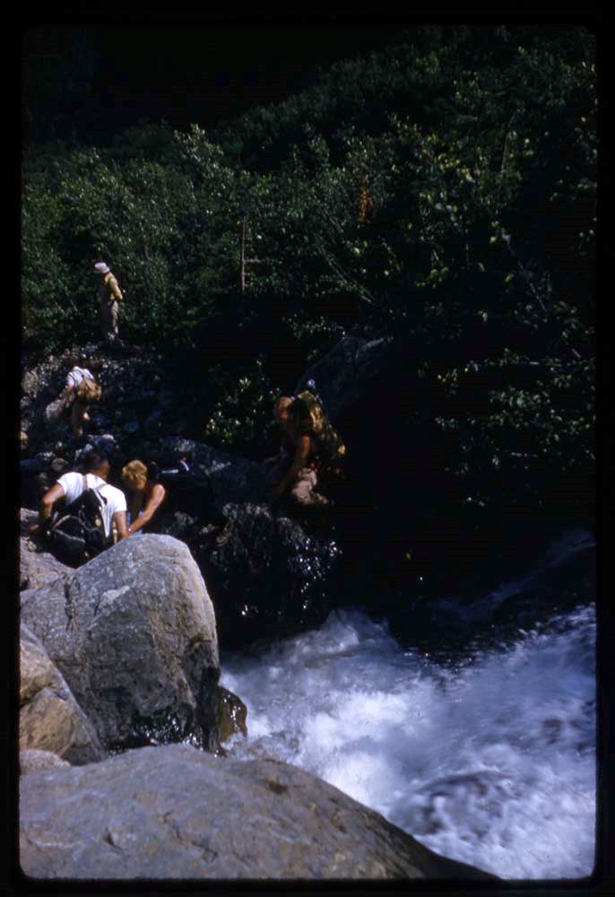
- File consists of lantern slides depicting Rocky Mountain scenic views, mountains, wildlife, horse rides. Includes Banff, Yoho, Lake O'Hara, Banff-Jasper Highway and surrounding areas. Slides are a mix of colour and black & white photographs; some images are printed directly onto one pane of glass …
- Date Range
- 1925-1931
- Reference Code
- V353 / I / B / PS-121 to PS-160
- Description Level
- 5 / File
- GMD
- Transparency
- Lantern slide
40 images
1 Electronic Resource
- Part Of
- Leonard Leacock fonds
- Description Level
- 5 / File
- Fonds Number
- M372 / V353 / S24
- Series
- V353 / I : Photography
- Sous-Fonds
- V353
- Sub-Series
- V353 / I / B : Photography: lantern slides
- Accession Number
- 6756
- Reference Code
- V353 / I / B / PS-121 to PS-160
- Date Range
- 1925-1931
- Physical Description
- 40 photographs : b&w and col. slides ; 10.2 x 8.2 cm
- History / Biographical
- See fonds level description.
- Scope & Content
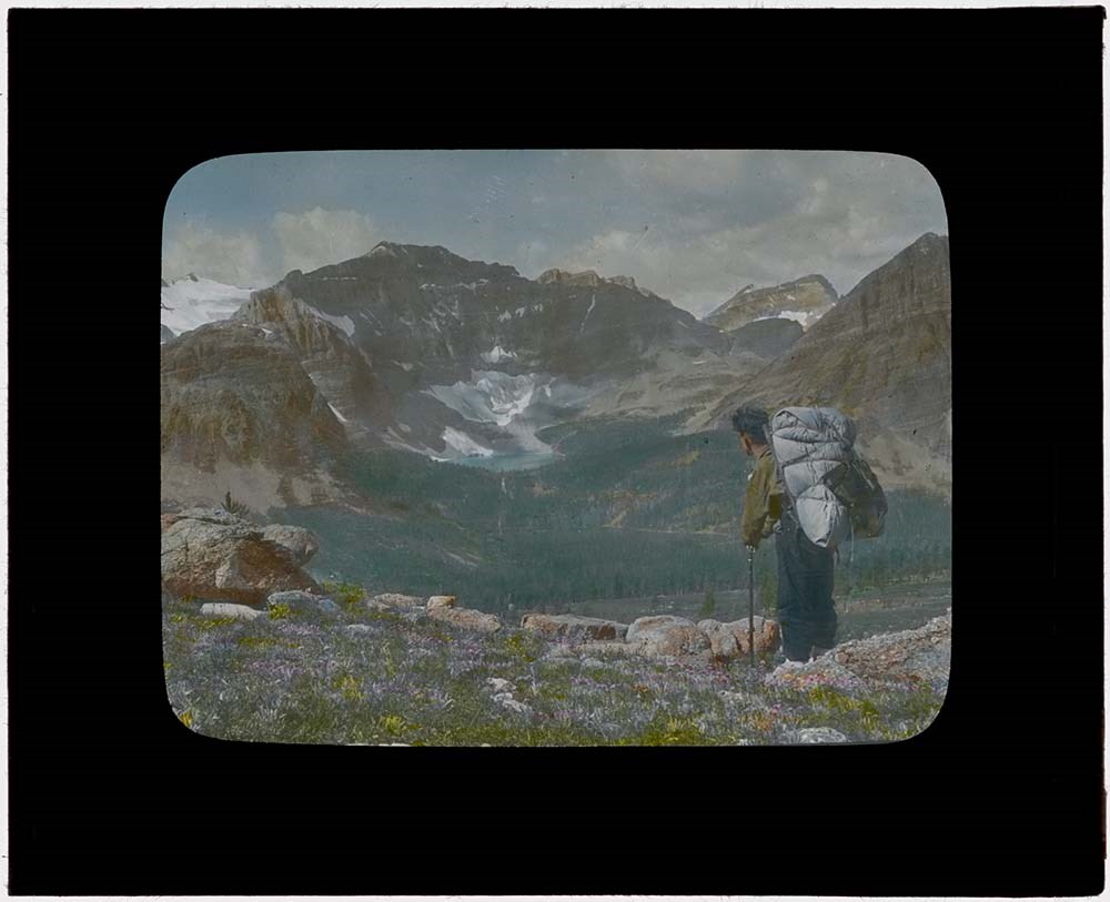
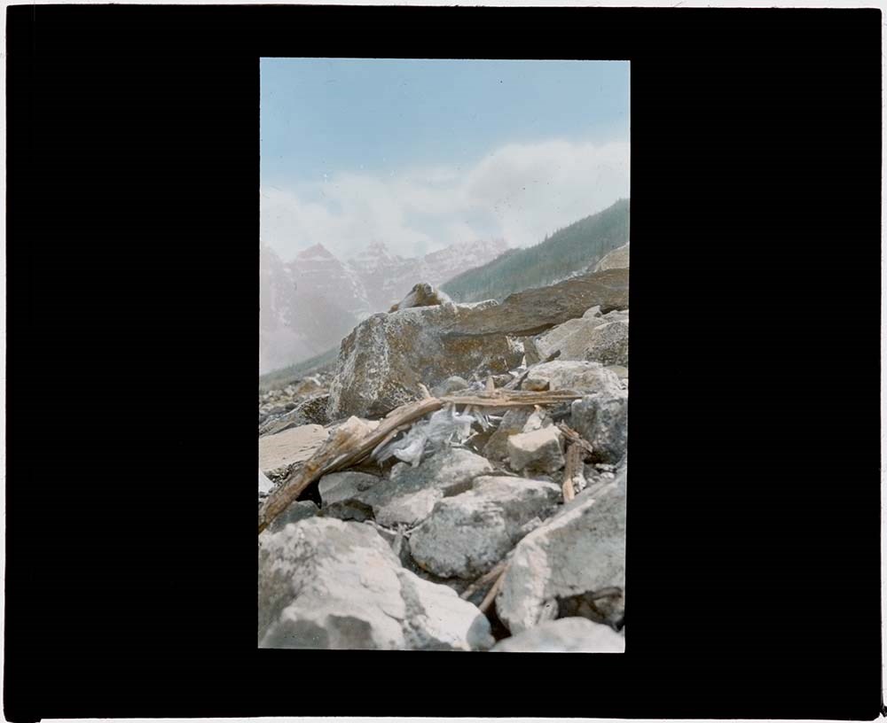
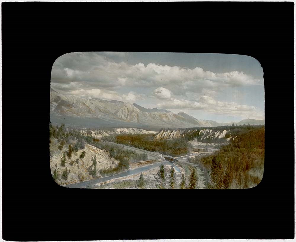
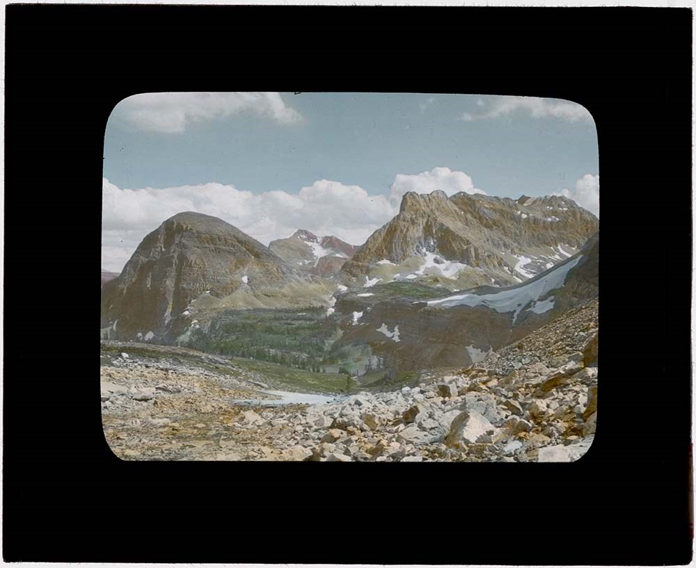
- File consists of lantern slides depicting Rocky Mountain scenic views, mountains, wildlife, horse rides. Includes Banff, Yoho, Lake O'Hara, Banff-Jasper Highway and surrounding areas. Slides are a mix of colour and black & white photographs; some images are printed directly onto one pane of glass while others are transparencies on celullose film mounted between 2 glass panes. There is no order to the different mediums. Slides were accompanied with 7 typed text papers listing the slide numbers and details of the images. See Notes for list.
- Notes
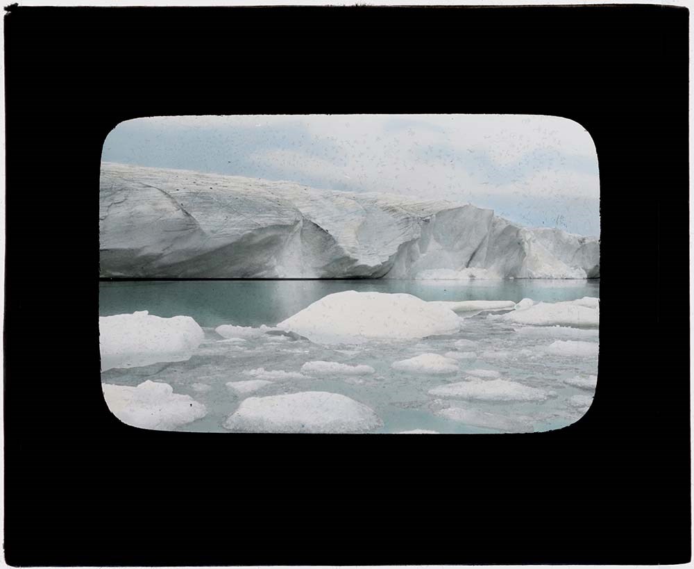
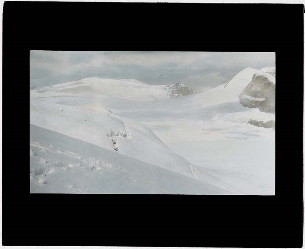
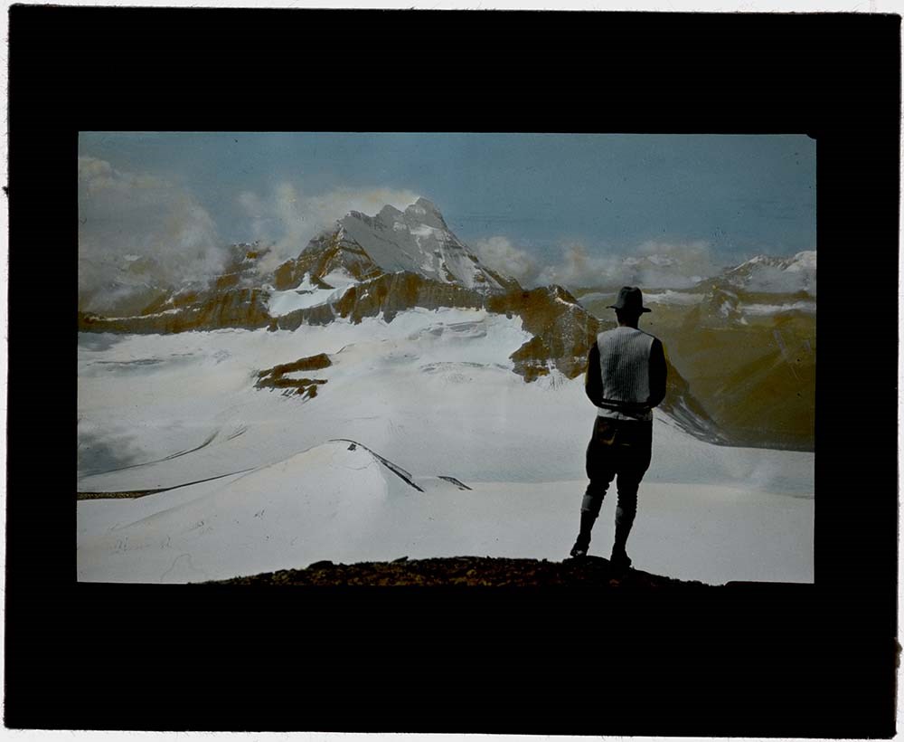
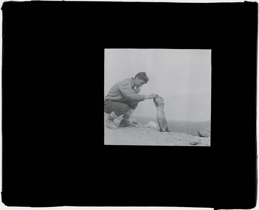
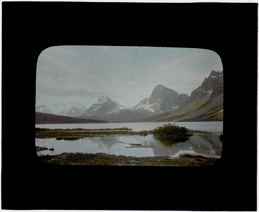
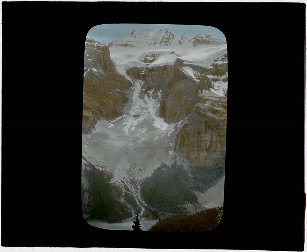
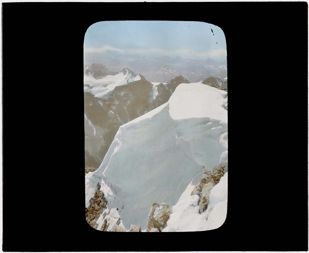
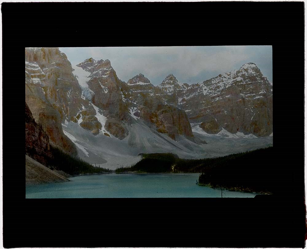
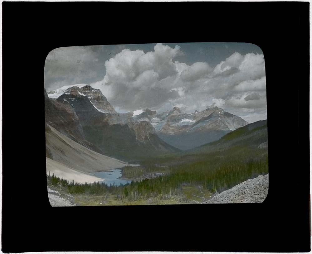
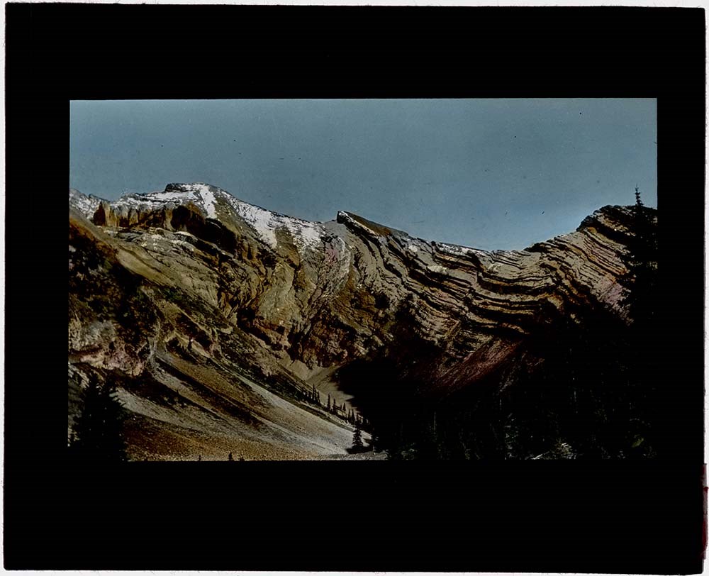
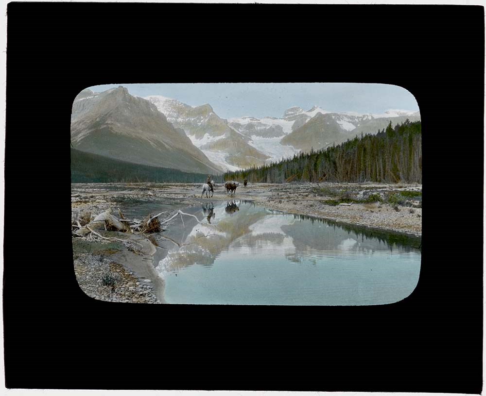
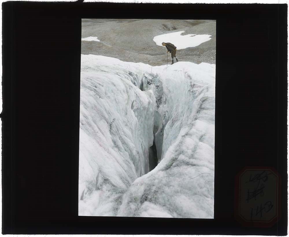
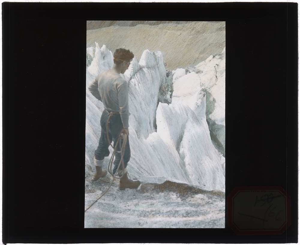
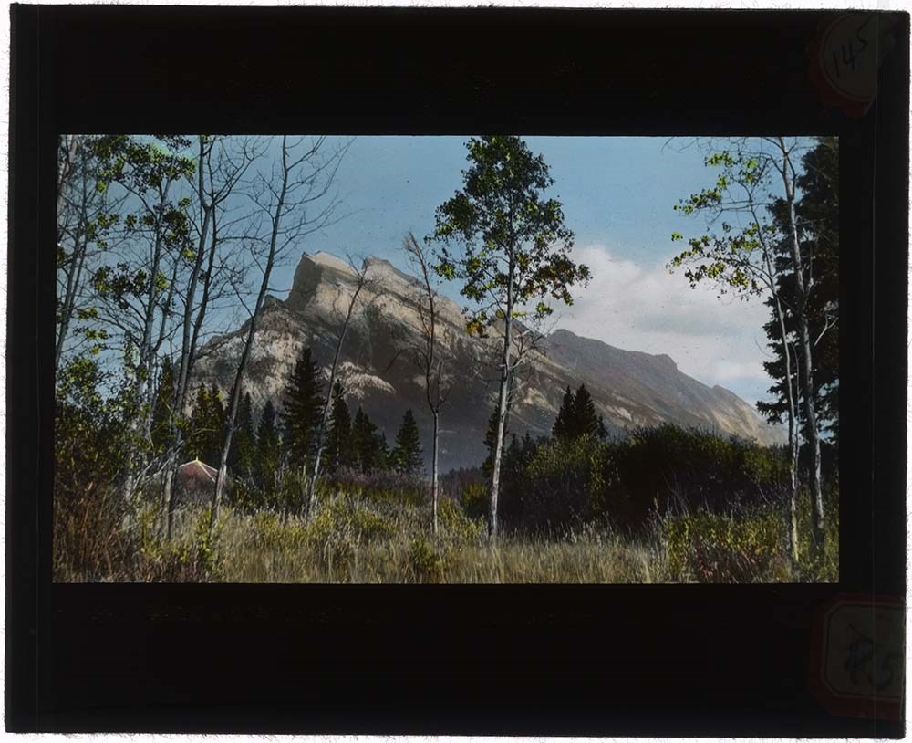
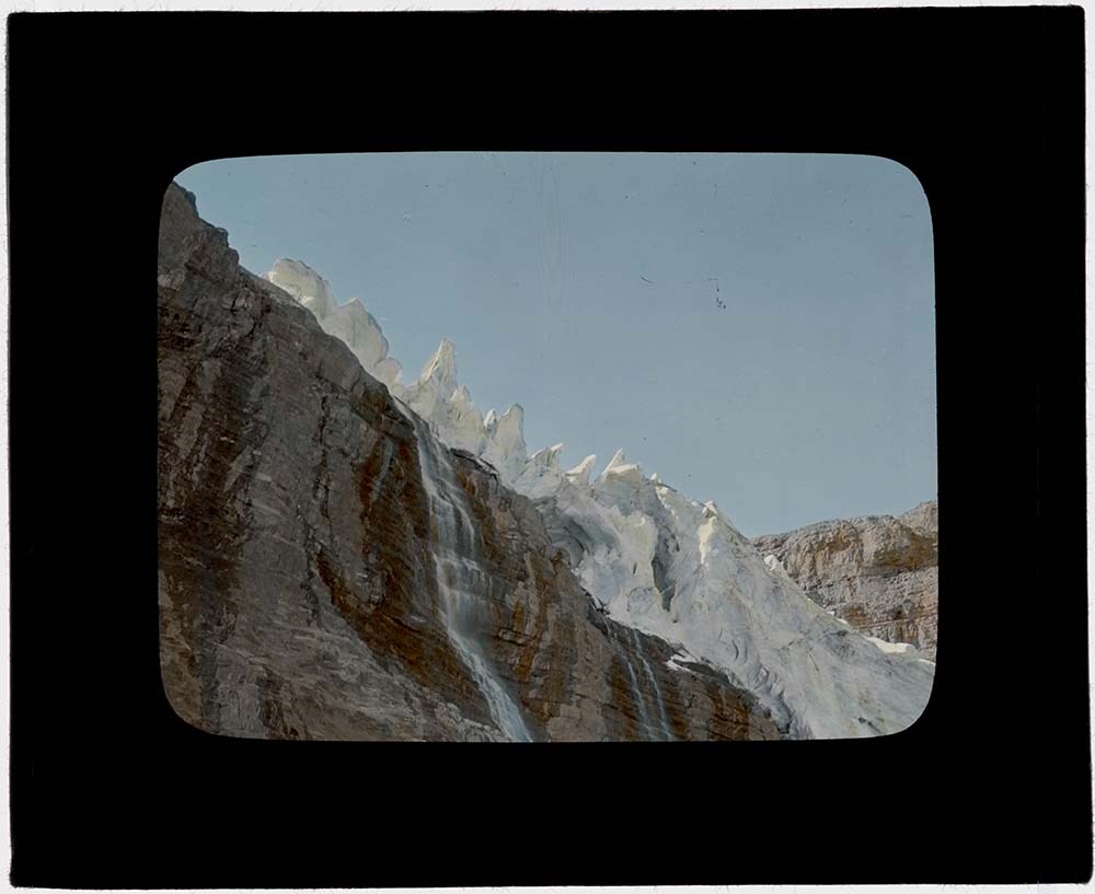
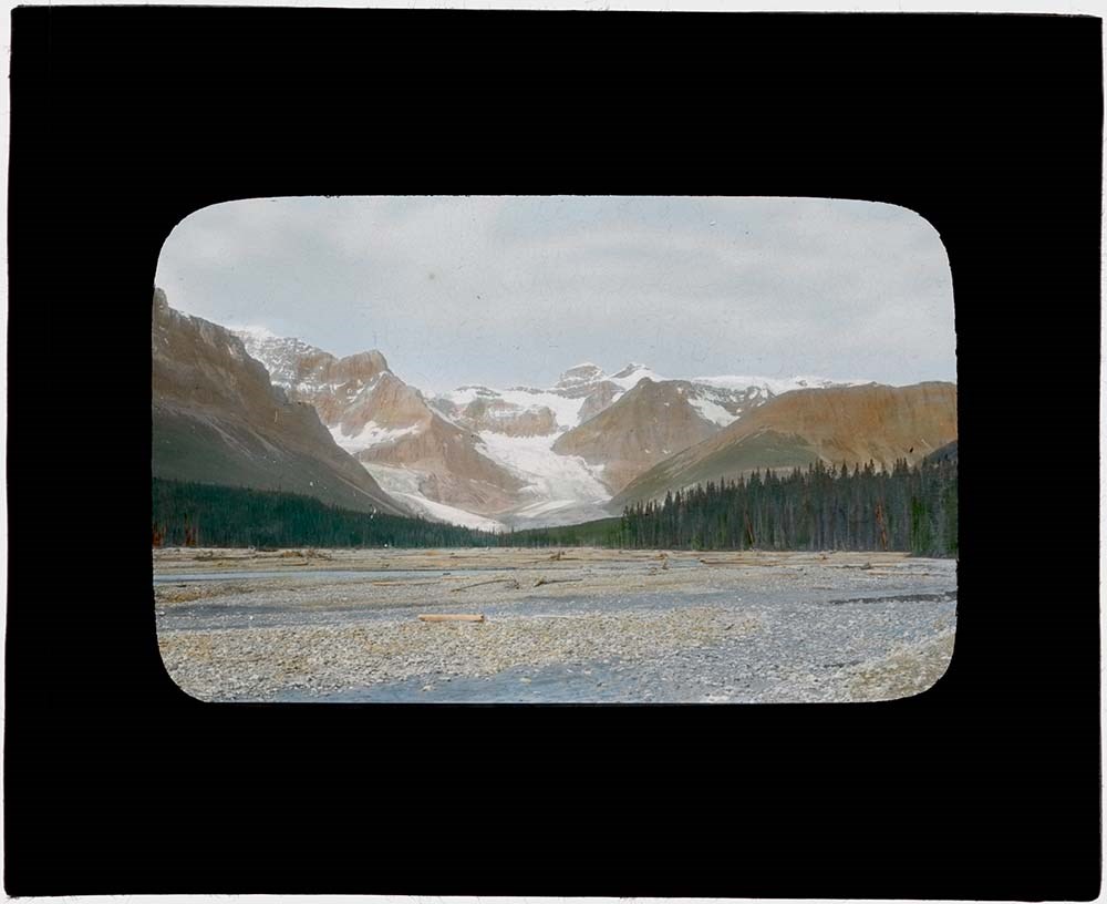
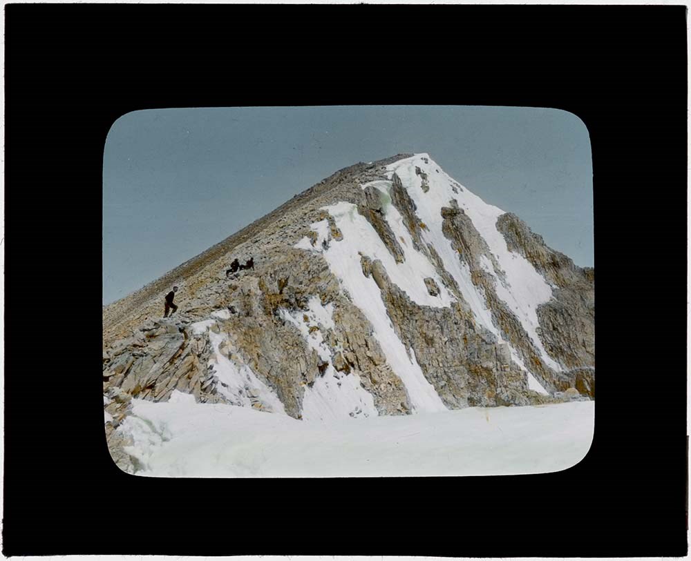
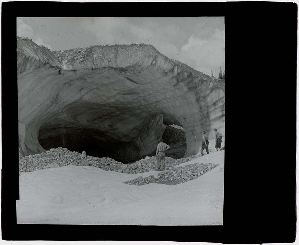
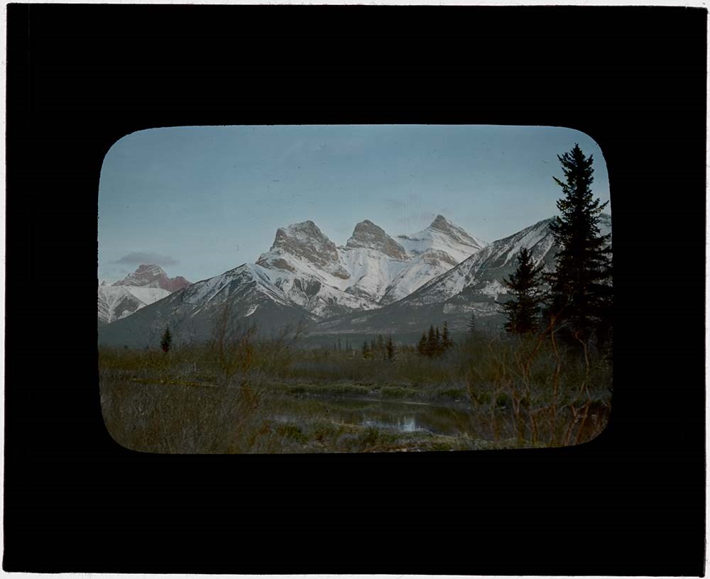
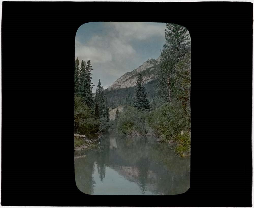
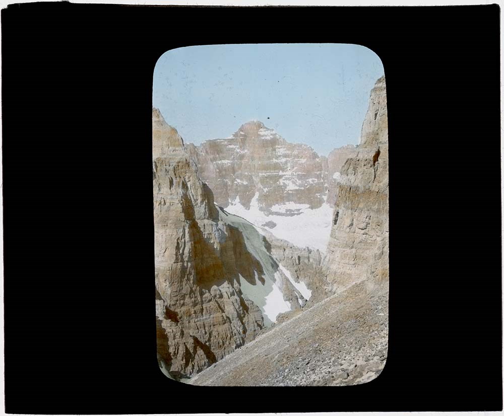
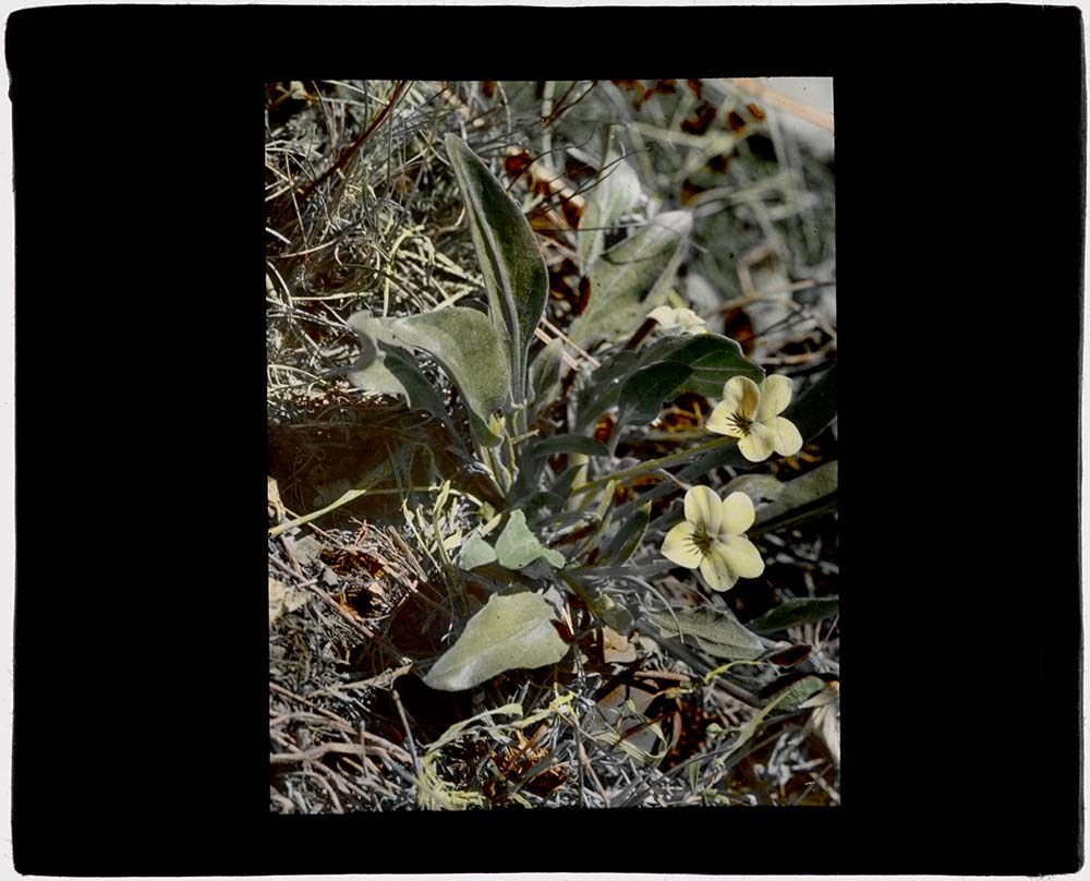
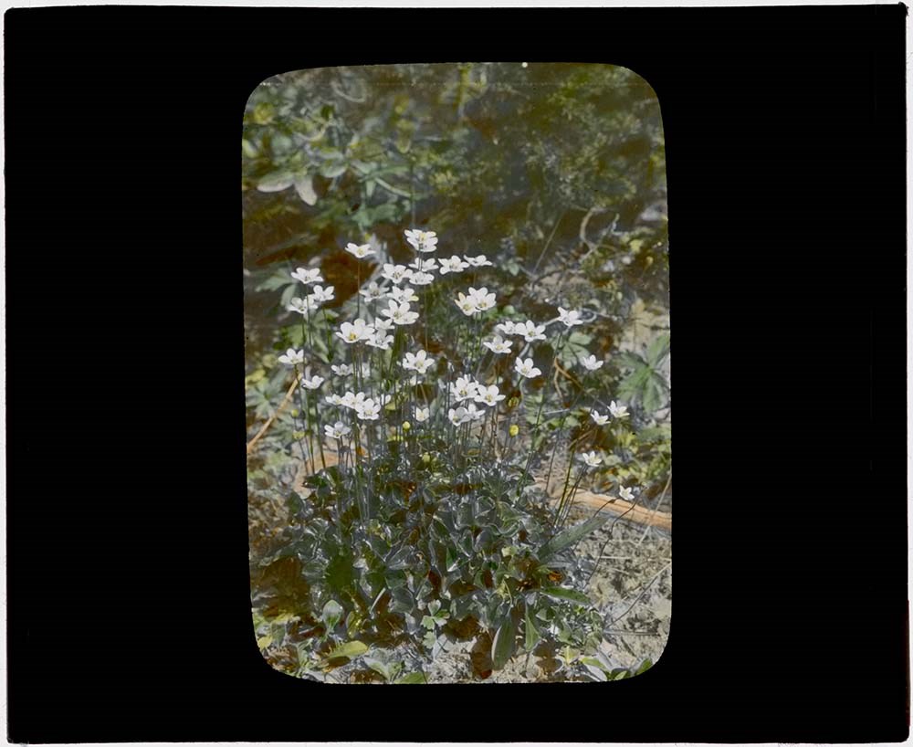
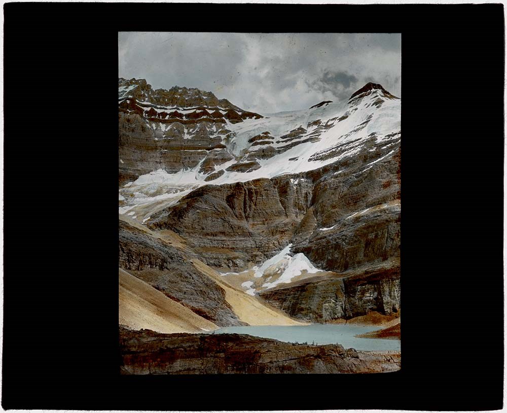
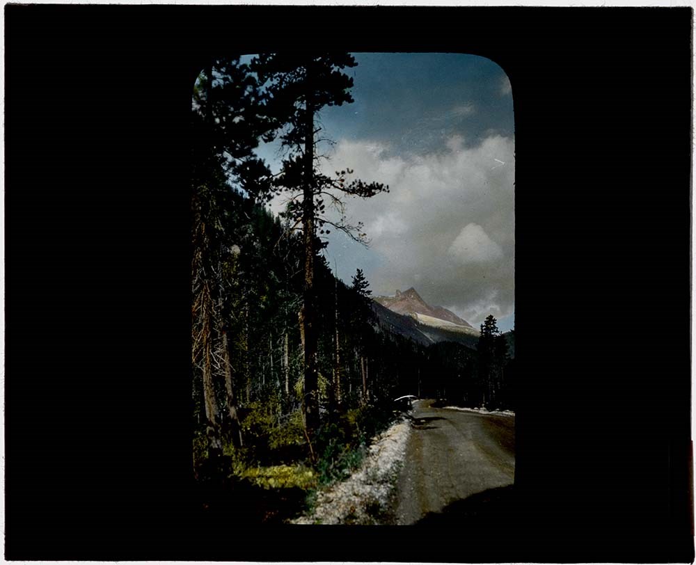
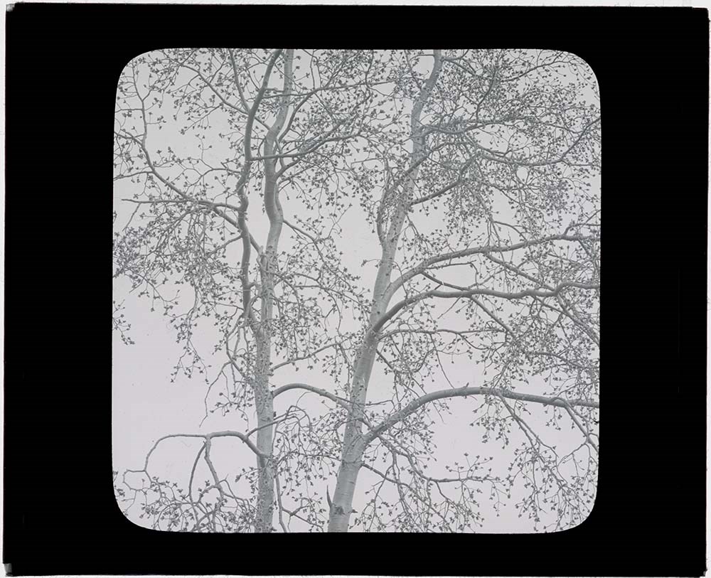
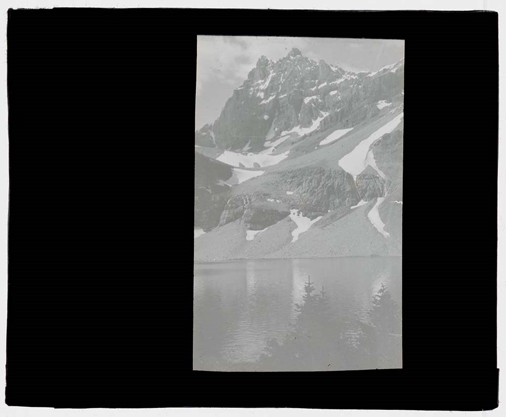
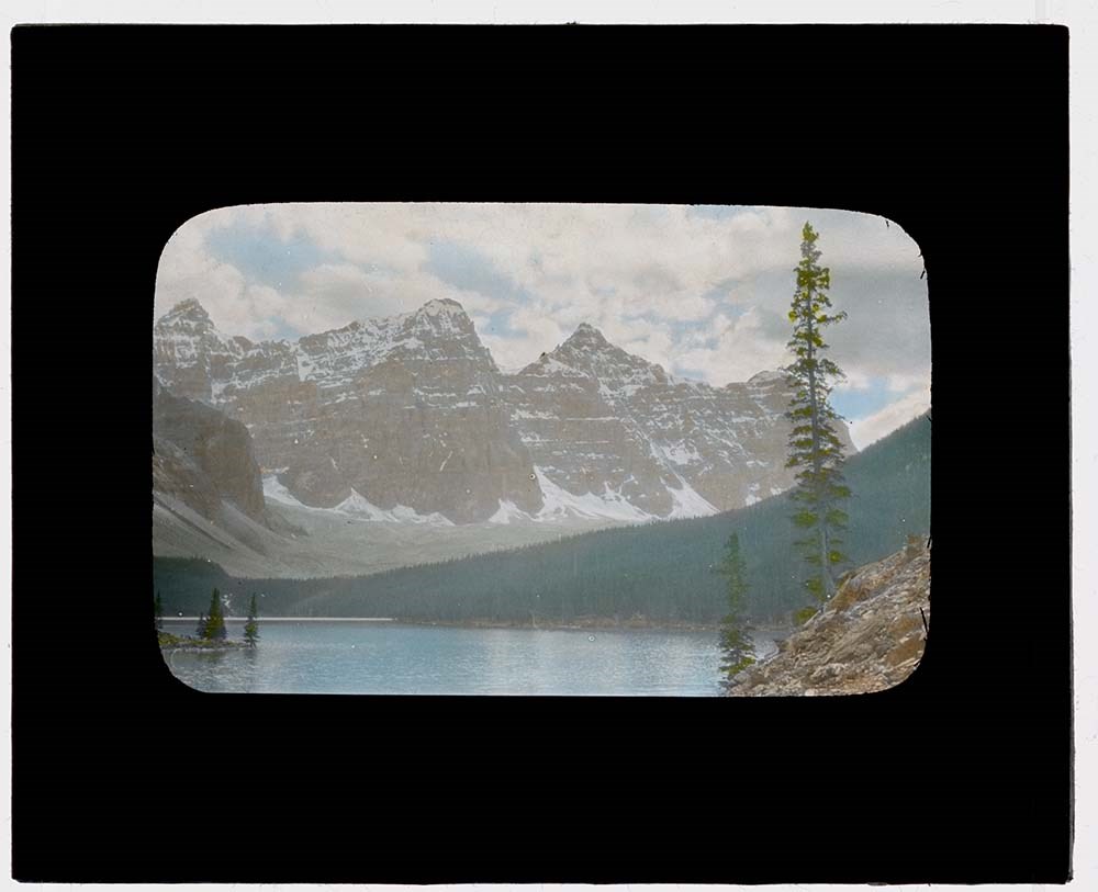
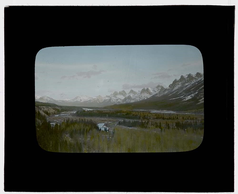
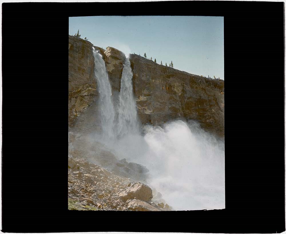
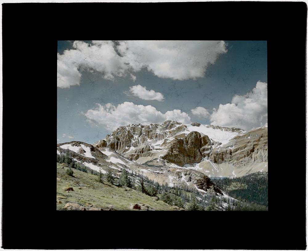
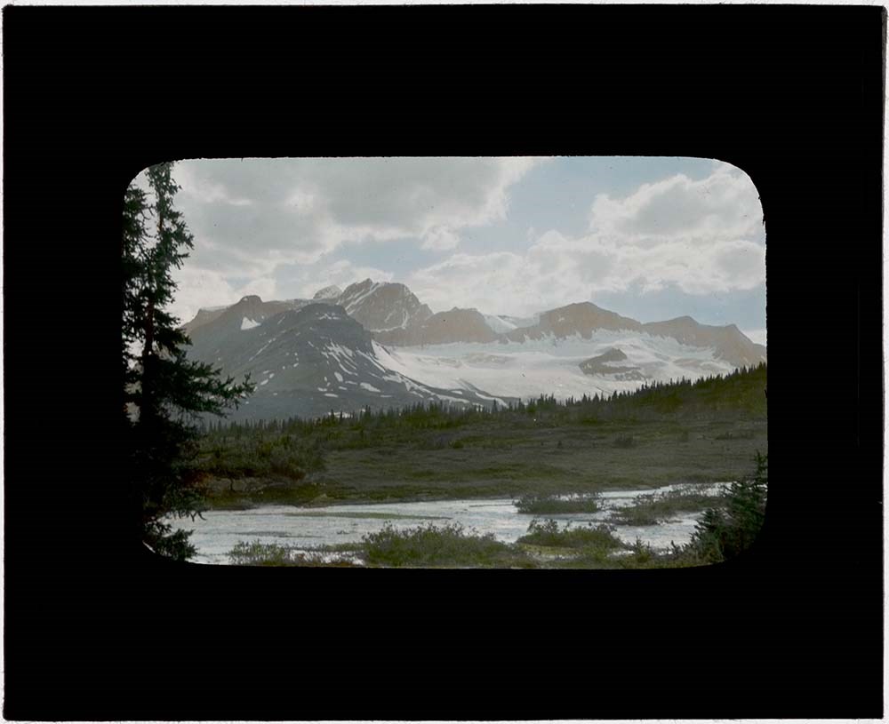
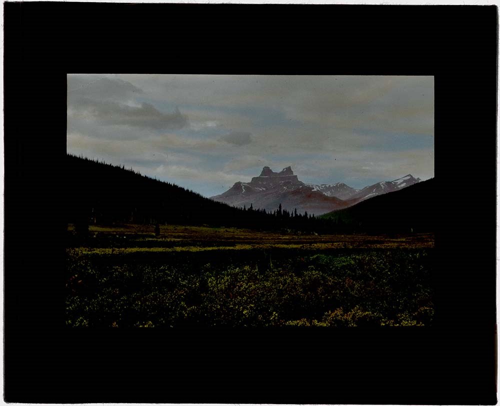
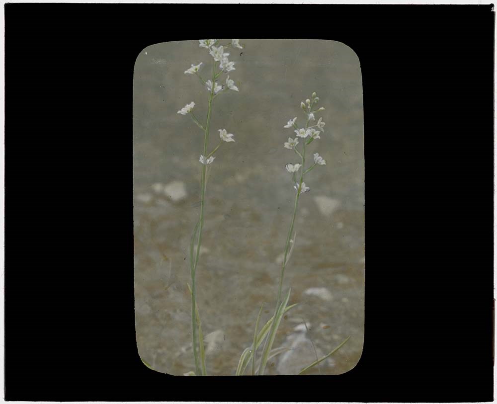
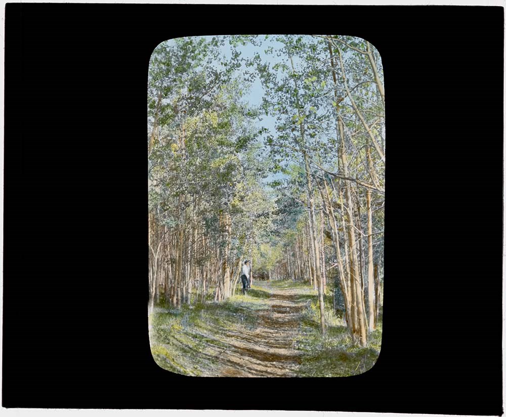
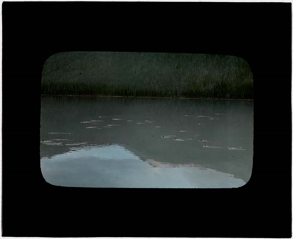
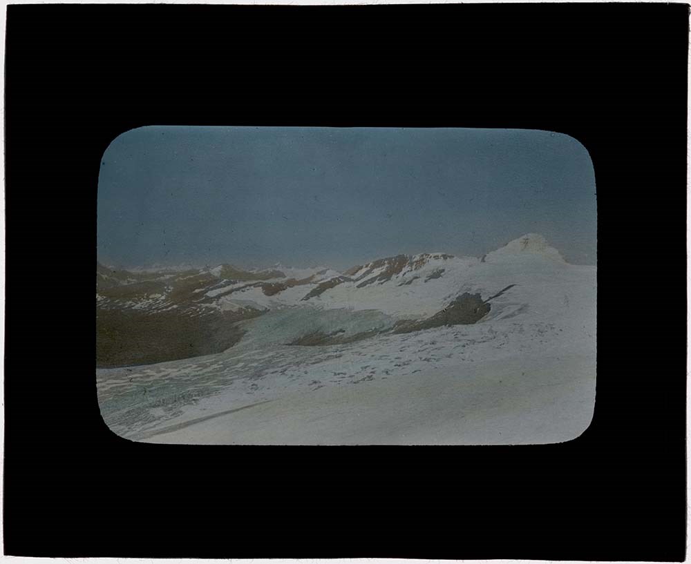
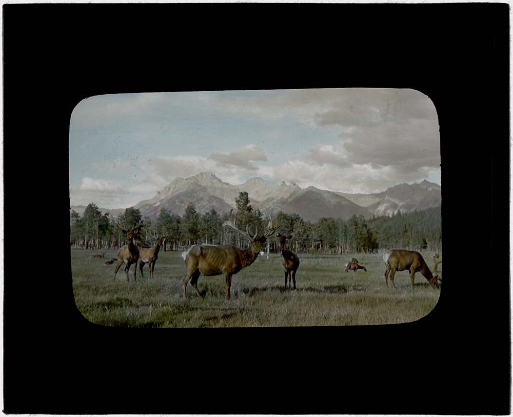
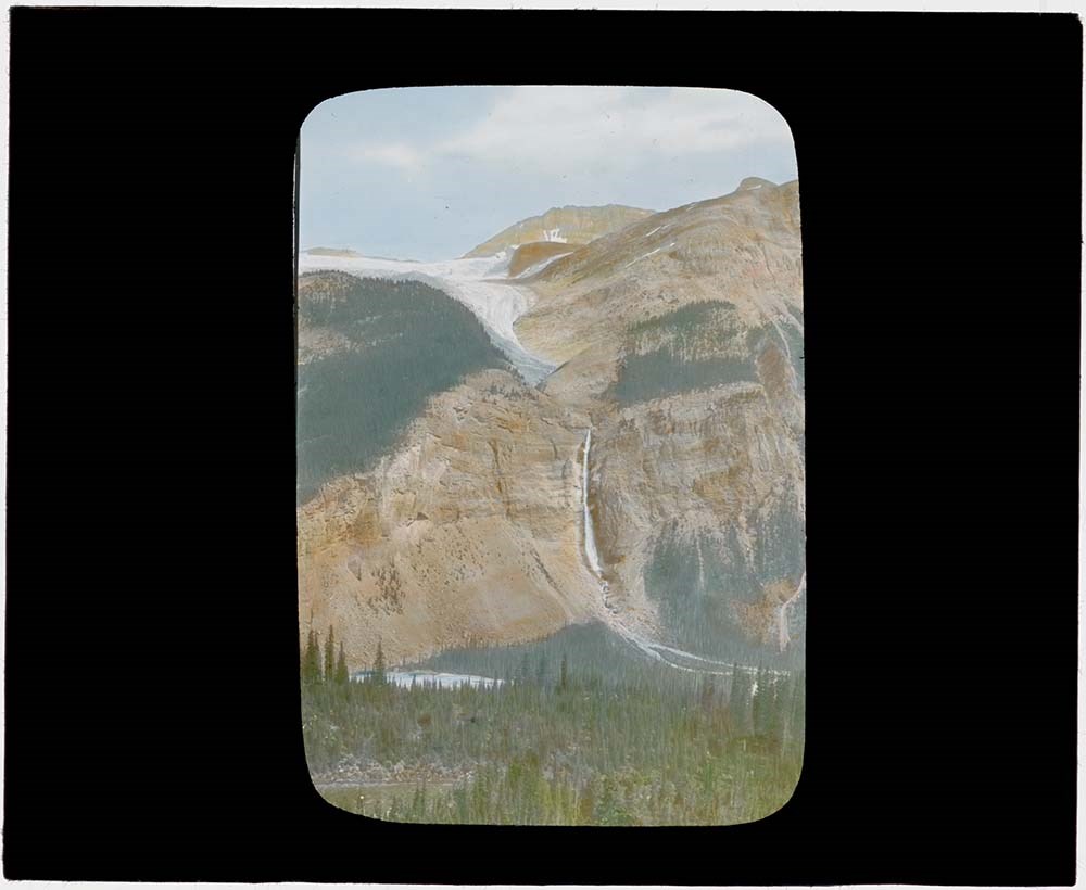
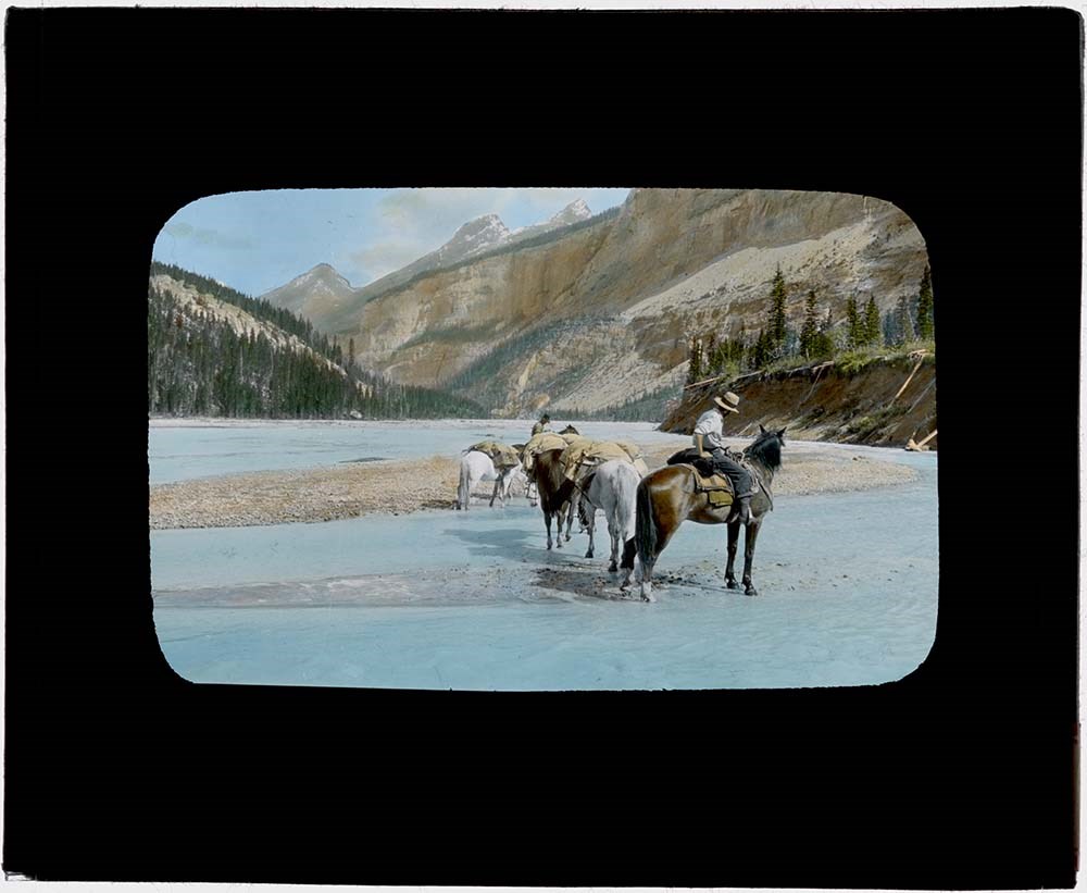
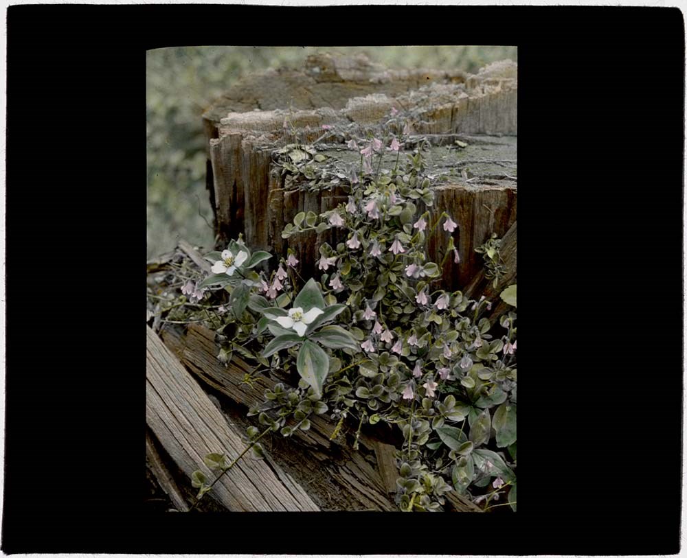
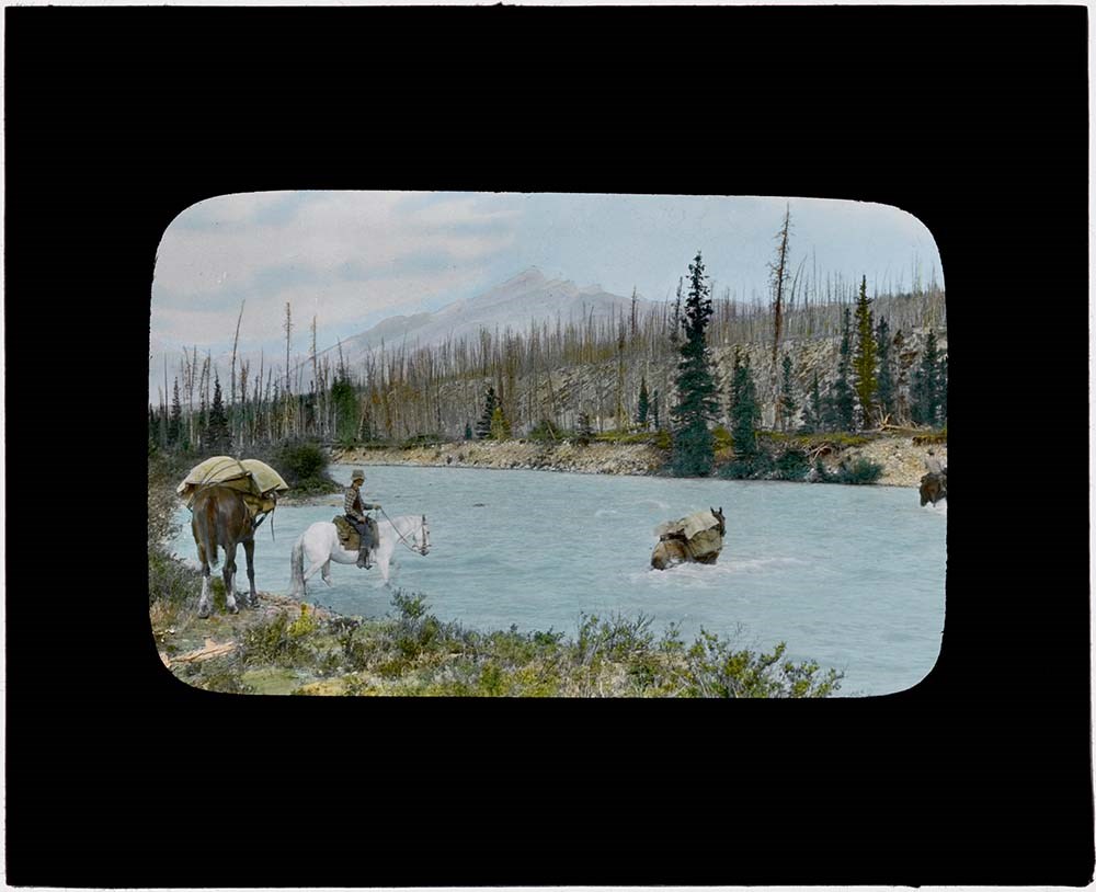
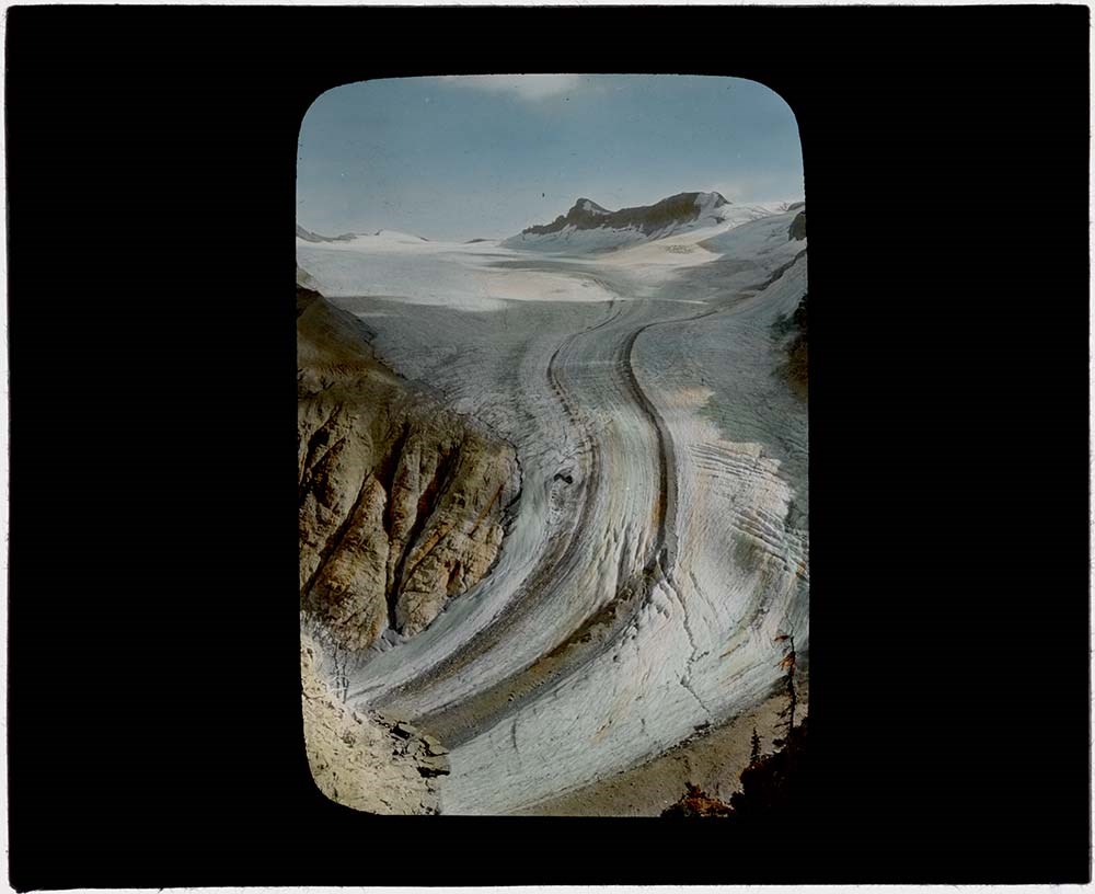
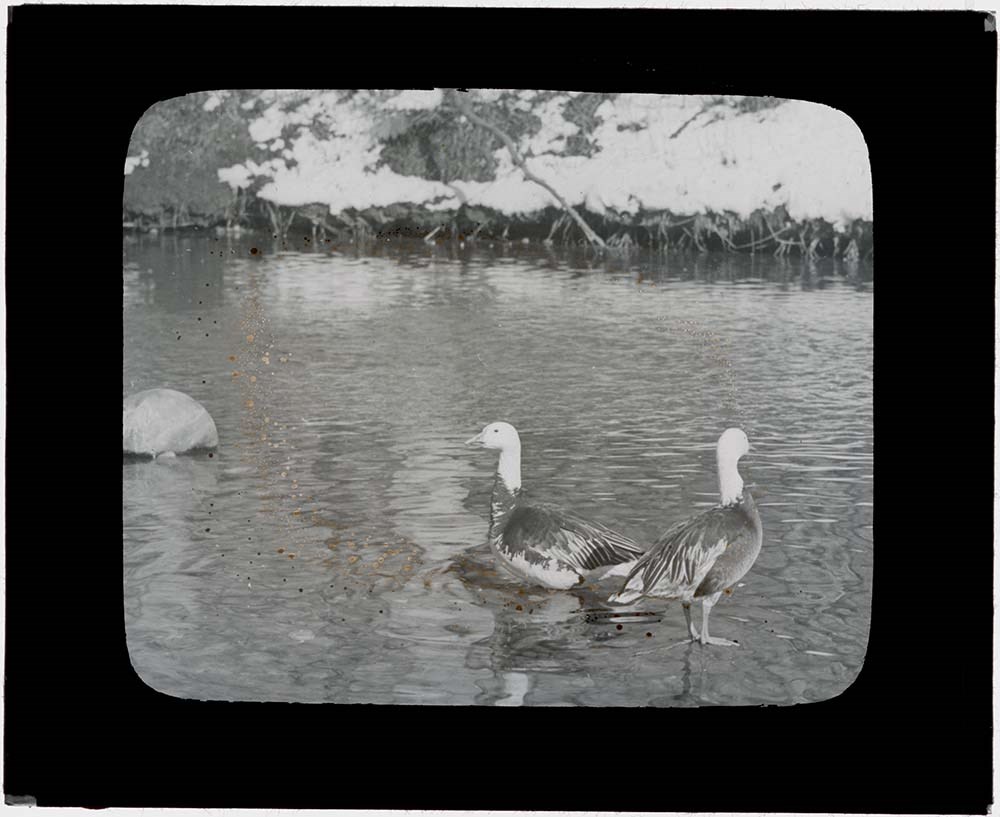
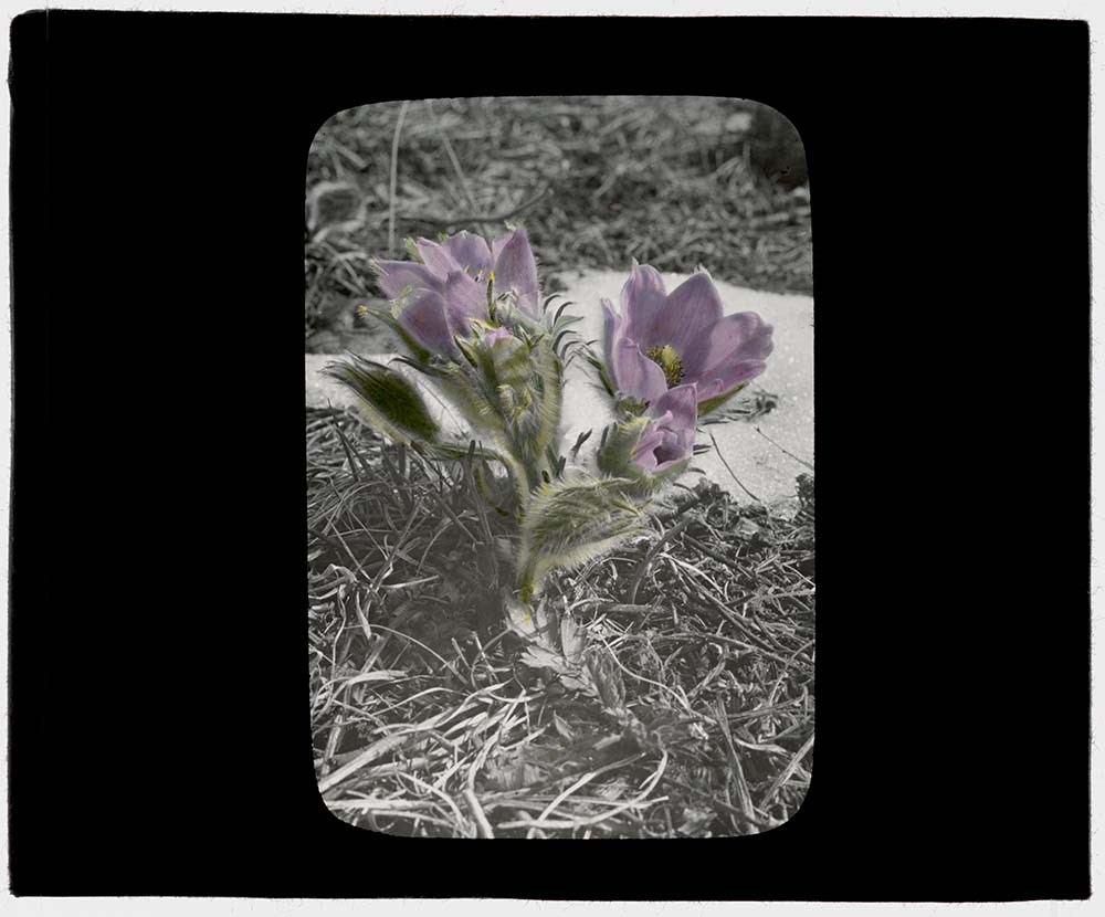
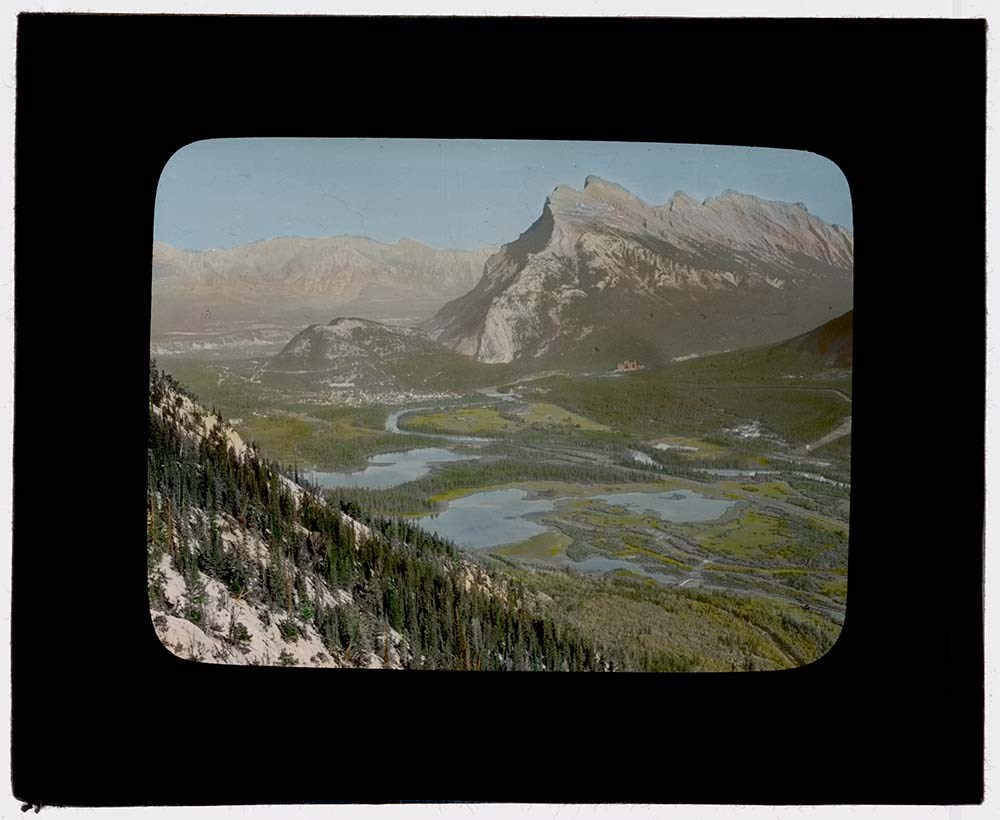
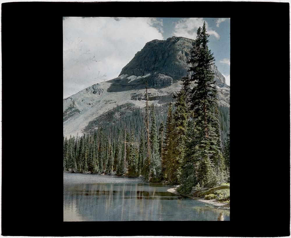
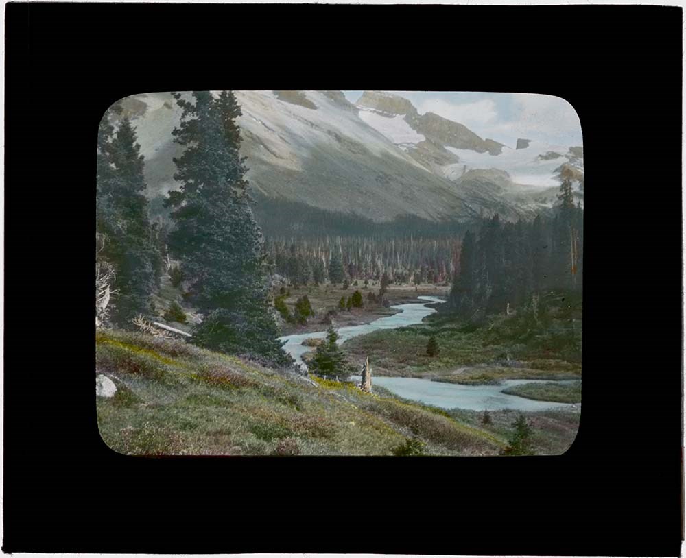
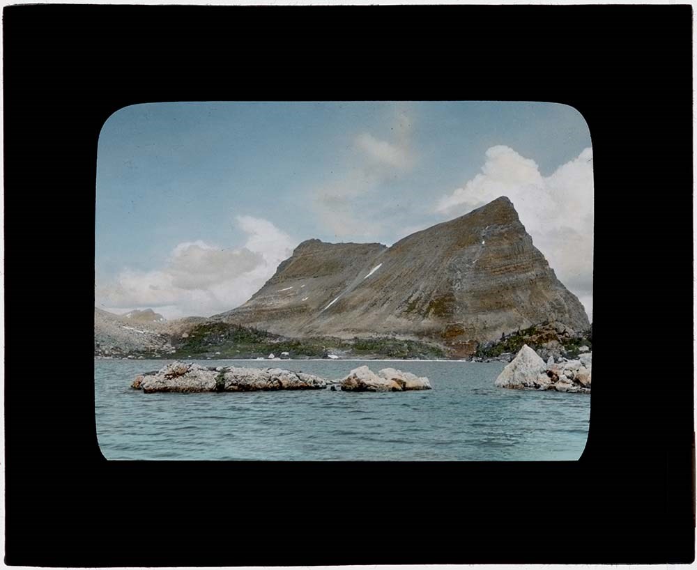
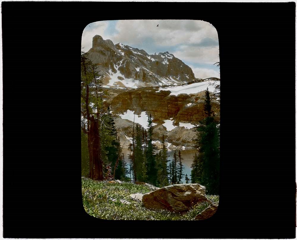
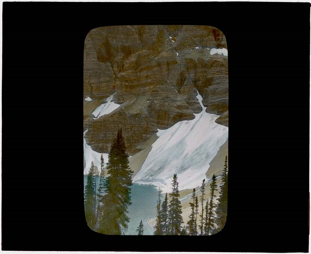
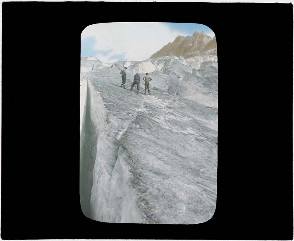
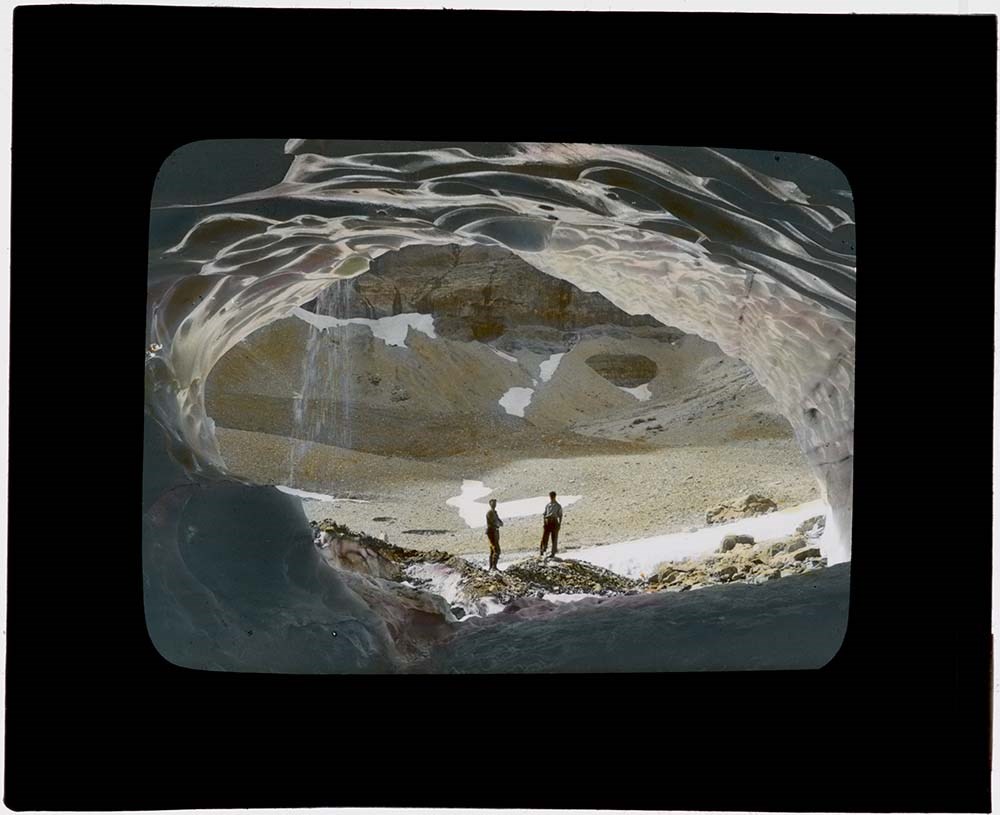
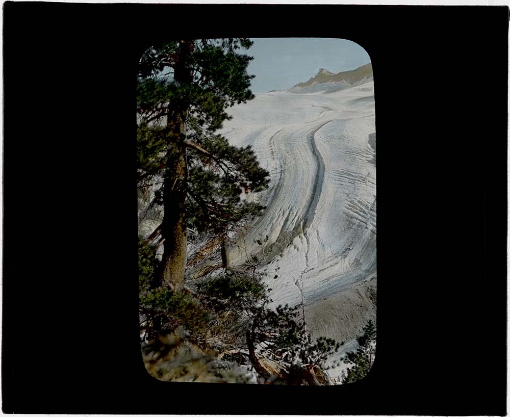
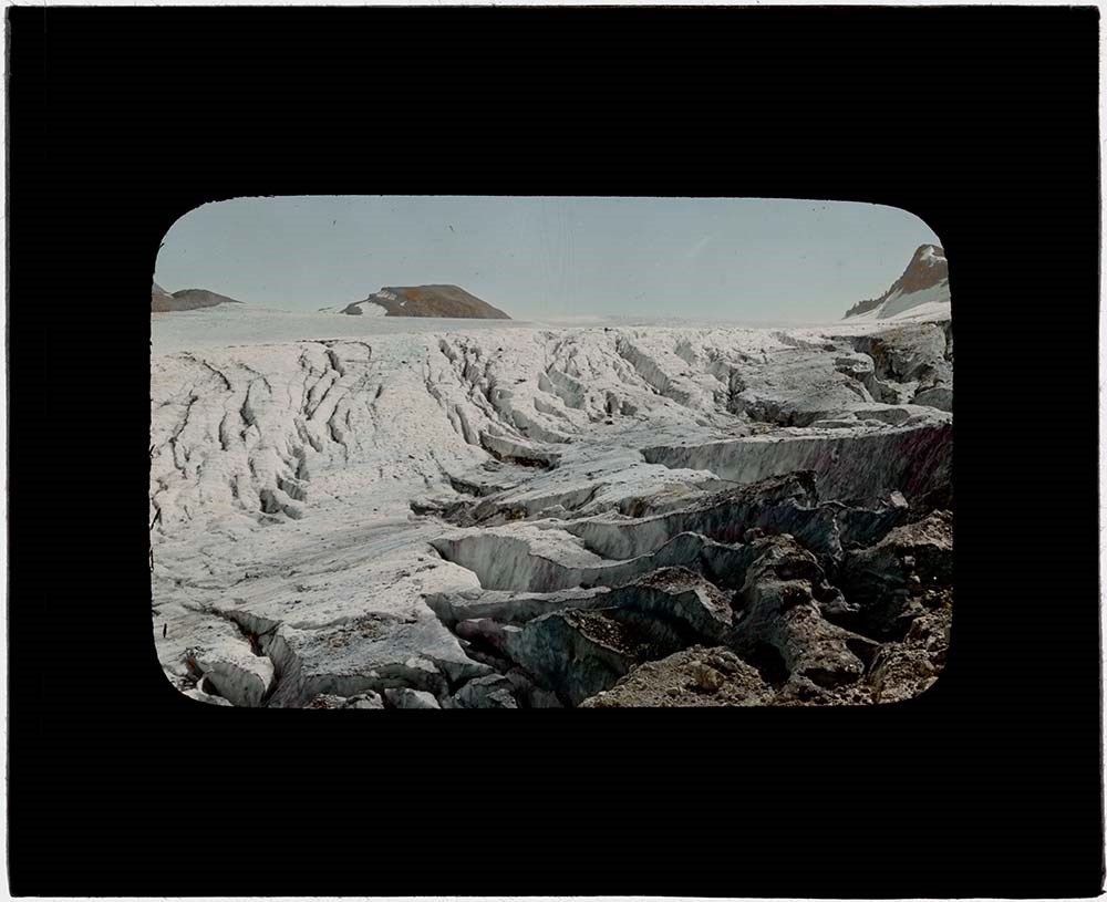
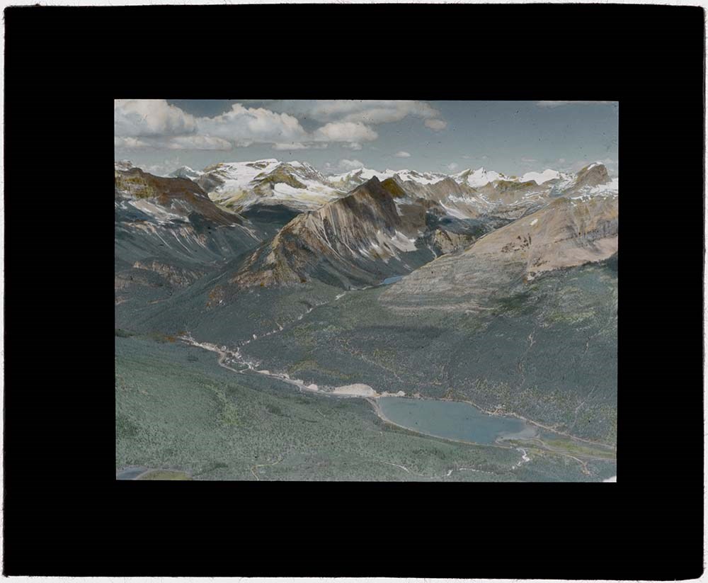
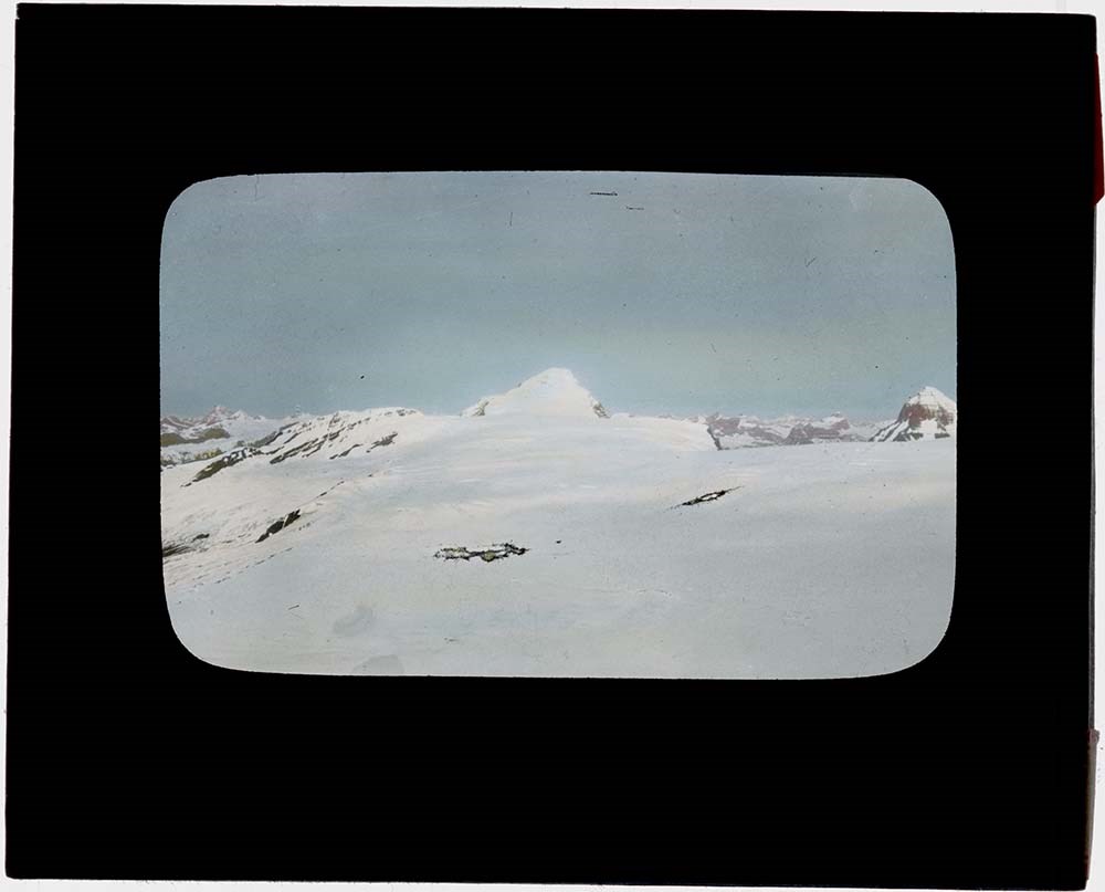
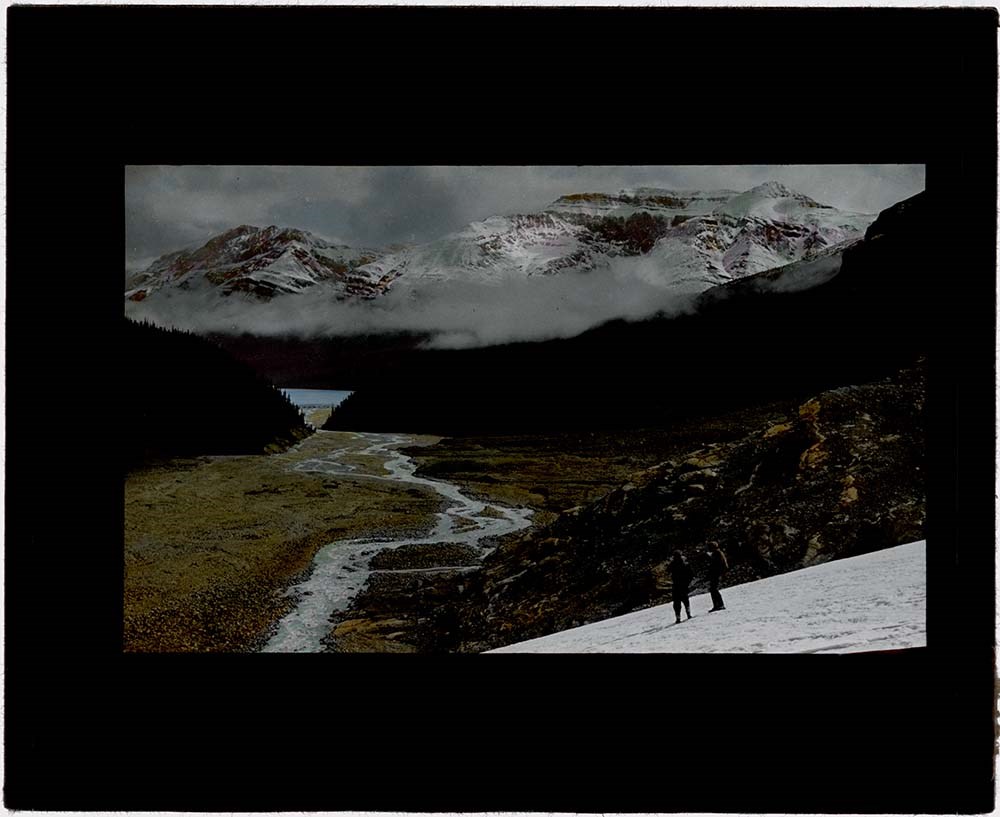
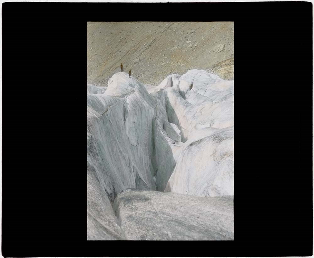
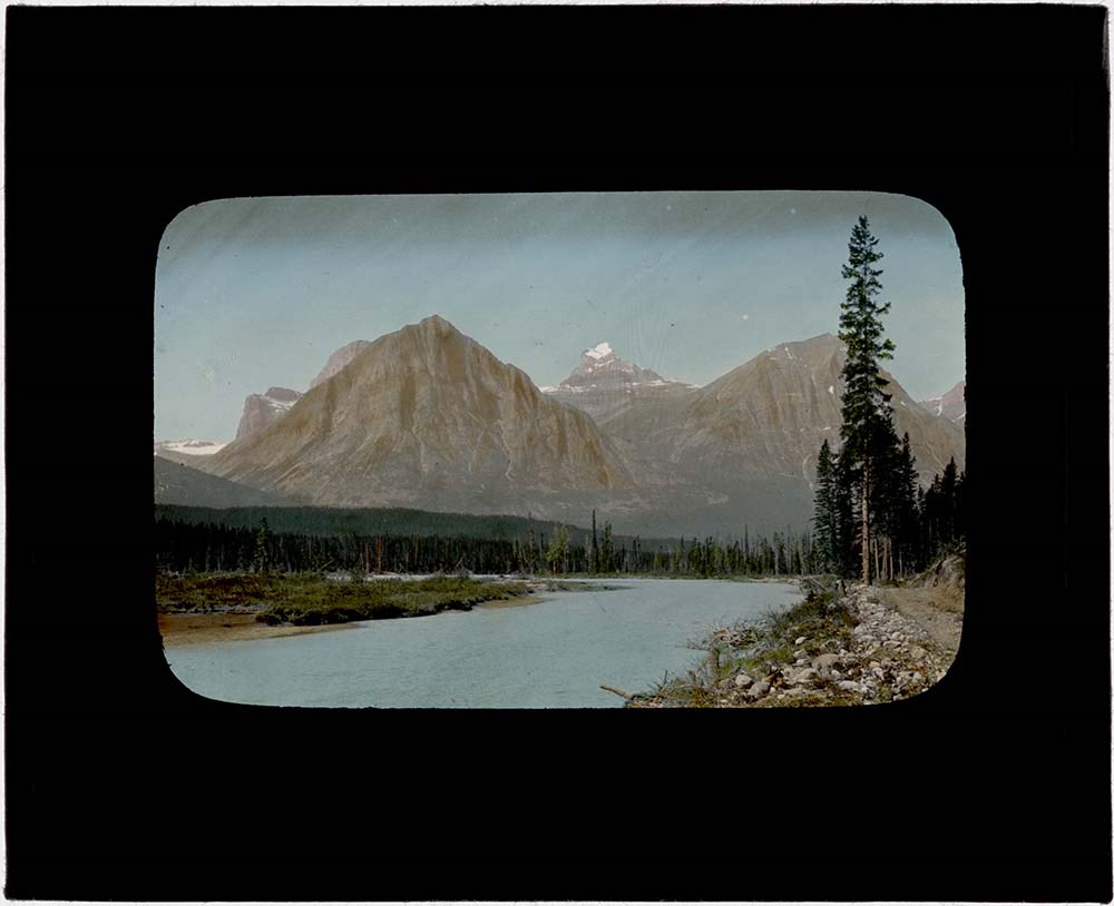
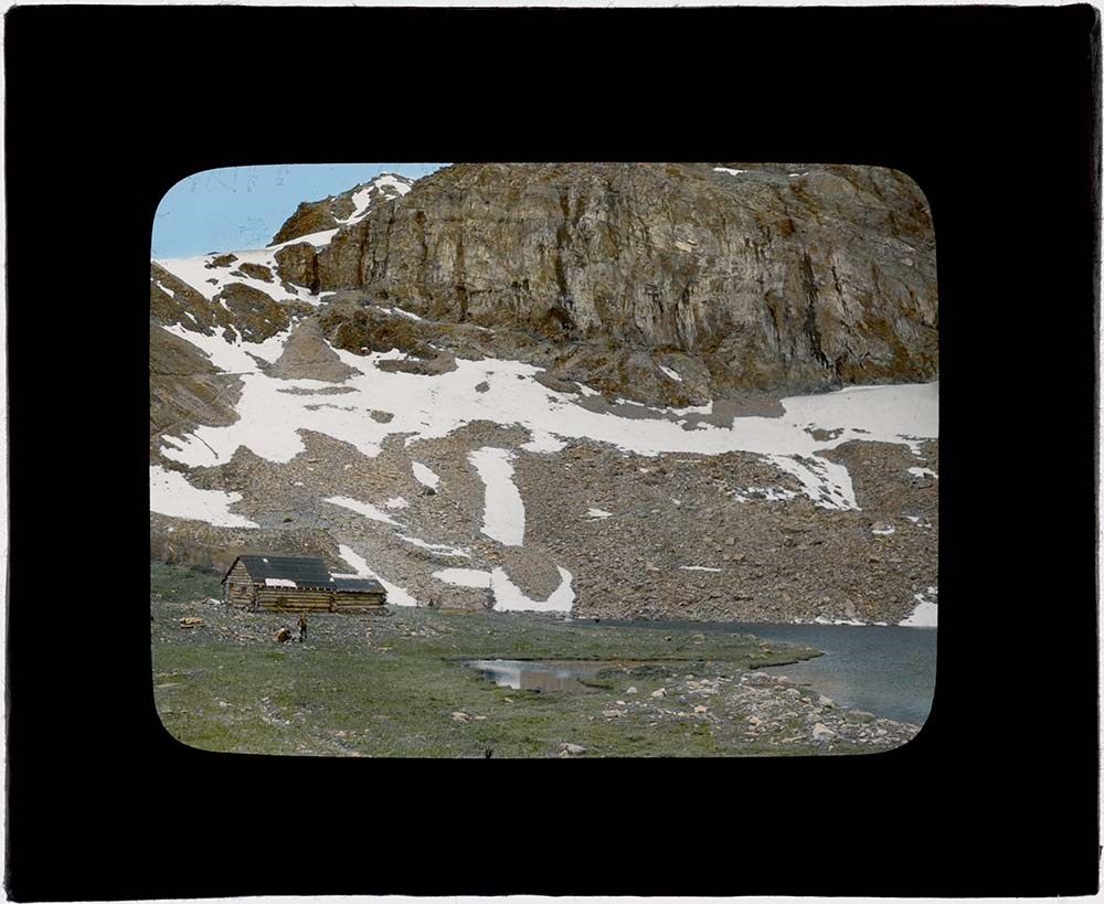
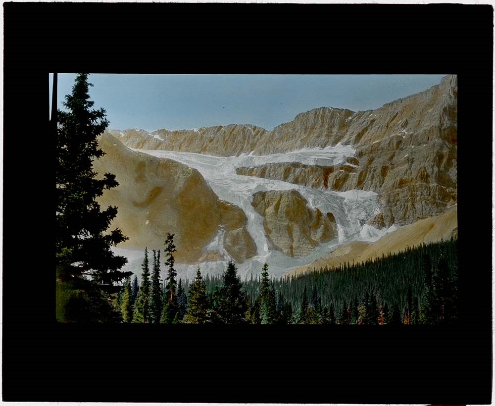
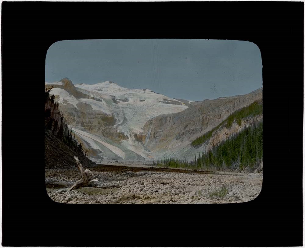
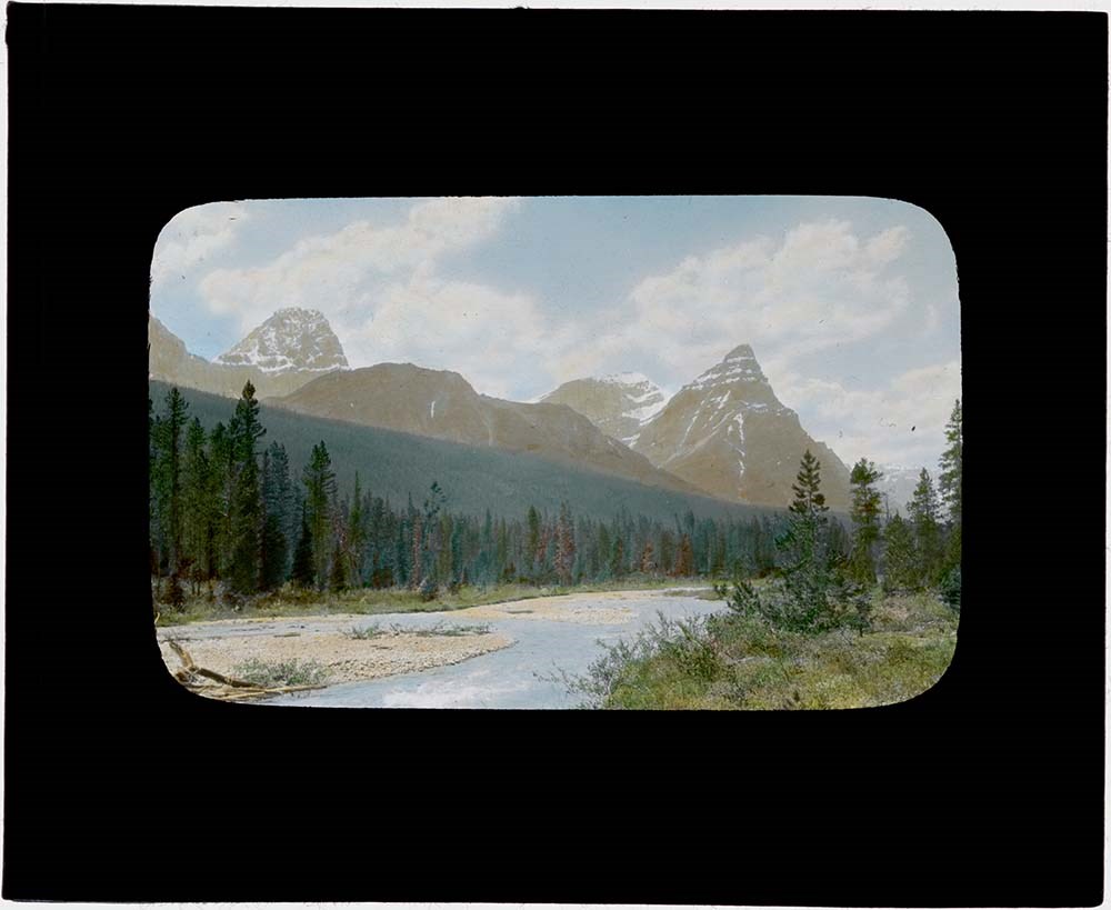
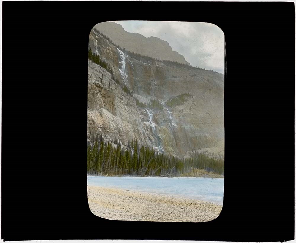
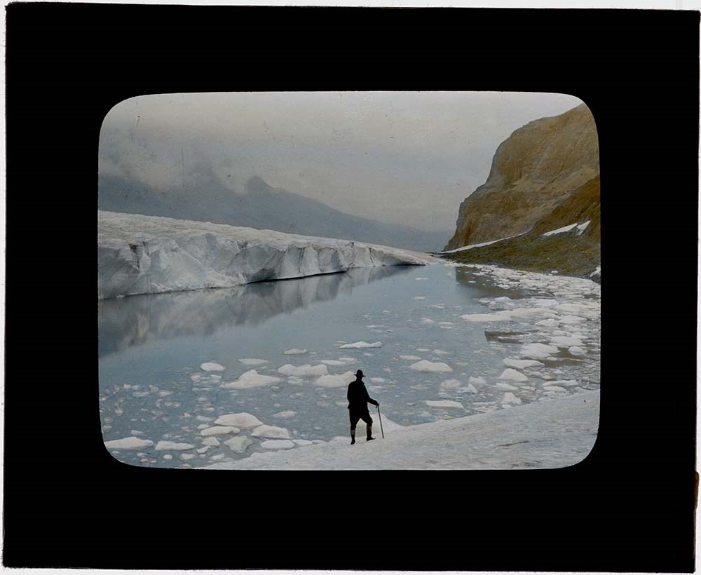
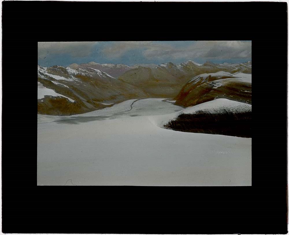
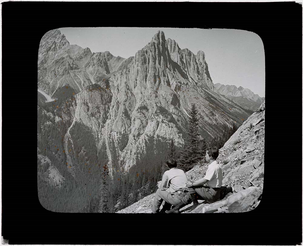
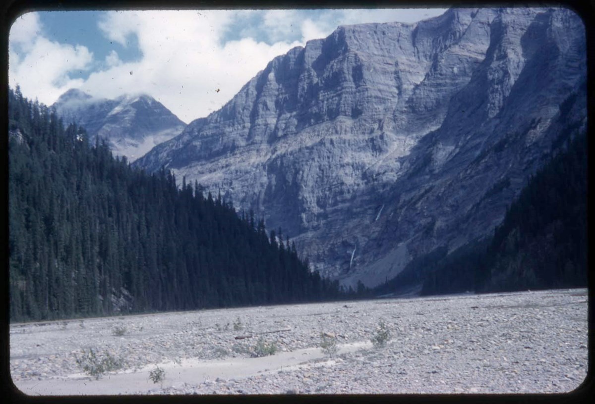
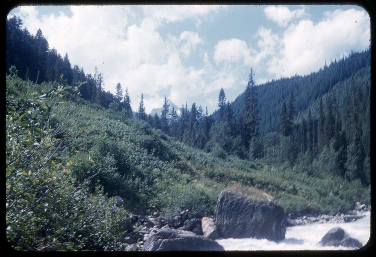
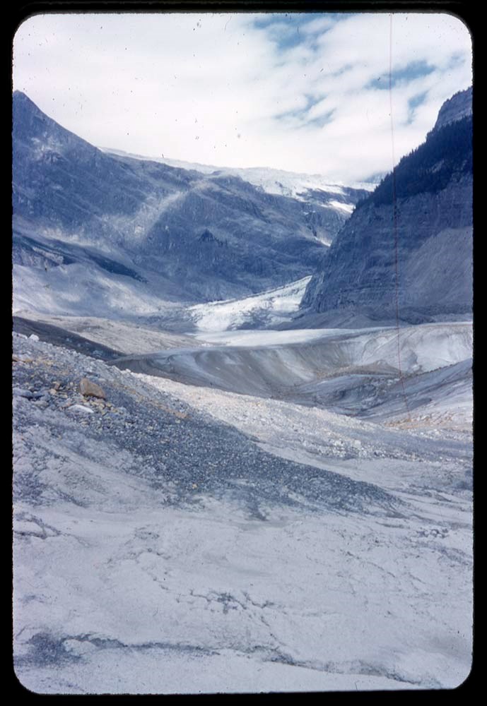
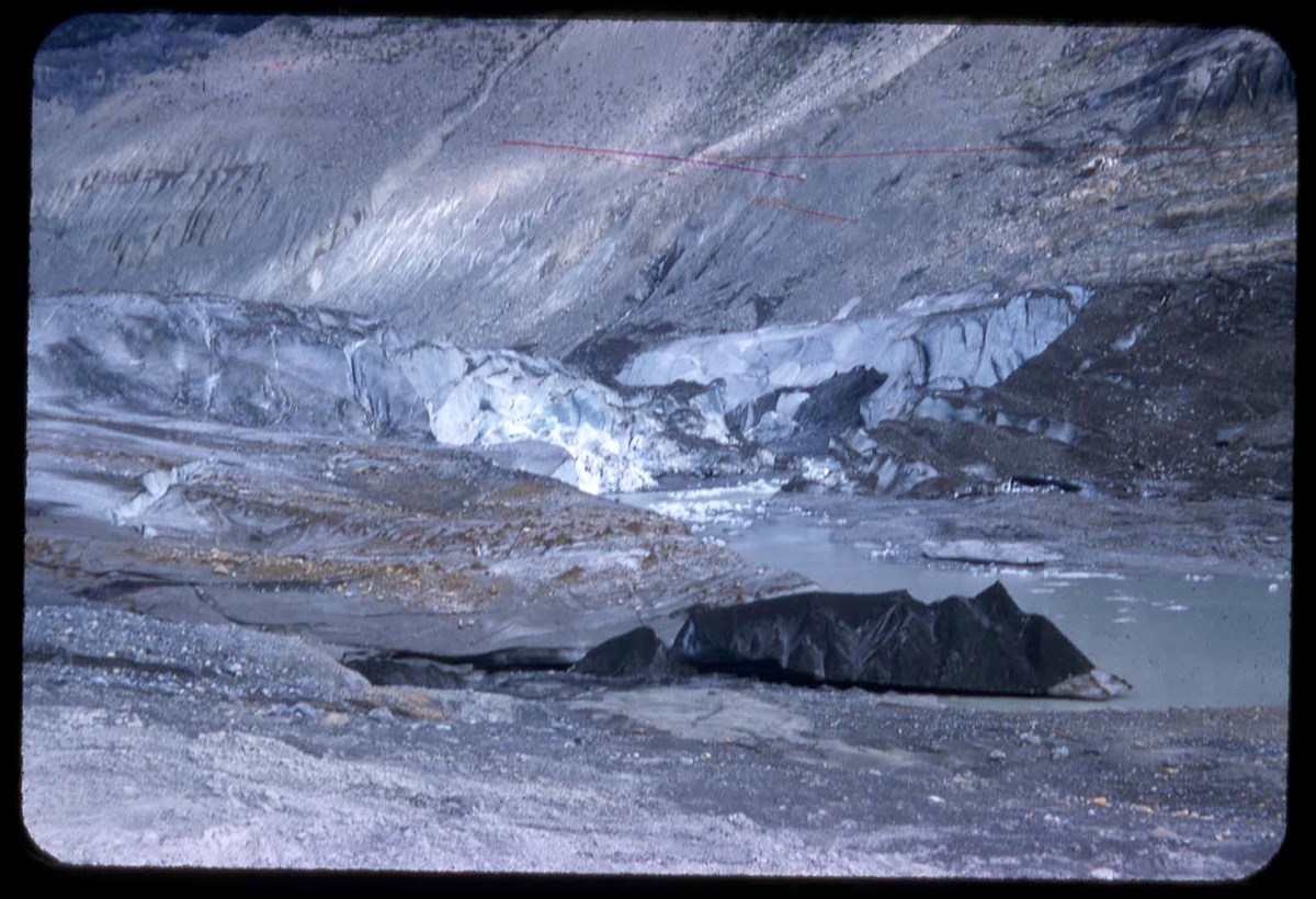
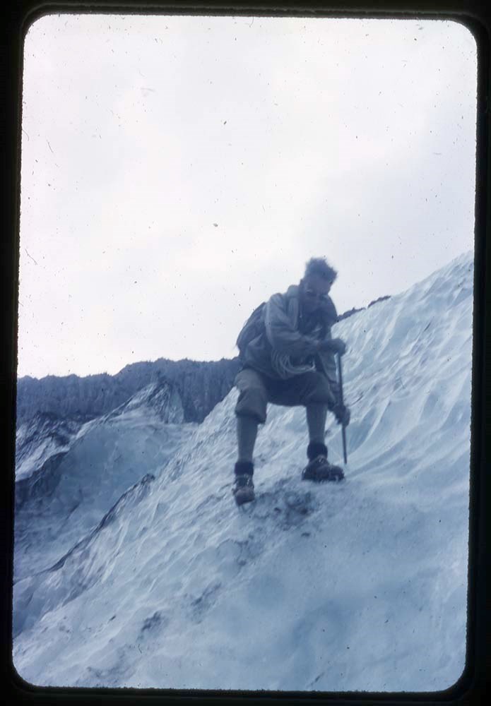
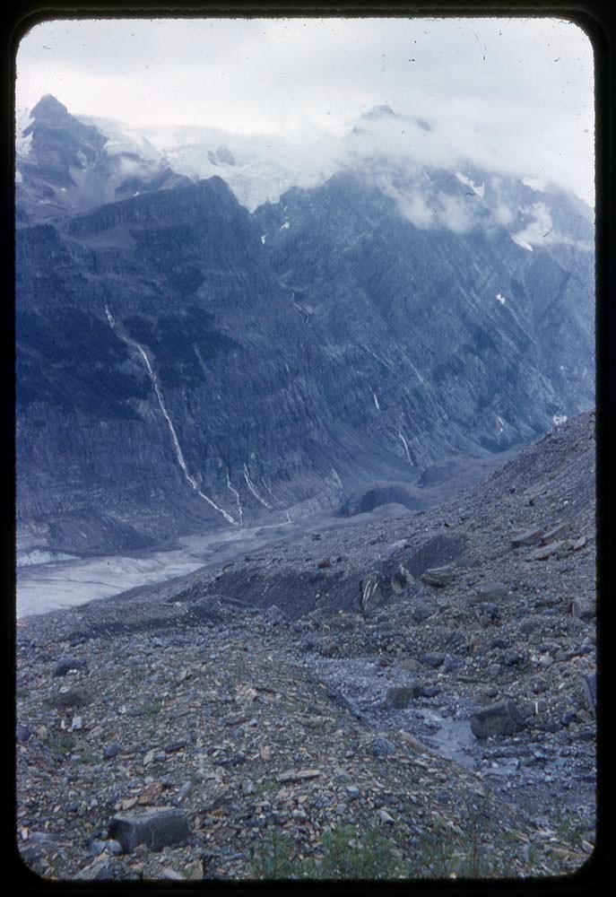
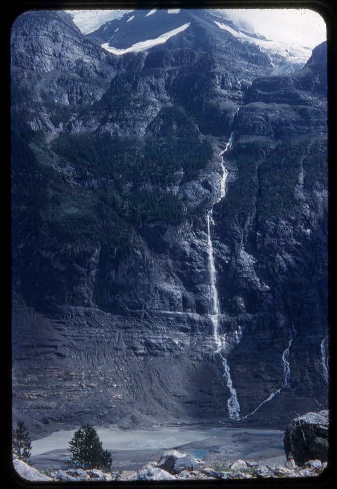
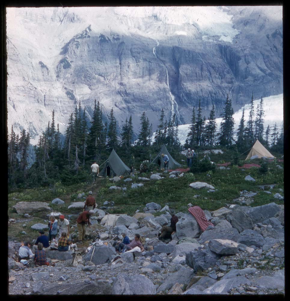
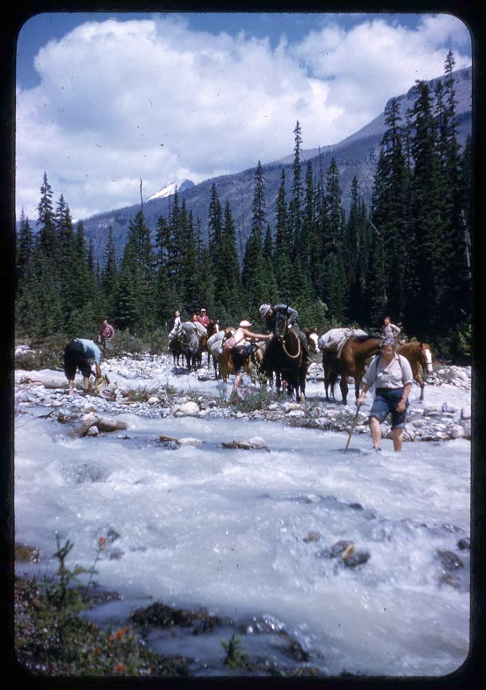
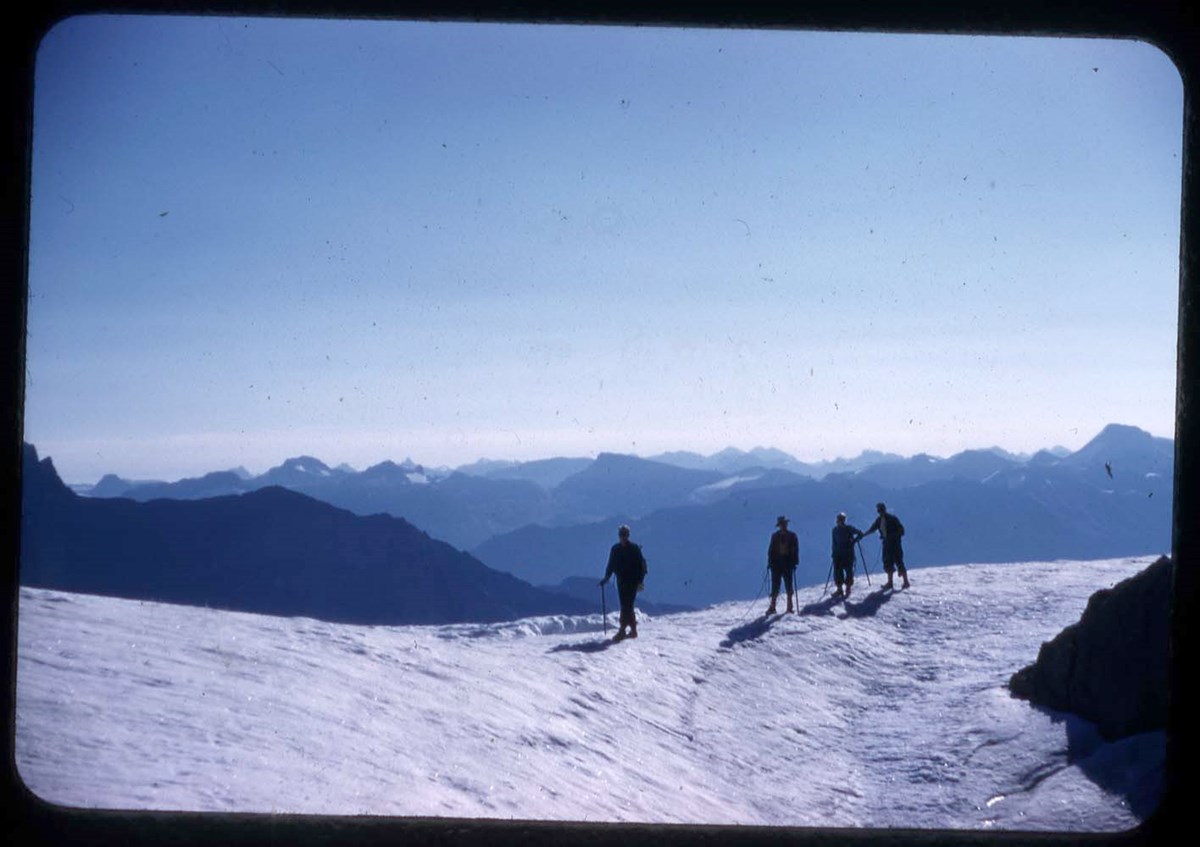
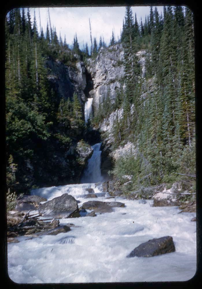
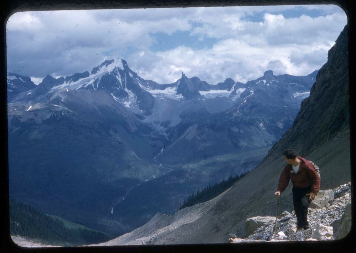
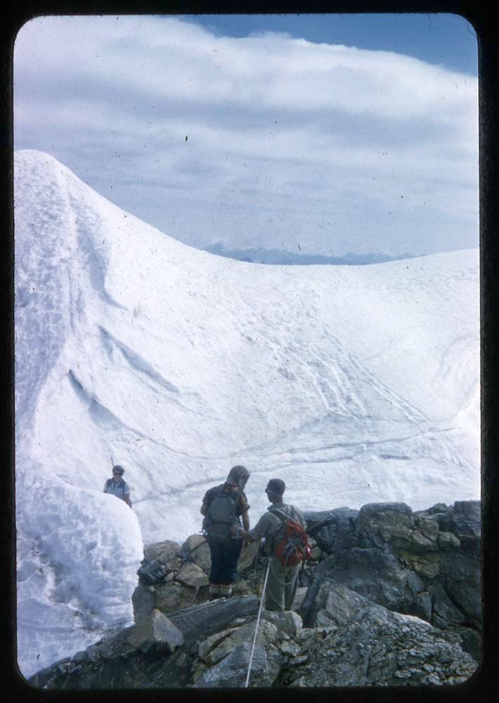
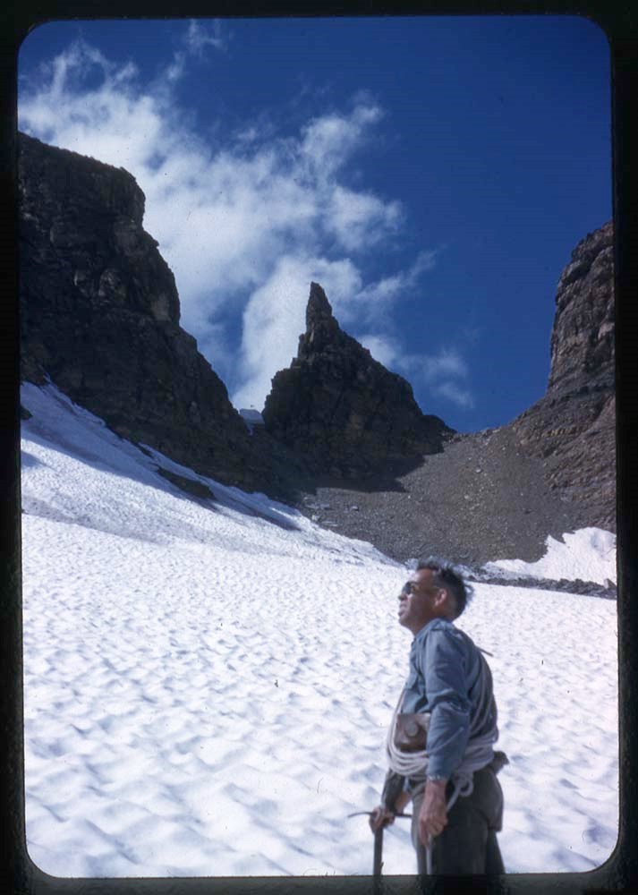
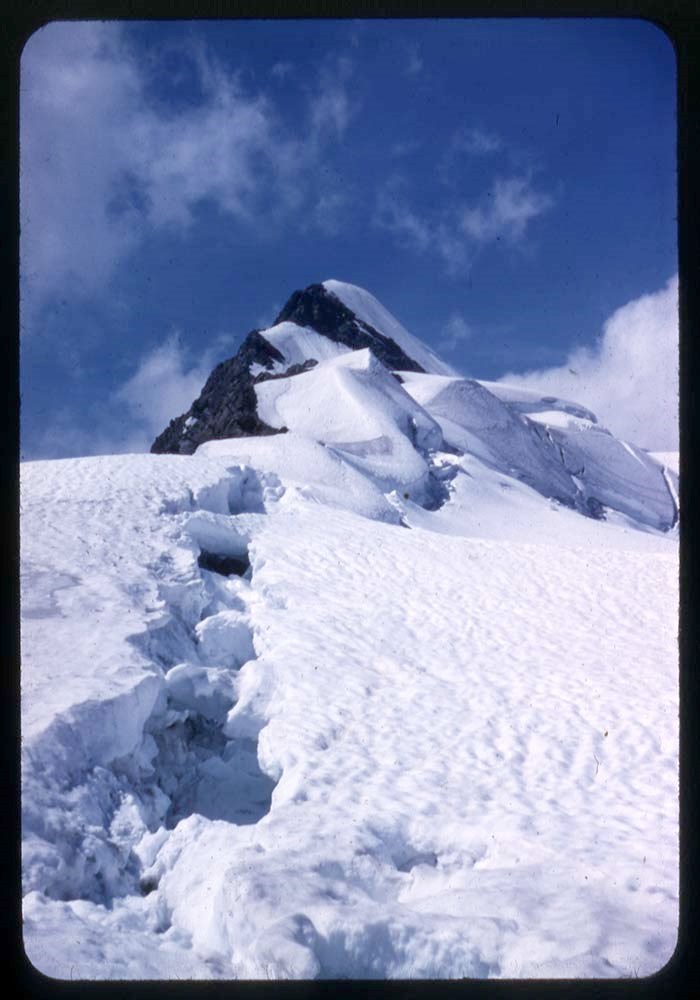
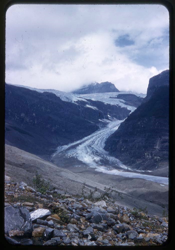
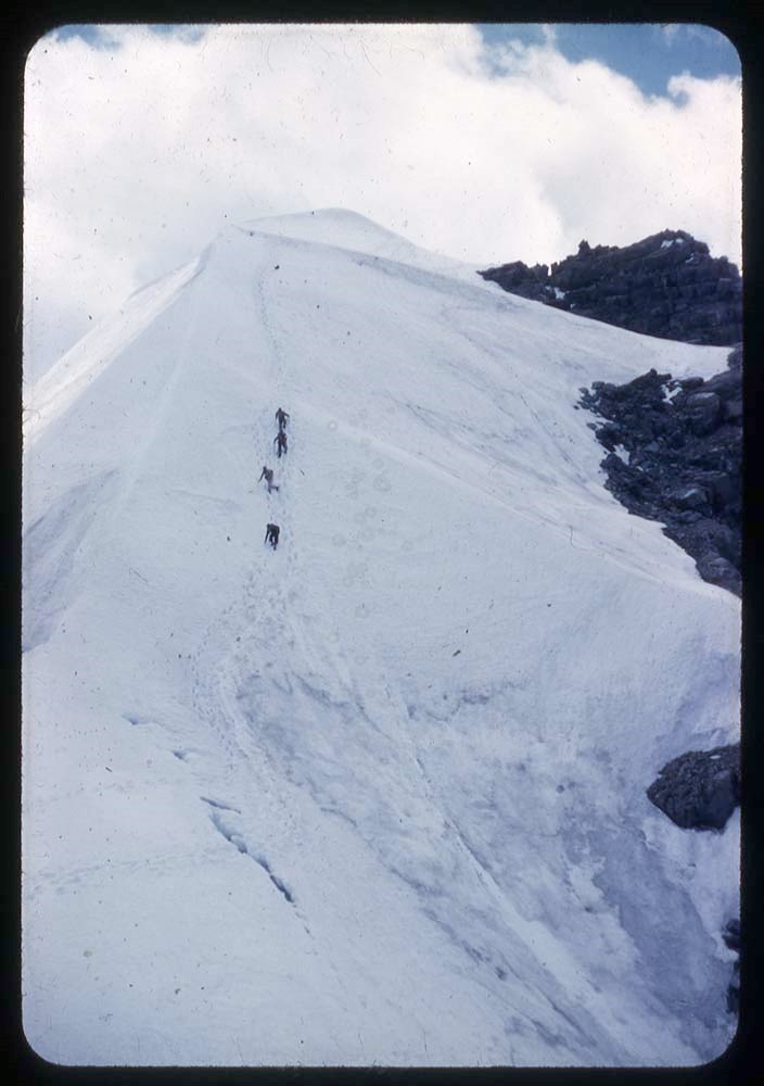
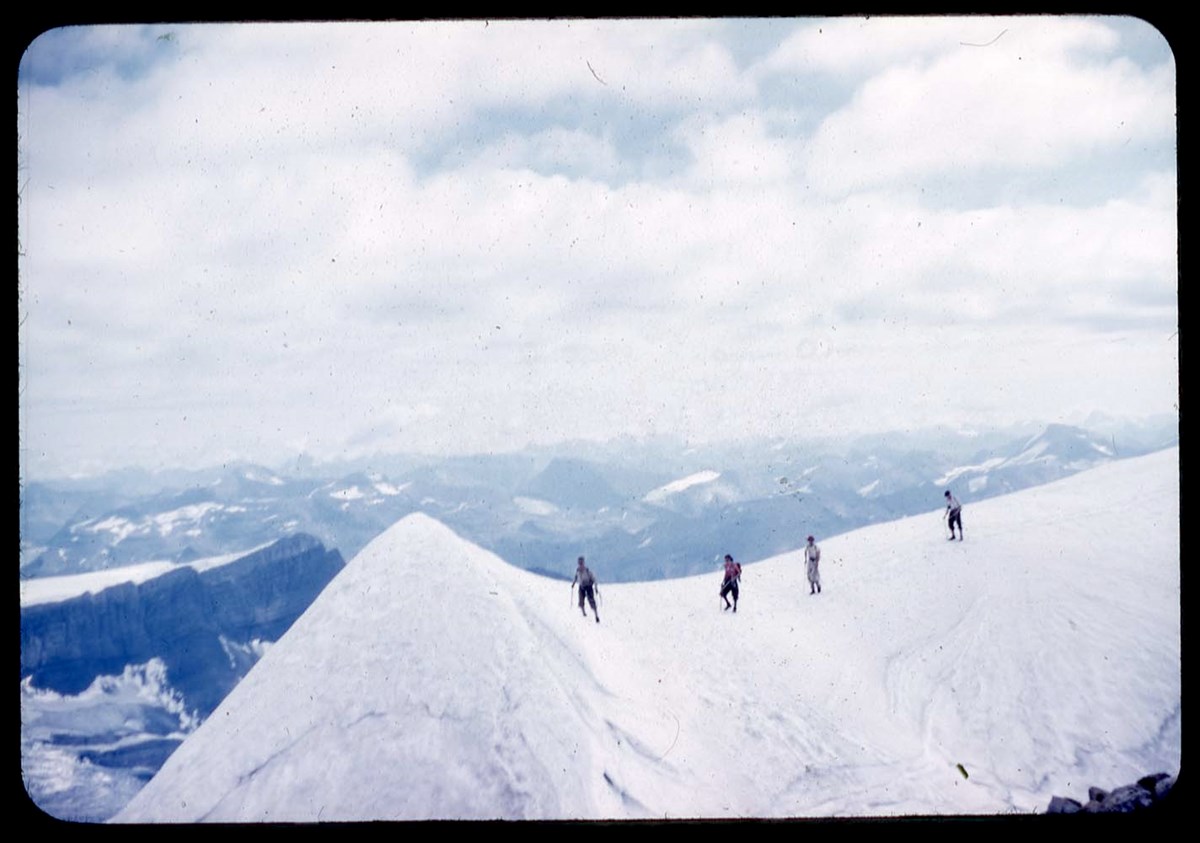
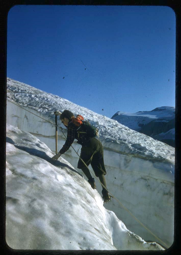
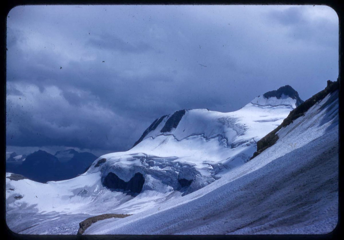
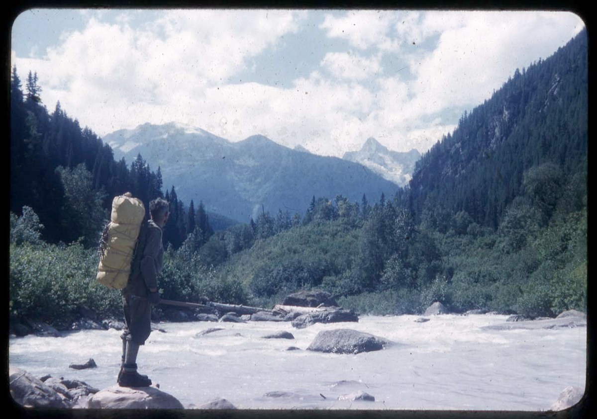
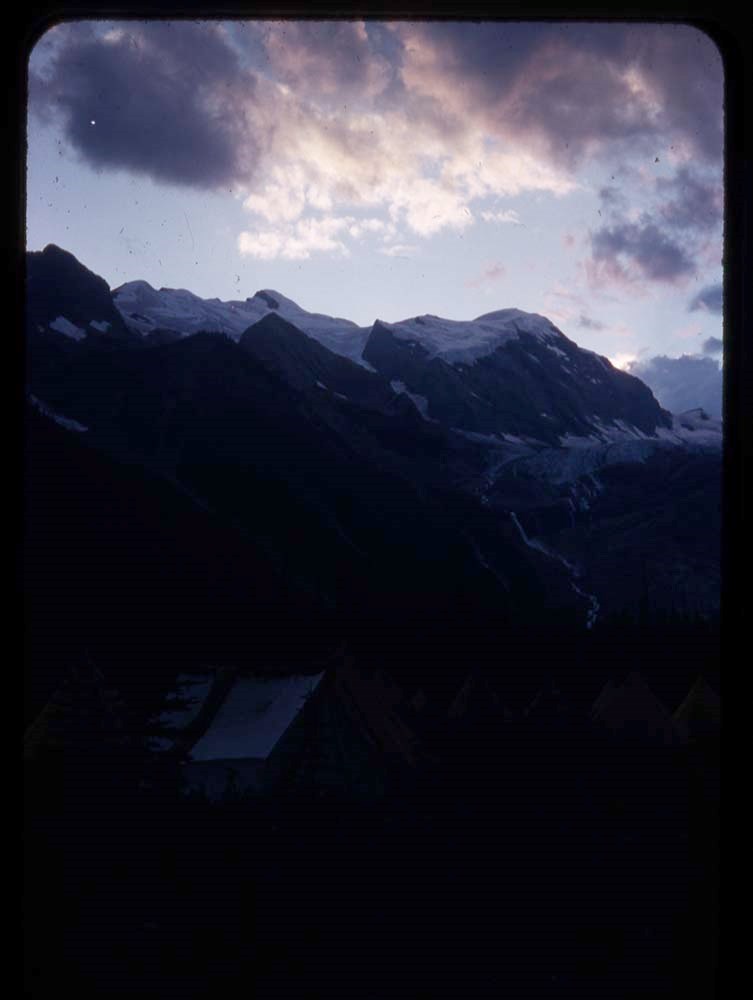
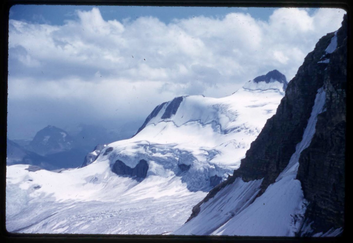
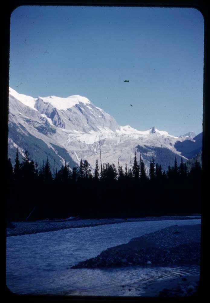
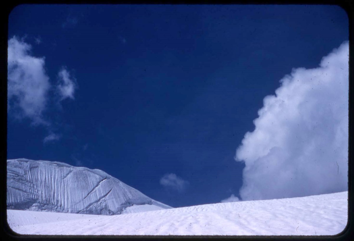
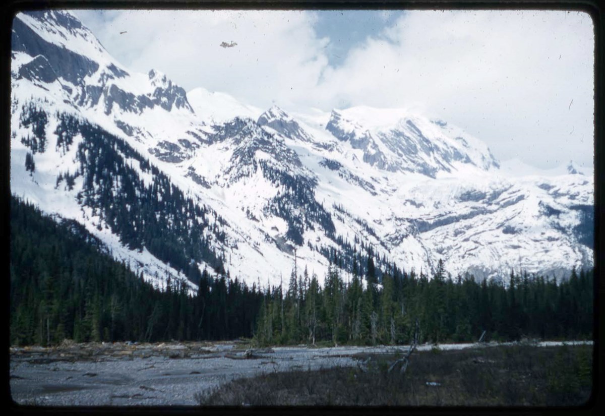
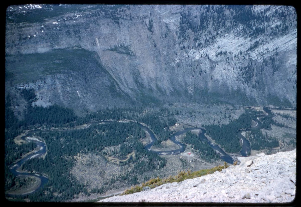
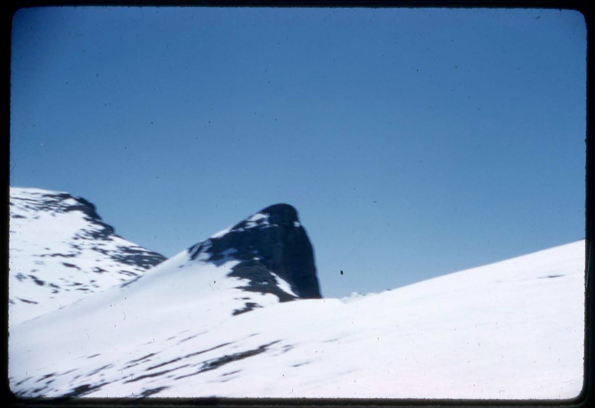
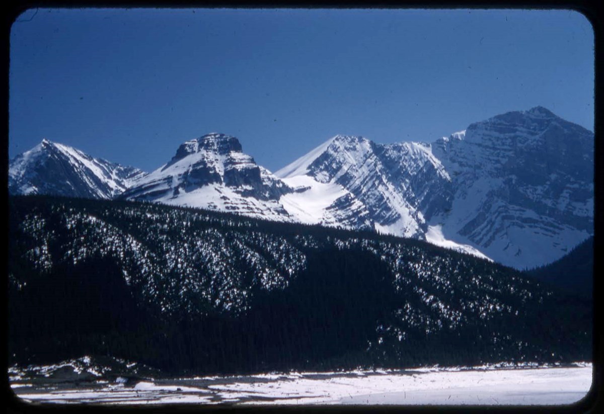
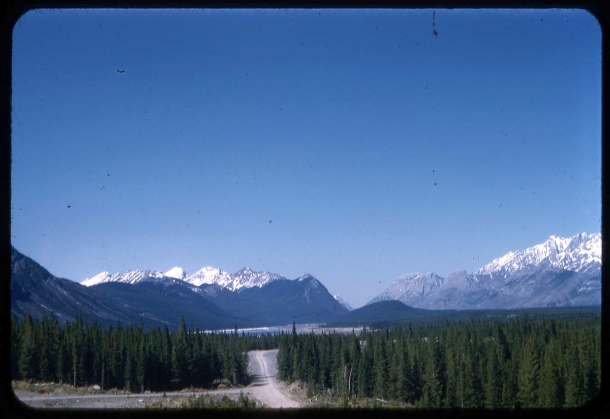
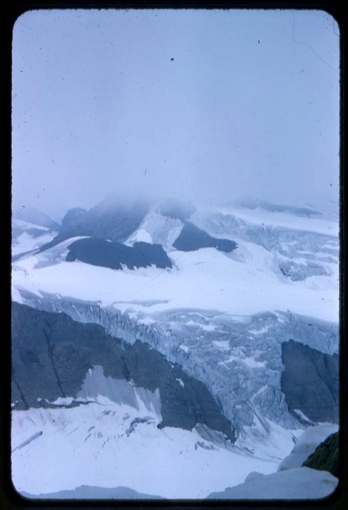
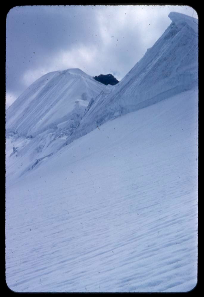
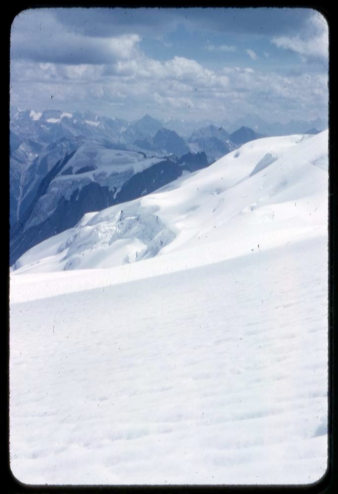
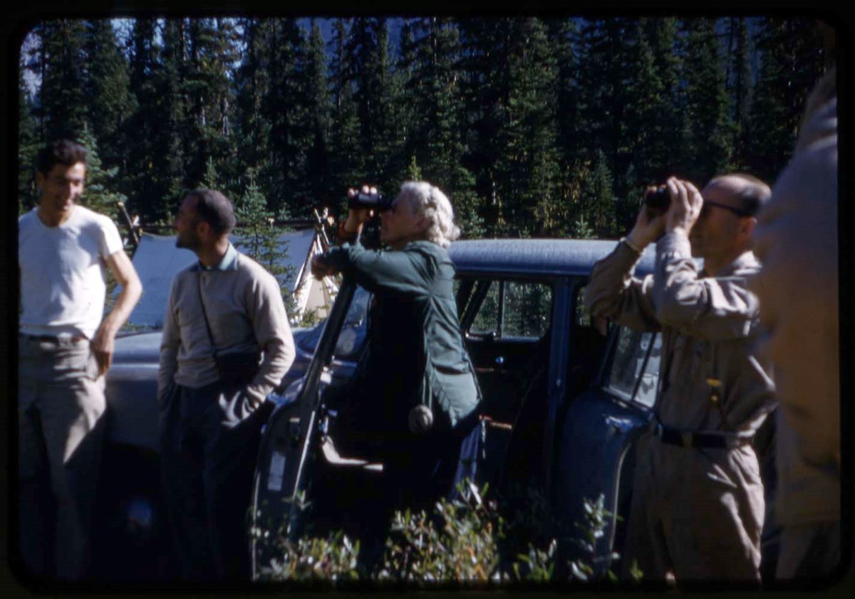
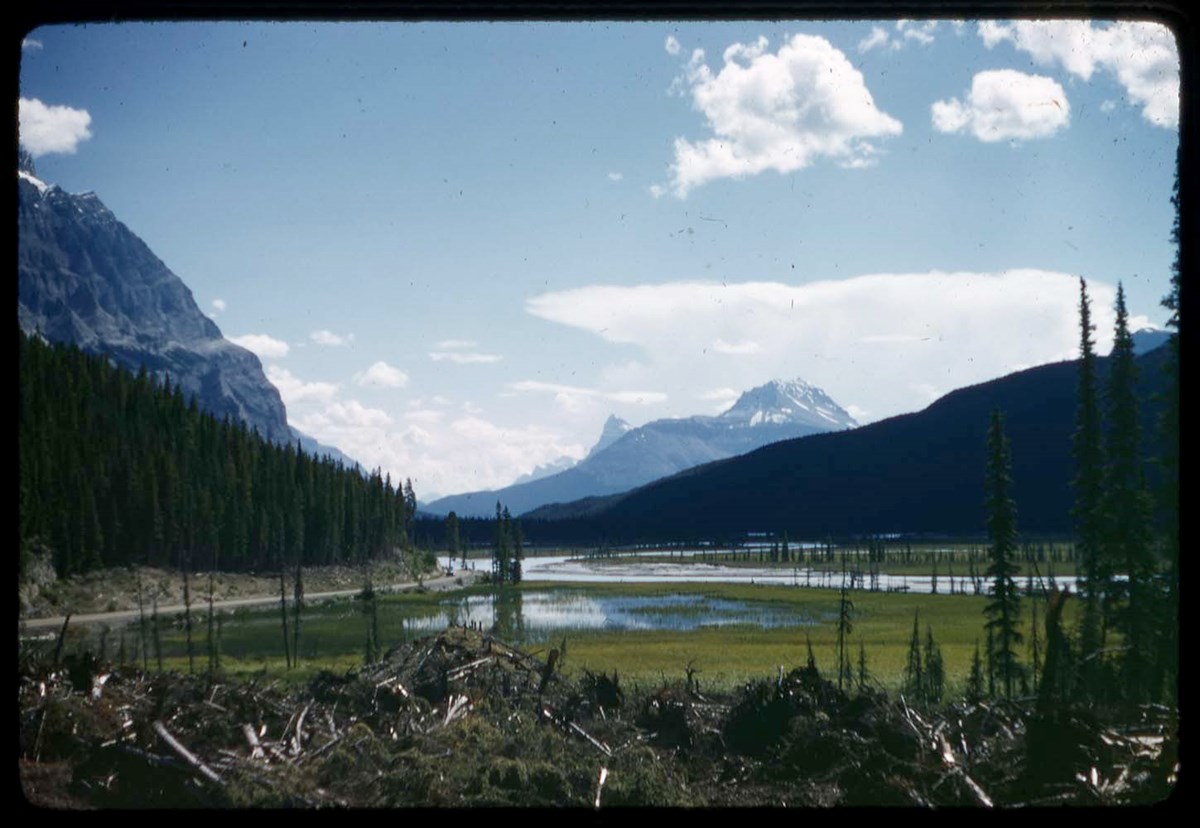
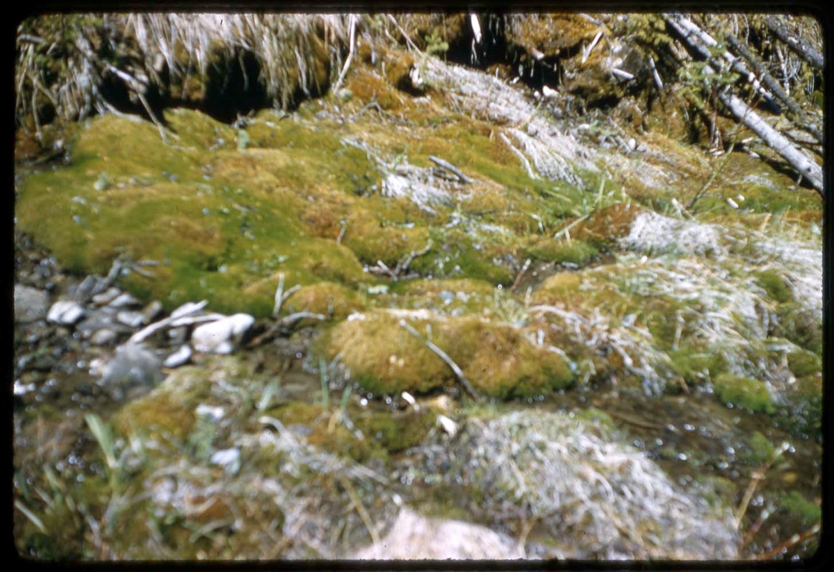
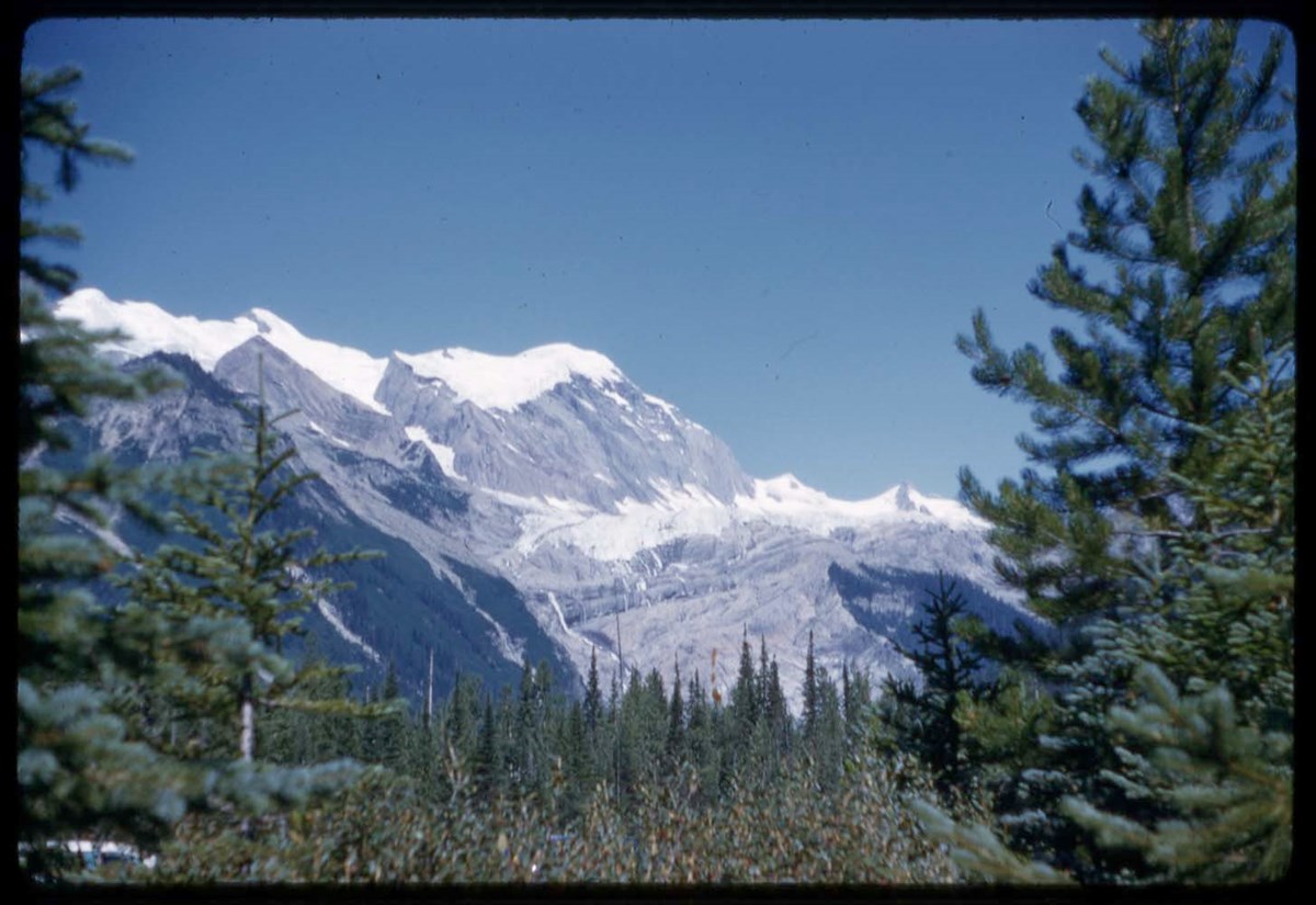
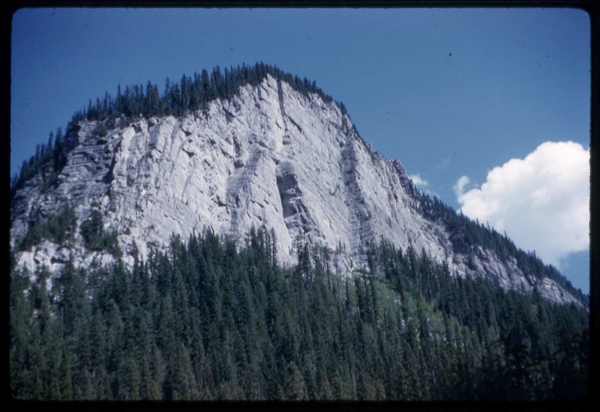
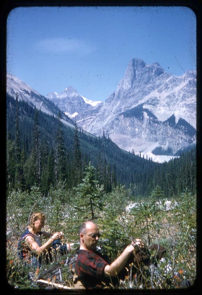
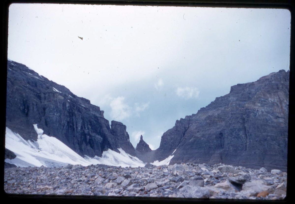
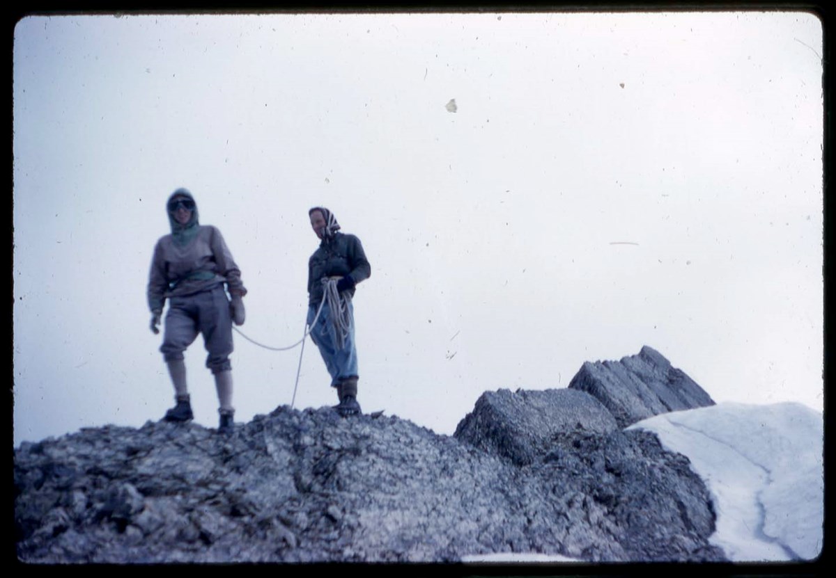
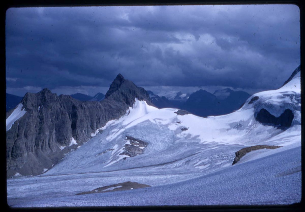
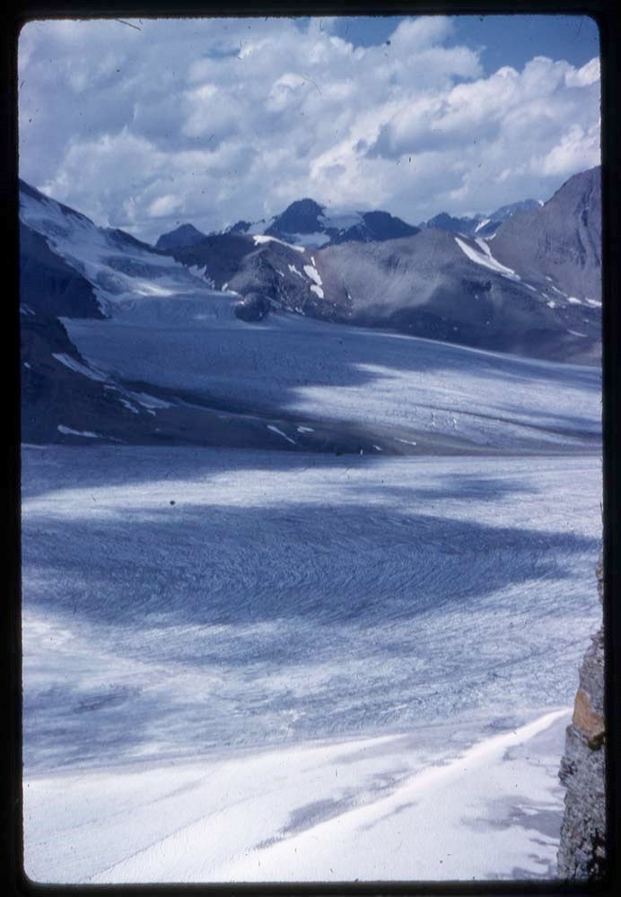
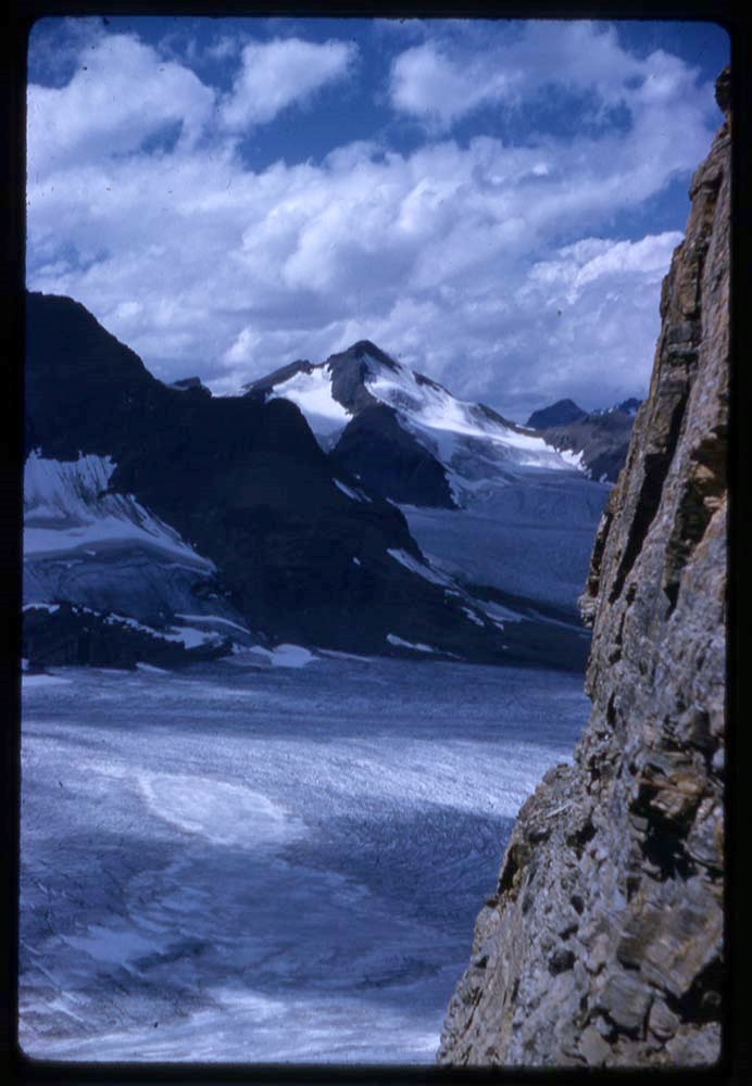
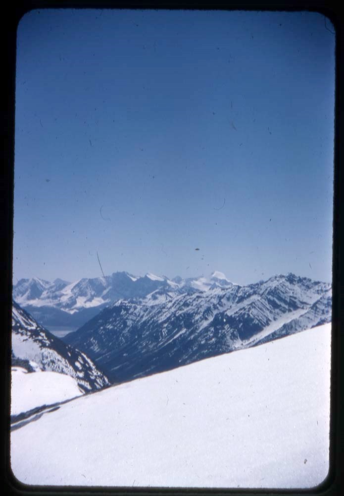
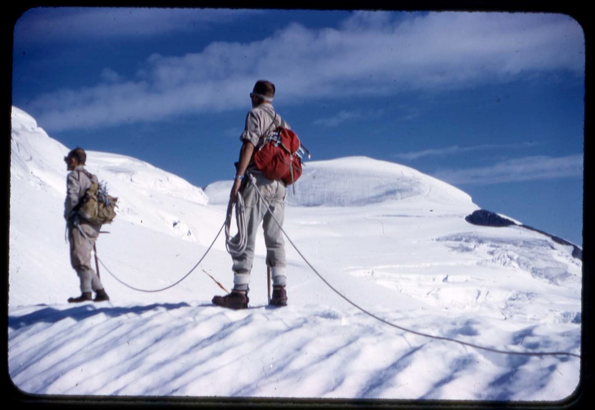
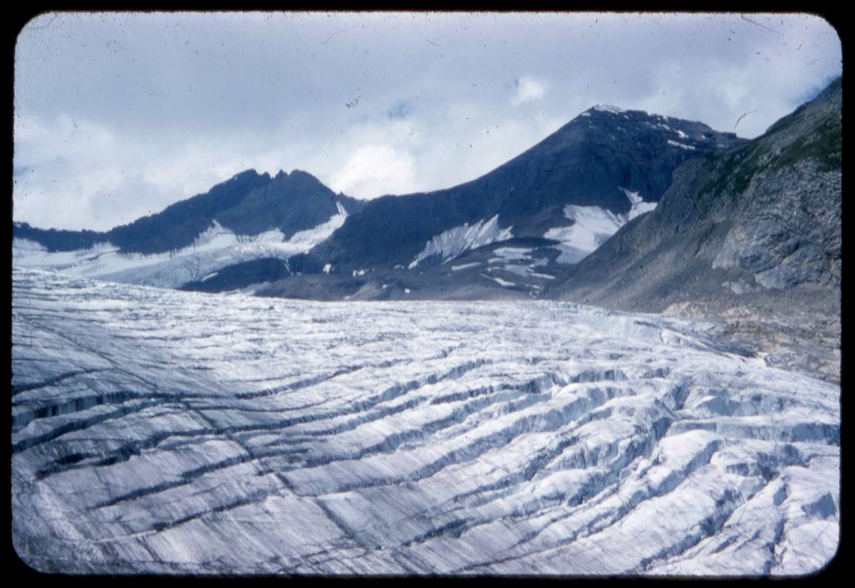
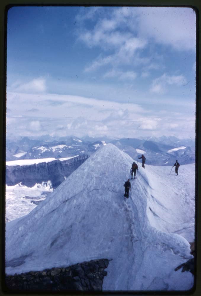
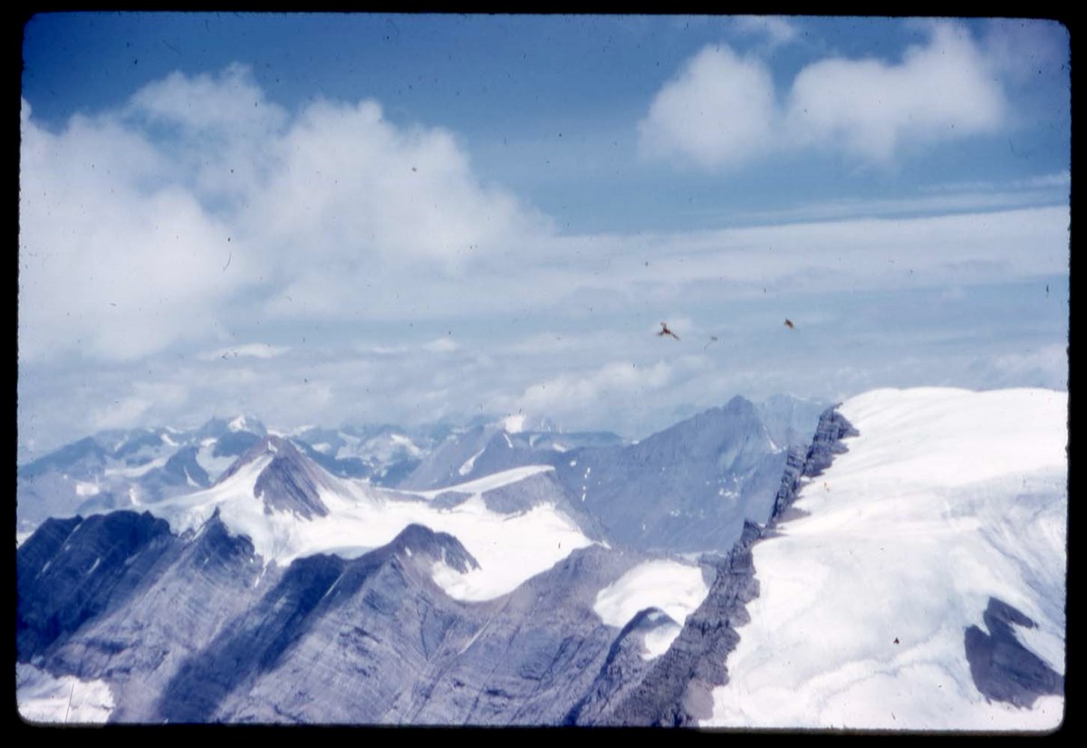
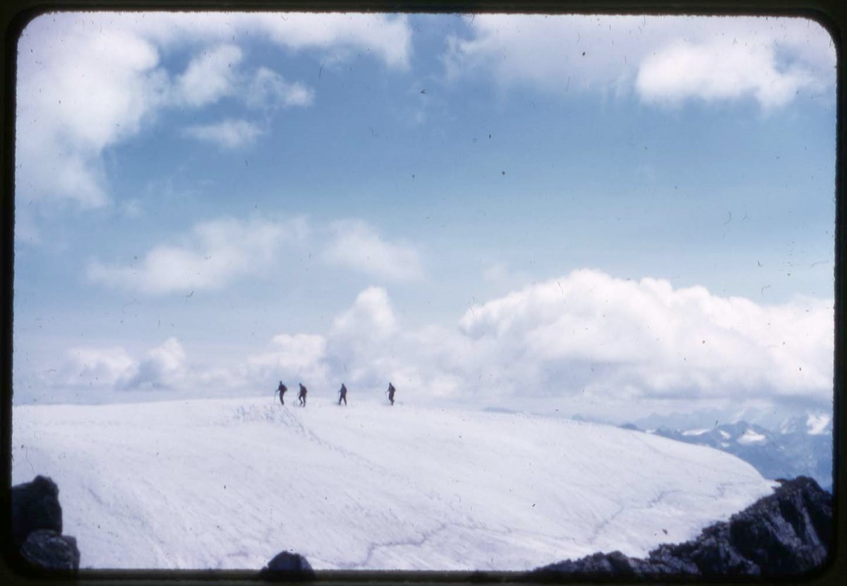
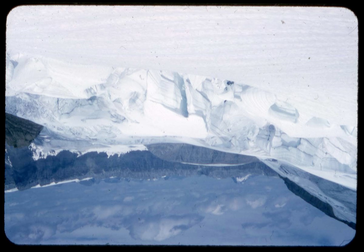
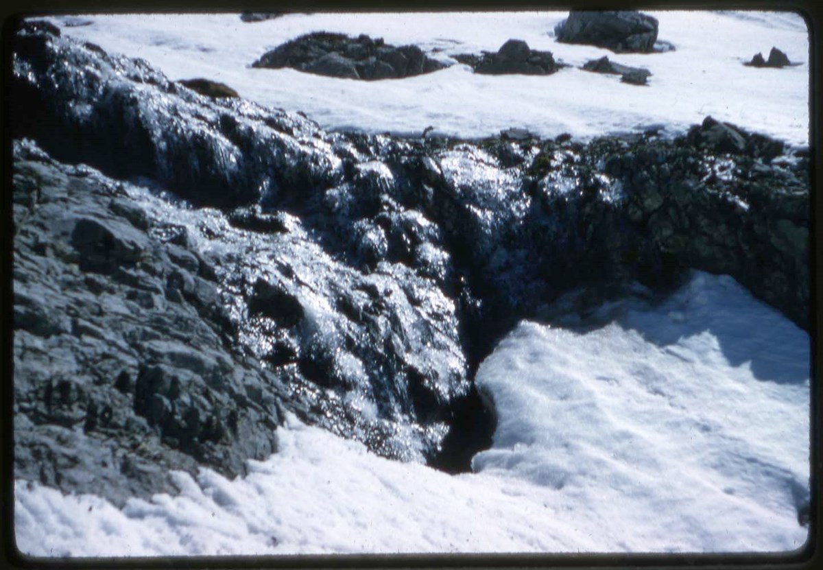
- [121] Temporary on margin of Saskatchewan Glacier [122] Snow Dome, Columbia Icefield [123] Mt. Bryce from summit of Mt. Castleguard [124] Mt. Castleguard Glacier [126] Marmot [127] On Jonas Pass [128] Bow Lake [129] Poplar Trees Banff [130] Mt. Fay [131] Cornice near summit of Mt. Temple [132] Moraine Lake [133] Mt. Ball, Haiduk Lake [134] Amphitheatre on Cascade Mt. [135] The trail up the Alexandra River [136] Mt. Balfour [137] Hoodoos up Hoodoo Creek [138] Head of the Pobokton [139] Mountains of Yoho Park from Mt. Narao [140] Mt. Assiniboine [141] Cave on lower Ball Glacier [142] Mt. Columbia and west side of Columbia Icefield [143] Crevasse on Yoho Glacier [144] Seracs on Yoho Glacier [145] Mt. Rundle, Banff [146] South side of Mt. Ball [147] North face of Mt. Ball [148] Pinnacles on Sentinel Pass [149] Seracs on lower Balfour Glacier [150] Alexandra Glaciers [151] Summit of Mt. Temple [152] Ice cave on lower Ball Glacier [153] Lone spruce [154] Three Sisters, Canmore [155] Saxifrage [156] Echo River Banff [157] Old tree on Gibbon Pass [158] White Moccasin flower [159] Mt's Pinnacle and Hungabee from Mt. Temple [160] Yellow violet
- Name Access
- Leacock, Leonard
- Subject Access
- Photography
- Lantern slide
- Climbing
- Environment and Nature
- Fossils
- Glaciers
- Horses
- Horseback riding
- Hiking
- Landscapes
- National parks and reserves
- Scenery
- Wildlife
- Geographic Access
- Banff
- Lake Louise
- Lake O'Hara
- Jasper
- Banff National Park
- Yoho National Park
- Jasper National Park
- Alberta
- Canada
- Language
- N/A
- Conservation
- Slides cleaned prior to scanning. If possilbe, locate missing slide PS-104.
- Finding Aid
- List available
- Related Material
- Corresponding negatives exist for some lantern slides Accompanying lantern slide notes moved to M372 / 14-18
- Creator
- Leacock, Leonard
- Title Source
- Title based on contents of file.
- Processing Status
- Processed
Electronic Resources
Images


This material is presented as originally created; it may contain outdated cultural descriptions and
potentially offensive content.
Read more.
Lantern slides -- 1925-1931
https://archives.whyte.org/en/permalink/descriptions54679
- Part Of
- Leonard Leacock fonds
- Scope & Content
- File consists of lantern slides depicting Rocky Mountain scenic views, mountains, wildlife, horse rides. Includes Banff, Yoho, Lake O'Hara, Banff-Jasper Highway and surrounding areas. Slides are a mix of colour and black & white photographs; some images are printed directly onto one pane of glass …
- Date Range
- 1925-1931
- Reference Code
- V353 / I / B / PS-161 to PS-200
- Description Level
- 5 / File
- GMD
- Transparency
- Lantern slide
40 images
1 Electronic Resource
- Part Of
- Leonard Leacock fonds
- Description Level
- 5 / File
- Fonds Number
- M372 / V353 / S24
- Series
- V353 / I : Photography
- Sous-Fonds
- V353
- Sub-Series
- V353 / I / B : Photography: lantern slides
- Accession Number
- 6756
- Reference Code
- V353 / I / B / PS-161 to PS-200
- Date Range
- 1925-1931
- Physical Description
- 40 photographs : b&w and col. slides ; 10.2 x 8.2 cm
- History / Biographical
- See fonds level description.
- Scope & Content
- File consists of lantern slides depicting Rocky Mountain scenic views, mountains, wildlife, horse rides. Includes Banff, Yoho, Lake O'Hara, Banff-Jasper Highway and surrounding areas. Slides are a mix of colour and black & white photographs; some images are printed directly onto one pane of glass while others are transparencies on celullose film mounted between 2 glass panes. There is no order to the different mediums. Slides were accompanied with 7 typed text papers listing the slide numbers and details of the images. See Notes for list.
- Notes
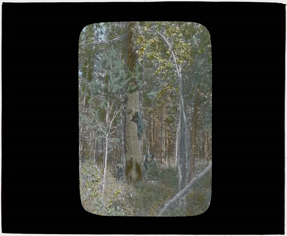
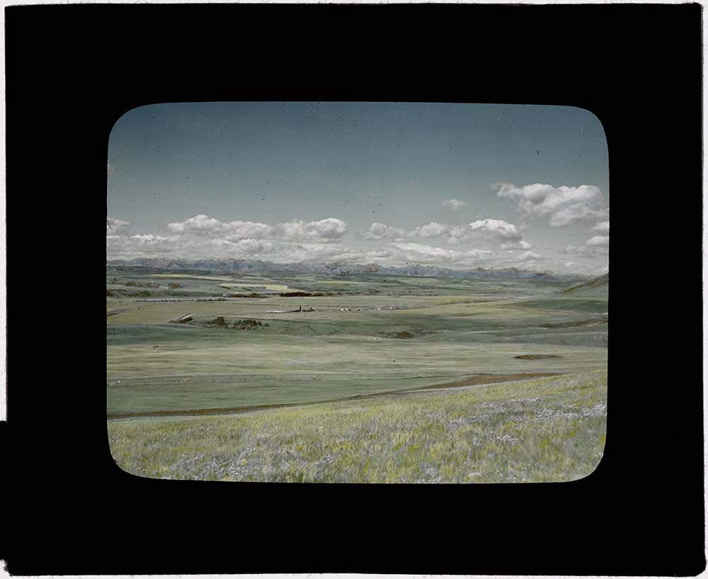
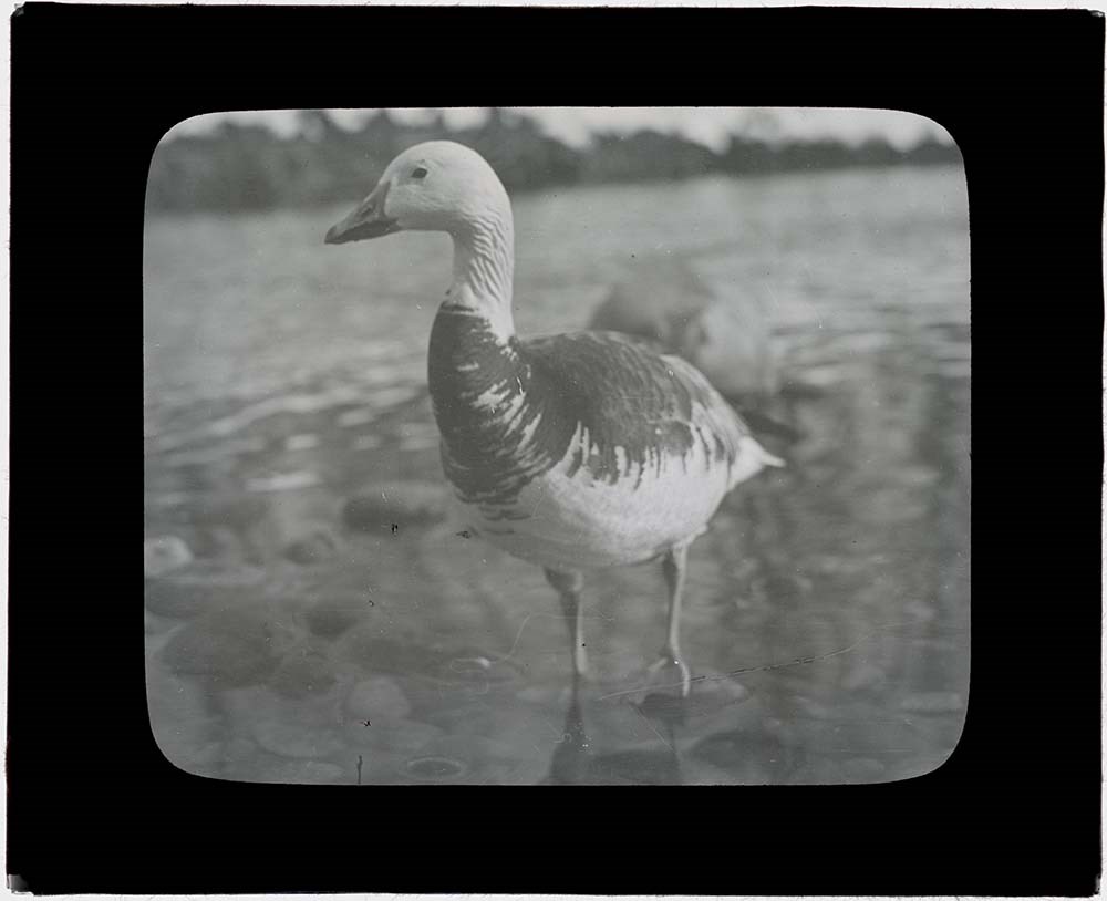
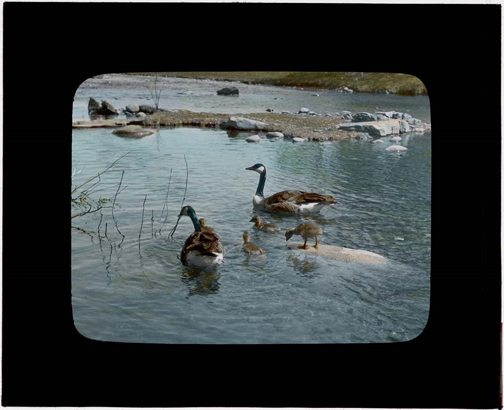
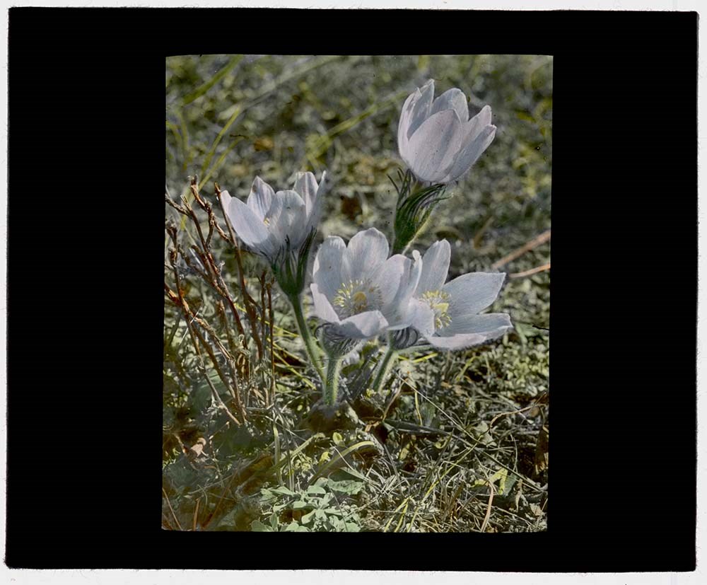
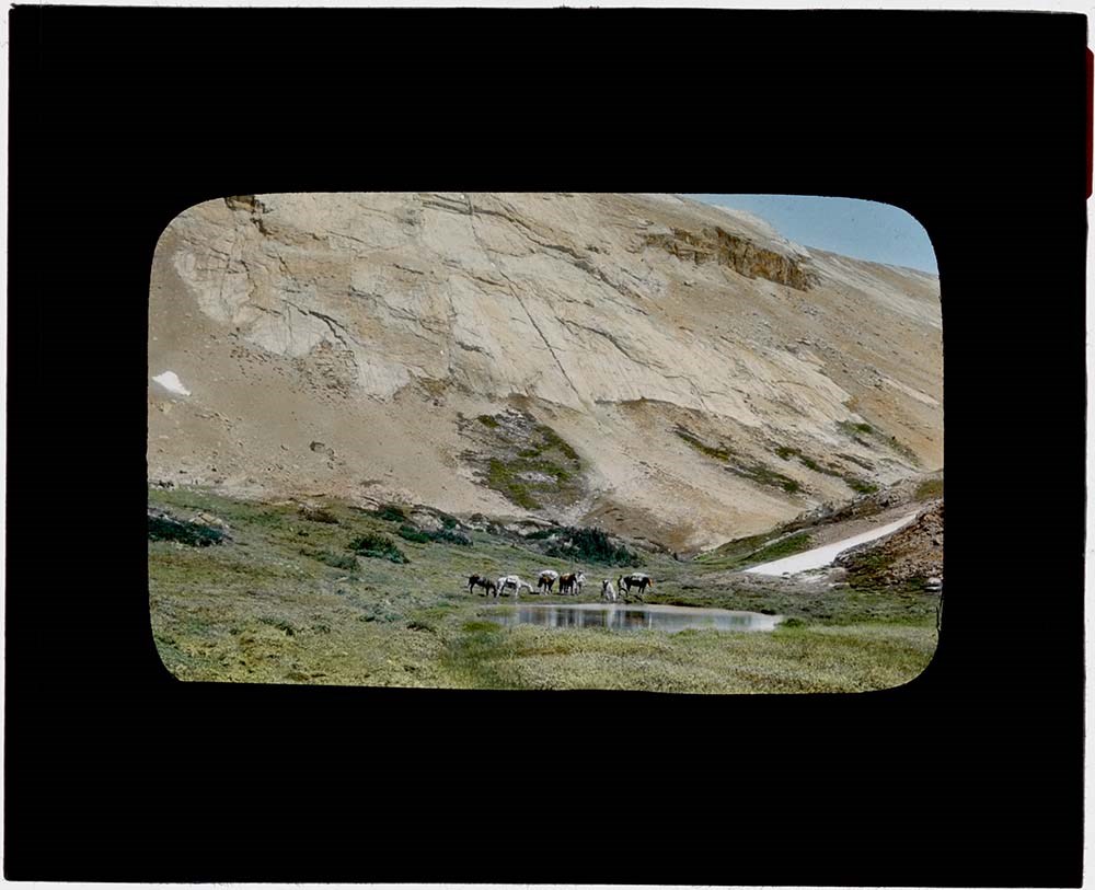
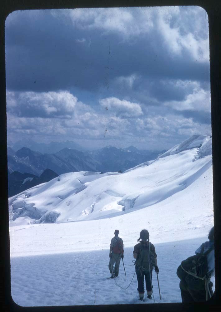
- [161] Grass of Parnassus [162] Bear and cubs [163] Lake Oesa - Mt. Lefroy [164] Yoho Valley Road [165] Poplar [166] Star-flowered wintergreen [167] Haiduk Lake [168] Moraine Lake [169] Bow Valley looking south toward Canmore [170] On brink of Twin Falls, Yoho Park [171] Twin Falls [172] Near site of old talc mine at head of Redearth Creek [173] Mt. Bryde from Castleguard Meadows [174] Mt. Molar [175] Green Lily [176] Snow Goose [177] At headwaters of Red Deer River [178] Poplar forest [179] Sandpipers gathering for migration [180] Mt. Columbia and west side of Columbia Icefield [181] Elk (Wapiti) [182] Bow Lake and Bow Glacier [183] Takakkaw Falls, Yoho [184] Rockey Mountains from hills above Cochrane [185] Fixing pack on a nervous horse [186] On North Fork of the Saskatchewan River [187] Twin-flowers and bunchberry blossom [188] Crossing the Red Deer River [189] Part of the Balfour Glacier [190] Calgary [191] Blue Goose [192] Blue Goose [193] Canada geese and family [194] Parrie Crocus [195] Prairie Crocus [196] Bow Valley, Banff and Mt. Rundle [197] Nest of osprey at junction of Bow and Echo River Banff. The same family returned for many years until finally the tree toppled into the water [198] Near source of the Red Deer River [199] Mt. Wapta, Summit Lake, Yoho [200] Pharaoh Peaks, Mummy Lake
- Name Access
- Leacock, Leonard
- Subject Access
- Photography
- Lantern slide
- Climbing
- Environment and Nature
- Fossils
- Glaciers
- Horses
- Horseback riding
- Hiking
- Landscapes
- National parks and reserves
- Scenery
- Wildlife
- Geographic Access
- Banff
- Lake Louise
- Lake O'Hara
- Jasper
- Banff National Park
- Yoho National Park
- Jasper National Park
- Alberta
- Canada
- Language
- N/A
- Conservation
- Slides cleaned prior to scanning. If possilbe, locate missing slide PS-104.
- Finding Aid
- List available
- Related Material
- Corresponding negatives exist for some lantern slides Accompanying lantern slide notes moved to M372 / 14-18
- Creator
- Leacock, Leonard
- Title Source
- Title based on contents of file.
- Processing Status
- Processed
Electronic Resources
Images


This material is presented as originally created; it may contain outdated cultural descriptions and
potentially offensive content.
Read more.
Lantern slides -- 1925-1931
https://archives.whyte.org/en/permalink/descriptions54680
- Part Of
- Leonard Leacock fonds
- Scope & Content
- File consists of lantern slides depicting Rocky Mountain scenic views, mountains, wildlife, horse rides. Includes Banff, Yoho, Lake O'Hara, Banff-Jasper Highway and surrounding areas. Slides are a mix of colour and black & white photographs; some images are printed directly onto one pane of glass …
- Date Range
- 1925-1931
- Reference Code
- V353 / I / B / PS-201 to PS-235
- Description Level
- 5 / File
- GMD
- Transparency
- Lantern slide
35 images
1 Electronic Resource
- Part Of
- Leonard Leacock fonds
- Description Level
- 5 / File
- Fonds Number
- M372 / V353 / S24
- Series
- V353 / I : Photography
- Sous-Fonds
- V353
- Sub-Series
- V353 / I / B : Photography: lantern slides
- Accession Number
- 6756
- Reference Code
- V353 / I / B / PS-201 to PS-235
- Date Range
- 1925-1931
- Physical Description
- 34 photographs : b&w and col. slides ; 10.2 x 8.2 cm
- History / Biographical
- See fonds level description.
- Scope & Content
- File consists of lantern slides depicting Rocky Mountain scenic views, mountains, wildlife, horse rides. Includes Banff, Yoho, Lake O'Hara, Banff-Jasper Highway and surrounding areas. Slides are a mix of colour and black & white photographs; some images are printed directly onto one pane of glass while others are transparencies on celullose film mounted between 2 glass panes. There is no order to the different mediums. Slides were accompanied with 7 typed text papers listing the slide numbers and details of the images. See Notes for list. PS-233 was labelled twice on 2 different slides; the slide matching the description in the accompanying notes was kept as PS-233 and the alternative was renumbered PS-235 in the order.
- Notes
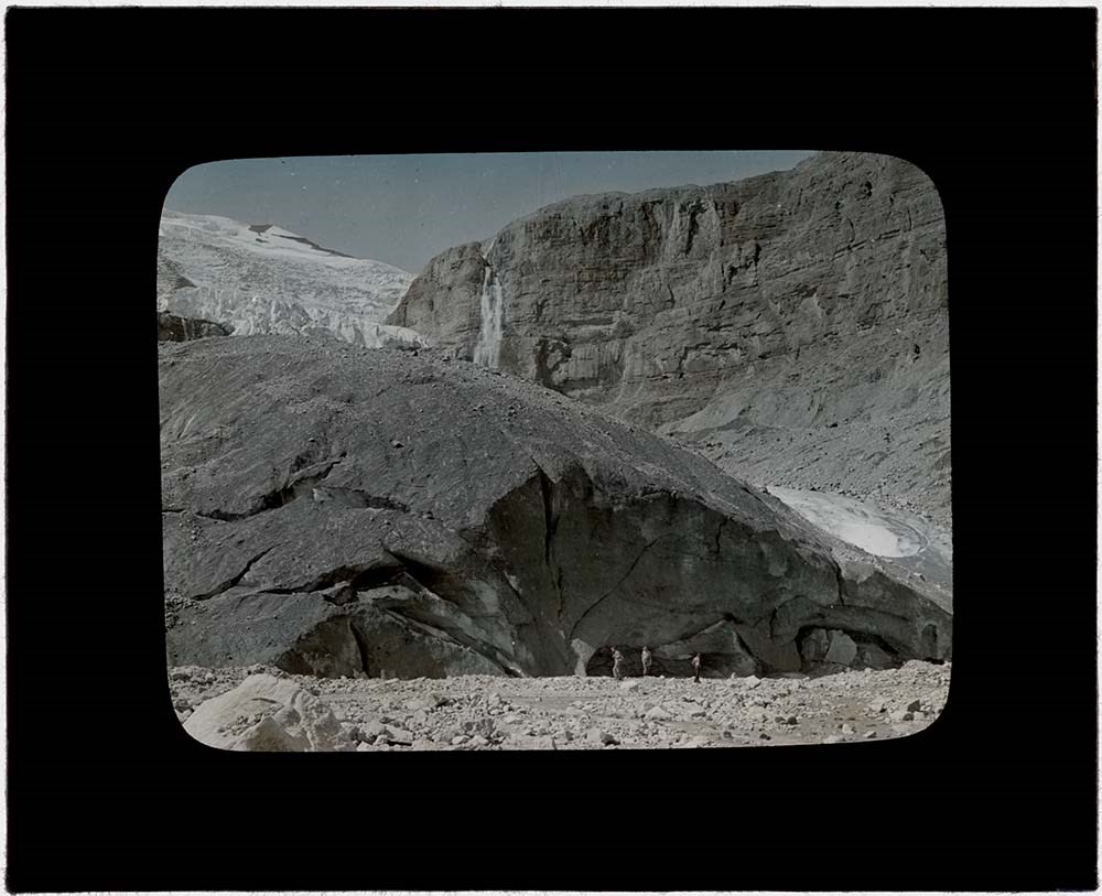
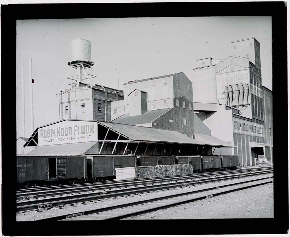
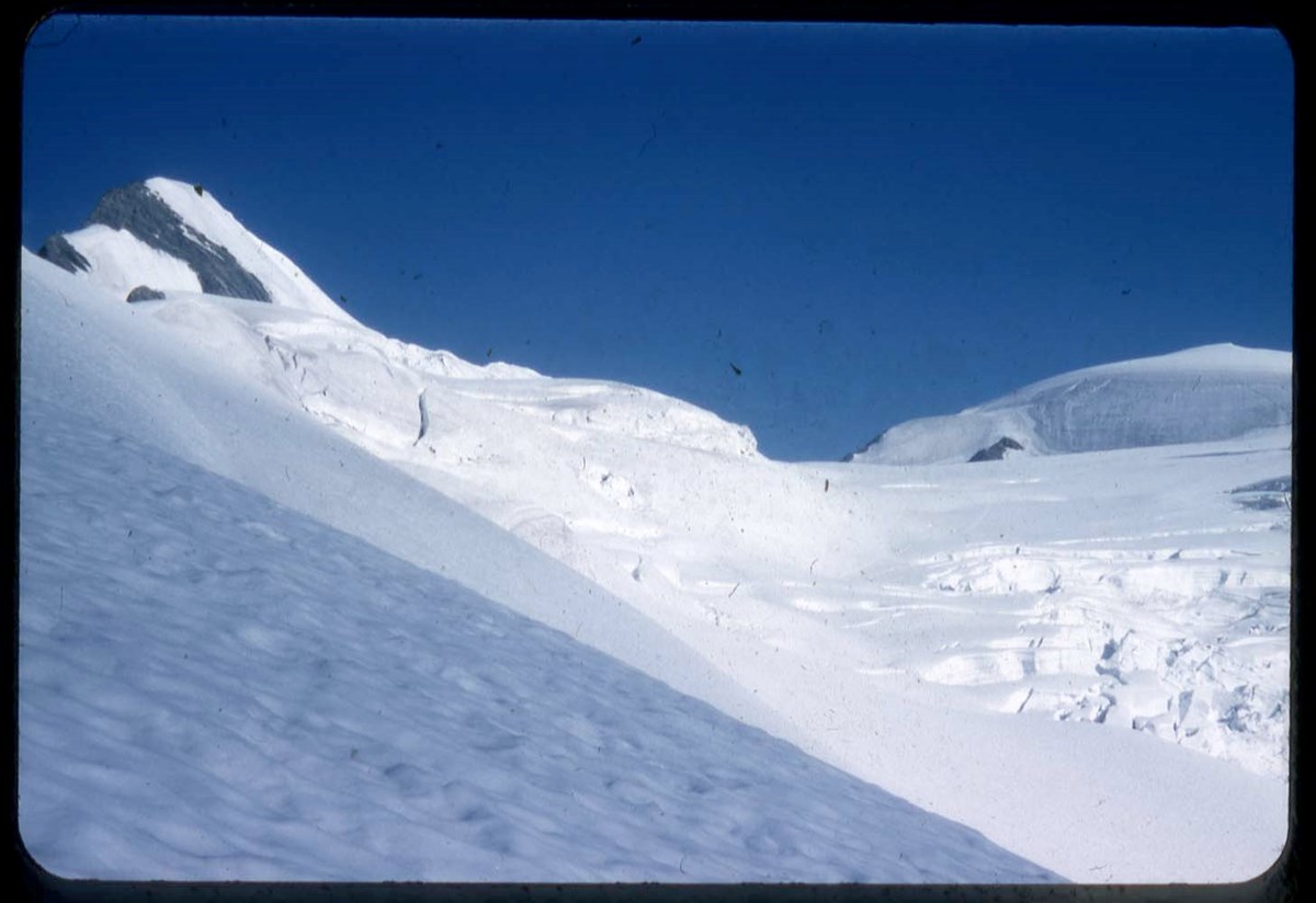
- [201] Hiking in Redearth Pass country. Egypt and Scarab Lakes [202] Hoary Marmot [203] Bow Valley at Anthracite [204] A mountain stream in winter [205] Above Scarab Lake [206] Snow lilies at Scarab Lake [207] Corner of Scarab Lake [208] Mt. Saskatchewan - driften snow on Mt. Castleguard [209] Crevasse on Yoho Glacier [210] On Yoho Glacier [211] Scarab and Mummy Lakes from summit of Pharaoh Peak [212] Ice cave on lower Ball glacier [213] Medial moraine on Balfour glacier [214] On edge of Balfour Glacier [215] Mountains of Yoho Peak from summit O Mt. Narao, Wapta Lake [216] Mt. Columbia looking across the Columbia Icefield from the summit of Mt. Castleguard [217] Glimpse of Peyto Lake from Peyto Glacier [218] Mt. Saskatchewan [219] Giant Hoodoos at head of Hoodoo Creek [220] Giant Hoodoos at head of Hoodoo Creek [221] On Yoho Glacier [222] Horses resting on Nigel Pass [223] Snout of Balfour Glacier above Lake Hector (this has now retreated far up the mountain side) [224] Peyto Glacier [225] Mt. Fryatt, Jasper [226] Packing horses at Windy Cabin [227] Old cabin near site of talc mine (near Egypt Lake) [228] Crowfoot Glacier (lower talon now gone) [229] Approaching Balfour glacier from Hector Lake (now completely retreated from valley floor) [230] Howse Peak - Pyramid Peak (now Mt. Chephren) Mystaya Creek [231] Waterfalls on the North Fork of the Saskatchewan River ( now called The Weeping Wall on the Jasper Highway) [232] Looking down the Saskatchewan Glacier to Parker Ridge [233] Robin Hood Mills, Calgary [234] Mt. Edith - Mt. Locus from west slopes of Mt. Norquay. Edith Garbutt on left [235] Unnamed slide
- Name Access
- Leacock, Leonard
- Subject Access
- Photography
- Lantern slide
- Climbing
- Environment and Nature
- Fossils
- Glaciers
- Horses
- Horseback riding
- Hiking
- Landscapes
- National parks and reserves
- Scenery
- Wildlife
- Geographic Access
- Banff
- Lake Louise
- Lake O'Hara
- Jasper
- Banff National Park
- Yoho National Park
- Jasper National Park
- Alberta
- Canada
- Language
- N/A
- Conservation
- Slides cleaned prior to scanning. If possilbe, locate missing slide PS-104.
- Finding Aid
- List available
- Related Material
- Corresponding negatives exist for some lantern slides Accompanying lantern slide notes moved to M372 / 14-18
- Creator
- Leacock, Leonard
- Title Source
- Title based on contents of file.
- Processing Status
- Processed
Electronic Resources
Images


This material is presented as originally created; it may contain outdated cultural descriptions and
potentially offensive content.
Read more.
Mount McArthur 1995-2001
https://archives.whyte.org/en/permalink/descriptions57789
- Part Of
- Alpine Club of Canada fonds
- Scope & Content
- File consists of a summit record from Mount McArthur produced by the Alpine Club of Canada between 1995 and 2001. Summit record includes entries from visitors to the various summits which pertain to individuals' hiking and climbing trips; details of specific events which occurred while at the summi…
- Date Range
- 1995-2001
- Reference Code
- M200 / V / A / 206
- Description Level
- 5 / File
- GMD
- Textual record
- Organization record
- Part Of
- Alpine Club of Canada fonds
- Description Level
- 5 / File
- Fonds Number
- M200
- V14
- S6
- Series
- M200 / V: Summit Records
- Sous-Fonds
- M200
- Sub-Series
- M200 / V / A: Identified Summit Records
- Accession Number
- accn. 7779
- Reference Code
- M200 / V / A / 206
- Responsibility
- Summit Registers and Notes produced by Alpine Club of Canada
- Date Range
- 1995-2001
- Physical Description
- 1 volume 0.5 cm of textual record
- History / Biographical
- Mount McArthur is located in Yoho National Park, British Columbia, near the Continental Divide/Great Divide. Nearby are Isolated Peak, Arete Peak, and Mount Carnarvon.
- Scope & Content
- File consists of a summit record from Mount McArthur produced by the Alpine Club of Canada between 1995 and 2001. Summit record includes entries from visitors to the various summits which pertain to individuals' hiking and climbing trips; details of specific events which occurred while at the summit, wildlife sightings, trail updates, and related topics. File: M200 / V / A / 206: Mount McArthur 1995-2001
- Name Access
- Alpine Club of Canada
- Subject Access
- Alpine Club of Canada
- Backpacking
- British Columbia
- Climbing
- Club
- Description and travel
- Environment
- Environment and Nature
- Great Divide
- Hiking
- Mountain
- Mountaineering
- Mountaineers
- Mountains
- National parks and reserves
- Record keeping
- Ski mountaineering
- Sports and leisure
- Sports and recreation
- Summit
- Trails
- Geographic Access
- Canada
- Canadian Rocky Mountains
- Rocky Mountains
- Continental Divide
- Great Divide
- British Columbia
- Yoho National Park
- Isolated Peak
- Arete Peak
- Mount Carnarvon
- Mount McArthur
- Access Restrictions
- Restrictions may apply
- Language
- English
- French
- Related Material
- M235
- Title Source
- Original title
- Processing Status
- Processed
This material is presented as originally created; it may contain outdated cultural descriptions and
potentially offensive content.
Read more.
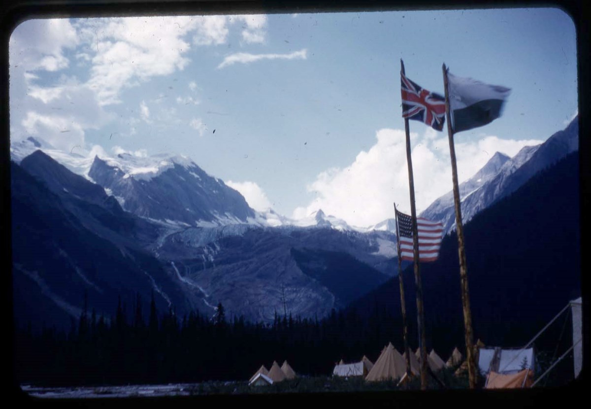
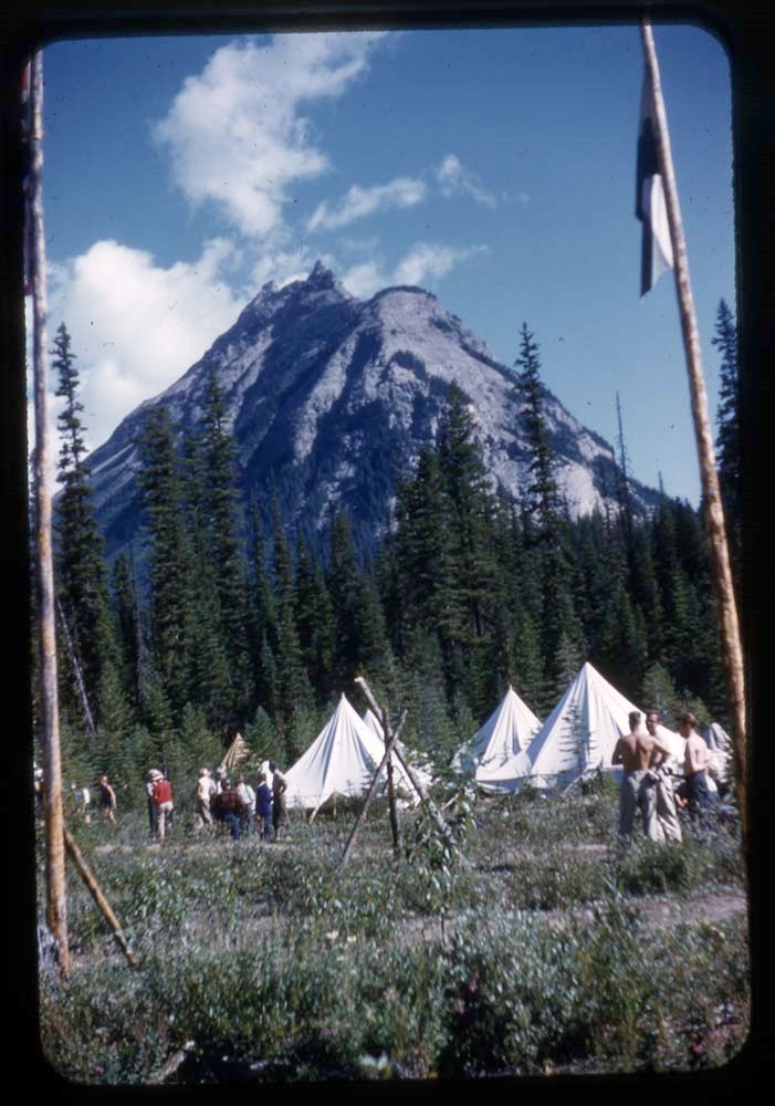
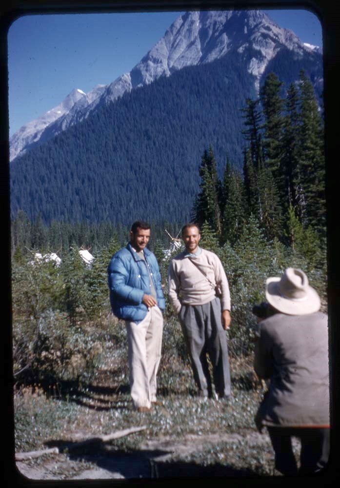
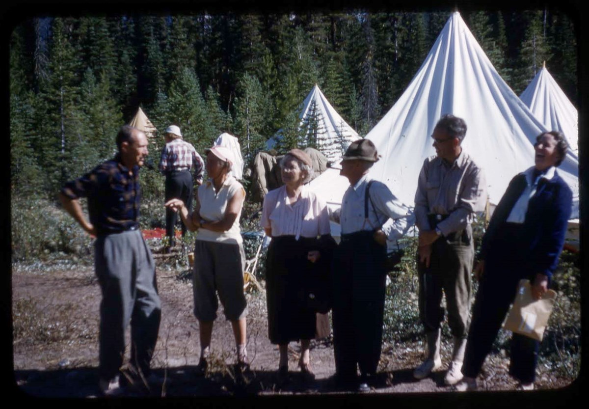
Mount Mummery and Mummery Glacier Area
https://archives.whyte.org/en/permalink/descriptions17529
- Part Of
- Bob Hind fonds
- Scope & Content
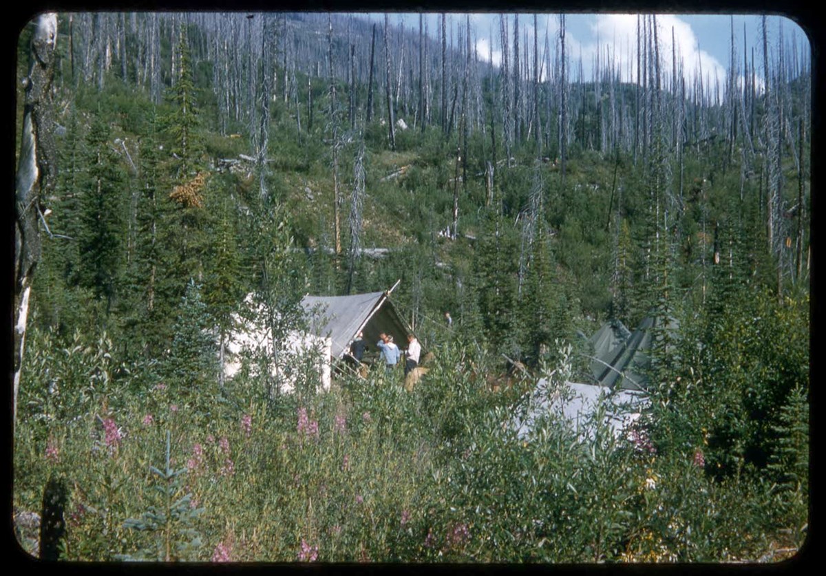
- File pertains to forests, mountains and glaciers, hiking and climbing, groups, camps around the Mummery area.
- Date Range
- 1958
- Reference Code
- V46 / I / A / 40 / NS 1 to 128
- Description Level
- 5 / File
- GMD
- Lantern slide
- Transparency
128 images
1 Electronic Resource
- Part Of
- Bob Hind fonds
- Description Level
- 5 / File
- Fonds Number
- M7 / V46
- Series
- I.A. Mountain travel and recreation, western Canada : Trips and activities
- Sous-Fonds
- V46
- Accession Number
- 7181
- Reference Code
- V46 / I / A / 40 / NS 1 to 128
- Date Range
- 1958
- Physical Description
- 128 photographs : transparencies, 35mm, col
- History / Biographical
- See fonds level description
- Scope & Content
- File pertains to forests, mountains and glaciers, hiking and climbing, groups, camps around the Mummery area.
- Name Access
- Hind, Bob
- Subject Access
- Activities
- Backpacking
- Cabins and shelters
- Environment
- Glaciers
- Guide
- Guiding
- Horses
- Horse packing
- Mountaineering
- Mountains
- Professional and Personal Life
- Geographic Access
- Mount Mummery
- Yoho National Park
- British Columbia
- Canada
- Language
- NA
- Title Source
- Title based on contents of file
- Processing Status
- Processed
Electronic Resources
Images


This material is presented as originally created; it may contain outdated cultural descriptions and
potentially offensive content.
Read more.
Mount Niles summit register Oct. 3, 1989 - Aug. 28, 1994
https://archives.whyte.org/en/permalink/descriptions57791
- Part Of
- Alpine Club of Canada fonds
- Scope & Content
- File consists of a summit record from Mount Niles produced by the Alpine Club of Canada between 1989 and 1994. Summit record includes entries from visitors to the various summits which pertain to individuals' hiking and climbing trips; details of specific events which occurred while at the summit, …
- Date Range
- 1989-1994
- Reference Code
- M200 / V / A / 208
- Description Level
- 5 / File
- GMD
- Textual record
- Organization record
- Part Of
- Alpine Club of Canada fonds
- Description Level
- 5 / File
- Fonds Number
- M200
- V14
- S6
- Series
- M200 / V: Summit Records
- Sous-Fonds
- M200
- Sub-Series
- M200 / V / A: Identified Summit Records
- Accession Number
- accn. 2023.10
- Reference Code
- M200 / V / A / 208
- Responsibility
- Summit Registers and Notes produced by Alpine Club of Canada
- Date Range
- 1989-1994
- Physical Description
- 1 volume 1 cm of textual record
- History / Biographical
- Mount Niles is part of the Canadian Rockies in Yoho National Park, British Columbia. Nearby are the Continental Divide/Great Divide, Mount Ogden, Waptutik Icefield, Mount Balfour, and Mount Yukness.
- Scope & Content
- File consists of a summit record from Mount Niles produced by the Alpine Club of Canada between 1989 and 1994. Summit record includes entries from visitors to the various summits which pertain to individuals' hiking and climbing trips; details of specific events which occurred while at the summit, wildlife sightings, trail updates, and related topics. File: M200 / V / A / 208: Mount Niles summit register Oct. 3, 1989 - Aug. 28, 1994
- Name Access
- Alpine Club of Canada
- Subject Access
- Alpine Club of Canada
- Backpacking
- British Columbia
- Climbing
- Club
- Description and travel
- Environment
- Environment and Nature
- Great Divide
- Hiking
- Mountain
- Mountaineering
- Mountaineers
- Mountains
- National parks and reserves
- Record keeping
- Ski area
- Ski areas
- Ski mountaineering
- Sports and leisure
- Sports and recreation
- Summit
- Trails
- Geographic Access
- Canada
- Canadian Rocky Mountains
- Rocky Mountains
- Continental Divide
- Great Divide
- British Columbia
- Yoho National Park
- Waputik Icefield
- Mount Yukness
- Mount Balfour
- Mount Ogden
- Mount Niles
- Access Restrictions
- Restrictions may apply
- Reproduction Restrictions
- Register in poor condition due to mold.
- Language
- English
- Conservation
- Register placed in mylar due to presence of mold. Register is loose pages, as staples holding the binding together have rusted and corroded.
- Related Material
- M235
- Biographical Source Notes
- Peak Finder: Mount Niles, Canadian Rockies Database: https://cdnrockiesdatabases.ca/peaks/966
- Title Source
- Original title
- Processing Status
- Processed
This material is presented as originally created; it may contain outdated cultural descriptions and
potentially offensive content.
Read more.
Mount Victoria Summit Record
https://archives.whyte.org/en/permalink/descriptions57688
- Part Of
- Alpine Club of Canada fonds
- Scope & Content
- File consists of one summit register from Mount Victoria produced by the Alpine Club of Canada between 1998 and 2004. Summit record include entries from visitors to the various summits which pertain to individuals' hiking and climbing trips; details of specific events which occurred while at the su…
- Date Range
- September 1998 - August 2004
- Reference Code
- M200 / V / A / 81
- Description Level
- 5 / File
- GMD
- Textual record
- Organization record
- Part Of
- Alpine Club of Canada fonds
- Description Level
- 5 / File
- Fonds Number
- M200
- V14
- S6
- Series
- M200 / V: Summit Records
- Sous-Fonds
- M200
- Sub-Series
- M200 / V / A: Identified Summit Records
- Accession Number
- accn. 8002
- Reference Code
- M200 / V / A / 81
- Responsibility
- Summit Registers and Notes produced by Alpine Club of Canada
- Date Range
- September 1998 - August 2004
- Physical Description
- 1 cm of textual records 1 volume
- History / Biographical
- Mount Victoria is located in both Yoho National Park, B. C. and Banff National Park, AB in the Canadian Rockies. The mountain is part of the mountain range along the Continental Divide, between Alberta and B.C. Nearby are Lake O'Hara, Lake Louise, Abbot Pass and Mount Lefroy. Mount Victoria was named for Queen Victoria.
- Scope & Content
- File consists of one summit register from Mount Victoria produced by the Alpine Club of Canada between 1998 and 2004. Summit record include entries from visitors to the various summits which pertain to individuals' hiking and climbing trips; details of specific events which occurred while at the summit, wildlife sightings, trail updates, and related topics. File: M200 / V / A / 81: Summit - MT. Victoria, Sept. 1998 - Aug. 2004
- Name Access
- Alpine Club of Canada
- Subject Access
- Alberta
- Abbot Pass
- Alpine Club of Canada
- Backcountry skiing
- Backpacking
- Banff National Park
- Bow Valley
- British Columbia
- Climbing
- Club
- Cross-country skiing
- Description and travel
- Environment
- Environment and Nature
- Hiking
- Lake Louise
- Lake O'hara
- Mountain
- Mountaineering
- Mountaineers
- Mountains
- Parks Canada
- Record keeping
- Ski area
- Ski areas
- Ski mountaineering
- Ski touring
- Skiers
- Skiing
- Snowshoes and snowshoeing
- Sports and leisure
- Sports and recreation
- Summit
- Trails
- Winter sports
- Geographic Access
- Canada
- Alberta
- British Columbia
- Banff National Park
- Yoho National Park
- Lake O'Hara
- Lake Louise
- Lake Louise, AB
- Abbot Pass
- Abbott Pass
- Mount Lefroy
- Mount Victoria
- Access Restrictions
- Restrictions may apply
- Language
- English
- French
- German
- Japanese
- Related Material
- M235
- Biographical Source Notes
- Peak Finder: Mount Victoria, Canadian Rockies Database: https://cdnrockiesdatabases.ca/peaks/1459
- Title Source
- Title based on contents of file
- Processing Status
- Processed
This material is presented as originally created; it may contain outdated cultural descriptions and
potentially offensive content.
Read more.
- Part Of
- Alpine Club of Canada fonds
- Scope & Content
- File consists of a summit record from Mount Baker produced by the Alpine Club of Canada around 1988. Summit record includes entries from visitors to the various summits which pertain to individuals' hiking and climbing trips; details of specific events which occurred while at the summit, wildlife s…
- Date Range
- ca. 1988
- Reference Code
- M200 / V / A / 120
- Description Level
- 5 / File
- GMD
- Textual record
- Organization record
- Part Of
- Alpine Club of Canada fonds
- Description Level
- 5 / File
- Fonds Number
- M200
- V14
- S6
- Series
- M200 / V: Summit Records
- Sous-Fonds
- M200
- Sub-Series
- M200 / V / A: Identified Summit Records
- Accession Number
- accn. 2023.10
- Reference Code
- M200 / V / A / 120
- Responsibility
- Summit Registers and Notes produced by Alpine Club of Canada
- Date Range
- ca. 1988
- Physical Description
- 1 volume 1 cm of textual record
- History / Biographical
- Mount Baker is located on the Continental Divide of Alberta and British Columbia. It is part of the Waputik Mountains of the Canadian Rockies. Nearby are Yoho Provincial Park, Banff National Park, Mount Freshfield, Mount Forbes, Lake Louise, AB, and Field, B.C.
- Scope & Content
- File consists of a summit record from Mount Baker produced by the Alpine Club of Canada around 1988. Summit record includes entries from visitors to the various summits which pertain to individuals' hiking and climbing trips; details of specific events which occurred while at the summit, wildlife sightings, trail updates, and related topics. File: M200 / V / A / 120: Mt. Baker
- Name Access
- Alpine Club of Canada
- Subject Access
- Alberta
- Alpine Club of Canada
- Backcountry skiing
- Backpacking
- Banff
- Banff National Park
- Bow Valley
- British Columbia
- Climbing
- Club
- Cross-country skiing
- Description and travel
- Environment
- Environment and Nature
- Hiking
- Mountain
- Mountaineering
- Mountaineers
- Mountains
- National parks and reserves
- Record keeping
- Ski area
- Ski areas
- Ski mountaineering
- Skiers
- Skiing
- Skis
- Sports and leisure
- Sports and recreation
- Summit
- Trails
- Winter sports
- Geographic Access
- Canada
- Canadian Rocky Mountains
- Rocky Mountains
- Continental Divide
- Alberta
- British Columbia
- Banff National Park
- Yoho National Park
- Mount Freshfield
- Mount Forbes
- Lake Louise
- Lake Louise, AB
- Mount Baker
- Access Restrictions
- Restrictions may apply
- Language
- English
- Conservation
- Register placed in mylar due to evidence of mold. Evidence of water damage.
- Related Material
- M235
- Title Source
- Original title used
- Processing Status
- Processed
This material is presented as originally created; it may contain outdated cultural descriptions and
potentially offensive content.
Read more.
- Part Of
- Alpine Club of Canada fonds
- Scope & Content
- Files consists of the summit register from Mount Bosworth produced by the Alpine Club of Canada between approximately 2003 to 2022. Summit record includes entries from visitors to the various summits which pertain to individuals' hiking and climbing trips; details of specific events which occurred …
- Date Range
- ca. 2003-2022
- Reference Code
- M200 / V / A / 222
- Description Level
- 5 / File
- GMD
- Textual record
- Organization record
- Part Of
- Alpine Club of Canada fonds
- Description Level
- 5 / File
- Fonds Number
- M200
- V14
- S6
- Series
- M200 / V: Summit Records
- Sous-Fonds
- M200
- Sub-Series
- M200 / V / A: Identified Summit Records
- Accession Number
- accn. 2024.20
- Reference Code
- M200 / V / A / 222
- Responsibility
- Summit Registers and Notes produced by Alpine Club of Canada
- Date Range
- ca. 2003-2022
- Physical Description
- 1 cm of textual records
- History / Biographical
- Mount Bosworth is located in the Canadian Rocky Mountains along the Continental Divide, between Alberta and British Columbia. Nearby is Paget Peak and Kicking Horse Pass.
- Scope & Content
- Files consists of the summit register from Mount Bosworth produced by the Alpine Club of Canada between approximately 2003 to 2022. Summit record includes entries from visitors to the various summits which pertain to individuals' hiking and climbing trips; details of specific events which occurred while at the summit, wildlife sightings, trail updates, and related topics. File: M200 / V / A / 222: Mt. Bosworth
- Name Access
- Alpine Club of Canada
- Subject Access
- Administration
- Alpine Club of Canada
- Club
- Record keeping
- Records
- Alberta
- Backpacking
- British Columbia
- Climbing
- Description and travel
- Environment
- Environment and Nature
- Great Divide
- Hiking
- Mountain
- Mountaineering
- Mountaineers
- Mountains
- Sports and leisure
- Sports and recreation
- Summit
- Geographic Access
- Canada
- Canadian Rocky Mountains
- Rocky Mountains
- Great Divide
- Continental Divide
- Alberta
- British Columbia
- Banff National Park
- Yoho National Park
- Kicking Horse Pass
- Mount Bosworth
- Access Restrictions
- Restrictions may apply
- Reproduction Restrictions
- Contains personal information
- Language
- English
- Conservation
- Register placed in mylar due to mold.
- Related Material
- M235
- Biographical Source Notes
- Peak Finder: Mount Bosworth, Canadian Rockies Database: https://cdnrockiesdatabases.ca/peaks/156#undefined1
- Title Source
- Original title
- Processing Status
- Processed
This material is presented as originally created; it may contain outdated cultural descriptions and
potentially offensive content.
Read more.
Mt. Carnarvon Summit Records
https://archives.whyte.org/en/permalink/descriptions57760
- Part Of
- Alpine Club of Canada fonds
- Scope & Content
- Files consist of summit records from Mount Carnarvon produced by the Alpine Club of Canada between 1990 and 2010. Summit record includes entries from visitors to the various summits which pertain to individuals' hiking and climbing trips; details of specific events which occurred while at the summi…
- Date Range
- 1990-2010
- Reference Code
- M200 / V / A / 203 to 204
- Description Level
- 5 / File
- GMD
- Textual record
- Organization record
- Part Of
- Alpine Club of Canada fonds
- Description Level
- 5 / File
- Fonds Number
- M200
- V14
- S6
- Series
- M200 / V: Summit Records
- Sous-Fonds
- M200
- Sub-Series
- M200 / V / A: Identified Summit Records
- Accession Number
- accn. 2014.8315
- accn. 7779
- Reference Code
- M200 / V / A / 203 to 204
- Responsibility
- Summit Registers and Notes produced by Alpine Club of Canada
- Date Range
- 1990-2010
- Physical Description
- 2 volume 2 cm of textual record
- History / Biographical
- Mount Carnarvon is located in Kiwetinok River Valley of Yoho National Park, British Columbia. It is part of the President Range of the Canadian Rocky Mountains.
- Scope & Content
- Files consist of summit records from Mount Carnarvon produced by the Alpine Club of Canada between 1990 and 2010. Summit record includes entries from visitors to the various summits which pertain to individuals' hiking and climbing trips; details of specific events which occurred while at the summit, wildlife sightings, trail updates, and related topics. File: M200 / V / A / 203: Mt. Carnarvon Jul 14, 1990 - Jul 20, 1997 M200 / V / A / 204: Mt. Carnarvon Log Book [1997-2010]
- Name Access
- Alpine Club of Canada
- Subject Access
- Alpine Club of Canada
- Backpacking
- Backcountry skiing
- British Columbia
- Club
- Climbing
- Description and travel
- Environment
- Environment and Nature
- Hiking
- Mountain
- Mountaineering
- Mountaineers
- Mountains
- National parks and reserves
- Record keeping
- Sports and leisure
- Sports and recreation
- Summit
- Trails
- Geographic Access
- Canada
- Canadian Rocky Mountains
- Rocky Mountains
- President Range
- British Columbia
- Yoho National Park
- Kiwetinok River Valley
- Isolated Peak
- Emerald Lake
- Mount Carnarvon
- Access Restrictions
- Restrictions may apply
- Language
- English
- French
- Spanish
- Related Material
- M235
- Biographical Source Notes
- Peak Finder: Mount Carnarvon, Canadian Rockies Database: https://cdnrockiesdatabases.ca/peaks/216
- Title Source
- Title based on contents of file
- Processing Status
- Processed
This material is presented as originally created; it may contain outdated cultural descriptions and
potentially offensive content.
Read more.
[Mt. Field, 1994-2000]
https://archives.whyte.org/en/permalink/descriptions57708
- Part Of
- Alpine Club of Canada fonds
- Scope & Content
- File consists of a summit record from Mount Field produced by the Alpine Club of Canada between 1994 and 2000. Summit record includes entries from visitors to the various summits which pertain to individuals' hiking and climbing trips; details of specific events which occurred while at the summit, …
- Date Range
- 1994-2000
- Reference Code
- M200 / V / A / 118
- Description Level
- 5 / File
- GMD
- Textual record
- Organization record
- Part Of
- Alpine Club of Canada fonds
- Description Level
- 5 / File
- Fonds Number
- M200
- V14
- S6
- Series
- M200 / V: Summit Records
- Sous-Fonds
- M200
- Sub-Series
- M200 / V / A: Identified Summit Records
- Accession Number
- accn. 2023.10
- Reference Code
- M200 / V / A / 118
- Responsibility
- Summit Registers and Notes produced by Alpine Club of Canada
- Date Range
- 1994-2000
- Physical Description
- 1 volume 0.5 cm of textual record
- History / Biographical
- Mt. Field is located in the Canadian Rockies, in Yoho National Park near the town of Field, B.C. Nearby are Mount Burgess, Wapta Mountain, and Emerald Lake.
- Scope & Content
- File consists of a summit record from Mount Field produced by the Alpine Club of Canada between 1994 and 2000. Summit record includes entries from visitors to the various summits which pertain to individuals' hiking and climbing trips; details of specific events which occurred while at the summit, wildlife sightings, trail updates, and related topics. File: M200 / V / A / 118: [Mt. Field, 1994-2000]
- Name Access
- Alpine Club of Canada
- Subject Access
- Alpine Club of Canada
- Backcountry skiing
- Backpacking
- British Columbia
- Climbing
- Club
- Cross-country skiing
- Description and travel
- Environment
- Environment and Nature
- Hiking
- Mountain
- Mountaineering
- Mountaineers
- Mountains
- National parks and reserves
- Record keeping
- Ski areas
- Ski area
- Ski mountaineering
- Skiers
- Skiing
- Skis
- Sports and leisure
- Sports and recreation
- Summit
- Trails
- Winter sports
- Geographic Access
- Canada
- Canadian Rocky Mountains
- British Columbia
- Yoho National Park
- Field
- Mount Burgess
- Wapta Mountain
- Emerald Lake
- Mount Field, B.C.
- Access Restrictions
- Restrictions may apply
- Language
- English
- Related Material
- M235
- Title Source
- Title based on contents of file
- Processing Status
- Processed
This material is presented as originally created; it may contain outdated cultural descriptions and
potentially offensive content.
Read more.
Mt. Lefroy Summit Records
https://archives.whyte.org/en/permalink/descriptions57737
- Part Of
- Alpine Club of Canada fonds
- Scope & Content
- Files consist of summit notes and summit registers Mount Lefroy produced by the Alpine Club of Canada between 1985 and 2010. Summit records include entries from visitors to the various summits which pertain to individuals' hiking and climbing trips; details of specific events which occurred while a…
- Date Range
- 1985-2010
- Reference Code
- M200 / V / A / 148 to 149
- Description Level
- 5 / File
- GMD
- Textual record
- Organization record
- Part Of
- Alpine Club of Canada fonds
- Description Level
- 5 / File
- Fonds Number
- M200
- V14
- S6
- Series
- M200 / V: Summit Records
- Sous-Fonds
- M200
- Sub-Series
- M200 / V / A: Identified Summit Records
- Accession Number
- accn. 5631
- accn. 2023.19
- Reference Code
- M200 / V / A / 148 to 149
- Responsibility
- Summit Registers and Notes produced by Alpine Club of Canada
- Date Range
- 1985-2010
- Physical Description
- 2 volumes 3 cm of textual records
- History / Biographical
- Mount Lefroy is located in along the Continental/Great Divide, and is part of the Canadian Rocky Mountains. Nearby are Abbot Pass and Mount Victoria. Mount Lefroy is the site of the first fatal mountaineering accident in Canada.
- Scope & Content
- Files consist of summit notes and summit registers Mount Lefroy produced by the Alpine Club of Canada between 1985 and 2010. Summit records include entries from visitors to the various summits which pertain to individuals' hiking and climbing trips; details of specific events which occurred while at the summit, wildlife sightings, trail updates, and related topics. Files include: M200 / V / A / 148: [Mt. Lefroy register 1985-1987] M200 / V / A / 149: Mt. Lefroy. [ca. 1986-2010]
- Name Access
- Alpine Club of Canada
- Subject Access
- Alberta
- Alpine Club of Canada
- Backcountry skiing
- Backpacking
- Banff
- Banff National Park
- British Columbia
- Climbing
- Club
- Description and travel
- Environment
- Environment and Nature
- Great Divide
- Hiking
- Mountain
- Mountaineering
- Mountaineers
- Mountains
- National parks and reserves
- Provincial parks and reserves
- Record keeping
- Ski mountaineering
- Skiing
- Skiers
- Skis
- Sports and leisure
- Sports and recreation
- Summit
- Trails
- Geographic Access
- Canada
- Canadian Rocky Mountains
- Rocky Mountains
- Continental Divide
- Great Divide
- Alberta
- British Columbia
- Banff National Park
- Yoho National Park
- Abbott Pass
- Abbot Pass
- Mount Victoria
- Mount Lefroy
- Access Restrictions
- Restrictions may apply
- Language
- English
- Japanese
- French
- Conservation
- Register has evidence of rust damage and loose pages. Pages have tears and some water damage.
- Related Material
- M235
- Title Source
- Title based on contents of file
- Processing Status
- Processed
This material is presented as originally created; it may contain outdated cultural descriptions and
potentially offensive content.
Read more.
Mt. McPhail Summit Register
https://archives.whyte.org/en/permalink/descriptions57711
- Part Of
- Alpine Club of Canada fonds
- Scope & Content
- File consists of a summit record from Mount McPhail produced by the Alpine Club of Canada around 1994. Summit record includes entries from visitors to the various summits which pertain to individuals' hiking and climbing trips; details of specific events which occurred while at the summit, wildlife…
- Date Range
- ca. 1994
- Reference Code
- M200 / V / A / 121
- Description Level
- 5 / File
- GMD
- Textual record
- Organization record
- Part Of
- Alpine Club of Canada fonds
- Description Level
- 5 / File
- Fonds Number
- M200
- V14
- S6
- Series
- M200 / V: Summit Records
- Sous-Fonds
- M200
- Sub-Series
- M200 / V / A: Identified Summit Records
- Accession Number
- accn. 2014.8293
- Reference Code
- M200 / V / A / 121
- Responsibility
- Summit Registers and Notes produced by Alpine Club of Canada
- Date Range
- ca. 1994
- Physical Description
- 1 volume 1 cm of textual record
- History / Biographical
- Mount McPhail is located in the Elk Range of the Park Ranges of the Canadian Rockies and is along the Continental Divide, between the Alberta and British Columbia border. It is within the Kananaskis Country Provincial Park boundary, Mount McPhail is also known as "The Pyramid" for its shape. The mountain was named for Corporal Norman RR. McPhail, a member of the Surveyor General staff, who fought and was killed in action in WWI.
- Scope & Content
- File consists of a summit record from Mount McPhail produced by the Alpine Club of Canada around 1994. Summit record includes entries from visitors to the various summits which pertain to individuals' hiking and climbing trips; details of specific events which occurred while at the summit, wildlife sightings, trail updates, and related topics. File: M200 / V / A / 121: Mt. McPhail Summit Register
- Name Access
- Alpine Club of Canada
- Subject Access
- Alberta
- Alpine Club of Canada
- Backcountry skiing
- Backpacking
- Banff
- Banff National Park
- Bow Valley
- British Columbia
- Climbing
- Club
- Cross-country skiing
- Description and travel
- Environment
- Environment and Nature
- Hiking
- Kananaskis Country
- Mountain
- Mountaineering
- Mountaineers
- Mountains
- National parks and reserves
- Provincial parks and reserves
- Record keeping
- Ski area
- Ski areas
- Ski mountaineering
- Skiing
- Skiers
- Sports and leisure
- Sports and recreation
- Summit
- Winter sports
- Geographic Access
- Canada
- Canadian Rocky Mountains
- Alberta
- British Columbia
- Banff National Park
- Yoho National Park
- Continental Divide
- Elk Range Mountains
- Mount McPhail
- Access Restrictions
- Restrictions may apply
- Language
- English
- Conservation
- Register contains black mold, water damage. Register is placed in mylar.
- Related Material
- M235
- Biographical Source Notes
- Peak Finder: Mount McPhail, Canadian Rockies Database: https://cdnrockiesdatabases.ca/peaks/889
- Title Source
- Original title used
- Processing Status
- Processed
This material is presented as originally created; it may contain outdated cultural descriptions and
potentially offensive content.
Read more.
Mt. Rhondda Summit Records
https://archives.whyte.org/en/permalink/descriptions57783
- Part Of
- Alpine Club of Canada fonds
- Scope & Content
- Files consist of summit notes and summit registers from Mount Rhondda produced by the Alpine Club of Canada between 1988 and 1998. Summit records include entries from visitors to the various summits which pertain to individuals' hiking and climbing trips; details of specific events which occurred w…
- Date Range
- 1988-1998
- Reference Code
- M200 / V / A / 197 to 198
- Description Level
- 5 / File
- GMD
- Textual record
- Organization record
- Part Of
- Alpine Club of Canada fonds
- Description Level
- 5 / File
- Fonds Number
- M200
- V14
- S6
- Series
- M200 / V: Summit Records
- Sous-Fonds
- M200
- Sub-Series
- M200 / V / A: Identified Summit Records
- Accession Number
- accn. 6396
- accn. 7779
- Reference Code
- M200 / V / A / 197 to 198
- Responsibility
- Summit Registers and Notes produced by Alpine Club of Canada
- Date Range
- 1988-1998
- Physical Description
- 2 volumes 2 cm of textual records
- History / Biographical
- Mount Rhondda is located along the Continental Divide/Great Divide, along the Canadian Rockies. It is in the centre of the Wapta Icefield. It also lies along the border of Banff National Park, Alberta and Yoho National Park, British Columbia.
- Scope & Content
- Files consist of summit notes and summit registers from Mount Rhondda produced by the Alpine Club of Canada between 1988 and 1998. Summit records include entries from visitors to the various summits which pertain to individuals' hiking and climbing trips; details of specific events which occurred while at the summit, wildlife sightings, trail updates, and related topics. Files include: M200 / V / A / 197: [Mt. Rhondda South register, 1988-1991] M200 / V / A / 198: [Mt. Rhondda summit register March 11, 1988 - July 6, 1998]
- Name Access
- Alpine Club of Canada
- Subject Access
- Alberta
- Alpine Club of Canada
- Banff
- Banff National Park
- Bow Valley
- British Columbia
- Climbing
- Club
- Description and travel
- Environment
- Environment and Nature
- Great Divide
- Hiking
- Mountain
- Mountaineering
- Mountaineers
- Mountains
- National parks and reserves
- Record keeping
- Sports and leisure
- Sports and recreation
- Summit
- Trails
- Geographic Access
- Canada
- Canadian Rocky Mountains
- Rocky Mountains
- Great Divide
- Continental Divide
- Alberta
- British Columbia
- Banff National Park
- Yoho National Park
- Wapta Icefield
- Mont des Pollus
- Arete Peak
- Mount Gordon
- Mount Rhondda
- Access Restrictions
- Restrictions may apply
- Reproduction Restrictions
- Both registers contain black mold
- Language
- English
- Conservation
- Both registers have been placed in mylar due to black mold.
- Related Material
- M235
- Biographical Source Notes
- Peak Finder: Mount Rhondda, Canadian Rockies Database: https://cdnrockiesdatabases.ca/peaks/1164
- Title Source
- Title based on contents of file
- Processing Status
- Processed
This material is presented as originally created; it may contain outdated cultural descriptions and
potentially offensive content.
Read more.
Mt. Yukness Summit Records
https://archives.whyte.org/en/permalink/descriptions57687
- Part Of
- Alpine Club of Canada fonds
- Scope & Content
- Files consist of summit notes and summit registers from Mt. Yukness produced by the Alpine Club of Canada between ca. 1962 and 2003. Summit records include entries from visitors to the various summits which pertain to individuals' hiking and climbing trips; details of specific events which occurred…
- Date Range
- ca. 1962-1985
- 1994-2003
- Reference Code
- M200 / V / A / 79 to 80
- Description Level
- 5 / File
- GMD
- Textual record
- Organization record
- Part Of
- Alpine Club of Canada fonds
- Description Level
- 5 / File
- Fonds Number
- M200
- V14
- S6
- Series
- M200 / V: Summit Records
- Sous-Fonds
- M200
- Sub-Series
- M200 / V / A: Identified Summit Records
- Accession Number
- accn. 2023.32
- accn. 8002
- Reference Code
- M200 / V / A / 79 to 80
- Responsibility
- Summit Registers and Notes produced by Alpine Club of Canada
- Date Range
- ca. 1962-1985
- 1994-2003
- Physical Description
- 2 cm of textual records 2 volumes
- History / Biographical
- Mt. Yukness is located near Lake O'Hara in Yoho National Park, B.C. Nearby is Ringrose Peak, Mount Huber, Mount Lefroy, Glacier Peak, and Mount Biddle.
- Scope & Content
- Files consist of summit notes and summit registers from Mt. Yukness produced by the Alpine Club of Canada between ca. 1962 and 2003. Summit records include entries from visitors to the various summits which pertain to individuals' hiking and climbing trips; details of specific events which occurred while at the summit, wildlife sightings, trail updates, and related topics. Files include: M200 / V / A / 79: Mt. Yukness [ca. 1962 - 1985] M200 / V / A / 80: Summit Register - MT. Yukness, 1994 - 2003
- Name Access
- Alpine Club of Canada
- Subject Access
- Alpine Club of Canada
- Backcountry skiing
- Backpacking
- British Columbia
- Climbing
- Cross-country skiing
- Description and travel
- Environment
- Environment and Nature
- Hiking
- Lake O'hara
- Mountain
- Mountaineering
- Mountaineers
- Mountains
- National parks and reserves
- Parks
- Record keeping
- Ski area
- Ski areas
- Ski mountaineering
- Ski touring
- Skiers
- Skiing
- Snowshoes and snowshoeing
- Sports and leisure
- Sports and recreation
- Summit
- Trails
- Winter sports
- Geographic Access
- Canada
- British Columbia
- Canadian Rocky Mountains
- Rocky Mountains
- Yoho National Park
- Lake O'Hara
- Mount Huber
- Mount Lefroy
- Ringrose Peak
- Access Restrictions
- Restrictions may apply
- Language
- English
- Conservation
- M200 / V / A / 80: Summit Register - MT. Yukness, 1994 - 2003 register is placed in mylar due to evidence of mold. This register also contains water damage.
- Related Material
- M235
- Biographical Source Notes
- Mount Yukness, Peak Finder, Canadian Rockies Database: https://cdnrockiesdatabases.ca/peaks/1559
- Title Source
- Title based on contents of file
- Processing Status
- Processed
This material is presented as originally created; it may contain outdated cultural descriptions and
potentially offensive content.
Read more.
National Parks - Kootenay, Yoho, Glacier, Jasper, Waterton Lakes
https://archives.whyte.org/en/permalink/descriptions55243
- Part Of
- Malcolm Geddes fonds
- Scope & Content
- File consists of 70 lantern slide images pertaining to views from Kootenay, Yoho, Glacier, Jasper and Waterton Lakes National Parks. Specific locations include: Marble Canyon and Sinclair Canyon; Mount Stephen, Lake Oesa, Lake O'Hara, Lake McArthur, Takakkaw Falls, Twin Falls and Yoho Glacier; Ille…
- Date Range
- [ca.1925]
- Reference Code
- V756 / III / A / PS - 161 to 230
- Description Level
- 5 / File
- GMD
- Photograph
- Lantern slide
- Part Of
- Malcolm Geddes fonds
- Description Level
- 5 / File
- Fonds Number
- M39
- V756
- Series
- V756 / III : Personal and family records
- Sous-Fonds
- V756
- Sub-Series
- V756 / III / A : Travel and mountain expeditions
- Accession Number
- 6504
- Reference Code
- V756 / III / A / PS - 161 to 230
- Responsibility
- Some items issued by Department of the Interior Natural Resources Intelligence Branch and by Canadian National Railways
- Date Range
- [ca.1925]
- Physical Description
- 70 photographs : lantern slides
- Scope & Content
- File consists of 70 lantern slide images pertaining to views from Kootenay, Yoho, Glacier, Jasper and Waterton Lakes National Parks. Specific locations include: Marble Canyon and Sinclair Canyon; Mount Stephen, Lake Oesa, Lake O'Hara, Lake McArthur, Takakkaw Falls, Twin Falls and Yoho Glacier; Illecillewaet Glacier and surrounding area; Jasper town and Jasper Park Lodge; Maligne Lake, Maligne Canyon, Mount Edith Cavell and Mount Robson; and Waterton Lake area. Most items are captioned.
- Notes
- Slides are organized by location: V756 / III / A / PS - 161 to 167 : Kootenay V756 / III / A / PS - 168 to 185 : Yoho V756 / III / A / PS - 186 to 194 : Glacier V756 / III / A / PS - 195 to 226 : Jasper V756 / III / A / PS - 227 to 230 : Waterton Lakes
- Subject Access
- Travel
- Exploration
- Mountains
- Landscapes
- Glaciers
- Hotels
- Waterfalls
- National parks and reserves
- Tourism
- Recreation
- Geographic Access
- Canada
- Alberta
- British Columbia
- Canadian Rocky Mountains
- Kootenay National Park
- Yoho National Park
- Glacier National Park
- Jasper National Park
- Jasper
- Waterton Lakes National Park
- Waterton
- Access Restrictions
- Fragile - restrictions may apply
- Language
- English
- Title Source
- Title based on contents of file
- Processing Status
- Processed
This material is presented as originally created; it may contain outdated cultural descriptions and
potentially offensive content.
Read more.
[Paget Peak Register, 2009-2018]
https://archives.whyte.org/en/permalink/descriptions57744
- Part Of
- Alpine Club of Canada fonds
- Scope & Content
- File consists of a summit record from Paget Peak produced by the Alpine Club of Canada between 2009 and 2018. Summit record includes entries from visitors to the various summits which pertain to individuals' hiking and climbing trips; details of specific events which occurred while at the summit, w…
- Date Range
- 2009-2018
- Reference Code
- M200 / V / A / 157
- Description Level
- 5 / File
- GMD
- Textual record
- Organization record
- Part Of
- Alpine Club of Canada fonds
- Description Level
- 5 / File
- Fonds Number
- M200
- V14
- S6
- Series
- M200 / V: Summit Records
- Sous-Fonds
- M200
- Sub-Series
- M200 / V / A: Identified Summit Records
- Accession Number
- accn. 2023.14
- Reference Code
- M200 / V / A / 157
- Responsibility
- Summit Registers and Notes produced by Alpine Club of Canada
- Date Range
- 2009-2018
- Physical Description
- 1 volume 2 cm of textual records
- History / Biographical
- Paget Peak is located in Yoho National Park, British Columbia. Nearby are Highway 1 and Mount Ogden.
- Scope & Content
- File consists of a summit record from Paget Peak produced by the Alpine Club of Canada between 2009 and 2018. Summit record includes entries from visitors to the various summits which pertain to individuals' hiking and climbing trips; details of specific events which occurred while at the summit, wildlife sightings, trail updates, and related topics. File: M200 / V / A / 157: [Paget Peak Register, 2009-2018]
- Name Access
- Alpine Club of Canada
- Subject Access
- Alpine Club of Canada
- Backpacking
- Backcountry skiing
- British Columbia
- Climbing
- Club
- Cross-country skiing
- Description and travel
- Environment
- Environment and Nature
- Hiking
- Mountain
- Mountaineering
- Mountaineers
- Mountains
- National parks and reserves
- Parks Canada
- Record keeping
- Skiing
- Skiers
- Ski mountaineering
- Sports and leisure
- Sports and recreation
- Summit
- Trails
- Trans-Canada Highway
- Geographic Access
- Canada
- Canadian Rocky Mountains
- Rocky Mountains
- British Columbia
- Yoho National Park
- Paget Peak
- Access Restrictions
- Restrictions may apply
- Language
- English
- French
- Related Material
- M235
- Title Source
- Title based on contents of file
- Processing Status
- Processed
This material is presented as originally created; it may contain outdated cultural descriptions and
potentially offensive content.
Read more.
Paget Peak summit registries
https://archives.whyte.org/en/permalink/descriptions58154
- Part Of
- Alpine Club of Canada fonds
- Scope & Content
- Files consist of summit notes and summit registers from Paget Peak produced by the Alpine Club of Canada between 2019 and 2022. Summit records include entries from visitors to the various summits which pertain to individuals' hiking and climbing trips; details of specific events which occurred whil…
- Date Range
- 2019-2022
- Reference Code
- M200 / V / A / 220 to 221
- Description Level
- 5 / File
- GMD
- Textual record
- Organization record
- Part Of
- Alpine Club of Canada fonds
- Description Level
- 5 / File
- Fonds Number
- M200
- V14
- S6
- Series
- M200 / V: Summit Records
- Sous-Fonds
- M200
- Sub-Series
- M200 / V / A: Identified Summit Records
- Accession Number
- accn. 2024.20
- Reference Code
- M200 / V / A / 220 to 221
- Responsibility
- Summit Registers and Notes produced by Alpine Club of Canada
- Date Range
- 2019-2022
- Physical Description
- 1 cm of textual records 2 volumes
- History / Biographical
- Paget Peak is located in Yoho National Park, British Columbia. Nearby are Highway 1 and Mount Ogden.
- Scope & Content
- Files consist of summit notes and summit registers from Paget Peak produced by the Alpine Club of Canada between 2019 and 2022. Summit records include entries from visitors to the various summits which pertain to individuals' hiking and climbing trips; details of specific events which occurred while at the summit, wildlife sightings, trail updates, and related topics. Files: M200 / V / A / 220: Paget Peak summit registries [Part 1 of 2]; register contains entries from 2019 to 2021 and, M200 / V / A / 221: Paget Peak summit registries [Part 2 of 2]; register contains entries from 2021 to 2022
- Name Access
- Alpine Club of Canada
- Subject Access
- Alpine Club of Canada
- Backpacking
- British Columbia
- Climbing
- Club
- Description and travel
- Environment
- Environment and Nature
- Hiking
- Mountain
- Mountaineering
- Mountaineers
- Mountains
- Record keeping
- Records
- Sports and leisure
- Sports and recreation
- Summit
- Trails
- Geographic Access
- Canada
- Canadian Rocky Mountains
- Rocky Mountains
- British Columbia
- Yoho National Park
- Paget Peak
- Access Restrictions
- Restrictions may apply
- Reproduction Restrictions
- Contains personal information
- Language
- English
- Related Material
- M235
- Title Source
- Original title
- Processing Status
- Processed
This material is presented as originally created; it may contain outdated cultural descriptions and
potentially offensive content.
Read more.
Property Reports
https://archives.whyte.org/en/permalink/descriptions55573
- Part Of
- Canadian Pacific Railway fonds
- Scope & Content
- File pertains to reports pertaining to various properties throughout the Canadian Rockies. Some of the reports were compiled by Canadian Pacific Hotels Architectural Engineer Ed Steel. Reports outline the costs of materials and goods needed for or provided by bungalow camps, lodges, tea houses, bac…
- Date Range
- [ca.1925]
- Reference Code
- M584 / I / 01 - 07
- Description Level
- 3 / Series
- GMD
- Organization record
- Textual record
- Part Of
- Canadian Pacific Railway fonds
- Description Level
- 3 / Series
- Fonds Number
- M584 / V782
- Series
- I : organizational records
- Sous-Fonds
- M584
- Accession Number
- 303, 304, 1471, 1086, 1544, 3288, 6740, 7071, 2021.18
- Reference Code
- M584 / I / 01 - 07
- Date Range
- [ca.1925]
- Physical Description
- 5 cm of textual records
- Scope & Content
- File pertains to reports pertaining to various properties throughout the Canadian Rockies. Some of the reports were compiled by Canadian Pacific Hotels Architectural Engineer Ed Steel. Reports outline the costs of materials and goods needed for or provided by bungalow camps, lodges, tea houses, backcountry camps, huts, and hotels, as well as dimensions of new additions to buildings/camps. Properties include Banff Springs Hotel, Chateua Lake Louise, Calgary Palliser Hotel and Station, Glacier House, Lake O'Hara, Yoho Valley, Radium Hot Springs, Moraine Lake, Lake Agnes, Plain of Six Glaciers, Mt. Assiniboine, Lake Windermere Ranch, Saddleback Rest House, Abbott Pass Hut, Sunshine Valley, Mystic Lake, Shadow Lake, Castle Mountain, Emerald Lake, and more.
- Notes
- Some records absorbed from old M48.
- Name Access
- Canadian Pacific Railway
- Subject Access
- Buildings
- Buildings and facilities
- Camps
- Construction
- Environment
- Huts
- Tourism
- Trains
- Transportation
- Geographic Access
- Banff National Park
- Jasper National Park
- Yoho National Park
- Glacier
- Alberta
- British Columbia
- Canada
- Language
- English
- Title Source
- Title based on contents of file
- Processing Status
- Processed
This material is presented as originally created; it may contain outdated cultural descriptions and
potentially offensive content.
Read more.
Schäffer Ridge
https://archives.whyte.org/en/permalink/descriptions57752
- Part Of
- Alpine Club of Canada fonds
- Scope & Content
- File consists of a summit record from Schäffer Ridge produced by the Alpine Club of Canada between 2010 and 2016. Summit record includes entries from visitors to the various summits which pertain to individuals' hiking and climbing trips; details of specific events which occurred while at the summi…
- Date Range
- 2010-2016
- Reference Code
- M200 / V / A / 165
- Description Level
- 5 / File
- GMD
- Textual record
- Organization record
- Part Of
- Alpine Club of Canada fonds
- Description Level
- 5 / File
- Fonds Number
- M200
- V14
- S6
- Series
- M200 / V: Summit Records
- Sous-Fonds
- M200
- Sub-Series
- M200 / V / A: Identified Summit Records
- Accession Number
- accn. 2023.20
- Reference Code
- M200 / V / A / 165
- Responsibility
- Summit Registers and Notes produced by Alpine Club of Canada
- Date Range
- 2010-2016
- Physical Description
- 1 volume 2 cm of textual record
- History / Biographical
- Schäffer Ridge is located in Yoho National Park, B.C. Nearby are Lake O'Hara, McArthur Lake and McArthur Pass.
- Scope & Content
- File consists of a summit record from Schäffer Ridge produced by the Alpine Club of Canada between 2010 and 2016. Summit record includes entries from visitors to the various summits which pertain to individuals' hiking and climbing trips; details of specific events which occurred while at the summit, wildlife sightings, trail updates, and related topics. File: M200 / V / A / 165: Schäffer Ridge
- Name Access
- Alpine Club of Canada
- Subject Access
- Backcountry skiing
- Backpacking
- British Columbia
- Climbing
- Club
- Description and travel
- Environment
- Environment and Nature
- Hiking
- Lake O'hara
- Mountain
- Mountaineering
- Mountaineers
- Mountains
- National parks and reserves
- Parks Canada
- Record keeping
- Ski mountaineering
- Sports and leisure
- Sports and recreation
- Summit
- Trails
- Geographic Access
- Canada
- Canadian Rocky Mountains
- Rocky Mountains
- British Columbia
- Yoho National Park
- Lake O'Hara
- McArthur Pass
- McArthur Lake
- Mount Schäffer
- Schäffer Ridge
- Access Restrictions
- Restrictions may apply
- Language
- English
- Mandarin
- Russian
- Conservation
- Register contains water damage, pages are ripped and ink has bled due to water damage making some entries illegible.
- Related Material
- M235
- Title Source
- Original title
- Processing Status
- Processed
This material is presented as originally created; it may contain outdated cultural descriptions and
potentially offensive content.
Read more.