Narrow Results By
- Nicholas Morant fonds 7
- Byron Harmon fonds 4
- Caroline Hinman fonds 4
- Luxton family fonds 4
- Archives General File Collection 2
- Bob Hind fonds 2
- Malcolm Geddes fonds 2
- Trail Riders of the Canadian Rockies fonds 2
- Ben Gadd fonds 1
- Bob Smith fonds 1
- Canadian Pacific Railway fonds 1
- Dorothy Wardle fonds 1
- Harmon, Byron 4
- Hinman, Caroline 4
- Canadian Pacific Railway 2
- Gest, Lillian 2
- Hind, Bob 2
- Morant, Nicholas 2
- Nicholas Morant 2
- A.O. Wheeler 1
- Alpine Club of Canada 1
- Auger, Tim 1
- Canadian Government, Government of Alberta, Government of Ontario, Canadian Pacific, National Parks of Canada 1
- Carr, Stan J. 1
The Selkirk Range Text and Maps
https://archives.whyte.org/en/permalink/descriptions54163
- Part Of
- Nicholas Morant fonds
- Scope & Content
- File consists of 2 volumes, 1 textual and 1 cartographic, from 'The Selkirk Range British Columbia'. Volume 1 pertains to a textual account of the Selkirk region; volume 2 pertains to a collection of various topographical maps of the Selkirk region. Volume 1 is signed by Emmeline Wheeler.
- Date Range
- 1951
- Reference Code
- M300 / III / D / 5 / 52 to 53
- Description Level
- 5 / File
- GMD
- Textual record
- Private record
- Map
- Part Of
- Nicholas Morant fonds
- Description Level
- 5 / File
- Fonds Number
- M300 / S20 / V500
- Sous-Fonds
- M300
- Sub-Series
- M300 / III / D / 5 : Personal Interest and Gifts
- Accession Number
- 7784
- Reference Code
- M300 / III / D / 5 / 52 to 53
- Responsibility
- Produced by A.O. Wheeler
- Date Range
- 1951
- Physical Description
- Textual record: book & Cartographic records: maps
- Scope & Content
- File consists of 2 volumes, 1 textual and 1 cartographic, from 'The Selkirk Range British Columbia'. Volume 1 pertains to a textual account of the Selkirk region; volume 2 pertains to a collection of various topographical maps of the Selkirk region. Volume 1 is signed by Emmeline Wheeler.
- Storage Range
- In file box M300 / III / D / 5 / 52 to M300 / III / D / 5 / 53.
- Name Access
- Wheeler, A.O.
- Geographic Access
- Canada
- Canadian Rocky Mountains
- Selkirks
- Access Restrictions
- Items in this file are not to be accessed or distributed without the explicit permission of their identified copyright owners.
- Reproduction Restrictions
- Items in this file are not to be reproduced without the explicit permission of their identified copyright owners.
- Language
- English
- Creator
- A.O. Wheeler
- Title Source
- Title based on contents of file
- Processing Status
- Processed
This material is presented as originally created; it may contain outdated cultural descriptions and
potentially offensive content.
Read more.
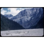
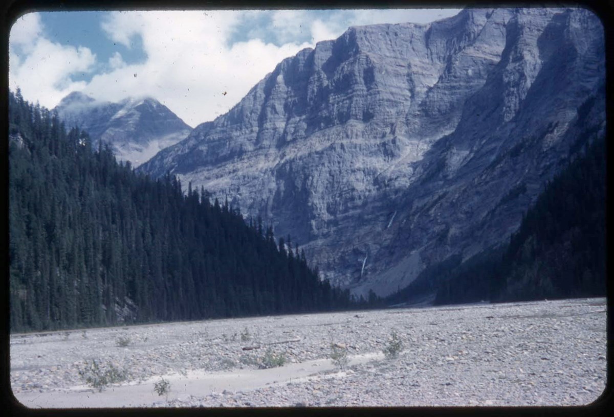
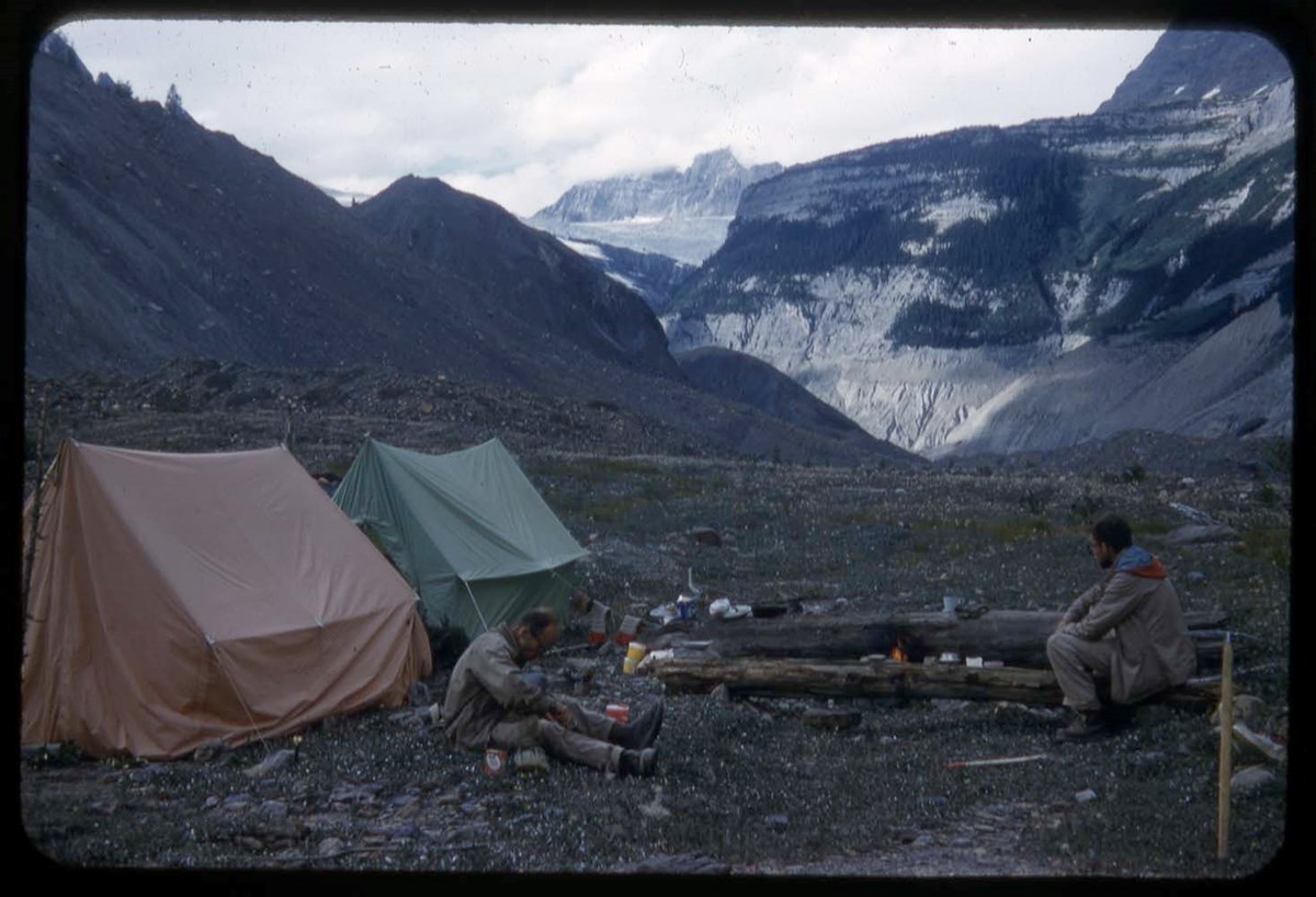
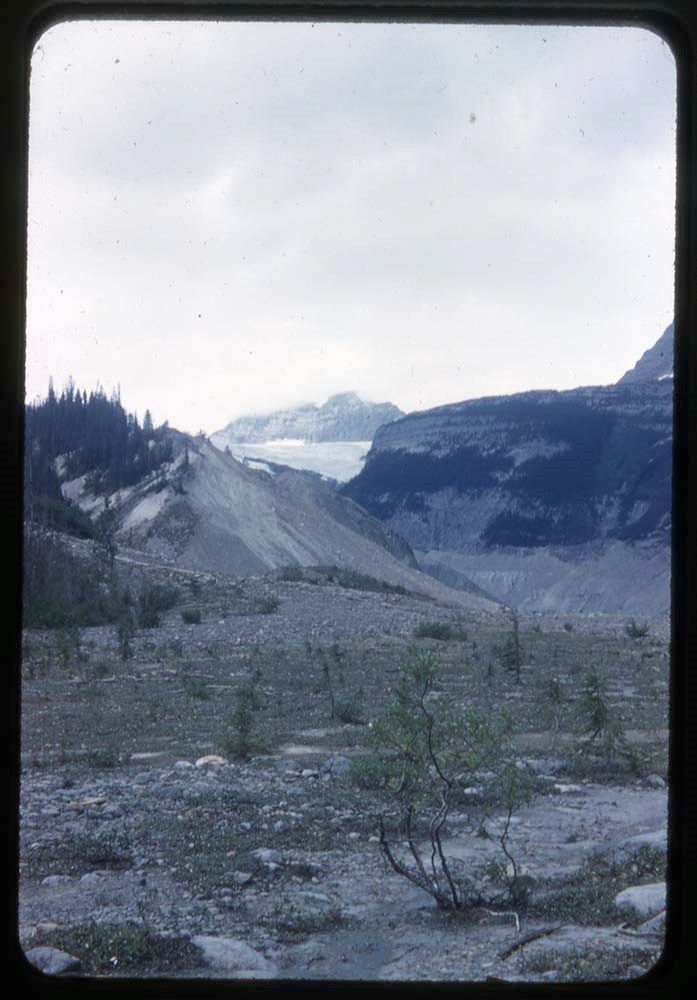
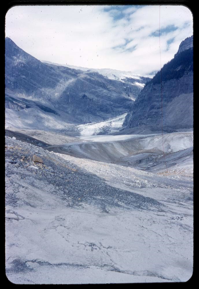
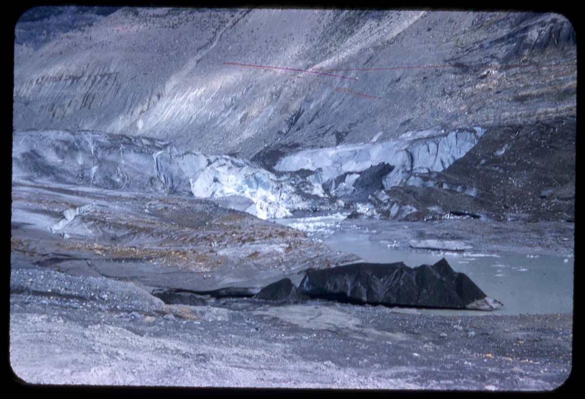
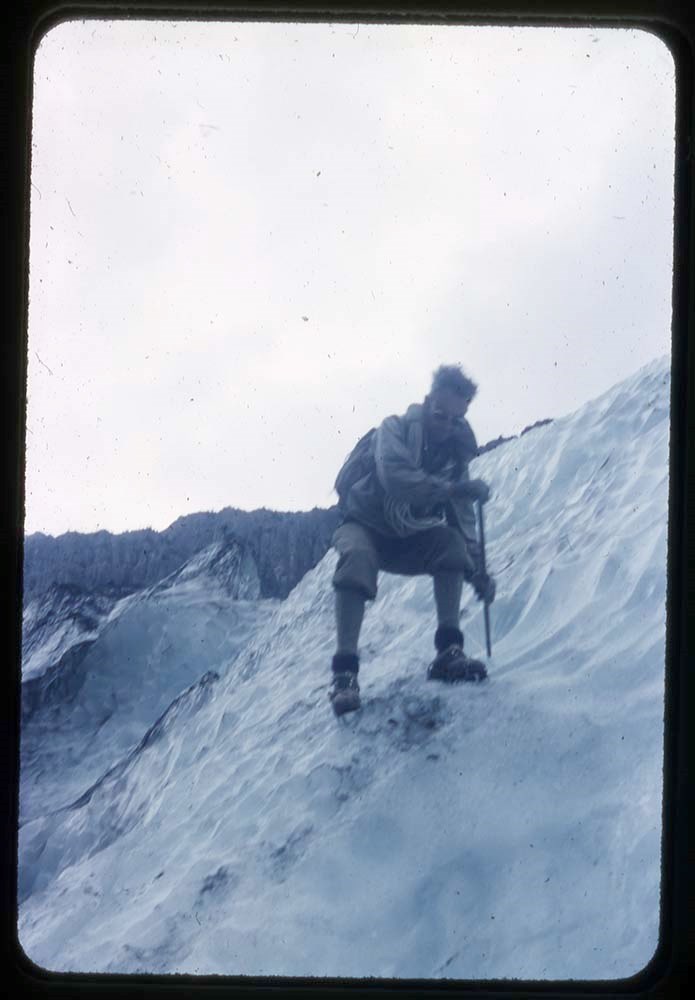
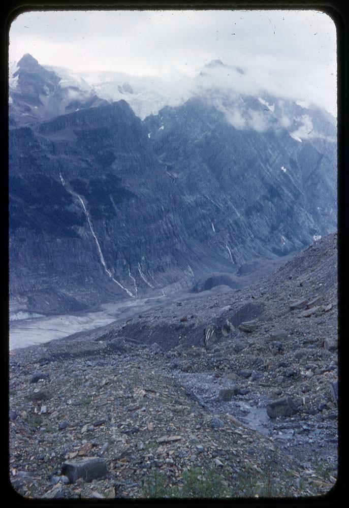
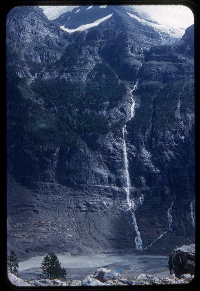
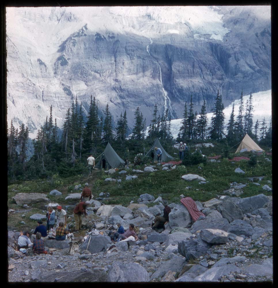
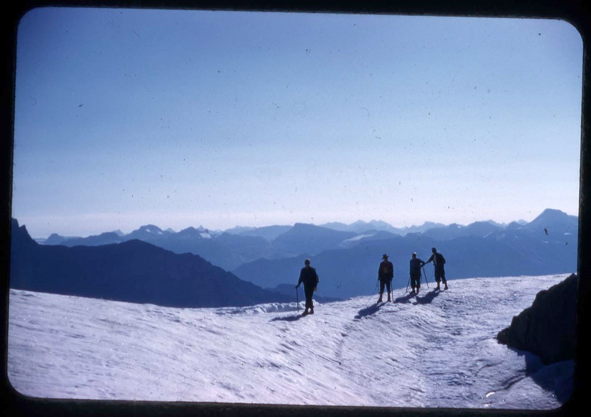
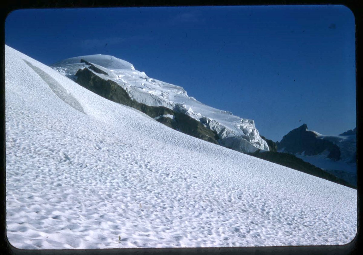
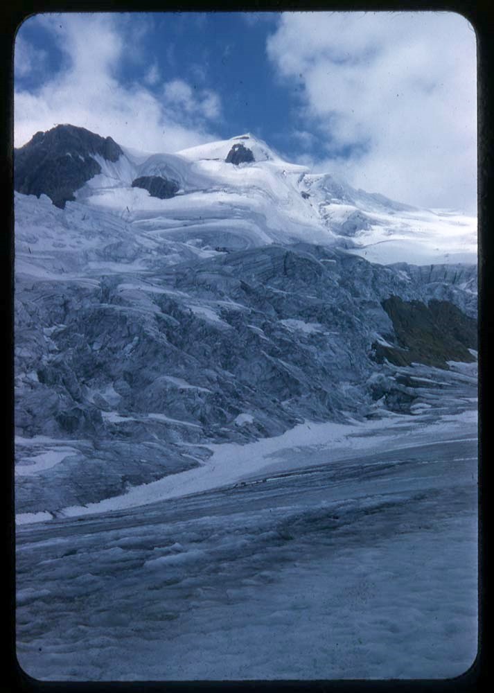
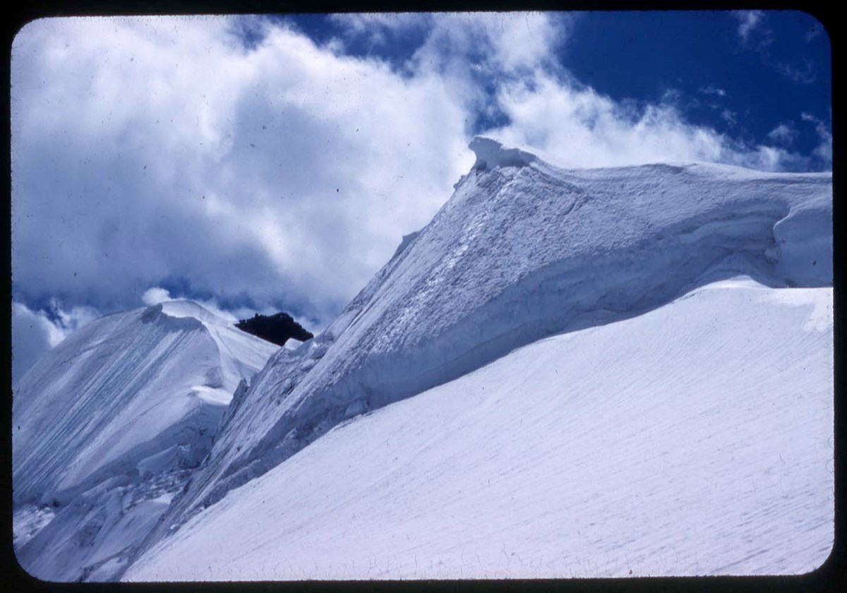
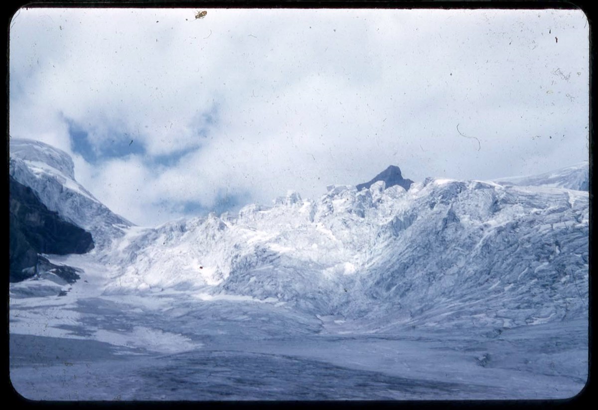
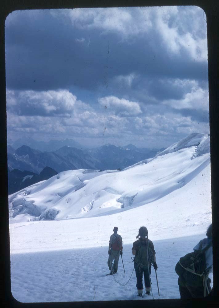
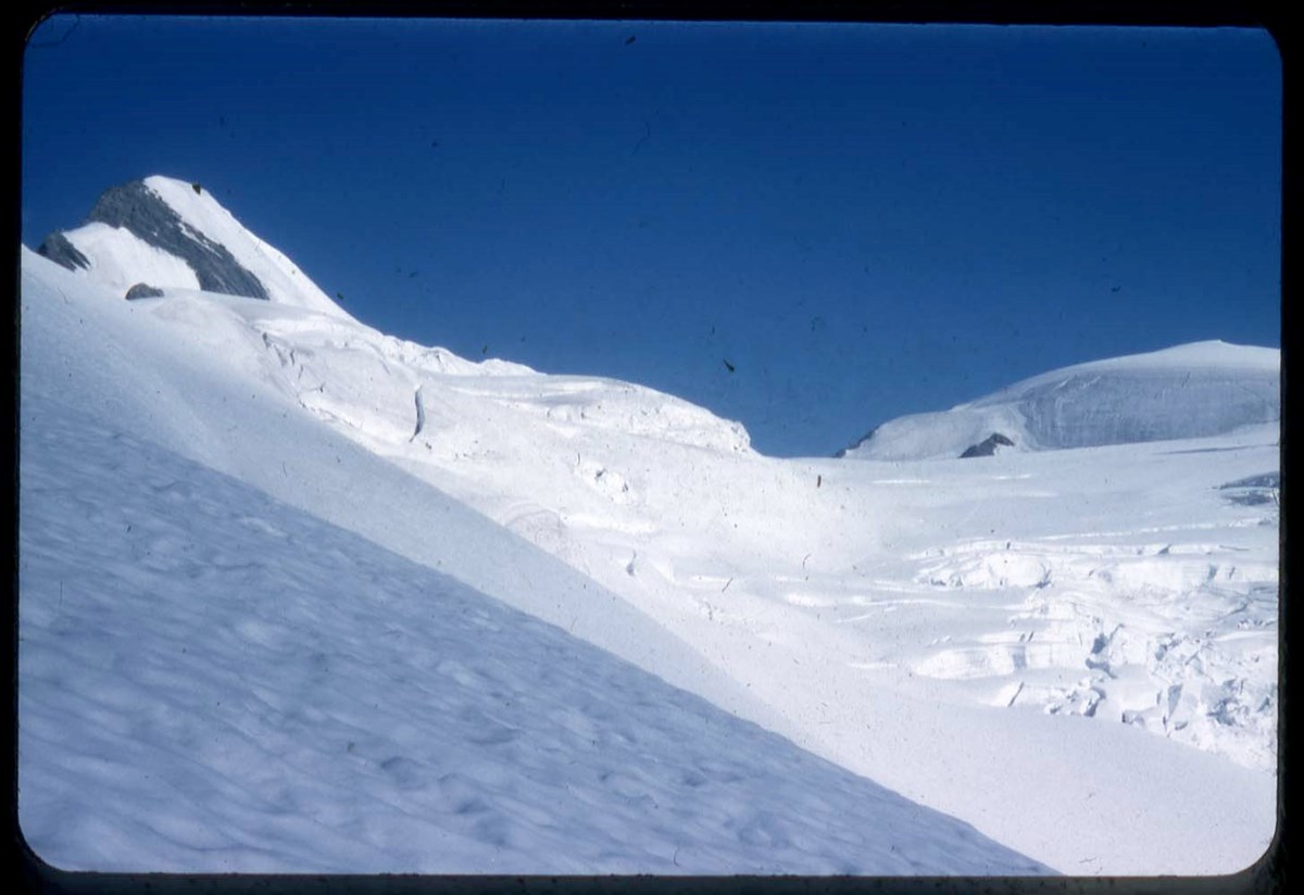
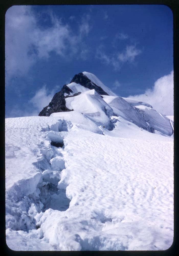
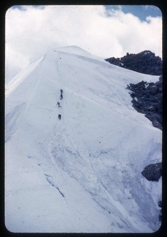
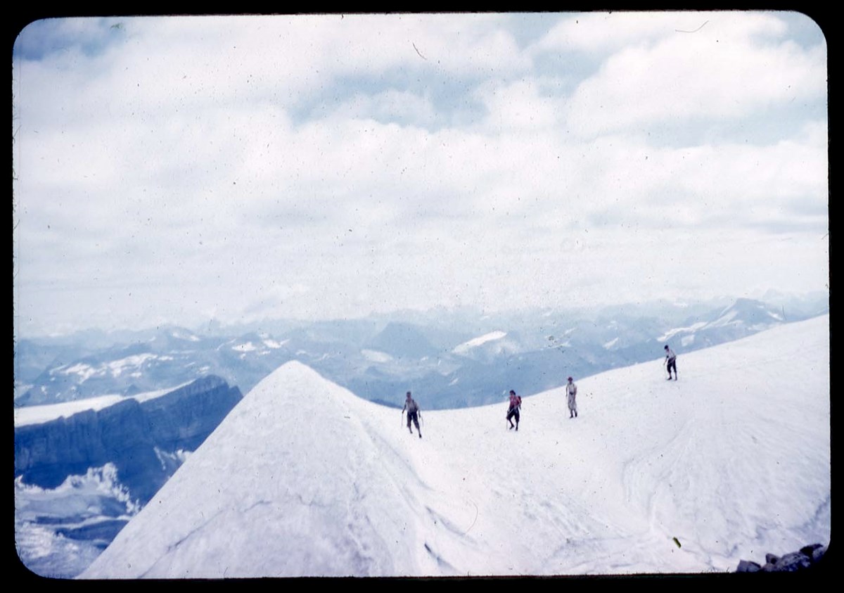
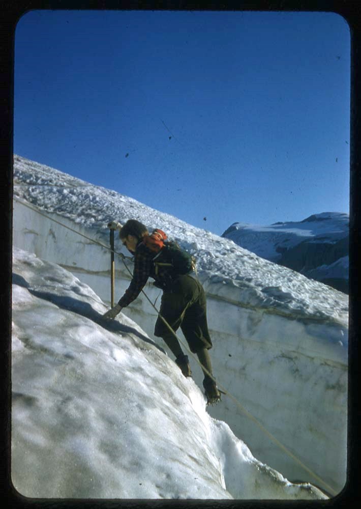
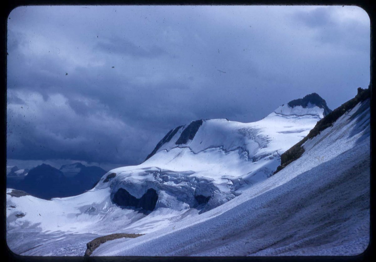
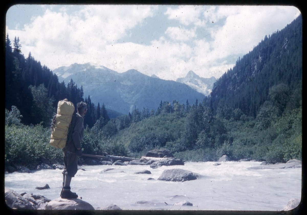
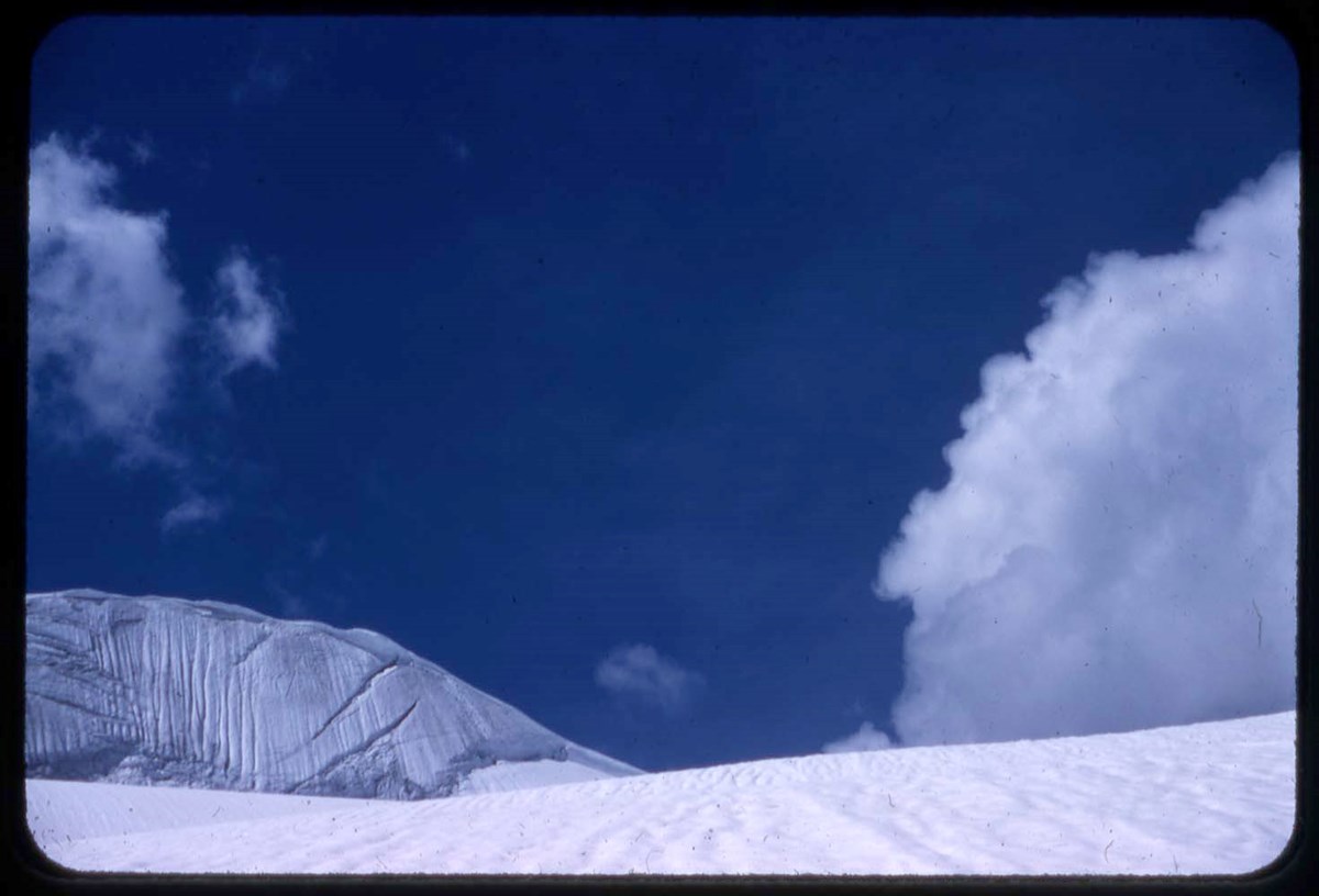
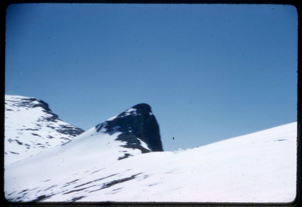
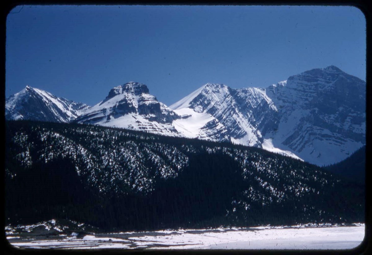
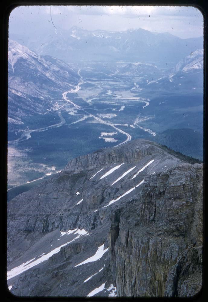
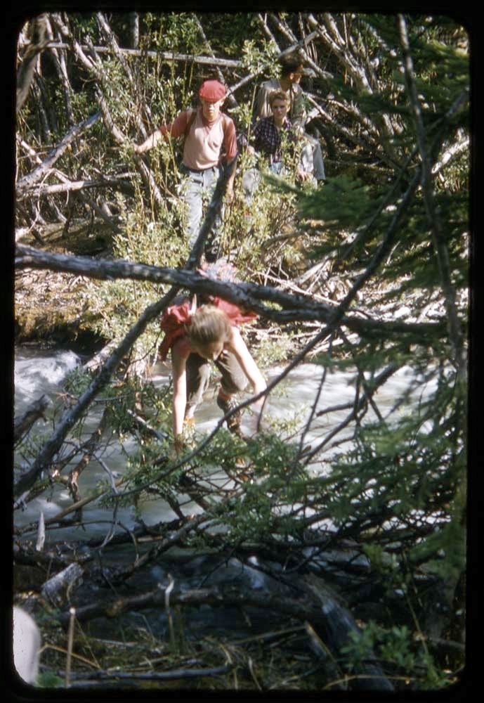
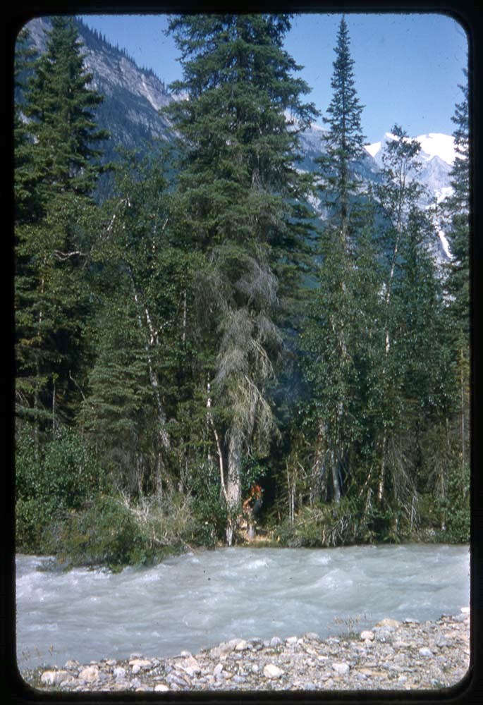
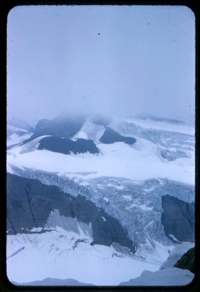
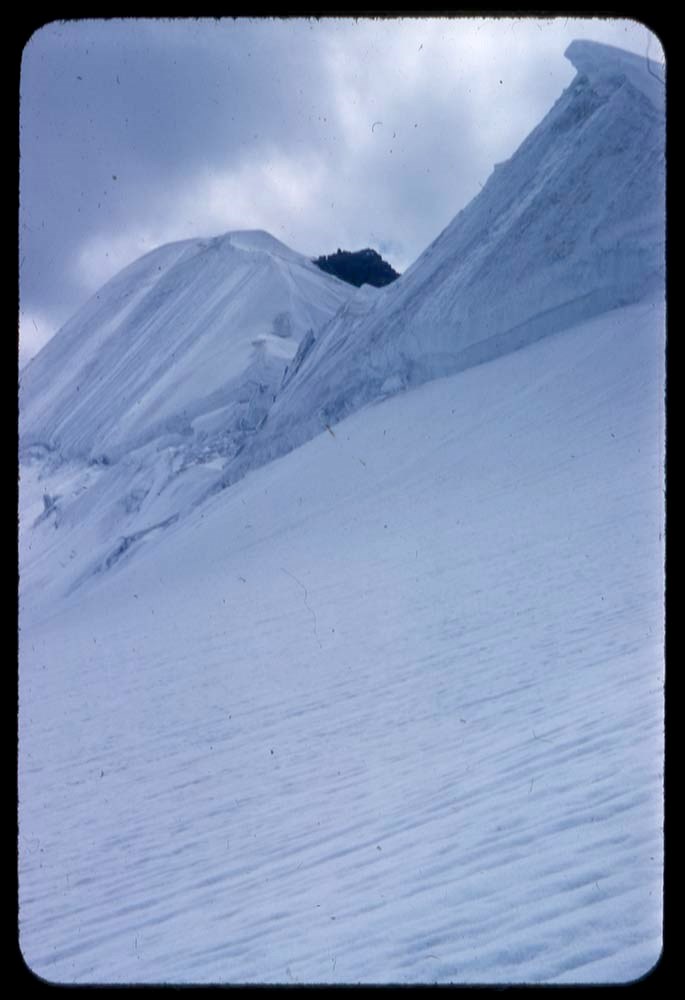
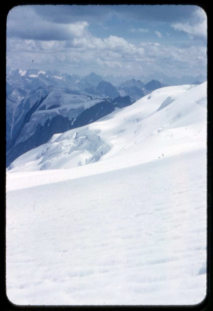
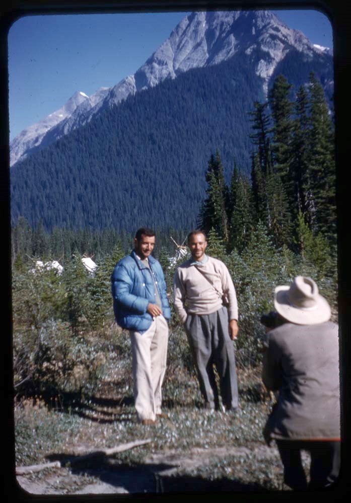
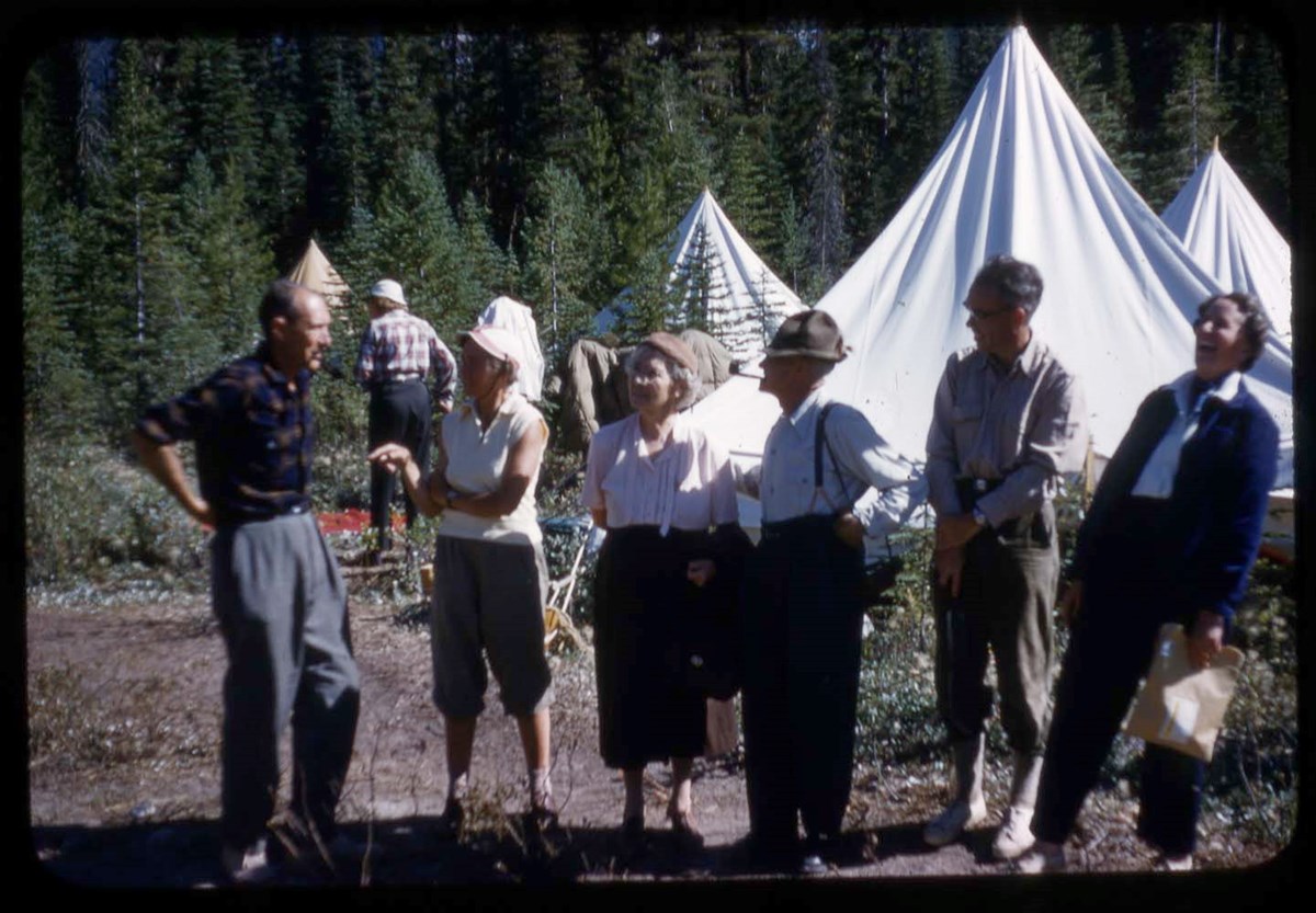
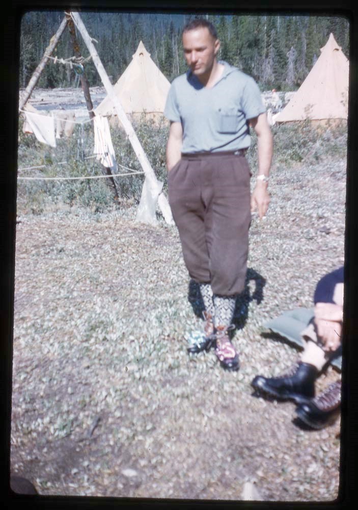
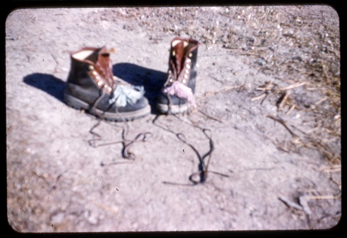
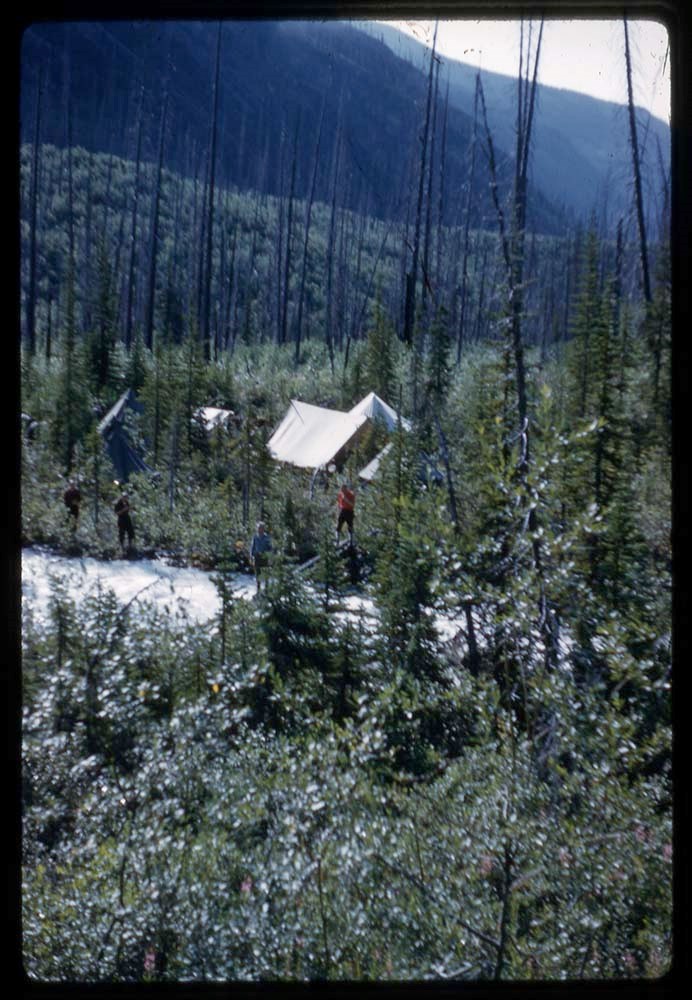
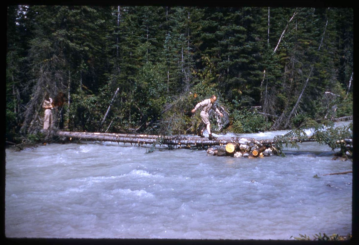
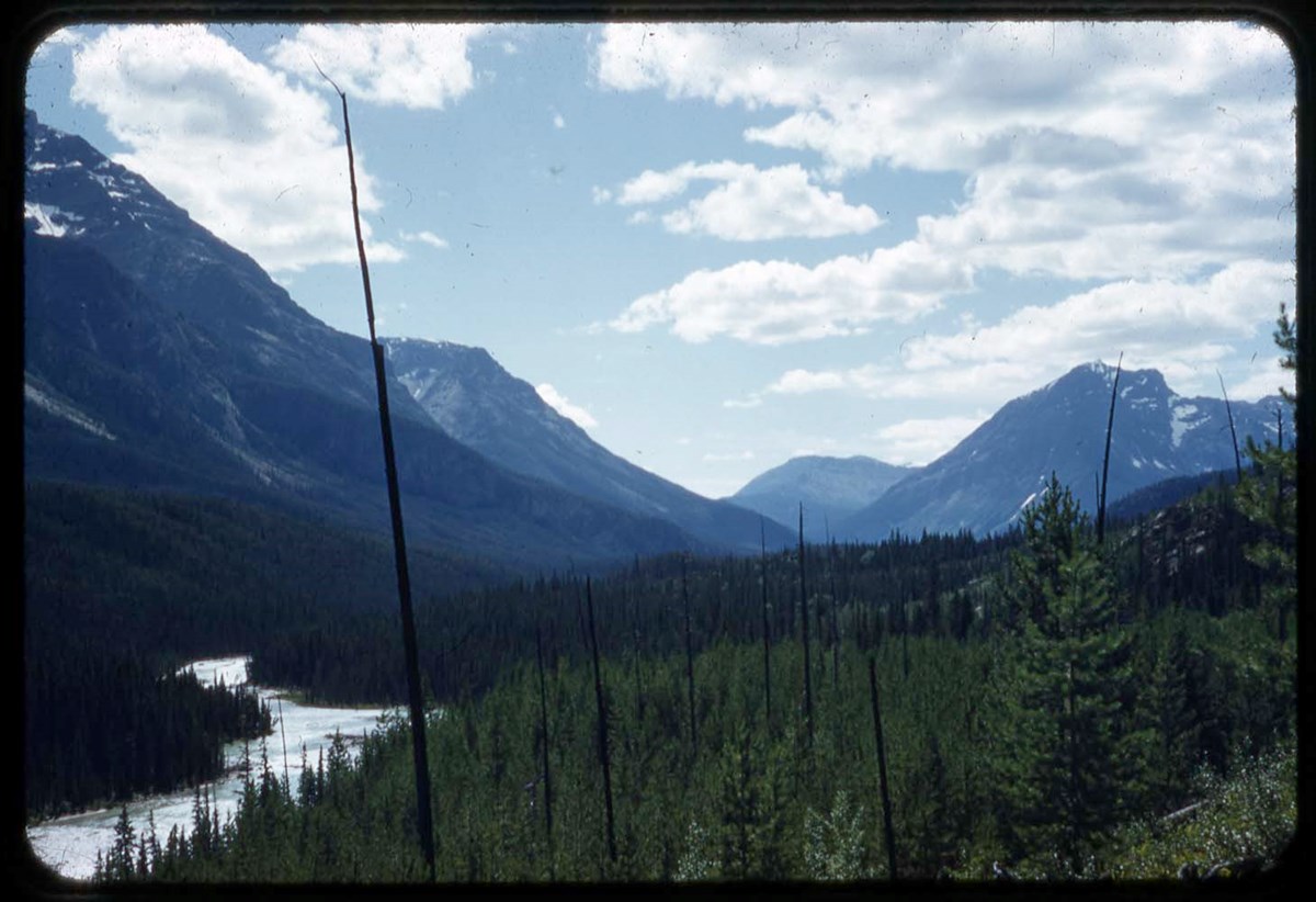
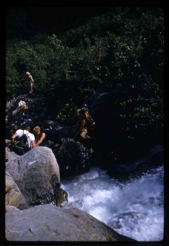
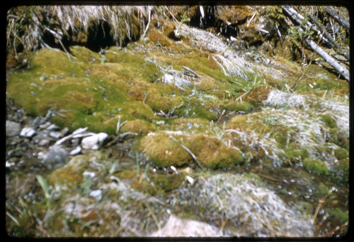
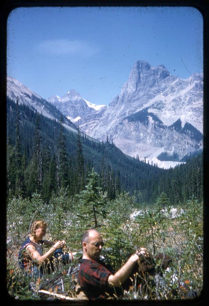
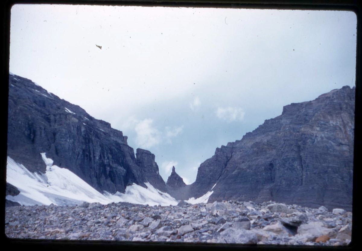
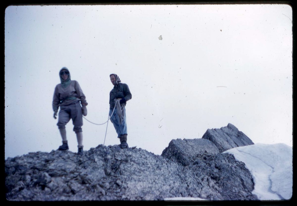
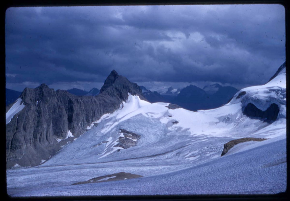
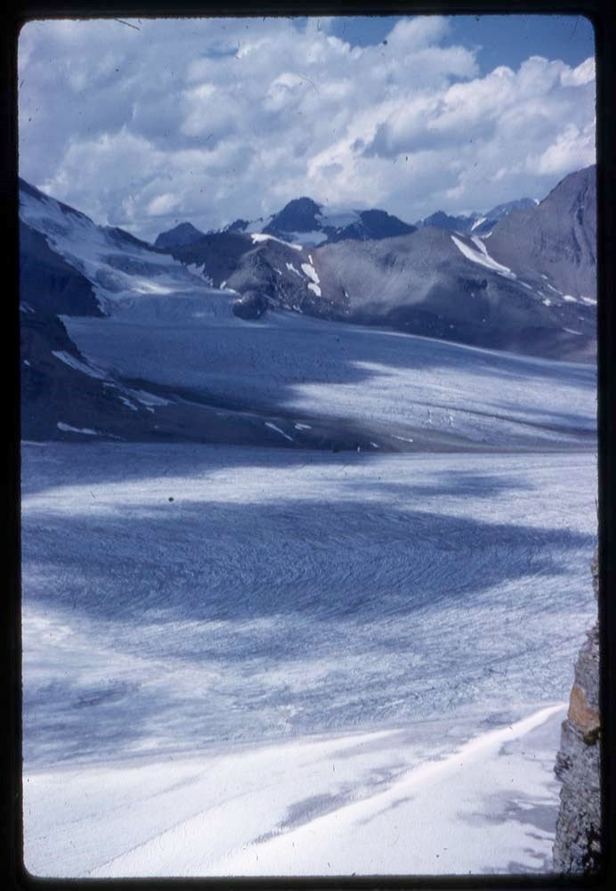
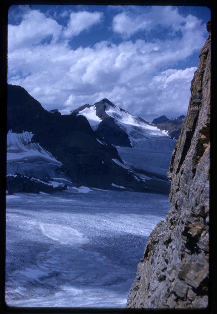
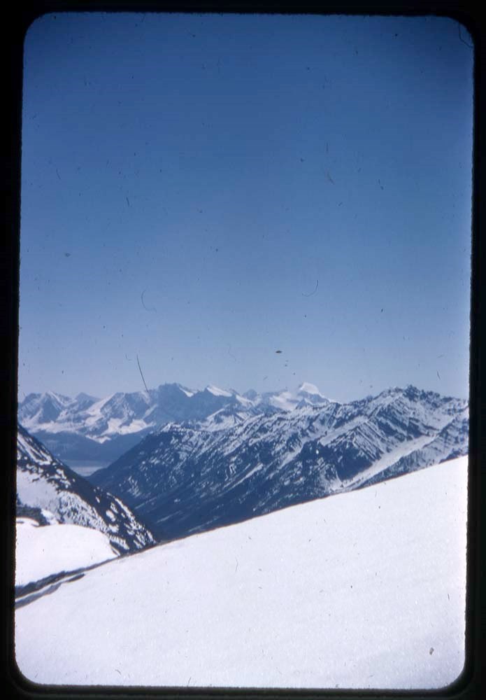
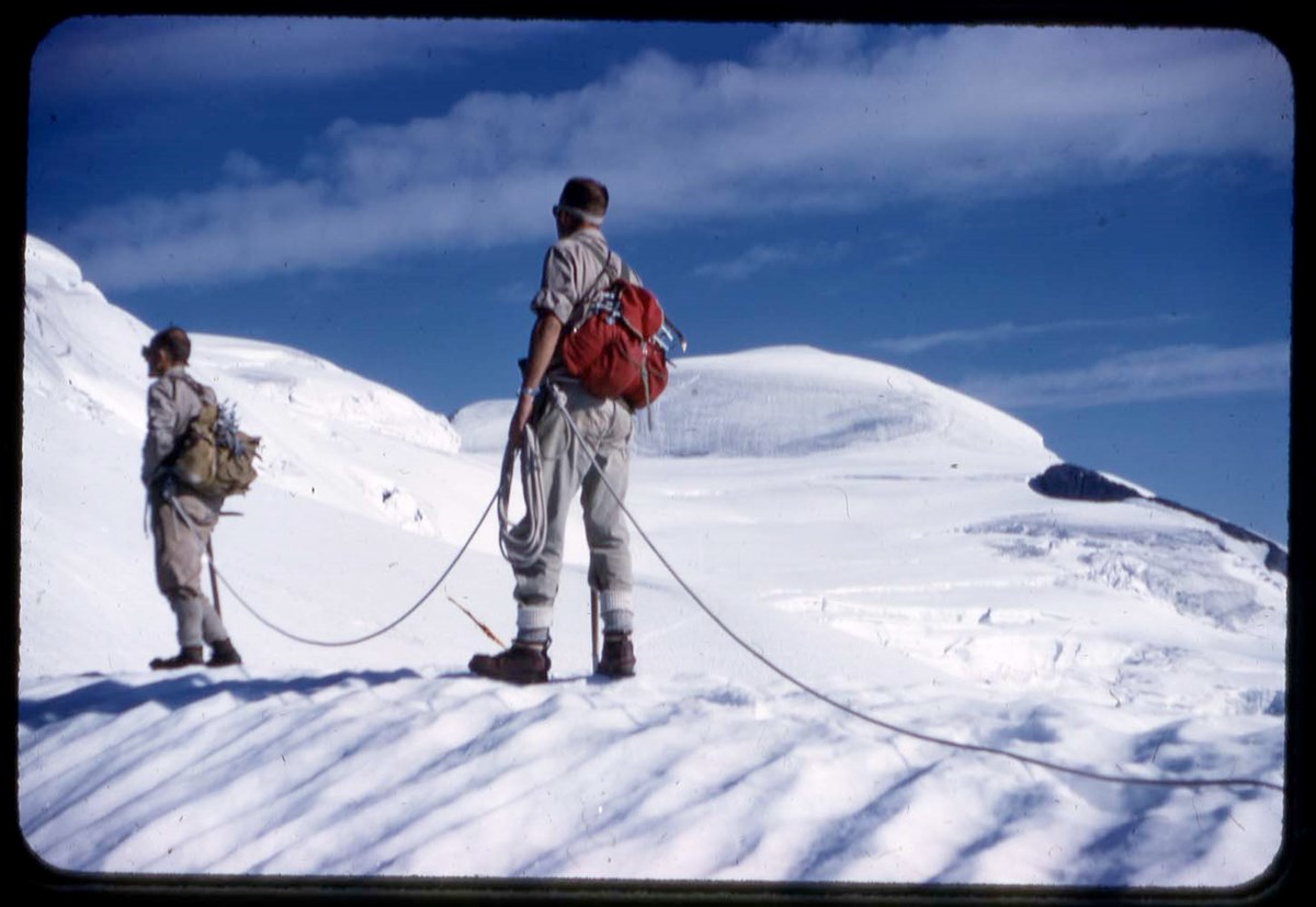
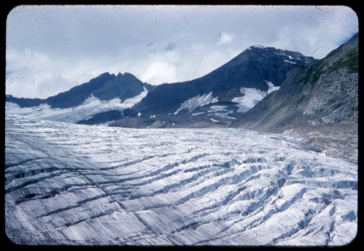
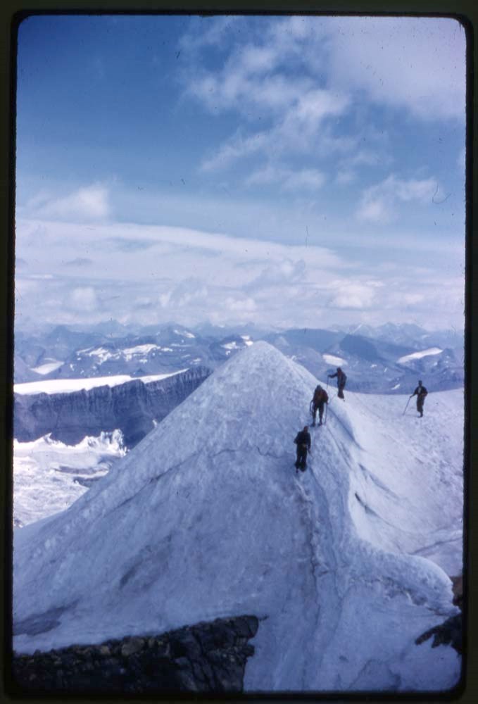
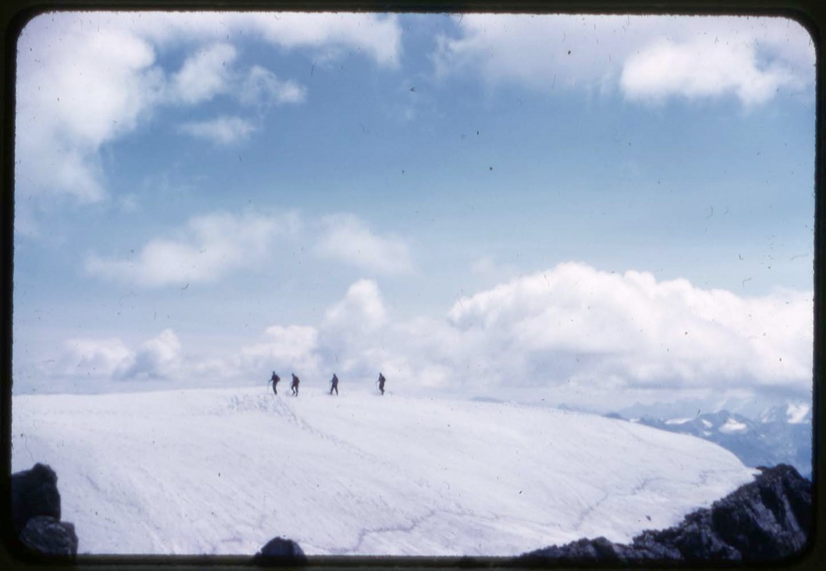
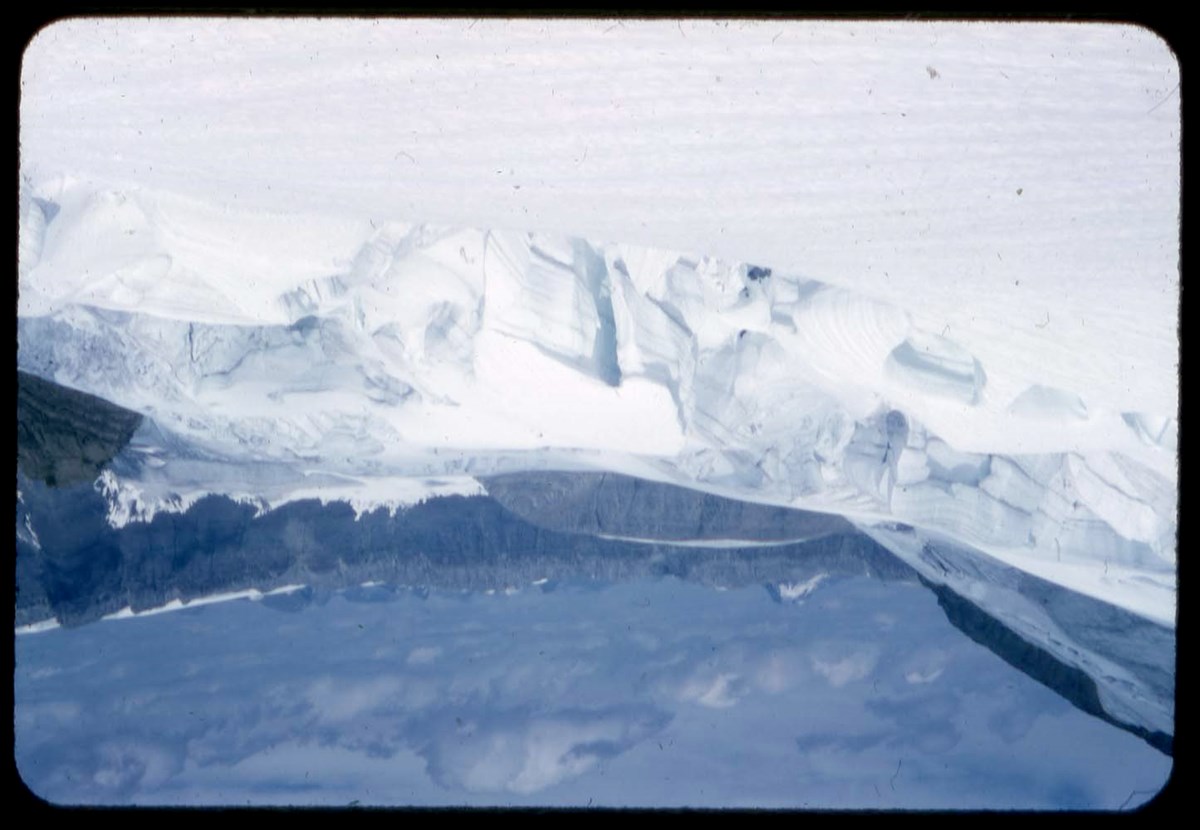
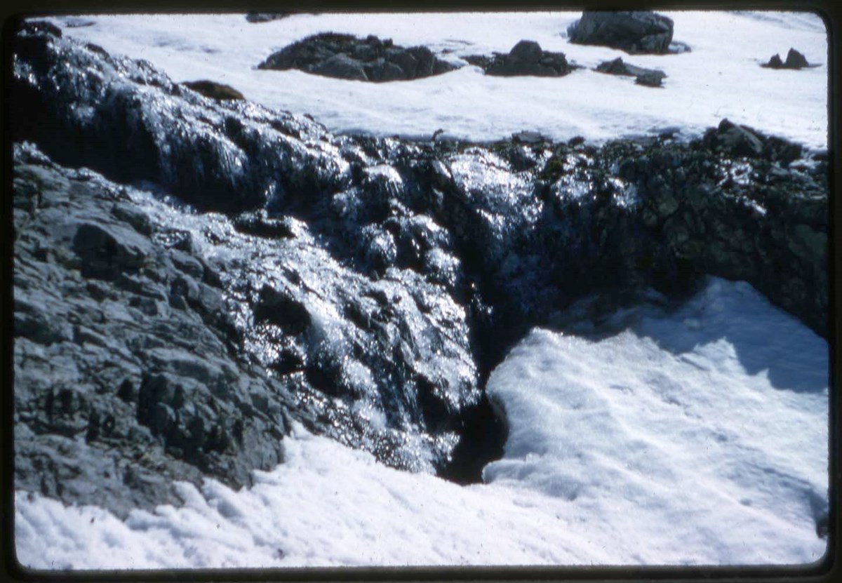
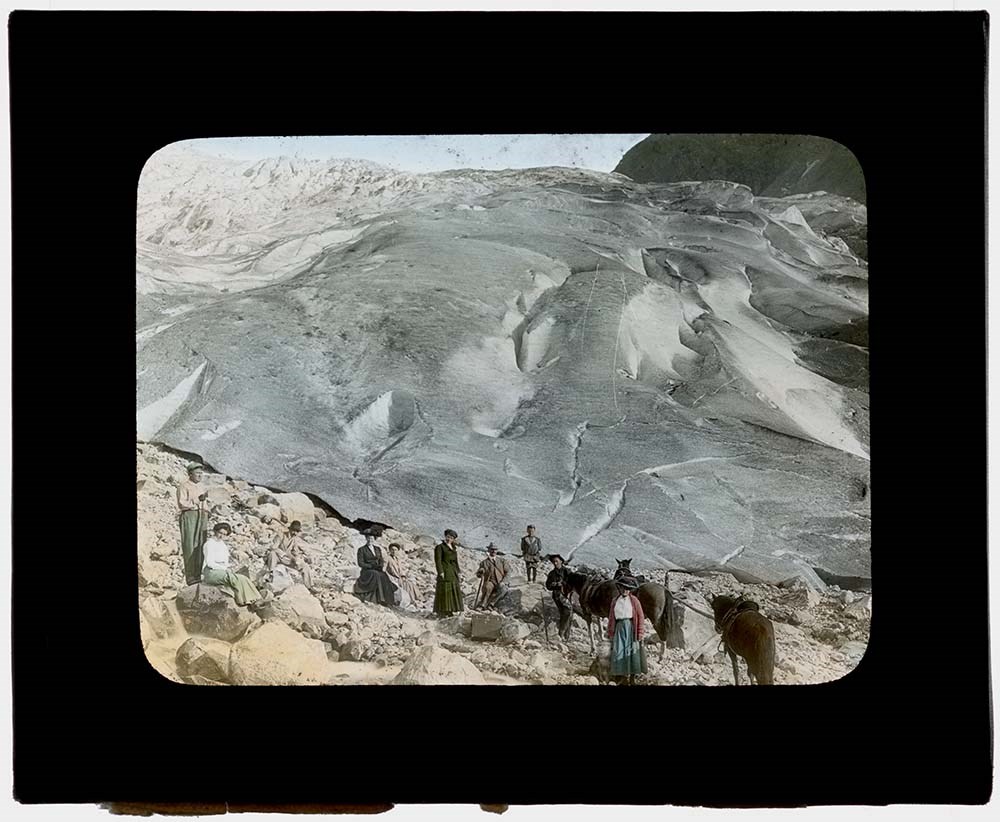
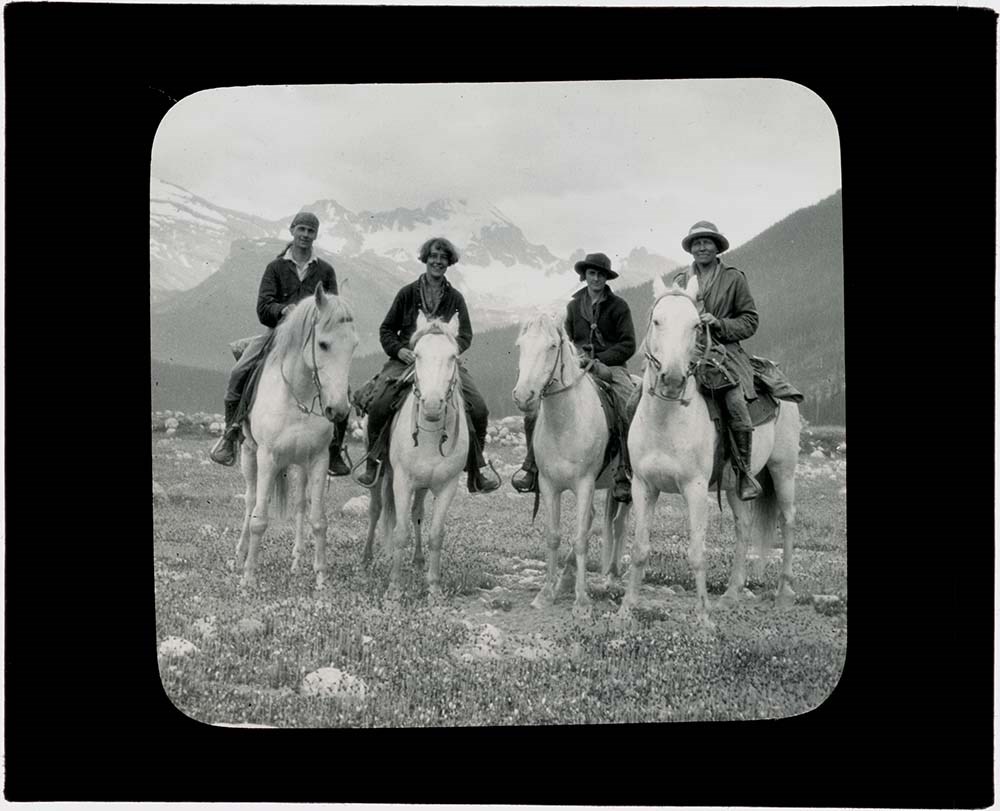
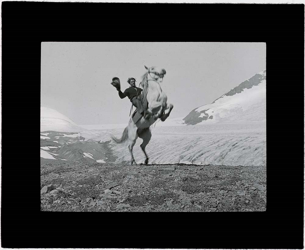
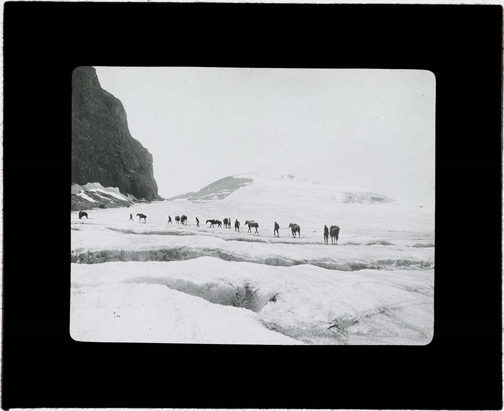
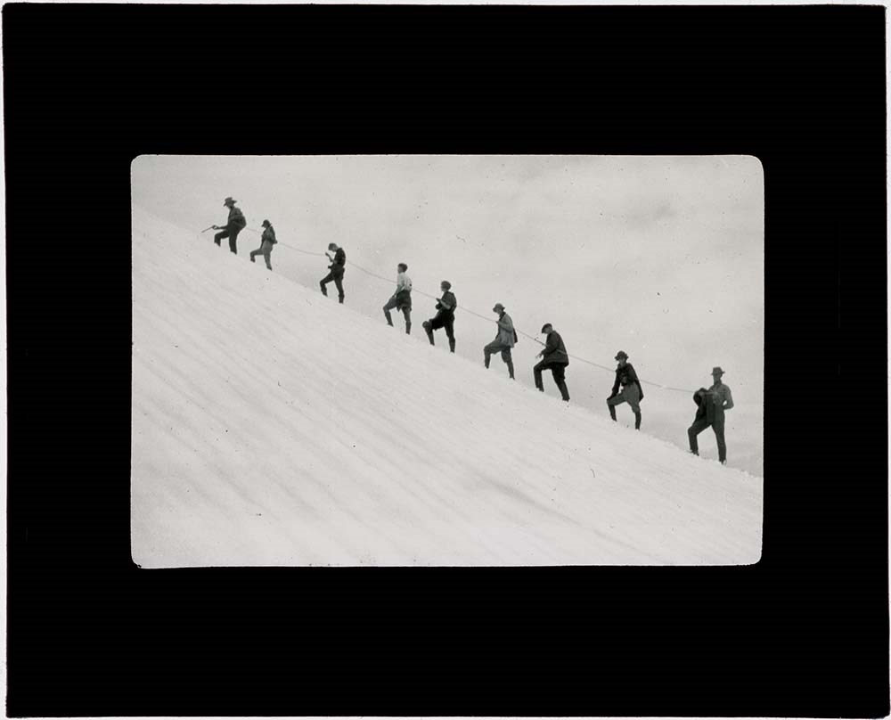
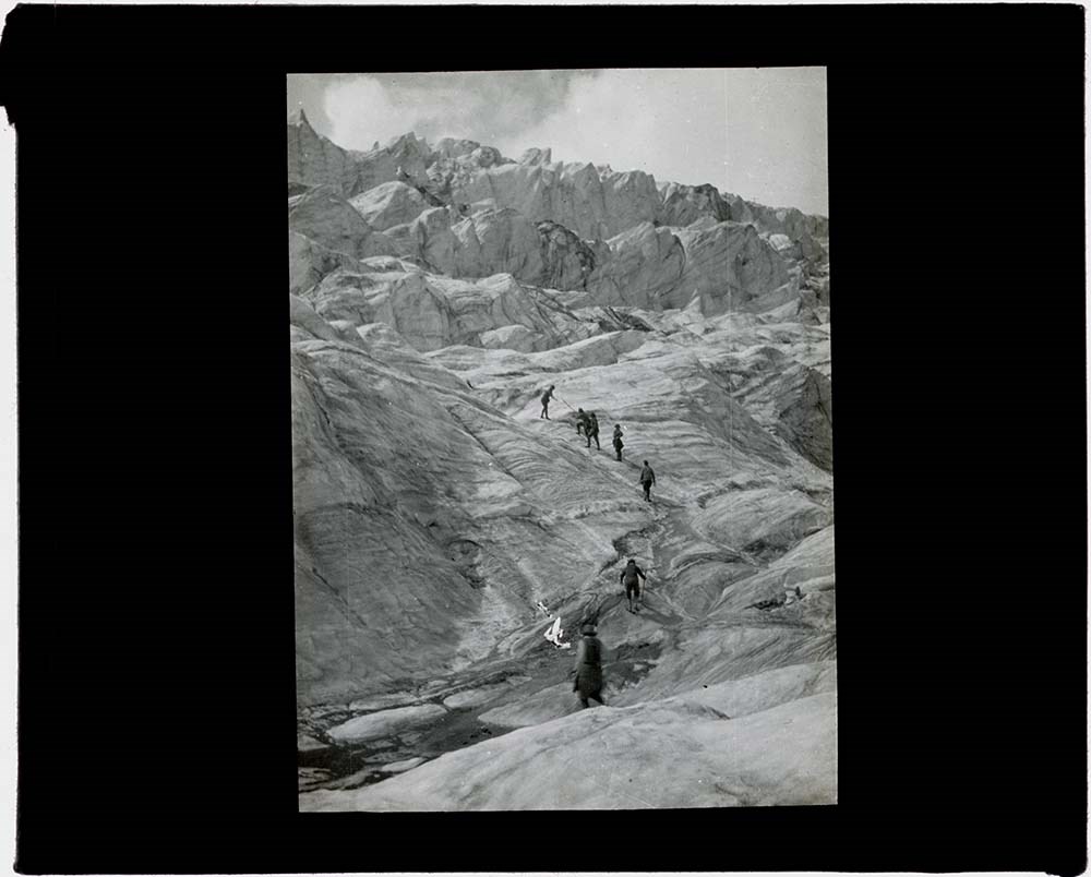
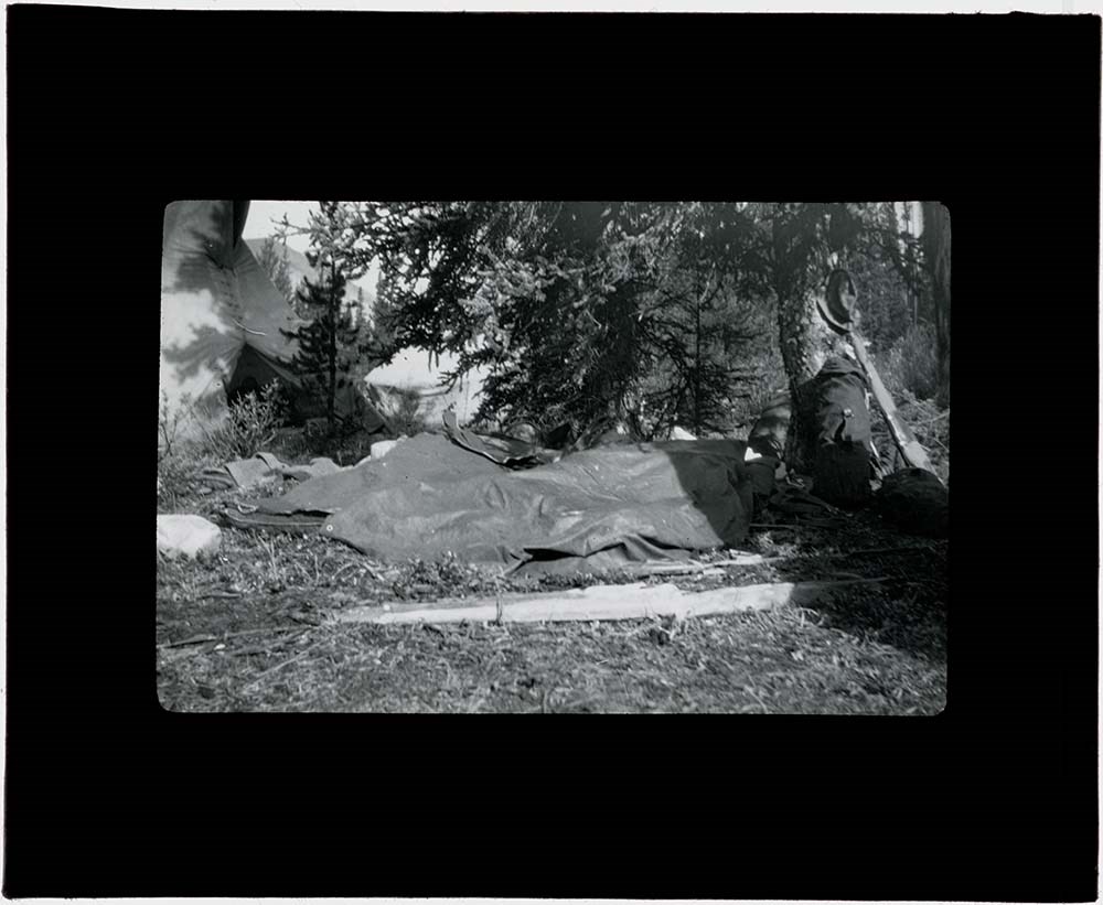
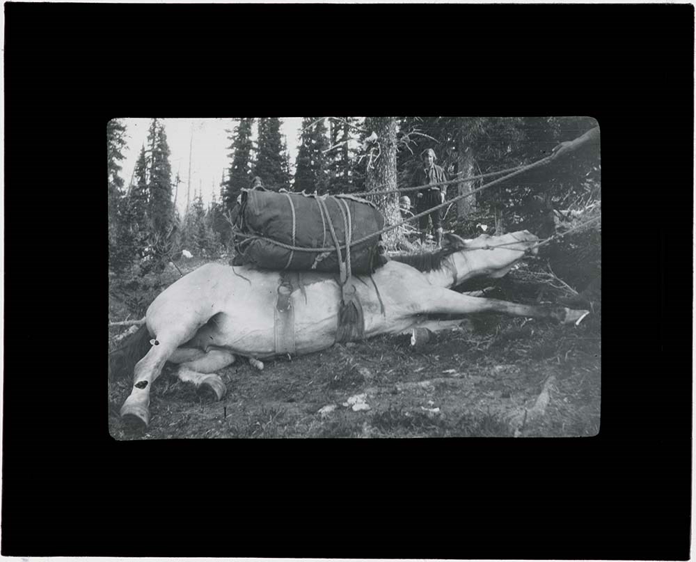
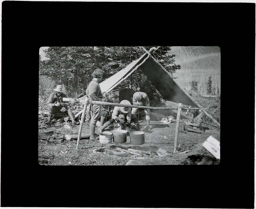
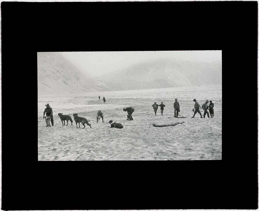
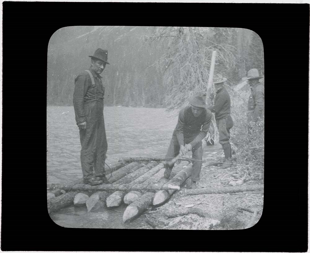
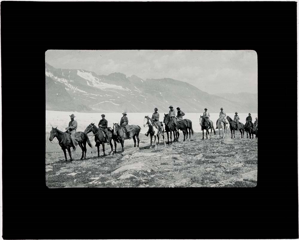
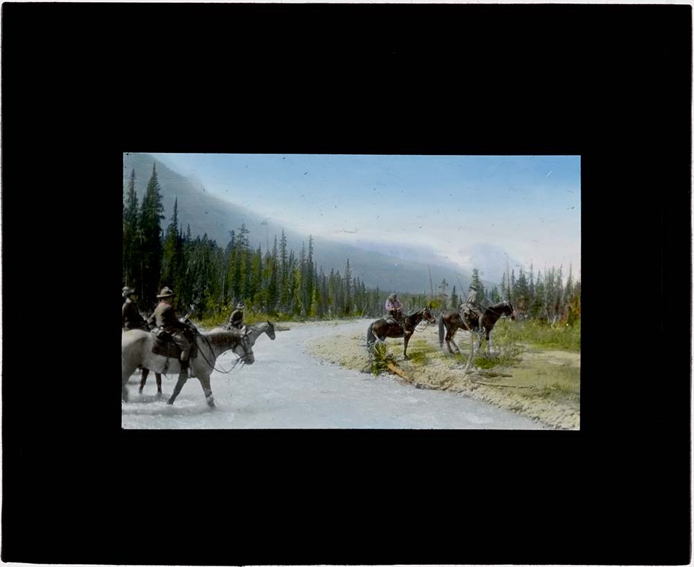
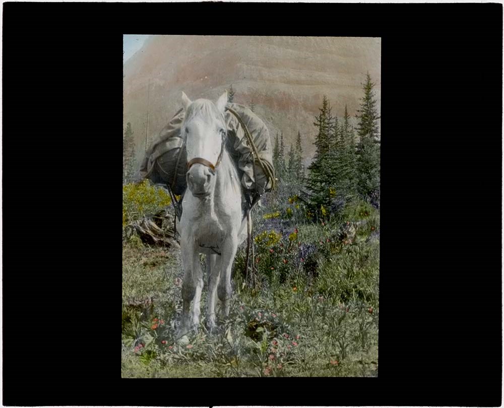
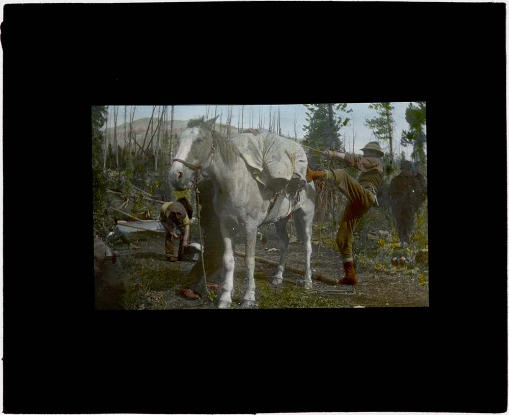
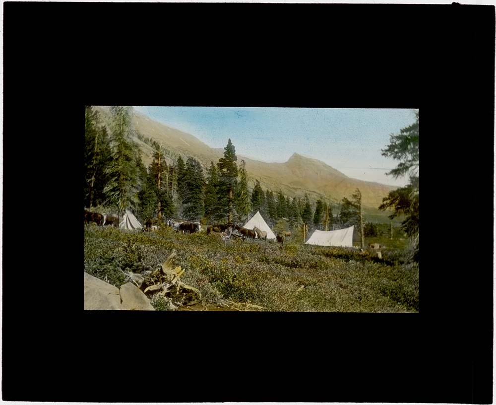
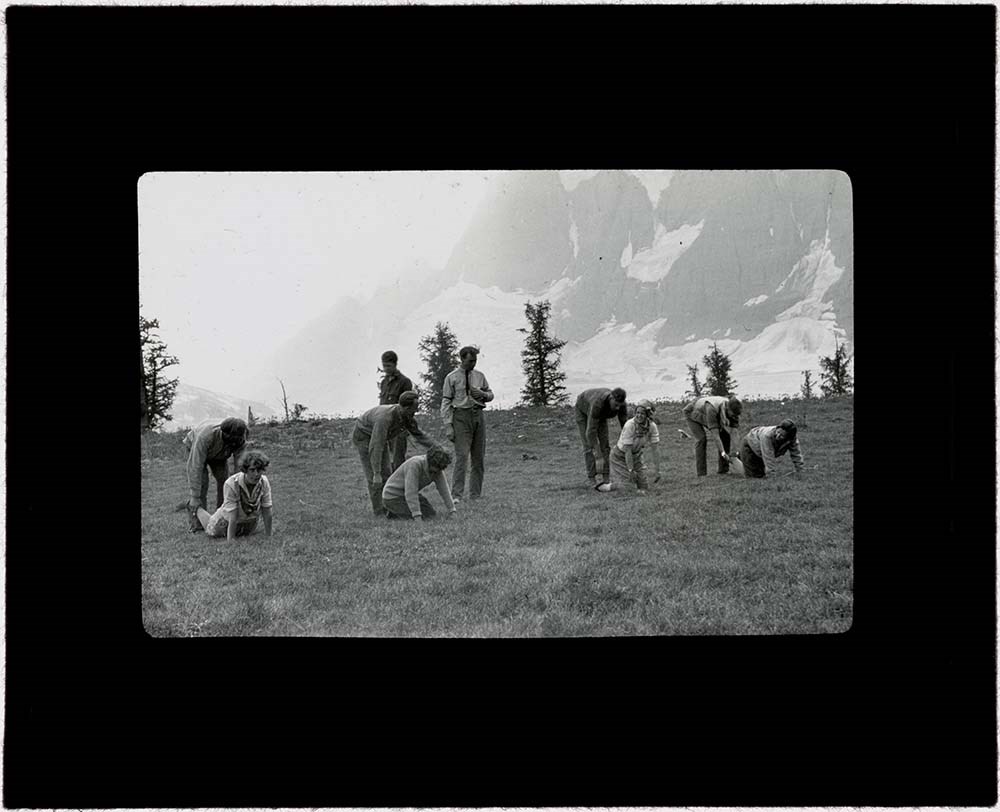
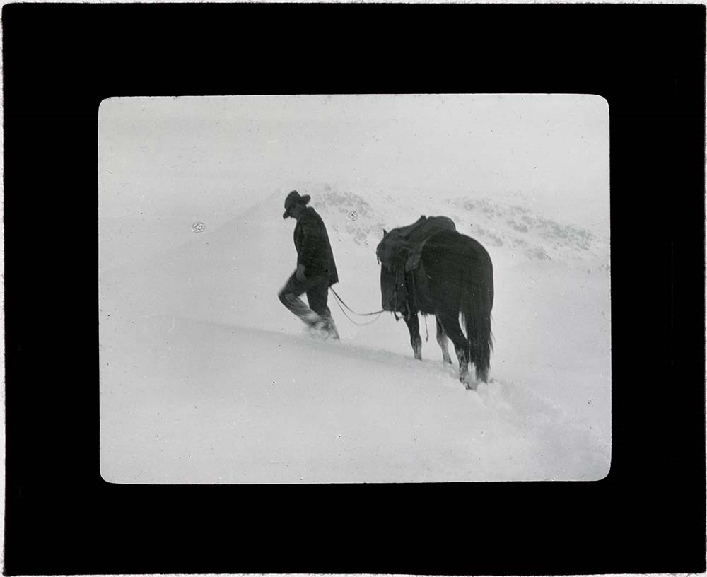
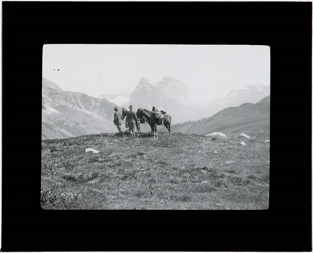
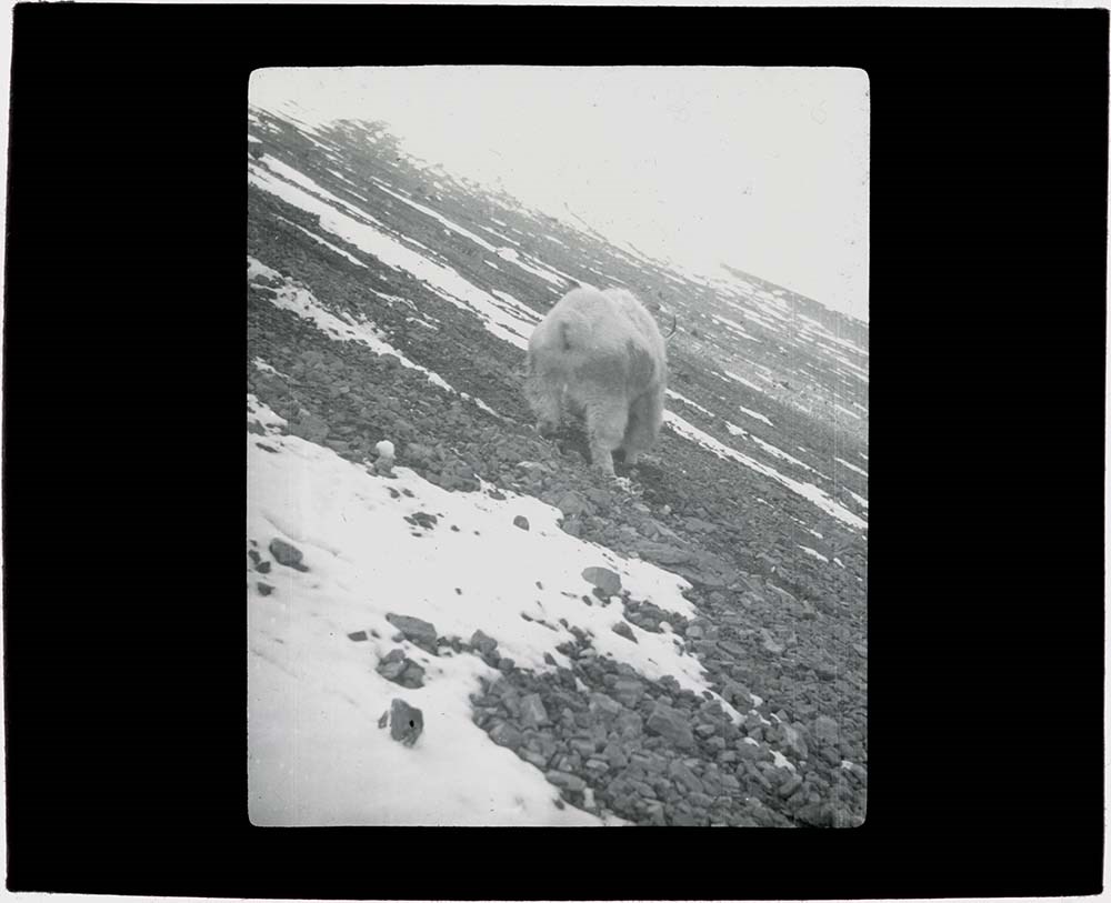
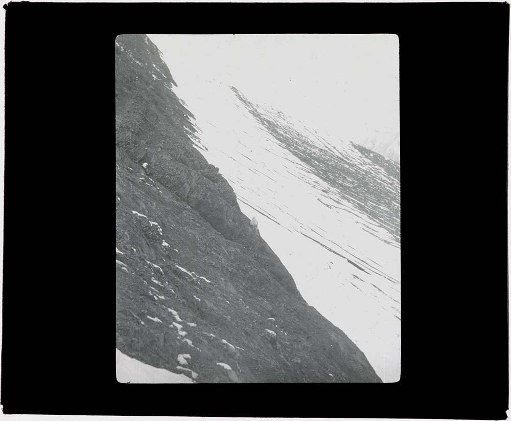
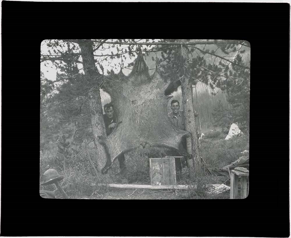
Mount Mummery and Mummery Glacier Area
https://archives.whyte.org/en/permalink/descriptions17529
- Part Of
- Bob Hind fonds
- Scope & Content
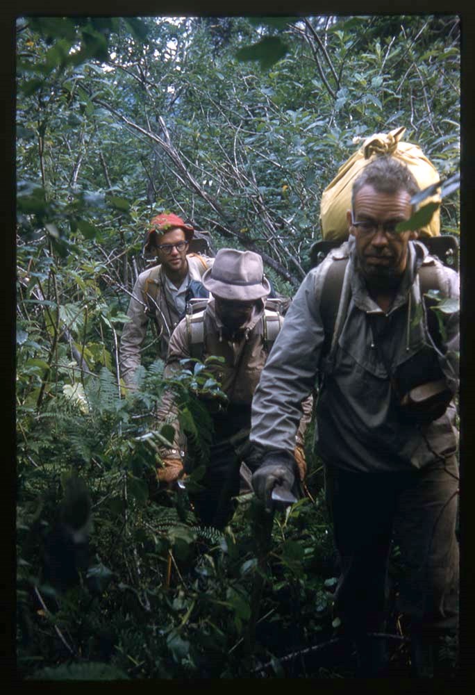
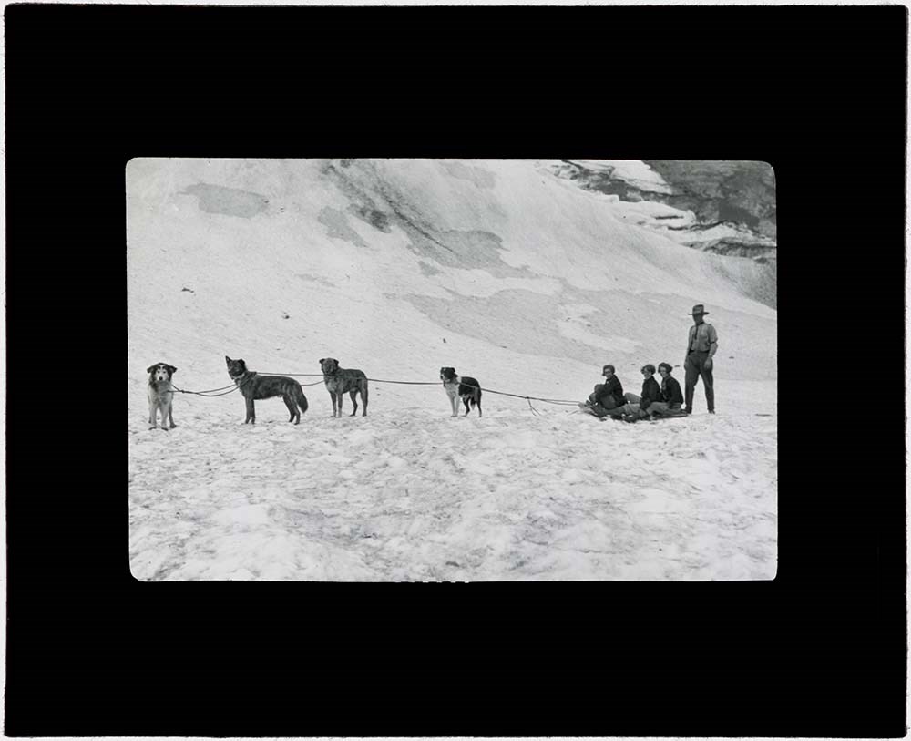
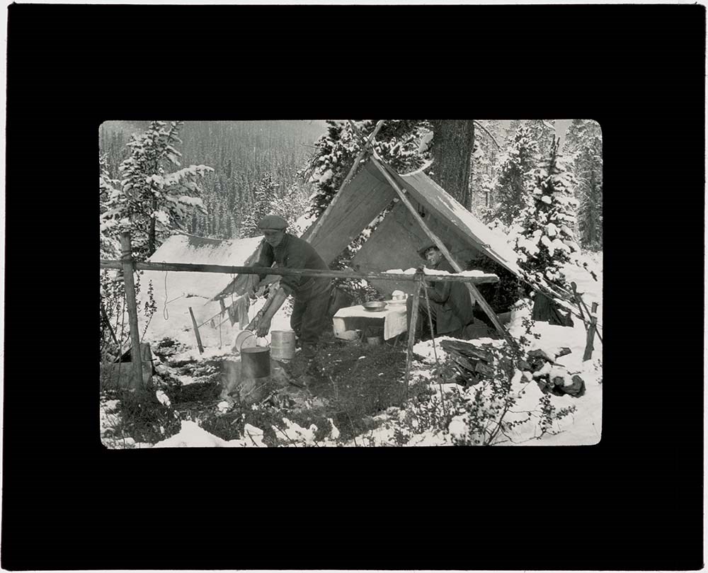
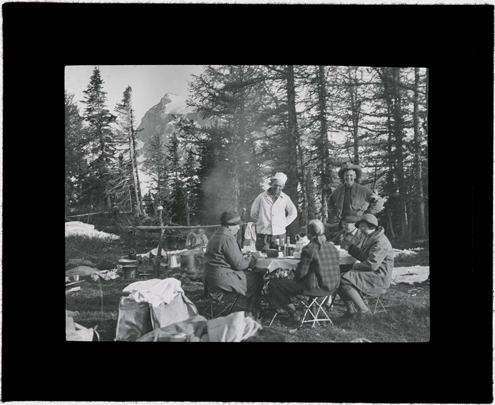
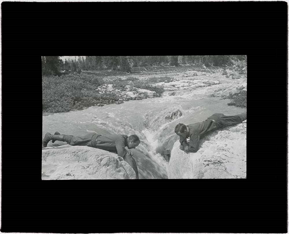
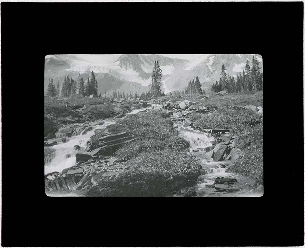
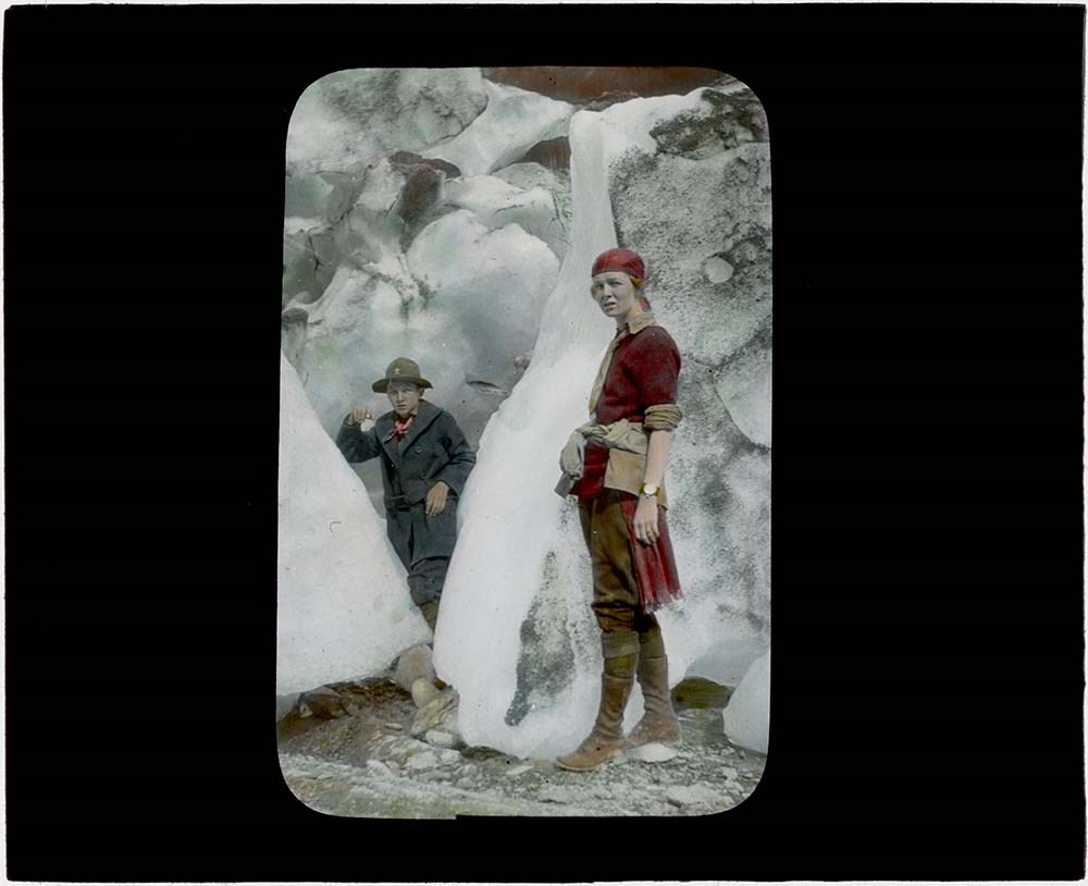
- File pertains to forests, mountains and glaciers, hiking and climbing, groups, camps around the Mummery area.
- Date Range
- 1958
- Reference Code
- V46 / I / A / 40 / NS 1 to 128
- Description Level
- 5 / File
- GMD
- Lantern slide
- Transparency
128 images
1 Electronic Resource
- Part Of
- Bob Hind fonds
- Description Level
- 5 / File
- Fonds Number
- M7 / V46
- Series
- I.A. Mountain travel and recreation, western Canada : Trips and activities
- Sous-Fonds
- V46
- Accession Number
- 7181
- Reference Code
- V46 / I / A / 40 / NS 1 to 128
- Date Range
- 1958
- Physical Description
- 128 photographs : transparencies, 35mm, col
- History / Biographical
- See fonds level description
- Scope & Content
- File pertains to forests, mountains and glaciers, hiking and climbing, groups, camps around the Mummery area.
- Name Access
- Hind, Bob
- Subject Access
- Activities
- Backpacking
- Cabins and shelters
- Environment
- Glaciers
- Guide
- Guiding
- Horses
- Horse packing
- Mountaineering
- Mountains
- Professional and Personal Life
- Geographic Access
- Mount Mummery
- Yoho National Park
- British Columbia
- Canada
- Language
- NA
- Title Source
- Title based on contents of file
- Processing Status
- Processed
Electronic Resources
Images


This material is presented as originally created; it may contain outdated cultural descriptions and
potentially offensive content.
Read more.
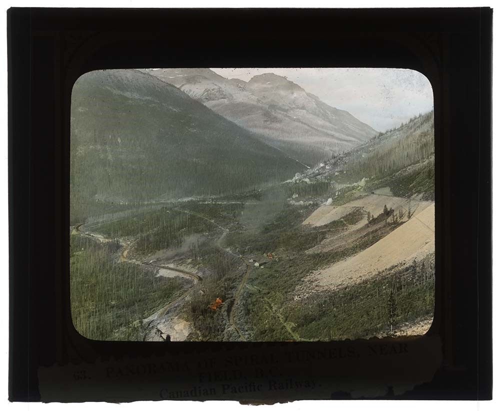
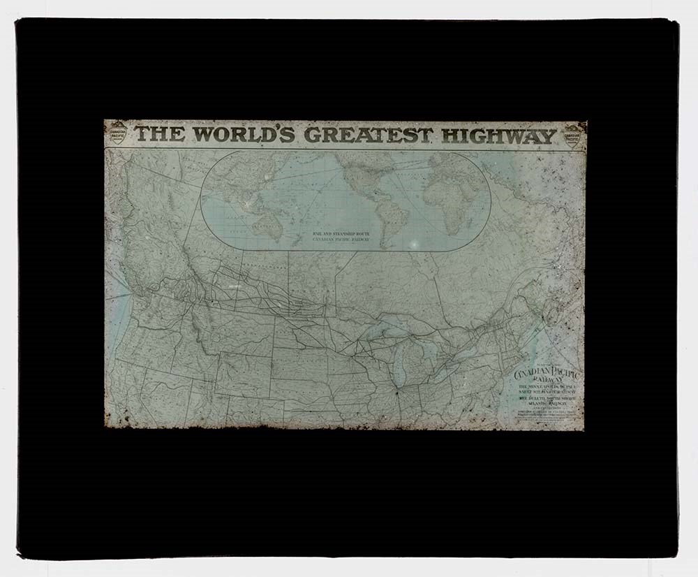
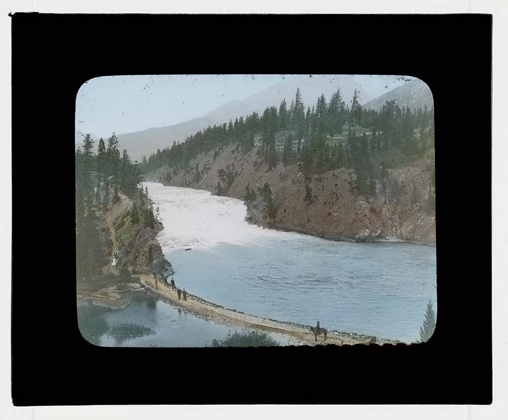
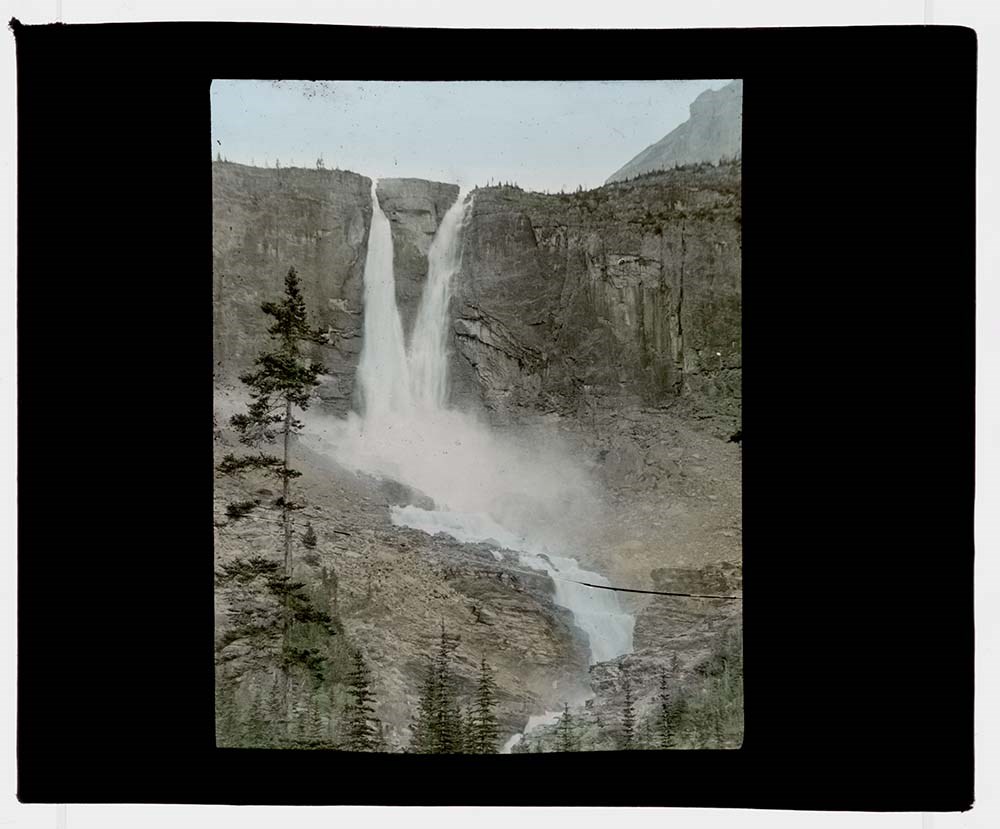
Canadian Pacific Railway Lantern Slides
https://archives.whyte.org/en/permalink/descriptions16400
- Part Of
- Archives General File Collection
- Scope & Content
- Series consists of 14 lantern slides [ca.1900-ca.1925]. Slides are views along the Canadian Pacific Railway.
- Date Range
- [c. 1905]
- Reference Code
- V8 / 5486 / PS - 1 to PS - 14
- Description Level
- 3 / Series
- GMD
- Transparency
- Lantern slide
14 images
- Part Of
- Archives General File Collection
- Description Level
- 3 / Series
- Fonds Number
- M8 / V8 / S8
- Series
- Accession Number: 5486
- Sous-Fonds
- V8
- Accession Number
- 5486
- Reference Code
- V8 / 5486 / PS - 1 to PS - 14
- Date Range
- [c. 1905]
- Physical Description
- 14 photographs : b&w and col. slides ; 10.2 x 8.2 cm
- History / Biographical
- The Canadian Pacific Railway (CPR) was officially formed in Februray, 1881, to construct a railroad that would link the eastern provinces with British Columbia, a key component of the Canadian Confederation of 1867. Headed by William C. Van Horne as General Manager, the railroad arrived in the Canadian Rockies in 1883 and a siding was established just east of present-day Banff. When railroad workers discovered a natural hot spring on the south side of the Bow River, Van Horne ordered the construction of a hotel that would house visitors brought in by train to visit the springs. Construction of the Banff Springs Hotel finished in 1888 and joined a handful of CPR hotels throughout the Rocky and Selkirk Mountain ranges. The popularity of the hot springs and surrounding area led to the formation of a national park and to the town of Banff. After construction of the railway had completed, the CPR continued to survey and document the Rocky Mountains alongside federal agencies like the Department of the Interior and private outfitters. Utilizing coloured lantern slides the CPR was able to showcase the mountains as both tourist and settlement destinations. Magic lantern shows of these slides could be used for administrative purposes by the company to showcase land holdings and investments or in public shows as advertisements of the new railway.
- Scope & Content
- Series consists of 14 lantern slides [ca.1900-ca.1925]. Slides are views along the Canadian Pacific Railway.
- Name Access
- Canadian Pacific Railway
- Subject Access
- Lantern slide
- Education
- Tourism
- Travel and Exploration
- Trains
- Geographic Access
- Banff
- Lake Louise
- Alberta
- British Columbia
- Canada
- Language
- English
- Conservation
- All slides were cleaned prior to scanning.
- Creator
- Canadian Pacific Railway
- Biographical Source Notes
- https://cpconnectingcanada.ca/#building-the-railway
- Title Source
- Title based on contents of series
- Processing Status
- Processed
Images


This material is presented as originally created; it may contain outdated cultural descriptions and
potentially offensive content.
Read more.
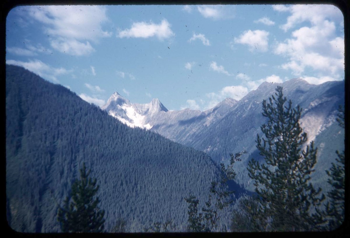
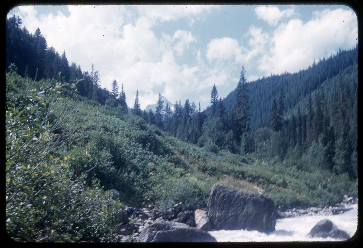
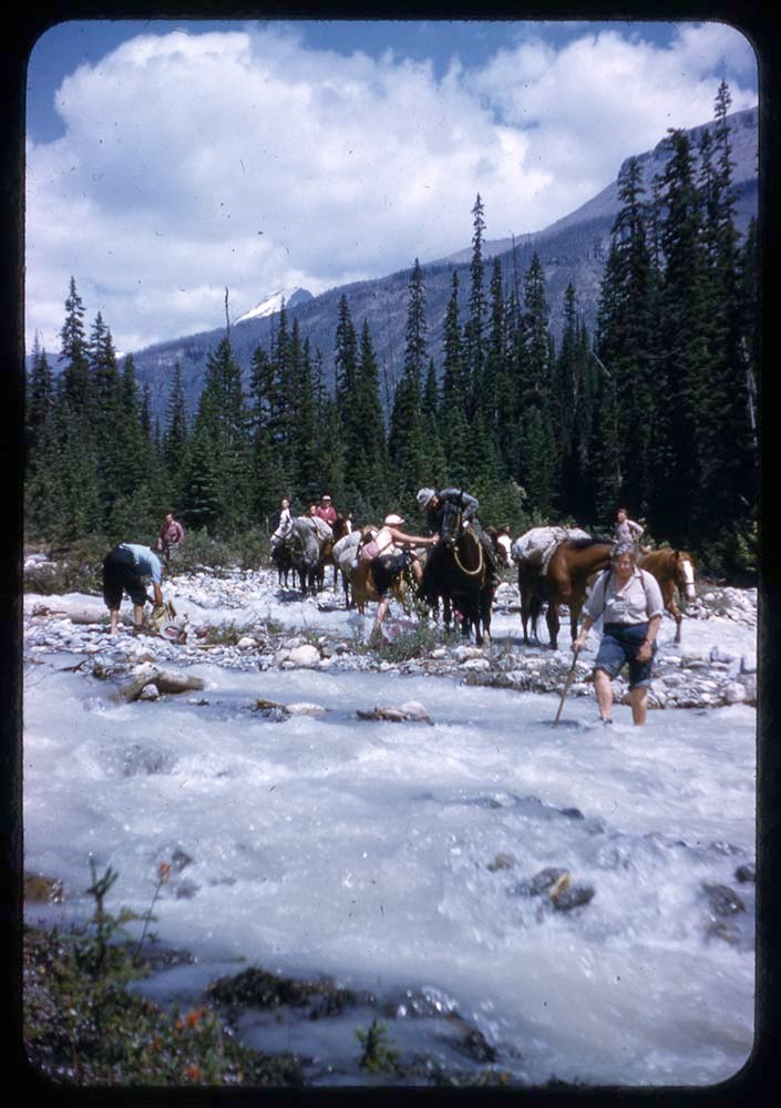
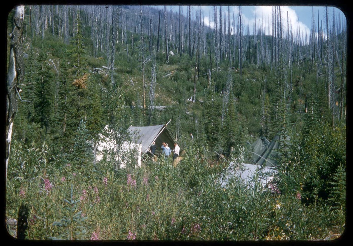
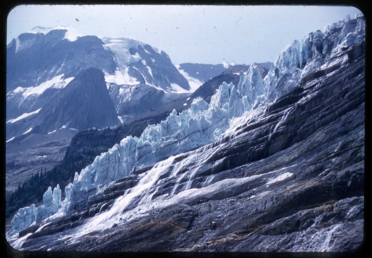
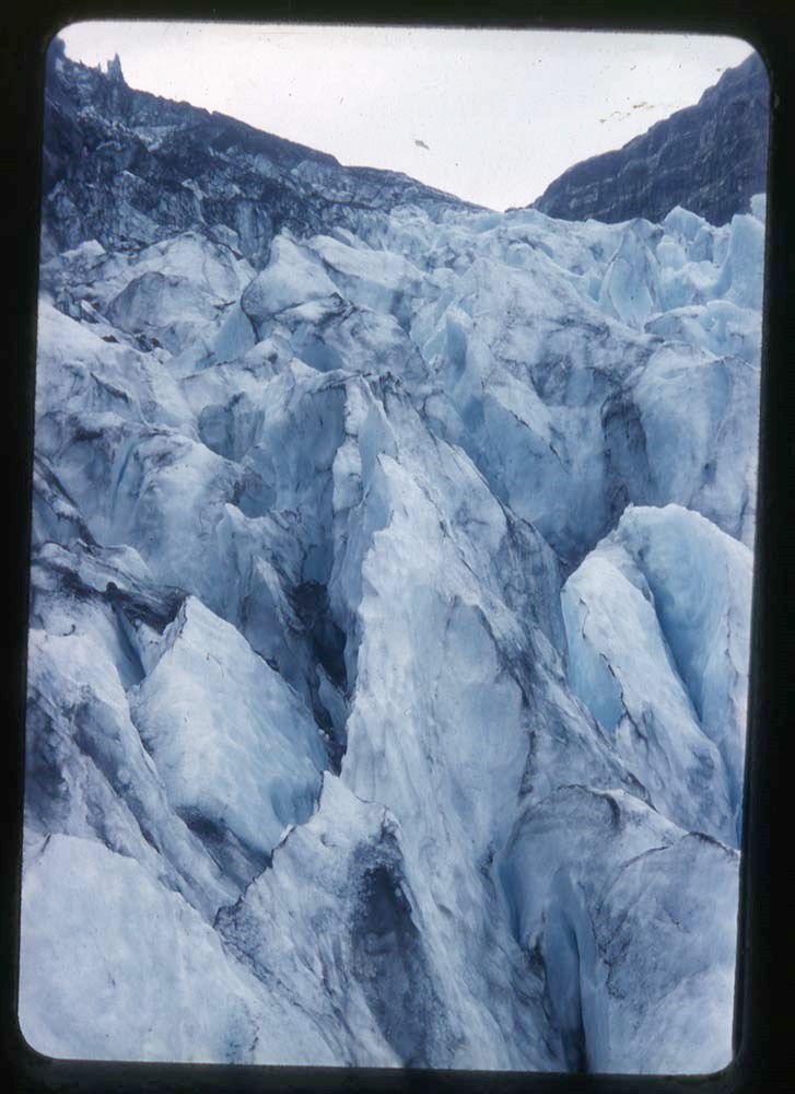
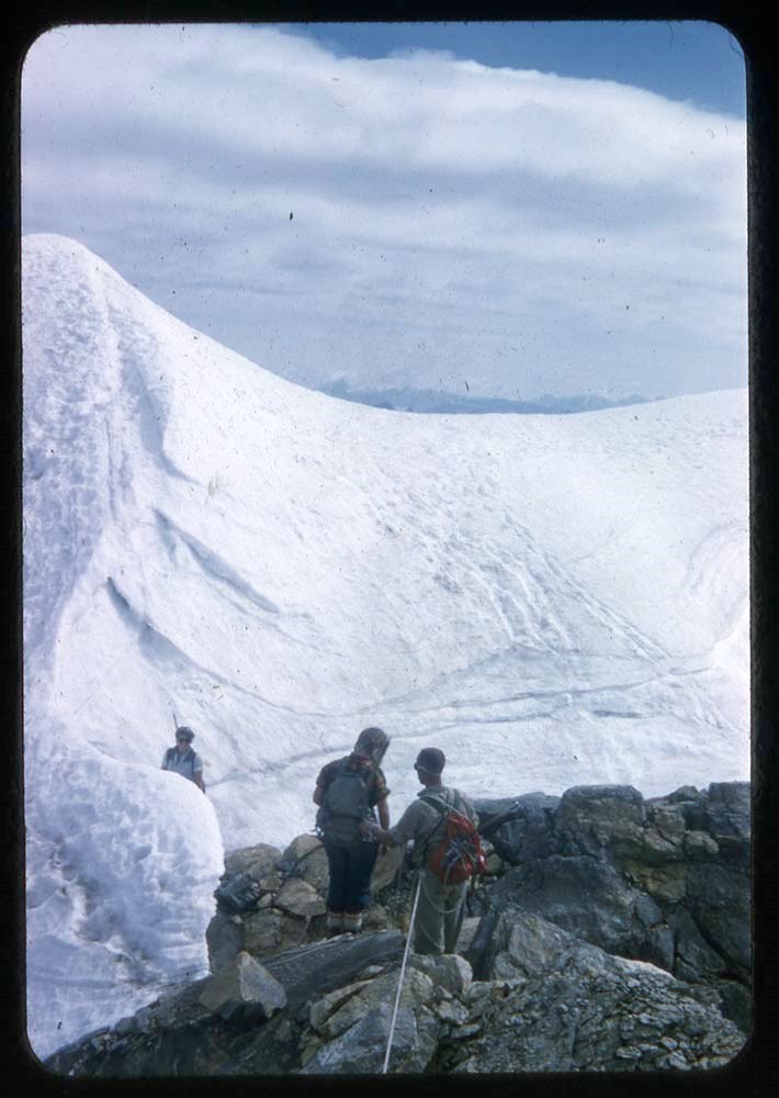
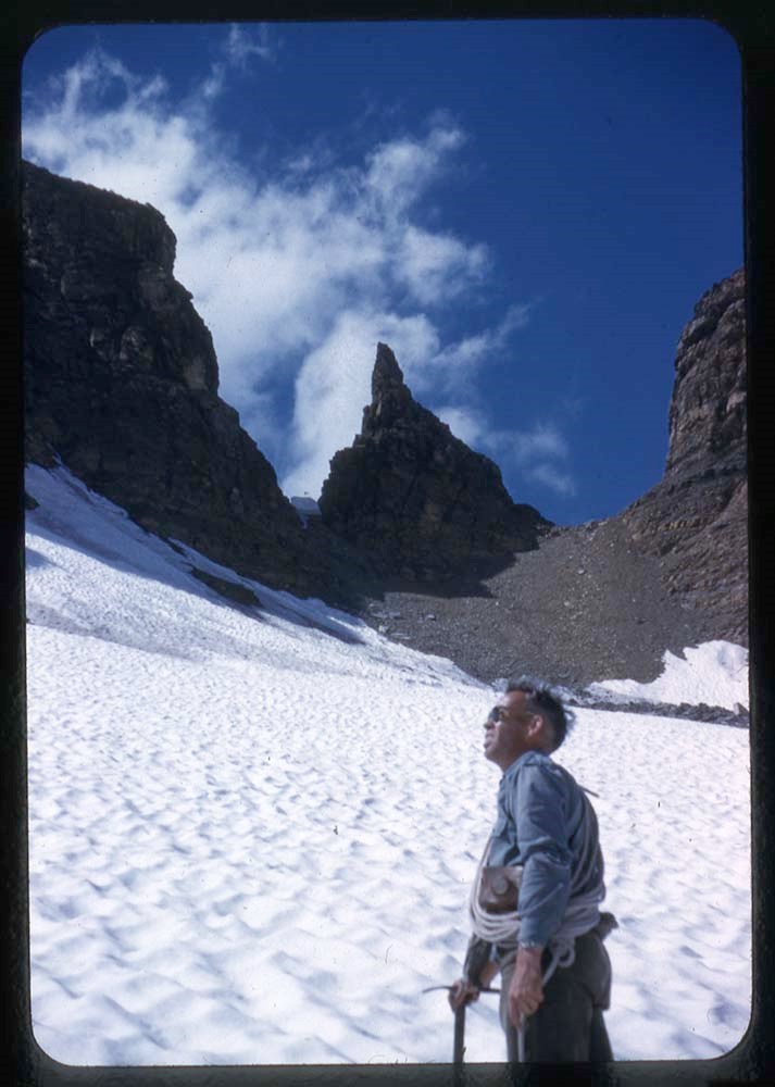
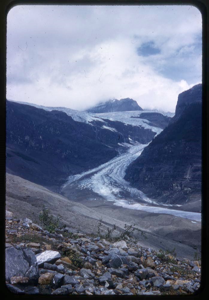
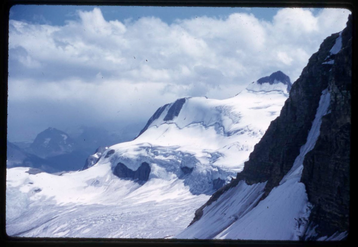
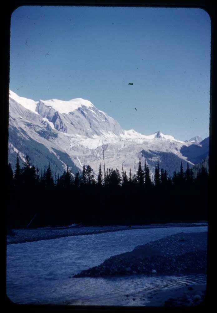
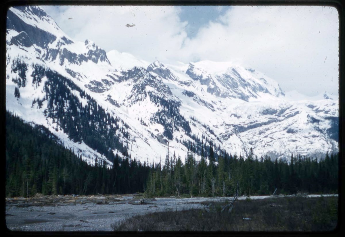
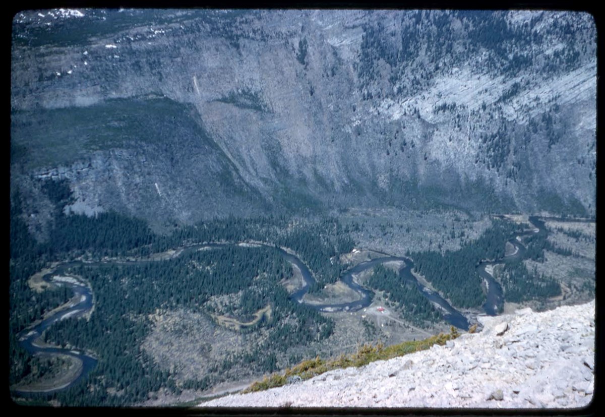
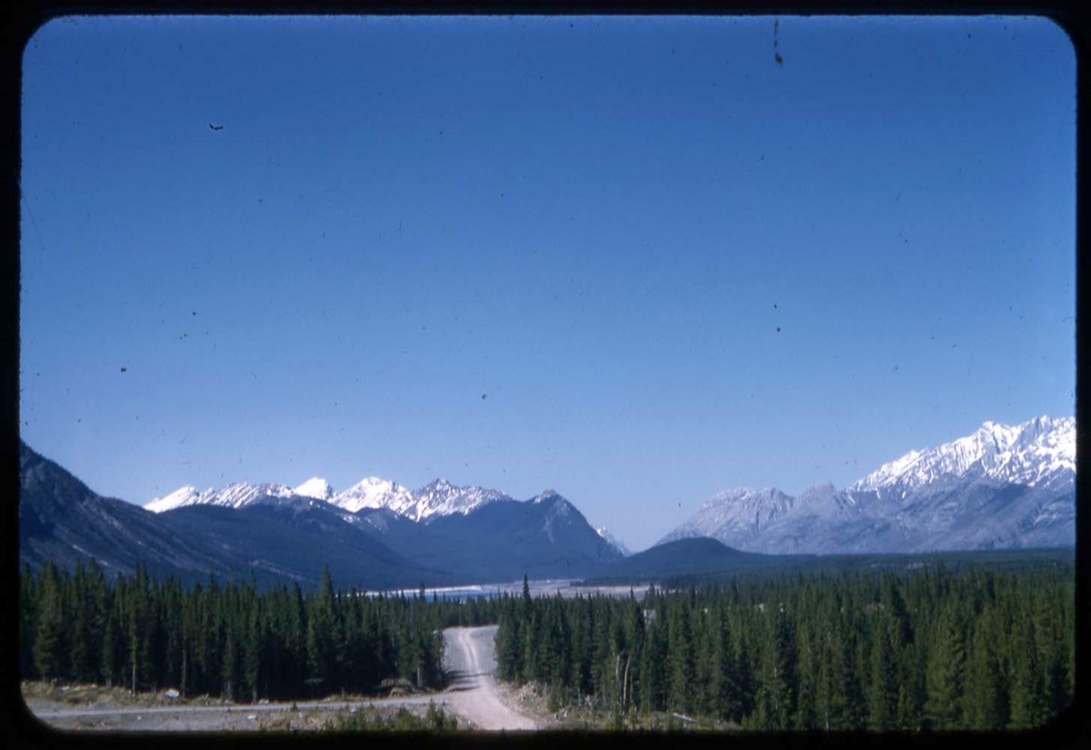
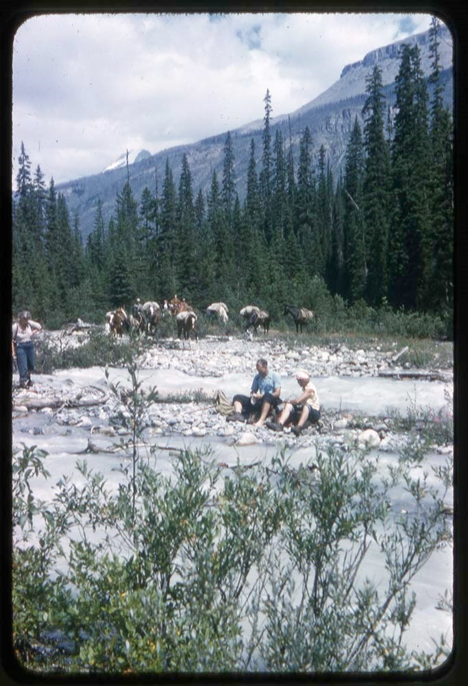
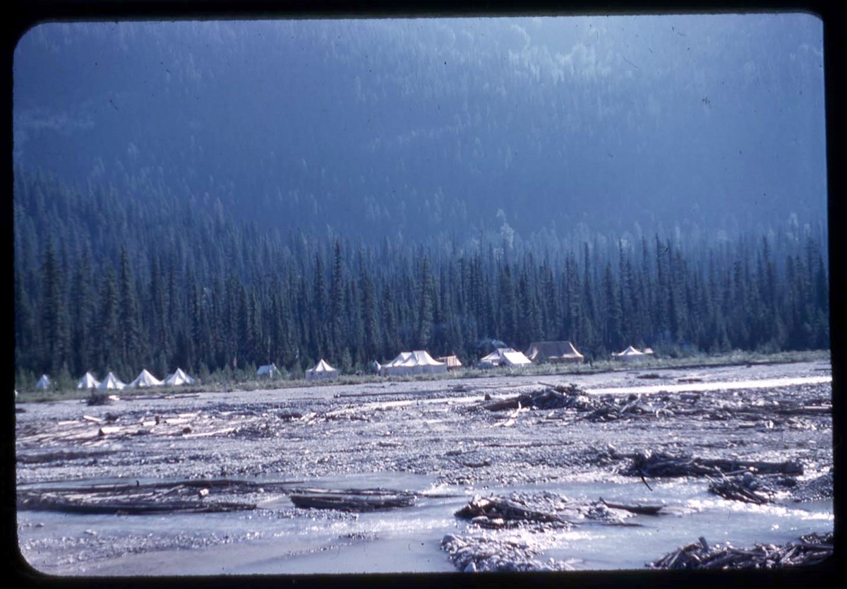
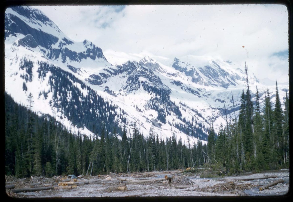
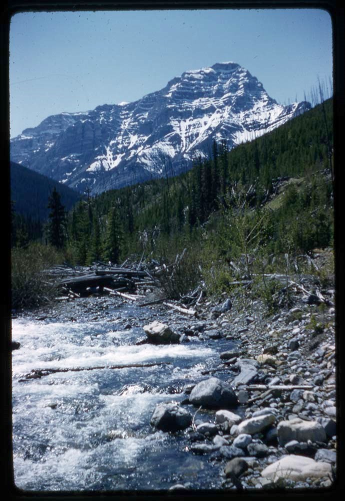
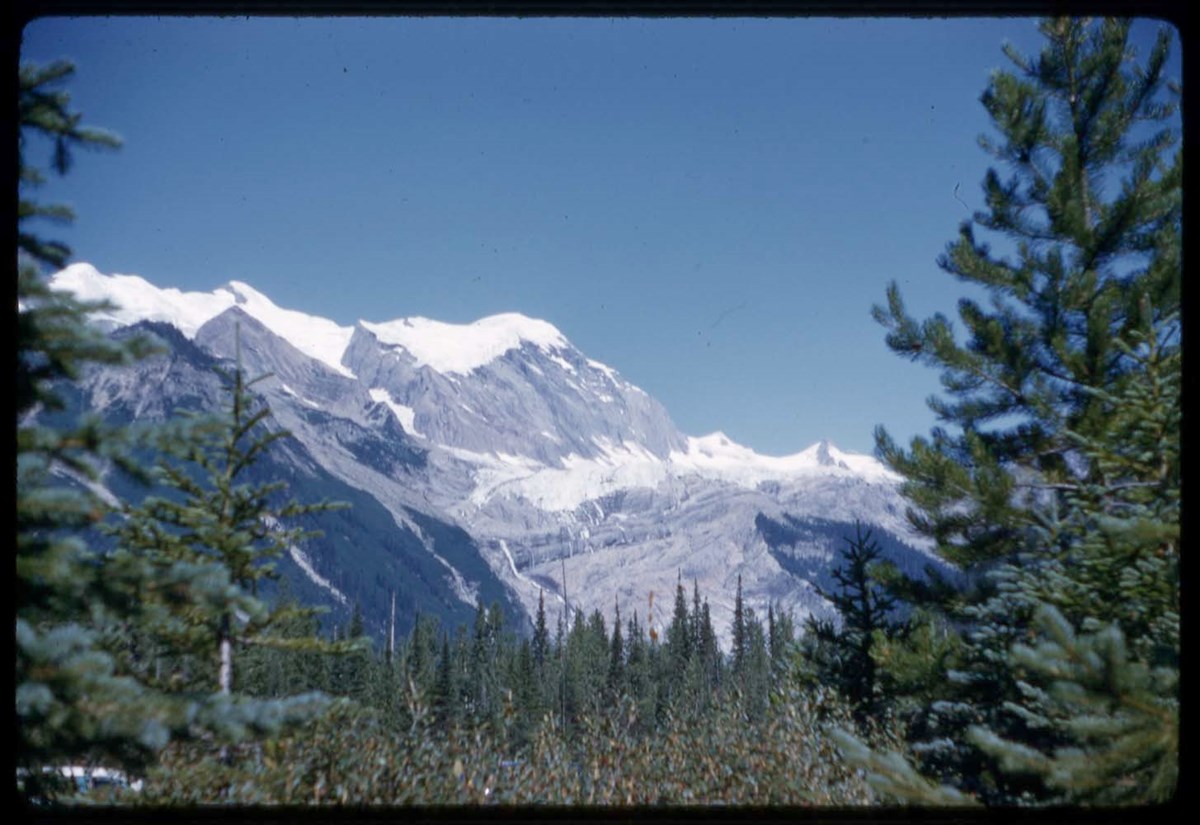
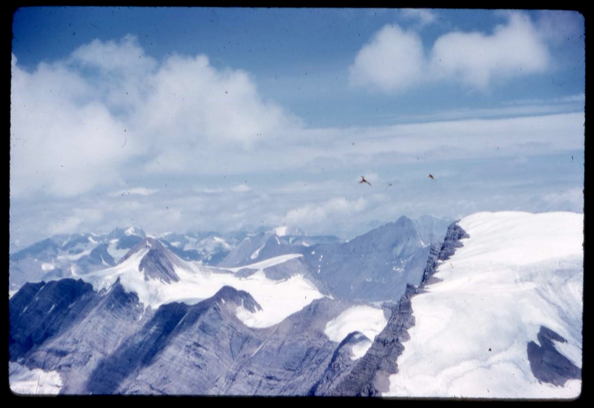
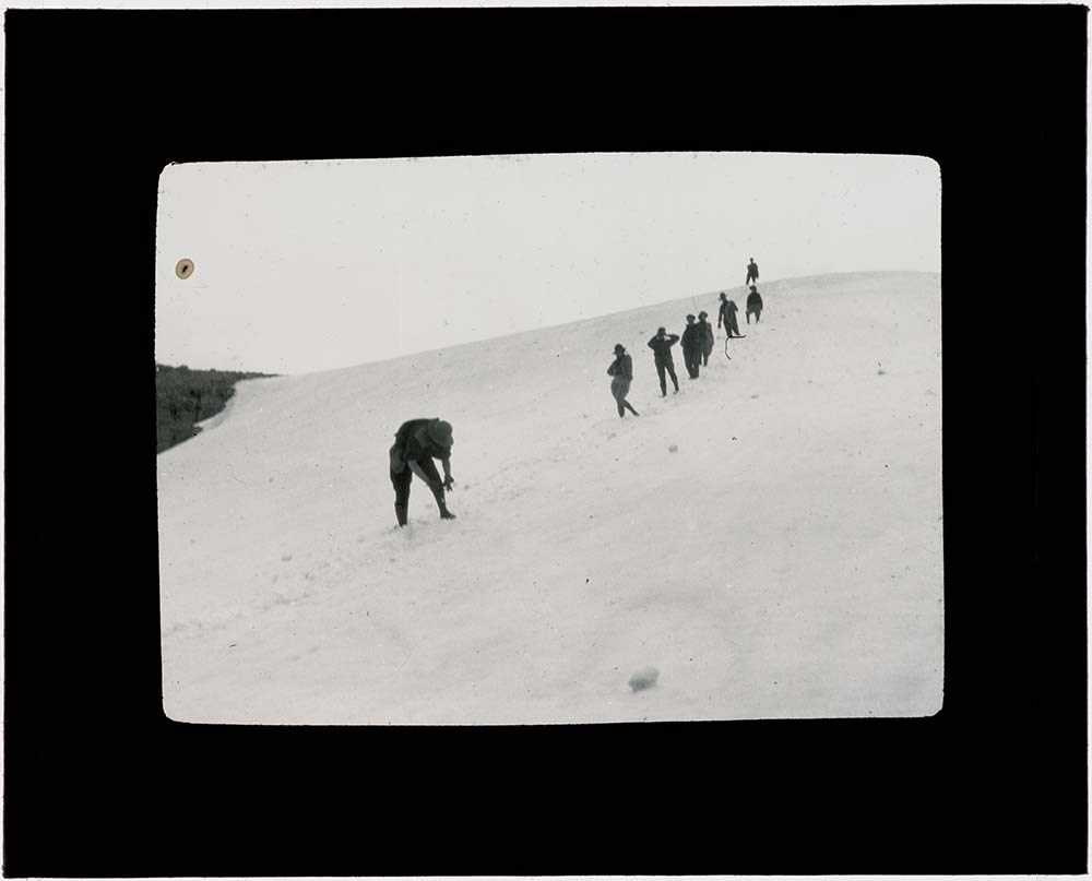
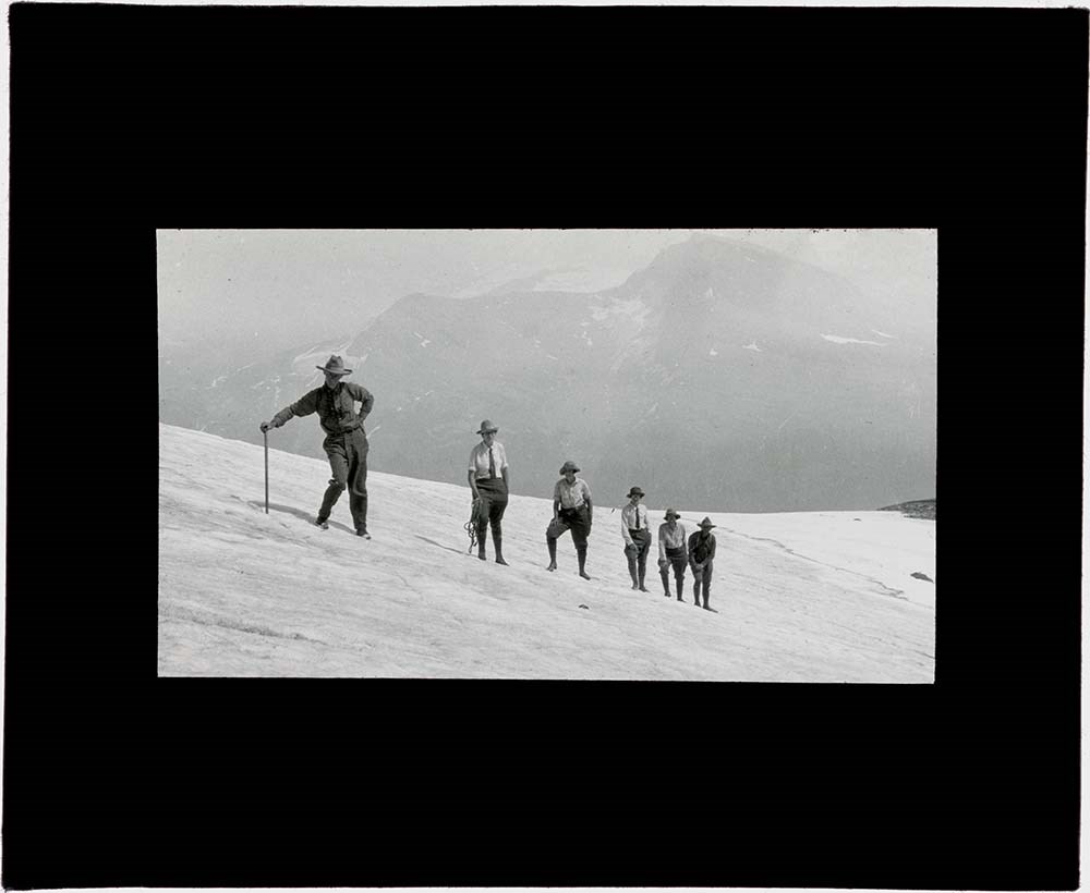
Mount Robson Area
https://archives.whyte.org/en/permalink/descriptions17542
- Part Of
- Bob Hind fonds
- Scope & Content
- File pertains to Mount Robson area, Robson ski camp, ski touring, cabin, 1953; Mount Robson area landscapes, 1955; Mount Robson area landscapes, camp, glacier climbing, 1955; landscape views, group camp, hiking and pack train. Includes views of The Helmut, Mount Robson and Berg Lake by Marj Hind;…
- Date Range
- 1953-1974
- Reference Code
- V46 / I / A / 38 / NS - 1 to 205
- Description Level
- 5 / File
- GMD
- Lantern slide
- Transparency
1 image
- Part Of
- Bob Hind fonds
- Description Level
- 5 / File
- Fonds Number
- M7 / V46
- Series
- I.A. Mountain travel and recreation, western Canada : Trips and activities
- Sous-Fonds
- V46
- Accession Number
- 7181
- Reference Code
- V46 / I / A / 38 / NS - 1 to 205
- Other Title Info
- Alternate title: Robson 53-55-74
- Responsibility
- Includes photographs by Marj Hind, some of which are labelled: Class I to Class VIII
- Date Range
- 1953-1974
- Physical Description
- 205 photographs : transparencies, 35mm, col
- History / Biographical
- See fonds level description.
- Scope & Content
- File pertains to Mount Robson area, Robson ski camp, ski touring, cabin, 1953; Mount Robson area landscapes, 1955; Mount Robson area landscapes, camp, glacier climbing, 1955; landscape views, group camp, hiking and pack train. Includes views of The Helmut, Mount Robson and Berg Lake by Marj Hind; include Phyl Munday and other hikers and pertain to landscape and flora, 1974
- Name Access
- Hind, Bob
- Subject Access
- Activities
- Backpacking
- Cabins and shelters
- Environment
- Guide
- Guiding
- Horses
- Horse packing
- Mountaineering
- Mountains
- Professional and Personal Life
- Geographic Access
- Mount Robson
- Mount Robson Provincial Park
- British Columbia
- Canada
- Language
- NA
- Title Source
- Title based on contents of file
- Processing Status
- Processed
Images

This material is presented as originally created; it may contain outdated cultural descriptions and
potentially offensive content.
Read more.
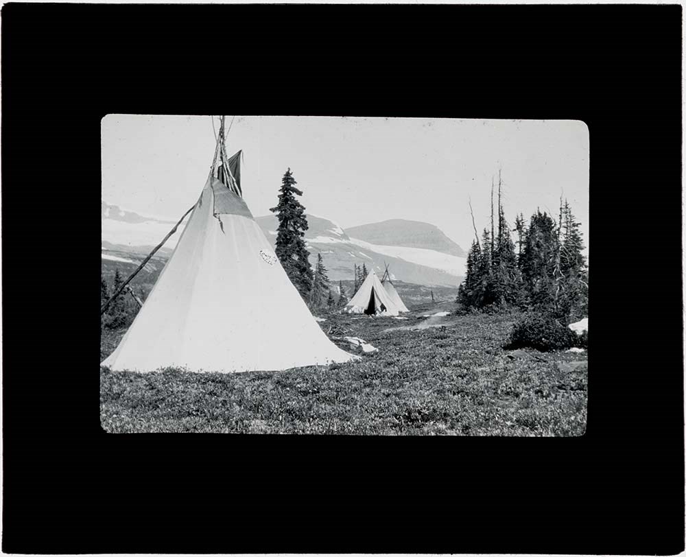
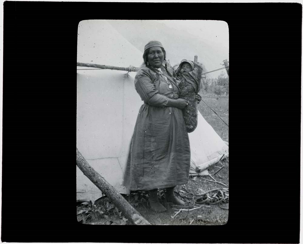
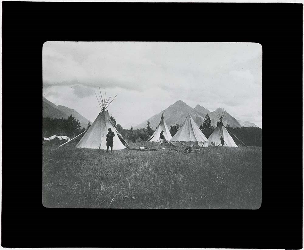
- Part Of
- Vaux family fonds
- Scope & Content
- Indigenous camp, unknown location
- Date Range
- [between 1894 and 1912]
- Reference Code
- V653 / PS - 137
- Description Level
- 6 / Item
- GMD
- Transparency
- Lantern slide
1 image
- Part Of
- Vaux family fonds
- Description Level
- 6 / Item
- Fonds Number
- M107 / V653
- Series
- I. Photography
- Sous-Fonds
- V653
- Sub-Series
- V. Lantern slides
- Reference Code
- V653 / PS - 137
- Date Range
- [between 1894 and 1912]
- Physical Description
- 1 transparency : lantern slide
- Scope & Content
- Indigenous camp, unknown location
- Subject Access
- Discovery and Exploration
- Geographic Access
- Canada
- Creator
- Vaux family (Philadelphia USA)
- Title Source
- Title based on contents of file
- Processing Status
- Processed
Images

This material is presented as originally created; it may contain outdated cultural descriptions and
potentially offensive content.
Read more.
Lake O'Hara & Cathedral Mountain
https://archives.whyte.org/en/permalink/descriptions43283
- Part Of
- Malcolm Geddes fonds
- Scope & Content
- Lantern slide depicts view of Lake O'Hara and Cathedral Mountain.
- Date Range
- [ca.1913-ca.1925]
- Reference Code
- V756 / III / A / PS - 41
- Description Level
- 6 / Item
- GMD
- Photograph
- Lantern slide
1 image
- Part Of
- Malcolm Geddes fonds
- Description Level
- 6 / Item
- Fonds Number
- M39 / V756
- Series
- V756 / III : Personal and family records
- Sous-Fonds
- V756
- Accession Number
- 6504
- Reference Code
- V756 / III / A / PS - 41
- Date Range
- [ca.1913-ca.1925]
- Physical Description
- 1 photograph : transparency (lantern slide)
- Scope & Content
- Lantern slide depicts view of Lake O'Hara and Cathedral Mountain.
- Notes
- Slide is hand-coloured.
- Material Details
- Individual labels: round red label 40; round red label G; handwritten title label 58 Lake O'Hara & Cathedral Mountain 29
- Geographic Access
- Canada
- British Columbia
- Lake O'Hara
- Cathedral Mountain
- Access Restrictions
- Fragile- restrictions may apply
- Reproduction Restrictions
- Fragile- restrictions may apply
- Language
- N/A
- Category
- Environment
- Title Source
- Title based on contents of file
- Processing Status
- Processed
Images

This material is presented as originally created; it may contain outdated cultural descriptions and
potentially offensive content.
Read more.
Blueprints of Connaught Tunnel and Map of Deutchman Cave
https://archives.whyte.org/en/permalink/descriptions54207
- Part Of
- Nicholas Morant fonds
- Scope & Content
- File consists of 2 printed paper copies of older hand-illustrated works. Pertains to a copied 1947 blueprint of Connaught Tunnel depicting burn damage on tracks from an accident that year; and a copied hand-drawn map of Deutchman Cave from 1902, with annotations bottom right (copied from the origin…
- Date Range
- [ca. 1950 - ca. 1970]
- Reference Code
- V500 / III / D / 5 / PA - 73 to 74 O.S.
- Description Level
- 5 / File
- GMD
- Drawing
- Map
- Blueprint
- Part Of
- Nicholas Morant fonds
- Description Level
- 5 / File
- Fonds Number
- M300 / S20 / V500
- Sous-Fonds
- V500
- Sub-Series
- V500 / III / D / 5 : Personal Interest and Gifts
- Accession Number
- 7784
- Reference Code
- V500 / III / D / 5 / PA - 73 to 74 O.S.
- Responsibility
- Nicholas Morant
- Date Range
- [ca. 1950 - ca. 1970]
- Physical Description
- 2 paper copies: 1 blueprint, 1 map
- Scope & Content
- File consists of 2 printed paper copies of older hand-illustrated works. Pertains to a copied 1947 blueprint of Connaught Tunnel depicting burn damage on tracks from an accident that year; and a copied hand-drawn map of Deutchman Cave from 1902, with annotations bottom right (copied from the original).
- Notes
- Items were stored together in a poster tube labelled: "Canadian Pacific Blueprints - CPR Passenger Train in Connaught Tunnel - Nakimu Caves at Glacier"
- Subject Access
- Geography
- Connaught Tunnel
- Canadian Pacific Railway
- Train
- Transportation
- Geographic Access
- Canada
- British Columbia
- Canadian Rocky Mountains
- Access Restrictions
- Items in this file are not to be accessed or distributed without the explicit permission of their identified copyright owners.
- Reproduction Restrictions
- Items in this file are not to be reproduced without the explicit permission of their identified copyright owners.
- Language
- English
- Conservation
- Items must be stored flat with similar materials
- Creator
- Nicholas Morant
- Title Source
- Title based on contents of file
- Processing Status
- Processed
This material is presented as originally created; it may contain outdated cultural descriptions and
potentially offensive content.
Read more.
Travel Documents and Maps (File 1 of 2)
https://archives.whyte.org/en/permalink/descriptions54316
- Part Of
- Nicholas Morant fonds
- Scope & Content
- File consists of 13 maps / map clippings of regions in Alberta (including map of Banff annotated to show location of former Morant home), B.C., Saskatchewan and Manitoba; 6 packing inventory lists and 3 other handwritten notes including shopping list; business card for Starlight Villa Motel in Nels…
- Date Range
- [ca. 1960 - ca. 1970]
- [ca. 1960 - ca. 1980]
- 1962
- 1972
- 1981 - 1982
- 1985
- 1988
- [ca. 1992]
- Reference Code
- M300 / III / A9 / 1
- Description Level
- 5 / File
- GMD
- Textual record
- Map
- Part Of
- Nicholas Morant fonds
- Description Level
- 5 / File
- Fonds Number
- M300 / S20 / V500
- Sous-Fonds
- M300
- Sub-Series
- M300 / III / A : Nick and WIllie Morant
- Accession Number
- Unknown
- Reference Code
- M300 / III / A9 / 1
- GMD
- Textual record
- Map
- Responsibility
- Collected by Nicholas Morant
- Date Range
- [ca. 1960 - ca. 1970]
- [ca. 1960 - ca. 1980]
- 1962
- 1972
- 1981 - 1982
- 1985
- 1988
- [ca. 1992]
- Physical Description
- 26 Textual records: maps, pamphlets, handwritten notes, partial notepads, typed pages, laminated card, business card
- Scope & Content
- File consists of 13 maps / map clippings of regions in Alberta (including map of Banff annotated to show location of former Morant home), B.C., Saskatchewan and Manitoba; 6 packing inventory lists and 3 other handwritten notes including shopping list; business card for Starlight Villa Motel in Nelson, B.C.; laminated card by Banff Lifts Ltd. allowing Nicholas Morant to ride Sulphur Mountain Gondola for free throughout 1992; and customs form with 2 other attached pages with inventory of camera equipment.
- Notes
- All contents originally stored in clipboard with black leather cover, untitled, with 6 b&w film negatives (now filed under V500 / III / A9 / NA - 1). Some items previously stored in labelled envelopes; original envelopes kept in folders directly behind previous contents.
- Geographic Access
- Canada
- Alberta
- Banff
- British Columbia
- Manitoba
- Saskatchewan
- Sulphur Mountain
- Access Restrictions
- Items in this file are not to be accessed or distributed without the explicit permission of their identified copyright owners.
- Reproduction Restrictions
- Items in this file are not to be reproduced without the explicit permission of heir identified copyright owners.
- Language
- English
- Title Source
- Title based on contents of file
- Processing Status
- Processed
This material is presented as originally created; it may contain outdated cultural descriptions and
potentially offensive content.
Read more.
Travel Documents and Maps (File 2 of 2)
https://archives.whyte.org/en/permalink/descriptions54324
- Part Of
- Nicholas Morant fonds
- Scope & Content
- File consists of 5 maps, 3 stamps, ca.12 blank CP labels, 10 CP "value labels",1 notepad, 11 travel release forms (5 annotated) and 1 travel folder. Content pertains to travel documents and maps used by Nicholas Morant during work trips with Canadian Pacific and possibly some personal travel. Inclu…
- Date Range
- 1930
- 1946
- 1947
- [ca. 1950 - ca. 1975]
- 1966
- 1977
- 1978
- Reference Code
- M300 / III / A9 / 2
- Description Level
- 5 / File
- GMD
- Map
- Organization record
- Textual record
- Corporate record
- Part Of
- Nicholas Morant fonds
- Description Level
- 5 / File
- Fonds Number
- M300 / S20 / V500
- Sous-Fonds
- V500
- Sub-Series
- V500 / I / A : Nick and WIllie Morant
- Accession Number
- 7784
- Reference Code
- M300 / III / A9 / 2
- Responsibility
- Collected by Nicholas Morant; corporate records for Canadian Pacific owned by Canadian Pacific company
- Date Range
- 1930
- 1946
- 1947
- [ca. 1950 - ca. 1975]
- 1966
- 1977
- 1978
- Physical Description
- ca. 43 Textual records: maps, stamps, labels, notepad, small travel folder, release forms
- Scope & Content
- File consists of 5 maps, 3 stamps, ca.12 blank CP labels, 10 CP "value labels",1 notepad, 11 travel release forms (5 annotated) and 1 travel folder. Content pertains to travel documents and maps used by Nicholas Morant during work trips with Canadian Pacific and possibly some personal travel. Includes maps of Alberta, Banff National Park, Yoho National Park, Jasper National Park; professional supplies (travel forms, shipping labels); 14-cent Canadian stamps (from XI Commonwealth Games in 1978); notepad with 2 pages of notes written by Nicholas Morant; and small blue travel-sized folder with pockets with CP Transport label on front.
- Notes
- CP Rail labels, stamps, value labels, blue folder and notepad originally stored in plastic wrapping labelled "ENVELOPES PAPER STAMPS VALUE LABELS" Travel release forms were originally stored in blue/grey CP Rail mailing envelope labelled "RR Releases" (stored in separate folder in same box) 1966 map of Alberta (fold-out map) and 3 maps of national parks were originally stored in large blue/grey Canadian Pacific envelope labelled "MAPS - PARKS ALBERTA SASKATCHEWAN ONTARIO" Large map of Alberta formerly stored in unlabelled plastic yellow bag with red cloth border (removed for conservation purposes) Items in this file were part of an original set of ca. 75 items; excess duplicates, blank pages and envelopes, non-annotated maps not relevant to the Canadian Rockies, etc. were discarded.
- Storage Range
- In file box M300 / III / A9
- Name Access
- Morant, Nicholas
- Subject Access
- Banff National Park
- Canadian Pacific Railway
- Jasper National Park
- National parks and reserves
- Parks
- Records
- Rocky Mountains
- Travel
- Yoho National Park
- Geographic Access
- Canada
- Alberta
- Banff
- British Columbia
- Canadian Rocky Mountains
- Reproduction Restrictions
- Items in this file are not to be reproduced without the explicit permission of their identified copyright owners.
- Language
- English
- French
- Title Source
- Title based on contents of file
- Processing Status
- Processed
This material is presented as originally created; it may contain outdated cultural descriptions and
potentially offensive content.
Read more.
Ephemera and Collected Materials
https://archives.whyte.org/en/permalink/descriptions54648
- Part Of
- Dorothy Wardle fonds
- Scope & Content
- File consists of 28 cm of textual records, 21 x 29.5 cm or smaller. File pertains to the Wardle family's travels overseas and in North America. Records include brochures, pamphlets, postcards (annotated and blank), folded maps and guidebooks, and other travel literature. Destinations include Amster…
- Date Range
- c.1950-c.1980
- Reference Code
- M521 / IV / 1-17
- Description Level
- 5 / File
- GMD
- Diary
- Map
- Postcard
- Published record
- Textual record
- Part Of
- Dorothy Wardle fonds
- Description Level
- 5 / File
- Fonds Number
- M521 / V75
- Series
- M521 / IV : Travel
- Sous-Fonds
- M521
- Accession Number
- 7504
- Reference Code
- M521 / IV / 1-17
- Date Range
- c.1950-c.1980
- Physical Description
- 28 cm of textual records (21 x 29.5 cm or smaller)
- Scope & Content
- File consists of 28 cm of textual records, 21 x 29.5 cm or smaller. File pertains to the Wardle family's travels overseas and in North America. Records include brochures, pamphlets, postcards (annotated and blank), folded maps and guidebooks, and other travel literature. Destinations include Amsterdam, Germany, Luxembourg, Austria, Spain, France, Monaco, Scotland, Italy, Scandinavia, Switzerland, the United Kingdom, and various places in North America.
- Name Access
- Wardle, Dorothy
- Subject Access
- Travel
- European travel
- Family and personal life
- Geographic Access
- Canada
- Scotland
- Europe
- Germany
- Switzerland
- France
- Spain
- Monaco
- Italy
- Denmark
- Austria
- Language
- English
- Title Source
- Title based on contents of file
- Processing Status
- Processed
This material is presented as originally created; it may contain outdated cultural descriptions and
potentially offensive content.
Read more.
Jean A. Hembroff MacDonald fonds
https://archives.whyte.org/en/permalink/descriptions54681
- Part Of
- Jean A. Hembroff MacDonald fonds
- Scope & Content
- Fonds consists of three sous-fonds: M573 / V797 / S60. M573 consists of three series, 26 cm of textual records, 1924-2005. Series I: Personal Papers, 19 cm, ca.1930-2005 (including notebooks and drafts of various talks that Jean delivered and records related to her participation in the Trail Rider…
- Date Range
- ca.1908-ca.2011
- Reference Code
- M573 / V797 / S60
- Description Level
- 1 / Fonds
- GMD
- Photograph
- Photograph print
- Private record
- Published record
- Newspaper clipping
- Transparency
- Textual record
- Sound recording
- Lantern slide
- Part Of
- Jean A. Hembroff MacDonald fonds
- Description Level
- 1 / Fonds
- Fonds Number
- M573 / V797 / S60
- Sous-Fonds
- M573
- V797
- S60
- Accession Number
- 2019.111
- Reference Code
- M573 / V797 / S60
- GMD
- Photograph
- Photograph print
- Private record
- Published record
- Newspaper clipping
- Transparency
- Textual record
- Sound recording
- Lantern slide
- Date Range
- ca.1908-ca.2011
- Physical Description
- 26 cm of textual records.-- 109 photographs (42 prints, 67 lantern slides). -- 2 sound recordings.
- History / Biographical
- Jean Alexandra Hembroff was born in Winnipeg, Manitoba on April 5, 1908 to Walter B. Hembroff (d. 1945) and Sarah Jane Hembroff (d.1952). Jean was accepted to the MacPhail School of Music and Dramatic Art at the University of Minnesota, from which she graduated in 1927. She returned to Winnipeg to begin teaching courses in speech arts and drama. To establish herself, she first volunteered as the "story lady" at the Williams Avenue Public Library and quickly became known as an excellent speaker sought by many different organizations. She taught at St. Mary's Academy and the Evening Institute at the University of Manitoba, as well as offered private sessions. Many of her students used the skills they learned from Jean as they entered radio, television, politics, and business. Jean was also very active in organizing and adjucating Speech Arts festivals in Manitoba, often going to inaccessible places to give workshops. Her teaching, broadcasting, adjucating, coaching, and speaking career spanned more than 50 years. Jean was hired by the Canadian Pacific Railway's promotions manager to give presentations and broadcast interviews across Canada and the United States. In 1937, Jean joined the Trail Riders of the Canadian Rockies and participated in their summer trail ride in the same year. For that year's issue of the Trail Rider's Bulletin Jean wrote an article - and became the first woman to ever do so. In 1938, during her lecture titled "Trail Riding in the Rockies" on January 18, 1938 at the Royal Alexandra Hotel, Jean met John David (Jack) MacDonald. Jack and Jean were married on June 18, 1938, and the couple had one son, Bruce Walter James MacDonald (August 28, 1946-August 25, 2016). Jean participated in several trail rides with the Trail Riders of the Canadian Rockies and the Sky Line Trail, and produced articles reflecting her experiences. Jean loved to travel and visited places all around Canada and the United States, Borneo, Tangier, Montevideo, Stockholm, New Delhi, and Tonga. At the age of 102, Jean passed away on February 2, 2011 and is buried in Winnipeg.
- Scope & Content
- Fonds consists of three sous-fonds: M573 / V797 / S60.
- M573 consists of three series, 26 cm of textual records, 1924-2005. Series I: Personal Papers, 19 cm, ca.1930-2005 (including notebooks and drafts of various talks that Jean delivered and records related to her participation in the Trail Riders of the Canadian Rockies and the Sky Line Hikers of the Canadian Rockies, particularly 1937-1939). Series II: Correspondence and Newspaper Clippings, 4 cm, 1924-2000 (including correspondence with John Murray Gibbon, former students, and attendees at various talks, as well as newspaper articles that Jean wrote about various subjects and articles of her achievements). Series III: Collected Materials and Ephemera, 3 cm, ca.1930-1950 (including a variety of collected poems and ephemera, as well as a copy of The Beaver Magazine from 1940, for which Jean wrote an article titled "On the Trail of Sir George").
- V797 consists of two series, 24.5 cm of visual records, ca.1928-1939. Series I: Photograph Prints, 3 cm, ca.1928-1939 (includes personal photographs of Jean and her family and friends as well as photographs of Jean and Jack's visit to Lake Louise in 1939). Series II: Lantern Slides, 21.5 cm, ca.1937-1939 (Trail Riders of the Canadian Rockies official ride of 1937 to Mt. Assiniboine; Sky Line Hikers of the Canadian Rockies official ride of 1939 to Ptarmigan Valley and Skoki; collection of trail ride songs).
- S60 consists of two sound recordings, 1 cm, 2004 and 2007 (Winnipeg at Christmas, narrated by Jean, broadcasted on the Canadian Broadcasting Corporation).
- Notes
- Lantern slides include wooden case.
- Name Access
- Hembroff MacDonald, Jean
- Subject Access
- Banff
- Banff National Park
- Camps
- Canadian Pacific Railway
- Discovery and travel
- Discovery and exploration
- Empress Hotel
- European travel
- Family and personal life
- Guides
- Hiking
- Horse packing
- Horses
- Horseback riding
- Kananaskis Ranch
- Lake Louise
- Lantern slide
- Mount Assiniboine
- Mountain
- Organizations
- Personal and Professional Life
- Photography
- Poetry
- Scenery
- Skyline Hikers of the Canadian Rockies
- Skyline Trail Hikers of the Canadian Rockies
- Sports and recreation
- Sunshine area
- Trails
- Trail guides
- Tourism
- Travel
- Travel and Exploration
- Trail Riders of the Canadian Rockies
- Women
- Geographic Access
- Assiniboine
- Alberta
- Banff
- Banff National Park
- British Columbia
- Canada
- Canadian Rocky Mountains
- Ireland
- Kananaskis Country
- Lake Louise
- Lake O'Hara
- Manitoba
- Mount Assiniboine
- Rocky Mountains
- Victoria
- West Indies
- Winnipeg
- Reproduction Restrictions
- Some restriction/s on access
- Copyright, privacy, commercial use and other restrictions may apply
- Language
- English
- Creator
- Hembroff MacDonald, Jean
- Biographical Source Notes
- Contents of the fonds
- https://www.findagrave.com/memorial/122854759/jean-alexandra-macdonald
- https://passages.winnipegfreepress.com/passage-details/id-174851/MACDONALD_JEAN
- https://www.dignitymemorial.com/obituaries/winnipeg-mb/bruce-macdonald-7064958
- Title Source
- Title based on contents of file
- Processing Status
- Processed
This material is presented as originally created; it may contain outdated cultural descriptions and
potentially offensive content.
Read more.
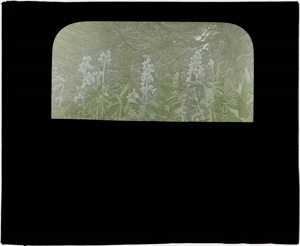
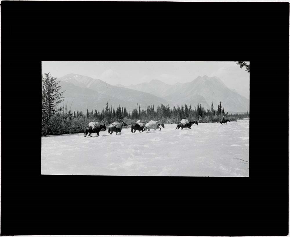
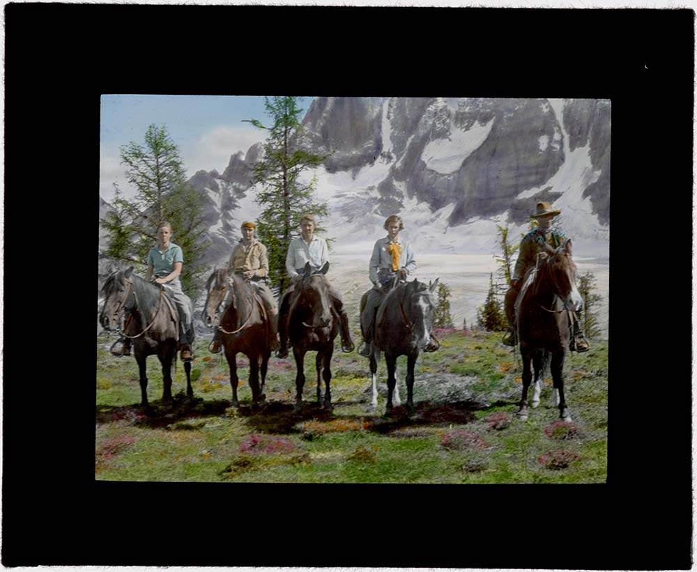
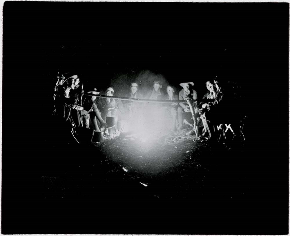
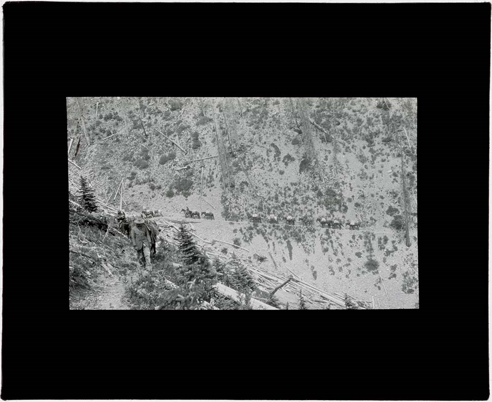
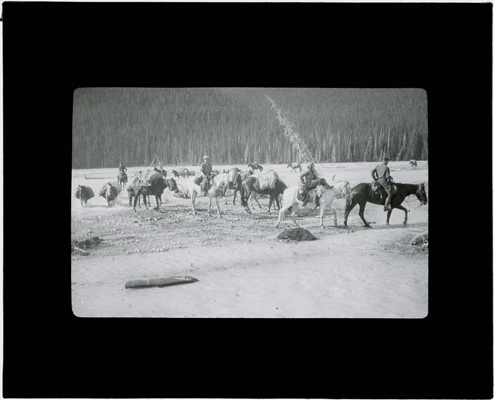
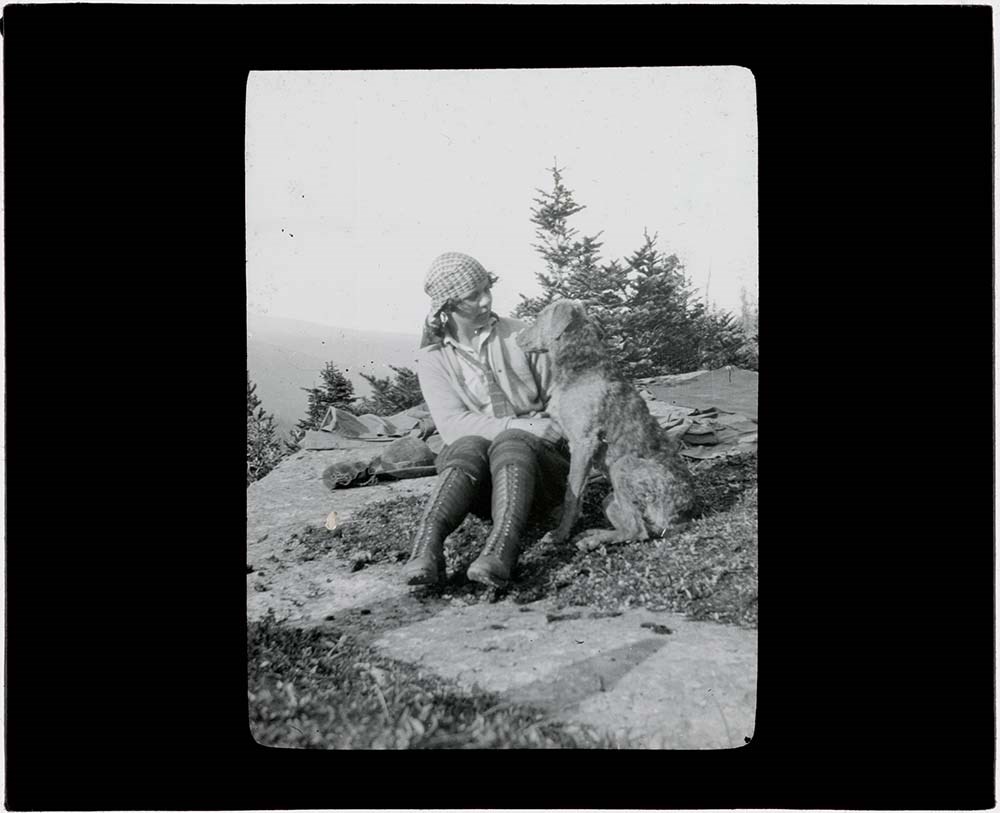
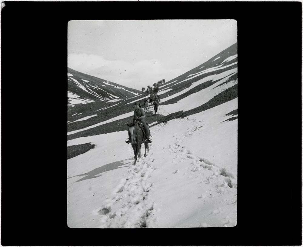
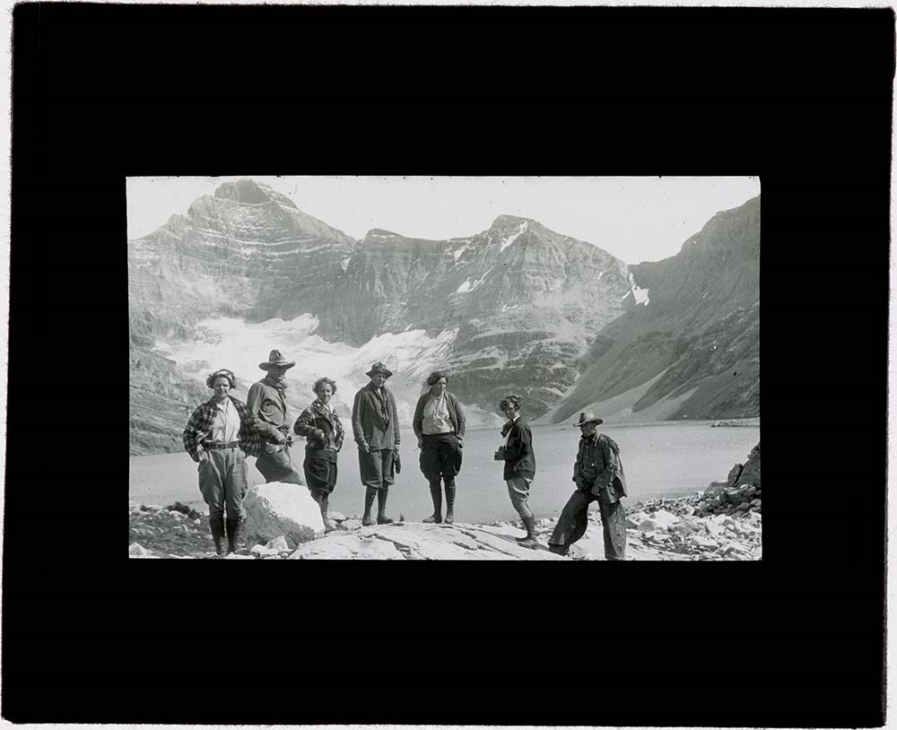
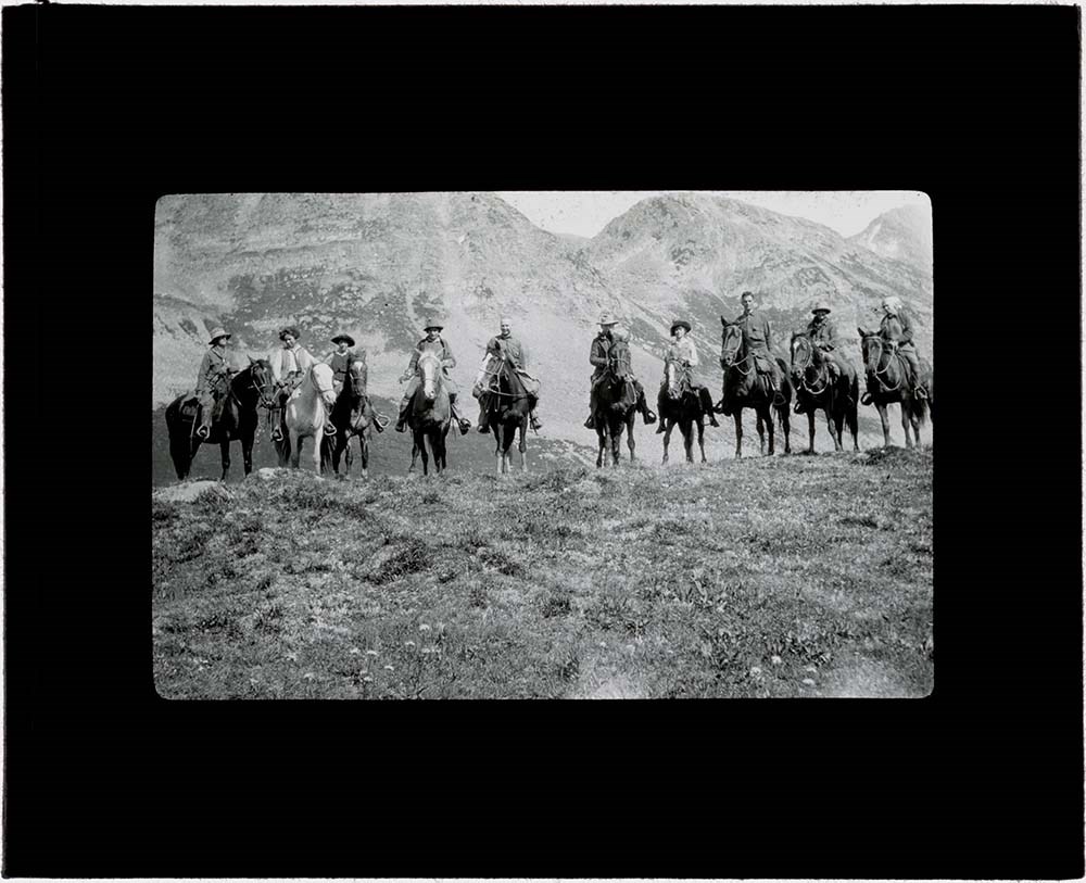
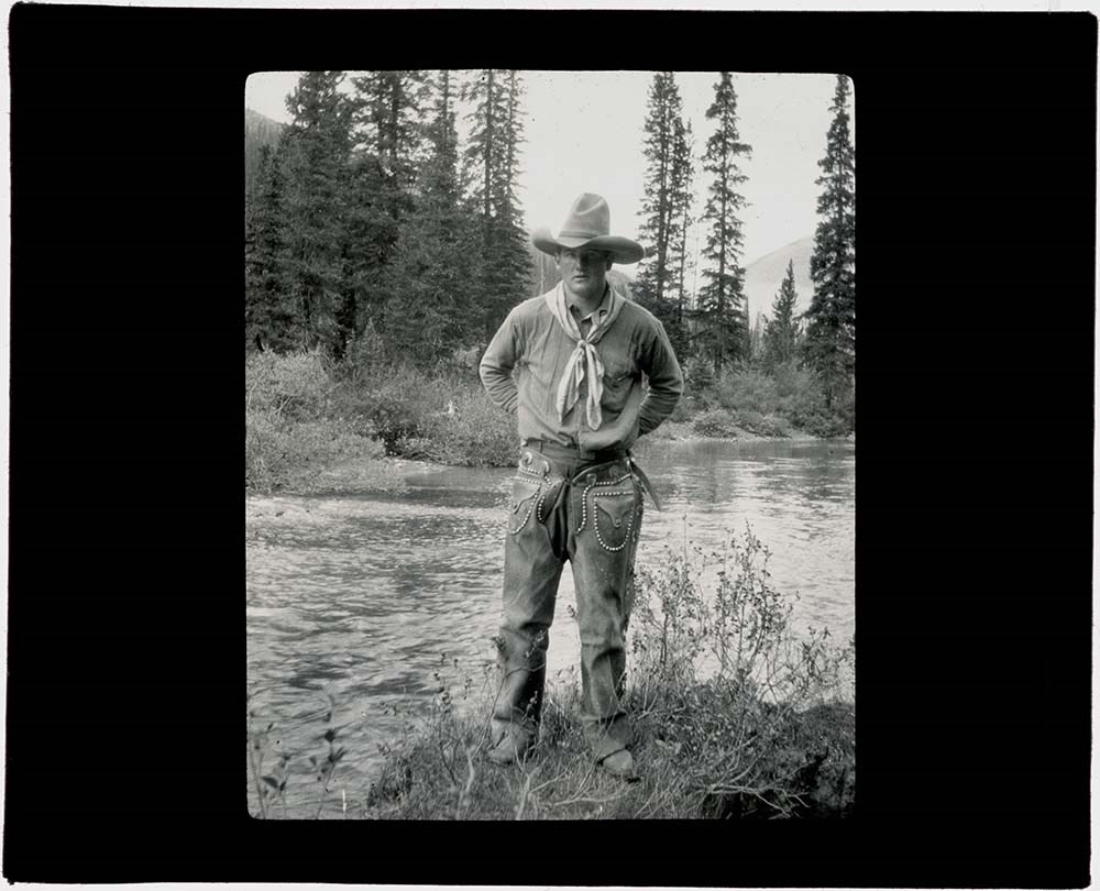
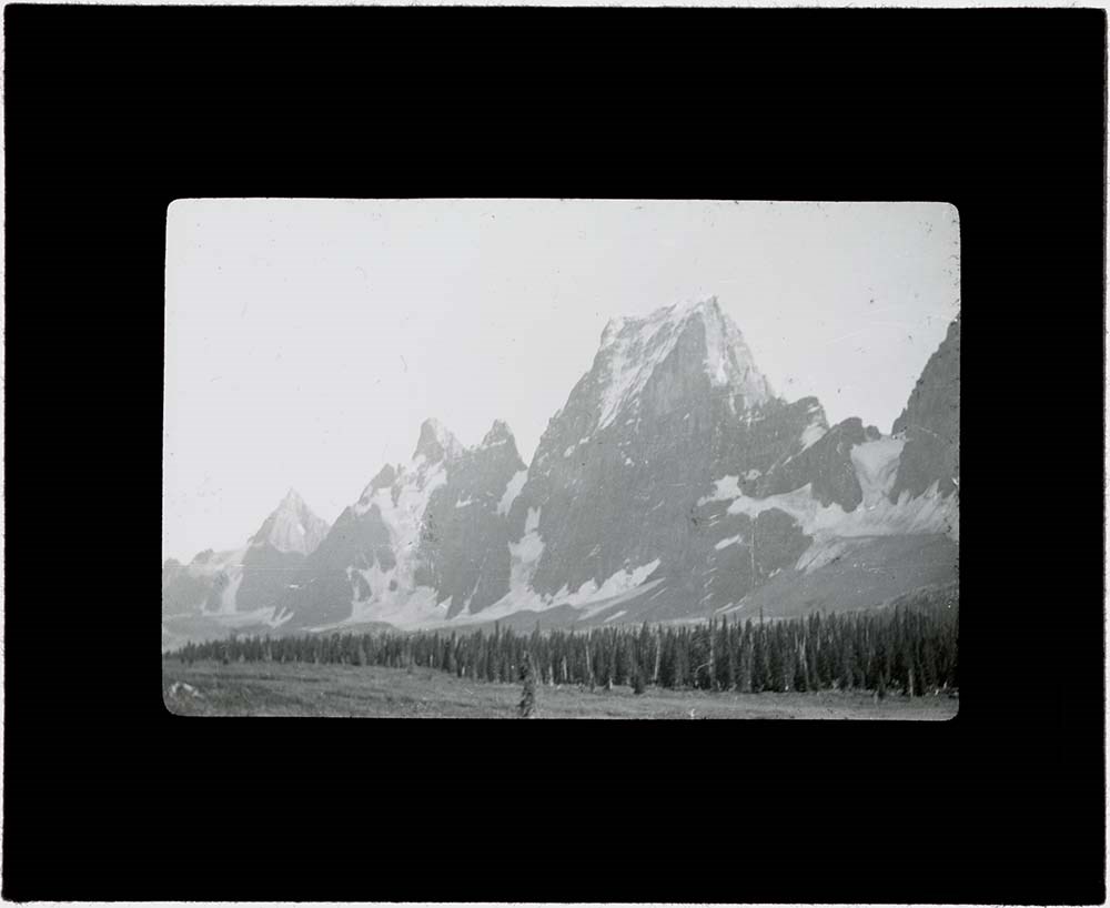
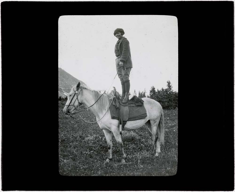
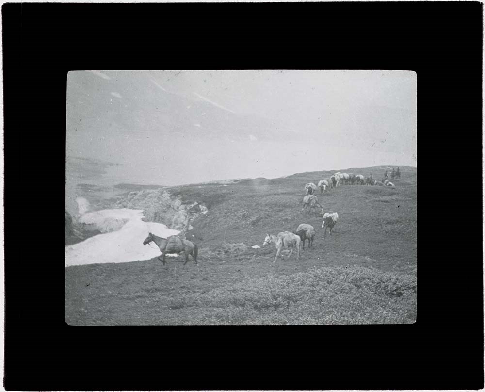
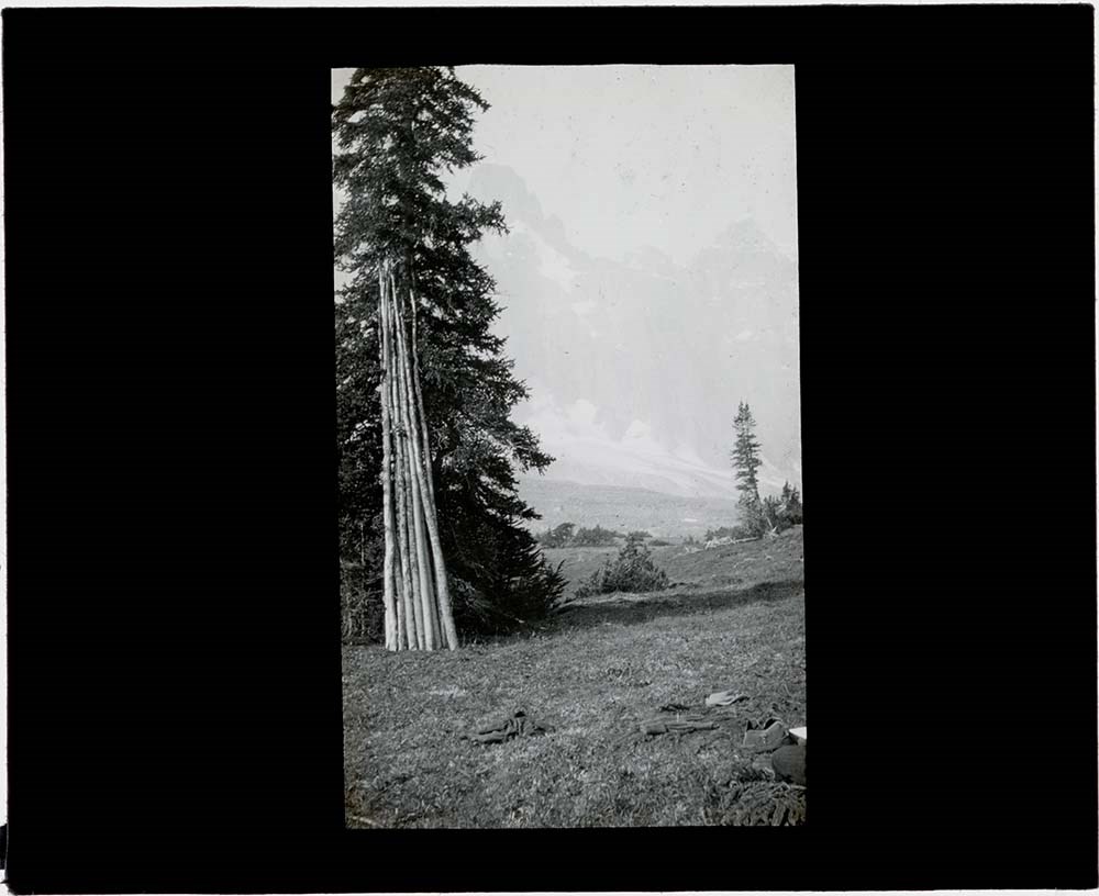
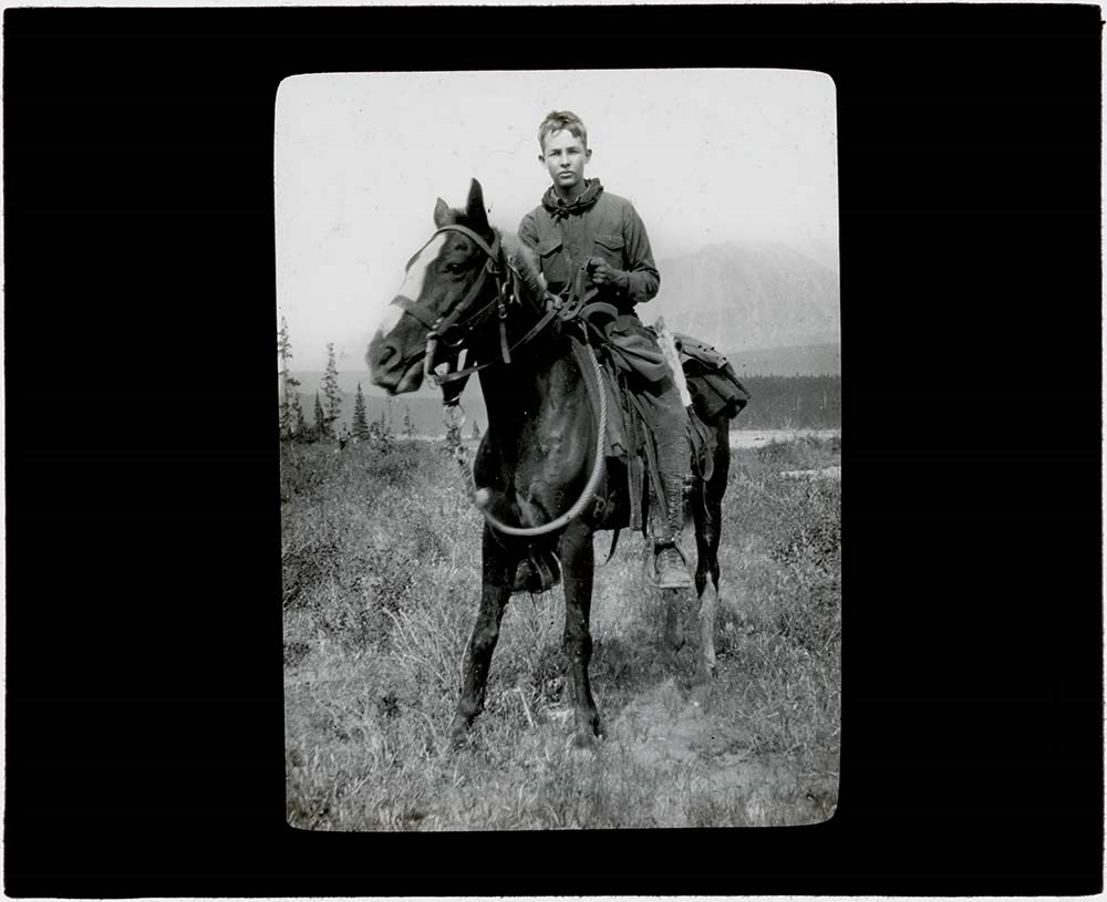
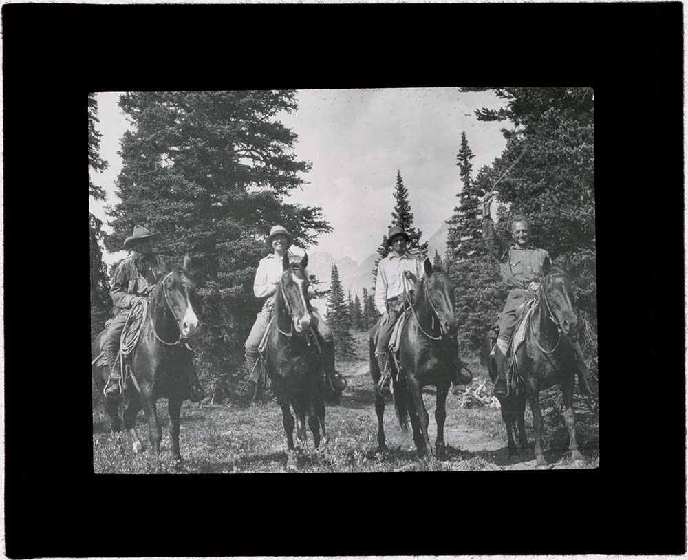
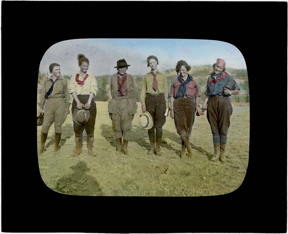
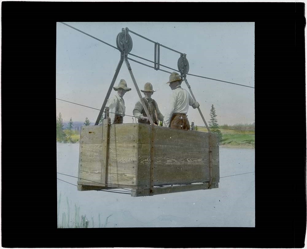
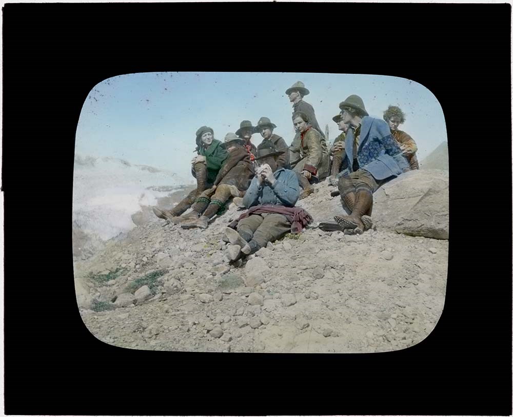
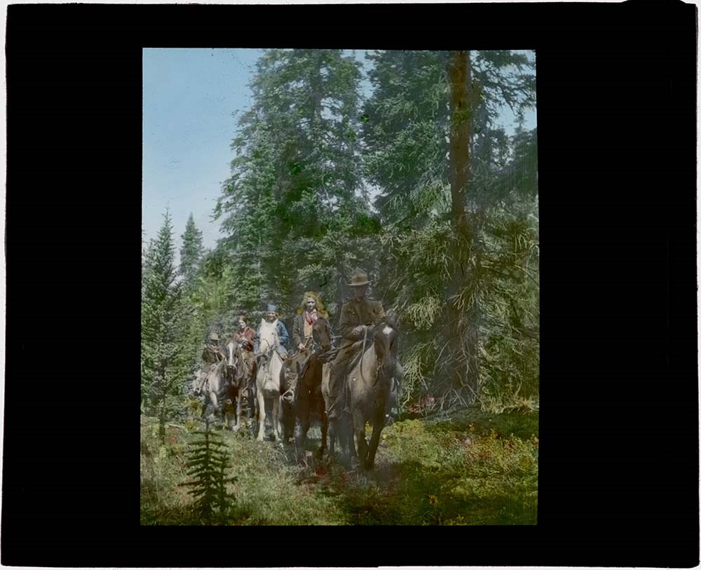
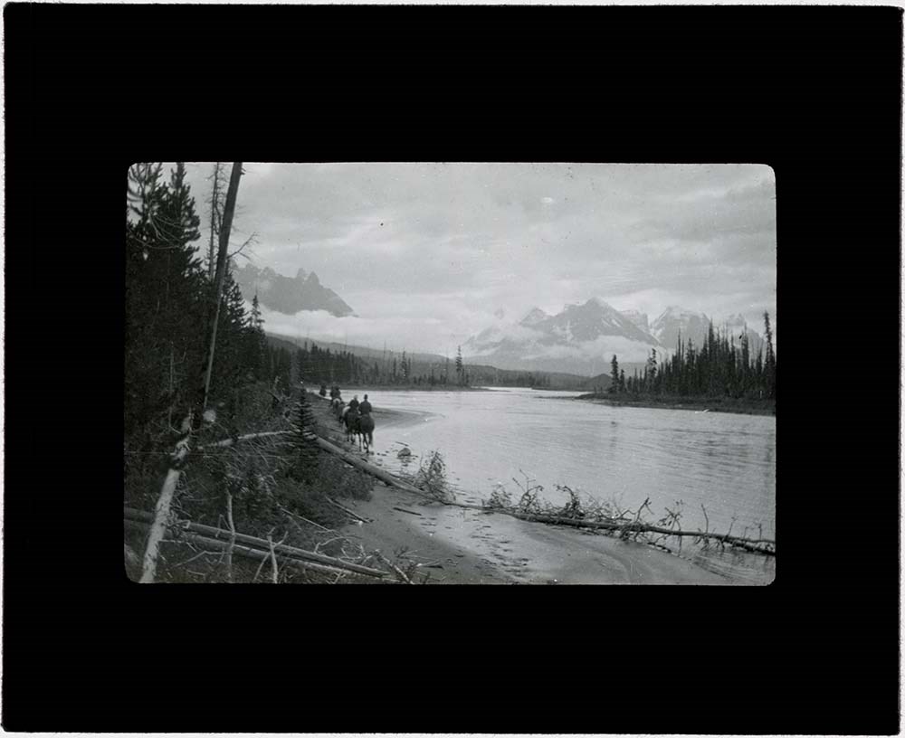
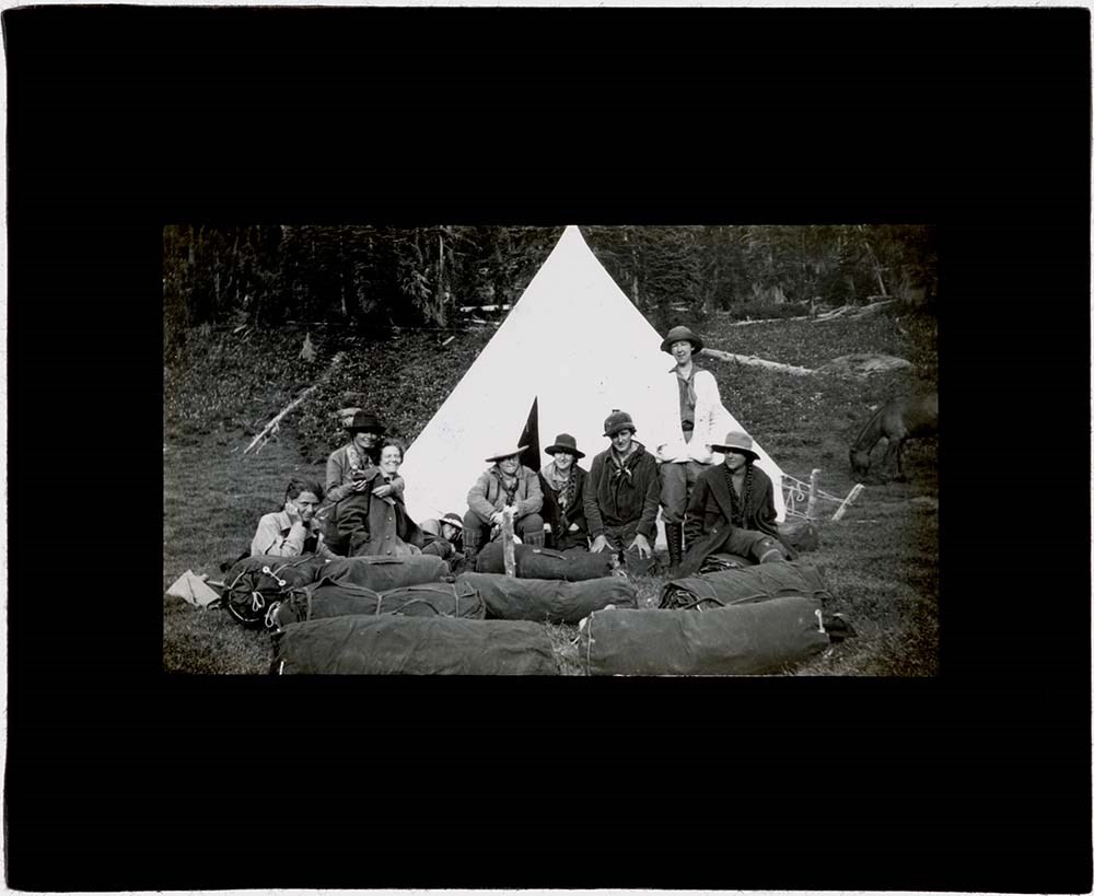
Rocky Mountain Trips Lantern Slides
https://archives.whyte.org/en/permalink/descriptions54688
- Part Of
- Caroline Hinman fonds
- Scope & Content
- File consists of lantern slides depicting various pack trips organized and led by Caroline Hinman during the summers between 1913 and 1958. The slides appear to be celluloid transparencies fixed between the panes of glass; lack of maker's marks on the transparencies indicates the images may have be…
- Date Range
- 1913 - 1958
- Reference Code
- V282 / III / B / PS - 53 to PS - 86
- Description Level
- 5 / File
- GMD
- Transparency
- Lantern slide
34 images
- Part Of
- Caroline Hinman fonds
- Description Level
- 5 / File
- Fonds Number
- M236 / V282
- Series
- V282 / III: Photography
- Sous-Fonds
- V282
- Sub-Series
- V282 / III / B: Photography: lantern slides
- Accession Number
- 1316, 1933
- Reference Code
- V282 / III / B / PS - 53 to PS - 86
- Date Range
- 1913 - 1958
- Physical Description
- 34 photographs : b&w and col. slides : 10.2 x 8.2 cm
- History / Biographical
- See fonds level description.
- Scope & Content
- File consists of lantern slides depicting various pack trips organized and led by Caroline Hinman during the summers between 1913 and 1958. The slides appear to be celluloid transparencies fixed between the panes of glass; lack of maker's marks on the transparencies indicates the images may have been developed onto a sheet and then individually cut out to form the slides.
- Name Access
- Hinman, Caroline
- Subject Access
- Photography
- Outfitters
- Outfitters, trail guides and packers
- Horse packing
- Horses
- Mount Assiniboine
- Travel
- Geographic Access
- Banff
- Lake Louise
- Jasper
- Mount Assiniboine
- Mount Assiniboine Park
- Banff National Park
- Jasper National Park
- Alberta
- British Columbia
- Canada
- Language
- English
- Conservation
- All slides cleaned prior to scanning
- Title Source
- Title based on contents of file
- Processing Status
- Processed
Images


This material is presented as originally created; it may contain outdated cultural descriptions and
potentially offensive content.
Read more.
Rocky Mountain Trips Lantern Slides
https://archives.whyte.org/en/permalink/descriptions54689
- Part Of
- Caroline Hinman fonds
- Scope & Content
- File consists of lantern slides depicting various pack trips organized and led by Caroline Hinman during the summers between 1913 and 1958. The slides appear to be celluloid transparencies fixed between the panes of glass; lack of maker's marks on the transparencies indicates the images may have be…
- Date Range
- 1913 - 1958
- Reference Code
- V282 / III / B / PS - 87 to PS - 131
- Description Level
- 5 / File
- GMD
- Transparency
- Lantern slide
45 images
- Part Of
- Caroline Hinman fonds
- Description Level
- 5 / File
- Fonds Number
- M236 / V282
- Series
- V282 / III: Photography
- Sous-Fonds
- V282
- Sub-Series
- V282 / III / B: Photography: lantern slides
- Accession Number
- 1316, 1933
- Reference Code
- V282 / III / B / PS - 87 to PS - 131
- Date Range
- 1913 - 1958
- Physical Description
- 45 photographs : b&w and col. slides : 10.2 x 8.2 cm
- History / Biographical
- See fonds level description.
- Scope & Content
- File consists of lantern slides depicting various pack trips organized and led by Caroline Hinman during the summers between 1913 and 1958. The slides appear to be celluloid transparencies fixed between the panes of glass; lack of maker's marks on the transparencies indicates the images may have been developed onto a sheet and then individually cut out to form the slides.
- Name Access
- Hinman, Caroline
- Subject Access
- Photography
- Outfitters
- Outfitters, trail guides and packers
- Horse packing
- Horses
- Mount Assiniboine
- Travel
- Geographic Access
- Banff
- Lake Louise
- Jasper
- Mount Assiniboine
- Mount Assiniboine Park
- Banff National Park
- Jasper National Park
- Alberta
- British Columbia
- Canada
- Language
- English
- Conservation
- All slides cleaned prior to scanning. Repair binding tape where needed.
- Title Source
- Title based on contents of file
- Processing Status
- Processed
Images


This material is presented as originally created; it may contain outdated cultural descriptions and
potentially offensive content.
Read more.
Rocky Mountain Trips Lantern Slides
https://archives.whyte.org/en/permalink/descriptions54690
- Part Of
- Caroline Hinman fonds
- Scope & Content
- File consists of lantern slides depicting various pack trips organized and led by Caroline Hinman during the summers between 1913 and 1958. The slides appear to be celluloid transparencies fixed between the panes of glass; lack of maker's marks on the transparencies indicates the images may have be…
- Date Range
- 1913 - 1958
- Reference Code
- V282 / III / B / PS - 132 to PS - 180
- Description Level
- 5 / File
- GMD
- Transparency
- Lantern slide
49 images
- Part Of
- Caroline Hinman fonds
- Description Level
- 5 / File
- Fonds Number
- M236 / V282
- Series
- V282 / III: Photography
- Sous-Fonds
- V282
- Sub-Series
- V282 / III / B: Photography: lantern slides
- Accession Number
- 1316, 1933
- Reference Code
- V282 / III / B / PS - 132 to PS - 180
- Date Range
- 1913 - 1958
- Physical Description
- 49 photographs : b&w and col. slides : 10.2 x 8.2 cm
- History / Biographical
- See fonds level description.
- Scope & Content
- File consists of lantern slides depicting various pack trips organized and led by Caroline Hinman during the summers between 1913 and 1958. The slides appear to be celluloid transparencies fixed between the panes of glass; lack of maker's marks on the transparencies indicates the images may have been developed onto a sheet and then individually cut out to form the slides.
- Name Access
- Hinman, Caroline
- Subject Access
- Photography
- Outfitters
- Outfitters, trail guides and packers
- Horse packing
- Horses
- Mount Assiniboine
- Travel
- Geographic Access
- Banff
- Lake Louise
- Jasper
- Mount Assiniboine
- Mount Assiniboine Park
- Banff National Park
- Jasper National Park
- Alberta
- British Columbia
- Canada
- Language
- English
- Conservation
- All slides cleaned prior to scanning. Repair binding tape where needed.
- Title Source
- Title based on contents of file
- Processing Status
- Processed
Images


This material is presented as originally created; it may contain outdated cultural descriptions and
potentially offensive content.
Read more.
Rocky Mountain Trips Lantern Slides
https://archives.whyte.org/en/permalink/descriptions54691
- Part Of
- Caroline Hinman fonds
- Scope & Content
- File consists of lantern slides depicting various pack trips organized and led by Caroline Hinman during the summers between 1913 and 1958. The slides appear to be celluloid transparencies fixed between the panes of glass; lack of maker's marks on the transparencies indicates the images may have be…
- Date Range
- 1913 - 1958
- Reference Code
- V282 / III / B / PS - 181 to PS - 225
- Description Level
- 5 / File
- GMD
- Transparency
- Lantern slide
45 images
- Part Of
- Caroline Hinman fonds
- Description Level
- 5 / File
- Fonds Number
- M236 / V282
- Series
- V282 / III: Photography
- Sous-Fonds
- V282
- Sub-Series
- V282 / III / B: Photography: lantern slides
- Accession Number
- 1316, 1933
- Reference Code
- V282 / III / B / PS - 181 to PS - 225
- Date Range
- 1913 - 1958
- Physical Description
- 46 photographs : b&w and col. slides : 10.2 x 8.2 cm
- History / Biographical
- See fonds level description.
- Scope & Content
- File consists of lantern slides depicting various pack trips organized and led by Caroline Hinman during the summers between 1913 and 1958. The slides appear to be celluloid transparencies fixed between the panes of glass; lack of maker's marks on the transparencies indicates the images may have been developed onto a sheet and then individually cut out to form the slides.
- Name Access
- Hinman, Caroline
- Subject Access
- Photography
- Outfitters
- Outfitters, trail guides and packers
- Horse packing
- Horses
- Mount Assiniboine
- Travel
- Hunting
- Geographic Access
- Banff
- Lake Louise
- Jasper
- Mount Assiniboine
- Mount Assiniboine Park
- Banff National Park
- Jasper National Park
- Alberta
- British Columbia
- Canada
- Language
- English
- Conservation
- All slides cleaned prior to scanning. Repair binding tape where needed.
- Title Source
- Title based on contents of file
- Processing Status
- Processed
Images


This material is presented as originally created; it may contain outdated cultural descriptions and
potentially offensive content.
Read more.
Our Heritage: A Series of Historical Sketches of Alberta
https://archives.whyte.org/en/permalink/descriptions54753
- Part Of
- Luxton family fonds
- Scope & Content
- File consists of a portfolio containing a map of Alberta and published textual record titled "Our Heritage: A Series of Historical Sketches of Alberta by John Fisher". Content pertains to accounts by John Fisher from his travels in Alberta, including Calgary and Jasper National Park. Front cover of…
- Date Range
- [1955-1960]
- Reference Code
- LUX / II / F1 / 38
- Description Level
- 5 / File
- GMD
- Textual record
- Published record
- Map
- Part Of
- Luxton family fonds
- Description Level
- 5 / File
- Fonds Number
- LUX
- Series
- LUX / II / F : Collected material
- Sous-Fonds
- LUX / II : Eleanor Luxton sous-fonds
- Sub-Series
- LUX / II / F1 : Textual
- Accession Number
- LUX
- Reference Code
- LUX / II / F1 / 38
- Date Range
- [1955-1960]
- Physical Description
- 1 cm of textual records
- Scope & Content
- File consists of a portfolio containing a map of Alberta and published textual record titled "Our Heritage: A Series of Historical Sketches of Alberta by John Fisher". Content pertains to accounts by John Fisher from his travels in Alberta, including Calgary and Jasper National Park. Front cover of portfolio is annotated in red ink with the name "Bessie L.[?] MacKay".
- Name Access
- Fisher, John
- MacKay, Bessie
- Subject Access
- History
- Businesses
- Commerce and industry
- Community events
- Hotel
- Palliser Hotel
- Winter sports
- Sports
- Skiing
- Biography
- Parks
- Geographic Access
- Canada
- Alberta
- Calgary
- Jasper National Park
- Reproduction Restrictions
- Restrictions may apply
- Language
- English
- Title Source
- Title copied from item in file
- Processing Status
- Processed
This material is presented as originally created; it may contain outdated cultural descriptions and
potentially offensive content.
Read more.
Maps of Banff and Western Canada
https://archives.whyte.org/en/permalink/descriptions54772
- Part Of
- Luxton family fonds
- Scope & Content
- File consists of 9 printed maps, b&w and col. [including zoning and topographical maps] depicting the Town of Banff and Banff National Park, the Rocky Mountains Forest Reserve, the Moose Mountain region, Medicine Hat, and the province of Alberta. File includes Trail Riders' Map of the Canadian Rock…
- Date Range
- 1912
- 1914
- 1924
- 1926
- 1932
- 1957
- [1970-1980]
- Reference Code
- LUX / II / C5 / 25
- Description Level
- 5 / File
- GMD
- Textual record
- Published record
- Map
- Part Of
- Luxton family fonds
- Description Level
- 5 / File
- Fonds Number
- LUX
- Series
- LUX / II / C : Personal
- Sous-Fonds
- LUX / II : Eleanor Luxton sous-fonds
- Sub-Series
- LUX / II / C5 : Other
- Accession Number
- LUX
- Reference Code
- LUX / II / C5 / 25
- Date Range
- 1912
- 1914
- 1924
- 1926
- 1932
- 1957
- [1970-1980]
- Physical Description
- 9 maps : b&w and col. ; 168 x 71 cm or smaller
- Scope & Content
- File consists of 9 printed maps, b&w and col. [including zoning and topographical maps] depicting the Town of Banff and Banff National Park, the Rocky Mountains Forest Reserve, the Moose Mountain region, Medicine Hat, and the province of Alberta. File includes Trail Riders' Map of the Canadian Rockies which has smaller maps of Waterton Lakes, Glacier, Revelstoke, and other national parks printed on the back. Map of Medicine Hat includes annotated storage envelope with dimensions written on the front.
- Subject Access
- Cartography
- Geography
- Land use
- Government
- Travel
- National parks and reserves
- Geographic Access
- Canada
- Alberta
- Banff
- Banff National Park
- Medicine Hat
- Rocky Mountains
- Glacier National Park
- Revelstoke
- Waterton Lakes National Park
- Reproduction Restrictions
- Restrictions may apply
- Language
- English
- Title Source
- Title based on contents of file
- Processing Status
- Processed
This material is presented as originally created; it may contain outdated cultural descriptions and
potentially offensive content.
Read more.
Map, Indian Tribes of North America
https://archives.whyte.org/en/permalink/descriptions54800
- Part Of
- Luxton family fonds
- Scope & Content
- File consists of one b&w printed paper copy of a map titled "Indian Tribes of North America" [n.d., creator unknown].
- Date Range
- [1950-1970]
- Reference Code
- LUX / II / F1 / 56
- Description Level
- 5 / File
- GMD
- Map
- Textual record
- Published record
- Part Of
- Luxton family fonds
- Description Level
- 5 / File
- Fonds Number
- LUX
- Series
- LUX / II / F : Collected material
- Sous-Fonds
- LUX / II : Eleanor Luxton sous-fonds
- Sub-Series
- LUX / II / F1 : Textual
- Accession Number
- LUX
- Reference Code
- LUX / II / F1 / 56
- Date Range
- [1950-1970]
- Physical Description
- 0.1 cm of textual records (map : b&w ; 48 x 53.5 cm)
- Scope & Content
- File consists of one b&w printed paper copy of a map titled "Indian Tribes of North America" [n.d., creator unknown].
- Notes
- Date range is estimate provided by Processing Archivist
- Subject Access
- Geography
- Indigenous Peoples
- Land, settlement and immigration
- Geographic Access
- Canada
- United States of America
- Reproduction Restrictions
- Restrictions may apply
- Language
- English
- Title Source
- Title taken from item in file
- Processing Status
- Processed
This material is presented as originally created; it may contain outdated cultural descriptions and
potentially offensive content.
Read more.
Published regional and trail maps
https://archives.whyte.org/en/permalink/descriptions54847
- Scope & Content
- File consists of maps depicting the Banff townsite and nearby travel routes. Includes a trail map for Banff, Yoho and Kootenay National Parks; a road map for Banff and nearby areas [1965]; a numbered townsite map of Banff marking local hotels and attractions; and a photocopied map of a trail route …
- Date Range
- [1950-1970]
- 1965
- Reference Code
- M545 / III / 29
- Description Level
- 5 / File
- GMD
- Textual record
- Published record
- Map
- Description Level
- 5 / File
- Fonds Number
- M545 / V635
- Series
- M545 / III : Published records
- Sous-Fonds
- M545
- Accession Number
- 5939
- Reference Code
- M545 / III / 29
- Date Range
- [1950-1970]
- 1965
- Physical Description
- 0.5 cm of textual records (4 maps ; 35.5 x 21.5 cm or smaller)
- Scope & Content
- File consists of maps depicting the Banff townsite and nearby travel routes. Includes a trail map for Banff, Yoho and Kootenay National Parks; a road map for Banff and nearby areas [1965]; a numbered townsite map of Banff marking local hotels and attractions; and a photocopied map of a trail route used by the Trail Riders of the Canadian Rockies [n.d.]
- Notes
- Banff townsite map has annotation marking the location of the Trail Ride Office on Caribou St.
- Subject Access
- Travel
- Trails
- Map
- Land, settlement and immigration
- Geography
- Geographic Access
- Canada
- Alberta
- Banff
- Banff National Park
- Yoho National Park
- Kootenay National Park
- Reproduction Restrictions
- Restrictions may apply
- Language
- English
- Title Source
- Title based on contents of file
- Processing Status
- Processed
This material is presented as originally created; it may contain outdated cultural descriptions and
potentially offensive content.
Read more.
Banff National Park and Lake Louise maps
https://archives.whyte.org/en/permalink/descriptions54945
- Scope & Content
- File consists of two folded maps and a small clipping [possibly top or bottom portion from a different map or one of maps in file]. One map is of Banff National Park and one is of Lake Louise [1959]. Banff National Park map has black pencil tracings over trail section near the bottom of the map and…
- Date Range
- 1959
- [1960-1970]
- Reference Code
- M545 / V / 53
- Description Level
- 5 / File
- GMD
- Textual record
- Published record
- Map
- Description Level
- 5 / File
- Fonds Number
- M545 / V635
- Series
- M545 / V : Administrative records
- Sous-Fonds
- M545
- Accession Number
- 8235
- Reference Code
- M545 / V / 53
- Date Range
- 1959
- [1960-1970]
- Physical Description
- 0.5 cm of textual records (2 maps ; 60.5 x 57.5 and 60 x 56.5 cm)
- Scope & Content
- File consists of two folded maps and a small clipping [possibly top or bottom portion from a different map or one of maps in file]. One map is of Banff National Park and one is of Lake Louise [1959]. Banff National Park map has black pencil tracings over trail section near the bottom of the map and annotation in bottom right corner which reads "Natural Bridge". Lake Louise map produced by the Government of Canada.
- Subject Access
- Banff National Park
- Environment
- Geography
- Map
- Lake Louise
- Travel
- Government
- National parks and reserves
- Trails
- Geographic Access
- Canada
- Alberta
- Banff National Park
- Lake Louise
- Language
- English
- Conservation
- Clipping stored in mylar due to significant staining and residue from tape
- Items kept folded [not placed in mylar] due to mass production of content and minimal/no annotations
- Title Source
- Title based on contents of file
- Processing Status
- Processed
This material is presented as originally created; it may contain outdated cultural descriptions and
potentially offensive content.
Read more.