Narrow Results By
- Bruno Engler fonds 65
- Nicholas Morant fonds 23
- Luxton family fonds 20
- Peter and Catharine Whyte fonds 17
- James Irving McLeod fonds 5
- William Royle fonds 4
- Alpine Club of Canada fonds 3
- Ben Gadd fonds 3
- Jim Brewster family fonds 3
- Archives General File Collection 2
- Astley family fonds 2
- George K. K. (Tommy) Link fonds 2
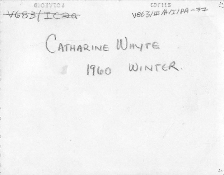
[Catharine Whyte reading newspaper]
https://archives.whyte.org/en/permalink/descriptions50211
- Part Of
- Peter and Catharine Whyte fonds
- Scope & Content
- Image of Catharine Whyte reading newspaper in her home
- Date Range
- 1960
- Reference Code
- V683 / III / A / 1 / PA - 77
- Description Level
- 6 / Item
- GMD
- Photograph
2 images
- Part Of
- Peter and Catharine Whyte fonds
- Description Level
- 6 / Item
- Fonds Number
- M36 / V683 / S37
- Series
- V683 / III / A / 1 : Peter and Catharine Whyte: Personal Photographs
- Sous-Fonds
- V683
- Accession Number
- .
- Reference Code
- V683 / III / A / 1 / PA - 77
- GMD
- Photograph
- Date Range
- 1960
- Physical Description
- Photographs: 1 print; b&w
- Scope & Content
- Image of Catharine Whyte reading newspaper in her home
- Name Access
- Whyte, Catharine
- Geographic Access
- Banff
- Language
- English
- Title Source
- Title based on item
- Processing Status
- Processed
Images

This material is presented as originally created; it may contain outdated cultural descriptions and
potentially offensive content.
Read more.
[South America]
https://archives.whyte.org/en/permalink/catalogue24831
- Medium
- Library - Maps and blueprints (unannotated; published)
- Map
- Published Date
- 1960
- Publisher
- National Geographic Society
- Call Number
- C13-3.3
- Publisher
- National Geographic Society
- Published Date
- 1960
- Scale
- Scale: 192 miles to 1 inch
- Relief: Bench marks
- Subjects
- South America
- Accession Number
- 495
- Call Number
- C13-3.3
- Collection
- Archives Library
This material is presented as originally created; it may contain outdated cultural descriptions and
potentially offensive content.
Read more.
[Ashnola 92H/1 East, B.C.]
https://archives.whyte.org/en/permalink/catalogue23452
- Medium
- Library - Maps and blueprints (unannotated; published)
- Map
- Published Date
- 1960
- Publisher
- Army Survey Establishment
- Call Number
- NTS
- 92H/1E
- Publisher
- Army Survey Establishment
- Published Date
- 1960
- Physical Description
- 1 map : col
- Scale
- Scale: 1:50,000
- Relief: Contour interval 100 ft.
- Subjects
- Ashnola
- British Columbia
- Notes
- National Topographic System
- Accession Number
- 7000
- Call Number
- NTS
- 92H/1E
- Collection
- Archives Library
This material is presented as originally created; it may contain outdated cultural descriptions and
potentially offensive content.
Read more.
[Ashnola 92H/1 West, B.C.]
https://archives.whyte.org/en/permalink/catalogue23453
- Medium
- Library - Maps and blueprints (unannotated; published)
- Map
- Published Date
- 1960
- Publisher
- Army Survey Establishment
- Call Number
- NTS
- 92H/1W
- Publisher
- Army Survey Establishment
- Published Date
- 1960
- Physical Description
- 1 map : col
- Scale
- Scale: 1:50,000
- Relief: Contour interval 100 ft.
- Subjects
- Ashnola
- British Columbia
- Notes
- National Topographic System
- Accession Number
- 7000
- Call Number
- NTS
- 92H/1W
- Collection
- Archives Library
This material is presented as originally created; it may contain outdated cultural descriptions and
potentially offensive content.
Read more.
[Barrier Mountain 820/12 East, Alberta]
https://archives.whyte.org/en/permalink/catalogue23484
- Medium
- Library - Maps and blueprints (unannotated; published)
- Map
- Published Date
- 1960
- Publisher
- Dept. of Mines and Technical Surveys
- Call Number
- NTS
- 820/12E
- Publisher
- Dept. of Mines and Technical Surveys
- Published Date
- 1960
- Physical Description
- 1 map : col
- Scale
- Scale: 1:50,000
- Relief: Contour interval 100'
- Subjects
- Barrier Mountain
- Alberta
- Notes
- National Topographic System
- Accession Number
- 6283
- Call Number
- NTS
- 820/12E
- Collection
- Archives Library
This material is presented as originally created; it may contain outdated cultural descriptions and
potentially offensive content.
Read more.
[Barrier Mountain 820/12 West, Alberta]
https://archives.whyte.org/en/permalink/catalogue23485
- Medium
- Library - Maps and blueprints (unannotated; published)
- Map
- Published Date
- 1960
- Publisher
- Dept. of Mines and Technical Surveys
- Call Number
- NTS
- 820/12W
- Publisher
- Dept. of Mines and Technical Surveys
- Published Date
- 1960
- Physical Description
- 1 map : col
- Scale
- Scale: 1:50,000
- Relief: Contour interval 100'
- Subjects
- Barrier Mountain
- Alberta
- Notes
- National Topographic System
- Accession Number
- 6283
- Call Number
- NTS
- 820/12W
- Collection
- Archives Library
This material is presented as originally created; it may contain outdated cultural descriptions and
potentially offensive content.
Read more.
[Beaver Mines 82G/8 East, Alberta]
https://archives.whyte.org/en/permalink/catalogue23490
- Medium
- Library - Maps and blueprints (unannotated; published)
- Map
- Published Date
- 1960
- Publisher
- Dept of Mines and Techinical Surveys
- Call Number
- NTS
- 82G/8E
- Publisher
- Dept of Mines and Techinical Surveys
- Published Date
- 1960
- Scale
- Scale: 1 : 50,000
- Relief: Contour interval 100'
- Subjects
- Beaver Mines
- East Alberta
- Notes
- National Topographic System
- Call Number
- NTS
- 82G/8E
- Collection
- Archives Library
This material is presented as originally created; it may contain outdated cultural descriptions and
potentially offensive content.
Read more.
[Beaver Mines 82G/8 West, Alberta-B.C.]
https://archives.whyte.org/en/permalink/catalogue23491
- Medium
- Library - Maps and blueprints (unannotated; published)
- Map
- Published Date
- 1960
- Publisher
- Dept of Mines and Techinical Surveys
- Call Number
- NTS
- 82G/8W
- Publisher
- Dept of Mines and Techinical Surveys
- Published Date
- 1960
- Physical Description
- 1 map : col
- Scale
- Scale: 1:50,000
- Relief: Contour interval 100'
- Subjects
- Beaver Mines
- West Alberta-B.C.
- Notes
- National Topographic System
- Call Number
- NTS
- 82G/8W
- Collection
- Archives Library
This material is presented as originally created; it may contain outdated cultural descriptions and
potentially offensive content.
Read more.
[Blue Creek 83E/7 East, Alta.]
https://archives.whyte.org/en/permalink/catalogue23503
- Medium
- Library - Maps and blueprints (unannotated; published)
- Map
- Published Date
- 1960
- Publisher
- Dept. of Mines and Techinical Surveys
- Call Number
- NTS
- 83E/7E
- Publisher
- Dept. of Mines and Techinical Surveys
- Published Date
- 1960
- Physical Description
- 1 map : col
- Scale
- Scale: 1: 50,000
- Relief: Contour Interval 100 feet
- Subjects
- Blue Creek
- Eastern Alberta
- Notes
- National Topographic System
- Accession Number
- 3000
- Call Number
- NTS
- 83E/7E
- Collection
- Archives Library
This material is presented as originally created; it may contain outdated cultural descriptions and
potentially offensive content.
Read more.
[Blue Creek 83E/7 West, Alta.]
https://archives.whyte.org/en/permalink/catalogue23504
- Medium
- Library - Maps and blueprints (unannotated; published)
- Map
- Published Date
- 1960
- Publisher
- Dept. of Mines and Techinical Surveys
- Call Number
- NTS
- 83E/7W
- Publisher
- Dept. of Mines and Techinical Surveys
- Published Date
- 1960
- Physical Description
- 1 map : col
- Scale
- Scale: 1:50,000
- Relief: Contour Interval 100 ft.
- Subjects
- Blue Creek
- Western Alberta
- Notes
- National Topographic System
- Accession Number
- 3000
- Call Number
- NTS
- 83E/7W
- Collection
- Archives Library
This material is presented as originally created; it may contain outdated cultural descriptions and
potentially offensive content.
Read more.
[Cheakamus River, B.C.]
https://archives.whyte.org/en/permalink/catalogue23548
- Medium
- Library - Maps and blueprints (unannotated; published)
- Map
- Published Date
- 1960
- Publisher
- Dept. of Lands and Forests
- Call Number
- NTS
- 92G/14E
- Publisher
- Dept. of Lands and Forests
- Published Date
- 1960
- Physical Description
- 1 map : col
- Scale
- Scale: 1:50,000
- Relief: Contour Interval 100'
- Subjects
- Cheakamus River
- British Columbia
- Notes
- National Topographic System
- Accession Number
- 1045
- Call Number
- NTS
- 92G/14E
- Collection
- Archives Library
This material is presented as originally created; it may contain outdated cultural descriptions and
potentially offensive content.
Read more.
[Cheakamus River, B.C.]
https://archives.whyte.org/en/permalink/catalogue23549
- Medium
- Library - Maps and blueprints (unannotated; published)
- Map
- Published Date
- 1960
- Publisher
- Dept. of Lands and Forests
- Call Number
- NTS
- 92G/14W
- Publisher
- Dept. of Lands and Forests
- Published Date
- 1960
- Physical Description
- 1 map : col
- Scale
- Scale: 1:50,000
- Relief: Contour Interval 100 feet
- Subjects
- Cheakamus River
- British Columbia
- Notes
- National Topographic System
- Accession Number
- 1045
- Call Number
- NTS
- 92G/14W
- Collection
- Archives Library
This material is presented as originally created; it may contain outdated cultural descriptions and
potentially offensive content.
Read more.
[Elko 82G/6E, B.C.]
https://archives.whyte.org/en/permalink/catalogue23602
- Medium
- Library - Maps and blueprints (unannotated; published)
- Map
- Published Date
- 1960
- Publisher
- Dept. of Mines and Technical Surveys
- Call Number
- NTS
- 82G/6E
- Publisher
- Dept. of Mines and Technical Surveys
- Published Date
- 1960
- Physical Description
- 1 map : col
- Scale
- Scale: 1:50,000
- Relief: Contour interval 100'
- Subjects
- Elko
- British Columbia
- Notes
- National Topographic System
- Call Number
- NTS
- 82G/6E
- Collection
- Archives Library
This material is presented as originally created; it may contain outdated cultural descriptions and
potentially offensive content.
Read more.
[Elko 82G/6 West, B.C.]
https://archives.whyte.org/en/permalink/catalogue23603
- Medium
- Library - Maps and blueprints (unannotated; published)
- Map
- Published Date
- 1960
- Publisher
- Dept. of Minesand Technical Surveys
- Call Number
- NTS
- 82G/6W
- Publisher
- Dept. of Minesand Technical Surveys
- Published Date
- 1960
- Physical Description
- 1 map : col
- Scale
- Scale: 1:50,000
- Relief: Contour interval 100'
- Subjects
- Elko
- British Columbia
- Notes
- National Topographic System
- Call Number
- NTS
- 82G/6W
- Collection
- Archives Library
This material is presented as originally created; it may contain outdated cultural descriptions and
potentially offensive content.
Read more.
[Fording River 82J/2 East, B.C.-Alberta]
https://archives.whyte.org/en/permalink/catalogue23619
- Medium
- Library - Maps and blueprints (unannotated; published)
- Map
- Published Date
- 1960
- Publisher
- Dept. of Mines and Technical Surveys
- Call Number
- NTS
- 82J/2E
- Publisher
- Dept. of Mines and Technical Surveys
- Published Date
- 1960
- Physical Description
- 1 map : col
- Scale
- Scale: 1:50,000
- Relief: Contour interval 100'
- Subjects
- Fording River
- British Columbia/Alberta
- Notes
- National Topographic System
- Call Number
- NTS
- 82J/2E
- Collection
- Archives Library
This material is presented as originally created; it may contain outdated cultural descriptions and
potentially offensive content.
Read more.
[Fording River 82J/2W, B.C.-Alberta]
https://archives.whyte.org/en/permalink/catalogue23620
- Medium
- Library - Maps and blueprints (unannotated; published)
- Map
- Published Date
- 1960
- Publisher
- Dept. of Mines and Technical Surveys
- Call Number
- NTS
- 82J/2W
- Publisher
- Dept. of Mines and Technical Surveys
- Published Date
- 1960
- Physical Description
- 1 map : col
- Scale
- Scale: 1:50,000
- Relief: Contour interval 100'
- Subjects
- Fording River 82J/2W, B.C.-Alberta
- Notes
- National Topographic System
- Call Number
- NTS
- 82J/2W
- Collection
- Archives Library
This material is presented as originally created; it may contain outdated cultural descriptions and
potentially offensive content.
Read more.
[Job Creek 83 C/7 East - Alberta]
https://archives.whyte.org/en/permalink/catalogue23683
- Medium
- Library - Maps and blueprints (unannotated; published)
- Map
- Published Date
- 1960
- Publisher
- Dept. of Mines and Technical Surveys
- Call Number
- NTS
- 83C/7E
- Publisher
- Dept. of Mines and Technical Surveys
- Published Date
- 1960
- Physical Description
- Colour
- Scale
- Scale: 1:50,000
- Relief: Contour interval 100'
- Subjects
- Job Creek 83 C/7 East - Alberta
- Notes
- National Topographic System
- Accession Number
- 717
- Call Number
- NTS
- 83C/7E
- Collection
- Archives Library
This material is presented as originally created; it may contain outdated cultural descriptions and
potentially offensive content.
Read more.
[Job Creek 83 C/7 West - Alberta]
https://archives.whyte.org/en/permalink/catalogue23684
- Medium
- Library - Maps and blueprints (unannotated; published)
- Map
- Published Date
- 1960
- Publisher
- Dept. of Mines and Technical Surveys
- Call Number
- NTS
- 83C/7W
- Publisher
- Dept. of Mines and Technical Surveys
- Published Date
- 1960
- Physical Description
- Colour
- Scale
- Scale: 1:50,000
- Relief: Contour interval 100'
- Subjects
- Job Creek 83 C/7 West - Alberta
- Notes
- National Topographic System
- Accession Number
- 717
- Call Number
- NTS
- 83C/7W
- Collection
- Archives Library
This material is presented as originally created; it may contain outdated cultural descriptions and
potentially offensive content.
Read more.
[Manning Park 92H/2E - B.C.]
https://archives.whyte.org/en/permalink/catalogue23729
- Medium
- Library - Maps and blueprints (unannotated; published)
- Map
- Published Date
- 1960
- Publisher
- Army Survey Establishment
- Call Number
- NTS
- 92H/2E
- Publisher
- Army Survey Establishment
- Published Date
- 1960
- Physical Description
- Colour
- Scale
- Scale: 1:50,000
- Relief: Contour interval 100 ft.
- Subjects
- Manning Park 92H/2E - B.C.
- Notes
- National Topographic System
- Accession Number
- 7000
- Call Number
- NTS
- 92H/2E
- Collection
- Archives Library
This material is presented as originally created; it may contain outdated cultural descriptions and
potentially offensive content.
Read more.
[Manning Park 92H/2W - B.C.]
https://archives.whyte.org/en/permalink/catalogue23730
- Medium
- Library - Maps and blueprints (unannotated; published)
- Map
- Published Date
- 1960
- Publisher
- Army Survey Establishment
- Call Number
- NTS
- 92H/2W
- Publisher
- Army Survey Establishment
- Published Date
- 1960
- Physical Description
- Colour
- Scale
- Scale: 1:50,000
- Relief: Contour interval 100 ft.
- Subjects
- Manning Park 92H/2W - B.C.
- Notes
- National Topographic System
- Accession Number
- 7000
- Call Number
- NTS
- 92H/2W
- Collection
- Archives Library
This material is presented as originally created; it may contain outdated cultural descriptions and
potentially offensive content.
Read more.