Narrow Results By
- Luxton family fonds 62
- Moore family fonds 19
- Nicholas Morant fonds 11
- Mary (Molly) Wright Adams fonds 9
- Kidney family fonds 6
- Malcolm Geddes fonds 5
- Dorothy Wardle fonds 4
- Archives General File Collection 3
- Arthur Oliver Wheeler fonds 3
- Canadian Pacific Railway fonds 3
- John Murray Gibbon fonds 3
- Crosby family fonds 2
Map showing Yellowhead Pass route from Edmonton to Tete-Jaune Cache
https://archives.whyte.org/en/permalink/catalogue24300
- Medium
- Library - Maps and blueprints (unannotated; published)
- Map
- Published Date
- 1900
- Publisher
- Geological Survey
- Call Number
- C6-3.3
- Publisher
- Geological Survey
- Published Date
- 1900
- Physical Description
- Colour
- Scale
- Scale: 8 miles to 1 inch
- Relief: Contour interval approx. 1000 ft.
- Subjects
- Yellowhead Pass
- Accession Number
- 1000
- Call Number
- C6-3.3
- Collection
- Archives Library
This material is presented as originally created; it may contain outdated cultural descriptions and
potentially offensive content.
Read more.
[Yukon District] Klondike Gold Fields
https://archives.whyte.org/en/permalink/catalogue24373
- Medium
- Library - Maps and blueprints (unannotated; published)
- Map
- Published Date
- 1900
- Publisher
- Dept. of the Interior
- Call Number
- C8-2.5
- Publisher
- Dept. of the Interior
- Published Date
- 1900
- Scale
- Scale: 2 miles - 1 inch
- Subjects
- Yukon District
- Notes
- Duplicate: C7-4.1
- Accession Number
- 400
- Call Number
- C8-2.5
- Collection
- Archives Library
This material is presented as originally created; it may contain outdated cultural descriptions and
potentially offensive content.
Read more.
Showing part of the Summit Range of the Canadian Rocky Mountains
https://archives.whyte.org/en/permalink/catalogue24615
- Medium
- Library - Maps and blueprints (unannotated; published)
- Map
- Published Date
- 1900
- Author
- Wilcox, Walter D.
- Call Number
- C3-2.1a
- Author
- Wilcox, Walter D.
- Responsibility
- Surveyed and drawn by Walter D. Wilcox
- Published Date
- 1900
- Physical Description
- Colour
- Scale
- Scale: 1 1/2 inch = 1 mile
- Relief: Contour interval 100'
- Subjects
- Lake Louise
- Notes
- Photostatic copy
- Accession Number
- 400
- 675
- Call Number
- C3-2.1a
- Collection
- Archives Library
This material is presented as originally created; it may contain outdated cultural descriptions and
potentially offensive content.
Read more.
[Index to Top. Sheets of Rocky Mountains]
https://archives.whyte.org/en/permalink/catalogue24641
- Medium
- Library - Maps and blueprints (unannotated; published)
- Map
- Published Date
- 1900
- Publisher
- Dept. of the Interior
- Call Number
- C3-8.1 (a)
- C3-8.1 (b)
- Publisher
- Dept. of the Interior
- Published Date
- 1900
- Scale
- (a): 25,000' to 1 inch; 1:300,000
- (b): 20,000' to 1 inch; 1:240,000
- Notes
- Photostatic copy from Public Archives
- Accession Number
- 675
- 1192
- Call Number
- C3-8.1 (a)
- C3-8.1 (b)
- Collection
- Archives Library
This material is presented as originally created; it may contain outdated cultural descriptions and
potentially offensive content.
Read more.
Map showing Yellowhead Pass route from Edmonton to Tete Jaune Cache
https://archives.whyte.org/en/permalink/catalogue24713
- Medium
- Library - Book (including soft-cover and pamphlets)
- Map
- Published Date
- 1900
- Author
- McEvoy, J.
- Publisher
- Ottawa : Geological Survey of Canada
- Call Number
- C7-1.25
- Author
- McEvoy, J.
- Responsibility
- compiled and drawn by J. McEvoy
- Publisher
- Ottawa : Geological Survey of Canada
- Published Date
- 1900
- Physical Description
- 1 map : col
- Scale
- 1:506,880
- Accession Number
- 2933
- 5670
- Call Number
- C7-1.25
- Collection
- Archives Library
This material is presented as originally created; it may contain outdated cultural descriptions and
potentially offensive content.
Read more.
Geological Survey
https://archives.whyte.org/en/permalink/catalogue24755
- Medium
- Library - Book (including soft-cover and pamphlets)
- Map
- Published Date
- 1900
- Publisher
- Dept. of the Interior, Ottawa
- Call Number
- C7-4.1
- Publisher
- Dept. of the Interior, Ottawa
- Published Date
- 1900
- Scale
- 2 miles to 1 inch
- Notes
- Dup. C8-4.2
- Accession Number
- 400
- Call Number
- C7-4.1
- Collection
- Archives Library
This material is presented as originally created; it may contain outdated cultural descriptions and
potentially offensive content.
Read more.
Geological Survey
https://archives.whyte.org/en/permalink/catalogue24773
- Medium
- Library - Book (including soft-cover and pamphlets)
- Map
- Published Date
- 1900
- Call Number
- C7-6.1(a)
- Published Date
- 1900
- Physical Description
- Colour
- Scale
- Scale: 4 miles to 1 inch
- Relief: Bench marks
- Subjects
- New Brunswick - Andover Sheet
- Accession Number
- 400
- Call Number
- C7-6.1(a)
- Collection
- Archives Library
This material is presented as originally created; it may contain outdated cultural descriptions and
potentially offensive content.
Read more.
[New Brunswick - Fredericton Sheet]
https://archives.whyte.org/en/permalink/catalogue24774
- Medium
- Library - Book (including soft-cover and pamphlets)
- Map
- Published Date
- 1900
- Publisher
- Geological Survey
- Call Number
- C7-6.1(b)
- Publisher
- Geological Survey
- Published Date
- 1900
- Scale
- Relief: Bench marks
- Scale: 4 miles to 1 inch
- Subjects
- New Brunswick - Frederiction Sheet
- Accession Number
- 400
- Call Number
- C7-6.1(b)
- Collection
- Archives Library
This material is presented as originally created; it may contain outdated cultural descriptions and
potentially offensive content.
Read more.
Iron ores and other minerals
https://archives.whyte.org/en/permalink/catalogue24783
- Medium
- Library - Book (including soft-cover and pamphlets)
- Map
- Published Date
- 1900
- Publisher
- Dept. of Crown Lands of Ontario. Geological Survey of Canada
- Call Number
- C7-6.10
- Publisher
- Dept. of Crown Lands of Ontario. Geological Survey of Canada
- Published Date
- 1900
- Physical Description
- Colour
- Scale
- 1:126,720
- Accession Number
- 400
- Call Number
- C7-6.10
- Collection
- Archives Library
This material is presented as originally created; it may contain outdated cultural descriptions and
potentially offensive content.
Read more.
Maps of exploration survey of divide between Great Slave Lake and Hudson Bay
https://archives.whyte.org/en/permalink/catalogue21400
- Medium
- Library - Maps and blueprints (unannotated; published)
- Map
- Published Date
- 1900
- Publisher
- Districts of MacKenzie and Keewatin, Dominion of Canada
- Call Number
- C8-3.3(a-v)
- Publisher
- Districts of MacKenzie and Keewatin, Dominion of Canada
- Published Date
- 1900
- Notes
- See: Sheets 1-22 (no. 11 missing)
- Accession Number
- 1248
- Call Number
- C8-3.3(a-v)
- Collection
- Archives Library
This material is presented as originally created; it may contain outdated cultural descriptions and
potentially offensive content.
Read more.
Showing rivers and Indian trails
https://archives.whyte.org/en/permalink/catalogue21450
- Medium
- Library - Maps and blueprints (unannotated; published)
- Map
- Published Date
- 1900
- Call Number
- C3-8.22
- Published Date
- 1900
- Subjects
- Rocky Mountains (2 Sections)
- Notes
- Photostatic copy from Public Archives
- Accession Number
- 675
- Call Number
- C3-8.22
- Collection
- Archives Library
This material is presented as originally created; it may contain outdated cultural descriptions and
potentially offensive content.
Read more.
Drainage Patterns
https://archives.whyte.org/en/permalink/catalogue21492
- Medium
- Library - Maps and blueprints (unannotated; published)
- Map
- Published Date
- 1900
- Call Number
- C12-1.17
- Published Date
- 1900
- Subjects
- Rocky Mountains
- Notes
- 2 sections
- Photostatic copy from Public Archives
- Accession Number
- 675
- Call Number
- C12-1.17
- Collection
- Archives Library
This material is presented as originally created; it may contain outdated cultural descriptions and
potentially offensive content.
Read more.
Map showing Yellowhead Pass route from Edmonton to Tete-Jaune Cache
https://archives.whyte.org/en/permalink/catalogue23367
- Medium
- Library - Maps and blueprints (unannotated; published)
- Map
- Published Date
- 1900
- Publisher
- Geological Survey
- Call Number
- C6-3.3
- Publisher
- Geological Survey
- Published Date
- 1900
- Physical Description
- Colour
- Scale
- Scale: 8 miles to 1 inch
- Relief: Contour interval approx. 1000 ft.
- Subjects
- Yellowhead Pass
- Accession Number
- 1000
- Call Number
- C6-3.3
- Collection
- Archives Library
This material is presented as originally created; it may contain outdated cultural descriptions and
potentially offensive content.
Read more.
[Canada] National Transcontinental Railway route
https://archives.whyte.org/en/permalink/catalogue24553
- Medium
- Library - Maps and blueprints (unannotated; published)
- Map
- Published Date
- 1901
- Publisher
- Dept. of the Interior
- Call Number
- C11-3.3
- Publisher
- Dept. of the Interior
- Published Date
- 1901
- Scale
- Scale: 100 miles to 1 inch
- Subjects
- Canada
- Railway routes
- Accession Number
- 400
- Call Number
- C11-3.3
- Collection
- Archives Library
This material is presented as originally created; it may contain outdated cultural descriptions and
potentially offensive content.
Read more.
Geological map of the Dominion of Canada (western sheet)
https://archives.whyte.org/en/permalink/catalogue24772
- Medium
- Library - Book (including soft-cover and pamphlets)
- Map
- Published Date
- 1901
- Publisher
- [Ottawa : Geolocial Survey of Canada?]
- Edition
- 1901 ed.
- Call Number
- C7-5.8
- Edition
- 1901 ed.
- Publisher
- [Ottawa : Geolocial Survey of Canada?]
- Published Date
- 1901
- Physical Description
- 1 map : col
- Scale
- 1 inch = 50 miles
- Subjects
- Geology - The West, Canadian
- Accession Number
- 576
- Call Number
- C7-5.8
- Collection
- Archives Library
This material is presented as originally created; it may contain outdated cultural descriptions and
potentially offensive content.
Read more.
Geological survey of Canada
https://archives.whyte.org/en/permalink/catalogue24784
- Medium
- Library - Book (including soft-cover and pamphlets)
- Map
- Published Date
- 1901
- Publisher
- Dept. of Crown Lands of Ontario
- Call Number
- C7-6.11
- Publisher
- Dept. of Crown Lands of Ontario
- Published Date
- 1901
- Physical Description
- Colour
- Scale
- 1 mile to 1 inch
- Subjects
- Ottawa and Vicinity
- Accession Number
- 400
- Call Number
- C7-6.11
- Collection
- Archives Library
This material is presented as originally created; it may contain outdated cultural descriptions and
potentially offensive content.
Read more.
[Yoho Park Reserve]
https://archives.whyte.org/en/permalink/catalogue23197
- Medium
- Library - Maps and blueprints (unannotated; published)
- Map
- Published Date
- 1901
- Publisher
- Dept. of the Interior, Ottawa
- Call Number
- C2-4.1
- Publisher
- Dept. of the Interior, Ottawa
- Published Date
- 1901
- Physical Description
- 1 map : black and white
- Scale
- Scale: 2 miles to 1 inch
- Bench marks
- Subjects
- Yoho Park Reserve
- Accession Number
- 400
- Call Number
- C2-4.1
- Collection
- Archives Library
This material is presented as originally created; it may contain outdated cultural descriptions and
potentially offensive content.
Read more.
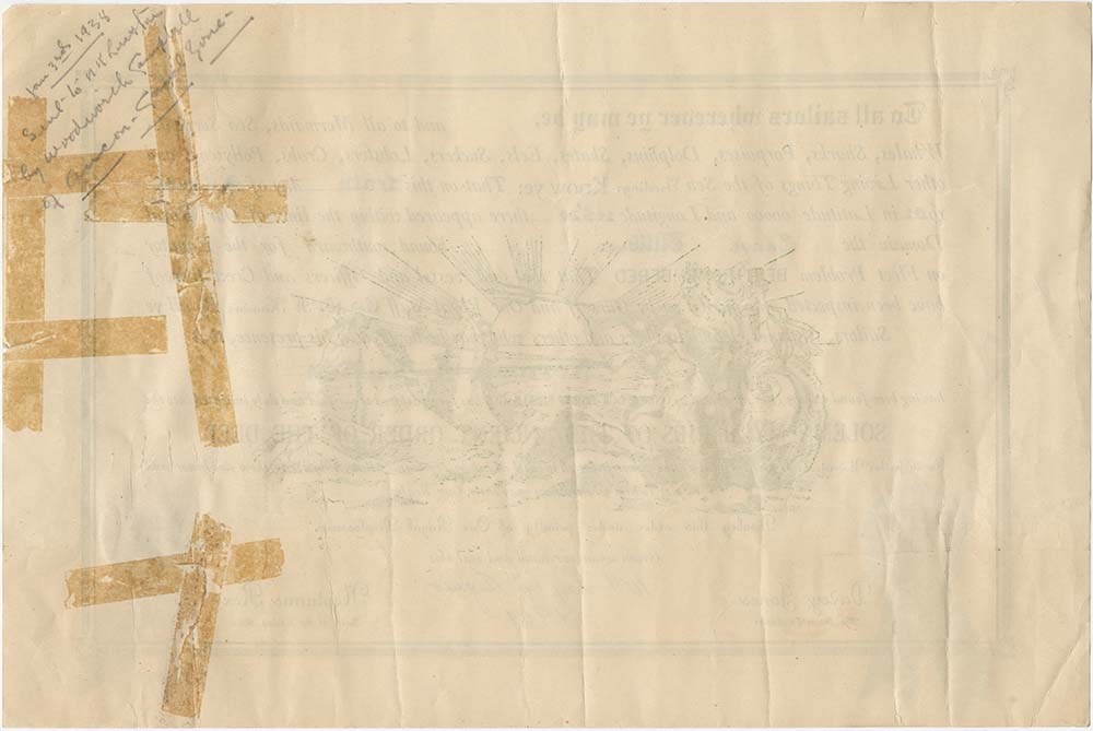
Tilikum certificate, 1901
https://archives.whyte.org/en/permalink/descriptions55640
- Part Of
- Luxton family fonds
- Scope & Content
- File consists of one certificate created by Woodworth Campbell and given to Norman Luxton in 1938 to celebrate his arrival in Australia during his expedition aboard the Tilikum dugout canoe in 1901.
- Date Range
- 1901
- Reference Code
- LUX / I / B1 / 19
- Description Level
- 5 / File
- GMD
- Textual record
2 images
- Part Of
- Luxton family fonds
- Description Level
- 5 / File
- Fonds Number
- LUX
- Series
- LUX / I / B1 : Tilikum voyage
- Sous-Fonds
- LUX / I : Norman Luxton sous-fonds
- Sub-Series
- LUX / I / B1 / 19 :
- Accession Number
- LUX
- Reference Code
- LUX / I / B1 / 19
- GMD
- Textual record
- Date Range
- 1901
- Physical Description
- 0.1 cm of textual records (1 certificate : 38 x 25 cm)
- Scope & Content
- File consists of one certificate created by Woodworth Campbell and given to Norman Luxton in 1938 to celebrate his arrival in Australia during his expedition aboard the Tilikum dugout canoe in 1901.
- Material Details
- Certificate has one blue ribbon and one red ribbon attached to bottom left and right corners, respectively
- Name Access
- Luxton, Norman
- Campbell, Woodworth
- Subject Access
- Canoes and canoeing
- Exploration
- Travel
- Geographic Access
- Australia
- Language
- English
- Conservation
- Item stored in mylar
- Category
- Exploration, discovery and travel
- Title Source
- Title based on contents of file
- Processing Status
- Processed
Images

This material is presented as originally created; it may contain outdated cultural descriptions and
potentially offensive content.
Read more.
Photograph Books 1901
https://archives.whyte.org/en/permalink/descriptions56683
- Part Of
- Arthur Oliver Wheeler fonds
- Scope & Content
- File consists of four notebooks labelled "1901, Photograph Book, No. 1 to No. 4 A.O. Wheeler D.LS." Each notebook contains notes written in pencil regarding photographs that A.O. Wheeler took during the Selkirk Mountain Survey he did in 1901.
- Date Range
- 1901
- Reference Code
- M546 / 56 - 59
- Description Level
- 5 / File
- GMD
- Textual record
- Part Of
- Arthur Oliver Wheeler fonds
- Description Level
- 5 / File
- Fonds Number
- M546 / V771
- Sous-Fonds
- M546
- Accession Number
- 8160
- Reference Code
- M546 / 56 - 59
- GMD
- Textual record
- Date Range
- 1901
- Physical Description
- 4 vol. textual records
- Scope & Content
- File consists of four notebooks labelled "1901, Photograph Book, No. 1 to No. 4 A.O. Wheeler D.LS." Each notebook contains notes written in pencil regarding photographs that A.O. Wheeler took during the Selkirk Mountain Survey he did in 1901.
- Name Access
- Arthur Oliver Wheeler
- A.O. Wheeler
- Language
- English
- Creator
- Arthur Oliver Wheeler
- Title Source
- Title based on contents of file
- Processing Status
- Processed
This material is presented as originally created; it may contain outdated cultural descriptions and
potentially offensive content.
Read more.
Map showing exploration between Lakes Winnipeg, Manitoba and Winnipegosis
https://archives.whyte.org/en/permalink/catalogue24597
- Medium
- Library - Maps and blueprints (unannotated; published)
- Map
- Published Date
- February 1901
- Publisher
- Department of the Interior
- Call Number
- C11-6.20
- Publisher
- Department of the Interior
- Published Date
- February 1901
- Scale
- 6 miles - 1 inch
- Subjects
- Canada - Prairie Region
- Manitoba
- Notes
- To accompany the report of Thos. Turnbull D.L.S.
- Accession Number
- 400
- Call Number
- C11-6.20
- Collection
- Archives Library
This material is presented as originally created; it may contain outdated cultural descriptions and
potentially offensive content.
Read more.