Narrow Results By
Map of North America engraved to illustrate Mitchell's school and family geography
https://archives.whyte.org/en/permalink/catalogue24834
- Medium
- Library - Maps and blueprints (unannotated; published)
- Map
- Published Date
- 1852
- Publisher
- Pennsylvania : S. Augustus Mitchell
- Call Number
- C13.4.6
- Publisher
- Pennsylvania : S. Augustus Mitchell
- Published Date
- 1852
- Physical Description
- 1 map : col
- Scale
- 1 inch = ca 600 miles
- Subjects
- North America
- Hooker, Mount
- Brown, Mount
- Notes
- Map shows Mts. Hooker and Brown, and gives altitudes of same
- Accession Number
- 3612
- Call Number
- C13.4.6
- Collection
- Archives Library
This material is presented as originally created; it may contain outdated cultural descriptions and
potentially offensive content.
Read more.
Stations of the Church Missionary Society
https://archives.whyte.org/en/permalink/catalogue21486
- Medium
- Library - Maps and blueprints (unannotated; published)
- Map
- Published Date
- 1852
- Call Number
- C12-1.10
- Published Date
- 1852
- Subjects
- Hudson's Bay Company's Territories
- Notes
- Route of the Bishop of Montreal from Quebec to Red River in 1844
- Photostatic copy from Public Archives
- Accession Number
- 675
- Call Number
- C12-1.10
- Collection
- Archives Library
This material is presented as originally created; it may contain outdated cultural descriptions and
potentially offensive content.
Read more.
Danubian Principalities
https://archives.whyte.org/en/permalink/catalogue21541
- Medium
- Library - Maps and blueprints (unannotated; published)
- Map
- Published Date
- 1854
- Publisher
- W and A.K. Johnston, Edinburgh
- Call Number
- C13-12.17
- Publisher
- W and A.K. Johnston, Edinburgh
- Published Date
- 1854
- Subjects
- Europe - Central & Eastern
- Accession Number
- 400
- Call Number
- C13-12.17
- Collection
- Archives Library
This material is presented as originally created; it may contain outdated cultural descriptions and
potentially offensive content.
Read more.
Princess May Shipwreck Framed Print
https://archives.whyte.org/en/permalink/descriptions54228
- Part Of
- Nicholas Morant fonds
- Scope & Content
- 1 framed print, signed and annotated by W.H. Case (presumably the creator of the photograph), depicting shipwrecked S.S. Princess May, 1910 (Canadian Pacific envelope attached to the back, contains 2 news clippings about the Princess May ship and one page detailing the cargo weights, measurements, …
- Date Range
- 1910
- Reference Code
- V500 / III / D / 4 / PC - 8 O.S.
- Description Level
- 6 / Item
- GMD
- Photograph
- Photograph print
- Textual record
- Part Of
- Nicholas Morant fonds
- Description Level
- 6 / Item
- Fonds Number
- M300 / V500 / S20
- Sous-Fonds
- V500
- Sub-Series
- V500 / III / D / 4 : Personal and Family Photography
- Accession Number
- 7784
- Reference Code
- V500 / III / D / 4 / PC - 8 O.S.
- Responsibility
- Nicholas Morant
- Date Range
- 1910
- Physical Description
- 1 Framed Photograph: print; b&w
- Scope & Content
- 1 framed print, signed and annotated by W.H. Case (presumably the creator of the photograph), depicting shipwrecked S.S. Princess May, 1910 (Canadian Pacific envelope attached to the back, contains 2 news clippings about the Princess May ship and one page detailing the cargo weights, measurements, etc. of the same ship).
- Notes
- Print annotated with the following: "C.P.R. CO. S.S. PRINCESS MAY, WRECKED, ON SENTINEL IS. ALASKA. AUG. 5. 1910." "W.H. CASE 433"
- Name Access
- Case, W.H.
- Geographic Access
- United States of America
- Alaska
- Access Restrictions
- This item is not to be accessed or distributed without the explicit permission of its identified owner(s).
- Reproduction Restrictions
- This item is not to be reproduced without the explicit permission of its identified owner(s).
- Language
- English
- Creator
- W.H. Case
- Title Source
- Title based on contents of file
- Processing Status
- Processed
This material is presented as originally created; it may contain outdated cultural descriptions and
potentially offensive content.
Read more.
[Rocky Mountains and Yoho Park]
https://archives.whyte.org/en/permalink/catalogue24800
- Medium
- Library - Maps and blueprints (unannotated; published)
- Map
- Published Date
- 1910
- Publisher
- Ottawa : Dept. of the Interior
- Call Number
- C12-1.31
- Publisher
- Ottawa : Dept. of the Interior
- Published Date
- 1910
- Physical Description
- 1 map -- (NMC0014969)
- Scale
- indeterminable
- Notes
- Title information taken from notes pencilled on reverse
- National Map Collection photostat, July 4, 1980
- Call Number
- C12-1.31
- Collection
- Archives Library
This material is presented as originally created; it may contain outdated cultural descriptions and
potentially offensive content.
Read more.
Map of Pelly, Ross and Gravel Rivers
https://archives.whyte.org/en/permalink/catalogue24369
- Medium
- Library - Maps and blueprints (unannotated; published)
- Map
- Published Date
- 1910
- Publisher
- Dept. of Mines and Geological Survey
- Call Number
- C8-1.3
- Publisher
- Dept. of Mines and Geological Survey
- Published Date
- 1910
- Scale
- 8 miles to 1 inch
- Subjects
- Yukon and North West Territories
- Notes
- Sources of info: G.M. Dawson, R.G. McConn., J. Keele, W. Ogilvie
- Accession Number
- 576
- Call Number
- C8-1.3
- Collection
- Archives Library
This material is presented as originally created; it may contain outdated cultural descriptions and
potentially offensive content.
Read more.
[Alberta] South-central portion
https://archives.whyte.org/en/permalink/catalogue24416
- Medium
- Library - Maps and blueprints (unannotated; published)
- Map
- Published Date
- 1910
- Publisher
- Dept. of the Interior, Ottawa
- Call Number
- C9-3.1
- Publisher
- Dept. of the Interior, Ottawa
- Published Date
- 1910
- Scale
- Bench marks
- Subjects
- Alberta
- Notes
- 1 duplicate in map room - Accn. 400
- Accession Number
- 400
- Call Number
- C9-3.1
- Collection
- Archives Library
This material is presented as originally created; it may contain outdated cultural descriptions and
potentially offensive content.
Read more.
Sectional map
https://archives.whyte.org/en/permalink/catalogue24464
- Medium
- Library - Maps and blueprints (unannotated; published)
- Map
- Published Date
- 1910
- Publisher
- Dept. of the Interior, Ottawa
- Call Number
- C9-6.4
- Publisher
- Dept. of the Interior, Ottawa
- Published Date
- 1910
- Scale
- 6 miles: 1 inch
- Subjects
- Calgary Sheet
- Accession Number
- 400
- Call Number
- C9-6.4
- Collection
- Archives Library
This material is presented as originally created; it may contain outdated cultural descriptions and
potentially offensive content.
Read more.
Sectional map
https://archives.whyte.org/en/permalink/catalogue24465
- Medium
- Library - Maps and blueprints (unannotated; published)
- Map
- Published Date
- 1910
- Publisher
- Department of the Interior, Ottawa
- Call Number
- C9-6.6
- Publisher
- Department of the Interior, Ottawa
- Published Date
- 1910
- Scale
- 6 miles: 1 inch
- Subjects
- Rocky Mountain House Sheet
- Accession Number
- 400
- Call Number
- C9-6.6
- Collection
- Archives Library
This material is presented as originally created; it may contain outdated cultural descriptions and
potentially offensive content.
Read more.
Map of the Columbia Valley Irrigated Fruitlands of the Windermere district
https://archives.whyte.org/en/permalink/catalogue24532
- Medium
- Library - Maps and blueprints (unannotated; published)
- Map
- Published Date
- 1910
- Call Number
- C10-6.1
- Published Date
- 1910
- Scale
- Scale: 1/2 mile - 1 inch
- Subjects
- Central British Columbia
- Notes
- Photostatic copy from Public Archives
- Accession Number
- 675
- Call Number
- C10-6.1
- Collection
- Archives Library
This material is presented as originally created; it may contain outdated cultural descriptions and
potentially offensive content.
Read more.
- Medium
- Library - Maps and blueprints (unannotated; published)
- Map
- Published Date
- 1910
- Publisher
- Departmentof Interior
- Call Number
- C11-3.8
- Publisher
- Departmentof Interior
- Published Date
- 1910
- Scale
- 100 miles to 1 inch
- Subjects
- Canada
- Railway routes
- Accession Number
- 573
- Call Number
- C11-3.8
- Collection
- Archives Library
This material is presented as originally created; it may contain outdated cultural descriptions and
potentially offensive content.
Read more.
Sectional map [Morley sheet]
https://archives.whyte.org/en/permalink/catalogue15489
- Medium
- Library - Maps and blueprints (unannotated; published)
- Map
- Published Date
- 1910
- Publisher
- Dept. of the Interior, Ottawa
- Call Number
- c9-6.5
- Publisher
- Dept. of the Interior, Ottawa
- Published Date
- 1910
- Scale
- 6 miles to 1 inch
- Accession Number
- 400
- Call Number
- c9-6.5
- Collection
- Archives Library
This material is presented as originally created; it may contain outdated cultural descriptions and
potentially offensive content.
Read more.
(Miette R-Grand Trunk Pacific Rwy Line)
https://archives.whyte.org/en/permalink/catalogue24500
- Medium
- Library - Maps and blueprints (unannotated; published)
- Map
- Published Date
- August 4, 1910
- Publisher
- Department of the Interior
- Call Number
- C9-7.45
- Publisher
- Department of the Interior
- Published Date
- August 4, 1910
- Physical Description
- 1 map : black and white
- Scale
- 40 chains: 1 inch
- Accession Number
- SG7500
- Call Number
- C9-7.45
- Collection
- Archives Library
This material is presented as originally created; it may contain outdated cultural descriptions and
potentially offensive content.
Read more.
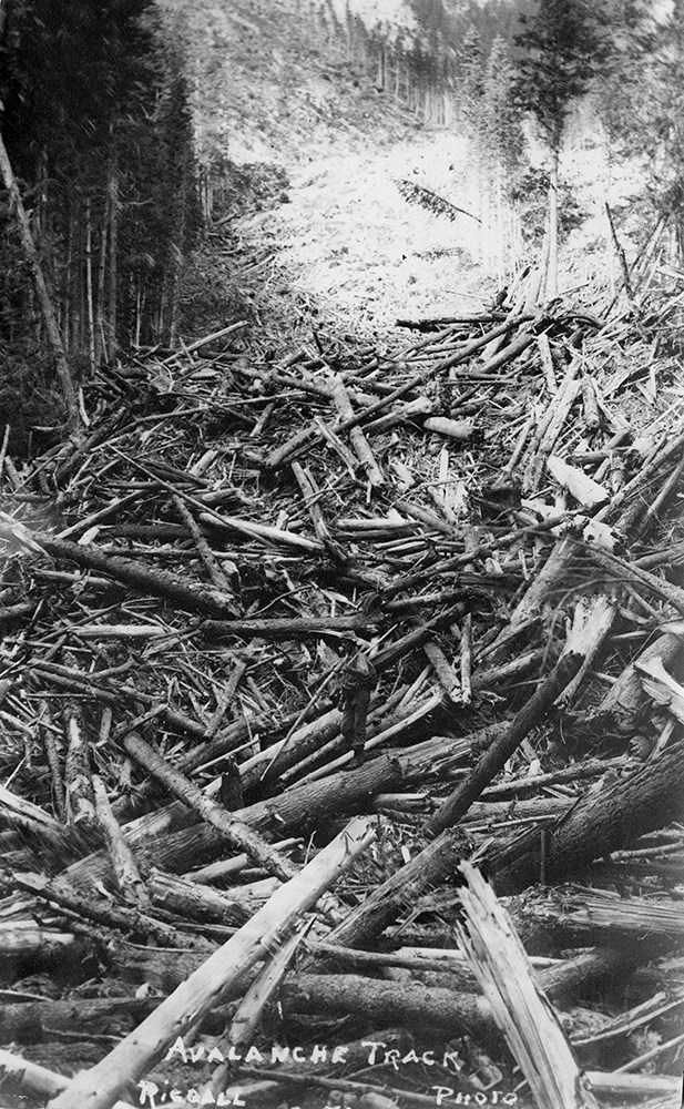
Bert Riggall's 1000 Mile Pack trip
https://archives.whyte.org/en/permalink/descriptions23454
- Part Of
- Bert Riggall fonds
- Scope & Content
- File consists of 43 b&w photographs, some captioned. Photographs pertain to Riggall's 1911 1000 mile pack trip undertaken to seek out areas for hunting and outfitting following the enlargement of Waterton National Park and the reduction of available hunting area for Riggall's clients. The prints do…
- Date Range
- 1911
- Reference Code
- V26 / II / A7 / PA - 119 to 161
- Description Level
- 5 / File
- GMD
- Photograph
- Photograph print
1 image
- Part Of
- Bert Riggall fonds
- Description Level
- 5 / File
- Fonds Number
- M376 / V26
- Series
- II.Business and Financial: Bert Riggall's 1000 Mile Pack trip, 1911
- Sous-Fonds
- V26
- Accession Number
- 7201
- Reference Code
- V26 / II / A7 / PA - 119 to 161
- Date Range
- 1911
- Physical Description
- 43 photographs: b&w prints
- Scope & Content
- File consists of 43 b&w photographs, some captioned. Photographs pertain to Riggall's 1911 1000 mile pack trip undertaken to seek out areas for hunting and outfitting following the enlargement of Waterton National Park and the reduction of available hunting area for Riggall's clients. The prints document this pack trip from stops in Banff, AB and Cranbrook, BC, and the extent of his mountain exploration from Fort Steele to Edson. On this trip, approximately 150 miles of new trail was cut including portions of Roger's Pass.
- Subject Access
- Pack trips
- Exploration
- Trails
- Trail making
- Recreation
- Hunting
- Outfitters, trail guides and packers
- Geographic Access
- Canada
- Alberta
- Banff National Park
- Waterton National Park
- British Columbia
- Cranbrook
- Rogers Pass
- Language
- English
- Title Source
- Title based on contents of file
- Processing Status
- Processed
Images

This material is presented as originally created; it may contain outdated cultural descriptions and
potentially offensive content.
Read more.
Bert Riggall's 1000 Mile Pack trip
https://archives.whyte.org/en/permalink/descriptions23455
- Part Of
- Bert Riggall fonds
- Scope & Content
- File consists of 20 b&w photographs, some captioned. Photographs pertain to Riggall's 1911 1000 mile pack trip undertaken to seek out areas for hunting and outfitting following the enlargement of Waterton National Park and the reduction of available hunting area for Riggall's clients. The prints do…
- Date Range
- 1911
- Reference Code
- V26 / II / A7 / PA - 162 to 181
- Description Level
- 5 / File
- GMD
- Photograph
- Photograph print
1 image
- Part Of
- Bert Riggall fonds
- Description Level
- 5 / File
- Fonds Number
- M376 / V26
- Series
- II.Business and Financial: Bert Riggall's 1000 Mile Pack trip, 1911
- Sous-Fonds
- V26
- Accession Number
- 7201
- Reference Code
- V26 / II / A7 / PA - 162 to 181
- Date Range
- 1911
- Physical Description
- Photographs: 20 prints, b&w
- Scope & Content
- File consists of 20 b&w photographs, some captioned. Photographs pertain to Riggall's 1911 1000 mile pack trip undertaken to seek out areas for hunting and outfitting following the enlargement of Waterton National Park and the reduction of available hunting area for Riggall's clients. The prints document this pack trip from stops in Banff, AB and Cranbrook, BC, and the extent of his mountain exploration from Fort Steele to Edson. On this trip, approximately 150 miles of new trail was cut including portions of Roger's Pass.
- Subject Access
- Pack trips
- Exploration
- Trails
- Trail making
- Recreation
- Hunting
- Outfitters, trail guides and packers
- Geographic Access
- Canada
- Alberta
- Banff National Park
- Waterton National Park
- British Columbia
- Cranbrook
- Rogers Pass
- Language
- English
- Title Source
- Title based on contents of file
- Processing Status
- Processed
Images
This material is presented as originally created; it may contain outdated cultural descriptions and
potentially offensive content.
Read more.
Plan of the city of Calgary
https://archives.whyte.org/en/permalink/catalogue21322
- Medium
- Library - Maps and blueprints (unannotated; published)
- Map
- Published Date
- 1911
- Publisher
- Great West Drafting Co. of Calgary
- Call Number
- C4-4.1
- Publisher
- Great West Drafting Co. of Calgary
- Published Date
- 1911
- Subjects
- Calgary
- Accession Number
- 400
- Call Number
- C4-4.1
- Collection
- Archives Library
This material is presented as originally created; it may contain outdated cultural descriptions and
potentially offensive content.
Read more.
[Rocky Mountains Park]
https://archives.whyte.org/en/permalink/catalogue23195
- Medium
- Library - Maps and blueprints (unannotated; published)
- Map
- Published Date
- 1911
- Publisher
- Dept. of the Interior
- Call Number
- C2-3.9
- Publisher
- Dept. of the Interior
- Published Date
- 1911
- Physical Description
- 1 map : black and white
- Scale
- Scale: 2 miles : 1 inch
- Subjects
- Rocky Mountains Park
- Call Number
- C2-3.9
- Collection
- Archives Library
This material is presented as originally created; it may contain outdated cultural descriptions and
potentially offensive content.
Read more.
[Glacier Park]
https://archives.whyte.org/en/permalink/catalogue23221
- Medium
- Library - Maps and blueprints (unannotated; published)
- Map
- Published Date
- 1911
- Publisher
- Dept. of the Interior
- Call Number
- C2-7.2
- Publisher
- Dept. of the Interior
- Published Date
- 1911
- Physical Description
- 1 map : black and white
- Scale
- Scale: 2 miles to 1 inch
- Relief: Spot heights
- Subjects
- Glacier National Park
- Accession Number
- 400
- Call Number
- C2-7.2
- Collection
- Archives Library
This material is presented as originally created; it may contain outdated cultural descriptions and
potentially offensive content.
Read more.
- Medium
- Library - Maps and blueprints (unannotated; published)
- Map
- Published Date
- 1911
- Publisher
- Dept. of the Interior
- Call Number
- C11-2.2
- Publisher
- Dept. of the Interior
- Published Date
- 1911
- Scale
- Scale: 100 miles to 1 inch
- Subjects
- Canada
- Accession Number
- 400
- Call Number
- C11-2.2
- Collection
- Archives Library
This material is presented as originally created; it may contain outdated cultural descriptions and
potentially offensive content.
Read more.
Canadian Pacific Railway
https://archives.whyte.org/en/permalink/catalogue24554
- Medium
- Library - Maps and blueprints (unannotated; published)
- Map
- Published Date
- 1911 (corrected to June, 1912)
- Publisher
- Canadian Pacific Railway
- Call Number
- C11-3.5
- Publisher
- Canadian Pacific Railway
- Published Date
- 1911 (corrected to June, 1912)
- Scale
- Scale: 1" -- 75 miles
- Subjects
- Canada
- Railway routes
- Notes
- The Minneapolis, St. Paul and Sault. Ste. Marie Railway, The Duluth, South Shore and Atlantic Railway and Connections
- Accession Number
- 7000
- Call Number
- C11-3.5
- Collection
- Archives Library
This material is presented as originally created; it may contain outdated cultural descriptions and
potentially offensive content.
Read more.