Narrow Results By
- Photograph 29371
- Negative 17287
- Library - Book (including soft-cover and pamphlets) 14313
- Transparency 3187
- Library - Periodical 3157
- Library - Postcard 2944
- Lantern slide 2559
- Textual record 2187
- Map 2131
- Photograph print 2109
- Library - Maps and blueprints (unannotated; published)
- Graphite Drawing 1627
- British Columbia 231
- Alberta 152
- Bow River Power and Storage Investigations 40
- Canada 35
- Banff National Park 31
- Jasper National Park 30
- Alberta/British Columbia 22
- Canada - Prairie Region 20
- Waterton Lakes National Park 20
- Banff townsite 19
- District of Franklin, Northwest Territories 16
- Railway routes 16
- Date
- 2015 – 2015
- Material
- glass; paper
- Catalogue Number
- 110.01.1071
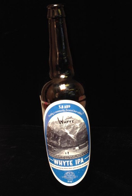
- Description
- 1 empty bottle of Whyte IPA by Banff Avenue Brewing Company established 2010. 2015 Whyte Museum logo on image of Charles Lefroy with the first milk cow in Banff, 1888. Photograph by A.B. Thom Whyte Museum of the Canadian ROckeis. Pat Brewster fonds (V91/NA66-1796) 27x8cmlabel reads “Banff Avenue Br…
1 image
- Title
- Beer Bottle
- Date
- 2015 – 2015
- Material
- glass; paper
- Dimensions
- 27 x 8 cm
- Description
- 1 empty bottle of Whyte IPA by Banff Avenue Brewing Company established 2010. 2015 Whyte Museum logo on image of Charles Lefroy with the first milk cow in Banff, 1888. Photograph by A.B. Thom Whyte Museum of the Canadian ROckeis. Pat Brewster fonds (V91/NA66-1796) 27x8cmlabel reads “Banff Avenue Brewing Company Whyte IPA”
- Subject
- beer
- bottle
- IPA
- Banff Brewing Company
- Credit
- Gift of Unknown, 2015
- Catalogue Number
- 110.01.1071
Images
This material is presented as originally created; it may contain outdated cultural descriptions and
potentially offensive content.
Read more.
Golden : British Columbia Alberta west of fifth meridian
https://archives.whyte.org/en/permalink/catalogue24234
- Medium
- Library - Maps and blueprints (unannotated; published)
- Map
- Published Date
- 1997
- Publisher
- Natural Resources Canada
- Call Number
- NTS
- 82N
- Publisher
- Natural Resources Canada
- Published Date
- 1997
- Physical Description
- 1 map : col
- Scale
- 1:250,000
- Subjects
- Golden
- British Columbia
- Surveys and Mapping
- Notes
- National Topographic System
- Accession Number
- 30500 3.2.98
- Call Number
- NTS
- 82N
- Collection
- Archives Library
This material is presented as originally created; it may contain outdated cultural descriptions and
potentially offensive content.
Read more.
Mountain Park : Alberta west of fifth meridian
https://archives.whyte.org/en/permalink/catalogue24235
- Medium
- Library - Maps and blueprints (unannotated; published)
- Map
- Published Date
- 1996
- Publisher
- Ottawa : Natural Resources Canada
- Edition
- 3 ed
- Call Number
- NTS
- 83 C14
- Edition
- 3 ed
- Publisher
- Ottawa : Natural Resources Canada
- Published Date
- 1996
- Physical Description
- 1 map : col
- Scale
- Scale: 1:50,000
- Relief: contour interval 20 metres below 2000 metres; contour interval 40 metres above 2000 metres
- Notes
- Partial contents: includes Mountain Park Provincial Forest Recreation Area and Cardinal River Provincial Forest Recreation Area
- Accession Number
- 30500 6.25.98
- Call Number
- NTS
- 83 C14
- Collection
- Archives Library
This material is presented as originally created; it may contain outdated cultural descriptions and
potentially offensive content.
Read more.
Miette : Alberta west of fifth meridian
https://archives.whyte.org/en/permalink/catalogue24236
- Medium
- Library - Maps and blueprints (unannotated; published)
- Map
- Published Date
- 1996
- Publisher
- Ottawa : Natural Resources Canada
- Edition
- 3 ed
- Call Number
- NTS
- 83 F4
- Edition
- 3 ed
- Publisher
- Ottawa : Natural Resources Canada
- Published Date
- 1996
- Physical Description
- 1 map : col
- Scale
- Scale: 1:50,000
- Relief: Contour interval 100'
- Accession Number
- 30500 3.2.98
- Call Number
- NTS
- 83 F4
- Collection
- Archives Library
This material is presented as originally created; it may contain outdated cultural descriptions and
potentially offensive content.
Read more.
Snaring River : Improvement District 12 Alberta west of fifth meridian
https://archives.whyte.org/en/permalink/catalogue24237
- Medium
- Library - Maps and blueprints (unannotated; published)
- Map
- Published Date
- 1996
- Publisher
- Natural Resources Canada
- Edition
- 4 ed
- Call Number
- NTS
- 83 E1
- Edition
- 4 ed
- Publisher
- Natural Resources Canada
- Published Date
- 1996
- Physical Description
- 1 map : col
- Scale
- Relief: Contour interval 100'
- Scale: 1:50,000
- Accession Number
- 30500 3.2.98
- Call Number
- NTS
- 83 E1
- Collection
- Archives Library
This material is presented as originally created; it may contain outdated cultural descriptions and
potentially offensive content.
Read more.
Clemenceau Icefield : British Columbia Alberta Colombie-Britannique Alberta
https://archives.whyte.org/en/permalink/catalogue24238
- Medium
- Library - Maps and blueprints (unannotated; published)
- Map
- Published Date
- 1996
- Publisher
- Ottawa : Natural Resources Canada
- Edition
- 3 ed
- Call Number
- NTS
- 83 C4
- Edition
- 3 ed
- Publisher
- Ottawa : Natural Resources Canada
- Published Date
- 1996
- Physical Description
- 1 map : col
- Scale
- Scale: 1:50,000
- Relief: Contour Interval 40 metres
- Accession Number
- 30500 3.2.98
- Call Number
- NTS
- 83 C4
- Collection
- Archives Library
This material is presented as originally created; it may contain outdated cultural descriptions and
potentially offensive content.
Read more.
Sunwapta Peak : Alberta
https://archives.whyte.org/en/permalink/catalogue24239
- Medium
- Library - Maps and blueprints (unannotated; published)
- Map
- Published Date
- 1996
- Publisher
- Ottawa : Natural Resources Canada
- Edition
- 3 ed
- Call Number
- NTS
- 83 C6
- Edition
- 3 ed
- Publisher
- Ottawa : Natural Resources Canada
- Published Date
- 1996
- Physical Description
- 1 map : col
- Scale
- Scale: 1:50,000
- Relief: contour interval 20 metres below 2000 metres, 40 metres above 200 metres
- Accession Number
- 30500 3.2.98
- Call Number
- NTS
- 83 C6
- Collection
- Archives Library
This material is presented as originally created; it may contain outdated cultural descriptions and
potentially offensive content.
Read more.
Athabasca Falls : Improvement District 12 Alberta
https://archives.whyte.org/en/permalink/catalogue24240
- Medium
- Library - Maps and blueprints (unannotated; published)
- Map
- Published Date
- 1996
- Publisher
- Ottawa : Natural Resources Canada
- Edition
- 3 ed
- Call Number
- NTS
- 83 C12
- Edition
- 3 ed
- Publisher
- Ottawa : Natural Resources Canada
- Published Date
- 1996
- Physical Description
- 1 map : col
- Scale
- Scale: 1:50,000
- Relief: contour interval 20 metres below 2000 metres, 40 metres above 2000 metres
- Accession Number
- 30500 3.2.98
- Call Number
- NTS
- 83 C12
- Collection
- Archives Library
This material is presented as originally created; it may contain outdated cultural descriptions and
potentially offensive content.
Read more.
Medicine Lake : Alberta
https://archives.whyte.org/en/permalink/catalogue24241
- Medium
- Library - Maps and blueprints (unannotated; published)
- Map
- Published Date
- 1996
- Publisher
- Ottawa : Natural Resources Canada
- Edition
- 4 ed
- Call Number
- NTS
- 83 C13
- Edition
- 4 ed
- Publisher
- Ottawa : Natural Resources Canada
- Published Date
- 1996
- Physical Description
- 1 map : col
- Scale
- Scale: 1:50,000
- Relief: contour interval 20 metres below 2000 metres, 40 metres above 2000 metres
- Call Number
- NTS
- 83 C13
- Collection
- Archives Library
This material is presented as originally created; it may contain outdated cultural descriptions and
potentially offensive content.
Read more.
Mount Goodsir : British Columbia Alberta Colombie-Britannique Alberta west of fifth meridian ouest du cinquieme meridien
https://archives.whyte.org/en/permalink/catalogue24242
- Medium
- Library - Maps and blueprints (unannotated; published)
- Map
- Published Date
- 1996
- Publisher
- Ottawa : Natural Resources Canada
- Edition
- 3 ed
- Call Number
- NTS
- 82 N1
- Edition
- 3 ed
- Publisher
- Ottawa : Natural Resources Canada
- Published Date
- 1996
- Physical Description
- 1 map : col
- Scale
- Scale: 1:50,000
- Relief: Contour interval 40 metres
- Accession Number
- 30500 3.2.98
- Call Number
- NTS
- 82 N1
- Collection
- Archives Library
This material is presented as originally created; it may contain outdated cultural descriptions and
potentially offensive content.
Read more.
Golden : Kootenay Land District British Columbia Colombie-Britannique
https://archives.whyte.org/en/permalink/catalogue24243
- Medium
- Library - Maps and blueprints (unannotated; published)
- Map
- Published Date
- 1996
- Publisher
- Ottawa : Natural Resources Canada
- Edition
- 4 ed
- Call Number
- NTS
- 82 N7
- Edition
- 4 ed
- Publisher
- Ottawa : Natural Resources Canada
- Published Date
- 1996
- Physical Description
- 1 map : col
- Scale
- Scale: 1:50,000
- Relief: Contour interval 40 metres
- Accession Number
- 30500 3.2.98
- Call Number
- NTS
- 82 N7
- Collection
- Archives Library
This material is presented as originally created; it may contain outdated cultural descriptions and
potentially offensive content.
Read more.
McMurdo : Kootenay Land District British Columbia Colombie-Britannique
https://archives.whyte.org/en/permalink/catalogue24244
- Medium
- Library - Maps and blueprints (unannotated; published)
- Map
- Published Date
- 1996
- Publisher
- Ottawa : Natural Resources Canada
- Edition
- 4 ed
- Call Number
- NTS
- 82 N2
- Edition
- 4 ed
- Publisher
- Ottawa : Natural Resources Canada
- Published Date
- 1996
- Physical Description
- 1 map : col
- Scale
- Scale: 1:50,000
- Relief: Contour interval 40 metres
- Accession Number
- 30500 3.2.98
- Call Number
- NTS
- 82 N2
- Collection
- Archives Library
This material is presented as originally created; it may contain outdated cultural descriptions and
potentially offensive content.
Read more.
Lake Louise : Alberta British Columbia Alberta Colombie-Britannique west of fifth meridian ouest du cinquieme meridien
https://archives.whyte.org/en/permalink/catalogue24245
- Medium
- Library - Maps and blueprints (unannotated; published)
- Map
- Published Date
- 1996
- Publisher
- Ottawa : Natural Resources Canada
- Edition
- 7 ed
- Call Number
- NTS
- 82 N8
- Edition
- 7 ed
- Publisher
- Ottawa : Natural Resources Canada
- Published Date
- 1996
- Physical Description
- 1 map : col
- Scale
- Scale: 1:50,000
- Relief: contour interval 40 metres
- Accession Number
- 30500 3.2.98
- Call Number
- NTS
- 82 N8
- Collection
- Archives Library
This material is presented as originally created; it may contain outdated cultural descriptions and
potentially offensive content.
Read more.
Hector Lake : Alberta British Columbia Alberta Colombie-Britannique west of fifth meridian ouest du cinquieme meridien
https://archives.whyte.org/en/permalink/catalogue24246
- Medium
- Library - Maps and blueprints (unannotated; published)
- Map
- Published Date
- 1996
- Publisher
- Ottawa : Natural Resources Canada
- Edition
- 3 ed
- Call Number
- NTS
- 82 N9
- Edition
- 3 ed
- Publisher
- Ottawa : Natural Resources Canada
- Published Date
- 1996
- Physical Description
- 1 map : col
- Scale
- Scale: 1:50,000
- Relief: Contour interval 40 metres
- Accession Number
- 30500 3.2.98
- Call Number
- NTS
- 82 N9
- Collection
- Archives Library
This material is presented as originally created; it may contain outdated cultural descriptions and
potentially offensive content.
Read more.
Blaeberry River : British Columbia Alberta Colombie-Britannique Alberta west of fifth meridian ouest du cinquieme meridien
https://archives.whyte.org/en/permalink/catalogue24247
- Medium
- Library - Maps and blueprints (unannotated; published)
- Map
- Published Date
- 1996
- Publisher
- Ottawa : Natural Resources Canada
- Edition
- 4 ed
- Call Number
- NTS
- 82 N10
- Edition
- 4 ed
- Publisher
- Ottawa : Natural Resources Canada
- Published Date
- 1996
- Physical Description
- 1 map : col
- Scale
- Scale: 1: 50,000
- Relief: Contour interval 40 metres
- Accession Number
- 30500 3.2.98
- Call Number
- NTS
- 82 N10
- Collection
- Archives Library
This material is presented as originally created; it may contain outdated cultural descriptions and
potentially offensive content.
Read more.
Spray Lakes Reservoir : Alberta British Columbia Alberta Colombie-Britannique west of fifth meridian ouest du cinquieme meridien
https://archives.whyte.org/en/permalink/catalogue24248
- Medium
- Library - Maps and blueprints (unannotated; published)
- Map
- Published Date
- 1996
- Publisher
- Ottawa : Natural Resources Canada
- Edition
- 3 ed
- Call Number
- NTS
- 82 J14
- Edition
- 3 ed
- Publisher
- Ottawa : Natural Resources Canada
- Published Date
- 1996
- Physical Description
- 1 map : col
- Scale
- Scale: 1:50,000
- Relief: Contour interval 40 metres
- Accession Number
- 30500 3.2.98
- Call Number
- NTS
- 82 J14
- Collection
- Archives Library
This material is presented as originally created; it may contain outdated cultural descriptions and
potentially offensive content.
Read more.
Waterton Lakes : Alberta west of fourth meridian ouest du quatrieme meridien
https://archives.whyte.org/en/permalink/catalogue24249
- Medium
- Library - Maps and blueprints (unannotated; published)
- Map
- Published Date
- 1996
- Publisher
- Ottawa : Natural Resources Canada
- Edition
- 3 ed
- Call Number
- NTS
- 82 H4
- Edition
- 3 ed
- Publisher
- Ottawa : Natural Resources Canada
- Published Date
- 1996
- Physical Description
- 1 map : col
- Scale
- Scale: 1:50,000
- Relief: Contour interval 100 ft
- Accession Number
- 30500 3.2.98
- Call Number
- NTS
- 82 H4
- Collection
- Archives Library
This material is presented as originally created; it may contain outdated cultural descriptions and
potentially offensive content.
Read more.
Resplendent Creek : Alberta British Columbia Alberta Colombie-Britannique west of fifth meridian ouest du cinquieme meridien
https://archives.whyte.org/en/permalink/catalogue24255
- Medium
- Library - Maps and blueprints (unannotated; published)
- Map
- Published Date
- 1996
- Publisher
- Ottawa : Natural Resources Canada
- Edition
- 5 ed
- Call Number
- NTS
- 83 E2
- Edition
- 5 ed
- Publisher
- Ottawa : Natural Resources Canada
- Published Date
- 1996
- Physical Description
- 1 map : col
- Scale
- Scale: 1:50,000
- Relief: Contour interval 100'
- Accession Number
- 29500 2.19.97
- Call Number
- NTS
- 83 E2
- Collection
- Archives Library
This material is presented as originally created; it may contain outdated cultural descriptions and
potentially offensive content.
Read more.
Entrance : Alberta west of fifth meridian ouest du cinquieme meridien
https://archives.whyte.org/en/permalink/catalogue24256
- Medium
- Library - Maps and blueprints (unannotated; published)
- Map
- Published Date
- 1996
- Publisher
- Ottawa : Natural Resources Canada
- Edition
- 4 ed
- Call Number
- NTS
- 83 F5
- Edition
- 4 ed
- Publisher
- Ottawa : Natural Resources Canada
- Published Date
- 1996
- Physical Description
- 1 map : col
- Scale
- Scale: 1:50,000
- Relief: Contour Interval 100 ft.
- Accession Number
- 29500 4.29.97
- Call Number
- NTS
- 83 F5
- Collection
- Archives Library
This material is presented as originally created; it may contain outdated cultural descriptions and
potentially offensive content.
Read more.
Kananaskis Lakes : British Columbia Alberta Colombie-Britannique Alberta west of fifth meridian ouest du cinquieme meridien
https://archives.whyte.org/en/permalink/catalogue24257
- Medium
- Library - Maps and blueprints (unannotated; published)
- Map
- Published Date
- 1996
- Publisher
- Ottawa : Natural Resources Canada
- Edition
- 3 ed
- Call Number
- NTS
- 82 J11
- Edition
- 3 ed
- Publisher
- Ottawa : Natural Resources Canada
- Published Date
- 1996
- Physical Description
- 1 map : col
- Scale
- Scale: 1:50,000
- Relief: Contour interval 40 metres
- Accession Number
- 29500 4.2.97
- Call Number
- NTS
- 82 J11
- Collection
- Archives Library
This material is presented as originally created; it may contain outdated cultural descriptions and
potentially offensive content.
Read more.