Narrow Results By
- Nicholas Morant fonds 6
- Archives General File Collection 3
- Ben Gadd fonds 2
- Luxton family fonds 2
- Dermot Kennedy and J. R. Webb fonds 1
- Galletly family fonds 1
- Glen Boles fonds 1
- Jim Brewster family fonds 1
- Jimmy Simpson family fonds 1
- Major Wharton R. Tweedy fonds 1
- Mary (Molly) Wright Adams fonds 1
- Mollie E. Smith and Peter Murray Ross fonds 1
- Clarence Ingwall Tillenius (1913 – 2012, Canadian) 7
- Fitzpatrick 6
- George Clutesi (1905 – 1988, Canadian) 4
- Alfred Crocker Leighton, R. C. A. (1901 – 1965, Canadian) 3
- Herbert C. Hahn (1907 – , American) 3
- Robert J. Hope (1948 – 2023, Canadian) 3
- Sarain Stump (1945 – 1974, Canadian) 3
- Brewster, Pat 2
- Gadd, Ben 2
- James Spencer (1940 – , Canadian) 2
- Luxton, Norman 2
- Nicholas Morant 2
Townsite of Banff reference plan
https://archives.whyte.org/en/permalink/catalogue23274
- Medium
- Library - Maps and blueprints (unannotated; published)
- Map
- Published Date
- 1979
- Publisher
- Ottawa? : Parks Canada?
- Call Number
- C4-1.17
- Publisher
- Ottawa? : Parks Canada?
- Published Date
- 1979
- Physical Description
- 1 map
- Scale
- Scale: 1 inch = 200 feet
- Subjects
- Banff townsite
- Accession Number
- 6741
- Call Number
- C4-1.17
- Collection
- Archives Library
This material is presented as originally created; it may contain outdated cultural descriptions and
potentially offensive content.
Read more.
Bugaboo Glacier, British Columbia, Canada
https://archives.whyte.org/en/permalink/catalogue23305
- Medium
- Library - Maps and blueprints (unannotated; published)
- Map
- Published Date
- 1979
- Publisher
- Ottawa : Inland Waters Directorate
- Call Number
- C5-2.6e
- Publisher
- Ottawa : Inland Waters Directorate
- Published Date
- 1979
- Physical Description
- 1 map : col
- Scale
- Scale: 1 : 2,500
- Subjects
- Bugaboo Glacier
- Notes
- To be used with publication 03.4/R27/1978
- Accession Number
- 3398
- Call Number
- C5-2.6e
- Collection
- Archives Library
This material is presented as originally created; it may contain outdated cultural descriptions and
potentially offensive content.
Read more.
[Copton Creek, Alberta]
https://archives.whyte.org/en/permalink/catalogue23560
- Medium
- Library - Maps and blueprints (unannotated; published)
- Map
- Published Date
- 1979
- Publisher
- Dept. of Energy, Mines and Resources
- Edition
- Edition 2
- Call Number
- NTS
- 83L/3
- Edition
- Edition 2
- Publisher
- Dept. of Energy, Mines and Resources
- Published Date
- 1979
- Physical Description
- 1 map : col
- Scale
- Scale: 1:50,000
- Relief: Contour Interval 100 ft.
- Subjects
- Copton Creek
- Alberta
- Notes
- National Topographic System
- Accession Number
- 13,000
- Call Number
- NTS
- 83L/3
- Collection
- Archives Library
This material is presented as originally created; it may contain outdated cultural descriptions and
potentially offensive content.
Read more.
Hector Lake, Alberta-British Columbia
https://archives.whyte.org/en/permalink/catalogue23654
- Medium
- Library - Maps and blueprints (unannotated; published)
- Map
- Published Date
- 1979
- Publisher
- [Ottawa] : Surveys and Mapping Branch, Dept. of Energy, Mines and Resources
- Edition
- 2d ed.
- Call Number
- NTS
- 82N/9
- Edition
- 2d ed.
- Publisher
- [Ottawa] : Surveys and Mapping Branch, Dept. of Energy, Mines and Resources
- Published Date
- 1979
- Physical Description
- 1 map : col
- Scale
- 1:50,000
- Subjects
- Hector Lake (Alta./B.C.)
- Accession Number
- 27,000
- Call Number
- NTS
- 82N/9
- Collection
- Archives Library
This material is presented as originally created; it may contain outdated cultural descriptions and
potentially offensive content.
Read more.
Topographic map of the Mount Fyfe area, Yukon Territories, Ogilvie Mountains
https://archives.whyte.org/en/permalink/catalogue23756
- Medium
- Library - Maps and blueprints (unannotated; published)
- Map
- Published Date
- 1979
- Publisher
- D.E.M.R.
- Call Number
- NTS
- 116H/7
- Publisher
- D.E.M.R.
- Published Date
- 1979
- Scale
- 1:50,000
- Subjects
- Mount Fyfe - Y.T.
- Accession Number
- 11,500
- Call Number
- NTS
- 116H/7
- Collection
- Archives Library
This material is presented as originally created; it may contain outdated cultural descriptions and
potentially offensive content.
Read more.
[Nosehill Creek, Alberta]
https://archives.whyte.org/en/permalink/catalogue23800
- Medium
- Library - Maps and blueprints (unannotated; published)
- Map
- Published Date
- 1979
- Publisher
- Dept of Energy Mines and Resources
- Edition
- 2
- Call Number
- NTS
- 83F/15
- Edition
- 2
- Publisher
- Dept of Energy Mines and Resources
- Published Date
- 1979
- Physical Description
- Colour
- Scale
- Scale: 1:50,000
- Relief: Contour Interval 100 ft.
- Subjects
- Nosehill Creek, Alberta
- Notes
- National Topographic System
- Accession Number
- 13,000
- Call Number
- NTS
- 83F/15
- Collection
- Archives Library
This material is presented as originally created; it may contain outdated cultural descriptions and
potentially offensive content.
Read more.
Transportation Map of Alberta
https://archives.whyte.org/en/permalink/catalogue24403
- Medium
- Library - Maps and blueprints (unannotated; published)
- Map
- Published Date
- 1979
- Publisher
- Surveys and Mapping Branch, Alberta Transportation, Edmonton
- Call Number
- C9-1.13
- Publisher
- Surveys and Mapping Branch, Alberta Transportation, Edmonton
- Published Date
- 1979
- Scale
- Scale: 1:250,000
- Subjects
- Alberta Transportation
- Notes
- Red Deer 83A
- Accession Number
- 3235
- Call Number
- C9-1.13
- Collection
- Archives Library
This material is presented as originally created; it may contain outdated cultural descriptions and
potentially offensive content.
Read more.
Transportation map of Alberta
https://archives.whyte.org/en/permalink/catalogue24404
- Medium
- Library - Maps and blueprints (unannotated; published)
- Map
- Published Date
- 1979
- Publisher
- Surveys and Mapping Branch, Alberta Transportation, Edmonton
- Call Number
- C9-1.14
- Publisher
- Surveys and Mapping Branch, Alberta Transportation, Edmonton
- Published Date
- 1979
- Scale
- Scale: 1:250,000
- Subjects
- Alberta Transportation
- Notes
- Rocky Mountain House 83B
- Accession Number
- 3235
- Call Number
- C9-1.14
- Collection
- Archives Library
This material is presented as originally created; it may contain outdated cultural descriptions and
potentially offensive content.
Read more.
Transportation Map of Alberta
https://archives.whyte.org/en/permalink/catalogue24405
- Medium
- Library - Maps and blueprints (unannotated; published)
- Map
- Published Date
- 1979
- Publisher
- Surveys and Mapping Branch, Alberta Transportation, Edmonton
- Call Number
- C9-1.15
- Publisher
- Surveys and Mapping Branch, Alberta Transportation, Edmonton
- Published Date
- 1979
- Scale
- Scale: 1:250,000
- Subjects
- Alberta Transportation
- Notes
- Wabamun Lake 83G
- Accession Number
- 3235
- Call Number
- C9-1.15
- Collection
- Archives Library
This material is presented as originally created; it may contain outdated cultural descriptions and
potentially offensive content.
Read more.
Transportation Map of Alberta
https://archives.whyte.org/en/permalink/catalogue24406
- Medium
- Library - Maps and blueprints (unannotated; published)
- Map
- Published Date
- 1979
- Publisher
- Surveys and Mapping Branch, Alberta Transportation, Edmonton
- Call Number
- C9-1.16
- Publisher
- Surveys and Mapping Branch, Alberta Transportation, Edmonton
- Published Date
- 1979
- Scale
- Scale: 1:250,000
- Subjects
- Alberta Transportation
- Notes
- Edmonton 83H
- Accession Number
- 3235
- Call Number
- C9-1.16
- Collection
- Archives Library
This material is presented as originally created; it may contain outdated cultural descriptions and
potentially offensive content.
Read more.
Municipalities 1980
https://archives.whyte.org/en/permalink/catalogue24450
- Medium
- Library - Maps and blueprints (unannotated; published)
- Map
- Published Date
- 1979
- Publisher
- Surveys and Mapping Braanch Alberta Transportation
- Call Number
- C9-5.14(f)
- Publisher
- Surveys and Mapping Braanch Alberta Transportation
- Published Date
- 1979
- Scale
- 1 inch = 40 miles, 1 = 2.500,000
- Subjects
- Alberta Municipal Affairs
- Accession Number
- 3235
- Call Number
- C9-5.14(f)
- Collection
- Archives Library
This material is presented as originally created; it may contain outdated cultural descriptions and
potentially offensive content.
Read more.
Alberta Landsat Mosaic
https://archives.whyte.org/en/permalink/catalogue24806
- Medium
- Library - Maps and blueprints (unannotated; published)
- Map
- Published Date
- 1979
- Publisher
- Alberta Environment
- Call Number
- C12-4.23
- Publisher
- Alberta Environment
- Published Date
- 1979
- Scale
- 1=1,500,000
- Subjects
- Alberta - Satellite Photo
- Accession Number
- 3235
- Call Number
- C12-4.23
- Collection
- Archives Library
This material is presented as originally created; it may contain outdated cultural descriptions and
potentially offensive content.
Read more.
- Date
- 1979
- Medium
- graphite on paper
- Catalogue Number
- SpJ.03.02
1 image
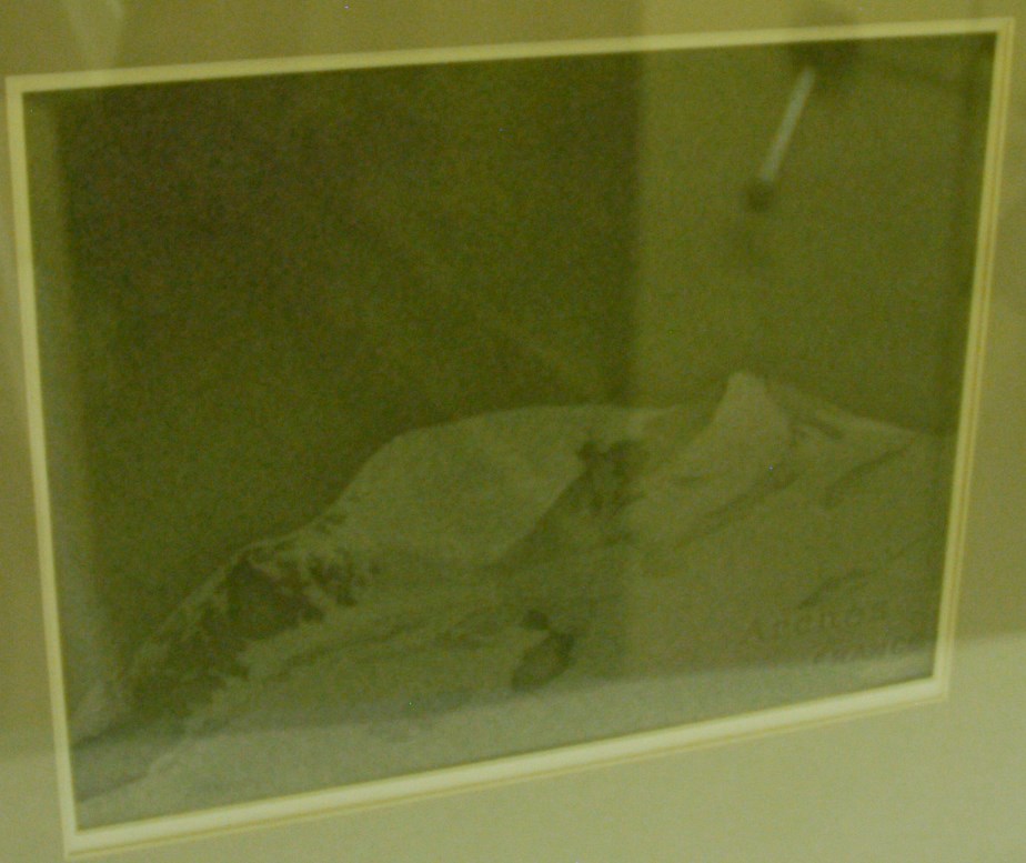
- Title
- Mountain
- Date
- 1979
- Medium
- graphite on paper
- Dimensions
- 22.0 x 29.0 cm
- Credit
- Gift of James Spencer, 1980
- Catalogue Number
- SpJ.03.02
Images
This material is presented as originally created; it may contain outdated cultural descriptions and
potentially offensive content.
Read more.
- Date
- 1979
- Medium
- graphite on paper
- Catalogue Number
- SpJ.03.01
1 image
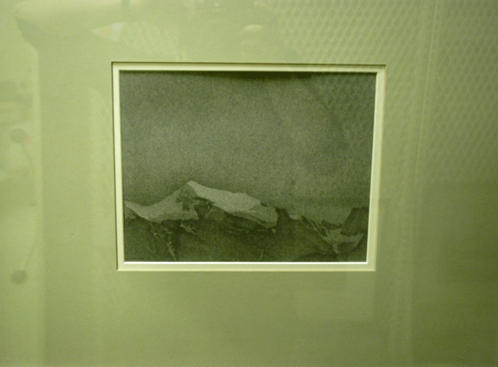
- Title
- Mountain
- Date
- 1979
- Medium
- graphite on paper
- Dimensions
- 17.5 x 22.5 cm
- Credit
- Gift of James Spencer, 1980
- Catalogue Number
- SpJ.03.01
Images
This material is presented as originally created; it may contain outdated cultural descriptions and
potentially offensive content.
Read more.
- Date
- 1979
- Medium
- graphite; watercolour on paper
- Catalogue Number
- CmC.03.01
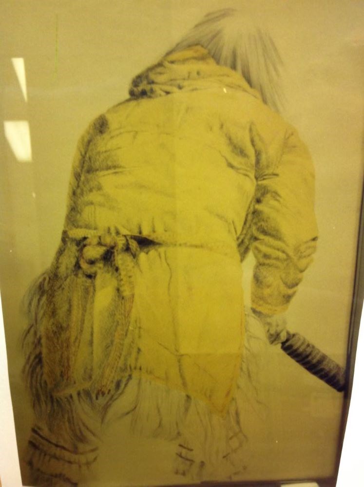
- Description
- Located in the center and filling most of the image area is an Inuit dancer. He stands with his back toward the viewer. His tunic is a yellow colour and he holds a drum stick in his right hand. He has medium length straight hair depicted in graphite and a colourful belt tied around his waist. His t…
1 image
- Title
- Bear Dancer I
- Date
- 1979
- Medium
- graphite; watercolour on paper
- Dimensions
- 105.0 x 75.5 cm
- Description
- Located in the center and filling most of the image area is an Inuit dancer. He stands with his back toward the viewer. His tunic is a yellow colour and he holds a drum stick in his right hand. He has medium length straight hair depicted in graphite and a colourful belt tied around his waist. His tunic has fringes at the sides and bottom and he has a decorative strip around the top of his mukluk.
- Credit
- Gift of Dora Helen Mackie, Calgary, 1998
- Catalogue Number
- CmC.03.01
Images
This material is presented as originally created; it may contain outdated cultural descriptions and
potentially offensive content.
Read more.
Topographic map of Blackstone Kale area in the Ogilvie Mountains, Yukon Territory. Blackstone River.
https://archives.whyte.org/en/permalink/catalogue23496
- Medium
- Library - Maps and blueprints (unannotated; published)
- Map
- Published Date
- 1978
- Publisher
- D.E.M.R.
- Call Number
- NTS
- 116H/4
- Publisher
- D.E.M.R.
- Published Date
- 1978
- Scale
- 1: 50,000
- Subjects
- Blackstone Lake
- Yukon Territory
- Accession Number
- 11.500
- Call Number
- NTS
- 116H/4
- Collection
- Archives Library
This material is presented as originally created; it may contain outdated cultural descriptions and
potentially offensive content.
Read more.
[Goodsir, Mount]
https://archives.whyte.org/en/permalink/catalogue23636
- Medium
- Library - Maps and blueprints (unannotated; published)
- Map
- Published Date
- 1978
- Publisher
- Surveys and Mapping Branch, Dept. of Energy, Mines and Resources
- Call Number
- NTS
- 82N/1
- Publisher
- Surveys and Mapping Branch, Dept. of Energy, Mines and Resources
- Published Date
- 1978
- Physical Description
- Colour
- Scale
- Scale: 1:50,000
- Relief: Contour Interval 100 ft.
- Subjects
- Goodsir, Mount
- Notes
- National Topographic System
- Accession Number
- 12,500
- Call Number
- NTS
- 82N/1
- Collection
- Archives Library
This material is presented as originally created; it may contain outdated cultural descriptions and
potentially offensive content.
Read more.
Topographic map, Mount Brimston, Y.T.
https://archives.whyte.org/en/permalink/catalogue23750
- Medium
- Library - Maps and blueprints (unannotated; published)
- Map
- Published Date
- 1978
- Call Number
- NTS
- 116G/11
- Published Date
- 1978
- Scale
- 1:50,000
- Subjects
- Mount Brimston - Y.T.
- Notes
- Nahoni Range (Ogilvie Mountains)
- Accession Number
- 11,500
- Call Number
- NTS
- 116G/11
- Collection
- Archives Library
This material is presented as originally created; it may contain outdated cultural descriptions and
potentially offensive content.
Read more.
Topographic map of the Mount Carter area in the Yukon Territory, Ogilvie Mountains. Blackstone River
https://archives.whyte.org/en/permalink/catalogue23751
- Medium
- Library - Maps and blueprints (unannotated; published)
- Map
- Published Date
- 1978
- Publisher
- D.E.M.R.
- Call Number
- NTS
- 116H/11
- Publisher
- D.E.M.R.
- Published Date
- 1978
- Scale
- 1:50,000
- Subjects
- Mount Carter - Y.T.
- Accession Number
- 11,500
- Call Number
- NTS
- 116H/11
- Collection
- Archives Library
This material is presented as originally created; it may contain outdated cultural descriptions and
potentially offensive content.
Read more.
Topo map of the Mount Kinney, Yukon Territory region, Hart River, Nethro Mountain
https://archives.whyte.org/en/permalink/catalogue23761
- Medium
- Library - Maps and blueprints (unannotated; published)
- Map
- Published Date
- 1978
- Publisher
- DEMR
- Call Number
- NTS
- 116H/3
- Publisher
- DEMR
- Published Date
- 1978
- Scale
- 1:50,000
- Subjects
- Mount Kinney - Y.T.
- Accession Number
- 11,500
- Call Number
- NTS
- 116H/3
- Collection
- Archives Library
This material is presented as originally created; it may contain outdated cultural descriptions and
potentially offensive content.
Read more.