Narrow Results By
Topographical Survey
https://archives.whyte.org/en/permalink/catalogue24795
- Medium
- Library - Maps and blueprints (unannotated; published)
- Map
- Published Date
- 1879
- Call Number
- C12-1.23
- Published Date
- 1879
- Scale
- 8 miles: 1 inch
- Subjects
- North West Territory
- Notes
- Photostatic copy from Public Archives
- Accession Number
- 675
- Call Number
- C12-1.23
- Collection
- Archives Library
This material is presented as originally created; it may contain outdated cultural descriptions and
potentially offensive content.
Read more.
Types of soil|Travelled routes
https://archives.whyte.org/en/permalink/catalogue21489
- Medium
- Library - Maps and blueprints (unannotated; published)
- Map
- Published Date
- 1879
- Call Number
- C12-1.14
- Published Date
- 1879
- Subjects
- Prairies
- Notes
- Photostatic copy from Public Archives
- two sections
- Accession Number
- 675
- Call Number
- C12-1.14
- Collection
- Archives Library
This material is presented as originally created; it may contain outdated cultural descriptions and
potentially offensive content.
Read more.
An approximate classification of the lands
https://archives.whyte.org/en/permalink/catalogue21497
- Medium
- Library - Maps and blueprints (unannotated; published)
- Map
- Published Date
- 1878
- Call Number
- C12-1.22
- Published Date
- 1878
- Subjects
- North West Territory
- Notes
- Photostatic copy from Public Archives
- two sections
- Accession Number
- 675
- Call Number
- C12-1.22
- Collection
- Archives Library
This material is presented as originally created; it may contain outdated cultural descriptions and
potentially offensive content.
Read more.
North West Frontiers of India
https://archives.whyte.org/en/permalink/catalogue21528
- Medium
- Library - Maps and blueprints (unannotated; published)
- Map
- Published Date
- 1878
- Publisher
- W. & A.K. Johnston, Edinburgh
- Call Number
- C13-8.6
- Publisher
- W. & A.K. Johnston, Edinburgh
- Published Date
- 1878
- Subjects
- Afghanistan
- Accession Number
- 400
- Call Number
- C13-8.6
- Collection
- Archives Library
This material is presented as originally created; it may contain outdated cultural descriptions and
potentially offensive content.
Read more.
Map from the Pacific Ocean across the Rocky Mountain Zone
https://archives.whyte.org/en/permalink/catalogue24555
- Medium
- Library - Maps and blueprints (unannotated; published)
- Map
- Published Date
- January 1874
- Call Number
- C11-3.7
- Published Date
- January 1874
- Scale
- Scale: 1/1:584,000 or 25 English Statute miles to 1 inch
- Subjects
- Canada
- Railway routes
- Notes
- Accompanies: "Report on the Explorations and Surveys" 08.5/C16/rep.
- Accession Number
- 10,000
- Call Number
- C11-3.7
- Collection
- Archives Library
This material is presented as originally created; it may contain outdated cultural descriptions and
potentially offensive content.
Read more.
Canadian Pacific Railway chart of the Thunder Bay-Lake Superior
https://archives.whyte.org/en/permalink/catalogue24556
- Medium
- Library - Maps and blueprints (unannotated; published)
- Map
- Published Date
- January 1874
- Call Number
- C11-3.7(c)
- Responsibility
- Surveyed by Admiral Bayfield R.N.
- Published Date
- January 1874
- Scale
- Soundings are in feet
- Subjects
- Canada
- Railway routes
- Notes
- To accompany report of the Engineer in Chief, C.P.R. 08.5/C16/rep
- Accession Number
- 10,000
- Call Number
- C11-3.7(c)
- Collection
- Archives Library
This material is presented as originally created; it may contain outdated cultural descriptions and
potentially offensive content.
Read more.
Plans of the Rivers Kamanistiquia and Nepigon
https://archives.whyte.org/en/permalink/catalogue24557
- Medium
- Library - Maps and blueprints (unannotated; published)
- Map
- Published Date
- January 1874
- Publisher
- Canadian Pacific Railway 08.5/C16/rep
- Call Number
- C11-3.7(e)
- Publisher
- Canadian Pacific Railway 08.5/C16/rep
- Published Date
- January 1874
- Scale
- Kamenestiquia Plan: 4000' - 1 inch
- Subjects
- Canada
- Railway routes
- Notes
- To accompany report of the Engineer-in-chief
- Accession Number
- 10,000
- Call Number
- C11-3.7(e)
- Collection
- Archives Library
This material is presented as originally created; it may contain outdated cultural descriptions and
potentially offensive content.
Read more.
Map of the country between the provinces of Ontario, Quebec and Manitoba
https://archives.whyte.org/en/permalink/catalogue21432
- Medium
- Library - Maps and blueprints (unannotated; published)
- Map
- Published Date
- January, 1874
- Call Number
- C11-3.7(a)
- Published Date
- January, 1874
- Subjects
- Canada
- Railway routes
- Notes
- Accompanies: "Report on the Explorations and Surveys" 08.5/C16/rep
- Distances from Fort Garry (The Stone Fort) to Toronto and Montreal. All rail routes
- Accession Number
- 10,000
- Call Number
- C11-3.7(a)
- Collection
- Archives Library
This material is presented as originally created; it may contain outdated cultural descriptions and
potentially offensive content.
Read more.
Canadian Pacific Railway chart of Nepigon Bay Lake Superior
https://archives.whyte.org/en/permalink/catalogue21434
- Medium
- Library - Maps and blueprints (unannotated; published)
- Map
- Published Date
- January 1874
- Call Number
- C11-3.7(d)
- Responsibility
- Surveyed by Admiral Bayfield R.N.
- Published Date
- January 1874
- Subjects
- Canada
- Railway routes
- Notes
- To accompany: "Report of the Enginer in Chief Canadian Pacific Railway" 08.5/C16/
- Accession Number
- 10,000
- Call Number
- C11-3.7(d)
- Collection
- Archives Library
This material is presented as originally created; it may contain outdated cultural descriptions and
potentially offensive content.
Read more.
Chart of the Coast of British Columbia North of Latitude, 51 degrees chiefly from Captain Vancouver's Surveys in 1792 and 1793
https://archives.whyte.org/en/permalink/catalogue21435
- Medium
- Library - Maps and blueprints (unannotated; published)
- Map
- Published Date
- 1874
- Publisher
- C.P.R. 08.5/C16/rep
- Call Number
- C11-3.7(f)
- Publisher
- C.P.R. 08.5/C16/rep
- Published Date
- 1874
- Subjects
- Canada
- Railway routes
- Notes
- To accompany: Report of the Engineer-in-chief
- Accession Number
- 10,000
- Call Number
- C11-3.7(f)
- Collection
- Archives Library
This material is presented as originally created; it may contain outdated cultural descriptions and
potentially offensive content.
Read more.
Drawing of Rocky Mountain by J.L.*
https://archives.whyte.org/en/permalink/catalogue21324
- Medium
- Library - Maps and blueprints (unannotated; published)
- Map
- Published Date
- 1873
- Call Number
- C4-5.2
- Published Date
- 1873
- Subjects
- Rocky Mountain House
- Notes
- Photostatic copy from Public Archives * See The Cairn, vol III, no. 2 last page re: Jean L'Heureux by E.J. Hart
- * See: The Cairn, vol III, no. 2 last page re: Jean L'Hereux by E.J. Hart
- Accession Number
- 675
- Call Number
- C4-5.2
- Collection
- Archives Library
This material is presented as originally created; it may contain outdated cultural descriptions and
potentially offensive content.
Read more.
Map of British Columbia to the 56th parallel. North Latitude.
https://archives.whyte.org/en/permalink/catalogue21414
- Medium
- Library - Maps and blueprints (unannotated; published)
- Map
- Published Date
- 1871
- Author
- Trutch, Honourable J.W.
- Call Number
- C10-2.4
- Author
- Trutch, Honourable J.W.
- Published Date
- 1871
- Notes
- Accompanies 03.7/77a (formerly 90/T76)
- Accession Number
- 1879
- Call Number
- C10-2.4
- Collection
- Archives Library
This material is presented as originally created; it may contain outdated cultural descriptions and
potentially offensive content.
Read more.
Danubian Principalities
https://archives.whyte.org/en/permalink/catalogue21541
- Medium
- Library - Maps and blueprints (unannotated; published)
- Map
- Published Date
- 1854
- Publisher
- W and A.K. Johnston, Edinburgh
- Call Number
- C13-12.17
- Publisher
- W and A.K. Johnston, Edinburgh
- Published Date
- 1854
- Subjects
- Europe - Central & Eastern
- Accession Number
- 400
- Call Number
- C13-12.17
- Collection
- Archives Library
This material is presented as originally created; it may contain outdated cultural descriptions and
potentially offensive content.
Read more.
Map of North America engraved to illustrate Mitchell's school and family geography
https://archives.whyte.org/en/permalink/catalogue24834
- Medium
- Library - Maps and blueprints (unannotated; published)
- Map
- Published Date
- 1852
- Publisher
- Pennsylvania : S. Augustus Mitchell
- Call Number
- C13.4.6
- Publisher
- Pennsylvania : S. Augustus Mitchell
- Published Date
- 1852
- Physical Description
- 1 map : col
- Scale
- 1 inch = ca 600 miles
- Subjects
- North America
- Hooker, Mount
- Brown, Mount
- Notes
- Map shows Mts. Hooker and Brown, and gives altitudes of same
- Accession Number
- 3612
- Call Number
- C13.4.6
- Collection
- Archives Library
This material is presented as originally created; it may contain outdated cultural descriptions and
potentially offensive content.
Read more.
Stations of the Church Missionary Society
https://archives.whyte.org/en/permalink/catalogue21486
- Medium
- Library - Maps and blueprints (unannotated; published)
- Map
- Published Date
- 1852
- Call Number
- C12-1.10
- Published Date
- 1852
- Subjects
- Hudson's Bay Company's Territories
- Notes
- Route of the Bishop of Montreal from Quebec to Red River in 1844
- Photostatic copy from Public Archives
- Accession Number
- 675
- Call Number
- C12-1.10
- Collection
- Archives Library
This material is presented as originally created; it may contain outdated cultural descriptions and
potentially offensive content.
Read more.
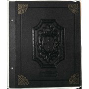
(Miss) Alice G. Fulmer's scrapbook
https://archives.whyte.org/en/permalink/descriptions17826
- Part Of
- Alice Fulmer fonds
- Scope & Content
- Scrapbook pertains to early Banff history and personalities; includes Walter P. Fulmer's papers
- Date Range
- 1833-1969
- Reference Code
- M70
- Description Level
- 5 / File
- GMD
- Scrapbook
1 Electronic Resource
- Part Of
- Alice Fulmer fonds
- Description Level
- 5 / File
- Fonds Number
- M70 / V217
- Sous-Fonds
- M70
- Accession Number
- 2416
- Reference Code
- M70
- GMD
- Scrapbook
- Responsibility
- Alice Fulmer
- Date Range
- 1833-1969
- Physical Description
- .
- History / Biographical
- See fonds level description
- Scope & Content
- Scrapbook pertains to early Banff history and personalities; includes Walter P. Fulmer's papers
- Name Access
- Alice G. Fulmer
- Subject Access
- Newspaper
- Accidents
- Activities
- Banff
- Banff Crag and Canyon
- Communities
- Community events
- Community life
- Skiing
- Sports
- Sports and leisure
- Exploration
- Discovery and travel
- Winter sports
- Trains
- Tourism
- Townsite development
- Geographic Access
- Banff
- Banff National Park
- Alberta
- Canada
- Access Restrictions
- Access restricted - fragile. Use photocopy
- Language
- English
- Related Material
- Related in part to Helen Fulmer Wells fonds (M480/V675)
- Title Source
- Title based on contents of file
- Content Details
- Oversize “C” Automobiles / Banff - History / Bears, Grizzly / / Boorne and May (photographers) / Bridges - Banff / Buildings - Banff (Banff Avenue, Bear Street, Buffalo Street, Caribou Street, Lynx Street) / Cascade Scenic Railway Co. / Cave and Basin / Kananaskis Dude Ranch / Morley Trading Store / Mount Royal Hotel / Newspapers and magazines / North West Mounted Police / Photographers / Post office, Banff / Restaurants, tea rooms, etc. / Schools - Banff / Silver City / Skiing - History Personalities include: Astley, Lizzie Ida / Bagley, (Major) Fred / Barnes, Elliott Chapple / Beattie, Francis / Benham, Gertrude / Brett, Harry / Brett, Robert Earle / Brett, Robert George / Brett family / Brewster, Fred / Brewster, Jack Walker / Brewster, James I. / Brewster, John / Brewster family / Campbell, Robert E. / Christmas, (Rev.) F. / Connor, Ralph / Deacon, Thomas R. / Fear, William H. / Fidler, John J. / Fulmer, Minnie Christina / Fulmer, Walter P. / Galletly, D. D. / Hogbin, George H. / Leroy, Charles / Locke, John / Luxton, Norman / McCardell, William / McDougall, David / McDougall, (Mrs.) David / English, Thomas F. / Fear, William H. / Johnson, Gustaf / Lindsay, (Dr.) N. J. / Lipsett, John C. / Mather, Margaret / McCardell, William H. / Moffatt, Charles W. / Paris, Ida / Ricks, Frank / Rundle, Robert Terrill / Schaffer, Mary T. S. / Sibbald, Andrew S. / Smith, Joe / Stocks, John / Unwin, Ethel / Unwin, Sid / Walker, John White, Dave, Sr. / Warren, William / Woodworth, Ben
- Processing Status
- Processed
Electronic Resources
This material is presented as originally created; it may contain outdated cultural descriptions and
potentially offensive content.
Read more.
Canadian Pacific Railway sketch plan of the mouth of the Saskatchewan River from Hinds Exploring Expedition also plan and section of the Mossy Portage between Cedar Lake and Lake Winnipegoosis and the Meadow Portage
https://archives.whyte.org/en/permalink/catalogue21433
- Medium
- Library - Maps and blueprints (unannotated; published)
- Map
- Published Date
- From a survey by Henry B. Smith, 1873
- Call Number
- C11-3.7(b)
- Published Date
- From a survey by Henry B. Smith, 1873
- Subjects
- Canada
- Railway routes
- Notes
- Accompanies 08.5/C16/rep
- Accession Number
- 10,000
- Call Number
- C11-3.7(b)
- Collection
- Archives Library
This material is presented as originally created; it may contain outdated cultural descriptions and
potentially offensive content.
Read more.
Routes in British North America explored by Captain Palliser, 1857-60
https://archives.whyte.org/en/permalink/catalogue21490
- Medium
- Library - Maps and blueprints (unannotated; published)
- Map
- Published Date
- 1857-60
- Call Number
- C12-1.15
- Published Date
- 1857-60
- Subjects
- Captain Palliser
- Notes
- Photostatic copy from Public Archives
- three sections
- Accession Number
- 675
- Call Number
- C12-1.15
- Collection
- Archives Library
This material is presented as originally created; it may contain outdated cultural descriptions and
potentially offensive content.
Read more.
Southern Alberta research project
https://archives.whyte.org/en/permalink/descriptions55619
- Part Of
- Luxton family fonds
- Scope & Content
- Sub-series consists of textual and visual materials pertaining to the history of Southern Alberta. Includes personal accounts, day books and diaries, genealogical research, records of livestock and other trade, and portrait and group photographs depicting early settlers of Southern Alberta. Materia…
- Date Range
- [ca.1845-1920]
- Reference Code
- LUX / II / C6
- Description Level
- 4 / Sub-series
- GMD
- Cabinet card
- Diary
- Organization record
- Photograph
- Postcard
- Private record
- Published record
- Scrapbook
- Textual record
- Tintype
- Part Of
- Luxton family fonds
- Description Level
- 4 / Sub-series
- Fonds Number
- LUX
- Series
- LUX / II / C : Personal records
- Sous-Fonds
- LUX / II : Eleanor Luxton sous-fonds
- Accession Number
- LUX
- Reference Code
- LUX / II / C6
- GMD
- Cabinet card
- Diary
- Organization record
- Photograph
- Postcard
- Private record
- Published record
- Scrapbook
- Textual record
- Tintype
- Date Range
- [ca.1845-1920]
- Physical Description
- 29 cm of textual records -- 29 photographs (28 b&w prints, 1 tintype) ; 20 x 25 cm or smaller
- Scope & Content
- Sub-series consists of textual and visual materials pertaining to the history of Southern Alberta. Includes personal accounts, day books and diaries, genealogical research, records of livestock and other trade, and portrait and group photographs depicting early settlers of Southern Alberta. Materials in sub-series believed to have been collected by Eleanor Luxton, possibly on behalf of the Southern Alberta Pioneers' and Old Timers' Association or as part of Eleanor's personal research.
- Subject Access
- Activities
- Agriculture
- Animals
- Buildings
- Businesses
- Community life
- Commerce and industry
- Communications
- Correspondence
- Environment
- Family and personal life
- Farmland
- Finances
- Genealogy
- History
- Homestead
- Immigration and homesteading
- Inventory
- Land use
- Land, settlement and immigration
- Manufacturing
- Municipal views
- Oil
- Postcards
- Portrait
- Property
- Real estate business
- Research
- Settlement
- Geographic Access
- Canada
- Alberta
- Reproduction Restrictions
- Some restrictions may apply - fragile materials
- Language
- English
- Category
- Commerce and industry
- Communications
- Family and personal life
- Environment
- Land, settlement and immigration
- Natural resources
- Title Source
- Title based on contents of sub-series
- Processing Status
- Processed
This material is presented as originally created; it may contain outdated cultural descriptions and
potentially offensive content.
Read more.
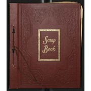
- Part Of
- Alpine Club of Canada fonds
- Scope & Content
- File consists of a scrapbook pertaining primarily to the Calgary Stampede and the Banff Indian Days. Contains newspaper clippings, photographs, and leaflets. Also includes newspaper clippings pertaining to Mt. Assiniboine, Timber Carnivals, and other ACC-affliated events.
- Date Range
- 1850-1952
- Reference Code
- M200 / AC 148M / 1
- Description Level
- 5 / File
- GMD
- Scrapbook
1 image
1 Electronic Resource
- Part Of
- Alpine Club of Canada fonds
- Description Level
- 5 / File
- Fonds Number
- M200 / S6 / V14
- Series
- IV.A. Other material: textual
- Sous-Fonds
- AC 148M
- Accession Number
- .
- Reference Code
- M200 / AC 148M / 1
- GMD
- Scrapbook
- Date Range
- 1850-1952
- Physical Description
- 2.5 cm of textual material (42 pages ; 30.5 x 25.5 cm)
- History / Biographical
- See fonds level description.
- Scope & Content
- File consists of a scrapbook pertaining primarily to the Calgary Stampede and the Banff Indian Days. Contains newspaper clippings, photographs, and leaflets. Also includes newspaper clippings pertaining to Mt. Assiniboine, Timber Carnivals, and other ACC-affliated events.
- Name Access
- Alpine Club of Canada
- Subject Access
- Banff Indian Days
- Banff Indian Grounds
- Calgary Stampede
- Rodeo
- Festival
- Winter Carnival
- Ranching
- Winter sports
- Geographic Access
- Banff
- Lake Louise
- Mount Assiniboine
- Mount Assiniboine Park
- Calgary
- Alberta
- British Columbia
- Canada
- Language
- English
- Title Source
- Title based on material
- Processing Status
- Processed
Electronic Resources
Images

This material is presented as originally created; it may contain outdated cultural descriptions and
potentially offensive content.
Read more.