Narrow Results By
- Boorne and May fonds 106
- Murray Hay fonds 22
- Ben Gadd fonds 19
- Luxton family fonds 10
- Trail Riders of the Canadian Rockies fonds 8
- Peter and Catharine Whyte fonds 7
- Bruno Engler's Veteran's Race fonds 4
- Dorothy Wardle fonds 4
- Aileen Harmon fonds 3
- Kidney family fonds 3
- Brett family fonds 2
- Chic Scott fonds 2
Deep Powder and Steep Rock - textual
https://archives.whyte.org/en/permalink/descriptions55082
- Part Of
- Chic Scott fonds
- Scope & Content
- Series consists of textual records, including notes, manuscripts and other related materials, pertaining to the creation of the book "Deep Powder and Steep Rock".
- Date Range
- 2009
- Reference Code
- M57 / V
- Description Level
- 3 / Series
- GMD
- Textual record
- Map
- Part Of
- Chic Scott fonds
- Description Level
- 3 / Series
- Fonds Number
- M57 / V40 / S47
- Series
- M57 / V : Deep Powder and Steep Rock
- Sous-Fonds
- M57
- Accession Number
- 2014.8295
- 2015.8559
- Reference Code
- M57 / V
- GMD
- Textual record
- Map
- Date Range
- 2009
- Physical Description
- 30 cm of textual records
- History / Biographical
- Hans Gmoser played a major role in creating Canada’s vibrant mountain community. Although known internationally as the father of heli-skiing, he was much more than that: a talented rock climber, tireless expedition leader, a mountain guide, film maker and organizer. Deep Powder and Steep Rock presents an intimate portrait of this charismatic man. Much of the story is told in Gmoser’s own words, gleaned from his diaries, expedition journals, film commentaries and personal correspondence. It is a unique tale of adventure, hard work, perseverance and ultimate success.
- Scope & Content
- Series consists of textual records, including notes, manuscripts and other related materials, pertaining to the creation of the book "Deep Powder and Steep Rock".
- Notes
- Series consists of five sub-series: M57 / V / A: Research files M57 / V / B: Maps M57 / V / C: Interviews M57 / V / D: Photograph notes M57 / V / E: Draft Manuscript
- Name Access
- Scott, Chic
- Gmoser, Hans
- Subject Access
- Biography
- Personal and Professional Life
- Publication
- Research
- Geography
- Map
- Mountaineers
- Mountaineering
- Skiing
- Sports
- Recreation
- Winter sports
- Canadian Mountain Holidays
- Helicopter skiing
- Tourism
- Climbing
- Geographic Access
- Canada
- Alberta
- Banff
- Banff National Park
- Canadian Rocky Mountains
- Language
- English
- Related Material
- S47 / V
- V40 / V
- Biographical Source Notes
- http://chicscott.com/books.htm
- Title Source
- Title based on contents of file
- Processing Status
- Processed
This material is presented as originally created; it may contain outdated cultural descriptions and
potentially offensive content.
Read more.
Camp coordinator packages, notes and handouts
https://archives.whyte.org/en/permalink/descriptions54472
- Scope & Content
- File consists of introductory packages put together for Camp Coordinators on pack trips led by the Trail Riders of the Canadian Rockies in 2008. File includes contact lists, name lists and basic information about riders, participant reports, printed maps and brochures pertaining to specific packing…
- Date Range
- 2008
- Reference Code
- M545 / II / 14
- Description Level
- 5 / File
- GMD
- Textual record
- Organization record
- Map
- Postcard
- Description Level
- 5 / File
- Fonds Number
- M545 / V635
- Series
- M545 / II : Members, Staff, Personal Content
- Sous-Fonds
- M545
- Accession Number
- 8235
- Reference Code
- M545 / II / 14
- Date Range
- 2008
- Physical Description
- 1.5 cm of textual records
- Scope & Content
- File consists of introductory packages put together for Camp Coordinators on pack trips led by the Trail Riders of the Canadian Rockies in 2008. File includes contact lists, name lists and basic information about riders, participant reports, printed maps and brochures pertaining to specific packing trips in 2008, blank survey sheets and insurance waivers, and itineraries. Items are kept in order of 2008 ride numbers: Ride 1, Ride 2, etc.
- Notes
- Contains numerous duplicates
- Subject Access
- Administration
- Packing
- Travel
- Tourism
- Geography
- Geographic Access
- Canada
- Alberta
- Kananaskis
- Banff
- Access Restrictions
- Restrictions may apply due to personal information
- Reproduction Restrictions
- Restrictions may apply due to personal information
- Language
- English
- Category
- Sports, recreation and leisure
- Title Source
- Title based on contents of file
- Processing Status
- Processed
This material is presented as originally created; it may contain outdated cultural descriptions and
potentially offensive content.
Read more.
2002 race award ceremony
https://archives.whyte.org/en/permalink/descriptions54388
- Scope & Content
- File consists of 54 colour photographs pertaining to the awards ceremony for Bruno Engler's Memorial Ski Race held in 2002. Images depict trophies won in the ski race, and various unnamed individuals accepting or presenting awards.
- Date Range
- 2002
- Reference Code
- V783 / II / PA - 70 to 123
- Description Level
- 5 / File
- GMD
- Photograph
- Photograph print
- Description Level
- 5 / File
- Fonds Number
- M559 / V783
- Series
- V783 / II : 1991 - 2016
- Sous-Fonds
- V783
- Accession Number
- 2018.8688
- Reference Code
- V783 / II / PA - 70 to 123
- Date Range
- 2002
- Physical Description
- 54 photographs : col. prints ; 15 x 10 cm
- Scope & Content
- File consists of 54 colour photographs pertaining to the awards ceremony for Bruno Engler's Memorial Ski Race held in 2002. Images depict trophies won in the ski race, and various unnamed individuals accepting or presenting awards.
- Notes
- Photographs not removed from original labelled/numbered sheets to maintain original order and context.
- Archival reference code numbers [V783/II/PA-70 to 123] follow original letter codes of photos written on mylar cases [V783/II/PA-70 is photo "A1", PA-71 is photo "A2", etc.]
- Subject Access
- Award
- Ceremony
- Memorial
- Skiing
- Ski racing
- Sports
- Winter sports
- Geographic Access
- Canada
- Alberta
- Banff
- Access Restrictions
- Copyright restrictions may apply
- Reproduction Restrictions
- Copyright restrictions may apply
- Language
- English
- Conservation
- Items appear to be safe remaining in original state of storage in protective sleeves. Consider removing photographs in the future if off-gassing becomes a concern.
- Category
- Sports, recreation and leisure
- Title Source
- Title based on contents of file
- Processing Status
- Processed
This material is presented as originally created; it may contain outdated cultural descriptions and
potentially offensive content.
Read more.
Canada and America album fonds
https://archives.whyte.org/en/permalink/descriptions464
- Part Of
- Canada and America album fonds
- Scope & Content
- Fonds consists of a photograph album titled "Canada and America, 28 Sept. to 14 Dec. 1889" that chronicles a journey through Canada and the United States, specifically the Canadian Rockies, the interior of British Columbia to Vancouver Island, Canada and south through Washington state to California…
- Date Range
- 1889
- Reference Code
- V388
- Description Level
- 1 / Fonds
- GMD
- Photograph
- Album
- Negative
- Photograph print
- Part Of
- Canada and America album fonds
- Description Level
- 1 / Fonds
- Fonds Number
- V 388
- Sous-Fonds
- V 388
- Accession Number
- 6261
- Reference Code
- V388
- Responsibility
- Album was compiled by an unknown traveler, possibly British
- Date Range
- 1889
- Physical Description
- 1 photograph album (73 prints).-- 7 photographs: copy negatives, b&w
- Scope & Content
- Fonds consists of a photograph album titled "Canada and America, 28 Sept. to 14 Dec. 1889" that chronicles a journey through Canada and the United States, specifically the Canadian Rockies, the interior of British Columbia to Vancouver Island, Canada and south through Washington state to California, USA. Views were probably purchased enroute from well-known artists, including Canadian photographers A. B. Thom and C. S. Bailey, and American photographers Taber, Fiske and C. R. Savage.
- 7 b&w copy negatives
- Notes
- Purchase was made possible through a grant from the Department of Communications, Government of Canada
- Name Access
- Canada and America album
- Subject Access
- Environment
- Exploration, discovery and travel
- Access Restrictions
- Some restrictions on access to originals
- Public domain (other restrictions may apply)
- Language
- Language is English
- Creator
- Canada and America album
- Title Source
- Title based on title on album
- Processing Status
- Processed
This material is presented as originally created; it may contain outdated cultural descriptions and
potentially offensive content.
Read more.
Topographical sheet
https://archives.whyte.org/en/permalink/catalogue24653
- Medium
- Library - Maps and blueprints (unannotated; published)
- Map
- Published Date
- 1889
- Publisher
- Dept. of the Interior
- Call Number
- C3-8.13
- Publisher
- Dept. of the Interior
- Published Date
- 1889
- Scale
- Scale: 1:40,000
- Relief: Contour interval 100 ft.
- Subjects
- Banff
- Notes
- Photostatic copy from Public Archives
- Accession Number
- 675
- Call Number
- C3-8.13
- Collection
- Archives Library
This material is presented as originally created; it may contain outdated cultural descriptions and
potentially offensive content.
Read more.
(a): Topographical sheets|(b): Original map
https://archives.whyte.org/en/permalink/catalogue24654
- Medium
- Library - Maps and blueprints (unannotated; published)
- Map
- Published Date
- 1889
- Publisher
- Dept. of the Interior
- Call Number
- C3-8.14 (a)
- C3-8.14 (b)
- Publisher
- Dept. of the Interior
- Published Date
- 1889
- Scale
- Scale:1:40,000
- Relief: Contour interval 100 ft.
- Subjects
- Anthracite
- Notes
- (b): 8 dup in map room
- Accession Number
- 675
- 400
- 3069
- Call Number
- C3-8.14 (a)
- C3-8.14 (b)
- Collection
- Archives Library
This material is presented as originally created; it may contain outdated cultural descriptions and
potentially offensive content.
Read more.
Topographical sheet
https://archives.whyte.org/en/permalink/catalogue24655
- Medium
- Library - Maps and blueprints (unannotated; published)
- Map
- Published Date
- 1889
- Publisher
- Dept. of the Interior
- Call Number
- C3-8.15
- Publisher
- Dept. of the Interior
- Published Date
- 1889
- Scale
- Scale: 1:40,000
- Relief: Contour interval 100 ft.
- Subjects
- Saddle Mountain
- Notes
- Photostatic copy from Public Archives
- Accession Number
- 675
- Call Number
- C3-8.15
- Collection
- Archives Library
This material is presented as originally created; it may contain outdated cultural descriptions and
potentially offensive content.
Read more.
Topographical Sheet
https://archives.whyte.org/en/permalink/catalogue24661
- Medium
- Library - Maps and blueprints (unannotated; published)
- Map
- Published Date
- 1889
- Publisher
- Dept. of the Interior
- Call Number
- C3-8.21
- Publisher
- Dept. of the Interior
- Published Date
- 1889
- Scale
- Scale: 1:40,000
- Relief: Contour interval 100 ft.
- Subjects
- Kananaskis
- Notes
- Photostatic copy from Public Archives
- Accession Number
- 675
- Call Number
- C3-8.21
- Collection
- Archives Library
This material is presented as originally created; it may contain outdated cultural descriptions and
potentially offensive content.
Read more.
Plan shewing the C.A.C. Coy's coal land, Bow River Valley
https://archives.whyte.org/en/permalink/catalogue24880
- Medium
- Library - Maps and blueprints (unannotated; published)
- Map
- Published Date
- 1889
- Publisher
- [Anthracite? Th. C. Watts?]
- Call Number
- C14-3.3
- Responsibility
- Watts, Th. C. [?]
- Publisher
- [Anthracite? Th. C. Watts?]
- Published Date
- 1889
- Physical Description
- 1 map
- Scale
- 1 inch = 40 chains
- Subjects
- Anthracite
- Coal and coal mines
- Notes
- Sgd. Anthracite, Aug. 9th, 1889, Th.[?] C. Watts
- Call Number
- C14-3.3
- Collection
- Archives Library
This material is presented as originally created; it may contain outdated cultural descriptions and
potentially offensive content.
Read more.
North West Territories
https://archives.whyte.org/en/permalink/catalogue21501
- Medium
- Library - Maps and blueprints (unannotated; published)
- Map
- Published Date
- 1889
- Call Number
- C12-1.27
- Published Date
- 1889
- Subjects
- Mounted Police Stations
- Notes
- Boundaries of Indian Treaties
- Photostatic copy from Public Archives
- Accession Number
- 675
- Call Number
- C12-1.27
- Collection
- Archives Library
This material is presented as originally created; it may contain outdated cultural descriptions and
potentially offensive content.
Read more.
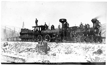
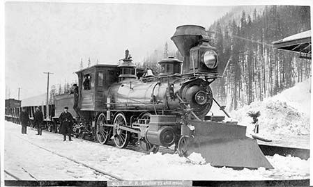
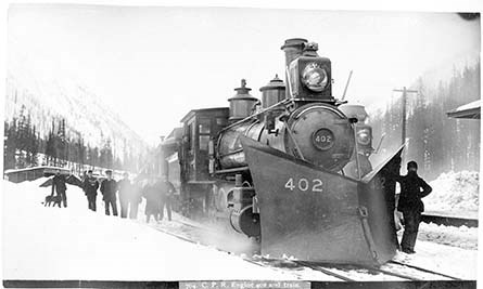
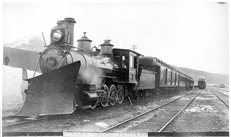
Photograph Album
https://archives.whyte.org/en/permalink/descriptions25330
- Part Of
- Boorne and May fonds
- Scope & Content
- Photograph: 1889. Album consists of 50 pages of 100 black and white photographs. Photographs also provides descriptions. Small amounts of silver mirroring starting to appear. V10 / PD - 1: 1- [721. Calgary from the E.] 2- [Slephen Clas. Calgary. From W.] 3- [716. Indigenous Camp, Winter.] 4- [Kan…
- Date Range
- 1889
- Reference Code
- V10 / PD -1
- Description Level
- 5 / File
- GMD
- Photograph
- Album
- Photograph print
101 images
1 Electronic Resource
- Part Of
- Boorne and May fonds
- Description Level
- 5 / File
- Fonds Number
- V10
- Sous-Fonds
- V10
- Accession Number
- 494
- Reference Code
- V10 / PD -1
- Date Range
- 1889
- Physical Description
- 1 photograph album
- Scope & Content
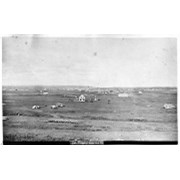
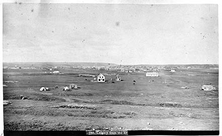
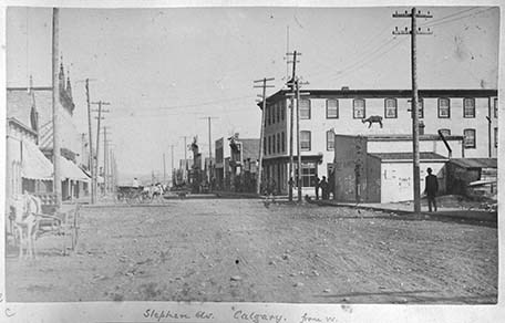
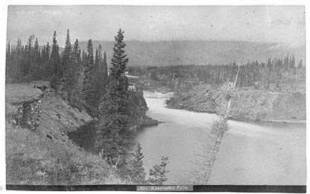
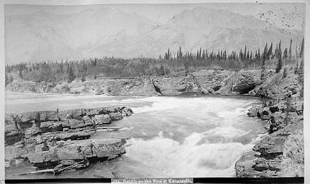
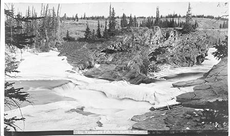
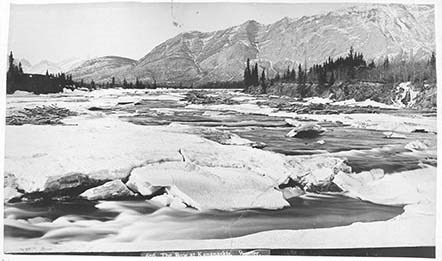
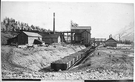
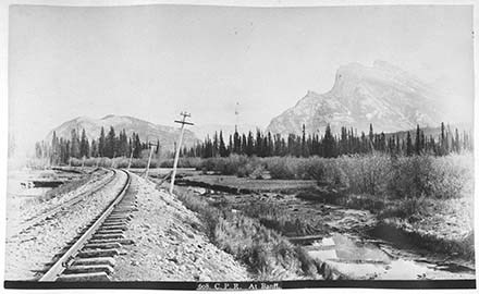
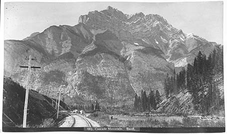
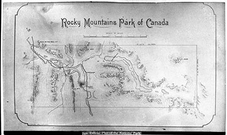
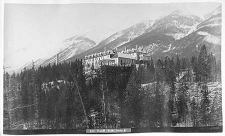
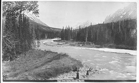
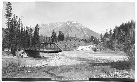
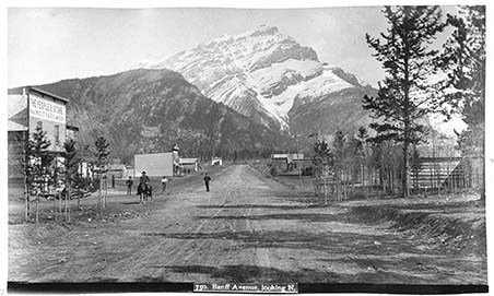
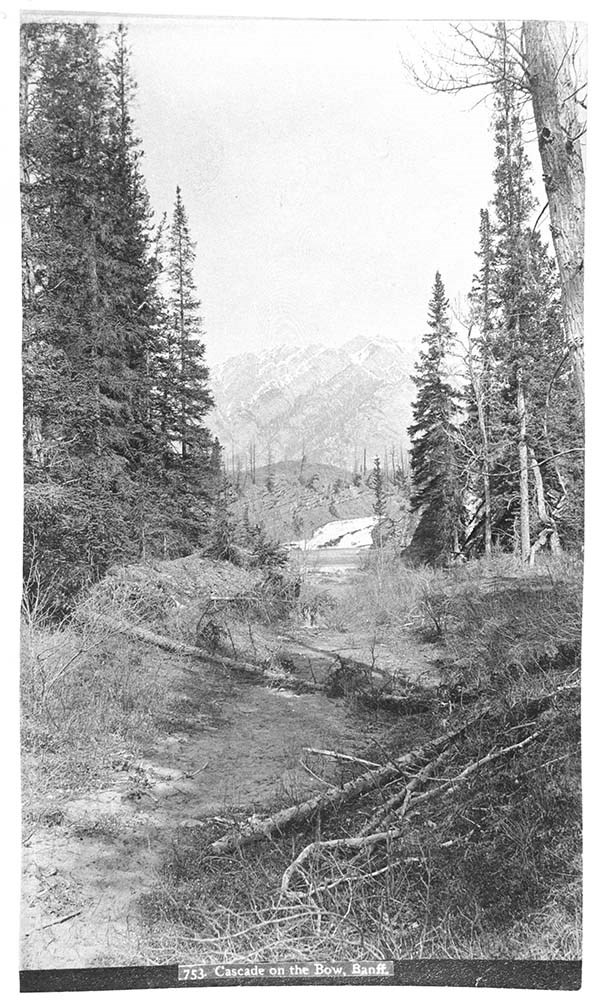
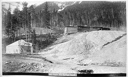
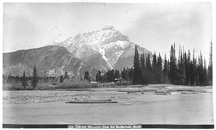
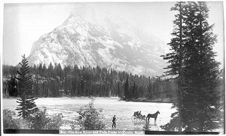
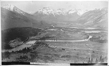
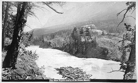
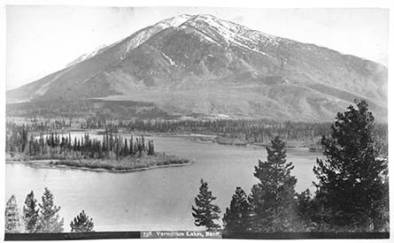
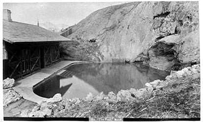
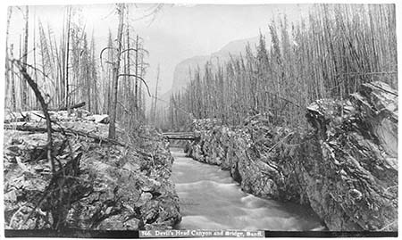
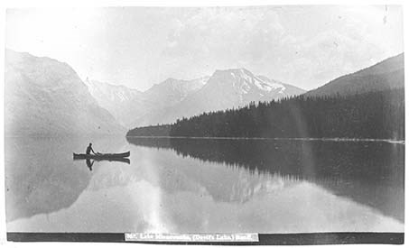
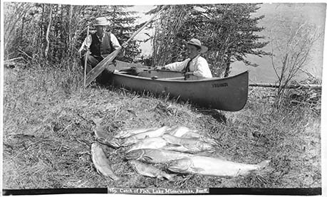
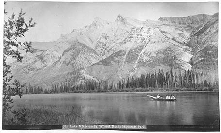
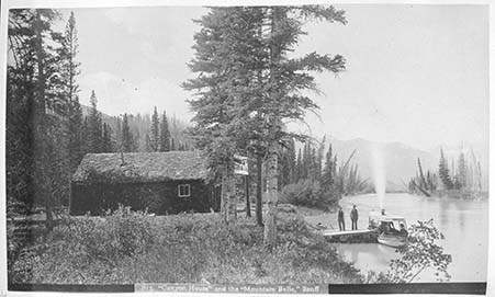
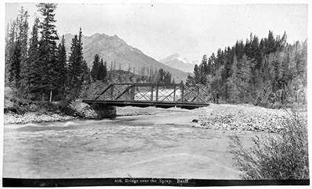
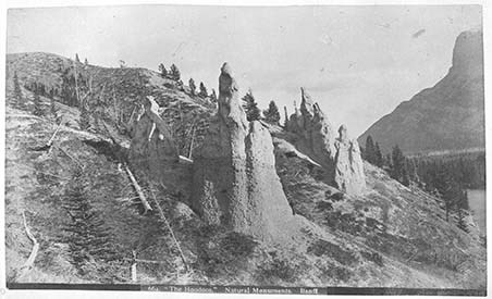
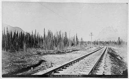
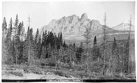
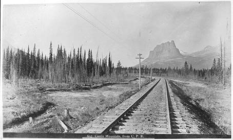
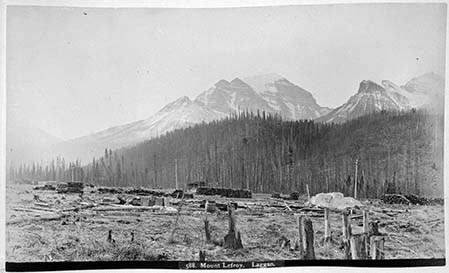
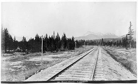
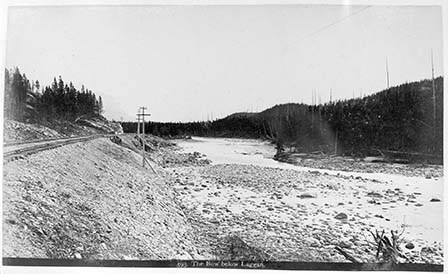
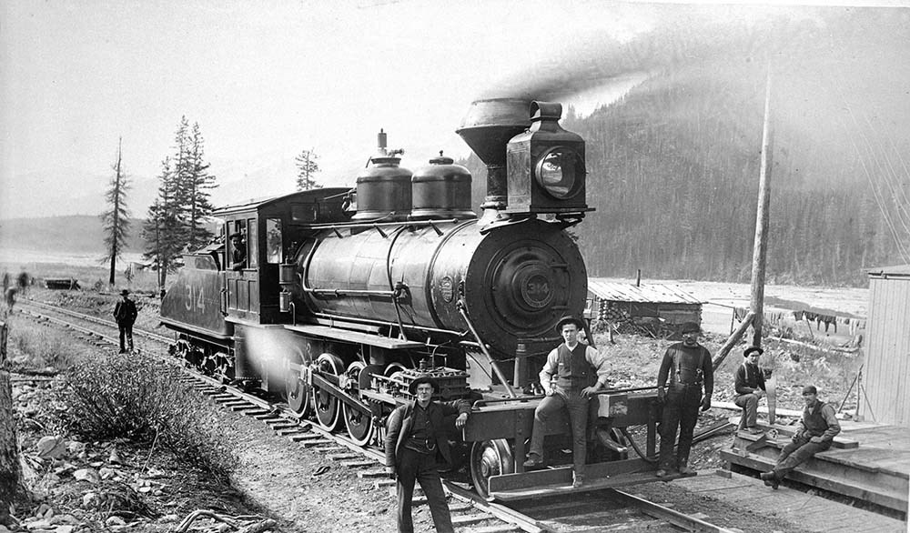
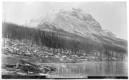
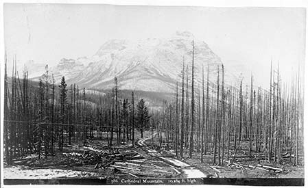
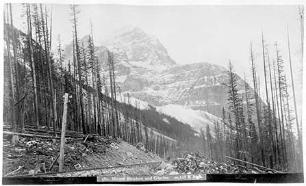
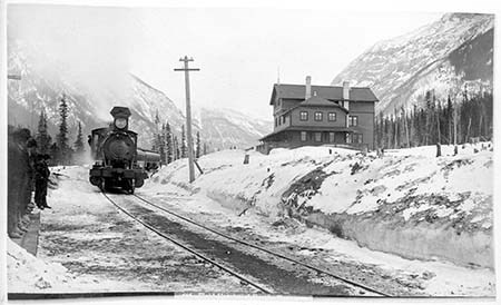
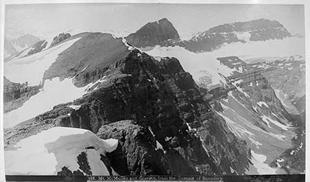
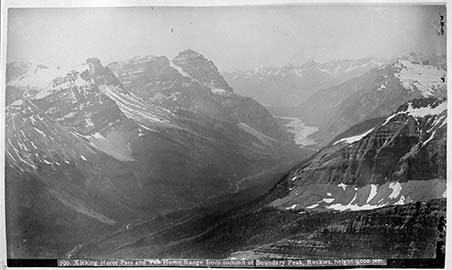
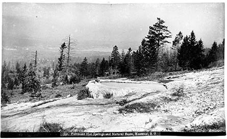
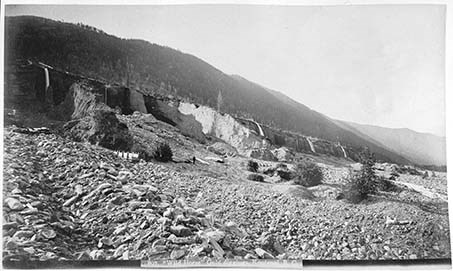
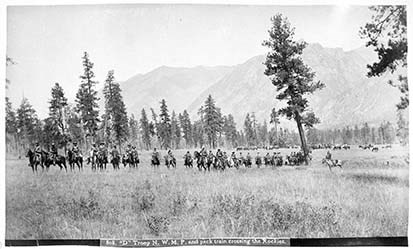
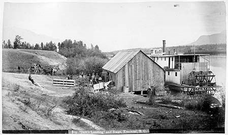
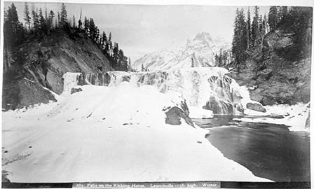
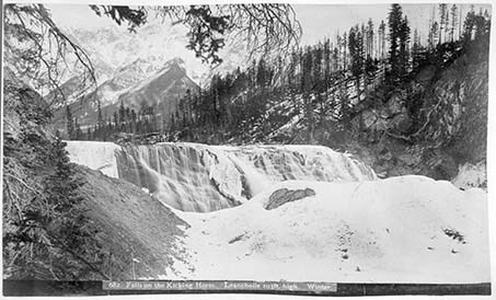
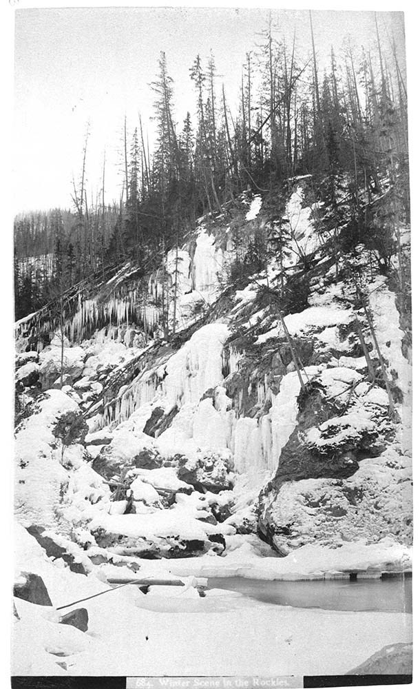
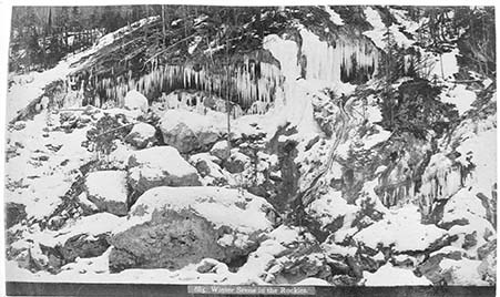
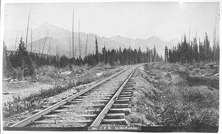
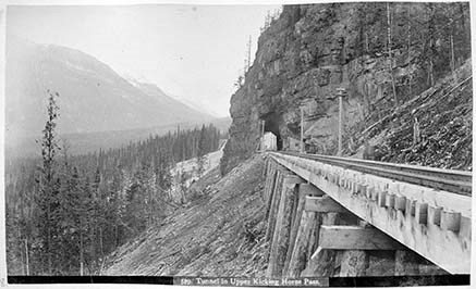
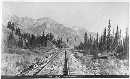
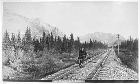
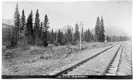
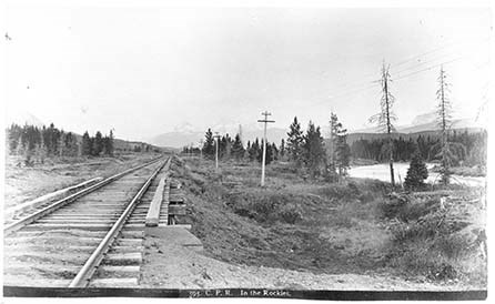
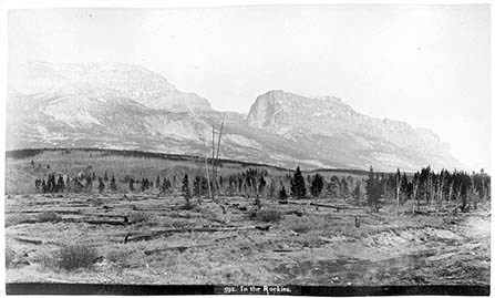
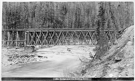
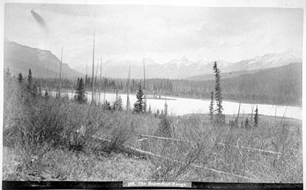
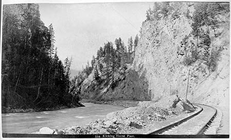
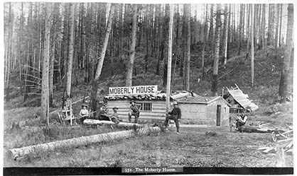
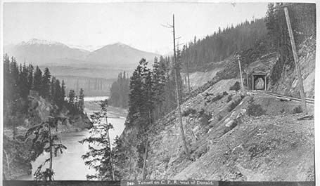
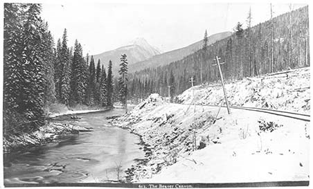
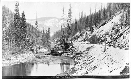
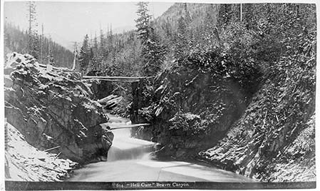
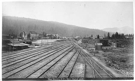
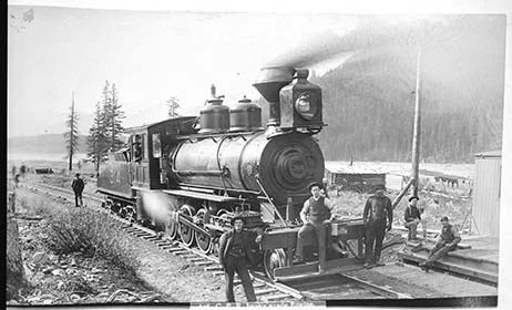
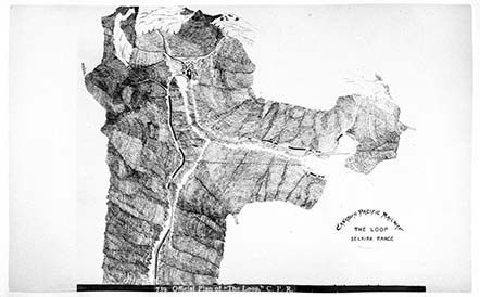
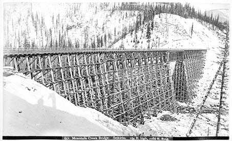
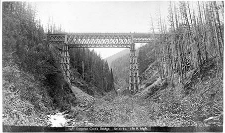
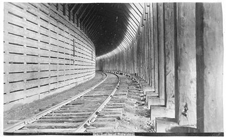
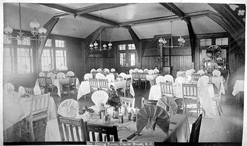
- Photograph: 1889. Album consists of 50 pages of 100 black and white photographs. Photographs also provides descriptions. Small amounts of silver mirroring starting to appear. V10 / PD - 1: 1- [721. Calgary from the E.] 2- [Slephen Clas. Calgary. From W.] 3- [716. Indigenous Camp, Winter.] 4- [Kananaskis Falls.] 5- [Rapids on the Bow at Kananaskis.] 6- [675. Kananaskis Falls from above. Winter.] 7- [676. The Bow at Kananaskis, Winter.] 8- [678. Mouth of Pit and Elevator, Anthracite.] 9- [608. C.P.R. At Banff.] 10- [663. Cascade Mountain. Banff.] 11- [740. Official Plan of the National Park.] 12- [641. C.P.R. Hotel. Banff.] 13- [720. Banff Hotel from N.] 14- [743. Lower Bow Park, from C.P.R. Hotel, Banff.] 15- [745. The Spray River, Banff.] 16- [751. Spray Bridge and Bow Falls, Banff.] 17- [750. Banff Avenue, looking N.] 18- [753. Cascade on the Bow, Banff.] 19- [719. The Sanitarium. Banff.] 20- [754. Upper Hot Springs, Banff.] 21- [755. Cascade Mountain from the Sanitarium, Banff.] 22- [756. Mount Edith, front Bow River, Banff.] 23- [824. The Bow River and Twin Peaks Mountain, Banff.] 24- [757. Bird’s Eye view of Banff, from Tunnel Mountain.] 25- [765. Bow Rapids and C.P.R. Hotel, Banff.] 26- [758. Vermilion Lakes, Banff.] 27- [760. Vermilion Lakes, Banff.] 28- [762. “The Pool,” Banff.] 29- [748. Interior of Cave, Banff] 30- [747. Cave and Basin Buildings, Banff.] 31- [766. Devil’s Head Canyon and Bridge, Banff.] 32- [767. Lake Minnewanka, (Devil’s Lake,) Banff.] 33- [769. Catch of Fish, Lake Minnewanka, Banff.] 34- [782. Lake Minnewanka. W. end, Rocky Mountain Park.] 35- [778. “Sundance Canyon,” Rocky Mountain Park.] 36- [815. “Canyon House” and the “Mountain Belle,” Banff] 37- [817. C.P.R. Transfer Co’s. Stables, Banff.] 38- [668. Bridge over the Spray. Banff] 39- [665. Tunnel Mountain. Banff.] 40- [664. “The Hoodoos.” Natural Monuments. Banff] 41- [657. Castle Mountain, from C.P.R.] 42- [599. Castle Mountain, Rockies.] 43- [596. C.P.R. At Castle Mountain] 44- [603. Castle Mountain, from C.P.R.] 45- [588. Mount LeFroy. Laggan.] 46- [598. Mount Hector. Laggan.] 47- [593. The Bow below Laggan.] 48- [Cathedral Mountain from the west.] 49- [586. Cathedral Mountain. 10,284 ft. high.] 50- [787. Field, B.C. from C.P.R. Hotel.] 51- [578. Field Hotel and Mount Stephen.] 52- [577. Mount Field. 8554 ft. high.] 53- [580. Mount Stephen and Glacier. 10,525 ft. high.] 54- [556. Field (?)] 55- [788. Mt. McMullen and Glaciers from the Summit of Boundary] 56- [790. Kicking Horse Pass and Van Home Range from summit of Boundary Peak, Rockies, height 9,000 feet.] 57- [791. Fairmont Hot Springs and Natural Basin, Kootenai, B.C.] 58- [807. “Wild Horse” Gold digging, Kootenai, B.C.] 59- [808. “D” Troop N. W.M.P. and pack train crossing the Rockies.] 60- [809. “Sam’s Landing” and Stage, Kootenai, B.C.] 61- [681. Falls on the Kicking Horse. Leanchoile 103ft. high. Winter.] 62- [682. Falls on the Kicking Horse. Leanchoile 103ft. high. Winter.] 63- [Winter scene in the Rockies.”] 64- [685. Winter Scene in the Rockies.] 65- [686. A Cascadec in Winter in the Kicking Horse Canyon.] 66- [687. The Kicking Horse in winter.] 67- [601. C.P.R. In the Rockies.] 68- [579. Tunnel in Upper Kicking Horse Pass.] 69- [604. C.P.R. In the Rockies.] 70- [605. C.P.R. In the Rockies.] 71- [606. C.P.R. In the Rockies.] 72- [607. The Bow River in the Rockies.] 73- [597. C.P.R. In the Rockies.] 74- [595. C.P.R. In the Rockies.] 75- [592. In the Rockies.] 76- [562. Bridge over the Kicking Horse.] 77- [555. Bridge and Tunnel. Kicking Horse Pass.] 78- [568. The Beaverfoot Range.] 79- [554. Kicking Horse Pass.] 80- [553. Group of section men on hand-car.] 81- [552. The Moberly House.] 82- [549. Tunnel on C.P.R. west of Donald.] 83- [550. The Columbia and Moberly Peak.] 84- [612. The Beaver Canyon.] 85- [613. The Beaver Canyon.] 86- [614. “Hell Gate.” Beaver Canyon.] 87- [819. Donald, B.C., from Station yard.] 88- [821. Round House and Turntable, Donald, B.C.] 89- [610. C.P.R. Engines.] 90- [703. C.P.R. Engine 73 and train.] 91- [C.P.R. Engine 402 and train] 92- [705. C.P.R. Engine, 316 and train at Donald, B.C.] 93- [606. C.P.R. heavy grade Engine.] 94- [739. Official Plan of “The Loop.” C.P.R.] 95- [651. Mountain Creek Bridge. Selkirks. 164 ft. high, 1086 ft. long.] 96- [652. Stony Creek Bridge. Selkirks. 296 ft. high.] 97- [648. Surprise Creek Bridge. Selkirks. 180 ft. high.] 98- [647. Interior of Snow-shed.] 99- [643. Glacier House. Selkirks.] 100- [837. Dining Room, Glacier House, B.C.]
- Language
- English
- Title Source
- Title based on contents of file
- Processing Status
- Processed
Electronic Resources
Images


This material is presented as originally created; it may contain outdated cultural descriptions and
potentially offensive content.
Read more.
(Bow Lake Area)
https://archives.whyte.org/en/permalink/catalogue24487
- Medium
- Library - Maps and blueprints (unannotated; published)
- Map
- Published Date
- October 31, 1888
- Publisher
- Dominion Lands Office
- Call Number
- C9-7.31
- Publisher
- Dominion Lands Office
- Published Date
- October 31, 1888
- Physical Description
- 1 map : black and white
- Scale
- 40 chains: 1 inch
- Notes
- xerox copy
- Accession Number
- SG7500
- Call Number
- C9-7.31
- Collection
- Archives Library
This material is presented as originally created; it may contain outdated cultural descriptions and
potentially offensive content.
Read more.
A surface geology map of New Brunswick
https://archives.whyte.org/en/permalink/catalogue24775
- Medium
- Library - Book (including soft-cover and pamphlets)
- Map
- Published Date
- 1888-9
- Call Number
- C7-6.1(c)
- Published Date
- 1888-9
- Scale
- 4 miles to 1 inch
- Subjects
- New Brunswick - Geological
- Notes
- Part N, No. 1 1/4 sheet 1, N.E.
- Accompanies 03.1/G29ar Annual Report, 1888-9
- To illustrate Reports by Messrs Bailey, Mathew and Ells, 1871-79
- Accession Number
- 7000
- Call Number
- C7-6.1(c)
- Collection
- Archives Library
This material is presented as originally created; it may contain outdated cultural descriptions and
potentially offensive content.
Read more.
(part of Bow River)
https://archives.whyte.org/en/permalink/catalogue24483
- Medium
- Library - Maps and blueprints (unannotated; published)
- Map
- Published Date
- June 23, 1888
- Publisher
- Dominion Lands Office
- Call Number
- C9-7.28
- Publisher
- Dominion Lands Office
- Published Date
- June 23, 1888
- Physical Description
- 1 map : col
- Scale
- 40 chains: 1 inch
- Accession Number
- SG7500
- Call Number
- C9-7.28
- Collection
- Archives Library
This material is presented as originally created; it may contain outdated cultural descriptions and
potentially offensive content.
Read more.
(Castle Mountain Area)
https://archives.whyte.org/en/permalink/catalogue24481
- Medium
- Library - Maps and blueprints (unannotated; published)
- Map
- Published Date
- April 14, 1888
- Publisher
- Dominion Lands Office
- Call Number
- C9-7.27
- Publisher
- Dominion Lands Office
- Published Date
- April 14, 1888
- Physical Description
- 1 map : black and white
- Scale
- 40 chains: 1 inch
- Notes
- xerox copy
- Accession Number
- SG7500
- Call Number
- C9-7.27
- Collection
- Archives Library
This material is presented as originally created; it may contain outdated cultural descriptions and
potentially offensive content.
Read more.
(part of Bow river)
https://archives.whyte.org/en/permalink/catalogue24480
- Medium
- Library - Maps and blueprints (unannotated; published)
- Map
- Published Date
- March 28, 1888
- Publisher
- Dominion Lands Office
- Call Number
- C9-7.27
- Publisher
- Dominion Lands Office
- Published Date
- March 28, 1888
- Physical Description
- 1 map : col
- Scale
- 40 chains to an inch
- Accession Number
- SG7500
- Call Number
- C9-7.27
- Collection
- Archives Library
This material is presented as originally created; it may contain outdated cultural descriptions and
potentially offensive content.
Read more.
Map of the Kootenay region to accompany report of Supt. S.B. Steele comanding the detachment of Mounted Police in B.C.
https://archives.whyte.org/en/permalink/catalogue21416
- Medium
- Library - Maps and blueprints (unannotated; published)
- Map
- Published Date
- 1888
- Call Number
- C10-6.2
- Published Date
- 1888
- Subjects
- Central British Columbia
- Notes
- Photostatic copy from Public Archives
- Accession Number
- 675
- Call Number
- C10-6.2
- Collection
- Archives Library
This material is presented as originally created; it may contain outdated cultural descriptions and
potentially offensive content.
Read more.
Electoral Districts for the Legislative Assembly and the Railroad System
https://archives.whyte.org/en/permalink/catalogue21500
- Medium
- Library - Maps and blueprints (unannotated; published)
- Map
- Published Date
- 1888
- Call Number
- C12-1.26
- Published Date
- 1888
- Subjects
- North West Territory
- Notes
- Photostatic copy from Public Archives
- Accession Number
- 675
- Call Number
- C12-1.26
- Collection
- Archives Library
This material is presented as originally created; it may contain outdated cultural descriptions and
potentially offensive content.
Read more.
Range 1, West of Fifth Meridian
https://archives.whyte.org/en/permalink/catalogue24490
- Medium
- Library - Maps and blueprints (unannotated; published)
- Map
- Published Date
- 1887
- Publisher
- Dominion Lands Office
- Call Number
- C9-7.34
- Publisher
- Dominion Lands Office
- Published Date
- 1887
- Scale
- 1 mile: 2 inches
- Subjects
- Township #34
- Notes
- photostatic copy from Public Archives
- Accession Number
- 675
- Call Number
- C9-7.34
- Collection
- Archives Library
This material is presented as originally created; it may contain outdated cultural descriptions and
potentially offensive content.
Read more.
Range 1, West of Fifth Meridian, Red Deer-Little Red Deer River Area
https://archives.whyte.org/en/permalink/catalogue24492
- Medium
- Library - Maps and blueprints (unannotated; published)
- Map
- Published Date
- 1887
- Publisher
- Dominion Lands Office, Ottawa
- Call Number
- C9-7.35
- Publisher
- Dominion Lands Office, Ottawa
- Published Date
- 1887
- Scale
- 1 mile: 2 inches
- Subjects
- Township #35
- Notes
- photostatic copy from Public Archives
- Accession Number
- 675
- Call Number
- C9-7.35
- Collection
- Archives Library
This material is presented as originally created; it may contain outdated cultural descriptions and
potentially offensive content.
Read more.