Narrow Results By
- Luxton family fonds 79
- George McLean fonds 36
- Nicholas Morant fonds 36
- Kidney family fonds 26
- Murray Hay fonds 22
- Ben Gadd fonds 19
- Eliza Hunter fonds 14
- Trail Riders of the Canadian Rockies fonds 14
- Archives General File Collection 12
- Dorothy Wardle fonds 10
- Dorothy Cranstone fonds 8
- Lawrence Grassi fonds 8
Deep Powder and Steep Rock - textual
https://archives.whyte.org/en/permalink/descriptions55082
- Part Of
- Chic Scott fonds
- Scope & Content
- Series consists of textual records, including notes, manuscripts and other related materials, pertaining to the creation of the book "Deep Powder and Steep Rock".
- Date Range
- 2009
- Reference Code
- M57 / V
- Description Level
- 3 / Series
- GMD
- Textual record
- Map
- Part Of
- Chic Scott fonds
- Description Level
- 3 / Series
- Fonds Number
- M57 / V40 / S47
- Series
- M57 / V : Deep Powder and Steep Rock
- Sous-Fonds
- M57
- Accession Number
- 2014.8295
- 2015.8559
- Reference Code
- M57 / V
- GMD
- Textual record
- Map
- Date Range
- 2009
- Physical Description
- 30 cm of textual records
- History / Biographical
- Hans Gmoser played a major role in creating Canada’s vibrant mountain community. Although known internationally as the father of heli-skiing, he was much more than that: a talented rock climber, tireless expedition leader, a mountain guide, film maker and organizer. Deep Powder and Steep Rock presents an intimate portrait of this charismatic man. Much of the story is told in Gmoser’s own words, gleaned from his diaries, expedition journals, film commentaries and personal correspondence. It is a unique tale of adventure, hard work, perseverance and ultimate success.
- Scope & Content
- Series consists of textual records, including notes, manuscripts and other related materials, pertaining to the creation of the book "Deep Powder and Steep Rock".
- Notes
- Series consists of five sub-series: M57 / V / A: Research files M57 / V / B: Maps M57 / V / C: Interviews M57 / V / D: Photograph notes M57 / V / E: Draft Manuscript
- Name Access
- Scott, Chic
- Gmoser, Hans
- Subject Access
- Biography
- Personal and Professional Life
- Publication
- Research
- Geography
- Map
- Mountaineers
- Mountaineering
- Skiing
- Sports
- Recreation
- Winter sports
- Canadian Mountain Holidays
- Helicopter skiing
- Tourism
- Climbing
- Geographic Access
- Canada
- Alberta
- Banff
- Banff National Park
- Canadian Rocky Mountains
- Language
- English
- Related Material
- S47 / V
- V40 / V
- Biographical Source Notes
- http://chicscott.com/books.htm
- Title Source
- Title based on contents of file
- Processing Status
- Processed
This material is presented as originally created; it may contain outdated cultural descriptions and
potentially offensive content.
Read more.
Camp coordinator packages, notes and handouts
https://archives.whyte.org/en/permalink/descriptions54472
- Scope & Content
- File consists of introductory packages put together for Camp Coordinators on pack trips led by the Trail Riders of the Canadian Rockies in 2008. File includes contact lists, name lists and basic information about riders, participant reports, printed maps and brochures pertaining to specific packing…
- Date Range
- 2008
- Reference Code
- M545 / II / 14
- Description Level
- 5 / File
- GMD
- Textual record
- Organization record
- Map
- Postcard
- Description Level
- 5 / File
- Fonds Number
- M545 / V635
- Series
- M545 / II : Members, Staff, Personal Content
- Sous-Fonds
- M545
- Accession Number
- 8235
- Reference Code
- M545 / II / 14
- Date Range
- 2008
- Physical Description
- 1.5 cm of textual records
- Scope & Content
- File consists of introductory packages put together for Camp Coordinators on pack trips led by the Trail Riders of the Canadian Rockies in 2008. File includes contact lists, name lists and basic information about riders, participant reports, printed maps and brochures pertaining to specific packing trips in 2008, blank survey sheets and insurance waivers, and itineraries. Items are kept in order of 2008 ride numbers: Ride 1, Ride 2, etc.
- Notes
- Contains numerous duplicates
- Subject Access
- Administration
- Packing
- Travel
- Tourism
- Geography
- Geographic Access
- Canada
- Alberta
- Kananaskis
- Banff
- Access Restrictions
- Restrictions may apply due to personal information
- Reproduction Restrictions
- Restrictions may apply due to personal information
- Language
- English
- Category
- Sports, recreation and leisure
- Title Source
- Title based on contents of file
- Processing Status
- Processed
This material is presented as originally created; it may contain outdated cultural descriptions and
potentially offensive content.
Read more.
2002 race award ceremony
https://archives.whyte.org/en/permalink/descriptions54388
- Scope & Content
- File consists of 54 colour photographs pertaining to the awards ceremony for Bruno Engler's Memorial Ski Race held in 2002. Images depict trophies won in the ski race, and various unnamed individuals accepting or presenting awards.
- Date Range
- 2002
- Reference Code
- V783 / II / PA - 70 to 123
- Description Level
- 5 / File
- GMD
- Photograph
- Photograph print
- Description Level
- 5 / File
- Fonds Number
- M559 / V783
- Series
- V783 / II : 1991 - 2016
- Sous-Fonds
- V783
- Accession Number
- 2018.8688
- Reference Code
- V783 / II / PA - 70 to 123
- Date Range
- 2002
- Physical Description
- 54 photographs : col. prints ; 15 x 10 cm
- Scope & Content
- File consists of 54 colour photographs pertaining to the awards ceremony for Bruno Engler's Memorial Ski Race held in 2002. Images depict trophies won in the ski race, and various unnamed individuals accepting or presenting awards.
- Notes
- Photographs not removed from original labelled/numbered sheets to maintain original order and context.
- Archival reference code numbers [V783/II/PA-70 to 123] follow original letter codes of photos written on mylar cases [V783/II/PA-70 is photo "A1", PA-71 is photo "A2", etc.]
- Subject Access
- Award
- Ceremony
- Memorial
- Skiing
- Ski racing
- Sports
- Winter sports
- Geographic Access
- Canada
- Alberta
- Banff
- Access Restrictions
- Copyright restrictions may apply
- Reproduction Restrictions
- Copyright restrictions may apply
- Language
- English
- Conservation
- Items appear to be safe remaining in original state of storage in protective sleeves. Consider removing photographs in the future if off-gassing becomes a concern.
- Category
- Sports, recreation and leisure
- Title Source
- Title based on contents of file
- Processing Status
- Processed
This material is presented as originally created; it may contain outdated cultural descriptions and
potentially offensive content.
Read more.
[Hightower Creek - Alberta]
https://archives.whyte.org/en/permalink/catalogue23660
- Medium
- Library - Maps and blueprints (unannotated; published)
- Map
- Published Date
- 1949
- Publisher
- Dept. of Mines & Technical Surv.
- Call Number
- NTS
- 83F/13E
- Publisher
- Dept. of Mines & Technical Surv.
- Published Date
- 1949
- Scale
- 1:50,000
- Subjects
- Hightower Creek - Alberta
- Notes
- National Topographic System
- Accession Number
- 12000
- Call Number
- NTS
- 83F/13E
- Collection
- Archives Library
This material is presented as originally created; it may contain outdated cultural descriptions and
potentially offensive content.
Read more.
[Hightower Creek - Alberta]
https://archives.whyte.org/en/permalink/catalogue23661
- Medium
- Library - Maps and blueprints (unannotated; published)
- Map
- Published Date
- 1949
- Publisher
- Dept. of Mines & Technical Survey
- Call Number
- NTS
- 83F/13W
- Publisher
- Dept. of Mines & Technical Survey
- Published Date
- 1949
- Scale
- 1:50,000
- Subjects
- Hightower Creek - Alberta
- Notes
- National Topographic System
- Accession Number
- 12000
- Call Number
- NTS
- 83F/13W
- Collection
- Archives Library
This material is presented as originally created; it may contain outdated cultural descriptions and
potentially offensive content.
Read more.
Topographical Map
https://archives.whyte.org/en/permalink/catalogue24619
- Medium
- Library - Maps and blueprints (unannotated; published)
- Map
- Published Date
- 1948
- Publisher
- Dept. of Mines and Resources
- Call Number
- C3-2.4
- Publisher
- Dept. of Mines and Resources
- Published Date
- 1948
- Physical Description
- Colour
- Scale
- Scale: 1:63,360
- Relief: Contour interval 100'
- Subjects
- Lake Louise
- Accession Number
- 1105
- Call Number
- C3-2.4
- Collection
- Archives Library
This material is presented as originally created; it may contain outdated cultural descriptions and
potentially offensive content.
Read more.
[Deep Valley Creek South, Alberta]
https://archives.whyte.org/en/permalink/catalogue23579
- Medium
- Library - Maps and blueprints (unannotated; published)
- Map
- Published Date
- 1947
- Publisher
- Dept. of Mines & Technical Survey
- Call Number
- NTS
- 82K/4E
- Publisher
- Dept. of Mines & Technical Survey
- Published Date
- 1947
- Scale
- Scale: 1:50,000
- Subjects
- Deep Valley Creek
- Alberta
- Notes
- National Topographic System
- Accession Number
- 12000
- Call Number
- NTS
- 82K/4E
- Collection
- Archives Library
This material is presented as originally created; it may contain outdated cultural descriptions and
potentially offensive content.
Read more.
[Deep Valley Creek South, Alberta]
https://archives.whyte.org/en/permalink/catalogue23580
- Medium
- Library - Maps and blueprints (unannotated; published)
- Map
- Published Date
- 1947
- Publisher
- Dept. of Mines & Technical Survey
- Call Number
- NTS
- 83K/4W
- Publisher
- Dept. of Mines & Technical Survey
- Published Date
- 1947
- Scale
- Scale: 1:50,000
- Subjects
- Deep Valley Creek
- Alberta
- Notes
- National Topographic System
- Accession Number
- 12000
- Call Number
- NTS
- 83K/4W
- Collection
- Archives Library
This material is presented as originally created; it may contain outdated cultural descriptions and
potentially offensive content.
Read more.
Province of Alberta
https://archives.whyte.org/en/permalink/catalogue24409
- Medium
- Library - Maps and blueprints (unannotated; published)
- Map
- Published Date
- 1947
- Publisher
- Alberta Dept. of Lands and Mines
- Call Number
- C9-1.19
- Publisher
- Alberta Dept. of Lands and Mines
- Published Date
- 1947
- Physical Description
- 1 map
- Scale
- Scale: 1 inch = 16 miles
- Subjects
- Alberta
- Notes
- In oversize cabinet (rolled up)
- Accession Number
- 6406
- Call Number
- C9-1.19
- Collection
- Archives Library
This material is presented as originally created; it may contain outdated cultural descriptions and
potentially offensive content.
Read more.
Topographic Map
https://archives.whyte.org/en/permalink/catalogue24621
- Medium
- Library - Maps and blueprints (unannotated; published)
- Map
- Published Date
- 1947
- Publisher
- Dept. of Mines and Resources
- Call Number
- C3-3.1
- Publisher
- Dept. of Mines and Resources
- Published Date
- 1947
- Physical Description
- Colour
- Scale
- Scale: 1": 1 mile
- Relief: Contour interval 100'
- Subjects
- Sunwapta
- Accession Number
- 442
- Call Number
- C3-3.1
- Collection
- Archives Library
This material is presented as originally created; it may contain outdated cultural descriptions and
potentially offensive content.
Read more.
Jasper Park South Sheet
https://archives.whyte.org/en/permalink/catalogue23180
- Medium
- Library - Maps and blueprints (unannotated; published)
- Map
- Published Date
- 1947
- Publisher
- Dept. of Mines and Resources
- Call Number
- C2-2.7
- Publisher
- Dept. of Mines and Resources
- Published Date
- 1947
- Scale
- Scale: 3 miles to 1 inch
- Notes
- Relief: Contour Interval 200'
- Accession Number
- 400, 718
- Call Number
- C2-2.7
- Collection
- Archives Library
This material is presented as originally created; it may contain outdated cultural descriptions and
potentially offensive content.
Read more.
[Jasper Park]
https://archives.whyte.org/en/permalink/catalogue23181
- Medium
- Library - Maps and blueprints (unannotated; published)
- Map
- Published Date
- 1947
- Publisher
- Dept. of Mines and Technical Surveys
- Call Number
- C2-2.8
- Publisher
- Dept. of Mines and Technical Surveys
- Published Date
- 1947
- Physical Description
- 1 map : col
- Scale
- Scale: 1 inch : 3 miles
- Relief: Contour Interval 200 ft
- Subjects
- Jasper National Park
- Notes
- Dup. in Research Room/2 Dup. in Map Room
- Accession Number
- 3000
- 673
- 1153 M. 171
- 1096
- 3349
- Call Number
- C2-2.8
- Collection
- Archives Library
This material is presented as originally created; it may contain outdated cultural descriptions and
potentially offensive content.
Read more.
[Jasper Park (South Sheet)]
https://archives.whyte.org/en/permalink/catalogue23182
- Medium
- Library - Maps and blueprints (unannotated; published)
- Map
- Published Date
- 1947 (interim corrections 1974)
- Publisher
- Department of Mines and Technical Surveys
- Call Number
- C2-2.8 (a)
- Publisher
- Department of Mines and Technical Surveys
- Published Date
- 1947 (interim corrections 1974)
- Physical Description
- 1 map : col
- Scale
- Scale: I inch: 3 miles
- Relief: Counter interval 200 ft.
- Subjects
- Jasper National Park
- Accession Number
- 7000
- Call Number
- C2-2.8 (a)
- Collection
- Archives Library
This material is presented as originally created; it may contain outdated cultural descriptions and
potentially offensive content.
Read more.
[Blairmore 82G/9 West, Alberta]
https://archives.whyte.org/en/permalink/catalogue23501
- Medium
- Library - Maps and blueprints (unannotated; published)
- Map
- Published Date
- 1946
- Publisher
- Dept. of Mines and Techinical Surveys
- Call Number
- NTS
- 82G/9W
- Publisher
- Dept. of Mines and Techinical Surveys
- Published Date
- 1946
- Physical Description
- 1 map : col
- Scale
- Scale: 1:50,000
- Relief: Contour interval 100'
- Subjects
- Blairmore
- Western Alberta
- Notes
- National Topographic System
- Call Number
- NTS
- 82G/9W
- Collection
- Archives Library
This material is presented as originally created; it may contain outdated cultural descriptions and
potentially offensive content.
Read more.
[Moberly Creek - Alberta]
https://archives.whyte.org/en/permalink/catalogue23741
- Medium
- Library - Maps and blueprints (unannotated; published)
- Map
- Published Date
- 1946
- Publisher
- Dept. of Mines & Technical Surveys
- Call Number
- NTS
- 83E/9
- Publisher
- Dept. of Mines & Technical Surveys
- Published Date
- 1946
- Scale
- 1:50,000
- Subjects
- Moberly Creek - Alberta
- Notes
- National Topographic System
- Provisional Map
- Accession Number
- 12000
- Call Number
- NTS
- 83E/9
- Collection
- Archives Library
This material is presented as originally created; it may contain outdated cultural descriptions and
potentially offensive content.
Read more.
[United States]
https://archives.whyte.org/en/permalink/catalogue24812
- Medium
- Library - Maps and blueprints (unannotated; published)
- Map
- Published Date
- 1946
- Publisher
- National Geographic Society
- Call Number
- C13-1.1(d)
- Publisher
- National Geographic Society
- Published Date
- 1946
- Scale
- Scale: 78.91 miles to 1 inch
- Relief: Bench marks
- Subjects
- United States
- Accession Number
- 495
- Call Number
- C13-1.1(d)
- Collection
- Archives Library
This material is presented as originally created; it may contain outdated cultural descriptions and
potentially offensive content.
Read more.
[RECONNAISSANCE PLAN: BANFF_MT. ASSINIBOINE PARK ROUTE 4 via Healy Creek, Sunshine Lodge, Citadel Pass]
https://archives.whyte.org/en/permalink/catalogue24909
- Medium
- Library - Maps and blueprints (unannotated; published)
- Map
- Published Date
- 1946 (transfered to manuscript Oct. 1994)
- Call Number
- C2-10.1 (d)
- Published Date
- 1946 (transfered to manuscript Oct. 1994)
- Scale
- 1) Scale: 4 ": 1 mile
- Relief - Counter interval 50 ft.
- 2) Scale: 1 ": 200 ft.
- Relief - Counter interval: 5 ft.
- Subjects
- Mount Assiniboine Provincial Park
- Notes
- 2) = Plan of Healy Creek_Mt. Assiniboine Proposed Location Class "C" Highway Survey 1946/Section 1_Banff to Healy Creek
- 5) Sunshine to Quartz Hill
- 6) 3 sections
- Accession Number
- 2158
- Call Number
- C2-10.1 (d)
- Collection
- Archives Library
This material is presented as originally created; it may contain outdated cultural descriptions and
potentially offensive content.
Read more.
Map showing Coalfields, Potential Coal Areas and Coal occurences of Canada
https://archives.whyte.org/en/permalink/catalogue21472
- Medium
- Library - Book (including soft-cover and pamphlets)
- Map
- Published Date
- 1946
- Publisher
- Dept. of Mines and Resources
- Call Number
- C7-5.7
- Publisher
- Dept. of Mines and Resources
- Published Date
- 1946
- Subjects
- Canada - Coal Areas
- Accession Number
- 3071
- Call Number
- C7-5.7
- Collection
- Archives Library
This material is presented as originally created; it may contain outdated cultural descriptions and
potentially offensive content.
Read more.
Glacier Park, B.C.
https://archives.whyte.org/en/permalink/catalogue23225
- Medium
- Library - Maps and blueprints (unannotated; published)
- Map
- Published Date
- 1946
- Publisher
- Ottawa, Tophographical Survey of Canada
- Call Number
- C2-7.5a
- Publisher
- Ottawa, Tophographical Survey of Canada
- Published Date
- 1946
- Physical Description
- 1 map : col
- Scale
- Scale: 1:126,720
- Subjects
- Glacier National Park
- Accession Number
- 3349
- Call Number
- C2-7.5a
- Collection
- Archives Library
This material is presented as originally created; it may contain outdated cultural descriptions and
potentially offensive content.
Read more.
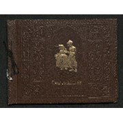
Trail ride album
https://archives.whyte.org/en/permalink/descriptions14151
- Scope & Content
- Photograph album contains 182 black and white prints pertaining to trail rides in July/August, 1945 through Baker Creek, Ptarmigan Lake, Skoki and Lake Louise; and Lake O'Hara, Lake McArthur and Odaray Trail. Images depict riders on horseback, scenic views of mountains, waterfalls, forests and land…
- Date Range
- 1945
- Reference Code
- V635 / I / PD - 3
- Description Level
- 5 / File
- GMD
- Album
- Photograph
- Photograph print
- Textual record
1 image
1 Electronic Resource
- Description Level
- 5 / File
- Fonds Number
- M545 / V635
- Series
- V635 / I : Events and Activities
- Sous-Fonds
- V635
- Accession Number
- 5757
- Reference Code
- V635 / I / PD - 3
- Responsibility
- Trail Riders of the Canadian Rockies
- Date Range
- 1945
- Physical Description
- 1 photograph album (182 prints)
- Scope & Content
- Photograph album contains 182 black and white prints pertaining to trail rides in July/August, 1945 through Baker Creek, Ptarmigan Lake, Skoki and Lake Louise; and Lake O'Hara, Lake McArthur and Odaray Trail. Images depict riders on horseback, scenic views of mountains, waterfalls, forests and landscapes, individual and group photographs of riders, and campsites. Most photographs not annotated and people in photographs not named. Album also contains three pamphlets pertaining to 1945 trail rides with lists of locations and attendees.
- Subject Access
- Travel
- Hiking
- Packing
- Horses
- Mountain
- Waterfall
- Landscapes
- Trail
- Lake
- Trail Riders of the Canadian Rockies
- Geographic Access
- Canada
- Alberta
- Canadian Rocky Mountains
- Language
- English
- Creator
- Unknown
- Title Source
- Title based on contents of file
- Processing Status
- Processed
Electronic Resources
Images

This material is presented as originally created; it may contain outdated cultural descriptions and
potentially offensive content.
Read more.