Narrow Results By
- Luxton family fonds 84
- George McLean fonds 36
- Mary Schaffer fonds 30
- Archives General File Collection 28
- Dan and Mary McCowan fonds 26
- Joe Kootenay fonds 24
- Moore family fonds 23
- Alpine Club of Canada fonds 21
- Kidney family fonds 20
- Eliza Hunter fonds 14
- Peter and Catharine Whyte fonds 11
- Nicholas Morant fonds 10
[Chipewyan, Alberta] Topographical Survey
https://archives.whyte.org/en/permalink/catalogue24413
- Medium
- Library - Maps and blueprints (unannotated; published)
- Map
- Published Date
- 1929
- Publisher
- Dept. of the Interior
- Call Number
- C9-2.1
- Publisher
- Dept. of the Interior
- Published Date
- 1929
- Physical Description
- 1 map : col
- Scale
- Scale: 4 miles: 1 inch
- Relief: Spot heights
- Subjects
- Chipewyan, Alberta
- Accession Number
- 400
- Call Number
- C9-2.1
- Collection
- Archives Library
This material is presented as originally created; it may contain outdated cultural descriptions and
potentially offensive content.
Read more.
[Stikine River, Northern B.C.]
https://archives.whyte.org/en/permalink/catalogue24528
- Medium
- Library - Maps and blueprints (unannotated; published)
- Map
- Published Date
- 1929
- Publisher
- Department of Lands, B.C.
- Call Number
- C10-3.6
- Publisher
- Department of Lands, B.C.
- Published Date
- 1929
- Scale
- Scale: 5 miles: 1 inch
- Relief: contour interval 500 ft.
- Subjects
- Northern British Columbia
- Stikine River
- Accession Number
- 495
- Call Number
- C10-3.6
- Collection
- Archives Library
This material is presented as originally created; it may contain outdated cultural descriptions and
potentially offensive content.
Read more.
[Europe and the Near East]
https://archives.whyte.org/en/permalink/catalogue24854
- Medium
- Library - Maps and blueprints (unannotated; published)
- Map
- Published Date
- 1929
- Publisher
- National Geographic Society
- Call Number
- C13-12.1
- Publisher
- National Geographic Society
- Published Date
- 1929
- Scale
- 94.7 miles to 1 inch
- Subjects
- Europe and the Near East
- Accession Number
- 400
- Call Number
- C13-12.1
- Collection
- Archives Library
This material is presented as originally created; it may contain outdated cultural descriptions and
potentially offensive content.
Read more.
Banff National Park, Yoho Park and Kootenay Park
https://archives.whyte.org/en/permalink/catalogue21447
- Medium
- Library - Maps and blueprints (unannotated; published)
- Map
- Published Date
- 1929
- Publisher
- Canadian Pacific Railway
- Call Number
- C3-6.3(a)
- Publisher
- Canadian Pacific Railway
- Published Date
- 1929
- Physical Description
- Colour
- Subjects
- Canadian Rockies
- Notes
- Panoramic map showing main and branch lines of C.P.R.
- 3 duplicates in Map Room
- Accession Number
- 131
- 110
- 1120
- 3072
- Call Number
- C3-6.3(a)
- Collection
- Archives Library
This material is presented as originally created; it may contain outdated cultural descriptions and
potentially offensive content.
Read more.
[Rocky Mountains and Jasper Parks] Showing areas which it is proposed to withdraw from
https://archives.whyte.org/en/permalink/catalogue23194
- Medium
- Library - Maps and blueprints (unannotated; published)
- Map
- Published Date
- 1929
- Publisher
- Dept. of the Interior
- Call Number
- C2-3.8
- Publisher
- Dept. of the Interior
- Published Date
- 1929
- Physical Description
- 1 map : col
- Scale
- Scale: 1:792,000
- Subjects
- Rocky Mountains and Jasper Parks
- Accession Number
- 1230
- Call Number
- C2-3.8
- Collection
- Archives Library
This material is presented as originally created; it may contain outdated cultural descriptions and
potentially offensive content.
Read more.
[Northwest Territories]
https://archives.whyte.org/en/permalink/catalogue24375
- Medium
- Library - Maps and blueprints (unannotated; published)
- Map
- Published Date
- 1929
- Publisher
- Dept. of the Interior
- Call Number
- C8-3.1
- Publisher
- Dept. of the Interior
- Published Date
- 1929
- Physical Description
- 1 map : col
- Scale
- Scale: 60 miles to 1 inch
- Subjects
- Northwest Territories
- Notes
- R.C.M.P. posts, Radio Stations, Trading Posts, Boundaries and Names of Preserves
- Call Number
- C8-3.1
- Collection
- Archives Library
This material is presented as originally created; it may contain outdated cultural descriptions and
potentially offensive content.
Read more.
(Canmore area)
https://archives.whyte.org/en/permalink/catalogue24469
- Medium
- Library - Maps and blueprints (unannotated; published)
- Map
- Published Date
- October 22, 1928
- Publisher
- Dept. of the Interior
- Call Number
- C9-7.24
- Publisher
- Dept. of the Interior
- Published Date
- October 22, 1928
- Physical Description
- 1 map : black and white
- Scale
- 40 chains: 1 "
- Accession Number
- SG7500
- Call Number
- C9-7.24
- Collection
- Archives Library
This material is presented as originally created; it may contain outdated cultural descriptions and
potentially offensive content.
Read more.
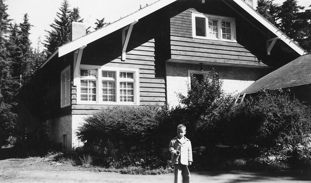
Lorne C. Paul fonds
https://archives.whyte.org/en/permalink/descriptions539
- Part Of
- Lorne C. Paul fonds
- Scope & Content
- Fonds pertains to trips, activities and views in Jasper National Park and at Jasper Park Lodge. Includes both snapshots and published prints. Identifications are included.
- Date Range
- 1928
- Reference Code
- V492
- Description Level
- 1 / Fonds
- GMD
- Photograph
- Photograph print
- Part Of
- Lorne C. Paul fonds
- Description Level
- 1 / Fonds
- Fonds Number
- V 492
- Sous-Fonds
- V 492
- Accession Number
- 2128
- Reference Code
- V492
- Date Range
- 1928
- Physical Description
- 73 photographs : prints
- History / Biographical
- Lorne Caswell Paul, b.1904, worked at the Jasper Park Lodge in Jasper, Alberta, 1927-1928. Later he was a professor at the University of Saskatchewan in Saskatoon, Saskatchewan.
- Scope & Content
- Fonds pertains to trips, activities and views in Jasper National Park and at Jasper Park Lodge. Includes both snapshots and published prints. Identifications are included.
- Name Access
- Paul, Lorne C.
- Subject Access
- Jasper National Park
- Sports, recreation and leisure
- Access Restrictions
- No restrictions on access
- Public domain (other restrictions may apply)
- Language
- Language is English
- Finding Aid
- Finding aids and reference tools: basic description
- Creator
- Paul, Lorne C.
- Category
- Sports, recreation and leisure
- Title Source
- Title based on accession record
- Processing Status
- Processed
This material is presented as originally created; it may contain outdated cultural descriptions and
potentially offensive content.
Read more.
[Northern Peace River Sheet] Pre-emptor's map
https://archives.whyte.org/en/permalink/catalogue24525
- Medium
- Library - Maps and blueprints (unannotated; published)
- Map
- Published Date
- 1928
- Publisher
- Department of Lands, B.C.
- Call Number
- C10-3.3
- Publisher
- Department of Lands, B.C.
- Published Date
- 1928
- Scale
- Scale: 4 miles: 1 inch
- Subjects
- British Columbia
- Northern Peace River
- Accession Number
- 495
- Call Number
- C10-3.3
- Collection
- Archives Library
This material is presented as originally created; it may contain outdated cultural descriptions and
potentially offensive content.
Read more.
- Medium
- Library - Maps and blueprints (unannotated; published)
- Map
- Published Date
- 1928
- Publisher
- Source: Canadian Geographica Survey
- Call Number
- C3-4.2
- Publisher
- Source: Canadian Geographica Survey
- Published Date
- 1928
- Scale
- Scale: 2 miles to 1 inch
- Relief: Contour interval 200'
- Subjects
- Windermere
- Accession Number
- 400
- Call Number
- C3-4.2
- Collection
- Archives Library
This material is presented as originally created; it may contain outdated cultural descriptions and
potentially offensive content.
Read more.
Boston in picture and story
https://archives.whyte.org/en/permalink/catalogue21516
- Medium
- Library - Maps and blueprints (unannotated; published)
- Map
- Published Date
- 1928
- Call Number
- C13-1.14
- Published Date
- 1928
- Subjects
- Boston, United States
- Notes
- 300 years of progress
- Accession Number
- 400
- Call Number
- C13-1.14
- Collection
- Archives Library
This material is presented as originally created; it may contain outdated cultural descriptions and
potentially offensive content.
Read more.
Kootenay Park
https://archives.whyte.org/en/permalink/catalogue23208
- Medium
- Library - Maps and blueprints (unannotated; published)
- Map
- Published Date
- 1928
- Publisher
- Ottawa: Office of the Surveyor General
- Call Number
- C2-5.3a
- Publisher
- Ottawa: Office of the Surveyor General
- Published Date
- 1928
- Physical Description
- 1 map : col
- Scale
- Scale: 1:126,720
- Subjects
- Kootenay National Park
- Accession Number
- 3206
- Call Number
- C2-5.3a
- Collection
- Archives Library
This material is presented as originally created; it may contain outdated cultural descriptions and
potentially offensive content.
Read more.
[Waterton Lakes Park]
https://archives.whyte.org/en/permalink/catalogue23215
- Medium
- Library - Maps and blueprints (unannotated; published)
- Map
- Published Date
- 1928
- Publisher
- Dept. of Mines and Technical Surveys
- Call Number
- C2-6.4(a)
- Publisher
- Dept. of Mines and Technical Surveys
- Published Date
- 1928
- Physical Description
- 1 map : col
- Scale
- Scale: 1 mile to 1 inch
- Subjects
- Waterton Lakes National Park
- Accession Number
- 2781
- Call Number
- C2-6.4(a)
- Collection
- Archives Library
This material is presented as originally created; it may contain outdated cultural descriptions and
potentially offensive content.
Read more.
Waterton Lakes Park
https://archives.whyte.org/en/permalink/catalogue23216
- Medium
- Library - Maps and blueprints (unannotated; published)
- Map
- Published Date
- 1928
- Publisher
- Ottawa : Topographical Survey of Canada
- Call Number
- C2-6.4b
- Publisher
- Ottawa : Topographical Survey of Canada
- Published Date
- 1928
- Physical Description
- 1 map : col
- Scale
- Scale: 1:63,360
- Subjects
- Waterton Lakes National Park
- Accession Number
- 3206
- Call Number
- C2-6.4b
- Collection
- Archives Library
This material is presented as originally created; it may contain outdated cultural descriptions and
potentially offensive content.
Read more.
Jack Herity fonds
https://archives.whyte.org/en/permalink/descriptions481
- Part Of
- Jack Herity fonds
- Scope & Content
- Fonds pertains to Banff Indian Days, Sundance Canyon, Otonabee Lodge; also Jack Herity and his companion, Greer Roberts. Accompanied by letter giving details of photographs.
- Date Range
- 1927
- Reference Code
- V278
- Description Level
- 1 / Fonds
- GMD
- Photograph
- Photograph print
- Part Of
- Jack Herity fonds
- Description Level
- 1 / Fonds
- Fonds Number
- V 278
- Sous-Fonds
- V 278
- Accession Number
- 3724
- Reference Code
- V278
- Date Range
- 1927
- Physical Description
- 13 photographs : prints
- History / Biographical
- Jack Herity was a sales representative (1927), freelance writer and photographer at Toronto, Ontario. Herity spent his holidays in Banff in 1927.
- Scope & Content
- Fonds pertains to Banff Indian Days, Sundance Canyon, Otonabee Lodge; also Jack Herity and his companion, Greer Roberts. Accompanied by letter giving details of photographs.
- Name Access
- Herity, Jack C.
- Subject Access
- Family and personal life
- Access Restrictions
- No restrictions on access
- Public domain (other restrictions may apply)
- Language
- Language is English
- Finding Aid
- Finding aids and reference tools: basic description
- Creator
- Herity, Jack C.
- Category
- Family and personal life
- Title Source
- Title based on accession record
- Processing Status
- Processed
This material is presented as originally created; it may contain outdated cultural descriptions and
potentially offensive content.
Read more.
Canadian Pacific Railway and connecting lines
https://archives.whyte.org/en/permalink/catalogue24565
- Medium
- Library - Maps and blueprints (unannotated; published)
- Map
- Published Date
- 1927
- Publisher
- [Montreal] : C.P.R.
- Call Number
- C11-3.17
- Publisher
- [Montreal] : C.P.R.
- Published Date
- 1927
- Physical Description
- 1 map : col
- Scale
- 1 inch = 110 miles
- Subjects
- Canadian Pacific Railway
- Accession Number
- 6596
- Call Number
- C11-3.17
- Collection
- Archives Library
This material is presented as originally created; it may contain outdated cultural descriptions and
potentially offensive content.
Read more.
Topographical Map
https://archives.whyte.org/en/permalink/catalogue24618
- Medium
- Library - Maps and blueprints (unannotated; published)
- Map
- Published Date
- 1927
- Publisher
- Dept. of the Interior
- Call Number
- C3-2.3
- Publisher
- Dept. of the Interior
- Published Date
- 1927
- Physical Description
- Colour
- Scale
- Scale: 1:63,360
- Relief: Contour interval 100ft.
- Subjects
- Lake Louise
- Notes
- Duplicates (3) in Map Room
- Accession Number
- 626
- 3069
- 3349
- 400 (2)
- 1113 (1)
- Call Number
- C3-2.3
- Collection
- Archives Library
This material is presented as originally created; it may contain outdated cultural descriptions and
potentially offensive content.
Read more.
Clifford White
https://archives.whyte.org/en/permalink/descriptions25387
- Part Of
- Barbara Whyte fonds
- Scope & Content
- Black and white photographs. A portrait of Clifford White, a portrait of Clifford White and Chief Calf Child. Both photographs are matted and taken by George Nobel.
- Date Range
- 1927
- Reference Code
- V688 / PA 71 (58-59)
- Description Level
- 5 / File
- GMD
- Photograph
- Photograph print
2 images
- Part Of
- Barbara Whyte fonds
- Description Level
- 5 / File
- Fonds Number
- V688
- Series
- Photographs
- Sous-Fonds
- V688
- Accession Number
- 6352
- Reference Code
- V688 / PA 71 (58-59)
- Date Range
- 1927
- Physical Description
- 2 photographs
- Scope & Content
- Black and white photographs. A portrait of Clifford White, a portrait of Clifford White and Chief Calf Child. Both photographs are matted and taken by George Nobel.
- Language
- English
- Title Source
- Titel based on contents
- Processing Status
- Processed
Images

This material is presented as originally created; it may contain outdated cultural descriptions and
potentially offensive content.
Read more.
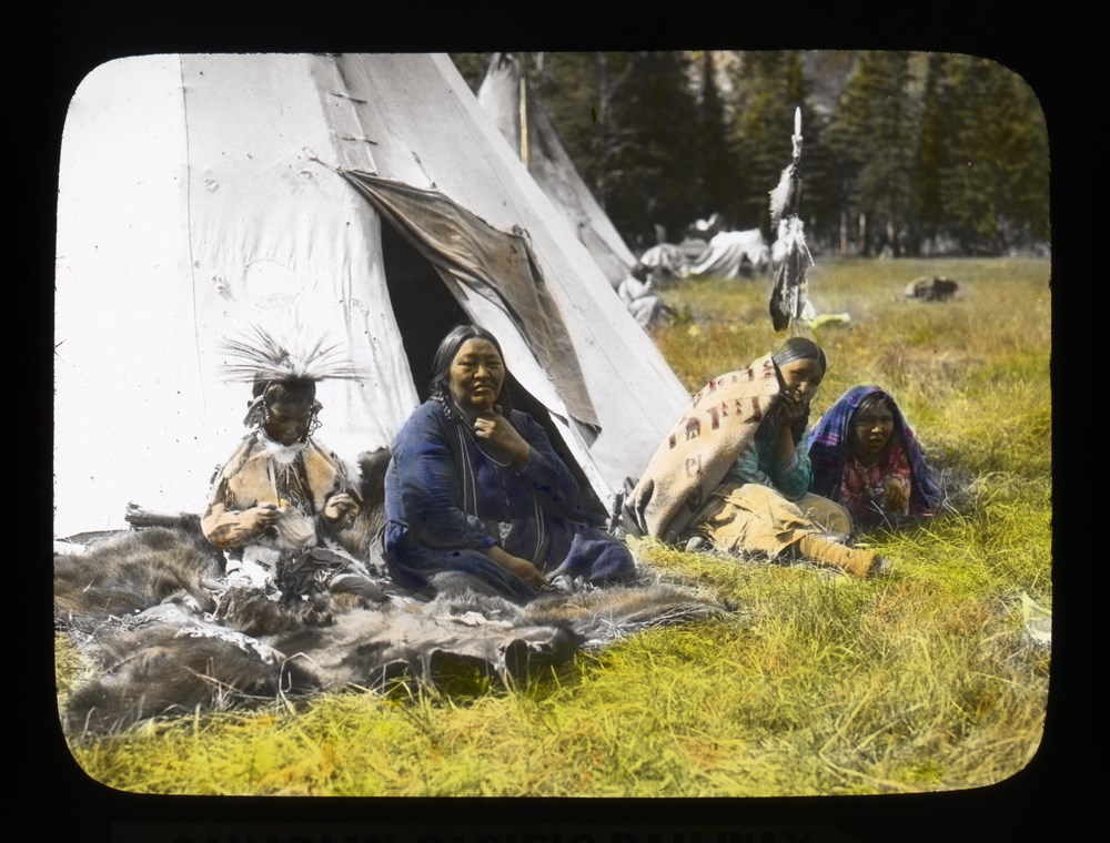
Banff - An Indigenous Family
https://archives.whyte.org/en/permalink/descriptions39498
- Part Of
- Moore family fonds
- Scope & Content
- Unidentified family
- Date Range
- 1927
- Reference Code
- V439 / PS - 324
- Description Level
- 6 / Item
- GMD
- Photograph
- Lantern slide
- Transparency
1 image
- Part Of
- Moore family fonds
- Description Level
- 6 / Item
- Fonds Number
- M307 / V439
- Series
- I. Philip Moore series
- Sous-Fonds
- V439
- Sub-Series
- B. Professional papers and photographs 2. Research, writing and lecturing d. Photographs i. Lantern slides (transparencies)
- Reference Code
- V439 / PS - 324
- Date Range
- 1927
- Physical Description
- 1 transparency : lantern slide
- Scope & Content
- Unidentified family
- Subject Access
- Buildings and memorials
- Discovery and Exploration
- Family and personal life
- First nations
- Geographic Access
- Alberta
- Creator
- Brigden's
- Processing Status
- Processed
Images
This material is presented as originally created; it may contain outdated cultural descriptions and
potentially offensive content.
Read more.
Map of the mountains from Calgary to Sicamous
https://archives.whyte.org/en/permalink/catalogue21446
- Medium
- Library - Maps and blueprints (unannotated; published)
- Map
- Published Date
- 1927
- Publisher
- Canadian Pacific Railway
- Call Number
- C3-6.2
- Publisher
- Canadian Pacific Railway
- Published Date
- 1927
- Physical Description
- Colour
- Subjects
- Canadian Pacific Rockies
- Notes
- Panoramic map
- Accession Number
- 74
- 3069
- 2933
- Call Number
- C3-6.2
- Collection
- Archives Library
This material is presented as originally created; it may contain outdated cultural descriptions and
potentially offensive content.
Read more.