Narrow Results By
- Byron Harmon fonds 3045
- George Noble fonds 2512
- Peter and Catharine Whyte fonds 1908
- Luxton family fonds 474
- Bill Gibbons fonds 311
- Vaux family fonds 243
- Nicholas Morant fonds 234
- Bert Riggall fonds 156
- Crosby family fonds 94
- Dan and Mary McCowan fonds 93
- Moore family fonds 80
- Jim and Dorothy Boyce fonds 63
- Byron Harmon (Banff, Alberta) 3025
- Peter Whyte (1905 – 1966, Canadian) 186
- Vaux family (Philadelphia USA) 185
- Catharine Robb Whyte, O. C. (1906 – 1979, Canadian) 145
- Whyte, Catharine 112
- Luxton, Norman 96
- Nicholas Morant 91
- Whyte, Peter 82
- Luxton, Eleanor 73
- Harmon, Byron 61
- McCowan, Dan 54
- Unknown 54
- 1930s 12671
- 1920s 12216
- 1940s
- 1910s 8186
- 1900s 6662
- 1950s 6339
- 1970s 6238
- 1960s 6020
- 1980s 3909
- 1990s 2520
- 2000s 1760
- 1890s
- 2010s 1195
- 1880s 1007
- 1870s 753
- 2020s 237
- 1850s 235
- 1860s 218
- 1800s 104
- 1840s 78
- 1820s 66
- 1830s 66
- 1810s 39
- 1780s 34
- 1790s 17
- 1750s 13
- 1770s 10
- 1700s 6
- 1720s 3
- 1740s 3
- 1760s 3
- 1570s 2
- 1600s 2
- 1080s 1
- 1300s 1
- 1500s 1
- 1530s 1
- 1550s 1
- 1560s 1
- 1610s 1
- 1620s 1
- 1680s 1
- 1690s 1
- 1710s 1
- 1730s 1
The Canadian Pacific : the highway to the Orient across the mountains, prairies and rivers of Canada
https://archives.whyte.org/en/permalink/catalogue7881
- Medium
- Library - Book (including soft-cover and pamphlets)
- Published Date
- [1891?]
- Publisher
- Montreal : Canadian Pacific Railway
- Call Number
- 02.4 C16cp 1891 Pam
- Publisher
- Montreal : Canadian Pacific Railway
- Published Date
- [1891?]
- Physical Description
- 48p. : ill., maps
- Notes
- Some illustrations signed by artist J. A. (John) Fraser
- Accession Number
- 24000
- Call Number
- 02.4 C16cp 1891 Pam
- Collection
- Archives Library
This material is presented as originally created; it may contain outdated cultural descriptions and
potentially offensive content.
Read more.
The Canadian Pacific : the new highway to the Orient across the mountains, prairies and rivers of Canada
https://archives.whyte.org/en/permalink/catalogue7882
- Medium
- Library - Book (including soft-cover and pamphlets)
- Published Date
- [1894?]
- Publisher
- Montreal : Canadian Pacific Railway
- Call Number
- 02.4 C16cp 1894 Pam
- Publisher
- Montreal : Canadian Pacific Railway
- Published Date
- [1894?]
- Physical Description
- 48p. : ill., maps
- Subjects
- Banff National Park
- Accession Number
- 18000
- Call Number
- 02.4 C16cp 1894 Pam
- Collection
- Archives Library
This material is presented as originally created; it may contain outdated cultural descriptions and
potentially offensive content.
Read more.
The Alberta vacation cruise
https://archives.whyte.org/en/permalink/catalogue7908
- Medium
- Library - Book (including soft-cover and pamphlets)
- Published Date
- 1942
- Publisher
- Edmonton : Alberta Publicity and Travel Bureau
- Call Number
- 02.5 Al1v Pam
- Publisher
- Edmonton : Alberta Publicity and Travel Bureau
- Published Date
- 1942
- Physical Description
- 16p. : ill., maps
- Subjects
- Banff-Jasper Highway
- Accession Number
- 5733
- Call Number
- 02.5 Al1v Pam
- Collection
- Archives Library
This material is presented as originally created; it may contain outdated cultural descriptions and
potentially offensive content.
Read more.
Your journey through the Canadian Rockies : eastbound
https://archives.whyte.org/en/permalink/catalogue7936
- Medium
- Library - Book (including soft-cover and pamphlets)
- Published Date
- 1945
- Publisher
- [Montreal] : News department, Canadian Pacific Railway Company
- Call Number
- 02.5 C16yje Pam
- Responsibility
- Canadian Pacific
- Publisher
- [Montreal] : News department, Canadian Pacific Railway Company
- Published Date
- 1945
- Physical Description
- 1v. : ill., maps
- Accession Number
- 18000
- Call Number
- 02.5 C16yje Pam
- Collection
- Archives Library
This material is presented as originally created; it may contain outdated cultural descriptions and
potentially offensive content.
Read more.
Banff Springs Hotel in the Canadian Rockies : baronial host in an alpine empire
https://archives.whyte.org/en/permalink/catalogue8054
- Medium
- Library - Book (including soft-cover and pamphlets)
- Published Date
- [1941?]
- Publisher
- Montreal : Canadian Pacific Railway
- Call Number
- 08.5 B22bs Pam
- Publisher
- Montreal : Canadian Pacific Railway
- Published Date
- [1941?]
- Physical Description
- 6p
- Accession Number
- 22500
- Call Number
- 08.5 B22bs Pam
- Collection
- Archives Library
This material is presented as originally created; it may contain outdated cultural descriptions and
potentially offensive content.
Read more.
British Columbia presents the Big Bend Highway
https://archives.whyte.org/en/permalink/catalogue8149
- Medium
- Library - Book (including soft-cover and pamphlets)
- Published Date
- 1940
- Publisher
- Victoria : King's Printer
- Call Number
- 08.3 B48b Pam
- Publisher
- Victoria : King's Printer
- Published Date
- 1940
- Physical Description
- 20p. : ill., maps
- Accession Number
- 1161
- Call Number
- 08.3 B48b Pam
- Collection
- Archives Library
This material is presented as originally created; it may contain outdated cultural descriptions and
potentially offensive content.
Read more.
Gracious living in the Canadian Rockies
https://archives.whyte.org/en/permalink/catalogue8297
- Medium
- Library - Book (including soft-cover and pamphlets)
- Published Date
- 1949
- Call Number
- 02.6 G75 Pam
- Responsibility
- Canadian Pacific Railway
- Published Date
- 1949
- Physical Description
- 16p. : ill., maps
- Subjects
- Banff Springs Hotel
- Chateau Lake Louise
- Accession Number
- 5733
- Call Number
- 02.6 G75 Pam
- Collection
- Archives Library
This material is presented as originally created; it may contain outdated cultural descriptions and
potentially offensive content.
Read more.
The development of painting in Canada, 1665-1945
https://archives.whyte.org/en/permalink/catalogue8630
- Medium
- Library - Book (including soft-cover and pamphlets)
- Published Date
- 1945
- Publisher
- Toronto : Ryerson Press
- Call Number
- 06 D49 Pam
- Publisher
- Toronto : Ryerson Press
- Published Date
- 1945
- Physical Description
- 65p. : ill., ports
- Subjects
- Artists
- Notes
- Annotated in 1949 by Catharine Robb Whyte in margins of biography section. The book belonged to her mother, Edith Morse Robb
- Bibliography and index
- Accession Number
- 3069
- Call Number
- 06 D49 Pam
- Collection
- Archives Library
This material is presented as originally created; it may contain outdated cultural descriptions and
potentially offensive content.
Read more.
Contemporary art of Canada and Newfoundland
https://archives.whyte.org/en/permalink/catalogue8646
- Medium
- Library - Book (including soft-cover and pamphlets)
- Published Date
- 1940
- Call Number
- 06 In8 Pam
- Responsibility
- collection of the International Business Machines Corporation shown ... at the Canadian National Exhibition, Toronto ... August 23 to September 7, 1940
- Published Date
- 1940
- Physical Description
- 1v. (unpaged) : ill., ports
- Subjects
- deForest, Henry
- Leighton, A.C
- Accession Number
- 3069
- Call Number
- 06 In8 Pam
- Collection
- Archives Library
This material is presented as originally created; it may contain outdated cultural descriptions and
potentially offensive content.
Read more.
The American bald eagle : national bird wins fight for survival
https://archives.whyte.org/en/permalink/catalogue9005
- Medium
- Library - Book (including soft-cover and pamphlets)
- Published Date
- 1946
- Call Number
- 04.2 Am3be Pam oversize
- Responsibility
- consists mostly of illustrations by Roger Tory Peterson
- Published Date
- 1946
- Notes
- From unknown periodical
- Accession Number
- 3069
- Call Number
- 04.2 Am3be Pam oversize
- Collection
- Archives Library
This material is presented as originally created; it may contain outdated cultural descriptions and
potentially offensive content.
Read more.
British Columbia's picturesque highways
https://archives.whyte.org/en/permalink/catalogue10964
- Medium
- Library - Book (including soft-cover and pamphlets)
- Published Date
- 1940
- Publisher
- Victoria : King's Printer
- Call Number
- 02.5 B77b 1940 Pam
- Responsibility
- compiled and issued by British Columbia Government Travel Bureau
- Publisher
- Victoria : King's Printer
- Published Date
- 1940
- Physical Description
- 39p. : ill., maps
- Accession Number
- 6636
- Call Number
- 02.5 B77b 1940 Pam
- Collection
- Archives Library
This material is presented as originally created; it may contain outdated cultural descriptions and
potentially offensive content.
Read more.
49th Parallel [DVD]
https://archives.whyte.org/en/permalink/catalogue11643
- Medium
- Library - Moving image (includes film and digital video - published)
- Published Date
- 1941
- Call Number
- 06.3 F82 DVD
- Responsibility
- produced and directed by Michael Powell
- starring Leslie Howard, Laurence Olivier, Raymond Massay, Anton Walbrook and Eric Portman
- Published Date
- 1941
- Physical Description
- 123 minutes : b&w
- Series
- Criterion Collection
- Subjects
- Lake O'Hara
- World War II
- Notes
- Originally produced 1942 under the title "The Invaders". Features Norman Luxton and Banff Indian Days. 2 double video disc restored high-definition digital transfer
- Accession Number
- outstanding - donated by Luxton Foundation to replace VHS
- Call Number
- 06.3 F82 DVD
- Collection
- Archives Library
This material is presented as originally created; it may contain outdated cultural descriptions and
potentially offensive content.
Read more.
Canada : an encyclopedia of the country ...
https://archives.whyte.org/en/permalink/catalogue11957
- Medium
- Library - Book (including soft-cover and pamphlets)
- Published Date
- 1898
- Publisher
- Toronto : Linscott
- Call Number
- R 02.4 C16c
- Responsibility
- by a corps of eminent writers and specialists, edited by J. Castell Hopkins
- Publisher
- Toronto : Linscott
- Published Date
- 1898
- Physical Description
- 5 v. : ill., ports., maps
- Accession Number
- 4083
- Call Number
- R 02.4 C16c
- Collection
- Archives Library
This material is presented as originally created; it may contain outdated cultural descriptions and
potentially offensive content.
Read more.
Chamber's mineralogical dictionary
https://archives.whyte.org/en/permalink/catalogue12251
- Medium
- Library - Book (including soft-cover and pamphlets)
- Published Date
- 1945, 1968
- Publisher
- New York : Chemical Pub. Co
- Call Number
- R 03.6 C35
- Publisher
- New York : Chemical Pub. Co
- Published Date
- 1945, 1968
- Physical Description
- 47p
- Accession Number
- 776
- Call Number
- R 03.6 C35
- Collection
- Archives Library
This material is presented as originally created; it may contain outdated cultural descriptions and
potentially offensive content.
Read more.
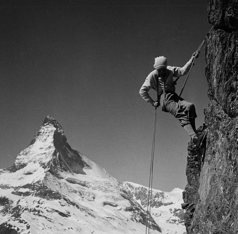
"A" series. -- [ca.1940-ca.1960]
https://archives.whyte.org/en/permalink/descriptions712
- Part Of
- Georgia Engelhard fonds
- Scope & Content
- Consists of mountain climbing and scenic views taken in the Alps of Switzerland and Italy, the Canadian Rockies, the Himalayas and the Teton Mountains of Wyoming. Canadian Rockies views are mainly Lake Louise area and include the Victoria Glacier, Goat Peak and other features. Photographs taken i…
- Date Range
- ca. 1940 - ca.1950
- Reference Code
- V751 / PA - 1 to 117
- Description Level
- 4 / Sub-series
- GMD
- Photograph
- Photograph print
3 images
- Part Of
- Georgia Engelhard fonds
- Description Level
- 4 / Sub-series
- Fonds Number
- V751
- Series
- I. Georgia Engelhard photographs
- Sous-Fonds
- V751
- Accession Number
- .
- Reference Code
- V751 / PA - 1 to 117
- Date Range
- ca. 1940 - ca.1950
- Physical Description
- 117 photographs : prints
- Scope & Content
- Consists of mountain climbing and scenic views taken in the Alps of Switzerland and Italy, the Canadian Rockies, the Himalayas and the Teton Mountains of Wyoming. Canadian Rockies views are mainly Lake Louise area and include the Victoria Glacier, Goat Peak and other features. Photographs taken in Swiss Alps include Zermatt, the Matterhorn and Val D'Herens. Climbers photographed include Eaton Cromwell, renowned mountaineer (#6, 8, 87) and Edmund Petrig, prominent Swiss guide (#6, 8).
- Language
- English
- Title Source
- Title based on original numbering
- Processing Status
- Processed
Images


This material is presented as originally created; it may contain outdated cultural descriptions and
potentially offensive content.
Read more.
"1" series. -- [ca.1945]
https://archives.whyte.org/en/permalink/descriptions713
- Part Of
- Georgia Engelhard fonds
- Scope & Content
- Views pertain to the Teton Mountains of Wyoming and include a climber or guide named Walter
- Date Range
- ca, 1940 - ca. 1950
- Reference Code
- V751 / PA - 118 to 127
- Description Level
- 4 / Sub-series
- GMD
- Photograph
- Photograph print
- Part Of
- Georgia Engelhard fonds
- Description Level
- 4 / Sub-series
- Fonds Number
- V751
- Series
- I. Georgia Engelhard photographs
- Sous-Fonds
- V751
- Accession Number
- .
- Reference Code
- V751 / PA - 118 to 127
- Date Range
- ca, 1940 - ca. 1950
- Physical Description
- 10 photographs : prints
- Scope & Content
- Views pertain to the Teton Mountains of Wyoming and include a climber or guide named Walter
- Language
- English
- Title Source
- Title based on original numbering
- Processing Status
- Processed
This material is presented as originally created; it may contain outdated cultural descriptions and
potentially offensive content.
Read more.
"278" series. -- [ca.1940-ca.1960]
https://archives.whyte.org/en/permalink/descriptions717
- Part Of
- Georgia Engelhard fonds
- Scope & Content
- Series includes numerous views pertaining of the Canadian Rockies and other Canadian locations, including Lake Louise area, Victoria Glacier, Mount Athabasca, Mount Assiniboine, Pinnacle Mountain, Mount Collie, Murchison Group and Bobbie Burns Group. Also includes views of Switzerland, including Ze…
- Date Range
- ca. 1940 to ca. 1950
- Reference Code
- V751 / PA - 162 to 220
- Description Level
- 4 / Sub-series
- GMD
- Photograph
- Photograph print
3 images
- Part Of
- Georgia Engelhard fonds
- Description Level
- 4 / Sub-series
- Fonds Number
- V751
- Series
- I. Georgia Engelhard photographs
- Sous-Fonds
- V751
- Accession Number
- .
- Reference Code
- V751 / PA - 162 to 220
- Date Range
- ca. 1940 to ca. 1950
- Physical Description
- 59 photographs : prints
- Scope & Content
- Series includes numerous views pertaining of the Canadian Rockies and other Canadian locations, including Lake Louise area, Victoria Glacier, Mount Athabasca, Mount Assiniboine, Pinnacle Mountain, Mount Collie, Murchison Group and Bobbie Burns Group. Also includes views of Switzerland, including Zermatt and Engadine districts and the Matterhorn; Italian Alps (Dolomites); and Teton Mountains. Includes Edward Feuz (#164?, 167, 173, 191?), Eaton Cromwell (#167), Georgia Engelhard (#183, 187, 188), Edmund Petrig (#190), Emil and Rudi Perren and unidentified climbers.
- Language
- English
- Title Source
- Title based on original numbering
- Processing Status
- Processed
Images


This material is presented as originally created; it may contain outdated cultural descriptions and
potentially offensive content.
Read more.
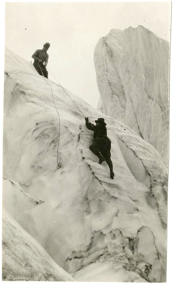
Guiding training photographs. -- [ca.1945]
https://archives.whyte.org/en/permalink/descriptions718
- Part Of
- Georgia Engelhard fonds
- Scope & Content
- Photographs document mountaineering techniques and guide training featuring Swiss guide Emil Perren and his son Rudi
- Date Range
- ca. 1940 to 1950
- Reference Code
- V751 / PA - 221 to 264
- Description Level
- 4 / Sub-series
- GMD
- Photograph
1 image
- Part Of
- Georgia Engelhard fonds
- Description Level
- 4 / Sub-series
- Fonds Number
- V751
- Series
- I.Georgia Engelhard photographs
- Sous-Fonds
- V751
- Accession Number
- .
- Reference Code
- V751 / PA - 221 to 264
- GMD
- Photograph
- Date Range
- ca. 1940 to 1950
- Physical Description
- 44 photographs : prints
- Scope & Content
- Photographs document mountaineering techniques and guide training featuring Swiss guide Emil Perren and his son Rudi
- Language
- English
- Related Material
- Related to "5" series and "278" series photographs
- Title Source
- Title based on contents of file
- Processing Status
- Processed
Images
This material is presented as originally created; it may contain outdated cultural descriptions and
potentially offensive content.
Read more.
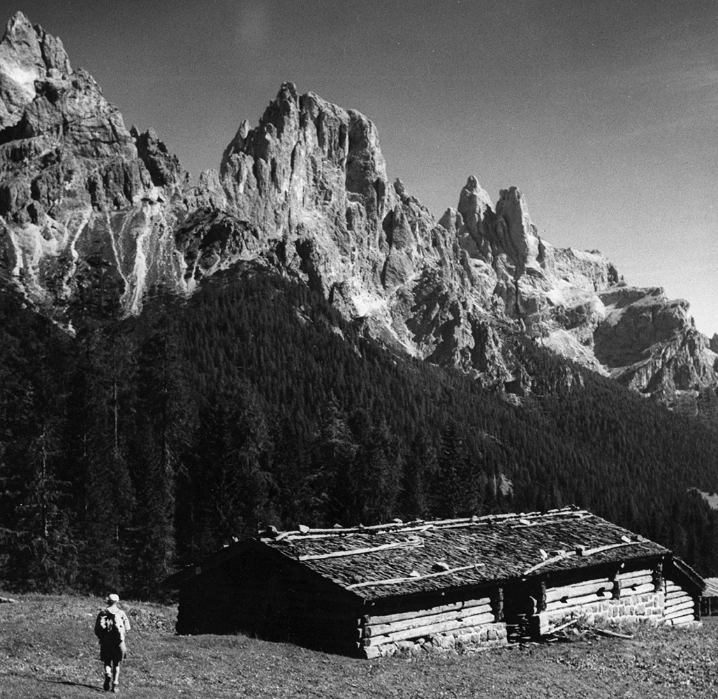
Scenic and commerical photographs series. -- 1907-1975
https://archives.whyte.org/en/permalink/descriptions722
- Part Of
- Byron Harmon fonds
- Scope & Content
- Series consists of the photographic records and sample materials of Byron Harmon Photos, the photographic business of Byron Harmon and his successors. Primary component is film and glass negatives, 1907-1942, ca.6500 items. Also includes: postcard negatives and positives and production negatives t…
- Date Range
- 1907 - 1942
- Reference Code
- V263 / PA / unnumbered
- V263 / PS
- V263 / NA / 1 - 6409
- V263 / NG / 1 - 78
- V263 / NA / unnumbered
- V263 / sample products
- Description Level
- 3 / Series
- Part Of
- Byron Harmon fonds
- Description Level
- 3 / Series
- Fonds Number
- V263
- Series
- I. Scenic and commercial photographs
- Sous-Fonds
- V263
- Reference Code
- V263 / PA / unnumbered
- V263 / PS
- V263 / NA / 1 - 6409
- V263 / NG / 1 - 78
- V263 / NA / unnumbered
- V263 / sample products
- Other Title Info
- Parallel title is original title
- Date Range
- 1907 - 1942
- Physical Description
- ca.10,000 photographs (and ca.35 cm) : negatives, prints, postcards, transparencies, sample products
- Scope & Content
- Series consists of the photographic records and sample materials of Byron Harmon Photos, the photographic business of Byron Harmon and his successors. Primary component is film and glass negatives, 1907-1942, ca.6500 items. Also includes: postcard negatives and positives and production negatives to ca.1955; original prints; a wide range of sample products, such as postcards, enlargements and framing prints, calendars and viewbooks, mainly by Harmon business, some by other photographers; and lantern slides, ca.1913-192-, pertaining to Columbia Icefield Expedition, mountaineering, mountain landscapes, Indigenous peoples, wildlife, Canadian Pacific Railway and Asian travel. Scenic / commercial series pertains to annual camps and expeditions of the Alpine Club of Canada in the Canadian Rockies and Selkirks, 1907-1913; private movie-making expeditions in the Canadian Rockies and Selkirks; mountain scenic views, primarily for postcard purposes; Banff events and development; skiing; birds and animals. Includes some material by Don Harmon and Lloyd Harmon, sons of Byron Harmon
- Access Restrictions
- Commercial use restrictions and restrictions on use of individual and family portraits, wedding photographs and similar works commissioned for personal use in effect. Access to original negatives restricted.
- Finding Aid
- Selected reference prints available in Visual Reference File
- Related Material
- Constitutes Series I of the Byron Harmon fonds
- Title Source
- Title based on accession records and contents of series
- Content Details
- V263 / NA - 1 to 6362 -- Series I.A.i.a. -- 1907 - 1942. -- 6362 items : negatives; 5 x 7" and smaller. -- Pertains to : annual camps and expeditions of the Alpine Club of Canada in the Canadian Rockies and Selkirks,1907-1913 ; private movie-making expeditions in the Canadian Rockies and Selkirks ; mountain scenic views, particularly for postcard purposes ; Banff events and development ; skiing ; birds and animals. Contains some views by Don Harmon and Lloyd Harmon, also some by Lewis Freeman. Incomplete item-level inventory available. Selected reference prints available. V263 / NA - 6363 to 6407 -- Series I.A.i.b. -- ca. 1910. -- 45 items : negatives ; panoramas, 4 x 11". -- Scenic views of Banff, Lake Louise and other areas in the Canadian Rockies. Item-level inventory available. Reference prints available. V263 / NA - 6408, 6409 -- Series I.A.i.c. -- 192-?. -- 2 items : negatives ; circut, 20 x 96 cm., 20 x 50 cm.-- View of group on shore of Lake O'Hara ; view of Lake McArthur with man on shore. V263 / NG - 1 to 78 -- Series I.A.i.d. -- ca. 1905 - ca. 1915. -- 78 items : negatives ; glass. -- Pertains to mountain peaks and scenes ; Alpine Club of Canada camps and activities ; mountaineering ; Banff views and activities, including Banff Springs Hotel ; Stoney First Nation. V263 / NA -- Series I.A.ii. -- ca. 192-? to ca. 1955. -- ca. 1100 items : negatives and positives, originals and copies ; mainly 5 x 7", some 11 x 14". -- Postcard negatives and positives and production negatives pertaining to scenic views throughout the Canadian Rockies, some elsewhere ; groups and conventions, facilities, buildings and interiors. Some by Don Harmon, Lloyd Harmon and F. A. Jackman of Jasper. Includes negatives by Herbert O. Frind of glacier trip to Columbia Icefield area, 1917. V263 / PA -- Series I.B. -- ca. 189-? to ca. 1965. -- ca. 900 items : prints, originals. -- Mainly first-generation prints of scenic and commercial views, wildlife, skiing, First Nation portraits, Banff Indian Days, Harmony Drug Store. Some prints were made at a much later date than negatives from which they came. V263 / PG -- Series I.C.i.a. -- ca. 1907 - ca. 1955. -- ca. 450 titles : postcards, black/white, hand-coloured. -- Mainly scenic and wildlife views of the Canadian Rockies. Arranged by publisher's number. Preliminiary item-level inventory available. V263 / PG -- Series I.C.i.b. -- After 1956. -- ca. 200 titles : postcards, natural colour. -- Mainly scenic and wildlife views of the Canadian Rockies. V263 / PA -- Series I.C.ii.a. -- ca. 191- to ca. 195-. -- ca. 800 items : prints, black/white. -- Mass-produced contact prints, enlargements and framing prints ; mainly scenic and wildlife views. V263 / PA -- Series I.C.ii.b. -- ca. 191- to ca. 195-. -- ca. 120 items : prints ; hand-coloured. -- Mass-produced contact prints, enlargements and framing prints ; mainly scenic and wildlife views. V263 / Series I.C.iii.a. -- Before 1942. -- ca. 10 cm. : various. -- Includes miniature views, advertising cards, postcard packages, view books, etc. of the Canadian Rockies. V263 / Series I.C.iii.b. -- After 1946. -- ca. 20 cm. : various. -- Includes 35 mm. slide packages, postcard packages, playing cards, greeting cards, calendars, viewbooks, etc. of the Canadian Rockies. V263 / Series I.C.iii.c. -- ca. 191- to ca. 196-. -- ca. 5 cm. : various. -- Sample products produced by other photographers for resale or comparison. Includes postcards, viewbooks, etc. V263 - PS -- Series I.D. -- ca. 1913 - ca. 192-. -- ca. 170 items : transparencies ; lantern slides, many hand-coloured. Lecture slides pertaining to Columbia Icefield Expedition, 1924, mountaineering, mountain landscapes, First Nations, wildlife, Canadian Pacific Railway ; also Asian travel photographs.
- Processing Status
- Processed
This material is presented as originally created; it may contain outdated cultural descriptions and
potentially offensive content.
Read more.
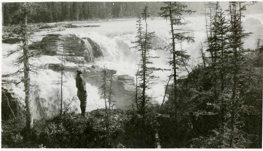
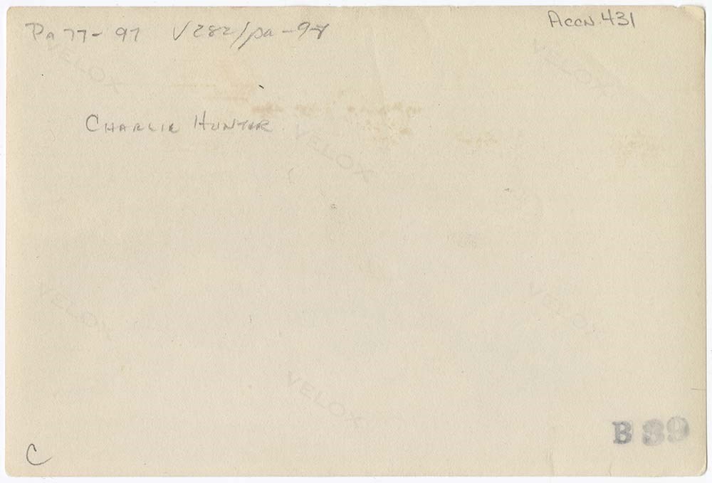
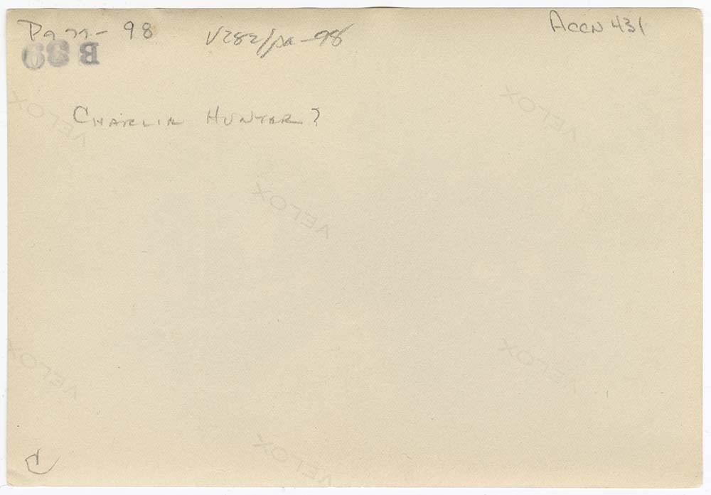
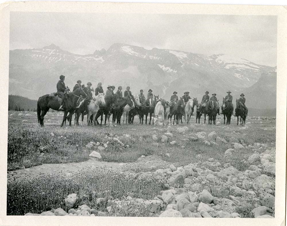
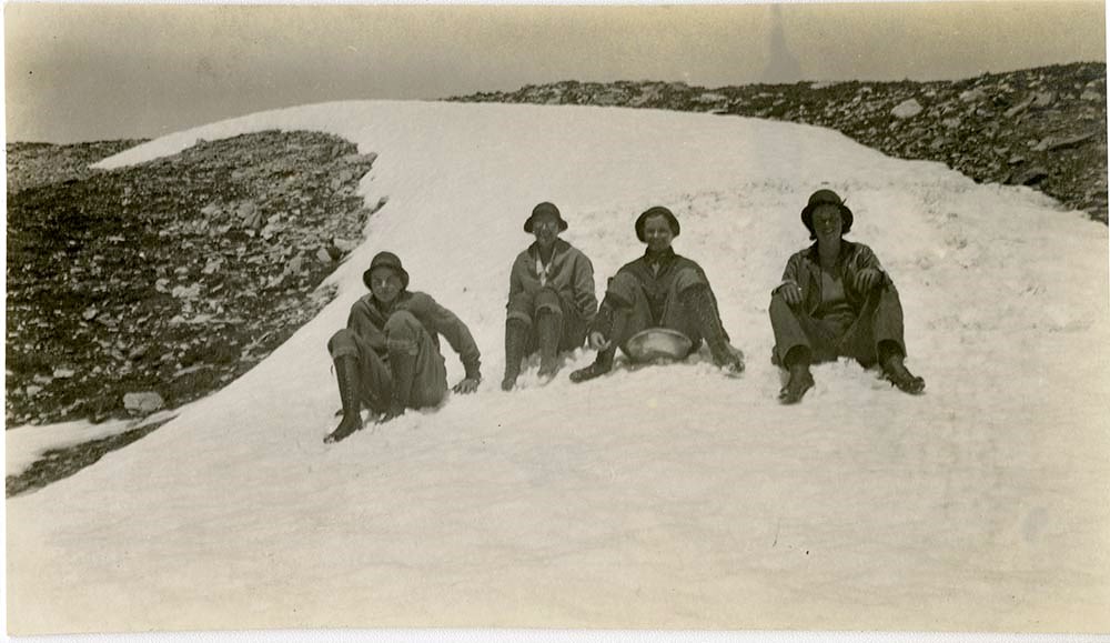
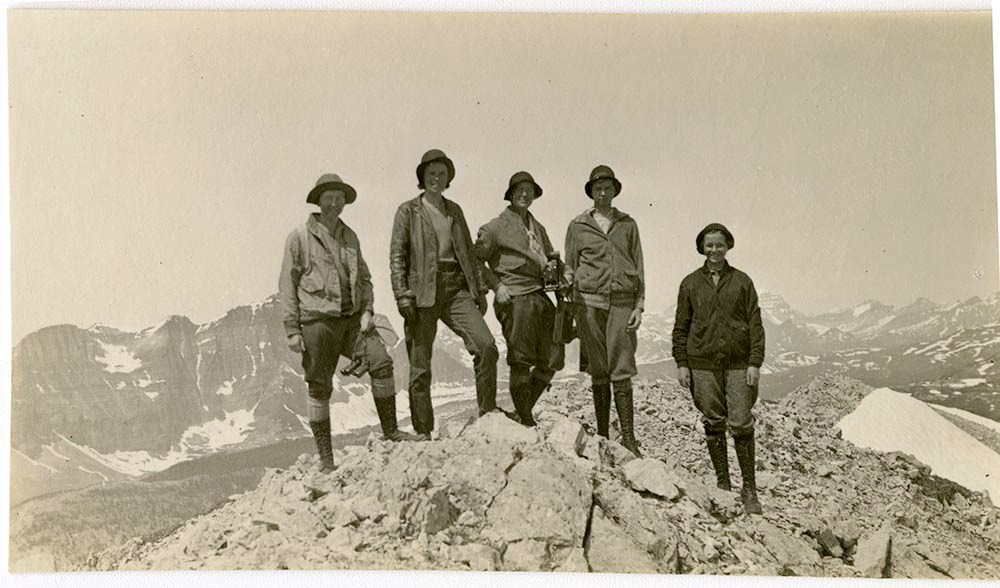
Prints. -- 1915-1958.
https://archives.whyte.org/en/permalink/descriptions753
- Part Of
- Caroline Hinman fonds
- Scope & Content
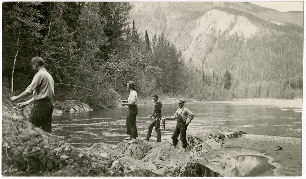
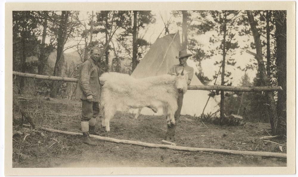
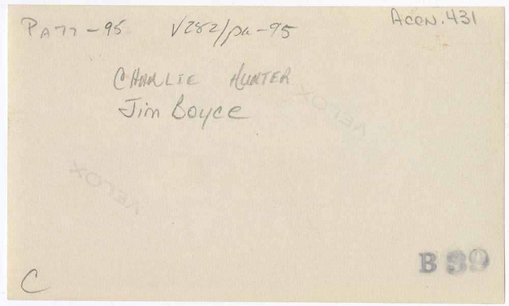
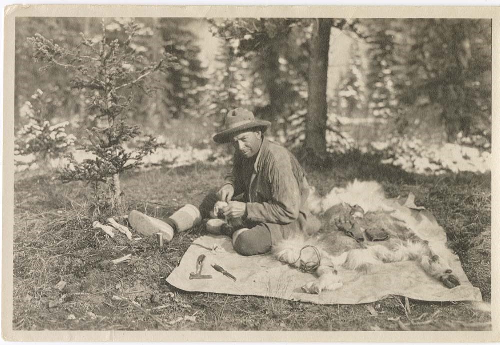
- Pertain to Caroline Hinman and her camping, climbing,hiking, horse, canoe and motor trips in the Canadian Rockies. Includes camps, hunting, climbs, Skyline Hikes, pack trips, scenery etc. Some views pertain to trip personnel such as Jim Boyce and Curly Phillips, and clients such as Lillian Gest.
- Date Range
- 1915-1958
- Reference Code
- V282 / PA (1 - 566)
- V282 / PB (1 - 8)
- Description Level
- 4 / Sub-series
13 images
- Part Of
- Caroline Hinman fonds
- Description Level
- 4 / Sub-series
- Fonds Number
- V282
- Series
- III.A. Photographs: prints
- Sous-Fonds
- V282
- Accession Number
- 1256
- Reference Code
- V282 / PA (1 - 566)
- V282 / PB (1 - 8)
- Date Range
- 1915-1958
- Physical Description
- 574 photographs : prints; 8 oversize.
- Scope & Content
- Pertain to Caroline Hinman and her camping, climbing,hiking, horse, canoe and motor trips in the Canadian Rockies. Includes camps, hunting, climbs, Skyline Hikes, pack trips, scenery etc. Some views pertain to trip personnel such as Jim Boyce and Curly Phillips, and clients such as Lillian Gest.
- Finding Aid
- Item-level list available.
- Processing Status
- Processed
Images


This material is presented as originally created; it may contain outdated cultural descriptions and
potentially offensive content.
Read more.