Narrow Results By
- Luxton family fonds 118
- Nicholas Morant fonds 40
- George McLean fonds 37
- Kidney family fonds 33
- Joe Kootenay fonds 24
- Peter and Catharine Whyte fonds 18
- Alpine Club of Canada fonds 16
- Trail Riders of the Canadian Rockies fonds 15
- Archives General File Collection 14
- Eliza Hunter fonds 14
- Dorothy Wardle fonds 11
- Lawrence Grassi fonds 9
"A" series. -- [ca.1940-ca.1960]
https://archives.whyte.org/en/permalink/descriptions712
- Part Of
- Georgia Engelhard fonds
- Scope & Content
- Consists of mountain climbing and scenic views taken in the Alps of Switzerland and Italy, the Canadian Rockies, the Himalayas and the Teton Mountains of Wyoming. Canadian Rockies views are mainly Lake Louise area and include the Victoria Glacier, Goat Peak and other features. Photographs taken i…
- Date Range
- ca. 1940 - ca.1950
- Reference Code
- V751 / PA - 1 to 117
- Description Level
- 4 / Sub-series
- GMD
- Photograph
- Photograph print
3 images
- Part Of
- Georgia Engelhard fonds
- Description Level
- 4 / Sub-series
- Fonds Number
- V751
- Series
- I. Georgia Engelhard photographs
- Sous-Fonds
- V751
- Accession Number
- .
- Reference Code
- V751 / PA - 1 to 117
- Date Range
- ca. 1940 - ca.1950
- Physical Description
- 117 photographs : prints
- Scope & Content
- Consists of mountain climbing and scenic views taken in the Alps of Switzerland and Italy, the Canadian Rockies, the Himalayas and the Teton Mountains of Wyoming. Canadian Rockies views are mainly Lake Louise area and include the Victoria Glacier, Goat Peak and other features. Photographs taken in Swiss Alps include Zermatt, the Matterhorn and Val D'Herens. Climbers photographed include Eaton Cromwell, renowned mountaineer (#6, 8, 87) and Edmund Petrig, prominent Swiss guide (#6, 8).
- Language
- English
- Title Source
- Title based on original numbering
- Processing Status
- Processed
Images


This material is presented as originally created; it may contain outdated cultural descriptions and
potentially offensive content.
Read more.
"1" series. -- [ca.1945]
https://archives.whyte.org/en/permalink/descriptions713
- Part Of
- Georgia Engelhard fonds
- Scope & Content
- Views pertain to the Teton Mountains of Wyoming and include a climber or guide named Walter
- Date Range
- ca, 1940 - ca. 1950
- Reference Code
- V751 / PA - 118 to 127
- Description Level
- 4 / Sub-series
- GMD
- Photograph
- Photograph print
- Part Of
- Georgia Engelhard fonds
- Description Level
- 4 / Sub-series
- Fonds Number
- V751
- Series
- I. Georgia Engelhard photographs
- Sous-Fonds
- V751
- Accession Number
- .
- Reference Code
- V751 / PA - 118 to 127
- Date Range
- ca, 1940 - ca. 1950
- Physical Description
- 10 photographs : prints
- Scope & Content
- Views pertain to the Teton Mountains of Wyoming and include a climber or guide named Walter
- Language
- English
- Title Source
- Title based on original numbering
- Processing Status
- Processed
This material is presented as originally created; it may contain outdated cultural descriptions and
potentially offensive content.
Read more.
"278" series. -- [ca.1940-ca.1960]
https://archives.whyte.org/en/permalink/descriptions717
- Part Of
- Georgia Engelhard fonds
- Scope & Content
- Series includes numerous views pertaining of the Canadian Rockies and other Canadian locations, including Lake Louise area, Victoria Glacier, Mount Athabasca, Mount Assiniboine, Pinnacle Mountain, Mount Collie, Murchison Group and Bobbie Burns Group. Also includes views of Switzerland, including Ze…
- Date Range
- ca. 1940 to ca. 1950
- Reference Code
- V751 / PA - 162 to 220
- Description Level
- 4 / Sub-series
- GMD
- Photograph
- Photograph print
3 images
- Part Of
- Georgia Engelhard fonds
- Description Level
- 4 / Sub-series
- Fonds Number
- V751
- Series
- I. Georgia Engelhard photographs
- Sous-Fonds
- V751
- Accession Number
- .
- Reference Code
- V751 / PA - 162 to 220
- Date Range
- ca. 1940 to ca. 1950
- Physical Description
- 59 photographs : prints
- Scope & Content
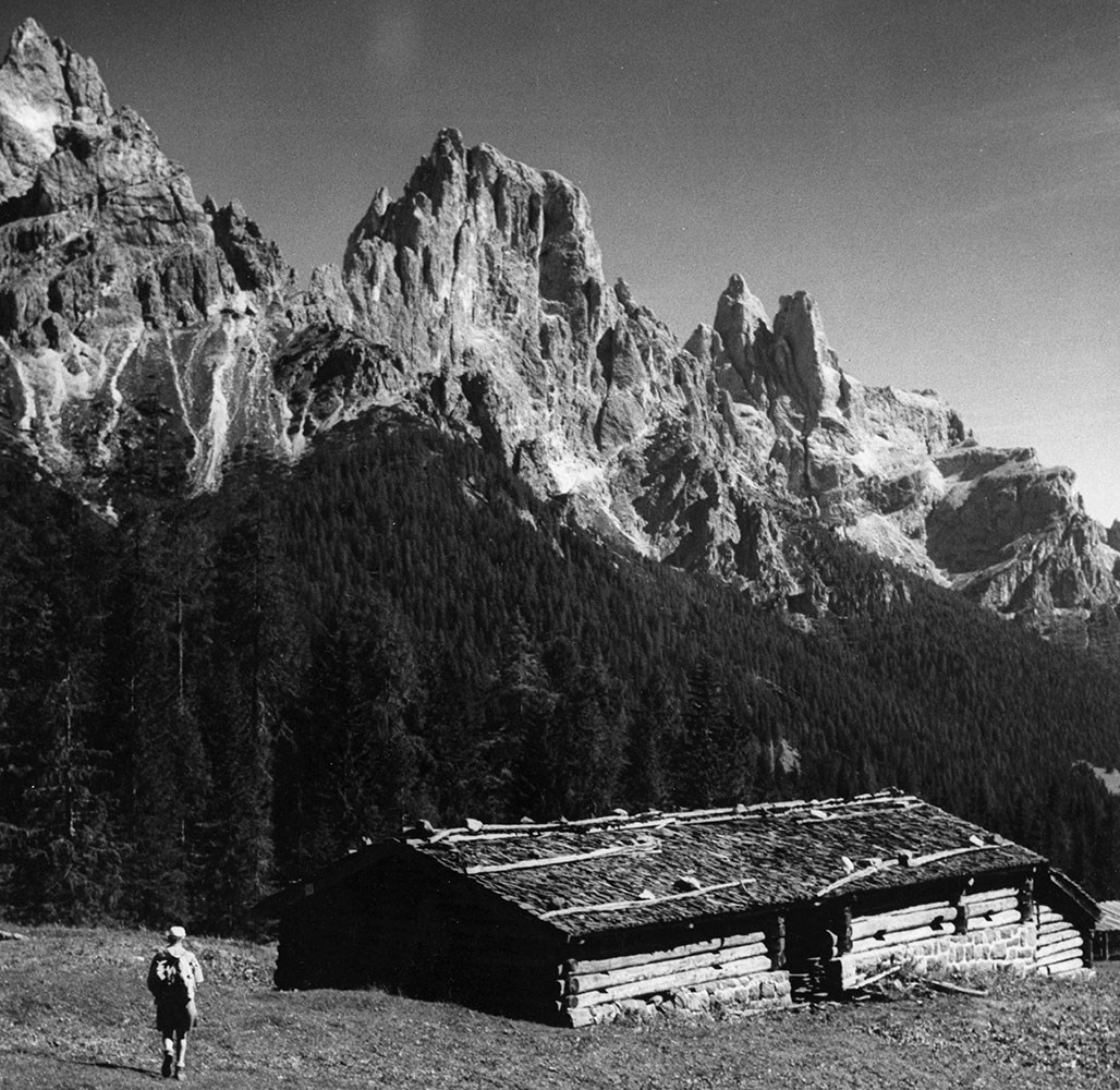
- Series includes numerous views pertaining of the Canadian Rockies and other Canadian locations, including Lake Louise area, Victoria Glacier, Mount Athabasca, Mount Assiniboine, Pinnacle Mountain, Mount Collie, Murchison Group and Bobbie Burns Group. Also includes views of Switzerland, including Zermatt and Engadine districts and the Matterhorn; Italian Alps (Dolomites); and Teton Mountains. Includes Edward Feuz (#164?, 167, 173, 191?), Eaton Cromwell (#167), Georgia Engelhard (#183, 187, 188), Edmund Petrig (#190), Emil and Rudi Perren and unidentified climbers.
- Language
- English
- Title Source
- Title based on original numbering
- Processing Status
- Processed
Images


This material is presented as originally created; it may contain outdated cultural descriptions and
potentially offensive content.
Read more.
(Castle Mtn. Station)
https://archives.whyte.org/en/permalink/catalogue24476
- Medium
- Library - Maps and blueprints (unannotated; published)
- Map
- Published Date
- September 6th, 1910
- Publisher
- Department of the Interior
- Call Number
- C9-7.26
- Publisher
- Department of the Interior
- Published Date
- September 6th, 1910
- Physical Description
- 1 map : black and white
- Scale
- 40 chains: 1"
- Accession Number
- SG7500
- Call Number
- C9-7.26
- Collection
- Archives Library
This material is presented as originally created; it may contain outdated cultural descriptions and
potentially offensive content.
Read more.
(Lake Louise Forest Park)
https://archives.whyte.org/en/permalink/catalogue24484
- Medium
- Library - Maps and blueprints (unannotated; published)
- Map
- Published Date
- February 10, 1896
- Publisher
- Department of the Interior
- Call Number
- C9-7.28
- Publisher
- Department of the Interior
- Published Date
- February 10, 1896
- Physical Description
- 1 map : black and white
- Scale
- 40 chains: 1 inch
- Notes
- xerox copy
- Accession Number
- SG7500
- Call Number
- C9-7.28
- Collection
- Archives Library
This material is presented as originally created; it may contain outdated cultural descriptions and
potentially offensive content.
Read more.
(edge of Lake Louise Forest Park)
https://archives.whyte.org/en/permalink/catalogue24485
- Medium
- Library - Maps and blueprints (unannotated; published)
- Map
- Published Date
- January 7th, 1896
- Publisher
- Department of the Interior
- Call Number
- C9-7.29
- Publisher
- Department of the Interior
- Published Date
- January 7th, 1896
- Physical Description
- 1 map : black and white
- Scale
- 40 chains: 1 inch
- Notes
- xerox copy
- Accession Number
- SG7500
- Call Number
- C9-7.29
- Collection
- Archives Library
This material is presented as originally created; it may contain outdated cultural descriptions and
potentially offensive content.
Read more.
Cart trail from Calgary to Edmonton
https://archives.whyte.org/en/permalink/catalogue24486
- Medium
- Library - Maps and blueprints (unannotated; published)
- Map
- Published Date
- 1890
- Publisher
- Dept. of the Interior
- Call Number
- C9-7.31
- Publisher
- Dept. of the Interior
- Published Date
- 1890
- Scale
- 1 mile: 2 inches
- Notes
- photostatic copy from Public Archives
- Accession Number
- 675
- Call Number
- C9-7.31
- Collection
- Archives Library
This material is presented as originally created; it may contain outdated cultural descriptions and
potentially offensive content.
Read more.
Morleyville Trail and Cart Trail from Calgary to Edmonton
https://archives.whyte.org/en/permalink/catalogue24488
- Medium
- Library - Maps and blueprints (unannotated; published)
- Map
- Published Date
- 1890
- Publisher
- Dept. of the Interior
- Call Number
- C9-7.32
- Publisher
- Dept. of the Interior
- Published Date
- 1890
- Scale
- 1 mile: 2 inches
- Notes
- photostatic copy from Public Archives
- Accession Number
- 675
- Call Number
- C9-7.32
- Collection
- Archives Library
This material is presented as originally created; it may contain outdated cultural descriptions and
potentially offensive content.
Read more.
Morleyville Traill; Calgary-Edmonton Rwy.
https://archives.whyte.org/en/permalink/catalogue24489
- Medium
- Library - Maps and blueprints (unannotated; published)
- Map
- Published Date
- 1893
- Publisher
- Dept. of the Interior
- Call Number
- C9-7.33
- Publisher
- Dept. of the Interior
- Published Date
- 1893
- Scale
- 1 mile: 2 inches
- Notes
- photostatic opy from Public Archives
- Accession Number
- 675
- Call Number
- C9-7.33
- Collection
- Archives Library
This material is presented as originally created; it may contain outdated cultural descriptions and
potentially offensive content.
Read more.
Range 1, West of Fifth Meridian, Trail from Calgary to Edmonton (Railway)
https://archives.whyte.org/en/permalink/catalogue24491
- Medium
- Library - Maps and blueprints (unannotated; published)
- Map
- Published Date
- 1896
- Publisher
- Dept. of the Interior
- Call Number
- C9-7.34(a)
- Publisher
- Dept. of the Interior
- Published Date
- 1896
- Scale
- 1 mile: 2 inches
- Subjects
- Township #34
- Notes
- photostatic copy from Public Archives
- Accession Number
- 675
- Call Number
- C9-7.34(a)
- Collection
- Archives Library
This material is presented as originally created; it may contain outdated cultural descriptions and
potentially offensive content.
Read more.
Trail from Calgary to Edmonton and Railway
https://archives.whyte.org/en/permalink/catalogue24493
- Medium
- Library - Maps and blueprints (unannotated; published)
- Map
- Published Date
- 1897
- Publisher
- Dept. of the Interior
- Call Number
- C9-7.35
- Publisher
- Dept. of the Interior
- Published Date
- 1897
- Scale
- 1 mile: 2 inches
- Notes
- Photostatic oopy from Public Archives
- Accession Number
- 675
- Call Number
- C9-7.35
- Collection
- Archives Library
This material is presented as originally created; it may contain outdated cultural descriptions and
potentially offensive content.
Read more.
(Brazeau River area)
https://archives.whyte.org/en/permalink/catalogue24494
- Medium
- Library - Maps and blueprints (unannotated; published)
- Map
- Published Date
- January 4, 1912
- Publisher
- Department of the Interior
- Call Number
- C9-7.41
- Publisher
- Department of the Interior
- Published Date
- January 4, 1912
- Physical Description
- 1 map : black and white
- Scale
- 40 chains: 1 inch
- Accession Number
- SG7500
- Call Number
- C9-7.41
- Collection
- Archives Library
This material is presented as originally created; it may contain outdated cultural descriptions and
potentially offensive content.
Read more.
(junction Southesk River and Brazeau River)
https://archives.whyte.org/en/permalink/catalogue24496
- Medium
- Library - Maps and blueprints (unannotated; published)
- Map
- Published Date
- October 25, 1912
- Publisher
- Department of the Interior)
- Call Number
- C9-7.43
- Publisher
- Department of the Interior)
- Published Date
- October 25, 1912
- Physical Description
- 1 map : black and white
- Scale
- 40 chains: 1 inch
- Accession Number
- SG7500
- Call Number
- C9-7.43
- Collection
- Archives Library
This material is presented as originally created; it may contain outdated cultural descriptions and
potentially offensive content.
Read more.
(junction Athabaska River & Miette River)
https://archives.whyte.org/en/permalink/catalogue24497
- Medium
- Library - Maps and blueprints (unannotated; published)
- Map
- Published Date
- February 22, 1911
- Publisher
- Department of the Interior
- Call Number
- C9-7.45
- Publisher
- Department of the Interior
- Published Date
- February 22, 1911
- Physical Description
- 1 map : black and white
- Scale
- 40 chainsL 1 inch
- Accession Number
- SG7500
- Call Number
- C9-7.45
- Collection
- Archives Library
This material is presented as originally created; it may contain outdated cultural descriptions and
potentially offensive content.
Read more.
(Miette River-Grand Trunk Railway)
https://archives.whyte.org/en/permalink/catalogue24498
- Medium
- Library - Maps and blueprints (unannotated; published)
- Map
- Published Date
- March 17, 1911
- Publisher
- Department of the Interior
- Call Number
- C9-7.45
- Publisher
- Department of the Interior
- Published Date
- March 17, 1911
- Physical Description
- 1 map : black and white
- Scale
- 40 chains: 1 inch
- Accession Number
- SG7500
- Call Number
- C9-7.45
- Collection
- Archives Library
This material is presented as originally created; it may contain outdated cultural descriptions and
potentially offensive content.
Read more.
(Miette R-G.T.P. Rwy Location Line)
https://archives.whyte.org/en/permalink/catalogue24499
- Medium
- Library - Maps and blueprints (unannotated; published)
- Map
- Published Date
- February 24, 1911
- Publisher
- Department of the Interior
- Call Number
- C9-7.45
- Publisher
- Department of the Interior
- Published Date
- February 24, 1911
- Physical Description
- 1 map : black and white
- Scale
- 40 chainsL 1 inch
- Accession Number
- SG7500
- Call Number
- C9-7.45
- Collection
- Archives Library
This material is presented as originally created; it may contain outdated cultural descriptions and
potentially offensive content.
Read more.
(Miette R-Grand Trunk Pacific Rwy Line)
https://archives.whyte.org/en/permalink/catalogue24500
- Medium
- Library - Maps and blueprints (unannotated; published)
- Map
- Published Date
- August 4, 1910
- Publisher
- Department of the Interior
- Call Number
- C9-7.45
- Publisher
- Department of the Interior
- Published Date
- August 4, 1910
- Physical Description
- 1 map : black and white
- Scale
- 40 chains: 1 inch
- Accession Number
- SG7500
- Call Number
- C9-7.45
- Collection
- Archives Library
This material is presented as originally created; it may contain outdated cultural descriptions and
potentially offensive content.
Read more.
(South branch of McLeod River area)
https://archives.whyte.org/en/permalink/catalogue24501
- Medium
- Library - Maps and blueprints (unannotated; published)
- Map
- Published Date
- November 18, 1912
- Publisher
- Department of the Interior
- Call Number
- C9-7.45
- Publisher
- Department of the Interior
- Published Date
- November 18, 1912
- Physical Description
- 1 map : black and white
- Scale
- 40 chains: 1 inch
- Accession Number
- SG7500
- Call Number
- C9-7.45
- Collection
- Archives Library
This material is presented as originally created; it may contain outdated cultural descriptions and
potentially offensive content.
Read more.
(Athabaska River area) - junction with Snarling River
https://archives.whyte.org/en/permalink/catalogue24502
- Medium
- Library - Maps and blueprints (unannotated; published)
- Map
- Published Date
- February 24, 1911
- Publisher
- Department of the Interior
- Call Number
- C9-7.46
- Publisher
- Department of the Interior
- Published Date
- February 24, 1911
- Physical Description
- 1 map : black and white
- Scale
- 40 chains: 1 inch
- Accession Number
- SG7500
- Call Number
- C9-7.46
- Collection
- Archives Library
This material is presented as originally created; it may contain outdated cultural descriptions and
potentially offensive content.
Read more.
(West Branch of McLeod River Area)
https://archives.whyte.org/en/permalink/catalogue24503
- Medium
- Library - Maps and blueprints (unannotated; published)
- Map
- Published Date
- November 22, 1912
- Publisher
- Department of the Interior
- Call Number
- C9-7.46
- Publisher
- Department of the Interior
- Published Date
- November 22, 1912
- Physical Description
- 1 map : black and white
- Scale
- 40 chains: 1 inch
- Subjects
- SG7500
- Accession Number
- SG7500
- Call Number
- C9-7.46
- Collection
- Archives Library
This material is presented as originally created; it may contain outdated cultural descriptions and
potentially offensive content.
Read more.