Narrow Results By
- Luxton family fonds 87
- Nicholas Morant fonds 38
- George McLean fonds 37
- Kidney family fonds 24
- Trail Riders of the Canadian Rockies fonds 15
- Eliza Hunter fonds 14
- Dorothy Wardle fonds 11
- Archives General File Collection 9
- Lawrence Grassi fonds 9
- Peter and Catharine Whyte fonds 9
- Alpine Club of Canada fonds 7
- Dorothy Cranstone fonds 7
"A" series. -- [ca.1940-ca.1960]
https://archives.whyte.org/en/permalink/descriptions712
- Part Of
- Georgia Engelhard fonds
- Scope & Content
- Consists of mountain climbing and scenic views taken in the Alps of Switzerland and Italy, the Canadian Rockies, the Himalayas and the Teton Mountains of Wyoming. Canadian Rockies views are mainly Lake Louise area and include the Victoria Glacier, Goat Peak and other features. Photographs taken i…
- Date Range
- ca. 1940 - ca.1950
- Reference Code
- V751 / PA - 1 to 117
- Description Level
- 4 / Sub-series
- GMD
- Photograph
- Photograph print
3 images
- Part Of
- Georgia Engelhard fonds
- Description Level
- 4 / Sub-series
- Fonds Number
- V751
- Series
- I. Georgia Engelhard photographs
- Sous-Fonds
- V751
- Accession Number
- .
- Reference Code
- V751 / PA - 1 to 117
- Date Range
- ca. 1940 - ca.1950
- Physical Description
- 117 photographs : prints
- Scope & Content
- Consists of mountain climbing and scenic views taken in the Alps of Switzerland and Italy, the Canadian Rockies, the Himalayas and the Teton Mountains of Wyoming. Canadian Rockies views are mainly Lake Louise area and include the Victoria Glacier, Goat Peak and other features. Photographs taken in Swiss Alps include Zermatt, the Matterhorn and Val D'Herens. Climbers photographed include Eaton Cromwell, renowned mountaineer (#6, 8, 87) and Edmund Petrig, prominent Swiss guide (#6, 8).
- Language
- English
- Title Source
- Title based on original numbering
- Processing Status
- Processed
Images


This material is presented as originally created; it may contain outdated cultural descriptions and
potentially offensive content.
Read more.
"1" series. -- [ca.1945]
https://archives.whyte.org/en/permalink/descriptions713
- Part Of
- Georgia Engelhard fonds
- Scope & Content
- Views pertain to the Teton Mountains of Wyoming and include a climber or guide named Walter
- Date Range
- ca, 1940 - ca. 1950
- Reference Code
- V751 / PA - 118 to 127
- Description Level
- 4 / Sub-series
- GMD
- Photograph
- Photograph print
- Part Of
- Georgia Engelhard fonds
- Description Level
- 4 / Sub-series
- Fonds Number
- V751
- Series
- I. Georgia Engelhard photographs
- Sous-Fonds
- V751
- Accession Number
- .
- Reference Code
- V751 / PA - 118 to 127
- Date Range
- ca, 1940 - ca. 1950
- Physical Description
- 10 photographs : prints
- Scope & Content
- Views pertain to the Teton Mountains of Wyoming and include a climber or guide named Walter
- Language
- English
- Title Source
- Title based on original numbering
- Processing Status
- Processed
This material is presented as originally created; it may contain outdated cultural descriptions and
potentially offensive content.
Read more.
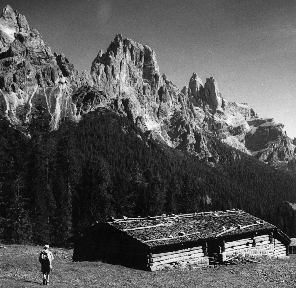
"278" series. -- [ca.1940-ca.1960]
https://archives.whyte.org/en/permalink/descriptions717
- Part Of
- Georgia Engelhard fonds
- Scope & Content
- Series includes numerous views pertaining of the Canadian Rockies and other Canadian locations, including Lake Louise area, Victoria Glacier, Mount Athabasca, Mount Assiniboine, Pinnacle Mountain, Mount Collie, Murchison Group and Bobbie Burns Group. Also includes views of Switzerland, including Ze…
- Date Range
- ca. 1940 to ca. 1950
- Reference Code
- V751 / PA - 162 to 220
- Description Level
- 4 / Sub-series
- GMD
- Photograph
- Photograph print
3 images
- Part Of
- Georgia Engelhard fonds
- Description Level
- 4 / Sub-series
- Fonds Number
- V751
- Series
- I. Georgia Engelhard photographs
- Sous-Fonds
- V751
- Accession Number
- .
- Reference Code
- V751 / PA - 162 to 220
- Date Range
- ca. 1940 to ca. 1950
- Physical Description
- 59 photographs : prints
- Scope & Content
- Series includes numerous views pertaining of the Canadian Rockies and other Canadian locations, including Lake Louise area, Victoria Glacier, Mount Athabasca, Mount Assiniboine, Pinnacle Mountain, Mount Collie, Murchison Group and Bobbie Burns Group. Also includes views of Switzerland, including Zermatt and Engadine districts and the Matterhorn; Italian Alps (Dolomites); and Teton Mountains. Includes Edward Feuz (#164?, 167, 173, 191?), Eaton Cromwell (#167), Georgia Engelhard (#183, 187, 188), Edmund Petrig (#190), Emil and Rudi Perren and unidentified climbers.
- Language
- English
- Title Source
- Title based on original numbering
- Processing Status
- Processed
Images


This material is presented as originally created; it may contain outdated cultural descriptions and
potentially offensive content.
Read more.
Extended family records
https://archives.whyte.org/en/permalink/descriptions22344
- Part Of
- Luxton family fonds
- Scope & Content
- Records in this series consist of three sub-series: C.1. William Luxton family papers and photographs; C.2. McDougall and Ross families papers, correspondence, and photographs; C.3. Other extended family records. Sub-series C.1. consists of four sub-sub-series: William Luxton; Sarah Luxton; Geor…
- Date Range
- 1893-1970
- Reference Code
- LUX / III / C
- Description Level
- 3 / Series
- GMD
- Textual record
- Private record
- Photograph
- Photograph print
- Part Of
- Luxton family fonds
- Description Level
- 3 / Series
- Fonds Number
- LUX
- Series
- III.C. Extended Family
- Sous-Fonds
- III. Luxton Family sous-fonds
- Accession Number
- LUX
- Reference Code
- LUX / III / C
- Date Range
- 1893-1970
- Physical Description
- 0.28 m textual records ; ca.147 photographs : b&w prints; 15 x 21 cm or smaller
- Scope & Content
- Records in this series consist of three sub-series: C.1. William Luxton family papers and photographs; C.2. McDougall and Ross families papers, correspondence, and photographs; C.3. Other extended family records. Sub-series C.1. consists of four sub-sub-series: William Luxton; Sarah Luxton; George Luxton; Louis Luxton. Sub-series C.2. consists of two sub-sub-series: McDougall family; Ross family.
- Language
- English
- Category
- Family and personal life
- Communications
- Title Source
- Title based on contents of series
- Processing Status
- Processed
This material is presented as originally created; it may contain outdated cultural descriptions and
potentially offensive content.
Read more.
[Gregg Lake - Alberta]
https://archives.whyte.org/en/permalink/catalogue23644
- Medium
- Library - Maps and blueprints (unannotated; published)
- Map
- Published Date
- 1959
- Publisher
- Dept. of Mines & Technical Surv.
- Call Number
- NTS
- 83F/12E
- Publisher
- Dept. of Mines & Technical Surv.
- Published Date
- 1959
- Scale
- 1:50,000
- Subjects
- Gregg Lake - Alberta
- Notes
- National Topographic System
- Accession Number
- 12000
- Call Number
- NTS
- 83F/12E
- Collection
- Archives Library
This material is presented as originally created; it may contain outdated cultural descriptions and
potentially offensive content.
Read more.
- Medium
- Library - Maps and blueprints (unannotated; published)
- Map
- Published Date
- 1959
- Publisher
- Dept. of Mines & Technical Surv.
- Call Number
- NTS
- 83F/12W
- Publisher
- Dept. of Mines & Technical Surv.
- Published Date
- 1959
- Scale
- 1:50,000
- Subjects
- Gregg Lake
- Notes
- National Topographic System
- Accession Number
- 12000
- Call Number
- NTS
- 83F/12W
- Collection
- Archives Library
This material is presented as originally created; it may contain outdated cultural descriptions and
potentially offensive content.
Read more.
[Harrison Lake 92H/5 East]
https://archives.whyte.org/en/permalink/catalogue23652
- Medium
- Library - Maps and blueprints (unannotated; published)
- Map
- Published Date
- 1958
- Publisher
- Dept. of Mines & Technical Surveys
- Call Number
- NTS
- 92H/5E
- Publisher
- Dept. of Mines & Technical Surveys
- Published Date
- 1958
- Physical Description
- Colour
- Scale
- Scale: 1:50,000
- Relief: Contour interval 100 ft.
- Subjects
- Harrison Lake 92H/5 East
- Notes
- National Topographic System
- Accession Number
- 7000
- Call Number
- NTS
- 92H/5E
- Collection
- Archives Library
This material is presented as originally created; it may contain outdated cultural descriptions and
potentially offensive content.
Read more.
[Harrison Lake 92H/5 West - B.C.]
https://archives.whyte.org/en/permalink/catalogue23653
- Medium
- Library - Maps and blueprints (unannotated; published)
- Map
- Published Date
- 1958
- Publisher
- Dept. of Mines & Technical Surveys
- Call Number
- NTS
- 92H/5W
- Publisher
- Dept. of Mines & Technical Surveys
- Published Date
- 1958
- Physical Description
- Colour
- Scale
- Scale: 1:50,000
- Relief: Contour interval 100 ft.
- Subjects
- Harrison Lake 92H/5 West - B.C.
- Notes
- National Topographic System
- Accession Number
- 7000
- Call Number
- NTS
- 92H/5W
- Collection
- Archives Library
This material is presented as originally created; it may contain outdated cultural descriptions and
potentially offensive content.
Read more.
[Hope 92H/6 West - B.C.]
https://archives.whyte.org/en/permalink/catalogue23665
- Medium
- Library - Maps and blueprints (unannotated; published)
- Map
- Published Date
- 1957
- Publisher
- Dept. of Mines & Technical Surveys
- Call Number
- NTS
- 92H/6W
- Publisher
- Dept. of Mines & Technical Surveys
- Published Date
- 1957
- Physical Description
- Colour
- Scale
- Scale: 1:50,000
- Relief: Contour interval 100 ft.
- Subjects
- Hope 92H/6 West - B.C.
- Notes
- National Topographic System
- Accession Number
- 7000
- Call Number
- NTS
- 92H/6W
- Collection
- Archives Library
This material is presented as originally created; it may contain outdated cultural descriptions and
potentially offensive content.
Read more.
[Jasper 83 D/16 East - Alberta-B.C.]
https://archives.whyte.org/en/permalink/catalogue23679
- Medium
- Library - Maps and blueprints (unannotated; published)
- Map
- Published Date
- 1953
- Publisher
- Dept. of Mines and Technical Surveys
- Call Number
- NTS
- 83D/16E
- Publisher
- Dept. of Mines and Technical Surveys
- Published Date
- 1953
- Physical Description
- Colour
- Scale
- Scale: 1:50,000
- Relief: Contour interval 100'
- Subjects
- Jasper 83 D/16 East - Alberta-B.C.
- Notes
- National Topographic System
- Accession Number
- 6283 (dup)
- Call Number
- NTS
- 83D/16E
- Collection
- Archives Library
This material is presented as originally created; it may contain outdated cultural descriptions and
potentially offensive content.
Read more.
[Jasper 83 D/16 West - Alberta-B.C.]
https://archives.whyte.org/en/permalink/catalogue23680
- Medium
- Library - Maps and blueprints (unannotated; published)
- Map
- Published Date
- 1953
- Publisher
- Dept. of Mines and Technical Surveys
- Call Number
- NTS
- 83D/16W
- Publisher
- Dept. of Mines and Technical Surveys
- Published Date
- 1953
- Physical Description
- Colour
- Scale
- Scale: 1:50,000
- Relief: Contour interval 100'
- Subjects
- Jasper 83 D/16 West - Alberta-B.C.
- Notes
- National Topographic System
- Accession Number
- 6283 (dup)
- Call Number
- NTS
- 83D/16W
- Collection
- Archives Library
This material is presented as originally created; it may contain outdated cultural descriptions and
potentially offensive content.
Read more.
[Jervis Inlet 92 G/14 East - B.C.]
https://archives.whyte.org/en/permalink/catalogue23681
- Medium
- Library - Maps and blueprints (unannotated; published)
- Map
- Published Date
- 1957
- Publisher
- Army Survey Establishement
- Call Number
- NTS
- 92G/13E
- Publisher
- Army Survey Establishement
- Published Date
- 1957
- Physical Description
- Colour
- Scale
- Scale: 1:50,000
- Relief: Contour interval 100 ft.
- Subjects
- Jervis Inlet 92 G/14 East - B.C.
- Notes
- National Topographic System
- Accession Number
- 3000
- Call Number
- NTS
- 92G/13E
- Collection
- Archives Library
This material is presented as originally created; it may contain outdated cultural descriptions and
potentially offensive content.
Read more.
[[Jervis Inlet 92 G/13 West - B.C.]
https://archives.whyte.org/en/permalink/catalogue23682
- Medium
- Library - Maps and blueprints (unannotated; published)
- Map
- Published Date
- 1957
- Publisher
- Army Survey Establisment
- Call Number
- NTS
- 92G/13W
- Publisher
- Army Survey Establisment
- Published Date
- 1957
- Physical Description
- Colour
- Scale
- Scale: 1:50,000
- Relief: Contour interval 100 ft.
- Subjects
- Jervis Inlet 92 G/13 West - B.C.
- Notes
- National Topographic System
- Accession Number
- 3000
- Call Number
- NTS
- 92G/13W
- Collection
- Archives Library
This material is presented as originally created; it may contain outdated cultural descriptions and
potentially offensive content.
Read more.
[Kakwa River - Alberta]
https://archives.whyte.org/en/permalink/catalogue23689
- Medium
- Library - Maps and blueprints (unannotated; published)
- Map
- Published Date
- 1955
- Publisher
- Dept. of Mines & Technical Survey
- Call Number
- NTS
- 83L/4E
- Publisher
- Dept. of Mines & Technical Survey
- Published Date
- 1955
- Scale
- 1:50,000
- Subjects
- Kakwa River - Alberta
- Notes
- National Topographic System
- Accession Number
- 12000
- Call Number
- NTS
- 83L/4E
- Collection
- Archives Library
This material is presented as originally created; it may contain outdated cultural descriptions and
potentially offensive content.
Read more.
[Kakwa River - Alberta]
https://archives.whyte.org/en/permalink/catalogue23690
- Medium
- Library - Maps and blueprints (unannotated; published)
- Map
- Published Date
- 1955
- Publisher
- Dept. of Mines & Technical Survey
- Call Number
- NTS
- 83L/4W
- Publisher
- Dept. of Mines & Technical Survey
- Published Date
- 1955
- Scale
- 1:50,000
- Subjects
- Kakwa River - Alberta
- Notes
- National Topographic System
- Accession Number
- 12000
- Call Number
- NTS
- 83L/4W
- Collection
- Archives Library
This material is presented as originally created; it may contain outdated cultural descriptions and
potentially offensive content.
Read more.
[Kluane River 115G/11, Yukon]
https://archives.whyte.org/en/permalink/catalogue23706
- Medium
- Library - Maps and blueprints (unannotated; published)
- Map
- Published Date
- 1953
- Publisher
- Dept. of National Defence
- Call Number
- NTS
- 115G/11
- Publisher
- Dept. of National Defence
- Published Date
- 1953
- Physical Description
- 1 map : col
- Scale
- Scale: 1:50,000
- Relief: Contour Interval 100 ft.
- Subjects
- Kluane River
- Yukon Territory
- Notes
- National Topographic System
- Accession Number
- 3000
- Call Number
- NTS
- 115G/11
- Collection
- Archives Library
This material is presented as originally created; it may contain outdated cultural descriptions and
potentially offensive content.
Read more.
[Lake Louise 82N/8 East, Alberta-B.C.]
https://archives.whyte.org/en/permalink/catalogue23711
- Medium
- Library - Maps and blueprints (unannotated; published)
- Map
- Published Date
- 1959
- Publisher
- Dept. of Mines and Technical Surveys
- Call Number
- NTS
- 82N/8E
- Publisher
- Dept. of Mines and Technical Surveys
- Published Date
- 1959
- Physical Description
- 1 map : col
- Scale
- Scale: 1:50,000
- Relief: Contour interval 100'
- Subjects
- Lake Louise
- Alberta/British Columbia
- Notes
- National Topographic System
- Accession Number
- 6283
- Call Number
- NTS
- 82N/8E
- Collection
- Archives Library
This material is presented as originally created; it may contain outdated cultural descriptions and
potentially offensive content.
Read more.
[Lake Louise 82N/8 West, Alberta-B.C.]
https://archives.whyte.org/en/permalink/catalogue23712
- Medium
- Library - Maps and blueprints (unannotated; published)
- Map
- Published Date
- 1959
- Publisher
- Dept. of Mines and Technical Surveys
- Call Number
- NTS
- 82N/8W
- Publisher
- Dept. of Mines and Technical Surveys
- Published Date
- 1959
- Physical Description
- 1 map : col
- Scale
- Scale: 1:50,000
- Relief: Contour interval 100'
- Subjects
- Lake Louise
- Alberta/British Columbia
- Notes
- National Topographic System
- Call Number
- NTS
- 82N/8W
- Collection
- Archives Library
This material is presented as originally created; it may contain outdated cultural descriptions and
potentially offensive content.
Read more.
[Lake Minnewanka 820/6 East, Alberta]
https://archives.whyte.org/en/permalink/catalogue23715
- Medium
- Library - Maps and blueprints (unannotated; published)
- Map
- Published Date
- 1958
- Publisher
- Dept. of Mines and Technical Surveys
- Call Number
- NTS
- 820/6E
- Publisher
- Dept. of Mines and Technical Surveys
- Published Date
- 1958
- Physical Description
- 1 map : col
- Scale
- Scale: 1:50,000
- Relief: Contour interval 100'
- Subjects
- Lake Minnewanka
- Alberta
- Notes
- National Topographic System
- Accession Number
- 6283
- Call Number
- NTS
- 820/6E
- Collection
- Archives Library
This material is presented as originally created; it may contain outdated cultural descriptions and
potentially offensive content.
Read more.
[Lake Minnewanka 820/6 West, Alberta]
https://archives.whyte.org/en/permalink/catalogue23716
- Medium
- Library - Maps and blueprints (unannotated; published)
- Map
- Published Date
- 1958
- Publisher
- Dept. of Mines and Technical Surveys
- Call Number
- NTS
- 820/6W
- Publisher
- Dept. of Mines and Technical Surveys
- Published Date
- 1958
- Physical Description
- 1 map : col
- Scale
- Scale: 1:50,000
- Relief: Contour interval 100'
- Subjects
- Lake Minnewanka
- Alberta
- Notes
- National Topographic System
- Accession Number
- 6283
- Call Number
- NTS
- 820/6W
- Collection
- Archives Library
This material is presented as originally created; it may contain outdated cultural descriptions and
potentially offensive content.
Read more.