Narrow Results By
- Charles Macmunn fonds 6
- Trail Riders of the Canadian Rockies fonds 4
- Kidney family fonds 3
- Archives General File Collection 2
- Dorothy Cranstone fonds 2
- Lawrence Grassi fonds 2
- Mary Schaffer fonds 2
- Nicholas Morant fonds 2
- Peter and Catharine Whyte fonds 2
- Alpine Club of Canada fonds 1
- Andy Russell fonds 1
- Arnold Wexler fonds 1
- Alberta. Environment Conservation Authority 28
- Parks Canada 19
- Alberta. Laws, statutes, etc 13
- Ford, Theresa M., ed 11
- Canada. National and Historic Parks Branch 10
- Russell, Andy 10
- Parks Canada. Western Region 9
- Alpine Club of Canada 8
- Scace, Robert C 8
- Banff Townsite Provisional Administration Board 7
- Birney, Earle 7
- Hungry Wolf, Adolf 7
- 1970s
- 1980s 1555
- 1960s 1213
- 1990s 1120
- 1950s 829
- 2000s 818
- 1920s 715
- 2010s 708
- 1930s 696
- 1940s 650
- 1910s 605
- 1900s 431
- 1890s
- 1880s 257
- 2020s 165
- 1870s 111
- 1860s 85
- 1850s 64
- 1840s 40
- 1830s 27
- 1820s 25
- 1780s 15
- 1810s 12
- 1800s 10
- 1770s 6
- 1790s 3
- 1570s 2
- 1740s 2
- 1560s 1
- 1610s 1
- 1680s 1
- 1700s 1
- 1710s 1
- 1760s 1
Photograph album
https://archives.whyte.org/en/permalink/descriptions17558
- Part Of
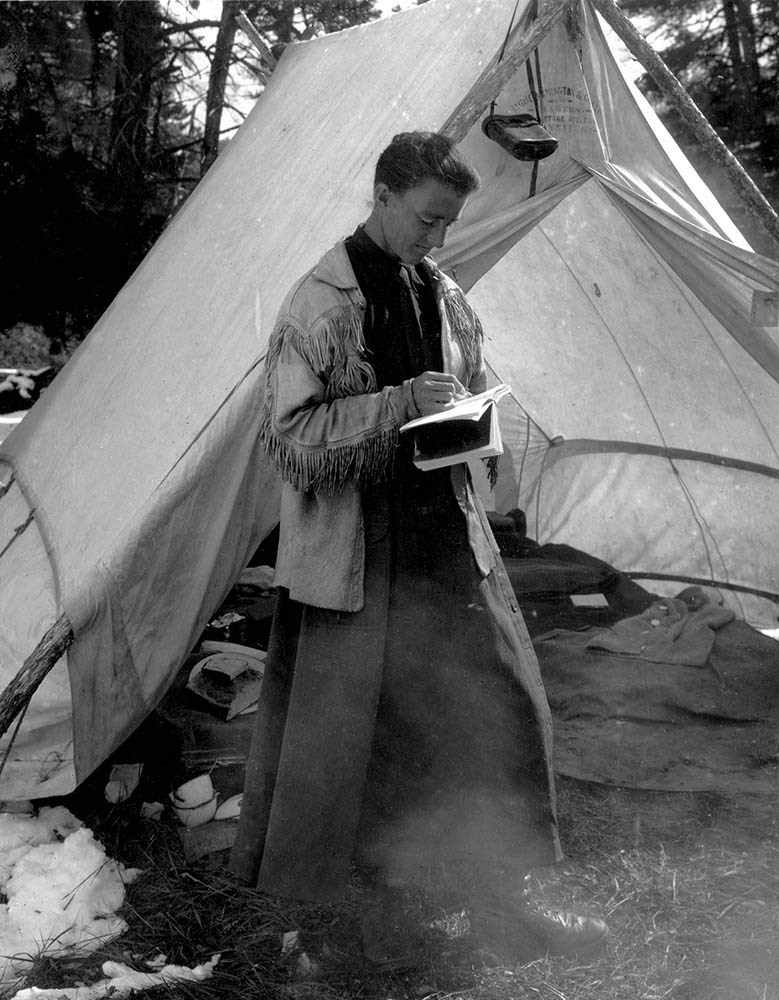
- Mary Schaffer fonds
- Scope & Content
- Album pertains to travels to Lake Louise, Field, Glacier House and expeditions from 1904-1908 seasons. Includes the following locations: Lake Louise, Field BC, Glacier House, Ross Peak, Badger Pass, Pipestone, Ptarmigan and Molar Pass, Nashan Valley, Wilcox Pass, Pinto summit, Mount Columbia, Mou…
- Date Range
- 1898-[1908]
- Reference Code
- V527 / PD - 1
- Description Level
- 5 / File
- GMD
- Photograph
- Album
3 images
- Part Of
- Mary Schaffer fonds
- Description Level
- 5 / File
- Fonds Number
- V527
- Series
- II.B. Photographs: albums
- Sous-Fonds
- V527
- Accession Number
- 7731
- Reference Code
- V527 / PD - 1
- GMD
- Photograph
- Album
- Responsibility
- Photographers include Mary Schaffer, Elliott Barnes, [Henrietta] Tuzo, and possibly J. N. Collie. Album includes annotations by Mary Schaffer, as well as later annotations by unknown person
- Date Range
- 1898-[1908]
- Physical Description
- 1 photograph album (781 prints)
- Scope & Content
- Album pertains to travels to Lake Louise, Field, Glacier House and expeditions from 1904-1908 seasons. Includes the following locations: Lake Louise, Field BC, Glacier House, Ross Peak, Badger Pass, Pipestone, Ptarmigan and Molar Pass, Nashan Valley, Wilcox Pass, Pinto summit, Mount Columbia, Mount Athabasca, Nakimu Caves, Illecillewaet Glacier, Athabasca Glacier, Hornady Glacier, Peyto Glacier, Crowfoot Glacier, Elliott Barnes ranch, Jimmy Simpson cabins, Vermilion Lakes. People include: Stoney Indians, Beaver family, A. P. Coleman and party (on Wilcox Pass 1907), Jimmy Simpson, Swift family, Tom Wilson, Sid Unwin, Mollie Adams, Elliott Barnes and others. Also includes landscape views from J. N. Collie trips of 1889 and 1902; flora and fauna. It appears that several photographs were removed from the album, prior to donation.
- Related Material
- Some images related to album V527 / PD - 4
- Title Source
- Title based on item.
- Processing Status
- Processed
Images

This material is presented as originally created; it may contain outdated cultural descriptions and
potentially offensive content.
Read more.
Geological Map
https://archives.whyte.org/en/permalink/catalogue24683
- Medium
- Library - Book (including soft-cover and pamphlets)
- Map
- Published Date
- 1970
- Publisher
- Dept. of Energy, Mines and Resources
- Call Number
- C7-1.6(a)
- Publisher
- Dept. of Energy, Mines and Resources
- Published Date
- 1970
- Physical Description
- Colour
- Scale
- 1:50,000
- Subjects
- Canmore
- Notes
- Diagrammatic Structure sections 1 and 2 to accompany map 1265A, Canmore (East half) and Map 1266A, Canmore (West half)
- Accession Number
- 3000
- Call Number
- C7-1.6(a)
- Collection
- Archives Library
This material is presented as originally created; it may contain outdated cultural descriptions and
potentially offensive content.
Read more.
Geographical map
https://archives.whyte.org/en/permalink/catalogue24685
- Medium
- Library - Book (including soft-cover and pamphlets)
- Map
- Published Date
- 1971
- Publisher
- Dept. of Energy, Mines and Resources
- Call Number
- C7-1.7(a)
- Publisher
- Dept. of Energy, Mines and Resources
- Published Date
- 1971
- Physical Description
- Colour
- Scale
- 1:50,000
- Subjects
- Lake Minnewanka
- Notes
- Diagrammatic structure sections 2,3 and 4 (a) to accompany map 1271A, Lake Minnewanka (East half) and map 1272A, Lake Minnewanka (West half)
- Accession Number
- 3000
- Call Number
- C7-1.7(a)
- Collection
- Archives Library
This material is presented as originally created; it may contain outdated cultural descriptions and
potentially offensive content.
Read more.
Geological map
https://archives.whyte.org/en/permalink/catalogue24686
- Medium
- Library - Book (including soft-cover and pamphlets)
- Map
- Published Date
- 1971
- Publisher
- Dept. of Energy, Mines and Resources
- Call Number
- C7-1.7(b)
- C7-1.7(c)
- Publisher
- Dept. of Energy, Mines and Resources
- Published Date
- 1971
- Physical Description
- Colour
- Scale
- 1:50,000
- Accession Number
- 3000
- Call Number
- C7-1.7(b)
- C7-1.7(c)
- Collection
- Archives Library
This material is presented as originally created; it may contain outdated cultural descriptions and
potentially offensive content.
Read more.
Geological Map
https://archives.whyte.org/en/permalink/catalogue24687
- Medium
- Library - Book (including soft-cover and pamphlets)
- Map
- Published Date
- 1972
- Publisher
- G.S.C., Dept of Energy, Mines and Resources
- Call Number
- C7-1.7(d)
- Publisher
- G.S.C., Dept of Energy, Mines and Resources
- Published Date
- 1972
- Physical Description
- Colour
- Scale
- 1:50,000
- Subjects
- Lake Minnewanka
- Notes
- Diagrammatic structure cross-sections A-B, C-D, and E-F, to accompany map 1347A, Lake Minnewanka (East Half)
- Accession Number
- 5500
- Call Number
- C7-1.7(d)
- Collection
- Archives Library
This material is presented as originally created; it may contain outdated cultural descriptions and
potentially offensive content.
Read more.
Geological Map
https://archives.whyte.org/en/permalink/catalogue24688
- Medium
- Library - Book (including soft-cover and pamphlets)
- Map
- Published Date
- 1972
- Publisher
- G.S.C., Det. of Energy, Mines and Resources
- Call Number
- C7-1.7(e)
- Publisher
- G.S.C., Det. of Energy, Mines and Resources
- Published Date
- 1972
- Physical Description
- Colour
- Scale
- 1:50,000
- Subjects
- Lake Minnewanka 1347A (East half)
- Accession Number
- 5500
- Call Number
- C7-1.7(e)
- Collection
- Archives Library
This material is presented as originally created; it may contain outdated cultural descriptions and
potentially offensive content.
Read more.
Geological Map
https://archives.whyte.org/en/permalink/catalogue24689
- Medium
- Library - Book (including soft-cover and pamphlets)
- Map
- Published Date
- 1971
- Publisher
- Dept. of Energy, Mines and Resources
- Call Number
- C7-1.8(a)
- Publisher
- Dept. of Energy, Mines and Resources
- Published Date
- 1971
- Physical Description
- Colour
- Scale
- 1:50,000
- Subjects
- Barrier Mountain
- Notes
- Diagrammatic structure sections 5 and 6 to accompany map 1273A, Barrier Mountain (East half) and map 1274A, Barrier Mountain (West half)
- Accession Number
- 3000
- Call Number
- C7-1.8(a)
- Collection
- Archives Library
This material is presented as originally created; it may contain outdated cultural descriptions and
potentially offensive content.
Read more.
Geological map
https://archives.whyte.org/en/permalink/catalogue24690
- Medium
- Library - Book (including soft-cover and pamphlets)
- Map
- Published Date
- 1971
- Publisher
- Dept. of Energy, Mines and Resources
- Call Number
- C7-1.8(b)
- C7-1.8(c)
- Publisher
- Dept. of Energy, Mines and Resources
- Published Date
- 1971
- Physical Description
- 1 map : col
- Scale
- 1:50,000
- Accession Number
- 3000
- Call Number
- C7-1.8(b)
- C7-1.8(c)
- Collection
- Archives Library
This material is presented as originally created; it may contain outdated cultural descriptions and
potentially offensive content.
Read more.
Geological Map, Diagrammatic structure sections 6,7,&8 to accompany Map I275A, Scalp Creek (East Half), and Map I276A, Scalp Creek (West Half)
https://archives.whyte.org/en/permalink/catalogue24691
- Medium
- Library - Book (including soft-cover and pamphlets)
- Map
- Published Date
- 1971
- Publisher
- G.S.C., Department of Energy, Mines and Resources
- Call Number
- C7-1.9(a)
- Publisher
- G.S.C., Department of Energy, Mines and Resources
- Published Date
- 1971
- Physical Description
- 1 map : col
- Scale
- Scale: 1:50,000
- Subjects
- Scalp Creek
- Accession Number
- 5500
- Call Number
- C7-1.9(a)
- Collection
- Archives Library
This material is presented as originally created; it may contain outdated cultural descriptions and
potentially offensive content.
Read more.
[Scalp Creek I275A (East Half)] Geological Map
https://archives.whyte.org/en/permalink/catalogue24692
- Medium
- Library - Book (including soft-cover and pamphlets)
- Map
- Published Date
- 1971
- Publisher
- G.S.C., Department of Energy, Mines and Resources
- Call Number
- C7-1.9(b)
- Publisher
- G.S.C., Department of Energy, Mines and Resources
- Published Date
- 1971
- Physical Description
- 1 map : col
- Scale
- Scale: 1:50,000
- Subjects
- Scalp Creek
- Accession Number
- 5500
- Call Number
- C7-1.9(b)
- Collection
- Archives Library
This material is presented as originally created; it may contain outdated cultural descriptions and
potentially offensive content.
Read more.
[Scalp Creek I276A (West Half)] Geological Map
https://archives.whyte.org/en/permalink/catalogue24693
- Medium
- Library - Book (including soft-cover and pamphlets)
- Map
- Published Date
- 1971
- Publisher
- G.S.C., Department of Energy, Mines and Resources
- Call Number
- C7-1.9(c)
- Publisher
- G.S.C., Department of Energy, Mines and Resources
- Published Date
- 1971
- Physical Description
- 1 map : col
- Scale
- Scale: 1:50,000
- Subjects
- Scalp Creek
- Accession Number
- 5500
- Call Number
- C7-1.9(c)
- Collection
- Archives Library
This material is presented as originally created; it may contain outdated cultural descriptions and
potentially offensive content.
Read more.
Geological Map, Diagrammatic Structure Sections 2 & 3 to accompany Map I294A, Banff (East Half) and Map I295A, Banff (West Half)
https://archives.whyte.org/en/permalink/catalogue24694
- Medium
- Library - Book (including soft-cover and pamphlets)
- Map
- Published Date
- 1972
- Publisher
- G.S.C., Department of Energy, Mines and Resources
- Call Number
- C7-1.10a
- Publisher
- G.S.C., Department of Energy, Mines and Resources
- Published Date
- 1972
- Physical Description
- 1 map : col
- Scale
- Scale: 1:50,000
- Subjects
- Banff
- Accession Number
- 5500
- Call Number
- C7-1.10a
- Collection
- Archives Library
This material is presented as originally created; it may contain outdated cultural descriptions and
potentially offensive content.
Read more.
[Banff 1294A (East half)] Geological Map
https://archives.whyte.org/en/permalink/catalogue24695
- Medium
- Library - Book (including soft-cover and pamphlets)
- Map
- Published Date
- 1972
- Publisher
- G.S.C., Department of Energy, Mines and Resources
- Call Number
- C7-1.10(b)
- Publisher
- G.S.C., Department of Energy, Mines and Resources
- Published Date
- 1972
- Physical Description
- 1 map : col
- Scale
- Scale: 1:50,000
- Subjects
- Banff
- Accession Number
- 5500
- Call Number
- C7-1.10(b)
- Collection
- Archives Library
This material is presented as originally created; it may contain outdated cultural descriptions and
potentially offensive content.
Read more.
Banff 1295A (West half) Geological map
https://archives.whyte.org/en/permalink/catalogue24696
- Medium
- Library - Book (including soft-cover and pamphlets)
- Map
- Published Date
- 1972
- Publisher
- G.S.C., Department of Energy, Mines and Resources
- Call Number
- C7-1.10(c)
- Publisher
- G.S.C., Department of Energy, Mines and Resources
- Published Date
- 1972
- Physical Description
- 1 map : col
- Scale
- Scale: 1:50,000
- Subjects
- Banff
- Accession Number
- 5500
- Call Number
- C7-1.10(c)
- Collection
- Archives Library
This material is presented as originally created; it may contain outdated cultural descriptions and
potentially offensive content.
Read more.
Banff Geology
https://archives.whyte.org/en/permalink/catalogue24697
- Medium
- Library - Book (including soft-cover and pamphlets)
- Map
- Published Date
- 1972
- Publisher
- G.S.C. Dept. of Energy, Mines and Resources
- Call Number
- C7-1.10(d)
- Publisher
- G.S.C. Dept. of Energy, Mines and Resources
- Published Date
- 1972
- Scale
- Scale: 1:50,000
- Subjects
- Banff
- Notes
- Surficial Geology of the Banff Area to accompany G.S.C. Bulletin # 206 by N.W. Rutter
- Accession Number
- 5500
- Call Number
- C7-1.10(d)
- Collection
- Archives Library
This material is presented as originally created; it may contain outdated cultural descriptions and
potentially offensive content.
Read more.
Surficial Geology of the Banff Area to accompany G.S.C. Bulletin # 206 by N.W. Rutter
https://archives.whyte.org/en/permalink/catalogue24698
- Medium
- Library - Book (including soft-cover and pamphlets)
- Map
- Published Date
- 1972
- Publisher
- G.S.C. Dept. of Energy, Mines and Resources
- Call Number
- C7-1.10(e)
- Publisher
- G.S.C. Dept. of Energy, Mines and Resources
- Published Date
- 1972
- Scale
- Scale: 1:50,000
- Subjects
- Banff Geology
- Accession Number
- 5500
- Call Number
- C7-1.10(e)
- Collection
- Archives Library
This material is presented as originally created; it may contain outdated cultural descriptions and
potentially offensive content.
Read more.
Geological Map. Relative ages of surficial deposits in the Banff area
https://archives.whyte.org/en/permalink/catalogue24699
- Medium
- Library - Book (including soft-cover and pamphlets)
- Map
- Published Date
- 1972
- Publisher
- G.S.C. Dept. of Energy, Mines and Resources
- Call Number
- C7-1.10(f)
- Publisher
- G.S.C. Dept. of Energy, Mines and Resources
- Published Date
- 1972
- Scale
- Scale: 1:125,000
- Subjects
- Banff Geology
- Accession Number
- 5500
- Call Number
- C7-1.10(f)
- Collection
- Archives Library
This material is presented as originally created; it may contain outdated cultural descriptions and
potentially offensive content.
Read more.
Geological Map
https://archives.whyte.org/en/permalink/catalogue24700
- Medium
- Library - Book (including soft-cover and pamphlets)
- Map
- Published Date
- 1972
- Publisher
- G.S.C., Department of Energy, Mines and Resources
- Call Number
- C7-1.11(a)
- Publisher
- G.S.C., Department of Energy, Mines and Resources
- Published Date
- 1972
- Physical Description
- Colour
- Scale
- 1:50,000
- Subjects
- Mount Eisenhower
- Notes
- Diagrammatic structure sections 3,4,&5 to accompany Map 1296A, Mount Eisenhower (east half) and MAp 1297A, Mount Eisenhower (west half)
- Accession Number
- 5500
- Call Number
- C7-1.11(a)
- Collection
- Archives Library
This material is presented as originally created; it may contain outdated cultural descriptions and
potentially offensive content.
Read more.
Geological Map
https://archives.whyte.org/en/permalink/catalogue24701
- Medium
- Library - Book (including soft-cover and pamphlets)
- Map
- Published Date
- 1972
- Publisher
- G.S.G., Department of Energy, Mines and Resources
- Call Number
- C7-1.11(b)
- Cy-1.11(c)
- Publisher
- G.S.G., Department of Energy, Mines and Resources
- Published Date
- 1972
- Physical Description
- Colour
- Scale
- 1:50,000
- Accession Number
- 5500
- Call Number
- C7-1.11(b)
- Cy-1.11(c)
- Collection
- Archives Library
This material is presented as originally created; it may contain outdated cultural descriptions and
potentially offensive content.
Read more.
Geological map of Hector Lake area, east half
https://archives.whyte.org/en/permalink/catalogue24702
- Medium
- Library - Book (including soft-cover and pamphlets)
- Map
- Published Date
- 1978
- Publisher
- Geological Survey of Canada
- Call Number
- C7-1.12(b)
- Publisher
- Geological Survey of Canada
- Published Date
- 1978
- Scale
- 1:50,000
- Subjects
- Hector Lake
- B.N.P.
- Notes
- Map 1463A
- Accession Number
- 11,000
- Call Number
- C7-1.12(b)
- Collection
- Archives Library
This material is presented as originally created; it may contain outdated cultural descriptions and
potentially offensive content.
Read more.