Narrow Results By
- Boorne and May fonds 102
- Nicholas Morant fonds 7
- Luxton family fonds 6
- Dorothy Wardle fonds 3
- Kidney family fonds 3
- Trail Riders of the Canadian Rockies fonds 3
- Alpine Club of Canada fonds 2
- Ben Gadd fonds 2
- Dorothy Cranstone fonds 2
- George K. K. (Tommy) Link fonds 2
- Jim Brewster family fonds 2
- Lawrence Grassi fonds 2
Maps of Banff and Western Canada
https://archives.whyte.org/en/permalink/descriptions54772
- Part Of
- Luxton family fonds
- Scope & Content
- File consists of 9 printed maps, b&w and col. [including zoning and topographical maps] depicting the Town of Banff and Banff National Park, the Rocky Mountains Forest Reserve, the Moose Mountain region, Medicine Hat, and the province of Alberta. File includes Trail Riders' Map of the Canadian Rock…
- Date Range
- 1912
- 1914
- 1924
- 1926
- 1932
- 1957
- [1970-1980]
- Reference Code
- LUX / II / C5 / 25
- Description Level
- 5 / File
- GMD
- Textual record
- Published record
- Map
- Part Of
- Luxton family fonds
- Description Level
- 5 / File
- Fonds Number
- LUX
- Series
- LUX / II / C : Personal
- Sous-Fonds
- LUX / II : Eleanor Luxton sous-fonds
- Sub-Series
- LUX / II / C5 : Other
- Accession Number
- LUX
- Reference Code
- LUX / II / C5 / 25
- Date Range
- 1912
- 1914
- 1924
- 1926
- 1932
- 1957
- [1970-1980]
- Physical Description
- 9 maps : b&w and col. ; 168 x 71 cm or smaller
- Scope & Content
- File consists of 9 printed maps, b&w and col. [including zoning and topographical maps] depicting the Town of Banff and Banff National Park, the Rocky Mountains Forest Reserve, the Moose Mountain region, Medicine Hat, and the province of Alberta. File includes Trail Riders' Map of the Canadian Rockies which has smaller maps of Waterton Lakes, Glacier, Revelstoke, and other national parks printed on the back. Map of Medicine Hat includes annotated storage envelope with dimensions written on the front.
- Subject Access
- Cartography
- Geography
- Land use
- Government
- Travel
- National parks and reserves
- Geographic Access
- Canada
- Alberta
- Banff
- Banff National Park
- Medicine Hat
- Rocky Mountains
- Glacier National Park
- Revelstoke
- Waterton Lakes National Park
- Reproduction Restrictions
- Restrictions may apply
- Language
- English
- Title Source
- Title based on contents of file
- Processing Status
- Processed
This material is presented as originally created; it may contain outdated cultural descriptions and
potentially offensive content.
Read more.
Map, Indian Tribes of North America
https://archives.whyte.org/en/permalink/descriptions54800
- Part Of
- Luxton family fonds
- Scope & Content
- File consists of one b&w printed paper copy of a map titled "Indian Tribes of North America" [n.d., creator unknown].
- Date Range
- [1950-1970]
- Reference Code
- LUX / II / F1 / 56
- Description Level
- 5 / File
- GMD
- Map
- Textual record
- Published record
- Part Of
- Luxton family fonds
- Description Level
- 5 / File
- Fonds Number
- LUX
- Series
- LUX / II / F : Collected material
- Sous-Fonds
- LUX / II : Eleanor Luxton sous-fonds
- Sub-Series
- LUX / II / F1 : Textual
- Accession Number
- LUX
- Reference Code
- LUX / II / F1 / 56
- Date Range
- [1950-1970]
- Physical Description
- 0.1 cm of textual records (map : b&w ; 48 x 53.5 cm)
- Scope & Content
- File consists of one b&w printed paper copy of a map titled "Indian Tribes of North America" [n.d., creator unknown].
- Notes
- Date range is estimate provided by Processing Archivist
- Subject Access
- Geography
- Indigenous Peoples
- Land, settlement and immigration
- Geographic Access
- Canada
- United States of America
- Reproduction Restrictions
- Restrictions may apply
- Language
- English
- Title Source
- Title taken from item in file
- Processing Status
- Processed
This material is presented as originally created; it may contain outdated cultural descriptions and
potentially offensive content.
Read more.
Published regional and trail maps
https://archives.whyte.org/en/permalink/descriptions54847
- Scope & Content
- File consists of maps depicting the Banff townsite and nearby travel routes. Includes a trail map for Banff, Yoho and Kootenay National Parks; a road map for Banff and nearby areas [1965]; a numbered townsite map of Banff marking local hotels and attractions; and a photocopied map of a trail route …
- Date Range
- [1950-1970]
- 1965
- Reference Code
- M545 / III / 29
- Description Level
- 5 / File
- GMD
- Textual record
- Published record
- Map
- Description Level
- 5 / File
- Fonds Number
- M545 / V635
- Series
- M545 / III : Published records
- Sous-Fonds
- M545
- Accession Number
- 5939
- Reference Code
- M545 / III / 29
- Date Range
- [1950-1970]
- 1965
- Physical Description
- 0.5 cm of textual records (4 maps ; 35.5 x 21.5 cm or smaller)
- Scope & Content
- File consists of maps depicting the Banff townsite and nearby travel routes. Includes a trail map for Banff, Yoho and Kootenay National Parks; a road map for Banff and nearby areas [1965]; a numbered townsite map of Banff marking local hotels and attractions; and a photocopied map of a trail route used by the Trail Riders of the Canadian Rockies [n.d.]
- Notes
- Banff townsite map has annotation marking the location of the Trail Ride Office on Caribou St.
- Subject Access
- Travel
- Trails
- Map
- Land, settlement and immigration
- Geography
- Geographic Access
- Canada
- Alberta
- Banff
- Banff National Park
- Yoho National Park
- Kootenay National Park
- Reproduction Restrictions
- Restrictions may apply
- Language
- English
- Title Source
- Title based on contents of file
- Processing Status
- Processed
This material is presented as originally created; it may contain outdated cultural descriptions and
potentially offensive content.
Read more.
Banff National Park and Lake Louise maps
https://archives.whyte.org/en/permalink/descriptions54945
- Scope & Content
- File consists of two folded maps and a small clipping [possibly top or bottom portion from a different map or one of maps in file]. One map is of Banff National Park and one is of Lake Louise [1959]. Banff National Park map has black pencil tracings over trail section near the bottom of the map and…
- Date Range
- 1959
- [1960-1970]
- Reference Code
- M545 / V / 53
- Description Level
- 5 / File
- GMD
- Textual record
- Published record
- Map
- Description Level
- 5 / File
- Fonds Number
- M545 / V635
- Series
- M545 / V : Administrative records
- Sous-Fonds
- M545
- Accession Number
- 8235
- Reference Code
- M545 / V / 53
- Date Range
- 1959
- [1960-1970]
- Physical Description
- 0.5 cm of textual records (2 maps ; 60.5 x 57.5 and 60 x 56.5 cm)
- Scope & Content
- File consists of two folded maps and a small clipping [possibly top or bottom portion from a different map or one of maps in file]. One map is of Banff National Park and one is of Lake Louise [1959]. Banff National Park map has black pencil tracings over trail section near the bottom of the map and annotation in bottom right corner which reads "Natural Bridge". Lake Louise map produced by the Government of Canada.
- Subject Access
- Banff National Park
- Environment
- Geography
- Map
- Lake Louise
- Travel
- Government
- National parks and reserves
- Trails
- Geographic Access
- Canada
- Alberta
- Banff National Park
- Lake Louise
- Language
- English
- Conservation
- Clipping stored in mylar due to significant staining and residue from tape
- Items kept folded [not placed in mylar] due to mass production of content and minimal/no annotations
- Title Source
- Title based on contents of file
- Processing Status
- Processed
This material is presented as originally created; it may contain outdated cultural descriptions and
potentially offensive content.
Read more.
Alberta historical photographs
https://archives.whyte.org/en/permalink/descriptions55340
- Part Of
- Luxton family fonds
- Scope & Content
- Album consists of 14 photographs and accompanying notes pertaining to various historical events in Alberta. Photographs in album pertain to the Ranchmen's Club in Calgary; an unidentified Stoney Nakoda chief receiving royalty payments for oil extraction in 1929; a group of police officers gathered …
- Date Range
- [1955-1960]
- Reference Code
- LUX / II / E / PD - 6
- Description Level
- 5 / File
- GMD
- Album
- Photograph
- Photograph print
- Part Of
- Luxton family fonds
- Description Level
- 5 / File
- Fonds Number
- LUX
- Series
- LUX / II / E : Travel and home records
- Sous-Fonds
- LUX / II : Eleanor Luxton sous-fonds
- Accession Number
- LUX
- Reference Code
- LUX / II / E / PD - 6
- Date Range
- [1955-1960]
- Physical Description
- 1 album (14 photographs : b&w ; 20 x 25 cm)
- Scope & Content
- Album consists of 14 photographs and accompanying notes pertaining to various historical events in Alberta. Photographs in album pertain to the Ranchmen's Club in Calgary; an unidentified Stoney Nakoda chief receiving royalty payments for oil extraction in 1929; a group of police officers gathered outside of a building [possibly the North-West Mounted Police Barracks in Canmore]; a cattle ranch, possibly located on a Blackfoot reserve; and other related subjects.
- Notes
- Photographs are copies of older images which were reproduced by Eleanor Luxton, ca.1955-1960. Dates and ownership details of original images is unknown.
- Subject Access
- Research
- History
- Animals
- Club
- Community life
- Environment
- Indigenous Peoples
- First Nations
- Land, settlement and immigration
- Natural resources
- Oil
- Organizations
- Ranchers and ranching
- Ranches
- Stoney Nakoda First Nations
- Geographic Access
- Canada
- Alberta
- Calgary
- Morley
- Canmore
- Reproduction Restrictions
- Copyright status unknown
- Language
- English
- Category
- Environment
- First nations
- Indigenous Peoples
- Land, settlement and immigration
- Natural resources
- Title Source
- Title based on contents of file
- Processing Status
- Processed
This material is presented as originally created; it may contain outdated cultural descriptions and
potentially offensive content.
Read more.
Postcard album, Brewster family
https://archives.whyte.org/en/permalink/descriptions57456
- Part Of
- Jim Brewster family fonds
- Scope & Content
- File consists of one postcard album with ca.65 images pertaining to members of the Brewster family; extended family and friends, some unidentified; buildings and landscapes from in and around Banff; winter sporting events; portraits of Indigenous men in regalia, including Hector Crawler [image by p…
- Date Range
- [ca.1900-1920]
- 1918
- 1921
- 1942
- 1949
- 1962
- Reference Code
- V90 / VI / PD - 1
- Description Level
- 5 / File
- GMD
- Album
- Postcard
- Photograph
- Part Of
- Jim Brewster family fonds
- Description Level
- 5 / File
- Fonds Number
- M436
- V90
- Series
- V90 / VI : Later acquisitions
- Sous-Fonds
- V90
- Accession Number
- 2023.09
- Reference Code
- V90 / VI / PD - 1
- GMD
- Album
- Postcard
- Photograph
- Date Range
- [ca.1900-1920]
- 1918
- 1921
- 1942
- 1949
- 1962
- Physical Description
- 1 album (ca.65 postcards and postcard prints): 23 x 39 cm
- Scope & Content
- File consists of one postcard album with ca.65 images pertaining to members of the Brewster family; extended family and friends, some unidentified; buildings and landscapes from in and around Banff; winter sporting events; portraits of Indigenous men in regalia, including Hector Crawler [image by photographer Byron Harmon]; members of the British royal family; men in military uniforms [World War I]; political satire and cartoon illustrations; and Australian wildlife.
- Notes
- Some postcard prints are annotated on the back
- NOTE: some materials in this album contain offensive subject matter, including racist content. These materials reflect views from their original time period and have not been censored.
- Subject Access
- Banff
- Businesses
- Community life
- Family and personal life
- Home
- Homestead
- Indigenous people
- Landscape
- Military
- Municipal views
- Public events
- Portrait
- Recreation
- Regalia
- Royalty
- Royal Visit
- Sports
- War
- World War I
- Winter sports
- Wildlife
- Geographic Access
- Canada
- Alberta
- Banff
- Banff National Park
- Australia
- Access Restrictions
- Contains offensive subject matter- accessible at researcher's individual discretion
- Language
- English
- Title Source
- Title based on contents of file
- Processing Status
- Processed
This material is presented as originally created; it may contain outdated cultural descriptions and
potentially offensive content.
Read more.
Photograph Album
https://archives.whyte.org/en/permalink/descriptions25330
- Part Of
- Boorne and May fonds
- Scope & Content
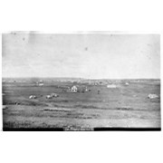
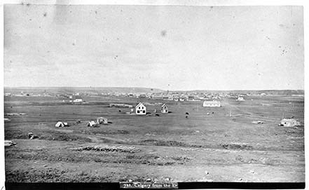
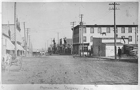
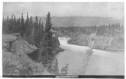
- Photograph: 1889. Album consists of 50 pages of 100 black and white photographs. Photographs also provides descriptions. Small amounts of silver mirroring starting to appear. V10 / PD - 1: 1- [721. Calgary from the E.] 2- [Slephen Clas. Calgary. From W.] 3- [716. Indigenous Camp, Winter.] 4- [Kan…
- Date Range
- 1889
- Reference Code
- V10 / PD -1
- Description Level
- 5 / File
- GMD
- Photograph
- Album
- Photograph print
101 images
1 Electronic Resource
- Part Of
- Boorne and May fonds
- Description Level
- 5 / File
- Fonds Number
- V10
- Sous-Fonds
- V10
- Accession Number
- 494
- Reference Code
- V10 / PD -1
- Date Range
- 1889
- Physical Description
- 1 photograph album
- Scope & Content
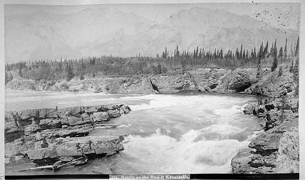
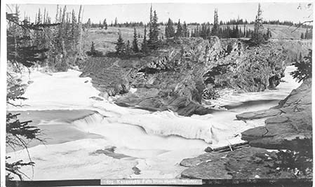
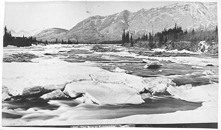
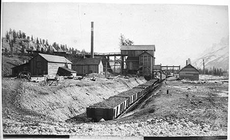
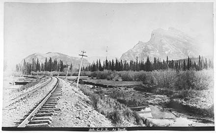
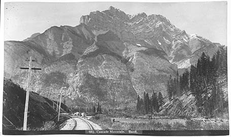
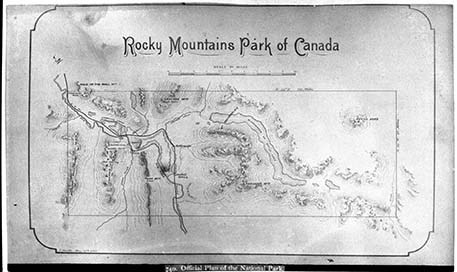
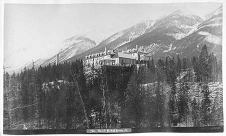
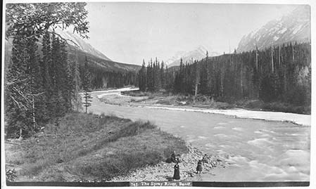
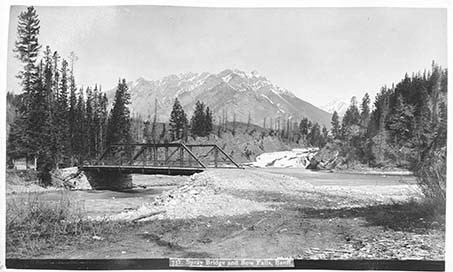
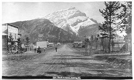
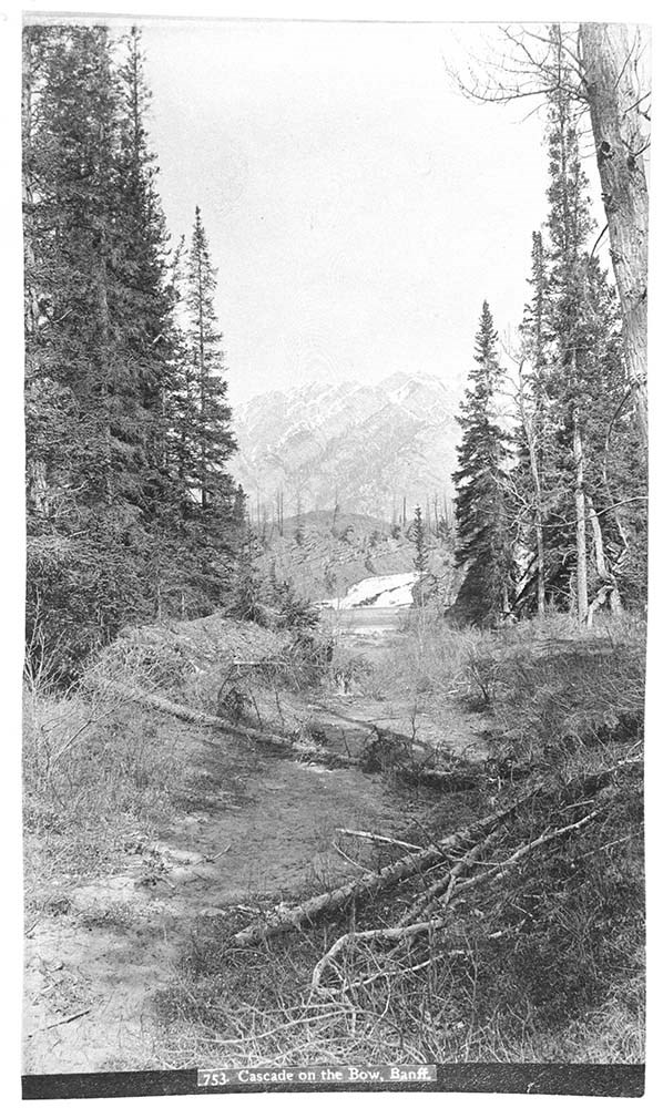
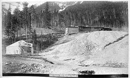
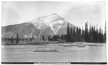
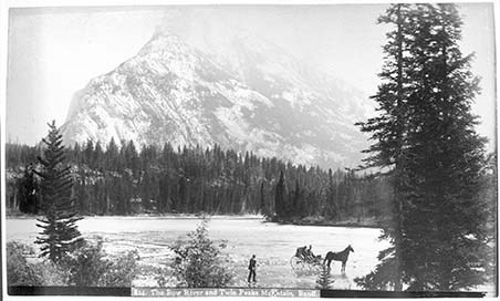
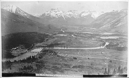
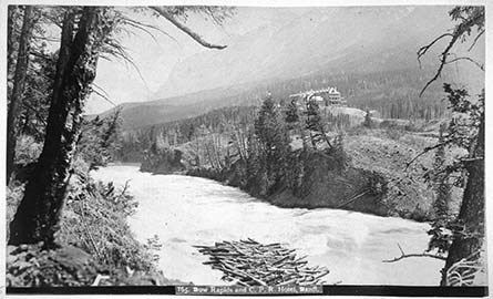
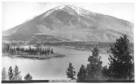
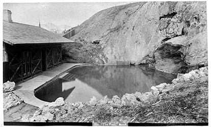
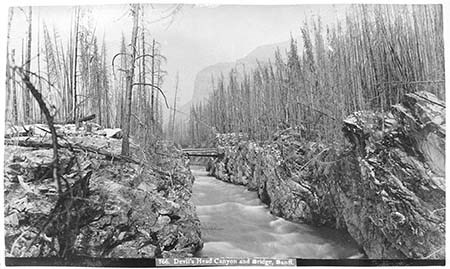
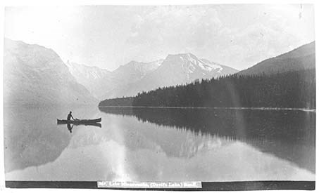
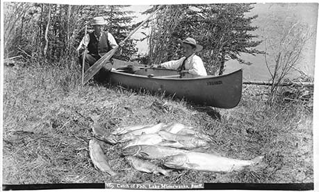
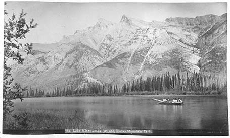
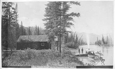
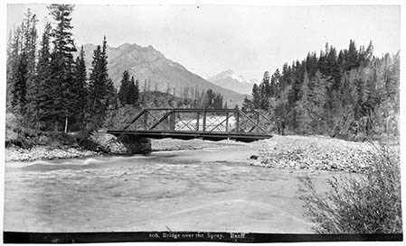
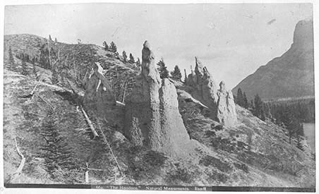
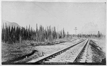
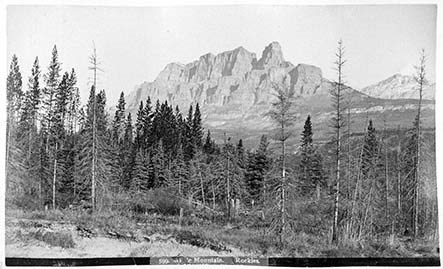
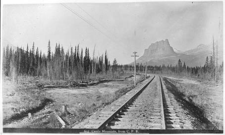
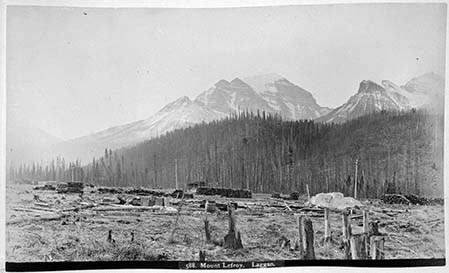
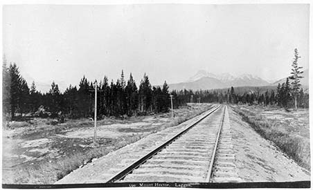
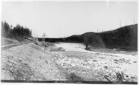
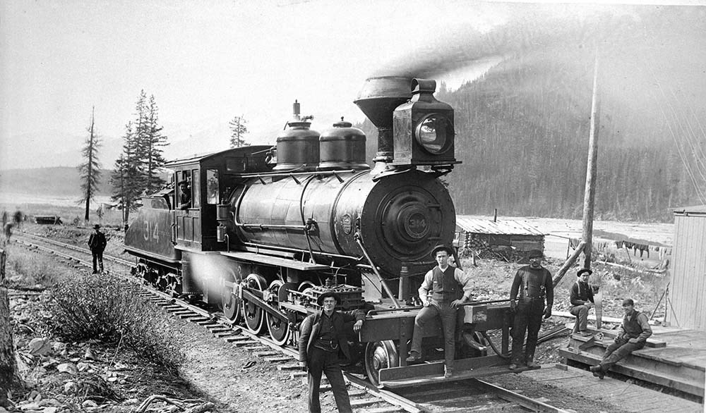
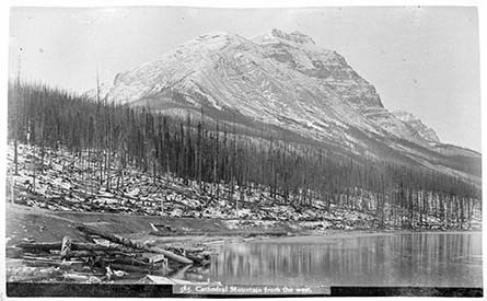
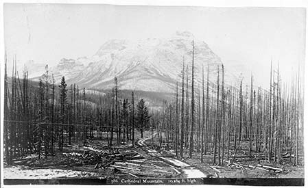
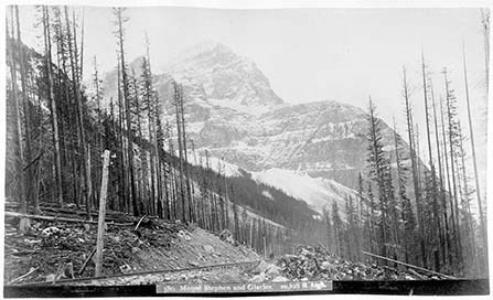
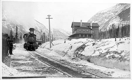
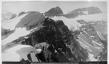
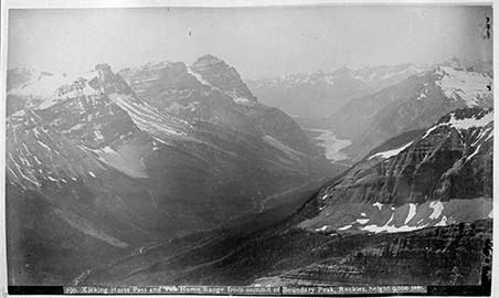
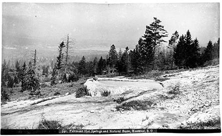
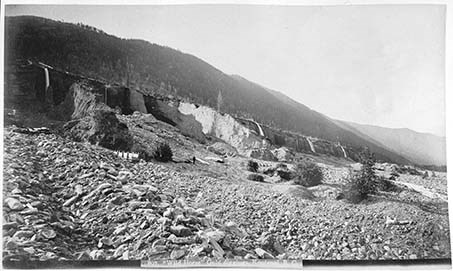
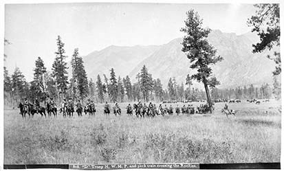
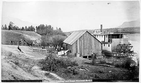
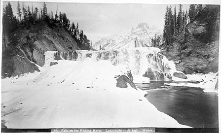
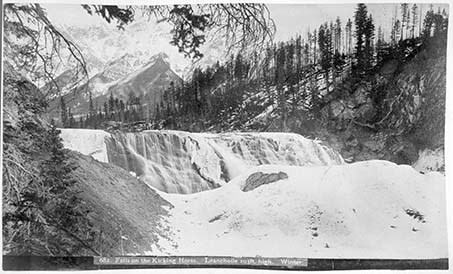
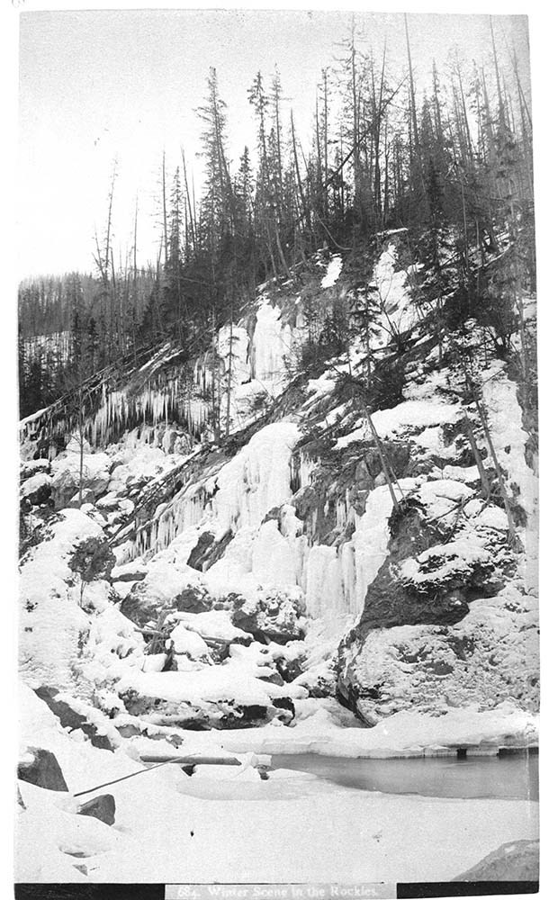
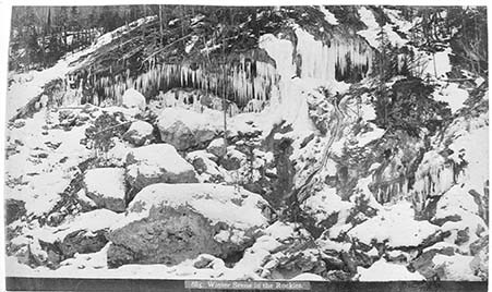
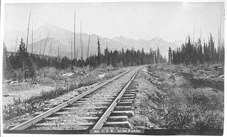
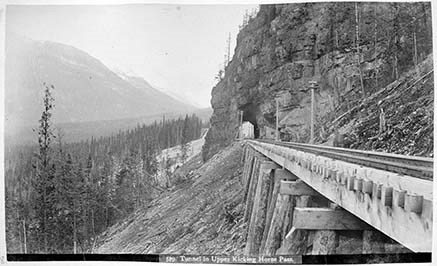
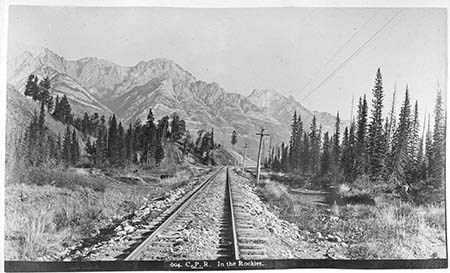
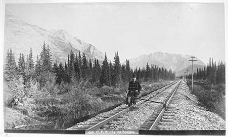
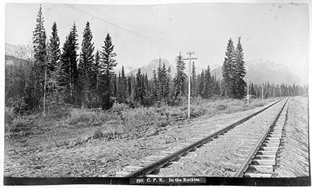
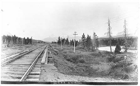
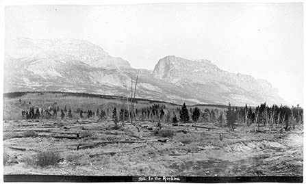
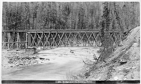
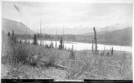
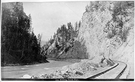
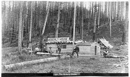
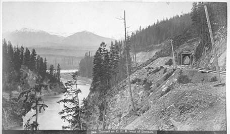
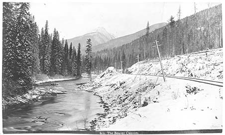
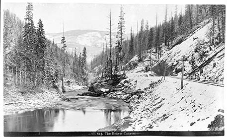
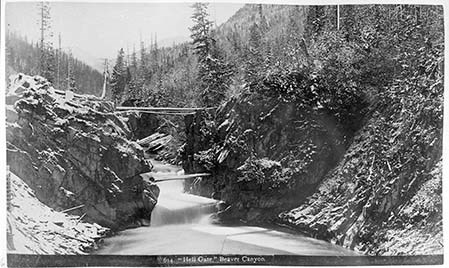
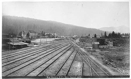
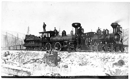
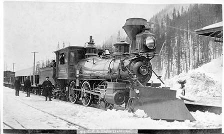
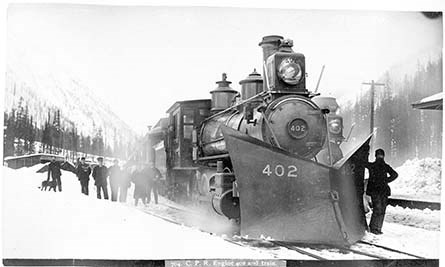
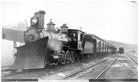
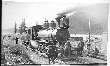
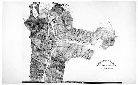
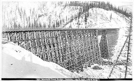
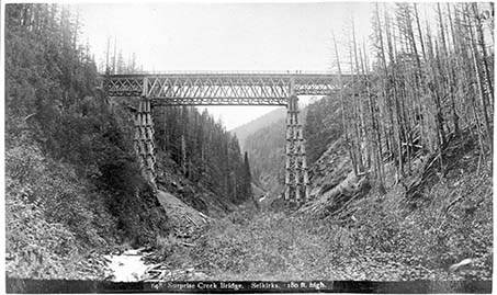
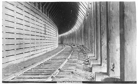
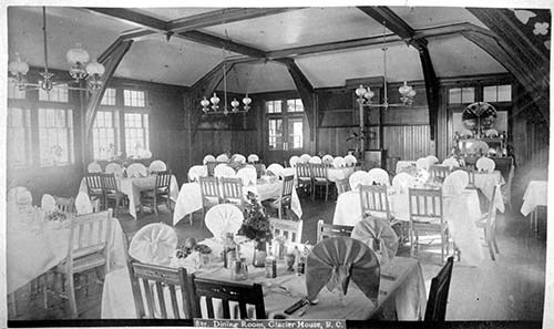
- Photograph: 1889. Album consists of 50 pages of 100 black and white photographs. Photographs also provides descriptions. Small amounts of silver mirroring starting to appear. V10 / PD - 1: 1- [721. Calgary from the E.] 2- [Slephen Clas. Calgary. From W.] 3- [716. Indigenous Camp, Winter.] 4- [Kananaskis Falls.] 5- [Rapids on the Bow at Kananaskis.] 6- [675. Kananaskis Falls from above. Winter.] 7- [676. The Bow at Kananaskis, Winter.] 8- [678. Mouth of Pit and Elevator, Anthracite.] 9- [608. C.P.R. At Banff.] 10- [663. Cascade Mountain. Banff.] 11- [740. Official Plan of the National Park.] 12- [641. C.P.R. Hotel. Banff.] 13- [720. Banff Hotel from N.] 14- [743. Lower Bow Park, from C.P.R. Hotel, Banff.] 15- [745. The Spray River, Banff.] 16- [751. Spray Bridge and Bow Falls, Banff.] 17- [750. Banff Avenue, looking N.] 18- [753. Cascade on the Bow, Banff.] 19- [719. The Sanitarium. Banff.] 20- [754. Upper Hot Springs, Banff.] 21- [755. Cascade Mountain from the Sanitarium, Banff.] 22- [756. Mount Edith, front Bow River, Banff.] 23- [824. The Bow River and Twin Peaks Mountain, Banff.] 24- [757. Bird’s Eye view of Banff, from Tunnel Mountain.] 25- [765. Bow Rapids and C.P.R. Hotel, Banff.] 26- [758. Vermilion Lakes, Banff.] 27- [760. Vermilion Lakes, Banff.] 28- [762. “The Pool,” Banff.] 29- [748. Interior of Cave, Banff] 30- [747. Cave and Basin Buildings, Banff.] 31- [766. Devil’s Head Canyon and Bridge, Banff.] 32- [767. Lake Minnewanka, (Devil’s Lake,) Banff.] 33- [769. Catch of Fish, Lake Minnewanka, Banff.] 34- [782. Lake Minnewanka. W. end, Rocky Mountain Park.] 35- [778. “Sundance Canyon,” Rocky Mountain Park.] 36- [815. “Canyon House” and the “Mountain Belle,” Banff] 37- [817. C.P.R. Transfer Co’s. Stables, Banff.] 38- [668. Bridge over the Spray. Banff] 39- [665. Tunnel Mountain. Banff.] 40- [664. “The Hoodoos.” Natural Monuments. Banff] 41- [657. Castle Mountain, from C.P.R.] 42- [599. Castle Mountain, Rockies.] 43- [596. C.P.R. At Castle Mountain] 44- [603. Castle Mountain, from C.P.R.] 45- [588. Mount LeFroy. Laggan.] 46- [598. Mount Hector. Laggan.] 47- [593. The Bow below Laggan.] 48- [Cathedral Mountain from the west.] 49- [586. Cathedral Mountain. 10,284 ft. high.] 50- [787. Field, B.C. from C.P.R. Hotel.] 51- [578. Field Hotel and Mount Stephen.] 52- [577. Mount Field. 8554 ft. high.] 53- [580. Mount Stephen and Glacier. 10,525 ft. high.] 54- [556. Field (?)] 55- [788. Mt. McMullen and Glaciers from the Summit of Boundary] 56- [790. Kicking Horse Pass and Van Home Range from summit of Boundary Peak, Rockies, height 9,000 feet.] 57- [791. Fairmont Hot Springs and Natural Basin, Kootenai, B.C.] 58- [807. “Wild Horse” Gold digging, Kootenai, B.C.] 59- [808. “D” Troop N. W.M.P. and pack train crossing the Rockies.] 60- [809. “Sam’s Landing” and Stage, Kootenai, B.C.] 61- [681. Falls on the Kicking Horse. Leanchoile 103ft. high. Winter.] 62- [682. Falls on the Kicking Horse. Leanchoile 103ft. high. Winter.] 63- [Winter scene in the Rockies.”] 64- [685. Winter Scene in the Rockies.] 65- [686. A Cascadec in Winter in the Kicking Horse Canyon.] 66- [687. The Kicking Horse in winter.] 67- [601. C.P.R. In the Rockies.] 68- [579. Tunnel in Upper Kicking Horse Pass.] 69- [604. C.P.R. In the Rockies.] 70- [605. C.P.R. In the Rockies.] 71- [606. C.P.R. In the Rockies.] 72- [607. The Bow River in the Rockies.] 73- [597. C.P.R. In the Rockies.] 74- [595. C.P.R. In the Rockies.] 75- [592. In the Rockies.] 76- [562. Bridge over the Kicking Horse.] 77- [555. Bridge and Tunnel. Kicking Horse Pass.] 78- [568. The Beaverfoot Range.] 79- [554. Kicking Horse Pass.] 80- [553. Group of section men on hand-car.] 81- [552. The Moberly House.] 82- [549. Tunnel on C.P.R. west of Donald.] 83- [550. The Columbia and Moberly Peak.] 84- [612. The Beaver Canyon.] 85- [613. The Beaver Canyon.] 86- [614. “Hell Gate.” Beaver Canyon.] 87- [819. Donald, B.C., from Station yard.] 88- [821. Round House and Turntable, Donald, B.C.] 89- [610. C.P.R. Engines.] 90- [703. C.P.R. Engine 73 and train.] 91- [C.P.R. Engine 402 and train] 92- [705. C.P.R. Engine, 316 and train at Donald, B.C.] 93- [606. C.P.R. heavy grade Engine.] 94- [739. Official Plan of “The Loop.” C.P.R.] 95- [651. Mountain Creek Bridge. Selkirks. 164 ft. high, 1086 ft. long.] 96- [652. Stony Creek Bridge. Selkirks. 296 ft. high.] 97- [648. Surprise Creek Bridge. Selkirks. 180 ft. high.] 98- [647. Interior of Snow-shed.] 99- [643. Glacier House. Selkirks.] 100- [837. Dining Room, Glacier House, B.C.]
- Language
- English
- Title Source
- Title based on contents of file
- Processing Status
- Processed
Electronic Resources
Images


This material is presented as originally created; it may contain outdated cultural descriptions and
potentially offensive content.
Read more.
Topographical sheet
https://archives.whyte.org/en/permalink/catalogue24653
- Medium
- Library - Maps and blueprints (unannotated; published)
- Map
- Published Date
- 1889
- Publisher
- Dept. of the Interior
- Call Number
- C3-8.13
- Publisher
- Dept. of the Interior
- Published Date
- 1889
- Scale
- Scale: 1:40,000
- Relief: Contour interval 100 ft.
- Subjects
- Banff
- Notes
- Photostatic copy from Public Archives
- Accession Number
- 675
- Call Number
- C3-8.13
- Collection
- Archives Library
This material is presented as originally created; it may contain outdated cultural descriptions and
potentially offensive content.
Read more.
(a): Topographical sheets|(b): Original map
https://archives.whyte.org/en/permalink/catalogue24654
- Medium
- Library - Maps and blueprints (unannotated; published)
- Map
- Published Date
- 1889
- Publisher
- Dept. of the Interior
- Call Number
- C3-8.14 (a)
- C3-8.14 (b)
- Publisher
- Dept. of the Interior
- Published Date
- 1889
- Scale
- Scale:1:40,000
- Relief: Contour interval 100 ft.
- Subjects
- Anthracite
- Notes
- (b): 8 dup in map room
- Accession Number
- 675
- 400
- 3069
- Call Number
- C3-8.14 (a)
- C3-8.14 (b)
- Collection
- Archives Library
This material is presented as originally created; it may contain outdated cultural descriptions and
potentially offensive content.
Read more.
Topographical sheet
https://archives.whyte.org/en/permalink/catalogue24655
- Medium
- Library - Maps and blueprints (unannotated; published)
- Map
- Published Date
- 1889
- Publisher
- Dept. of the Interior
- Call Number
- C3-8.15
- Publisher
- Dept. of the Interior
- Published Date
- 1889
- Scale
- Scale: 1:40,000
- Relief: Contour interval 100 ft.
- Subjects
- Saddle Mountain
- Notes
- Photostatic copy from Public Archives
- Accession Number
- 675
- Call Number
- C3-8.15
- Collection
- Archives Library
This material is presented as originally created; it may contain outdated cultural descriptions and
potentially offensive content.
Read more.
Topographical Sheet
https://archives.whyte.org/en/permalink/catalogue24661
- Medium
- Library - Maps and blueprints (unannotated; published)
- Map
- Published Date
- 1889
- Publisher
- Dept. of the Interior
- Call Number
- C3-8.21
- Publisher
- Dept. of the Interior
- Published Date
- 1889
- Scale
- Scale: 1:40,000
- Relief: Contour interval 100 ft.
- Subjects
- Kananaskis
- Notes
- Photostatic copy from Public Archives
- Accession Number
- 675
- Call Number
- C3-8.21
- Collection
- Archives Library
This material is presented as originally created; it may contain outdated cultural descriptions and
potentially offensive content.
Read more.
Geological map of the Cascade Coal Basin
https://archives.whyte.org/en/permalink/catalogue24678
- Medium
- Library - Book (including soft-cover and pamphlets)
- Map
- Published Date
- Topo survey: 1889-90
- Call Number
- C7-1.1(b)
- Published Date
- Topo survey: 1889-90
- Scale
- 1 mile - 1 inch
- Subjects
- Cascade Coal Basin
- Alberta
- Notes
- Sheet #2. Cascade River No. 931
- To illustrate Report by D.B. Dowling
- Accession Number
- 3120 (Copy 2)
- Call Number
- C7-1.1(b)
- Collection
- Archives Library
This material is presented as originally created; it may contain outdated cultural descriptions and
potentially offensive content.
Read more.
Geological and Nat. Historical Survey
https://archives.whyte.org/en/permalink/catalogue24681
- Medium
- Library - Book (including soft-cover and pamphlets)
- Map
- Published Date
- 1886
- Publisher
- Burland Lithographic Co., Montreal
- Call Number
- C7-1.4
- Publisher
- Burland Lithographic Co., Montreal
- Published Date
- 1886
- Scale
- 2 miles to 1 inch
- Subjects
- Rocky Mountains
- Notes
- Cross section in the vicinity of the Canadian Pacific Railway
- Accession Number
- 400
- Call Number
- C7-1.4
- Collection
- Archives Library
This material is presented as originally created; it may contain outdated cultural descriptions and
potentially offensive content.
Read more.
[Exshaw-Golden] Sheets 1 and 2, Photogeological interpretation
https://archives.whyte.org/en/permalink/catalogue24720
- Medium
- Library - Book (including soft-cover and pamphlets)
- Map
- Published Date
- 1960
- Publisher
- Hunting Survey Corp. Ltd. Calgary
- Call Number
- C7-2.6
- Publisher
- Hunting Survey Corp. Ltd. Calgary
- Published Date
- 1960
- Physical Description
- 1 map : col
- Scale
- Relief: Contour interval 1000'
- Accession Number
- 673
- 2815
- Call Number
- C7-2.6
- Collection
- Archives Library
This material is presented as originally created; it may contain outdated cultural descriptions and
potentially offensive content.
Read more.
Geological and Tectonic map
https://archives.whyte.org/en/permalink/catalogue24757
- Medium
- Library - Book (including soft-cover and pamphlets)
- Map
- Published Date
- 1960
- Publisher
- Alberta Society of Petroleum Geologists
- Call Number
- C7-4.3
- Publisher
- Alberta Society of Petroleum Geologists
- Published Date
- 1960
- Physical Description
- Colour
- Scale
- 1:7,500,000
- Subjects
- Arctic
- Accession Number
- 673
- Call Number
- C7-4.3
- Collection
- Archives Library
This material is presented as originally created; it may contain outdated cultural descriptions and
potentially offensive content.
Read more.
Permafrost map|Permafrost in Canada, RCGS, 1967
https://archives.whyte.org/en/permalink/catalogue24770
- Medium
- Library - Book (including soft-cover and pamphlets)
- Map
- Published Date
- 1967
- Publisher
- Dept. of Energy, Mines and Resources
- Call Number
- C7-5.3(a)
- C7-5.3(b)
- Publisher
- Dept. of Energy, Mines and Resources
- Published Date
- 1967
- Scale
- 1 inch to 120 miles
- Subjects
- Canada
- Notes
- Geological Survey
- Accession Number
- 673
- 495
- Call Number
- C7-5.3(a)
- C7-5.3(b)
- Collection
- Archives Library
This material is presented as originally created; it may contain outdated cultural descriptions and
potentially offensive content.
Read more.
A surface geology map of New Brunswick
https://archives.whyte.org/en/permalink/catalogue24775
- Medium
- Library - Book (including soft-cover and pamphlets)
- Map
- Published Date
- 1888-9
- Call Number
- C7-6.1(c)
- Published Date
- 1888-9
- Scale
- 4 miles to 1 inch
- Subjects
- New Brunswick - Geological
- Notes
- Part N, No. 1 1/4 sheet 1, N.E.
- Accompanies 03.1/G29ar Annual Report, 1888-9
- To illustrate Reports by Messrs Bailey, Mathew and Ells, 1871-79
- Accession Number
- 7000
- Call Number
- C7-6.1(c)
- Collection
- Archives Library
This material is presented as originally created; it may contain outdated cultural descriptions and
potentially offensive content.
Read more.
Part N. Surface Geology, Southern New Brunswick, No. 1, 1/4 Sheet 1, S.W.
https://archives.whyte.org/en/permalink/catalogue24776
- Medium
- Library - Book (including soft-cover and pamphlets)
- Map
- Published Date
- 1888-89
- Call Number
- C7-6.1(d)
- Published Date
- 1888-89
- Scale
- 4 miles to 1 inch
- Subjects
- New Brunswick - Geological
- Notes
- Accompanies 03.1/G29 ar/Annual Report, 1888-89
- Accession Number
- 7000
- Call Number
- C7-6.1(d)
- Collection
- Archives Library
This material is presented as originally created; it may contain outdated cultural descriptions and
potentially offensive content.
Read more.
Geological maps
https://archives.whyte.org/en/permalink/catalogue24792
- Medium
- Library - Book (including soft-cover and pamphlets)
- Map
- Published Date
- 1885
- Publisher
- Geological and Natural History Survey of Canada
- Call Number
- C7-6.19
- Publisher
- Geological and Natural History Survey of Canada
- Published Date
- 1885
- Scale
- 1:506,880
- Notes
- (a) Geological and Topographical
- (b) Surface Character
- Accession Number
- 400
- Call Number
- C7-6.19
- Collection
- Archives Library
This material is presented as originally created; it may contain outdated cultural descriptions and
potentially offensive content.
Read more.
[United States]
https://archives.whyte.org/en/permalink/catalogue24814
- Medium
- Library - Maps and blueprints (unannotated; published)
- Map
- Published Date
- 1966
- Publisher
- National Geographic Society
- Call Number
- C13-1.6
- Publisher
- National Geographic Society
- Published Date
- 1966
- Scale
- Scale: 26 miles to 1 inch
- Relief: Bench marks
- Subjects
- California, United States
- Accession Number
- 495
- Call Number
- C13-1.6
- Collection
- Archives Library
This material is presented as originally created; it may contain outdated cultural descriptions and
potentially offensive content.
Read more.