Narrow Results By
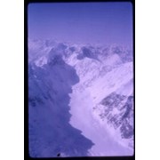
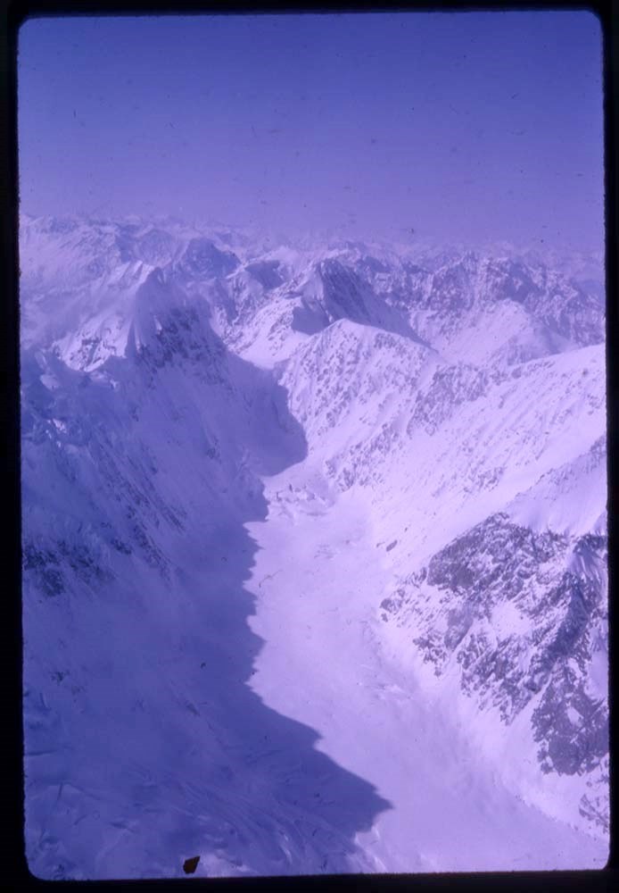
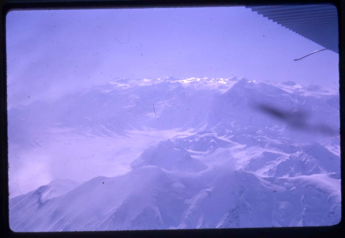
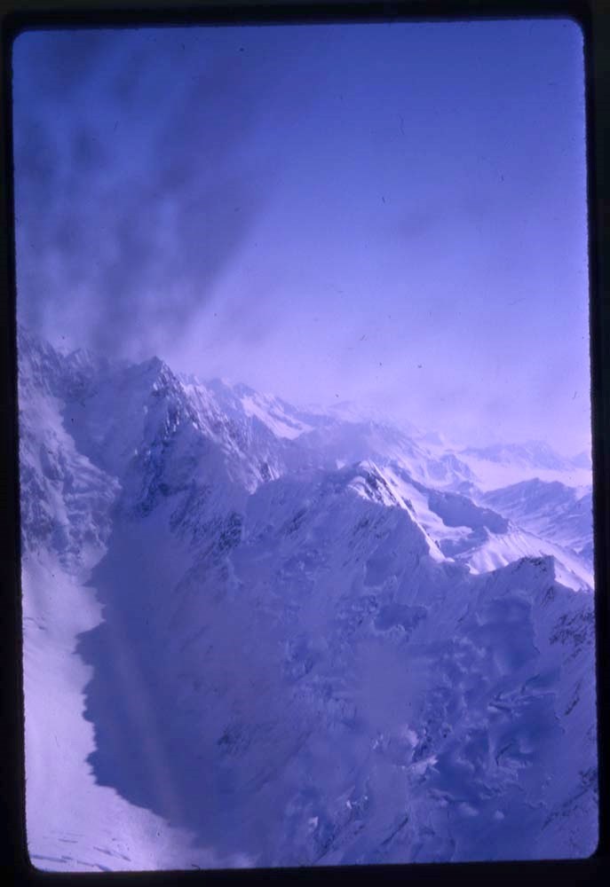
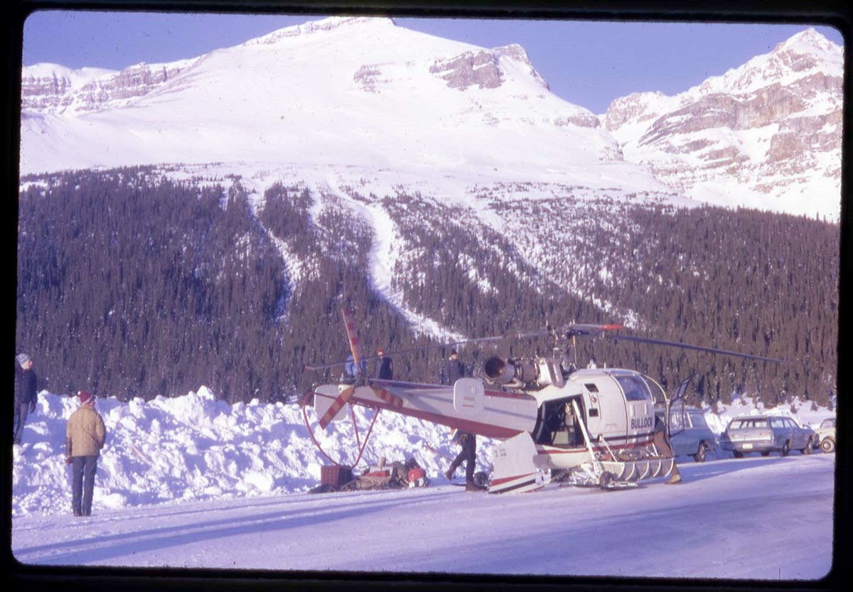
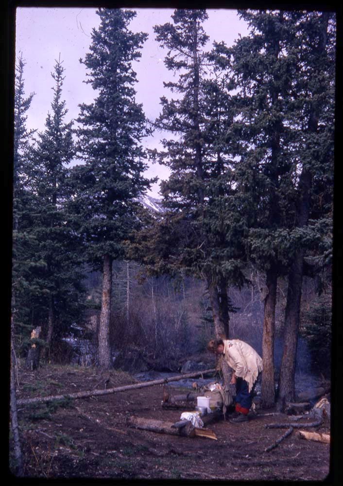
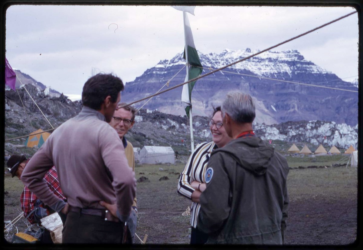
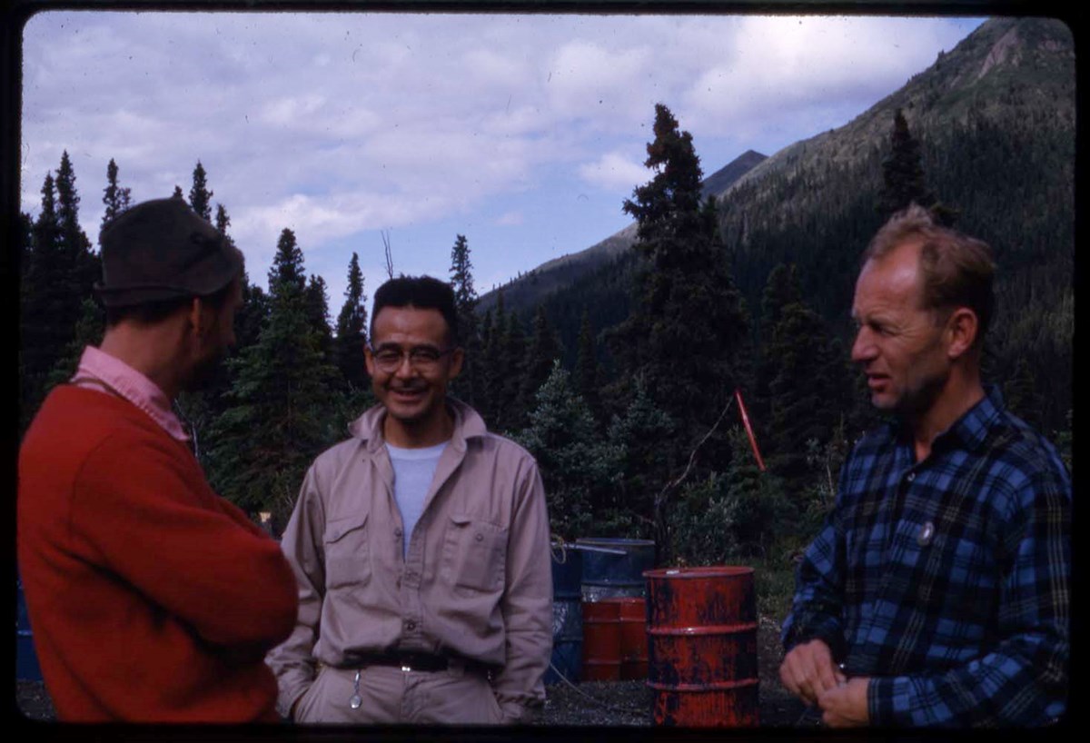
Yukon 67, 88 Yukon, recce 66 : [Yukon expeditions]
https://archives.whyte.org/en/permalink/descriptions17544
- Part Of
- Bob Hind fonds
- Scope & Content
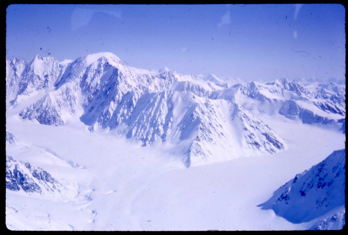
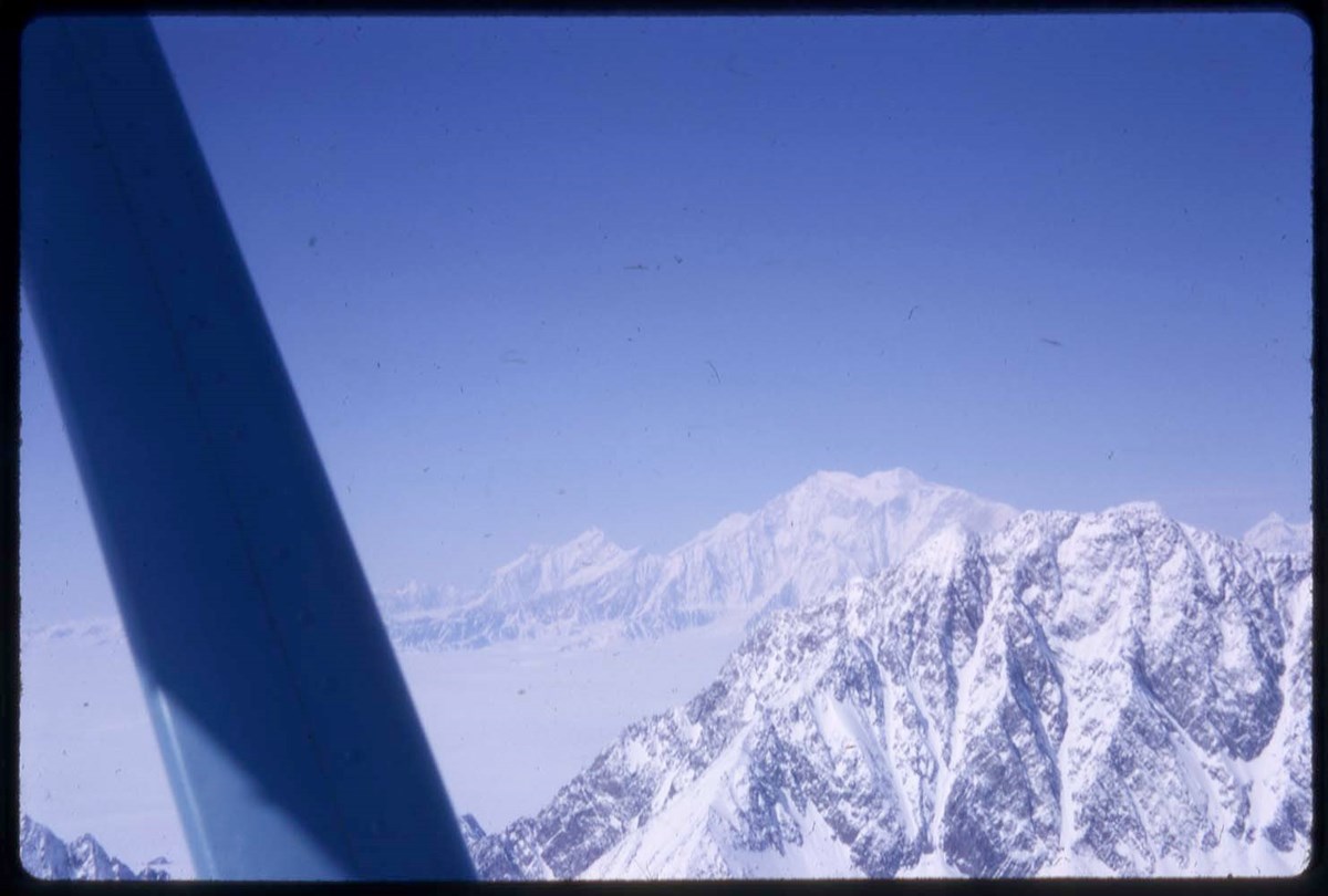
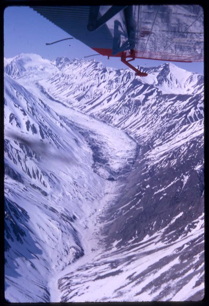
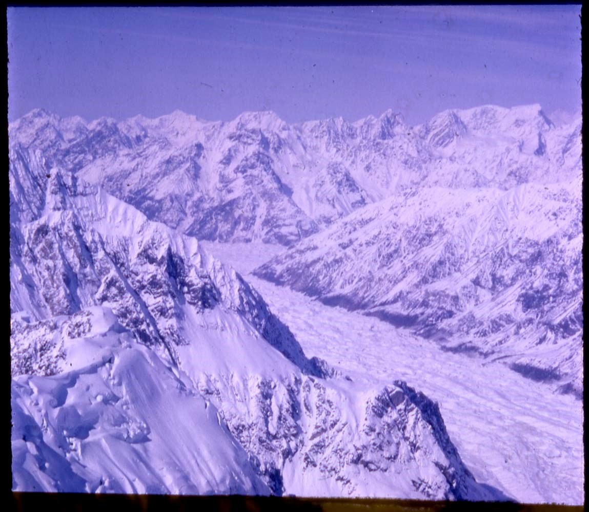
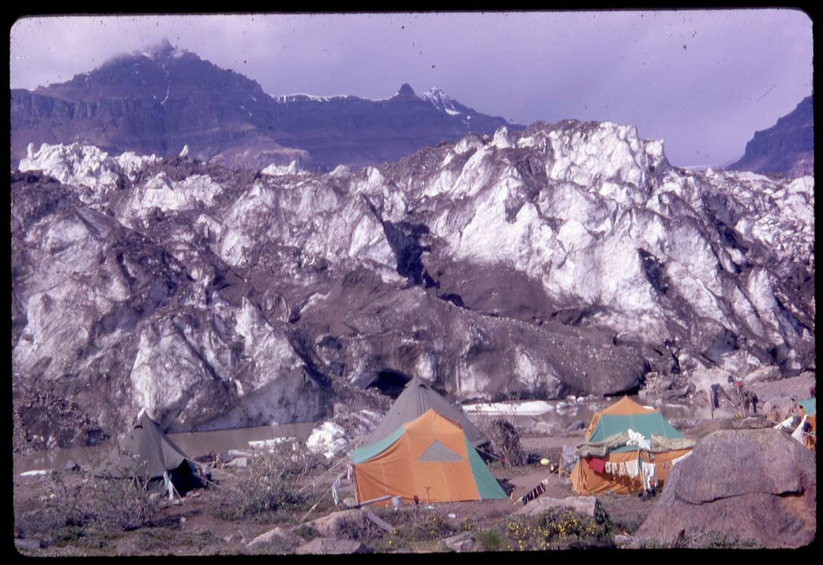
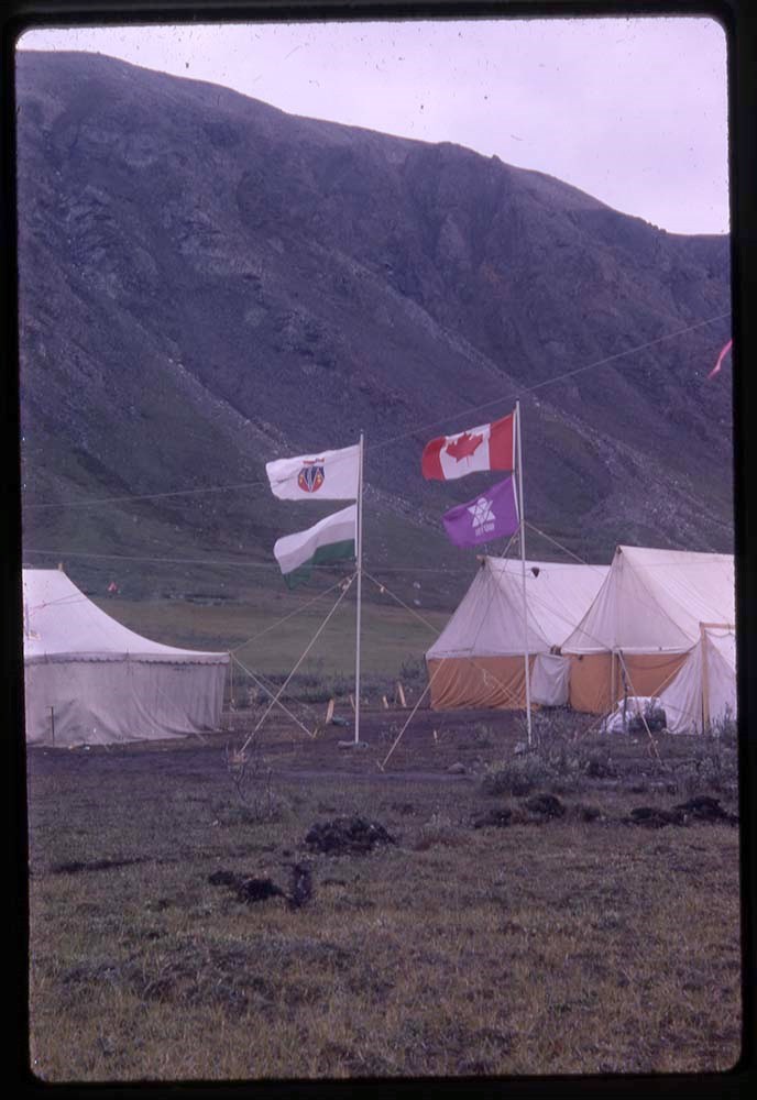
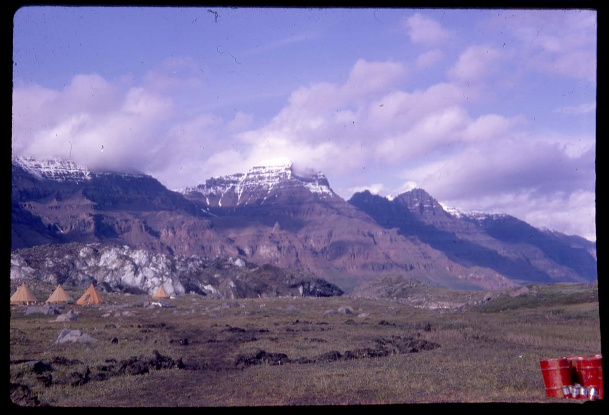
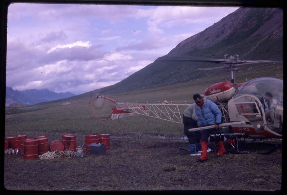
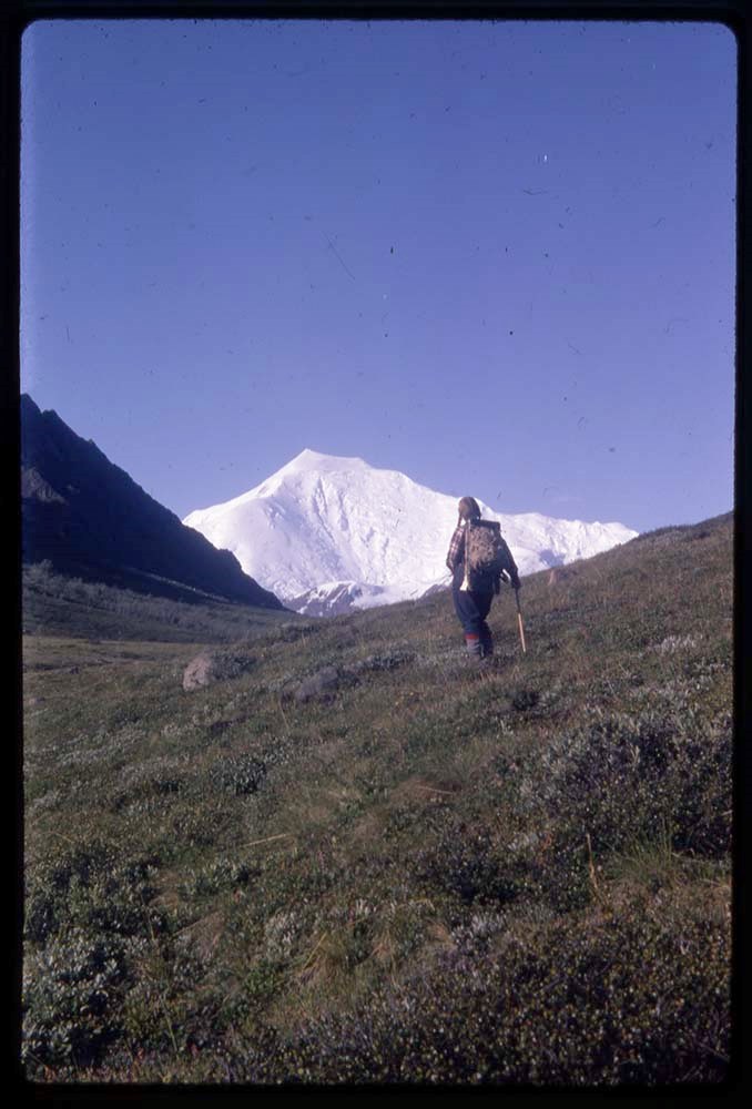
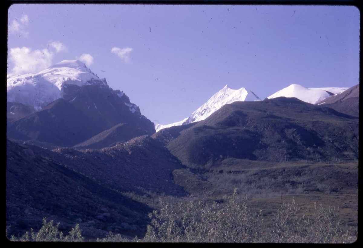
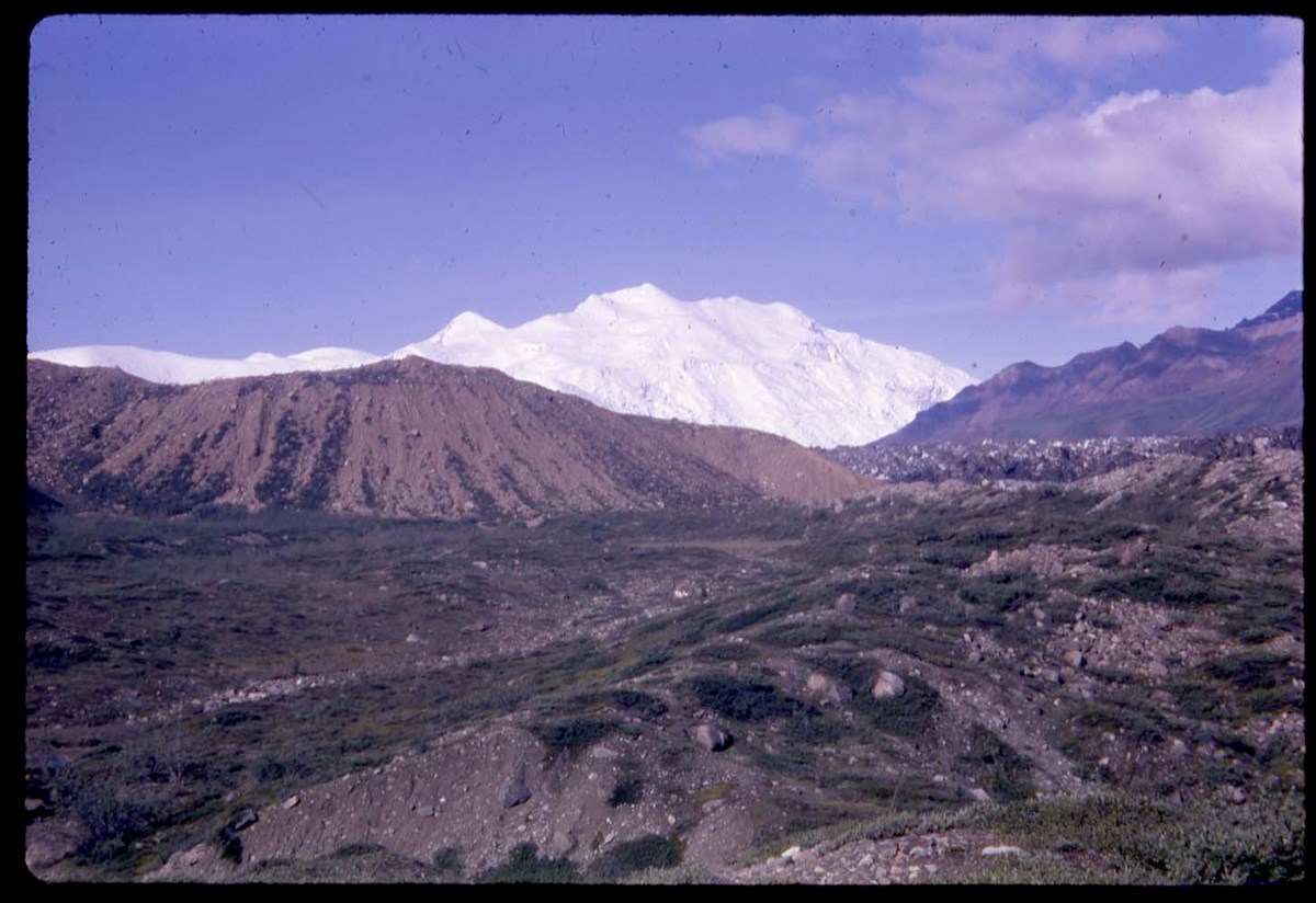
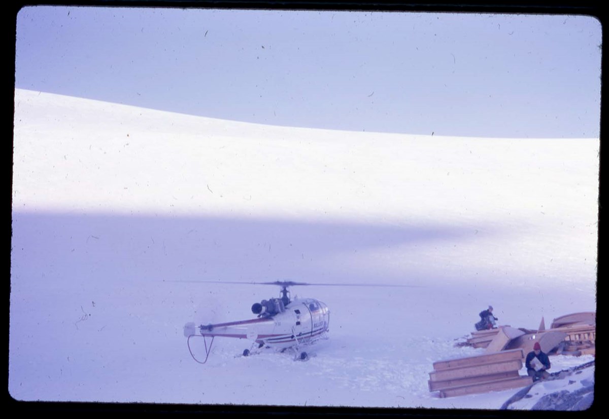
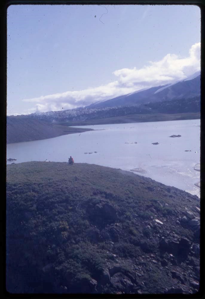
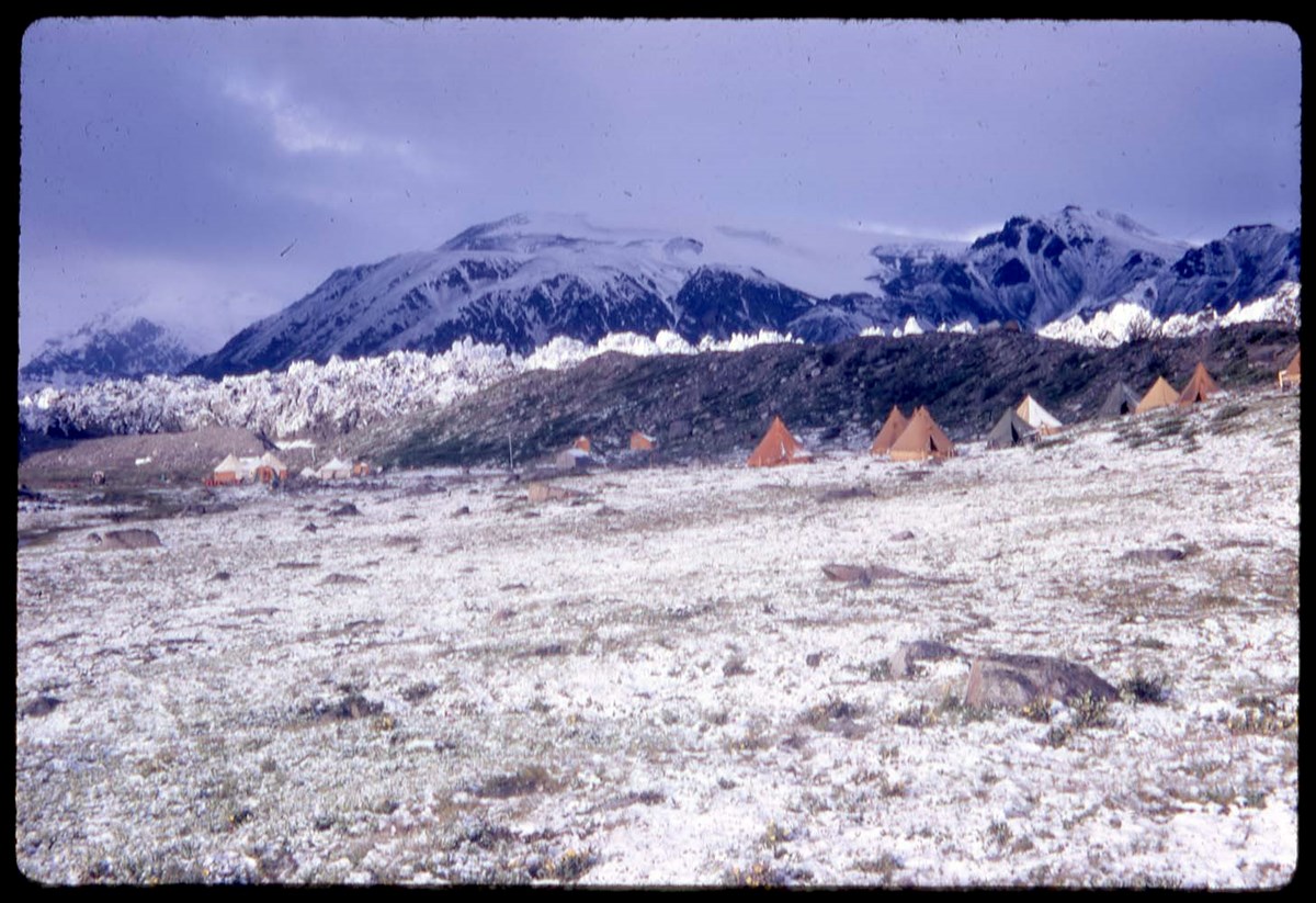
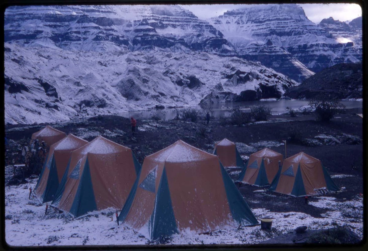
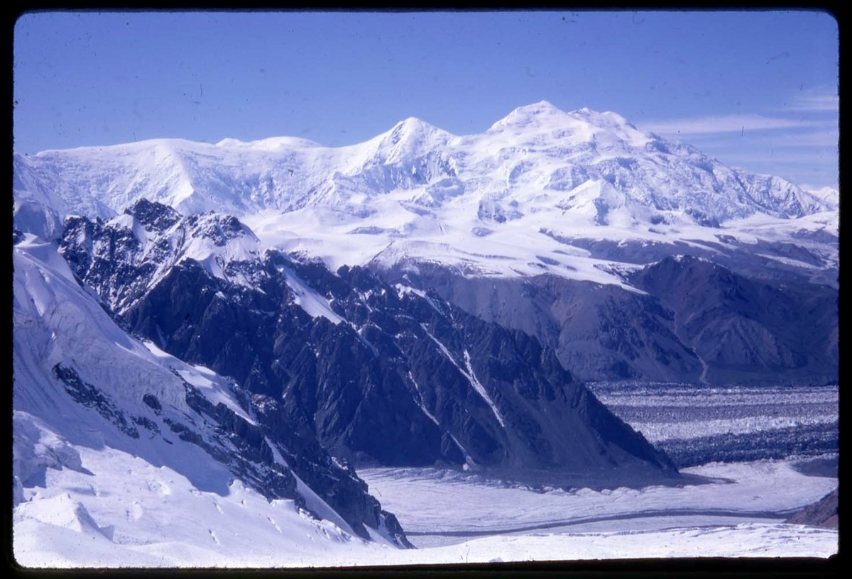
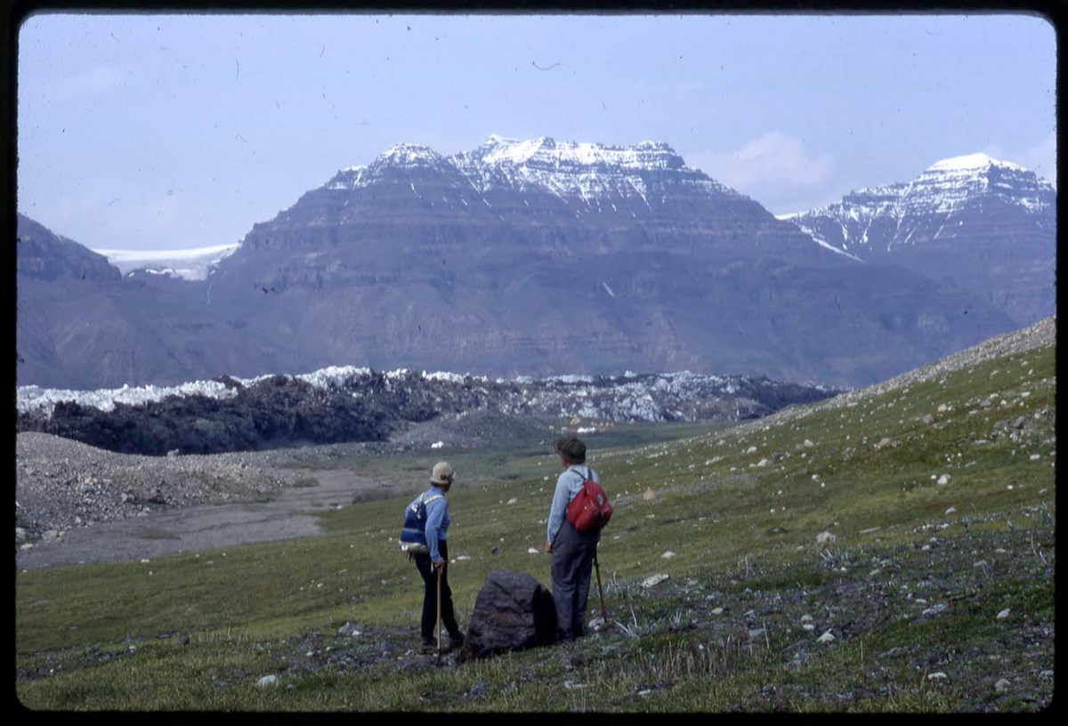
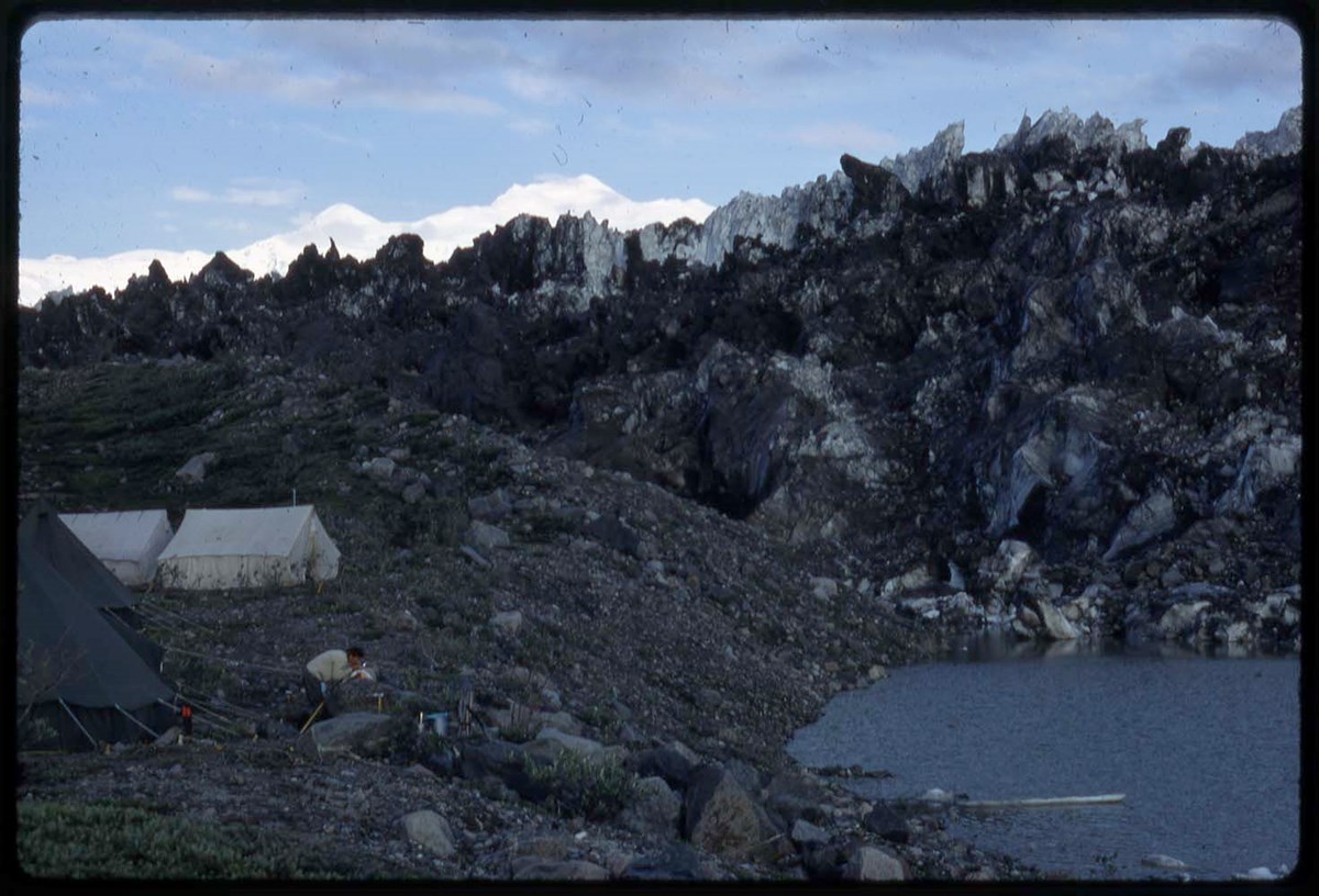
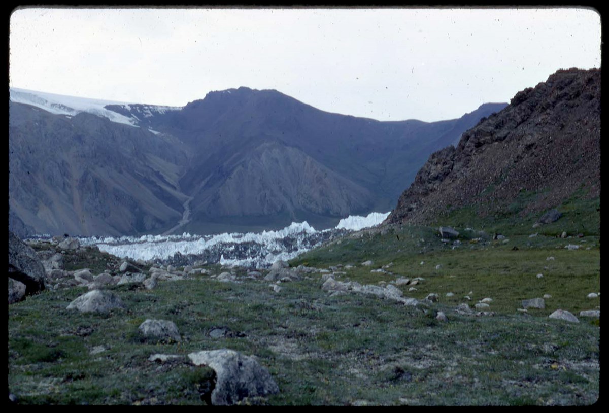
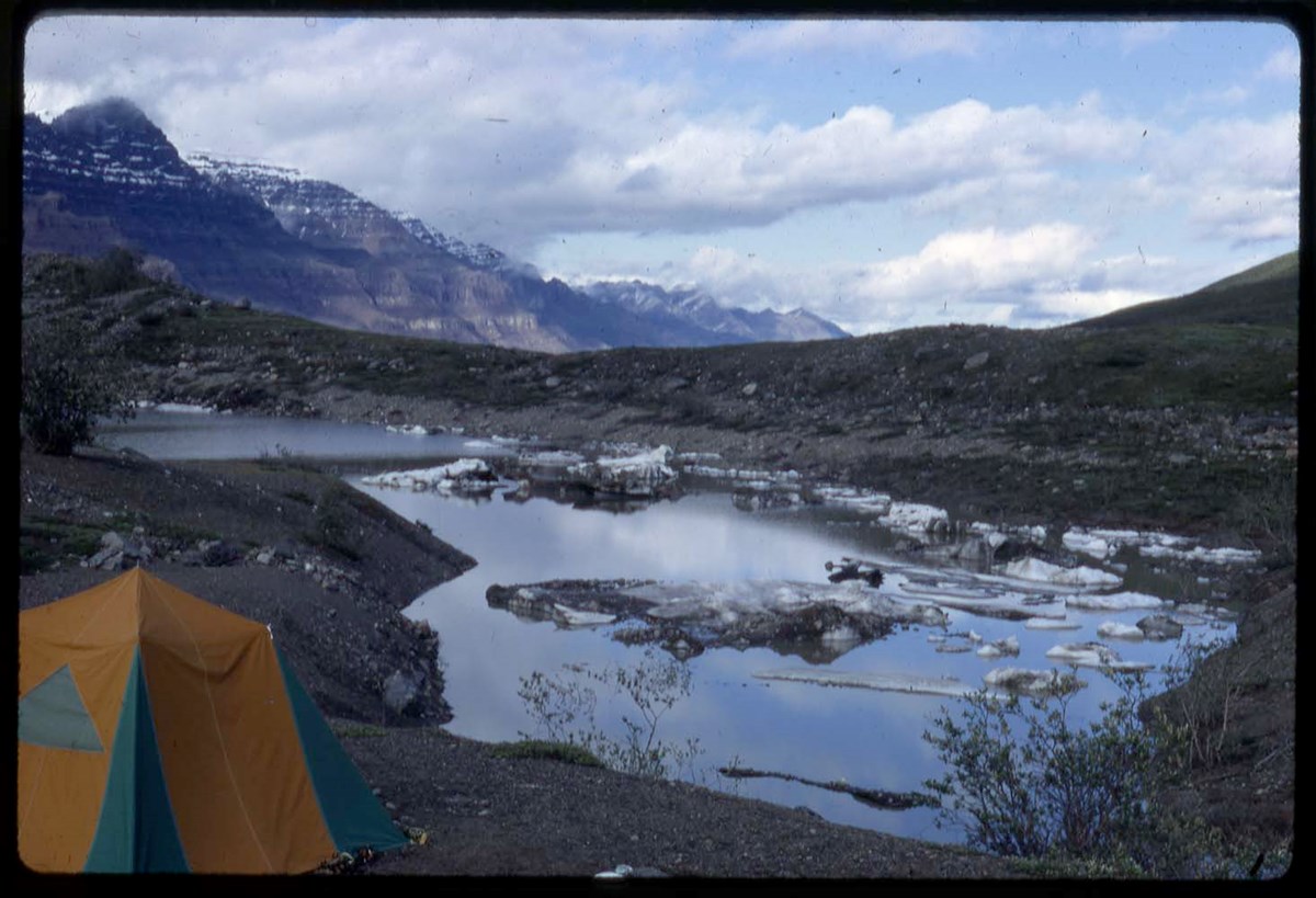
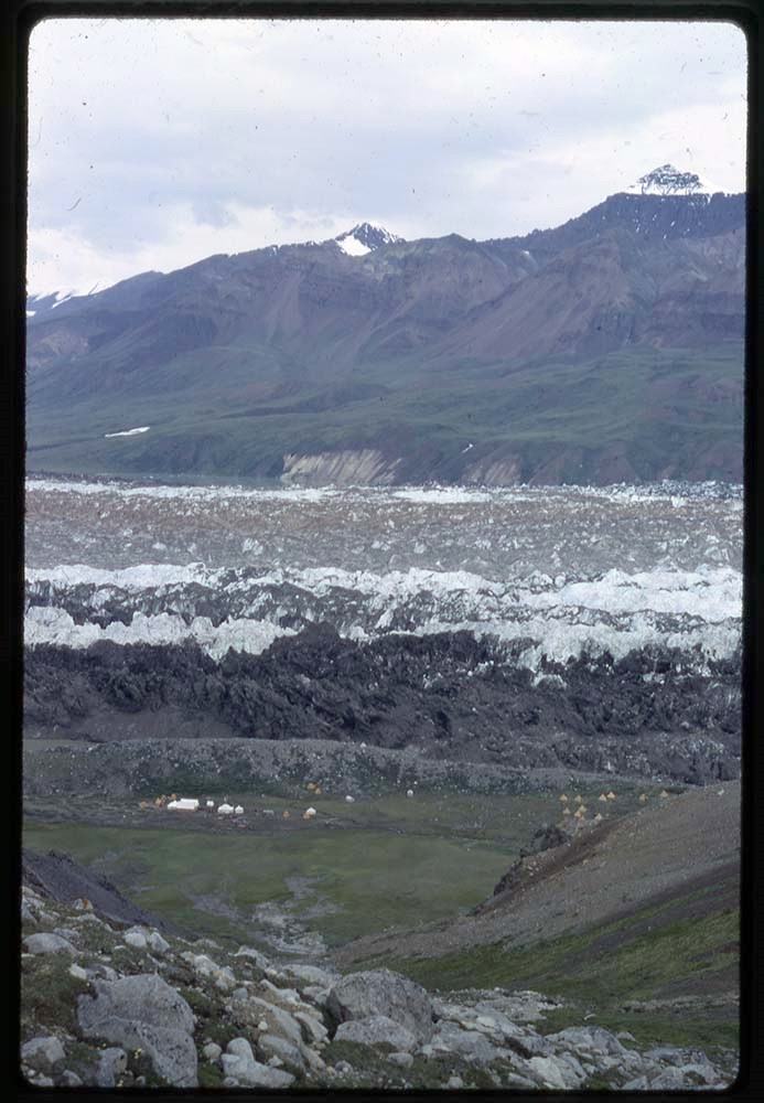
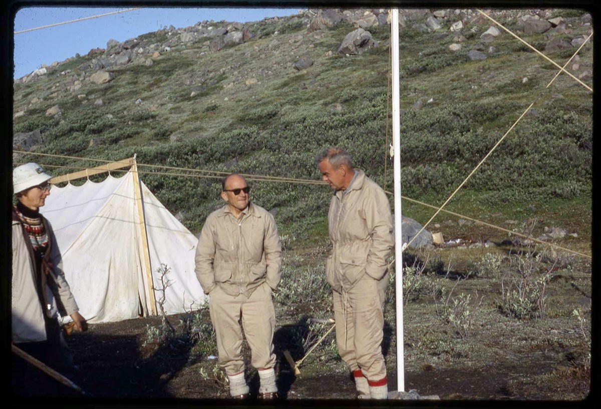
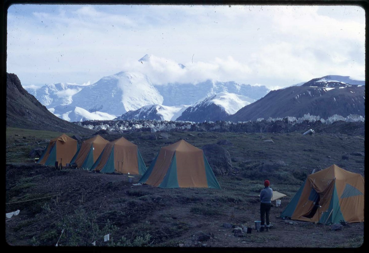
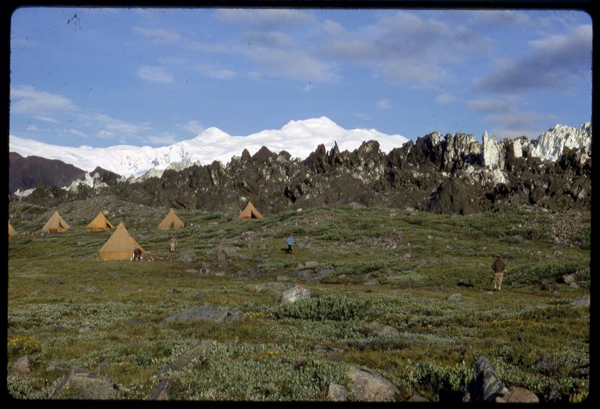
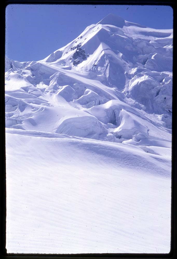
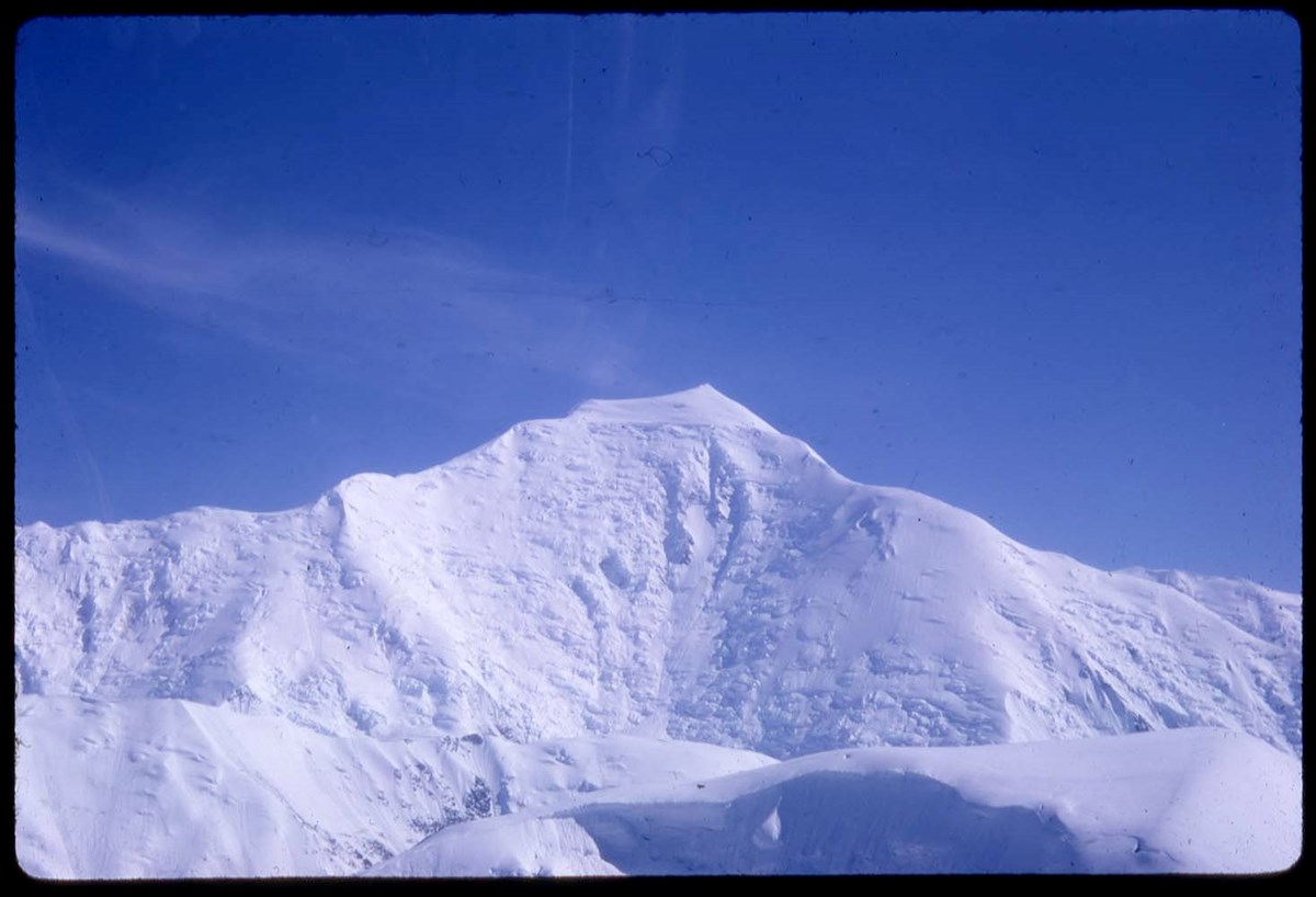
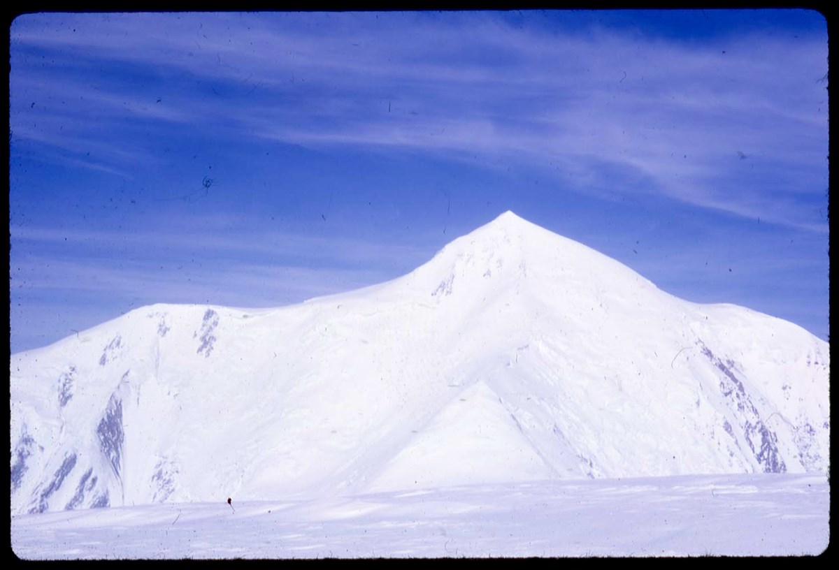
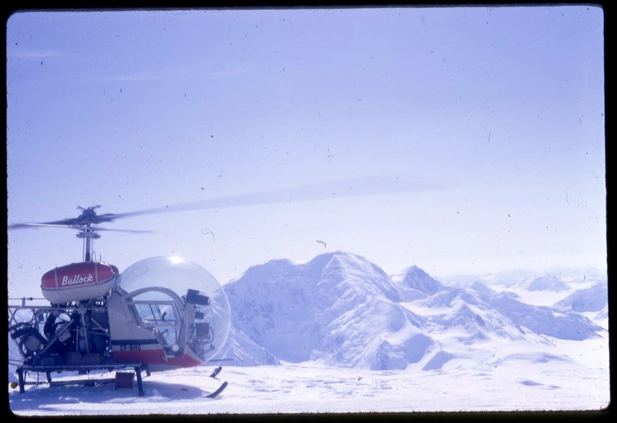
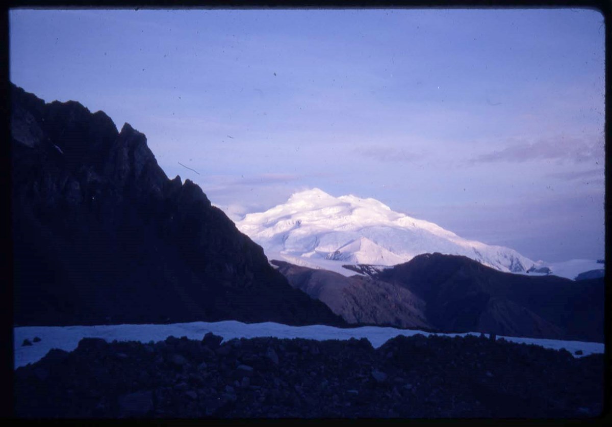
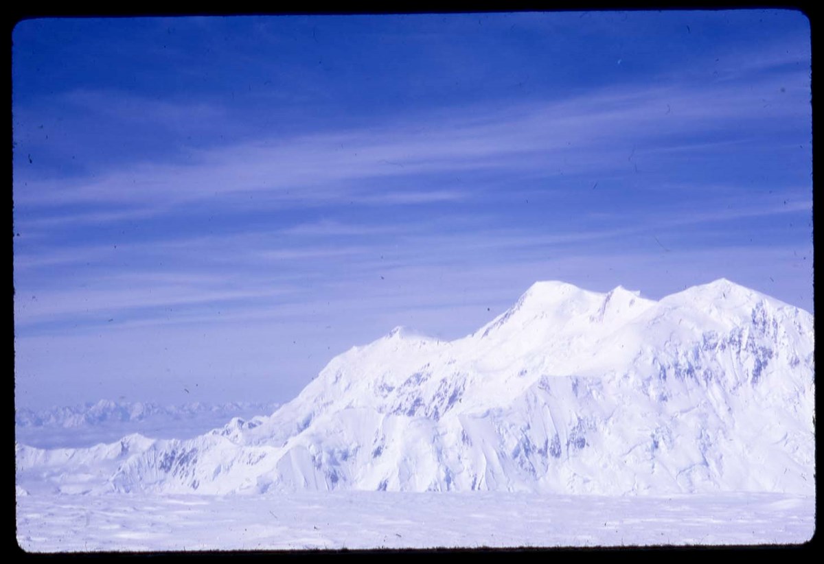
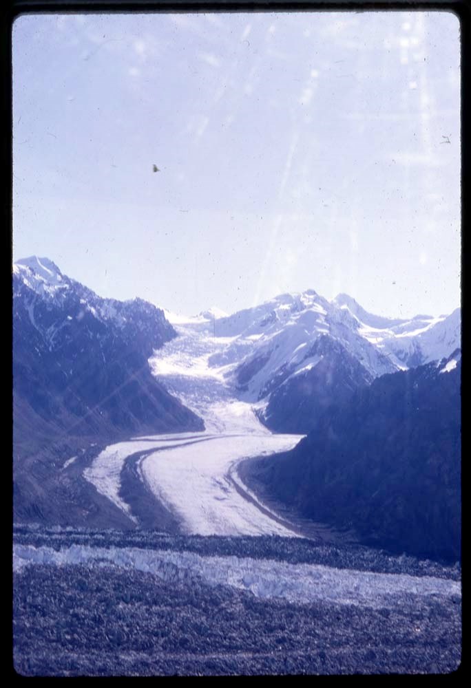
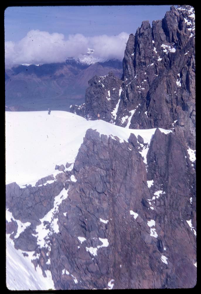
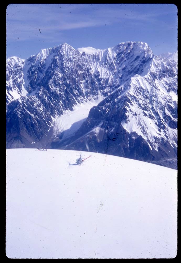
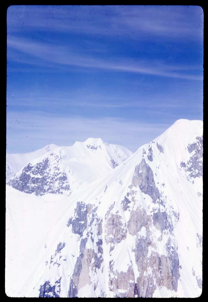
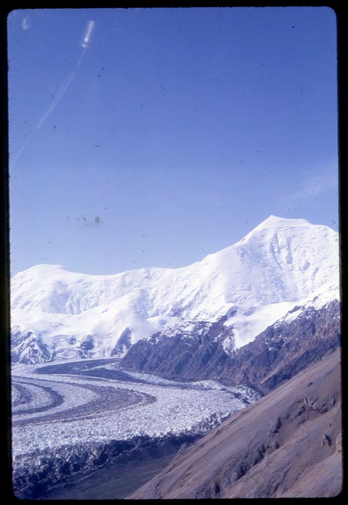
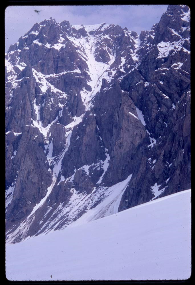
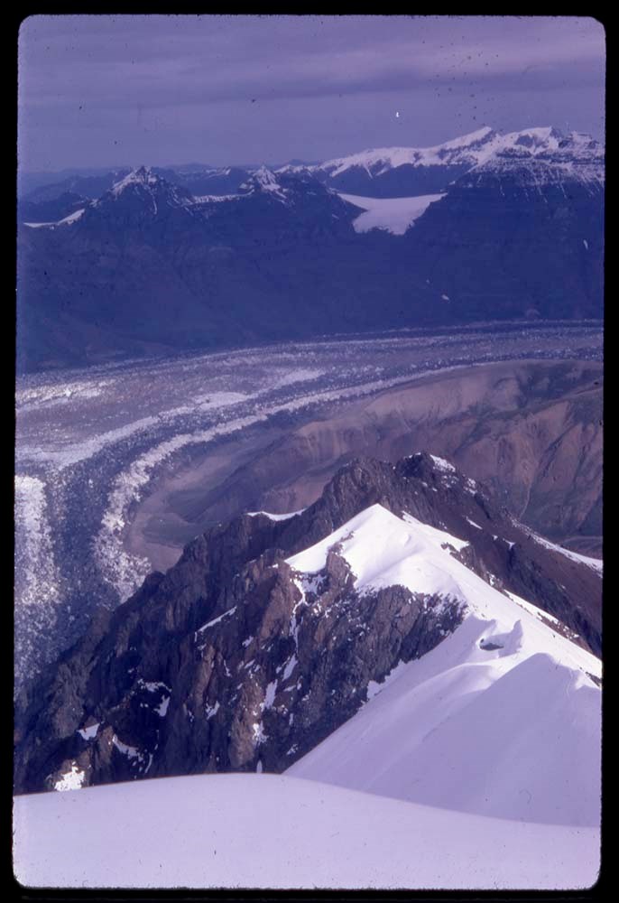
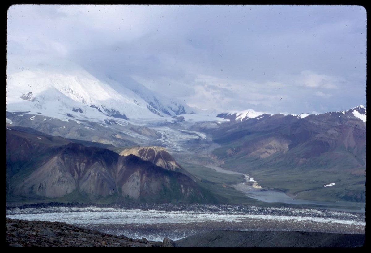
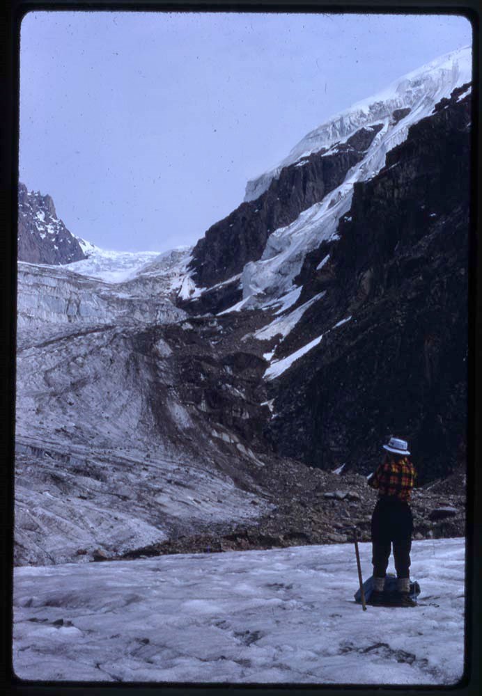
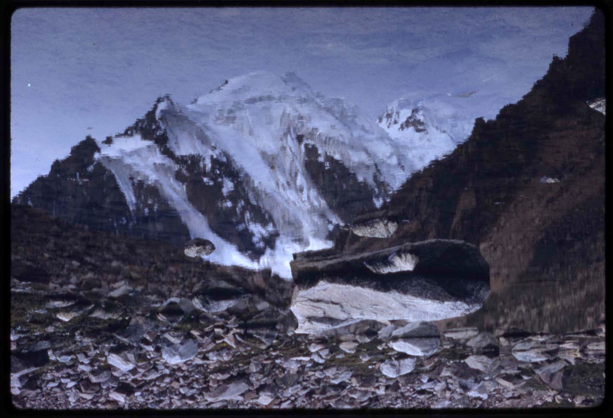
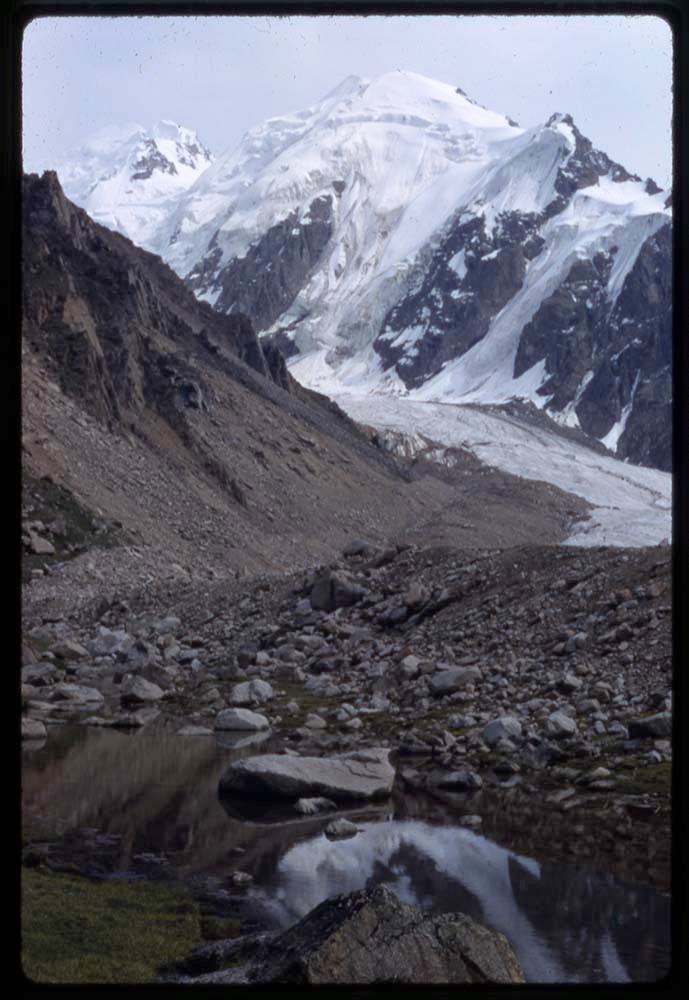
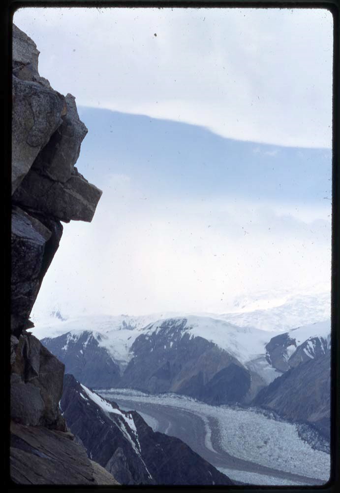
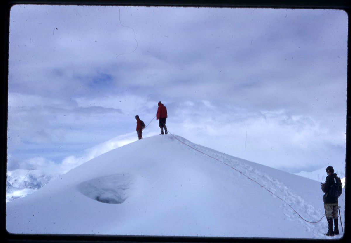
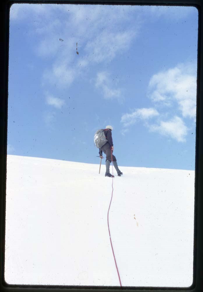
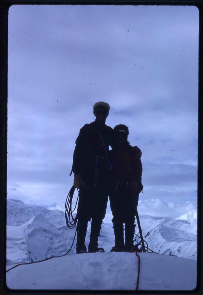
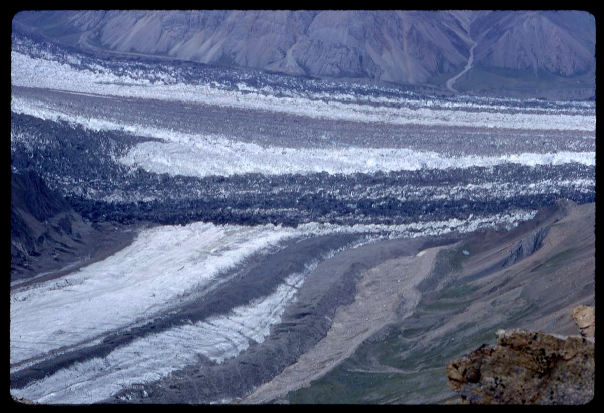
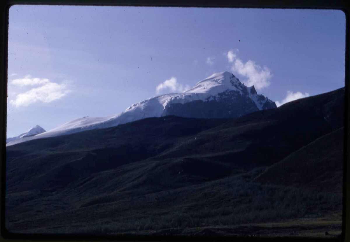
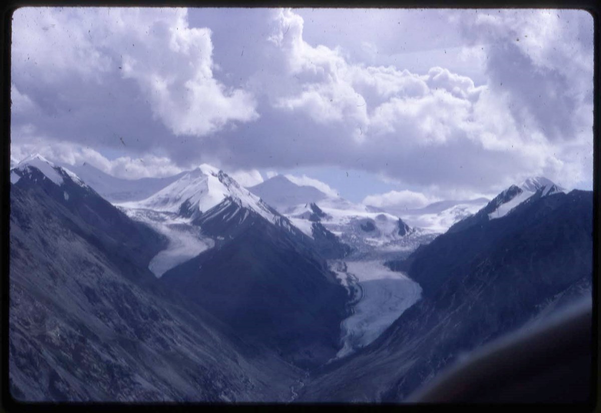
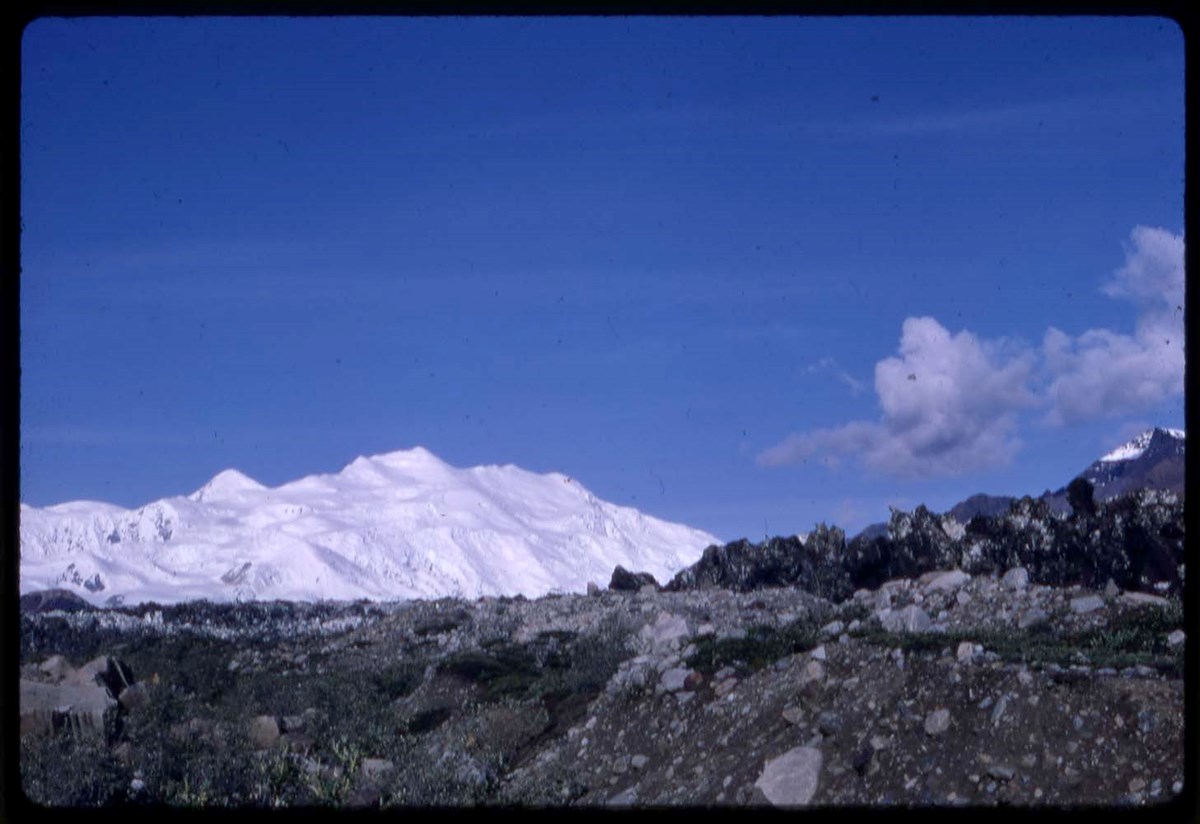
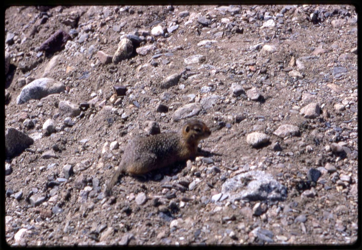
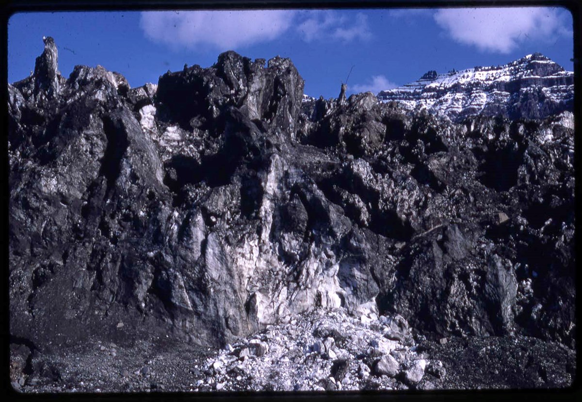
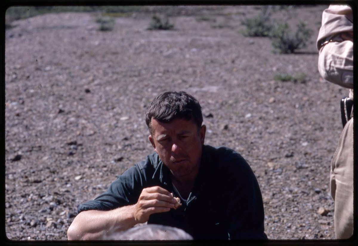
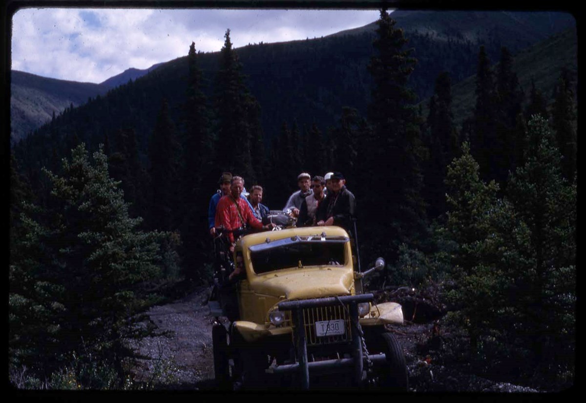
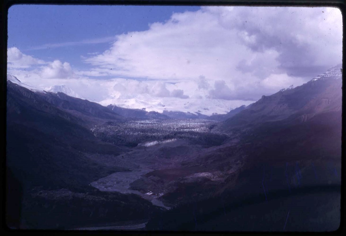
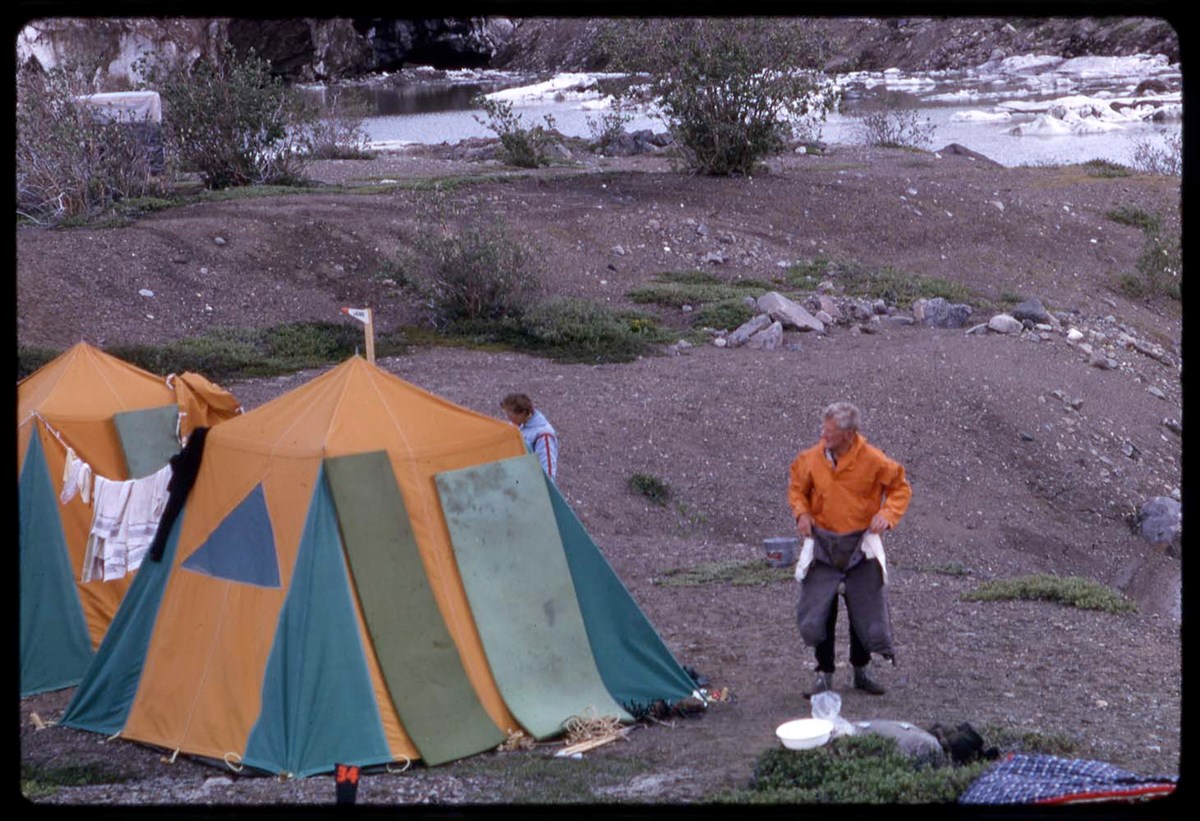
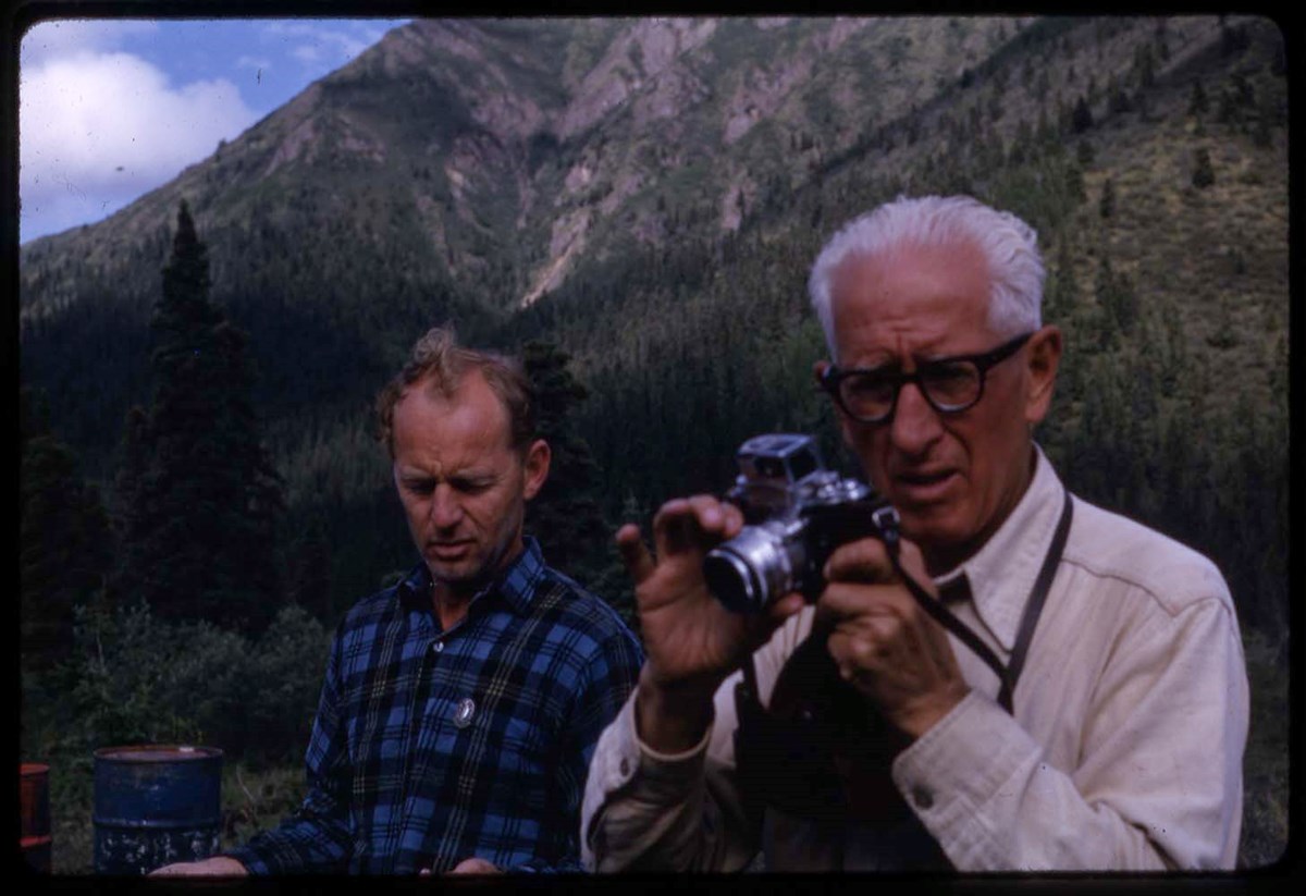
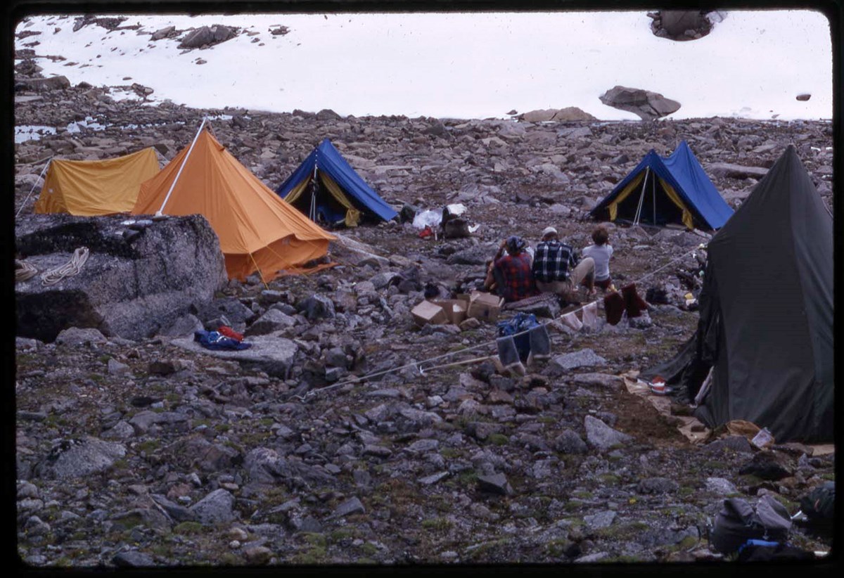
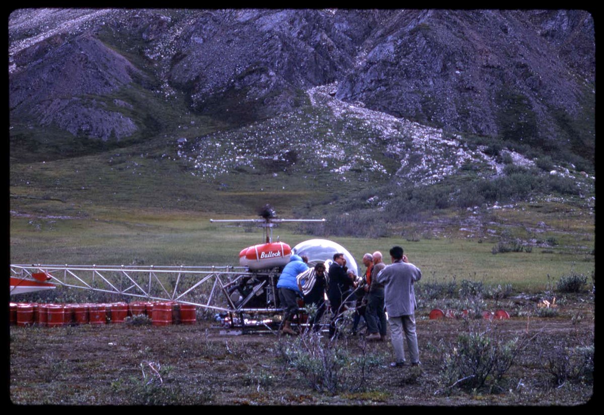
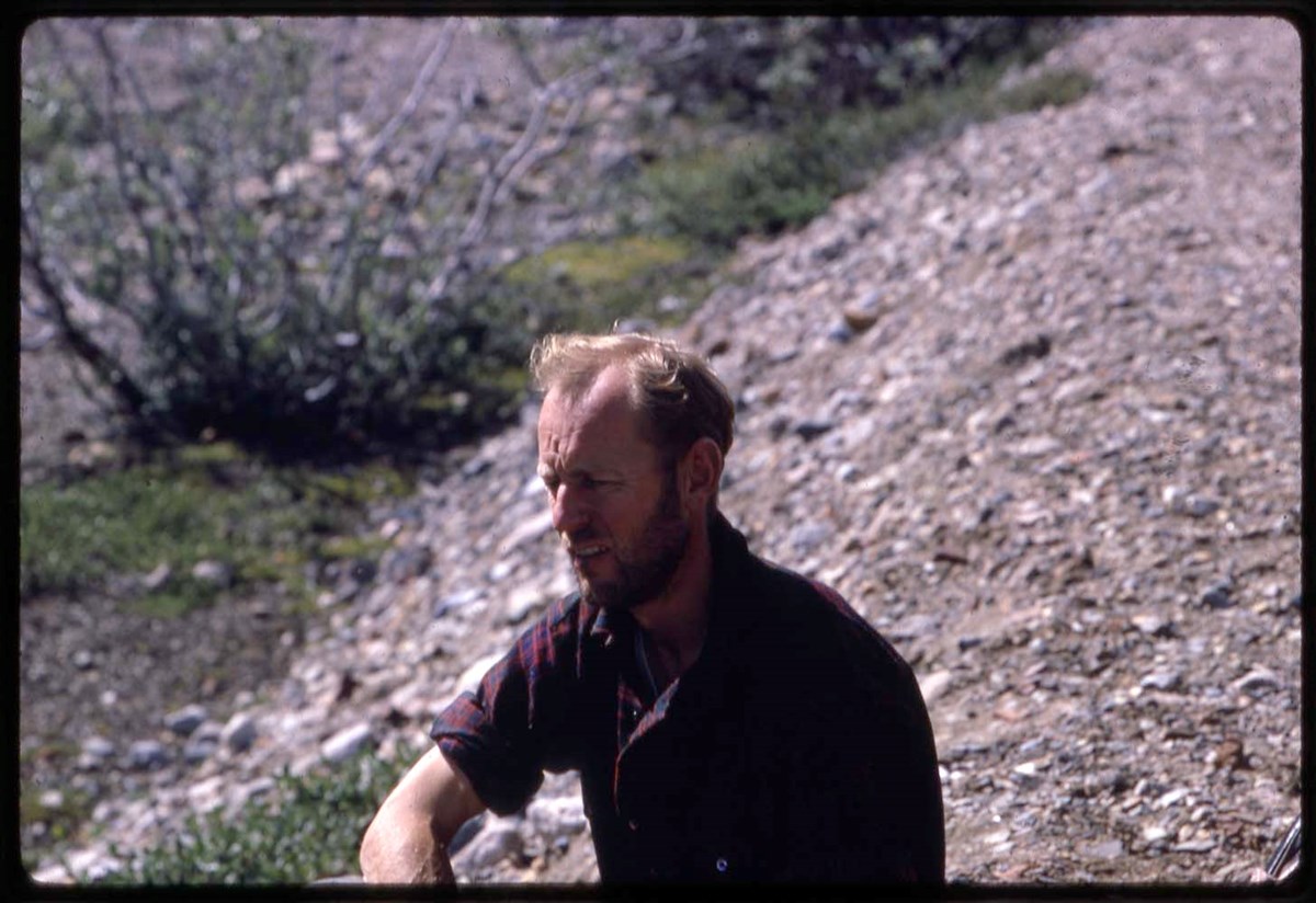
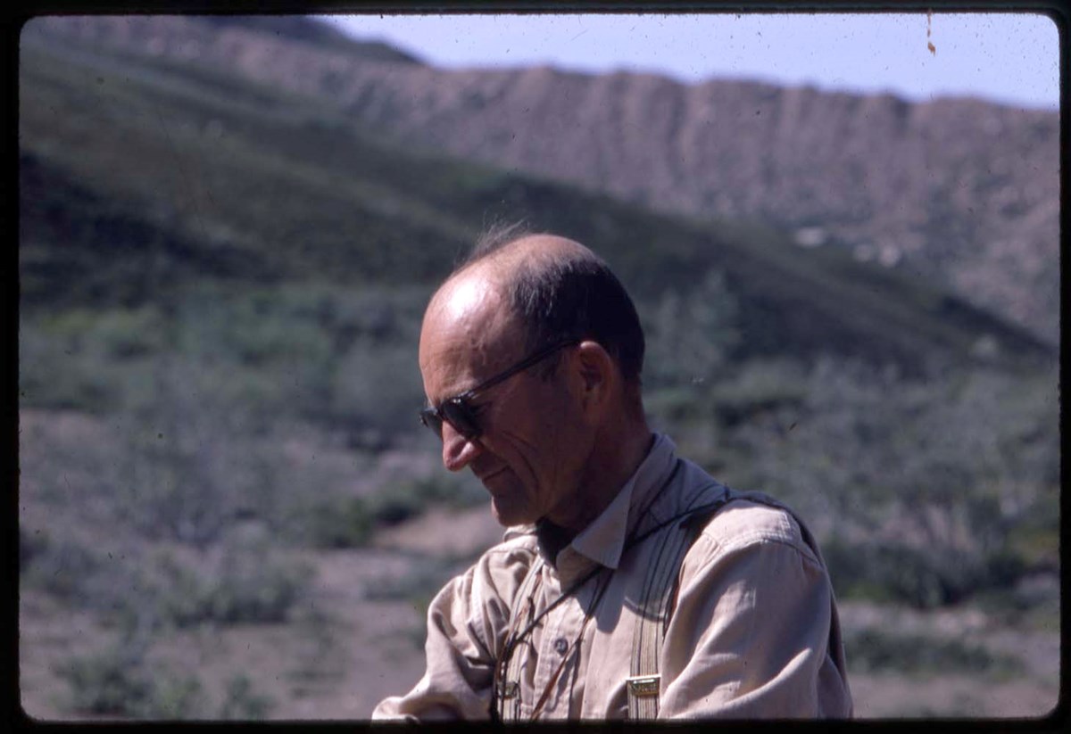
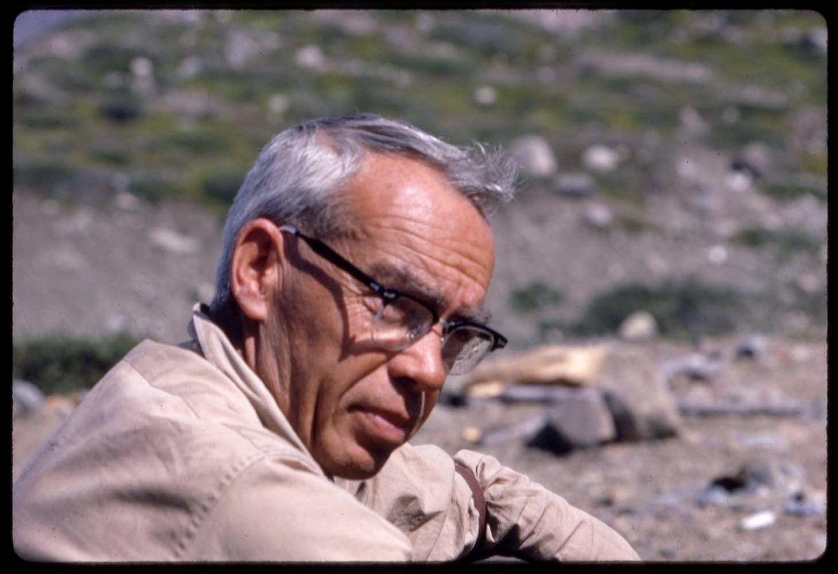
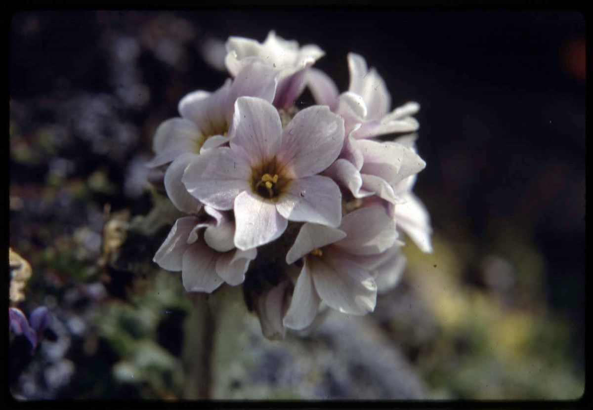
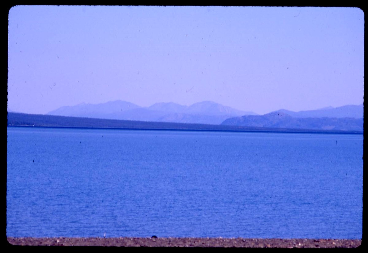
- File pertains to 1967 Yukon Alpine Centennial Expedition (YACE), including reconnaissance trip, 1966. The Alpine Club of Canada was an expedition sponsor. Also includes Yukon trip in 1988. Transparencies are annotated and are marked with an asterisk
- Date Range
- 1966-1967
- 1988
- Reference Code
- V46 / I / A / 44 / NS - 1 to 156
- Description Level
- 5 / File
- GMD
- Photograph
- Transparency
156 images
1 Electronic Resource
- Part Of
- Bob Hind fonds
- Description Level
- 5 / File
- Fonds Number
- M7
- V46
- Series
- I.A. Mountain travel and recreation, western Canada : Trips and activities
- Sous-Fonds
- V46
- Accession Number
- 7181
- Reference Code
- V46 / I / A / 44 / NS - 1 to 156
- Other Title Info
- Alternate title: Yukon 66-67-88, 1967, 88 Yukon, recce 66
- Date Range
- 1966-1967
- 1988
- Physical Description
- 162 photographs : transparencies, 35mm, col
- Scope & Content
- File pertains to 1967 Yukon Alpine Centennial Expedition (YACE), including reconnaissance trip, 1966. The Alpine Club of Canada was an expedition sponsor. Also includes Yukon trip in 1988. Transparencies are annotated and are marked with an asterisk
- Subject Access
- Camping
- Hiking
- Exploration
- Mountaineering
- Sports
- Recreation
- Geographic Access
- Yukon
- Language
- N/A
- Title Source
- Title basedon contents of file
- Content Details
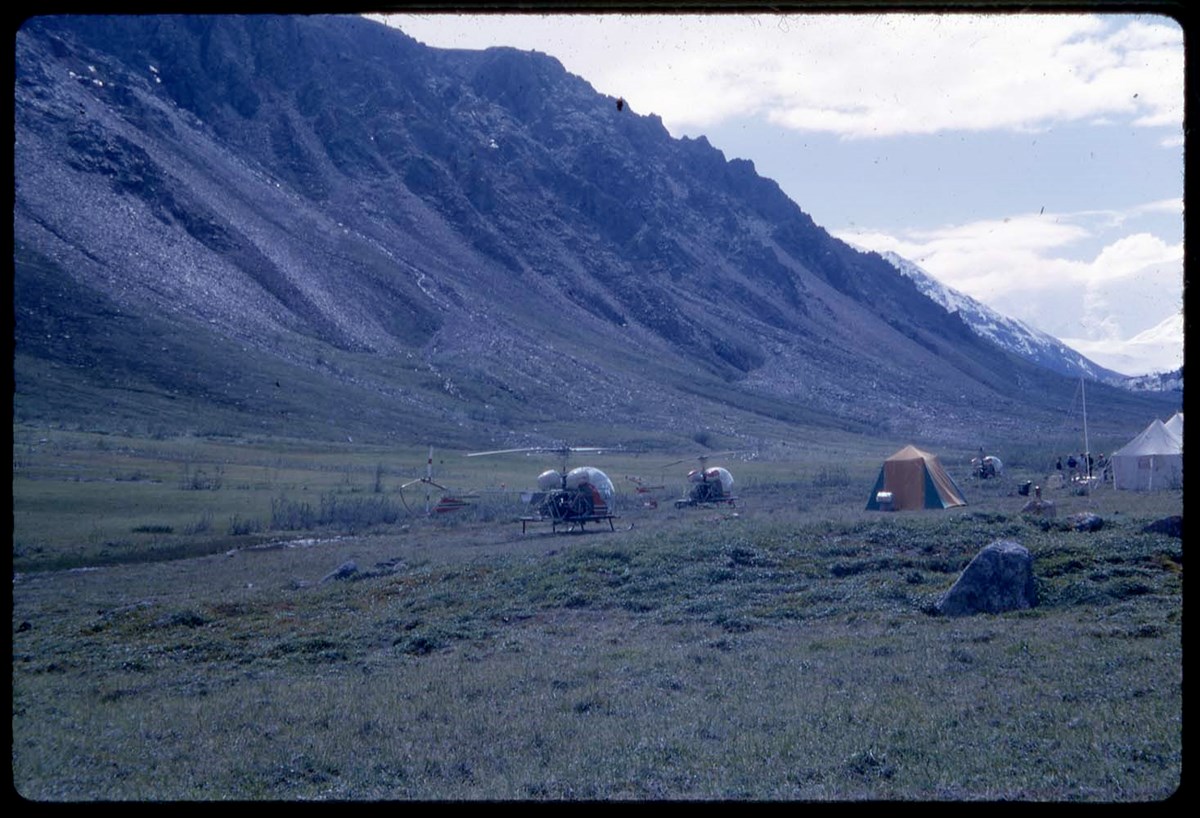
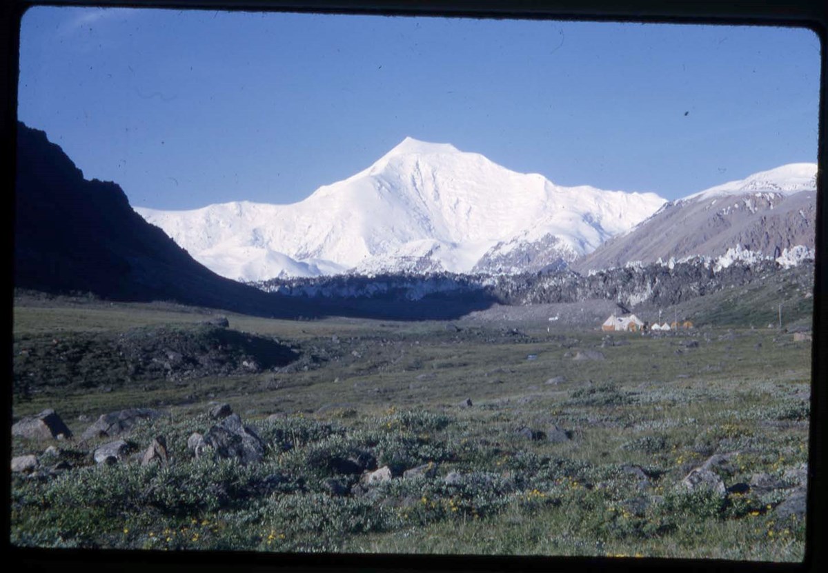
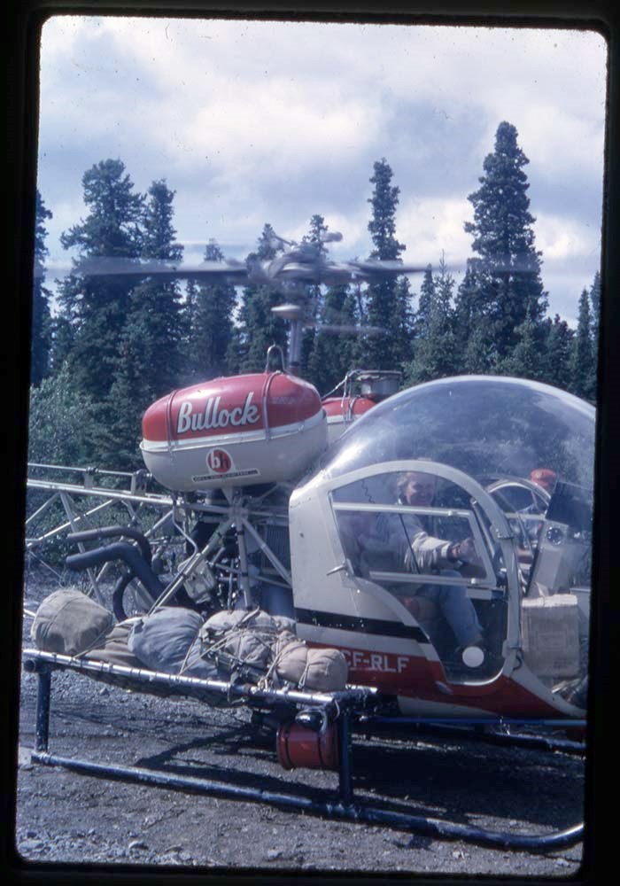
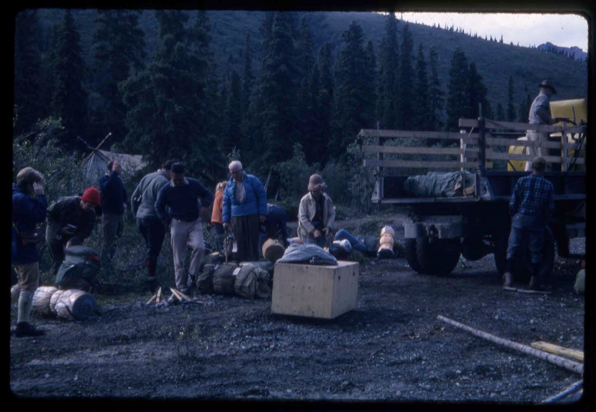
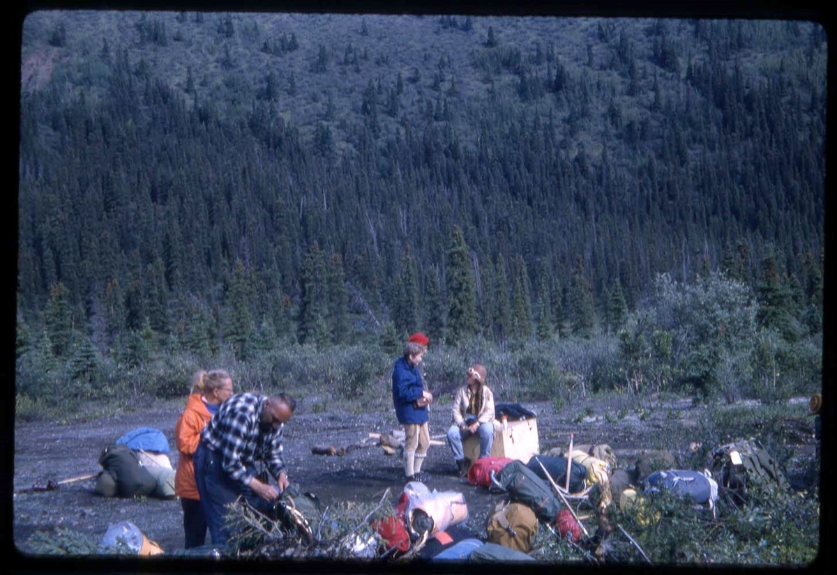
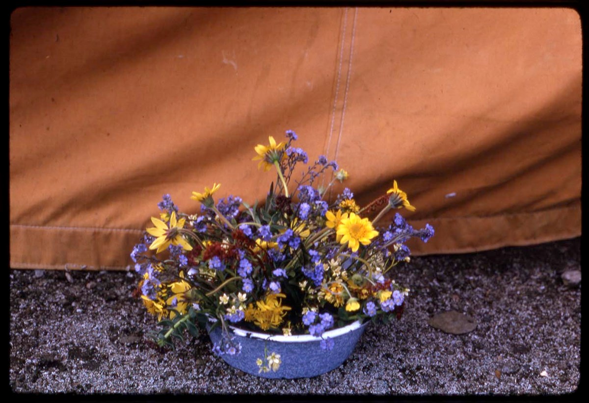
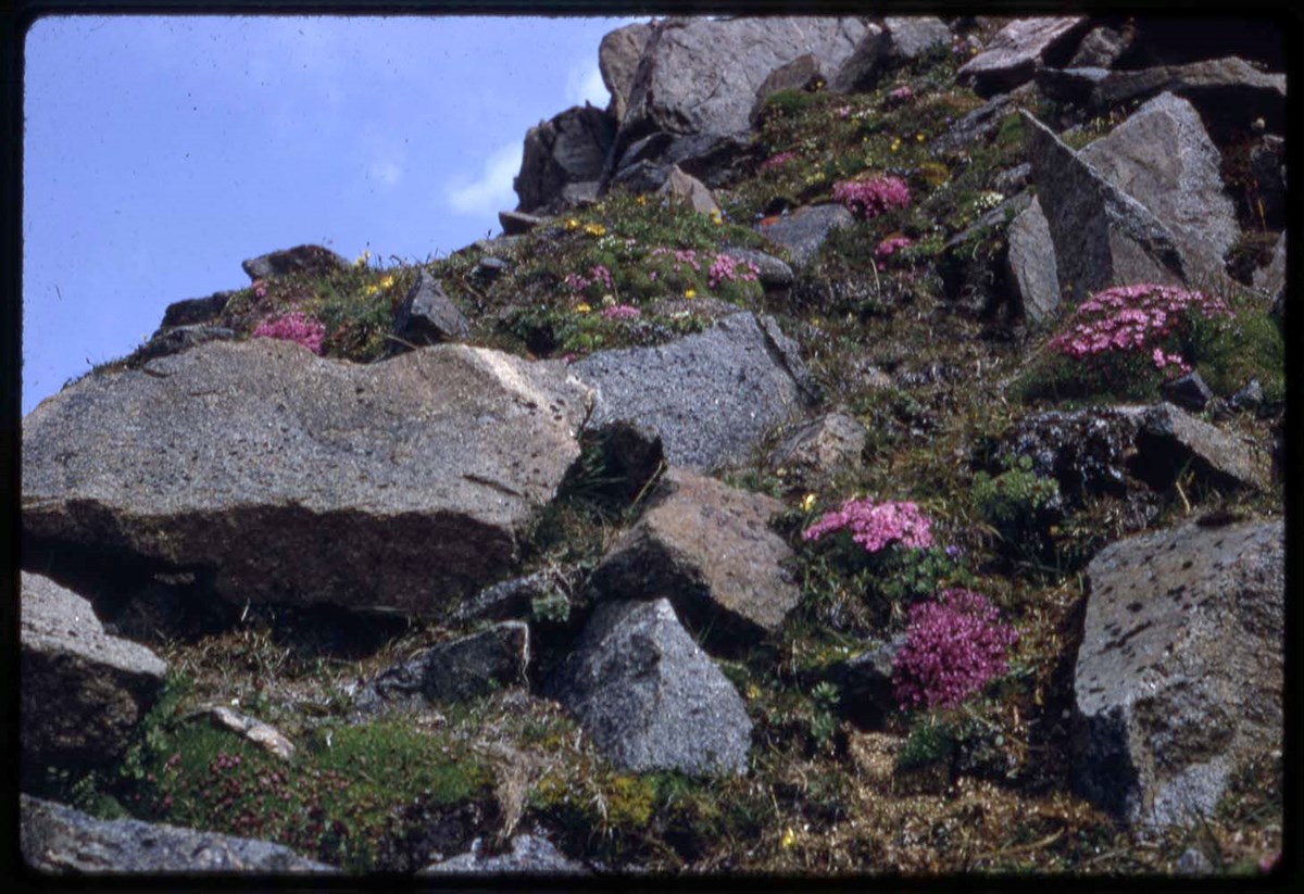
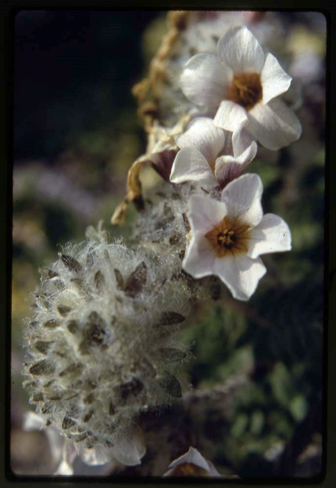
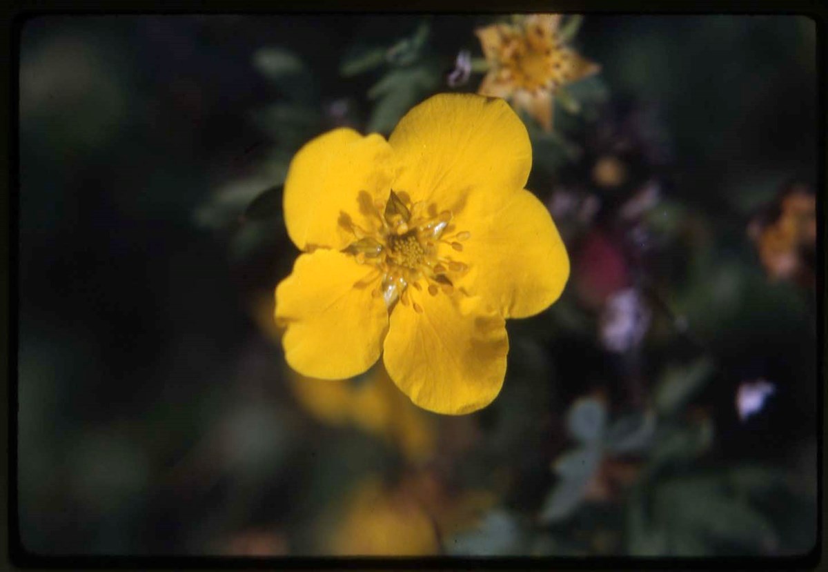
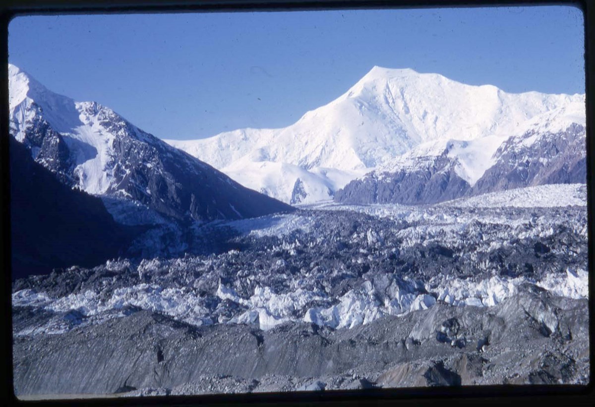
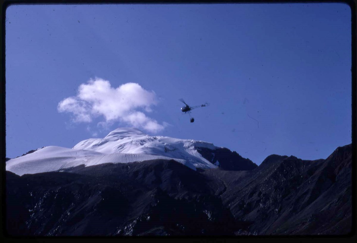
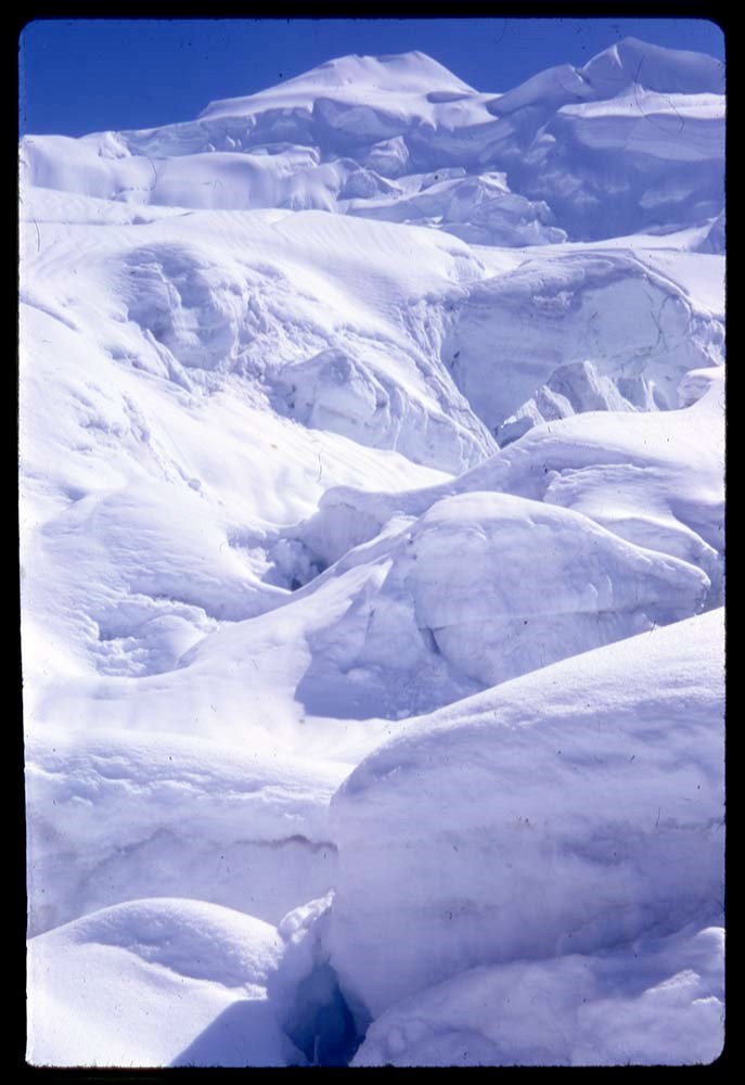
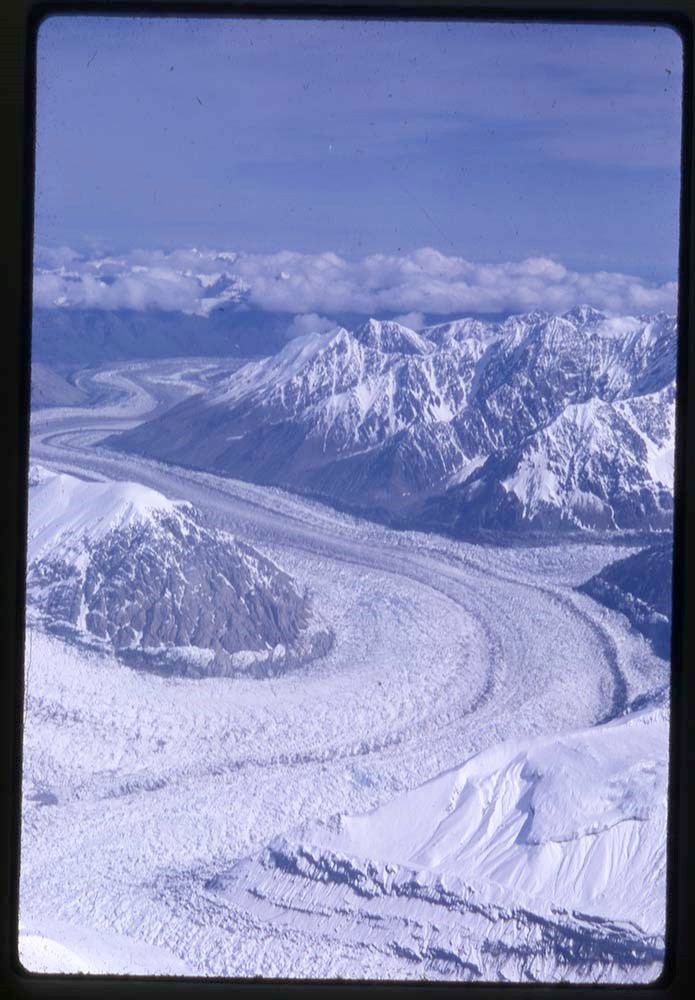
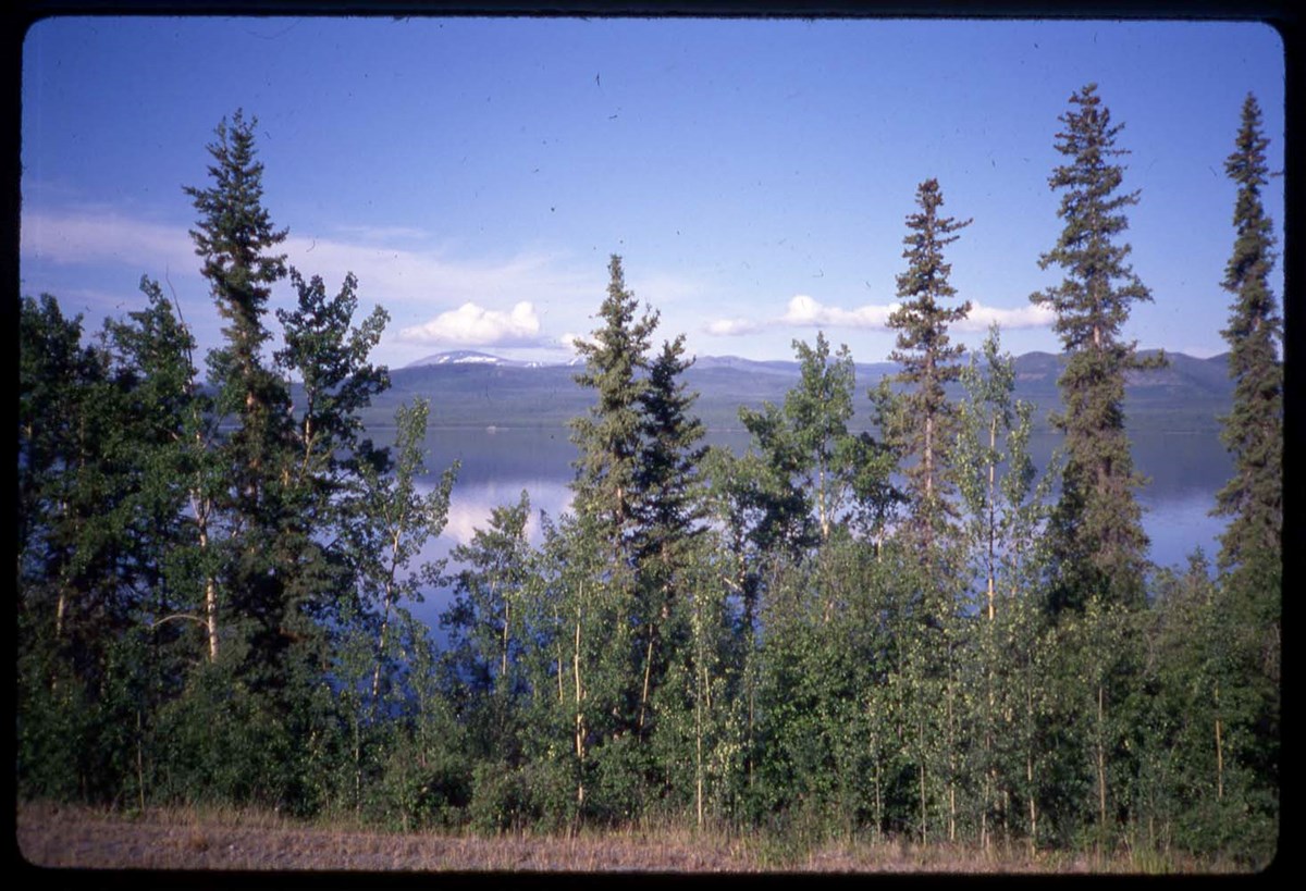
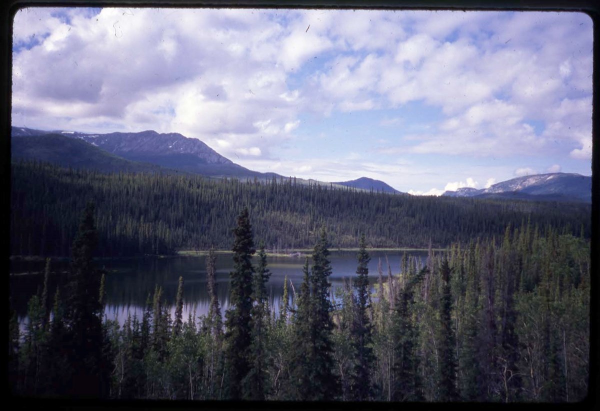
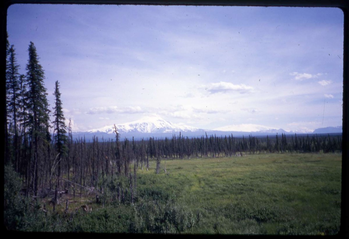
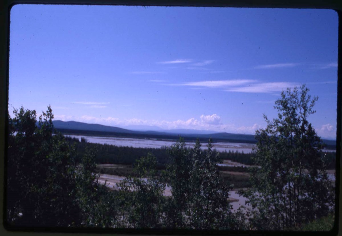
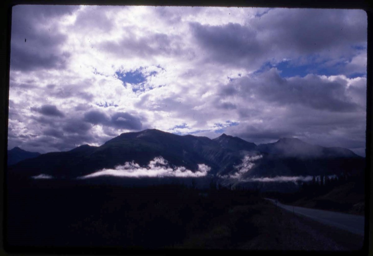
- LIST OF CONTENTS (V46 / 50) - 1966, 1967 :
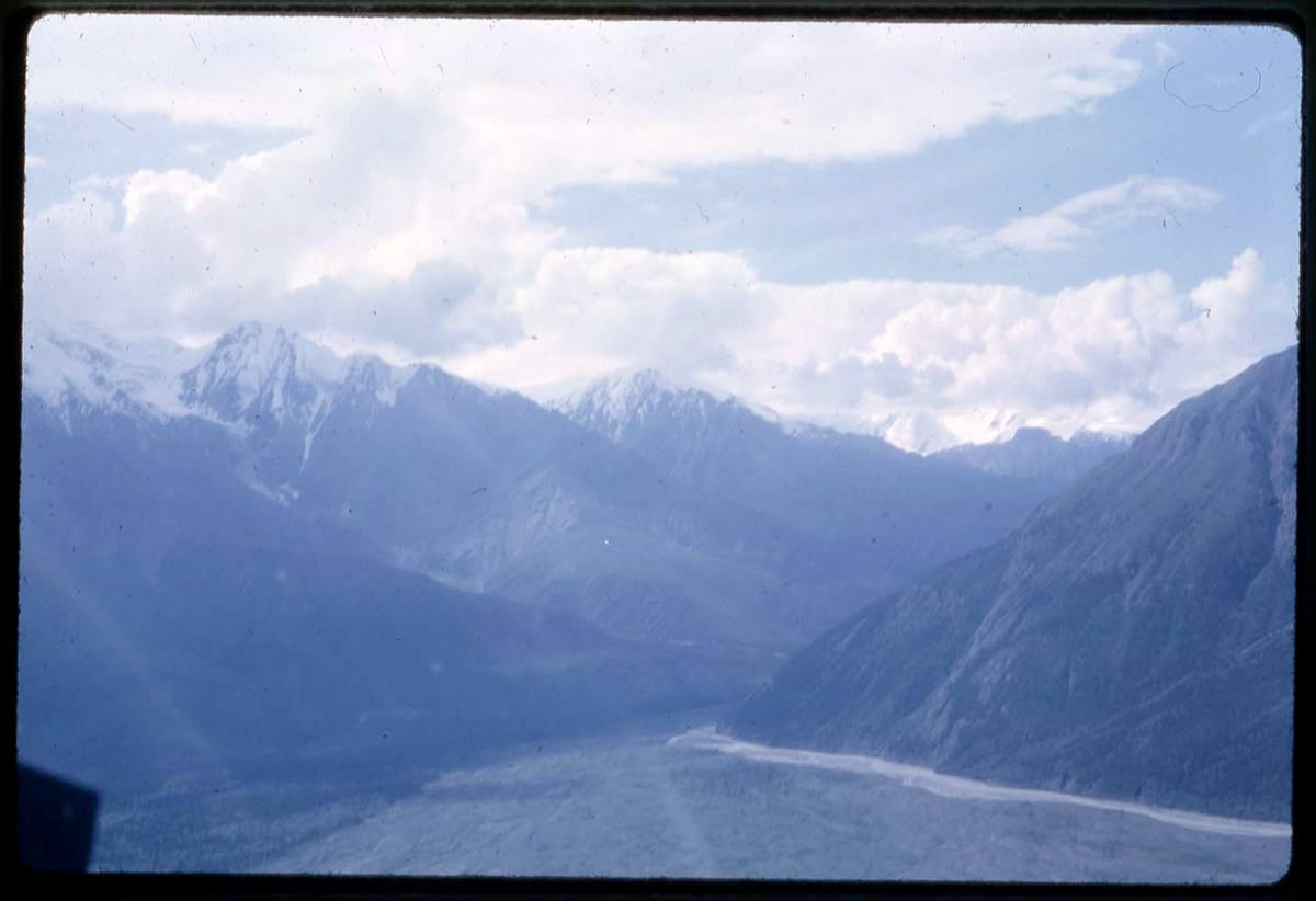
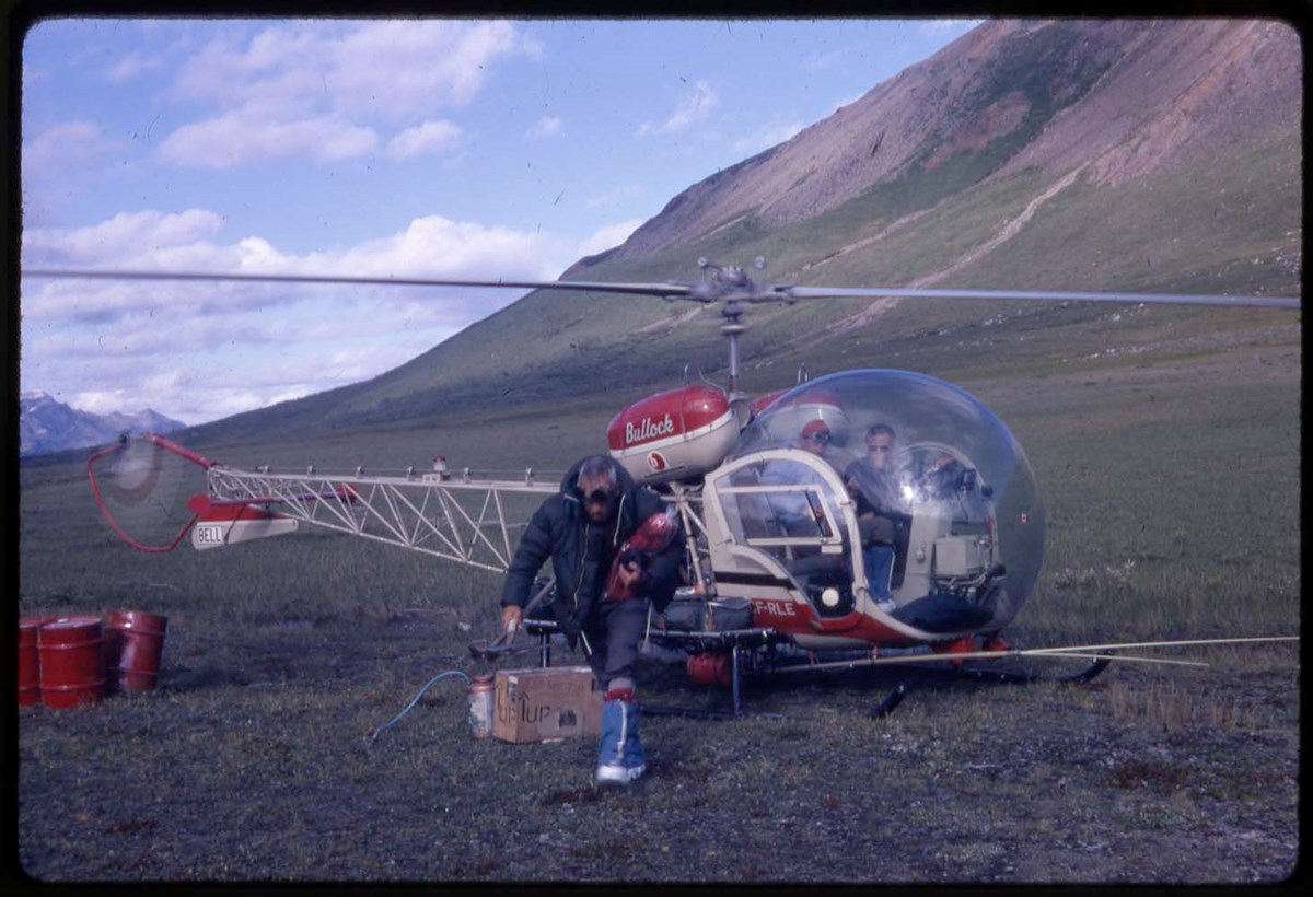
- * YR66: Hind, aerial view - 1966
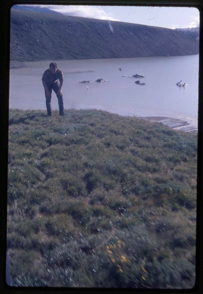
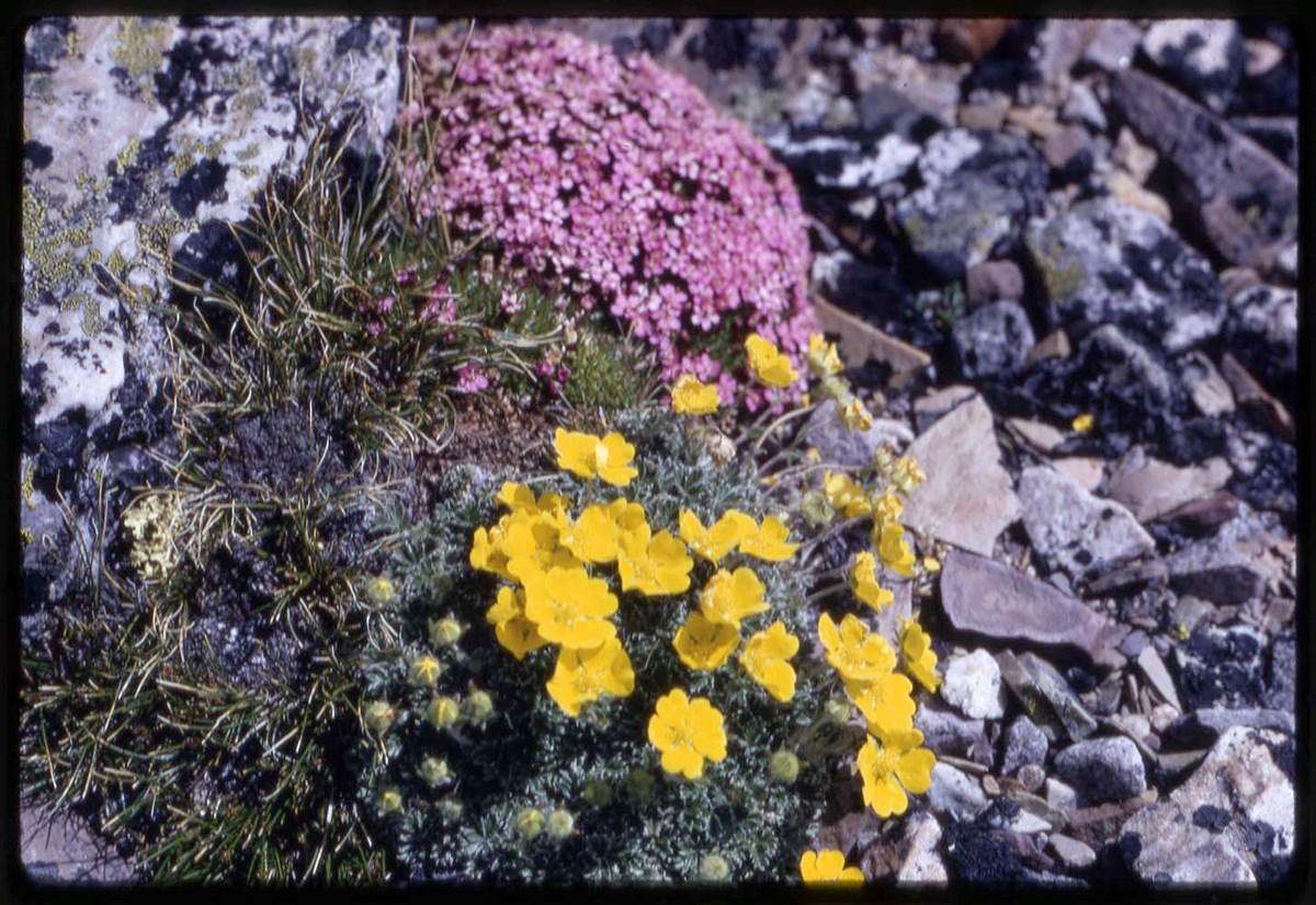
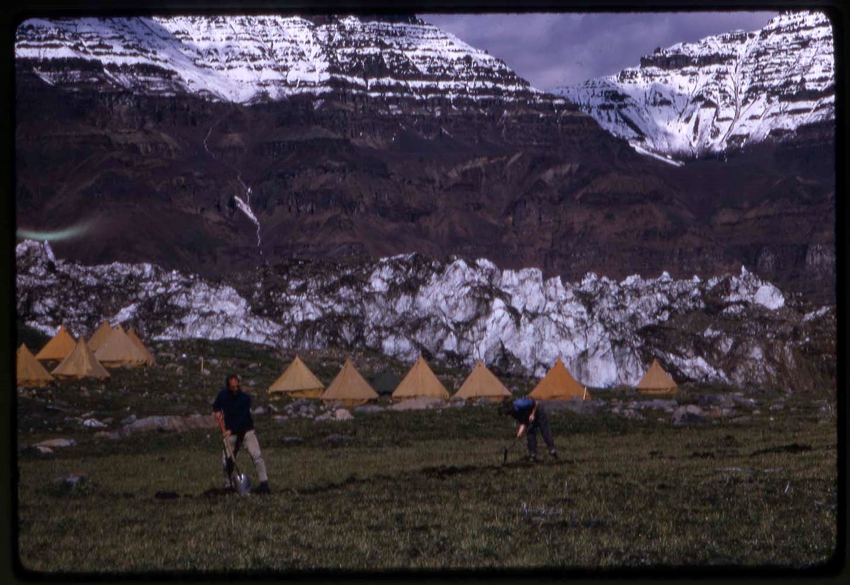
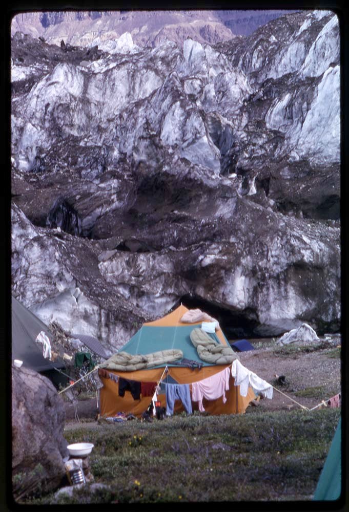
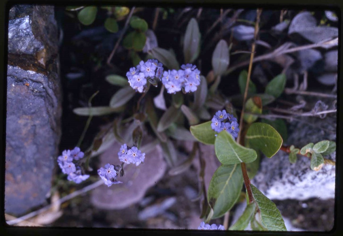
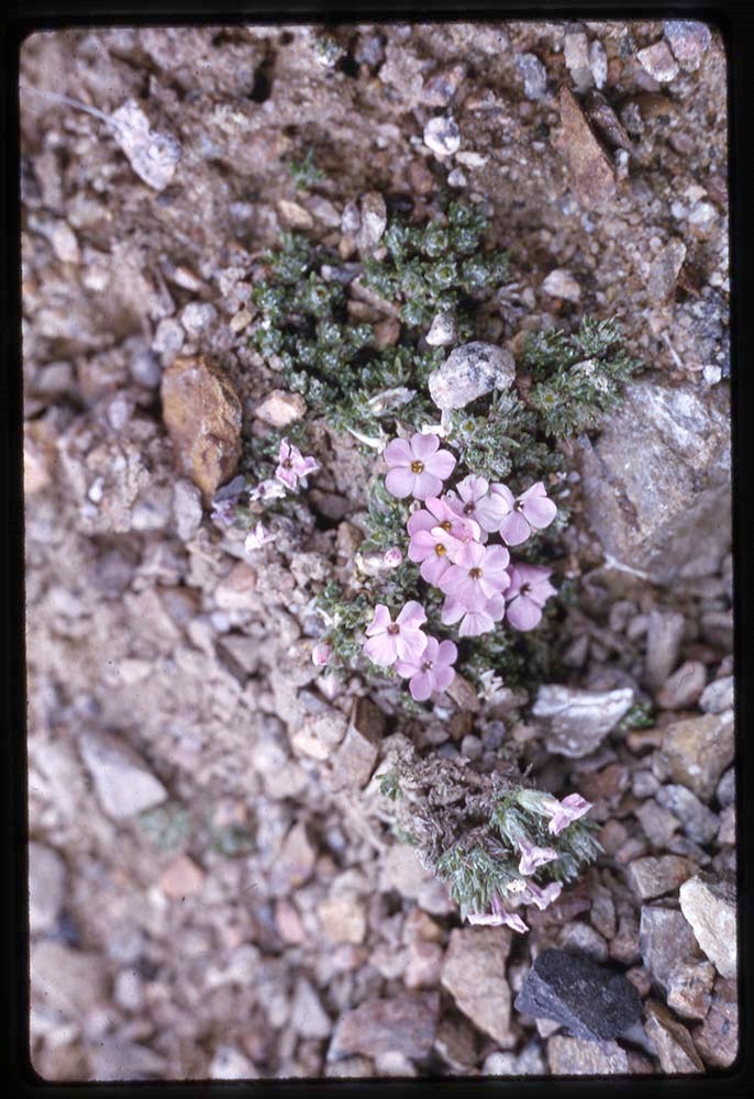
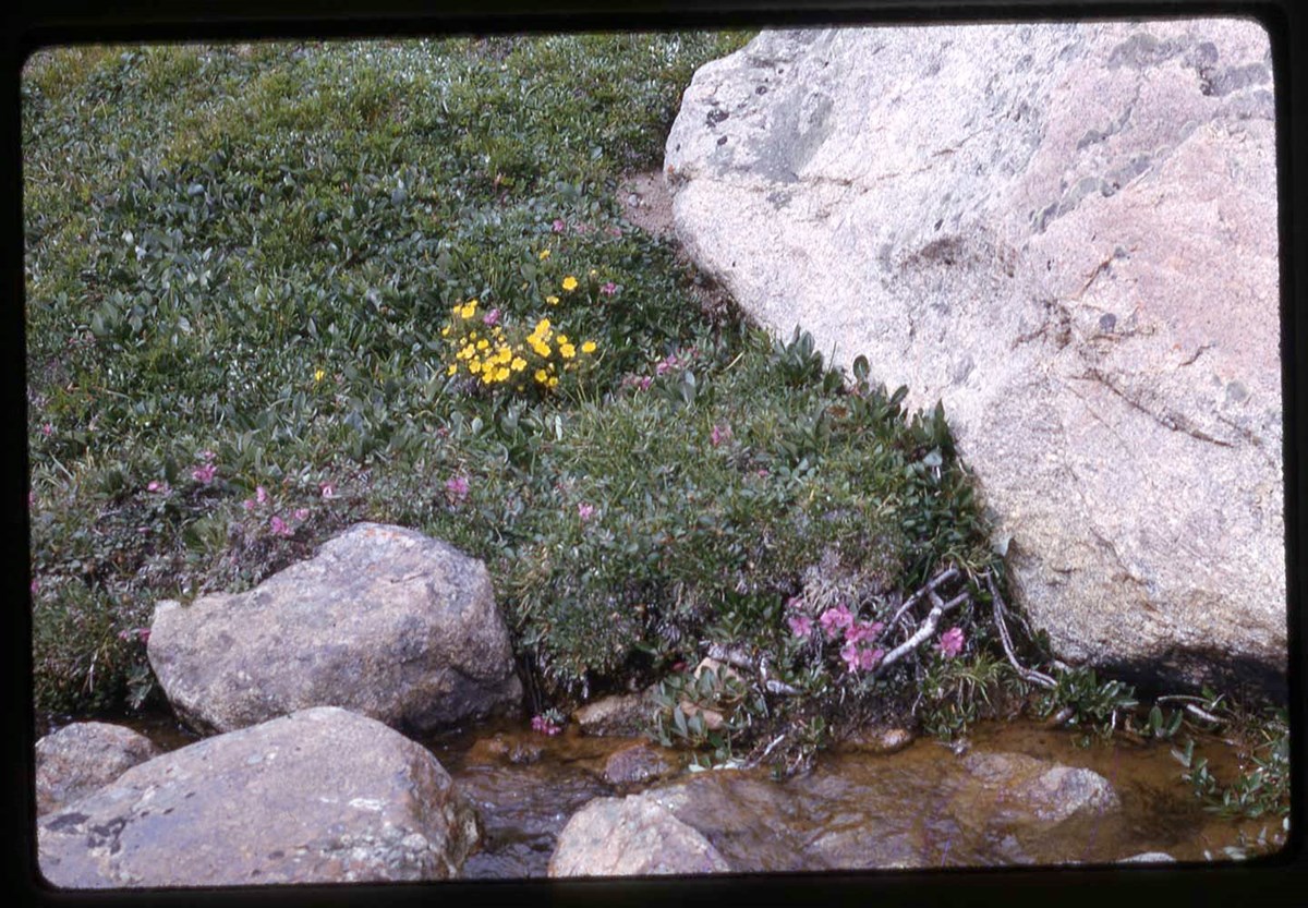
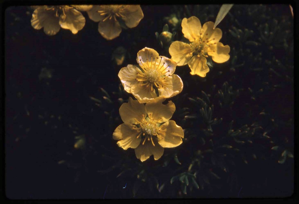
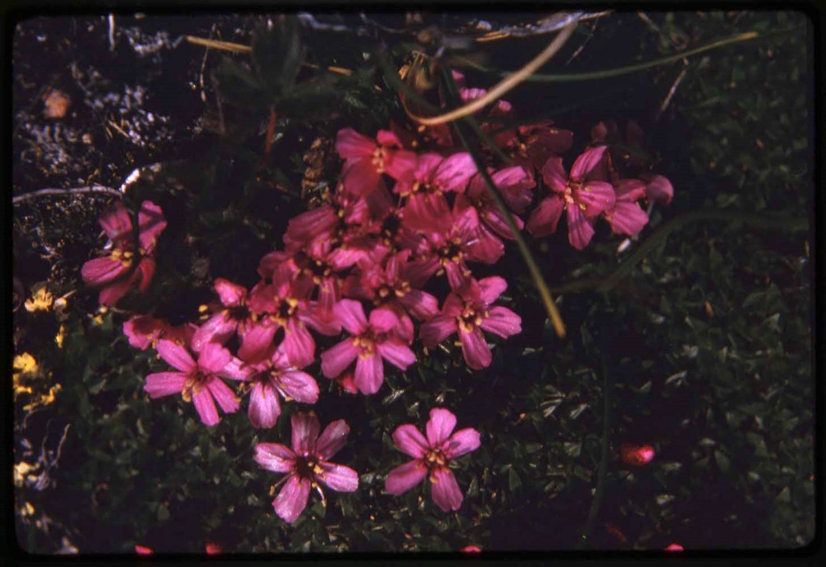
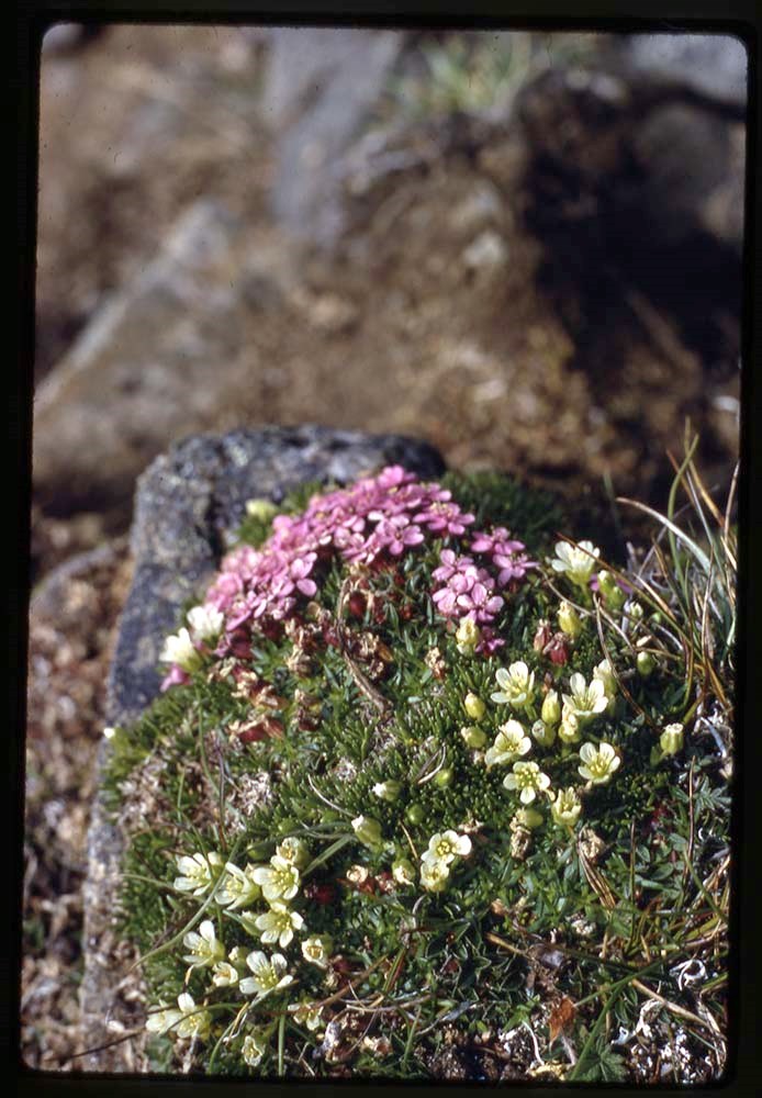
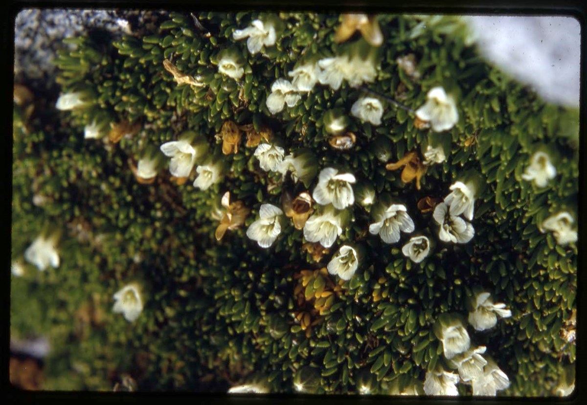
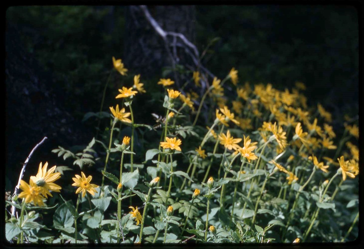
- * Y67: head shots, flora, camps and base camps, helicopter, climbing on glacier - 1967
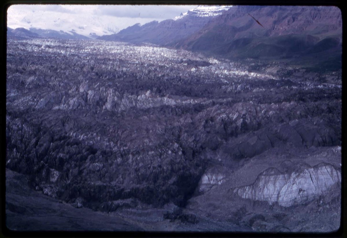
- * Y67: flora, glacier - 1967
- * Y67: glacier, helicopter - 1967
- * Y67: flora - 1967
- * Y67, M1, T: flora, group shots, candid of Secretary of State Judy LaMarsh, camp with flags, helicopter, aerial view - 1967
- * Y67: camp, helicopter, aerial view, YACE informational sign and staging camp - 1967
- * Y67: RCH, glacier - 1967
- * Y67: camp, landscape views - 1967
- * Y67: Hind, camps, climbing on glacier, landscape views- 1967
- * Y67: helicopter, aerial view, expedition member - 1967
- * Y67: camp, helicopter, aerial view - 1967
- * Y67: Hind - 1967
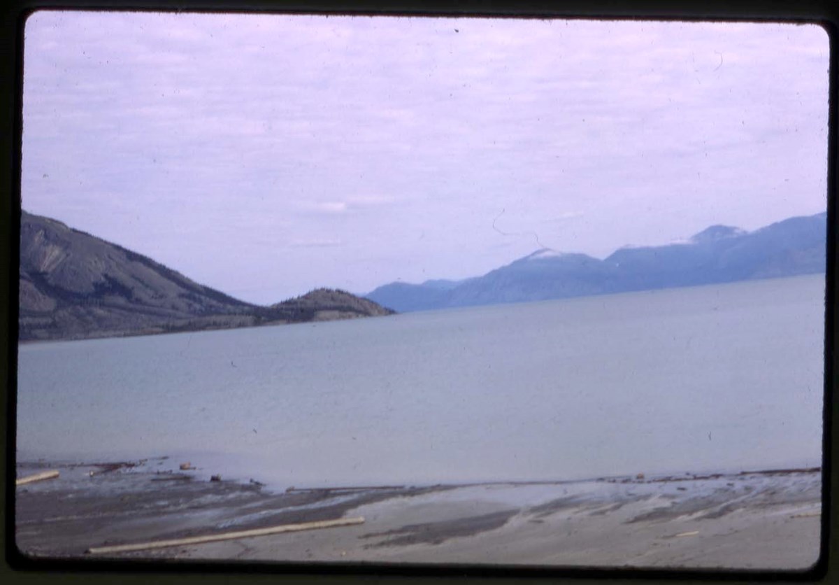
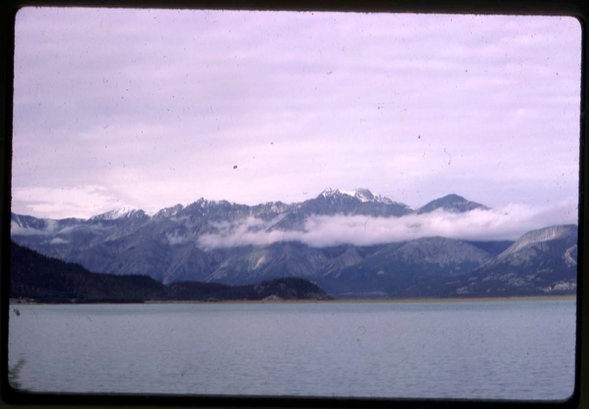
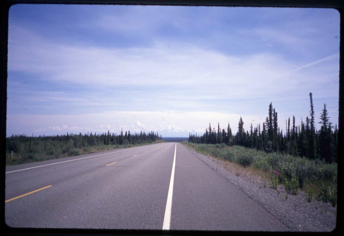
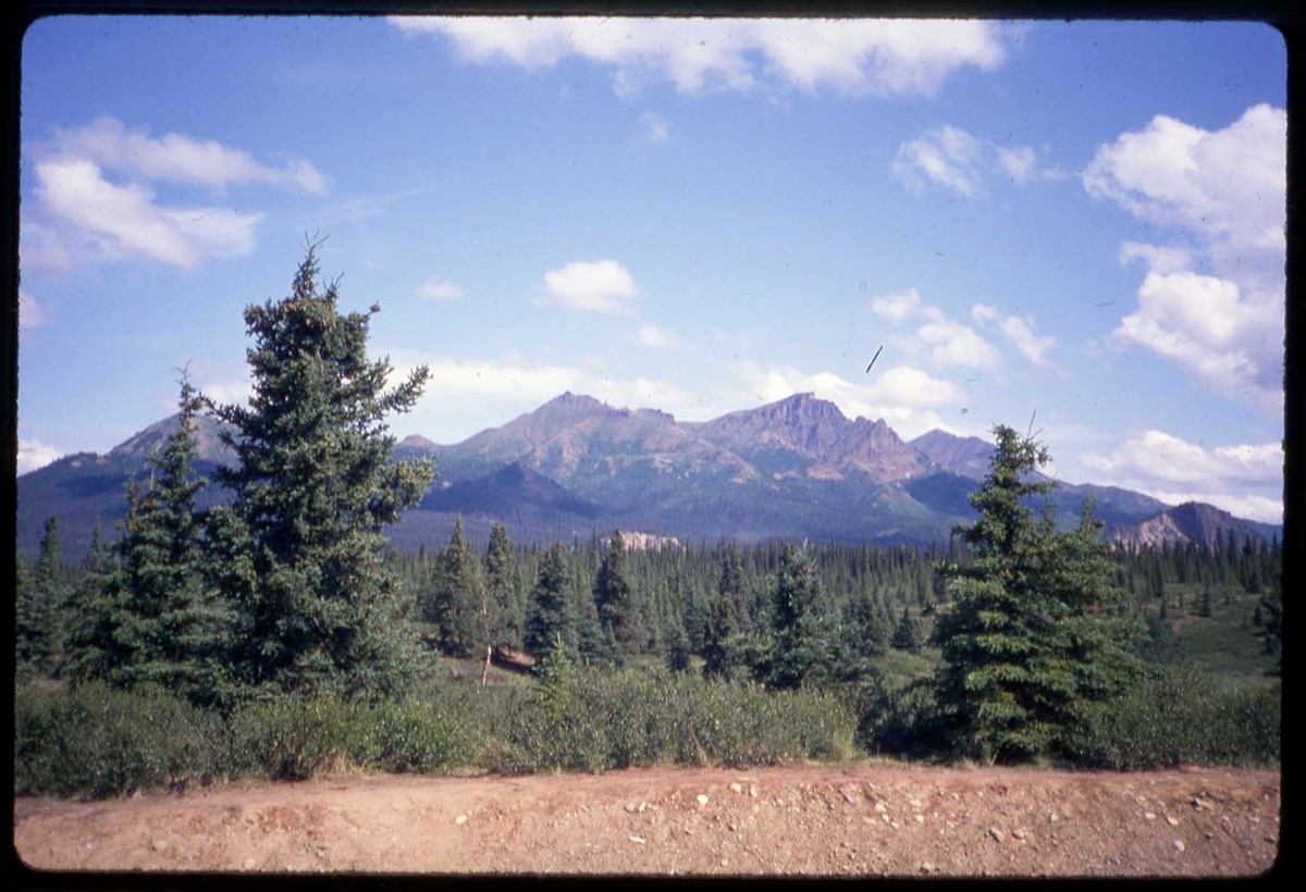
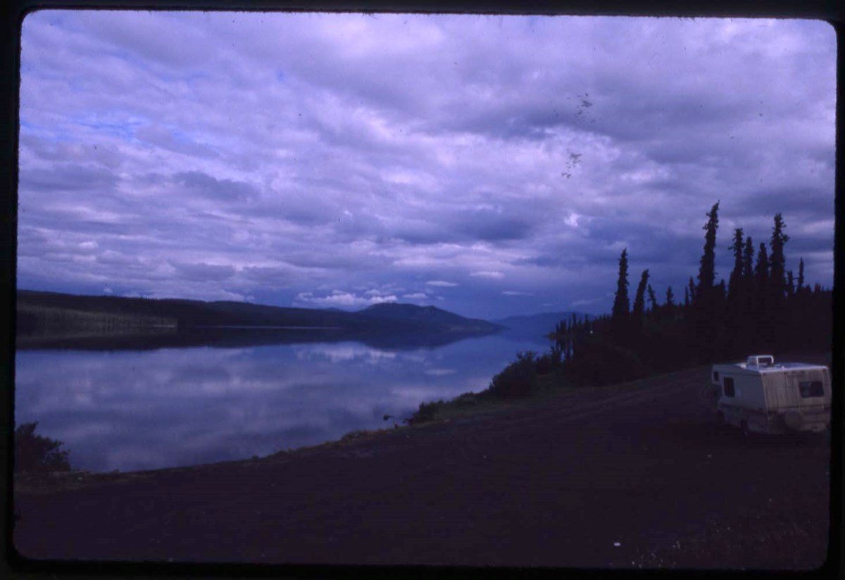
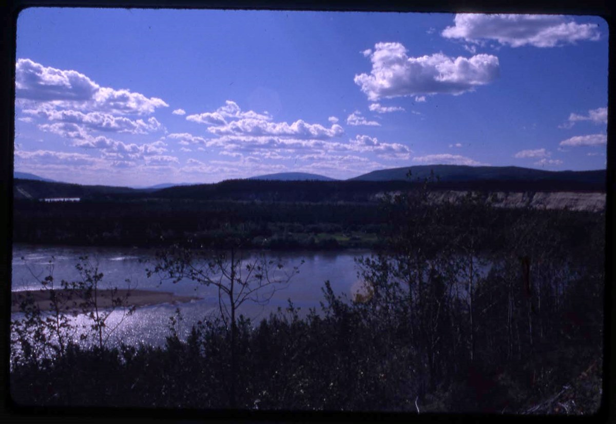
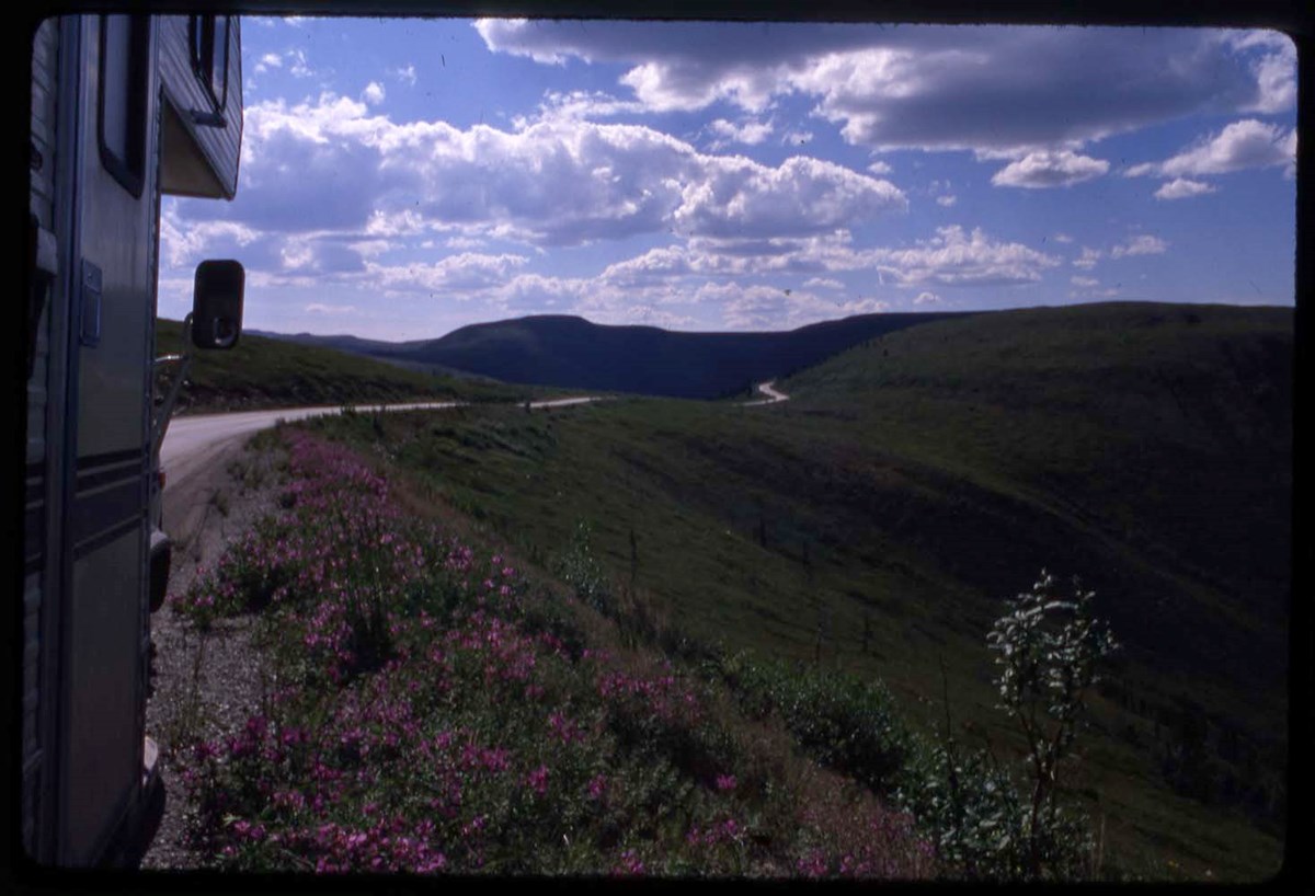
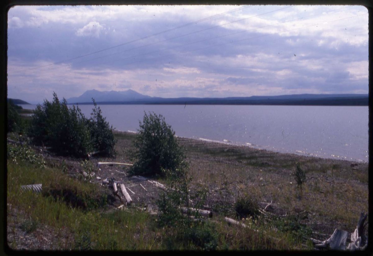
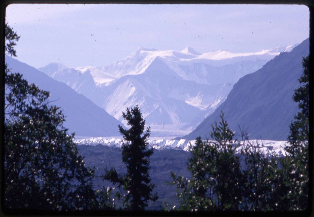
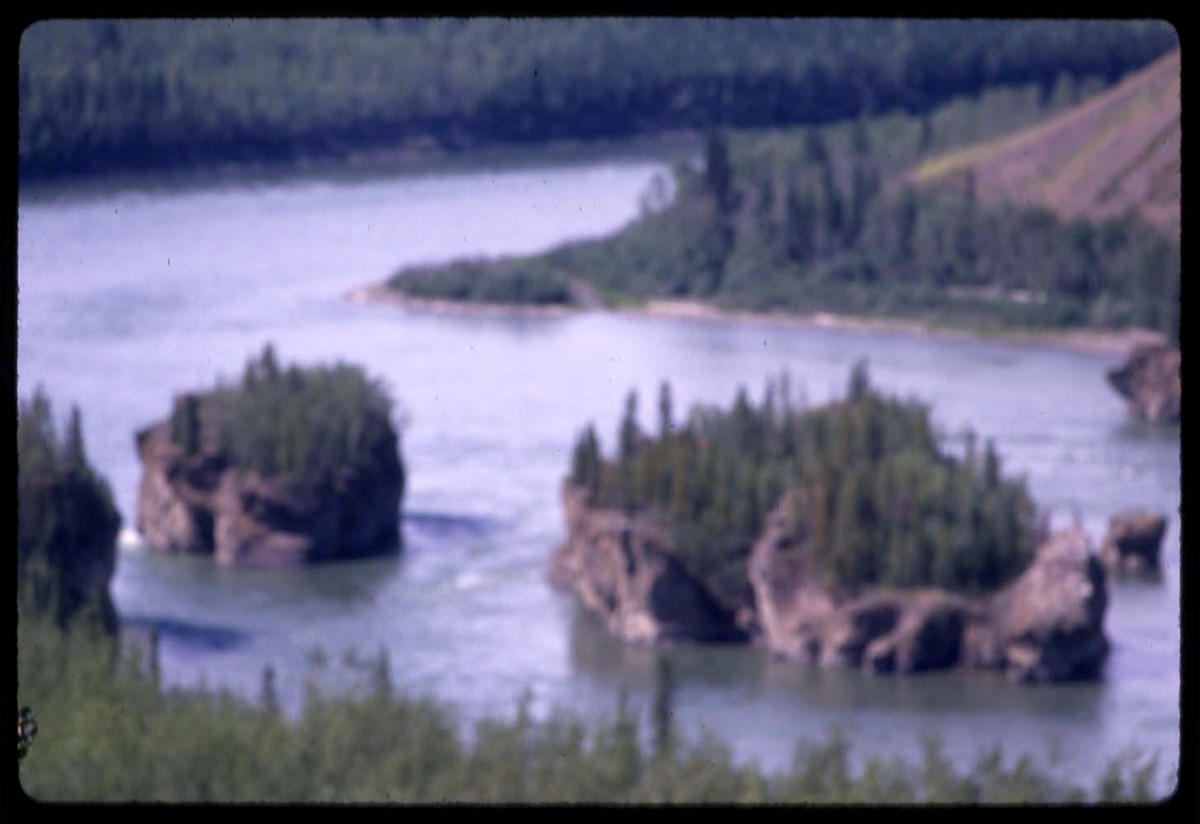
- LIST OF CONTENTS (V46 / 50) - 1988 :
- Note: transparency mounts dated 1989 (printing date)
- * R1 : forest views
- * R2 : road views, Dawson City
- * M1 : river
- * M2 : Mount McKinley, road views
- * M3 : river
- * Mount Robson, Mosquito Creek campground, Maligne Lake, Banff-Jasper Highway
- Processing Status
- Processed
Electronic Resources
Images


This material is presented as originally created; it may contain outdated cultural descriptions and
potentially offensive content.
Read more.
International Symposium of Problems of High Altitude, Darjeeling, India, Januaey 1962 : [papers]
https://archives.whyte.org/en/permalink/catalogue4058
- Medium
- Library - Book (including soft-cover and pamphlets)
- Published Date
- 1962
- Call Number
- 02.7 In8
- Published Date
- 1962
- Subjects
- Mountaineering
- Search and rescue
- Notes
- 1 volume
- Call Number
- 02.7 In8
- Collection
- Archives Library
This material is presented as originally created; it may contain outdated cultural descriptions and
potentially offensive content.
Read more.
Government Communiques
https://archives.whyte.org/en/permalink/descriptions8493
- Part Of
- Peter and Catharine Whyte fonds
- Scope & Content
- Includes brief submitted by Catharine regarding Village Lake Louise and redevelopment of area.
- Date Range
- 1969-1972
- Reference Code
- M36 / I / A / 4 / b / iii / 1378
- Description Level
- 5 / File
- Part Of
- Peter and Catharine Whyte fonds
- Description Level
- 5 / File
- Fonds Number
- M36 / V683 / S37
- Series
- I.A.4. Catharine Robb Whyte papers / photographs
- Reference Code
- M36 / I / A / 4 / b / iii / 1378
- Date Range
- 1969-1972
- Physical Description
- 1 file of textual records
- Scope & Content
- Includes brief submitted by Catharine regarding Village Lake Louise and redevelopment of area.
- Subject Access
- Village Lake Louise
- Environment
- Conservation
This material is presented as originally created; it may contain outdated cultural descriptions and
potentially offensive content.
Read more.
Staged, copyright and published trail riders photographs
https://archives.whyte.org/en/permalink/descriptions54351
- Scope & Content
- File consists of 12 b&w photographs pertaining to the Trail Riders of the Canadian Rockies. Includes staged photographs of riders on horseback and scenic views of the Canadian Rockies. Most images annotated with return address of Trail Riders of the Canadian Rockies on back [copyrighted photographs…
- Date Range
- [ca. 1960 - ca. 1980]
- Reference Code
- V635 / III / PA - 1 to 12
- Description Level
- 5 / File
- GMD
- Photograph
- Photograph print
- Description Level
- 5 / File
- Fonds Number
- M545 / V635
- Series
- V635 / III : Published records
- Sous-Fonds
- V635
- Accession Number
- 5757
- Reference Code
- V635 / III / PA - 1 to 12
- Responsibility
- One photograph copyright of the Canadian Government Travel Bureau
- Date Range
- [ca. 1960 - ca. 1980]
- Physical Description
- 12 photographs : b&w prints ; 20.5 x 25.5 cm or smaller
- Scope & Content
- File consists of 12 b&w photographs pertaining to the Trail Riders of the Canadian Rockies. Includes staged photographs of riders on horseback and scenic views of the Canadian Rockies. Most images annotated with return address of Trail Riders of the Canadian Rockies on back [copyrighted photographs?], and one with text on back identifying it as property of the Canadian Government Travel Bureau. Locations include Monarch Ridge, "Pul. Pass", and Mount Assiniboine Park.
- Notes
- Most photographs in this file were likely produced and/or used for publication purposes but this is not confirmed. Further research into origins of individual photographs required.
- Subject Access
- Horses
- Trails
- Travel
- Tourism
- Mountain
- Landscapes
- Trail Riders of the Canadian Rockies
- Geographic Access
- Canada
- Alberta
- Monarch Ridge
- Mount Assiniboine Park
- Access Restrictions
- Restrictions may apply
- Reproduction Restrictions
- Restrictions may apply
- Language
- English
- Title Source
- Title based on contents of file
- Processing Status
- Processed
This material is presented as originally created; it may contain outdated cultural descriptions and
potentially offensive content.
Read more.
Maps of Banff and Western Canada
https://archives.whyte.org/en/permalink/descriptions54772
- Part Of
- Luxton family fonds
- Scope & Content
- File consists of 9 printed maps, b&w and col. [including zoning and topographical maps] depicting the Town of Banff and Banff National Park, the Rocky Mountains Forest Reserve, the Moose Mountain region, Medicine Hat, and the province of Alberta. File includes Trail Riders' Map of the Canadian Rock…
- Date Range
- 1912
- 1914
- 1924
- 1926
- 1932
- 1957
- [1970-1980]
- Reference Code
- LUX / II / C5 / 25
- Description Level
- 5 / File
- GMD
- Textual record
- Published record
- Map
- Part Of
- Luxton family fonds
- Description Level
- 5 / File
- Fonds Number
- LUX
- Series
- LUX / II / C : Personal
- Sous-Fonds
- LUX / II : Eleanor Luxton sous-fonds
- Sub-Series
- LUX / II / C5 : Other
- Accession Number
- LUX
- Reference Code
- LUX / II / C5 / 25
- Date Range
- 1912
- 1914
- 1924
- 1926
- 1932
- 1957
- [1970-1980]
- Physical Description
- 9 maps : b&w and col. ; 168 x 71 cm or smaller
- Scope & Content
- File consists of 9 printed maps, b&w and col. [including zoning and topographical maps] depicting the Town of Banff and Banff National Park, the Rocky Mountains Forest Reserve, the Moose Mountain region, Medicine Hat, and the province of Alberta. File includes Trail Riders' Map of the Canadian Rockies which has smaller maps of Waterton Lakes, Glacier, Revelstoke, and other national parks printed on the back. Map of Medicine Hat includes annotated storage envelope with dimensions written on the front.
- Subject Access
- Cartography
- Geography
- Land use
- Government
- Travel
- National parks and reserves
- Geographic Access
- Canada
- Alberta
- Banff
- Banff National Park
- Medicine Hat
- Rocky Mountains
- Glacier National Park
- Revelstoke
- Waterton Lakes National Park
- Reproduction Restrictions
- Restrictions may apply
- Language
- English
- Title Source
- Title based on contents of file
- Processing Status
- Processed
This material is presented as originally created; it may contain outdated cultural descriptions and
potentially offensive content.
Read more.
Map, Indian Tribes of North America
https://archives.whyte.org/en/permalink/descriptions54800
- Part Of
- Luxton family fonds
- Scope & Content
- File consists of one b&w printed paper copy of a map titled "Indian Tribes of North America" [n.d., creator unknown].
- Date Range
- [1950-1970]
- Reference Code
- LUX / II / F1 / 56
- Description Level
- 5 / File
- GMD
- Map
- Textual record
- Published record
- Part Of
- Luxton family fonds
- Description Level
- 5 / File
- Fonds Number
- LUX
- Series
- LUX / II / F : Collected material
- Sous-Fonds
- LUX / II : Eleanor Luxton sous-fonds
- Sub-Series
- LUX / II / F1 : Textual
- Accession Number
- LUX
- Reference Code
- LUX / II / F1 / 56
- Date Range
- [1950-1970]
- Physical Description
- 0.1 cm of textual records (map : b&w ; 48 x 53.5 cm)
- Scope & Content
- File consists of one b&w printed paper copy of a map titled "Indian Tribes of North America" [n.d., creator unknown].
- Notes
- Date range is estimate provided by Processing Archivist
- Subject Access
- Geography
- Indigenous Peoples
- Land, settlement and immigration
- Geographic Access
- Canada
- United States of America
- Reproduction Restrictions
- Restrictions may apply
- Language
- English
- Title Source
- Title taken from item in file
- Processing Status
- Processed
This material is presented as originally created; it may contain outdated cultural descriptions and
potentially offensive content.
Read more.
Published regional and trail maps
https://archives.whyte.org/en/permalink/descriptions54847
- Scope & Content
- File consists of maps depicting the Banff townsite and nearby travel routes. Includes a trail map for Banff, Yoho and Kootenay National Parks; a road map for Banff and nearby areas [1965]; a numbered townsite map of Banff marking local hotels and attractions; and a photocopied map of a trail route …
- Date Range
- [1950-1970]
- 1965
- Reference Code
- M545 / III / 29
- Description Level
- 5 / File
- GMD
- Textual record
- Published record
- Map
- Description Level
- 5 / File
- Fonds Number
- M545 / V635
- Series
- M545 / III : Published records
- Sous-Fonds
- M545
- Accession Number
- 5939
- Reference Code
- M545 / III / 29
- Date Range
- [1950-1970]
- 1965
- Physical Description
- 0.5 cm of textual records (4 maps ; 35.5 x 21.5 cm or smaller)
- Scope & Content
- File consists of maps depicting the Banff townsite and nearby travel routes. Includes a trail map for Banff, Yoho and Kootenay National Parks; a road map for Banff and nearby areas [1965]; a numbered townsite map of Banff marking local hotels and attractions; and a photocopied map of a trail route used by the Trail Riders of the Canadian Rockies [n.d.]
- Notes
- Banff townsite map has annotation marking the location of the Trail Ride Office on Caribou St.
- Subject Access
- Travel
- Trails
- Map
- Land, settlement and immigration
- Geography
- Geographic Access
- Canada
- Alberta
- Banff
- Banff National Park
- Yoho National Park
- Kootenay National Park
- Reproduction Restrictions
- Restrictions may apply
- Language
- English
- Title Source
- Title based on contents of file
- Processing Status
- Processed
This material is presented as originally created; it may contain outdated cultural descriptions and
potentially offensive content.
Read more.
Banff National Park and Lake Louise maps
https://archives.whyte.org/en/permalink/descriptions54945
- Scope & Content
- File consists of two folded maps and a small clipping [possibly top or bottom portion from a different map or one of maps in file]. One map is of Banff National Park and one is of Lake Louise [1959]. Banff National Park map has black pencil tracings over trail section near the bottom of the map and…
- Date Range
- 1959
- [1960-1970]
- Reference Code
- M545 / V / 53
- Description Level
- 5 / File
- GMD
- Textual record
- Published record
- Map
- Description Level
- 5 / File
- Fonds Number
- M545 / V635
- Series
- M545 / V : Administrative records
- Sous-Fonds
- M545
- Accession Number
- 8235
- Reference Code
- M545 / V / 53
- Date Range
- 1959
- [1960-1970]
- Physical Description
- 0.5 cm of textual records (2 maps ; 60.5 x 57.5 and 60 x 56.5 cm)
- Scope & Content
- File consists of two folded maps and a small clipping [possibly top or bottom portion from a different map or one of maps in file]. One map is of Banff National Park and one is of Lake Louise [1959]. Banff National Park map has black pencil tracings over trail section near the bottom of the map and annotation in bottom right corner which reads "Natural Bridge". Lake Louise map produced by the Government of Canada.
- Subject Access
- Banff National Park
- Environment
- Geography
- Map
- Lake Louise
- Travel
- Government
- National parks and reserves
- Trails
- Geographic Access
- Canada
- Alberta
- Banff National Park
- Lake Louise
- Language
- English
- Conservation
- Clipping stored in mylar due to significant staining and residue from tape
- Items kept folded [not placed in mylar] due to mass production of content and minimal/no annotations
- Title Source
- Title based on contents of file
- Processing Status
- Processed
This material is presented as originally created; it may contain outdated cultural descriptions and
potentially offensive content.
Read more.
Commercial travel postcards
https://archives.whyte.org/en/permalink/descriptions55101
- Part Of
- Luxton family fonds
- Scope & Content
- File consists of collected commercial postcards from Canada, the United States, Central America, Europe and the United Kingdom [non-annotated]. File includes loose postcards, postcard sets and fold-out photo card booklets.
- Date Range
- [1900-1960]
- Reference Code
- LUX / III / D / PG - 1 to 8
- Description Level
- 5 / File
- GMD
- Published record
- Postcard
- Part Of
- Luxton family fonds
- Description Level
- 5 / File
- Fonds Number
- LUX
- Series
- LUX / III/ D : Other materials
- Sous-Fonds
- LUX / III : Luxton family sous-fonds
- Accession Number
- LUX
- Reference Code
- LUX / III / D / PG - 1 to 8
- Date Range
- [1900-1960]
- Physical Description
- ca. 630 b&w and col. postcards ; 23 x 18 cm or smaller
- Scope & Content
- File consists of collected commercial postcards from Canada, the United States, Central America, Europe and the United Kingdom [non-annotated]. File includes loose postcards, postcard sets and fold-out photo card booklets.
- Notes
- Items in this file have been organized by geographical location. See "Content Details" entry field for contents of individual folders.
- Subject Access
- Advertising
- Events
- Environment
- European travel
- Environment and Nature
- Travel
- Tourism
- Waterfalls
- Wildlife
- Leisure
- Landscapes
- History
- Mountains
- Public events
- Public entertainment
- National parks and reserves
- Centennial
- Buildings and memorials
- Banff National Park
- Art
- Photography
- Postcards
- Royalty
- Seascapes
- Ship
- Souvenir
- Sports and recreation
- Tourist information
- Winter sports
- Geographic Access
- Canada
- Alberta
- Banff
- Banff National Park
- Lake Louise
- Calgary
- British Columbia
- Vancouver
- Rocky Mountains
- Selkirks
- Ontario
- Sault Ste. Marie
- Owen Sound
- Toronto
- Quebec
- Montreal
- United States of America
- Yellowstone National Park
- Colorado
- Denver
- Florida
- California
- Chicago
- Michigan
- France
- Paris
- England
- London
- Cuba
- Mexico
- Ireland
- Dublin
- Reproduction Restrictions
- Some copyright restrictions may apply
- Language
- English
- French
- Related Material
- Items in this file were separated from annotated postcards [processed as LUX / III / A1 / 25 to 27]
- Title Source
- Title based on contents of file
- Content Details
- File is organized into 8 folders, numbered LUX / III / D / PG - 1 to 8. PG - 1 : Banff National Park PG - 2 : Canadian Rockies and Selkirks PG - 3 : Alberta and British Columbia [Other] PG - 4 : Canada PG - 5 : United States of America PG - 6 : United States of America, cont.'d [postcard sets and 1933 Chicago World Fair] PG - 7 : Foreign PG - 8 : Other [location not specified]
- Processing Status
- Processed
This material is presented as originally created; it may contain outdated cultural descriptions and
potentially offensive content.
Read more.
- Part Of
- Luxton family fonds
- Scope & Content
- File consists of two calendars. One calendar dated 1934 depicts a waterfront view and an unidentified mountain range; one calendar pertains to Union Milk Co. Ltd. in Banff, and includes recipes, cooking measurements and substitutions, and other related information.
- Date Range
- 1934
- 1960
- Reference Code
- LUX / II / F1 / 65
- Description Level
- 5 / File
- GMD
- Textual record
- Calendar
- Part Of
- Luxton family fonds
- Description Level
- 5 / File
- Fonds Number
- LUX
- Series
- LUX / II / F : Collected material
- Sous-Fonds
- LUX / II : Eleanor Luxton sous-fonds
- Sub-Series
- LUX / II / F1 : Textual
- Accession Number
- LUX
- Reference Code
- LUX / II / F1 / 65
- Date Range
- 1934
- 1960
- Physical Description
- 0.2 cm of textual records (2 calendars ; 20.5 x 19.5 cm and 20 x 17 cm)
- Scope & Content
- File consists of two calendars. One calendar dated 1934 depicts a waterfront view and an unidentified mountain range; one calendar pertains to Union Milk Co. Ltd. in Banff, and includes recipes, cooking measurements and substitutions, and other related information.
- Material Details
- Calendar dated 1934 has small brown ribbon attached at the top, presumably intended for hanging the calendar on a wall
- Subject Access
- Union Milk Company Limited
- Businesses
- Commerce and industry
- Mountains
- Environment
- Seascapes
- Calendar
- Geographic Access
- Canada
- Alberta
- Banff
- Language
- English
- Category
- Commerce and industry
- Environment
- Title Source
- Title based on contents of file
- Processing Status
- Processed
This material is presented as originally created; it may contain outdated cultural descriptions and
potentially offensive content.
Read more.