Narrow Results By
Yukon 67, 88 Yukon, recce 66 : [Yukon expeditions]
https://archives.whyte.org/en/permalink/descriptions17544
- Part Of
- Bob Hind fonds
- Scope & Content
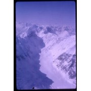
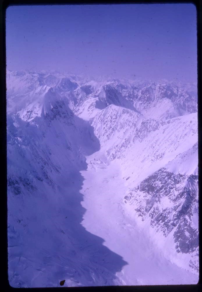
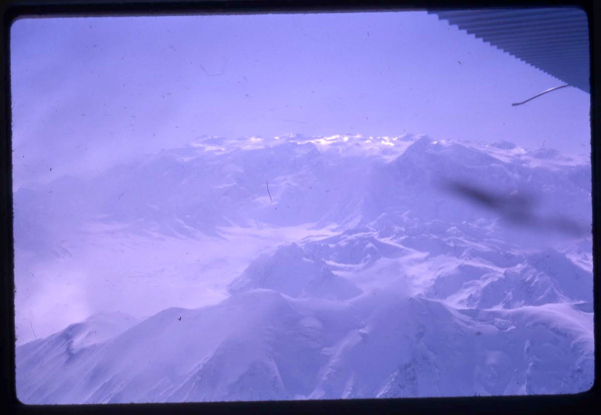
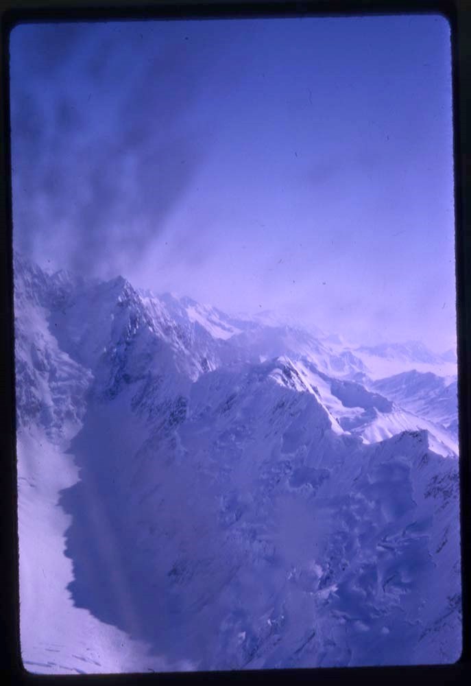
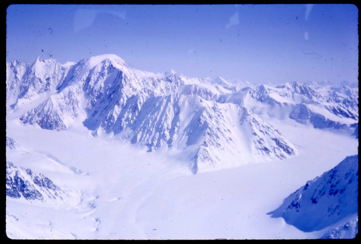
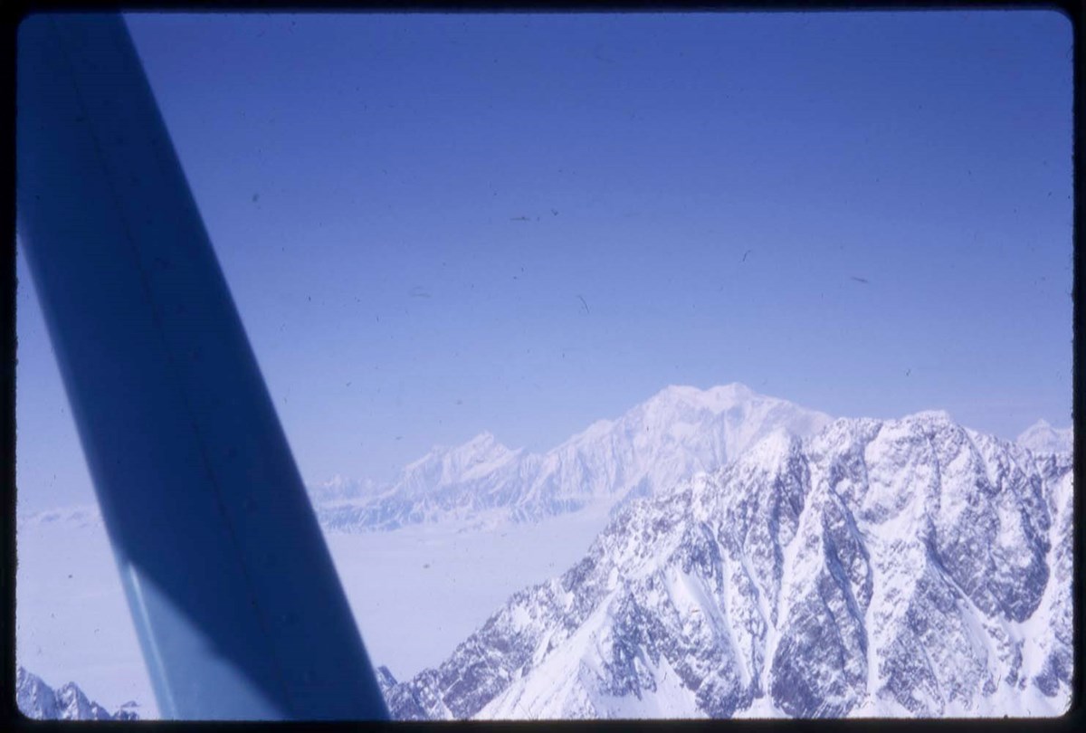
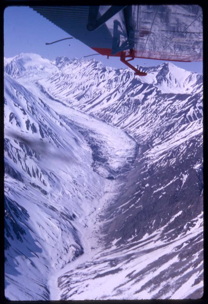
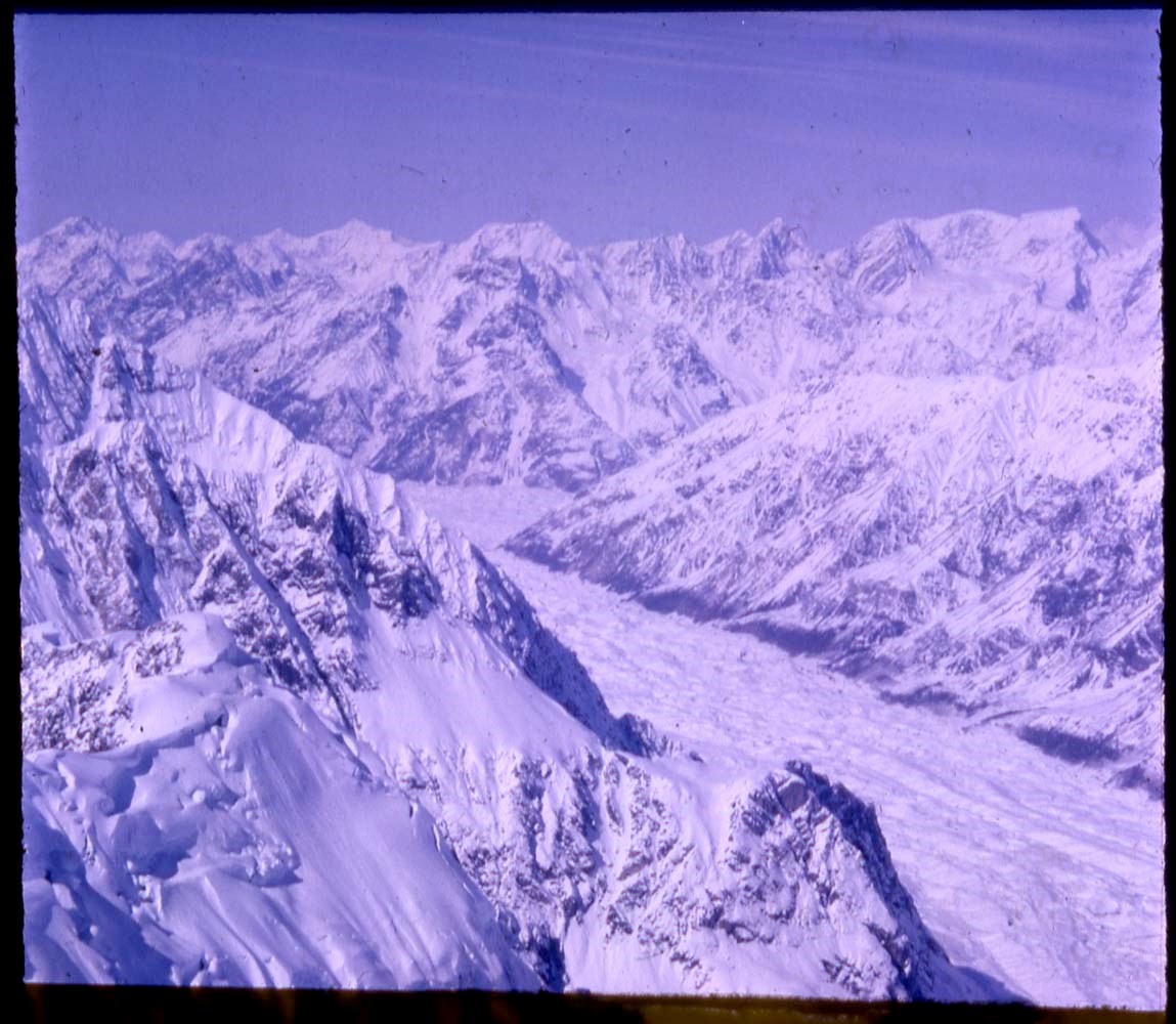
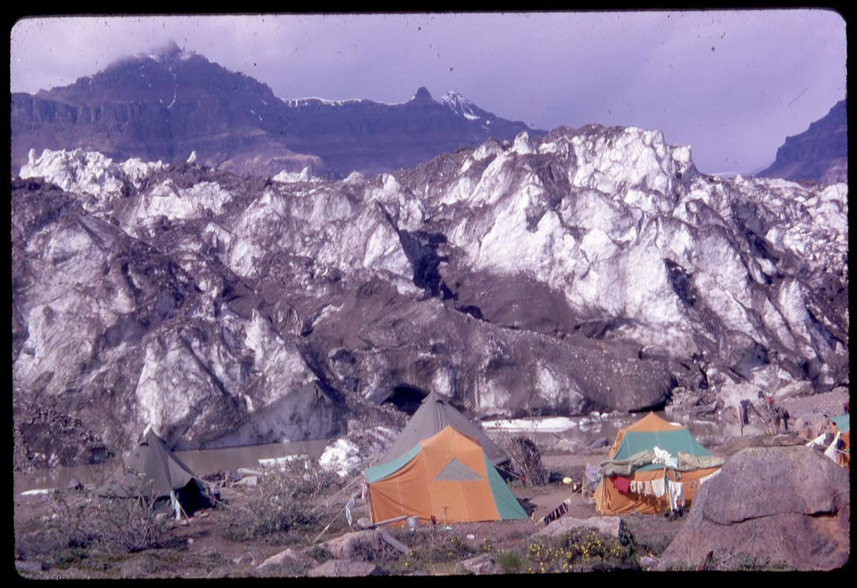
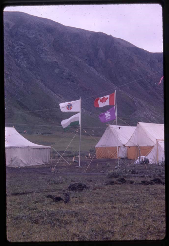
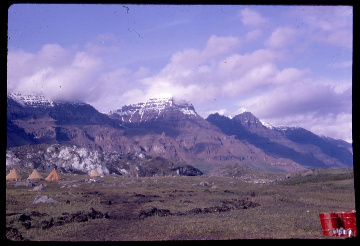
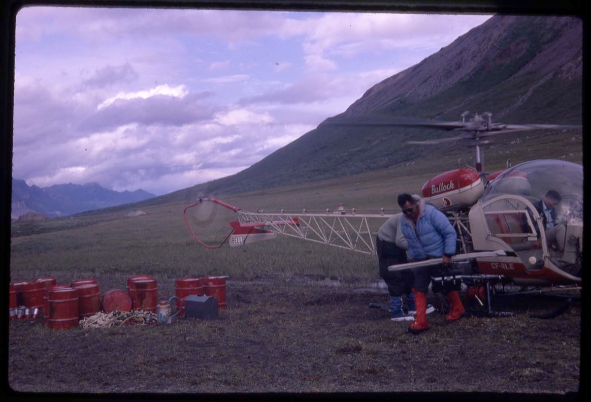
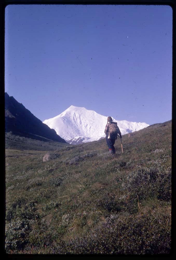
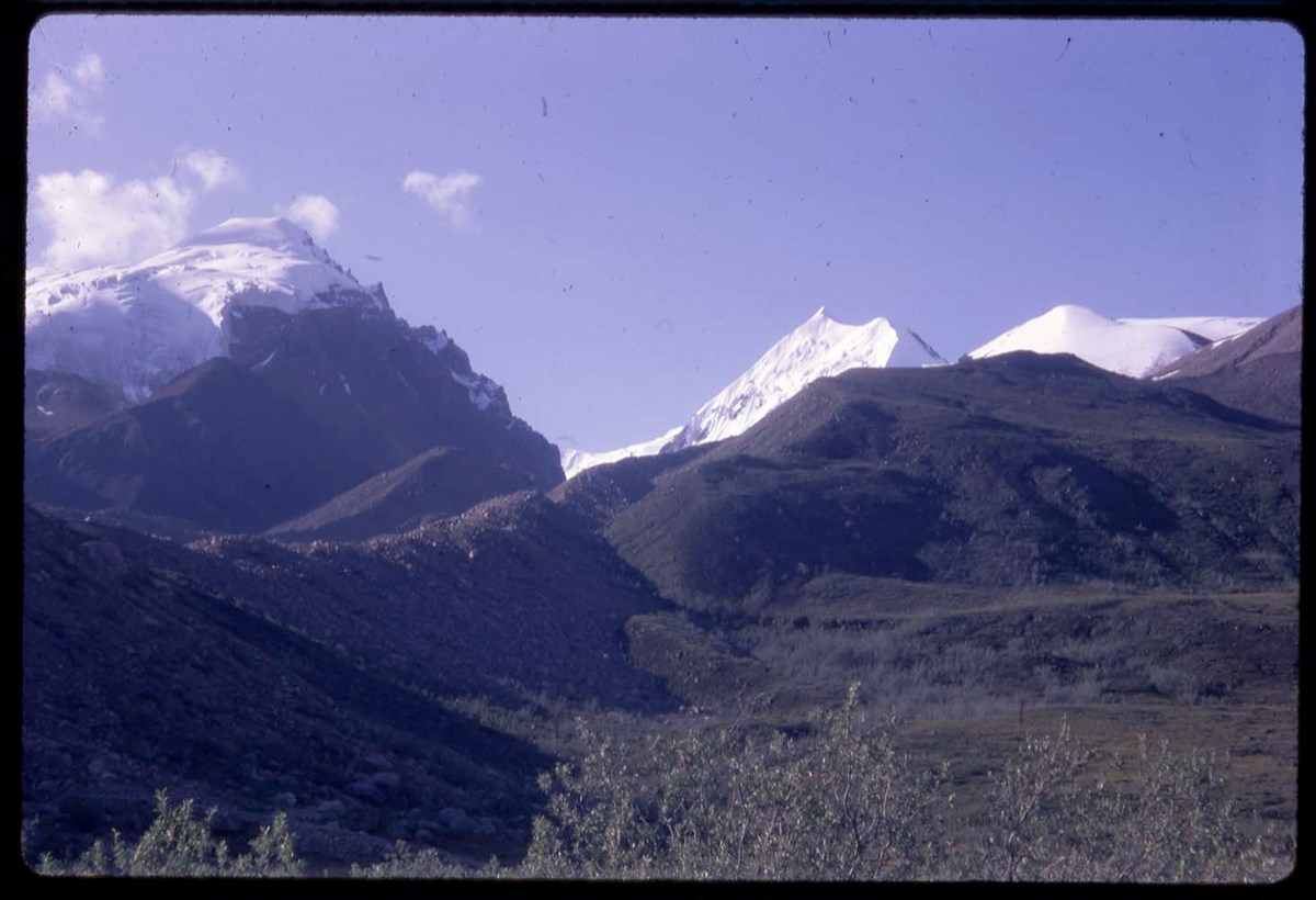
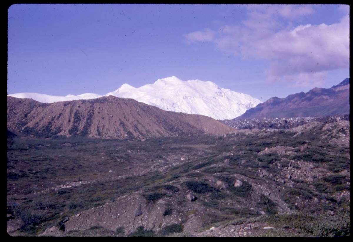
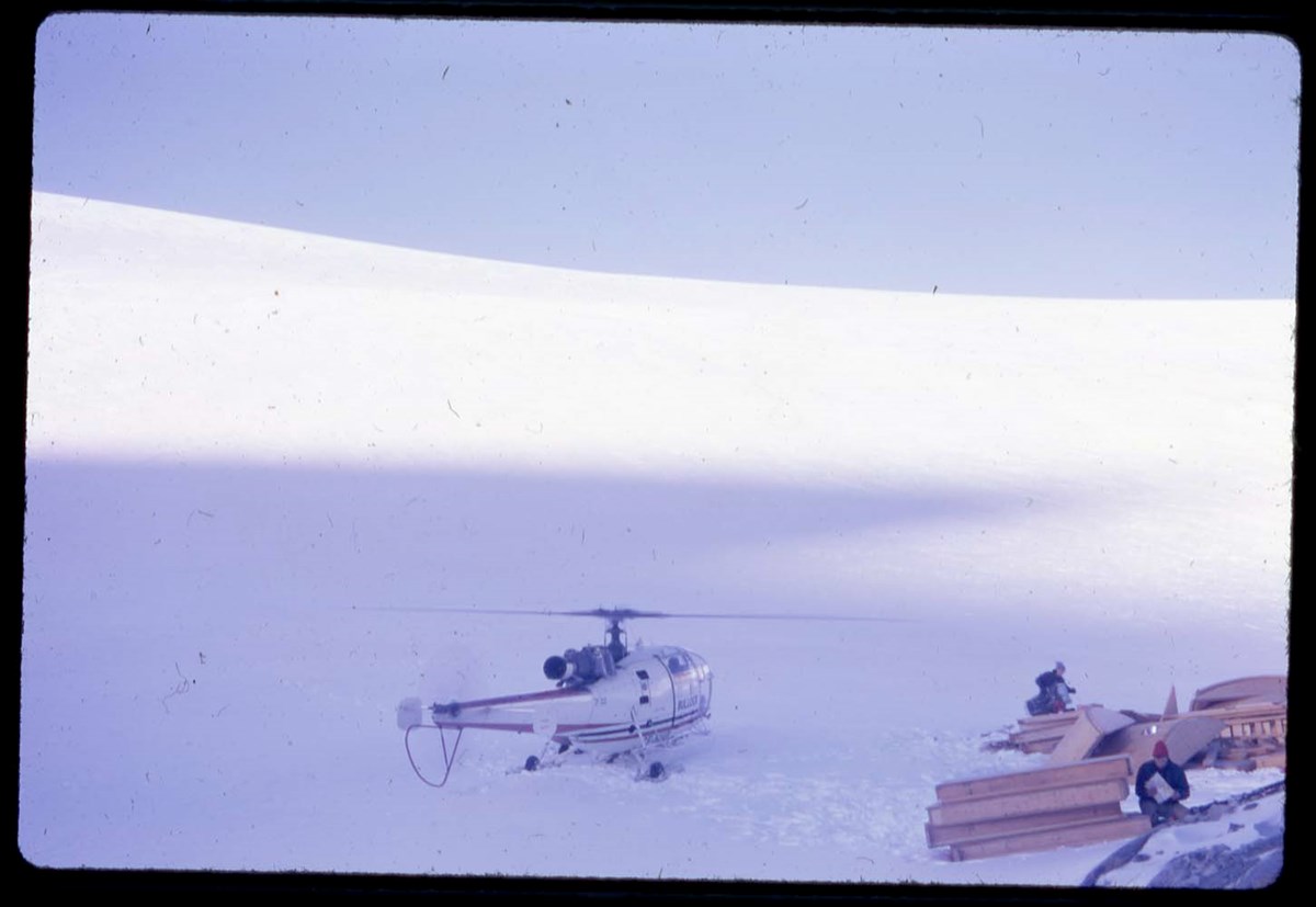
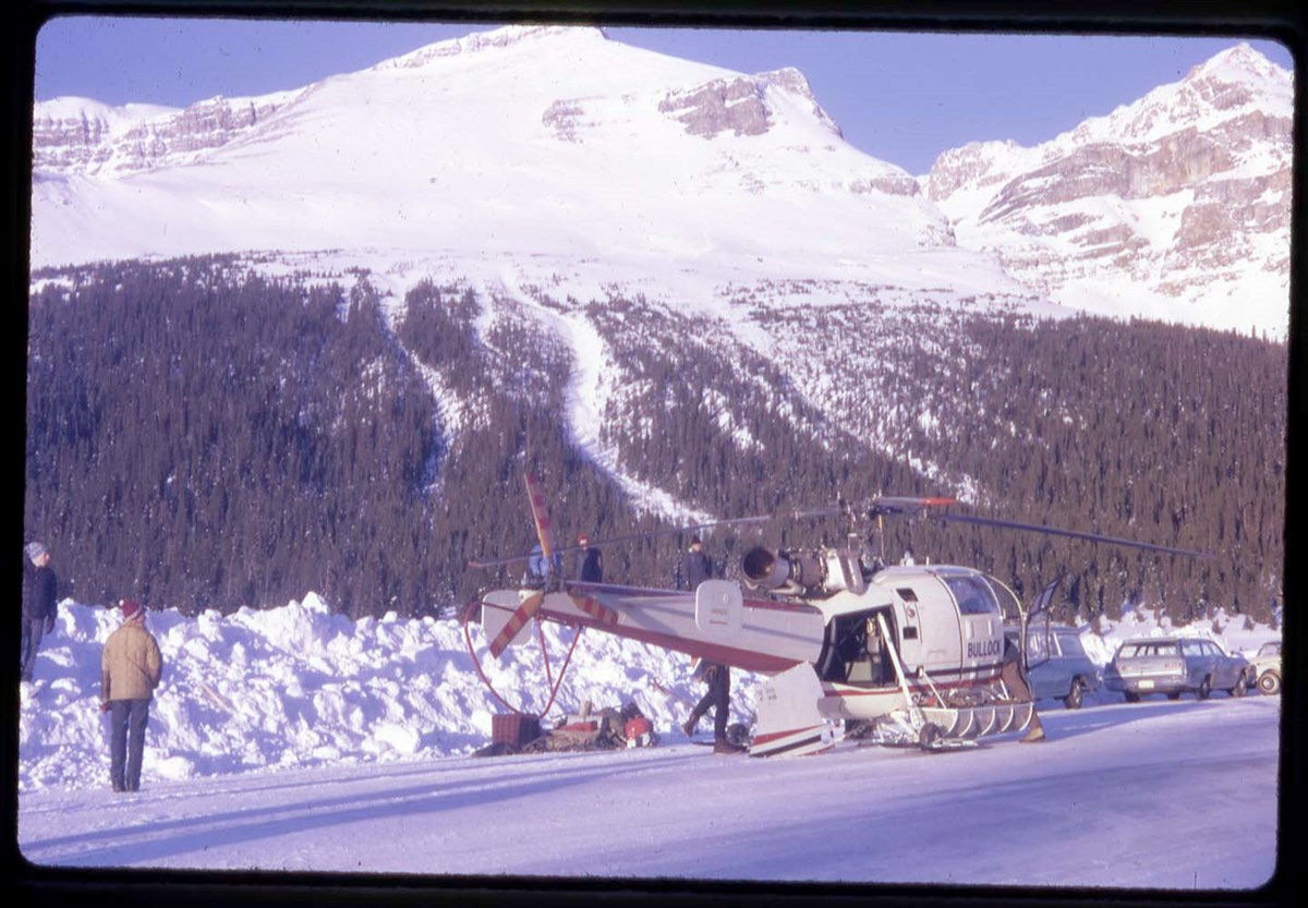
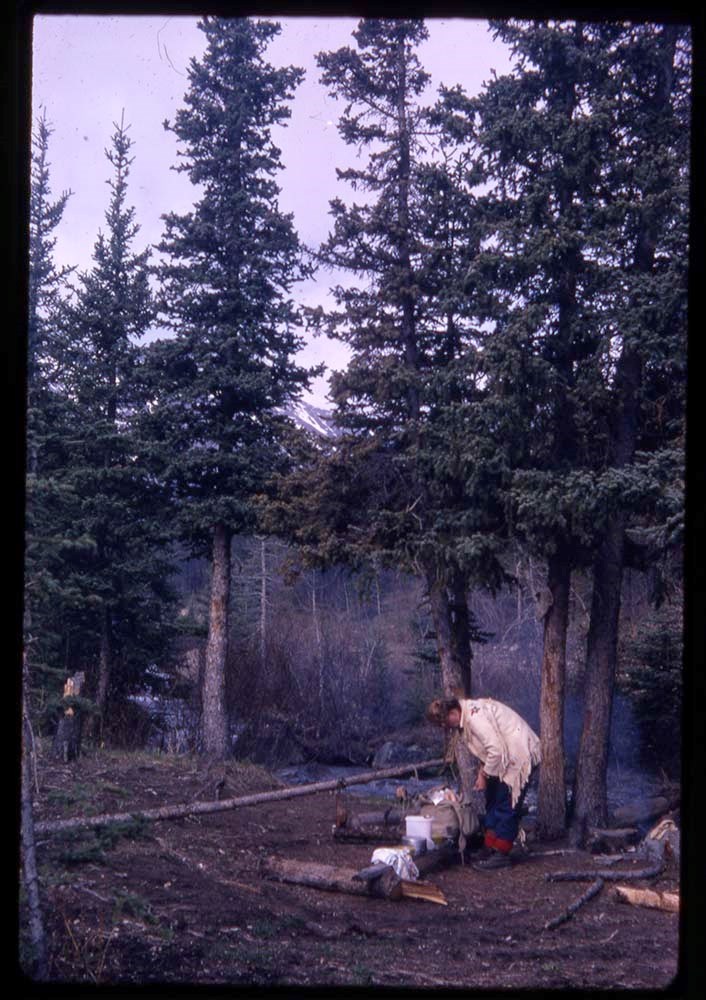
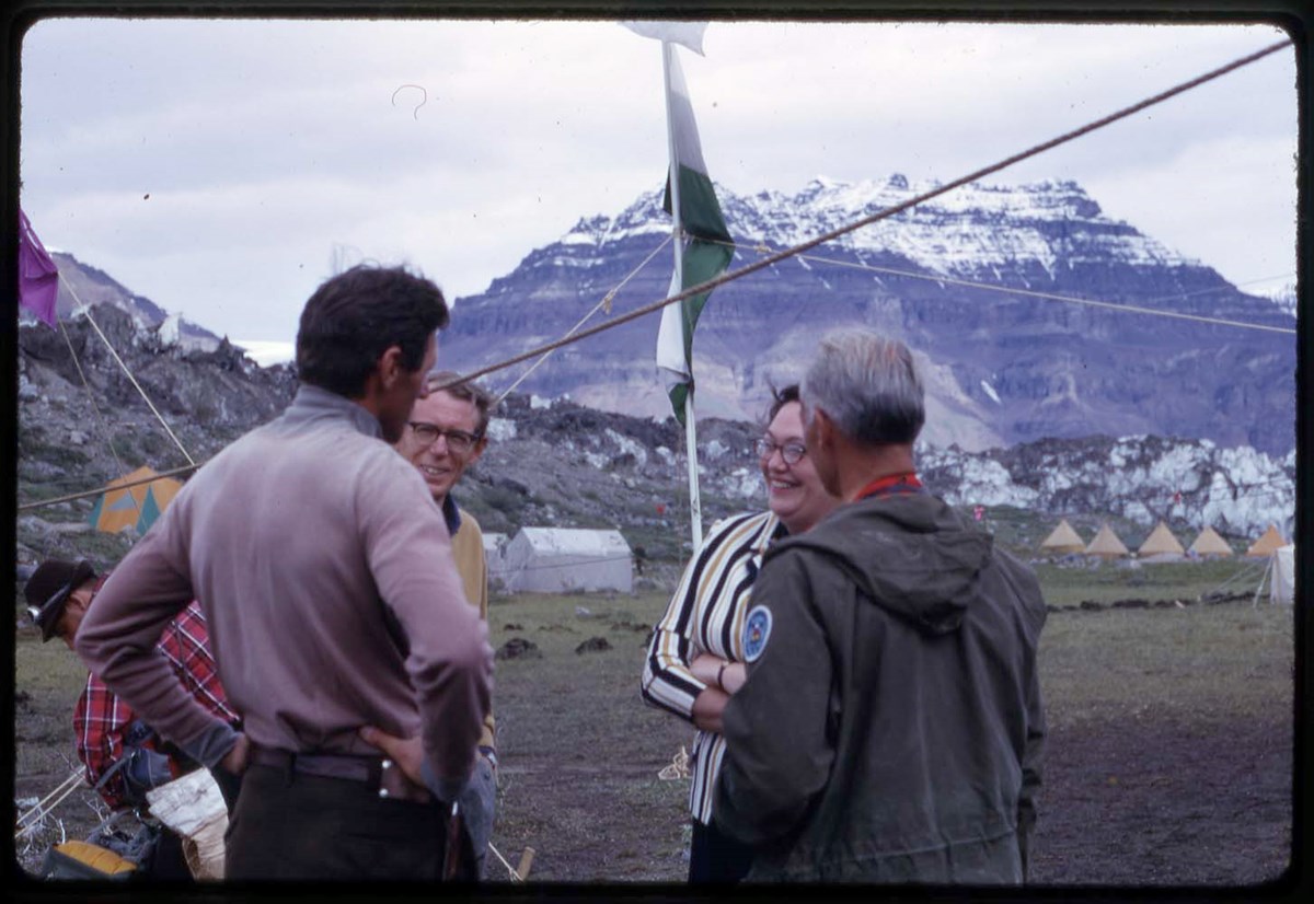
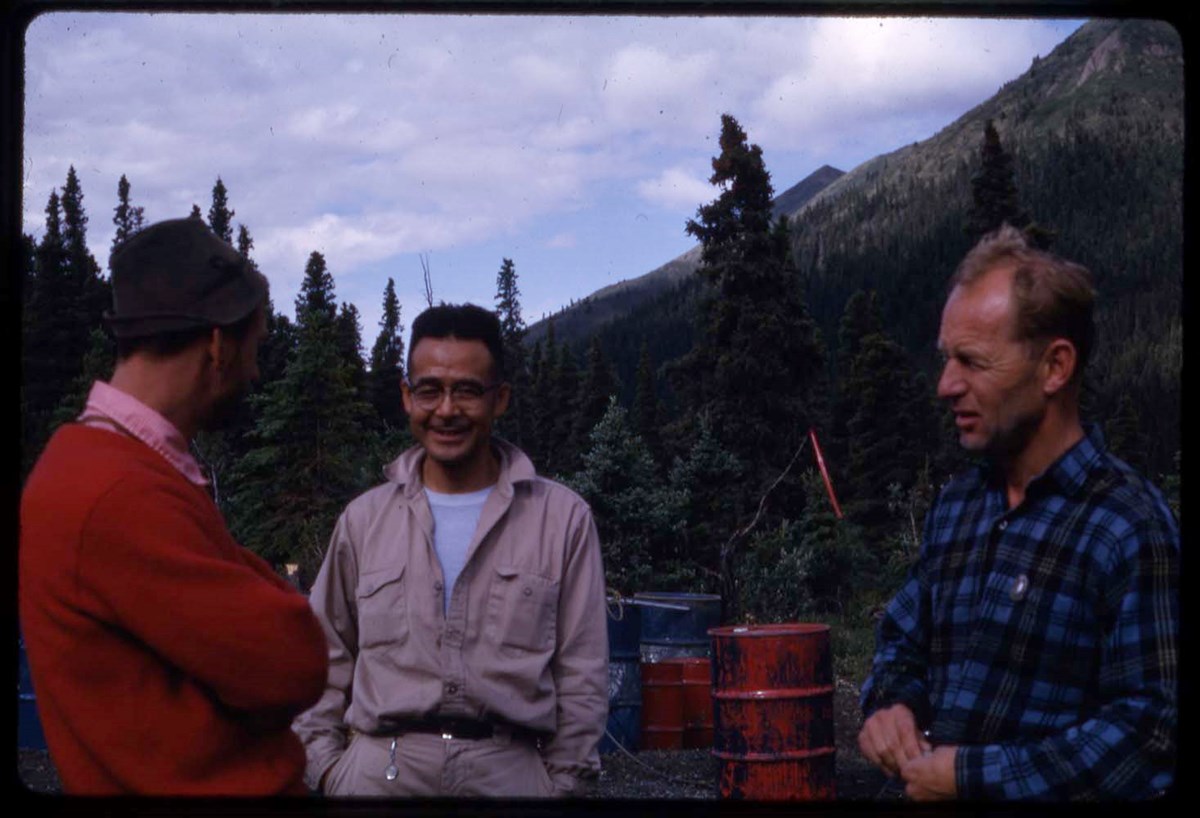
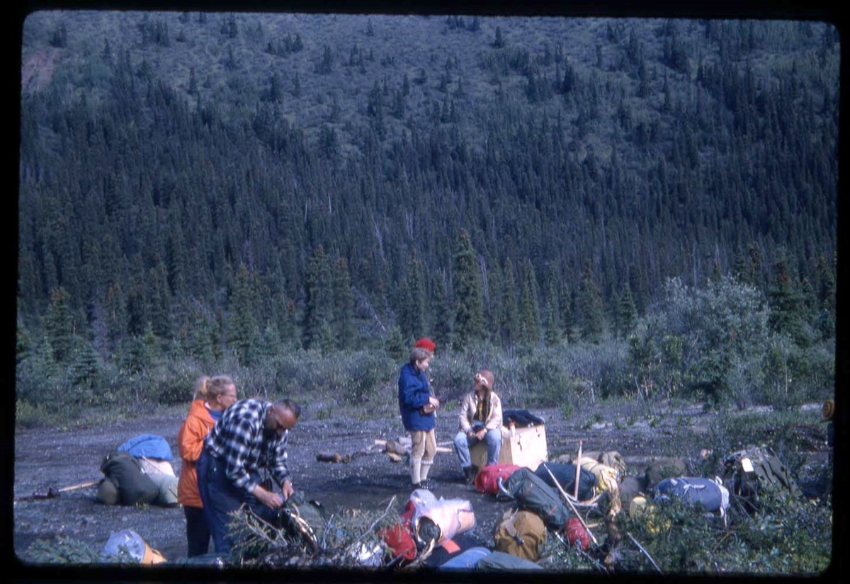
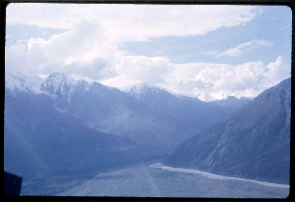
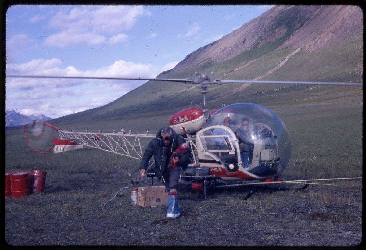
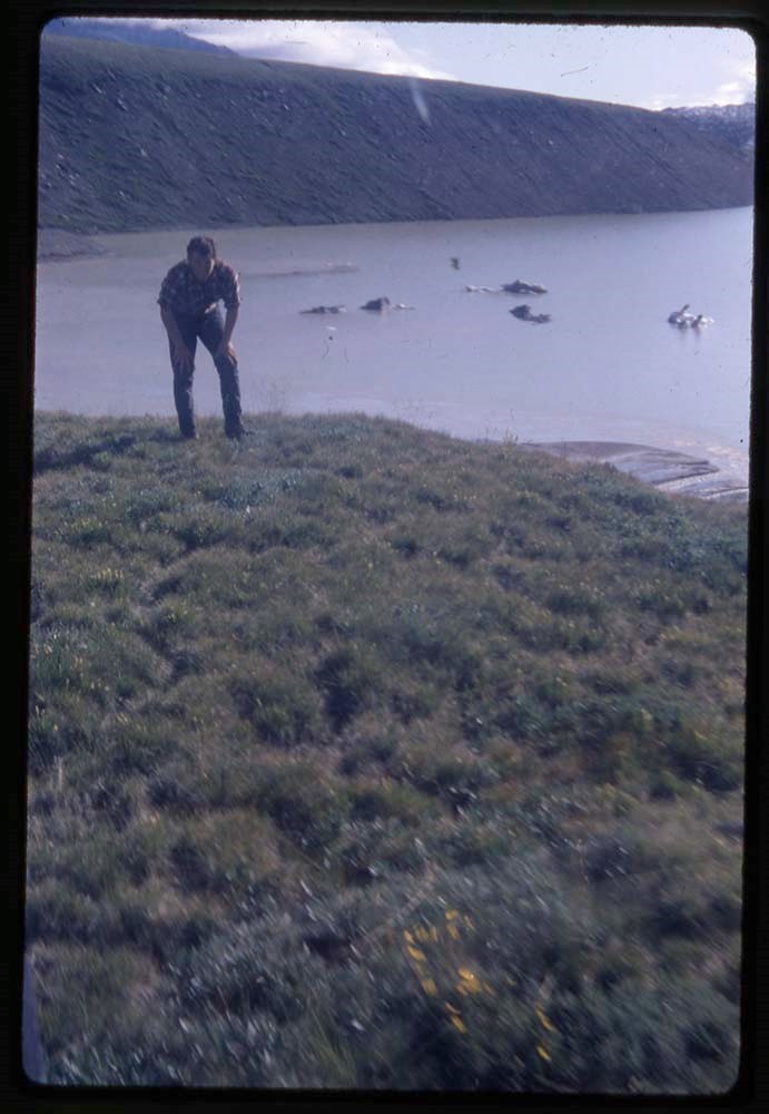
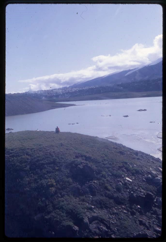
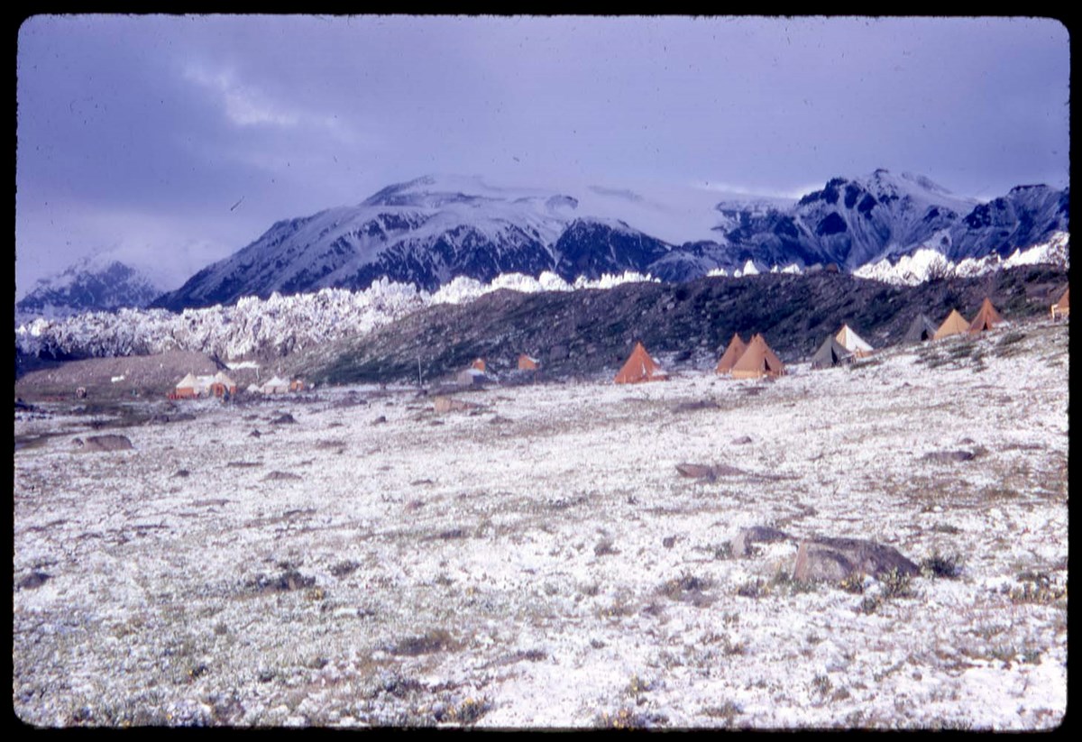
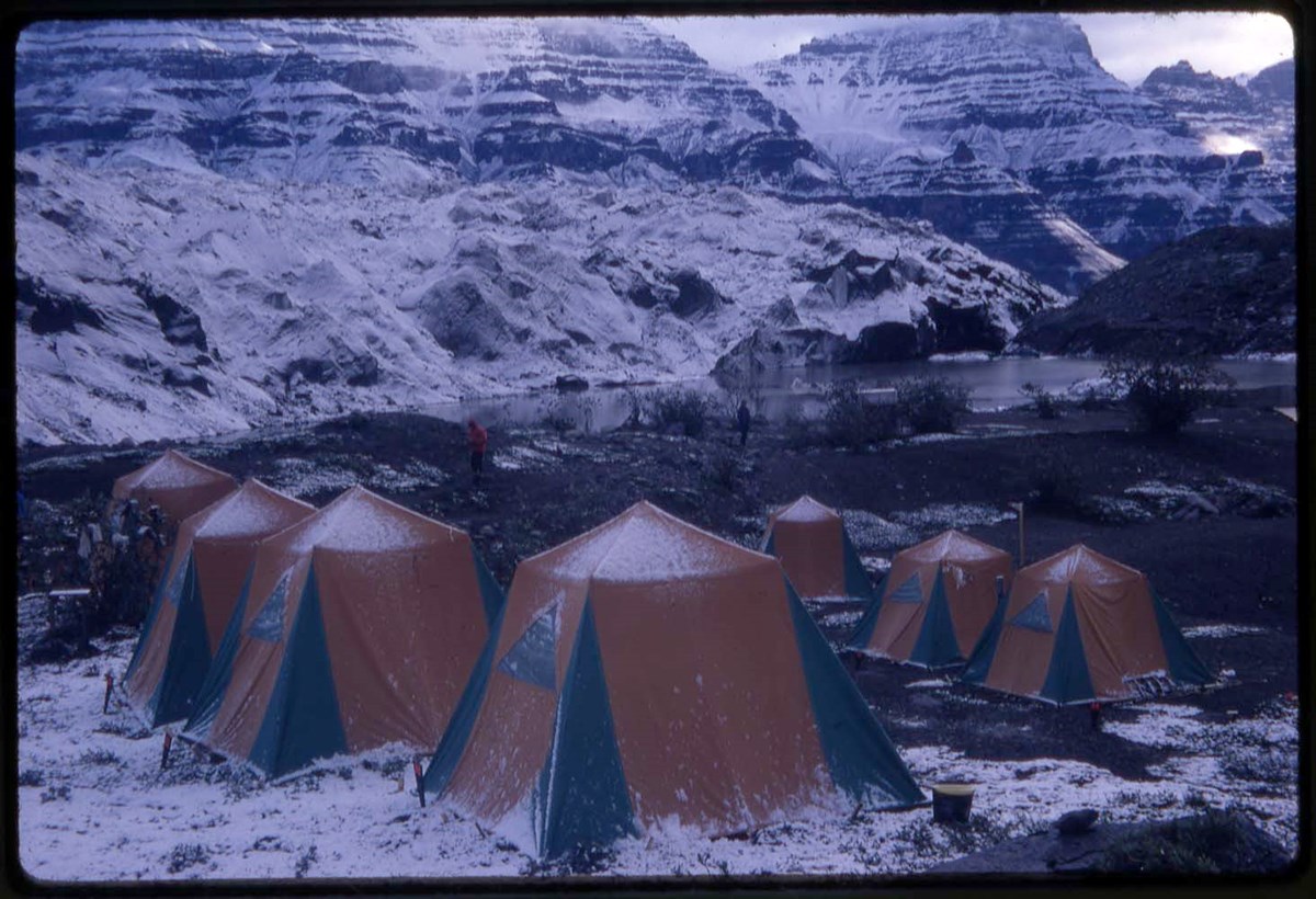
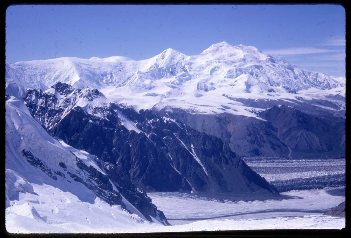
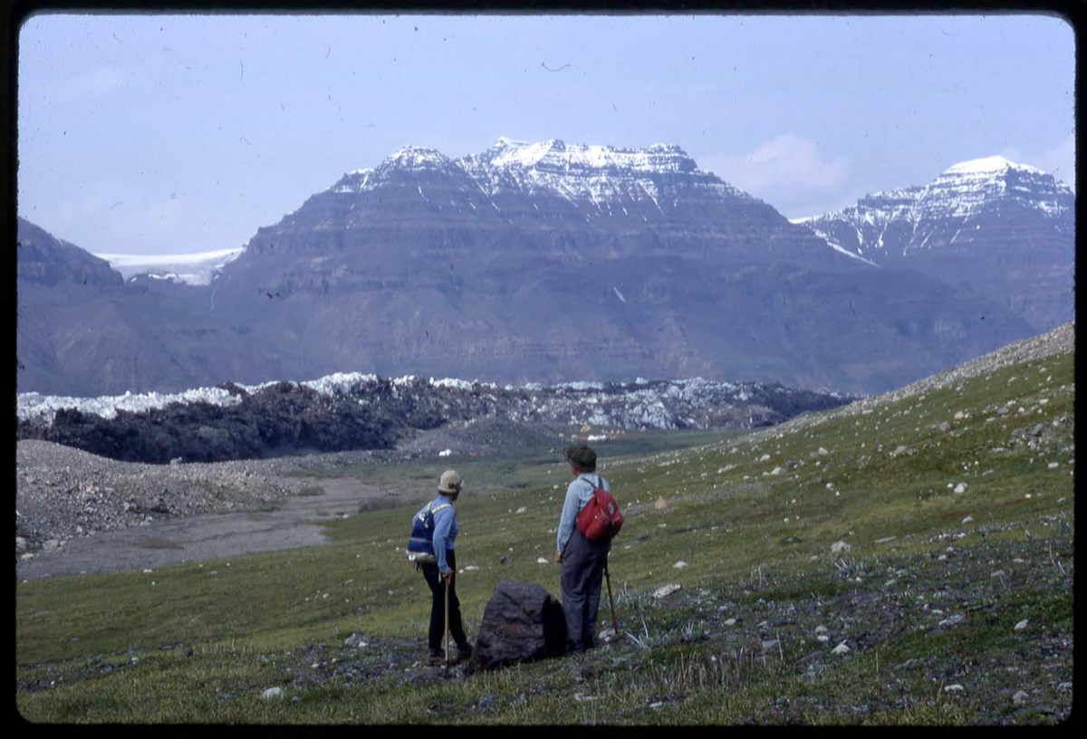
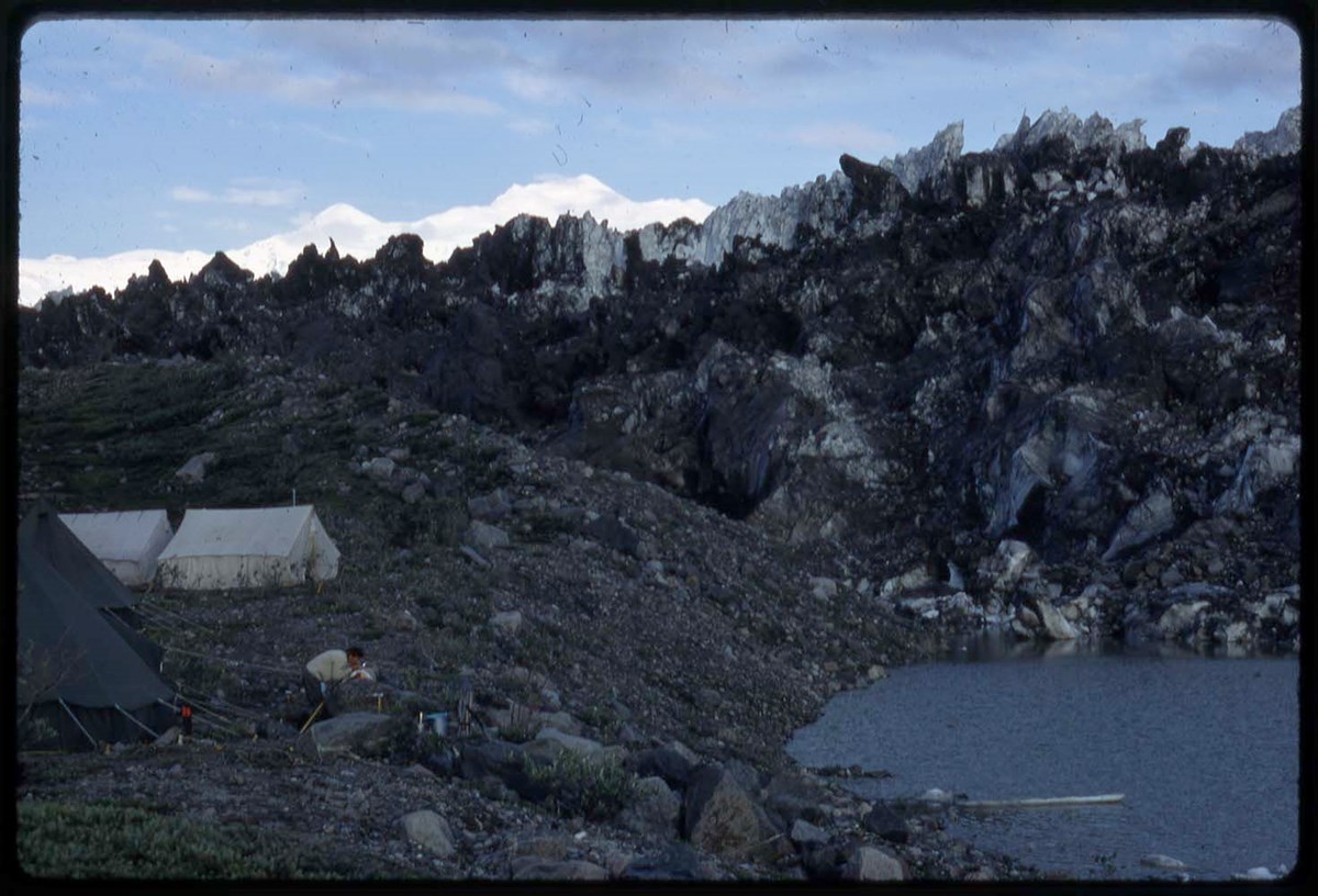
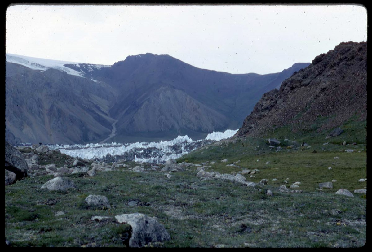
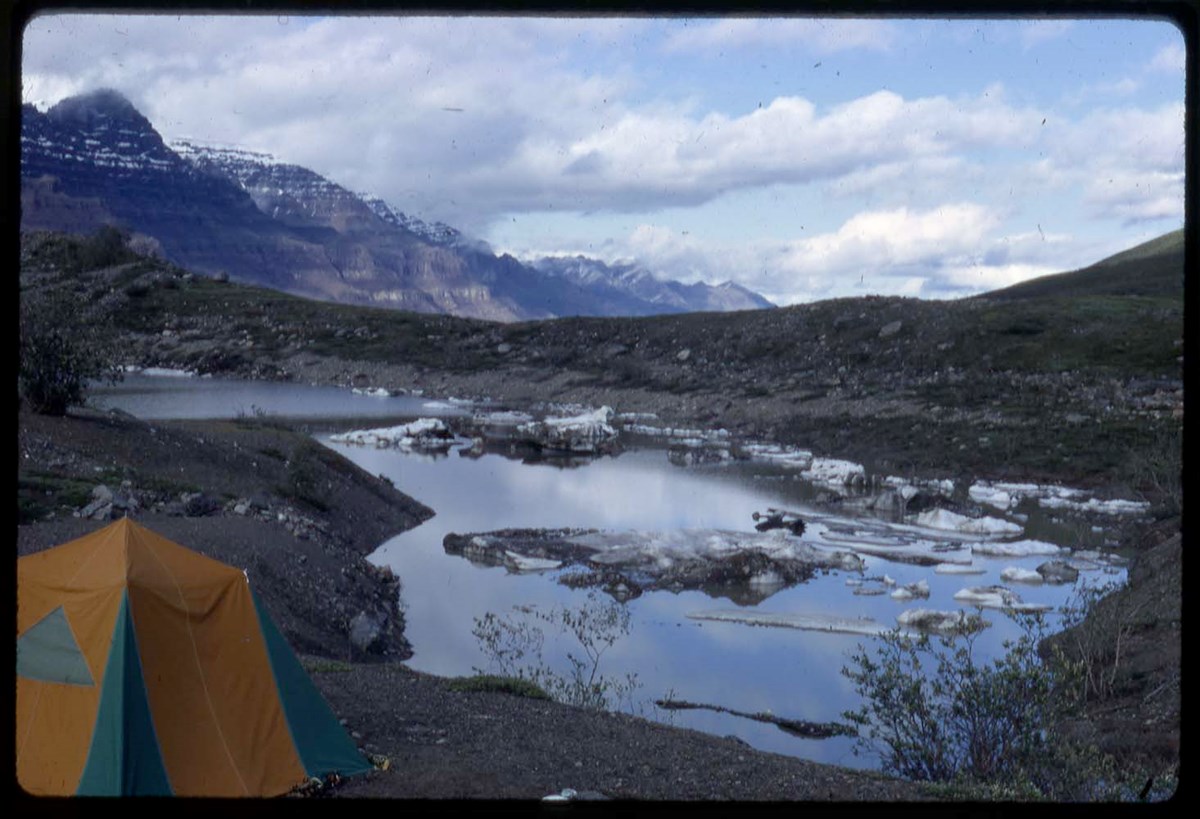
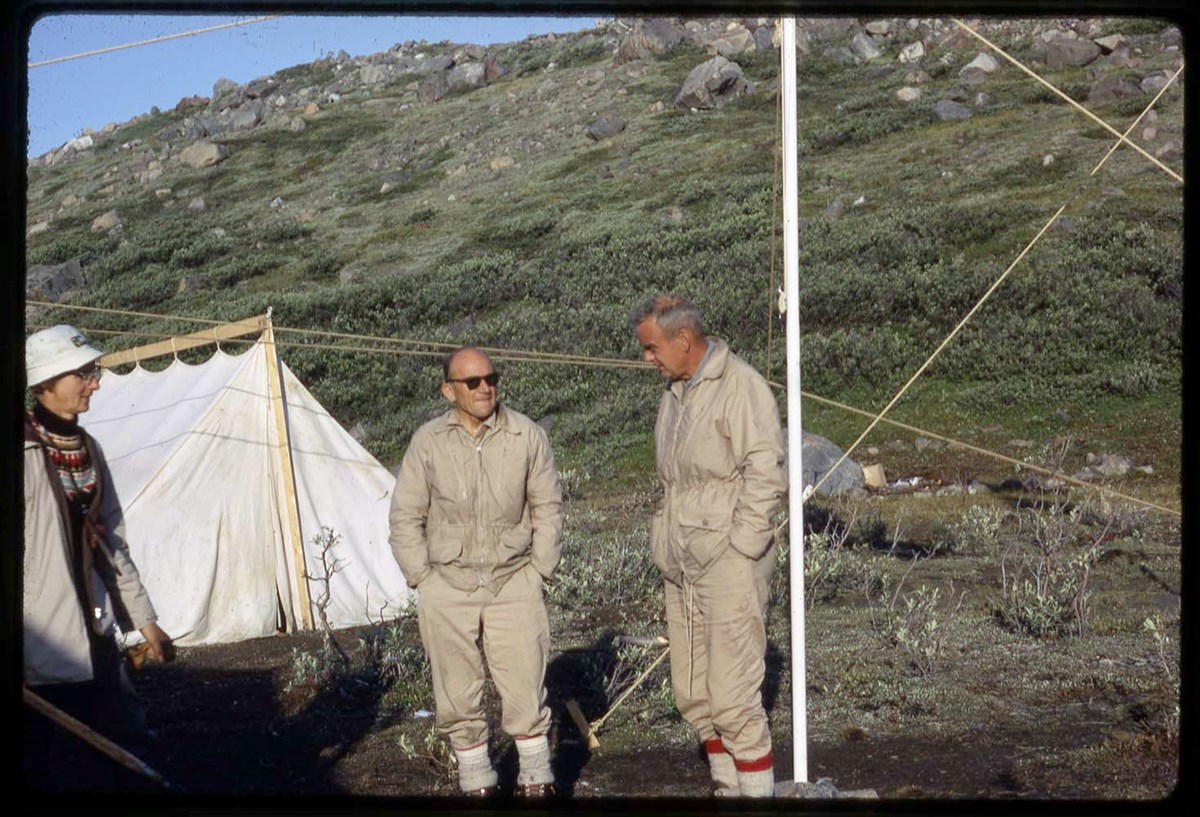
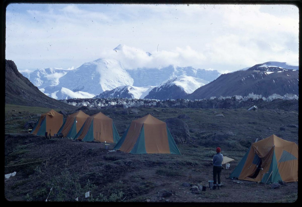
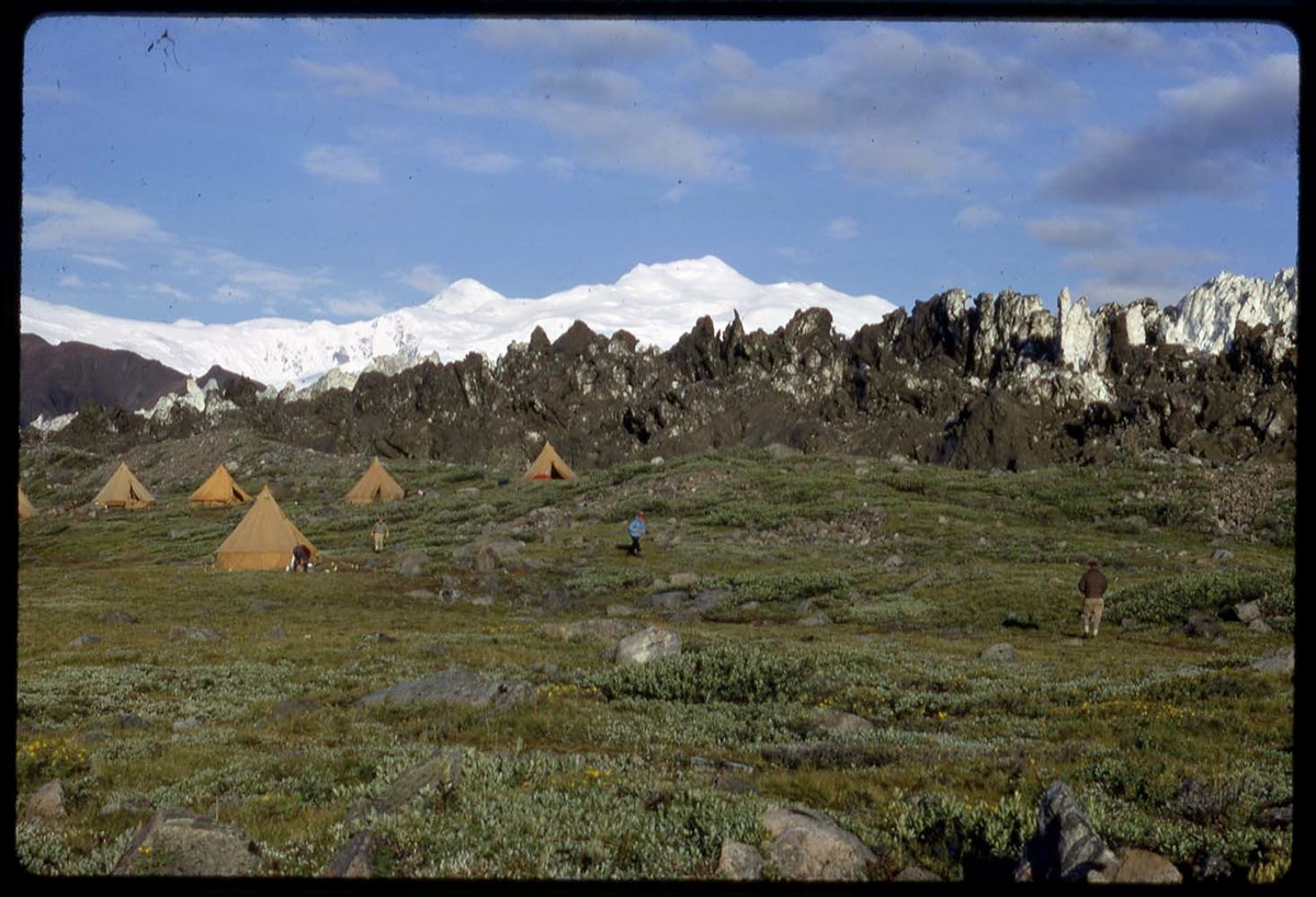
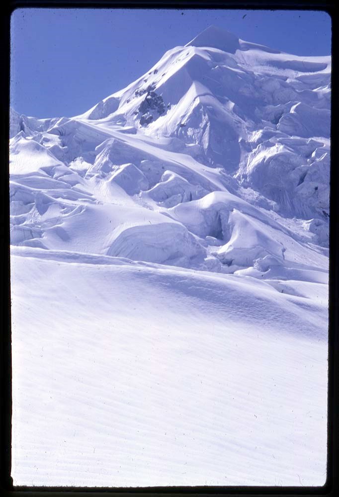
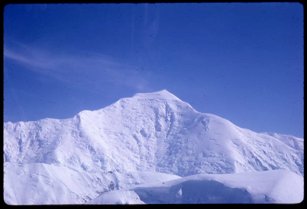
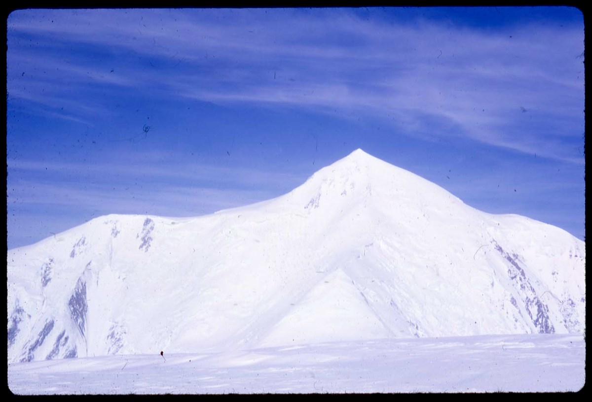
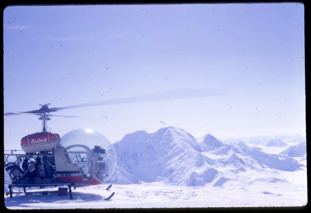
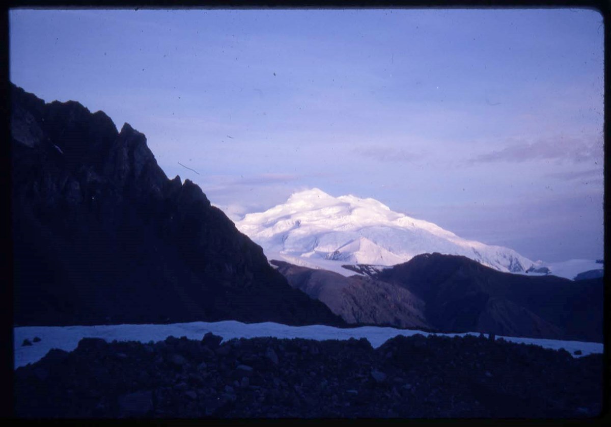
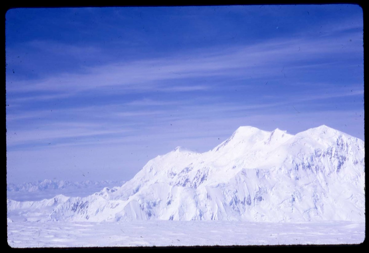
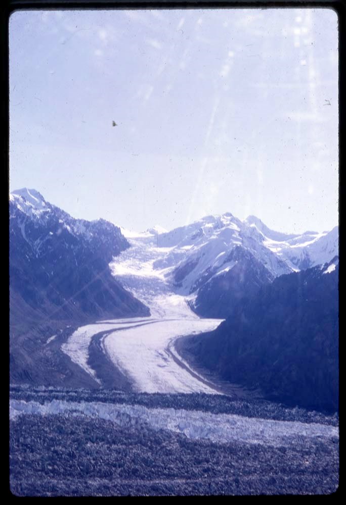
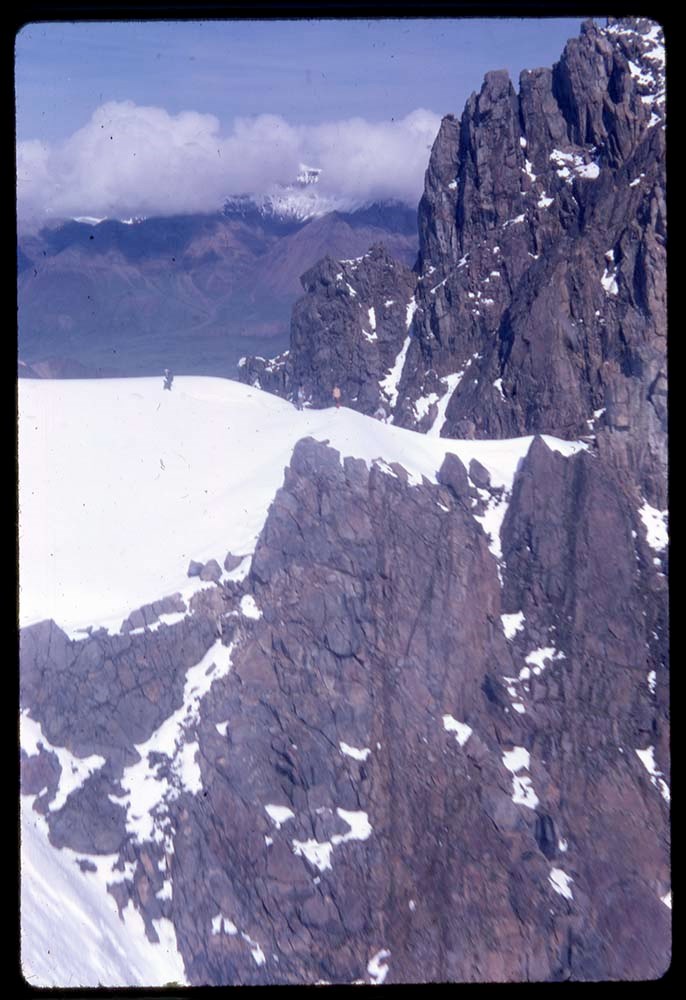
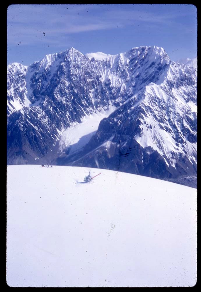
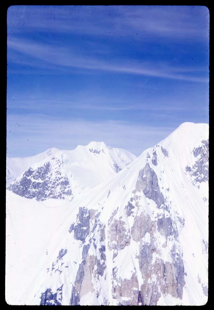
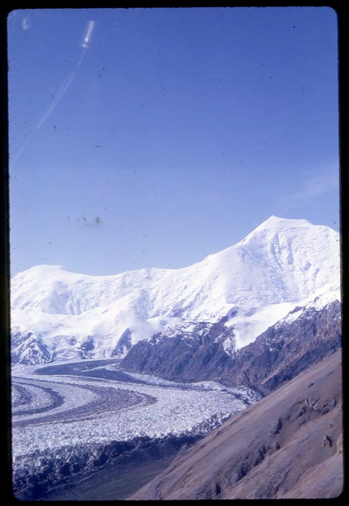
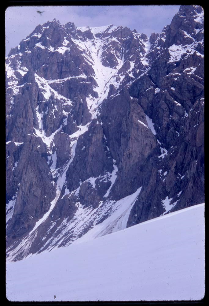
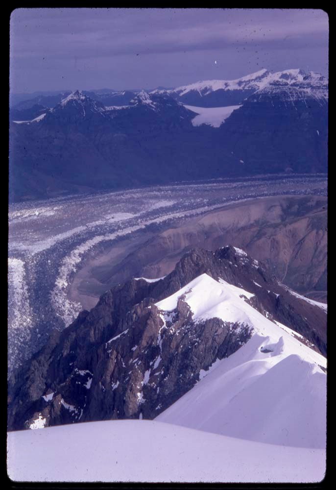
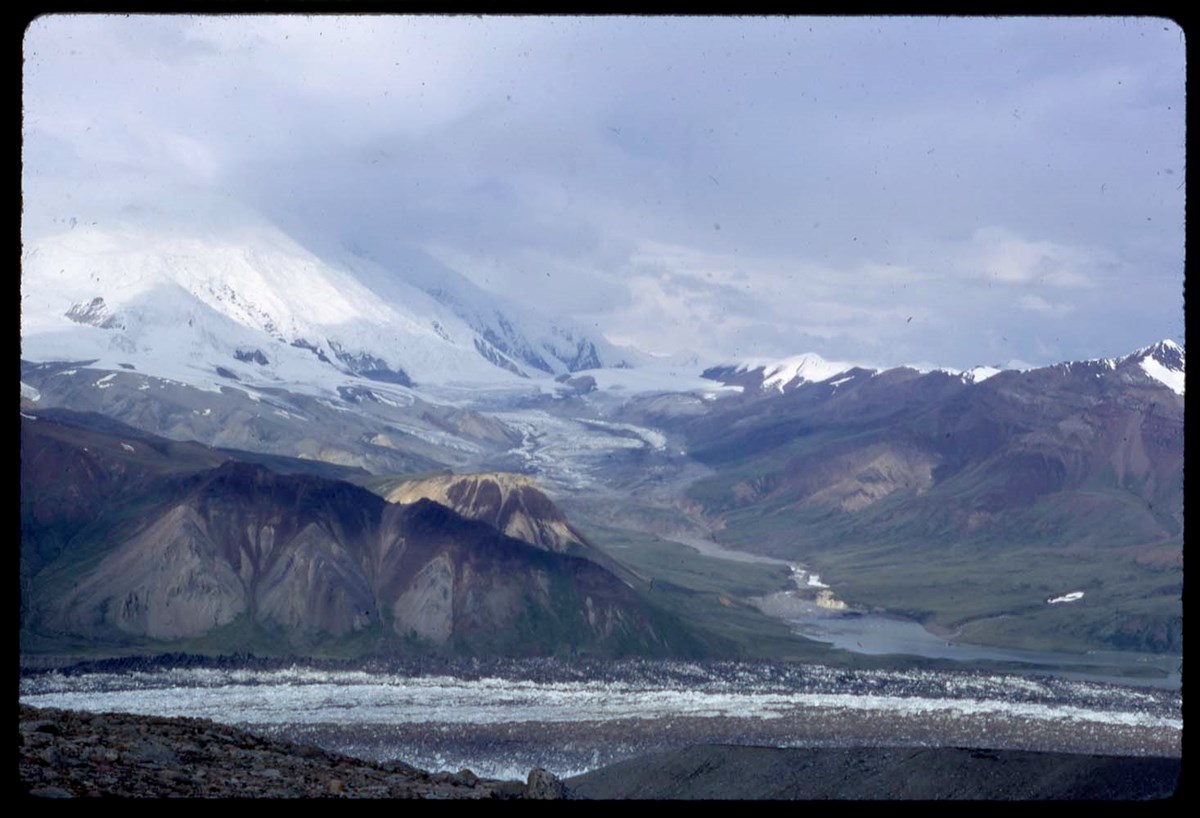
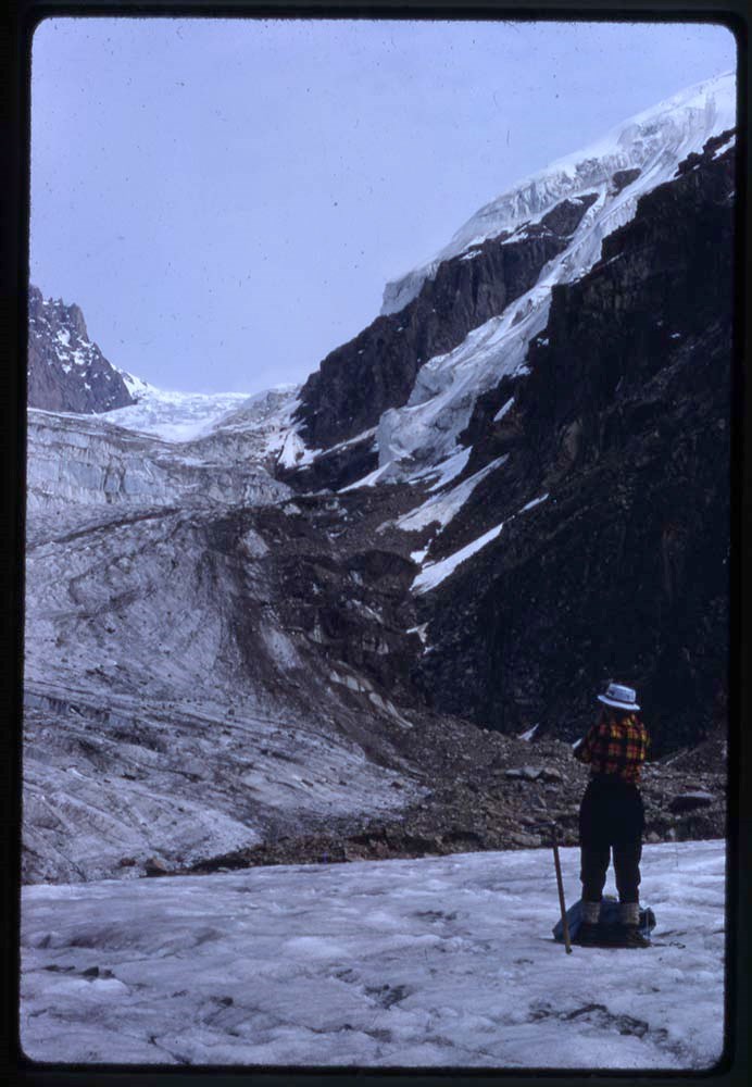
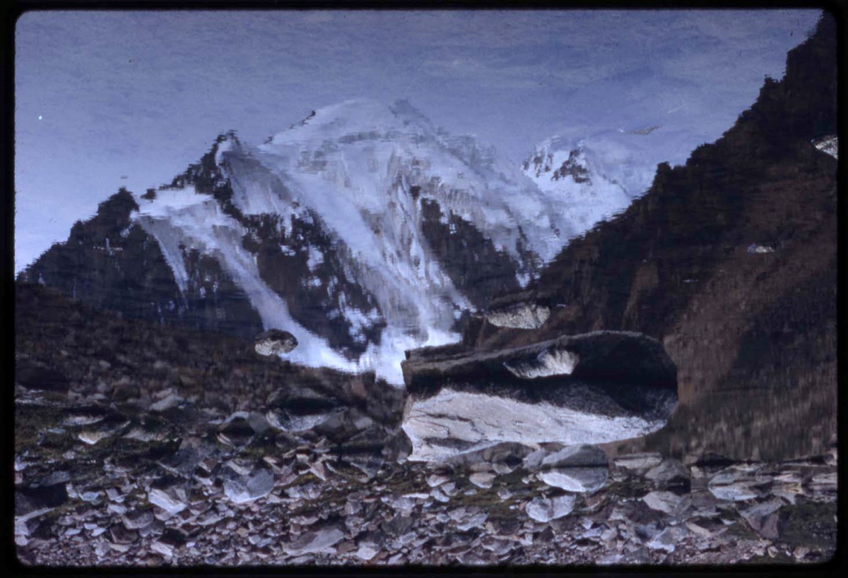
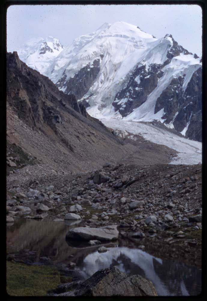
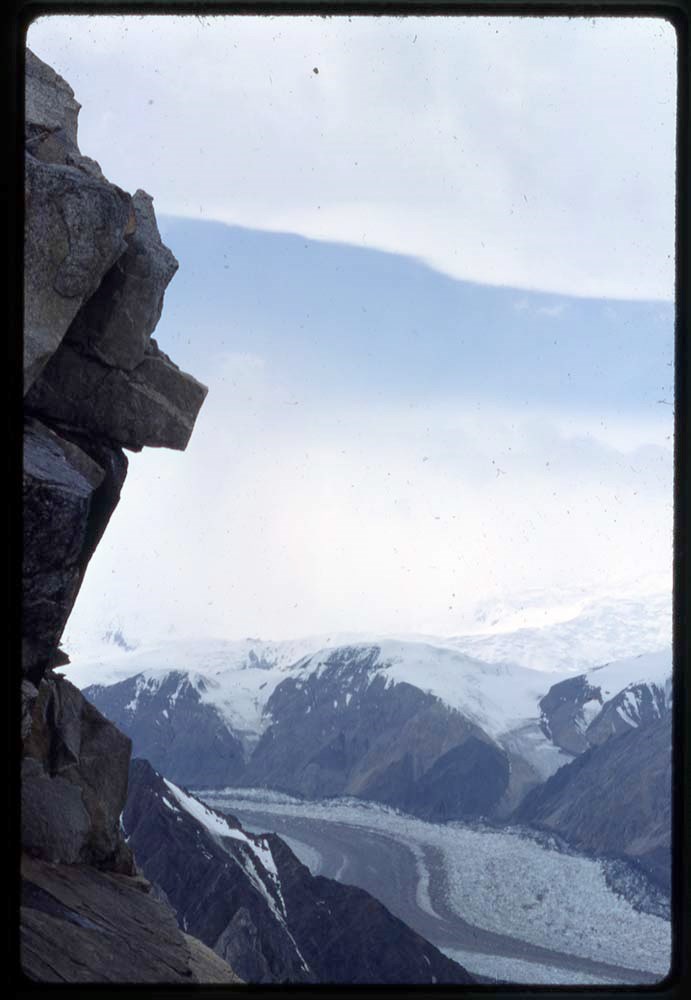
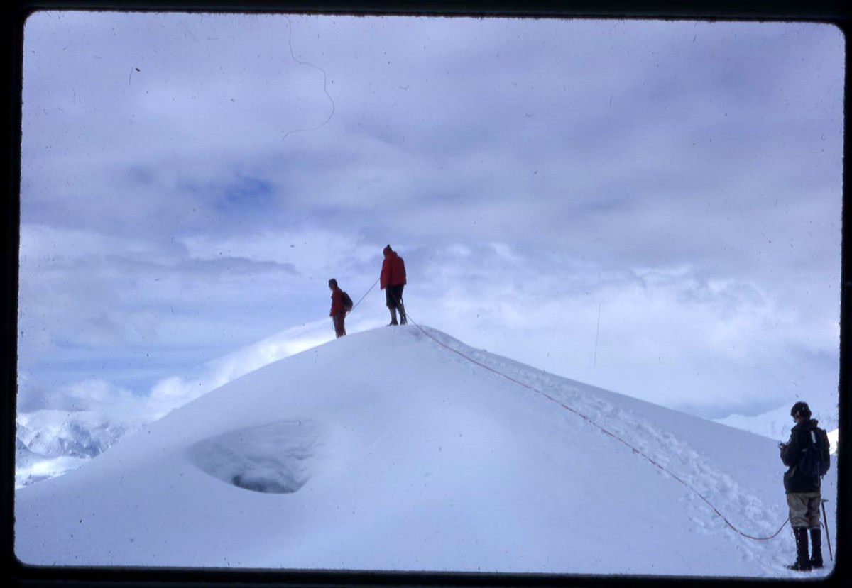
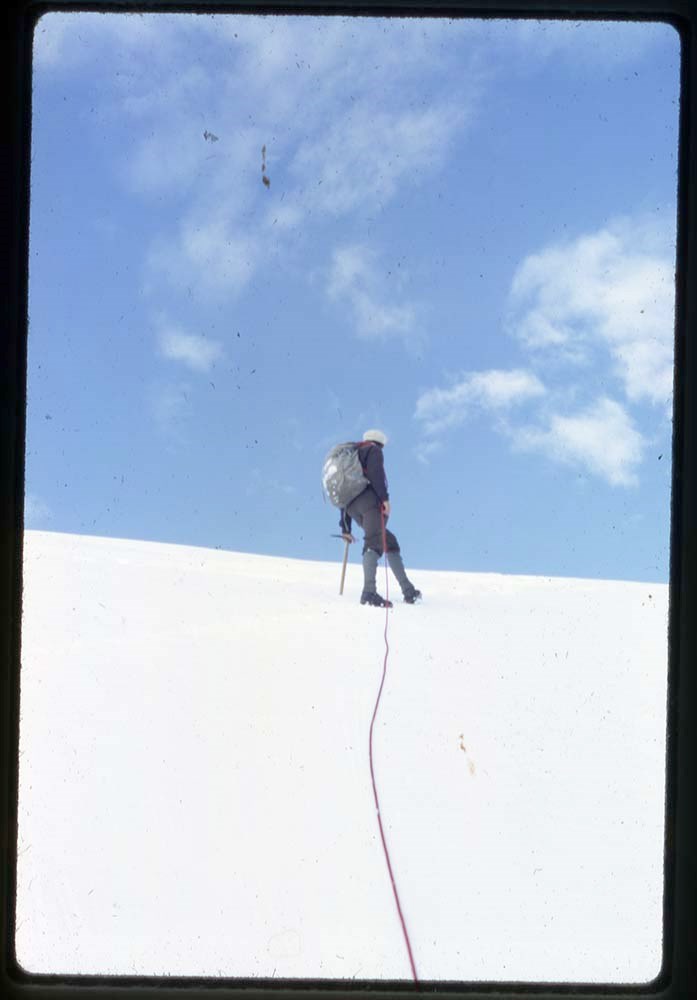
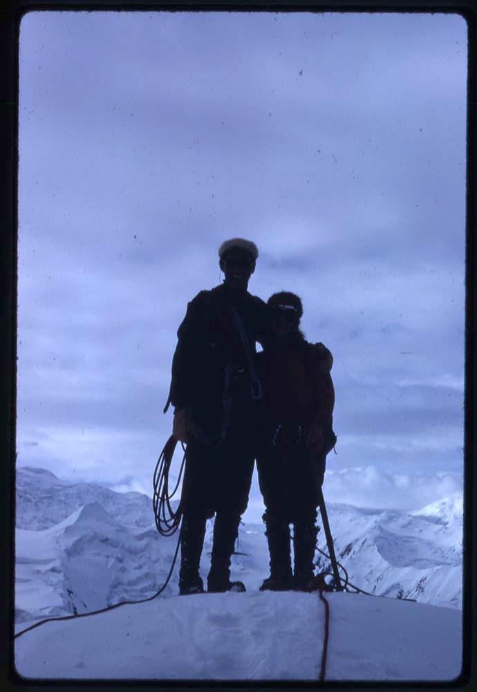
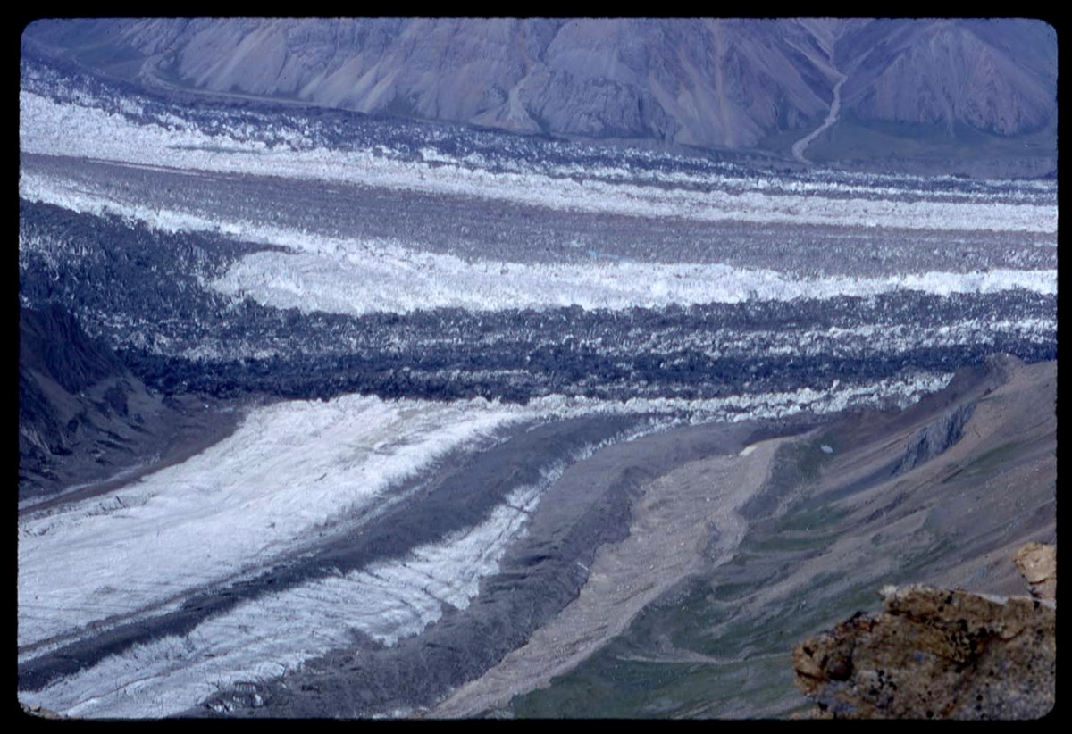
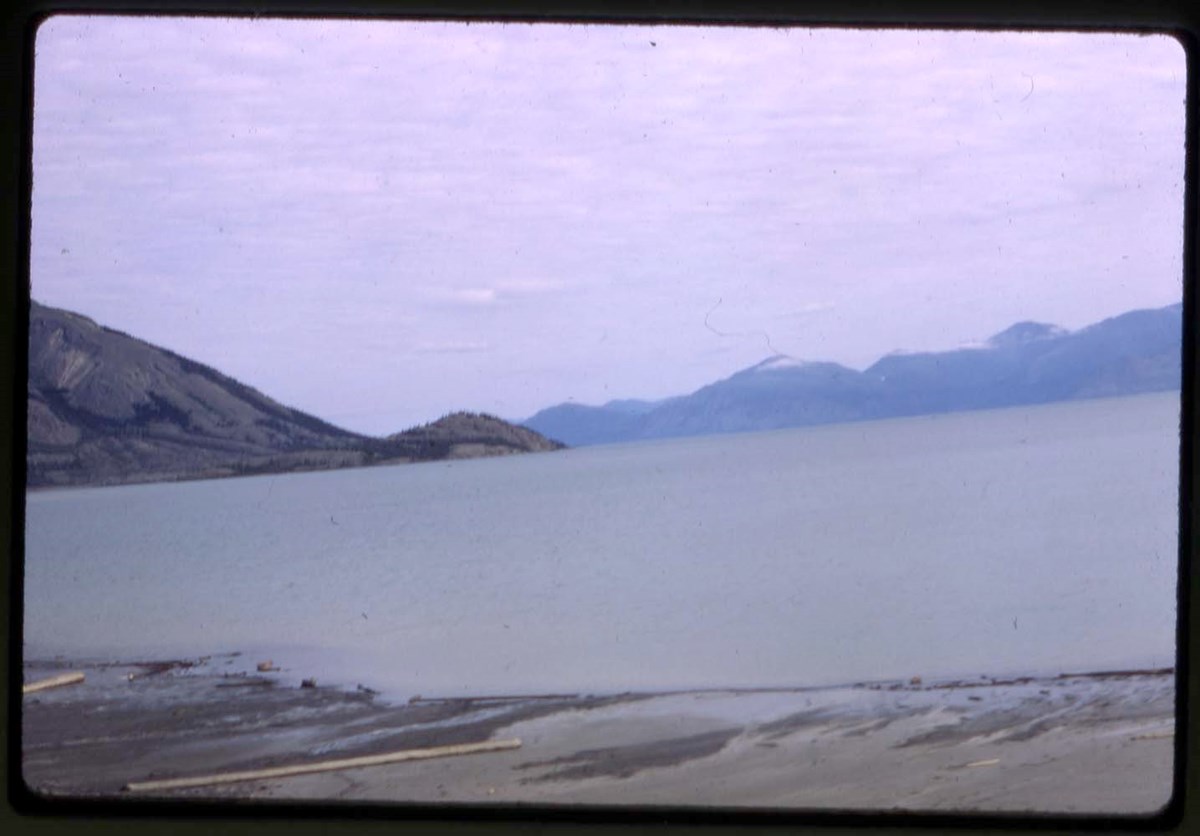
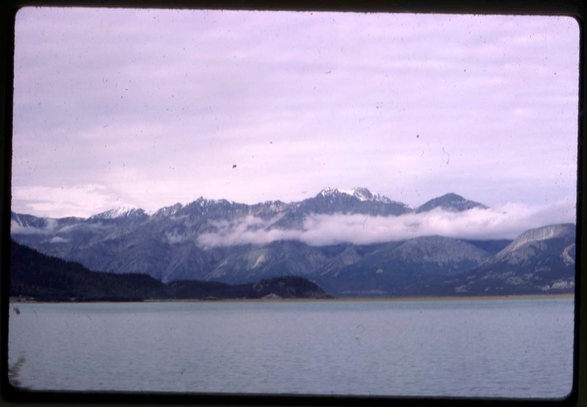
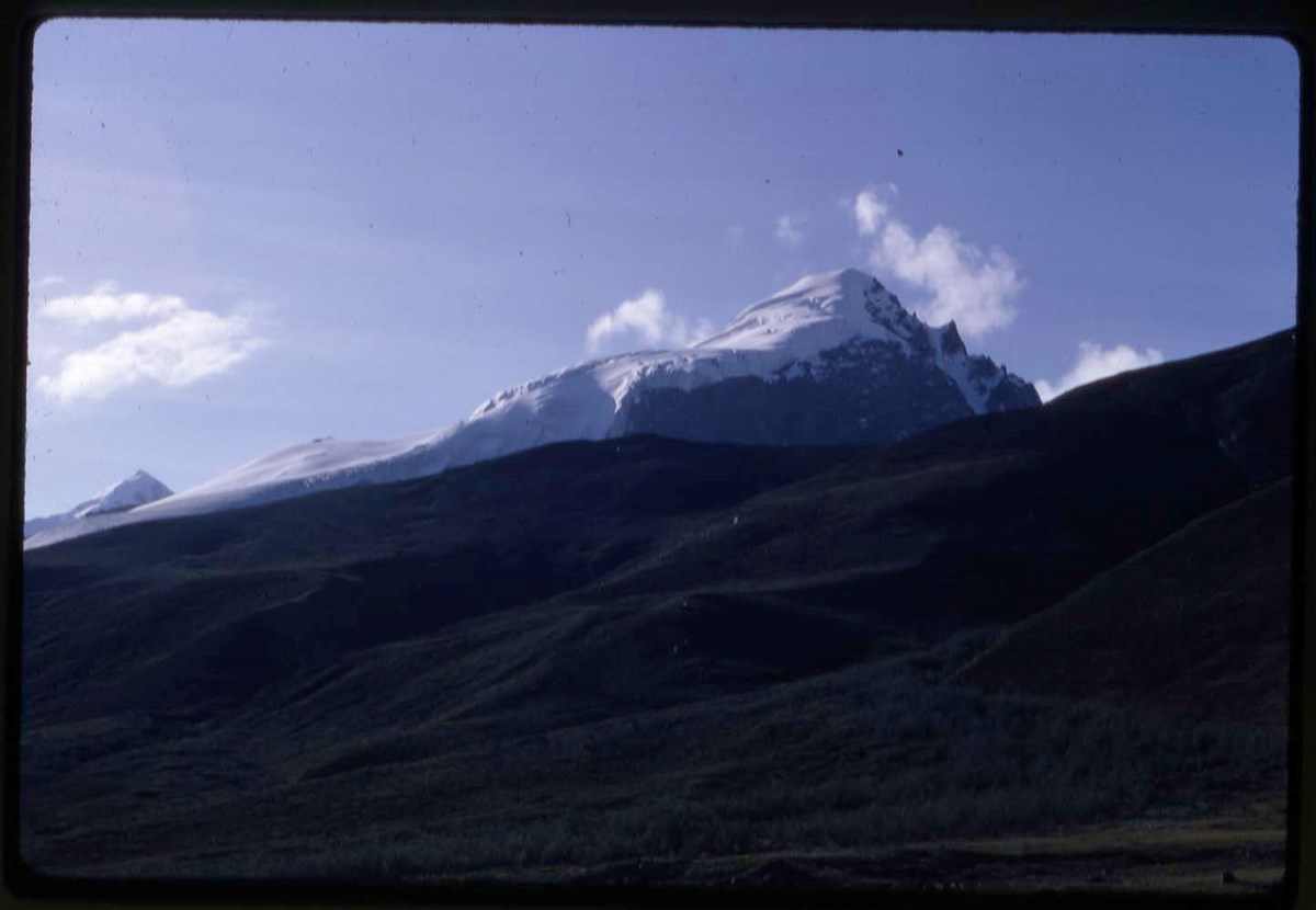
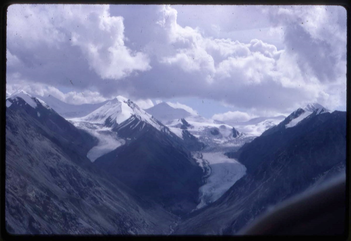
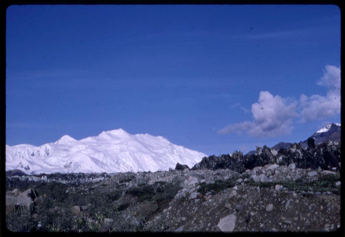
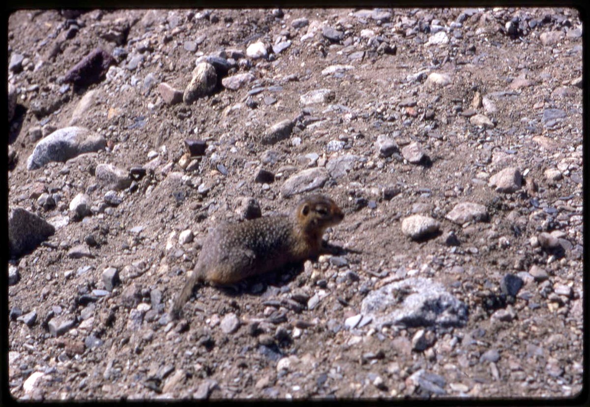
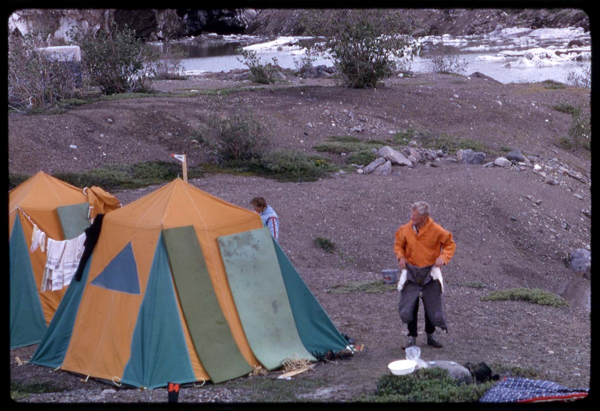
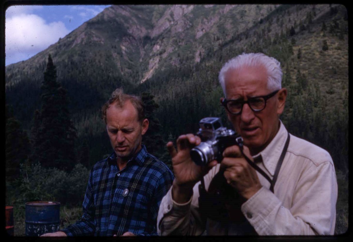
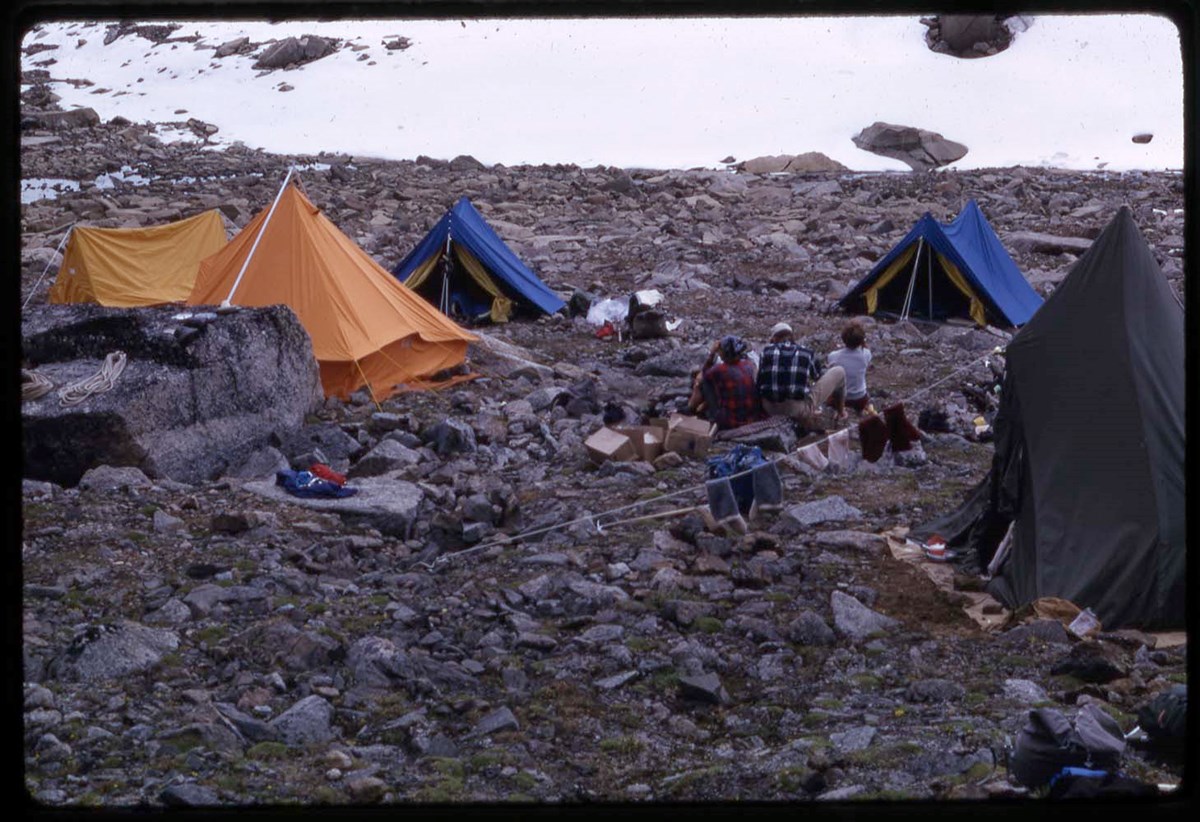
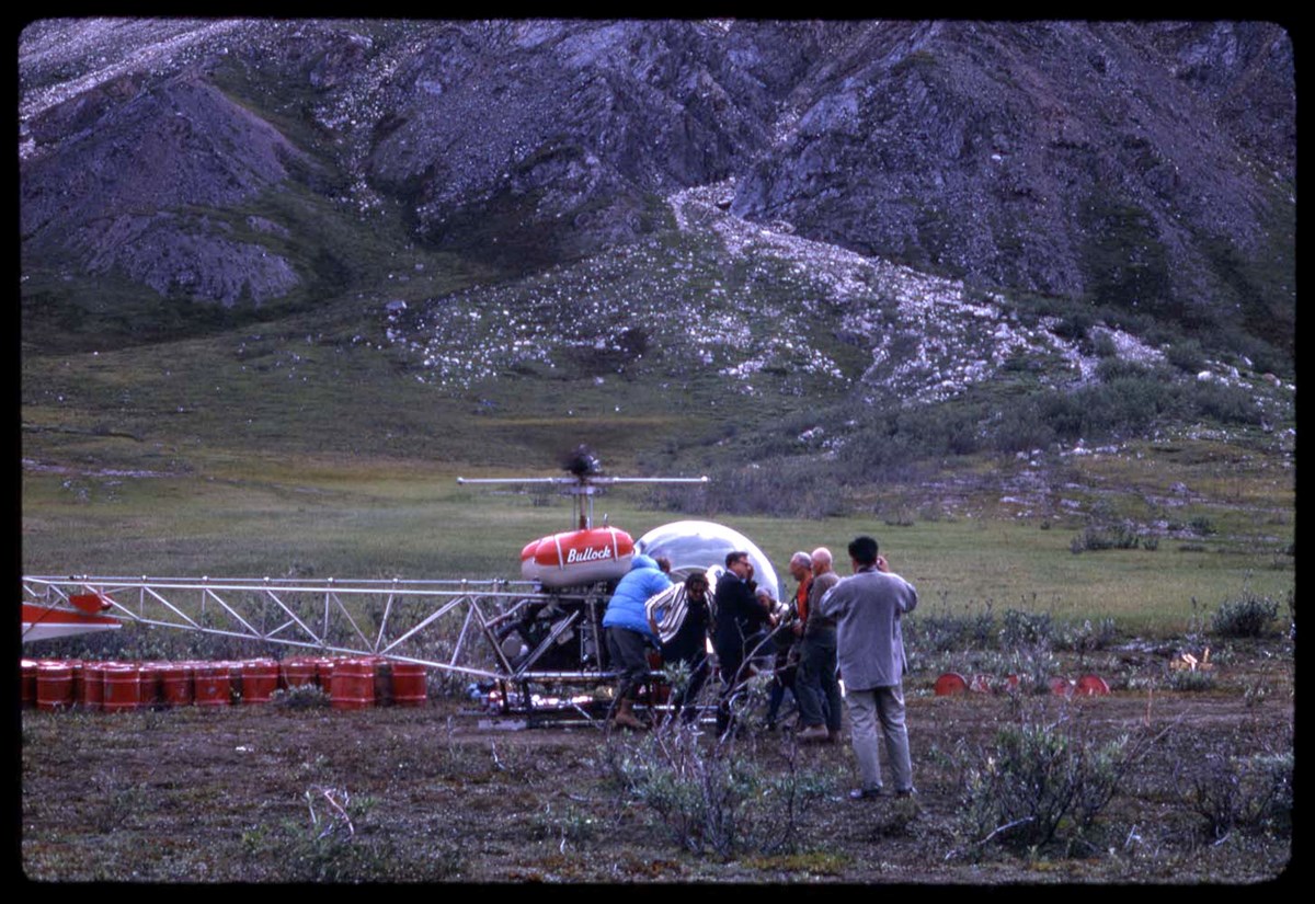
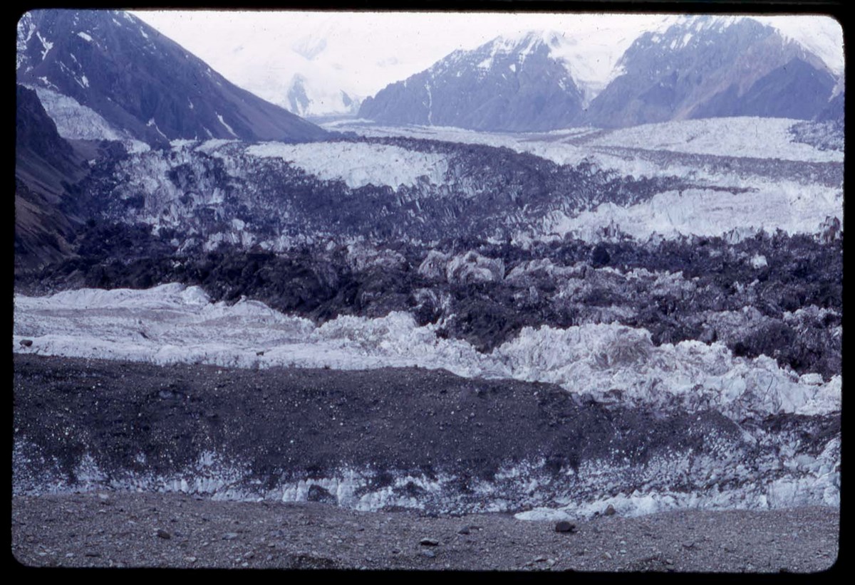
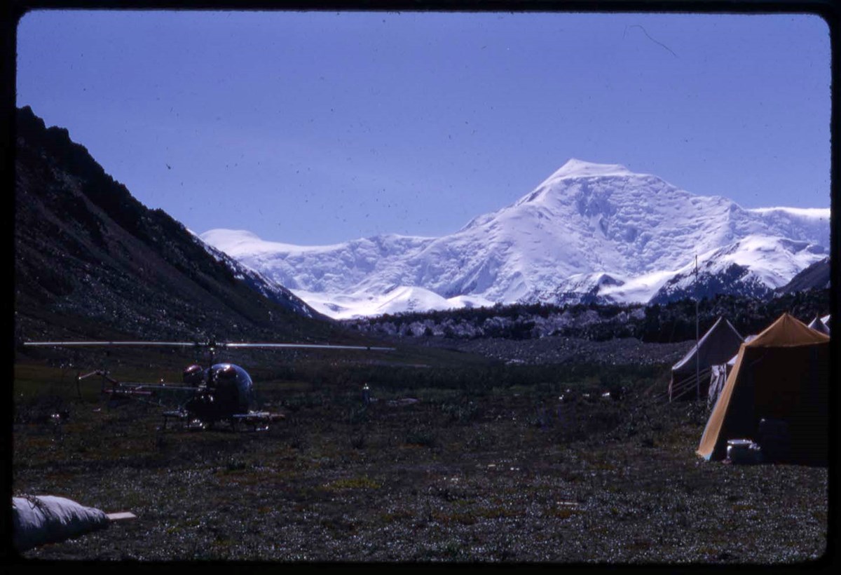
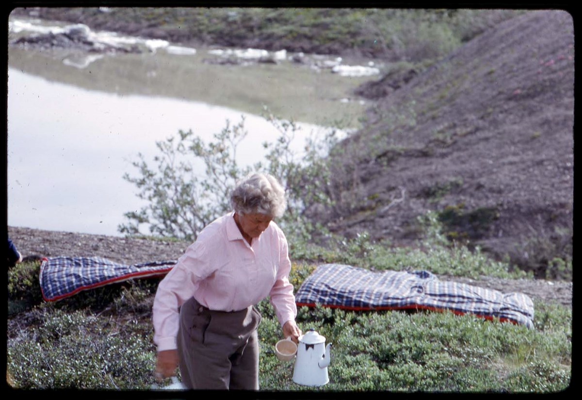
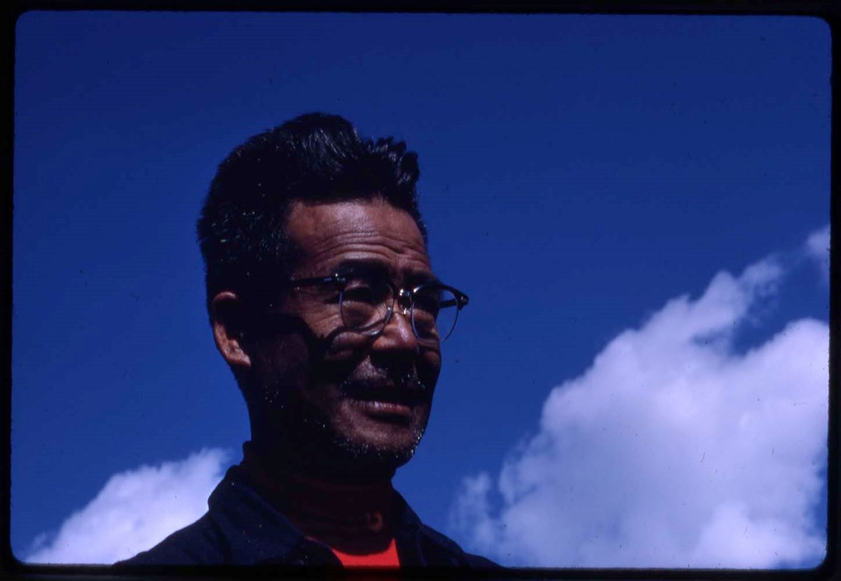
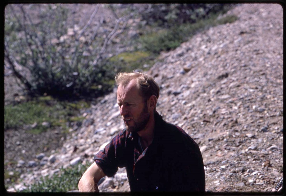
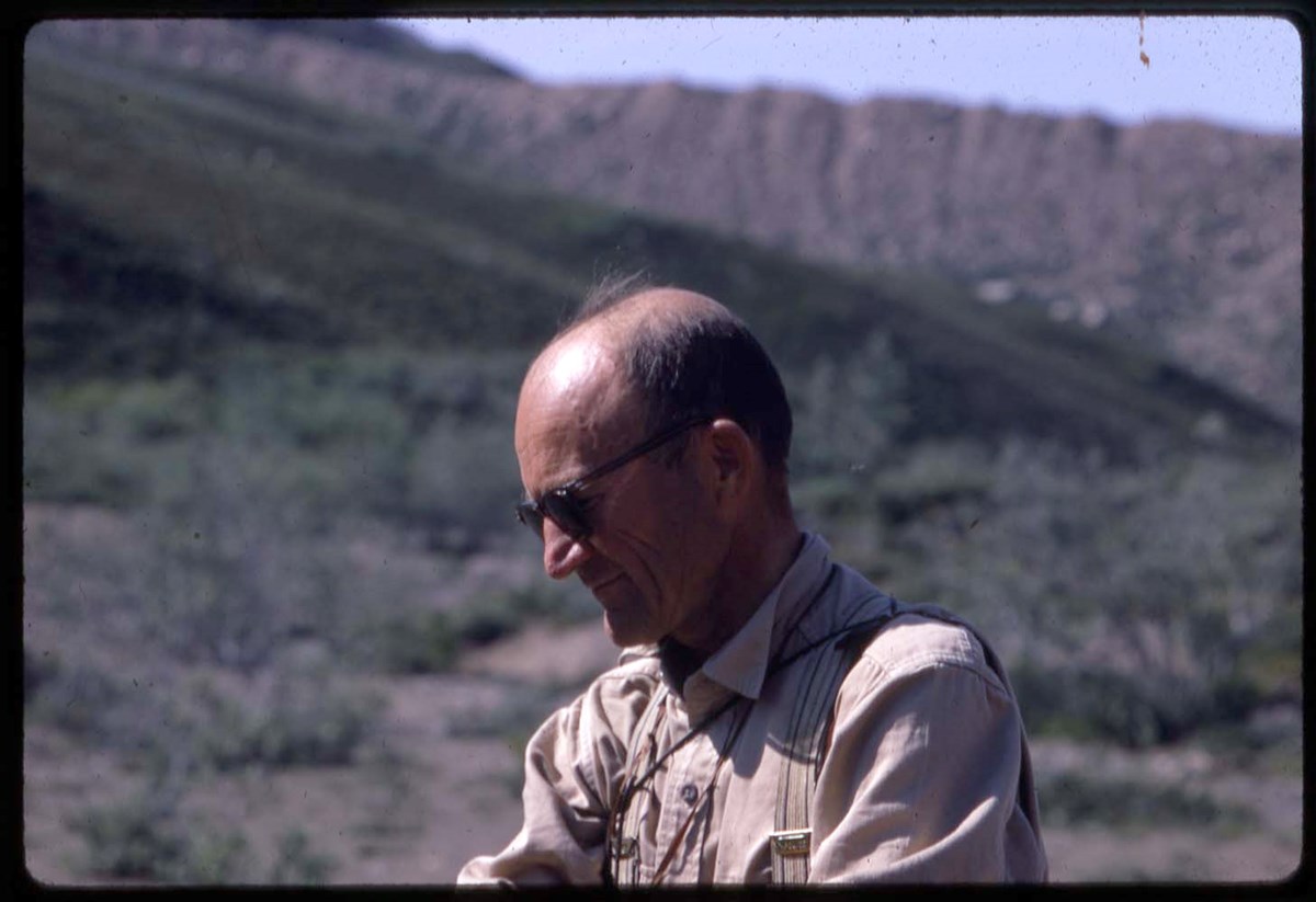
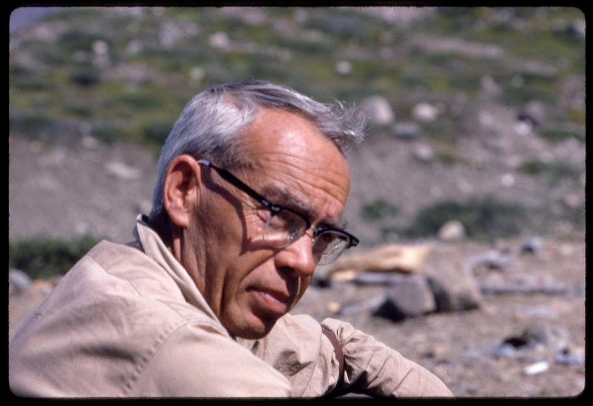
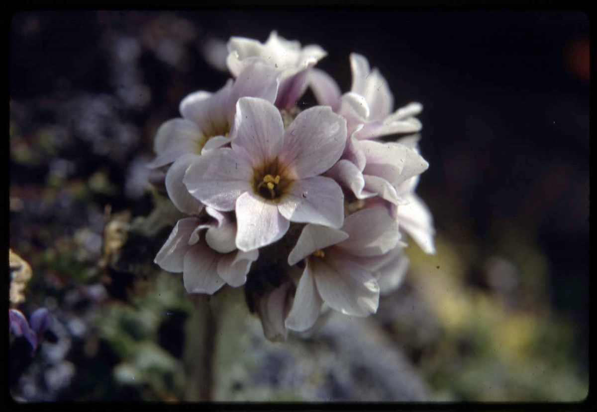
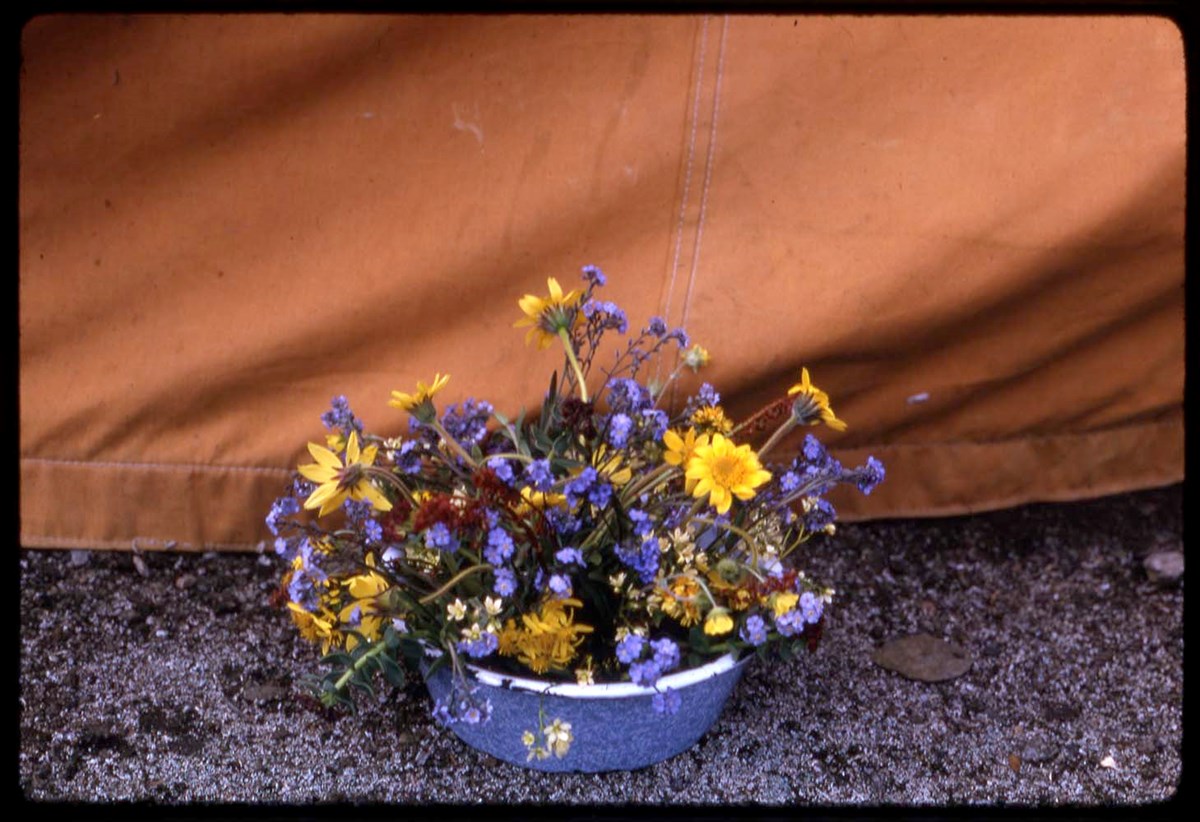
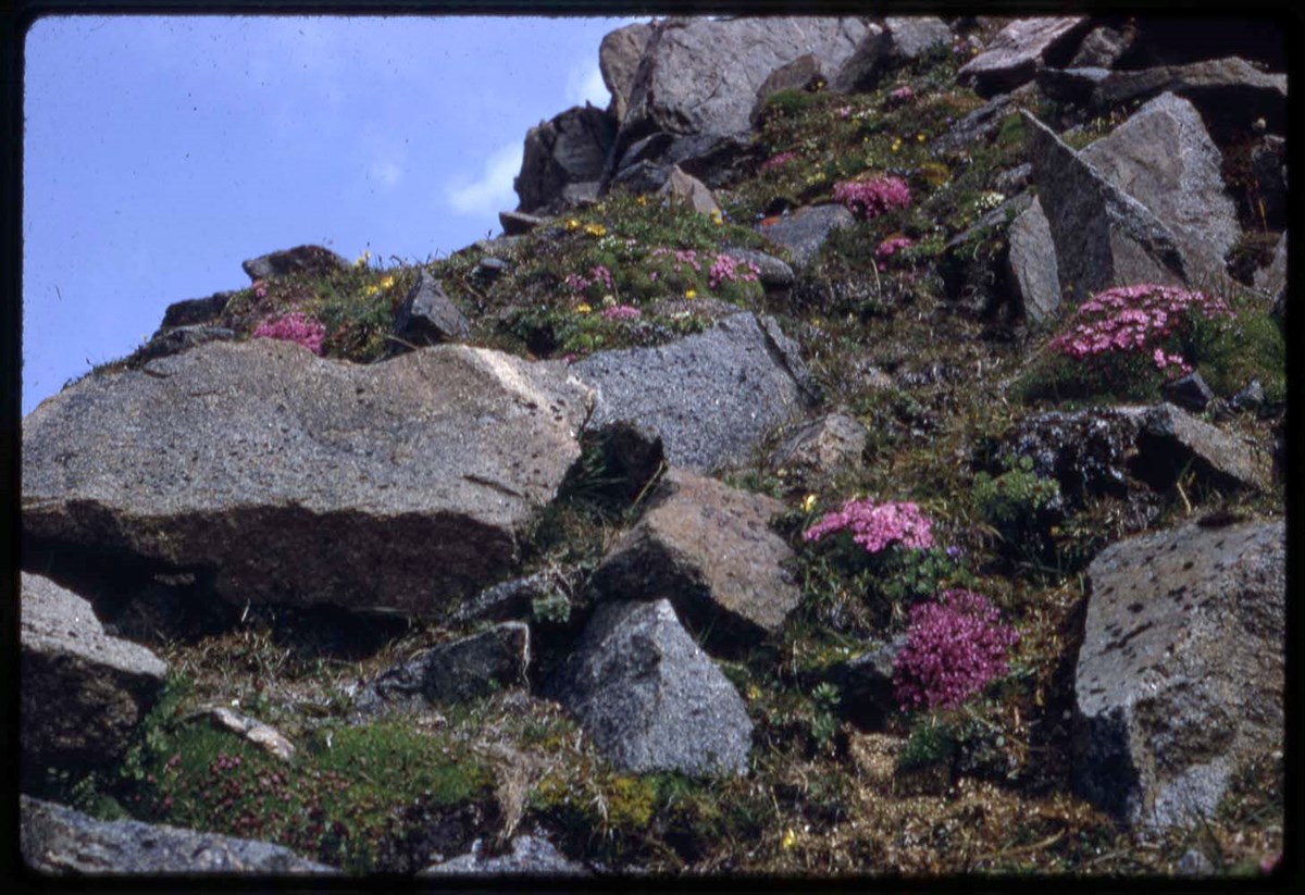
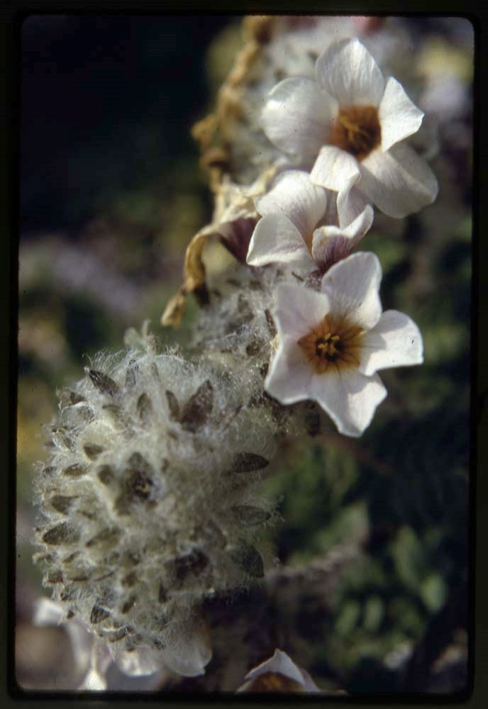
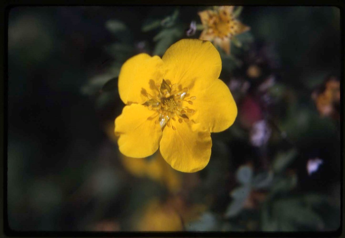
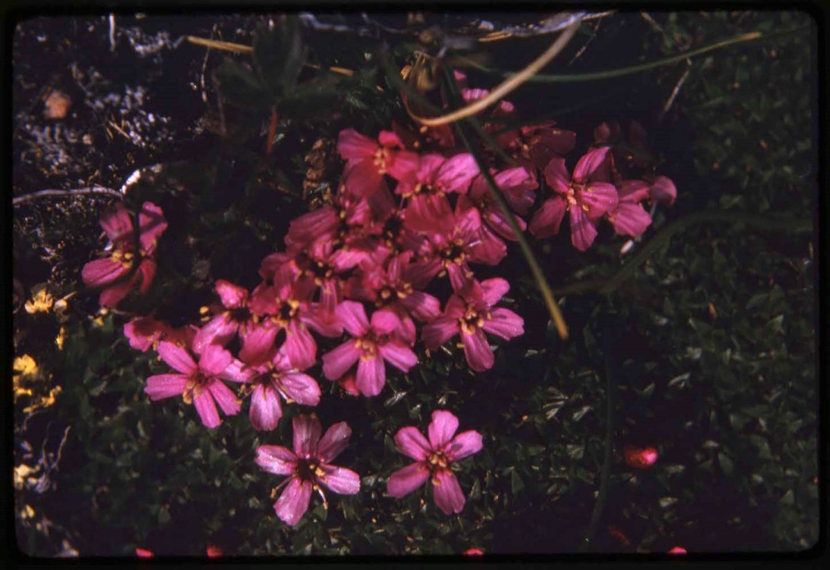
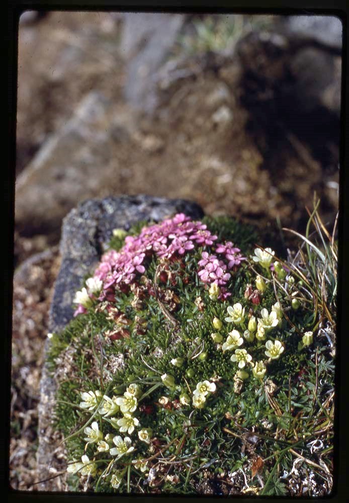
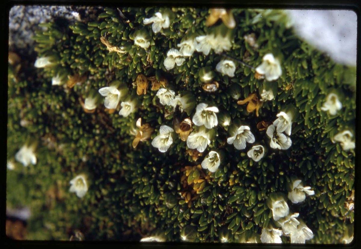
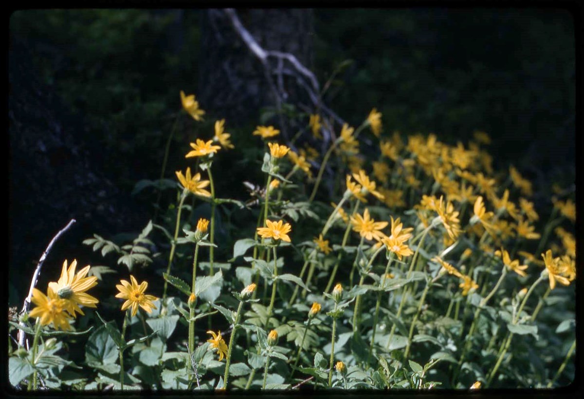
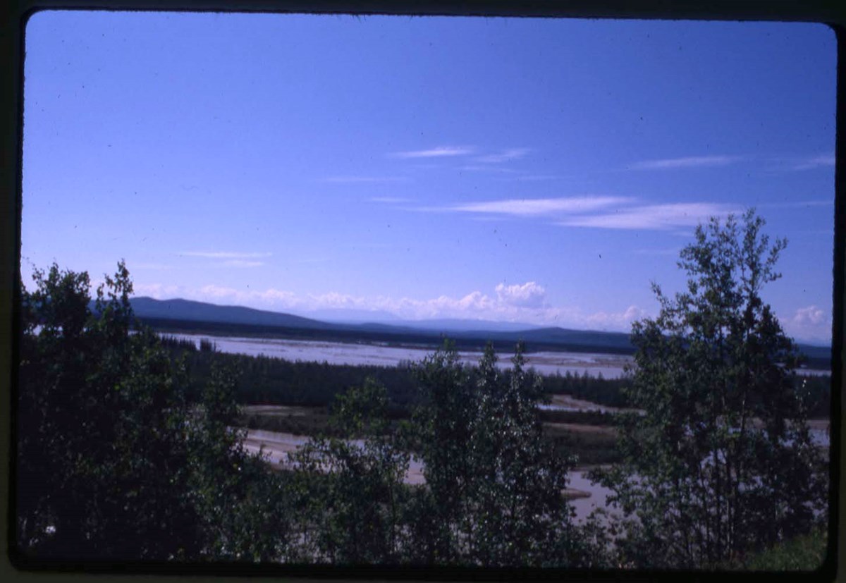
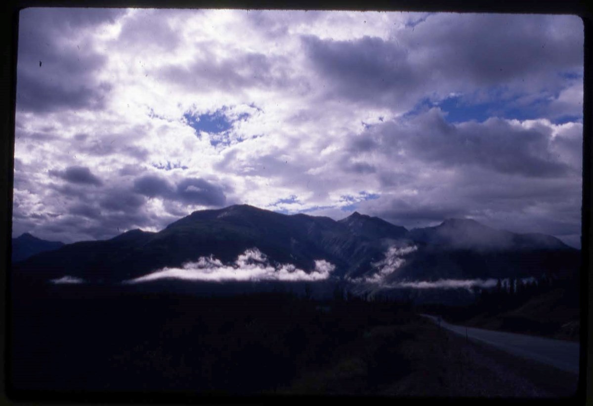
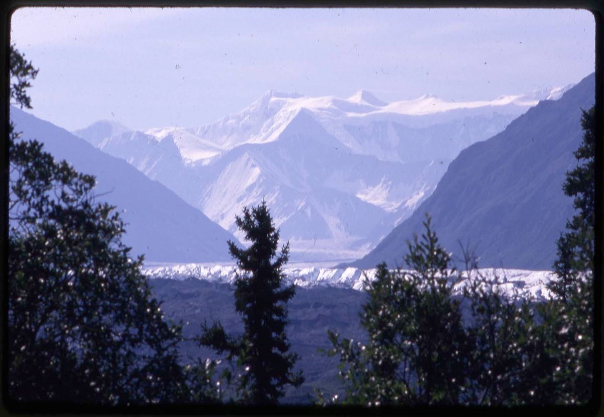
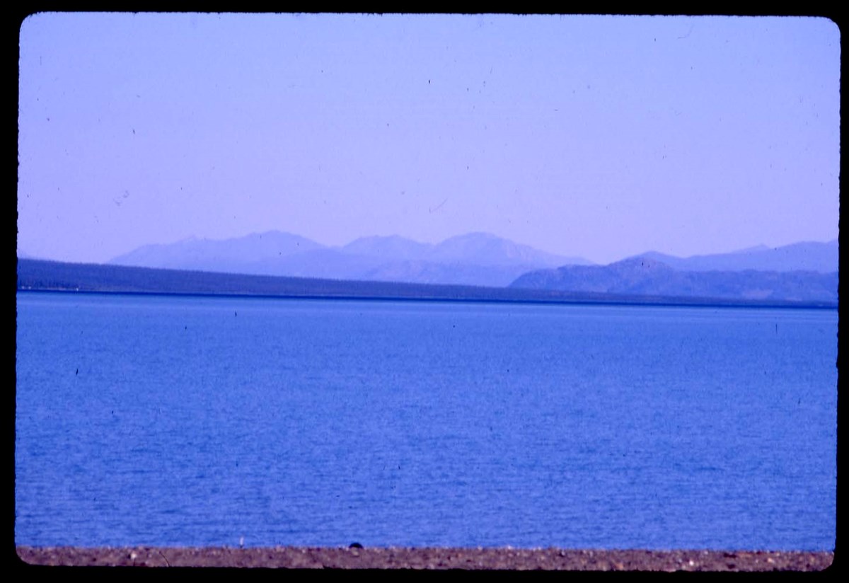
- File pertains to 1967 Yukon Alpine Centennial Expedition (YACE), including reconnaissance trip, 1966. The Alpine Club of Canada was an expedition sponsor. Also includes Yukon trip in 1988. Transparencies are annotated and are marked with an asterisk
- Date Range
- 1966-1967
- 1988
- Reference Code
- V46 / I / A / 44 / NS - 1 to 156
- Description Level
- 5 / File
- GMD
- Photograph
- Transparency
156 images
1 Electronic Resource
- Part Of
- Bob Hind fonds
- Description Level
- 5 / File
- Fonds Number
- M7
- V46
- Series
- I.A. Mountain travel and recreation, western Canada : Trips and activities
- Sous-Fonds
- V46
- Accession Number
- 7181
- Reference Code
- V46 / I / A / 44 / NS - 1 to 156
- Other Title Info
- Alternate title: Yukon 66-67-88, 1967, 88 Yukon, recce 66
- Date Range
- 1966-1967
- 1988
- Physical Description
- 162 photographs : transparencies, 35mm, col
- Scope & Content
- File pertains to 1967 Yukon Alpine Centennial Expedition (YACE), including reconnaissance trip, 1966. The Alpine Club of Canada was an expedition sponsor. Also includes Yukon trip in 1988. Transparencies are annotated and are marked with an asterisk
- Subject Access
- Camping
- Hiking
- Exploration
- Mountaineering
- Sports
- Recreation
- Geographic Access
- Yukon
- Language
- N/A
- Title Source
- Title basedon contents of file
- Content Details
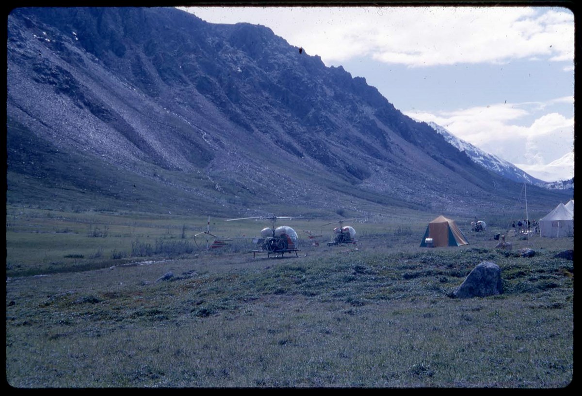
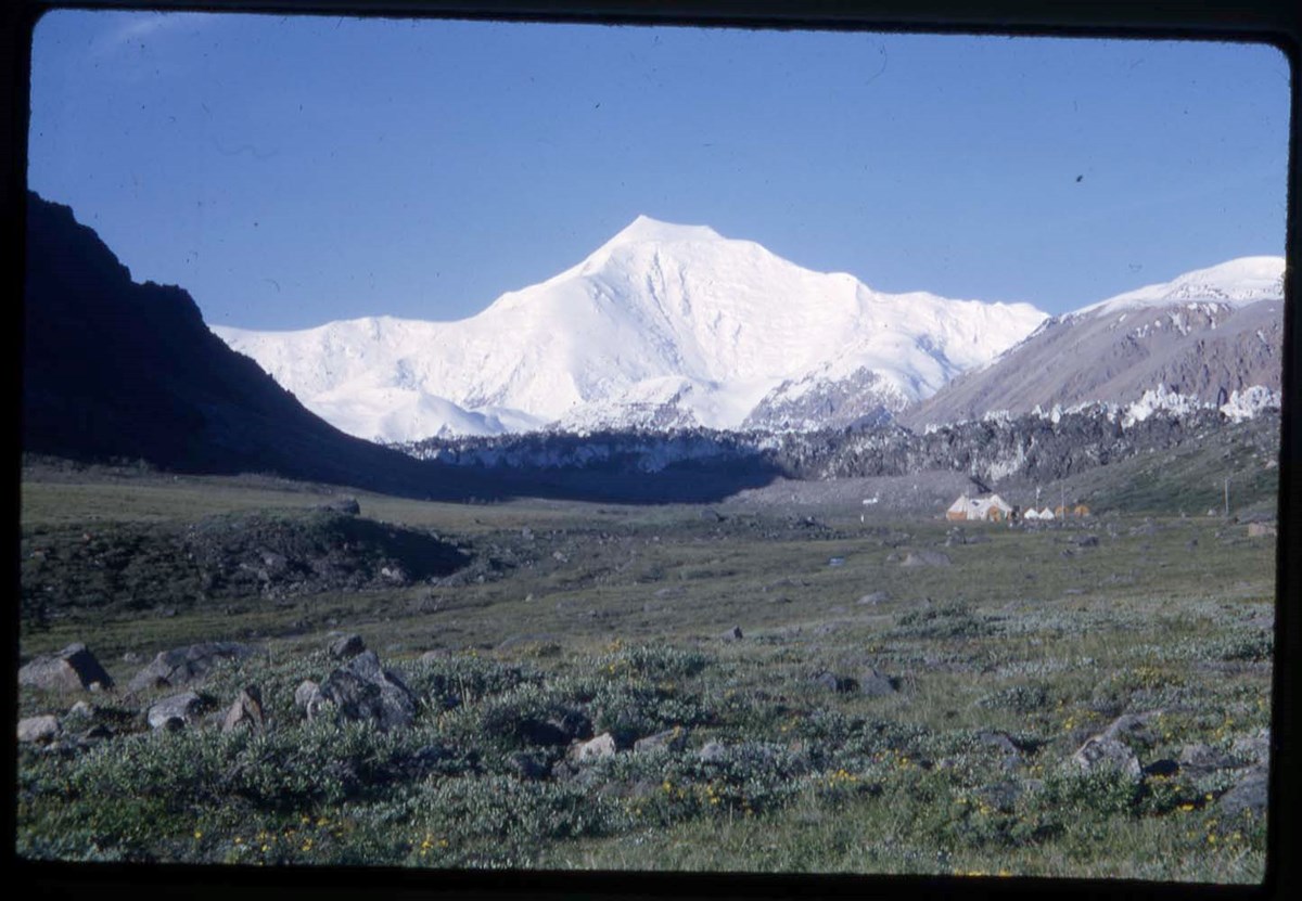
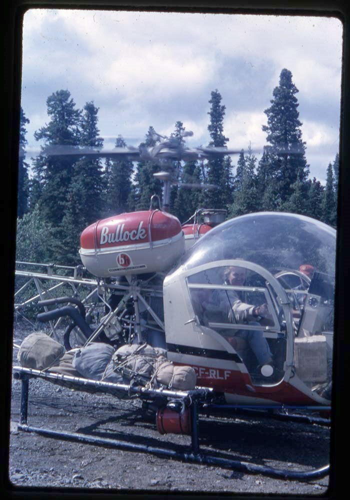
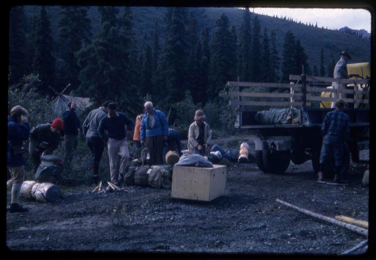
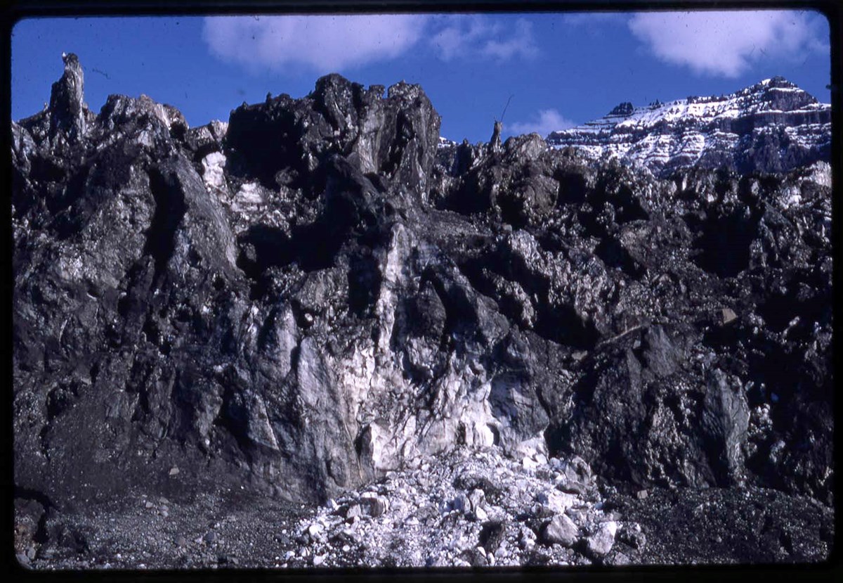
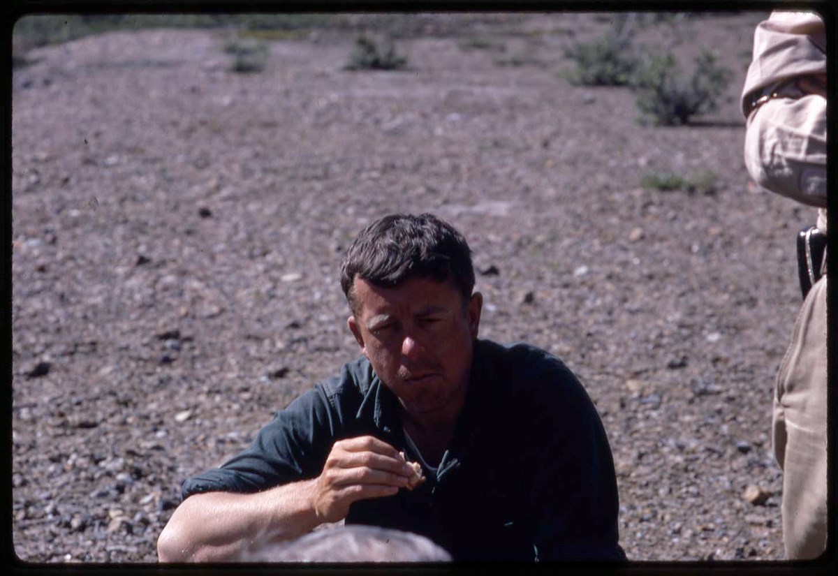
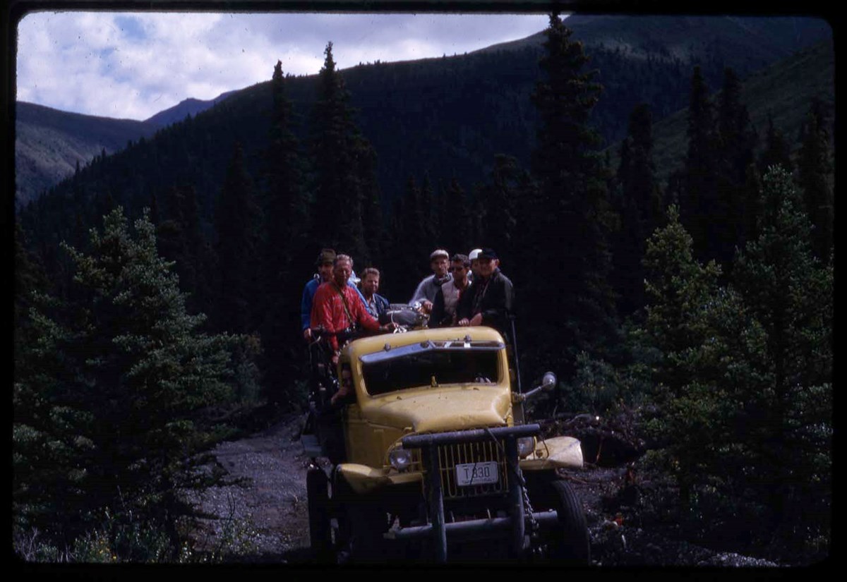
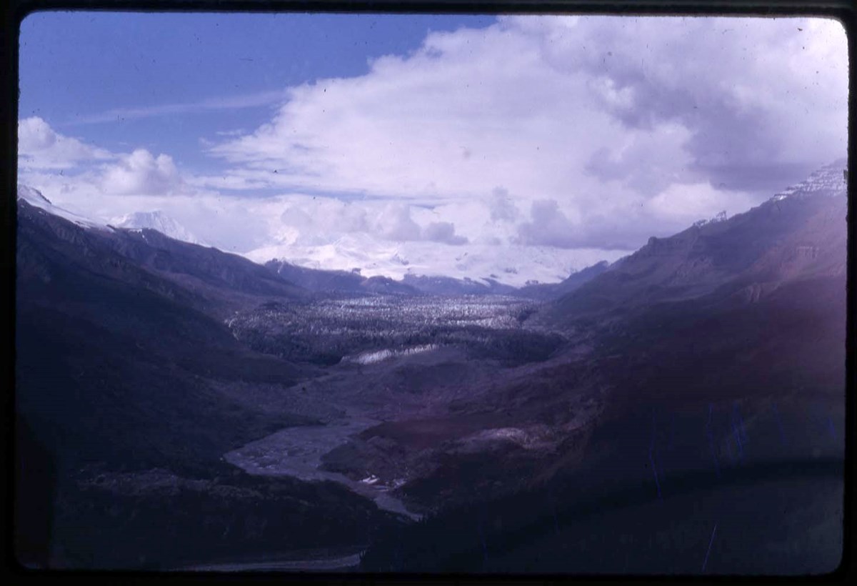
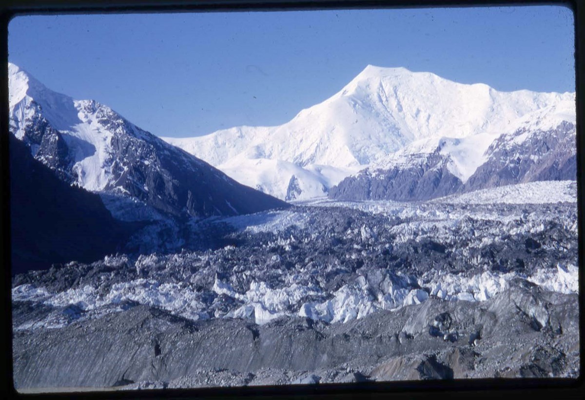
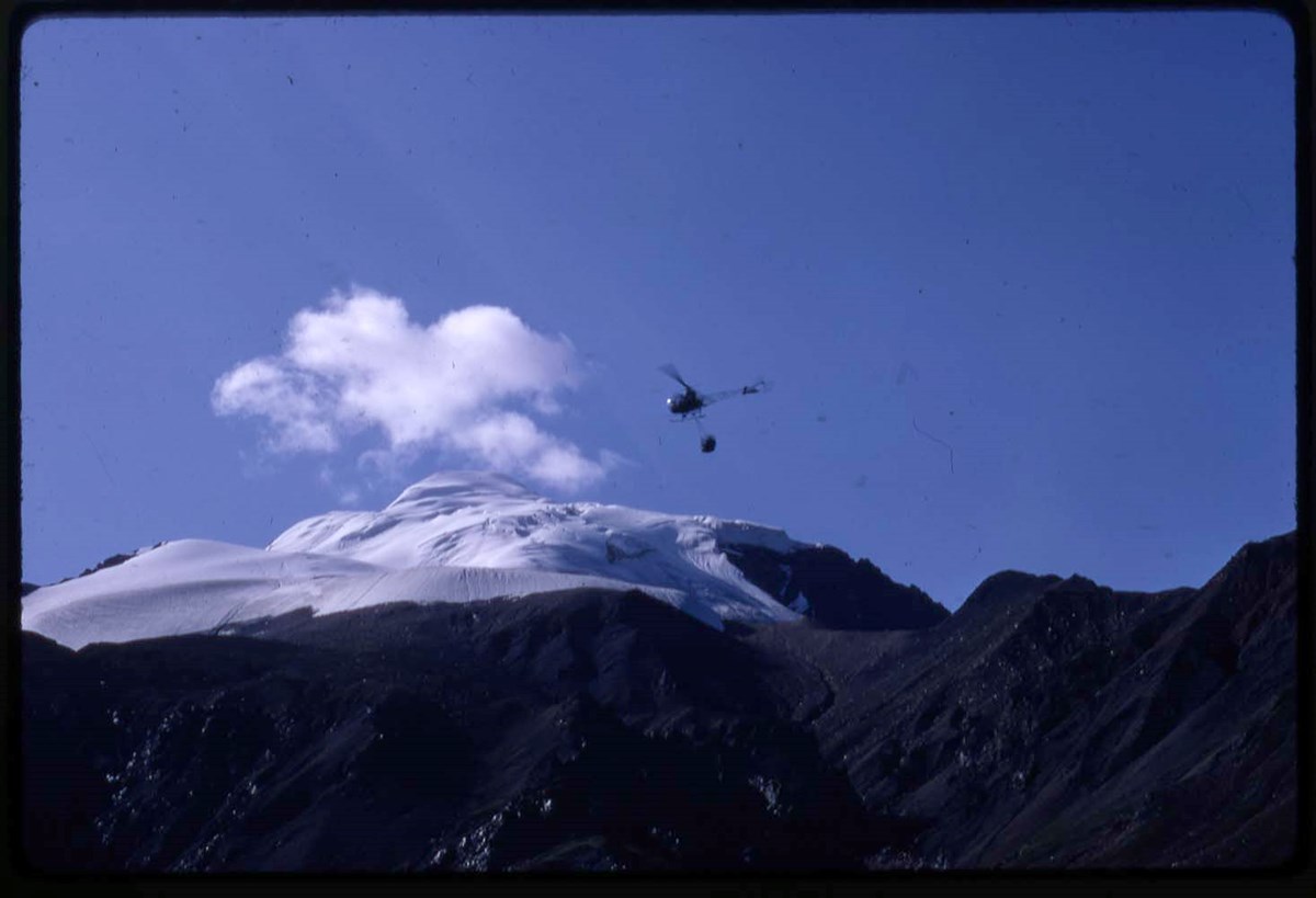
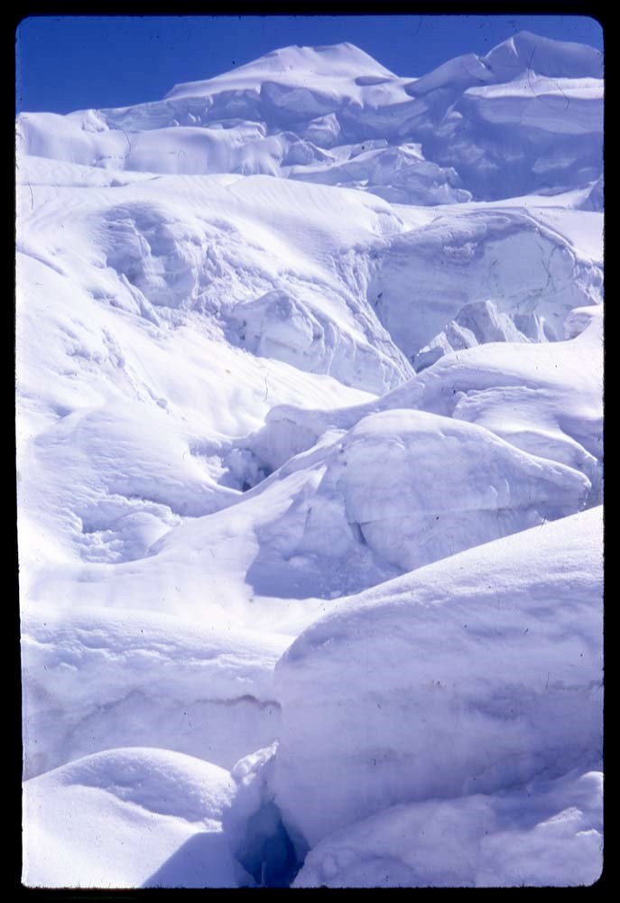
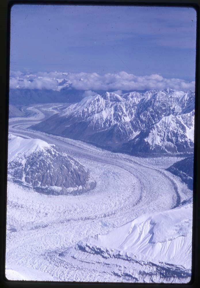
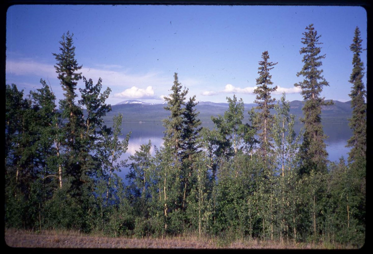
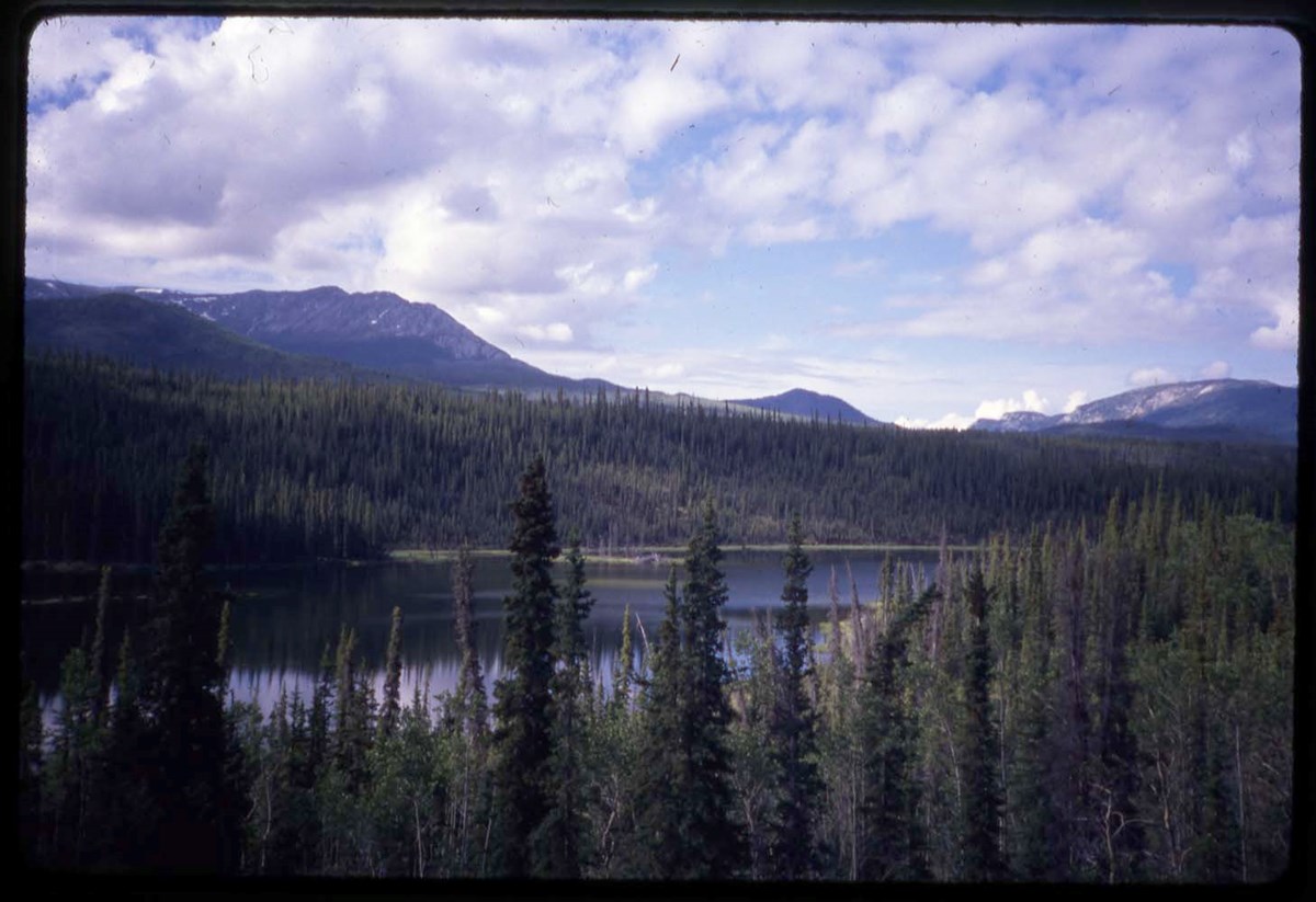
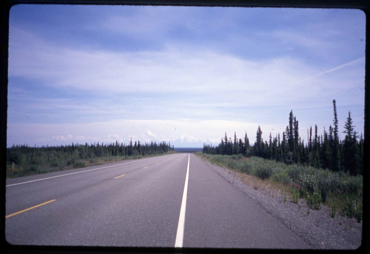
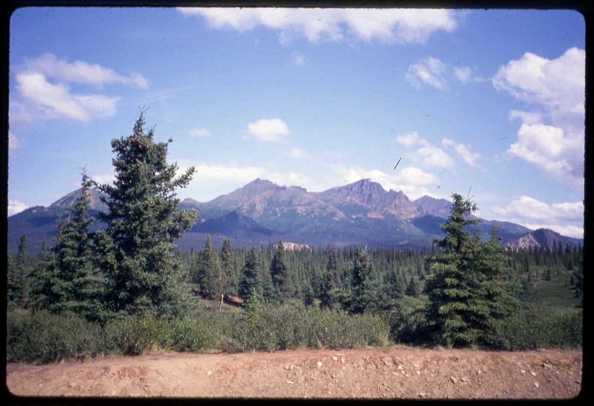
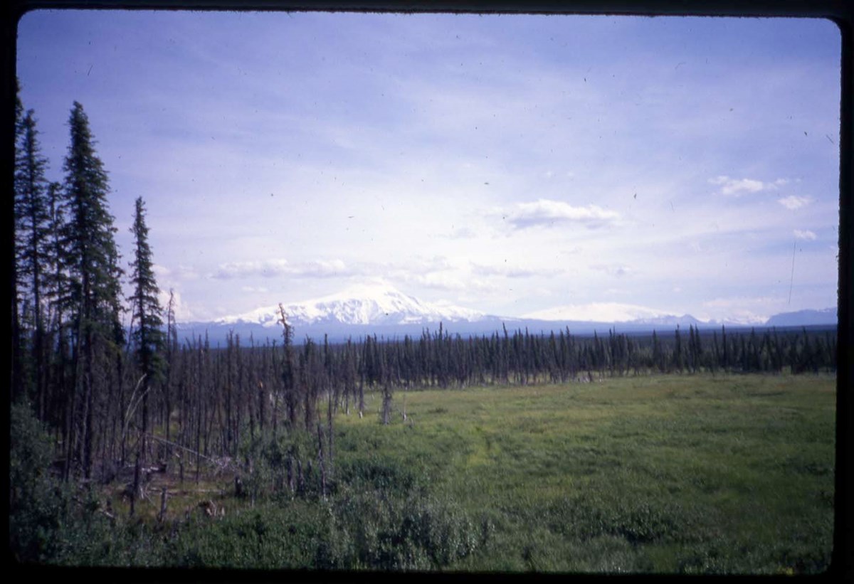
- LIST OF CONTENTS (V46 / 50) - 1966, 1967 :
- * YR66: Hind, aerial view - 1966
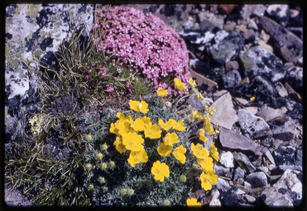
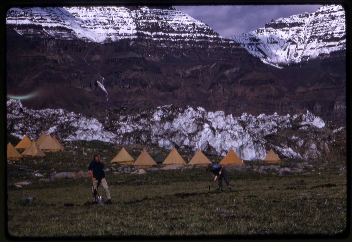
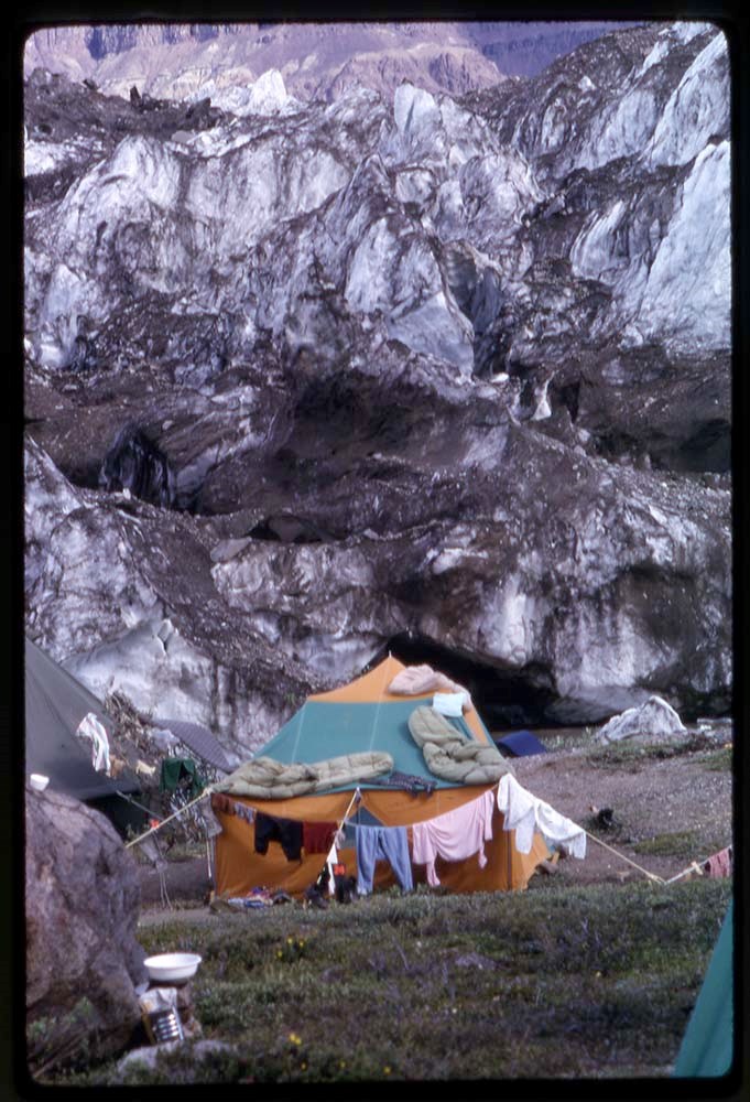
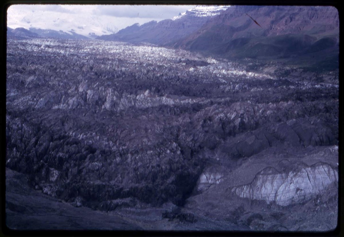
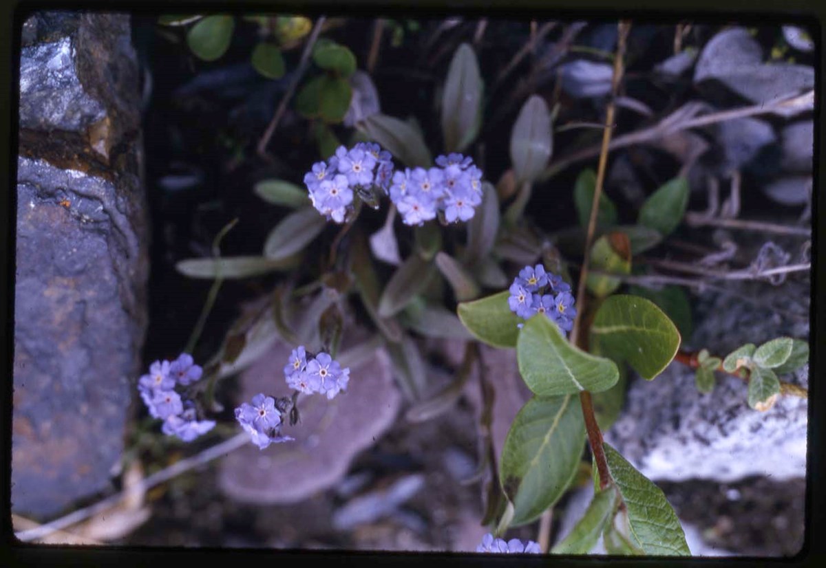
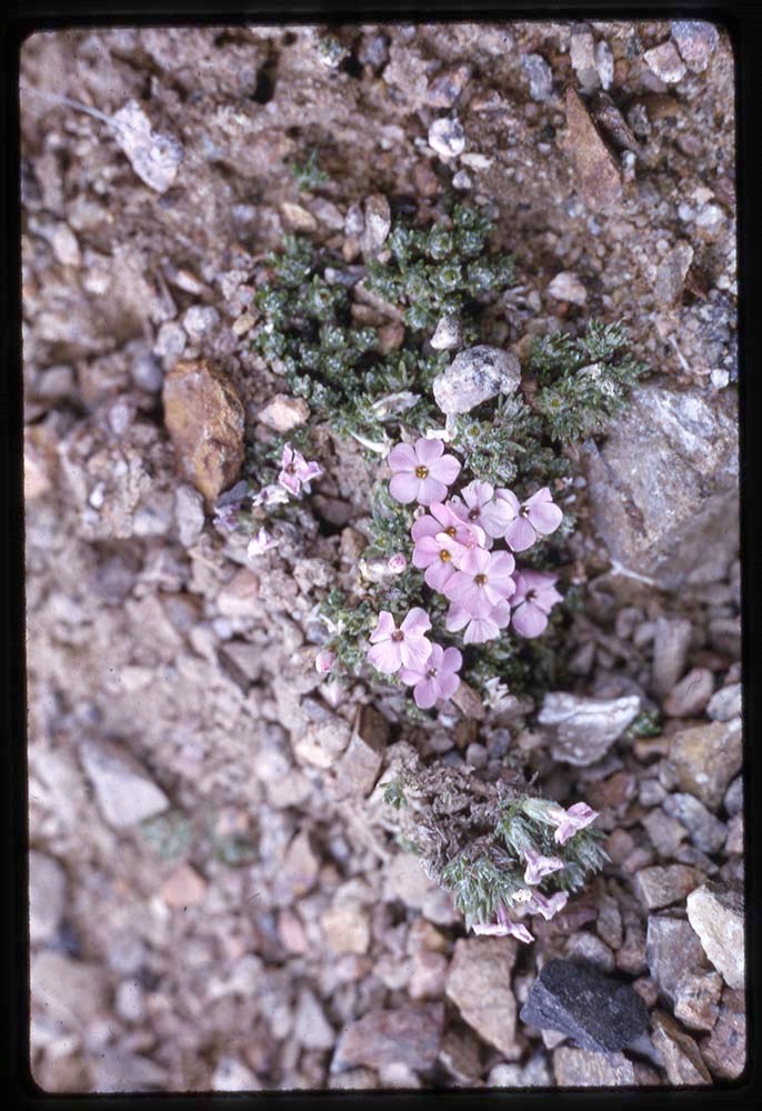
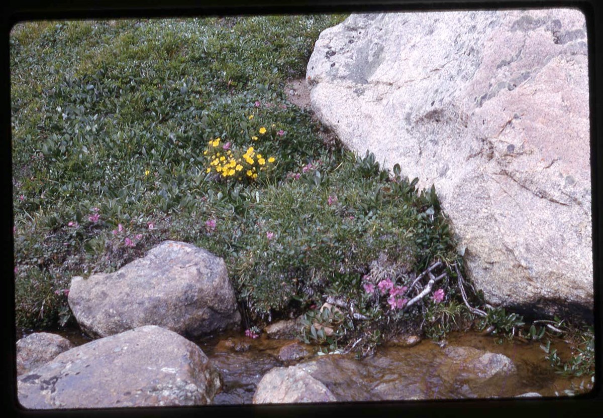
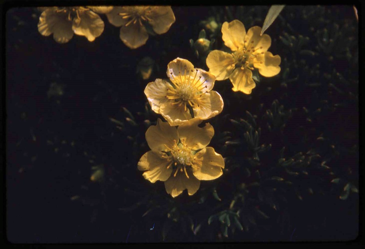
- * Y67: head shots, flora, camps and base camps, helicopter, climbing on glacier - 1967
- * Y67: flora, glacier - 1967
- * Y67: glacier, helicopter - 1967
- * Y67: flora - 1967
- * Y67, M1, T: flora, group shots, candid of Secretary of State Judy LaMarsh, camp with flags, helicopter, aerial view - 1967
- * Y67: camp, helicopter, aerial view, YACE informational sign and staging camp - 1967
- * Y67: RCH, glacier - 1967
- * Y67: camp, landscape views - 1967
- * Y67: Hind, camps, climbing on glacier, landscape views- 1967
- * Y67: helicopter, aerial view, expedition member - 1967
- * Y67: camp, helicopter, aerial view - 1967
- * Y67: Hind - 1967
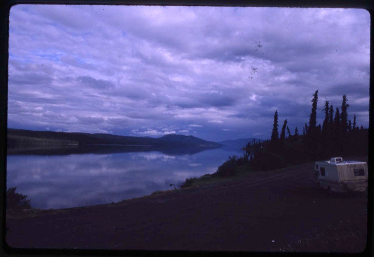
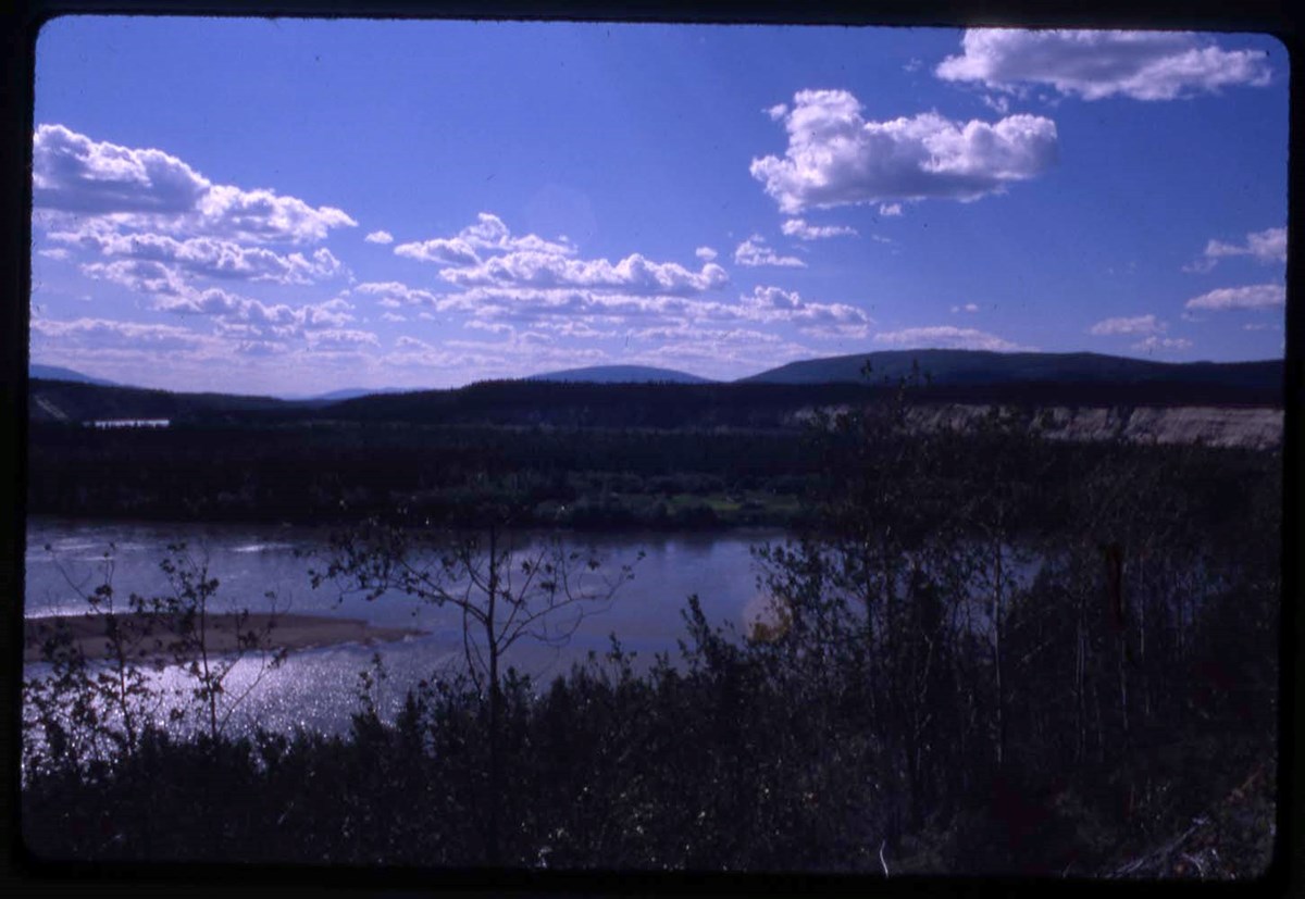
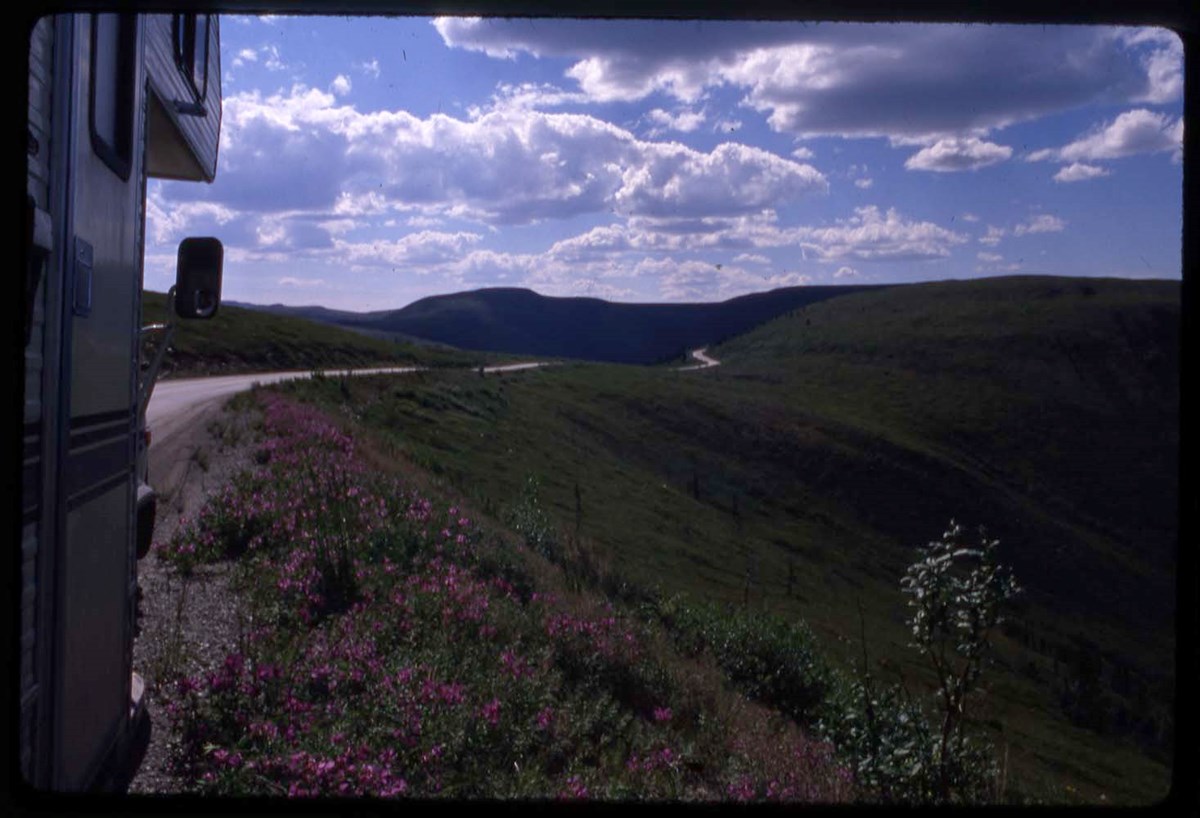
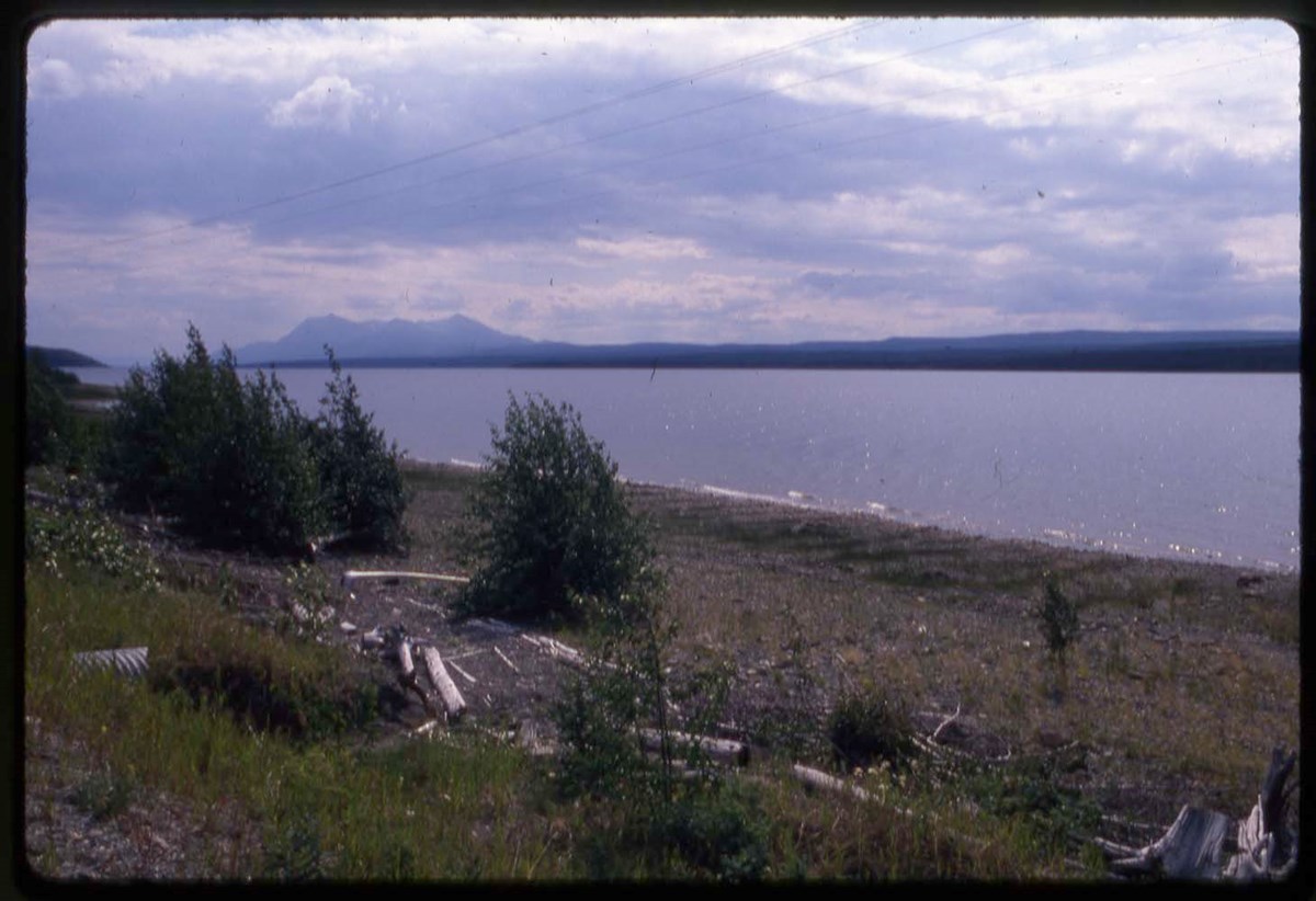
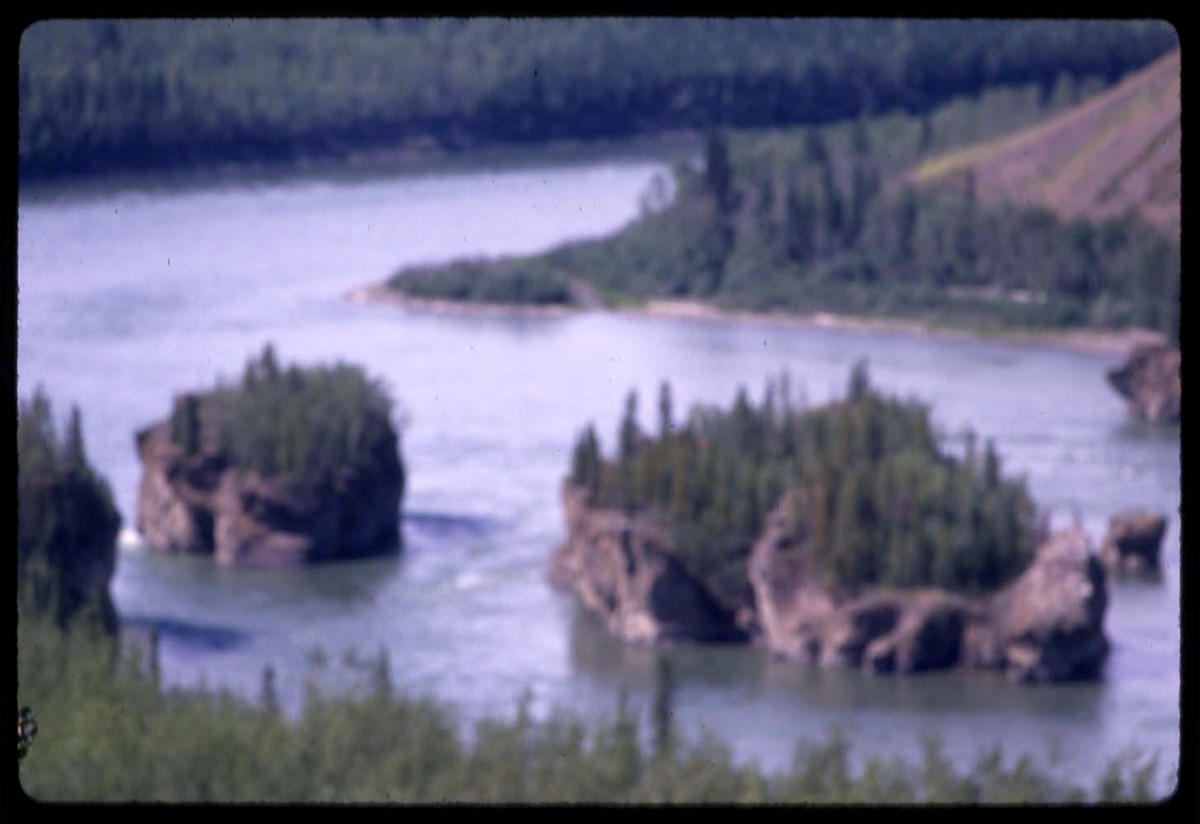
- LIST OF CONTENTS (V46 / 50) - 1988 :
- Note: transparency mounts dated 1989 (printing date)
- * R1 : forest views
- * R2 : road views, Dawson City
- * M1 : river
- * M2 : Mount McKinley, road views
- * M3 : river
- * Mount Robson, Mosquito Creek campground, Maligne Lake, Banff-Jasper Highway
- Processing Status
- Processed
Electronic Resources
Images


This material is presented as originally created; it may contain outdated cultural descriptions and
potentially offensive content.
Read more.
Travel guides - Canmore, Kananaskis
https://archives.whyte.org/en/permalink/descriptions55910
- Part Of
- Ben Gadd fonds
- Scope & Content
- File consists of travel guides collected by Ben Gadd pertaining to areas near Canmore and Kananaskis.
- Date Range
- 1998
- 2006
- Reference Code
- M590 / I / A / i / 1 to 2
- Description Level
- 5 / File
- GMD
- Published record
- Textual record
- Map
- Part Of
- Ben Gadd fonds
- Description Level
- 5 / File
- Fonds Number
- M590
- V810
- S61
- Series
- M590 / I : Personal records
- Sous-Fonds
- M590
- Sub-Series
- M590 / I / A : Travel guides and maps
- Accession Number
- 2021.20
- Reference Code
- M590 / I / A / i / 1 to 2
- Date Range
- 1998
- 2006
- Physical Description
- 4 cm of textual records
- Scope & Content
- File consists of travel guides collected by Ben Gadd pertaining to areas near Canmore and Kananaskis.
- Subject Access
- Geography
- Travel
- Tourism
- Tourist information
- Geographic Access
- Canada
- Alberta
- Canmore
- Kananaskis
- Reproduction Restrictions
- Copyright restrictions may apply
- Language
- English
- Category
- Exploration, discovery and travel
- Title Source
- Title based on contents of file
- Processing Status
- Processed
This material is presented as originally created; it may contain outdated cultural descriptions and
potentially offensive content.
Read more.
Travel guides - Lake Louise, Yoho
https://archives.whyte.org/en/permalink/descriptions55913
- Part Of
- Ben Gadd fonds
- Scope & Content
- File consists of travel guides collected by Ben Gadd pertaining to areas near Lake Louise and Yoho National Park.
- Date Range
- 1998
- 2001
- Reference Code
- M590 / I / A / i / 3
- Description Level
- 5 / File
- GMD
- Published record
- Textual record
- Map
- Part Of
- Ben Gadd fonds
- Description Level
- 5 / File
- Fonds Number
- M590
- V810
- S61
- Series
- M590 / I : Personal records
- Sous-Fonds
- M590
- Sub-Series
- M590 / I / A : Travel guides and maps
- Accession Number
- 2021.20
- Reference Code
- M590 / I / A / i / 3
- Date Range
- 1998
- 2001
- Physical Description
- 2 cm of textual records
- Scope & Content
- File consists of travel guides collected by Ben Gadd pertaining to areas near Lake Louise and Yoho National Park.
- Subject Access
- Geography
- Travel
- Tourism
- Tourist information
- Geographic Access
- Canada
- Alberta
- British Columbia
- Lake Louise
- Yoho National Park
- Reproduction Restrictions
- Copyright restrictions may apply
- Language
- English
- Category
- Exploration, discovery and travel
- Title Source
- Title based on contents of file
- Processing Status
- Processed
This material is presented as originally created; it may contain outdated cultural descriptions and
potentially offensive content.
Read more.
Travel guides - Icefields
https://archives.whyte.org/en/permalink/descriptions55917
- Part Of
- Ben Gadd fonds
- Scope & Content
- File consists of travel guides collected by Ben Gadd pertaining to Columbia Icefield, Icefields Parkway and the Wapta Icefields.
- Date Range
- 1994
- [ca.2000]
- Reference Code
- M590 / I / A / i / 7
- Description Level
- 5 / File
- GMD
- Published record
- Textual record
- Map
- Part Of
- Ben Gadd fonds
- Description Level
- 5 / File
- Fonds Number
- M590
- V810
- S61
- Series
- M590 / I : Personal records
- Sous-Fonds
- M590
- Sub-Series
- M590 / I / A : Travel guides and maps
- Accession Number
- 2021.20
- Reference Code
- M590 / I / A / i / 7
- Date Range
- 1994
- [ca.2000]
- Physical Description
- 1 cm of textual records
- Scope & Content
- File consists of travel guides collected by Ben Gadd pertaining to Columbia Icefield, Icefields Parkway and the Wapta Icefields.
- Notes
- Travel guide of Wapta Icefields includes annotations on cover by Ben Gadd.
- Subject Access
- Geography
- Travel
- Tourism
- Tourist information
- Geographic Access
- Canada
- Alberta
- Jasper National Park
- Columbia Icefield
- Icefields Parkway
- British Columbia
- Wapta Icefields
- Reproduction Restrictions
- Copyright restrictions may apply
- Language
- English
- Category
- Exploration, discovery and travel
- Title Source
- Title based on contents of file
- Processing Status
- Processed
This material is presented as originally created; it may contain outdated cultural descriptions and
potentially offensive content.
Read more.
Travel guides - Waterton Lakes
https://archives.whyte.org/en/permalink/descriptions55918
- Part Of
- Ben Gadd fonds
- Scope & Content
- File consists of travel guides collected by Ben Gadd pertaining to Waterton Lakes National Park.
- Date Range
- [ca.1995-2000]
- Reference Code
- M590 / I / A / i / 8
- Description Level
- 5 / File
- GMD
- Published record
- Textual record
- Map
- Part Of
- Ben Gadd fonds
- Description Level
- 5 / File
- Fonds Number
- M590
- V810
- S61
- Series
- M590 / I : Personal records
- Sous-Fonds
- M590
- Sub-Series
- M590 / I / A : Travel guides and maps
- Accession Number
- 2021.20
- Reference Code
- M590 / I / A / i / 8
- Date Range
- [ca.1995-2000]
- Physical Description
- 1.5 cm of textual records
- Scope & Content
- File consists of travel guides collected by Ben Gadd pertaining to Waterton Lakes National Park.
- Notes
- One guide includes annotations on cover by Ben Gadd.
- Subject Access
- Geography
- Travel
- Tourism
- Tourist information
- Geographic Access
- Canada
- Alberta
- Waterton
- Waterton Lakes National Park
- Reproduction Restrictions
- Copyright restrictions may apply
- Language
- English
- Category
- Exploration, discovery and travel
- Title Source
- Title based on contents of file
- Processing Status
- Processed
This material is presented as originally created; it may contain outdated cultural descriptions and
potentially offensive content.
Read more.
Travel guides - Calgary, Bragg Creek, Edmonton
https://archives.whyte.org/en/permalink/descriptions55919
- Part Of
- Ben Gadd fonds
- Scope & Content
- File consists of travel guides collected by Ben Gadd pertaining to Calgary, Bragg Creek, Edmonton and surrounding areas.
- Date Range
- 1999
- 2003
- 2004
- Reference Code
- M590 / I / A / i / 9
- Description Level
- 5 / File
- GMD
- Published record
- Textual record
- Map
- Part Of
- Ben Gadd fonds
- Description Level
- 5 / File
- Fonds Number
- M590
- V810
- S61
- Series
- M590 / I : Personal records
- Sous-Fonds
- M590
- Sub-Series
- M590 / I / A : Travel guides and maps
- Accession Number
- 2021.20
- Reference Code
- M590 / I / A / i / 9
- Date Range
- 1999
- 2003
- 2004
- Physical Description
- 2 cm of textual records
- Scope & Content
- File consists of travel guides collected by Ben Gadd pertaining to Calgary, Bragg Creek, Edmonton and surrounding areas.
- Notes
- Some items in file are annotated
- Subject Access
- Geography
- Travel
- Tourism
- Tourist information
- Geographic Access
- Canada
- Alberta
- Calgary
- Bragg Creek
- Edmonton
- Reproduction Restrictions
- Copyright restrictions may apply
- Language
- English
- Category
- Exploration, discovery and travel
- Title Source
- Title based on contents of file
- Processing Status
- Processed
This material is presented as originally created; it may contain outdated cultural descriptions and
potentially offensive content.
Read more.
Travel guides - United States, Italy
https://archives.whyte.org/en/permalink/descriptions55928
- Part Of
- Ben Gadd fonds
- Scope & Content
- File consists of travel guides collected by Ben Gadd pertaining to Olympic National Park and other destinations in the United States and Italy.
- Date Range
- [ca.1990-2010]
- Reference Code
- M590 / I / A / i / 14
- Description Level
- 5 / File
- GMD
- Published record
- Textual record
- Map
- Part Of
- Ben Gadd fonds
- Description Level
- 5 / File
- Fonds Number
- M590
- V810
- S61
- Series
- M590 / I : Personal records
- Sous-Fonds
- M590
- Sub-Series
- M590 / I / A : Travel guides and maps
- Accession Number
- 2021.20
- Reference Code
- M590 / I / A / i / 14
- Date Range
- [ca.1990-2010]
- Physical Description
- 2 cm of textual records
- Scope & Content
- File consists of travel guides collected by Ben Gadd pertaining to Olympic National Park and other destinations in the United States and Italy.
- Subject Access
- Geography
- Travel
- Tourism
- Tourist information
- National parks and reserves
- Geographic Access
- United States of America
- Washington
- Hawaii
- Italy
- Reproduction Restrictions
- Copyright restrictions may apply
- Language
- English
- Category
- Exploration, discovery and travel
- Title Source
- Title based on contents of file
- Processing Status
- Processed
This material is presented as originally created; it may contain outdated cultural descriptions and
potentially offensive content.
Read more.
Geology photos for geological views
https://archives.whyte.org/en/permalink/descriptions55990
- Part Of
- Ben Gadd fonds
- Scope & Content
- File consists of printed photographs compiled by Ben Gadd pertaining to his book, Handbook of the Canadian Rockies. Images depict mountain views; bighorn sheep posing on steep rock; and highway views, possibly including Icefields Parkway.
- Date Range
- [ca.1990-1995]
- Reference Code
- V810 / II / A / PA - 40 to 138
- Description Level
- 5 / File
- GMD
- Photograph
- Part Of
- Ben Gadd fonds
- Description Level
- 5 / File
- Fonds Number
- M590
- V810
- S61
- Series
- V810 / II : Research and publication records
- Sous-Fonds
- V810
- Sub-Series
- V810 / II / B : Handbook of the Canadian Rockies
- Accession Number
- 2021.20
- Reference Code
- V810 / II / A / PA - 40 to 138
- GMD
- Photograph
- Responsibility
- Produced by Ben Gadd
- Date Range
- [ca.1990-1995]
- Physical Description
- 99 photographs : col. prints ; 15 x 10 cm
- Scope & Content
- File consists of printed photographs compiled by Ben Gadd pertaining to his book, Handbook of the Canadian Rockies. Images depict mountain views; bighorn sheep posing on steep rock; and highway views, possibly including Icefields Parkway.
- Material Details
- Photographs were originally stored in Tekarra Color Lab envelope
- Subject Access
- Publication
- Landscapes
- Travel
- Roads
- Wildlife
- Bighorn Sheep
- Mountains
- Geology
- Environment
- Natural history
- Geographic Access
- Canada
- Alberta
- Columbia Icefield
- Jasper National Park
- Canadian Rocky Mountains
- Reproduction Restrictions
- Restrictions may apply
- Language
- English
- Title Source
- Original title used
- Processing Status
- Processed
This material is presented as originally created; it may contain outdated cultural descriptions and
potentially offensive content.
Read more.
Canadian Pacific souvenir and travel publications
https://archives.whyte.org/en/permalink/descriptions54726
- Part Of
- Luxton family fonds
- Scope & Content
- File consists of brochures, souvenir booklets, travel guides and related materials pertaining to Canadian Pacific trips and destinations within North America. Locations include: Banff Springs Hotel and Banff National Park; the Empress Hotel in Victoria; British Columbia; Ontario and the the Great L…
- Date Range
- [1905-1911]
- 1909
- [1915-1920]
- 1917-1918
- 1920-1921
- 1923
- 1928-1929
- 1931
- 1935-1938
- 1940
- [1940-1950]
- 1974
- Reference Code
- LUX / II / C4 / 15 to 17
- Description Level
- 5 / File
- GMD
- Textual record
- Published record
- Part Of
- Luxton family fonds
- Description Level
- 5 / File
- Fonds Number
- LUX
- Series
- LUX / II / C : Personal material
- Sous-Fonds
- LUX / II : Eleanor Luxton sous-fonds
- Sub-Series
- LUX / II / C4 : Travel and hobbies
- Accession Number
- LUX
- Reference Code
- LUX / II / C4 / 15 to 17
- Date Range
- [1905-1911]
- 1909
- [1915-1920]
- 1917-1918
- 1920-1921
- 1923
- 1928-1929
- 1931
- 1935-1938
- 1940
- [1940-1950]
- 1974
- Physical Description
- 7.5 cm of textual records
- Scope & Content
- File consists of brochures, souvenir booklets, travel guides and related materials pertaining to Canadian Pacific trips and destinations within North America. Locations include: Banff Springs Hotel and Banff National Park; the Empress Hotel in Victoria; British Columbia; Ontario and the the Great Lakes; Quebec; Alaska; and the Pacific and Atlantic coasts. File also includes a map of the Canadian Pacific rail system [1918] and a copy of "Empress of the Pacific" cruise magazine [1936].
- Subject Access
- Tourism
- Travel
- Canadian Pacific Railway
- Cruise ships
- Banff Springs Hotel
- Hotel
- Empress Hotel
- Train
- Railways
- Geographic Access
- Canada
- Alberta
- Banff
- British Columbia
- Victoria
- Ontario
- Quebec
- Great Lakes
- United States of America
- Alaska
- Access Restrictions
- Restrictions may apply
- Reproduction Restrictions
- Restrictions may apply
- Language
- English
- Title Source
- Title based on contents of file
- Content Details
- Items divided into 3 files: LUX/II/C4/15: Ontario, Quebec, Alaska and Canadian coastal guide books [ca. 1915-1920] LUX/II/C4/16: Canadian Rockies guides and information booklets LUX/II/C4/17: Other Canadian Pacific material
- Processing Status
- Processed
This material is presented as originally created; it may contain outdated cultural descriptions and
potentially offensive content.
Read more.
Maps of Banff and Western Canada
https://archives.whyte.org/en/permalink/descriptions54772
- Part Of
- Luxton family fonds
- Scope & Content
- File consists of 9 printed maps, b&w and col. [including zoning and topographical maps] depicting the Town of Banff and Banff National Park, the Rocky Mountains Forest Reserve, the Moose Mountain region, Medicine Hat, and the province of Alberta. File includes Trail Riders' Map of the Canadian Rock…
- Date Range
- 1912
- 1914
- 1924
- 1926
- 1932
- 1957
- [1970-1980]
- Reference Code
- LUX / II / C5 / 25
- Description Level
- 5 / File
- GMD
- Textual record
- Published record
- Map
- Part Of
- Luxton family fonds
- Description Level
- 5 / File
- Fonds Number
- LUX
- Series
- LUX / II / C : Personal
- Sous-Fonds
- LUX / II : Eleanor Luxton sous-fonds
- Sub-Series
- LUX / II / C5 : Other
- Accession Number
- LUX
- Reference Code
- LUX / II / C5 / 25
- Date Range
- 1912
- 1914
- 1924
- 1926
- 1932
- 1957
- [1970-1980]
- Physical Description
- 9 maps : b&w and col. ; 168 x 71 cm or smaller
- Scope & Content
- File consists of 9 printed maps, b&w and col. [including zoning and topographical maps] depicting the Town of Banff and Banff National Park, the Rocky Mountains Forest Reserve, the Moose Mountain region, Medicine Hat, and the province of Alberta. File includes Trail Riders' Map of the Canadian Rockies which has smaller maps of Waterton Lakes, Glacier, Revelstoke, and other national parks printed on the back. Map of Medicine Hat includes annotated storage envelope with dimensions written on the front.
- Subject Access
- Cartography
- Geography
- Land use
- Government
- Travel
- National parks and reserves
- Geographic Access
- Canada
- Alberta
- Banff
- Banff National Park
- Medicine Hat
- Rocky Mountains
- Glacier National Park
- Revelstoke
- Waterton Lakes National Park
- Reproduction Restrictions
- Restrictions may apply
- Language
- English
- Title Source
- Title based on contents of file
- Processing Status
- Processed
This material is presented as originally created; it may contain outdated cultural descriptions and
potentially offensive content.
Read more.