Narrow Results By
- Byron Harmon (Banff, Alberta) 3169
- Peter Whyte (1905 – 1966, Canadian) 415
- Alpine Club of Canada 329
- Catharine Robb Whyte, O. C. (1906 – 1979, Canadian) 245
- Charles John Collings (1848 – 1931, British) 222
- Vaux family (Philadelphia USA) 204
- Gadd, Ben
- Engler, Bruno 134
- Nicholas Morant 90
- Luxton, Eleanor 84
- Elliott Barnes 79
- Leighton, Douglas 77
Bankhead : the twenty year town
https://archives.whyte.org/en/permalink/catalogue6080
- Medium
- Library - Book (including soft-cover and pamphlets)
- Published Date
- 1989
- Author
- Gadd, Ben
- Publisher
- Banff : Friends of Banff National Park
- Canadian Parks Service
- Edition
- 1st ed (reprint)
- Call Number
- 08.3 B22g Pam oversize
- Author
- Gadd, Ben
- Edition
- 1st ed (reprint)
- Publisher
- Banff : Friends of Banff National Park
- Canadian Parks Service
- Published Date
- 1989
- Physical Description
- 74p. : ill., ports., map, facsim
- ISBN
- 0-969-0845-5-2
- Accession Number
- 25000 (browser shelf)
- 34500 03-07-2002
- Call Number
- 08.3 B22g Pam oversize
- Collection
- Archives Library
This material is presented as originally created; it may contain outdated cultural descriptions and
potentially offensive content.
Read more.

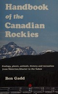
Handbook of the Canadian Rockies
https://archives.whyte.org/en/permalink/catalogue6477
- Medium
- Library - Book (including soft-cover and pamphlets)
- Published Date
- 1988
- c1986
- Author
- Gadd, Ben
- Publisher
- Jasper : Corax Press
- Call Number
- 04 G11
- Author
- Gadd, Ben
- Publisher
- Jasper : Corax Press
- Published Date
- 1988
- c1986
- Physical Description
- xvi, 878p. : ill., maps
- Subjects
- Geology
- Guidebooks
- Notes
- Bibliography and index
- ISBN
- 0-9692631-0-4
- Accession Number
- 23500
- replaces 5290 (lost)
- Call Number
- 04 G11
- Collection
- Archives Library
This material is presented as originally created; it may contain outdated cultural descriptions and
potentially offensive content.
Read more.
Mountains and valleys : a guide to the landscape of Waterton Lakes
https://archives.whyte.org/en/permalink/catalogue7103
- Medium
- Library - Book (including soft-cover and pamphlets)
- Published Date
- 1980
- Author
- Gadd, Ben
- Publisher
- Ottawa : Parks Canada
- Supply and Services Canada
- Call Number
- 03.2 W31 Pam
- Author
- Gadd, Ben
- Responsibility
- design and text by Ben Gadd
- illustrated by Bug McKeith
- Publisher
- Ottawa : Parks Canada
- Supply and Services Canada
- Published Date
- 1980
- Physical Description
- 22p. : ill
- Subjects
- Geomorphology
- Accession Number
- 3339
- Call Number
- 03.2 W31 Pam
- Collection
- Archives Library
This material is presented as originally created; it may contain outdated cultural descriptions and
potentially offensive content.
Read more.
Climbing at Wasootch Slabs
https://archives.whyte.org/en/permalink/catalogue7707
- Medium
- Library - Book (including soft-cover and pamphlets)
- Published Date
- 1980
- Author
- Gadd, Ben
- Publisher
- Calgary : Rocky Mountain Books
- Call Number
- 01.4 K13g Pam
- Author
- Gadd, Ben
- Publisher
- Calgary : Rocky Mountain Books
- Published Date
- 1980
- Physical Description
- 32p. : ill
- Subjects
- Kananaskis Country
- Rock climbing
- Accession Number
- 3154
- Call Number
- 01.4 K13g Pam
- Collection
- Archives Library
This material is presented as originally created; it may contain outdated cultural descriptions and
potentially offensive content.
Read more.
Mountains and valleys: a guide to the landscape of Waterton Lakes National Park, Waterton Lakes National Park Canadian Sector: Waterton-Glacier International Peace Park
https://archives.whyte.org/en/permalink/catalogue19873
- Medium
- Library - Book (including soft-cover and pamphlets)
- Published Date
- 1980
- Author
- Gadd, Ben
- Publisher
- Parks Canada
- Call Number
- 13.115 G11m Pam
- Author
- Gadd, Ben
- Responsibility
- Ben Gadd
- Publisher
- Parks Canada
- Published Date
- 1980
- Abstract
- Pertains to the geological history of the mountains within Waterton Lakes National Parks. Topics covered pertain to glacial erosion, glacial deposits, lakes, future glaciation, streams and the deterioration of mountains in Waterton Lakes National Park.
- Accession Number
- 2017.8683
- Call Number
- 13.115 G11m Pam
- Collection
- Archives Library
This material is presented as originally created; it may contain outdated cultural descriptions and
potentially offensive content.
Read more.
Bankhead : the twenty year town
https://archives.whyte.org/en/permalink/catalogue12461
- Medium
- Library - Book (including soft-cover and pamphlets)
- Published Date
- 1989
- Author
- Gadd, Ben
- Publisher
- Banff : Friends of Banff National Park
- Canadian Parks Service
- Edition
- 1st ed (reprint)
- Call Number
- 08.3 B22g
- Author
- Gadd, Ben
- Edition
- 1st ed (reprint)
- Publisher
- Banff : Friends of Banff National Park
- Canadian Parks Service
- Published Date
- 1989
- Physical Description
- 74p. : ill., ports., map, facsim
- ISBN
- 0-969-0845-5-2
- Accession Number
- 25000 (browser shelf)
- 34500 03-07-2002
- Call Number
- 08.3 B22g
- Collection
- Archives Library
This material is presented as originally created; it may contain outdated cultural descriptions and
potentially offensive content.
Read more.
Climbing at Wasootch Slabs
https://archives.whyte.org/en/permalink/catalogue1081
- Medium
- Library - Book (including soft-cover and pamphlets)
- Published Date
- 1980
- Author
- Gadd, Ben
- Publisher
- Calgary : The Author : Rocky Mountain Books
- Call Number
- F1090 G3 Pam
- Author
- Gadd, Ben
- Publisher
- Calgary : The Author : Rocky Mountain Books
- Published Date
- 1980
- Subjects
- Kananaskis
- Rock climbing
- Call Number
- F1090 G3 Pam
- Collection
- Alpine Club of Canada Library
This material is presented as originally created; it may contain outdated cultural descriptions and
potentially offensive content.
Read more.
Travel guides and maps
https://archives.whyte.org/en/permalink/descriptions56361
- Part Of
- Ben Gadd fonds
- Scope & Content
- Sub-series consists of travel brochures and maps which were collected and used by Ben Gadd. Sub-series contains five sub-sub series: M590 / I / A / i : Travel guides and pocket maps M590 / I / A / ii : Topographical maps M590 / I / A / iii : Geological maps M590 / I / A / iv : Highway maps M590 / …
- Date Range
- [ca.1920-2010]
- Reference Code
- M590 / I / A
- Description Level
- 4 / Sub-series
- GMD
- Map
- Textual record
- Part Of
- Ben Gadd fonds
- Description Level
- 4 / Sub-series
- Fonds Number
- M590
- V810
- S61
- Series
- M590 / I : Personal records
- Sous-Fonds
- M590
- Sub-Series
- M590 / I / A : Travel guides and maps
- Accession Number
- 2021.20
- Reference Code
- M590 / I / A
- GMD
- Map
- Textual record
- Date Range
- [ca.1920-2010]
- Physical Description
- ca. 274 maps -- ca. 61 travel guides, brochures
- Scope & Content
- Sub-series consists of travel brochures and maps which were collected and used by Ben Gadd. Sub-series contains five sub-sub series: M590 / I / A / i : Travel guides and pocket maps M590 / I / A / ii : Topographical maps M590 / I / A / iii : Geological maps M590 / I / A / iv : Highway maps M590 / I / A / v : Index maps, other
- Notes
- Some materials in sub-series are annotated with notes by Ben Gadd
- Name Access
- Gadd, Ben
- Subject Access
- Geography
- Geology
- Environment
- Map
- Tourism
- Tourist information
- Travel
- Trails
- Roads
- Transportation
- Natural history
- National parks and reserves
- Provincial parks and reserves
- Government
- Sports
- Recreation
- Hiking
- Geographic Access
- Canada
- Alberta
- British Columbia
- Banff National Park
- Jasper National Park
- Kootenay National Park
- Yoho National Park
- Waterton Lakes National Park
- Columbia Icefields
- United States of America
- Colorado
- Montana
- Yellowstone National Park
- Access Restrictions
- Restrictions may apply - some materials are fragile
- Reproduction Restrictions
- Restrictions may apply
- Language
- English
- Conservation
- Some fragile/torn materials stored in mylar
- Category
- Environment
- Exploration, discovery and travel
- Government
- Sports, recreation and leisure
- Transportation
- Tourism
- Title Source
- Title based on contents of sub-series
- Processing Status
- Processed
This material is presented as originally created; it may contain outdated cultural descriptions and
potentially offensive content.
Read more.
Travel guides and pocket maps
https://archives.whyte.org/en/permalink/descriptions56806
- Part Of
- Ben Gadd fonds
- Scope & Content
- Sub-sub-series consists of ca.30 travel maps and guides collected by Ben Gadd, primarily pertaining to regions in the United States. Includes regions in Colorado, Arizona, British Columbia, Alberta and Saskatchewan.
- Date Range
- [ca.1970-2005]
- Reference Code
- M590 / I / A / i
- Description Level
- 4.1 / Sub-sub-series
- GMD
- Map
- Part Of
- Ben Gadd fonds
- Description Level
- 4.1 / Sub-sub-series
- Fonds Number
- M590
- V810
- S61
- Series
- M590 / I : Personal records
- Sous-Fonds
- M590
- Sub-Series
- M590 / I / A / i : Travel guides and pocket maps
- Accession Number
- 2021.20
- Reference Code
- M590 / I / A / i
- GMD
- Map
- Date Range
- [ca.1970-2005]
- Physical Description
- ca.30 travel guides and maps
- Scope & Content
- Sub-sub-series consists of ca.30 travel maps and guides collected by Ben Gadd, primarily pertaining to regions in the United States. Includes regions in Colorado, Arizona, British Columbia, Alberta and Saskatchewan.
- Name Access
- Gadd, Ben
- Geographic Access
- Canada
- Alberta
- British Columbia
- Saskatchewan
- Canadian Rocky Mountains
- United States of America
- Colorado
- Arizona
- Reproduction Restrictions
- Restrictions may apply
- Language
- English
- Title Source
- Title based on contents of file
- Processing Status
- Processed
This material is presented as originally created; it may contain outdated cultural descriptions and
potentially offensive content.
Read more.
Topographical maps
https://archives.whyte.org/en/permalink/descriptions56805
- Part Of
- Ben Gadd fonds
- Scope & Content
- Sub-sub series consists of topographical maps depicting various regions in Canada and the United States, which were collected by Ben Gadd. Includes ca.13 maps of regions in the United States (including Eagletail National Park in Arizona, Colorado Springs, and Montana); and ca.213 maps of regions in…
- Date Range
- [ca.1960-2005]
- Reference Code
- M590 / I / A / ii
- Description Level
- 4.1 / Sub-sub-series
- GMD
- Map
- Part Of
- Ben Gadd fonds
- Description Level
- 4.1 / Sub-sub-series
- Fonds Number
- M590
- V810
- S61
- Series
- M590 / I : Personal records
- Sous-Fonds
- M590
- Sub-Series
- M590 / I / A / ii : Travel guides and maps : Topographical maps
- Accession Number
- 2021.20
- Reference Code
- M590 / I / A / ii
- GMD
- Map
- Date Range
- [ca.1960-2005]
- Physical Description
- ca.226 topographical maps
- Scope & Content
- Sub-sub series consists of topographical maps depicting various regions in Canada and the United States, which were collected by Ben Gadd. Includes ca.13 maps of regions in the United States (including Eagletail National Park in Arizona, Colorado Springs, and Montana); and ca.213 maps of regions in Northern Canada, Western Canada and the Canadian Rockies (predominantly Alberta and British Columbia, as well as the Yukon).
- Notes
- Some maps include annotations by Ben Gadd
- Name Access
- Gadd, Ben
- Geographic Access
- Canada
- Alberta
- British Columbia
- Yukon
- Canadian Rocky Mountains
- Rocky Mountains
- Reproduction Restrictions
- Restrictions may apply
- Language
- English
- Category
- Exploration and travel
- Title Source
- Title based on contents of file
- Processing Status
- Processed
This material is presented as originally created; it may contain outdated cultural descriptions and
potentially offensive content.
Read more.