57 records – page 1 of 3.
An approximate classification of the lands
Canadian Irrigation Surveys; A preliminary map of a portion of ...
Canadian Pacific Railway chart of Nepigon Bay Lake Superior
Canadian Pacific Railway chart of the Thunder Bay-Lake Superior
Canadian Pacific Railway sketch plan of the mouth of the ...
Cart trail from Calgary to Edmonton
(Castle Mtn. area)
Chart of the Coast of British Columbia North of Latitude, ...
Danubian Principalities
Dominion of Canada and Newfoundland
Drawing of Rocky Mountain by J.L.*
(edge of Lake Louise Forest Park)
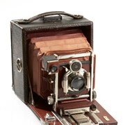
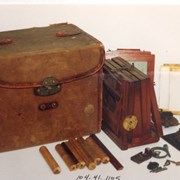
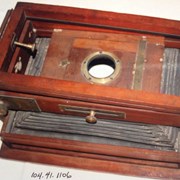
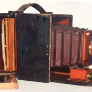
Folding Camera
General map
(Lake Louise Forest Park)
Map from the Pacific Ocean across the Rocky Mountain Zone
Map of British Columbia to the 56th parallel. North Latitude.