48 records – page 1 of 3.
Mary (Molly) Wright Adams fonds
Moore family fonds
Pat Brewster fonds
Peter and Catharine Whyte fonds
An approximate classification of the lands
British Columbia
[British North America]
Canadian Pacific Railway chart of Nepigon Bay Lake Superior
Canadian Pacific Railway chart of the Thunder Bay-Lake Superior
Canadian Pacific Railway sketch plan of the mouth of the ...
Chart of the Coast of British Columbia North of Latitude, ...
Drawing of Rocky Mountain by J.L.*
French map showing various districts
A general map of the routes in British North America ...
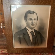
John Brewster
Map from the Pacific Ocean across the Rocky Mountain Zone
Map of British Columbia to the 56th parallel. North Latitude.
Map of the country between the provinces of Ontario, Quebec ...
North West Frontiers of India
Outline of slave-holding States