774 records – page 1 of 39.
Map of British Columbia to the 56th parallel. North Latitude.
Drawing of Rocky Mountain by J.L.*
Map of the country between the provinces of Ontario, Quebec ...
Canadian Pacific Railway chart of Nepigon Bay Lake Superior
Chart of the Coast of British Columbia North of Latitude, ...
Map from the Pacific Ocean across the Rocky Mountain Zone
Canadian Pacific Railway chart of the Thunder Bay-Lake Superior
Plans of the Rivers Kamanistiquia and Nepigon
An approximate classification of the lands
North West Frontiers of India
Types of soil|Travelled routes
Topographical Survey
295. Chairlift, 2 chairs. -- [1950 Feb.].
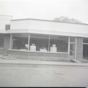
Standish Hardware. -- 1950 May 12 & 13
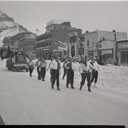
Jaycee & IODE Carnival 1950. -- 1950 Feb.
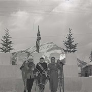
Snowshoe Race Winners, Carnival 1950. -- 1950 Feb.
Northwestern United States and Neighbouring Canadian Provinces
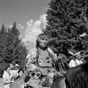
Leah (Rider) Hunter (Pasi) (Female Cousin/Kin), Stoney Nakoda
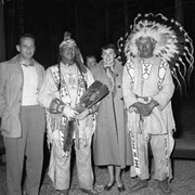
3 unknown people and Tom Kaquitts (Sûga Wakâ) (Dog God) ...
Beckers, Jasper, Bears . -- [ca. 1950]
![Cover image of 295. Chairlift, 2 chairs. -- [1950 Feb.].](/media/archives/v108_harmon_lloyd_web/v108_ii_na_1934.jpg?width=180&height=180&mode=crop&anchor=topcenter&404=no-img.jpg)
![Cover image of Beckers, Jasper, Bears . -- [ca. 1950]](/media/archives/v227_gibbons_web/v227_i_c_na_3803.jpg?width=180&height=180&mode=crop&anchor=topcenter&404=no-img.jpg)