821 records – page 1 of 42.
Map of British Columbia to the 56th parallel. North Latitude.
Drawing of Rocky Mountain by J.L.*
Map of the country between the provinces of Ontario, Quebec ...
Canadian Pacific Railway chart of Nepigon Bay Lake Superior
Chart of the Coast of British Columbia North of Latitude, ...
Map from the Pacific Ocean across the Rocky Mountain Zone
Canadian Pacific Railway chart of the Thunder Bay-Lake Superior
Plans of the Rivers Kamanistiquia and Nepigon
An approximate classification of the lands
North West Frontiers of India
Topographical Survey
Types of soil|Travelled routes
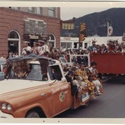
Banff Indian Days parade
[Alberta Air Facilities Map]
Map of the northern Cordillera Blanca, Peru Aplamayo region.
Parks of the Canadian Rockies
Jasper Nationa Park in the heart of the beautiful Canadian ...
[Amethyst Lakes 83D/9, Alta.-B.C.]
[Fortress Lake 83 C/5 - Alta.-B.C.]
[Jumpingpound 82 0/2 - Alta]