222 records – page 1 of 12.
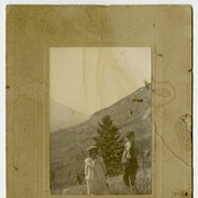
Pearl and George
Dominion of Canada and Newfoundland
Geological survey [Shuswap Sheet]
General map
Trail from Calgary to Edmonton and Railway
Map of the Kootenay District - A mining recording divisions ...
Principle Mining disricts and railroad main and spur lines of ...
(Lake Louise Forest Park)
Range 1, West of Fifth Meridian, Trail from Calgary to ...
Reservoir Sites A and B Canadian Irrigation Surveyrs Jumpingpound Creek ...
Map to illustrate system of Canadian Irrigation Surveys.
Western Canada and the North Western United States
Canadian Irrigation Surveys; A preliminary map of a portion of ...
Sketch showing the proposed method of diverting water from the ...
Morleyville Traill; Calgary-Edmonton Rwy.
Topographic Sheet
Topographical sheet