5178 records – page 1 of 259.
Map showing the northern paortion of Vancouver Island
Races of Europe
Mt. Louis
Map of Waterton Lakes National Park, Alberta/from photographic surveys by ...
[Wildermere, Southern B.C.]
Geological survey [Sooke sheet - Vancouver Island]
Geological Survey [Duncan Sheet - Vancouver Island]
Porteous family fonds
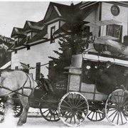
Horse-drawn carriage
Group of children
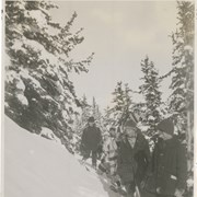
Group of snowshoers
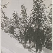
Norman Sanson and snowshoers
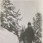
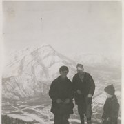
Young George, Cyril Paris, Peter Whyte
Townsite map
Map of central part of Jasper from surveys by M.P. ...
[Northern Alberta]
Map of the Ominecca and Finlay River Basins
[British Columbia Forestry] Map showing forest stand types
[Boundary Between Alberta and B.C.]
[Boundary Between Alta. and B.C.]