63 records – page 1 of 4.
[British North America]
[Canada] National Transcontinental Railway route
[Canada] Relief map
Climbing done in 1890 from Glacier House
CPR Plan and Profile of Line Change, Rogers Pass
Drainage Patterns
(Duthil Station area)
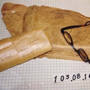
Eyeglasses
A game map of the area between Banff to North ...
Grand Trunk Pacific. Dominion of Canada. The German Development Company
[Grandview Villa Banff]
[Index to Top. Sheets of Rocky Mountains]
(junction North/South Forks Blakiston Brook)
[Lake Louise, Moraine Lake and Vermilion Pass]
The main range adjacent to the Canadian Pacific Railway
Map of Nakimu Caves by W.S. Ayres
Map of the Selkirks from a photographic survey by A.O. ...
Map showing exploration between Lakes Winnipeg, Manitoba and Winnipegosis