Narrow Results By
HCR Info Files - Fish, amphibians, reptiles, water life
https://archives.whyte.org/en/permalink/descriptions55966
- Part Of
- Ben Gadd fonds
- Scope & Content
- File consists of published research materials collected by Ben Gadd pertaining to fish, amphibians, reptiles and water life in the Canadian Rockies.
- Date Range
- 1933
- 1973-1979
- 1984-1990
- 1993-1994
- 1997-1998
- 2000
- Reference Code
- M590 / II / A / 52 to 53
- Description Level
- 5 / File
- GMD
- Textual record
- Published record
- Part Of
- Ben Gadd fonds
- Description Level
- 5 / File
- Fonds Number
- M590
- V810
- S61
- Series
- M590 / II : Research and publication records
- Sous-Fonds
- M590
- Sub-Series
- M590 / II / A : Handbook of the Canadian Rockies
- Accession Number
- 2021.20
- Reference Code
- M590 / II / A / 52 to 53
- Date Range
- 1933
- 1973-1979
- 1984-1990
- 1993-1994
- 1997-1998
- 2000
- Physical Description
- 4 cm of textual records
- Scope & Content
- File consists of published research materials collected by Ben Gadd pertaining to fish, amphibians, reptiles and water life in the Canadian Rockies.
- Notes
- Some items in file are annotated by Ben Gadd
- Name Access
- Gadd, Ben
- Subject Access
- Publication
- Research
- Environment
- Natural history
- Ecology
- Wildlife
- Fish
- Animals
- Geographic Access
- Canada
- Alberta
- Jasper National Park
- Canadian Rocky Mountains
- Reproduction Restrictions
- Restrictions may apply
- Language
- English
- Category
- Environment
- Title Source
- Original title used
- Processing Status
- Processed
This material is presented as originally created; it may contain outdated cultural descriptions and
potentially offensive content.
Read more.
HCR info files - Geomorphology and Pleistocene
https://archives.whyte.org/en/permalink/descriptions55957
- Part Of
- Ben Gadd fonds
- Scope & Content
- File consists of published research material collected by Ben Gadd pertaining to the study of Geomorphology and the Pleistocene Epoch. File includes one photograph print sent to Ben Gadd depicting a boulder [in file M590/II/A/32].
- Date Range
- 1958
- 1966-1967
- 1973-1989
- 1991-1995
- 2004
- 2007-2010
- Reference Code
- M590 / II / A / 32 to 37
- Description Level
- 5 / File
- GMD
- Textual record
- Published record
- Photograph
- Part Of
- Ben Gadd fonds
- Description Level
- 5 / File
- Fonds Number
- M590
- V810
- S61
- Series
- M590 / II : Research and publication records
- Sous-Fonds
- M590
- Sub-Series
- M590 / II / A : Handbook of the Canadian Rockies
- Accession Number
- 2021.20
- Reference Code
- M590 / II / A / 32 to 37
- Responsibility
- Photograph produced by Alan Kane, 1994
- Date Range
- 1958
- 1966-1967
- 1973-1989
- 1991-1995
- 2004
- 2007-2010
- Physical Description
- 12 cm of textual records -- 1 photograph : col. print
- Scope & Content
- File consists of published research material collected by Ben Gadd pertaining to the study of Geomorphology and the Pleistocene Epoch. File includes one photograph print sent to Ben Gadd depicting a boulder [in file M590/II/A/32].
- Storage Range
- Materials stored in two file boxes: M590/II/A/26 to 32 and M590/II/A/33 to 38
- Name Access
- Gadd, Ben
- Subject Access
- Publication
- Research
- Natural history
- Environment
- Geology
- Geographic Access
- Canada
- Canadian Rocky Mountains
- Reproduction Restrictions
- Copyright restrictions may apply
- Language
- English
- Category
- Environment
- Title Source
- Title based on contents of file
- Processing Status
- Processed
This material is presented as originally created; it may contain outdated cultural descriptions and
potentially offensive content.
Read more.
HCR Info Files - HCR Rivers 2008
https://archives.whyte.org/en/permalink/descriptions55960
- Part Of
- Ben Gadd fonds
- Scope & Content
- File consists of hydrometric data for various rivers in the Canadian Rockies which was compiled as part of the Water Survey of Canada in 2008. Includes annotations by Ben Gadd pertaining to data which he used to update information in his book, Handbook of the Canadian Rockies.
- Date Range
- 2008
- Reference Code
- M590 / II / A / 39 to 41
- Description Level
- 5 / File
- GMD
- Textual record
- Published record
- Part Of
- Ben Gadd fonds
- Description Level
- 5 / File
- Fonds Number
- M590
- V810
- S61
- Series
- M590 / II : Research and publication records
- Sous-Fonds
- M590
- Sub-Series
- M590 / II / A : Handbook of the Canadian Rockies
- Accession Number
- 2021.20
- Reference Code
- M590 / II / A / 39 to 41
- Date Range
- 2008
- Physical Description
- 5 cm of textual records
- Scope & Content
- File consists of hydrometric data for various rivers in the Canadian Rockies which was compiled as part of the Water Survey of Canada in 2008. Includes annotations by Ben Gadd pertaining to data which he used to update information in his book, Handbook of the Canadian Rockies.
- Name Access
- Gadd, Ben
- Subject Access
- Publication
- Research
- Environment
- Rivers
- Geographic Access
- Canada
- Alberta
- British Columbia
- Canadian Rocky Mountains
- Reproduction Restrictions
- Restrictions may apply
- Language
- English
- Category
- Environment
- Title Source
- Original title used
- Processing Status
- Processed
This material is presented as originally created; it may contain outdated cultural descriptions and
potentially offensive content.
Read more.
HCR Info Files - Mammals
https://archives.whyte.org/en/permalink/descriptions55968
- Part Of
- Ben Gadd fonds
- Scope & Content
- File consists of published research materials collected by Ben Gadd pertaining to various mammals in the Canadian Rockies.
- Date Range
- 1973-1976
- 1978-1998
- 2000-2004
- 2011
- Reference Code
- M590 / II / A / 58 to 62
- Description Level
- 5 / File
- GMD
- Textual record
- Published record
- Part Of
- Ben Gadd fonds
- Description Level
- 5 / File
- Fonds Number
- M590
- V810
- S61
- Series
- M590 / II : Research and publication records
- Sous-Fonds
- M590
- Sub-Series
- M590 / II / A : Handbook of the Canadian Rockies
- Accession Number
- 2021.20
- Reference Code
- M590 / II / A / 58 to 62
- Date Range
- 1973-1976
- 1978-1998
- 2000-2004
- 2011
- Physical Description
- 9 cm of textual records
- Scope & Content
- File consists of published research materials collected by Ben Gadd pertaining to various mammals in the Canadian Rockies.
- Notes
- Some items in file are annotated by Ben Gadd
- Name Access
- Gadd, Ben
- Subject Access
- Publication
- Research
- Environment
- Wildlife
- Animals
- Dogs
- Bears
- Elk
- Geographic Access
- Canada
- Alberta
- Banff National Park
- Jasper National Park
- Canadian Rocky Mountains
- Reproduction Restrictions
- Restrictions may apply
- Language
- English
- Category
- Environment
- Title Source
- Original title used
- Processing Status
- Processed
This material is presented as originally created; it may contain outdated cultural descriptions and
potentially offensive content.
Read more.
HCR Update 2009
https://archives.whyte.org/en/permalink/descriptions55987
- Part Of
- Ben Gadd fonds
- Scope & Content
- File consists of loose notes by Ben Gadd and quotes from Friesens publishing company pertaining to additional changes and corrections made in Ben's book, Handbook of the Canadian Rockies, in 2009.
- Date Range
- 2009
- Reference Code
- M590 / II / A / 88
- Description Level
- 5 / File
- GMD
- Published record
- Textual record
- Newspaper clipping
- Part Of
- Ben Gadd fonds
- Description Level
- 5 / File
- Fonds Number
- M590
- V810
- S61
- Series
- M590 / II : Research and publication records
- Sous-Fonds
- M590
- Sub-Series
- M590 / II / A : Handbook of the Canadian Rockies
- Accession Number
- 2021.20
- Reference Code
- M590 / II / A / 88
- Date Range
- 2009
- Physical Description
- 0.2 cm of textual records
- Scope & Content
- File consists of loose notes by Ben Gadd and quotes from Friesens publishing company pertaining to additional changes and corrections made in Ben's book, Handbook of the Canadian Rockies, in 2009.
- Name Access
- Gadd, Ben
- Subject Access
- Publication
- Commerce
- Communications
- Research
- Wildlife
- Professional and Personal Life
- Geographic Access
- Canada
- Alberta
- Jasper
- Canadian Rocky Mountains
- Reproduction Restrictions
- Restrictions may apply
- Language
- English
- Category
- Commerce and industry
- Communications
- Title Source
- Original title used
- Processing Status
- Processed
This material is presented as originally created; it may contain outdated cultural descriptions and
potentially offensive content.
Read more.
- Part Of
- Ben Gadd fonds
- Scope & Content
- Sub-sub-series consists of ca.50 maps of various regions in Western Canada and Alaska which were collected by Ben Gadd. Maps are arranged according to associated highways which the mapped regions depict.
- Date Range
- [ca.1970-2005]
- Reference Code
- M590 / I / A / iv
- Description Level
- 4.1 / Sub-sub-series
- GMD
- Map
- Part Of
- Ben Gadd fonds
- Description Level
- 4.1 / Sub-sub-series
- Fonds Number
- M590
- V810
- S61
- Series
- M590 / I : Personal records
- Sous-Fonds
- M590
- Sub-Series
- M590 / I / A / iv : Travel guides and maps : Highway maps
- Accession Number
- 2021.20
- Reference Code
- M590 / I / A / iv
- GMD
- Map
- Date Range
- [ca.1970-2005]
- Physical Description
- ca.50 maps -- 4 paper scans of maps
- Scope & Content
- Sub-sub-series consists of ca.50 maps of various regions in Western Canada and Alaska which were collected by Ben Gadd. Maps are arranged according to associated highways which the mapped regions depict.
- Notes
- Regions included in file: Highway 3 Highway 6 Highway 11 Highway 16 Highway 22 & 40 Highway 93 [To Jasper] Highway 93 [To Radium] Highway 97 [Pine Pass] Highway 97 [Alaska Highway]
- Name Access
- Gadd, Ben
- Geographic Access
- Canada
- Alberta
- British Columbia
- Canadian Rocky Mountains
- Alaska
- Reproduction Restrictions
- Restrictions may apply
- Language
- English
- Title Source
- Title based on contents of file
- Processing Status
- Processed
This material is presented as originally created; it may contain outdated cultural descriptions and
potentially offensive content.
Read more.
- Part Of
- Alpine Club of Canada fonds
- Scope & Content
- Series consists of hut registers produced by the Alpine Club of Canada between ca.1930-2020. Registers include entries from visitors to the huts, which pertain to individuals' hiking and climbing trips; details of specific events which occurred while staying at the huts; wildlife sightings; custodi…
- Date Range
- [ca.1930-2020]
- Reference Code
- M200 / IV
- Description Level
- 3 / Series
- GMD
- Textual record
- Organization record
- Part Of
- Alpine Club of Canada fonds
- Description Level
- 3 / Series
- Fonds Number
- M200
- S6
- V14
- Series
- M200 / IV : Hut Registers
- Sous-Fonds
- M200
- Accession Number
- accn. 2023.19 accn. 8002 accn. 2023.20 accn. 2023.32 accn. 1299 accn. 1040 accn. 2141 accn. 3298 accn. 3757 accn. 6376 accn. 6465 accn. 6623 accn. 7779 accn. 2023.10 accn. 5538 accn. 2014.8293 accn. 2023.31 accn. 2023.15 accn. 2020.05 accn. 6766 accn. 2376 accn. 3296 accn. 3970 accn. 5215 accn. 3560 accn. 2014.8278 accn. 5462 accn. 3382 accn. 5330 accn. 6457 accn. 5635 accn. 5591 accn. 8120 accn. 2376 accn. 3560 accn. 2023.41 accn. 8119 accn. 2023.14 accn. 3160 accn. 3298 accn. 3970 accn. 5114 accn. 5200 accn. 5463 accn. 5631 accn. 6470
- Reference Code
- M200 / IV
- Responsibility
- Registers produced by Alpine Club of Canada
- Date Range
- [ca.1930-2020]
- Physical Description
- ca. 3.5 metres of textual records
- Scope & Content
- Series consists of hut registers produced by the Alpine Club of Canada between ca.1930-2020. Registers include entries from visitors to the huts, which pertain to individuals' hiking and climbing trips; details of specific events which occurred while staying at the huts; wildlife sightings; custodial issues and updates; and related topics. Series is separated at the sub-series level by individual huts: M200 / IV / A : Abbot Pass Hut M200 / IV / B : Elizabeth Parker Hut M200 / IV / C : Wates-Gibson Hut M200 / IV / D : A. O. Wheeler Hut M200 / IV / E : Sydney Vallance (Fryatt) Hut M200 / IV / F : Bow Hut M200 / IV / G : Stanley Mitchell Hut M200 / IV / H : Fay Hut M200 / IV / I : Balfour Hut M200 / IV / J : Peyto Hut/ Peter and Catharine Whyte Hut M200 / IV / K : Elk Lakes Cabin M200 / IV / L : Bon Echo Hut M200 / IV / M : Bill Putnam / Fairy Meadows Hut M200 / IV / N : Scott Duncan Hut M200 / IV / O: Conrad Kain/Bugaboos Hut M200 / IV / P: Neil Colgan Hut M200 / IV / Q: Silver Spray Hut M200 / IV / R: Asulkan Hut M200 / IV / S: Mount Colin Hut M200 / IV / T: Great Cairn Hut M200 / IV / U: Other Huts [Registers]
- Notes
- See sub-series entries for chronological inventories of hut registers
- Name Access
- Alpine Club of Canada
- Subject Access
- Abbot Pass Hut
- Backcountry skiing
- Buildings and facilities
- Cabins
- Cabins and shelters
- Climbing
- Environment
- Exploration
- Helicopter skiing
- Huts
- Log structures
- Memorial
- Mountaineering
- Mountains
- Parks Canada
- Peter Whyte Hut
- Porcupine
- Property
- Recreation
- Ski areas
- Sports
- Sports and recreation
- Wildlife
- Winter sports
- Geographic Access
- Canada
- Alberta
- British Columbia
- Canadian Rocky Mountains
- Access Restrictions
- Restrictions may apply
- Language
- English
- Related Material
- M235
- Title Source
- Title based on contents of series
- Processing Status
- Processed
This material is presented as originally created; it may contain outdated cultural descriptions and
potentially offensive content.
Read more.
Identified Summit Records
https://archives.whyte.org/en/permalink/descriptions57799
- Part Of
- Alpine Club of Canada fonds
- Scope & Content
- Sub-series of identified summit registers and notes produced by the Alpine Club of Canada between 1930 and 2022. Summit records include entries from visitors to the various summits which pertain to individuals' hiking and climbing trips; details of specific events which occurred while at the summit…
- Date Range
- 1930-1931
- 1959-1968
- 1970-1989
- 1992 -2022
- Reference Code
- M200 / V / A
- Description Level
- 4 / Sub-series
- GMD
- Textual record
- Organization record
- Part Of
- Alpine Club of Canada fonds
- Description Level
- 4 / Sub-series
- Fonds Number
- M200
- V14
- S6
- Series
- M200 / V: Summit Records
- Sous-Fonds
- M200
- Sub-Series
- M200 / V / A: Identified Summit Records
- Accession Number
- accn. 2023.20 accn. 7779 accn. 2023.10 accn. 2014.8347 accn. 6465 accn. 8002 accn. 2020.05 accn. 2023.19 accn. 2014.8293 accn. 8119 accn. 2023.32 accn. 2023.41 accn. 6623 accn. 6062 accn. 2014.8318 accn. 6767 accn. 2014.8315 accn. 2014.8317 accn. 5680 accn. 2023.16 accn. 2018.9010 accn. 5396 accn. 6459 accn. 2014.8316 accn. 2023.18 accn. 5631 accn. 2013.8245 accn. 2014.8275 accn. 2023.06 accn. 2023.14 accn. 2023.17 accn. 5569 accn. 8113 accn. 6396 accn. 2024.20
- Reference Code
- M200 / V / A
- Responsibility
- Summit Registers and Notes produced by Alpine Club of Canada
- Date Range
- 1930-1931
- 1959-1968
- 1970-1989
- 1992 -2022
- Physical Description
- 100 cm of textual records 223 volumes
- Scope & Content
- Sub-series of identified summit registers and notes produced by the Alpine Club of Canada between 1930 and 2022. Summit records include entries from visitors to the various summits which pertain to individuals' hiking and climbing trips; details of specific events which occurred while at the summit, wildlife sightings, trail updates, and related topics. The sub-series is separated into individual identified summit records.
- Notes
- See file-level entries for inventories of identified summit registers and notes.
- Name Access
- Alpine Club of Canada
- Subject Access
- Alberta
- Alpine Club of Canada
- Backpacking
- Backcountry skiing
- Banff
- Banff National Park
- Bow Valley
- British Columbia
- Castle Mountain
- Cascade Mountain
- Centennial
- Climbing
- Club
- Cross-country skiing
- Description and travel
- Environment
- Environment and Nature
- Fortress Mountain
- Great Divide
- Hiking
- Kananaskis Country
- Mount Assiniboine
- Mount Logan
- Mountain
- Mountain guides
- Mountaineering
- Mountaineers
- Mountains
- Provincial parks and reserves
- Parks
- National parks and reserves
- Record keeping
- Ski area
- Ski areas
- Ski mountaineering
- Skiing
- Skis
- Skiers
- Snowshoes and snowshoeing
- Sports and leisure
- Sports and recreation
- Summit
- Trails
- Winter sports
- Geographic Access
- Canada
- Canadian Rocky Mountains
- Rocky Mountains
- Continental Divide
- Great Divide
- Alberta
- British Columbia
- Abbot Pass
- Mount Assiniboine
- Cascade Mountain
- Canmore
- Assiniboine
- Banff National Park
- Banff, Alberta
- Bugaboos
- Castle Mountain, AB
- Cathedral Mountain
- Glacier
- Jasper National Park
- Kananaskis Country
- Little Yoho Valley
- Mount Baldy
- Mount Baker
- Mount Cory
- Mount Edith
- Mount Lefroy
- Mount Norquay
- Mount Rundle
- Rundle Mountain
- Mount Temple
- Mount Victoria
- Mount Yamnuska
- Selkirks
- Yoho National Park
- Access Restrictions
- Restrictions may apply
- Reproduction Restrictions
- Contains personal information
- Language
- English
- Conservation
- Some records have been placed in mylar. Some record have mold, rust or water damage.
- Related Material
- M235
- Title Source
- Title based on contents of sub-series
- Processing Status
- Processed
This material is presented as originally created; it may contain outdated cultural descriptions and
potentially offensive content.
Read more.
Isolated Peak Summit Records
https://archives.whyte.org/en/permalink/descriptions57690
- Part Of
- Alpine Club of Canada fonds
- Scope & Content
- Files consist of summit notes and summit registers and notes from Isolated Peak between 1996 and 2012 produced by the Alpine Club of Canada. Summit records include entries from visitors to the various summits which pertain to individuals' hiking and climbing trips; details of specific events which …
- Date Range
- 1996-2012
- Reference Code
- M200 / V / A / 83 to 84
- Description Level
- 5 / File
- GMD
- Textual record
- Organization record
- Part Of
- Alpine Club of Canada fonds
- Description Level
- 5 / File
- Fonds Number
- M200
- V14
- S6
- Series
- M200 / V: Summit Records
- Sous-Fonds
- M200
- Sub-Series
- M200 / V / A: Identified Summit Records
- Accession Number
- accn. 8002
- accn. 2023.19
- Reference Code
- M200 / V / A / 83 to 84
- Responsibility
- Summit Registers and Notes produced by Alpine Club of Canada
- Date Range
- 1996-2012
- Physical Description
- 2 volumes ca. 2 cm of textual records
- History / Biographical
- Isolated Peak is located in Little Yoho Valley of Yoho National Park, B.C. in the Canadian Rockies. Nearby are Mount McArthur, Arete Peak and Mont des Poilus, Vice President and President Mountains.
- Scope & Content
- Files consist of summit notes and summit registers and notes from Isolated Peak between 1996 and 2012 produced by the Alpine Club of Canada. Summit records include entries from visitors to the various summits which pertain to individuals' hiking and climbing trips; details of specific events which occurred while at the summit, wildlife sightings, trail updates, and related topics. Files include: M200 / V / A / 83: Summit Register - Isolated Peak, July 1996 - Aug 2009 M200 / V / A / 84: Isolated Peak [2009-2012]
- Name Access
- Alpine Club of Canada
- Subject Access
- Alpine Club of Canada
- Backpacking
- Backcountry skiing
- British Columbia
- Climbing
- Club
- Cross-country skiing
- Description and travel
- Environment
- Environment and Nature
- Hiking
- Mountain
- Mountaineering
- Mountaineers
- Mountains
- National parks and reserves
- Parks Canada
- Record keeping
- Ski area
- Ski areas
- Ski mountaineering
- Skiing
- Skiers
- Snowshoes and snowshoeing
- Sports and leisure
- Sports and recreation
- Summit
- Trails
- Winter sports
- Geographic Access
- Canada
- Canadian Rocky Mountains
- Rocky Mountains
- British Columbia
- Yoho National Park
- Little Yoho Valley
- The Vice President
- The President
- Isolated Peak
- Access Restrictions
- Restrictions may apply
- Language
- English
- French
- Conservation
- Summit notes are loose pages and contain water damage. Summit notes may contain rust damage.
- Related Material
- M235
- Biographical Source Notes
- Peak Finder, Isolated Peak, Canadian Rockies Database: https://cdnrockiesdatabases.ca/peaks/687#undefined1
- Title Source
- Title based on contents of file
- Processing Status
- Processed
This material is presented as originally created; it may contain outdated cultural descriptions and
potentially offensive content.
Read more.
Jasper Marmot Basin
https://archives.whyte.org/en/permalink/descriptions54813
- Part Of
- Murray Hay fonds
- Scope & Content
- File consists of 1 cm of textual records, 10 x 23.5 cm or smaller. File pertains to ski trail maps of Jasper Marmot Basin and ski area created by Murray Hay. File includes three brochures promoting the ski runs at Marmot Basin that each include a reproduced map by Hay.
- Date Range
- 2001-2003
- 2001
- 2003
- Reference Code
- M570 / III / B / iii / 1
- Description Level
- 5 / File
- GMD
- Map
- Textual record
- Published record
- Part Of
- Murray Hay fonds
- Description Level
- 5 / File
- Fonds Number
- M570 / V795
- Series
- M570 / III : Murray Hay portfolio (published material)
- Sous-Fonds
- M570
- Sub-Series
- M570 / III / B : Alberta / iii : Jasper
- Accession Number
- 2019.41
- Reference Code
- M570 / III / B / iii / 1
- Date Range
- 2001-2003
- 2001
- 2003
- Physical Description
- 1 cm of textual records (10 x 23.5 cm or smaller)
- Scope & Content
- File consists of 1 cm of textual records, 10 x 23.5 cm or smaller. File pertains to ski trail maps of Jasper Marmot Basin and ski area created by Murray Hay. File includes three brochures promoting the ski runs at Marmot Basin that each include a reproduced map by Hay.
- Name Access
- Hay, Murray
- Subject Access
- Ski Maps
- Skiing
- Ski areas
- Map
- Marmot Basin Ski Area
- Cartography
- Sports and recreation
- Tourism
- Tourist information
- Travel
- Winter
- Winter sports
- Advertising
- Artist
- Geographic Access
- Jasper
- Jasper Marmot Basin
- Jasper National Park
- Alberta
- Canada
- Canadian Rocky Mountains
- Language
- English
- Related Material
- V795 / II / B / i / 1
- Title Source
- Title based on contents of file
- Processing Status
- Processed
This material is presented as originally created; it may contain outdated cultural descriptions and
potentially offensive content.
Read more.
Lake Louise Area
https://archives.whyte.org/en/permalink/descriptions54925
- Part Of
- Murray Hay fonds
- Scope & Content
- File consists of 6 prints : col. ; 25.5 x 20 cm or smaller. File pertains to Murray Hay's renderings of the Lake Louise ski area. File includes six reproduced draft prints of original paintings of the Lake Louise ski area created by Murray Hay (different iterations).
- Date Range
- ca.1976-ca.2000
- Reference Code
- V795 / II / B / ii / 1
- Description Level
- 5 / File
- GMD
- Map
- Private record
- Part Of
- Murray Hay fonds
- Description Level
- 5 / File
- Fonds Number
- M570 / V795
- Series
- V795 / I : Unpublished Material
- Sous-Fonds
- V795
- Sub-Series
- V795 / I / B : Alberta / ii : Lake Louise
- Accession Number
- 2019.41
- Reference Code
- V795 / II / B / ii / 1
- GMD
- Map
- Private record
- Date Range
- ca.1976-ca.2000
- Physical Description
- 6 prints : col. ; 25.5 x 20 cm or smaller
- Scope & Content
- File consists of 6 prints : col. ; 25.5 x 20 cm or smaller. File pertains to Murray Hay's renderings of the Lake Louise ski area. File includes six reproduced draft prints of original paintings of the Lake Louise ski area created by Murray Hay (different iterations).
- Name Access
- Hay, Murray
- Subject Access
- Advertising
- Artist
- Ski Maps
- Map
- Cartography
- Sports and recreation
- Tourism
- Tourist information
- Winter
- Winter sports
- Ski area
- Lake Louise Ski Area
- Geographic Access
- Lake Louise
- Alberta
- Canada
- Canadian Rocky Mountains
- Language
- English
- Related Material
- M570 / III / B / ii / 1-2
- Creator
- Hay, Murray
- Title Source
- Title based on contents of file
- Processing Status
- Processed
This material is presented as originally created; it may contain outdated cultural descriptions and
potentially offensive content.
Read more.
Lake O'Hara Trails
https://archives.whyte.org/en/permalink/descriptions54776
- Part Of
- Murray Hay fonds
- Scope & Content
- File consists of 0.5 cm of textual records, 60.5 x 48.5 cm. File pertains to a trail map of the Lake O'Hara area created by Murray Hay. File consists of one published poster depicting a reproduced map of the trails at Lake O'Hara in Yoho National Park (British Columbia).
- Date Range
- ca.1970-ca.2015
- Reference Code
- M570 / III / A / iv / 1
- Description Level
- 5 / File
- GMD
- Map
- Poster
- Published record
- Textual record
- Part Of
- Murray Hay fonds
- Description Level
- 5 / File
- Fonds Number
- M570 / V795
- Series
- M570 / III : Murray Hay Portfolio (published material)
- Sous-Fonds
- M570
- Sub-Series
- M570 / III / A : British Columbia / iv : Lake O'Hara
- Accession Number
- 2019.41
- Reference Code
- M570 / III / A / iv / 1
- Date Range
- ca.1970-ca.2015
- Physical Description
- 0.5 cm of textual material (60.5 x 48.5 cm)
- Scope & Content
- File consists of 0.5 cm of textual records, 60.5 x 48.5 cm. File pertains to a trail map of the Lake O'Hara area created by Murray Hay. File consists of one published poster depicting a reproduced map of the trails at Lake O'Hara in Yoho National Park (British Columbia).
- Notes
- M570 / III / A / iv / 1 is oversize.
- Name Access
- Hay, Murray
- Subject Access
- Trails
- Hiking
- Cartography
- Advertising
- Artist
- Sports and recreation
- Travel
- Tourism
- Tourist information
- Geographic Access
- Lake O'Hara
- British Columbia
- Canada
- Canadian Rocky Mountains
- Yoho National Park
- Language
- English
- Title Source
- Title based on contents of file
- Processing Status
- Processed
This material is presented as originally created; it may contain outdated cultural descriptions and
potentially offensive content.
Read more.
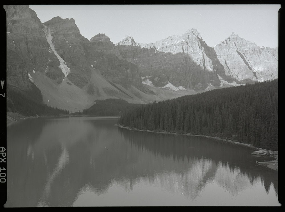
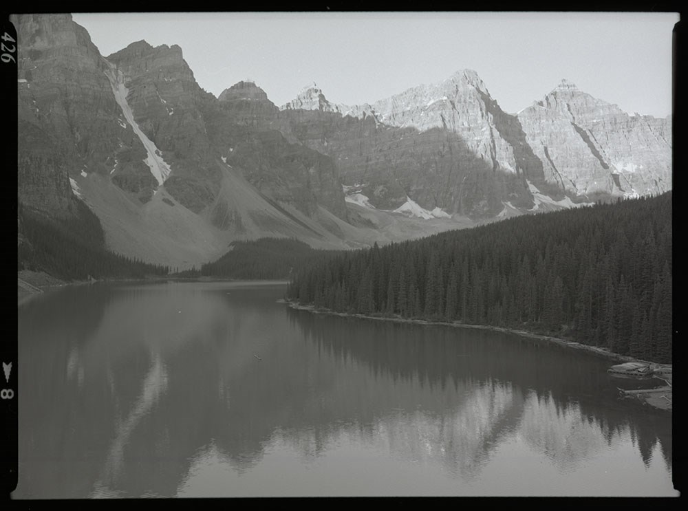
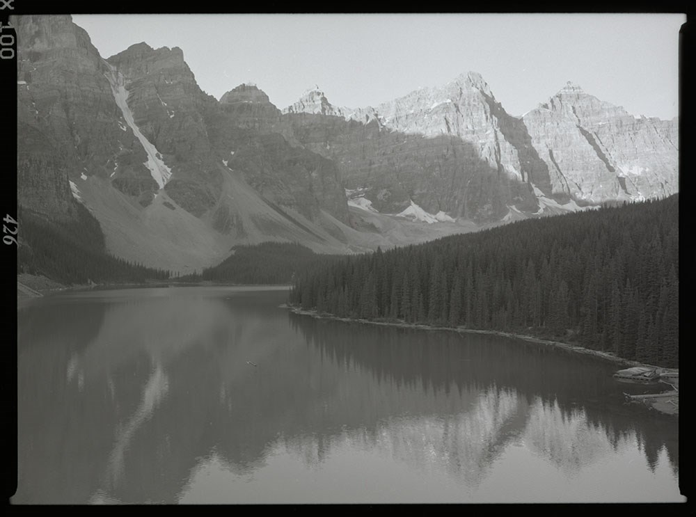
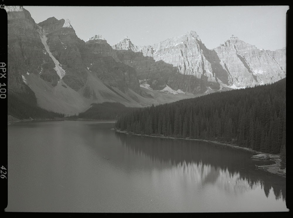
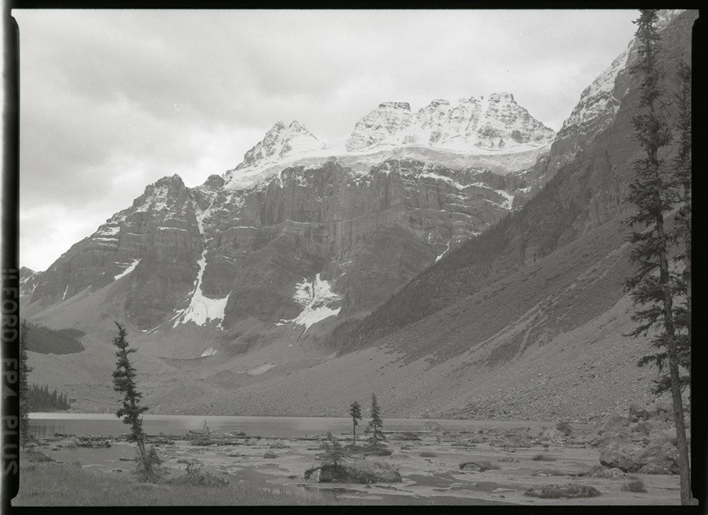
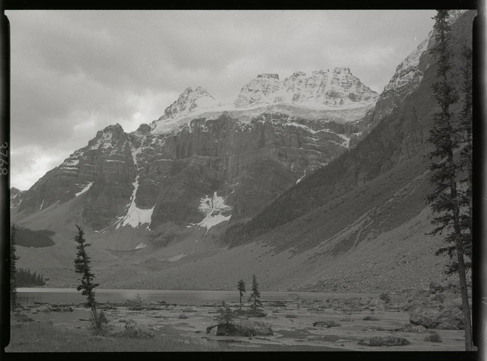
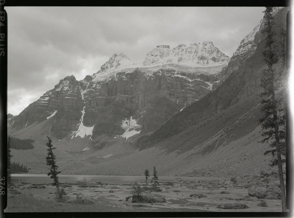
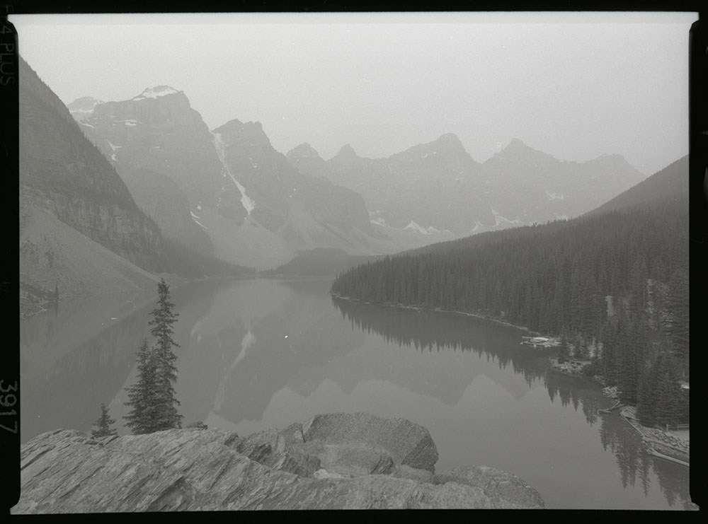
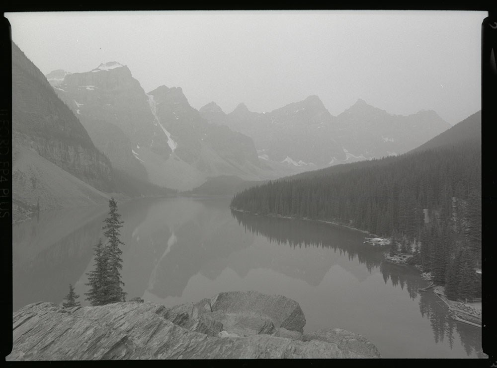
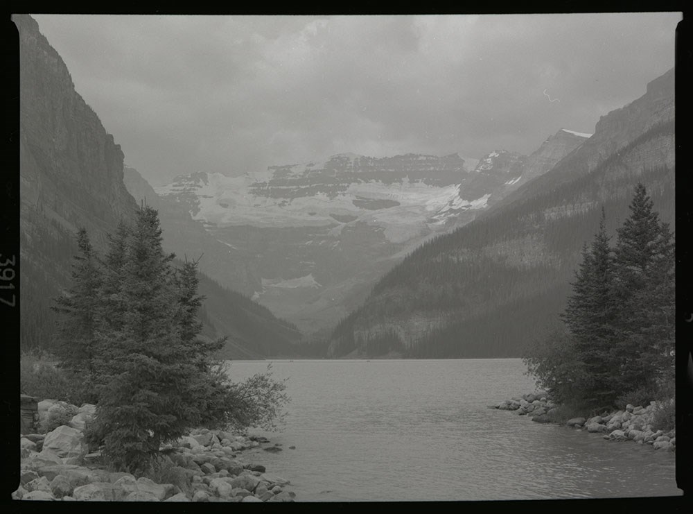
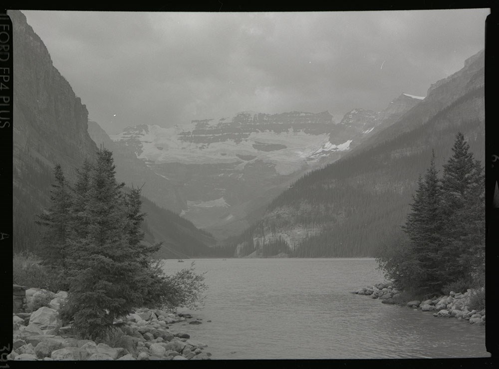
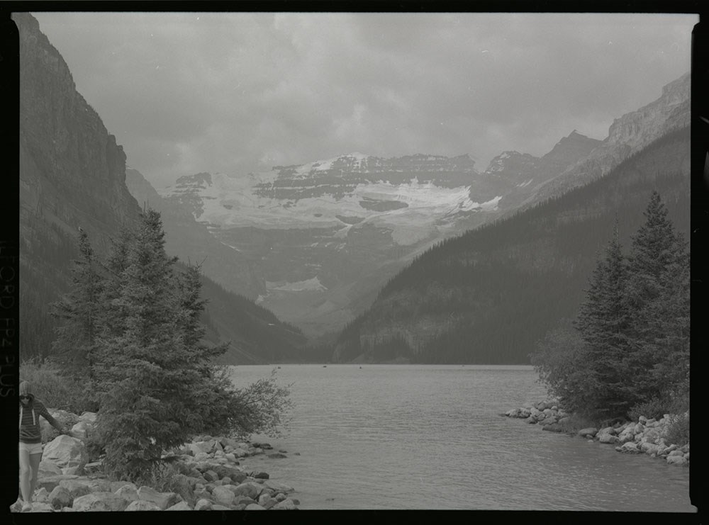
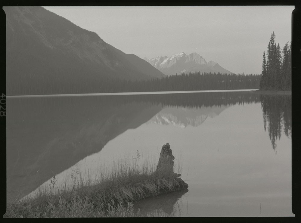
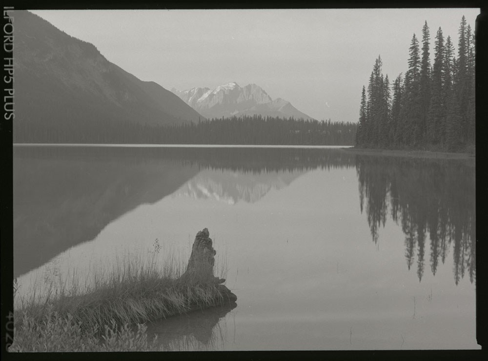
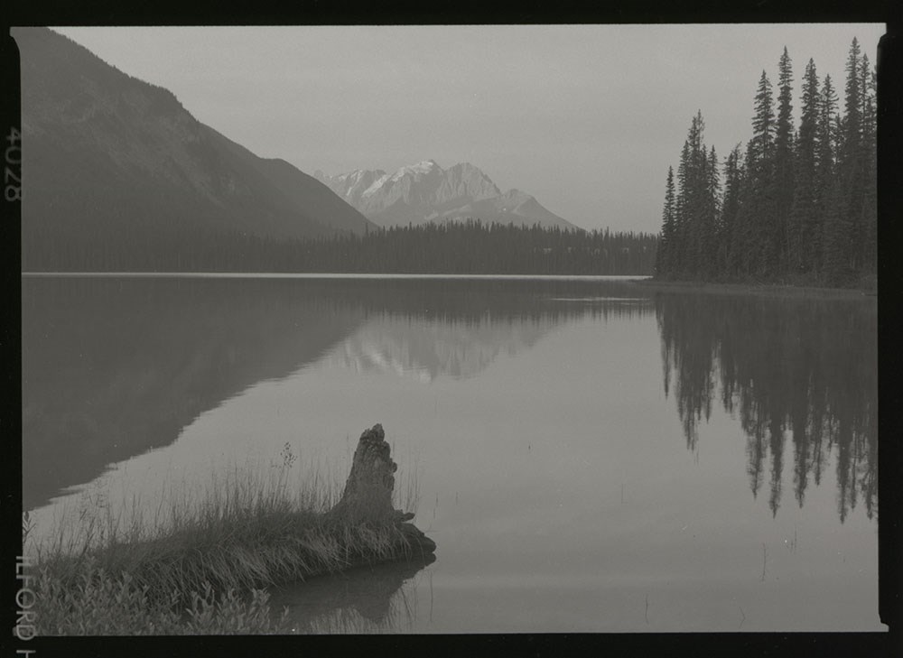
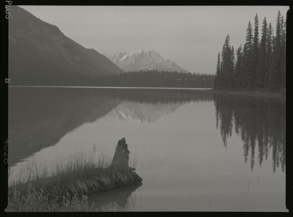
- Part Of
- Henry Vaux Jr. fonds
- Scope & Content
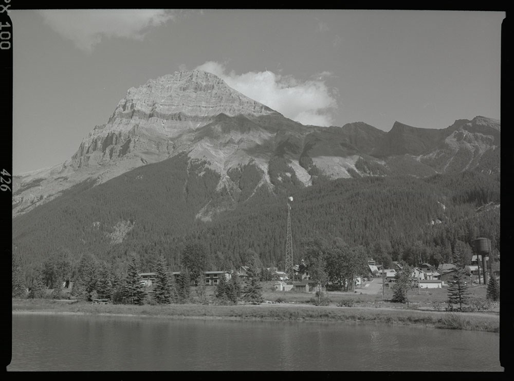
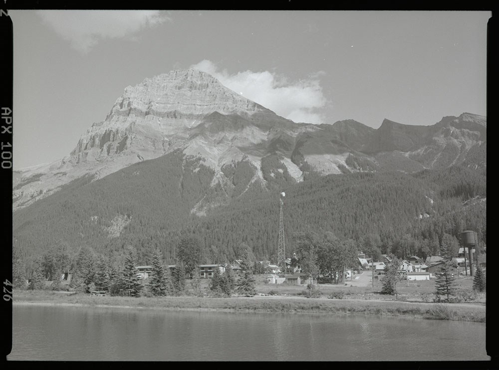
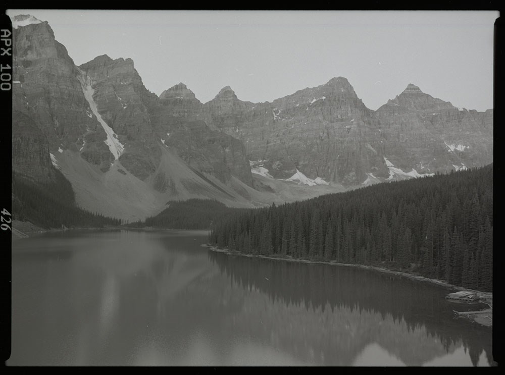
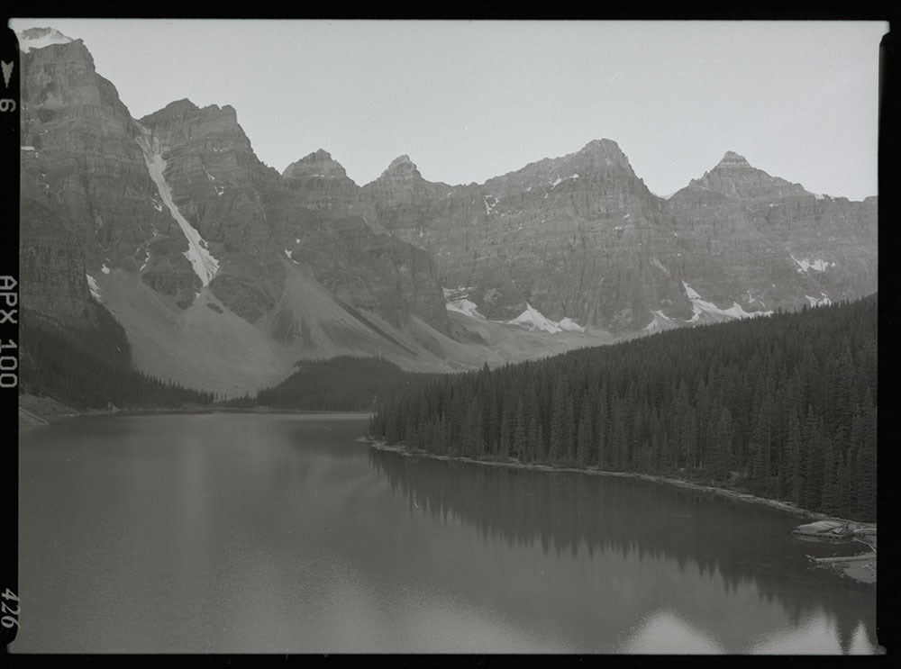
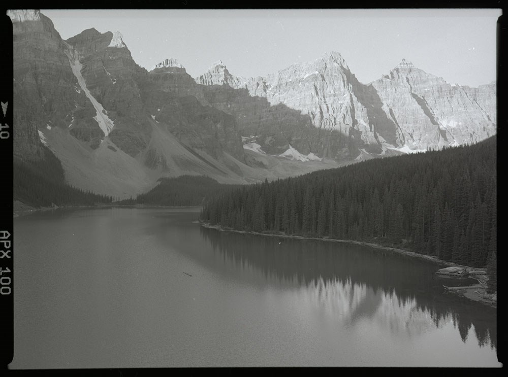
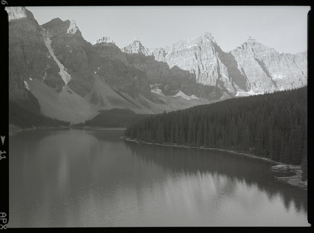
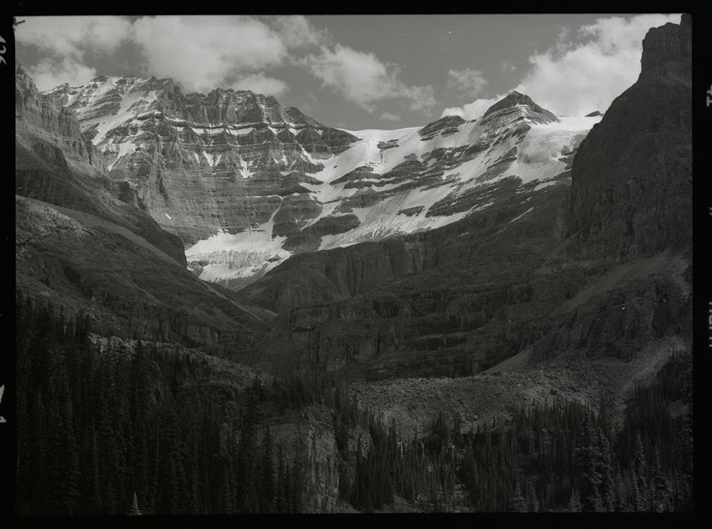
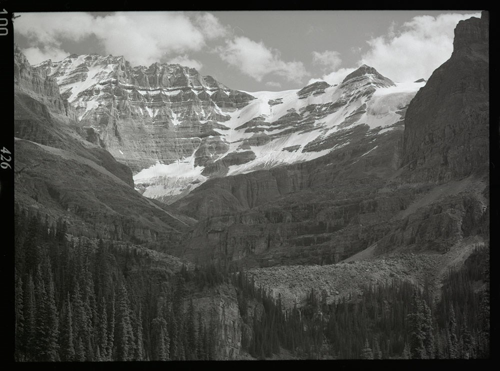
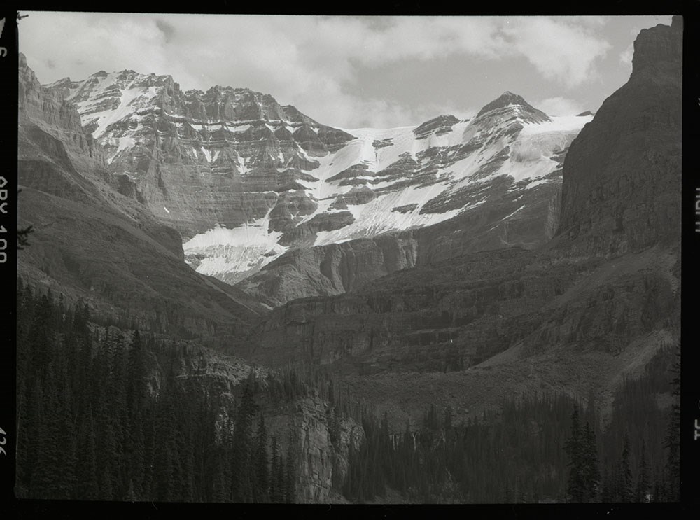
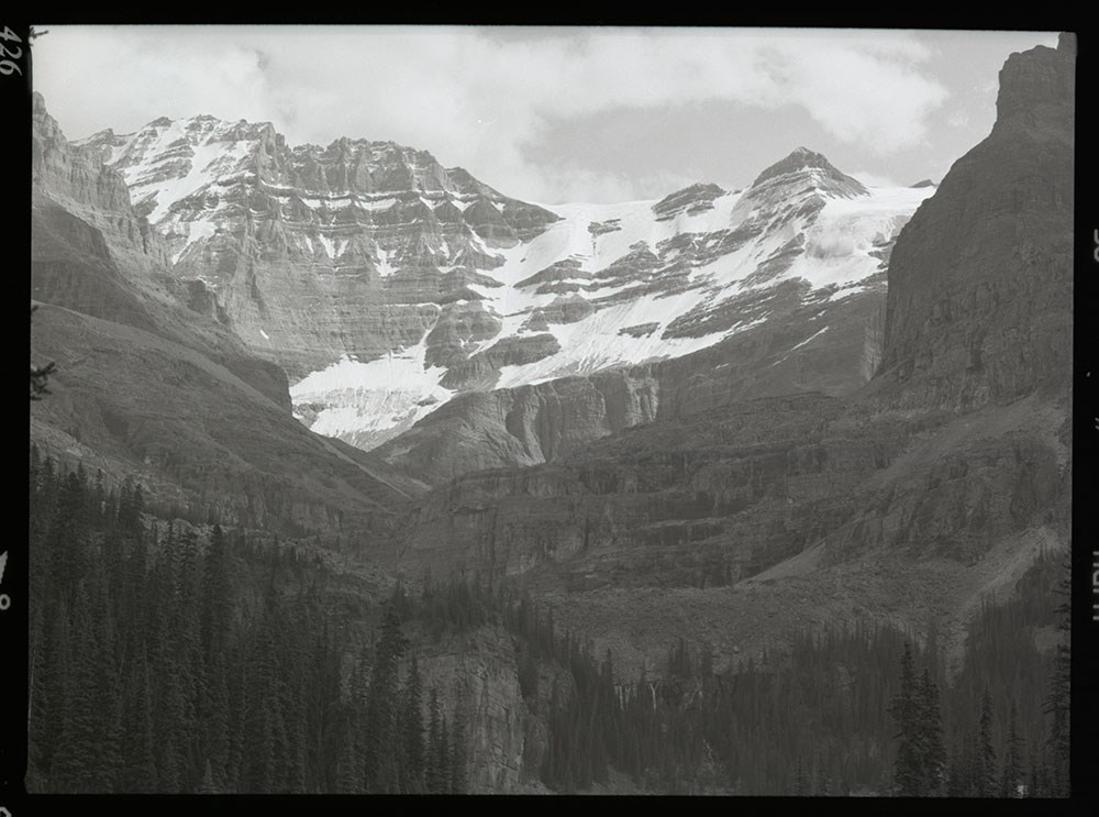
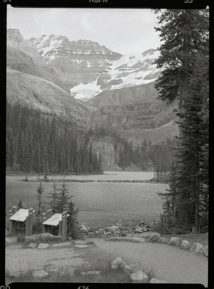
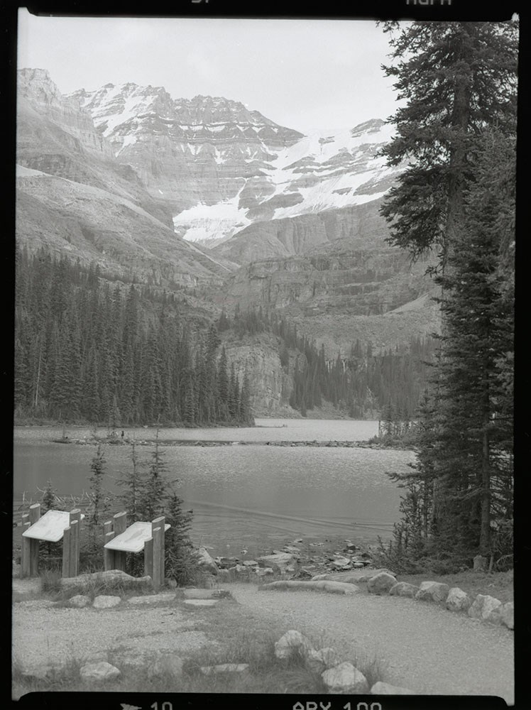
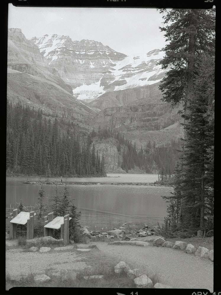
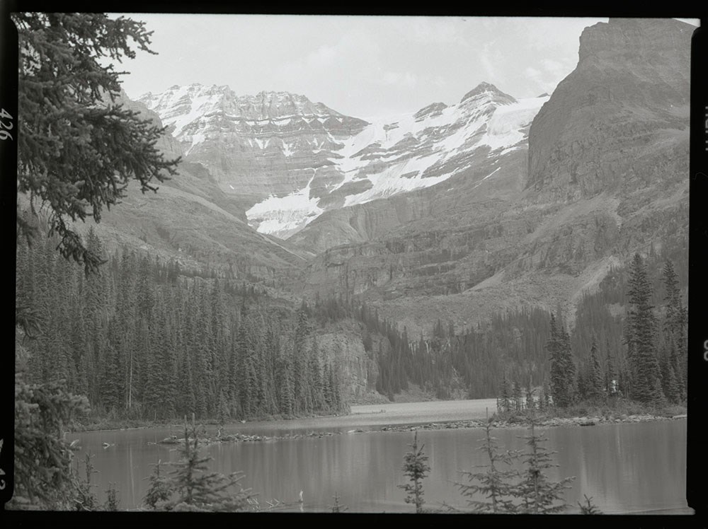
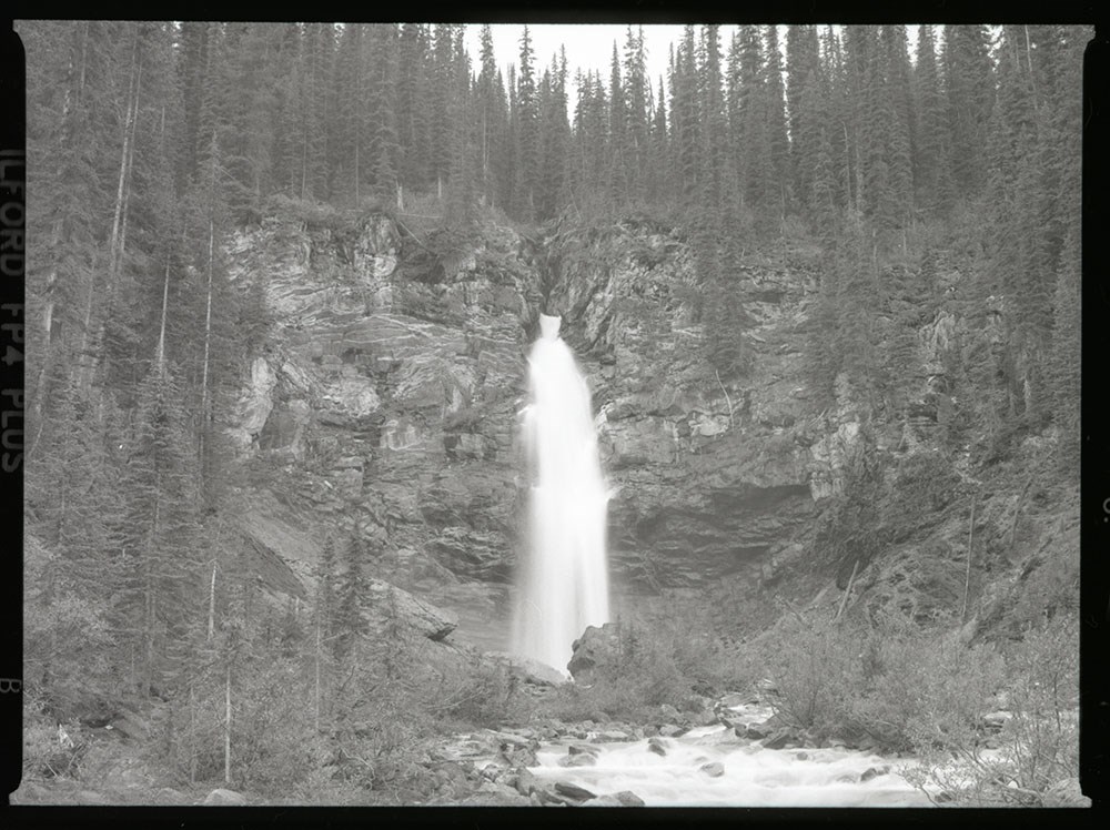
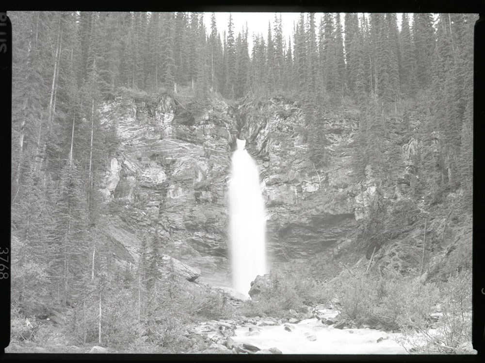
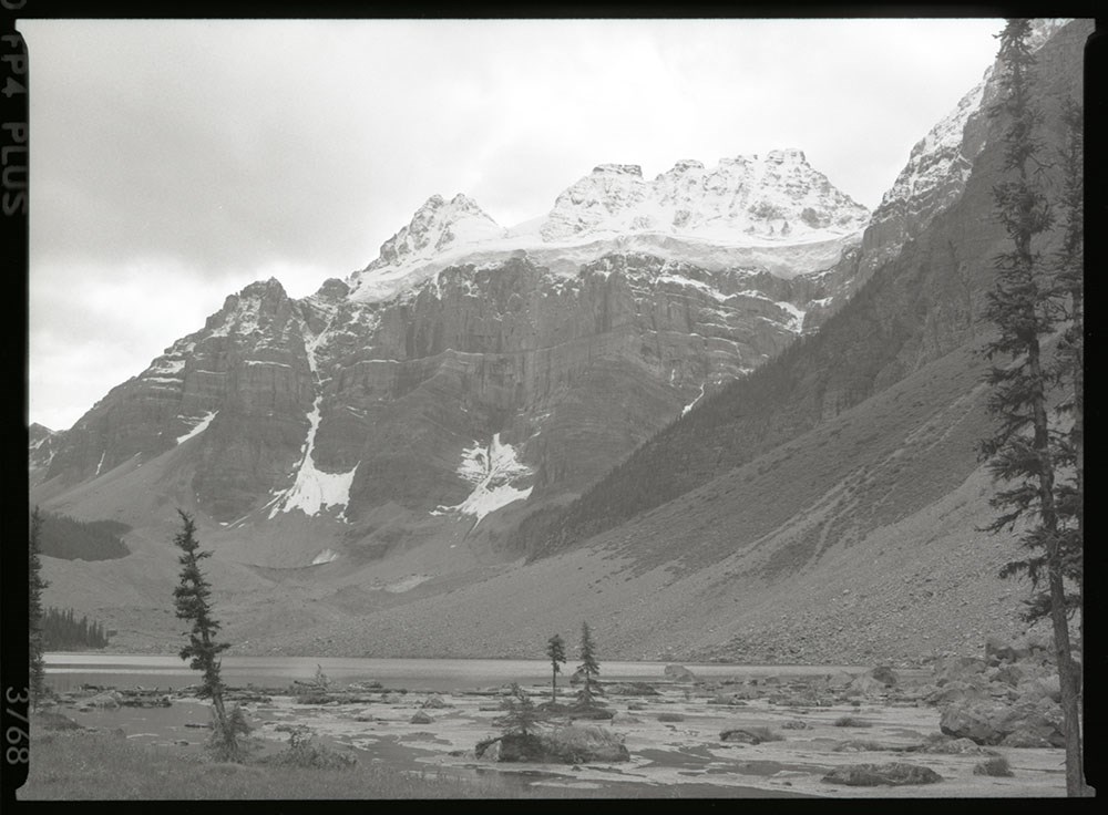
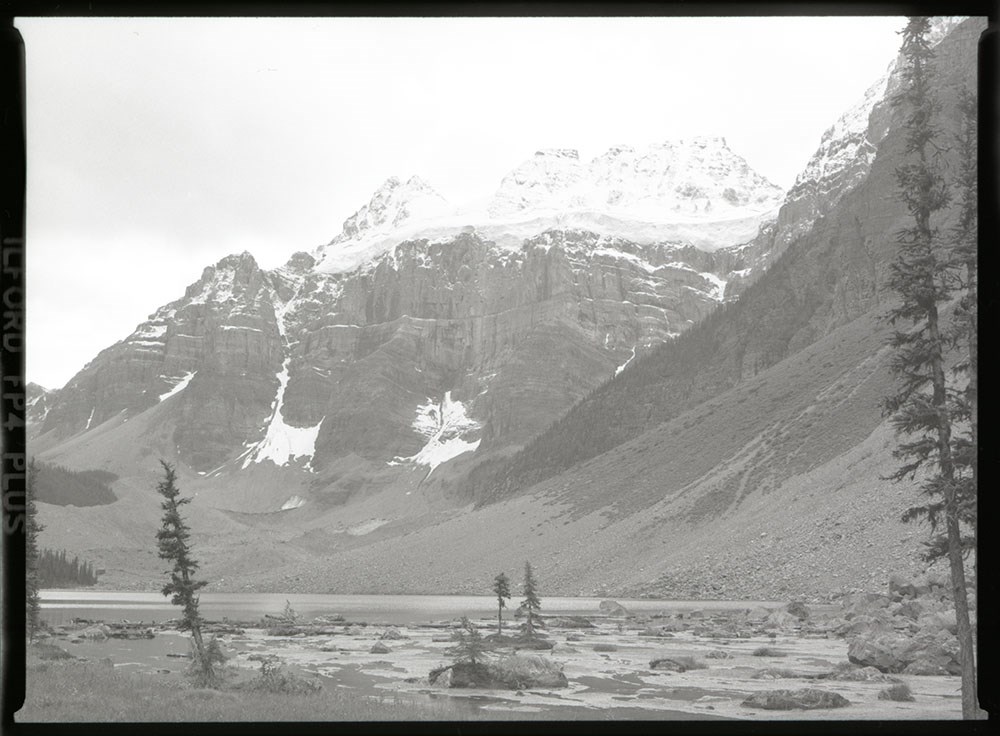
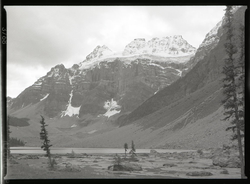
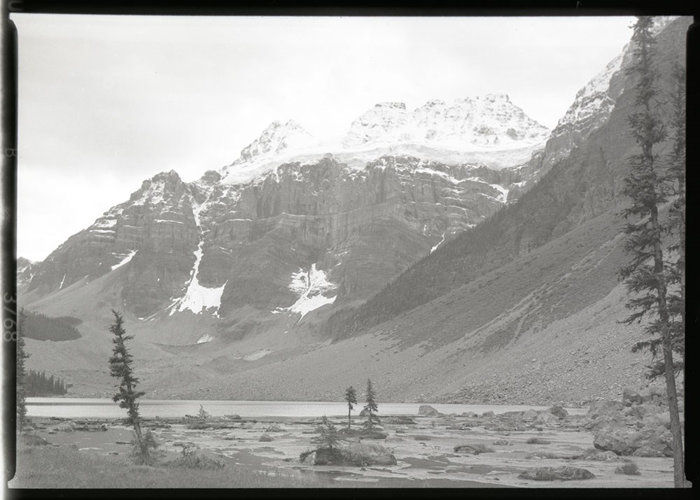
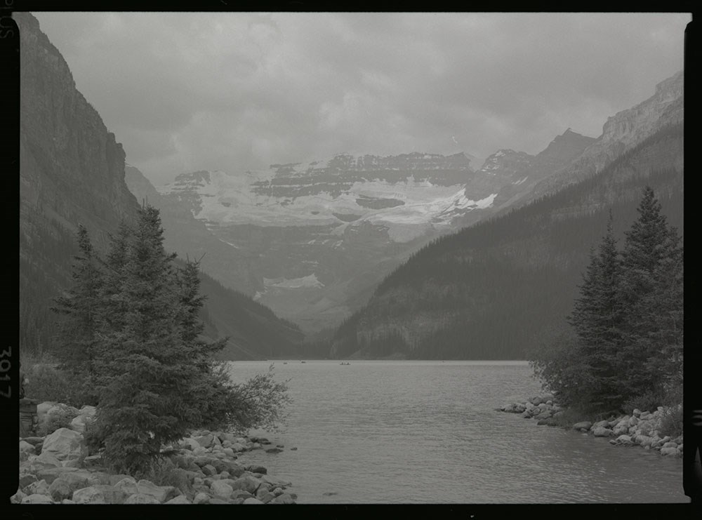
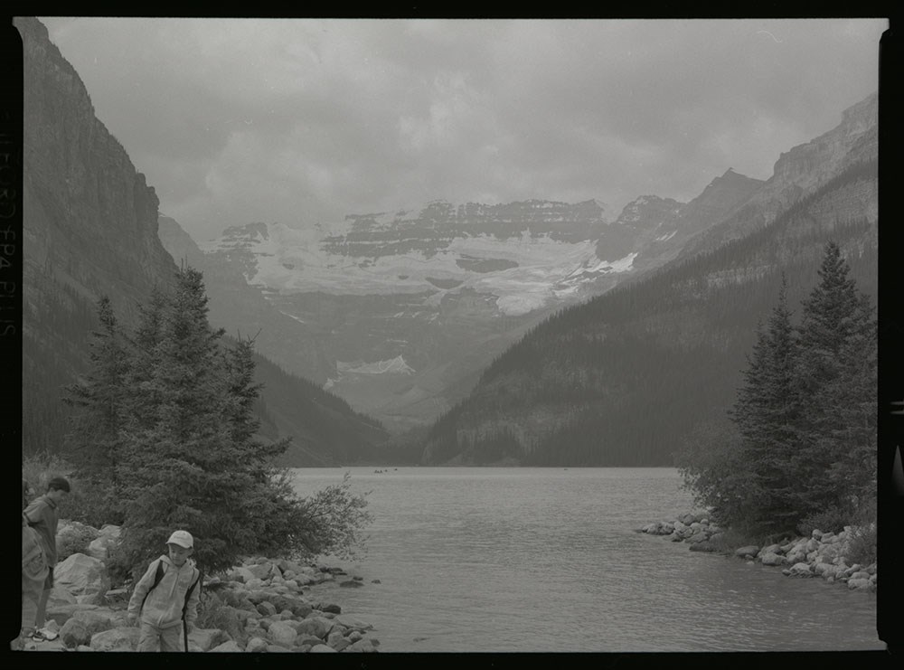
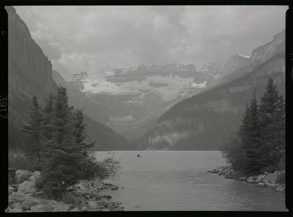
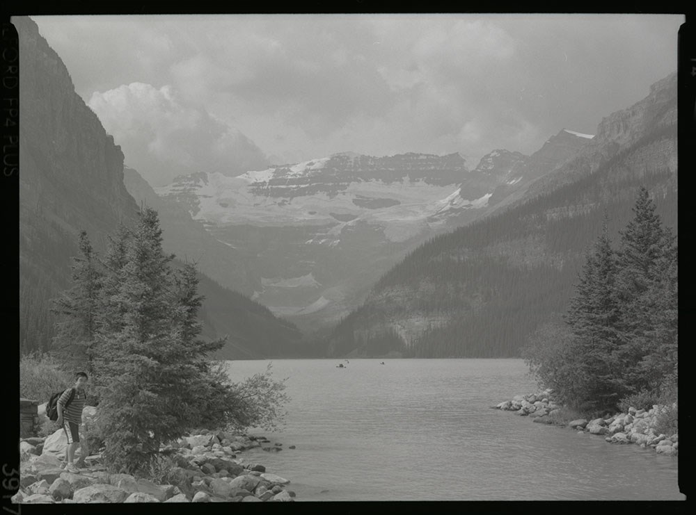
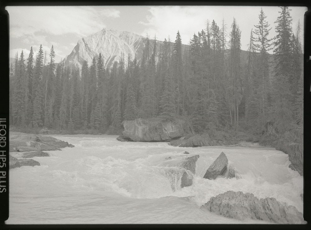
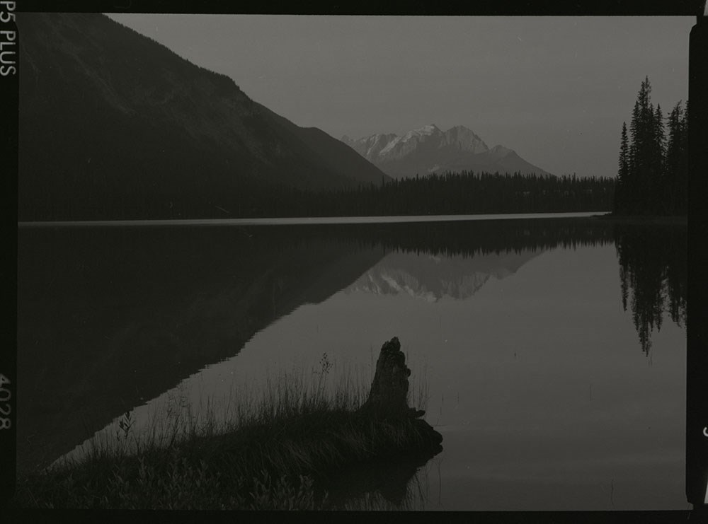
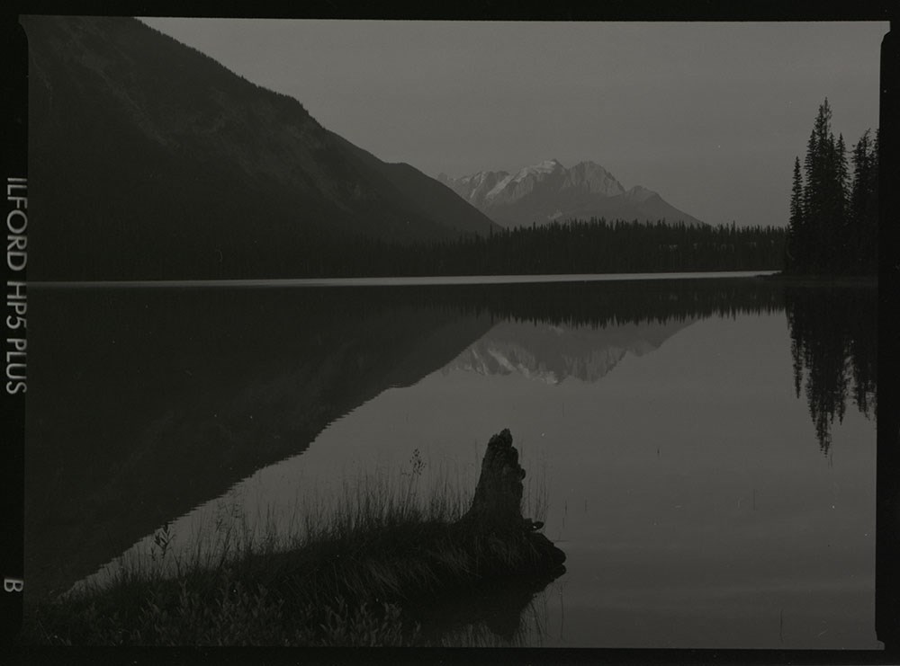
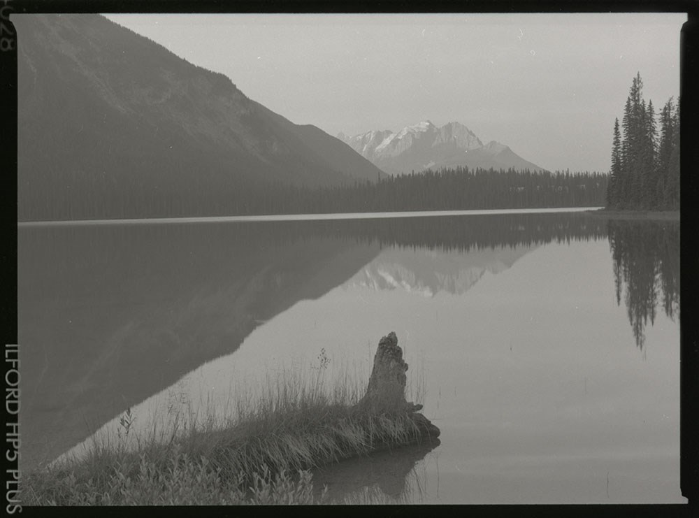
- Sub-series consists of images by Henry Vaux Jr. depicting lakes and surrounding landscapes throughout the Canadian Rockies. Locations include Moraine Lake, Lake O'Hara, Consolation Lake, Lake Louise and Emerald Lake.
- Date Range
- 2002
- 2008
- 2010
- [ca. 2005 - ca. 2010]
- Reference Code
- V794 / I / D / NA - 1 to NA - 75
- Description Level
- 4 / Sub-series
- GMD
- Negative
- Photograph
75 images
- Part Of
- Henry Vaux Jr. fonds
- Description Level
- 4 / Sub-series
- Fonds Number
- V794
- Series
- V794 / I : Legacy in Time
- Sous-Fonds
- V794
- Accession Number
- 2018.9008
- Reference Code
- V794 / I / D / NA - 1 to NA - 75
- GMD
- Negative
- Photograph
- Responsibility
- Produced by Henry Vaux Jr.
- Date Range
- 2002
- 2008
- 2010
- [ca. 2005 - ca. 2010]
- Physical Description
- 75 Photographs: negatives; b&w
- Scope & Content
- Sub-series consists of images by Henry Vaux Jr. depicting lakes and surrounding landscapes throughout the Canadian Rockies. Locations include Moraine Lake, Lake O'Hara, Consolation Lake, Lake Louise and Emerald Lake.
- Name Access
- Vaux, Henry Jr.
- Subject Access
- Lake
- Landscapes
- Photography
- Mountain
- Geographic Access
- Canada
- Alberta
- Canadian Rocky Mountains
- Language
- English
- Creator
- Henry Vaux Jr.
- Title Source
- Title based on contents of file
- Processing Status
- Processed
Images


This material is presented as originally created; it may contain outdated cultural descriptions and
potentially offensive content.
Read more.
Letters and reviews, second edition
https://archives.whyte.org/en/permalink/descriptions55950
- Part Of
- Ben Gadd fonds
- Scope & Content
- File consists of letters from readers and published reviews pertaining to the second edition of Ben Gadd's book, Handbook of the Canadian Rockies.
- Date Range
- 1995-2000
- 2003
- 2005-2006
- Reference Code
- M590 / II / A / 21
- Description Level
- 5 / File
- GMD
- Textual record
- Part Of
- Ben Gadd fonds
- Description Level
- 5 / File
- Fonds Number
- M590
- V810
- S61
- Series
- M590 / II : Research and publication records
- Sous-Fonds
- M590
- Sub-Series
- M590 / II / A : Handbook of the Canadian Rockies
- Accession Number
- 2021.20
- Reference Code
- M590 / II / A / 21
- GMD
- Textual record
- Date Range
- 1995-2000
- 2003
- 2005-2006
- Physical Description
- 2 cm of textual records
- Scope & Content
- File consists of letters from readers and published reviews pertaining to the second edition of Ben Gadd's book, Handbook of the Canadian Rockies.
- Name Access
- Gadd, Ben
- Subject Access
- Research
- Publication
- Professional and Personal Life
- Correspondence
- Wildlife
- Natural history
- Environment
- Geographic Access
- Canada
- Alberta
- Jasper
- Canadian Rocky Mountains
- Reproduction Restrictions
- Restrictions may apply
- Language
- English
- Category
- Environment
- Title Source
- Title based on contents of file
- Processing Status
- Processed
This material is presented as originally created; it may contain outdated cultural descriptions and
potentially offensive content.
Read more.
A Life in the Wild: The Story of Mountain Explorer John Baldwin - sound recordings
https://archives.whyte.org/en/permalink/descriptions55057
- Part Of
- Chic Scott fonds
- Scope & Content
- Series consists of five sound recordings pertaining to A Life in the Wild: The Story of Mountain Explorer John Baldwin. Includes interviews of John Baldwin, Helen Soudat, Ed Amann and "Steve".
- Date Range
- 2002 - 2019
- Reference Code
- S47 / XV
- Description Level
- 3 / Series
- GMD
- Sound recording
- Cassette
- Part Of
- Chic Scott fonds
- Description Level
- 3 / Series
- Fonds Number
- M57 / V40 / S47
- Series
- S47 / XV : A Life in the Wild: The Story of Mountain Explorer John Baldwin
- Sous-Fonds
- S47
- Reference Code
- S47 / XV
- Date Range
- 2002 - 2019
- Physical Description
- 5 sound recordings
- History / Biographical
- A Life in the Wild is a biography of John Baldwin written by Chic Scott. The booklet is the Twenty-fifth in the Alpine Club of Canada's Summit Series which recognizes and celebrates the accomplishments of exceptional individuals who have, through their achievements as explorers, mountaineers, volunteers, outfitters and storytellers, helped define and shape Canada's unique mountain community. "Since his teenage years John Baldwin has explored the rugged Coast Mountain Range, climbing 700 peaks, many of them first ascents, and making perhaps one-hundred multi-week, long-distance forays across the icefields and along the ridges of what is one of the last true wilderness areas on earth. Shunning the easy path and forging his own way through some of the roughest geography on the planet. He is a mountaineer and explorer of the first order." - Chic Scott
- Scope & Content
- Series consists of five sound recordings pertaining to A Life in the Wild: The Story of Mountain Explorer John Baldwin. Includes interviews of John Baldwin, Helen Soudat, Ed Amann and "Steve".
- Subject Access
- Alpine Club of Canada
- Biography
- Climbing
- Environment
- Exploration
- Hiking
- Mountaineering
- Mountaineers
- Personal and Professional Life
- Recreation
- Research
- Sports
- Summit
- Geographic Access
- Canada
- Alberta
- Banff National Park
- Jasper National Park
- Canadian Rocky Mountains
- Language
- English
- Biographical Source Notes
- http://johnbaldwin.ca/a-life-in-the-wild.asp
- Title Source
- Title based on contents of file
- Processing Status
- Processed
This material is presented as originally created; it may contain outdated cultural descriptions and
potentially offensive content.
Read more.
- Part Of
- Murray Hay fonds
- Scope & Content
- File consists of 2 prints : col. ; 35 x 28 cm. File pertains to Murray Hay's rendering of Marmot Basin ski area in Jasper National Park. File includes two iterations of reproduction draft prints of Hay's map of Marmot Basin.
- Date Range
- ca.1976-ca.2000
- Reference Code
- V795 / II / B / i / 1
- Description Level
- 5 / File
- GMD
- Map
- Private record
- Part Of
- Murray Hay fonds
- Description Level
- 5 / File
- Fonds Number
- M570 / V795
- Series
- V795 / II : Unpublished Material
- Sous-Fonds
- V795
- Sub-Series
- V795 / II / B : Alberta / i : Jasper National Park
- Accession Number
- 2019.41
- Reference Code
- V795 / II / B / i / 1
- GMD
- Map
- Private record
- Date Range
- ca.1976-ca.2000
- Physical Description
- 2 prints : col. ; 35 x 28 cm
- Scope & Content
- File consists of 2 prints : col. ; 35 x 28 cm. File pertains to Murray Hay's rendering of Marmot Basin ski area in Jasper National Park. File includes two iterations of reproduction draft prints of Hay's map of Marmot Basin.
- Name Access
- Hay, Murray
- Subject Access
- Advertising
- Artist
- Ski Maps
- Ski area
- Map
- Cartography
- Sports and recreation
- Tourism
- Tourist information
- Winter
- Winter sports
- Geographic Access
- Jasper Marmot Basin
- Jasper National Park
- Alberta
- Canada
- Canadian Rocky Mountains
- Language
- English
- Related Material
- M570 / III / B / iii / 1
- Creator
- Hay, Murray
- Title Source
- Title based on contents of file
- Processing Status
- Processed
This material is presented as originally created; it may contain outdated cultural descriptions and
potentially offensive content.
Read more.
Mount Aylmer Summit Records
https://archives.whyte.org/en/permalink/descriptions57739
- Part Of
- Alpine Club of Canada fonds
- Scope & Content
- Files consist of summit notes and summit registers from Mount Aylmer produced by the Alpine Club of Canada between 1988 and 2005. Summit records include entries from visitors to the various summits which pertain to individuals' hiking and climbing trips; details of specific events which occurred wh…
- Date Range
- 1988-2005
- Reference Code
- M200 / V / A / 151 to 152
- Description Level
- 5 / File
- GMD
- Textual record
- Organization record
- Part Of
- Alpine Club of Canada fonds
- Description Level
- 5 / File
- Fonds Number
- M200
- V14
- S6
- Series
- M200 / V: Summit Records
- Sous-Fonds
- M200
- Sub-Series
- M200 / V / A: Identified Summit Records
- Accession Number
- accn. 2023.10
- accn. 7779
- Reference Code
- M200 / V / A / 151 to 152
- Responsibility
- Summit Registers and Notes produced by Alpine Club of Canada
- Date Range
- 1988-2005
- Physical Description
- 2 cm of textual records 2 volumes
- History / Biographical
- Mount Aylmer is located in Banff National Park, Alberta, and is part of the Palliser Range of the Canadian Rockies. Nearby are Banff and Canmore.
- Scope & Content
- Files consist of summit notes and summit registers from Mount Aylmer produced by the Alpine Club of Canada between 1988 and 2005. Summit records include entries from visitors to the various summits which pertain to individuals' hiking and climbing trips; details of specific events which occurred while at the summit, wildlife sightings, trail updates, and related topics. Files include: M200 / V / A / 151: Mount Aylmer summit register July 29, 1988 - Aug. 25, 1995 via ACC office Feb. 1998 M200 / V / A / 152: Mt. Aylmer Sept. 4, 1995 - Aug 20, 2005
- Name Access
- Alpine Club of Canada
- Subject Access
- Alberta
- Alpine Club of Canada
- Backpacking
- Banff
- Banff National Park
- Climbing
- Club
- Description and travel
- Environment
- Environment and Nature
- Hiking
- Mountain
- Mountaineering
- Mountaineers
- Mountains
- National parks and reserves
- Parks
- Record keeping
- Ski mountaineering
- Sports and leisure
- Sports and recreation
- Summit
- Trails
- Geographic Access
- Canada
- Canadian Rocky Mountains
- Rocky Mountains
- Alberta
- Banff National Park
- Banff, AB
- Banff, Alberta
- Canmore
- Canmore, AB
- Canmore, Alberta
- Palliser Range
- Mount Aylmer
- Access Restrictions
- Restrictions may apply
- Language
- English
- French
- Related Material
- M235
- Title Source
- Original title
- Processing Status
- Processed
This material is presented as originally created; it may contain outdated cultural descriptions and
potentially offensive content.
Read more.
Mount Baldy Summit Notes
https://archives.whyte.org/en/permalink/descriptions54264
- Scope & Content
- File consists of 32 paper and cardboard scraps (one laminated) containing individual handwritten notes by numerous authors. Content pertains to personal notes and accounts of ascent of Mount Baldy. Many notes dated and listing names of author(s), some with further detailed accounts of ascent. Also …
- Date Range
- 2009
- 2010
- 2012
- Reference Code
- M235 / accn. 8072
- Description Level
- 5 / File
- GMD
- Textual record
- Description Level
- 5 / File
- Fonds Number
- M235
- Sous-Fonds
- M235
- Accession Number
- 8072
- Reference Code
- M235 / accn. 8072
- GMD
- Textual record
- Responsibility
- Martin Provencher
- Date Range
- 2009
- 2010
- 2012
- Physical Description
- 33 Textual records: handwritten notes
- Scope & Content
- File consists of 32 paper and cardboard scraps (one laminated) containing individual handwritten notes by numerous authors. Content pertains to personal notes and accounts of ascent of Mount Baldy. Many notes dated and listing names of author(s), some with further detailed accounts of ascent. Also one rolled piece of paper material, annotated, containing dried plant matter.
- Name Access
- Provencher, Martin
- Geographic Access
- Canada
- Canadian Rocky Mountains
- Mount Baldy
- Language
- English
- Mandarin
- Conservation
- Items must be kept flat and stored away from risky materials such as ink, adhesives, etc. to prevent further deterioration.
- Title Source
- Title based on contents of file
- Processing Status
- Processed
This material is presented as originally created; it may contain outdated cultural descriptions and
potentially offensive content.
Read more.
Mount Edith Summit Records
https://archives.whyte.org/en/permalink/descriptions57695
- Part Of
- Alpine Club of Canada fonds
- Scope & Content
- Files consist of summit notes and summit registers from Mount Edith (in Banff National Park), produced by the Alpine Club of Canada between around 1987 and 2015. Summit records include entries from visitors to the various summits which pertain to individuals' hiking and climbing trips; details of s…
- Date Range
- ca.1987-2005
- 2007-2015
- Reference Code
- M200 / V / A / 101 to 105
- Description Level
- 5 / File
- GMD
- Textual record
- Organization record
- Part Of
- Alpine Club of Canada fonds
- Description Level
- 5 / File
- Fonds Number
- M200
- V14
- S6
- Series
- M200 / V: Summit Records
- Sous-Fonds
- M200
- Sub-Series
- M200 / V / A: Identified Summit Records
- Accession Number
- accn. 2023.10
- accn. 7779
- accn. 2023.19
- Reference Code
- M200 / V / A / 101 to 105
- Responsibility
- Summit Registers and Notes produced by Alpine Club of Canada
- Date Range
- ca.1987-2005
- 2007-2015
- Physical Description
- 5 volumes 8 cm of textual records
- History / Biographical
- Mount Edith is located in the Bow Valley of Banff National Park, AB, and is along the Sawback Range. It was named for Edith Orde who worked as an assistant to Lady Agnes Macdonald.
- Scope & Content
- Files consist of summit notes and summit registers from Mount Edith (in Banff National Park), produced by the Alpine Club of Canada between around 1987 and 2015. Summit records include entries from visitors to the various summits which pertain to individuals' hiking and climbing trips; details of specific events which occurred while at the summit, wildlife sightings, trail updates, and related topics. Files include: M200 / V / A / 101: Mount Edith North Summit Summit register Aug. 5, 1993 - June 17, 1995 M200 / V / A / 102: [Mt. Edith? 1997 - 2001] M200 / V / A / 103: [Summit Notes and Mt. Edith Summit Register. ca. 1987 - 2005] M200 / V / A / 104: Mt. Edith summit register July 16, 1995 - July 12, 1998 M200 / V / A / 105: Mount Edith notebook filled [2007-2015]
- Name Access
- Alpine Club of Canada
- Subject Access
- Alberta
- Alpine Club of Canada
- Backcountry skiing
- Backpacking
- Banff
- Banff National Park
- Bow Valley
- Climbing
- Club
- Cross-country skiing
- Description and travel
- Environment
- Environment and Nature
- Hiking
- Mountain
- Mountaineering
- Mountaineers
- Mountains
- National parks and reserves
- Parks
- Record keeping
- Ski areas
- Ski area
- Skiing
- Skiers
- Ski mountaineering
- Sports and leisure
- Sports and recreation
- Summit
- Trails
- Winter sports
- Geographic Access
- Canada
- Alberta
- Canadian Rocky Mountains
- Rocky Mountains
- Banff National Park
- Banff
- Access Restrictions
- Restrictions may apply
- Language
- English
- French
- German
- Conservation
- Some registers contain evidence of mold.
- Related Material
- M235
- Biographical Source Notes
- Peak Finder: Mount Edith, Canadian Rockies Database: https://cdnrockiesdatabases.ca/peaks/414
- Title Source
- Title based on contents of file
- Processing Status
- Processed
This material is presented as originally created; it may contain outdated cultural descriptions and
potentially offensive content.
Read more.
Mount Fisher Summit Register, 2005-2009
https://archives.whyte.org/en/permalink/descriptions57798
- Part Of
- Alpine Club of Canada fonds
- Scope & Content
- File consists of a summit record from Mount Fisher produced by the Alpine Club of Canada between 2005 and 2009. Summit record includes entries from visitors to the various summits which pertain to individuals' hiking and climbing trips; details of specific events which occurred while at the summit,…
- Date Range
- 2005-2009
- Reference Code
- M200 / V / A / 217
- Description Level
- 5 / File
- GMD
- Textual record
- Organization record
- Part Of
- Alpine Club of Canada fonds
- Description Level
- 5 / File
- Fonds Number
- M200
- V14
- S6
- Series
- M200 / V: Summit Records
- Sous-Fonds
- M200
- Sub-Series
- M200 / V / A: Identified Summit Records
- Accession Number
- accn. 2014.8316
- Reference Code
- M200 / V / A / 217
- Responsibility
- Summit Registers and Notes produced by Alpine Club of Canada
- Date Range
- 2005-2009
- Physical Description
- 1 volume 2 cm of textual records
- History / Biographical
- Mount Fisher, also known as Fisher Peak, is part of the Hughes Range of the Canadian Rockies in southeastern British Columbia. Nearby are Cranbrook, Fort Steele, and Mount Morro.
- Scope & Content
- File consists of a summit record from Mount Fisher produced by the Alpine Club of Canada between 2005 and 2009. Summit record includes entries from visitors to the various summits which pertain to individuals' hiking and climbing trips; details of specific events which occurred while at the summit, wildlife sightings, trail updates, and related topics. File: M200 / V / A / 217: Mount Fisher Summit Register, 2005-2009
- Name Access
- Alpine Club of Canada
- Subject Access
- Alpine Club of Canada
- Backpacking
- British Columbia
- Climbing
- Club
- Description and travel
- Environment
- Environment and Nature
- Hiking
- Mountain
- Mountaineering
- Mountaineers
- Mountains
- Record keeping
- Sports and leisure
- Sports and recreation
- Summit
- Trails
- Geographic Access
- Canada
- Canadian Rocky Mountains
- Rocky Mountains
- Hughes Range
- British Columbia
- Cranbrook, BC
- Cranbrook
- Cranbrook, British Columbia
- Fort Steele
- Mount Morro
- Mount Fisher
- Fisher Peak
- Access Restrictions
- Restrictions may apply
- Language
- English
- German
- Conservation
- Front cover of register has become detached from rest of book.
- Related Material
- M235
- Title Source
- Original title
- Processing Status
- Processed
This material is presented as originally created; it may contain outdated cultural descriptions and
potentially offensive content.
Read more.