Narrow Results By
- Catharine Robb Whyte, O. C. (1906 – 1979, Canadian) 29
- Charles John Collings (1848 – 1931, British) 21
- Peter Whyte (1905 – 1966, Canadian) 9
- Frederic Marlett Bell-Smith, R. C. A. (1846 – 1923, Canadian) 3
- C. Firth 2
- John Arthur Fraser (1838 – 1898, English) 2
- Thomas Mower Martin, R. C. A. (1838 – 1934, Canadian) 2
- William Hastings McMahon (1864 – 1956, Canadian) 2
- Adeline Baxter (1881 – 1959) 1
- Chalifour, J.E., Chief Geographer 1
- D. Clark 1
- Ernest C. W Lamarque (1879 – 1970, Canadian) 1
(a): Topographical sheets|(b): Original map
https://archives.whyte.org/en/permalink/catalogue24654
- Medium
- Library - Maps and blueprints (unannotated; published)
- Map
- Published Date
- 1889
- Publisher
- Dept. of the Interior
- Call Number
- C3-8.14 (a)
- C3-8.14 (b)
- Publisher
- Dept. of the Interior
- Published Date
- 1889
- Scale
- Scale:1:40,000
- Relief: Contour interval 100 ft.
- Subjects
- Anthracite
- Notes
- (b): 8 dup in map room
- Accession Number
- 675
- 400
- 3069
- Call Number
- C3-8.14 (a)
- C3-8.14 (b)
- Collection
- Archives Library
This material is presented as originally created; it may contain outdated cultural descriptions and
potentially offensive content.
Read more.
Alberta : Athabaska sheet
https://archives.whyte.org/en/permalink/catalogue24415
- Medium
- Library - Maps and blueprints (unannotated; published)
- Map
- Published Date
- 1914
- Publisher
- Ottawa: Office of the Surveyor General
- Edition
- 2d ed.
- Call Number
- C9-2.4
- Edition
- 2d ed.
- Publisher
- Ottawa: Office of the Surveyor General
- Published Date
- 1914
- Physical Description
- 1 map
- Scale
- Scale: 1:190,080
- Subjects
- Athabaska River
- Notes
- Sectional map
- Accession Number
- 5576
- 4008
- Call Number
- C9-2.4
- Collection
- Archives Library
This material is presented as originally created; it may contain outdated cultural descriptions and
potentially offensive content.
Read more.
[Alberta] South-central portion
https://archives.whyte.org/en/permalink/catalogue24416
- Medium
- Library - Maps and blueprints (unannotated; published)
- Map
- Published Date
- 1910
- Publisher
- Dept. of the Interior, Ottawa
- Call Number
- C9-3.1
- Publisher
- Dept. of the Interior, Ottawa
- Published Date
- 1910
- Scale
- Bench marks
- Subjects
- Alberta
- Notes
- 1 duplicate in map room - Accn. 400
- Accession Number
- 400
- Call Number
- C9-3.1
- Collection
- Archives Library
This material is presented as originally created; it may contain outdated cultural descriptions and
potentially offensive content.
Read more.
- Date
- 1916 – 1927
- Medium
- charcoal; pastel; on paper
- Catalogue Number
- WyP.03.062
- Description
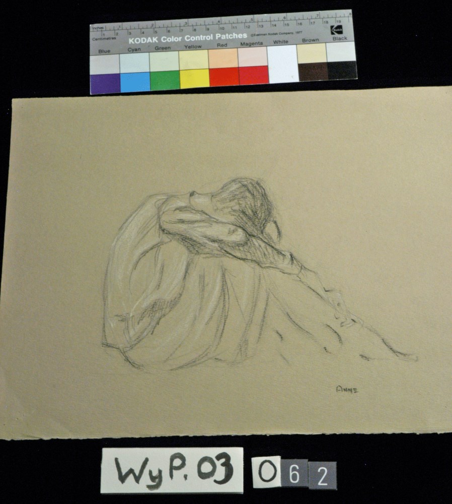
- Person sitting with head bent over raised knees.
1 image
- Title
- Anne
- Date
- 1916 – 1927
- Medium
- charcoal; pastel; on paper
- Dimensions
- 26.4 x 33.3 cm
- Description
- Person sitting with head bent over raised knees.
- Credit
- Gift of Catharine Robb Whyte, O. C., Banff, 1975
- Catalogue Number
- WyP.03.062
Images
This material is presented as originally created; it may contain outdated cultural descriptions and
potentially offensive content.
Read more.
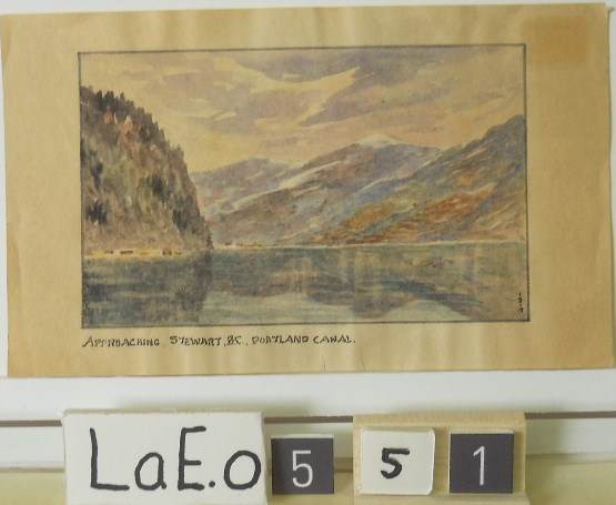
Approaching Stewart B.C. Portland Canal
https://archives.whyte.org/en/permalink/artifactlae.05.51
- Date
- 1919
- Medium
- watercolour on paper
- Catalogue Number
- LaE.05.51
1 image
- Title
- Approaching Stewart B.C. Portland Canal
- Date
- 1919
- Medium
- watercolour on paper
- Dimensions
- 8.7 x 14.1 cm
- Credit
- Gift of Ernest Lamarque (Estate), 1971
- Catalogue Number
- LaE.05.51
Images
This material is presented as originally created; it may contain outdated cultural descriptions and
potentially offensive content.
Read more.
(Athabaska River area) - junction with Snarling River
https://archives.whyte.org/en/permalink/catalogue24502
- Medium
- Library - Maps and blueprints (unannotated; published)
- Map
- Published Date
- February 24, 1911
- Publisher
- Department of the Interior
- Call Number
- C9-7.46
- Publisher
- Department of the Interior
- Published Date
- February 24, 1911
- Physical Description
- 1 map : black and white
- Scale
- 40 chains: 1 inch
- Accession Number
- SG7500
- Call Number
- C9-7.46
- Collection
- Archives Library
This material is presented as originally created; it may contain outdated cultural descriptions and
potentially offensive content.
Read more.
(Athabaska River-Talbot Lake area)
https://archives.whyte.org/en/permalink/catalogue24508
- Medium
- Library - Maps and blueprints (unannotated; published)
- Map
- Published Date
- October 19, 1911
- Publisher
- Department of the Interior
- Call Number
- C9-7.48
- Publisher
- Department of the Interior
- Published Date
- October 19, 1911
- Physical Description
- 1 map : black and white
- Scale
- 40 chains: 1 inch
- Accession Number
- SG7500
- Call Number
- C9-7.48
- Collection
- Archives Library
This material is presented as originally created; it may contain outdated cultural descriptions and
potentially offensive content.
Read more.
[Banff - Plan of resurvey of the town of Banff]
https://archives.whyte.org/en/permalink/catalogue23262
- Medium
- Library - Maps and blueprints (unannotated; published)
- Map
- Published Date
- 1914
- Publisher
- Dept. of the Interior
- Call Number
- C4-1.8
- Publisher
- Dept. of the Interior
- Published Date
- 1914
- Scale
- Scale: 1 inch = 150 ft.
- Notes
- Black and white
- Accession Number
- 718
- 2933 deaccessioned
- Call Number
- C4-1.8
- Collection
- Archives Library
This material is presented as originally created; it may contain outdated cultural descriptions and
potentially offensive content.
Read more.
[Banff - Proposed Electric Lighting Project]
https://archives.whyte.org/en/permalink/catalogue23257
- Medium
- Library - Maps and blueprints (unannotated; published)
- Map
- Published Date
- 1912
- Publisher
- Dept. of the Interior
- Call Number
- C4-1.4
- Publisher
- Dept. of the Interior
- Published Date
- 1912
- Physical Description
- 1 map : black and white
- Scale
- Scale: 400' = 1"
- Notes
- Photostatic copy from Public Archives
- Accession Number
- 675
- Call Number
- C4-1.4
- Collection
- Archives Library
This material is presented as originally created; it may contain outdated cultural descriptions and
potentially offensive content.
Read more.
[Banff - Townsite]
https://archives.whyte.org/en/permalink/catalogue21316
- Medium
- Library - Maps and blueprints (unannotated; published)
- Map
- Published Date
- 1912
- Call Number
- C4-1.13
- Published Date
- 1912
- Subjects
- Banff townsite
- Notes
- Black and white
- DAMAGED
- Accession Number
- 1113
- Call Number
- C4-1.13
- Collection
- Archives Library
This material is presented as originally created; it may contain outdated cultural descriptions and
potentially offensive content.
Read more.
[Banff: Bow River to Moose Street]
https://archives.whyte.org/en/permalink/catalogue23258
- Medium
- Library - Maps and blueprints (unannotated; published)
- Map
- Published Date
- 1913
- Author
- Walker, C.M.
- Publisher
- Ottawa: Dept. of the Interior
- Call Number
- C4-1.4
- Author
- Walker, C.M.
- Publisher
- Ottawa: Dept. of the Interior
- Published Date
- 1913
- Physical Description
- 1 map : black and white
- Scale
- Scale indeterminable
- Subjects
- Banff - Townsite development
- Walker, C.M.
- Notes
- Compiled from official surveys, December 17, 1912, by C.M. Walker
- Accession Number
- 5670
- Call Number
- C4-1.4
- Collection
- Archives Library
This material is presented as originally created; it may contain outdated cultural descriptions and
potentially offensive content.
Read more.
Banff Springs Hotel, Rocky Mountains 1887
https://archives.whyte.org/en/permalink/artifactfic.05.01
- Artist
- C. Firth
- Date
- 1887
- Medium
- watercolour on paper
- Catalogue Number
- FiC.05.01
- Description
- Scene showing Banff springs hotel at right perched on a hillside. In the background the Bow River winds through a valley between Tunnel Mountain and Mt. Roundly. More mountains in distance. Trees in foreground. My. Roundly is hazy, almost unfinished in appearance.
1 image
- Artist
- C. Firth
- Title
- Banff Springs Hotel, Rocky Mountains 1887
- Date
- 1887
- Medium
- watercolour on paper
- Dimensions
- 12.0 x 16.0 cm
- Description
- Scene showing Banff springs hotel at right perched on a hillside. In the background the Bow River winds through a valley between Tunnel Mountain and Mt. Roundly. More mountains in distance. Trees in foreground. My. Roundly is hazy, almost unfinished in appearance.
- Credit
- Gift of Dorothy and Jim McLeod, Calgary, 2021
- Catalogue Number
- FiC.05.01
Images

This material is presented as originally created; it may contain outdated cultural descriptions and
potentially offensive content.
Read more.
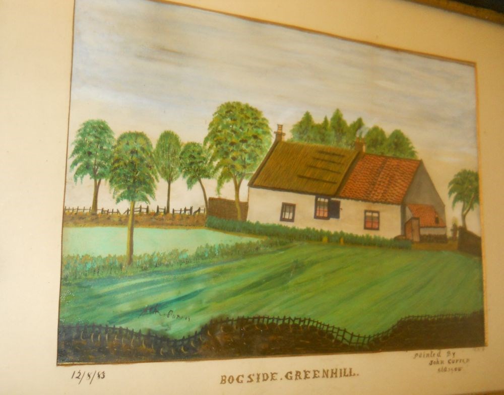
Bogside Scotland
https://archives.whyte.org/en/permalink/artifactcuj.05.01
- Date
- later than 1883
- Medium
- ink; watercolour on paper
- Catalogue Number
- CuJ.05.01
- Description
- General colour: green, orange. Central image is a house. Half of the roof is tiled with orange brick. There are trees to the left and behind. In front are fields and a cross the bottom, is a brown fence. Sky is grey.
1 image
- Title
- Bogside Scotland
- Date
- later than 1883
- Medium
- ink; watercolour on paper
- Dimensions
- 14.25 x 18.75 cm
- Description
- General colour: green, orange. Central image is a house. Half of the roof is tiled with orange brick. There are trees to the left and behind. In front are fields and a cross the bottom, is a brown fence. Sky is grey.
- Subject
- landscape
- architecture
- rural
- Credit
- Gift of Catharine Robb Whyte, O. C., Banff, 1974
- Catalogue Number
- CuJ.05.01
Images
This material is presented as originally created; it may contain outdated cultural descriptions and
potentially offensive content.
Read more.
[Boundary Between Alberta and B.C.]
https://archives.whyte.org/en/permalink/catalogue24662
- Medium
- Library - Maps and blueprints (unannotated; published)
- Map
- Published Date
- 1916
- Edition
- Sheet #12
- Call Number
- C3-9.13
- Edition
- Sheet #12
- Published Date
- 1916
- Scale
- Scale: 1:62,500
- Relief: Contour interval 100 ft.
- Series
- Sheet #12
- Notes
- 2 duplicates in Map Room
- 2 photostat copies showing outline of Mt. Assiniboine Provincial Park
- Duplicate in Boundary Atlas #1
- Accession Number
- 44
- 400
- 3349
- 2949
- Call Number
- C3-9.13
- Collection
- Archives Library
This material is presented as originally created; it may contain outdated cultural descriptions and
potentially offensive content.
Read more.
[Boundary Between Alberta and B.C.]
https://archives.whyte.org/en/permalink/catalogue24664
- Medium
- Library - Maps and blueprints (unannotated; published)
- Map
- Published Date
- 1916
- Call Number
- C3-9.15
- Published Date
- 1916
- Scale
- Scale: 1:62,500
- Relief: Contour interval 100 ft.
- Series
- Sheet #15
- Notes
- Duplicate in Map Room
- Duplicate in Boundary Atlas #1
- Accession Number
- 400
- Call Number
- C3-9.15
- Collection
- Archives Library
This material is presented as originally created; it may contain outdated cultural descriptions and
potentially offensive content.
Read more.
[Boundary Between Alberta and B.C.]
https://archives.whyte.org/en/permalink/catalogue24665
- Medium
- Library - Maps and blueprints (unannotated; published)
- Map
- Published Date
- 1917
- Call Number
- C3-9.17, -9.18
- Published Date
- 1917
- Scale
- Scale: 1:62,500
- Relief: Contour interval 100 ft.
- Series
- Sheet #17, Sheet #18
- Notes
- Duplicate in Boundary Atlas #2
- Accession Number
- 718
- Call Number
- C3-9.17, -9.18
- Collection
- Archives Library
This material is presented as originally created; it may contain outdated cultural descriptions and
potentially offensive content.
Read more.
Boundary between Alberta and British Columbia / Interprovincial Boundary Commission
https://archives.whyte.org/en/permalink/catalogue21452
- Medium
- Library - Maps and blueprints (unannotated; published)
- Map
- Published Date
- ca. 1915-1917
- Publisher
- Ottawa : Surveyor General's Office
- Call Number
- C3-9.1-29b
- Publisher
- Ottawa : Surveyor General's Office
- Published Date
- ca. 1915-1917
- Physical Description
- 25 maps : col
- Notes
- In this sequence: 1-3, 5, 6-13A, 15, 17-20, 21, 25, 29, 29B
- Accession Number
- 2949
- Call Number
- C3-9.1-29b
- Collection
- Archives Library
This material is presented as originally created; it may contain outdated cultural descriptions and
potentially offensive content.
Read more.
[Boundary Between Alta. & B.C.]
https://archives.whyte.org/en/permalink/catalogue24669
- Medium
- Library - Maps and blueprints (unannotated; published)
- Map
- Published Date
- 1917
- Call Number
- C3-9.29A, -9.29B
- Published Date
- 1917
- Scale
- Scale: 1:25,000
- Relief: Contour interval 100 ft.
- Series
- Sheets #29A & 29B
- Notes
- Duplicate in Boundary Atlas #3
- Call Number
- C3-9.29A, -9.29B
- Collection
- Archives Library
This material is presented as originally created; it may contain outdated cultural descriptions and
potentially offensive content.
Read more.
[Boundary Between Alta. and B.C.]
https://archives.whyte.org/en/permalink/catalogue24666
- Medium
- Library - Maps and blueprints (unannotated; published)
- Map
- Published Date
- 1917
- Call Number
- C3-9.18A
- Published Date
- 1917
- Scale
- Scale: 1:25,000
- Relief: Contour interval 100 ft.
- Series
- Sheet #18A
- Notes
- Duplicate in Boundary Atlas #2
- Accession Number
- 718
- Call Number
- C3-9.18A
- Collection
- Archives Library
This material is presented as originally created; it may contain outdated cultural descriptions and
potentially offensive content.
Read more.
[Boundary Between Alta. and B.C.]
https://archives.whyte.org/en/permalink/catalogue24667
- Medium
- Library - Maps and blueprints (unannotated; published)
- Map
- Published Date
- 1918-1919
- Call Number
- C3-9.10, -9.20, -9.21
- Published Date
- 1918-1919
- Scale
- Scale: 1:62,500
- Relief: Contour interval 100 ft.
- Series
- Sheets #19, 20, 21
- Notes
- Duplicate of #20
- Duplicates in Boundary Atlas #2
- Accession Number
- 718
- Call Number
- C3-9.10, -9.20, -9.21
- Collection
- Archives Library
This material is presented as originally created; it may contain outdated cultural descriptions and
potentially offensive content.
Read more.