Narrow Results By
- Catharine Robb Whyte, O. C. (1906 – 1979, Canadian) 29
- Charles John Collings (1848 – 1931, British) 18
- Peter Whyte (1905 – 1966, Canadian) 9
- Serena Matilda Potts (1812 – 1898, American) 2
- Adeline Baxter (1881 – 1959) 1
- Chalifour, J.E., Chief Geographer 1
- Ernest C. W Lamarque (1879 – 1970, Canadian) 1
- Louis Agassiz Fuertes (1874 – 1927, American) 1
- Unknown 1
- Walker, C.M. 1
Bow Lake Storage Basin, Topographic Sheet No. 16
https://archives.whyte.org/en/permalink/catalogue23347
- Medium
- Library - Maps and blueprints (unannotated; published)
- Map
- Published Date
- Jan., 1913
- Publisher
- Water Power Branch
- Call Number
- C5-6.16
- Publisher
- Water Power Branch
- Published Date
- Jan., 1913
- Scale
- 400 feet to the inch
- Notes
- (accompanies Bow River Power and Storage Investigations by M.C. Hendry 03.6)
- Accession Number
- 576
- Call Number
- C5-6.16
- Collection
- Archives Library
This material is presented as originally created; it may contain outdated cultural descriptions and
potentially offensive content.
Read more.
[Bow River Basin above Calgary]
https://archives.whyte.org/en/permalink/catalogue24417
- Medium
- Library - Maps and blueprints (unannotated; published)
- Map
- Published Date
- 1912
- Publisher
- Dept. of the Interior Water Power Branch
- Call Number
- C9-3.2
- Publisher
- Dept. of the Interior Water Power Branch
- Published Date
- 1912
- Scale
- Scale: 4 miles: 1 inch
- Relief: Contour interval 500 ft.
- Subjects
- Bow River Basin
- Notes
- 2 duplicates in map room - Accn. 400
- Accession Number
- 400
- Call Number
- C9-3.2
- Collection
- Archives Library
This material is presented as originally created; it may contain outdated cultural descriptions and
potentially offensive content.
Read more.
(Brazeau River area)
https://archives.whyte.org/en/permalink/catalogue24494
- Medium
- Library - Maps and blueprints (unannotated; published)
- Map
- Published Date
- January 4, 1912
- Publisher
- Department of the Interior
- Call Number
- C9-7.41
- Publisher
- Department of the Interior
- Published Date
- January 4, 1912
- Physical Description
- 1 map : black and white
- Scale
- 40 chains: 1 inch
- Accession Number
- SG7500
- Call Number
- C9-7.41
- Collection
- Archives Library
This material is presented as originally created; it may contain outdated cultural descriptions and
potentially offensive content.
Read more.
[British Columbia Forestry] Map showing forest stand types
https://archives.whyte.org/en/permalink/catalogue24537
- Medium
- Library - Maps and blueprints (unannotated; published)
- Map
- Published Date
- 1917
- Publisher
- Commission of Conservation Can.
- Call Number
- C10-9.1
- Publisher
- Commission of Conservation Can.
- Published Date
- 1917
- Scale
- Scale: 25 miles to the inch
- Subjects
- British Columbia
- Forestry
- Notes
- Accompanies "Forests of British Columbia" by H.N. Whitford 04.1/Wh
- 1 duplicate
- Accession Number
- 400
- Call Number
- C10-9.1
- Collection
- Archives Library
This material is presented as originally created; it may contain outdated cultural descriptions and
potentially offensive content.
Read more.
British Columbia Railway Belt
https://archives.whyte.org/en/permalink/catalogue24629
- Medium
- Library - Maps and blueprints (unannotated; published)
- Map
- Published Date
- 1913
- Publisher
- Dept. of the Interior
- Call Number
- C3-5.2
- Publisher
- Dept. of the Interior
- Published Date
- 1913
- Scale
- Scale: 3 miles to 1 inch
- Relief: Spot heights
- Subjects
- Parks - Glacier and Yoho
- Notes
- Donald Sheet
- Accession Number
- 400
- Call Number
- C3-5.2
- Collection
- Archives Library
This material is presented as originally created; it may contain outdated cultural descriptions and
potentially offensive content.
Read more.
[Calgary sheet] Sectional map
https://archives.whyte.org/en/permalink/catalogue24418
- Medium
- Library - Maps and blueprints (unannotated; published)
- Map
- Published Date
- 1912
- Publisher
- Surveyor Generals' Office, Ottawa
- Call Number
- C9-3.3
- Publisher
- Surveyor Generals' Office, Ottawa
- Published Date
- 1912
- Physical Description
- 1 map : black and white
- Scale
- Scale: 3 miles: 1 inch
- Relief: Bench marks
- Subjects
- Calgary
- Call Number
- C9-3.3
- Collection
- Archives Library
This material is presented as originally created; it may contain outdated cultural descriptions and
potentially offensive content.
Read more.
- Medium
- Library - Maps and blueprints (unannotated; published)
- Map
- Published Date
- 1911
- Publisher
- Dept. of the Interior
- Call Number
- C11-2.2
- Publisher
- Dept. of the Interior
- Published Date
- 1911
- Scale
- Scale: 100 miles to 1 inch
- Subjects
- Canada
- Accession Number
- 400
- Call Number
- C11-2.2
- Collection
- Archives Library
This material is presented as originally created; it may contain outdated cultural descriptions and
potentially offensive content.
Read more.
Canadian Pacific Railway
https://archives.whyte.org/en/permalink/catalogue24554
- Medium
- Library - Maps and blueprints (unannotated; published)
- Map
- Published Date
- 1911 (corrected to June, 1912)
- Publisher
- Canadian Pacific Railway
- Call Number
- C11-3.5
- Publisher
- Canadian Pacific Railway
- Published Date
- 1911 (corrected to June, 1912)
- Scale
- Scale: 1" -- 75 miles
- Subjects
- Canada
- Railway routes
- Notes
- The Minneapolis, St. Paul and Sault. Ste. Marie Railway, The Duluth, South Shore and Atlantic Railway and Connections
- Accession Number
- 7000
- Call Number
- C11-3.5
- Collection
- Archives Library
This material is presented as originally created; it may contain outdated cultural descriptions and
potentially offensive content.
Read more.
Canadian Pacific Railway and connecting lines
https://archives.whyte.org/en/permalink/catalogue24564
- Medium
- Library - Maps and blueprints (unannotated; published)
- Map
- Published Date
- 1912
- Publisher
- Chicago : Poole Bros
- Call Number
- C11-3.16
- Publisher
- Chicago : Poole Bros
- Published Date
- 1912
- Physical Description
- 1 map : col
- Scale
- 1 inch = 100 miles
- Subjects
- Canadian Pacific Railway
- Notes
- Info file transfer
- Accession Number
- SL 94330QOT
- Call Number
- C11-3.16
- Collection
- Archives Library
This material is presented as originally created; it may contain outdated cultural descriptions and
potentially offensive content.
Read more.
Cascade River Power Site, Topographic Sheet 8
https://archives.whyte.org/en/permalink/catalogue23349
- Medium
- Library - Maps and blueprints (unannotated; published)
- Map
- Published Date
- Jan., 1913
- Publisher
- Water Power Branch
- Call Number
- C5-6.18
- Publisher
- Water Power Branch
- Published Date
- Jan., 1913
- Scale
- 50 feet to the inch
- Notes
- (accompanies Bow River Power and Storage Investigations by M.C. Hendry 03.6)
- Accession Number
- 576
- Call Number
- C5-6.18
- Collection
- Archives Library
This material is presented as originally created; it may contain outdated cultural descriptions and
potentially offensive content.
Read more.
(Castle Mtn. Station)
https://archives.whyte.org/en/permalink/catalogue24476
- Medium
- Library - Maps and blueprints (unannotated; published)
- Map
- Published Date
- September 6th, 1910
- Publisher
- Department of the Interior
- Call Number
- C9-7.26
- Publisher
- Department of the Interior
- Published Date
- September 6th, 1910
- Physical Description
- 1 map : black and white
- Scale
- 40 chains: 1"
- Accession Number
- SG7500
- Call Number
- C9-7.26
- Collection
- Archives Library
This material is presented as originally created; it may contain outdated cultural descriptions and
potentially offensive content.
Read more.
[Coastal British Columbia] Southwestern part
https://archives.whyte.org/en/permalink/catalogue24530
- Medium
- Library - Maps and blueprints (unannotated; published)
- Map
- Published Date
- 1912
- Publisher
- Dept. of Lands
- Call Number
- C10-4.1
- Publisher
- Dept. of Lands
- Published Date
- 1912
- Scale
- Scale: 1 inch - 13 miles
- Subjects
- Coastal British Columbia
- Accession Number
- 400
- Call Number
- C10-4.1
- Collection
- Archives Library
This material is presented as originally created; it may contain outdated cultural descriptions and
potentially offensive content.
Read more.
Contour Map of Bow River Basin above Calgary
https://archives.whyte.org/en/permalink/catalogue23319
- Medium
- Library - Maps and blueprints (unannotated; published)
- Map
- Published Date
- May, 1912
- Publisher
- Water Power Branch
- Call Number
- C5-6.0
- Publisher
- Water Power Branch
- Published Date
- May, 1912
- Scale
- 4 miles to the inch
- Notes
- (accompanies Bow River Power and Storage Investigations by M.C. Hendry 03.6)
- Accession Number
- 576
- Call Number
- C5-6.0
- Collection
- Archives Library
This material is presented as originally created; it may contain outdated cultural descriptions and
potentially offensive content.
Read more.
[Crowsnest Forest & Waterton Lakes Park]
https://archives.whyte.org/en/permalink/catalogue23212
- Medium
- Library - Maps and blueprints (unannotated; published)
- Map
- Published Date
- 1914
- Publisher
- Dept. of the Interior
- Call Number
- C2-6.2a, C2-6.2b, C2-6.2c, C2-6.2d
- Publisher
- Dept. of the Interior
- Published Date
- 1914
- Physical Description
- 4 sections : col
- Scale
- Scale: 1:62,500
- Contour Interval 100 ft.
- Subjects
- Waterton Lakes National Park
- Accession Number
- 718
- Call Number
- C2-6.2a, C2-6.2b, C2-6.2c, C2-6.2d
- Collection
- Archives Library
This material is presented as originally created; it may contain outdated cultural descriptions and
potentially offensive content.
Read more.
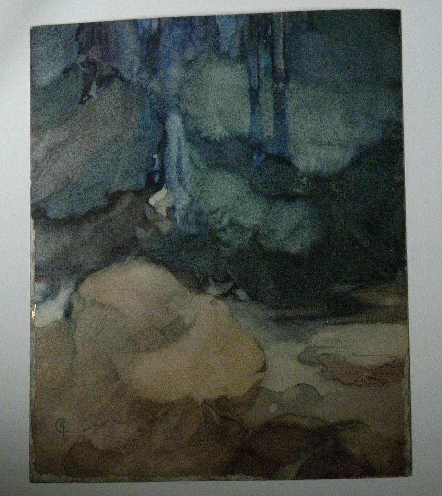
Edge of Forest (No. 8)
https://archives.whyte.org/en/permalink/artifactcoj.05.44
- Date
- 1912
- Medium
- watercolour on paper
- Catalogue Number
- CoJ.05.44
- Description
- colourful abstract scene of a landscape in varying hues of brown; green; and blues.
1 image
- Title
- Edge of Forest (No. 8)
- Date
- 1912
- Medium
- watercolour on paper
- Dimensions
- 61.0 x 13.0 cm
- Description
- colourful abstract scene of a landscape in varying hues of brown; green; and blues.
- Subject
- landscape
- Credit
- Gift of John Rivette, Seymour Arm, 1986
- Catalogue Number
- CoJ.05.44
Images
This material is presented as originally created; it may contain outdated cultural descriptions and
potentially offensive content.
Read more.
Elbow River Development
https://archives.whyte.org/en/permalink/catalogue23357
- Medium
- Library - Maps and blueprints (unannotated; published)
- Map
- Published Date
- Jan., 1913
- Publisher
- Water Power Branch
- Call Number
- C5-6.25
- Publisher
- Water Power Branch
- Published Date
- Jan., 1913
- Scale
- 750 feet to the inch
- Notes
- (accompanies Bow River Power and Storage Investigations by M.C. Hendry 03.6)
- Accession Number
- 576
- Call Number
- C5-6.25
- Collection
- Archives Library
This material is presented as originally created; it may contain outdated cultural descriptions and
potentially offensive content.
Read more.
Entrance to Mill
https://archives.whyte.org/en/permalink/artifactcoj.03.517
- Date
- c. 1920
- Medium
- charcoal on board
- Catalogue Number
- CoJ.03.517
- Description
- A path leads into background where a mill stands. Old buildings and brush line the path.verso has cursive writing that describes colour scheme and details.
1 image
- Title
- Entrance to Mill
- Date
- c. 1920
- Medium
- charcoal on board
- Dimensions
- 28.0 x 38.0 cm
- Description
- A path leads into background where a mill stands. Old buildings and brush line the path.verso has cursive writing that describes colour scheme and details.
- Credit
- Gift of John Rivette, Seymour Arm, 1997
- Catalogue Number
- CoJ.03.517
Images

This material is presented as originally created; it may contain outdated cultural descriptions and
potentially offensive content.
Read more.
- Date
- c. 1920
- Medium
- charcoal on paper
- Catalogue Number
- CoJ.03.479
- Description
- A charcoal sketch of a haphazard arrangement of four different shovels.
1 image
- Title
- Four Shovels
- Date
- c. 1920
- Medium
- charcoal on paper
- Dimensions
- 19.5 x 12.5 cm
- Description
- A charcoal sketch of a haphazard arrangement of four different shovels.
- Subject
- shovels
- Credit
- Gift of John Rivette, Seymour Arm, 1997
- Catalogue Number
- CoJ.03.479
Images

This material is presented as originally created; it may contain outdated cultural descriptions and
potentially offensive content.
Read more.
General Plan And Development, Kananaskis Falls
https://archives.whyte.org/en/permalink/catalogue23325
- Medium
- Library - Maps and blueprints (unannotated; published)
- Map
- Published Date
- Jan., 1913
- Publisher
- Water Power Branch
- Call Number
- C5-6.1a
- Publisher
- Water Power Branch
- Published Date
- Jan., 1913
- Scale
- 80 feet to the inch
- Notes
- (accompanies the Bow River Power and Storage Investigations by M.C. Hendry 03.6)
- Accession Number
- 576
- Call Number
- C5-6.1a
- Collection
- Archives Library
This material is presented as originally created; it may contain outdated cultural descriptions and
potentially offensive content.
Read more.
Ghost River Storage Site, Topographic Sheet No. 15
https://archives.whyte.org/en/permalink/catalogue23346
- Medium
- Library - Maps and blueprints (unannotated; published)
- Map
- Published Date
- Jan., 1913
- Publisher
- Water Power Branch
- Call Number
- C5-6.15
- Publisher
- Water Power Branch
- Published Date
- Jan., 1913
- Scale
- 400 feet to the inch
- Notes
- (accompanies Bow River Power and Storage Investigations by M.C. Hendry 03.6)
- Accession Number
- 576
- Call Number
- C5-6.15
- Collection
- Archives Library
This material is presented as originally created; it may contain outdated cultural descriptions and
potentially offensive content.
Read more.