Narrow Results By
- Alpine Club of Canada 8
- Catharine Robb Whyte, O. C. (1906 – 1979, Canadian) 4
- James (Sr.) Simpson (1877 – 1972, Canadian) 3
- Engler, Bruno 2
- Monachello, Placido 2
- Peter Whyte (1905 – 1966, Canadian) 2
- Associated screen news limited 1
- Clifford Foard Robinson (1916 – 1992, Canadian) 1
- Duke, Ron 1
- Ernest C. W Lamarque (1879 – 1970, Canadian) 1
- George Weber (1907 – 2002, Canadian) 1
- Harding, Warren 1
[Deep Valley Creek South, Alberta]
https://archives.whyte.org/en/permalink/catalogue23579
- Medium
- Library - Maps and blueprints (unannotated; published)
- Map
- Published Date
- 1947
- Publisher
- Dept. of Mines & Technical Survey
- Call Number
- NTS
- 82K/4E
- Publisher
- Dept. of Mines & Technical Survey
- Published Date
- 1947
- Scale
- Scale: 1:50,000
- Subjects
- Deep Valley Creek
- Alberta
- Notes
- National Topographic System
- Accession Number
- 12000
- Call Number
- NTS
- 82K/4E
- Collection
- Archives Library
This material is presented as originally created; it may contain outdated cultural descriptions and
potentially offensive content.
Read more.
[Deep Valley Creek South, Alberta]
https://archives.whyte.org/en/permalink/catalogue23580
- Medium
- Library - Maps and blueprints (unannotated; published)
- Map
- Published Date
- 1947
- Publisher
- Dept. of Mines & Technical Survey
- Call Number
- NTS
- 83K/4W
- Publisher
- Dept. of Mines & Technical Survey
- Published Date
- 1947
- Scale
- Scale: 1:50,000
- Subjects
- Deep Valley Creek
- Alberta
- Notes
- National Topographic System
- Accession Number
- 12000
- Call Number
- NTS
- 83K/4W
- Collection
- Archives Library
This material is presented as originally created; it may contain outdated cultural descriptions and
potentially offensive content.
Read more.
Downward bound : a mad! guide to rock climbing
https://archives.whyte.org/en/permalink/catalogue1242
- Medium
- Library - Book (including soft-cover and pamphlets)
- Published Date
- 1975
- Author
- Harding, Warren
- Publisher
- Englewood Cliffs : Prentice-Hall
- Call Number
- G513 H3
- Author
- Harding, Warren
- Publisher
- Englewood Cliffs : Prentice-Hall
- Published Date
- 1975
- Subjects
- Yosemite Valley
- Call Number
- G513 H3
- Collection
- Alpine Club of Canada Library
This material is presented as originally created; it may contain outdated cultural descriptions and
potentially offensive content.
Read more.
Environmental groups in Alberta
https://archives.whyte.org/en/permalink/catalogue12260
- Medium
- Library - Book (including soft-cover and pamphlets)
- Published Date
- July 1974 (1st rev)
- October 1977 (2 rev)
- Call Number
- R 04 En8
- Responsibility
- originally compiled June 1972 by Kenneth Persson (and others)
- Published Date
- July 1974 (1st rev)
- October 1977 (2 rev)
- Physical Description
- 50p
- Subjects
- Alpine Club of Canada
- Bow Valley Naturalists
- Clubs
- Sky Line Trail Hikers of the Canadian Rockies
- Trail Riders of the Canadian Rockies
- Accession Number
- 11000
- Call Number
- R 04 En8
- Collection
- Archives Library
This material is presented as originally created; it may contain outdated cultural descriptions and
potentially offensive content.
Read more.
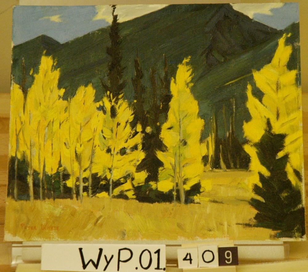
Fall Colour, Bow Valley
https://archives.whyte.org/en/permalink/artifactwyp.01.409
- Date
- 1940 – 1955
- Medium
- oil on canvas
- Catalogue Number
- WyP.01.409
1 image
- Title
- Fall Colour, Bow Valley
- Date
- 1940 – 1955
- Medium
- oil on canvas
- Dimensions
- 25.3 x 30.1 cm
- Subject
- landscape
- Canadian Rockies
- mountain
- valley
- Credit
- Gift of Catharine Robb Whyte, O. C., Banff, 1979
- Catalogue Number
- WyP.01.409
Images
This material is presented as originally created; it may contain outdated cultural descriptions and
potentially offensive content.
Read more.
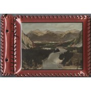
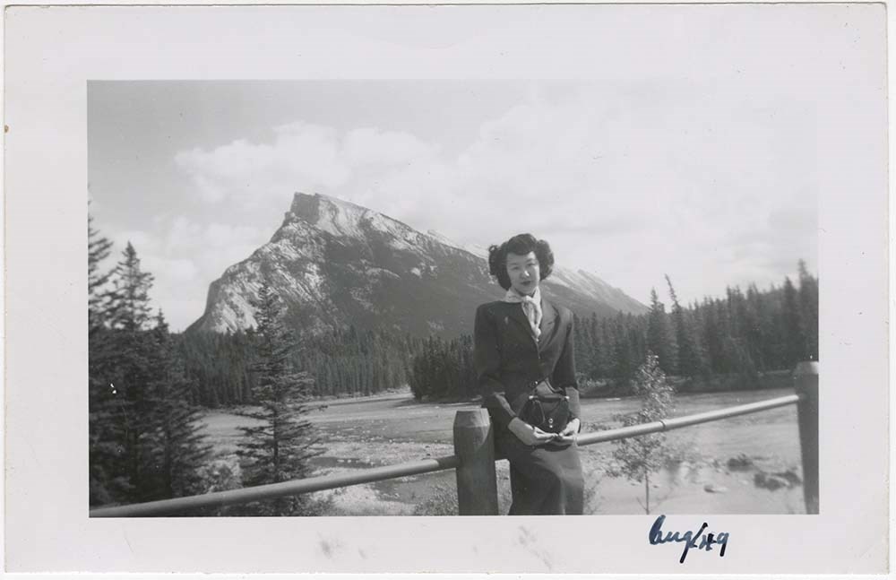
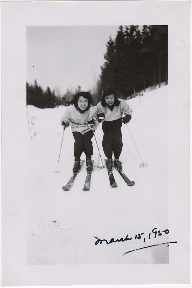
- Part Of
- Wing Family fonds
- Scope & Content
- File consists of 1 album with 226 b&w photographs and 9 colour photographs depicting everyday scenes of the Wing family around Banff. Includes photographs of the two eldest Wing children (Carole and Paul) as babies and young children. Album has 1 colour print of the Bow valley on front and is bound…
- Date Range
- 1949 - 1953
- Reference Code
- V781 / A / PD – 1
- Description Level
- 5 / File
- GMD
- Album
- Photograph
3 images
1 Electronic Resource
- Part Of
- Wing Family fonds
- Description Level
- 5 / File
- Fonds Number
- M558 / V781
- Series
- V781 / A: Wing Family: Photographs
- Sous-Fonds
- V781
- Accession Number
- 2015.8408
- Reference Code
- V781 / A / PD – 1
- GMD
- Album
- Photograph
- Date Range
- 1949 - 1953
- Physical Description
- Photograph Album : 1 photograph album (235 photographs; b&w and col.).
- Scope & Content
- File consists of 1 album with 226 b&w photographs and 9 colour photographs depicting everyday scenes of the Wing family around Banff. Includes photographs of the two eldest Wing children (Carole and Paul) as babies and young children. Album has 1 colour print of the Bow valley on front and is bound with black cord. Plastic lacing around edges of album is broken in some parts. Images mostly adhered with photo corners.
- Name Access
- Wing, Edith
- Wing, Carole
- Wing, Paul
- Wing, Fred
- Subject Access
- Activities
- Animals
- Asian
- Banff townsite
- Banff Winter Carnival
- Banff Winter Festival
- Bow Falls
- Bow River
- Bow Valley
- Buildings
- Businesses
- Cascades of Time Garden
- Castle Mountain
- Chateau Lake Louise
- Children
- Christmas
- Clothing and dress
- Columbia Icefield
- Dogs
- Dominion Cafe
- Family
- Family and personal life
- Glaciers
- Holidays
- Home
- Horses
- Horseback riding
- Lake Louise
- Marriage
- Personal and Family Life
- Personal and Professional Life
- Photography
- Picnics and picnicking
- Portrait
- Swimming
- Takakkaw Falls
- Winter Carnival
- Geographic Access
- Banff
- Lake Louise
- Banff National Park
- Vancouver
- Yoho National Park
- Alberta
- British Columbia
- Title Source
- Title based on contents of file.
- Processing Status
- Processed
Electronic Resources
Images

This material is presented as originally created; it may contain outdated cultural descriptions and
potentially offensive content.
Read more.
The Gap, Bow Valley, Yamnuska Mt.
https://archives.whyte.org/en/permalink/descriptions52057
- Part Of
- Peter and Catharine Whyte fonds
- Scope & Content
- Image aerial view of The Gap in the Bow Valley and Yamnuska Mountain with double prop airplane in flight at centre "4" and "II272" on side of plane - airplane wing visible in foreground
- Date Range
- ca. 1926 to ca. 1950
- Reference Code
- V683 / III / A / 3 / PA - 278
- Description Level
- 6 / Item
- GMD
- Photograph
2 images
- Part Of
- Peter and Catharine Whyte fonds
- Description Level
- 6 / Item
- Fonds Number
- M36 / V683 / S37
- Series
- V683 / III / A / 3 : Peter and Catharine Whyte: Various Views of Banff and Area
- Sous-Fonds
- V683
- Accession Number
- .
- Reference Code
- V683 / III / A / 3 / PA - 278
- GMD
- Photograph
- Date Range
- ca. 1926 to ca. 1950
- Physical Description
- Photograph: 1 print (front and back) ; b&w.
- Scope & Content
- Image aerial view of The Gap in the Bow Valley and Yamnuska Mountain with double prop airplane in flight at centre "4" and "II272" on side of plane - airplane wing visible in foreground
- Subject Access
- Airplanes
- Aerial photography
- Mountains
- Bow Valley
- Geographic Access
- Alberta
- Language
- English
- Title Source
- Title based on item
- Processing Status
- Processed
Images


This material is presented as originally created; it may contain outdated cultural descriptions and
potentially offensive content.
Read more.
- Part Of
- Alpine Club of Canada fonds
- Scope & Content
- File consists of a summit record from Haddo Peak produced by the Alpine Club of Canada between 1968 and 2001. Summit record includes entries from visitors to the various summits which pertain to individuals' hiking and climbing trips; details of specific events which occurred while at the summit, w…
- Date Range
- 1968-2001
- Reference Code
- M200 / V / A / 212
- Description Level
- 5 / File
- GMD
- Textual record
- Organization record
- Part Of
- Alpine Club of Canada fonds
- Description Level
- 5 / File
- Fonds Number
- M200
- V14
- S6
- Series
- M200 / V: Summit Records
- Sous-Fonds
- M200
- Sub-Series
- M200 / V / A: Identified Summit Records
- Accession Number
- accn. 2023.10
- Reference Code
- M200 / V / A / 212
- Responsibility
- Summit Registers and Notes produced by Alpine Club of Canada
- Date Range
- 1968-2001
- Physical Description
- 1 volume 1 cm of textual record
- History / Biographical
- Haddo Peak is located in the Lake Louise area of Banff National Park, Alberta. Haddo Peak is attached to Mount Aberdeen. Nearby is the Plain of the Six Glaciers Tea House, Lake Louise, Mount Victoria, Mount Lefroy and Mount Temple.
- Scope & Content
- File consists of a summit record from Haddo Peak produced by the Alpine Club of Canada between 1968 and 2001. Summit record includes entries from visitors to the various summits which pertain to individuals' hiking and climbing trips; details of specific events which occurred while at the summit, wildlife sightings, trail updates, and related topics. File: M200 / V / A / 212: Haddo [Peak]
- Name Access
- Alpine Club of Canada
- Subject Access
- Alberta
- Alpine Club of Canada
- Backpacking
- Banff
- Banff National Park
- Bow Valley
- Climbing
- Club
- Description and travel
- Environment
- Environment and Nature
- Hiking
- Lake Louise
- Mountain
- Mountaineering
- Mountaineers
- Mountains
- National parks and reserves
- Plain of Six Glacier Teahouse
- Record keeping
- Sports and leisure
- Sports and recreation
- Summit
- Temple Mountain
- Trails
- Geographic Access
- Canada
- Canadian Rocky Mountains
- Rocky Mountains
- Alberta
- Banff National Park
- Lake Louise
- Lake Louise, AB
- Plain of Six Glaciers
- Mount Victoria
- Mount Lefroy
- Mount Temple
- Mount Aberdeen
- Haddo Peak
- Access Restrictions
- Restrictions may apply
- Language
- English
- Related Material
- M235
- Title Source
- Title based on contents of file
- Processing Status
- Processed
This material is presented as originally created; it may contain outdated cultural descriptions and
potentially offensive content.
Read more.
Identified Summit Records
https://archives.whyte.org/en/permalink/descriptions57799
- Part Of
- Alpine Club of Canada fonds
- Scope & Content
- Sub-series of identified summit registers and notes produced by the Alpine Club of Canada between 1930 and 2022. Summit records include entries from visitors to the various summits which pertain to individuals' hiking and climbing trips; details of specific events which occurred while at the summit…
- Date Range
- 1930-1931
- 1959-1968
- 1970-1989
- 1992 -2022
- Reference Code
- M200 / V / A
- Description Level
- 4 / Sub-series
- GMD
- Textual record
- Organization record
- Part Of
- Alpine Club of Canada fonds
- Description Level
- 4 / Sub-series
- Fonds Number
- M200
- V14
- S6
- Series
- M200 / V: Summit Records
- Sous-Fonds
- M200
- Sub-Series
- M200 / V / A: Identified Summit Records
- Accession Number
- accn. 2023.20 accn. 7779 accn. 2023.10 accn. 2014.8347 accn. 6465 accn. 8002 accn. 2020.05 accn. 2023.19 accn. 2014.8293 accn. 8119 accn. 2023.32 accn. 2023.41 accn. 6623 accn. 6062 accn. 2014.8318 accn. 6767 accn. 2014.8315 accn. 2014.8317 accn. 5680 accn. 2023.16 accn. 2018.9010 accn. 5396 accn. 6459 accn. 2014.8316 accn. 2023.18 accn. 5631 accn. 2013.8245 accn. 2014.8275 accn. 2023.06 accn. 2023.14 accn. 2023.17 accn. 5569 accn. 8113 accn. 6396 accn. 2024.20
- Reference Code
- M200 / V / A
- Responsibility
- Summit Registers and Notes produced by Alpine Club of Canada
- Date Range
- 1930-1931
- 1959-1968
- 1970-1989
- 1992 -2022
- Physical Description
- 100 cm of textual records 223 volumes
- Scope & Content
- Sub-series of identified summit registers and notes produced by the Alpine Club of Canada between 1930 and 2022. Summit records include entries from visitors to the various summits which pertain to individuals' hiking and climbing trips; details of specific events which occurred while at the summit, wildlife sightings, trail updates, and related topics. The sub-series is separated into individual identified summit records.
- Notes
- See file-level entries for inventories of identified summit registers and notes.
- Name Access
- Alpine Club of Canada
- Subject Access
- Alberta
- Alpine Club of Canada
- Backpacking
- Backcountry skiing
- Banff
- Banff National Park
- Bow Valley
- British Columbia
- Castle Mountain
- Cascade Mountain
- Centennial
- Climbing
- Club
- Cross-country skiing
- Description and travel
- Environment
- Environment and Nature
- Fortress Mountain
- Great Divide
- Hiking
- Kananaskis Country
- Mount Assiniboine
- Mount Logan
- Mountain
- Mountain guides
- Mountaineering
- Mountaineers
- Mountains
- Provincial parks and reserves
- Parks
- National parks and reserves
- Record keeping
- Ski area
- Ski areas
- Ski mountaineering
- Skiing
- Skis
- Skiers
- Snowshoes and snowshoeing
- Sports and leisure
- Sports and recreation
- Summit
- Trails
- Winter sports
- Geographic Access
- Canada
- Canadian Rocky Mountains
- Rocky Mountains
- Continental Divide
- Great Divide
- Alberta
- British Columbia
- Abbot Pass
- Mount Assiniboine
- Cascade Mountain
- Canmore
- Assiniboine
- Banff National Park
- Banff, Alberta
- Bugaboos
- Castle Mountain, AB
- Cathedral Mountain
- Glacier
- Jasper National Park
- Kananaskis Country
- Little Yoho Valley
- Mount Baldy
- Mount Baker
- Mount Cory
- Mount Edith
- Mount Lefroy
- Mount Norquay
- Mount Rundle
- Rundle Mountain
- Mount Temple
- Mount Victoria
- Mount Yamnuska
- Selkirks
- Yoho National Park
- Access Restrictions
- Restrictions may apply
- Reproduction Restrictions
- Contains personal information
- Language
- English
- Conservation
- Some records have been placed in mylar. Some record have mold, rust or water damage.
- Related Material
- M235
- Title Source
- Title based on contents of sub-series
- Processing Status
- Processed
This material is presented as originally created; it may contain outdated cultural descriptions and
potentially offensive content.
Read more.
Lac Des Arcs, Bow Valley, Exshaw
https://archives.whyte.org/en/permalink/descriptions52060
- Part Of
- Peter and Catharine Whyte fonds
- Scope & Content
- Image of aerial view of Lac Des Arcs and Exshaw in the Bow Valley - airplane wing visible at right
- Date Range
- ca. 1926 to ca. 1950
- Reference Code
- V683 / III / A / 3 / PA - 281
- Description Level
- 6 / Item
- GMD
- Photograph
2 images
- Part Of
- Peter and Catharine Whyte fonds
- Description Level
- 6 / Item
- Fonds Number
- M36 / V683 / S37
- Series
- V683 / III / A / 3 : Peter and Catharine Whyte: Various Views of Banff and Area
- Sous-Fonds
- V683
- Accession Number
- .
- Reference Code
- V683 / III / A / 3 / PA - 281
- GMD
- Photograph
- Date Range
- ca. 1926 to ca. 1950
- Physical Description
- Photograph: 1 print (front and back) ; b&w.
- Scope & Content
- Image of aerial view of Lac Des Arcs and Exshaw in the Bow Valley - airplane wing visible at right
- Subject Access
- Aerial photography
- Bow Valley
- Lac Des Arcs
- Geographic Access
- Exshaw
- Alberta
- Language
- English
- Title Source
- Title based on item
- Processing Status
- Processed
Images


This material is presented as originally created; it may contain outdated cultural descriptions and
potentially offensive content.
Read more.