Narrow Results By
Geomorphology : selected readings
https://archives.whyte.org/en/permalink/catalogue5367
- Medium
- Library - Book (including soft-cover and pamphlets)
- Published Date
- 1969
- Author
- Nelson, James Gordon
- Publisher
- Toronto : Methuen
- Call Number
- 03.1 N33
- Author
- Nelson, James Gordon
- Responsibility
- edited by J.G. Nelson and M.J. Chambers
- Publisher
- Toronto : Methuen
- Published Date
- 1969
- Physical Description
- x, 399p. : ill., maps
- Subjects
- Avalanches
- Drummond Glacier
- Glaciers
- Lake Louise
- Notes
- Bibliography
- Accession Number
- 7500
- Call Number
- 03.1 N33
- Collection
- Archives Library
This material is presented as originally created; it may contain outdated cultural descriptions and
potentially offensive content.
Read more.
Glacier and Mount Revelstoke National parks: where rivers are born
https://archives.whyte.org/en/permalink/catalogue19860
- Medium
- Library - Book (including soft-cover and pamphlets)
- Published Date
- 1965
- Author
- Baird, David M.
- Publisher
- Ottawa, Geological survey of Canada, Dept. of mines and technical surveys
- Call Number
- 13.115 B11g Pam
- Author
- Baird, David M.
- Responsibility
- David M. Baird
- Publisher
- Ottawa, Geological survey of Canada, Dept. of mines and technical surveys
- Published Date
- 1965
- Physical Description
- v, 104 pages illustrations, maps (1 folded color). 18 cm.
- Subjects
- Geology
- Geology - British Columbia
- Mount Revelstoke National Park
- Glacier National Park
- British Columbia
- Banff National Park
- Abstract
- Pertains to the geology of Glacier and Mount Revelstoke National parks. While providing an overview of the geology, the author also provides the reader with specific details making the experience well rounded. The content pertains to the Rocky Mountains and makes specific mention to Banff and Banff National park
- Contents
- Introduction
- Divides
- Boundaries of the parks
- Origin of the mountains
- The rocks
- The sculpturing of the mountains
- Regional differences in the mountains
- Shapes of mountains
- Roadlog and points of interest along the Trans-Canada Highway
- Epilogue
- Index
- Notes
- The page numbers for the following locations listed in the abstract are as follows; Banff (37), Banff National Park (vi, 4, 19, 37 and 40)
- Accession Number
- 2017.8683
- Call Number
- 13.115 B11g Pam
- Collection
- Archives Library
This material is presented as originally created; it may contain outdated cultural descriptions and
potentially offensive content.
Read more.
- Part Of
- Alpine Club of Canada fonds
- Scope & Content
- File consists of a summit record from Haddo Peak produced by the Alpine Club of Canada between 1968 and 2001. Summit record includes entries from visitors to the various summits which pertain to individuals' hiking and climbing trips; details of specific events which occurred while at the summit, w…
- Date Range
- 1968-2001
- Reference Code
- M200 / V / A / 212
- Description Level
- 5 / File
- GMD
- Textual record
- Organization record
- Part Of
- Alpine Club of Canada fonds
- Description Level
- 5 / File
- Fonds Number
- M200
- V14
- S6
- Series
- M200 / V: Summit Records
- Sous-Fonds
- M200
- Sub-Series
- M200 / V / A: Identified Summit Records
- Accession Number
- accn. 2023.10
- Reference Code
- M200 / V / A / 212
- Responsibility
- Summit Registers and Notes produced by Alpine Club of Canada
- Date Range
- 1968-2001
- Physical Description
- 1 volume 1 cm of textual record
- History / Biographical
- Haddo Peak is located in the Lake Louise area of Banff National Park, Alberta. Haddo Peak is attached to Mount Aberdeen. Nearby is the Plain of the Six Glaciers Tea House, Lake Louise, Mount Victoria, Mount Lefroy and Mount Temple.
- Scope & Content
- File consists of a summit record from Haddo Peak produced by the Alpine Club of Canada between 1968 and 2001. Summit record includes entries from visitors to the various summits which pertain to individuals' hiking and climbing trips; details of specific events which occurred while at the summit, wildlife sightings, trail updates, and related topics. File: M200 / V / A / 212: Haddo [Peak]
- Name Access
- Alpine Club of Canada
- Subject Access
- Alberta
- Alpine Club of Canada
- Backpacking
- Banff
- Banff National Park
- Bow Valley
- Climbing
- Club
- Description and travel
- Environment
- Environment and Nature
- Hiking
- Lake Louise
- Mountain
- Mountaineering
- Mountaineers
- Mountains
- National parks and reserves
- Plain of Six Glacier Teahouse
- Record keeping
- Sports and leisure
- Sports and recreation
- Summit
- Temple Mountain
- Trails
- Geographic Access
- Canada
- Canadian Rocky Mountains
- Rocky Mountains
- Alberta
- Banff National Park
- Lake Louise
- Lake Louise, AB
- Plain of Six Glaciers
- Mount Victoria
- Mount Lefroy
- Mount Temple
- Mount Aberdeen
- Haddo Peak
- Access Restrictions
- Restrictions may apply
- Language
- English
- Related Material
- M235
- Title Source
- Title based on contents of file
- Processing Status
- Processed
This material is presented as originally created; it may contain outdated cultural descriptions and
potentially offensive content.
Read more.
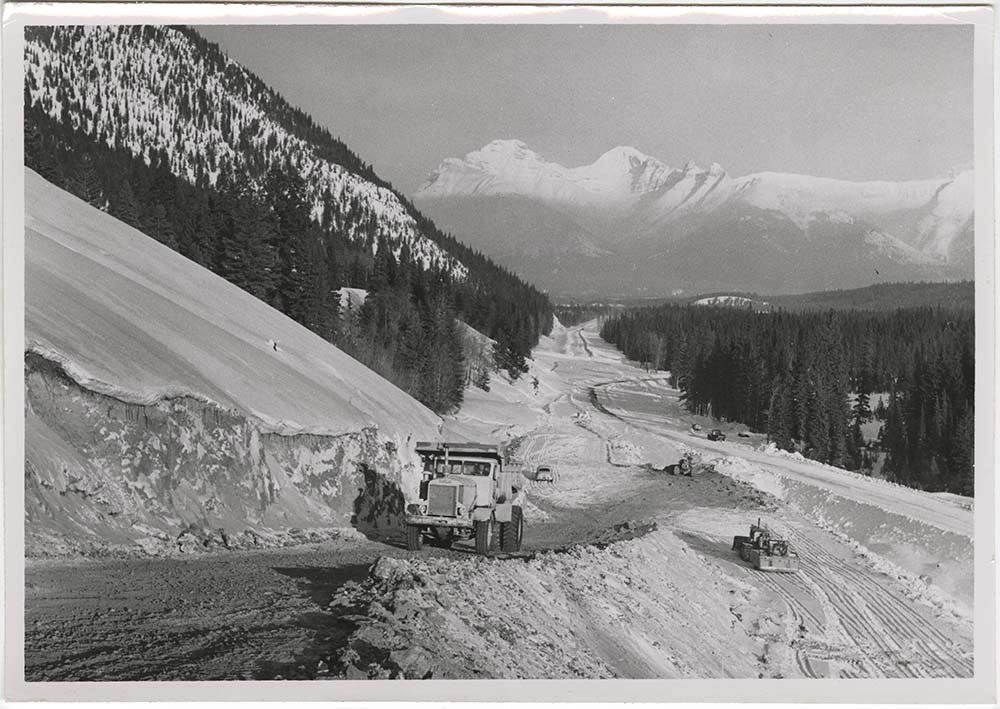
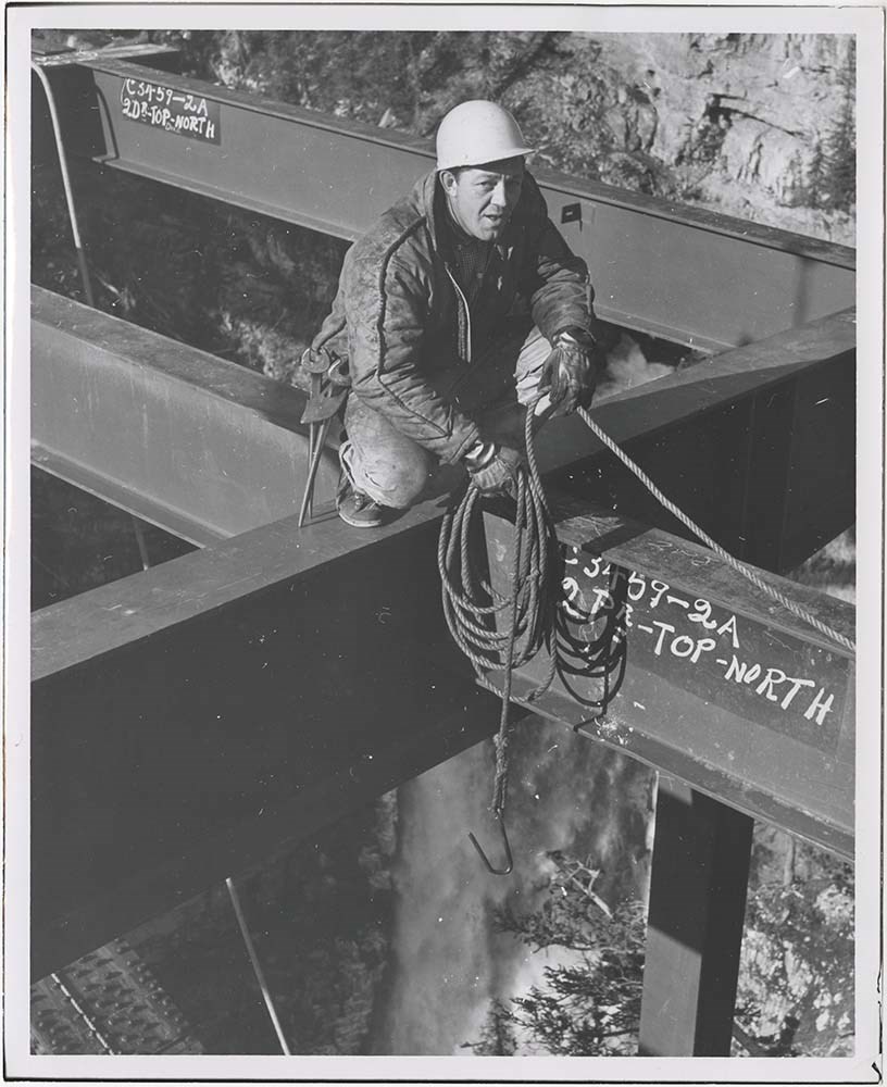
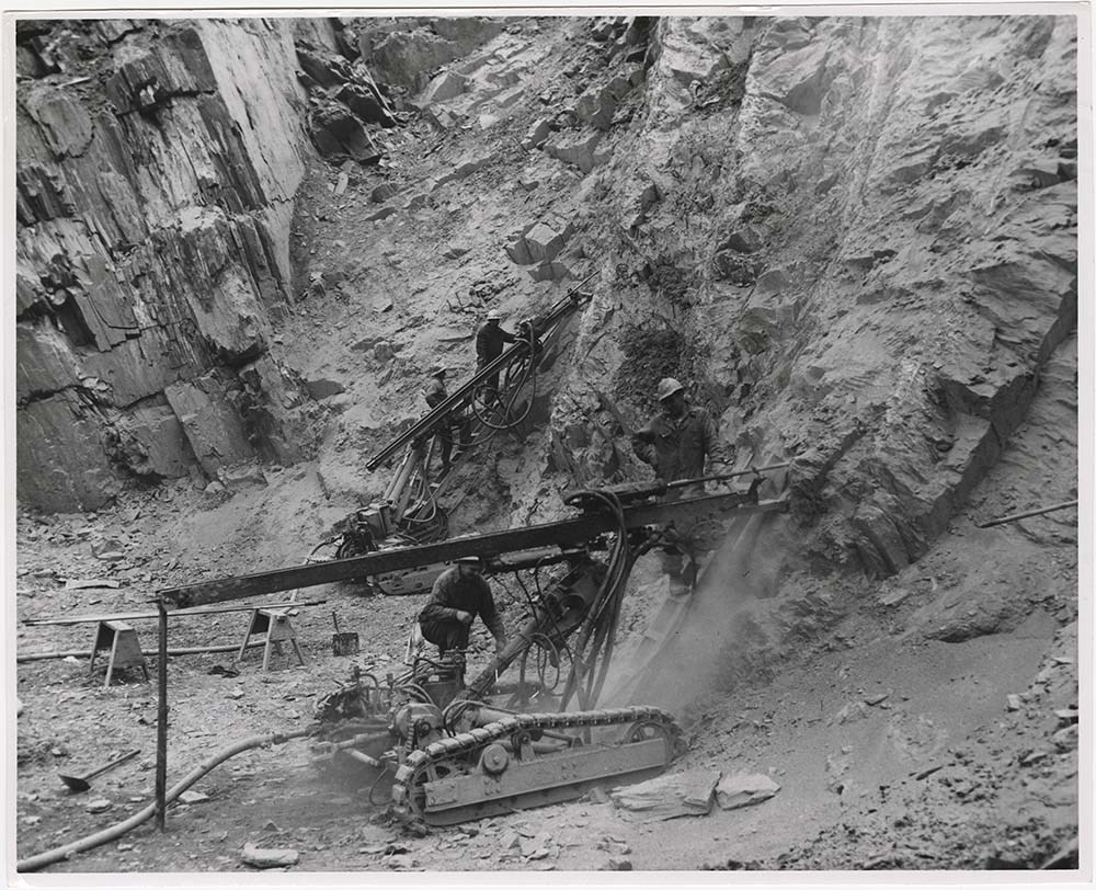
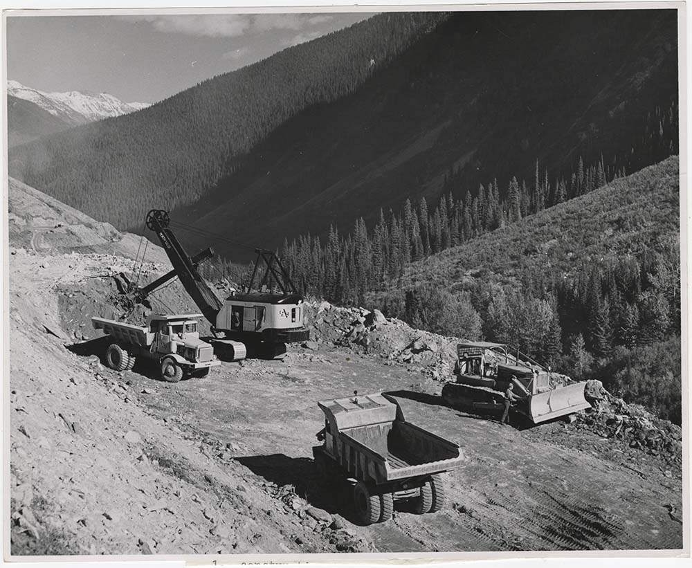
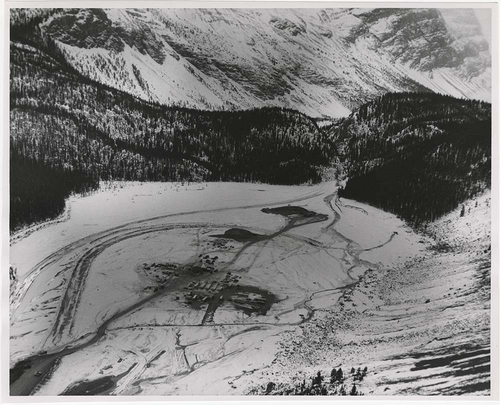
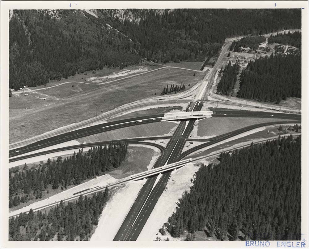
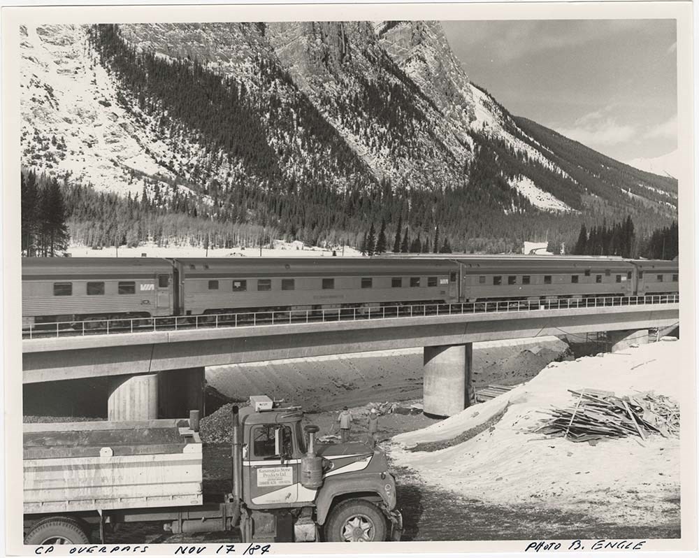
Road Constructions
https://archives.whyte.org/en/permalink/descriptions57427
- Part Of
- Bruno Engler fonds
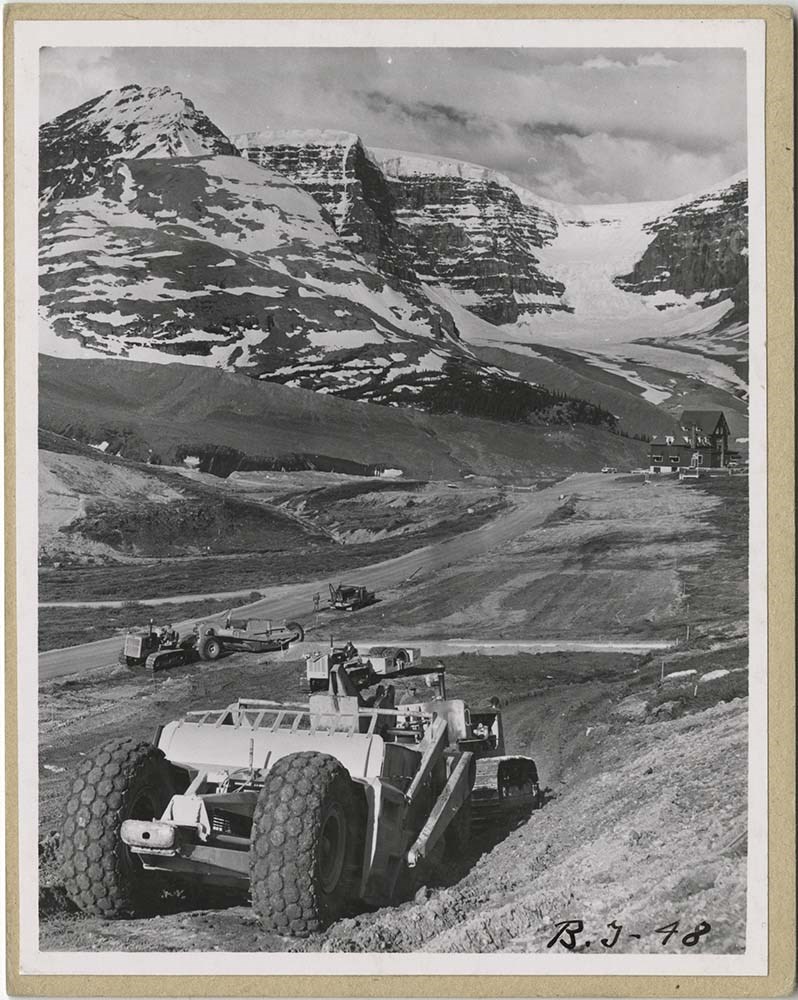
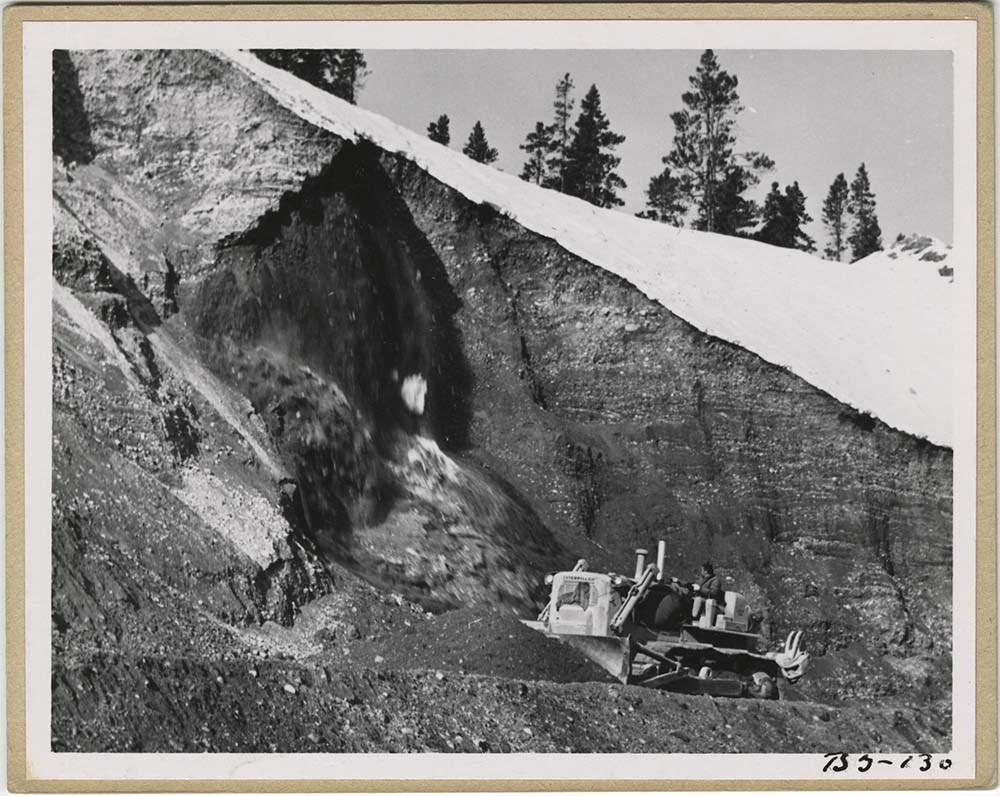
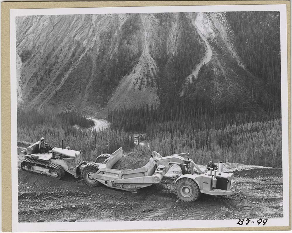
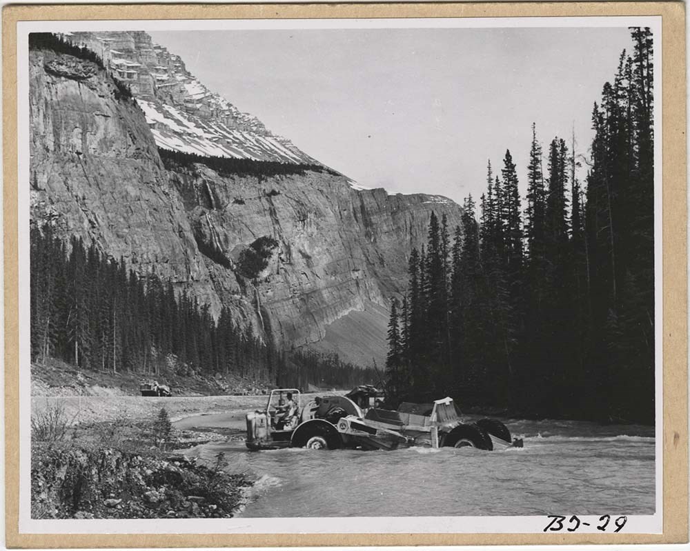
- Scope & Content
- File pertains to 62 b&w prints of construction of the Banff-Jasper Highway [the Icefield Parkway], as well as a few shots of the Trans-Canada Highway construction just west of the town of Banff.
- Date Range
- 1957-1962
- Reference Code
- V190 / VI / R / ii / b / PA - 01 to PA - 62
- Description Level
- 5 / File
- GMD
- Photograph
14 images
- Part Of
- Bruno Engler fonds
- Description Level
- 5 / File
- Fonds Number
- M323 / S40 / V190
- Series
- VI : Retained file, R : Alphabetical order
- Sous-Fonds
- V190
- Sub-Series
- ii : Roads, b : Construction
- Accession Number
- 7436
- Reference Code
- V190 / VI / R / ii / b / PA - 01 to PA - 62
- GMD
- Photograph
- Date Range
- 1957-1962
- Physical Description
- 62 photographs : b&w ; 25.2 x 20.2 cm or smaller
- History / Biographical
- See fonds level description
- Scope & Content
- File pertains to 62 b&w prints of construction of the Banff-Jasper Highway [the Icefield Parkway], as well as a few shots of the Trans-Canada Highway construction just west of the town of Banff.
- Subject Access
- Athabasca Glacier
- Banff-Jasper Highway
- Bridges
- Construction
- Glaciers
- Mountains
- Trans-Canada Highway
- Roads
- Geographic Access
- Banff
- Banff National Park
- Jasper National Park
- Alberta
- Language
- English
- Creator
- Engler, Bruno
- Title Source
- Original title kept
- Processing Status
- Processed
Images


This material is presented as originally created; it may contain outdated cultural descriptions and
potentially offensive content.
Read more.
Snowfield Above [?] Creek, South Bentinck Arm, B.C.
https://archives.whyte.org/en/permalink/artifactwbg.04.109
- Date
- 1967
- Medium
- ink on paper
- Catalogue Number
- WbG.04.109
- Description
- Glacier at centre of image. Creek in foreground and logs in creek.
- Title
- Snowfield Above [?] Creek, South Bentinck Arm, B.C.
- Date
- 1967
- Medium
- ink on paper
- Dimensions
- 66.2 x 51.2 cm
- Description
- Glacier at centre of image. Creek in foreground and logs in creek.
- Credit
- Gift of Donna Tingley, Edmonton, 2004
- Catalogue Number
- WbG.04.109
This material is presented as originally created; it may contain outdated cultural descriptions and
potentially offensive content.
Read more.