Narrow Results By
Canadian Rockies Trips Slide Show - Series I [2/2]
https://archives.whyte.org/en/permalink/descriptions1823
- Part Of
- Lillian Gest fonds
- Scope & Content
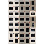
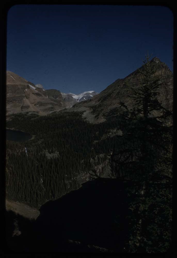
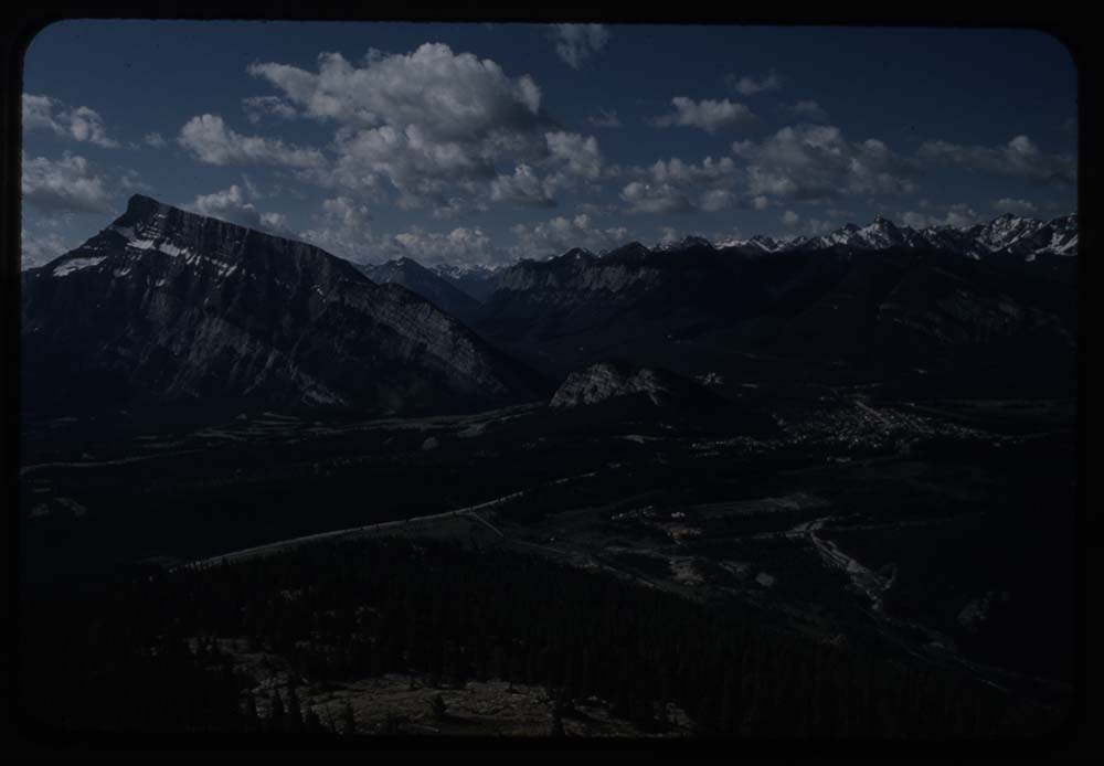
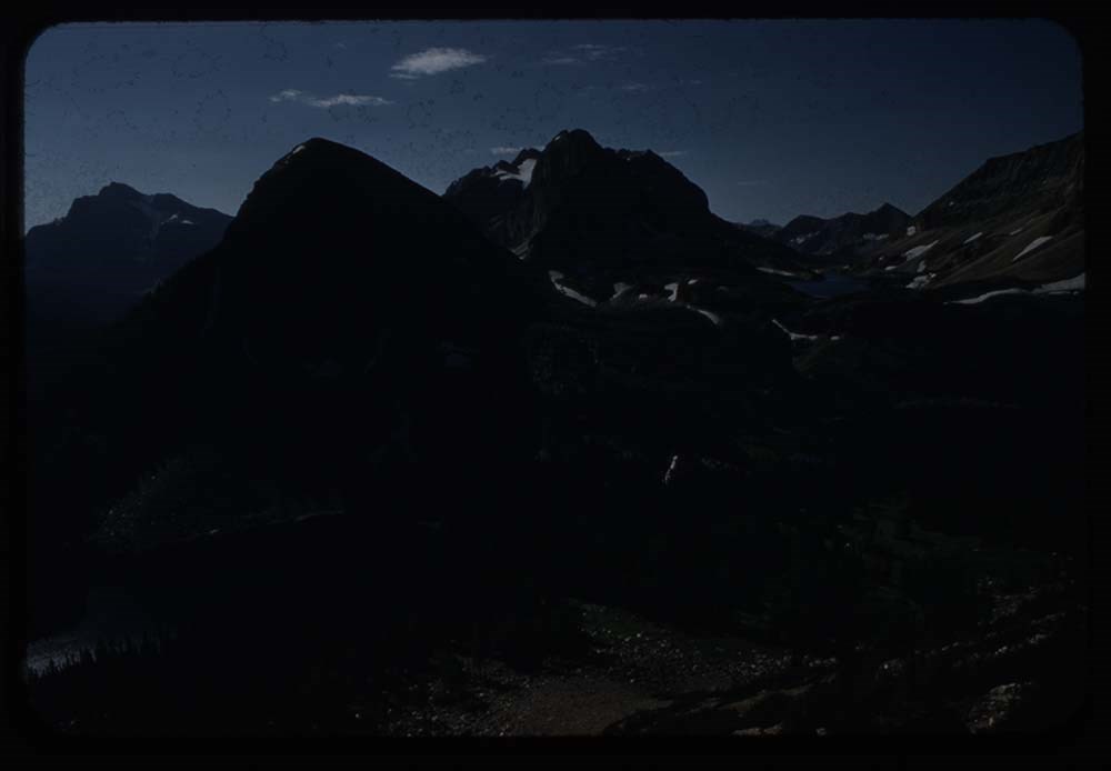
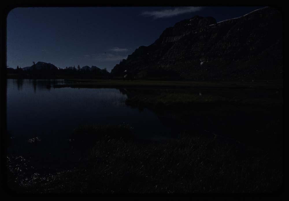
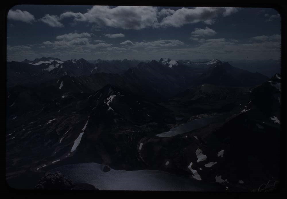
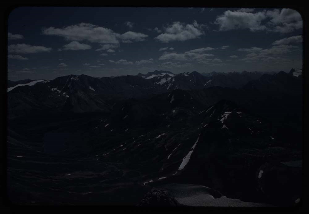
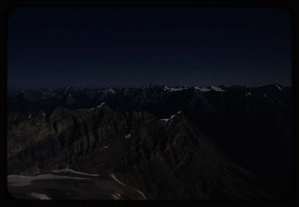
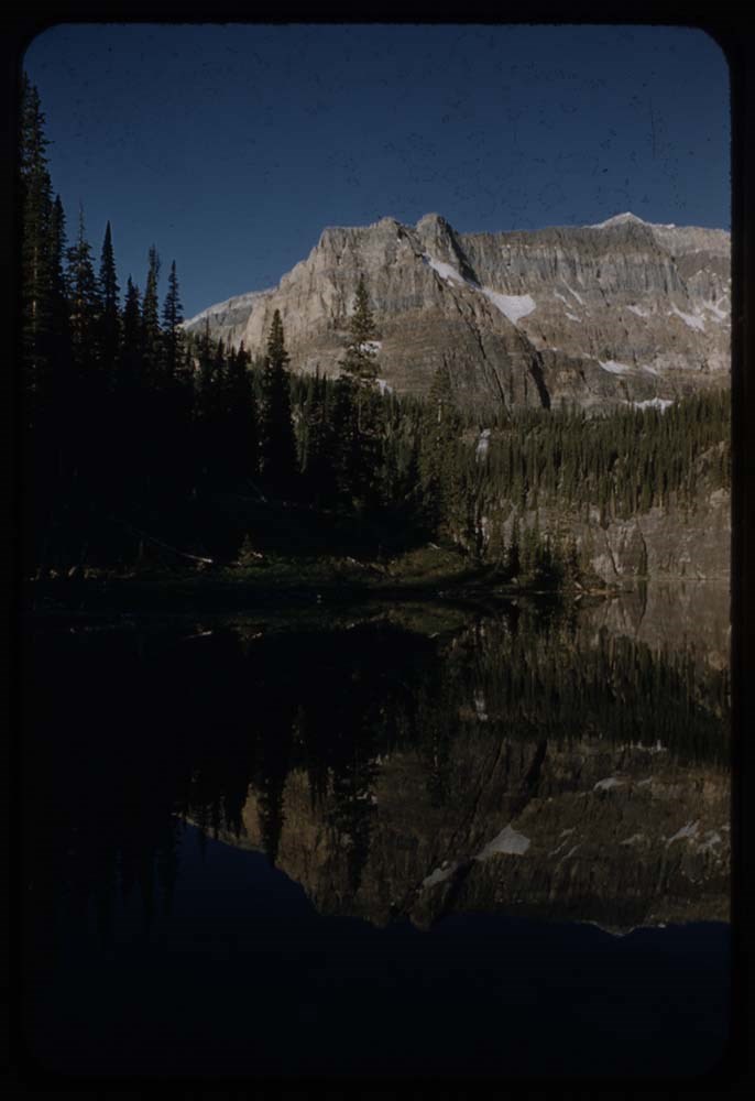
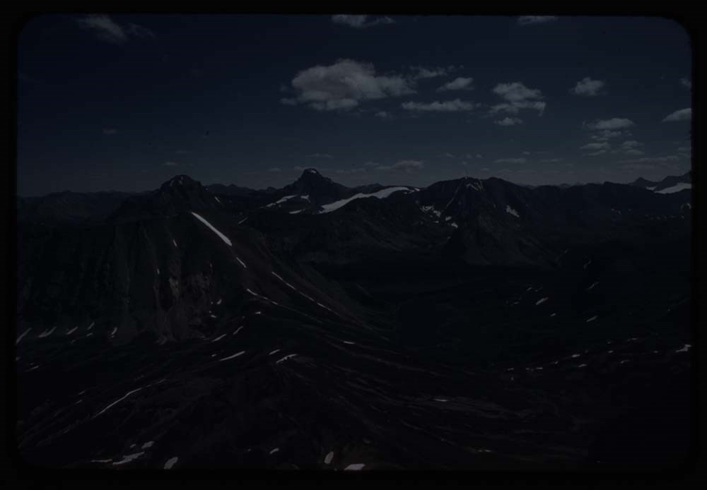
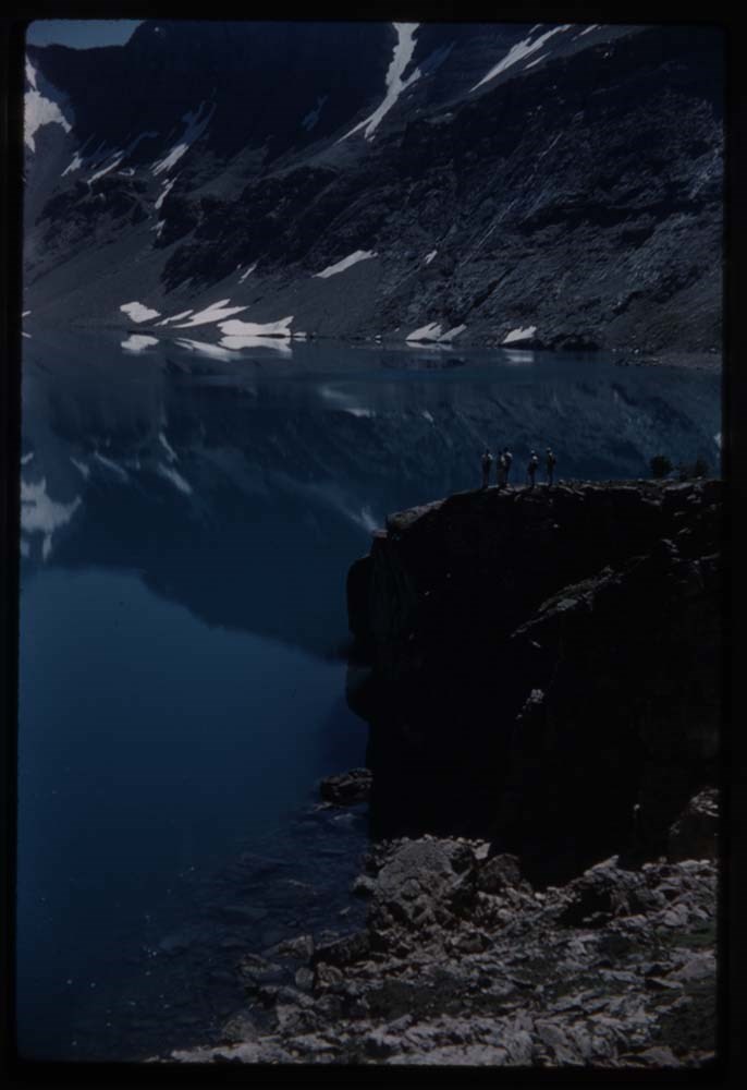
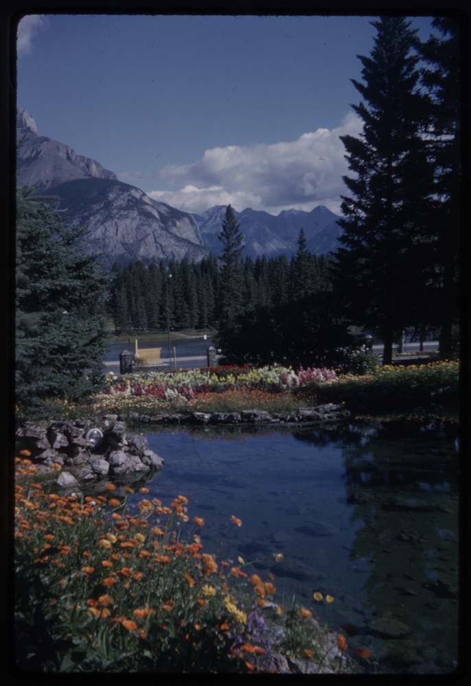
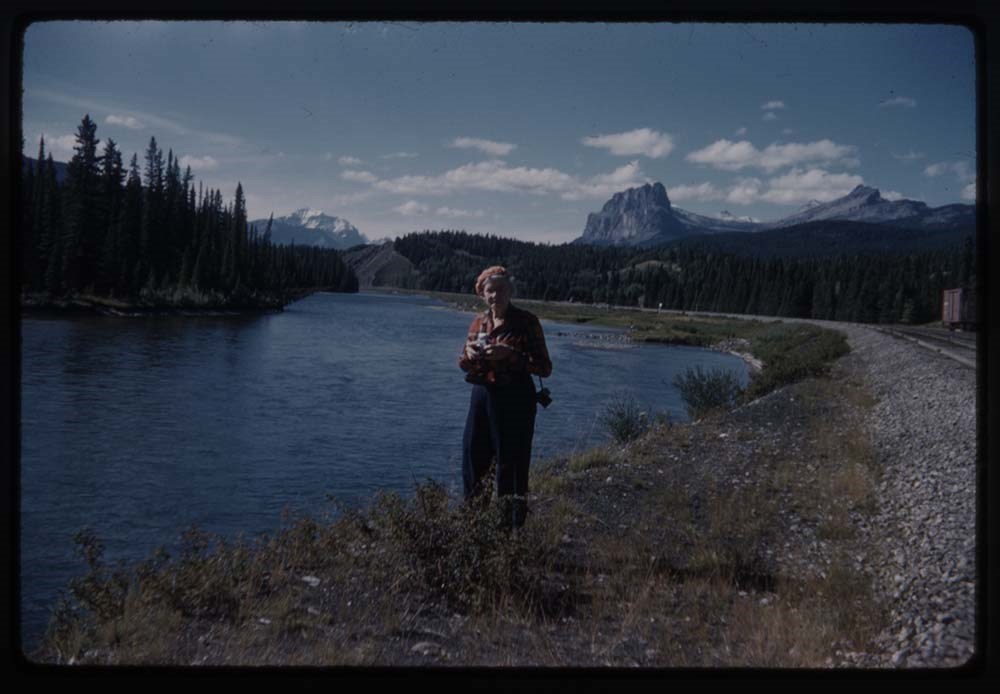
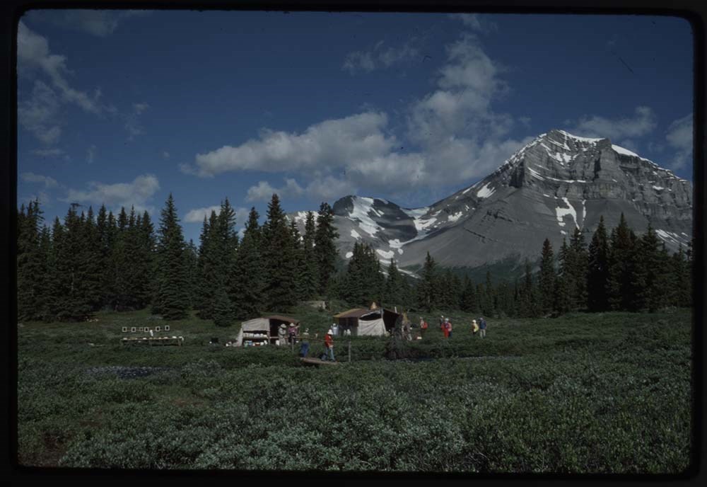
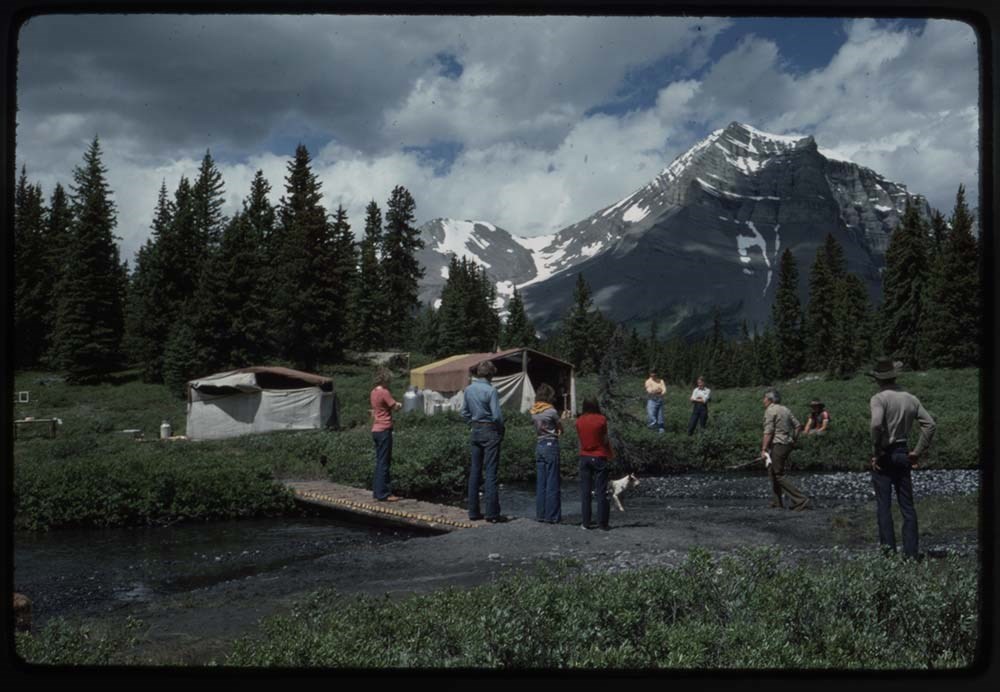
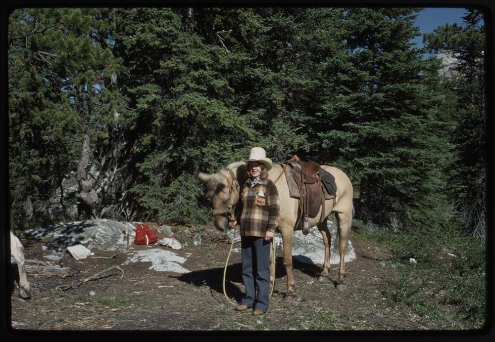
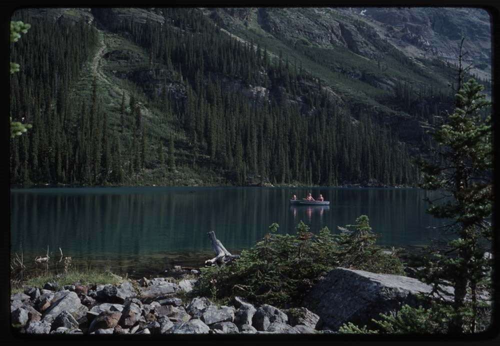
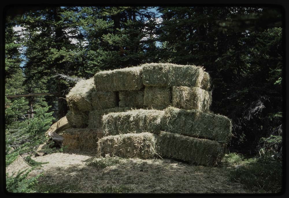
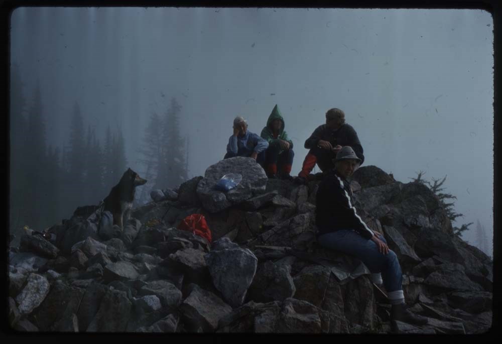
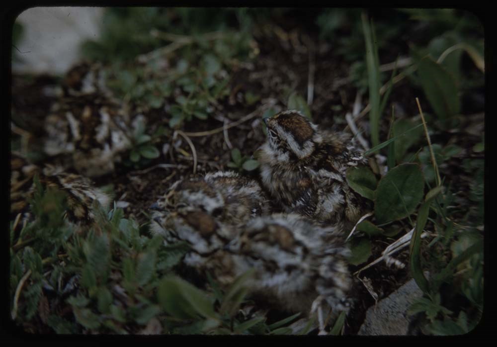
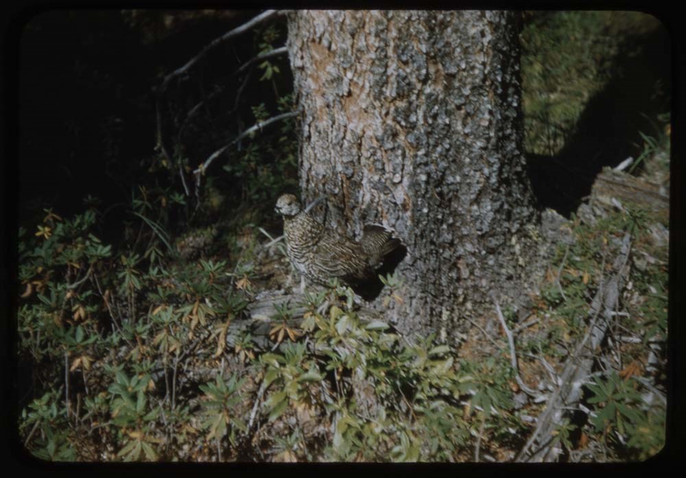
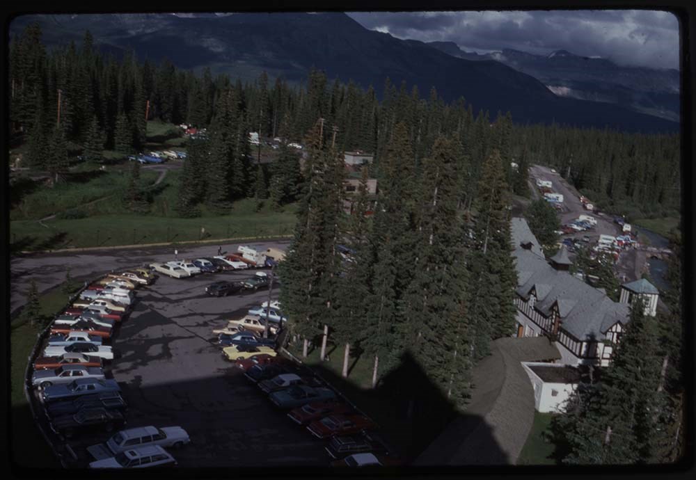
- File pertains to 80 slides assembled by Lillian Gest in 1981 into a show from slides depicting various summer and winter trips to the Canadian Rockies throughout the late 1960s and 1970s. Topics include mountains and mountain views, wildflowers, wildlife, Lillian and her friends, lakes, boats, fish…
- Date Range
- [ca. 1960-1981]
- Reference Code
- V225 / II / C / ii / a / ii / NS - I / 2
- Description Level
- 5 / File
- GMD
- Film
- Transparency
80 images
1 Electronic Resource
- Part Of
- Lillian Gest fonds
- Description Level
- 5 / File
- Fonds Number
- M67 / S36 / V225
- Series
- II.C. Activities / photography
- Sous-Fonds
- V225
- Sub-Series
- ii.a.ii Photographic material / transparencies / carousels
- Accession Number
- 5142
- Reference Code
- V225 / II / C / ii / a / ii / NS - I / 2
- GMD
- Film
- Transparency
- Parallel Title
- I : [transparencies]. -- [before 1981] V225 / NS 27
- Date Range
- [ca. 1960-1981]
- Physical Description
- 80 photographs : col. slides ; 35 mm
- History / Biographical
- See fonds level description.
- Scope & Content
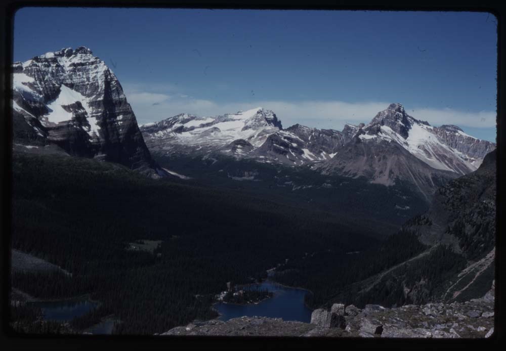
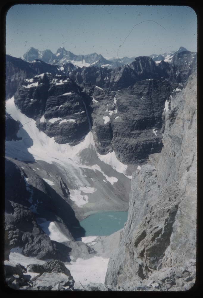
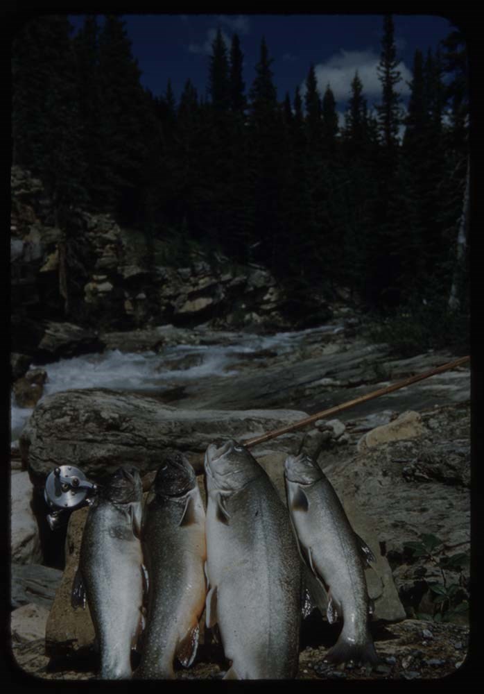
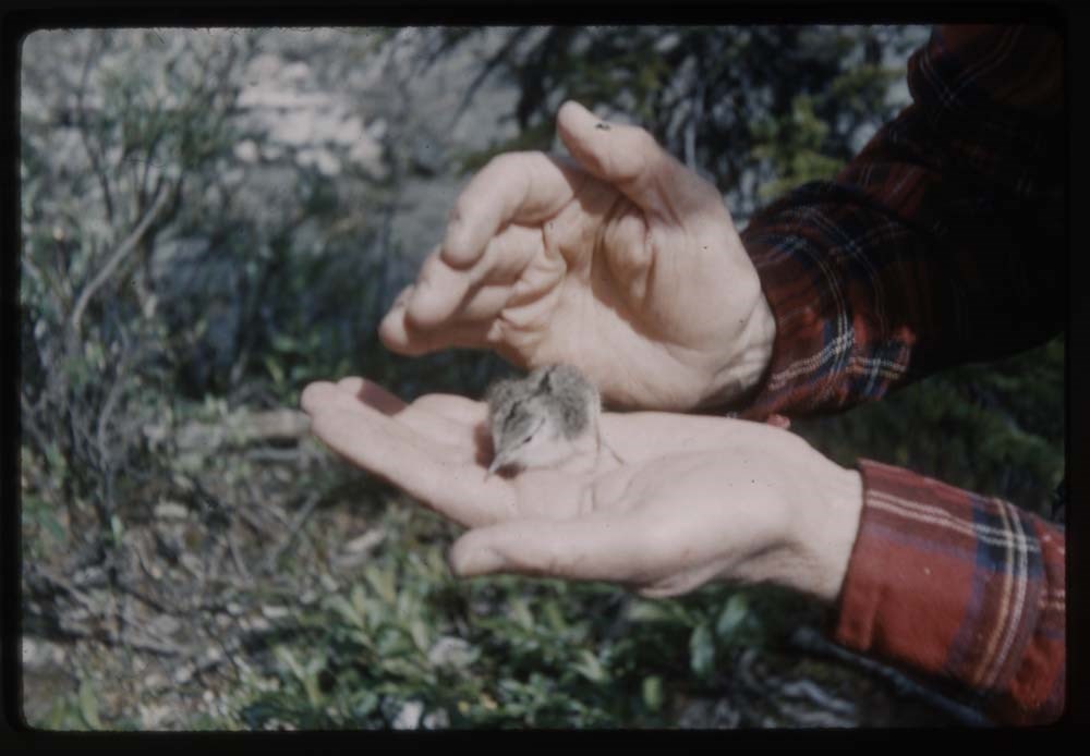
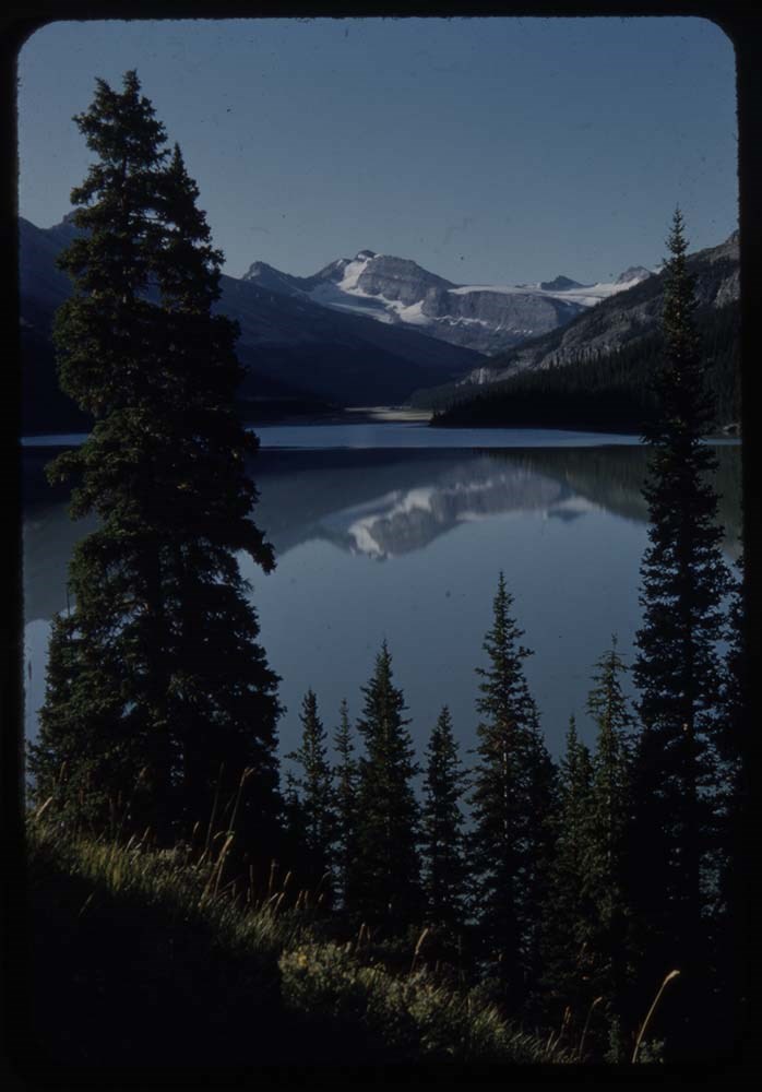
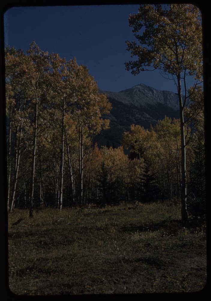
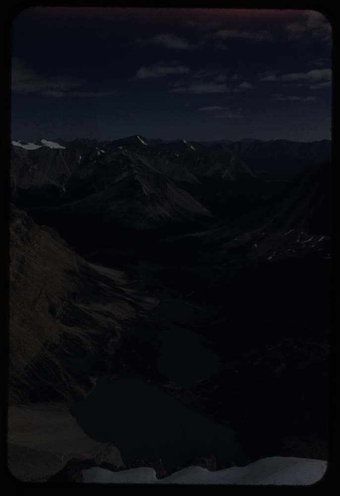
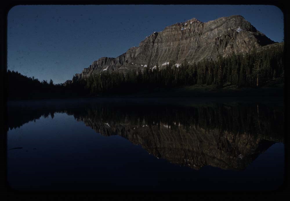
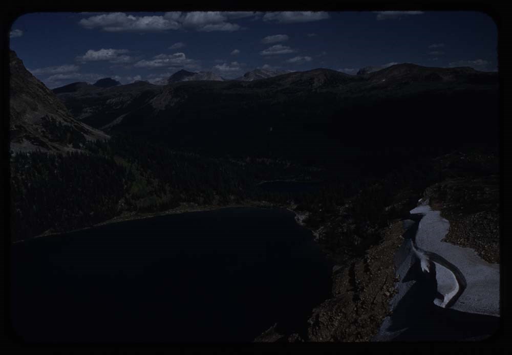
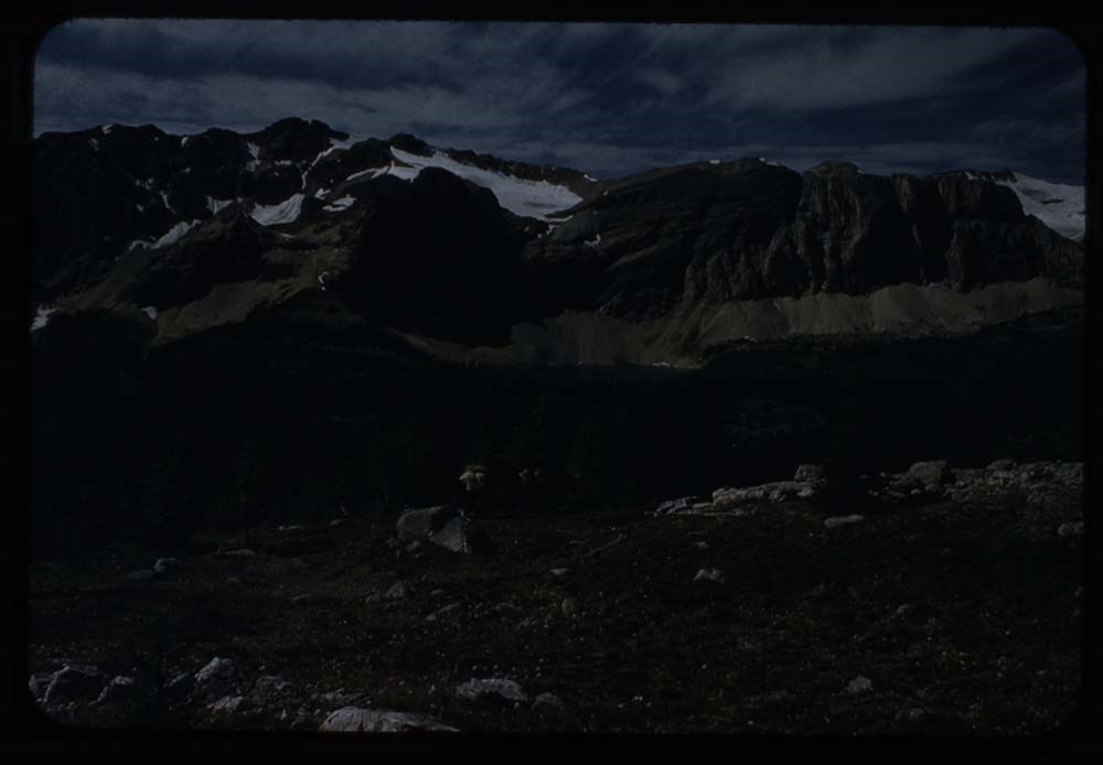
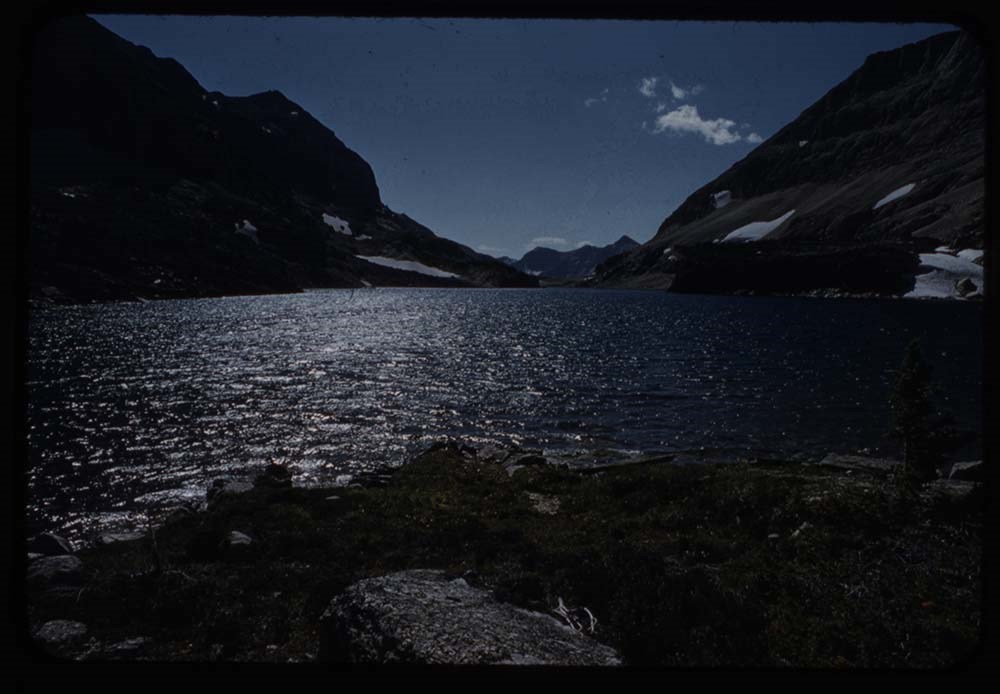
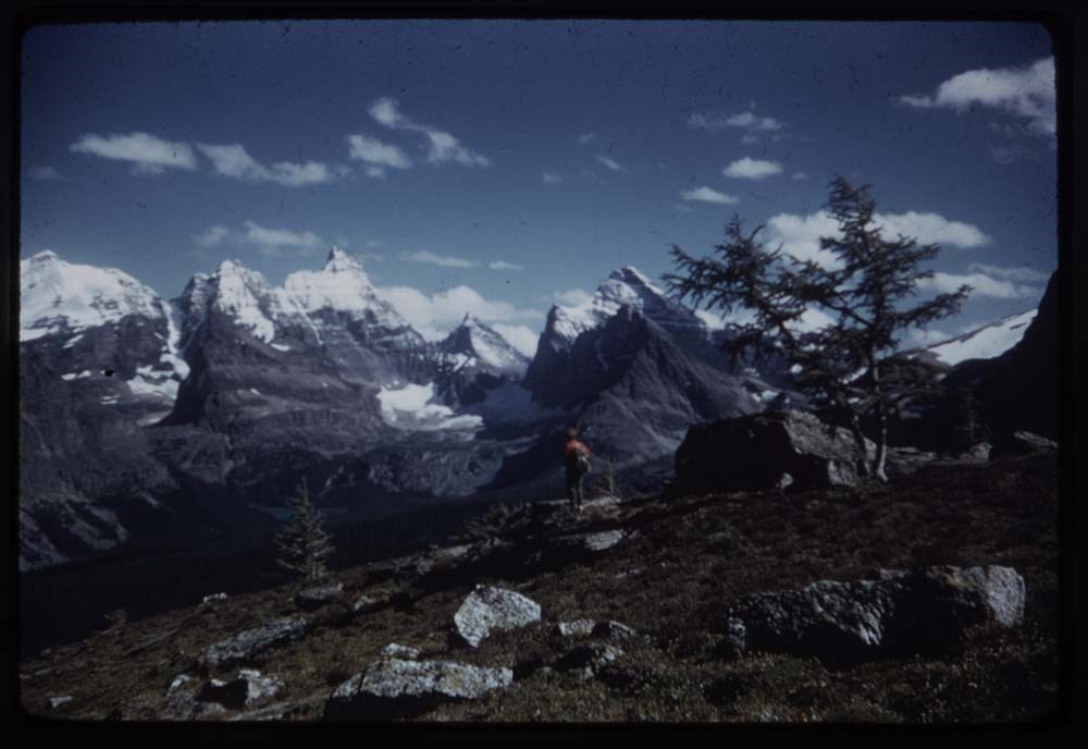
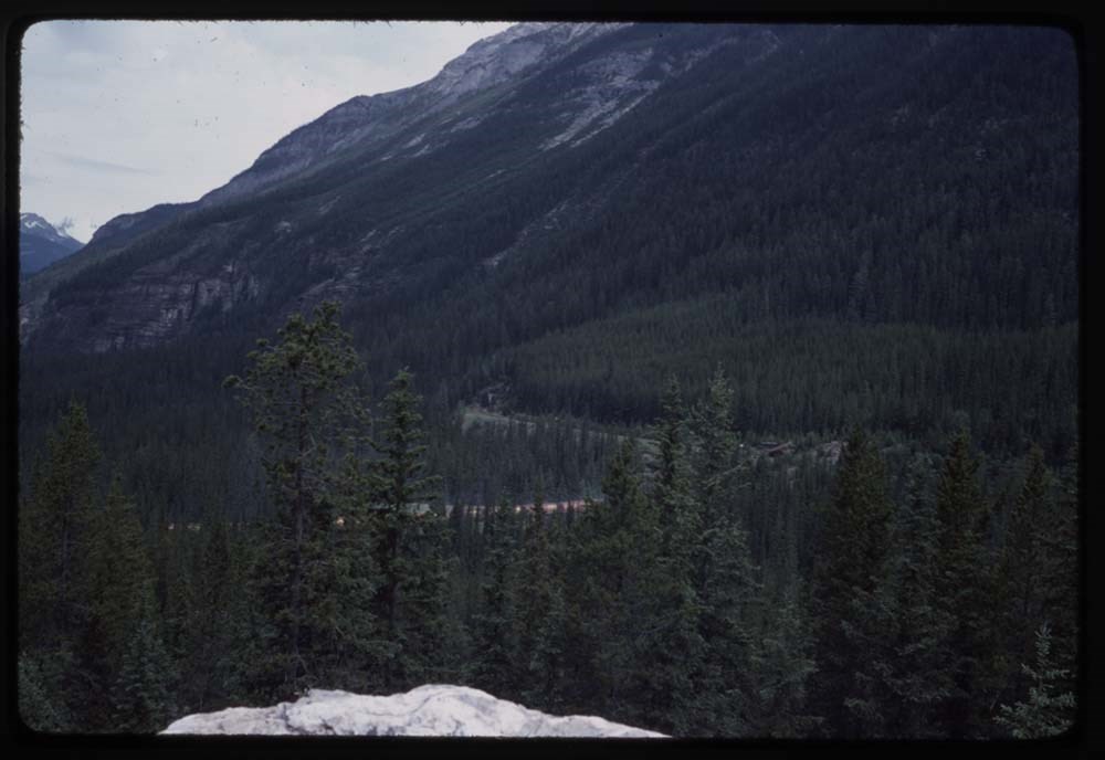
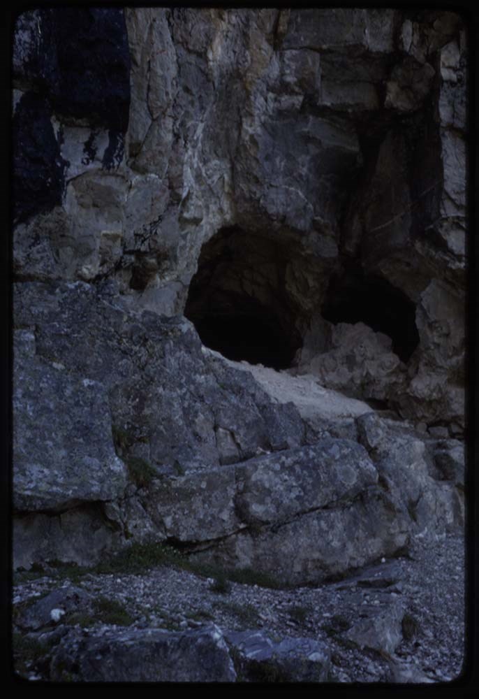
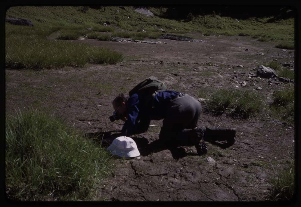
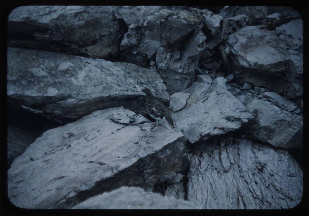
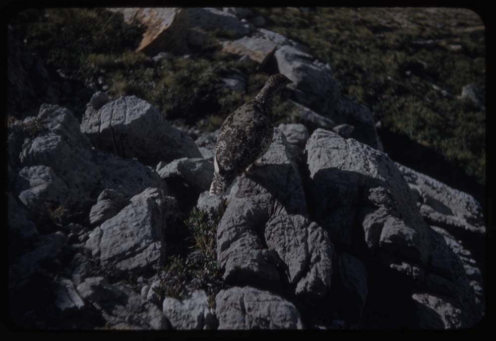
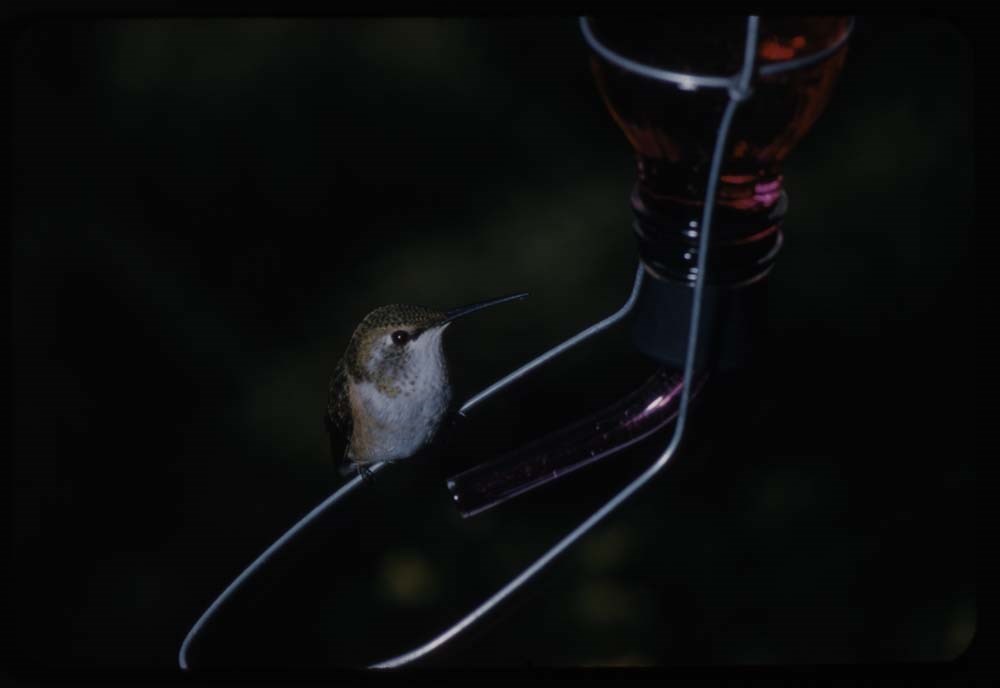
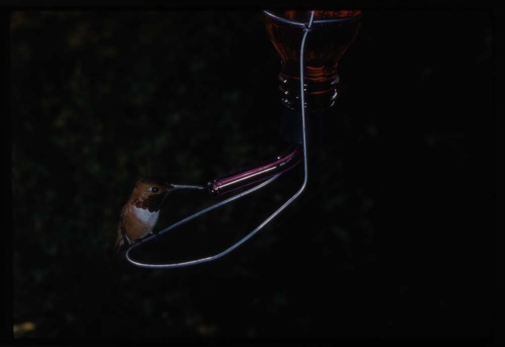
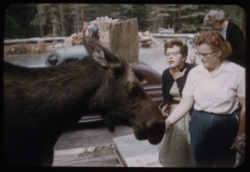
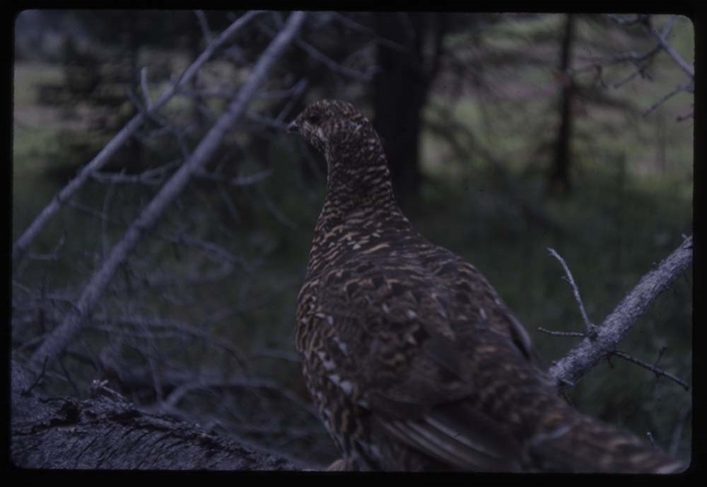
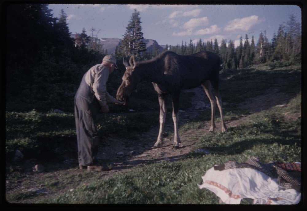
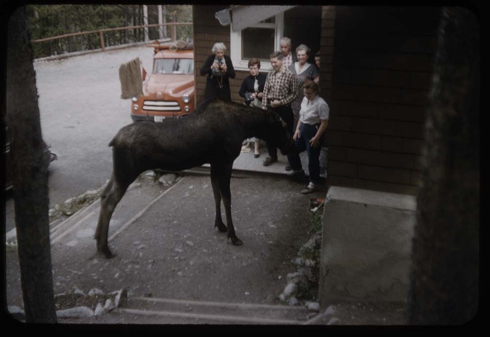
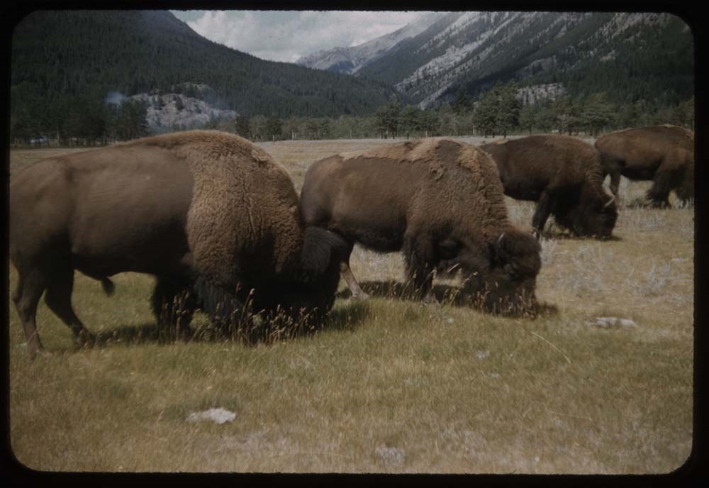
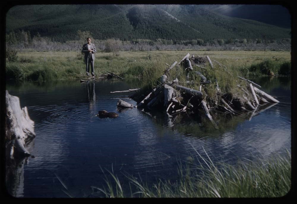
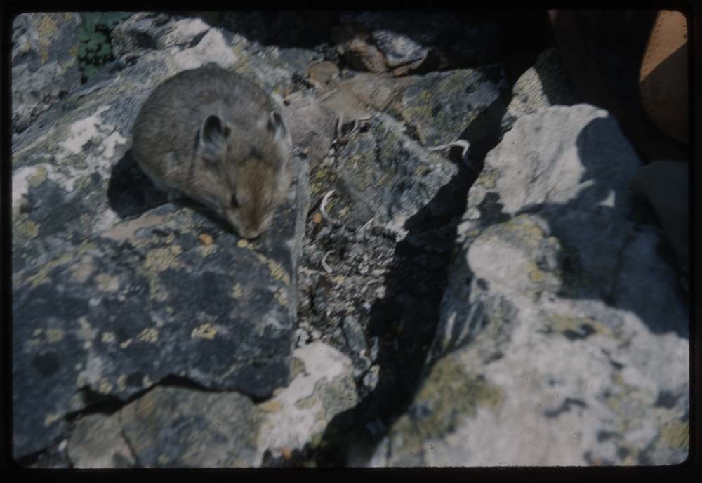
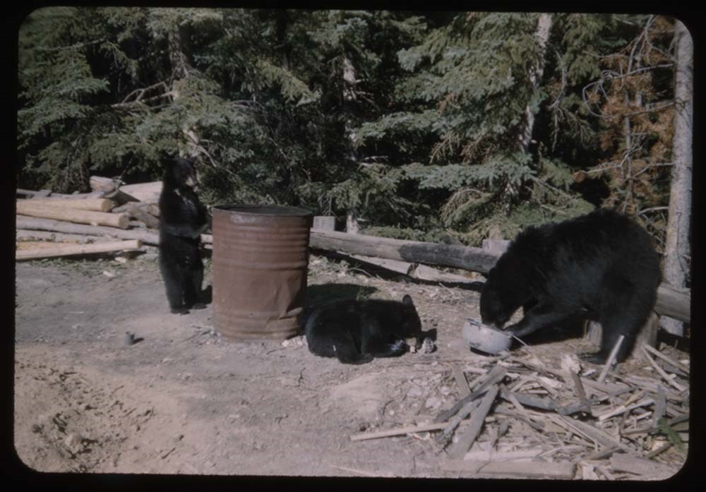
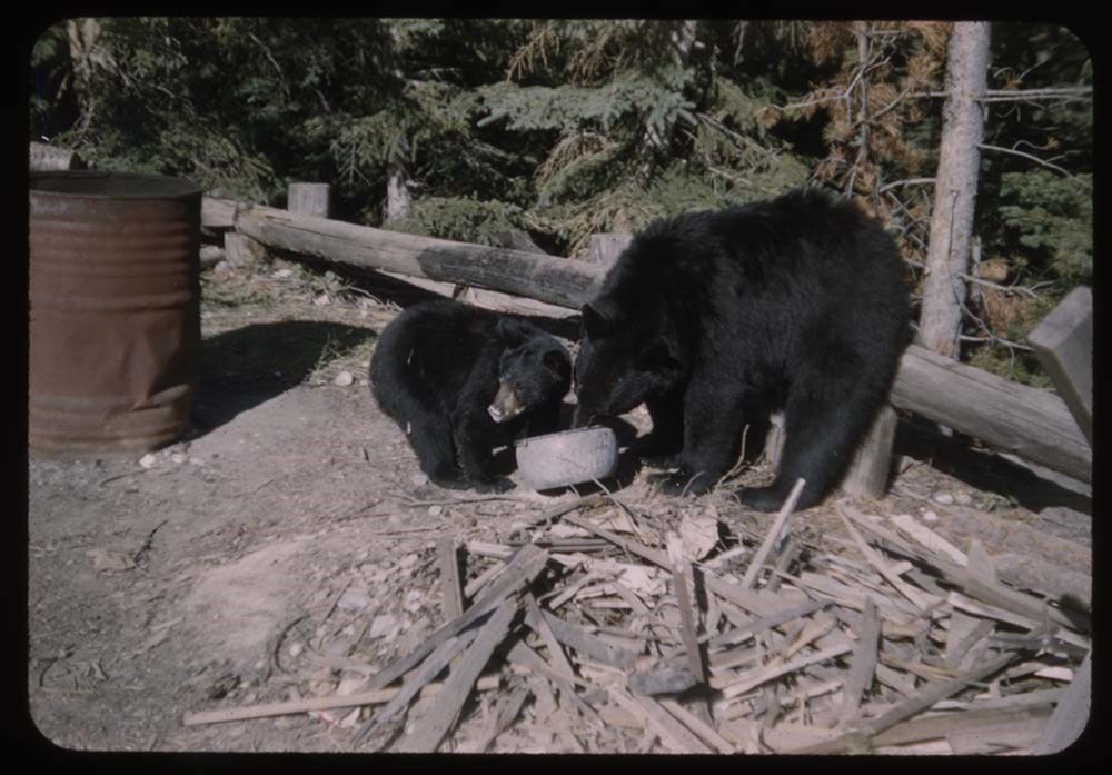
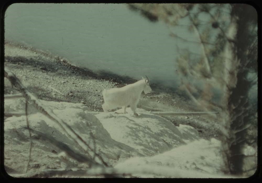
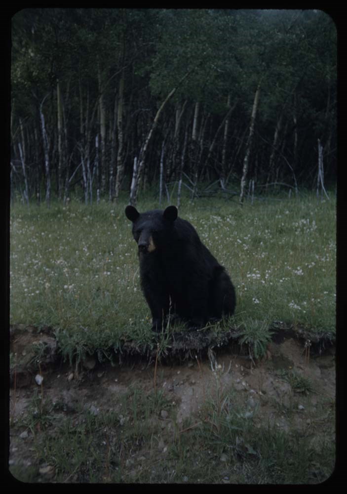
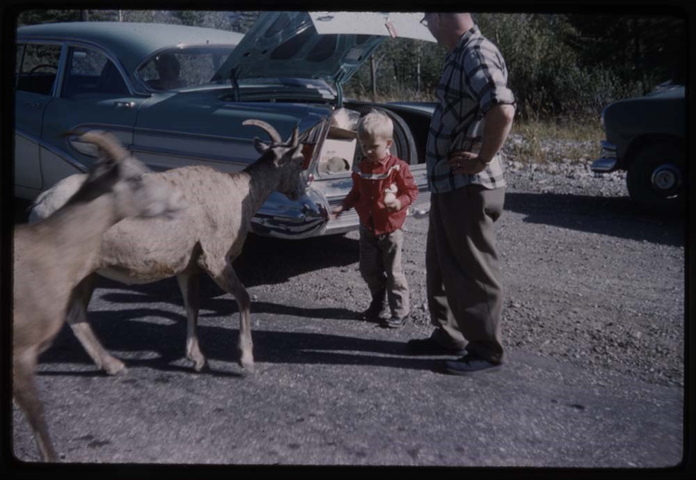
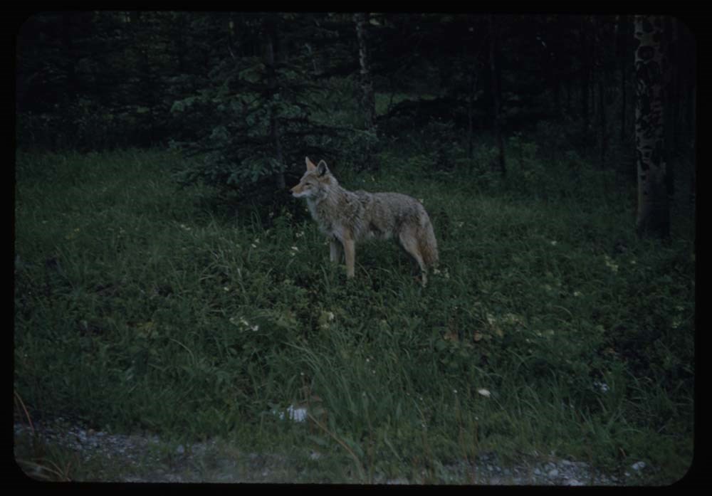
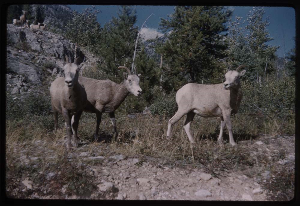
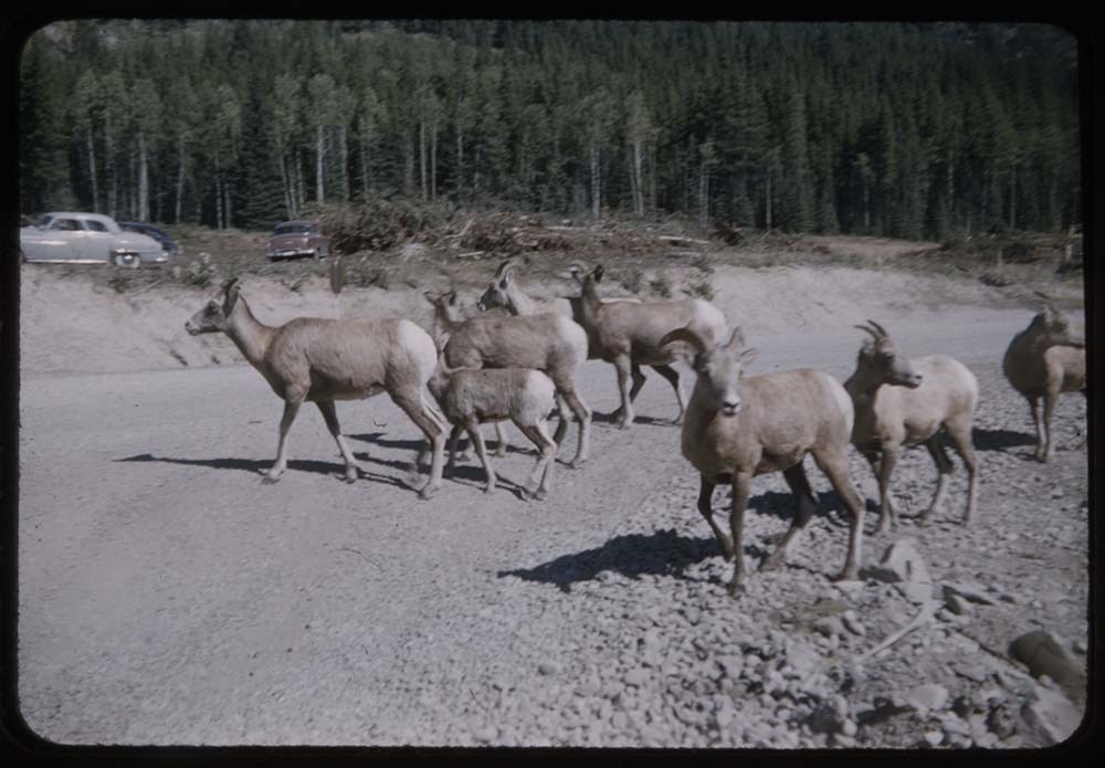
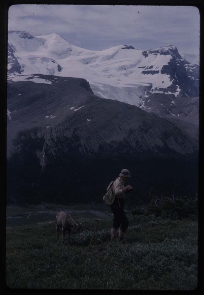
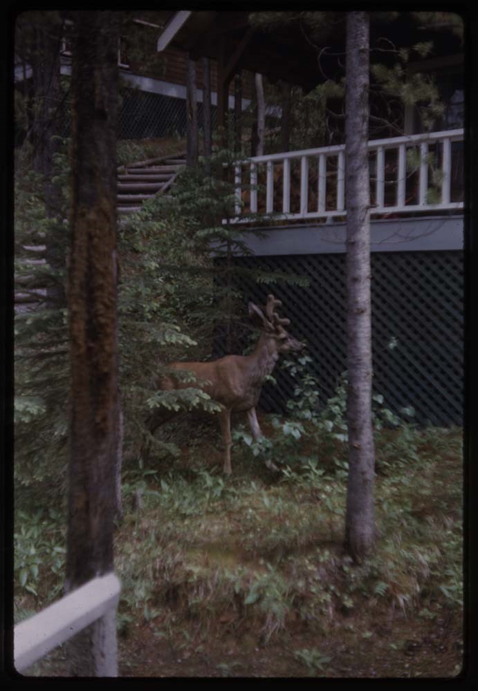
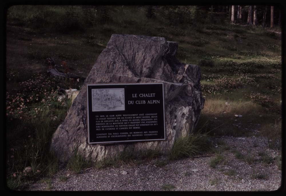
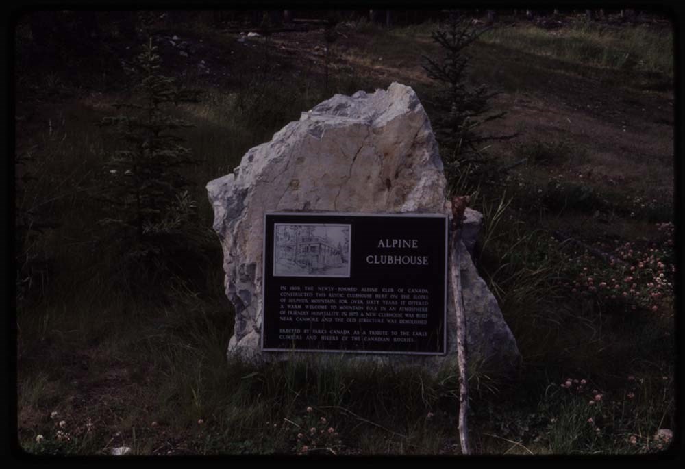
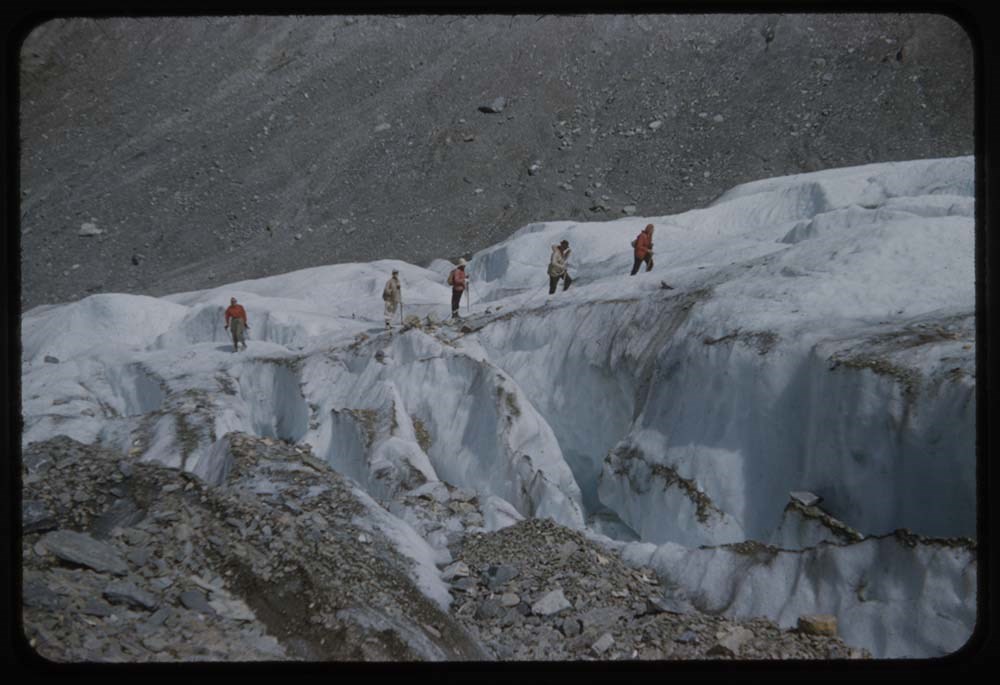
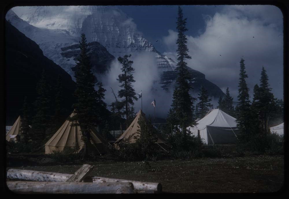
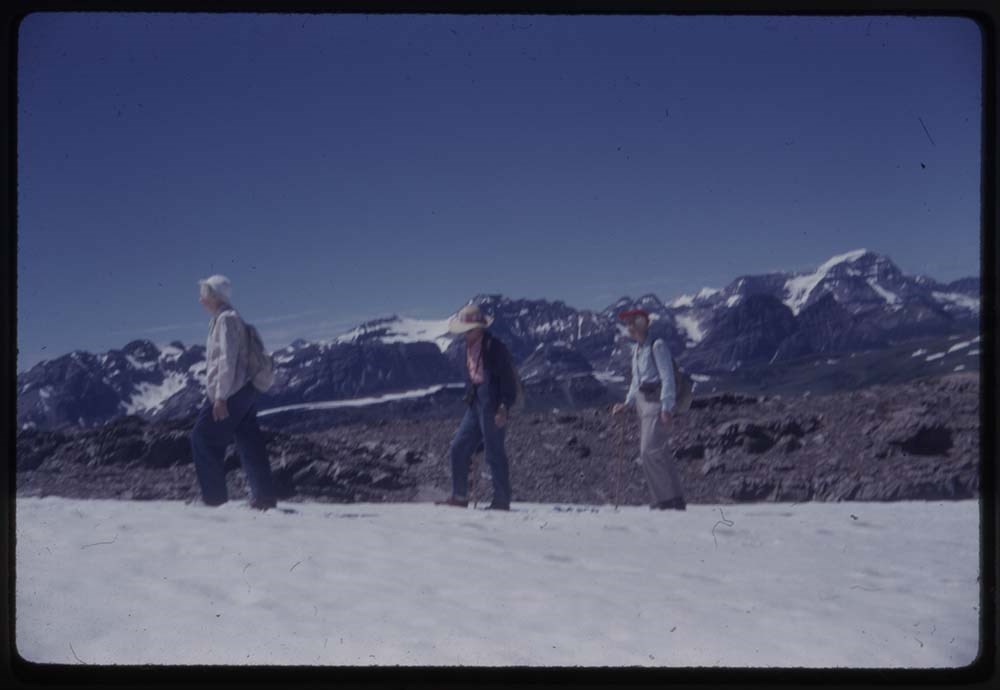
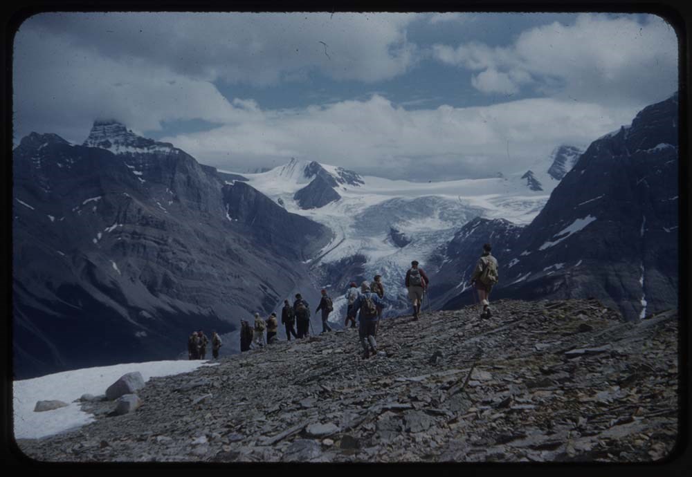
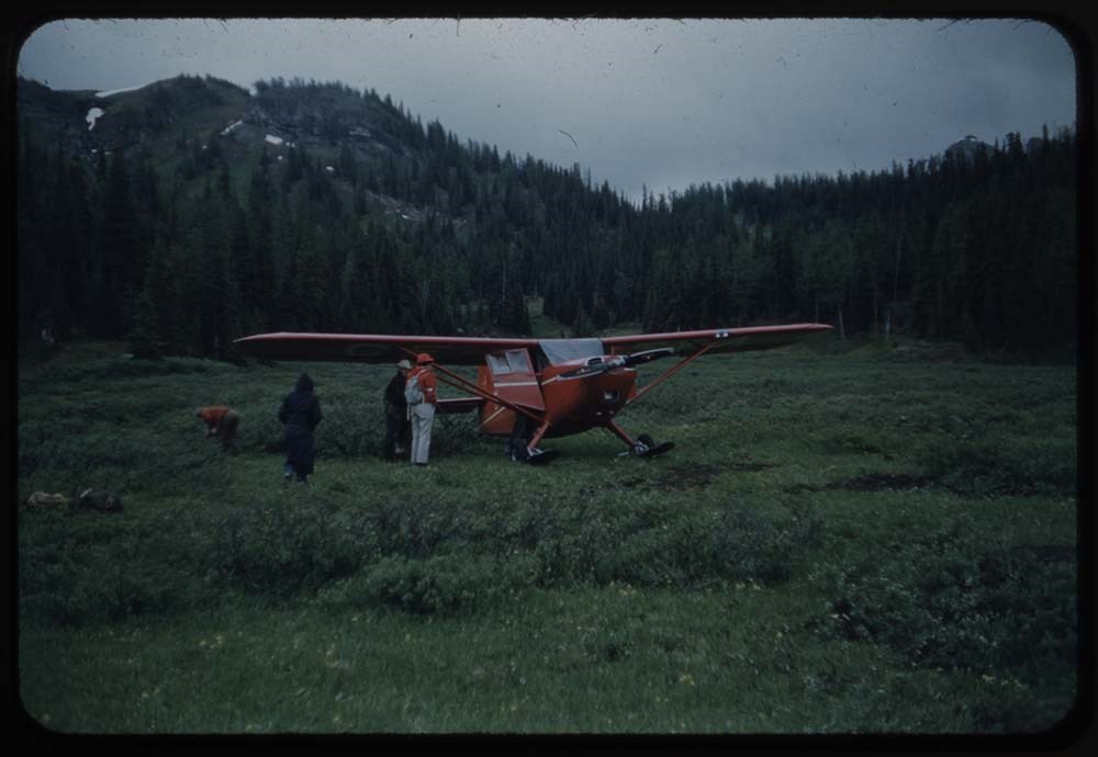
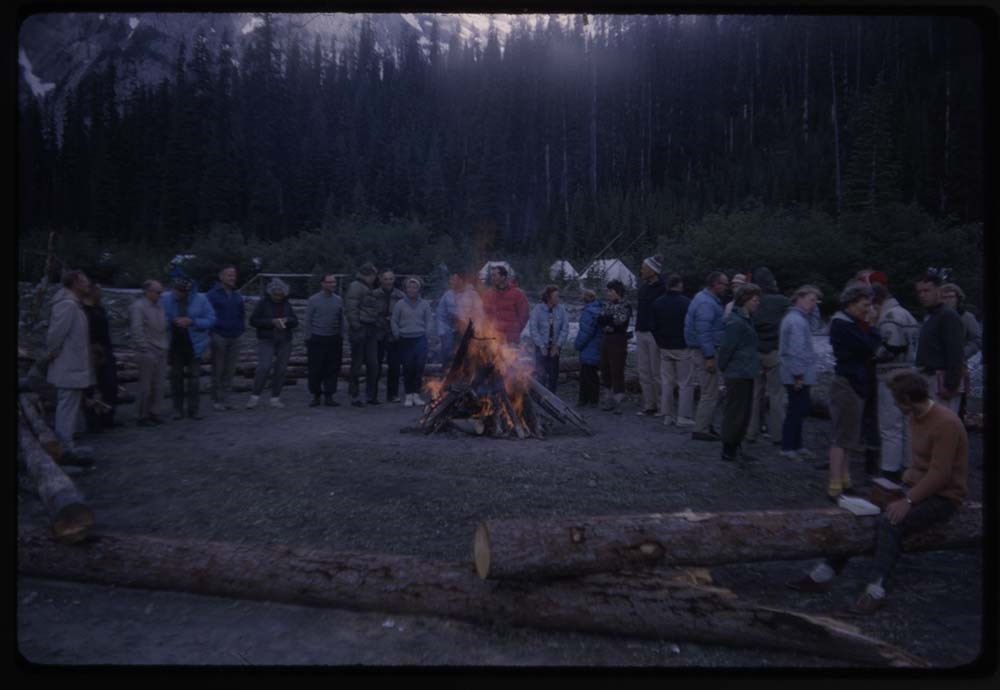
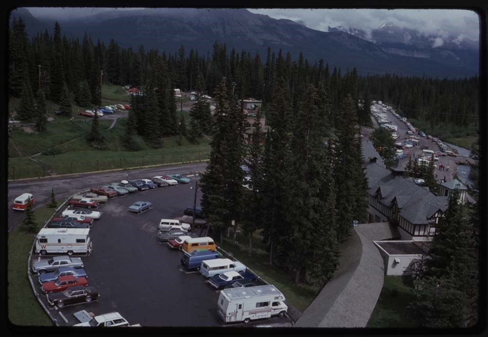
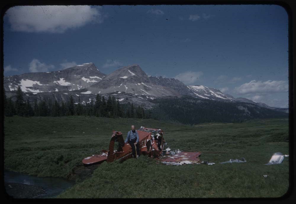
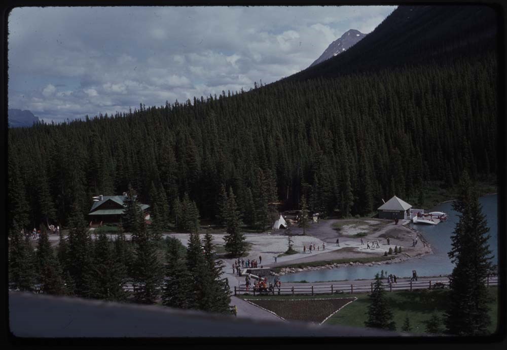
- File pertains to 80 slides assembled by Lillian Gest in 1981 into a show from slides depicting various summer and winter trips to the Canadian Rockies throughout the late 1960s and 1970s. Topics include mountains and mountain views, wildflowers, wildlife, Lillian and her friends, lakes, boats, fishing, hiking, and various other scenic views around Banff, Lake Louise, and Lake O'Hara. Titles: 1. K14-15 Clouds from plane 2. K17-26 3 Sisters & clouds 3. K11-8 From Poet's Pool 4. K207-34 Oesa from Abbots Pass 5. B30-27 Babg sandpiper 6. CH 4 fish from Baker Cr. 7. CH. Wilson's Ranch 8. CH. Douglas Lake at sunrise 9. CH. '55 ACC Camp Robson 10. CH. '55 N.E. from Ptarmigan Pk. 11. CH. '55 Banff fr. shoulder Cascade 12. CH. '55 Scarab L. & Whistler Pass 13. CH. 55 Lake & Healy Ck. Plateau 14. CH. 55 Egypt, Scarab, & Mummy Lake 15. CH. 55 NE across Scarab & Egypt L. 16. CH. 55 Monarch Mt. unnamed Lake 17. CH. 55 Mummy Lake 18. CH. 55 Healy Cr. summit & Talc mine L. beyond 19. CH. 55 Ptarmigan, Baker, Redonlet Lakes 20. CH 55 Fr. Ptarmigan Peak 21. CH 55 North fr. Ptarmigan Pk 22. CH 55 Merlin Lake 23. CH 55 Fossil Mt & Baker Lake fr. Ptarm. Pk 24. CH 55 Egypt Lake 25. B50-5 Garden & fowers 26. B32-6 MacArthur Lake 27. Duplicate Cathedral Basin 28. B27-24 Phyl waiting for train 29. K22-21 Spiral Tunnel 30. K22-18 [Spiral Tunnel] 31. K111-18 Photographer Hiker 32. K17-13 Crystal Cave 33. K17-23 Big Rock on trail 34. K16-12 Main Camp & Mt Coleman 35. K16-2 Around stream & dogs 36. K16-13 Campers & Mt Coleman 37. K16. 22 Conne & my horse 38. K16-23 [Conne] & her horse 39. K16-6 Hay fr. the horses 40. K10-14 Canoe on Lake O'Hara 41. -- 10 Walyek & party on porch 42. K5-34 Party by cairn 43. R146-36 Fool hen 44. CH. Baby ptarmigan 45. 191-15 Ptarmigan 46. R144-27 [Ptarmigan] on rocks 47. Vallance 60 Hummingbird male 48. [Vallance] 60 [Hummingbird] female 49. B55-11 Fool hen (nearest) 50. B13-37 Close up of moose 51. B13-35 Moose on club porch 52. B67-4 Charlie feeding moose 53. B11-26 4 buffalo feeding 54. B11-24 Buffalo herd 55. B30-4 Pika 56. B1-24 Beaver in pond 57. R173-34 Bear & cub at one pot 58. R173-33 Bear & 2 cubs one standing 59. R173-35 Bear 60. R185-16B1 Mt goat (bouglet) 61. R177-28 Coyote 62. B27-34 2 Sheep & tourists 63. B8-21 Sheep on the road 64. B27-31 3 ewes 65. B71-36 SHeep & marg fo[?] 66. R173-9 Ewe 67. B65-22 Deer at Club house 68. K36-3 2 plaques at old [Club house] 69. K36-1 Club house plaque 70. K36-2 [Club house plaque] 71. R206-28 Camp at Robson 72. R189-6 Phyl's rope on glacier 73. R187-21 Crowd on decsent 74. B46-4 Above Sunshine Lodge 75. B68-5 Camp fire w- flame 76. R179-17 Al gates plane in meadow 77. R204-32 Mashed plane 78. K15-6 Cars cars cars 79. K15-5 Cars at the Chateau 80. K15-4 View from #658 window
- Notes
- Please note: Language pertaining to First Nations people is outdated and offensive. Please note: Behavior towards wildlife, primarily human proximity and feeding, is outdated and no longer tolerated throughout all National Parks - do not feed or approach wildlife. Slides originally in Kodak Carousel 80 slide tray.
- Name Access
- Gest, Lillian
- Feuz, Edward
- Strom, Erling
- Hinman, Caroline
- Subject Access
- Abbot Pass Hut
- Activities
- Alpine Club of Canada
- Animals
- Avalanches
- Backpacking
- Banff
- Banff Indian Days
- Banff Springs Hotel
- Birds
- Boats
- Boat House
- Cabins and shelters
- Calgary Stampede
- Canoes and canoeing
- Climbing
- Club
- Elk
- Entertainment
- Environment
- Environment and Nature
- First Nations
- Flowers
- Geography
- Glaciers
- Guides
- Guiding
- Hiking
- Holidays
- Horses
- Huts
- Indigenous Peoples
- Lake O'Hara region
- Landscapes
- Leisure
- Mountain
- Mountain Goat
- Mountaineering
- Mountains
- National parks and reserves
- Norquay Ski Hill
- Outfitters, trail guides and packers
- Pack trains
- Pack trips
- Personal and Family Life
- Photography
- Portrait
- Recreation
- Scenery
- Stoney Nakoda First Nations
- Tavel
- Trails
- Trains
- Travel
- Wildlife
- Winter
- Women
- Geographic Access
- Banff
- Lake Louise
- Moraine Lake
- Banff National Park
- Canmore
- Lake O'Hara
- Yoho National Park
- British Columbia
- Alberta
- Canada
- Language
- English
- Conservation
- Slides rehoused into protective sleeves and acid-free folders after scanning.
- Related Material
- M67 / II / C / i / c / 56 - 8 ; See also notebooks (M67/51).
- Creator
- Gest, Lillian
- Title Source
- Title based on contents of file.
- Processing Status
- Processed
Electronic Resources
Images


This material is presented as originally created; it may contain outdated cultural descriptions and
potentially offensive content.
Read more.
Commercial trail riding policy
https://archives.whyte.org/en/permalink/descriptions54918
- Scope & Content
- File consists of a 1978 report titled "Commercial Trail Riding Policy for the Green Area of Alberta", a newspaper clipping, annotated agenda and scanned brochure, all of which produced by the Alberta Energy and Natural Resources corporation. Contents pertain to the Commercial Trail Riding Policy an…
- Date Range
- 1978
- 1981
- Reference Code
- M545 / V / 23
- Description Level
- 5 / File
- GMD
- Textual record
- Corporate record
- Description Level
- 5 / File
- Fonds Number
- M545 / V635
- Series
- M545 / V : Administrative records
- Sous-Fonds
- M545
- Accession Number
- 5939
- Reference Code
- M545 / V / 23
- Date Range
- 1978
- 1981
- Physical Description
- 0.5 cm of textual records
- Scope & Content
- File consists of a 1978 report titled "Commercial Trail Riding Policy for the Green Area of Alberta", a newspaper clipping, annotated agenda and scanned brochure, all of which produced by the Alberta Energy and Natural Resources corporation. Contents pertain to the Commercial Trail Riding Policy and a related workshop held in Red Deer in 1981.
- Notes
- Clipping, agenda and brochure were originally stored loose inside bound report
- Subject Access
- Administration
- Events
- Environment
- Natural resources
- Laws and legislation
- Land use
- Trails
- Geographic Access
- Canada
- Alberta
- Red Deer
- Language
- English
- Conservation
- Plastic binding and plain green cover pages were removed from report booklet due to risk of damage from contact with other materials in file
- Contents of bound report and loose contents previously stored inside report booklet secured separately in folder with two archival clips
- Category
- Environment
- Government
- Natural resources
- Title Source
- Title based on contents of file
- Processing Status
- Processed
This material is presented as originally created; it may contain outdated cultural descriptions and
potentially offensive content.
Read more.
Correspondence about O'Hara
https://archives.whyte.org/en/permalink/descriptions4530
- Part Of
- George K. K. (Tommy) Link fonds
- Scope & Content
- Correspondence between Link and Austin H. Ford re operating Lake O'Hara Lodge, transportation to the Lake and Lake O'Hara warden cabin. Letters from Link to the National Geographic Magazine re footpath construction, annual visits to Lake O'Hara, total mileage of ways, photograph description in maga…
- Date Range
- 1971-1978
- Reference Code
- M60 / 23
- Description Level
- 5 / File
- GMD
- Textual record
- Private record
- Part Of
- George K. K. (Tommy) Link fonds
- Description Level
- 5 / File
- Fonds Number
- M60 / V276
- Series
- I. Writing, research and translation
- Sous-Fonds
- M60
- Sub-Series
- A.The Ways of Lake O'Hara
- Accession Number
- 2815
- 2019.38
- Reference Code
- M60 / 23
- Date Range
- 1971-1978
- Physical Description
- 2 cm of textual records
- Scope & Content
- Correspondence between Link and Austin H. Ford re operating Lake O'Hara Lodge, transportation to the Lake and Lake O'Hara warden cabin. Letters from Link to the National Geographic Magazine re footpath construction, annual visits to Lake O'Hara, total mileage of ways, photograph description in magazine, Wiwaxy Trail Crew, preparation of map and treatise, O'Hara Trails Club, lodge construction, horse trails. Correspondence between Link and Tim Auger re history of Yoho National Park trail crews, Wapta Lake warden cabin, path changes, trail naming, injuries, equipment environmental issues, skiing in winter. Correspondence between Link and Glen L. Brook re Park personnel at Lake O'Hara, wardens stationed at Wapta Lake, Yoho National Park Superintendents, autobiography of Brook, duties of Lawrence Grassi at O'Hara, changes in routes, horse trails, Trans- Canada Highway and Charlotte Tuerck. Letters to Link from Tom Westervelt re types of rock in O'Hara area. Notes on Don Quixote Loop.
- Name Access
- Link, George K.K.
- Auger, Tim
- Brook, Glen
- Westervelt, Tom
- Grassi, Lawrence
- Tuerck, Charlotte
- Subject Access
- Trail making
- Trail guides
- Trails
- Horses
- Skiing
- Trans-Canada Highway
- Geographic Access
- Lake O'Hara
- Yoho National Park
- British Columbia
- Canada
- Wapta Lake
- Language
- English
- Finding Aid
- In case file
- Title Source
- Title based on contents of folder
- Processing Status
- Processed
This material is presented as originally created; it may contain outdated cultural descriptions and
potentially offensive content.
Read more.
Freelance and loose writing, comics
https://archives.whyte.org/en/permalink/descriptions54486
- Scope & Content
- File consists of textual records pertaining to trips led by the Trail Riders of the Canadian Rockies. Includes an annotated skit performed on a 1982 trail ride, drafts of possible content for newsletters, freelance writing samples, and accounts of specific trail rides. Most items list author(s) and…
- Date Range
- [1970-1980]
- 1982-1984
- 1986
- 1992-1993
- 1999
- 2003
- 2005-2008
- Reference Code
- M545 / II / 19
- Description Level
- 5 / File
- GMD
- Textual record
- Private record
- Drawing
- Description Level
- 5 / File
- Fonds Number
- M545 / V635
- Series
- M545 / II : Members, Staff and Personal Records
- Sous-Fonds
- M545
- Accession Number
- 8235
- Reference Code
- M545 / II / 19
- Date Range
- [1970-1980]
- 1982-1984
- 1986
- 1992-1993
- 1999
- 2003
- 2005-2008
- Physical Description
- 2 cm of textual records
- Scope & Content
- File consists of textual records pertaining to trips led by the Trail Riders of the Canadian Rockies. Includes an annotated skit performed on a 1982 trail ride, drafts of possible content for newsletters, freelance writing samples, and accounts of specific trail rides. Most items list author(s) and date. File also includes several annotated sketches depicting trail riders.
- Notes
- File contains duplicates which have been attached to each other
- Name Access
- Fedder, Zelda
- Vale, Don
- Howard, Christine
- Sharp, Thelma
- Levy, Joanne
- Brown, Brenda
- Bauer, Rebecca
- Orr, Dennis
- Wallace, Don
- Reid, Janice
- Elphinstone, Michelle
- Dallimore, Karen
- Godderis, Rick
- Geographic Access
- Canada
- Alberta
- Banff
- Clearwater
- Wonder Pass
- Language
- English
- Conservation
- Metal staples removed from numerous items
- Category
- Sports, recreation and leisure
- Title Source
- Title based on contents of file
- Processing Status
- Processed
This material is presented as originally created; it may contain outdated cultural descriptions and
potentially offensive content.
Read more.
- Part Of
- Alpine Club of Canada fonds
- Scope & Content
- File consists of a summit record from Haddo Peak produced by the Alpine Club of Canada between 1968 and 2001. Summit record includes entries from visitors to the various summits which pertain to individuals' hiking and climbing trips; details of specific events which occurred while at the summit, w…
- Date Range
- 1968-2001
- Reference Code
- M200 / V / A / 212
- Description Level
- 5 / File
- GMD
- Textual record
- Organization record
- Part Of
- Alpine Club of Canada fonds
- Description Level
- 5 / File
- Fonds Number
- M200
- V14
- S6
- Series
- M200 / V: Summit Records
- Sous-Fonds
- M200
- Sub-Series
- M200 / V / A: Identified Summit Records
- Accession Number
- accn. 2023.10
- Reference Code
- M200 / V / A / 212
- Responsibility
- Summit Registers and Notes produced by Alpine Club of Canada
- Date Range
- 1968-2001
- Physical Description
- 1 volume 1 cm of textual record
- History / Biographical
- Haddo Peak is located in the Lake Louise area of Banff National Park, Alberta. Haddo Peak is attached to Mount Aberdeen. Nearby is the Plain of the Six Glaciers Tea House, Lake Louise, Mount Victoria, Mount Lefroy and Mount Temple.
- Scope & Content
- File consists of a summit record from Haddo Peak produced by the Alpine Club of Canada between 1968 and 2001. Summit record includes entries from visitors to the various summits which pertain to individuals' hiking and climbing trips; details of specific events which occurred while at the summit, wildlife sightings, trail updates, and related topics. File: M200 / V / A / 212: Haddo [Peak]
- Name Access
- Alpine Club of Canada
- Subject Access
- Alberta
- Alpine Club of Canada
- Backpacking
- Banff
- Banff National Park
- Bow Valley
- Climbing
- Club
- Description and travel
- Environment
- Environment and Nature
- Hiking
- Lake Louise
- Mountain
- Mountaineering
- Mountaineers
- Mountains
- National parks and reserves
- Plain of Six Glacier Teahouse
- Record keeping
- Sports and leisure
- Sports and recreation
- Summit
- Temple Mountain
- Trails
- Geographic Access
- Canada
- Canadian Rocky Mountains
- Rocky Mountains
- Alberta
- Banff National Park
- Lake Louise
- Lake Louise, AB
- Plain of Six Glaciers
- Mount Victoria
- Mount Lefroy
- Mount Temple
- Mount Aberdeen
- Haddo Peak
- Access Restrictions
- Restrictions may apply
- Language
- English
- Related Material
- M235
- Title Source
- Title based on contents of file
- Processing Status
- Processed
This material is presented as originally created; it may contain outdated cultural descriptions and
potentially offensive content.
Read more.
- Part Of
- Peter and Catharine Whyte fonds
- Date Range
- 1972-1974
- Reference Code
- M36 / I / A / 4 / b / iii / 1386
- Description Level
- 5 / File
- Part Of
- Peter and Catharine Whyte fonds
- Description Level
- 5 / File
- Fonds Number
- M36 / V683 / S37
- Series
- I.A.4. Catharine Robb Whyte papers / photographs
- Reference Code
- M36 / I / A / 4 / b / iii / 1386
- Date Range
- 1972-1974
- Physical Description
- 1 file of textual records
- Subject Access
- Lake O'Hara Trails Club
This material is presented as originally created; it may contain outdated cultural descriptions and
potentially offensive content.
Read more.
Lake O'Hara Trails
https://archives.whyte.org/en/permalink/descriptions54776
- Part Of
- Murray Hay fonds
- Scope & Content
- File consists of 0.5 cm of textual records, 60.5 x 48.5 cm. File pertains to a trail map of the Lake O'Hara area created by Murray Hay. File consists of one published poster depicting a reproduced map of the trails at Lake O'Hara in Yoho National Park (British Columbia).
- Date Range
- ca.1970-ca.2015
- Reference Code
- M570 / III / A / iv / 1
- Description Level
- 5 / File
- GMD
- Map
- Poster
- Published record
- Textual record
- Part Of
- Murray Hay fonds
- Description Level
- 5 / File
- Fonds Number
- M570 / V795
- Series
- M570 / III : Murray Hay Portfolio (published material)
- Sous-Fonds
- M570
- Sub-Series
- M570 / III / A : British Columbia / iv : Lake O'Hara
- Accession Number
- 2019.41
- Reference Code
- M570 / III / A / iv / 1
- Date Range
- ca.1970-ca.2015
- Physical Description
- 0.5 cm of textual material (60.5 x 48.5 cm)
- Scope & Content
- File consists of 0.5 cm of textual records, 60.5 x 48.5 cm. File pertains to a trail map of the Lake O'Hara area created by Murray Hay. File consists of one published poster depicting a reproduced map of the trails at Lake O'Hara in Yoho National Park (British Columbia).
- Notes
- M570 / III / A / iv / 1 is oversize.
- Name Access
- Hay, Murray
- Subject Access
- Trails
- Hiking
- Cartography
- Advertising
- Artist
- Sports and recreation
- Travel
- Tourism
- Tourist information
- Geographic Access
- Lake O'Hara
- British Columbia
- Canada
- Canadian Rocky Mountains
- Yoho National Park
- Language
- English
- Title Source
- Title based on contents of file
- Processing Status
- Processed
This material is presented as originally created; it may contain outdated cultural descriptions and
potentially offensive content.
Read more.
Letter to Bruno about map in process
https://archives.whyte.org/en/permalink/descriptions4531
- Part Of
- George K. K. (Tommy) Link fonds
- Scope & Content
- Between Link and Austin Ford, Bruno Struck, the draftsman and the photographer regarding changes or additions to the map re boundaries, ways and topographical features on the Lake O'Hara Region South Area. Letters to and from Link, Lillian Gest and the map printers. The Map includes a magnified vi…
- Date Range
- 1957 - 1975
- Reference Code
- M60 / I / B / 38
- Description Level
- 5 / File
- GMD
- Map
- Private record
- Part Of
- George K. K. (Tommy) Link fonds
- Description Level
- 5 / File
- Fonds Number
- M60 / V276
- Series
- I. Writing, research and translation
- Sous-Fonds
- M60
- Sub-Series
- B. Map of Lake O'Hara region south area
- Accession Number
- 2019.36
- 2815
- Reference Code
- M60 / I / B / 38
- GMD
- Map
- Private record
- Date Range
- 1957 - 1975
- Physical Description
- 1 file of textual records (1 cm)
- Scope & Content
- Between Link and Austin Ford, Bruno Struck, the draftsman and the photographer regarding changes or additions to the map re boundaries, ways and topographical features on the Lake O'Hara Region South Area. Letters to and from Link, Lillian Gest and the map printers. The Map includes a magnified view of Lake O'Hara as well as detailed account of trails, geography, and other landmarks of interest in the O'Hara area.
- Name Access
- Auger, Tim
- Stuck, Bruno
- Gest, Lillian
- Link, George K.K.
- Subject Access
- Trails
- Trail guides
- Geographic Access
- Lake O'Hara
- Yoho National Park
- British Columbia
- Canada
- Language
- English
- Finding Aid
- In case file
- Title Source
- Title originated in contents
- Processing Status
- Processed
This material is presented as originally created; it may contain outdated cultural descriptions and
potentially offensive content.
Read more.
Mount Lougheed Summit Registers
https://archives.whyte.org/en/permalink/descriptions57732
- Part Of
- Alpine Club of Canada fonds
- Scope & Content
- Files consist of summit notes and summit registers from Mount Lougheed produced by the Alpine Club of Canada between 1967 and 2017. Summit records include entries from visitors to the various summits which pertain to individuals' hiking and climbing trips; details of specific events which occurred …
- Date Range
- 1967-1970
- 1980
- 1996-2017
- Reference Code
- M200 / V / A / 140 to 142
- Description Level
- 5 / File
- GMD
- Textual record
- Organization record
- Part Of
- Alpine Club of Canada fonds
- Description Level
- 5 / File
- Fonds Number
- M200
- V14
- S6
- Series
- M200 / V: Summit Records
- Sous-Fonds
- M200
- Sub-Series
- M200 / V / A: Identified Summit Records
- Accession Number
- accn. 2023.19
- accn. 8119
- accn. 2023.41
- Reference Code
- M200 / V / A / 140 to 142
- Responsibility
- Summit Registers and Notes produced by Alpine Club of Canada
- Date Range
- 1967-1970
- 1980
- 1996-2017
- Physical Description
- 4 cm of textual records 3 volumes
- History / Biographical
- Mount Lougheed is located in Kananaskis Country near the Spray Lakes Reservoir, in Alberta. Mount Lougheed has three summits, and the mountain is part of the Canadian Rockies. The highest of the three peaks is known as Peak 2 or Lougheed II.
- Scope & Content
- Files consist of summit notes and summit registers from Mount Lougheed produced by the Alpine Club of Canada between 1967 and 2017. Summit records include entries from visitors to the various summits which pertain to individuals' hiking and climbing trips; details of specific events which occurred while at the summit, wildlife sightings, trail updates, and related topics. Files include: M200 / V / A / 140: [Mt. Lougheed, 1967-1970, 1980] M200 / V / A / 141: Mt. Lougheed 1996-2007 M200 / V / A / 142: [Lougheed II 2007-2017]
- Name Access
- Alpine Club of Canada
- Subject Access
- Alberta
- Alpine Club of Canada
- Backpacking
- Backcountry skiing
- Climbing
- Club
- Cross-country skiing
- Description and travel
- Environment
- Environment and Nature
- Hiking
- Kananaskis Country
- Mountain
- Mountaineering
- Mountaineers
- Mountains
- Record keeping
- Ski mountaineering
- Ski area
- Ski areas
- Skiing
- Skiers
- Skis
- Sports and leisure
- Sports and recreation
- Summit
- Trails
- Geographic Access
- Canada
- Canadian Rocky Mountains
- Rocky Mountains
- Alberta
- Kananaskis
- Kananaskis Country
- Spray Lakes
- Dead Man's Flats
- Canmore
- Canmore, AB
- Canmore, Alberta
- Mount Lougheed
- Access Restrictions
- Restrictions may apply
- Language
- English
- French
- Japanese
- Mandarin
- Conservation
- Some summit notes are placed in mylar. Some registers have water damage and rust damage.
- Related Material
- M235
- Biographical Source Notes
- Peak Finder: Mount Lougheed, Canadian Rockies Database: https://cdnrockiesdatabases.ca/peaks/811#undefined1
- Title Source
- Title based on contents of file
- Processing Status
- Processed
This material is presented as originally created; it may contain outdated cultural descriptions and
potentially offensive content.
Read more.
Mt. Assiniboine, Palliser and Johnston Creek trail rides album
https://archives.whyte.org/en/permalink/descriptions54338
- Scope & Content
- Album contains lists of participants and photographs pertaining to five trail rides with the Trail Riders of the Canadian Rockies between 1977 and 1981. Locations include Mt. Assiniboine, Palliser Range, Johnston Creek, Panther River and Red Deer River. Photographs include members of the Wotypka fa…
- Date Range
- 1977
- 1978
- 1979
- 1980
- 1981
- Reference Code
- V635 / I / PD - 4
- Description Level
- 5 / File
- GMD
- Album
- Photograph
- Photograph print
- Textual record
- Description Level
- 5 / File
- Fonds Number
- M545 / V635
- Series
- V635 / I : Events and Activities
- Sous-Fonds
- V635
- Accession Number
- 2014.8277
- Reference Code
- V635 / I / PD - 4
- Responsibility
- Anne Wotypka
- Date Range
- 1977
- 1978
- 1979
- 1980
- 1981
- Physical Description
- Album : 248 photographs ; colour
- Scope & Content
- Album contains lists of participants and photographs pertaining to five trail rides with the Trail Riders of the Canadian Rockies between 1977 and 1981. Locations include Mt. Assiniboine, Palliser Range, Johnston Creek, Panther River and Red Deer River. Photographs include members of the Wotypka family. Photographs depict scenic views in the Canadian Rockies, riders on horseback, campsites, group photographs, indoor games and entertainment. Album also contains one route map for the Trail Riders (no date), 6 pages of song lyrics and one news article re: 1979 Trail Riders trip (March 30, 1979).
- Name Access
- Jameson, Roy
- Wotypka, Frank
- Wotypka, Barbara
- Orr, Dennis
- Thomson, Gordon
- Pruden, Ron
- Langdon, Victor
- Wotypka, Joanne
- Wotypka, Karen
- Subject Access
- Travel
- Packing
- Mountain
- Camping
- Trails
- Music
- Horses
- Trail Riders of the Canadian Rockies
- Geographic Access
- Canada
- Alberta
- Banff
- Canadian Rocky Mountains
- Language
- English
- Conservation
- Consider future conservation measures if metal rings of binder or plastic photograph pockets of album pose risk to photographic and paper contents.
- Title Source
- Title based on contents of file
- Processing Status
- Processed
This material is presented as originally created; it may contain outdated cultural descriptions and
potentially offensive content.
Read more.