Narrow Results By
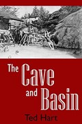
The Cave and Basin : Banff's hot springs and the birth of Canada's national parks
https://archives.whyte.org/en/permalink/catalogue25251
- Medium
- Library - Book (including soft-cover and pamphlets)
- Published Date
- 2017
- Author
- Hart, E.J. (Ted)
- Publisher
- Banff, AB : Summerthought Publishing
- Call Number
- 08.3 H11c
1 website
- Author
- Hart, E.J. (Ted)
- Responsibility
- Ted (E.J.) Hart
- Publisher
- Banff, AB : Summerthought Publishing
- Published Date
- 2017
- Physical Description
- 91 pages
- Abstract
- THE CAVE AND BASIN by Ted Hart is the story of mineral springs in Banff National Park that were instrumental to the growth of Banff and formed the nucleus of Canada’s national park system. Authored by renowned historian E.J. (Ted) Hart, Cave and Basin offers background on what is now protected as a national historic site, exploring the story of its discovery and the lives of those involved in its development as a world-famous attraction. It describes these unique and fascinating hot springs and how they became the catalyst for important developments in Canadian history and culture. The book details the story of the springs’ first discovery, their critical place in a government decision to create a reserve to protect them for public use and their development into a tourist location where generations of Canadians and those from around the world came to enjoy their soothing balm. In the process, the springs, and the Cave and Basin particularly, became the epicentre for both the creation and the commemoration of Canada’s national parks. (From publisher's website)
- Contents
- Introduction
- Chapter 1 - Sacred waters of the mountains
- Chapter 2 - Like some fantastic dream
- Chapter 3 - The hot springs investigation
- Chapter 4 - Recuperate the patients and recoup the treasury
- Chapter 5 - As near perfetion as it is possible to make
- Chapter 6 - Walter Painter's wonder
- Chapter 7 - Different guises
- Chapter 8 - Recent times
- Index
- Photo credits
- About the author
- ISBN
- 9781926983271
- Accession Number
- P2020.07
- Call Number
- 08.3 H11c
- Collection
- Archives Library
- URL Notes
- Publisher's website
Websites
This material is presented as originally created; it may contain outdated cultural descriptions and
potentially offensive content.
Read more.
Rails over the mountains : exploring the railway heritage of Canada's western mountains
https://archives.whyte.org/en/permalink/catalogue25285
- Medium
- Library - Book (including soft-cover and pamphlets)
- Published Date
- 2016
- Author
- Brown, Ron
- Publisher
- Toronto : Dundurn
- Call Number
- 08.3 B78r
1 website
- Author
- Brown, Ron
- Responsibility
- Ron Brown
- Publisher
- Toronto : Dundurn
- Published Date
- 2016
- Physical Description
- 156 pages : illustrations
- Subjects
- Railways
- History
- History of Alberta
- History-Canada
- Rocky Mountains
- Canadian Pacific Railway
- Canadian Pacific Railway Company
- Canadian Pacific Railway Hotels
- Abstract
- Ride the rails through Canada’s western mountains to explore the many vestiges of the region’s spectacular and surprising railway heritage. Here is where grand railway hotels were built to attract tourists to the West’s beautiful scenery and bring profit to the railway lines as well. Rustic stations added to the allure. The challenges of conquering the mountains resulted in some of Canada’s most ingenious feats of engineering, such as spiral tunnels and soaring trestles (one of which was featured in The Amazing Race Canada). Relive the days of rail on a steam train, the luxurious Rocky Mountaineer, or one of VIA Rail’s mountain journeys. Outdoor enthusiasts can follow the abandoned roadbeds of Canada’s more spectacular rail trails, like the legendary Kettle Valley Railway. Also included are some of Canada’s most extensive railway museums, which have helped to bring this vanished era back to life. (From publisher's website)
- Contents
- The rails arrive -- Conquering the mountains : the tunnels and bridges -- The faces of the railways : the heritage railway stations -- Life on the line : the railway towns -- The dream castles : western Canada's railway hotels -- Railway structures : a forgotten heritage -- Celebrating the heritage : the railway museums -- The rail trails -- All aboard.
- ISBN
- 9781459733596
- Accession Number
- P2020.07
- Call Number
- 08.3 B78r
- Collection
- Archives Library
- URL Notes
- Publisher's website
Websites
This material is presented as originally created; it may contain outdated cultural descriptions and
potentially offensive content.
Read more.

Surveying the 120th meridian and the great divide : the Alberta/BC boundary survey, 1918-1924
https://archives.whyte.org/en/permalink/catalogue24952
- Medium
- Library - Book (including soft-cover and pamphlets)
- Published Date
- 2019
- Author
- Sherwood, Jay
- Publisher
- Halfmoon Bay, BC : Caitlin Press
- Call Number
- 08.3 Sh5s Volume 2
1 website
- Author
- Sherwood, Jay
- Responsibility
- Jay Sherwood
- Publisher
- Halfmoon Bay, BC : Caitlin Press
- Published Date
- 2019
- Physical Description
- 192 p. ; illus.
- Series
- Volume 2
- Subjects
- Surveyors
- Surveys and Mapping
- Surveys
- Great Divide Trail
- Alberta
- British Columbia
- British Columbia - Boundaries
- British Columbia - Surveys and Mapping
- Alberta - B.C. Boundary
- Alberta - Boundaries
- Wheeler, Arthur Oliver
- Cautley, Richard William
- History
- History of Alberta
- Abstract
- "Surveying the 120th Meridian and the Great Divide is the second book of a two-part series describing the initial Alberta/BC boundary survey undertaken between 1913-1924. Surveying the 120th Meridian focuses on the years 1918–1924, when the Alberta crew continued the survey of the 120th meridian while the BC crew split off to continue mapping the Great (Continental) Divide. The Alberta/BC boundary survey was a unique Canadian project that combined talented surveyors, high-tech surveying equipment, rugged crew members and Canadian wilderness. This is a story of adventure and danger: the crew climbed mountains and surveyed from the peaks of the Canadian Rockies; slogged through the muskeg north of the Peace River; occasionally crossed rivers at high water; and often worked in the rain, snow or cold. The boundary survey produced the first detailed maps of the terrain along the divide and the first pictures of the northern Canadian Rockies taken from an airplane. But the most important legacy of this project is the collection of approximately 5,000 photographs developed from high-quality glass plate negatives. These photographs provide full panoramas of the Rocky Mountain landscape as it looked over a century ago. Surveying the 120th Meridian and the Great Divide combines the best of these photographs, diary entries and government documents to recount the astonishing journey of the surveyors and their crew members as they explored Canada’s most dramatic landscape."-- Provided by publisher.
- Contents
- Maps
- Acknowledgements
- Introduction
- The Surveyors
- Surveying Methods 1918-1924
- Completion of the Boundary Survey, 1950-1953
- Conclusion
- Geographical Names
- Survey Crews, 1918-1924
- Sources Consulted
- Index
- Notes
- Features visual and textual material from the A.O. Wheeler fonds M546 / V771
- ISBN
- 9780773860091
- Accession Number
- 2019.90
- Call Number
- 08.3 Sh5s Volume 2
- Collection
- Archives Library
- URL Notes
- Publisher's website
Websites
This material is presented as originally created; it may contain outdated cultural descriptions and
potentially offensive content.
Read more.
