Narrow Results By
Big White Ski Village
https://archives.whyte.org/en/permalink/descriptions54801
- Part Of
- Murray Hay fonds
- Scope & Content
- File consists of 0.5 cm of textual records, 90 x 60.5 cm. File pertains to ski trail maps of Big White Ski Village and Area created by Murray Hay. File includes one oversized published reproduction of a Big White trail map in poster format.
- Date Range
- ca.1980 - ca.2000
- Reference Code
- M570 / III / A / v / 1
- Description Level
- 5 / File
- GMD
- Map
- Poster
- Published record
- Textual record
- Part Of
- Murray Hay fonds
- Description Level
- 5 / File
- Fonds Number
- M570 / V795
- Series
- M570 / III : Murray Hay portfolio (published material)
- Sous-Fonds
- M570
- Sub-Series
- M570 / III / A : British Columbia / v : Big White
- Accession Number
- 2019.41
- Reference Code
- M570 / III / A / v / 1
- Date Range
- ca.1980 - ca.2000
- Physical Description
- 0.5 cm of textual records (90 x 60.5 cm)
- Scope & Content
- File consists of 0.5 cm of textual records, 90 x 60.5 cm. File pertains to ski trail maps of Big White Ski Village and Area created by Murray Hay. File includes one oversized published reproduction of a Big White trail map in poster format.
- Name Access
- Hay, Murray
- Subject Access
- Ski Maps
- Map
- Ski area
- Skiing
- Tourism
- Travel
- Winter
- Winter sports
- Sports and recreation
- Big White Ski Area
- Tourist information
- Artist
- Advertising
- Geographic Access
- Kelowna
- British Columbia
- Canada
- Language
- English
- Related Material
- V795 / II / A / iv / 5
- Title Source
- Title based on contents of file
- Processing Status
- Processed
This material is presented as originally created; it may contain outdated cultural descriptions and
potentially offensive content.
Read more.
- Part Of
- Dorothy Wardle fonds
- Scope & Content
- File consists of 139 pages of handwritten research notes, correspondence, and newspaper clippings, H35 x W30 cm or smaller. File pertains to Dorothy's research on Banff and surrounding area, Parks Canada, Department of the Interior, and the history of the Canadian Rocky Mountains in general. Record…
- Date Range
- ca. 1870 - ca. 1998
- 1870s-1880s
- ca.1918 - ca. 1960s
- 1986-1998
- 1986
- 1990
- 1993
- 1995
- 1997-1998
- Reference Code
- M521 / I / A / 3-4
- Description Level
- 5 / File
- GMD
- Newspaper clipping
- Private record
- Textual record
- Part Of
- Dorothy Wardle fonds
- Description Level
- 5 / File
- Fonds Number
- M521 / V75
- Series
- M521 / I : Dorothy Wardle Personal Papers
- Sous-Fonds
- M521
- Sub-Series
- M521 / I / A : Research and Writing
- Accession Number
- 7504
- Reference Code
- M521 / I / A / 3-4
- Date Range
- ca. 1870 - ca. 1998
- 1870s-1880s
- ca.1918 - ca. 1960s
- 1986-1998
- 1986
- 1990
- 1993
- 1995
- 1997-1998
- Physical Description
- 2 cm of textual records (139 pages ; 30 x 35 cm or smaller)
- Scope & Content
- File consists of 139 pages of handwritten research notes, correspondence, and newspaper clippings, H35 x W30 cm or smaller. File pertains to Dorothy's research on Banff and surrounding area, Parks Canada, Department of the Interior, and the history of the Canadian Rocky Mountains in general. Records were filed in an envelope that was titled "Book Notes." Notable people include James Wardle, J.B. Harkin, Pat Brewster, Arthur Unwin, Dr. Brett, Norman Sanson, and Bill Peyto, among others. Notable places and topics include the organization of the Department of the Interior, the Banff-Windemere Highway, Rocky Mountain Park and Park Wardens, Kootenay National Park fires, coal and precious metal mines (e.g. Bankhead, Silver City), trail riding and hiking, research about James Wardle and his accomplishments, Ya-Ha-Tinda, and various parks (e.g. Glacier, Revelstoke, Elk Island, Kootenay, and Yoho). Other records include a handwritten letter to the Auld family in Scotland (cousins of Sheila Ritchie) with a story about Glenbow and a highland cow from Oban, Scotland; personal reflections on the Banff area and mountains in general; notes that Dorothy took while doing research at the Whyte Museum of the Canadian Rockies and the Banff Public Library; and a variety of newspaper clippings.
- Notes
- Includes request slips and stationary from the archives at the Whyte Museum.
- Potentially includes a handwritten list of Dorothy's written works.
- Newspaper clippings primarily from the Times Colonist, which is published in Victoria, British Columbia.
- Name Access
- Wardle, Dorothy
- Wardle, James M.
- Harkin, J. B. (James Bernard)
- Brewster, Pat
- Peyto, Bill
- Brett, Robert George
- Sanson, Norman
- Subject Access
- Banff
- Banff National Park
- Banff Public Library
- National parks and reserves
- Newspaper
- Parks Canada
- Park policy
- Research
- Trail Riders of the Canadian Rockies
- Wardens
- Whyte Museum of the Canadian Rockies
- Ya-Ha-Tinda Ranch
- Hiking
- Community life
- History
- Mines and mineral resources
- Geographic Access
- Alberta
- Banff
- Banff National Park
- Bankhead
- British Columbia
- Canada
- Canadian Rocky Mountains
- Castle Mountain
- Glacier National Park
- Kootenay National Park
- Silver City
- Victoria
- Yoho National Park
- Scotland
- Revelstoke
- Language
- English
- Conservation
- Some of the slips of paper are taped together. Was unable to remove them without damaging the materials. May present conservation issues in the future.
- Creator
- Wardle, Dorothy
- Category
- Sports, recreation and leisure
- Transportation
- Politics
- Natural resources
- Family and personal life
- Exploration, discovery and travel
- Title Source
- Title based on contents of file
- Title was written on an envelope containing these materials.
- Processing Status
- Processed
This material is presented as originally created; it may contain outdated cultural descriptions and
potentially offensive content.
Read more.
Canadian Rockies
https://archives.whyte.org/en/permalink/descriptions54817
- Part Of
- Murray Hay fonds
- Scope & Content
- File consists of 1 cm of textual records, 10 x 22 cm. File pertains to tourist maps of the Canadian Rocky Mountains created by Murray Hay. File includes a brochure of titled "Canadian Rockies Access Maps" that, when unfolded, includes several maps of the various areas that make up the Canadian Rock…
- Date Range
- ca. 1990 - 1999
- 1999
- Reference Code
- M570 / III / D / i / 2
- Description Level
- 5 / File
- GMD
- Published record
- Map
- Textual record
- Part Of
- Murray Hay fonds
- Description Level
- 5 / File
- Fonds Number
- M570 / V795
- Series
- M570 / III : Murray Hay portfolio (published material)
- Sous-Fonds
- M570
- Sub-Series
- M570 / III / D : Miscellaneous / i : Canada (general)
- Accession Number
- 2019.41
- Reference Code
- M570 / III / D / i / 2
- Date Range
- ca. 1990 - 1999
- 1999
- Physical Description
- 1 cm of textual records (10 x 22 cm)
- Scope & Content
- File consists of 1 cm of textual records, 10 x 22 cm. File pertains to tourist maps of the Canadian Rocky Mountains created by Murray Hay. File includes a brochure of titled "Canadian Rockies Access Maps" that, when unfolded, includes several maps of the various areas that make up the Canadian Rocky Mountains, like Kananaskis Country, Canmore, Banff National Park, Jasper National Park, Yoho National Park, etc.
- Name Access
- Hay, Murray
- Subject Access
- Advertising
- Artist
- Banff
- Banff National Park
- Cartography
- Communications
- Lake Louise
- Kananaskis Country
- Map
- Mountains
- Tourism
- Tourist information
- Travel
- Geographic Access
- Canada
- Canadian Rocky Mountains
- Alberta
- British Columbia
- Yoho National Park
- Jasper National Park
- Banff National Park
- Glacier National Park
- Canmore
- Banff
- Jasper
- Lake Louise
- Kananaskis
- Kananaskis Country
- Kootenay National Park
- Language
- English
- Title Source
- Title based on contents of file
- Processing Status
- Processed
This material is presented as originally created; it may contain outdated cultural descriptions and
potentially offensive content.
Read more.
Cariboo Monashee Heli-Skiing
https://archives.whyte.org/en/permalink/descriptions54812
- Part Of
- Murray Hay fonds
- Scope & Content
- File consists of 1 cm of textual records, 28 x 21.5 cm. File pertains to maps related to the ski areas utilized by Helicopter Skiing Canada in Cariboo Monashee Country, created by Murray Hay. File includes reproductions of the maps in an individual promotional map with information on the back and a…
- Date Range
- ca. 1978 - ca. 1979
- Reference Code
- M570 / III / A / vii / 1
- Description Level
- 5 / File
- GMD
- Map
- Published record
- Textual record
- Part Of
- Murray Hay fonds
- Description Level
- 5 / File
- Fonds Number
- M570 / V795
- Series
- M570 / III : Murray Hay portfolio (published material)
- Sous-Fonds
- M570
- Sub-Series
- M570 / III / A : British Columbia / vii : Cariboo Monashee
- Accession Number
- 2019.41
- Reference Code
- M570 / III / A / vii / 1
- Date Range
- ca. 1978 - ca. 1979
- Physical Description
- 1 cm of textual records (28 x 21.5 cm)
- Scope & Content
- File consists of 1 cm of textual records, 28 x 21.5 cm. File pertains to maps related to the ski areas utilized by Helicopter Skiing Canada in Cariboo Monashee Country, created by Murray Hay. File includes reproductions of the maps in an individual promotional map with information on the back and a bound brochure (which also includes the map) promoting helicopter skiing.
- Notes
- Dates are approximate based on the ages of the daughter of Mike Wiegele (owner of Cariboo Monashee Helicopter Skiing Canada), who was born in 1970 and is aged 8 in the photographs included in the booklet.
- Name Access
- Hay, Murray
- Subject Access
- Ski Maps
- Skiing
- Ski touring
- Ski areas
- Helicopter skiing
- Cartography
- Tourism
- Tourist information
- Sports and recreation
- Travel
- Winter
- Winter sports
- Advertising
- Artist
- Geographic Access
- British Columbia
- Canada
- Monashee Mountains
- Cariboo Mountains
- Language
- English
- Title Source
- Title based on contents of file
- Processing Status
- Processed
This material is presented as originally created; it may contain outdated cultural descriptions and
potentially offensive content.
Read more.
Fairmont Hot Springs
https://archives.whyte.org/en/permalink/descriptions54807
- Part Of
- Murray Hay fonds
- Scope & Content
- File consists of 1 cm of textual records, 23 x 30 cm. File pertains to alpine and cross-country ski trail maps at Fairmont Hot Springs created by Murray Hay. File includes a reproduced map of the resort village and ski areas that was included in a bound brochure promoting Vacation Lease Ownership a…
- Date Range
- ca. 1980 - ca. 1990
- Reference Code
- M570 / III / A / vi / 1
- Description Level
- 5 / File
- GMD
- Map
- Textual record
- Published record
- Part Of
- Murray Hay fonds
- Description Level
- 5 / File
- Fonds Number
- M570 / V795
- Series
- M570 / III : Murray Hay portfolio (published material)
- Sous-Fonds
- M570
- Sub-Series
- M570 / III / A : British Columbia / vi : Fairmont Hot Springs
- Accession Number
- 2019.41
- Reference Code
- M570 / III / A / vi / 1
- Date Range
- ca. 1980 - ca. 1990
- Physical Description
- 1 cm of textual records (23 x 30 cm)
- Scope & Content
- File consists of 1 cm of textual records, 23 x 30 cm. File pertains to alpine and cross-country ski trail maps at Fairmont Hot Springs created by Murray Hay. File includes a reproduced map of the resort village and ski areas that was included in a bound brochure promoting Vacation Lease Ownership at the Fairmont Hot Springs Villas.
- Name Access
- Hay, Murray
- Subject Access
- Cartography
- Map
- Ski Maps
- Skiing
- Ski area
- Hot Springs
- Resort
- Winter sports
- Tourism
- Tourist information
- Travel
- Advertising
- Artist
- Geographic Access
- British Columbia
- Canada
- Fairmont Hot Springs
- Language
- English
- Related Material
- V795 / II / A / viii / 1
- Title Source
- Title based on contents of file
- Processing Status
- Processed
This material is presented as originally created; it may contain outdated cultural descriptions and
potentially offensive content.
Read more.
Invermere Area
https://archives.whyte.org/en/permalink/descriptions54889
- Part Of
- Murray Hay fonds
- Scope & Content
- File consists of 1 map (1 base, 1 overlay) : ms., col., annotations, on tracing paper. File pertains to Murray Hay's rendering of the Invermere area (including the town, key local areas, and Radium). File includes one original painting on a piece of white board.
- Date Range
- ca.1980-ca.1989
- Reference Code
- V795 / II / A / vii / 2
- Description Level
- 5 / File
- GMD
- Map
- Painting
- Part Of
- Murray Hay fonds
- Description Level
- 5 / File
- Fonds Number
- M570 / V795
- Series
- V795 / II : Unpublished Material
- Sous-Fonds
- V795
- Sub-Series
- V795 / II / A : British Columbia / vii : Invermere
- Accession Number
- 2020.03
- Reference Code
- V795 / II / A / vii / 2
- Date Range
- ca.1980-ca.1989
- Physical Description
- 1 map (1 base, 1 overlay) : ms., col., annotations, on tracing paper
- Scope & Content
- File consists of 1 map (1 base, 1 overlay) : ms., col., annotations, on tracing paper. File pertains to Murray Hay's rendering of the Invermere area (including the town, key local areas, and Radium). File includes one original painting on a piece of white board.
- Notes
- Copyright Key West Publishers on the bottom right corner.
- Name Access
- Hay, Murray
- Subject Access
- Advertising
- Art
- Artist
- Painting
- Tourism
- Tourist information
- Travel
- Map
- Cartography
- Geographic Access
- British Columbia
- Canada
- Canadian Rocky Mountains
- Invermere
- Language
- English
- Creator
- Hay, Murray
- Title Source
- Title based on contents of file
- Processing Status
- Processed
This material is presented as originally created; it may contain outdated cultural descriptions and
potentially offensive content.
Read more.
- Part Of
- Murray Hay fonds
- Scope & Content
- File consists of 8 colour prints, 28 x 35 cm or smaller. File pertains to Murray Hay's work for the City of Kimberley, British Columbia. File includes prints of original paintings done by Hay relating to a proposed real estate development in the city and the Kimberley ski hill.
- Date Range
- ca.1979-ca.2000
- Reference Code
- V795 / II / A / iii / 1-2
- Description Level
- 5 / File
- GMD
- Map
- Private record
- Part Of
- Murray Hay fonds
- Description Level
- 5 / File
- Fonds Number
- M570 / V795
- Series
- V795 / II : Unpublished Material
- Sous-Fonds
- V795
- Sub-Series
- V795 / II / A : British Columbia / iii : Kimberley
- Accession Number
- 2019.41
- Reference Code
- V795 / II / A / iii / 1-2
- GMD
- Map
- Private record
- Date Range
- ca.1979-ca.2000
- Physical Description
- 8 prints : col. ; 28 x 35 cm or smaller
- Scope & Content
- File consists of 8 colour prints, 28 x 35 cm or smaller. File pertains to Murray Hay's work for the City of Kimberley, British Columbia. File includes prints of original paintings done by Hay relating to a proposed real estate development in the city and the Kimberley ski hill.
- Notes
- The ski hill at Kimberley was developed in 1979.
- Most of the prints are annotated in ink by Hay (his own notes and comments by clients).
- Name Access
- Hay, Murray
- Subject Access
- Advertising
- Artist
- Art
- Cartography
- Community life
- Landscapes
- Map
- Mountains
- Municipal views
- Ski area
- Ski Maps
- Sports and recreation
- Tourism
- Tourist information
- Winter
- Kimberley Alpine Resort
- Geographic Access
- Kimberley
- British Columbia
- Canada
- Purcell Mountains
- Language
- English
- Conservation
- There is masking tape holding some of the prints together on a piece of paper, which should be removed and alternative preservation methods should be considered at a reasonable time to do so.
- Creator
- Hay, Murray
- Title Source
- Title based on contents of file
- Processing Status
- Processed
This material is presented as originally created; it may contain outdated cultural descriptions and
potentially offensive content.
Read more.
Lake O'Hara Trails
https://archives.whyte.org/en/permalink/descriptions54776
- Part Of
- Murray Hay fonds
- Scope & Content
- File consists of 0.5 cm of textual records, 60.5 x 48.5 cm. File pertains to a trail map of the Lake O'Hara area created by Murray Hay. File consists of one published poster depicting a reproduced map of the trails at Lake O'Hara in Yoho National Park (British Columbia).
- Date Range
- ca.1970-ca.2015
- Reference Code
- M570 / III / A / iv / 1
- Description Level
- 5 / File
- GMD
- Map
- Poster
- Published record
- Textual record
- Part Of
- Murray Hay fonds
- Description Level
- 5 / File
- Fonds Number
- M570 / V795
- Series
- M570 / III : Murray Hay Portfolio (published material)
- Sous-Fonds
- M570
- Sub-Series
- M570 / III / A : British Columbia / iv : Lake O'Hara
- Accession Number
- 2019.41
- Reference Code
- M570 / III / A / iv / 1
- Date Range
- ca.1970-ca.2015
- Physical Description
- 0.5 cm of textual material (60.5 x 48.5 cm)
- Scope & Content
- File consists of 0.5 cm of textual records, 60.5 x 48.5 cm. File pertains to a trail map of the Lake O'Hara area created by Murray Hay. File consists of one published poster depicting a reproduced map of the trails at Lake O'Hara in Yoho National Park (British Columbia).
- Notes
- M570 / III / A / iv / 1 is oversize.
- Name Access
- Hay, Murray
- Subject Access
- Trails
- Hiking
- Cartography
- Advertising
- Artist
- Sports and recreation
- Travel
- Tourism
- Tourist information
- Geographic Access
- Lake O'Hara
- British Columbia
- Canada
- Canadian Rocky Mountains
- Yoho National Park
- Language
- English
- Title Source
- Title based on contents of file
- Processing Status
- Processed
This material is presented as originally created; it may contain outdated cultural descriptions and
potentially offensive content.
Read more.
- Part Of
- Murray Hay fonds
- Scope & Content
- File consists of 5 prints : b&w and col. ; 38 x 26.5 cm or smaller. FIle pertains to Murray Hay's work on different maps for a variety of places in British Columbia, Canada. File includes three draft prints of different iterations of the ski trails at the Fairmont Hot Springs resort; a map labelled…
- Date Range
- ca.1976-ca.2000
- Reference Code
- V795 / II / A / viii / 1-3
- Description Level
- 5 / File
- GMD
- Private record
- Map
- Part Of
- Murray Hay fonds
- Description Level
- 5 / File
- Fonds Number
- M570 / V795
- Series
- V795 / II : Unpublished Material
- Sous-Fonds
- V795
- Sub-Series
- V795 / II / A : British Columbia / viii : Miscellaneous
- Accession Number
- 2019.41
- Reference Code
- V795 / II / A / viii / 1-3
- GMD
- Private record
- Map
- Date Range
- ca.1976-ca.2000
- Physical Description
- 5 prints : b&w and col. ; 38 x 26.5 cm or smaller
- Scope & Content
- File consists of 5 prints : b&w and col. ; 38 x 26.5 cm or smaller. FIle pertains to Murray Hay's work on different maps for a variety of places in British Columbia, Canada. File includes three draft prints of different iterations of the ski trails at the Fairmont Hot Springs resort; a map labelled in pencil (on the back of the print) "Cypress Bowl Cross Country Ski Map - Vancouver", and a map glued or otherwise attached to a piece of white board labelled in blue ink "Blue River Heli Ski Area (approximately the size of Belgium."
- Name Access
- Hay, Murray
- Subject Access
- Advertising
- Artist
- Ski area
- Ski Maps
- Map
- Cartography
- Sports and recreation
- Tourism
- Tourist information
- Helicopter skiing
- Winter
- Winter sports
- Geographic Access
- Vancouver
- Fairmont Hot Springs
- Blue River Resort
- British Columbia
- Canada
- Language
- English
- Conservation
- Adhesives should be removed and alternative preservation methods should be used.
- Related Material
- M570 / III / A / vi / 1
- Creator
- Hay, Murray
- Title Source
- Title based on contents of file
- Processing Status
- Processed
This material is presented as originally created; it may contain outdated cultural descriptions and
potentially offensive content.
Read more.
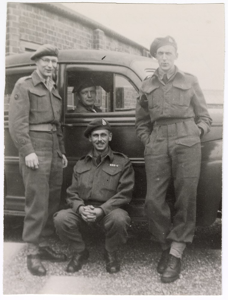
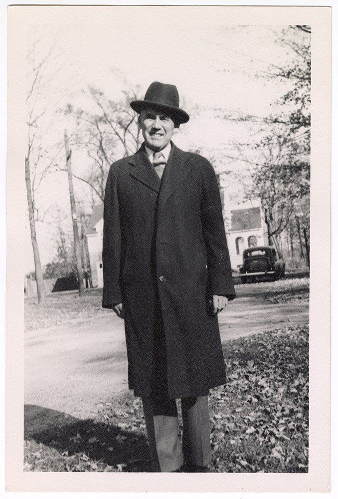
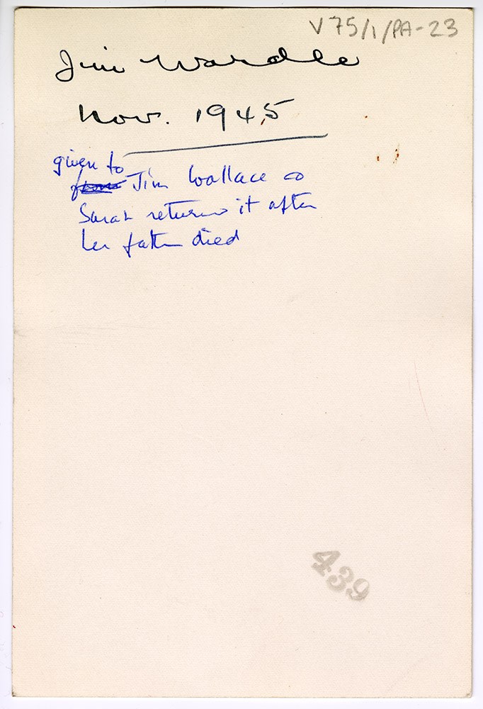
- Part Of
- Dorothy Wardle fonds
- Scope & Content
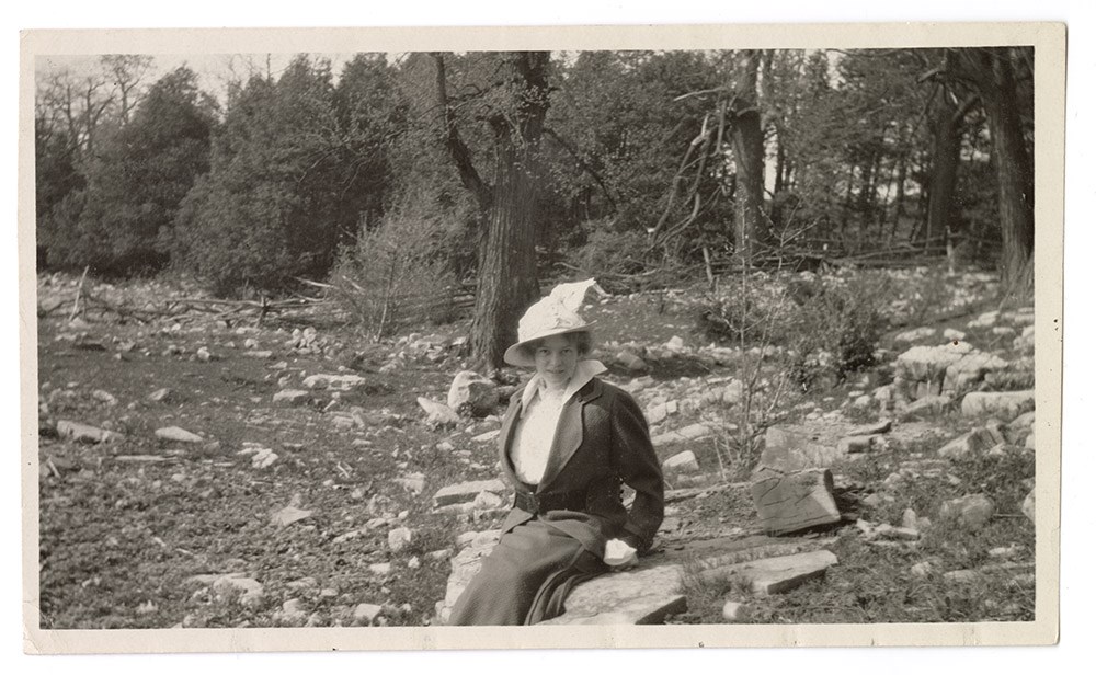
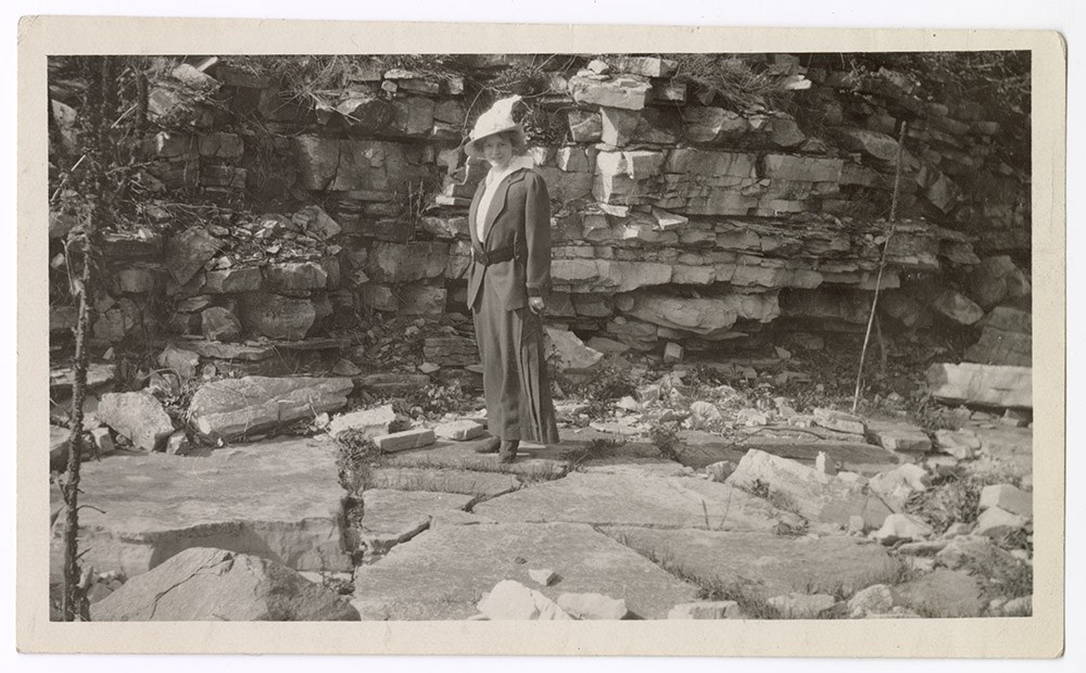
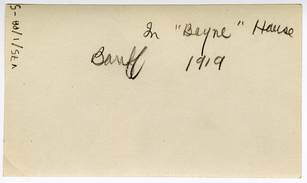
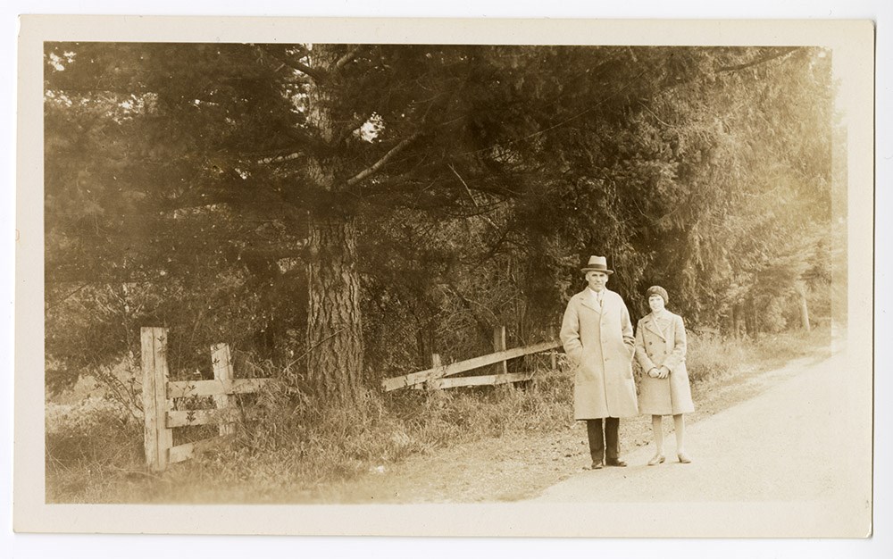
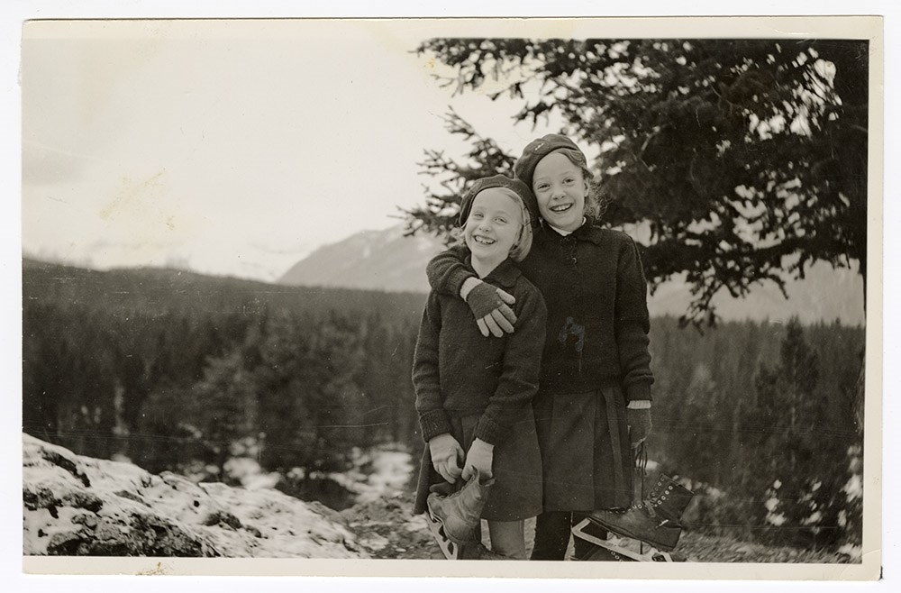
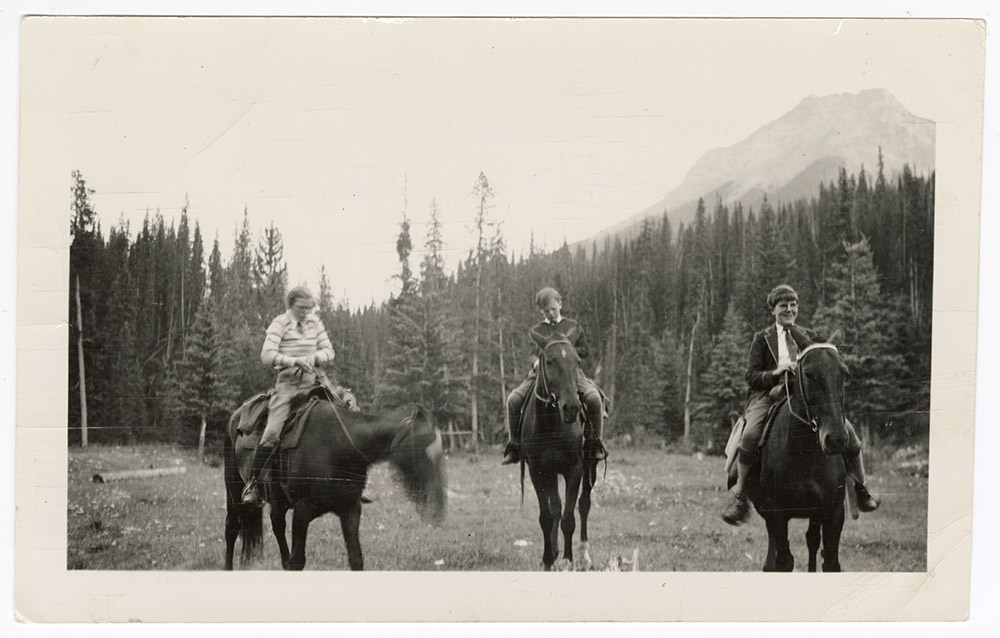
- File consists of 109 black and white and colour photograph prints, 23.5 x 17 cm or smaller. File documents various unidentified family members and friends, travels and outings, special events (e.g. weddings, graduations), holidays (e.g. Easter), official portraits (including a National Film Board o…
- Date Range
- c.1912-1971
- 1913
- 1919
- 1932-1940
- 1942-1957
- 1948
- 1952
- 1960
- 1967
- 1970-1971
- Reference Code
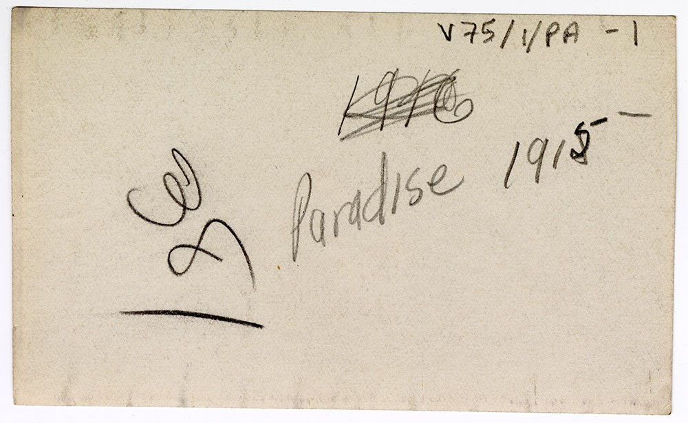
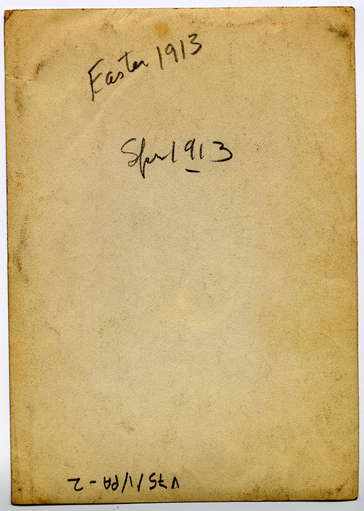
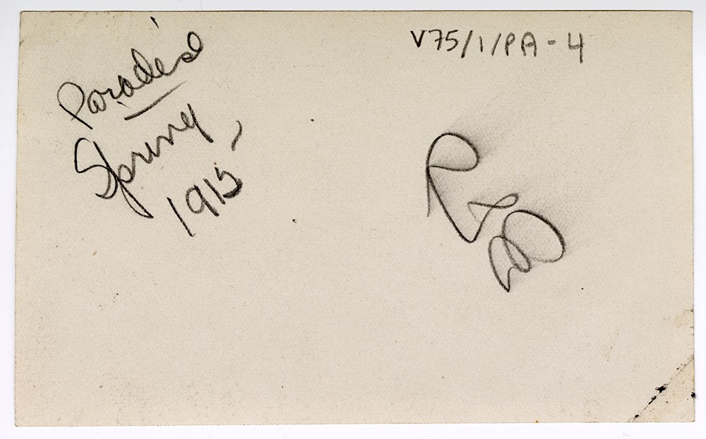
- V75 / I / PA - 1 to 116
- Description Level
- 5 / File
- GMD
- Photograph print
- Photograph
- Private record
56 images
- Part Of
- Dorothy Wardle fonds
- Description Level
- 5 / File
- Fonds Number
- M521 / V75
- Series
- V75 / I : Wardle Family, c.1912-1971
- Sous-Fonds
- V75
- Accession Number
- 7504
- Reference Code
- V75 / I / PA - 1 to 116
- Date Range
- c.1912-1971
- 1913
- 1919
- 1932-1940
- 1942-1957
- 1948
- 1952
- 1960
- 1967
- 1970-1971
- Physical Description
- 109 photographs : b&w and col. ; 23.5 x 17 cm or smaller
- Scope & Content
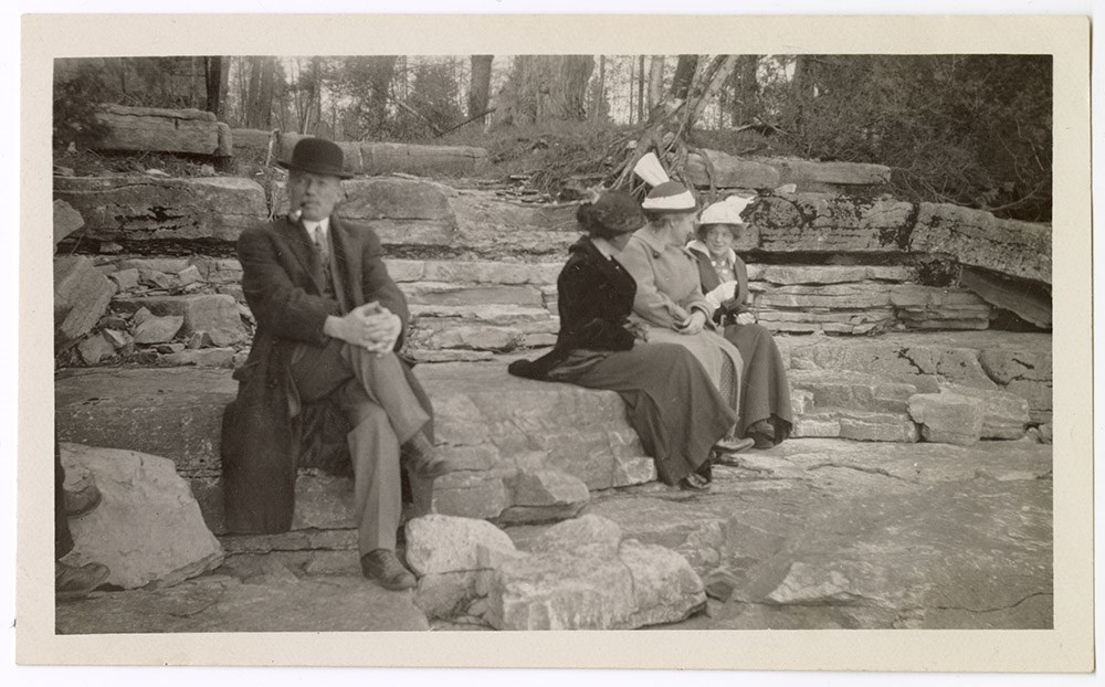
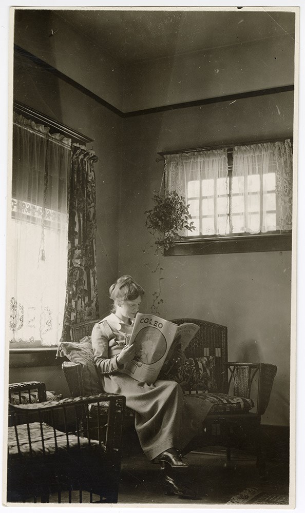
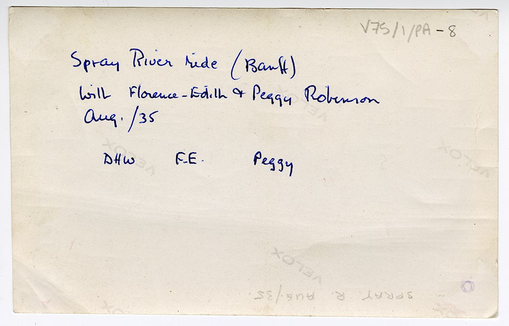
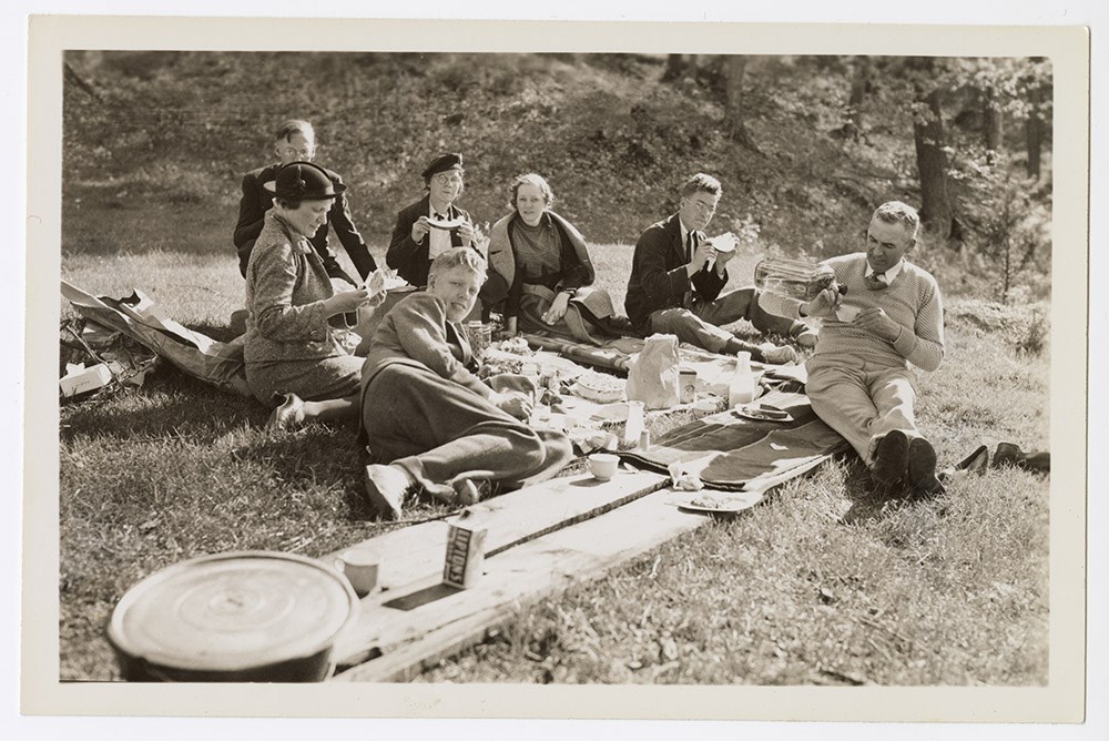
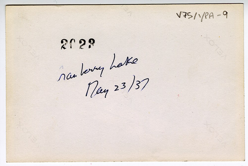
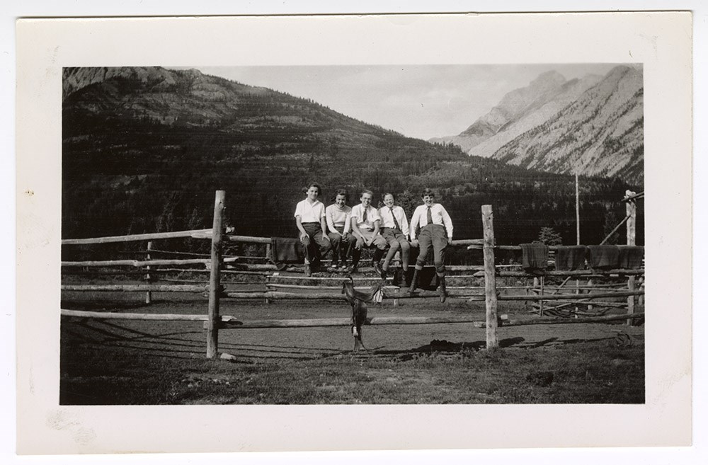
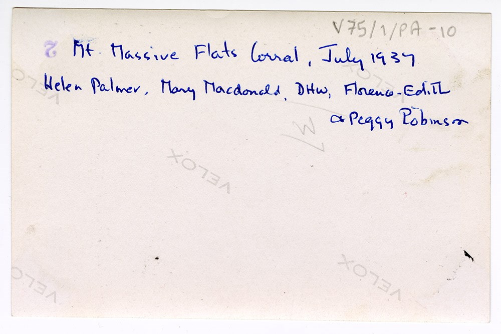
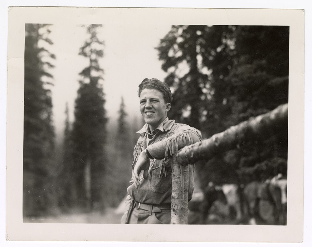
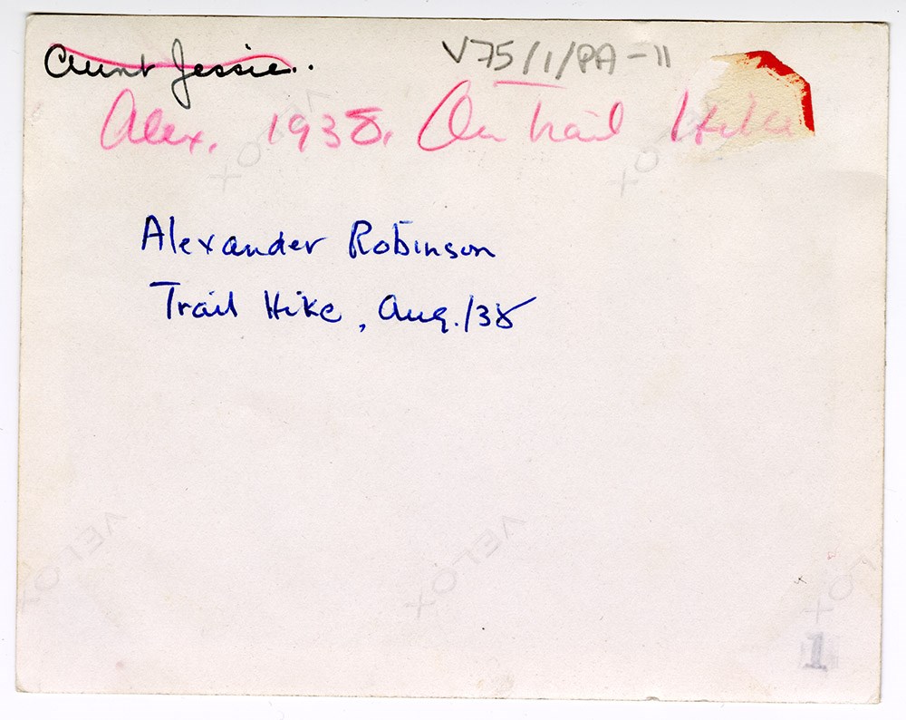
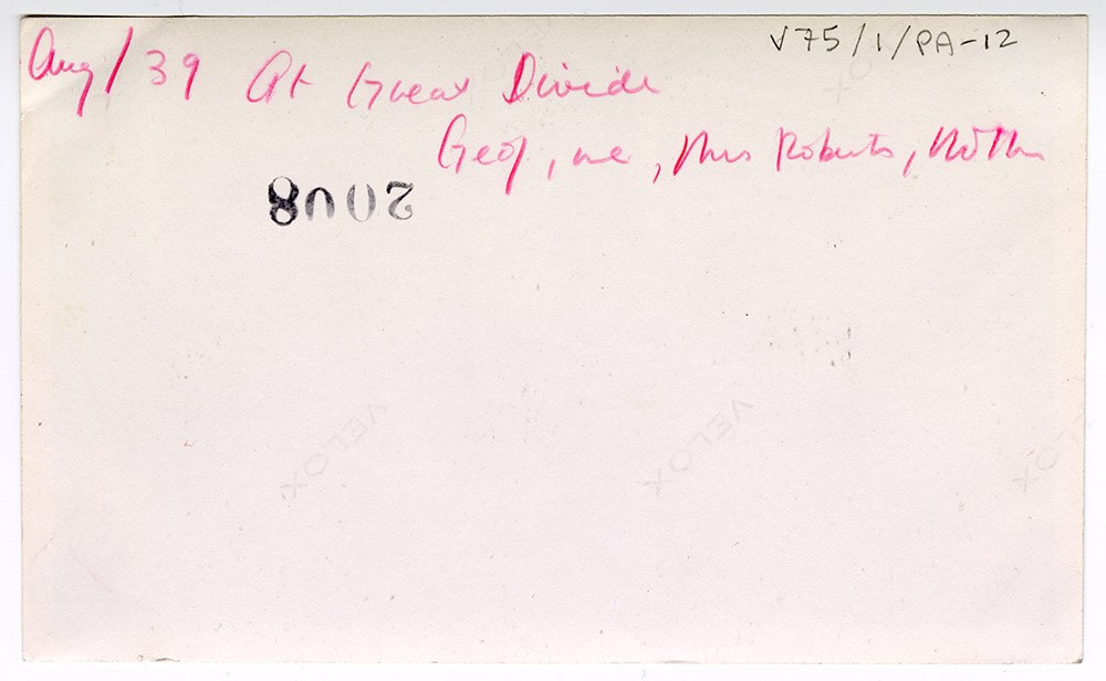
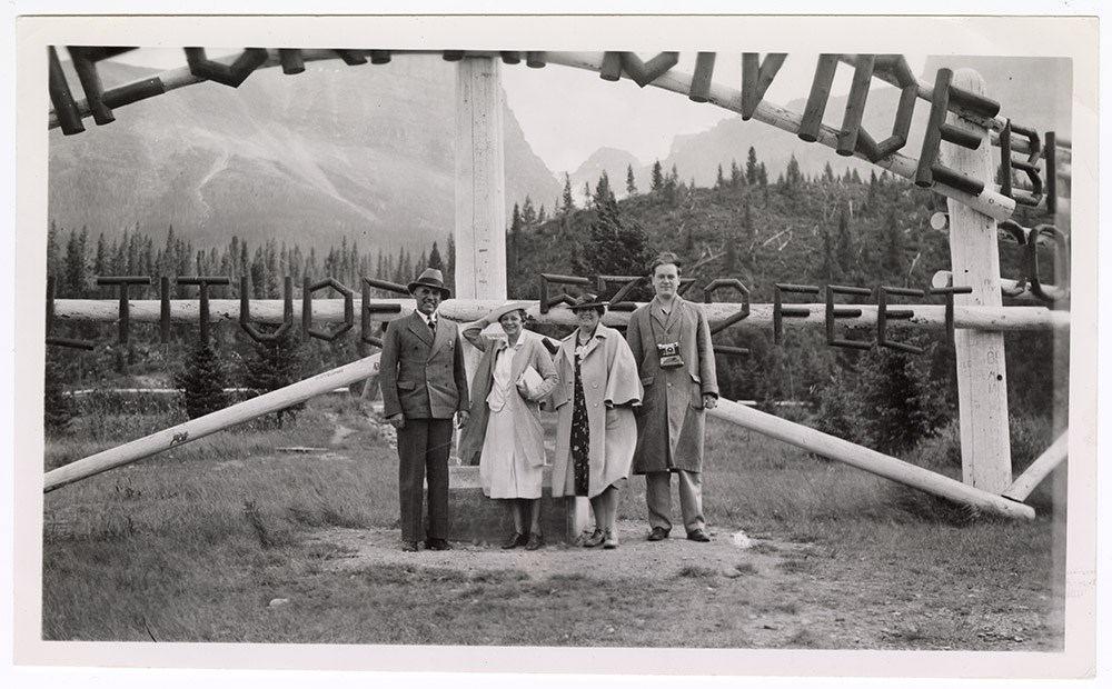
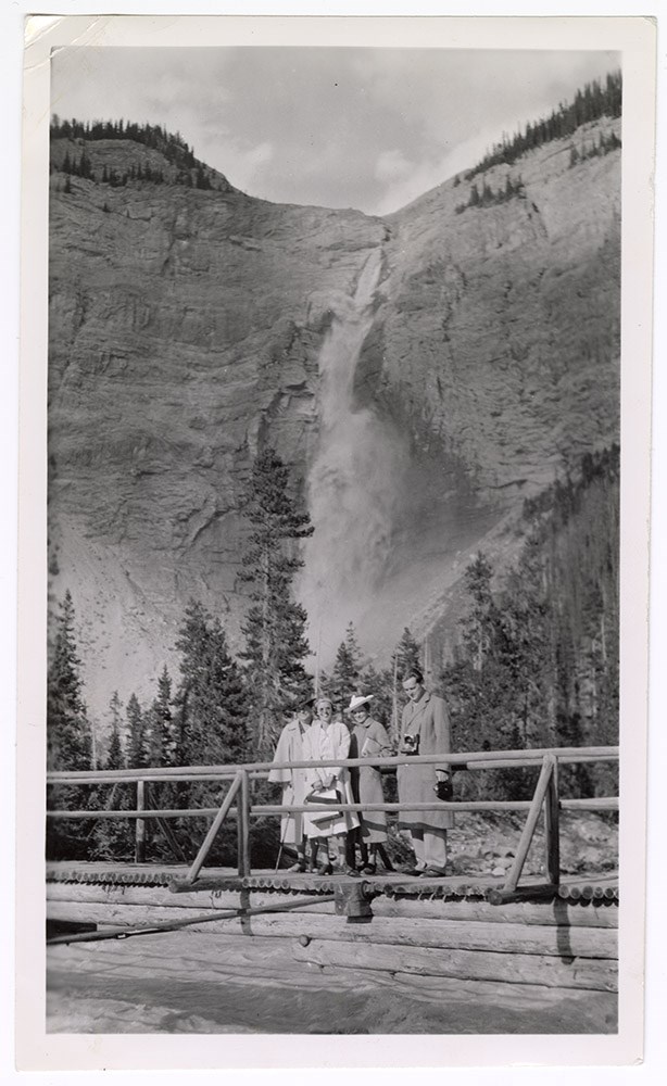
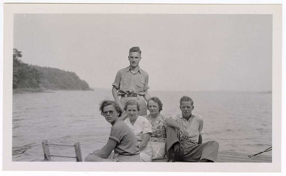
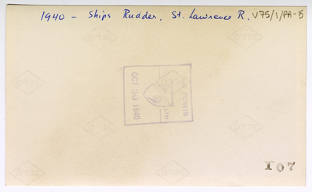
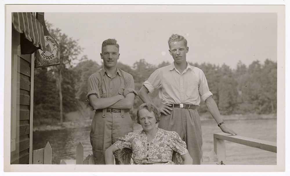
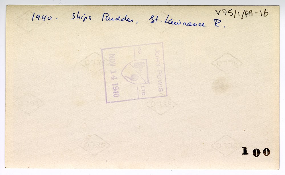
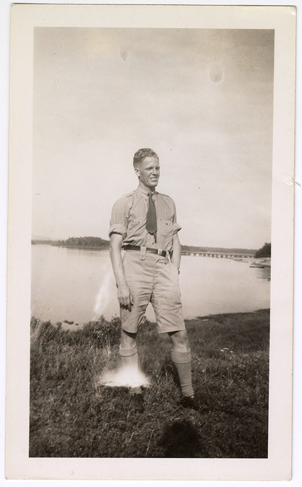
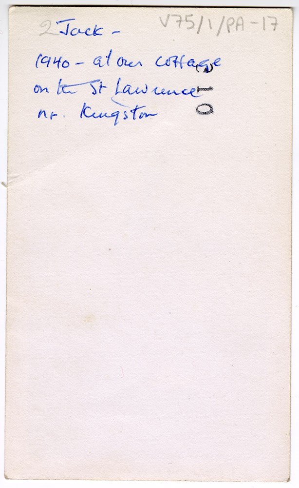
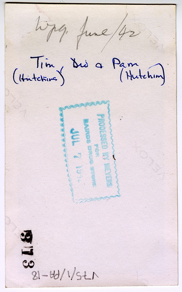
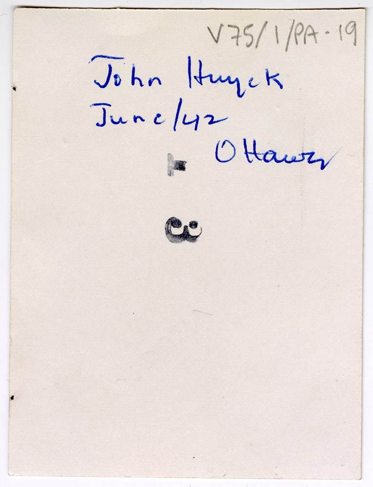
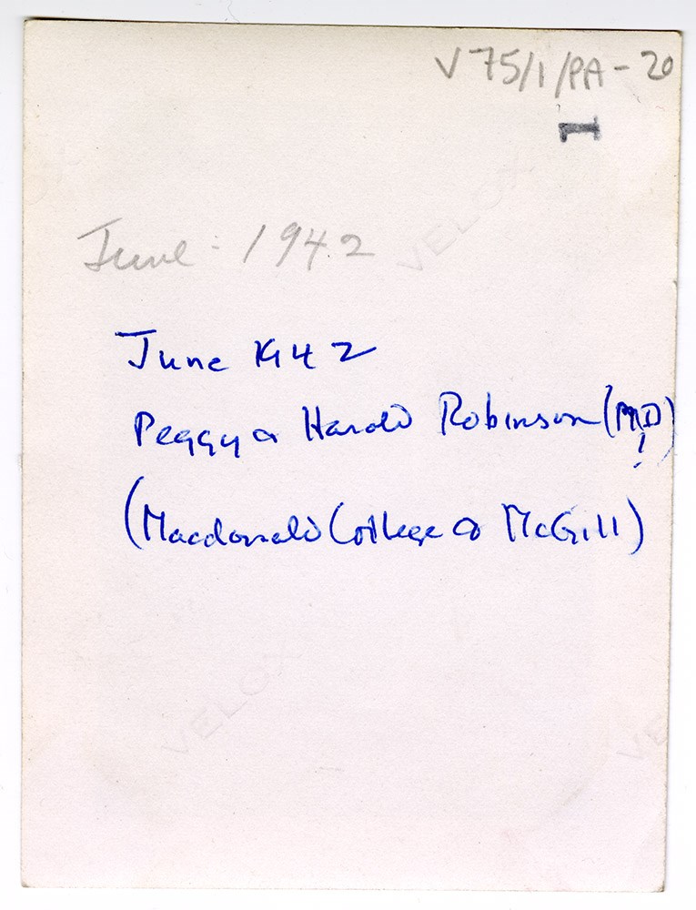
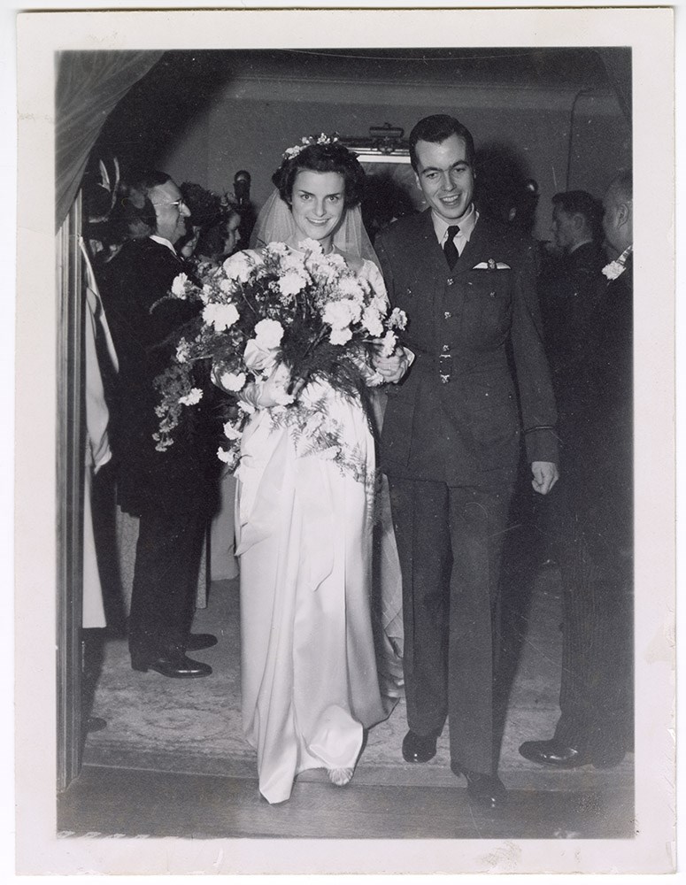
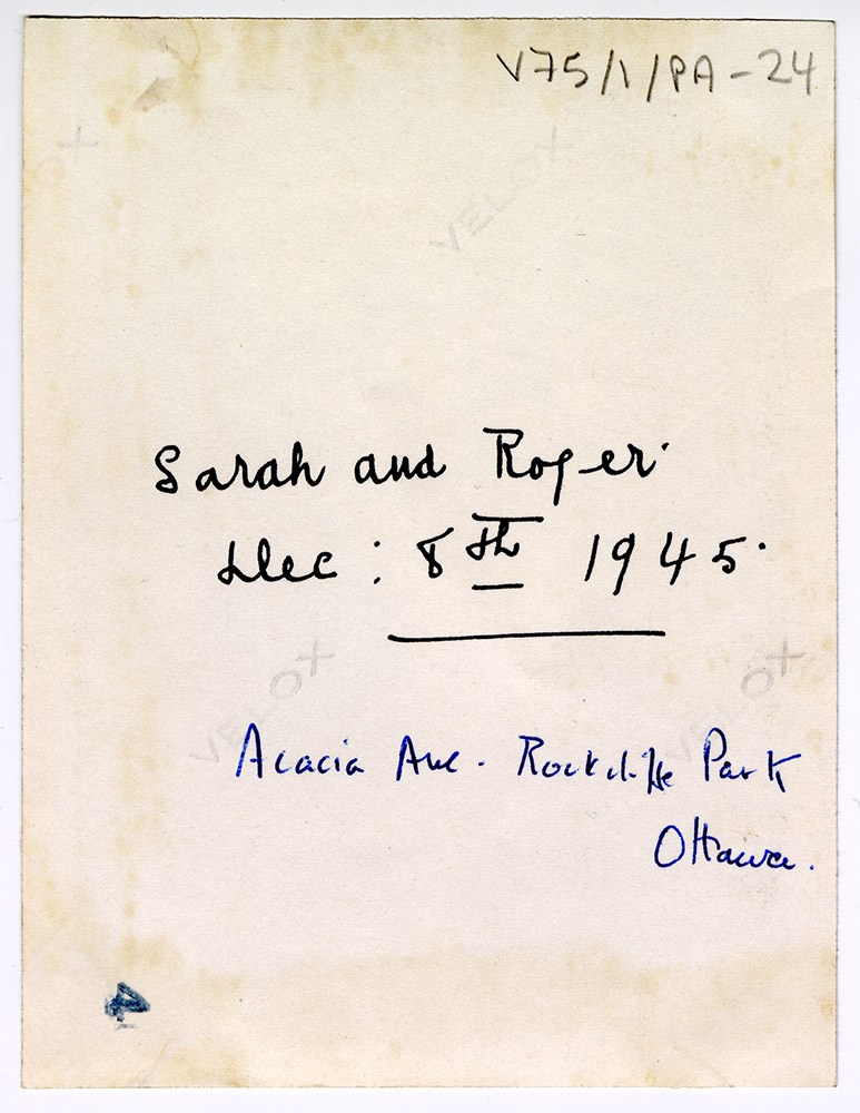
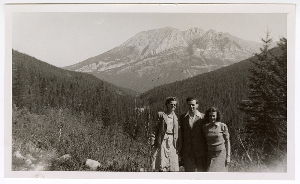
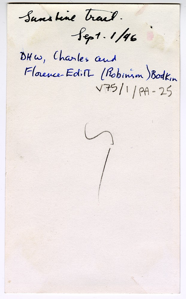
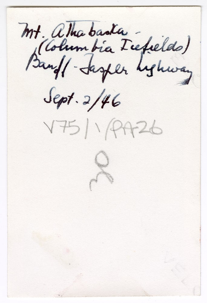
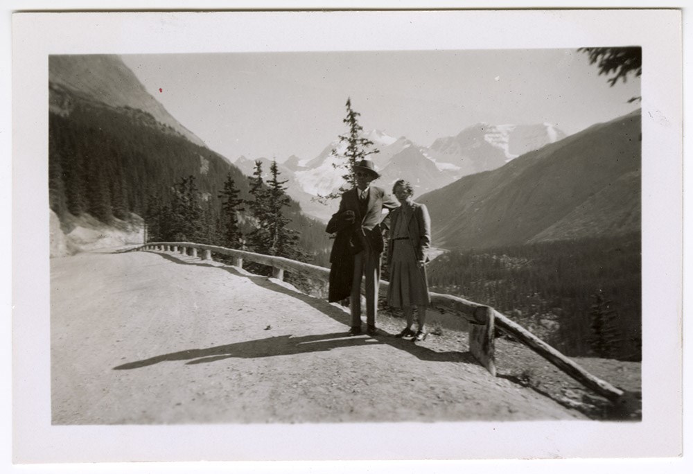
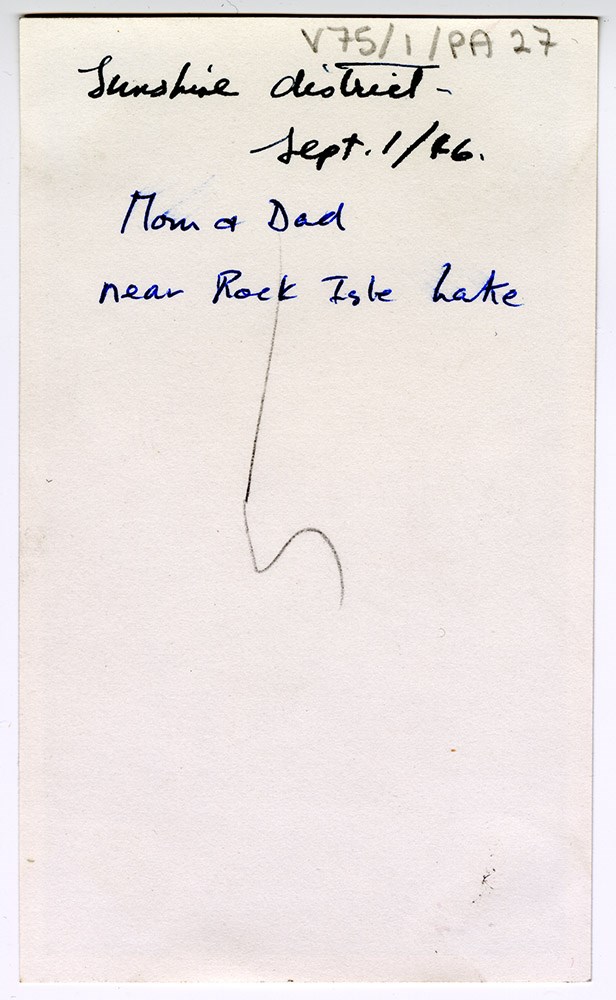
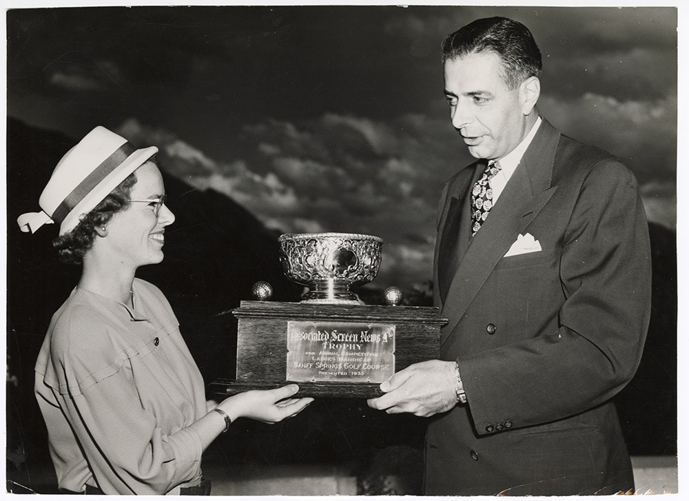
- File consists of 109 black and white and colour photograph prints, 23.5 x 17 cm or smaller. File documents various unidentified family members and friends, travels and outings, special events (e.g. weddings, graduations), holidays (e.g. Easter), official portraits (including a National Film Board of Canada portrait of James Wardle), and sports and leisure (e.g. canoeing, golf). File also includes photographs of Carl Rungius (on his birthday in 1954), Betty Ormond in Peru (with a message addressed to "Dorrie" written on the back of the print), graduation photograph of James Wardle from Queen's (c.1912), and travel photographs from the United States in 1948 (New York, Washington, Philadelphia, and Atlantic City) and Amsterdam, Netherlands (1952). Notable places the photographs depict include Banff (including Banff Train Station), the Great Divide, St. Lawrence River (the Wardle family had a cottage here), Sunshine trail, Mt. Athabasca, Columbia Icefields, Lake O'Hara, Montreal, Lake Louise, Moraine Lake, Paris (France), Ghost River, Ottawa, Peru, Lake Minnewanka, Elk Island, and Maligne Lake.
- Notes
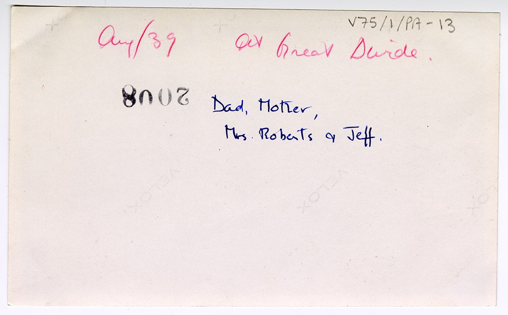
- Most (but not all) photographs are annotated on the back identifying who is in the photograph, when it was taken, and where.
- Name Access
- Wardle, Dorothy
- Wardle, James M.
- Rungius, Carl
- Subject Access
- Family and personal life
- Travel
- Travel and Exploration
- European travel
- Skiing
- Canoes and canoeing
- Horseback riding
- Picnics and picnicking
- Weddings
- Scenery
- Mountain
- Beach
- Golfing
- Geographic Access
- Banff
- Alberta
- Canada
- Canadian Rocky Mountains
- Yoho National Park
- British Columbia
- Banff National Park
- Great Divide
- Columbia Icefield
- Lake Louise
- Lake Minnewanka
- Lake O'Hara
- Maligne Lake
- Moraine Lake
- Montreal
- Quebec
- Ontario
- Ottawa
- France
- Ghost River
- Peru
- United States
- New York
- Washington
- Philadelphia
- Atlantic City
- Language
- English
- Related Material
- V75 / I / NA-13
- Creator
- Wardle, Dorothy
- Title Source
- Title based on contents of file
- Processing Status
- Processed
Images


This material is presented as originally created; it may contain outdated cultural descriptions and
potentially offensive content.
Read more.