Narrow Results By
Athabasca Pass trip
https://archives.whyte.org/en/permalink/descriptions55684
- Part Of
- Maryalice Harvey Stewart fonds
- Scope & Content
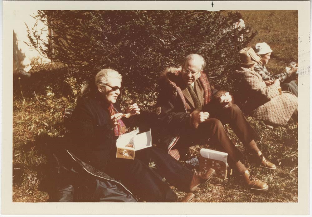
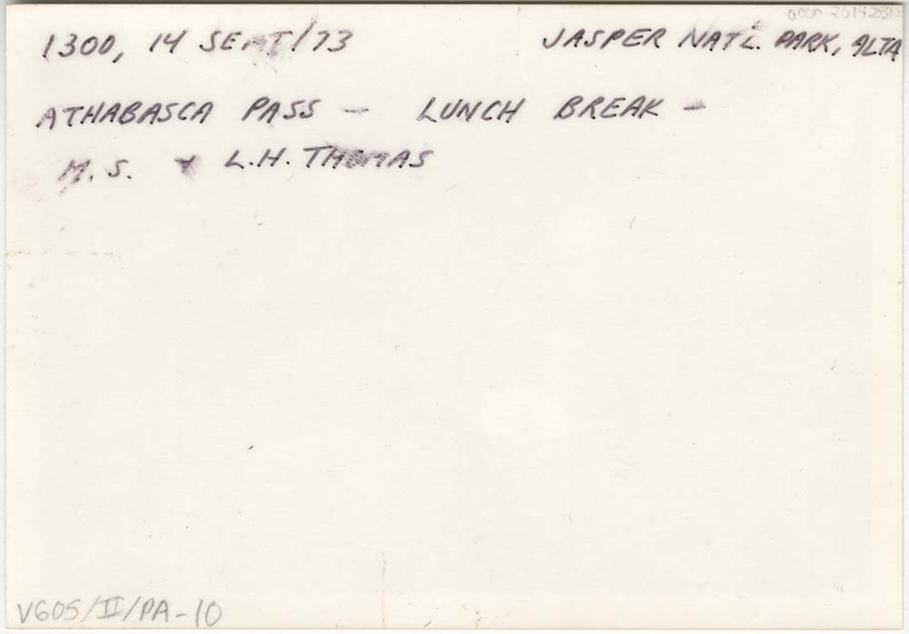
- File consists of 10 photographs depicting Maryalice Harvey Stewart and friends during a trip to Athabasca Pass in Jasper National Park to celebrate the unveiling of a historic site plaque.
- Date Range
- 1973
- Reference Code
- V605 / II / PA - 1 to 10
- Description Level
- 5 / File
- GMD
- Photograph
2 images
- Part Of
- Maryalice Harvey Stewart fonds
- Description Level
- 5 / File
- Fonds Number
- M9
- S13
- V605
- Series
- V605 / II: Personal records
- Sous-Fonds
- V605
- Accession Number
- 2014.8310
- Reference Code
- V605 / II / PA - 1 to 10
- GMD
- Photograph
- Date Range
- 1973
- Physical Description
- 11 photographs : col. prints ; 12.5 x 9 cm and 9 x 9 cm
- Scope & Content
- File consists of 10 photographs depicting Maryalice Harvey Stewart and friends during a trip to Athabasca Pass in Jasper National Park to celebrate the unveiling of a historic site plaque.
- Name Access
- Stewart, Maryalice Harvey
- Subject Access
- Family and personal life
- Travel
- History
- National parks and reserves
- Events
- Geographic Access
- Canada
- Alberta
- Jasper National Park
- Athabasca
- Language
- English
- Conservation
- Items stored in mylar
- Title Source
- Title based on contents of file
- Processing Status
- Processed
Images
This material is presented as originally created; it may contain outdated cultural descriptions and
potentially offensive content.
Read more.
Banff National Park (general)
https://archives.whyte.org/en/permalink/descriptions55338
- Part Of
- Murray Hay fonds
- Scope & Content
- File consists of 4 prings : col. 35.1 x 24.8 cm or smaller and 4 maps (2 paper, 2 overlays) : col., on mylar ; 60.4 x 30. cm or smaller. File pertains to aerial views of Banff National Park, showing the towns of Banff and Lake Louise, ski hills (Norqay Ski Hill, Sunshine Village, and Lake Louise Sk…
- Date Range
- ca.1976-ca.2000
- Reference Code
- V795 / II / B / v / 1-2
- Description Level
- 5 / File
- GMD
- Map
- Private record
- Part Of
- Murray Hay fonds
- Description Level
- 5 / File
- Fonds Number
- M570 / V795
- Series
- V795 / II : Unpublished Material
- Sous-Fonds
- V795
- Sub-Series
- V795 / II / B : Alberta / v : Banff National Park
- Accession Number
- 2019.41
- Reference Code
- V795 / II / B / v / 1-2
- GMD
- Map
- Private record
- Date Range
- ca.1976-ca.2000
- Physical Description
- 4 prints : col. 35.1 x 24.8 cm or smaller
- 4 maps (2 paper, 2 overlays) : col., annotations, on mylar ; 60.4 x 30. cm or smaller
- Scope & Content
- File consists of 4 prings : col. 35.1 x 24.8 cm or smaller and 4 maps (2 paper, 2 overlays) : col., on mylar ; 60.4 x 30. cm or smaller. File pertains to aerial views of Banff National Park, showing the towns of Banff and Lake Louise, ski hills (Norqay Ski Hill, Sunshine Village, and Lake Louise Ski Resort), as well as other georgraphic features. The mylar overlays contain various amounts of detail and annotations - one consists of a dark red sheet overlayed with place names in negative.
- Notes
- Items not in oversize stored in downstairs vault.
- Name Access
- Hay, Murray
- Subject Access
- Advertising
- Artist
- Ski Maps
- Map
- Cartography
- Sports and recreation
- Tourism
- Tourist information
- Winter
- Winter sports
- Ski area
- Sunshine Village
- Norquay Ski Hill
- Lake Louise Ski Area
- Geographic Access
- Banff
- Lake Louise
- Banff National Park
- Alberta
- Canada
- Canadian Rocky Mountains
- Language
- English
- Creator
- Hay, Murray
- Title Source
- Title based on contents of file
- Processing Status
- Processed
This material is presented as originally created; it may contain outdated cultural descriptions and
potentially offensive content.
Read more.
Bow Valley area, mountain ranges and views
https://archives.whyte.org/en/permalink/descriptions55530
- Part Of
- Luxton family fonds
- Scope & Content
- File consists of 34 photographs depicting views of the Bow Valley and surrounding areas, and Quebec. Depicted locations include Chinaman's Peak (now Ha Ling), End Mountain, Fairholme Range, Mount McDougall, Mount Chester, Mount Galatea, Fisher Range in Kananaskis, Mount Lougheed and Mount Sparrowha…
- Date Range
- 1938-1939
- Reference Code
- LUX / III / D / PA - 171 to 204
- Description Level
- 5 / File
- GMD
- Photograph
- Part Of
- Luxton family fonds
- Description Level
- 5 / File
- Fonds Number
- LUX
- Series
- LUX / III / D : Other material
- Sous-Fonds
- LUX / III : Luxton family sous-fonds
- Accession Number
- LUX
- Reference Code
- LUX / III / D / PA - 171 to 204
- GMD
- Photograph
- Date Range
- 1938-1939
- Physical Description
- 34 photographs : b&w prints ; 11 x 7 cm
- Scope & Content
- File consists of 34 photographs depicting views of the Bow Valley and surrounding areas, and Quebec. Depicted locations include Chinaman's Peak (now Ha Ling), End Mountain, Fairholme Range, Mount McDougall, Mount Chester, Mount Galatea, Fisher Range in Kananaskis, Mount Lougheed and Mount Sparrowhawk in Alberta; and the Laurentian Mountains and St Adele (Quebec).
- Notes
- Some photographs are individually captioned with locations, dates and other related information
- Subject Access
- Exploration
- Travel
- Mountains
- Landscapes
- Environment
- Hiking
- Recreation
- Summit
- Geographic Access
- Canada
- Alberta
- Bow Valley
- Kananaskis
- Quebec
- Reproduction Restrictions
- Copyright status unknown
- Language
- English
- Conservation
- Items stored in mylar
- Title Source
- Title based on contents of file
- Processing Status
- Processed
This material is presented as originally created; it may contain outdated cultural descriptions and
potentially offensive content.
Read more.
Charlevoix Region
https://archives.whyte.org/en/permalink/descriptions54969
- Part Of
- Murray Hay fonds
- Scope & Content
- File consists of 1 print : col. ; 35.5 x 28 cm. File pertains to Murray Hay's work on Charlevoix, Quebec. FIle includes one print, labelled "Charlevoix Region - Quebec," that depicts the landscape of the region.
- Date Range
- ca. 1976 - ca. 2000
- Reference Code
- V795 / II / C / iii / 1
- Description Level
- 5 / File
- GMD
- Map
- Private record
- Part Of
- Murray Hay fonds
- Description Level
- 5 / File
- Fonds Number
- M570 / V795
- Series
- V795 / II : Unpublished Material
- Sous-Fonds
- V795
- Sub-Series
- V795 / II / C : Canada [general] / iii : Quebec
- Accession Number
- 2019.41
- Reference Code
- V795 / II / C / iii / 1
- GMD
- Map
- Private record
- Date Range
- ca. 1976 - ca. 2000
- Physical Description
- 1 print : col. ; 35.5 x 28 cm
- Scope & Content
- File consists of 1 print : col. ; 35.5 x 28 cm. File pertains to Murray Hay's work on Charlevoix, Quebec. FIle includes one print, labelled "Charlevoix Region - Quebec," that depicts the landscape of the region.
- Name Access
- Hay, Murray
- Subject Access
- Advertising
- Artist
- Map
- Cartography
- Tourism
- Landscapes
- Geography
- Geographic Access
- Quebec
- Canada
- Language
- English
- Creator
- Hay, Murray
- Title Source
- Title based on contents of file
- Processing Status
- Processed
This material is presented as originally created; it may contain outdated cultural descriptions and
potentially offensive content.
Read more.
Community events, friends
https://archives.whyte.org/en/permalink/descriptions55539
- Part Of
- Luxton family fonds
- Scope & Content
- File consists of photographs pertaining to travel photos, family and group portraits, and other events involving friends of the Luxton family. Includes images of unidentified individuals in Egypt, standing by a large glacier in the Rockies, visiting Stanford University, and feeding birds in Paris[?…
- Date Range
- [ca.1900-1960]
- Reference Code
- LUX / III / D / PA - 205 to 231
- Description Level
- 5 / File
- GMD
- Photograph
- Part Of
- Luxton family fonds
- Description Level
- 5 / File
- Fonds Number
- LUX
- Series
- LUX / III / D : Collected material
- Sous-Fonds
- LUX / III : Luxton family sous-fonds
- Accession Number
- LUX
- Reference Code
- LUX / III / D / PA - 205 to 231
- GMD
- Photograph
- Date Range
- [ca.1900-1960]
- Physical Description
- 27 photographs : b&w and col. prints ; 13.5 x 19.5 cm or smaller
- Scope & Content
- File consists of photographs pertaining to travel photos, family and group portraits, and other events involving friends of the Luxton family. Includes images of unidentified individuals in Egypt, standing by a large glacier in the Rockies, visiting Stanford University, and feeding birds in Paris[?]; group portraits of unidentified children; a pack train fording the Pipestone River; and related views.
- Subject Access
- Family and personal life
- Travel
- Tourism
- Children
- Public events
- Community life
- Horses
- Hiking
- Recreation
- Portrait
- Christmas
- Landscapes
- Glaciers
- Geographic Access
- Canada
- Alberta
- Pipestone River
- Canadian Rocky Mountains
- Egypt
- Europe
- United States of America
- California
- Reproduction Restrictions
- Restrictions may apply
- Title Source
- Title based on contents of file
- Processing Status
- Processed
This material is presented as originally created; it may contain outdated cultural descriptions and
potentially offensive content.
Read more.
Friends, travel
https://archives.whyte.org/en/permalink/descriptions56319
- Part Of
- Ben Gadd fonds
- Scope & Content
- File consists of photographs taken or collected by Ben Gadd between 1983 and ca.1990. Images pertain to unnamed friends at Maligne Canyon; and views of Wisconsin, South Dakota and other regions of the United States.
- Date Range
- 1983
- [1985-1990]
- Reference Code
- V810 / I / D / PA - 1 to 12
- Description Level
- 5 / File
- GMD
- Photograph
- Part Of
- Ben Gadd fonds
- Description Level
- 5 / File
- Fonds Number
- M590
- V810
- S61
- Series
- V810 / I : Personal records
- Sous-Fonds
- V810
- Sub-Series
- V810 / I / D : Other personal and collected
- Accession Number
- 2021.20
- Reference Code
- V810 / I / D / PA - 1 to 12
- GMD
- Photograph
- Date Range
- 1983
- [1985-1990]
- Physical Description
- 12 photographs : col. prints ; 10 x 15 cm or smaller
- Scope & Content
- File consists of photographs taken or collected by Ben Gadd between 1983 and ca.1990. Images pertain to unnamed friends at Maligne Canyon; and views of Wisconsin, South Dakota and other regions of the United States.
- Notes
- Some photographs in file are annotated on back
- Name Access
- Gadd, Ben
- Subject Access
- Travel
- Tourism
- Hiking
- Recreation
- Environment
- Family and personal life
- Geographic Access
- Canada
- Alberta
- Maligne Canyon
- United States of America
- Wisconsin
- South Dakota
- Language
- English
- Category
- Family and personal life
- Environment
- Sports, recreation and leisure
- Exploration, discovery and travel
- Title Source
- Title based on contents of file
- Processing Status
- Processed
This material is presented as originally created; it may contain outdated cultural descriptions and
potentially offensive content.
Read more.
Geology photos for geological views
https://archives.whyte.org/en/permalink/descriptions55990
- Part Of
- Ben Gadd fonds
- Scope & Content
- File consists of printed photographs compiled by Ben Gadd pertaining to his book, Handbook of the Canadian Rockies. Images depict mountain views; bighorn sheep posing on steep rock; and highway views, possibly including Icefields Parkway.
- Date Range
- [ca.1990-1995]
- Reference Code
- V810 / II / A / PA - 40 to 138
- Description Level
- 5 / File
- GMD
- Photograph
- Part Of
- Ben Gadd fonds
- Description Level
- 5 / File
- Fonds Number
- M590
- V810
- S61
- Series
- V810 / II : Research and publication records
- Sous-Fonds
- V810
- Sub-Series
- V810 / II / B : Handbook of the Canadian Rockies
- Accession Number
- 2021.20
- Reference Code
- V810 / II / A / PA - 40 to 138
- GMD
- Photograph
- Responsibility
- Produced by Ben Gadd
- Date Range
- [ca.1990-1995]
- Physical Description
- 99 photographs : col. prints ; 15 x 10 cm
- Scope & Content
- File consists of printed photographs compiled by Ben Gadd pertaining to his book, Handbook of the Canadian Rockies. Images depict mountain views; bighorn sheep posing on steep rock; and highway views, possibly including Icefields Parkway.
- Material Details
- Photographs were originally stored in Tekarra Color Lab envelope
- Subject Access
- Publication
- Landscapes
- Travel
- Roads
- Wildlife
- Bighorn Sheep
- Mountains
- Geology
- Environment
- Natural history
- Geographic Access
- Canada
- Alberta
- Columbia Icefield
- Jasper National Park
- Canadian Rocky Mountains
- Reproduction Restrictions
- Restrictions may apply
- Language
- English
- Title Source
- Original title used
- Processing Status
- Processed
This material is presented as originally created; it may contain outdated cultural descriptions and
potentially offensive content.
Read more.
Jasper Institute 1994
https://archives.whyte.org/en/permalink/descriptions55997
- Part Of
- Ben Gadd fonds
- Scope & Content
- File consists of three transparency slide photographs sent to Ben Gadd from Dave Thomas. Images pertain to a five-day ecology course near Suplhur Skyline Trail and Geraldine Lakes Trail which Ben led through the Jasper Institute in 1994. Images in file are accompanied by a letter from Dave to Ben, …
- Date Range
- 1994
- Reference Code
- V810 / III / B / NS - 1 to 3
- Description Level
- 5 / File
- GMD
- Photograph
- Transparency
- Part Of
- Ben Gadd fonds
- Description Level
- 5 / File
- Fonds Number
- M590
- V810
- S61
- Series
- V810 / III : Professional records
- Sous-Fonds
- V810
- Sub-Series
- V810 / III / B : Interpretive guiding
- Accession Number
- 2021.20
- Reference Code
- V810 / III / B / NS - 1 to 3
- Responsibility
- Produced by Dave Thomas
- Date Range
- 1994
- Physical Description
- 3 photographs : col. transparency slides ; 35 mm -- 1 textual record
- Scope & Content
- File consists of three transparency slide photographs sent to Ben Gadd from Dave Thomas. Images pertain to a five-day ecology course near Suplhur Skyline Trail and Geraldine Lakes Trail which Ben led through the Jasper Institute in 1994. Images in file are accompanied by a letter from Dave to Ben, thanking him for leading the program.
- Name Access
- Gadd, Ben
- Thomas, Dave
- Subject Access
- Guiding
- Exploration
- Education
- Environment
- Ecology
- Hiking
- Trails
- Recreation
- Geographic Access
- Canada
- Alberta
- Jasper National Park
- Reproduction Restrictions
- Restrictions may apply
- Language
- English
- Title Source
- Title based on contents of file
- Processing Status
- Processed
This material is presented as originally created; it may contain outdated cultural descriptions and
potentially offensive content.
Read more.
Lake Louise Area
https://archives.whyte.org/en/permalink/descriptions54925
- Part Of
- Murray Hay fonds
- Scope & Content
- File consists of 6 prints : col. ; 25.5 x 20 cm or smaller. File pertains to Murray Hay's renderings of the Lake Louise ski area. File includes six reproduced draft prints of original paintings of the Lake Louise ski area created by Murray Hay (different iterations).
- Date Range
- ca.1976-ca.2000
- Reference Code
- V795 / II / B / ii / 1
- Description Level
- 5 / File
- GMD
- Map
- Private record
- Part Of
- Murray Hay fonds
- Description Level
- 5 / File
- Fonds Number
- M570 / V795
- Series
- V795 / I : Unpublished Material
- Sous-Fonds
- V795
- Sub-Series
- V795 / I / B : Alberta / ii : Lake Louise
- Accession Number
- 2019.41
- Reference Code
- V795 / II / B / ii / 1
- GMD
- Map
- Private record
- Date Range
- ca.1976-ca.2000
- Physical Description
- 6 prints : col. ; 25.5 x 20 cm or smaller
- Scope & Content
- File consists of 6 prints : col. ; 25.5 x 20 cm or smaller. File pertains to Murray Hay's renderings of the Lake Louise ski area. File includes six reproduced draft prints of original paintings of the Lake Louise ski area created by Murray Hay (different iterations).
- Name Access
- Hay, Murray
- Subject Access
- Advertising
- Artist
- Ski Maps
- Map
- Cartography
- Sports and recreation
- Tourism
- Tourist information
- Winter
- Winter sports
- Ski area
- Lake Louise Ski Area
- Geographic Access
- Lake Louise
- Alberta
- Canada
- Canadian Rocky Mountains
- Language
- English
- Related Material
- M570 / III / B / ii / 1-2
- Creator
- Hay, Murray
- Title Source
- Title based on contents of file
- Processing Status
- Processed
This material is presented as originally created; it may contain outdated cultural descriptions and
potentially offensive content.
Read more.
Lantern Slides
https://archives.whyte.org/en/permalink/descriptions54147
- Part Of
- Stan J. Carr fonds
- Scope & Content
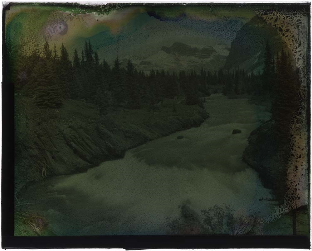
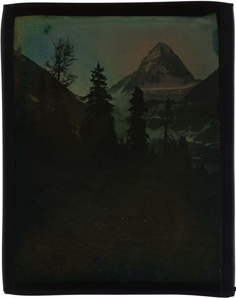
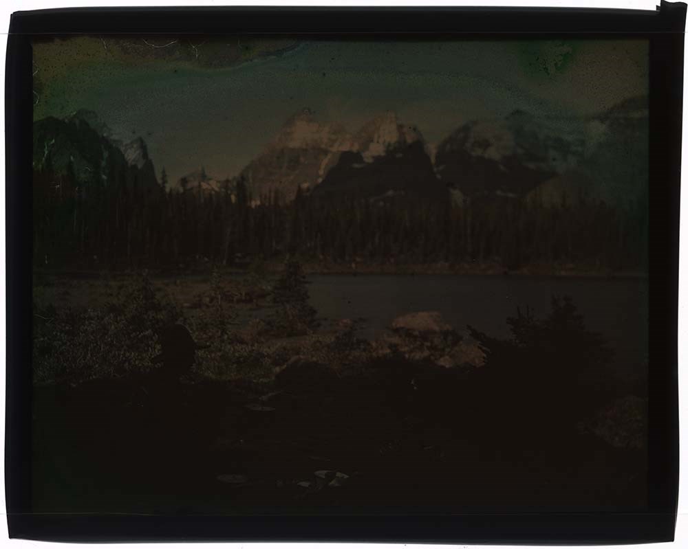
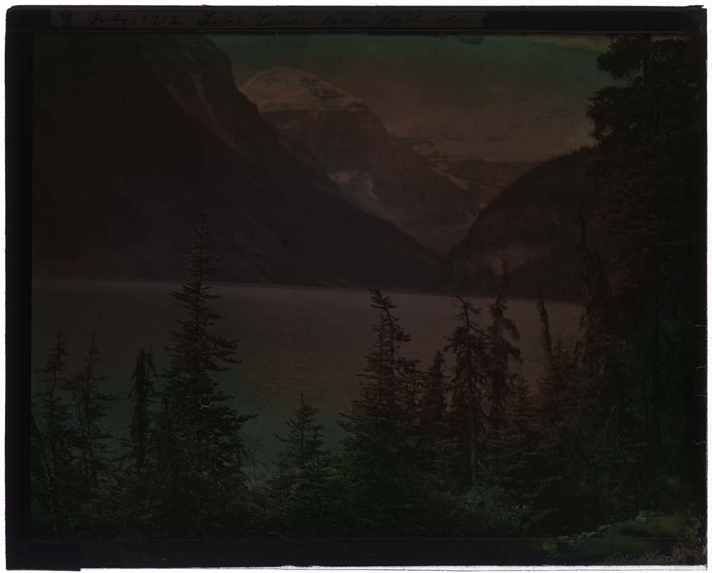
- File consists of 8 colour lantern slides, some captioned. File subjects include an unidentified mountain scene, Mount Assiniboine, horse in unientified mountain scene, man posed in campsite in unidentified location, Lake Louise and Victoria Glacier, Hector Lake and Bow Peak, unidentified man in cam…
- Date Range
- ca. 1912
- Reference Code
- V127 / PS - 1 to 8
- Description Level
- 5 / File
- GMD
- Transparency
- Lantern slide
8 images
- Part Of
- Stan J. Carr fonds
- Description Level
- 5 / File
- Fonds Number
- M 179
- V 127
- Sous-Fonds
- V 127
- Accession Number
- 1072
- Reference Code
- V127 / PS - 1 to 8
- Date Range
- ca. 1912
- Physical Description
- 8 photographs : col. slides ; 10.5 x 14 cm
- History / Biographical
- Additive Colour Screen Plates, first theorized by James Clerk Maxwell in 1861, were the first forms of colour photography. Maxwell’s original process involved printing the same black and white image through different coloured screens onto transparencies and then projecting them overlapped in order to create a single full-colour image. In 1868 Louis Ducos du Hauron expanded on this method by placing a screen made up of microscopic coloured stripes in front of a light-sensitive emulsion before exposing it to light. During exposure, the colours in the screen attached to the developing picture so when viewed back through the screen in a projector the image appeared fully in colour. Neither of these methods were commercially popular during the 19th century since black and white processes were cheaper and more widely available. In 1907 the Lumiere brothers introduced the Autochrome process to wide commercial success. The Autochrome process involved a mix of tiny potato starch grains dyed green, orange-red, and blue-purple that were mixed thoroughly and applied to a glass slide coated in a sticky varnish that held the grains in an evenly-distributed layer. The grains were laminated into the varnish to make them smaller and more transparent, and then the whole thing was sealed with another layer of waterproof varnish. The entire process could be done by machines, which made the slides cheap to produce, easily available to the public and opened up the process to amateur photographers. Photographs developed on Autochrome plates created soft images with relatively natural colour rendering, making them popular with artists and photojournalists. Autochrome plates (which came to refer to all colour screen plates regardless of manufacturer) created one-of-a-kind positive images and required long exposure times. Once an image was complete, it had to be quickly covered with either a strong coating of varnish or another slide of glass and then sealed along the edges with binding tape. Because silver is an element of the sticky base varnish that holds the dyed grains, if moisture was allowed to access the image the layers of varnish could ripple or tear away from the glass, or the dye could bleed or fade. The silver base is highly sensative to oxygen and if improperly sealed images could begin to "mirror," a process in which the exposed parts of the slide become uniform and shiny, obscuring the image. Because of the random distribution of dyed colour grains throughout the image and the lines created by laminating those grains into the base varnish, Autochrome transparencies are often mistaken for hand-painted coloured slides. Autochrome can be identified by looking closely for small dots of colour in all parts of the image, rather than the solid blots of colour found on hand-painted slides.
- Scope & Content
- File consists of 8 colour lantern slides, some captioned. File subjects include an unidentified mountain scene, Mount Assiniboine, horse in unientified mountain scene, man posed in campsite in unidentified location, Lake Louise and Victoria Glacier, Hector Lake and Bow Peak, unidentified man in camp.
- Name Access
- Carr, Stan J.
- Subject Access
- Exploration
- Discovery and travel
- Lantern slide
- Geographic Access
- Mount Assiniboine
- Lake Louise
- Bow Summit
- Banff National Park
- Alberta
- Canada
- Access Restrictions
- No restrictions on access
- Language
- English
- Conservation
- Re-seal all slides appropriately; keep stored in cool, dry, dark area; refrain from exposing to further damage.
- Creator
- Carr, Stan J.
- Category
- Exploration, discovery and travel
- Biographical Source Notes
- http://www.graphicsatlas.org/identification/?process_id=286#overview
- https://psap.library.illinois.edu/collection-id-guide/slide#autochrome
- Title Source
- Title based on contents of file
- Processing Status
- Processed
Images


This material is presented as originally created; it may contain outdated cultural descriptions and
potentially offensive content.
Read more.