Narrow Results By
- Lake O'Hara Trails Club fonds 23
- Lillian Gest fonds 17
- Alpine Club of Canada fonds
- Ben Gadd fonds 6
- Leonard Leacock fonds 6
- Bill Goodrich fonds
- Chic Scott fonds 2
- Dorothy Wardle fonds 2
- Trail Riders of the Canadian Rockies fonds 2
- Alpine Club of Canada 1
- Lawrence Grassi fonds 1
- Malcolm Geddes fonds 1
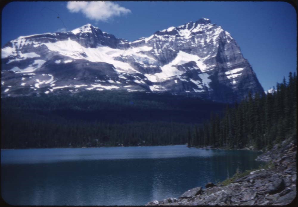
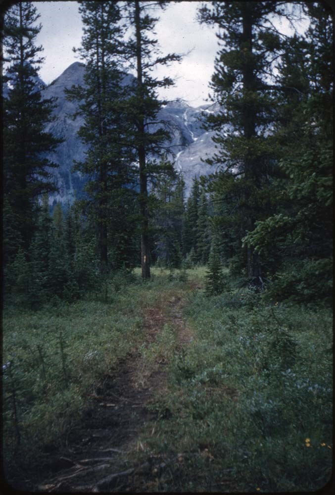
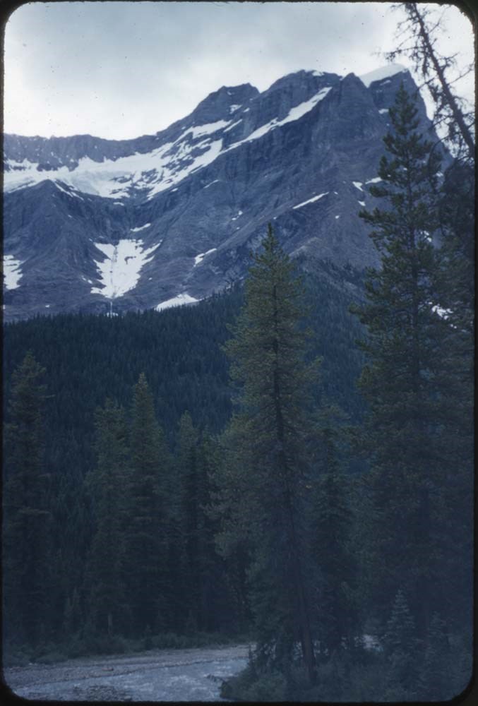
Mt. Yukness Summit Records
https://archives.whyte.org/en/permalink/descriptions57687
- Part Of
- Alpine Club of Canada fonds
- Scope & Content
- Files consist of summit notes and summit registers from Mt. Yukness produced by the Alpine Club of Canada between ca. 1962 and 2003. Summit records include entries from visitors to the various summits which pertain to individuals' hiking and climbing trips; details of specific events which occurred…
- Date Range
- ca. 1962-1985
- 1994-2003
- Reference Code
- M200 / V / A / 79 to 80
- Description Level
- 5 / File
- GMD
- Textual record
- Organization record
- Part Of
- Alpine Club of Canada fonds
- Description Level
- 5 / File
- Fonds Number
- M200
- V14
- S6
- Series
- M200 / V: Summit Records
- Sous-Fonds
- M200
- Sub-Series
- M200 / V / A: Identified Summit Records
- Accession Number
- accn. 2023.32
- accn. 8002
- Reference Code
- M200 / V / A / 79 to 80
- Responsibility
- Summit Registers and Notes produced by Alpine Club of Canada
- Date Range
- ca. 1962-1985
- 1994-2003
- Physical Description
- 2 cm of textual records 2 volumes
- History / Biographical
- Mt. Yukness is located near Lake O'Hara in Yoho National Park, B.C. Nearby is Ringrose Peak, Mount Huber, Mount Lefroy, Glacier Peak, and Mount Biddle.
- Scope & Content
- Files consist of summit notes and summit registers from Mt. Yukness produced by the Alpine Club of Canada between ca. 1962 and 2003. Summit records include entries from visitors to the various summits which pertain to individuals' hiking and climbing trips; details of specific events which occurred while at the summit, wildlife sightings, trail updates, and related topics. Files include: M200 / V / A / 79: Mt. Yukness [ca. 1962 - 1985] M200 / V / A / 80: Summit Register - MT. Yukness, 1994 - 2003
- Name Access
- Alpine Club of Canada
- Subject Access
- Alpine Club of Canada
- Backcountry skiing
- Backpacking
- British Columbia
- Climbing
- Cross-country skiing
- Description and travel
- Environment
- Environment and Nature
- Hiking
- Lake O'hara
- Mountain
- Mountaineering
- Mountaineers
- Mountains
- National parks and reserves
- Parks
- Record keeping
- Ski area
- Ski areas
- Ski mountaineering
- Ski touring
- Skiers
- Skiing
- Snowshoes and snowshoeing
- Sports and leisure
- Sports and recreation
- Summit
- Trails
- Winter sports
- Geographic Access
- Canada
- British Columbia
- Canadian Rocky Mountains
- Rocky Mountains
- Yoho National Park
- Lake O'Hara
- Mount Huber
- Mount Lefroy
- Ringrose Peak
- Access Restrictions
- Restrictions may apply
- Language
- English
- Conservation
- M200 / V / A / 80: Summit Register - MT. Yukness, 1994 - 2003 register is placed in mylar due to evidence of mold. This register also contains water damage.
- Related Material
- M235
- Biographical Source Notes
- Mount Yukness, Peak Finder, Canadian Rockies Database: https://cdnrockiesdatabases.ca/peaks/1559
- Title Source
- Title based on contents of file
- Processing Status
- Processed
This material is presented as originally created; it may contain outdated cultural descriptions and
potentially offensive content.
Read more.
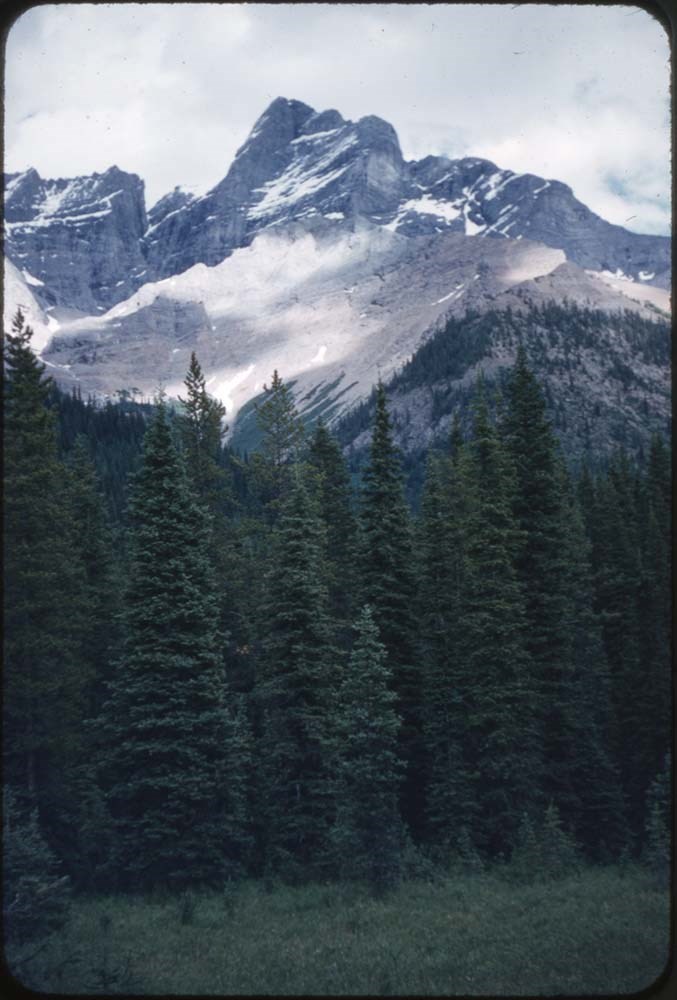
Schäffer Ridge
https://archives.whyte.org/en/permalink/descriptions57752
- Part Of
- Alpine Club of Canada fonds
- Scope & Content
- File consists of a summit record from Schäffer Ridge produced by the Alpine Club of Canada between 2010 and 2016. Summit record includes entries from visitors to the various summits which pertain to individuals' hiking and climbing trips; details of specific events which occurred while at the summi…
- Date Range
- 2010-2016
- Reference Code
- M200 / V / A / 165
- Description Level
- 5 / File
- GMD
- Textual record
- Organization record
- Part Of
- Alpine Club of Canada fonds
- Description Level
- 5 / File
- Fonds Number
- M200
- V14
- S6
- Series
- M200 / V: Summit Records
- Sous-Fonds
- M200
- Sub-Series
- M200 / V / A: Identified Summit Records
- Accession Number
- accn. 2023.20
- Reference Code
- M200 / V / A / 165
- Responsibility
- Summit Registers and Notes produced by Alpine Club of Canada
- Date Range
- 2010-2016
- Physical Description
- 1 volume 2 cm of textual record
- History / Biographical
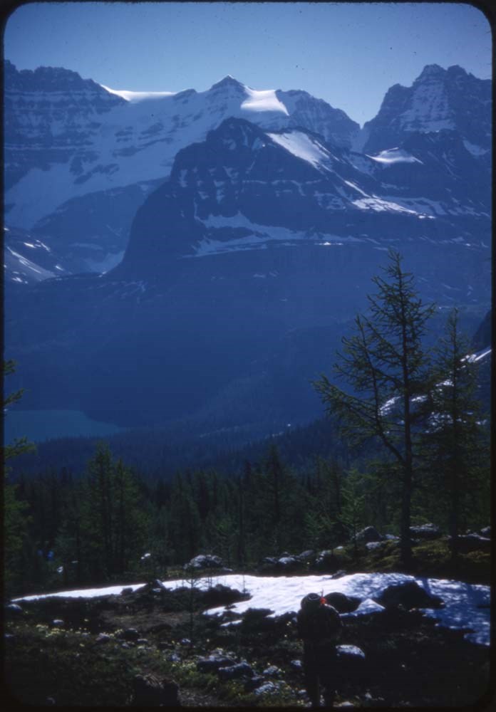
- Schäffer Ridge is located in Yoho National Park, B.C. Nearby are Lake O'Hara, McArthur Lake and McArthur Pass.
- Scope & Content
- File consists of a summit record from Schäffer Ridge produced by the Alpine Club of Canada between 2010 and 2016. Summit record includes entries from visitors to the various summits which pertain to individuals' hiking and climbing trips; details of specific events which occurred while at the summit, wildlife sightings, trail updates, and related topics. File: M200 / V / A / 165: Schäffer Ridge
- Name Access
- Alpine Club of Canada
- Subject Access
- Backcountry skiing
- Backpacking
- British Columbia
- Climbing
- Club
- Description and travel
- Environment
- Environment and Nature
- Hiking
- Lake O'hara
- Mountain
- Mountaineering
- Mountaineers
- Mountains
- National parks and reserves
- Parks Canada
- Record keeping
- Ski mountaineering
- Sports and leisure
- Sports and recreation
- Summit
- Trails
- Geographic Access
- Canada
- Canadian Rocky Mountains
- Rocky Mountains
- British Columbia
- Yoho National Park
- Lake O'Hara
- McArthur Pass
- McArthur Lake
- Mount Schäffer
- Schäffer Ridge
- Access Restrictions
- Restrictions may apply
- Language
- English
- Mandarin
- Russian
- Conservation
- Register contains water damage, pages are ripped and ink has bled due to water damage making some entries illegible.
- Related Material
- M235
- Title Source
- Original title
- Processing Status
- Processed
This material is presented as originally created; it may contain outdated cultural descriptions and
potentially offensive content.
Read more.
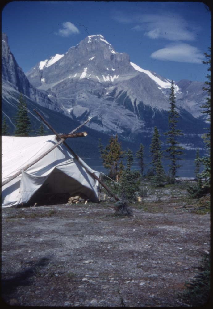
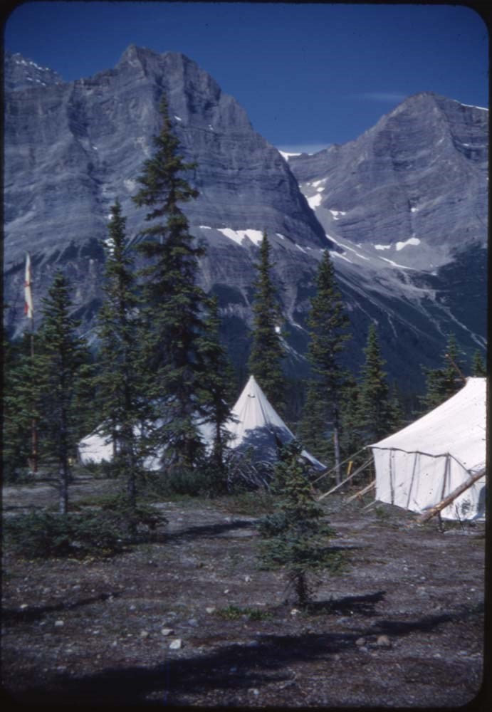
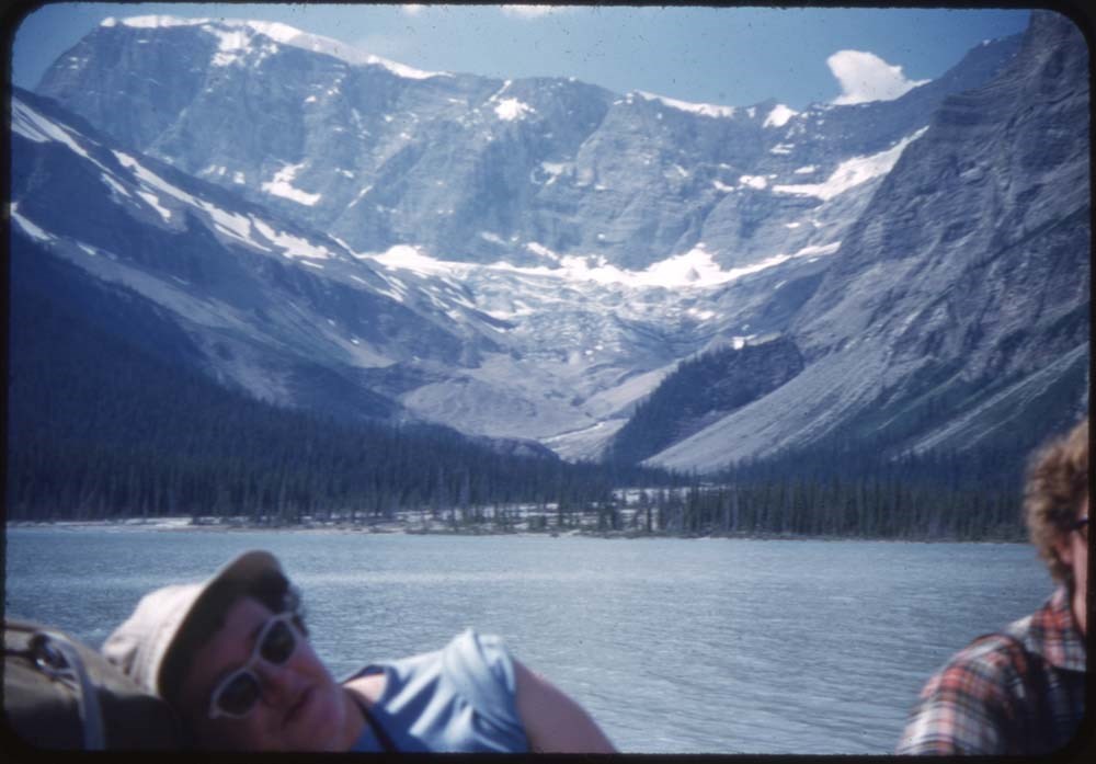
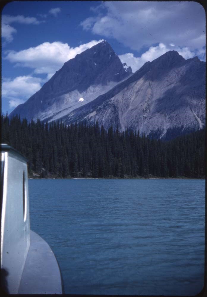
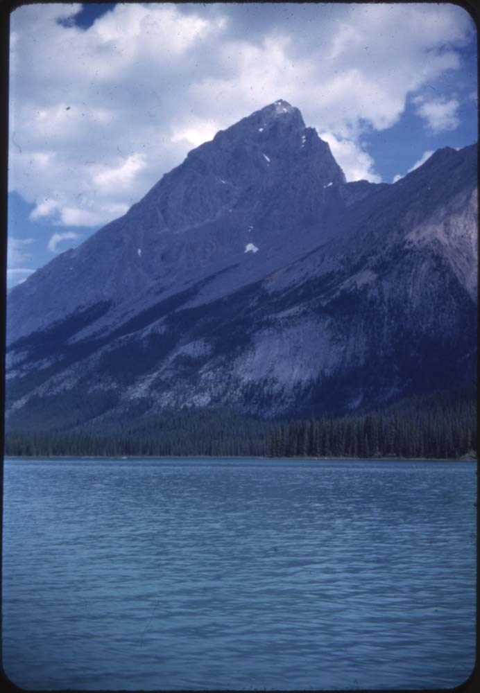
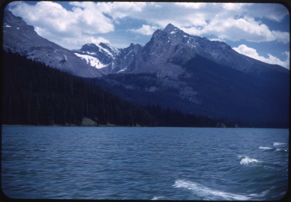
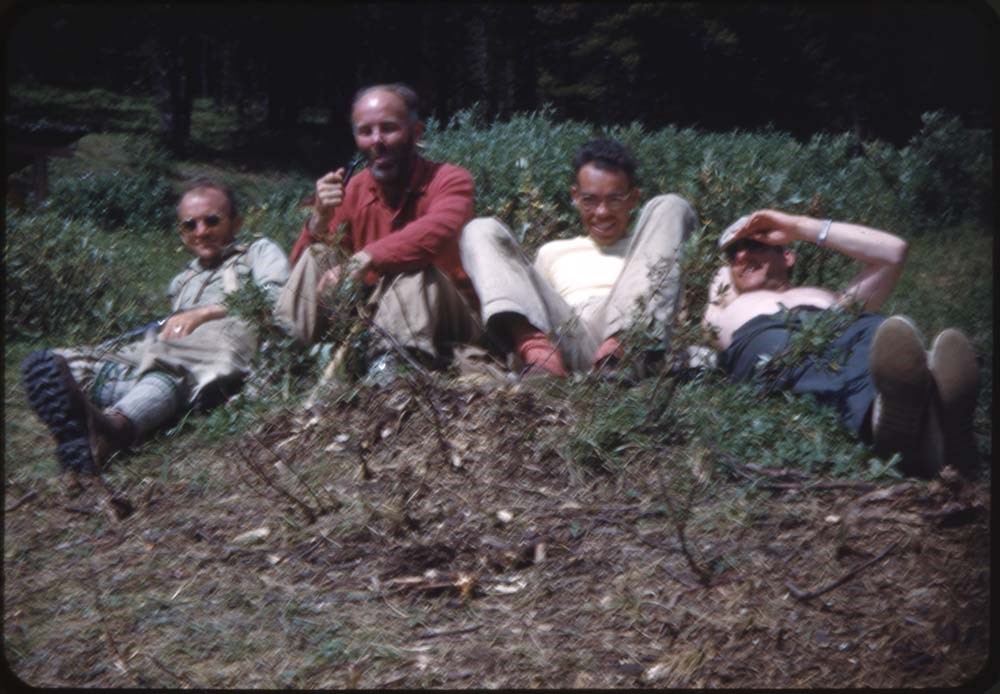
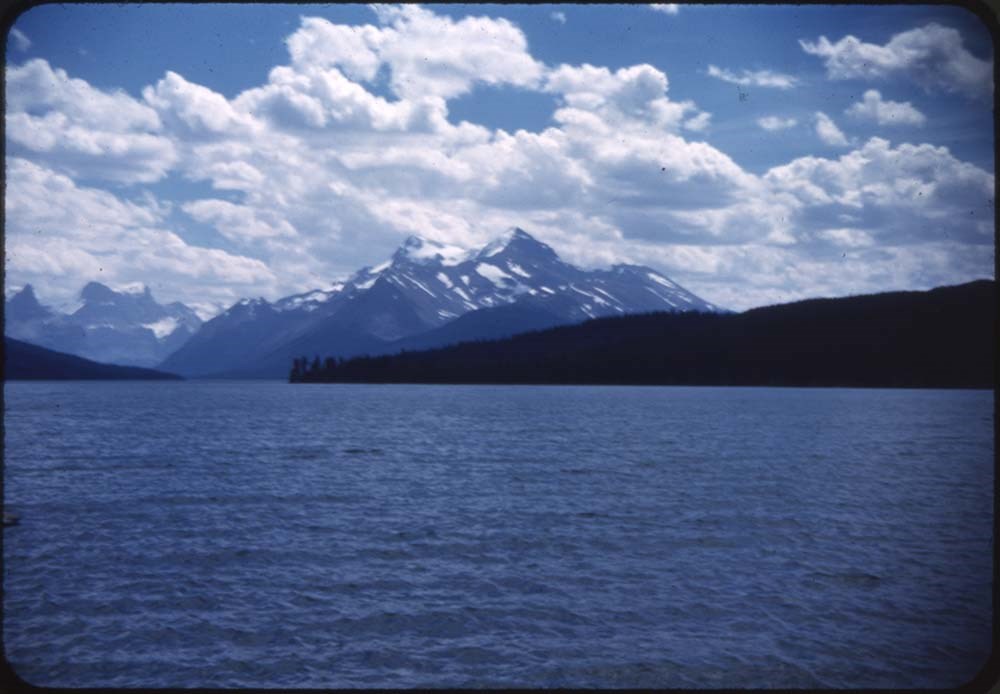
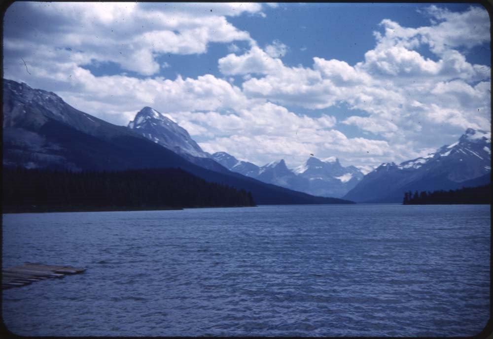
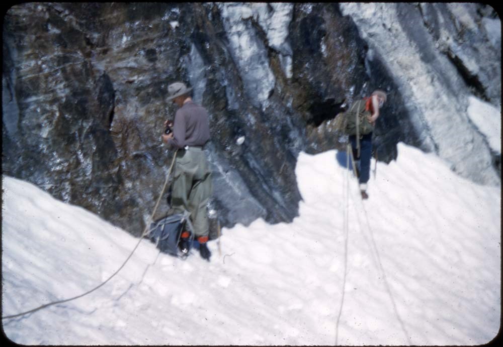
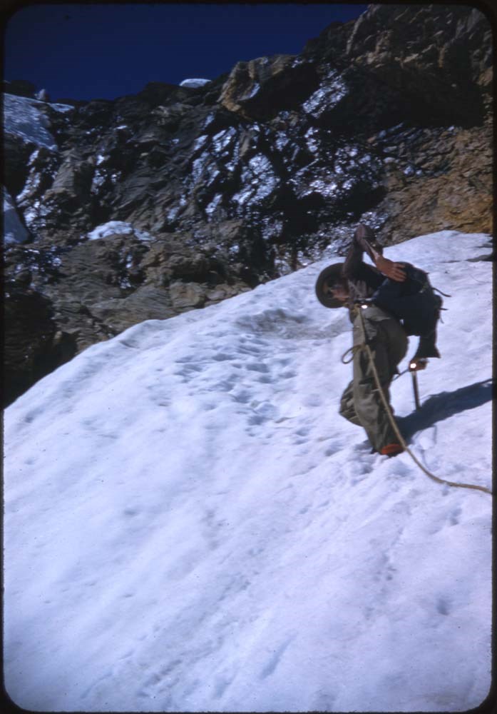
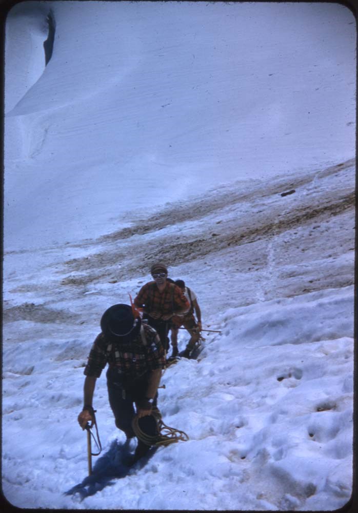
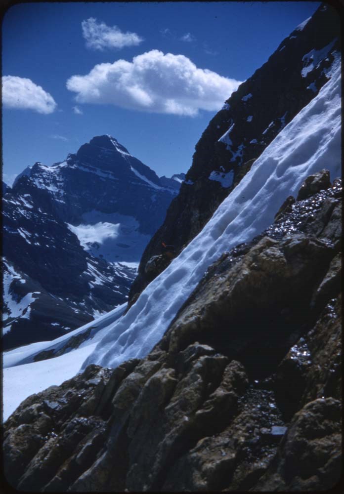
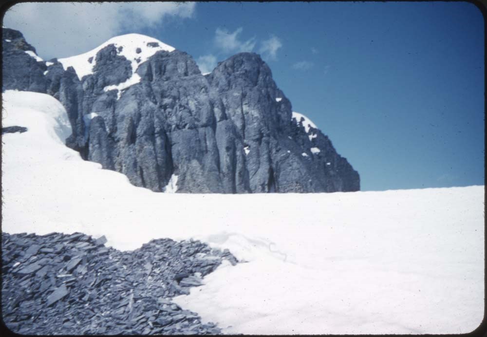
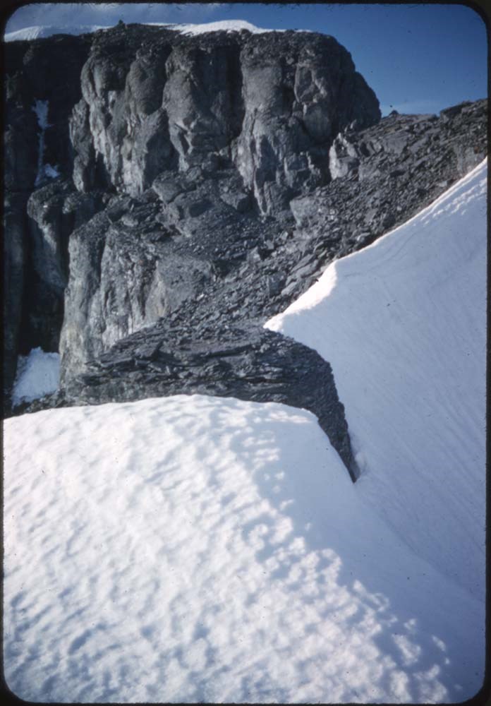
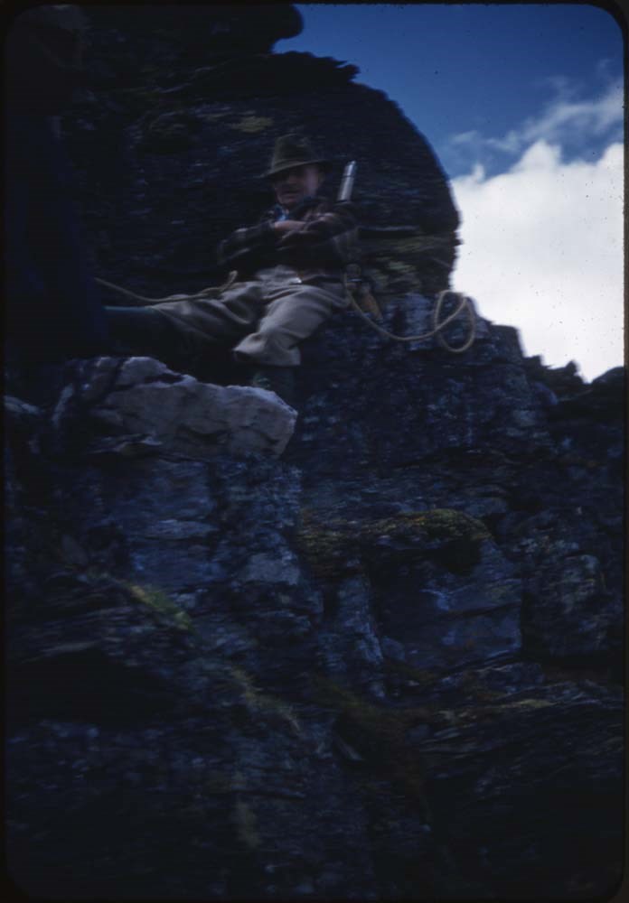
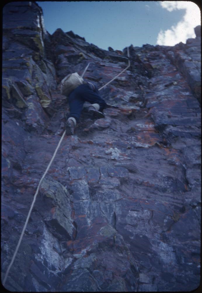
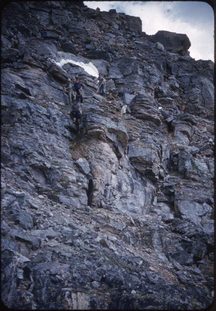
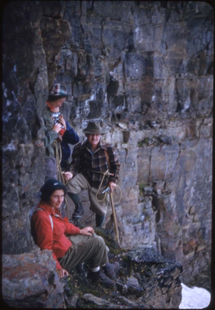
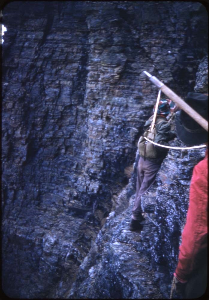
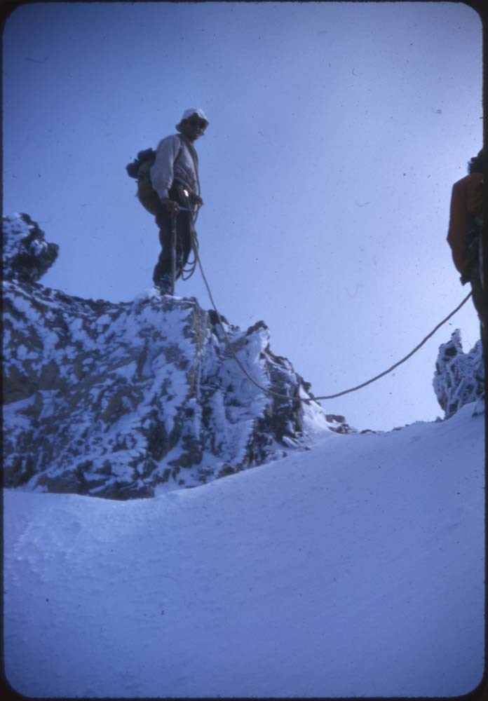
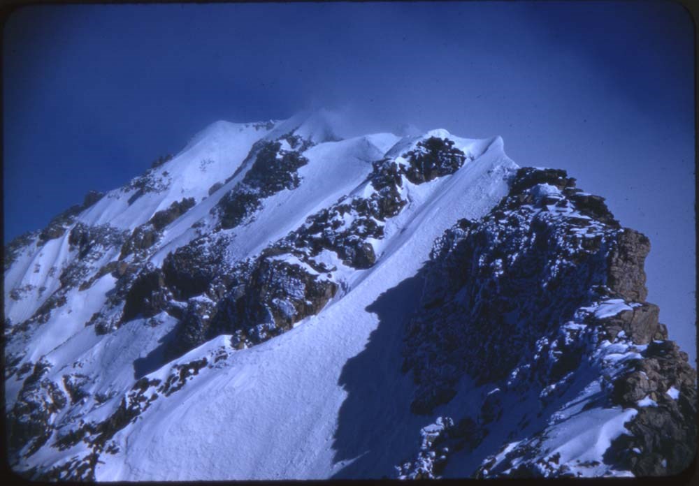
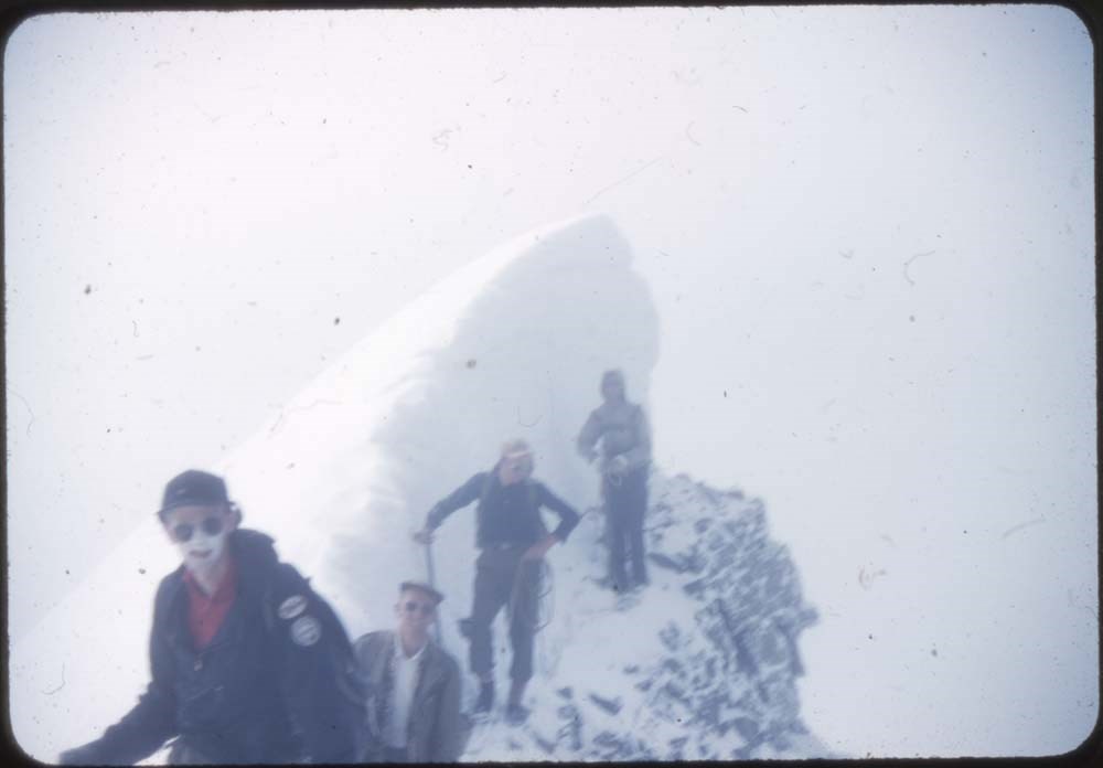
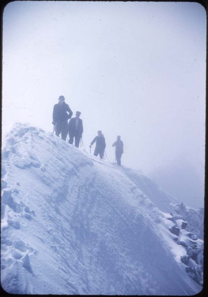
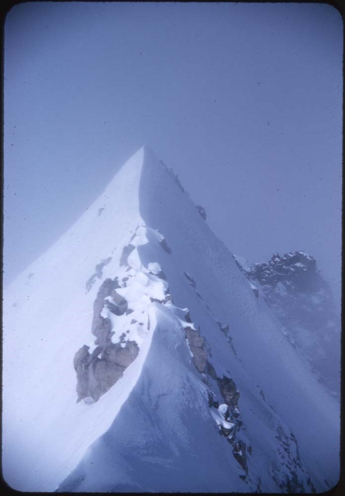
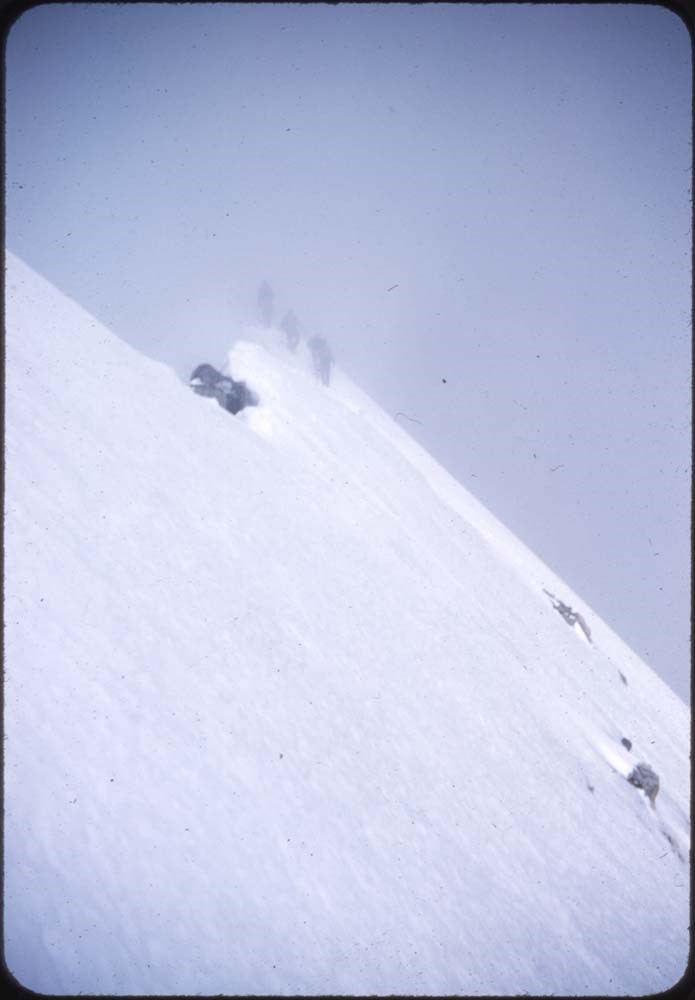
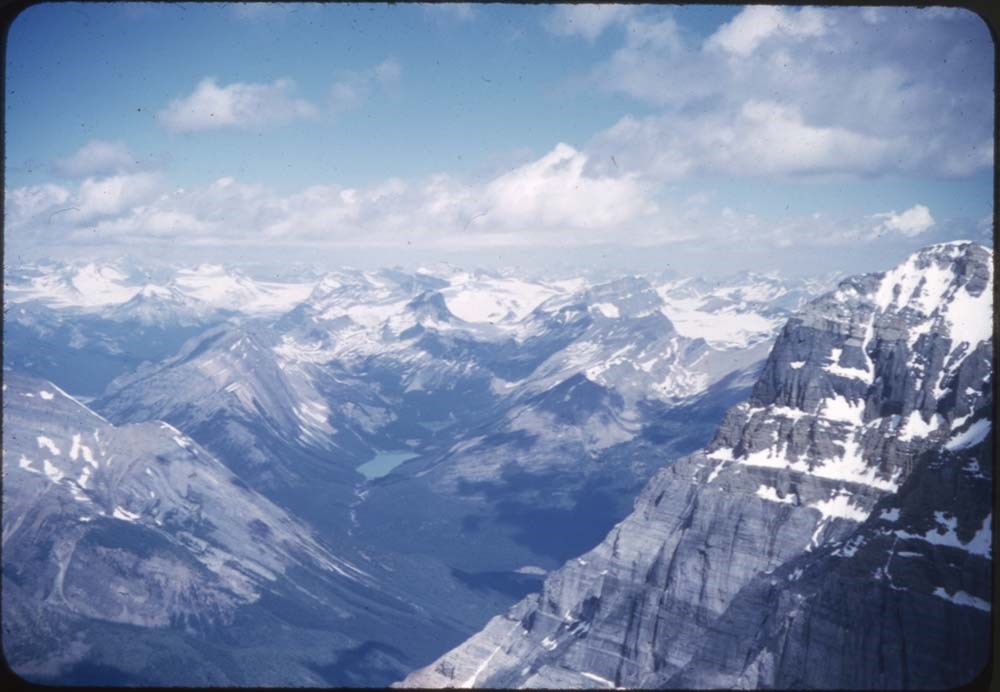
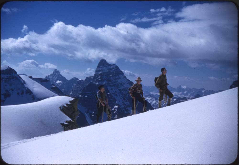
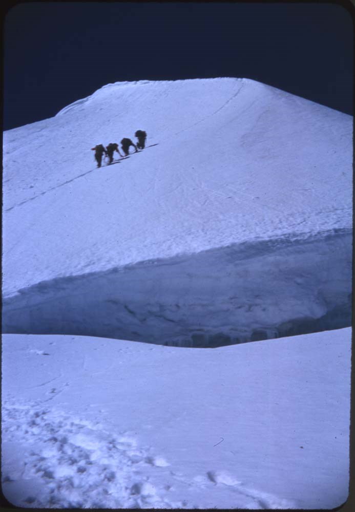
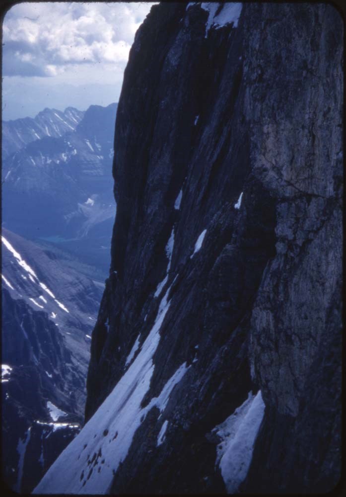
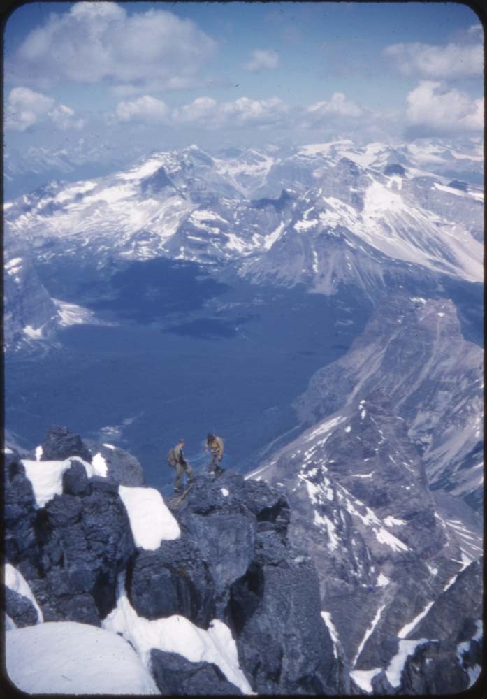
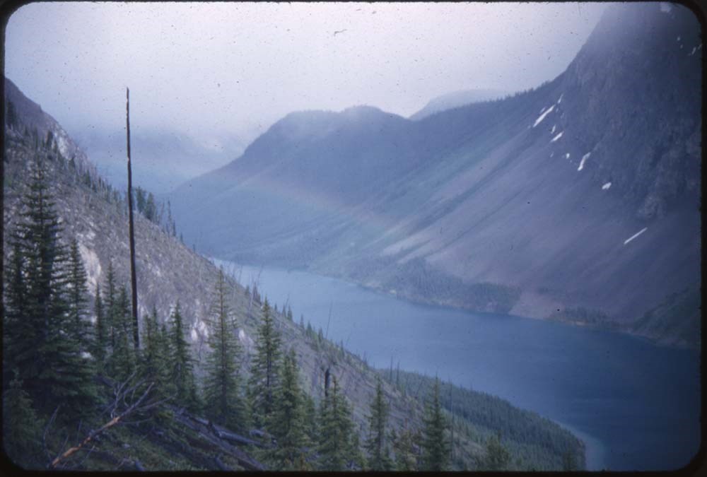
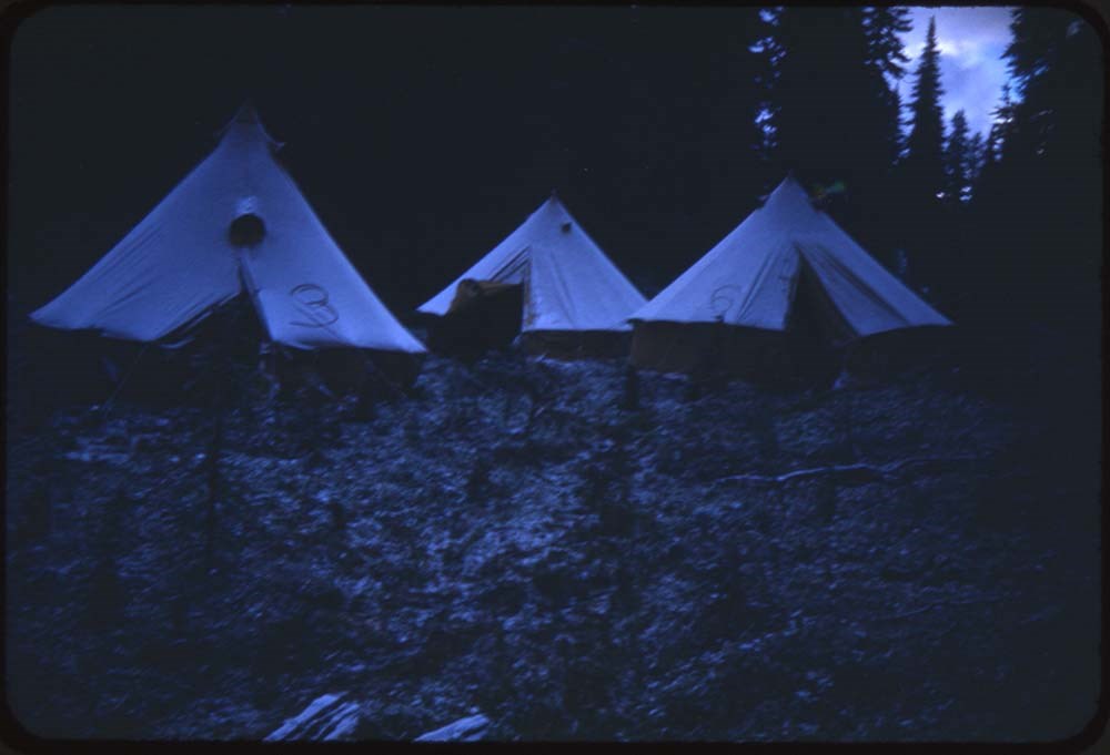
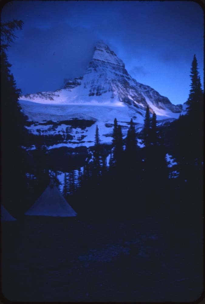
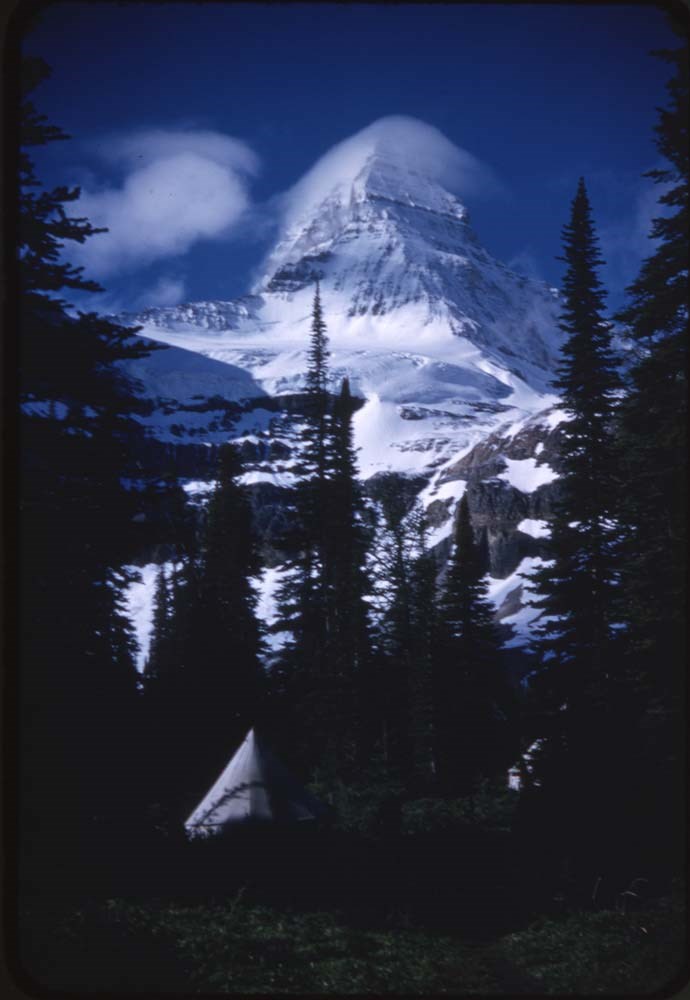
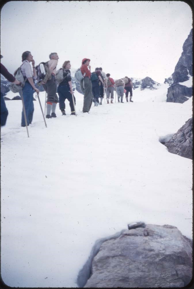
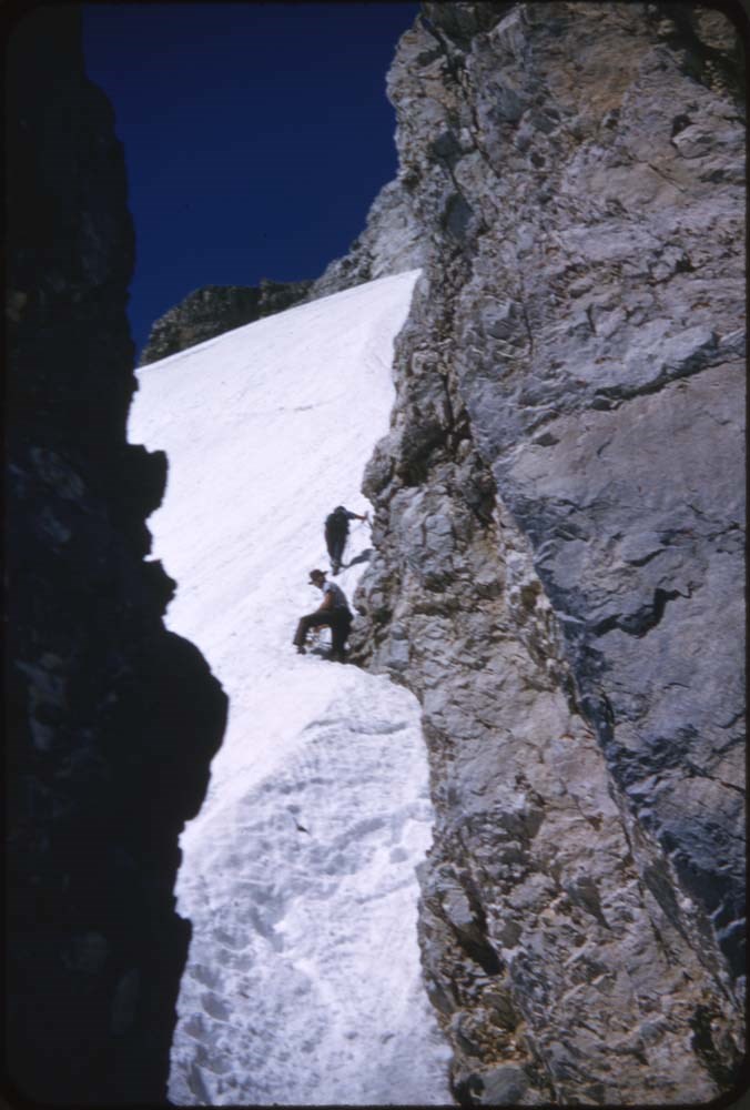
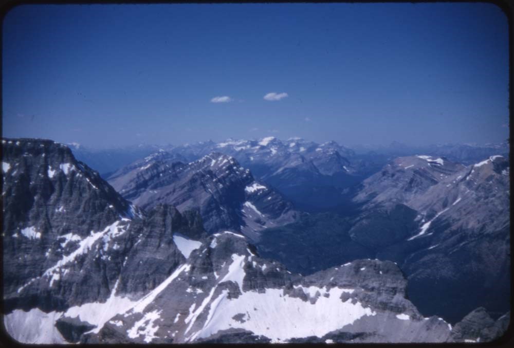
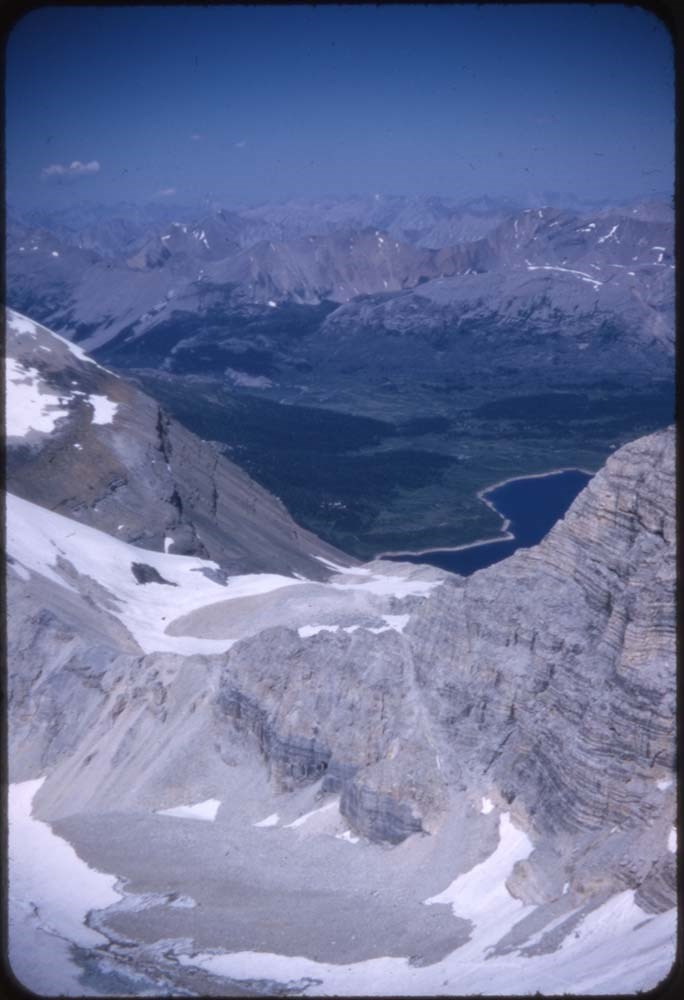
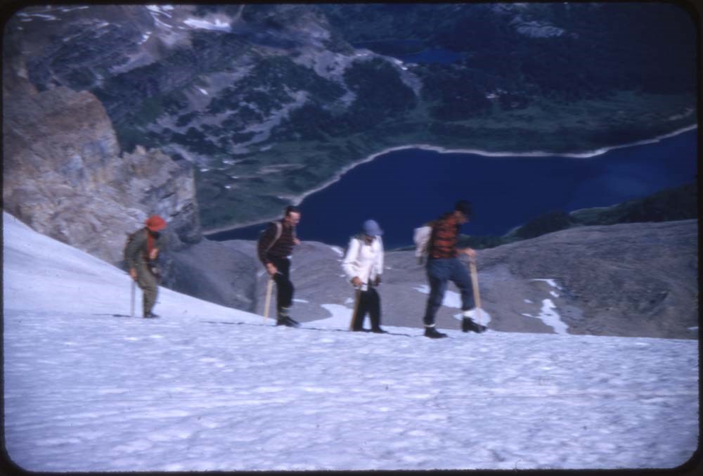
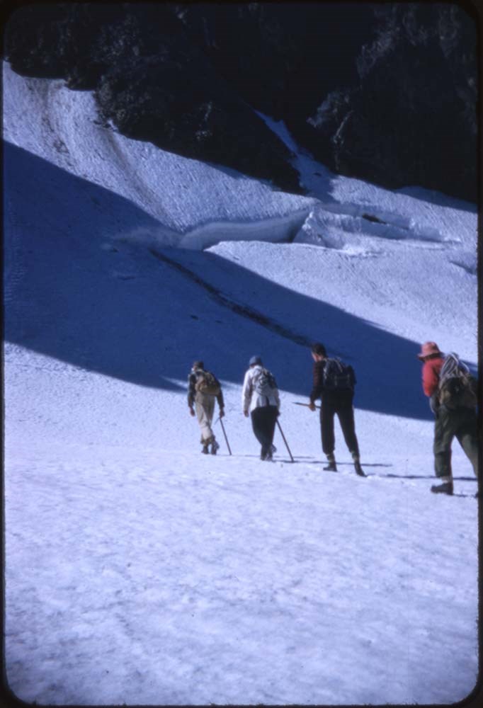
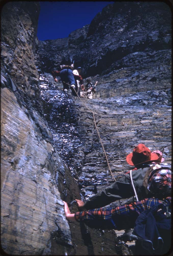
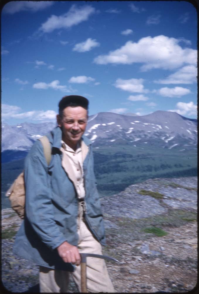
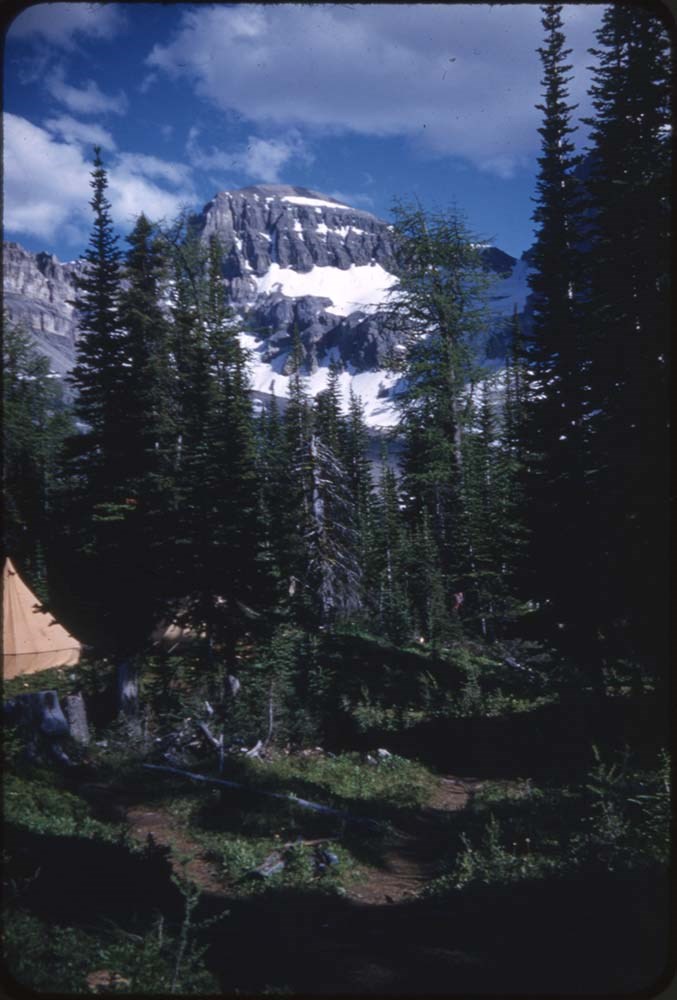
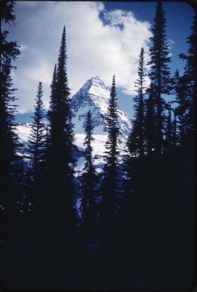
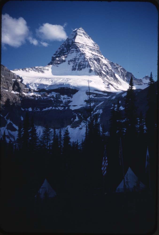
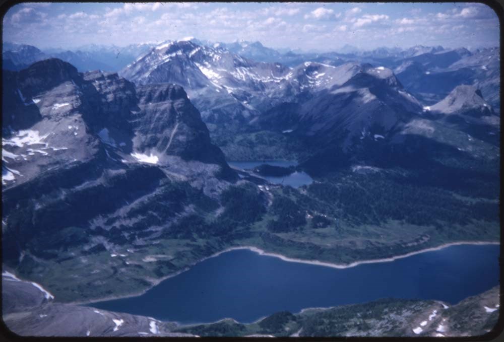
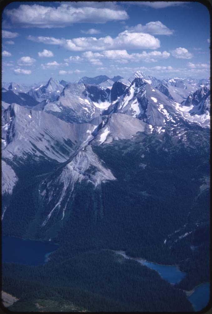
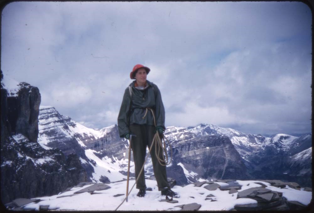
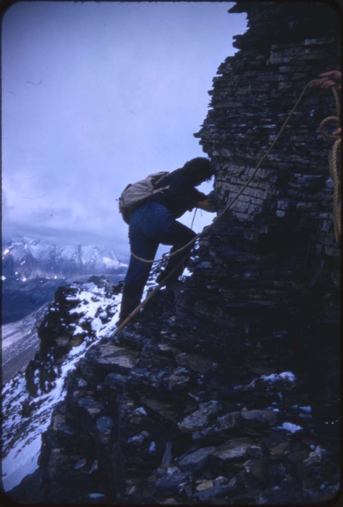
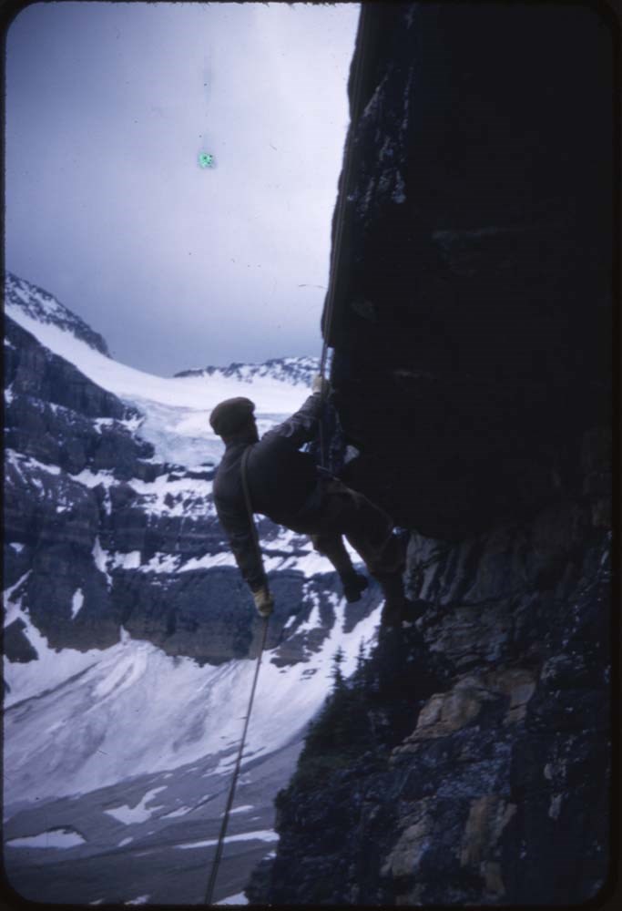
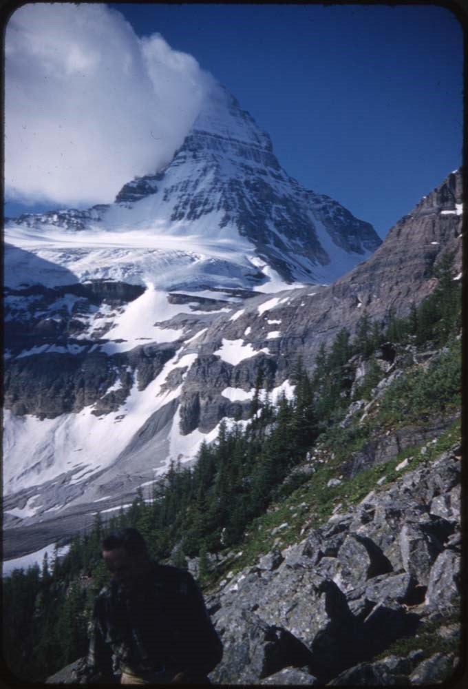
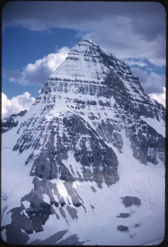
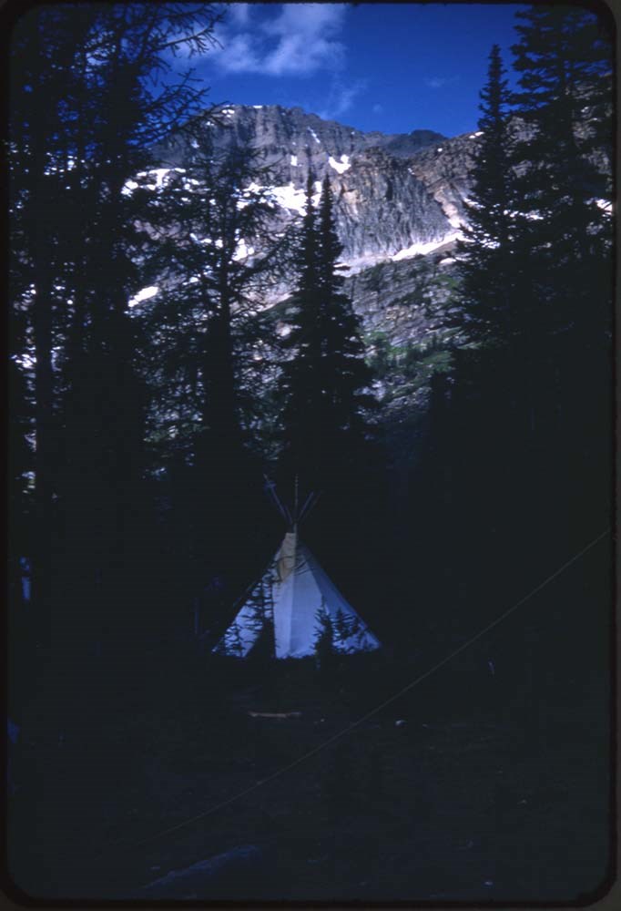
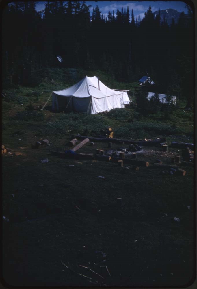
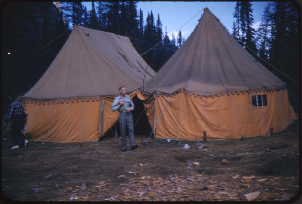
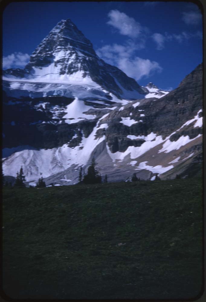
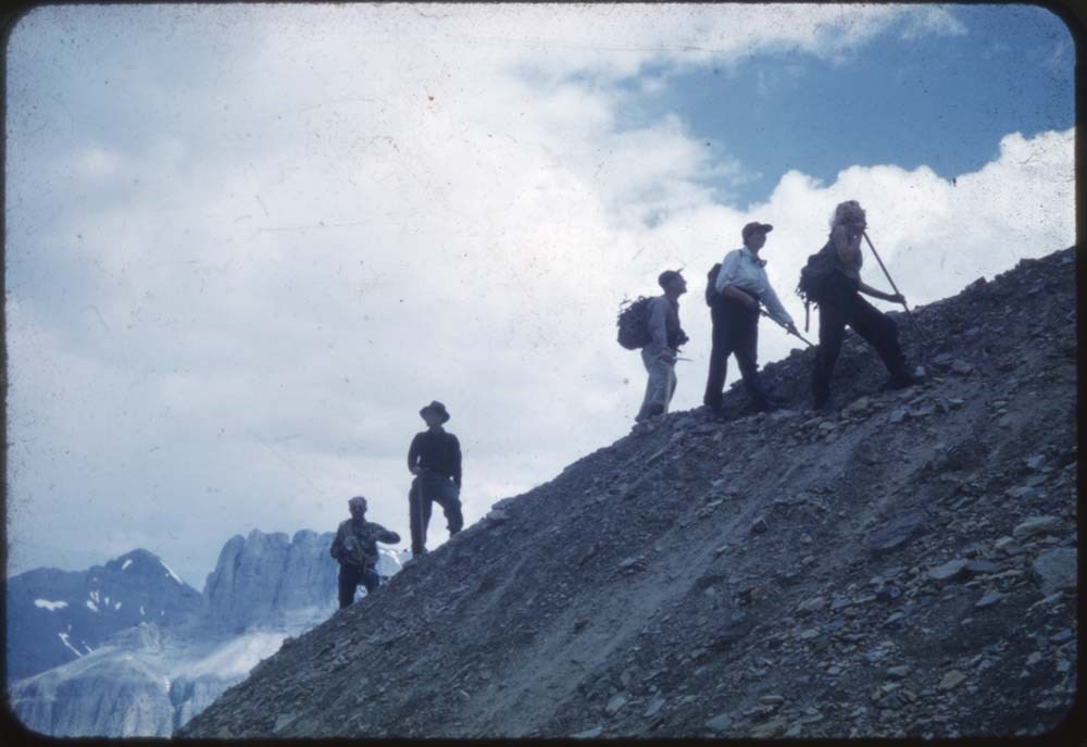
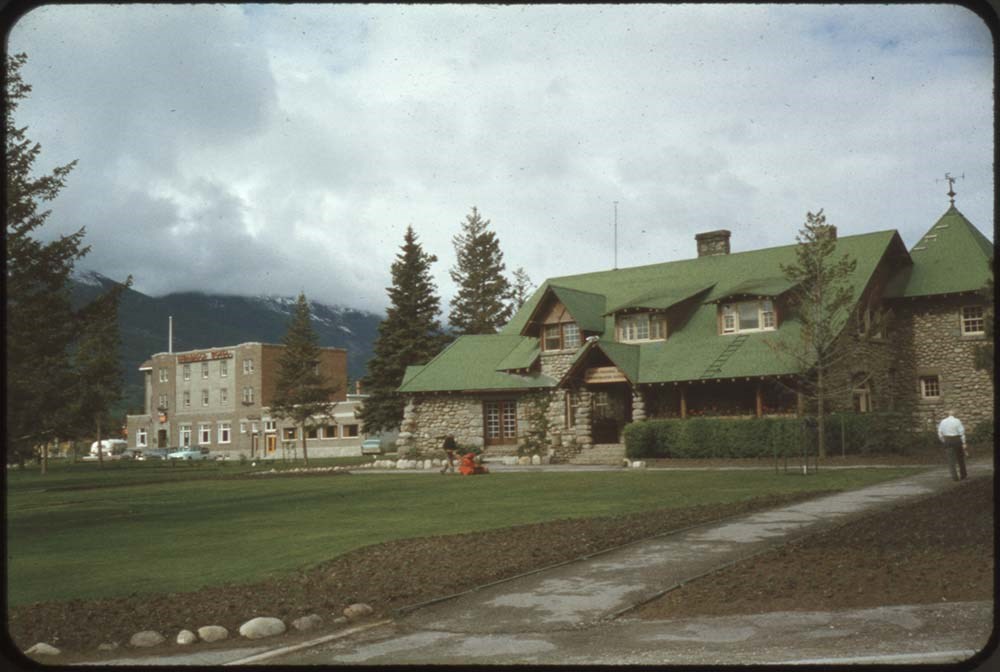
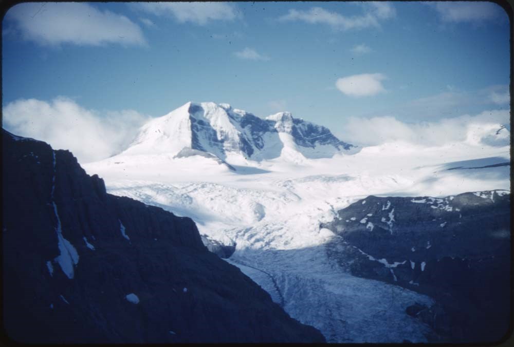
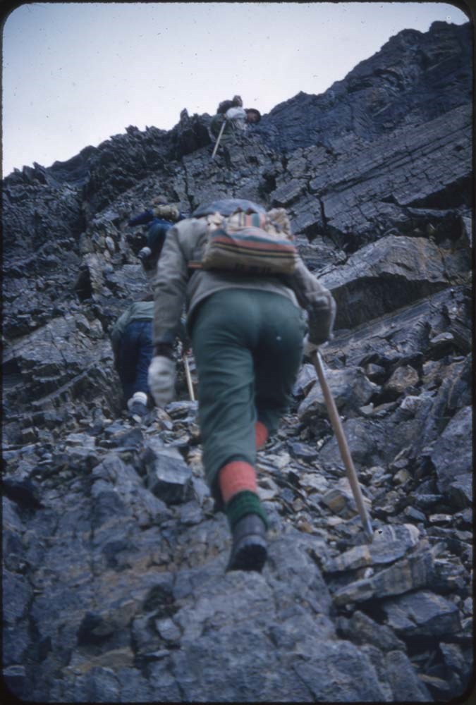
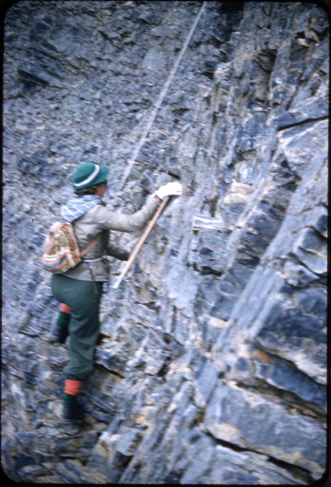
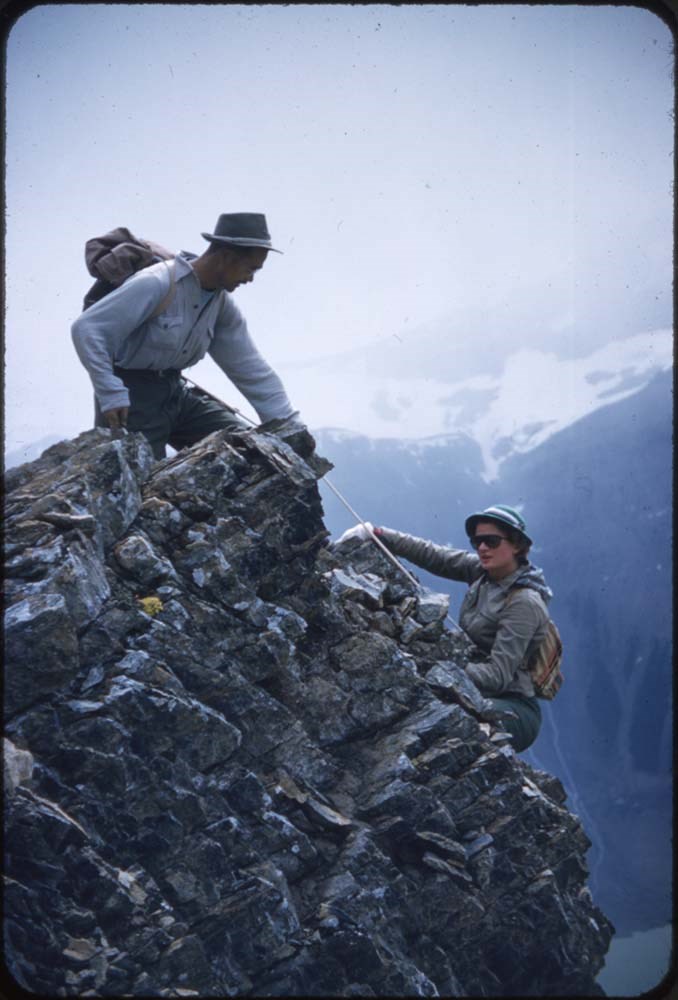
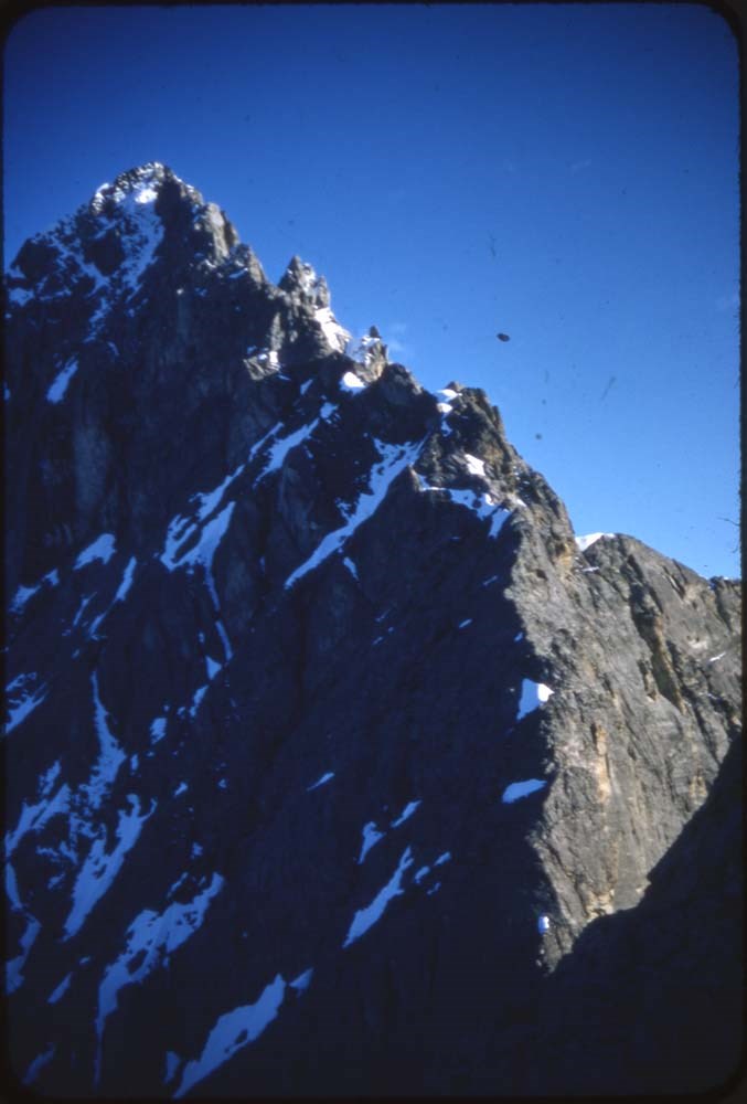
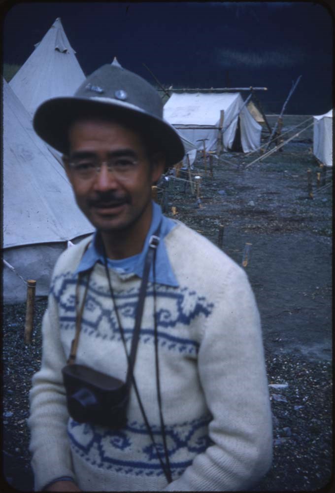
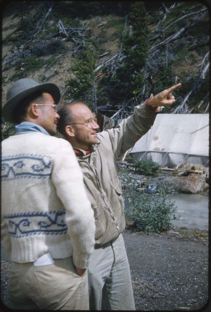
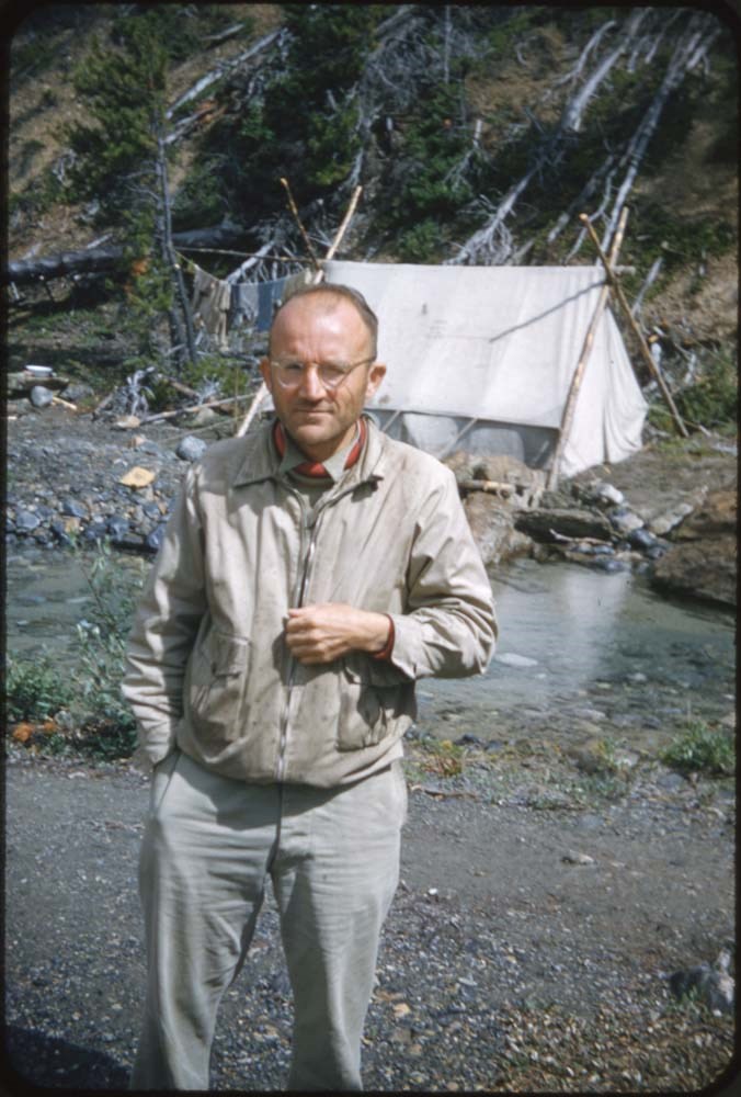
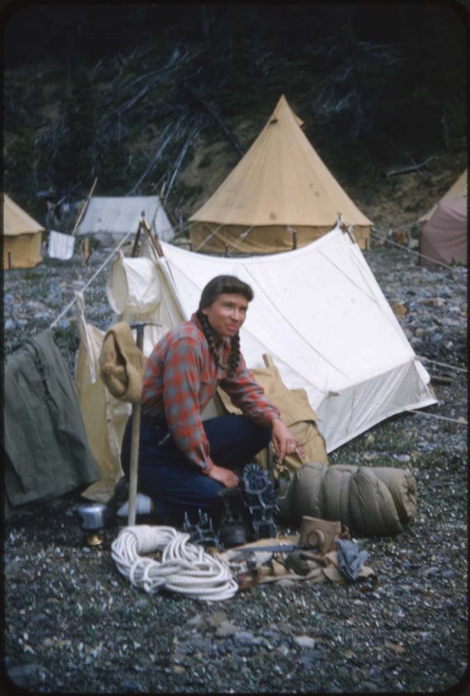
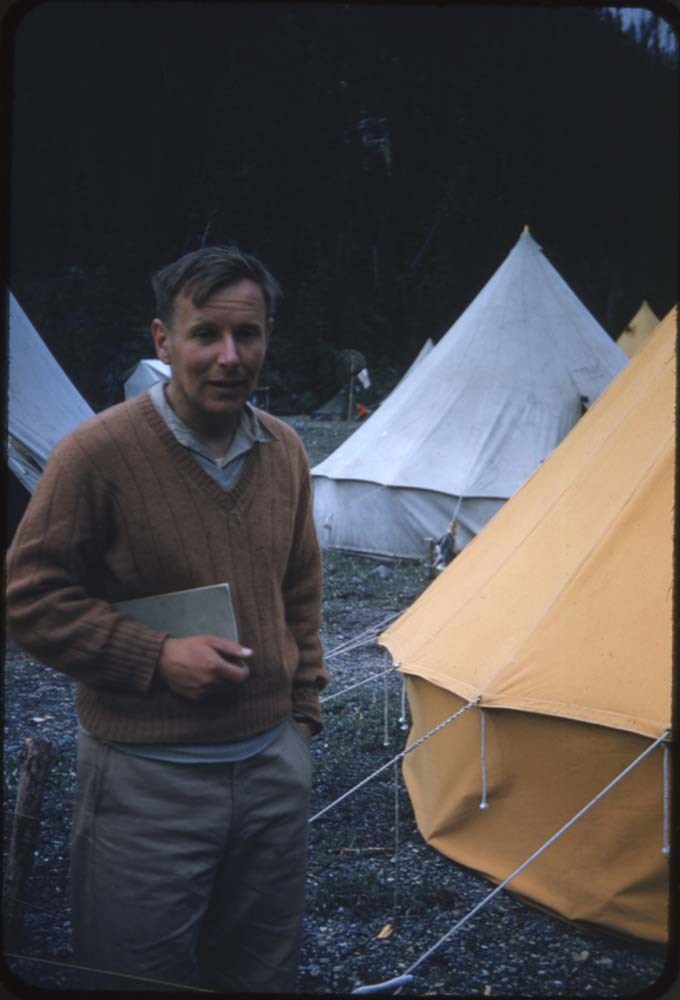
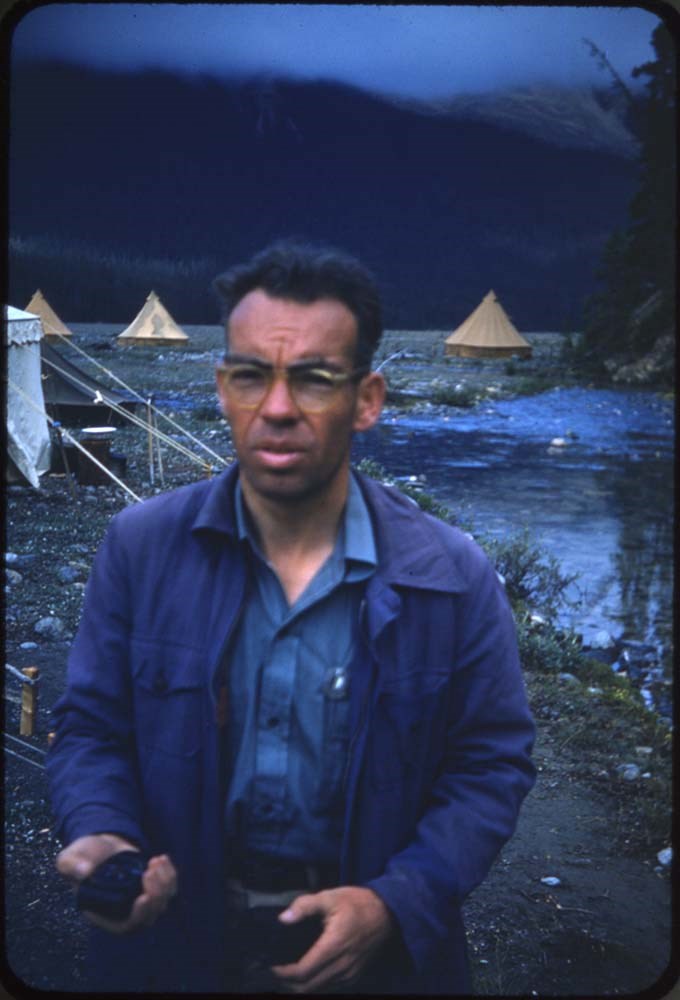
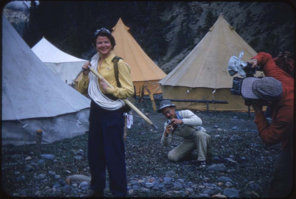
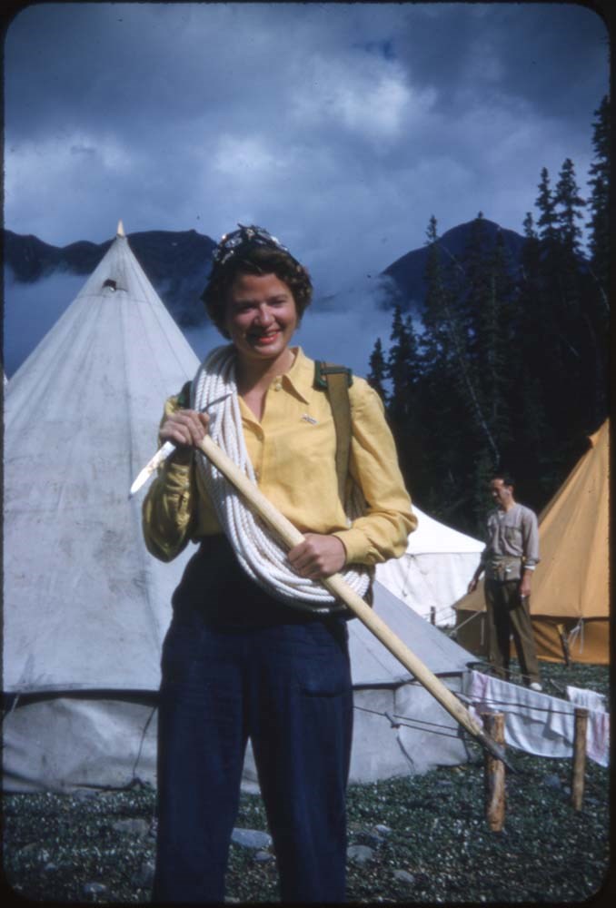
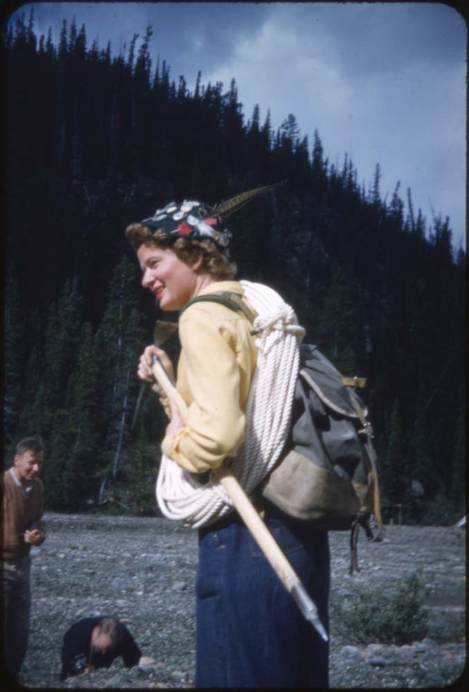
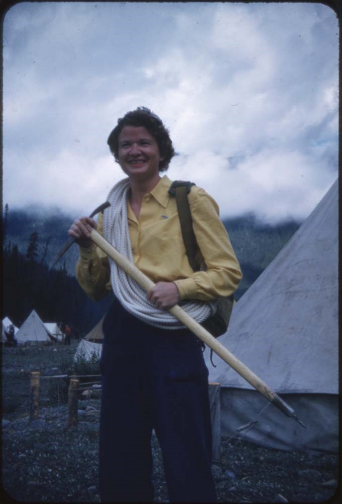
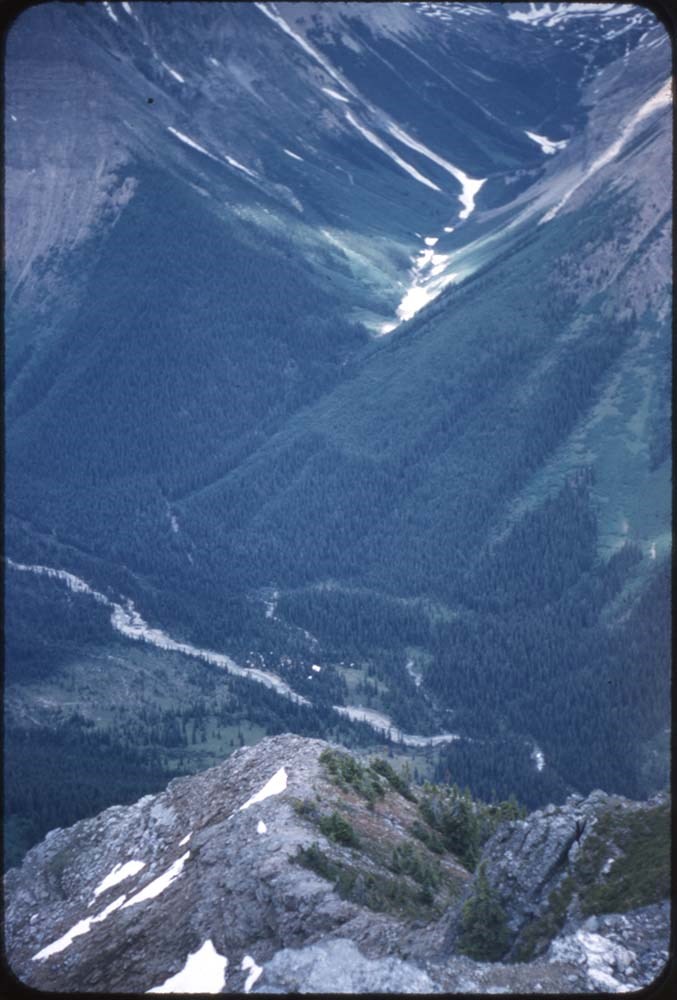
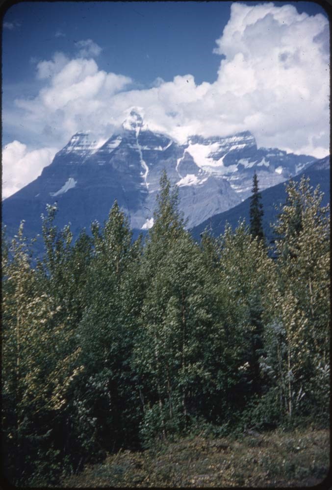
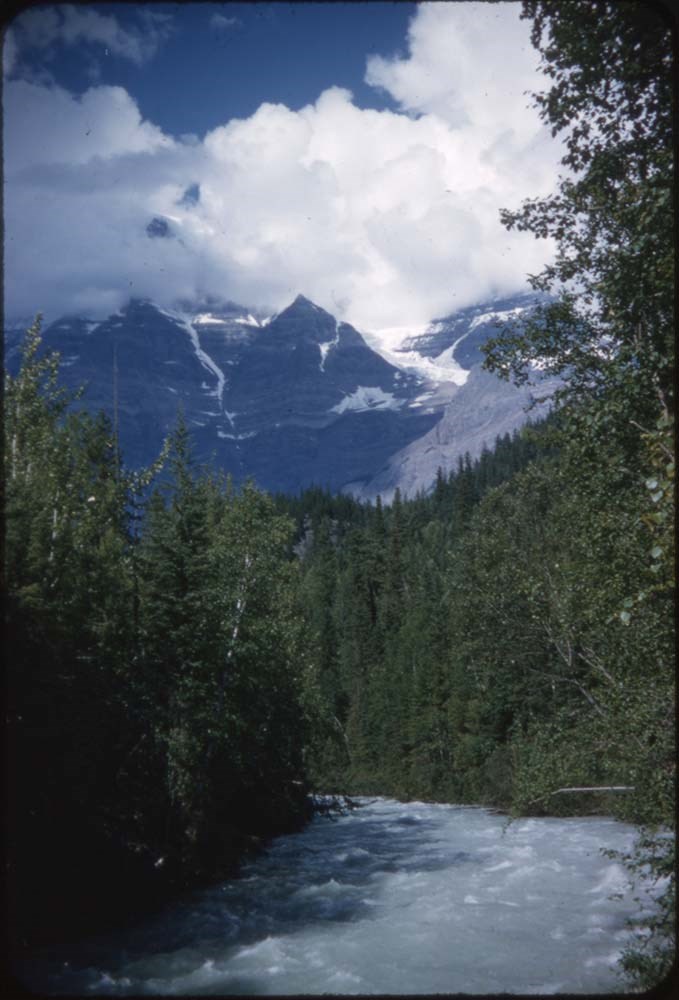
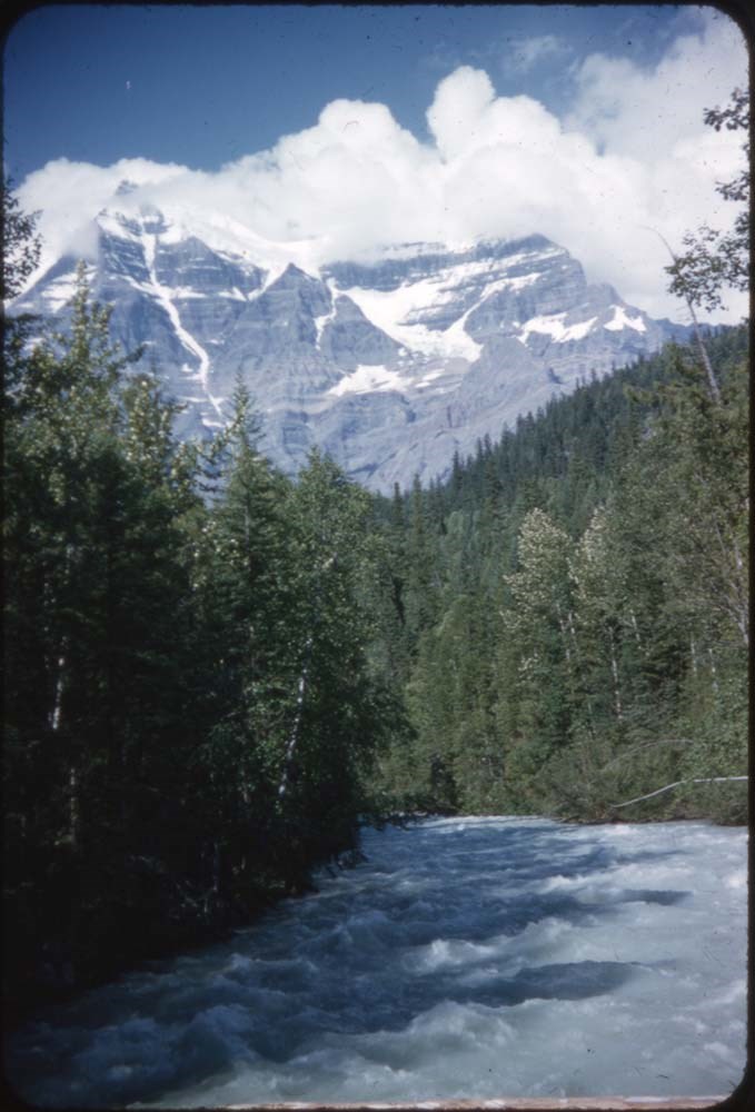
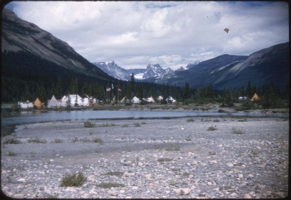
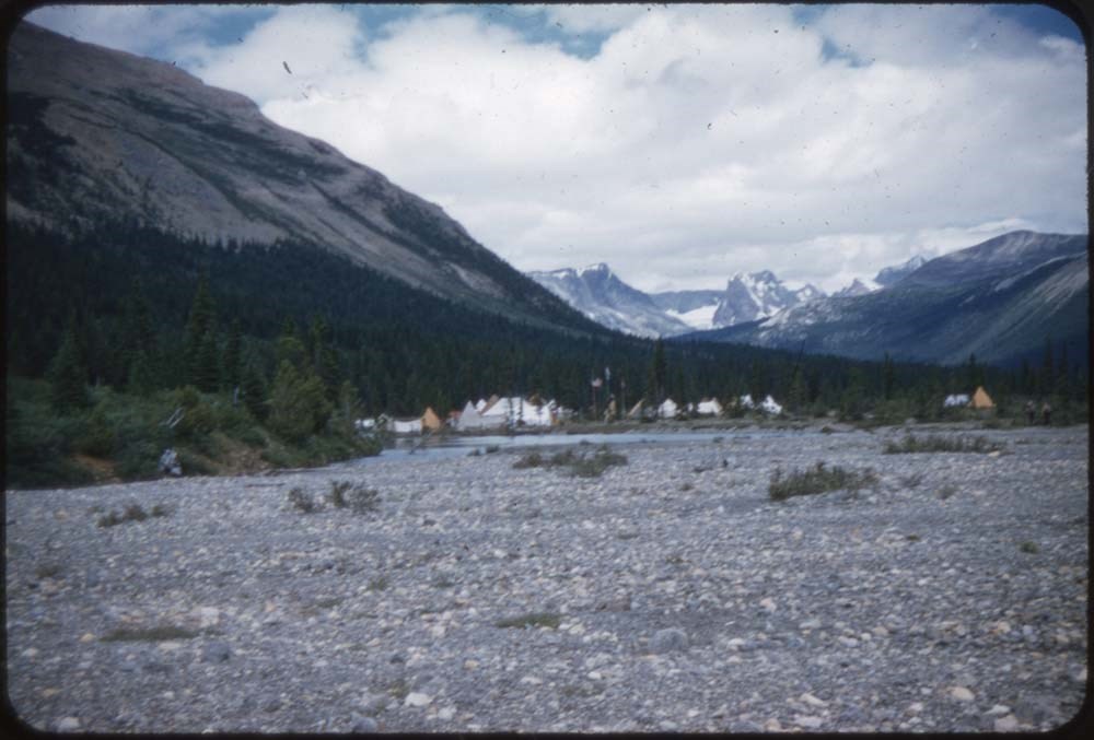
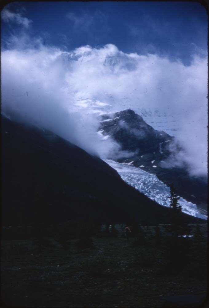
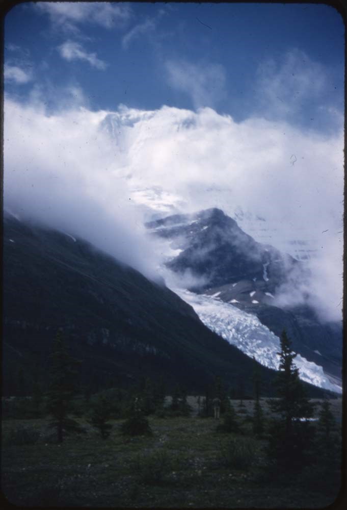
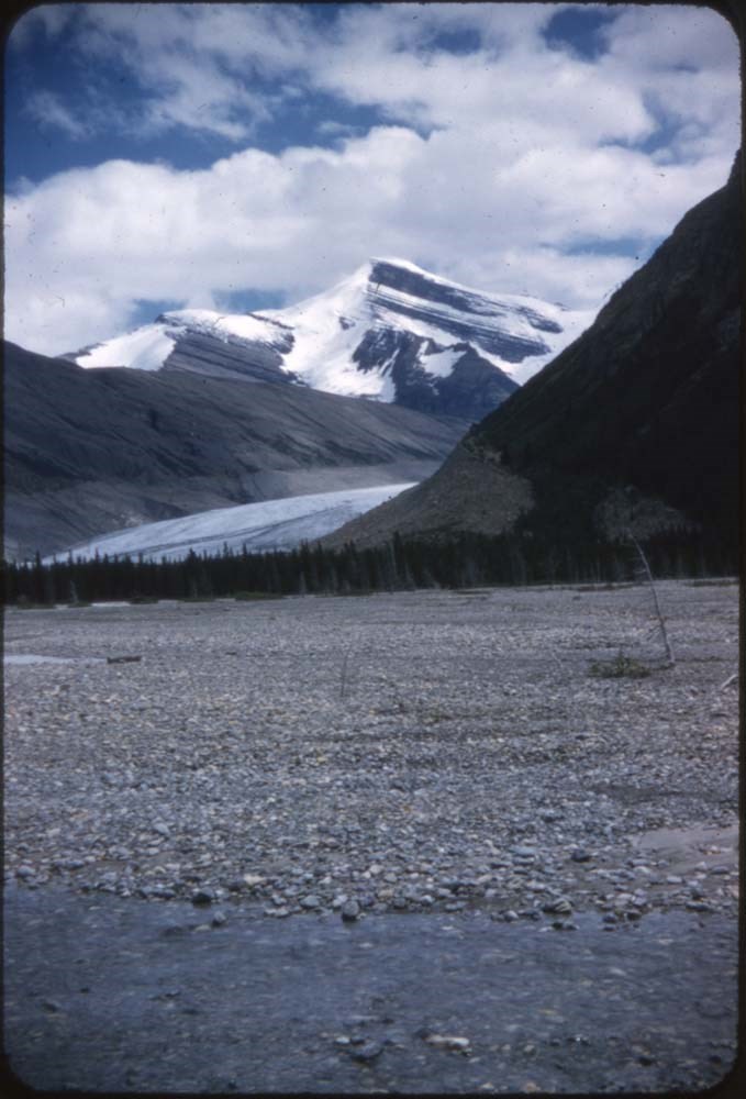
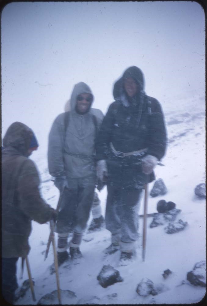
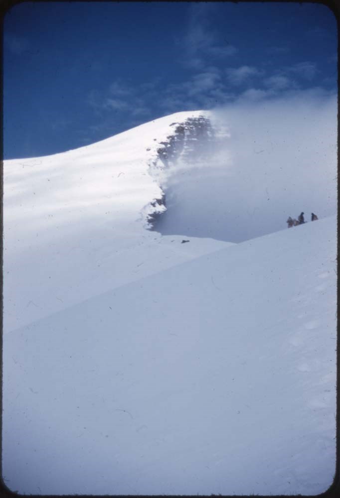
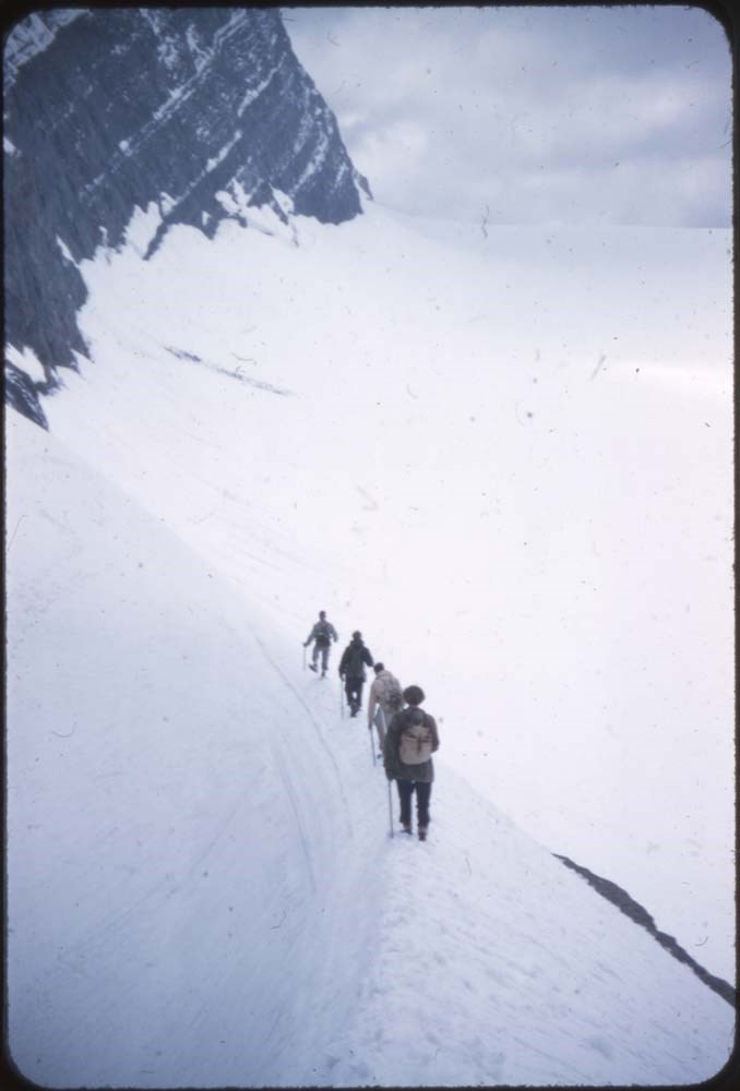
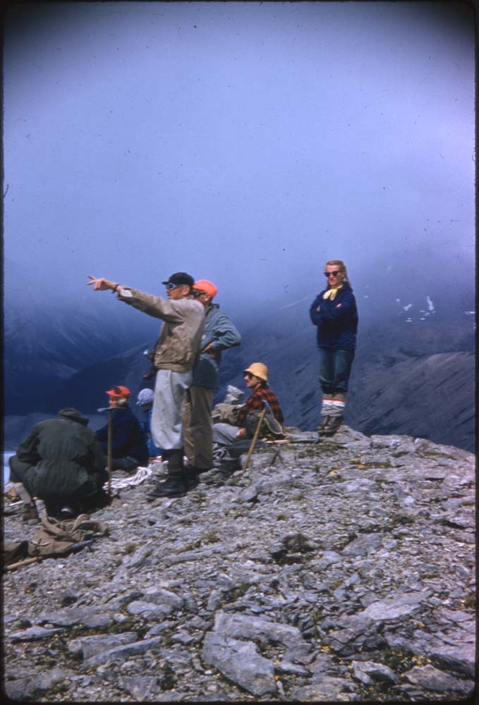
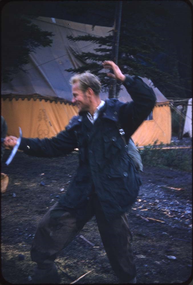
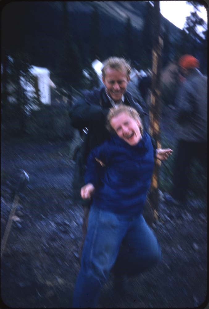
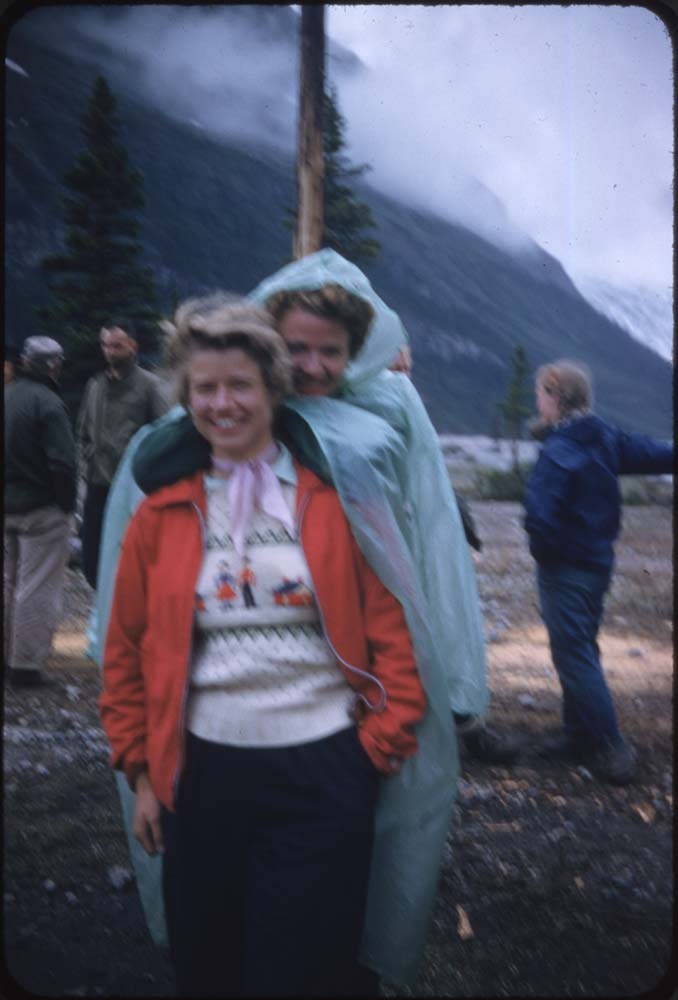
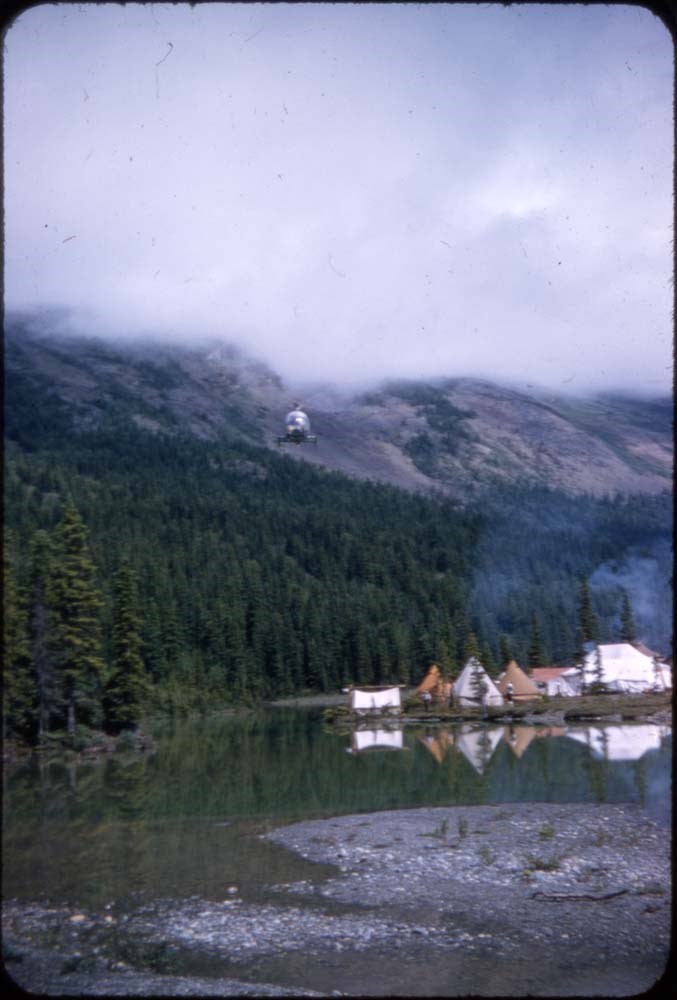
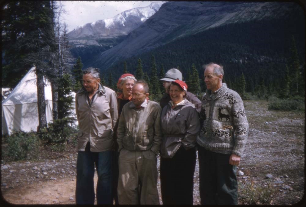
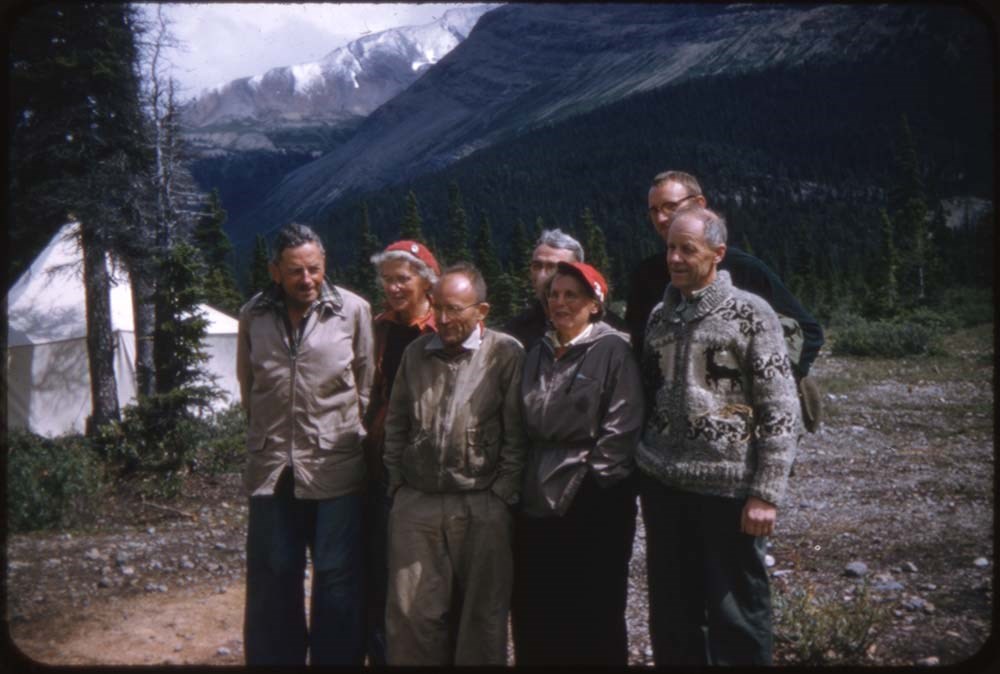
ACC Camps [1/3]
https://archives.whyte.org/en/permalink/descriptions57601
- Part Of
- Bill Goodrich fonds
- Scope & Content
- File pertains to 132 35 mm slides depictiong Alpine Club of Canada Camps from 1950, 1951, 1952, and 1960, consisting mostly of shots of people hiking, climbing, and mountaineering in and around the Lake O'Hara and Mt. Assiniboine areas. Contents include: 1950 - Maligne (1-19) 1951 - Lake O'Hara (21…
- Date Range
- 1950-1960
- Reference Code
- V106 / NS - 01 to NS - 132
- Description Level
- 5 / File
- GMD
- Photograph
- Transparency
132 images
- Part Of
- Bill Goodrich fonds
- Description Level
- 5 / File
- Fonds Number
- V106
- Sous-Fonds
- V106
- Accession Number
- 7765
- Reference Code
- V106 / NS - 01 to NS - 132
- Date Range
- 1950-1960
- Physical Description
- 132 photographs : col. slides ; 35 mm
- History / Biographical
- See fonds level description.
- Scope & Content
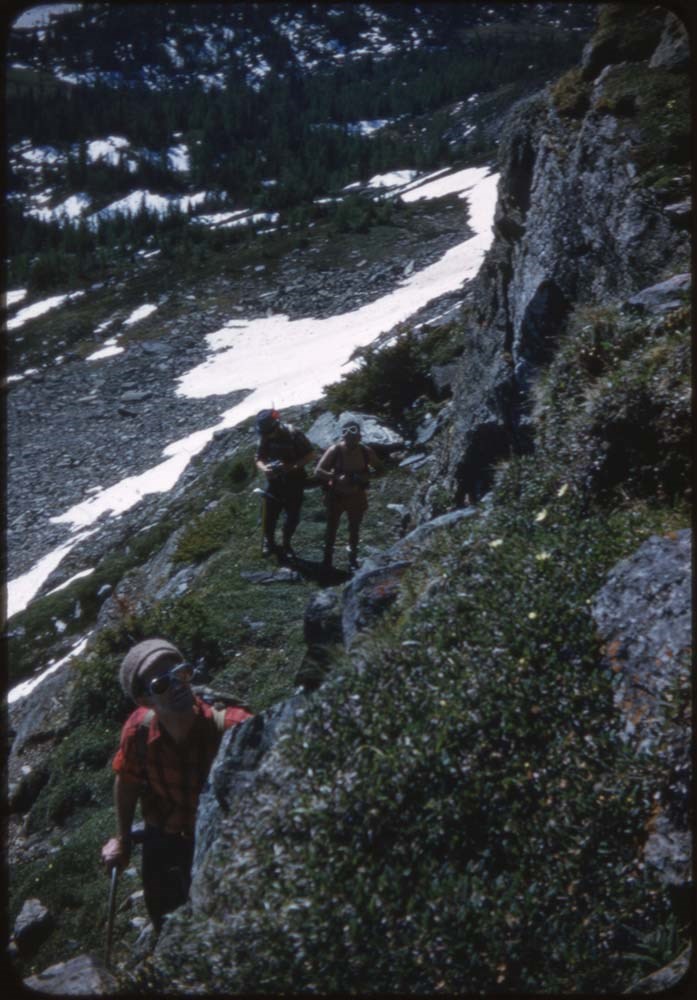
- File pertains to 132 35 mm slides depictiong Alpine Club of Canada Camps from 1950, 1951, 1952, and 1960, consisting mostly of shots of people hiking, climbing, and mountaineering in and around the Lake O'Hara and Mt. Assiniboine areas. Contents include: 1950 - Maligne (1-19) 1951 - Lake O'Hara (21-69) 1952 - Mt. Assiniboine (71-124) 1952 - Mt. Assiniboine from Monica & Dudley (126-129) 1950 - Sent to [Bill Goodrich] from '50 Maligne Camp, [Bill Goodrich] on trail to glacier (131) 1960 - B-J HWY (Sent to [Bill Goodrich]) Mt. Saskatchewan (133) Mt. Chephren (134) Athabaska River (135) Pyramid Mt. (136) Athabaska Hotel (137)
- Name Access
- Alpine Club of Canada
- Goodrich, Bill
- Subject Access
- Activities
- Alpine Club of Canada
- Buildings
- Camping
- Camps
- Climbing
- Glaciers
- Hiking
- Lake O'hara
- Mountaineering
- Mountaineers
- Mountains
- Parks Canada
- Photography
- Portrait
- Scenery
- scenic
- Geographic Access
- Jasper
- Jasper National Park
- Alberta
- Lake O'Hara
- Yoho National Park
- Assiniboine
- Assiniboine Provincial Park
- British Columbia
- Language
- English
- Finding Aid
- No finding aid
- Creator
- Goodrich, Bill
- Title Source
- Title based on contents of fonds
- Processing Status
- Processed
Images


This material is presented as originally created; it may contain outdated cultural descriptions and
potentially offensive content.
Read more.
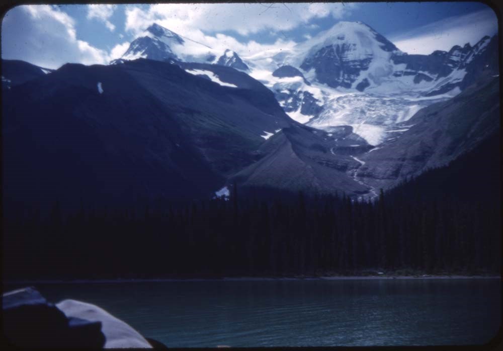
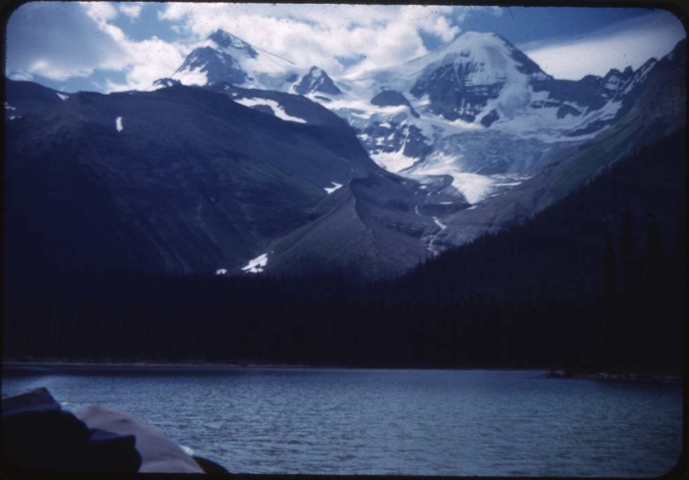
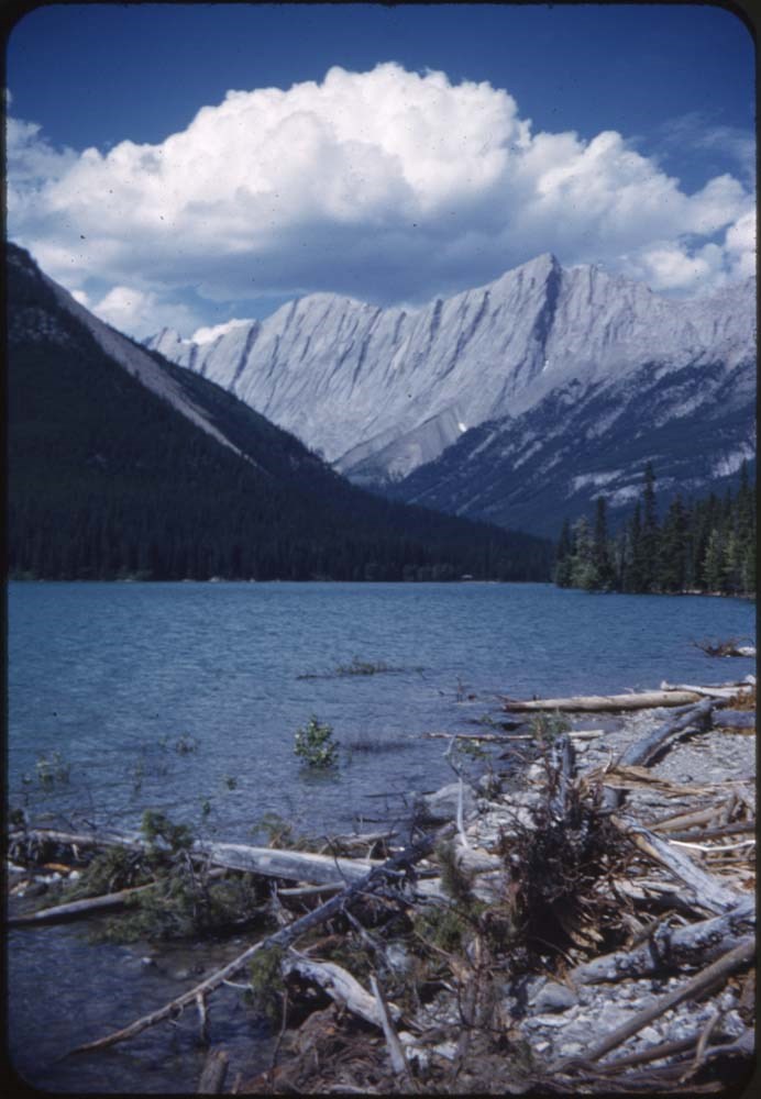
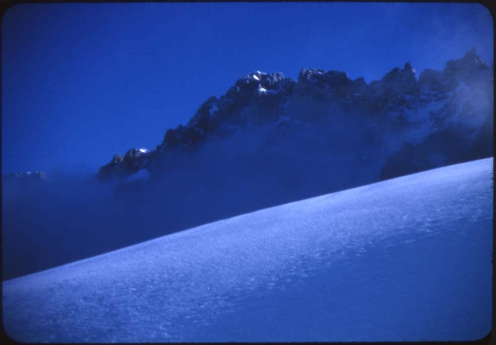
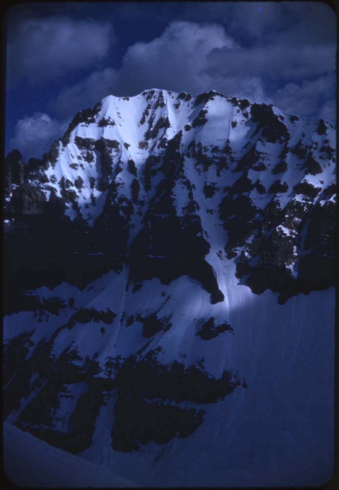
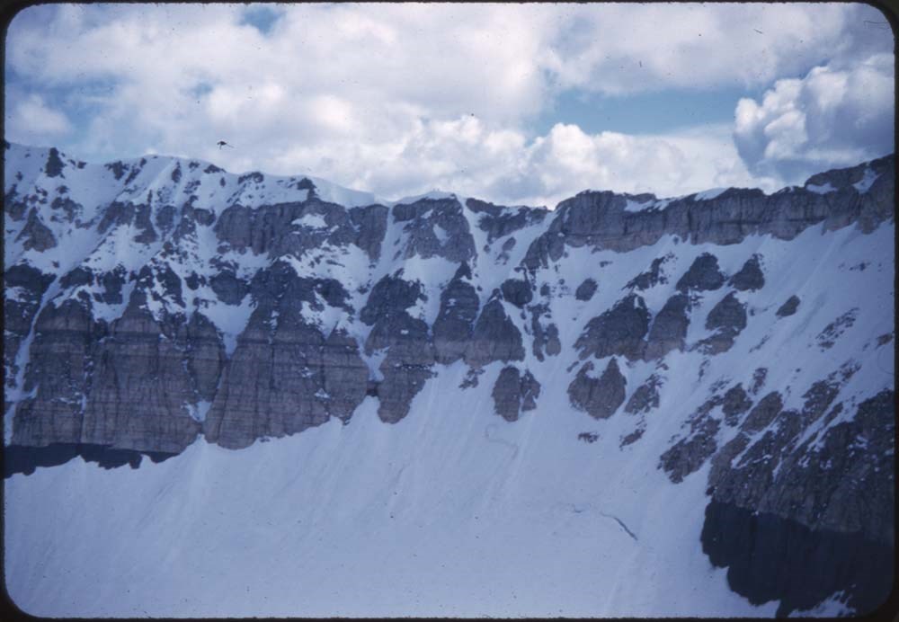
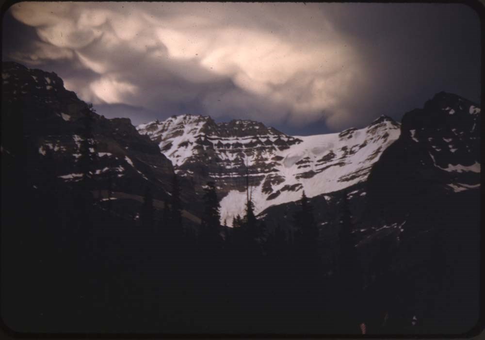
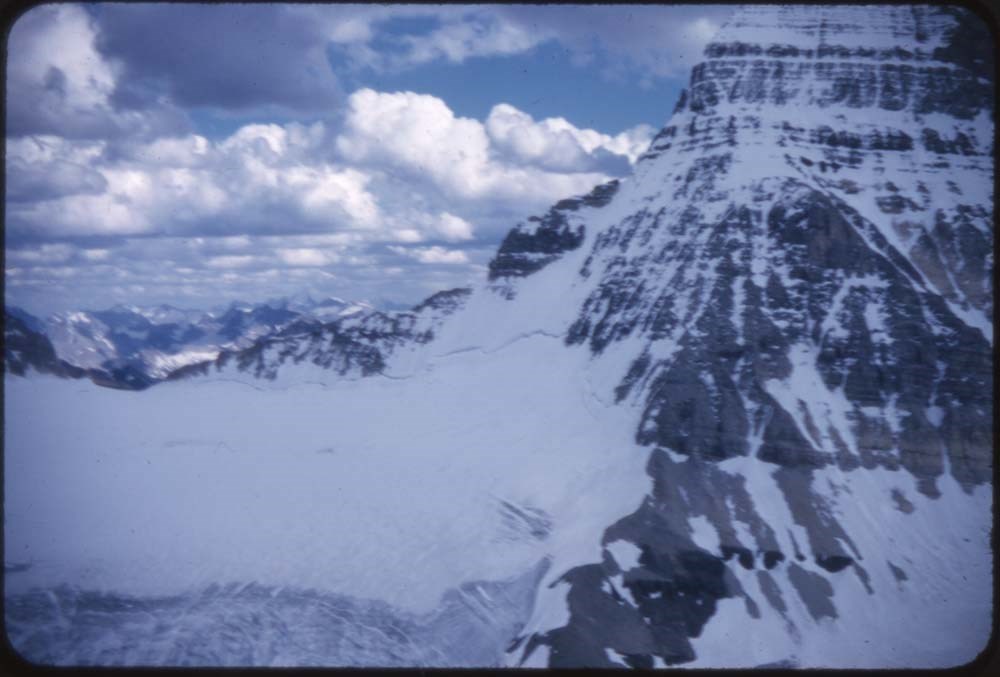
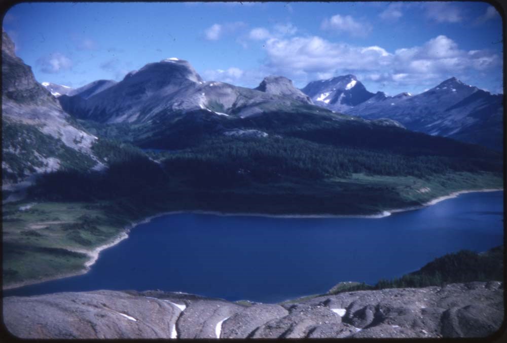
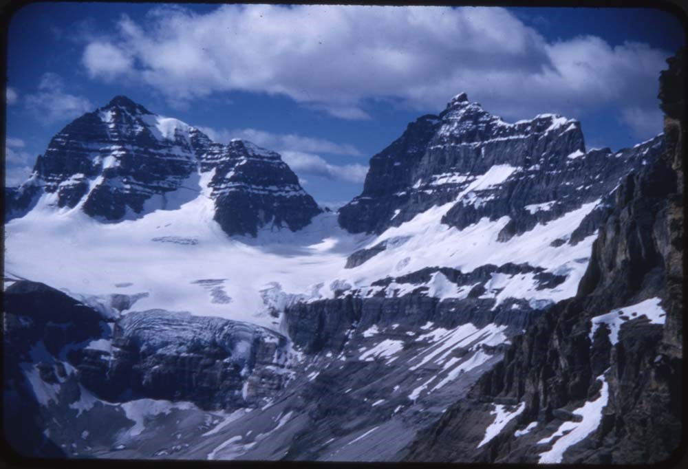
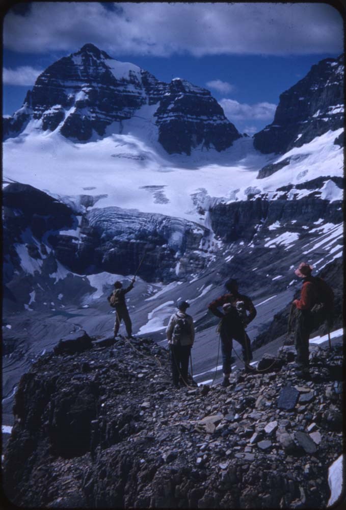
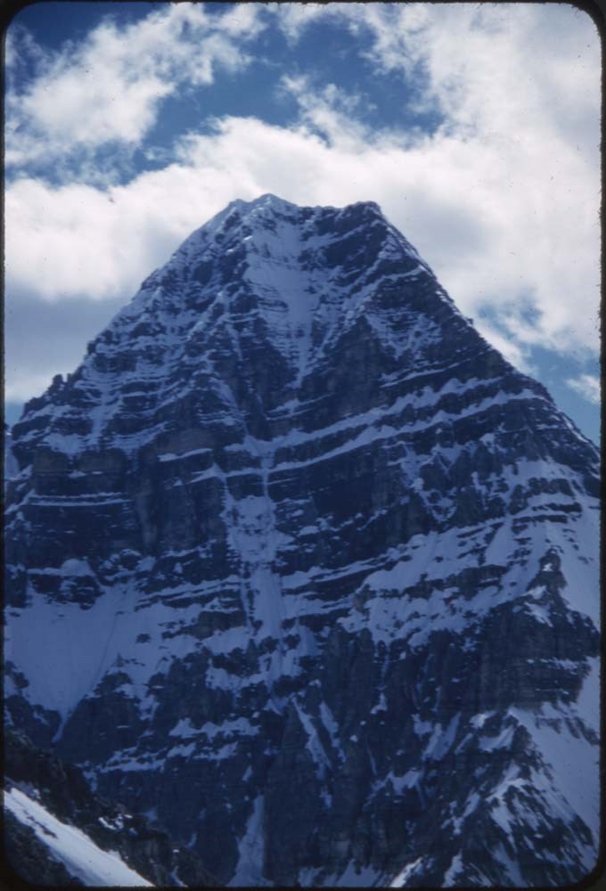
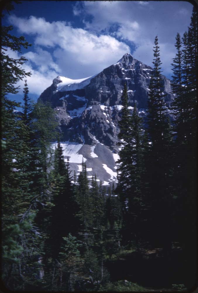
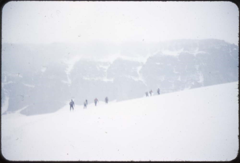
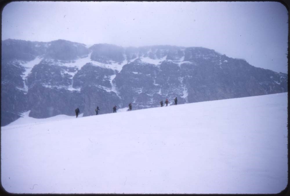
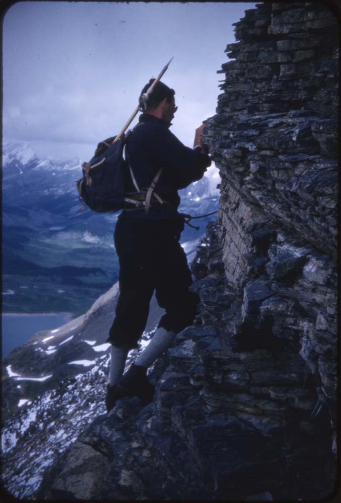
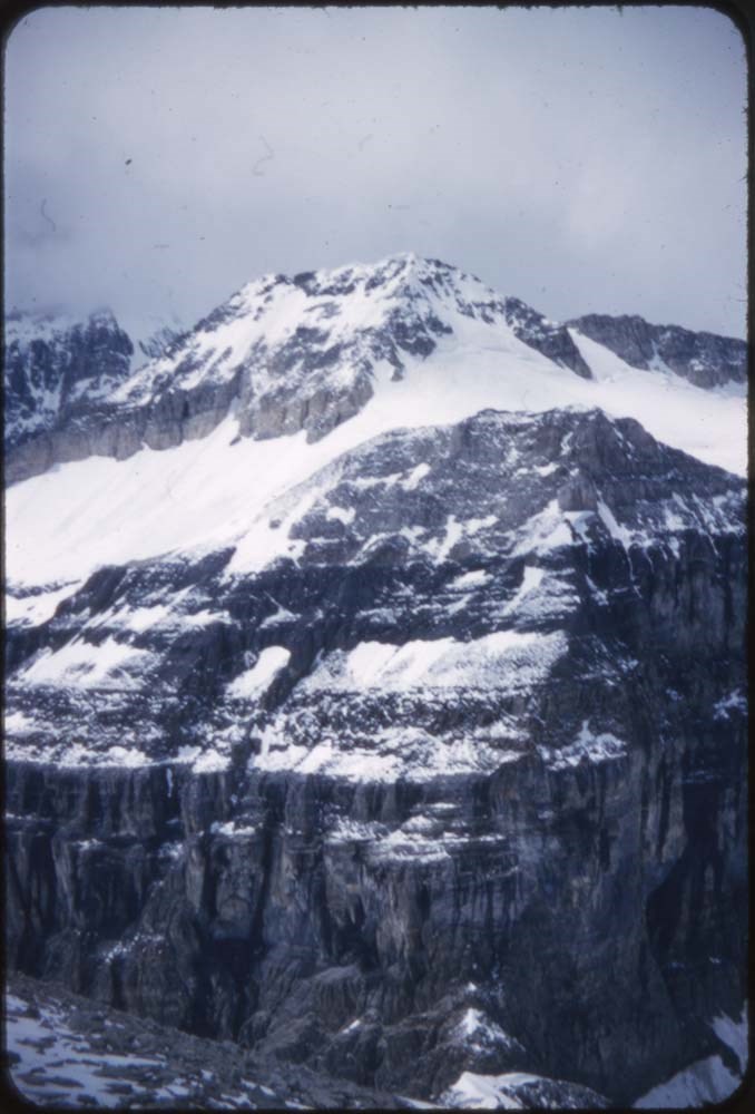
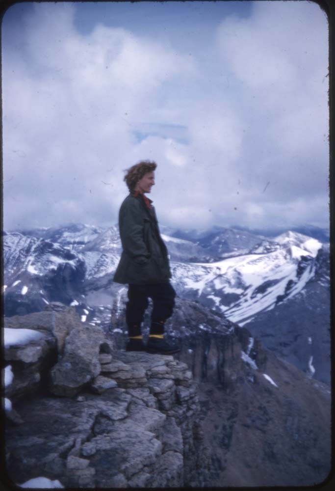
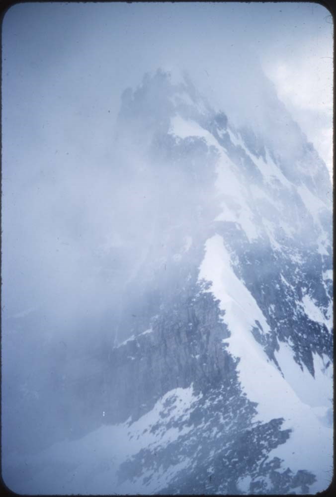
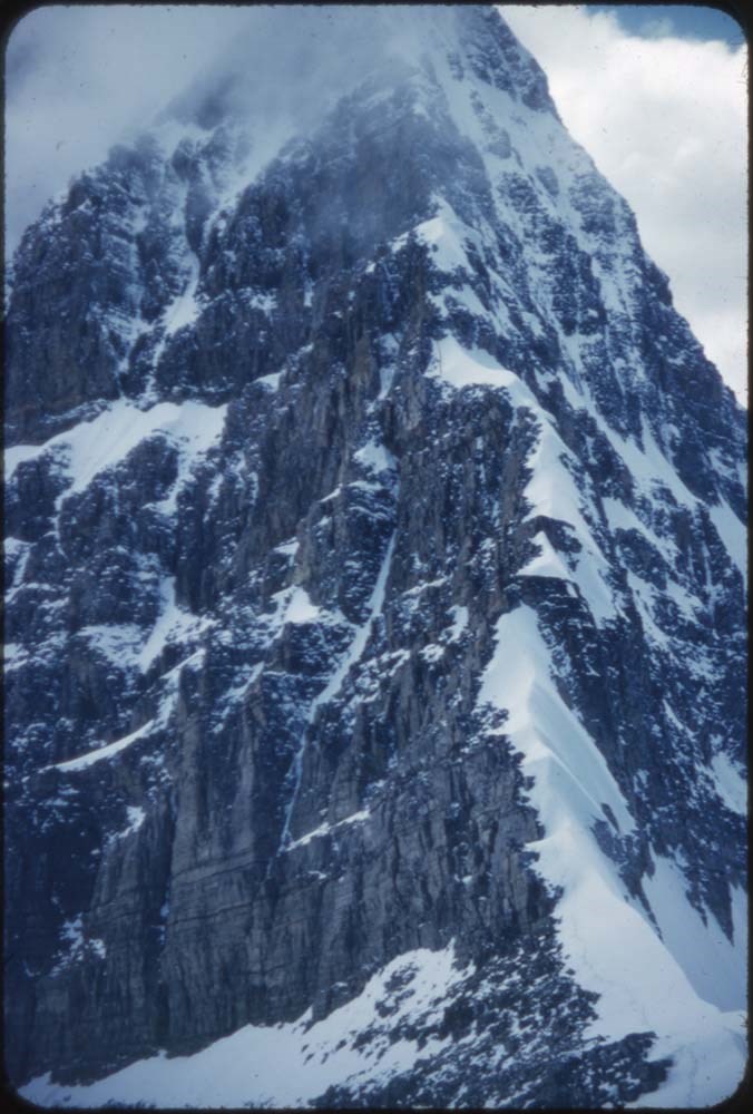
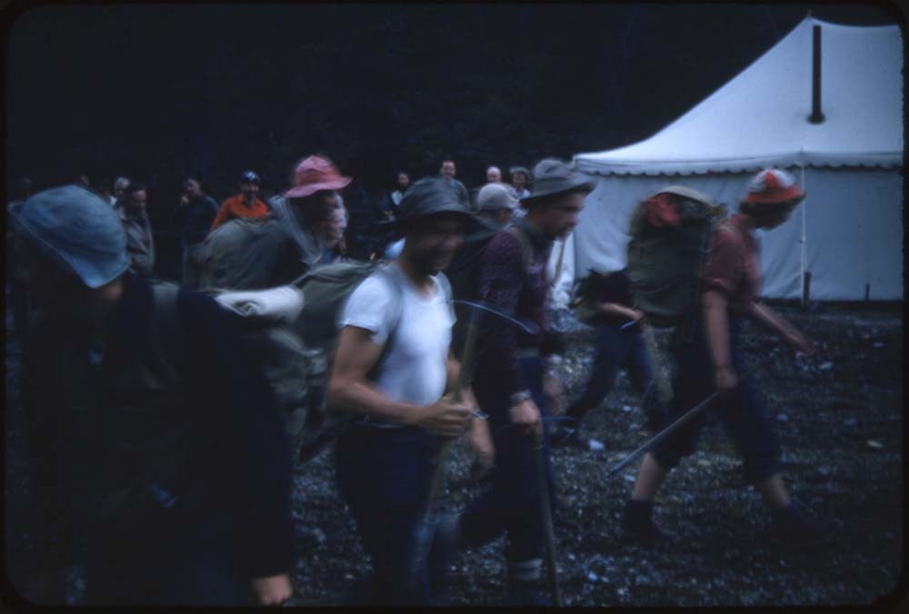
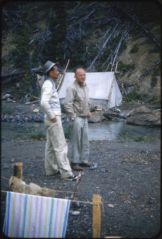
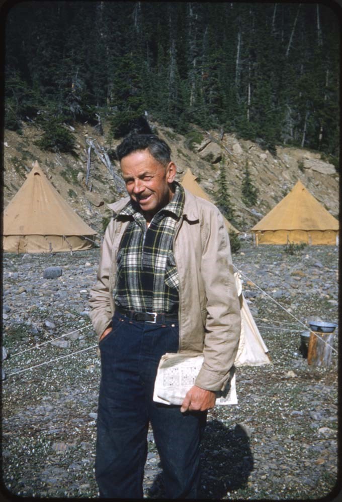
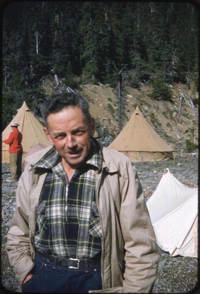
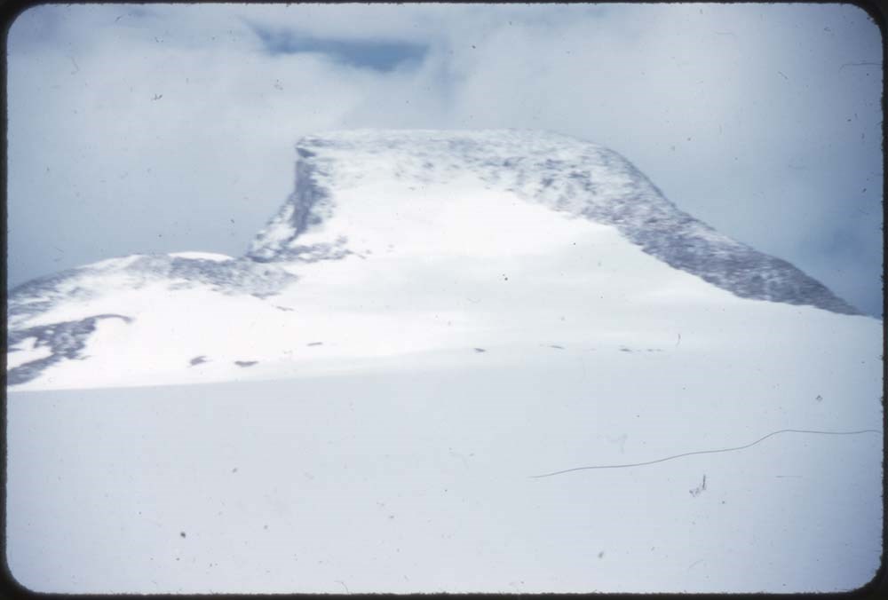
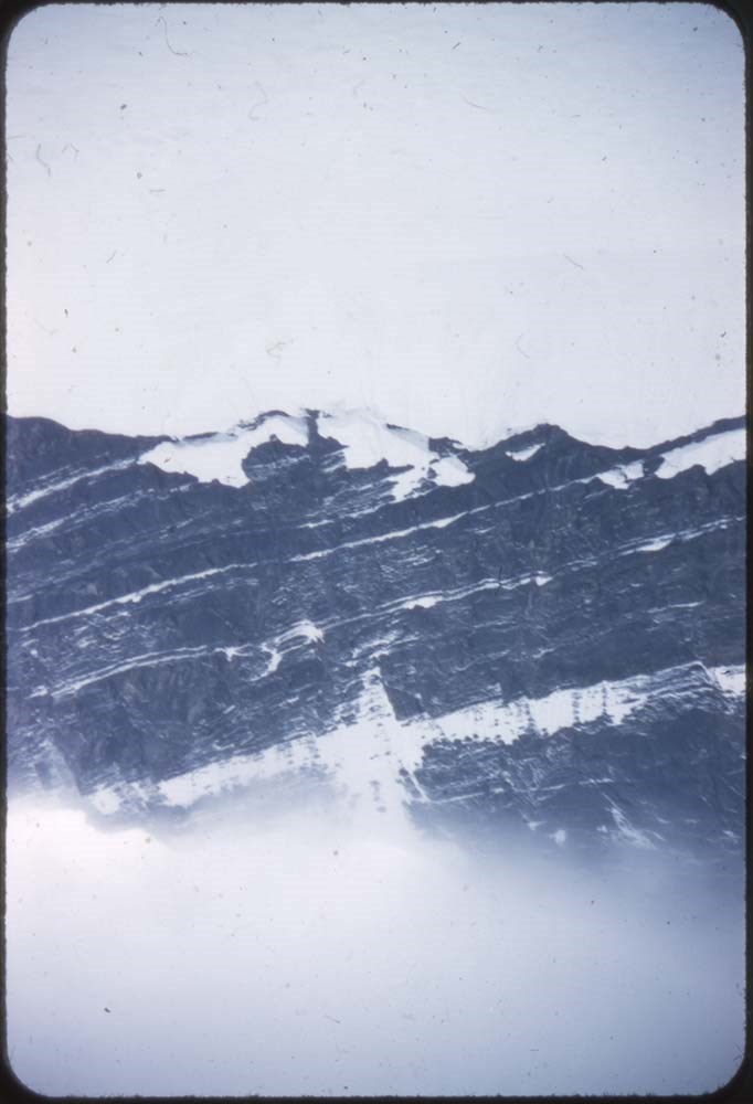
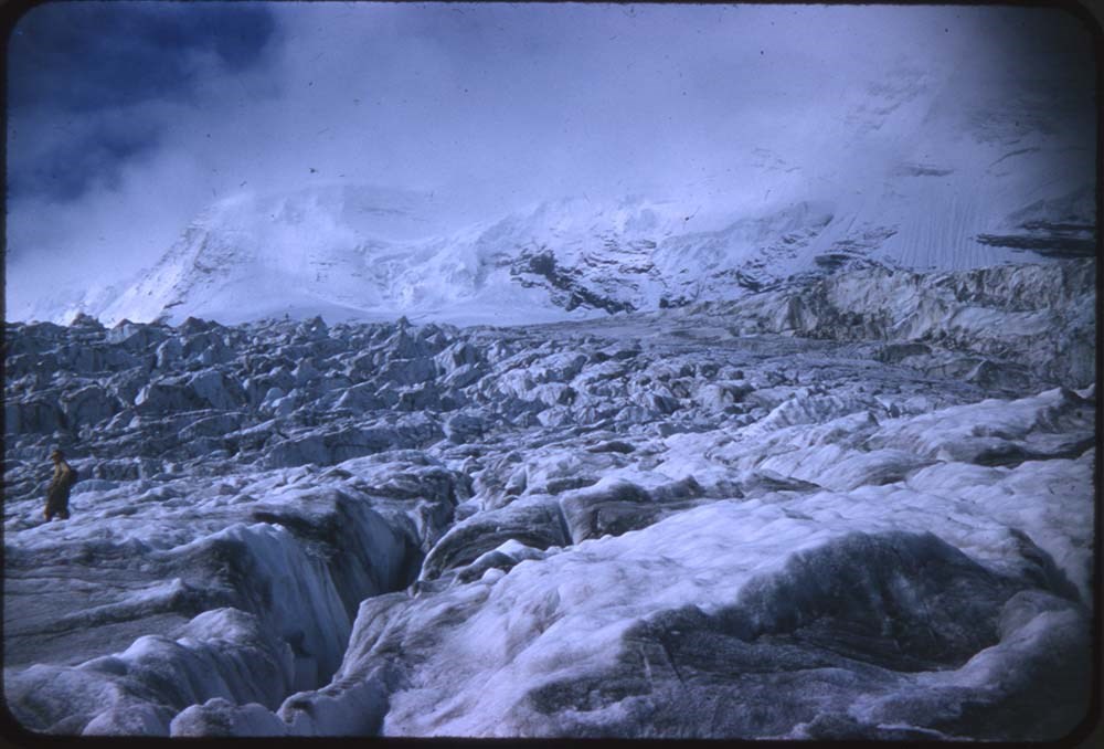
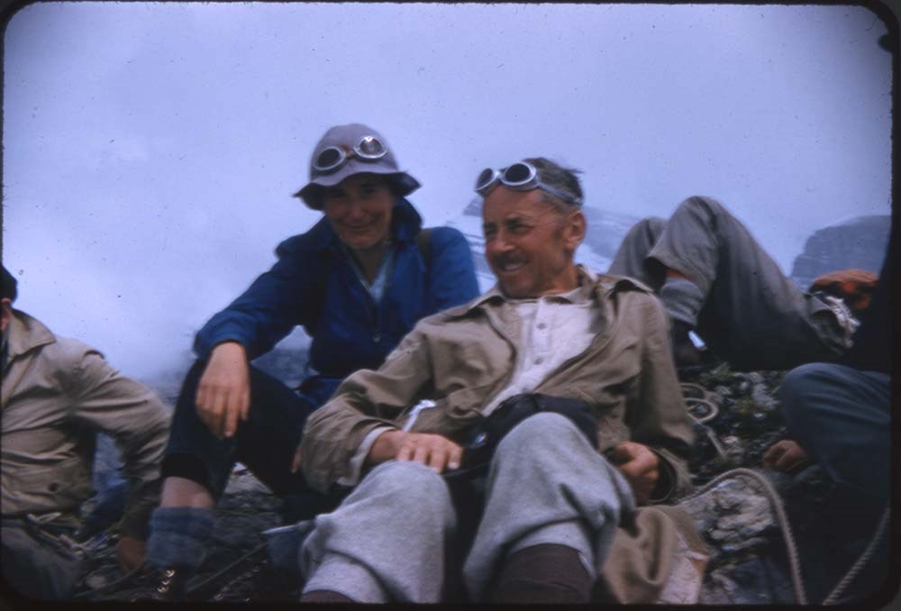
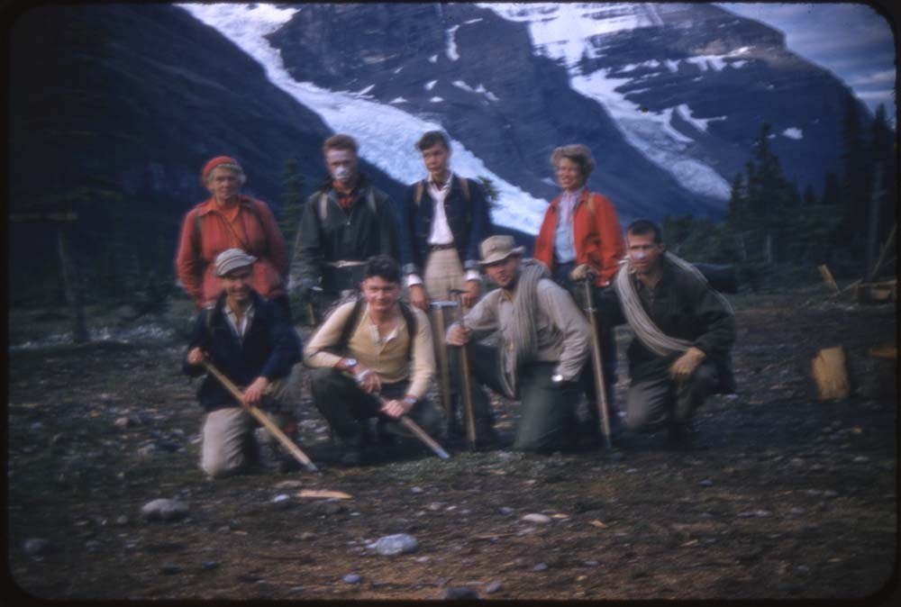
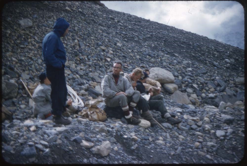
ACC Camps [2/3]
https://archives.whyte.org/en/permalink/descriptions57611
- Part Of
- Bill Goodrich fonds
- Scope & Content
- File pertains to 121 35 mm slides depictiong Alpine Club of Canada Camps from 1953-1955 & 1957, consisting of scenic shots of mountain scenes and people climbing, portraits of various camp members, group portraits, waterfalls, glaciers, summit poses, and more. Contents include: 1953 - Mt. Hooker (&…
- Date Range
- 1953-1957
- Reference Code
- V106 / NS - 133 to NS - 254
- Description Level
- 5 / File
- GMD
- Photograph
- Transparency
121 images
- Part Of
- Bill Goodrich fonds
- Description Level
- 5 / File
- Fonds Number
- V106
- Sous-Fonds
- V106
- Accession Number
- 7765
- Reference Code
- V106 / NS - 133 to NS - 254
- Date Range
- 1953-1957
- Physical Description
- 121 photographs : col. slides ; 35 mm
- History / Biographical
- See fonds level description.
- Scope & Content
- File pertains to 121 35 mm slides depictiong Alpine Club of Canada Camps from 1953-1955 & 1957, consisting of scenic shots of mountain scenes and people climbing, portraits of various camp members, group portraits, waterfalls, glaciers, summit poses, and more. Contents include: 1953 - Mt. Hooker (& Edith Cavell): 1-47 1954 - The Goodsirs: 49-58 1955 - Mt. Robson: 60-120 1957 - Robson from JEAN: 121-123 Robson Glacier: 124
- Name Access
- Alpine Club of Canada
- Goodrich, Bill
- Subject Access
- Activities
- Alpine Club of Canada
- Buildings
- Camping
- Camps
- Climbing
- Glaciers
- Hiking
- Lake O'hara
- Mountaineering
- Mountaineers
- Mountains
- Parks Canada
- Photography
- Portrait
- Scenery
- scenic
- Waterfalls
- Women
- Geographic Access
- Jasper
- Jasper National Park
- Alberta
- Lake O'Hara
- Yoho National Park
- Assiniboine
- Assiniboine Provincial Park
- British Columbia
- Language
- English
- Finding Aid
- No finding aid
- Creator
- Goodrich, Bill
- Title Source
- Title based on contents of fonds
- Processing Status
- Processed
Images


This material is presented as originally created; it may contain outdated cultural descriptions and
potentially offensive content.
Read more.
Mount Deltaform Summit Note
https://archives.whyte.org/en/permalink/descriptions57779
- Part Of
- Alpine Club of Canada fonds
- Scope & Content
- File consists of a summit record from Mount Deltaform produced by the Alpine Club of Canada in 1983. Summit note by Hans Fuhrer and David Wilkinson depicting their route to the summit.
- Date Range
- 1983
- Reference Code
- M200 / V / A / 193
- Description Level
- 5 / File
- GMD
- Textual record
- Organization record
- Part Of
- Alpine Club of Canada fonds
- Description Level
- 5 / File
- Fonds Number
- M200
- V14
- S6
- Series
- M200 / V: Summit Records
- Sous-Fonds
- M200
- Sub-Series
- M200 / V / A: Identified Summit Records
- Accession Number
- accn. 8119
- Reference Code
- M200 / V / A / 193
- Responsibility
- Summit Registers and Notes produced by Alpine Club of Canada
- Date Range
- 1983
- Physical Description
- 0.5 cm of textual record 1 summit note
- History / Biographical
- Mount Deltaform is located in the Valley of the Ten Peaks, along the Continental Divide/Great Divide of the Canadian Rockies. Mount Deltaform is also on the border of Kootenay National Park, BC and Banff National Park, AB. Nearby are Hungabee Mountain, Mount Tuzo, and Mount Whymper.
- Scope & Content
- File consists of a summit record from Mount Deltaform produced by the Alpine Club of Canada in 1983. Summit note by Hans Fuhrer and David Wilkinson depicting their route to the summit.
- Name Access
- Alpine Club of Canada
- Subject Access
- Alberta
- Banff National Park
- British Columbia
- Climbing
- Description and travel
- Environment
- Environment and Nature
- Great Divide
- Hiking
- Mountain
- Mountaineering
- Mountaineers
- Mountains
- National parks and reserves
- Record keeping
- Sports and leisure
- Sports and recreation
- Summit
- Geographic Access
- Canada
- Canadian Rocky Mountains
- Rocky Mountains
- Continental Divide
- Great Divide
- Alberta
- British Columbia
- Banff National Park
- Kootenay National Park
- Valley of the Ten Peaks
- Hungabee Mountain
- Mount Whymper
- Mount Tuzo
- Mount Deltaform
- Access Restrictions
- Restrictions may apply
- Language
- English
- Related Material
- M235
- Biographical Source Notes
- Peak Finder: Deltaform Mountain, Canadian Rockies Database: https://cdnrockiesdatabases.ca/peaks/365
- Title Source
- Original title
- Processing Status
- Processed
This material is presented as originally created; it may contain outdated cultural descriptions and
potentially offensive content.
Read more.
Mount Victoria Summit Record
https://archives.whyte.org/en/permalink/descriptions57688
- Part Of
- Alpine Club of Canada fonds
- Scope & Content
- File consists of one summit register from Mount Victoria produced by the Alpine Club of Canada between 1998 and 2004. Summit record include entries from visitors to the various summits which pertain to individuals' hiking and climbing trips; details of specific events which occurred while at the su…
- Date Range
- September 1998 - August 2004
- Reference Code
- M200 / V / A / 81
- Description Level
- 5 / File
- GMD
- Textual record
- Organization record
- Part Of
- Alpine Club of Canada fonds
- Description Level
- 5 / File
- Fonds Number
- M200
- V14
- S6
- Series
- M200 / V: Summit Records
- Sous-Fonds
- M200
- Sub-Series
- M200 / V / A: Identified Summit Records
- Accession Number
- accn. 8002
- Reference Code
- M200 / V / A / 81
- Responsibility
- Summit Registers and Notes produced by Alpine Club of Canada
- Date Range
- September 1998 - August 2004
- Physical Description
- 1 cm of textual records 1 volume
- History / Biographical
- Mount Victoria is located in both Yoho National Park, B. C. and Banff National Park, AB in the Canadian Rockies. The mountain is part of the mountain range along the Continental Divide, between Alberta and B.C. Nearby are Lake O'Hara, Lake Louise, Abbot Pass and Mount Lefroy. Mount Victoria was named for Queen Victoria.
- Scope & Content
- File consists of one summit register from Mount Victoria produced by the Alpine Club of Canada between 1998 and 2004. Summit record include entries from visitors to the various summits which pertain to individuals' hiking and climbing trips; details of specific events which occurred while at the summit, wildlife sightings, trail updates, and related topics. File: M200 / V / A / 81: Summit - MT. Victoria, Sept. 1998 - Aug. 2004
- Name Access
- Alpine Club of Canada
- Subject Access
- Alberta
- Abbot Pass
- Alpine Club of Canada
- Backcountry skiing
- Backpacking
- Banff National Park
- Bow Valley
- British Columbia
- Climbing
- Club
- Cross-country skiing
- Description and travel
- Environment
- Environment and Nature
- Hiking
- Lake Louise
- Lake O'hara
- Mountain
- Mountaineering
- Mountaineers
- Mountains
- Parks Canada
- Record keeping
- Ski area
- Ski areas
- Ski mountaineering
- Ski touring
- Skiers
- Skiing
- Snowshoes and snowshoeing
- Sports and leisure
- Sports and recreation
- Summit
- Trails
- Winter sports
- Geographic Access
- Canada
- Alberta
- British Columbia
- Banff National Park
- Yoho National Park
- Lake O'Hara
- Lake Louise
- Lake Louise, AB
- Abbot Pass
- Abbott Pass
- Mount Lefroy
- Mount Victoria
- Access Restrictions
- Restrictions may apply
- Language
- English
- French
- German
- Japanese
- Related Material
- M235
- Biographical Source Notes
- Peak Finder: Mount Victoria, Canadian Rockies Database: https://cdnrockiesdatabases.ca/peaks/1459
- Title Source
- Title based on contents of file
- Processing Status
- Processed
This material is presented as originally created; it may contain outdated cultural descriptions and
potentially offensive content.
Read more.
Mt. Little Summit Register
https://archives.whyte.org/en/permalink/descriptions57757
- Part Of
- Alpine Club of Canada fonds
- Scope & Content
- File consists of summit notes from Mount Little produced by the Alpine Club of Canada between 2001 and 2017. Summit notes include entries from visitors to the various summits which pertain to individuals' hiking and climbing trips; details of specific events which occurred while at the summit, wild…
- Date Range
- 2001-2017
- Reference Code
- M200 / V / A / 170
- Description Level
- 5 / File
- GMD
- Textual record
- Organization record
- Part Of
- Alpine Club of Canada fonds
- Description Level
- 5 / File
- Fonds Number
- M200
- V14
- S6
- Series
- M200 / V: Summit Records
- Sous-Fonds
- M200
- Sub-Series
- M200 / V / A: Identified Summit Records
- Accession Number
- accn. 2018.9010
- Reference Code
- M200 / V / A / 170
- Responsibility
- Summit Registers and Notes produced by Alpine Club of Canada
- Date Range
- 2001-2017
- Physical Description
- 1 volume 1 cm of textual records
- History / Biographical
- Mount Little is located on the Continental/Great Divide, and is part of the Canadian Rockies on the border of Alberta and British Columbia.
- Scope & Content
- File consists of summit notes from Mount Little produced by the Alpine Club of Canada between 2001 and 2017. Summit notes include entries from visitors to the various summits which pertain to individuals' hiking and climbing trips; details of specific events which occurred while at the summit, wildlife sightings, trail updates, and related topics. File: M200 / V / A / 170: Mt. Little Summit Register
- Name Access
- Alpine Club of Canada
- Subject Access
- Alberta
- Alpine Club of Canada
- Backpacking
- Banff National Park
- British Columbia
- Climbing
- Club
- Description and travel
- Environment
- Environment and Nature
- Great Divide
- Hiking
- Mountain
- Mountaineering
- Mountaineers
- Mountains
- National parks and reserves
- Record keeping
- Sports and leisure
- Sports and recreation
- Summit
- Trails
- Geographic Access
- Canada
- Great Divide
- Continental Divide
- Canadian Rocky Mountains
- Rocky Mountains
- British Columbia
- Alberta
- Kootenay National Park
- Banff National Park
- Lake Louise
- Valley of the Ten Peaks
- Mount Victoria
- Mount Temple
- Mount Babel
- Mount Bell
- Deltaform Mountain
- Mount Little
- Access Restrictions
- Restrictions may apply
- Language
- English
- Conservation
- Summit notes are written on sticky notes; some pages have stuck together. Glue from sticky notes has bled onto the pages.
- Related Material
- M235
- Biographical Source Notes
- Peak Finder: Mount Little, Canadian Rockies Database: https://cdnrockiesdatabases.ca/peaks/788
- Title Source
- Original title
- Processing Status
- Processed
This material is presented as originally created; it may contain outdated cultural descriptions and
potentially offensive content.
Read more.
Mt. Whymper Summit Registry
https://archives.whyte.org/en/permalink/descriptions57778
- Part Of
- Alpine Club of Canada fonds
- Scope & Content
- File consists of a summit record from Mount Whymper produced by the Alpine Club of Canada between 1987 and 2007. Summit record includes entries from visitors to the various summits which pertain to individuals' hiking and climbing trips; details of specific events which occurred while at the summit…
- Date Range
- 1987-2007
- Reference Code
- M200 / V / A / 192
- Description Level
- 5 / File
- GMD
- Textual record
- Organization record
- Part Of
- Alpine Club of Canada fonds
- Description Level
- 5 / File
- Fonds Number
- M200
- V14
- S6
- Series
- M200 / V: Summit Records
- Sous-Fonds
- M200
- Sub-Series
- M200 / V / A: Identified Summit Records
- Accession Number
- accn. 8119
- Reference Code
- M200 / V / A / 192
- Responsibility
- Summit Registers and Notes produced by Alpine Club of Canada
- Date Range
- 1987-2007
- Physical Description
- 1 volume 1 cm of textual record
- History / Biographical
- Mount Whymper is located in Kootenay National Park, British Columbia, near the Continental Divide/Great Divide, in the Canadian Rockies. Nearby are Storm Mountain, Vermillion Peak, Highway 93 and Chimper Peak.
- Scope & Content
- File consists of a summit record from Mount Whymper produced by the Alpine Club of Canada between 1987 and 2007. Summit record includes entries from visitors to the various summits which pertain to individuals' hiking and climbing trips; details of specific events which occurred while at the summit, wildlife sightings, trail updates, and related topics. File: M200 / V / A / 192: Mt. Whymper Summit Registry
- Name Access
- Alpine Club of Canada
- Subject Access
- Alpine Club of Canada
- Backpacking
- British Columbia
- Climbing
- Club
- Description and travel
- Environment
- Environment and Nature
- Great Divide
- Hiking
- Mountain
- Mountaineering
- Mountaineers
- Mountains
- National parks and reserves
- Record keeping
- Sports and leisure
- Sports and recreation
- Summit
- Trails
- Geographic Access
- Canada
- Canadian Rocky Mountains
- Rocky Mountains
- Continental Divide
- Great Divide
- British Columbia
- Kootenay National Park
- Vermilion River Valley
- Storm Mountain
- Vermillion Peak
- Mount Whymper
- Access Restrictions
- Restrictions may apply
- Language
- English
- French
- Conservation
- Register contains some rust damage, particularly along the spine of the register. Potential mold.
- Related Material
- M235
- Biographical Source Notes
- Peakery: Mount Whymper map, Peakery: https://peakery.com/mount-whymper-british-columbia/map/
- Title Source
- Original title
- Processing Status
- Processed
This material is presented as originally created; it may contain outdated cultural descriptions and
potentially offensive content.
Read more.
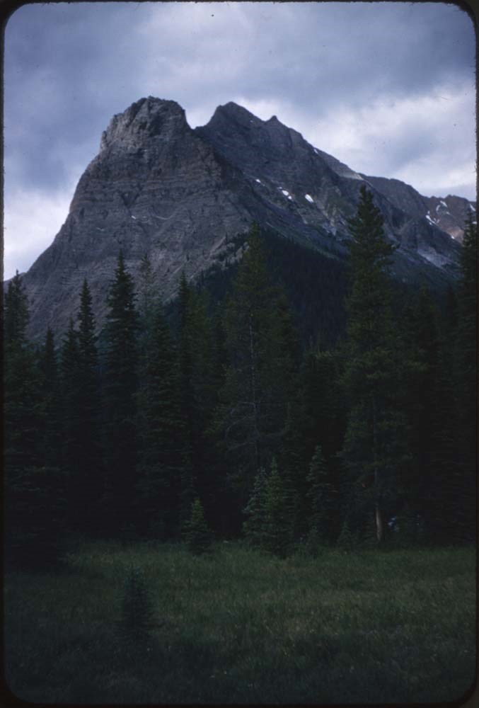
Storm Mountain Summit Records
https://archives.whyte.org/en/permalink/descriptions57676
- Part Of
- Alpine Club of Canada fonds
- Scope & Content
- Files consist of summit notes and summit registers from Storm Mountain produced by the Alpine Club of Canada between 1993 and 2009. Summit records include entries from visitors to the various summits which pertain to individuals' hiking and climbing trips; details of specific events which occurred …
- Date Range
- 1993 - 2009
- Reference Code
- M200 / V / A / 57 to 60
- Description Level
- 5 / File
- GMD
- Textual record
- Organization record
- Part Of
- Alpine Club of Canada fonds
- Description Level
- 5 / File
- Fonds Number
- M200
- V14
- S6
- Series
- M200 / V: Summit Records
- Sous-Fonds
- M200
- Sub-Series
- M200 / V / A: Identified Summit Records
- Accession Number
- accn. 8002 accn. 7779 accn. 2014.8315
- Reference Code
- M200 / V / A / 57 to 60
- Responsibility
- Summit Registers and Notes produced by Alpine Club of Canada
- Date Range
- 1993 - 2009
- Physical Description
- 4 cm of textual records 4 volumes
- History / Biographical
- Storm Mountain is located on the Continental Divide between Alberta and British Columbia, and is also on the boundary between Kootenay National Park and Banff National Park. Nearby are Castle Mountain, Vermilion Pass and Stanley Peak.
- Scope & Content
- Files consist of summit notes and summit registers from Storm Mountain produced by the Alpine Club of Canada between 1993 and 2009. Summit records include entries from visitors to the various summits which pertain to individuals' hiking and climbing trips; details of specific events which occurred while at the summit, wildlife sightings, trail updates, and related topics. Files include: M200 / V / A / 57: Summit Register - Storm Mtn., 1993 - 2009 M200 / V / A / 58: Storm Mountain July 1994 - August 2004 M200 / V / A / 59: Summit Register - MT. Storm (Banff), 2005 M200 / V / A / 60: Mt. Storm Summit Register [2005-2009]
- Name Access
- Alpine Club of Canada
- Subject Access
- Alpine Club of Canada
- Alberta
- Backcountry skiing
- Backpacking
- Banff National Park
- British Columbia
- Castle Mountain
- Climbing
- Environment
- Environment and Nature
- Hiking
- Mountain
- Mountaineering
- Mountaineers
- Mountains
- National parks and reserves
- Ski mountaineering
- Skiing
- Sports and leisure
- Sports and recreation
- Summit
- Trails
- Winter sports
- Geographic Access
- Canada
- Alberta
- British Columbia
- Banff National Park
- Kootenay National Park
- Castle Mountain
- Vermilion Pass
- Stanley Peak
- Access Restrictions
- Restrictions may apply
- Language
- English
- French
- Conservation
- Some registers contain water damage. Some registers are loose pages and have been placed in mylar.
- Related Material
- M235
- Biographical Source Notes
- Storm Mountain, North East Face, 1988, In Alpinism no.1, p.60-61, Archives Library, Call Number P
- Title Source
- Title based on contents of file
- Processing Status
- Processed
This material is presented as originally created; it may contain outdated cultural descriptions and
potentially offensive content.
Read more.
Vermillion Peak Summit Register [Vermilion Peak]
https://archives.whyte.org/en/permalink/descriptions57756
- Part Of
- Alpine Club of Canada fonds
- Scope & Content
- File consists of a summit record from Vermilion Peak produced by the Alpine Club of Canada between 2008 and 2017. Summit record includes entries from visitors to the various summits which pertain to individuals' hiking and climbing trips; details of specific events which occurred while at the summi…
- Date Range
- 2008-2017
- Reference Code
- M200 / V / A / 169
- Description Level
- 5 / File
- GMD
- Textual record
- Organization record
- Part Of
- Alpine Club of Canada fonds
- Description Level
- 5 / File
- Fonds Number
- M200
- V14
- S6
- Series
- M200 / V: Summit Records
- Sous-Fonds
- M200
- Sub-Series
- M200 / V / A: Identified Summit Records
- Accession Number
- accn. 2018.9010
- Reference Code
- M200 / V / A / 169
- Responsibility
- Summit Registers and Notes produced by Alpine Club of Canada
- Date Range
- 2008-2017
- Physical Description
- 1 volume 0.5 cm of textual record
- History / Biographical
- Vermilion Peak is part of the the Ball Range of the Canadian Rockies, the Continental Divide / Great Divide, and is located in the Vermilion River Valley of Kootenay National Park, British Columbia.
- Scope & Content
- File consists of a summit record from Vermilion Peak produced by the Alpine Club of Canada between 2008 and 2017. Summit record includes entries from visitors to the various summits which pertain to individuals' hiking and climbing trips; details of specific events which occurred while at the summit, wildlife sightings, trail updates, and related topics. File: M200 / V / A / 169: Vermillion Peak Summit Register [Vermilion Peak]
- Name Access
- Alpine Club of Canada
- Subject Access
- Alpine Club of Canada
- Backpacking
- British Columbia
- Climbing
- Club
- Description and travel
- Environment
- Environment and Nature
- Great Divide
- Hiking
- Mountain
- Mountaineering
- Mountaineers
- Mountains
- National parks and reserves
- Record keeping
- Sports and leisure
- Sports and recreation
- Summit
- Trails
- Geographic Access
- Canada
- Continental Divide
- Great Divide
- Canadian Rocky Mountains
- Rocky Mountains
- Ball Range
- British Columbia
- Kootenay National Park
- Vermilion River Valley
- Vermilion Peak
- Vermillion Peak
- Access Restrictions
- Restrictions may apply
- Language
- English
- Conservation
- Some of the ink from entries has bled, making some entries illegible
- Related Material
- M235
- Biographical Source Notes
- Peak Finder: Vermilion Peak, Canadian Rockies Database: https://cdnrockiesdatabases.ca/peaks/1454
- Title Source
- Title based on contents of file
- Processing Status
- Processed
This material is presented as originally created; it may contain outdated cultural descriptions and
potentially offensive content.
Read more.