Narrow Results By
- Alpine Club of Canada fonds 592
- Ben Gadd fonds 338
- Luxton family fonds 238
- Trail Riders of the Canadian Rockies fonds 114
- Moore family fonds 71
- Nicholas Morant fonds 46
- Maryalice Harvey Stewart fonds 36
- Kidney family fonds 35
- Chic Scott fonds 33
- Archives General File Collection 29
- Murray Hay fonds
- Lake O'Hara Trails Club fonds 24
Peter and Catharine Whyte fonds
https://archives.whyte.org/en/permalink/descriptions36
- Part Of
- Peter and Catharine Whyte fonds
- Scope & Content
- Fonds consists of papers, photographs and sound recordings of Peter and Catharine Whyte and the papers and photographs of their respective families. Consists of three sous-fonds: V683, S37 and M36. M36 and S37 consists of three series. Series I: Peter and Catharine Whyte, Series II: Robb and Morse …
- Date Range
- 1856-1980
- Reference Code
- M36 / S37 / V683
- Description Level
- 1 / Fonds
- GMD
- Drawing
- Motion picture
- Film
- Photograph
- Album
- Ambrotype
- Cased photograph
- Daguerreotype
- Negative
- Photograph print
- Postcard
- Tintype
- Transparency
- Sound recording
- Cassette
- Reel to reel
- Textual record
- Plan
- Poster
- Private record
- Published record
1 Electronic Resource
- Part Of
- Peter and Catharine Whyte fonds
- Description Level
- 1 / Fonds
- Fonds Number
- M36 / V683 / S37
- Sous-Fonds
- TBD
- Accession Number
- 3069 and various
- Reference Code
- M36 / S37 / V683
- GMD
- Drawing
- Motion picture
- Film
- Photograph
- Album
- Ambrotype
- Cased photograph
- Daguerreotype
- Negative
- Photograph print
- Postcard
- Tintype
- Transparency
- Sound recording
- Cassette
- Reel to reel
- Textual record
- Plan
- Poster
- Private record
- Published record
- Other Title Info
- Also known as the Whyte family fonds
- Date Range
- 1856-1980
- Physical Description
- 25 m of textual records. -- ca.46,000 photographs : prints, albums, postcards, cased photographs, transparencies, negatives. -- 178 sound recordings : audio tape reels, audio tape cassettes. -- 6 motion pictures (and film strips)
- History / Biographical
- Peter and Catharine Whyte were artists, photographers, outdoor enthusiasts, travelers, philanthropists and cultural workers at Banff, Alberta, Canada. Peter Whyte, 1905-1966, was born at Banff in 1905 to pioneer merchant Dave White and Annie (Curren) White. He was an accomplished skier and ski jumper and one of the region's first native-born painters with an intimate knowledge of the mountains and was an active photographer from ca.1920 until the 1950s. Peter Whyte studied art at the Otis Art Institute, Los Angeles, 1923-1924, and at the School of the Museum of Fine Arts at Boston, 1925, where he met Catharine Robb. Catharine Robb Whyte, 1906-1979, was born in 1906 at Concord, Massachusetts and grew up amongst the wealth and creativity of the Robb and Morse families. She studied at the School of the Museum of Fine Arts at Boston, 1925-1929.
- Following their marriage in 1930, the Whytes pursued a life of painting, photography, hiking, skiing and travelling. Their log home and studio in Banff became a focal point for their artist friends, Stoney Indians and local pioneers. Catharine shared Pete's involvement in skiing and hiking organizations and together they managed Skoki Lodge from 1932-1934. In following years, the Whytes travelled extensively. During the Second World War, Peter served in the reserve army, with the Royal Canadian Air Force as a photographer and, briefly, as an official war artist. Catharine continued to paint and maintain their home and, when possible, accompanied Pete to his military postings. In civilian life, Pete resumed his art career, explored new photographic techniques and sculpted.
- Throughout the 1950s and 1960s, the Whytes formulated plans for a foundation to preserve the art and history of the Canadian Rockies. Plans for a building to house an archives, public library and gallery were in preparation when Pete died in 1966. The Peter Whyte Foundation was named in his honour. Catharine immersed herself in the development of what is now the Whyte Museum of the Canadian Rockies, in the cultural community, painting, outdoor activity, travel and work with the Stoney First Nations. She became a more active photographer, recording her travels and outdoor pursuits. She served in an official capacity with numerous cultural and charitable organizations, was a patron to individuals studying art and music, and supported numerous causes relating to the Stoney First Nations. Catharine also supported causes related to multiculturalism, regional culture and recreation, and cancer research. Despite her modesty and often anonymous patronage of causes, Catharine was recognized with numerous awards and honours, including the Order of Canada in 1978. She died in Banff in 1979.
- Scope & Content
- Fonds consists of papers, photographs and sound recordings of Peter and Catharine Whyte and the papers and photographs of their respective families. Consists of three sous-fonds: V683, S37 and M36. M36 and S37 consists of three series. Series I: Peter and Catharine Whyte, Series II: Robb and Morse families, Series III: White and Curren families. Within Series I, there are four Sub-series: Series: A. Catharine Robb Whyte papers; B. Peter Whyte papers; C. Peter and Catharine Whyte papers accessioned after 2017; D. Peter and Catharine Whyte sound recordings.
- Name Access
- Whyte, Peter
- Whyte, Catharine
- Subject Access
- Arts
- Communications
- Environment
- Exploration, discovery and travel
- Family and personal life
- First nations
- Sports, recreation and leisure
- Access Restrictions
- Some restriction/s on access
- Copyright, privacy, commercial use and other restrictions may apply
- Language
- Language is English
- Finding Aid
- Finding aids and reference tools: arrangement outline
- sous-fonds, series and file description for textual
- sub-series and group description for photographs
- item description, subject/proper name index, and summaries for sound recordings
- reference copies for sound recordings
- Creator
- Whyte, Peter
- Whyte, Catharine
- Category
- Arts
- Communications
- Environment
- Exploration, discovery and travel
- Family and personal life
- First nations
- Sports, recreation and leisure
- Title Source
- Title based on contents of fonds
- Processing Status
- Processed
Electronic Resources
This material is presented as originally created; it may contain outdated cultural descriptions and
potentially offensive content.
Read more.
- Part Of
- Murray Hay fonds
- Scope & Content
- File consists of 144 photographs : col. negatives ; 35 m m; 12 prints : col. ; 42 x 35 cm or smaller ; 1 cm of visual material. File pertains to various projects Murray Hay was involved with related to Alaska, USA, particularly in the mid-1990s. File includes: aerial photographs of the landscape (A…
- Date Range
- ca.1990-ca.1999
- 1992
- 1994
- Reference Code
- V795 / II / D / i / 1-2
- Description Level
- 5 / File
- GMD
- Drawing
- Map
- Photograph print
- Negative
- Private record
- Textual record
- Part Of
- Murray Hay fonds
- Description Level
- 5 / File
- Fonds Number
- M570 / V795
- Series
- V795 / II : Unpublished Material
- Sous-Fonds
- V795
- Sub-Series
- V795 / II / D : International / i : United States of America
- Accession Number
- 2019.41
- Reference Code
- V795 / II / D / i / 1-2
- Date Range
- ca.1990-ca.1999
- 1992
- 1994
- Physical Description
- 144 photographs : col. negatives ; 35 mm
- 12 prints : col. ; 42 x 35 cm or smaller
- 1 cm of visual material
- Scope & Content
- File consists of 144 photographs : col. negatives ; 35 m m; 12 prints : col. ; 42 x 35 cm or smaller ; 1 cm of visual material. File pertains to various projects Murray Hay was involved with related to Alaska, USA, particularly in the mid-1990s. File includes: aerial photographs of the landscape (Anchorage area, Homer, Prince William Sound, Valdez); hand-drawn draft maps of the Prince William Sound region (created for a cruise line); a variety of printed maps with annotations demonstrating comments (including a fax with an attached map from Dana at Adventure Media International); and a variety of printed reproductions of draft maps (Alyeska Ski Resort, City of Anchorage for the 1992 Olympic Bid, and Glacier Bay and the Tongass National Forest).
- Notes
- Items not in oversize (negatives) stored in downstairs vault.
- Name Access
- Hay, Murray
- Subject Access
- Advertising
- Artist
- Ski Maps
- Map
- Cartography
- Sports and recreation
- Tourism
- Tourist information
- Travel
- Geography
- Winter
- Winter sports
- Ski area
- Olympic Games (Winter)
- Geographic Access
- Alaska
- United States
- Valdez
- Prince William Sound
- Anchorage
- Glacier Bay and Tongass National Forest
- Language
- English
- Conservation
- Masking tape should be removed and alternative preservation methods used in the future.
- Related Material
- M570 / IV / A / 2-3
- Creator
- Hay, Murray
- Title Source
- Title based on contents of file
- Processing Status
- Processed
This material is presented as originally created; it may contain outdated cultural descriptions and
potentially offensive content.
Read more.
- Part Of
- Murray Hay fonds
- Scope & Content
- File consists of 2 cm of textual records, 43 x 28 cm, or smaller. File pertains to Murray Hay's work on various projects in Alaska, USA, specifically the Mount Roberts Tramway in Juneau and Anchorage's Olympic Bid for the 1992 Winter Olympics. File includes a map and/or illustration of the Mount Ro…
- Date Range
- ca.1980-1997
- 1996
- 1997
- Reference Code
- M570 / IV / A / 2-3
- Description Level
- 5 / File
- GMD
- Textual record
- Private record
- Map
- Part Of
- Murray Hay fonds
- Description Level
- 5 / File
- Fonds Number
- M570 / V795
- Series
- M570 / IV : Murray Hay Personal Papers
- Sous-Fonds
- M570
- Sub-Series
- M570 / IV / A : Correspondence
- Accession Number
- 2019.41
- Reference Code
- M570 / IV / A / 2-3
- Date Range
- ca.1980-1997
- 1996
- 1997
- Physical Description
- 2 cm of textual records (43 x 28 cm or smaller)
- Scope & Content
- File consists of 2 cm of textual records, 43 x 28 cm, or smaller. File pertains to Murray Hay's work on various projects in Alaska, USA, specifically the Mount Roberts Tramway in Juneau and Anchorage's Olympic Bid for the 1992 Winter Olympics. File includes a map and/or illustration of the Mount Roberts Tramway in Juneau, Alaska; handwritten correspondence between Hay and "Ms. Hunter" and the mailing slip (1997); a rough sketch of Hay's illustrations; tourism information related to the Mount Roberts Tramway; and correspondence and a draft example of the map for the Olympic Bid.
- Notes
- The Mount Roberts Tramway has been in operation since 1996.
- M570 / IV / A / 3 : date based on the potential connection between the records and the Olympic bid process for the 1992 Winter Olympics, for which Anchorage (Alyeska) submitted a bid using maps created by Murray Hay. The selection was determined in 1986.
- Records were originally filed in two envelopes, labelled: "Mt. Roberts Trmw." and "Prince William Sound - Valdez." File titles reflect this.
- Name Access
- Hay, Murray
- Subject Access
- Advertising
- Artist
- Cartography
- Discovery and travel
- Leisure
- Map
- Tourism
- Tourist information
- Travel
- Ski area
- Ski Maps
- Sports and recreation
- Winter
- Winter sports
- Olympic Games (Winter)
- Geographic Access
- Alaska
- United States of America
- Juneau
- Valdez
- Prince William Sound
- Language
- English
- Title Source
- Title based on contents of file
- Processing Status
- Processed
This material is presented as originally created; it may contain outdated cultural descriptions and
potentially offensive content.
Read more.
- Part Of
- Murray Hay fonds
- Scope & Content
- File consists of 1 map : col., annotations, 96.5 x 69 cm. File pertains to an original unfinished hand-drawn map of interior Arizona in red, blue, black, and purple ink. Includes geographic features and labeled cities (including Yuma, Nogales, Bisbee, and Flagstaff).
- Date Range
- ca.1990-ca.1999
- Reference Code
- V795 / II / D / i / 4
- Description Level
- 5 / File
- GMD
- Drawing
- Map
- Private record
- Textual record
- Part Of
- Murray Hay fonds
- Description Level
- 5 / File
- Fonds Number
- M570 / V795
- Series
- V795 / II : Unpublished Material
- Sous-Fonds
- V795
- Sub-Series
- V795 / II / D : International / i : United States of America
- Accession Number
- 2019.41
- Reference Code
- V795 / II / D / i / 4
- Date Range
- ca.1990-ca.1999
- Physical Description
- 1 map : col., annotations ; 96.5 x 69 cm
- Scope & Content
- File consists of 1 map : col., annotations, 96.5 x 69 cm. File pertains to an original unfinished hand-drawn map of interior Arizona in red, blue, black, and purple ink. Includes geographic features and labeled cities (including Yuma, Nogales, Bisbee, and Flagstaff).
- Name Access
- Hay, Murray
- Subject Access
- Advertising
- Artist
- Ski Maps
- Map
- Cartography
- Sports and recreation
- Tourism
- Tourist information
- Travel
- Geography
- Winter
- Winter sports
- Ski area
- Geographic Access
- Arizona
- United States
- Language
- English
- Creator
- Hay, Murray
- Title Source
- Title based on contents of file
- Processing Status
- Processed
This material is presented as originally created; it may contain outdated cultural descriptions and
potentially offensive content.
Read more.
Baja California Sur, Mexico
https://archives.whyte.org/en/permalink/descriptions54835
- Part Of
- Murray Hay fonds
- Scope & Content
- File consists of 1 cm of textual records, 21.5 x 36 cm or smaller. File pertains to a project Murray Hay worked on for Glacier Bay Tours and Cruises (based out of Alaska). File is comprised of handwritten and faxed correspondence between Hay and Steve Cowart, Manager, Creative Services. Corresponde…
- Date Range
- ca.1998
- Reference Code
- M570 / IV / A / 1
- Description Level
- 5 / File
- GMD
- Textual record
- Private record
- Map
- Part Of
- Murray Hay fonds
- Description Level
- 5 / File
- Fonds Number
- M570 / V795
- Series
- M570 / IV : Murray Hay Personal Papers
- Sous-Fonds
- M570
- Sub-Series
- M570 / IV / A : Correspondence
- Accession Number
- 2019.41
- Reference Code
- M570 / IV / A / 1
- Date Range
- ca.1998
- Physical Description
- 1 cm of textual records (21.5 x 36 cm or smaller)
- Scope & Content
- File consists of 1 cm of textual records, 21.5 x 36 cm or smaller. File pertains to a project Murray Hay worked on for Glacier Bay Tours and Cruises (based out of Alaska). File is comprised of handwritten and faxed correspondence between Hay and Steve Cowart, Manager, Creative Services. Correspondence is in regards to the map of Baja California Sur, Mexico Hay was to create for the company's promotion of their cruise to the area.
- Notes
- Originally filed with draft material related to this project [see related material].
- Name Access
- Hay, Murray
- Cowart, Steve
- Subject Access
- Advertising
- Artist
- Cartography
- Map
- Tourism
- Travel
- Tourist information
- Geographic Access
- Mexico
- Baja California Sur
- Language
- English
- Related Material
- V795 / II / D / ii / 2-3
- Title Source
- Title based on contents of file
- Processing Status
- Processed
This material is presented as originally created; it may contain outdated cultural descriptions and
potentially offensive content.
Read more.
Baja California Sur, Mexico
https://archives.whyte.org/en/permalink/descriptions54974
- Part Of
- Murray Hay fonds
- Scope & Content
- File consists of 11 maps : mss. and reproductions, some col., annotations ; 43 x 94 cm or smaller. File pertains to a project Murray Hay worked on for Glacier Bay Tours and Cruises (based out of Alaska). File includes 11 original hand-drawn and reproduced drafts, including annotations, of a map dep…
- Date Range
- ca.1990-ca.1999
- ca. 1998
- Reference Code
- V795 / II / D / ii / 2-3
- Description Level
- 5 / File
- GMD
- Drawing
- Map
- Private record
- Part Of
- Murray Hay fonds
- Description Level
- 5 / File
- Fonds Number
- M570 / V795
- Series
- V795 / II : Unpublished Material
- Sous-Fonds
- V795
- Sub-Series
- V795 / II / D : International / ii : Miscellaneous
- Accession Number
- 2019.41
- Reference Code
- V795 / II / D / ii / 2-3
- GMD
- Drawing
- Map
- Private record
- Date Range
- ca.1990-ca.1999
- ca. 1998
- Physical Description
- 11 maps : mss. and reproductions, some col., annotations ; 43 x 94 cm or smaller
- Scope & Content
- File consists of 11 maps : mss. and reproductions, some col., annotations ; 43 x 94 cm or smaller. File pertains to a project Murray Hay worked on for Glacier Bay Tours and Cruises (based out of Alaska). File includes 11 original hand-drawn and reproduced drafts, including annotations, of a map depicting the Baja California Sur region and the cruise's route in this area.
- Notes
- Originally filed with correspondence related to this project [see related material]. "For Steve Cowart" is also written on at least one map (who Murray Hay is corresponding with in M570 / IV / A / 1). Items not in oversize stored in downstairs vault.
- Name Access
- Hay, Murray
- Cowart, Steve
- Subject Access
- Advertising
- Artist
- Cartography
- Map
- Tourism
- Tourist information
- Travel
- Geography
- Geographic Access
- Mexico
- Baja California Sur
- Language
- English
- Related Material
- M570 / IV / A /1
- Creator
- Hay, Murray
- Title Source
- Title based on contents of file
- Processing Status
- Processed
This material is presented as originally created; it may contain outdated cultural descriptions and
potentially offensive content.
Read more.
Big White Ski Village
https://archives.whyte.org/en/permalink/descriptions54801
- Part Of
- Murray Hay fonds
- Scope & Content
- File consists of 0.5 cm of textual records, 90 x 60.5 cm. File pertains to ski trail maps of Big White Ski Village and Area created by Murray Hay. File includes one oversized published reproduction of a Big White trail map in poster format.
- Date Range
- ca.1980 - ca.2000
- Reference Code
- M570 / III / A / v / 1
- Description Level
- 5 / File
- GMD
- Map
- Poster
- Published record
- Textual record
- Part Of
- Murray Hay fonds
- Description Level
- 5 / File
- Fonds Number
- M570 / V795
- Series
- M570 / III : Murray Hay portfolio (published material)
- Sous-Fonds
- M570
- Sub-Series
- M570 / III / A : British Columbia / v : Big White
- Accession Number
- 2019.41
- Reference Code
- M570 / III / A / v / 1
- Date Range
- ca.1980 - ca.2000
- Physical Description
- 0.5 cm of textual records (90 x 60.5 cm)
- Scope & Content
- File consists of 0.5 cm of textual records, 90 x 60.5 cm. File pertains to ski trail maps of Big White Ski Village and Area created by Murray Hay. File includes one oversized published reproduction of a Big White trail map in poster format.
- Name Access
- Hay, Murray
- Subject Access
- Ski Maps
- Map
- Ski area
- Skiing
- Tourism
- Travel
- Winter
- Winter sports
- Sports and recreation
- Big White Ski Area
- Tourist information
- Artist
- Advertising
- Geographic Access
- Kelowna
- British Columbia
- Canada
- Language
- English
- Related Material
- V795 / II / A / iv / 5
- Title Source
- Title based on contents of file
- Processing Status
- Processed
This material is presented as originally created; it may contain outdated cultural descriptions and
potentially offensive content.
Read more.
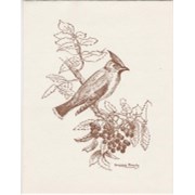
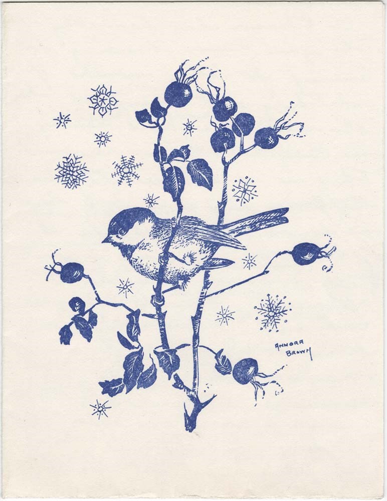
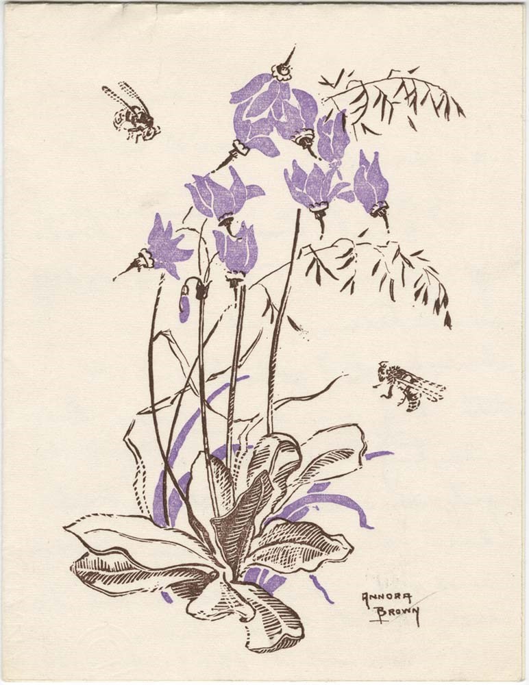
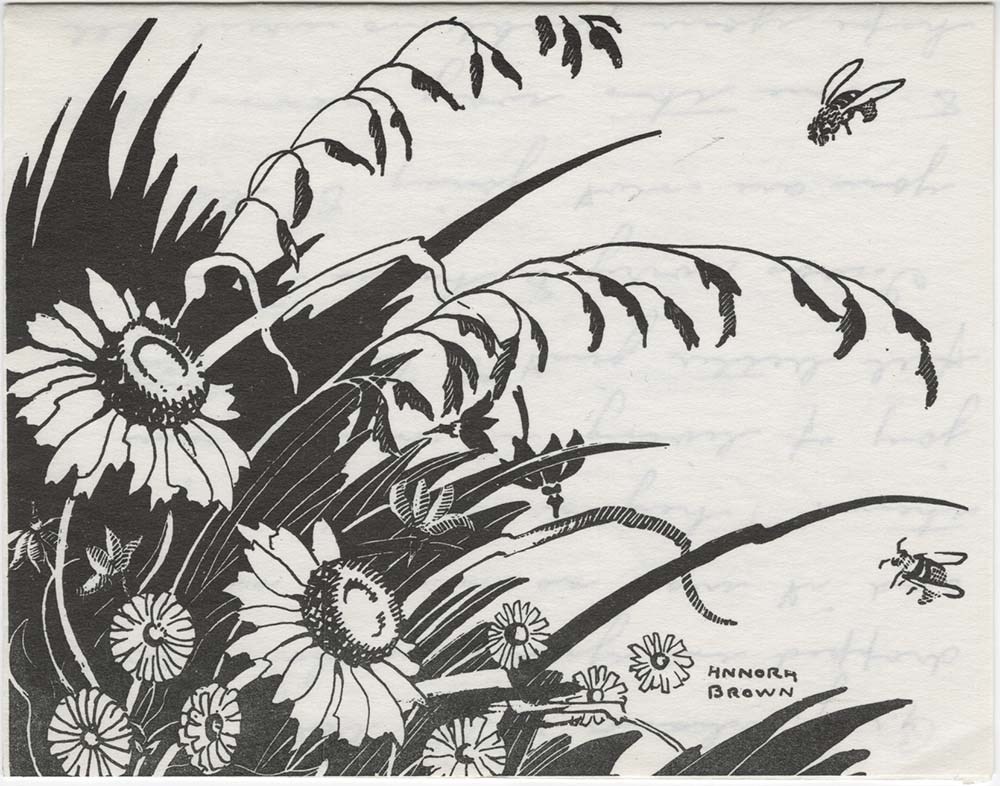
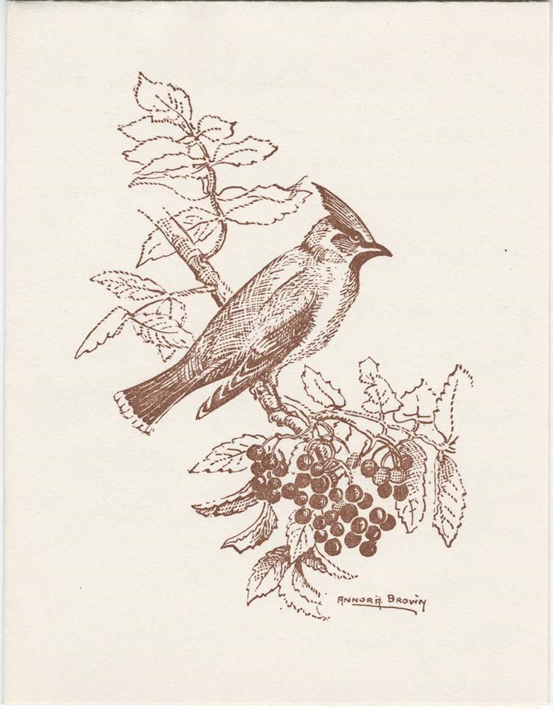
Brown, Annora : [correspondence]
https://archives.whyte.org/en/permalink/descriptions7526
- Part Of
- Peter and Catharine Whyte fonds
- Scope & Content
- Annora Brown was an artist from Fort Macleod, Alta. & moved to Sidney, B.C. in 1965. Note on original file: "Mother was a Cody." Addition of 2 letters in 2018: M36/219/45 and M36/219/46
- Date Range
- 1957-1971
- Reference Code
- M36 / I / A / 2 / c / 219
- Description Level
- 5 / File
- GMD
- Private record
- Textual record
5 images
5 Electronic Resources
- Part Of
- Peter and Catharine Whyte fonds
- Description Level
- 5 / File
- Fonds Number
- M36 / V683 / S37
- Series
- I.A.2. Catharine Robb Whyte papers / photographs
- Sous-Fonds
- M36
- Accession Number
- .
- Reference Code
- M36 / I / A / 2 / c / 219
- Responsibility
- Responsibility: Annora Brown
- Date Range
- 1957-1971
- Physical Description
- 1 file of textual records, includes newsclippings
- Scope & Content
- Annora Brown was an artist from Fort Macleod, Alta. & moved to Sidney, B.C. in 1965. Note on original file: "Mother was a Cody." Addition of 2 letters in 2018: M36/219/45 and M36/219/46
- Language
- English
- Title Source
- Title based on contents of file
- Processing Status
- Processed
Electronic Resources

Images

This material is presented as originally created; it may contain outdated cultural descriptions and
potentially offensive content.
Read more.
Calgary, Alberta
https://archives.whyte.org/en/permalink/descriptions54814
- Part Of
- Murray Hay fonds
- Scope & Content
- File consists of 1 cm of textual records, 21.5 x 35 cm. File pertains to development of The Fairways (a golf community) in Calgary, Alberta. File includes a reproduced published map of the development and surrounding area created by Murray Hay.
- Date Range
- ca. 1985-1991
- Reference Code
- M570 / III / D / i / 1
- Description Level
- 5 / File
- GMD
- Map
- Published record
- Textual record
- Part Of
- Murray Hay fonds
- Description Level
- 5 / File
- Fonds Number
- M570 / V795
- Series
- M570 / III : Murray Hay portfolio (published material)
- Sous-Fonds
- M570
- Sub-Series
- M570 / III / D : Miscellaneous / i : Canada (general)
- Accession Number
- 2019.41
- Reference Code
- M570 / III / D / i / 1
- Date Range
- ca. 1985-1991
- Physical Description
- 1 cm of textual records (21.5 x 35 cm)
- Scope & Content
- File consists of 1 cm of textual records, 21.5 x 35 cm. File pertains to development of The Fairways (a golf community) in Calgary, Alberta. File includes a reproduced published map of the development and surrounding area created by Murray Hay.
- Notes
- Date approximate based on the development of The Fairways, 1985-1991 (https://anthemunited.com/properties/the-fairways/).
- Name Access
- Hay, Murray
- Subject Access
- Advertising
- Community life
- Golfing
- Map
- Recreation
- Sports and leisure
- Sports and recreation
- Tourism
- Tourist information
- Cartography
- Artist
- Geographic Access
- Calgary
- Alberta
- Canada
- Language
- English
- Title Source
- Title based on contents of file
- Processing Status
- Processed
This material is presented as originally created; it may contain outdated cultural descriptions and
potentially offensive content.
Read more.
Canada Olympic Park
https://archives.whyte.org/en/permalink/descriptions54779
- Part Of
- Murray Hay fonds
- Scope & Content
- File consists of 0.5 cm of textual records, 75.5 x 64.5 cm. File pertains to Murray Hay's rendering of Canada Olympic Park (A Site of the Calgary 1988 Olympic Winter Games) in the early to mid-1980s. File includes a reproduction of Hay's original painted map in poster form.
- Date Range
- ca.1980-ca. 1986
- Reference Code
- M570 / III / C / i / 1
- Description Level
- 5 / File
- GMD
- Map
- Poster
- Published record
- Textual record
- Part Of
- Murray Hay fonds
- Description Level
- 5 / File
- Fonds Number
- M570 / V795
- Series
- M570 / III : Murray Hay Portfolio (published material)
- Sous-Fonds
- M570
- Sub-Series
- M570 / III / C : Olympic Bids / i : Canada
- Accession Number
- 2019.41
- Reference Code
- M570 / III / C / i / 1
- Date Range
- ca.1980-ca. 1986
- Physical Description
- 0.5 cm of textual records (75.5 x 64.5 cm)
- Scope & Content
- File consists of 0.5 cm of textual records, 75.5 x 64.5 cm. File pertains to Murray Hay's rendering of Canada Olympic Park (A Site of the Calgary 1988 Olympic Winter Games) in the early to mid-1980s. File includes a reproduction of Hay's original painted map in poster form.
- Notes
- Date range is approximate based on the year the park was constructed (1984-1986)
- A sticky note was attached to M570 / III / C / i / 1 that read: "This was drawn and painted before the park was built", which has been removed for preservation purposes.
- Name Access
- Hay, Murray
- Subject Access
- Ski Maps
- Cartography
- Winter
- Winter sports
- Olympic Games (Winter)
- Ski area
- Map
- Artist
- Sports and recreation
- Geographic Access
- Calgary
- Alberta
- Canada
- Canada Olympic Park
- Language
- English
- Related Material
- V795 / II / B / iv / 1-2
- Title Source
- Title based on contents of file
- Processing Status
- Processed
This material is presented as originally created; it may contain outdated cultural descriptions and
potentially offensive content.
Read more.
Canadian Rockies
https://archives.whyte.org/en/permalink/descriptions54817
- Part Of
- Murray Hay fonds
- Scope & Content
- File consists of 1 cm of textual records, 10 x 22 cm. File pertains to tourist maps of the Canadian Rocky Mountains created by Murray Hay. File includes a brochure of titled "Canadian Rockies Access Maps" that, when unfolded, includes several maps of the various areas that make up the Canadian Rock…
- Date Range
- ca. 1990 - 1999
- 1999
- Reference Code
- M570 / III / D / i / 2
- Description Level
- 5 / File
- GMD
- Published record
- Map
- Textual record
- Part Of
- Murray Hay fonds
- Description Level
- 5 / File
- Fonds Number
- M570 / V795
- Series
- M570 / III : Murray Hay portfolio (published material)
- Sous-Fonds
- M570
- Sub-Series
- M570 / III / D : Miscellaneous / i : Canada (general)
- Accession Number
- 2019.41
- Reference Code
- M570 / III / D / i / 2
- Date Range
- ca. 1990 - 1999
- 1999
- Physical Description
- 1 cm of textual records (10 x 22 cm)
- Scope & Content
- File consists of 1 cm of textual records, 10 x 22 cm. File pertains to tourist maps of the Canadian Rocky Mountains created by Murray Hay. File includes a brochure of titled "Canadian Rockies Access Maps" that, when unfolded, includes several maps of the various areas that make up the Canadian Rocky Mountains, like Kananaskis Country, Canmore, Banff National Park, Jasper National Park, Yoho National Park, etc.
- Name Access
- Hay, Murray
- Subject Access
- Advertising
- Artist
- Banff
- Banff National Park
- Cartography
- Communications
- Lake Louise
- Kananaskis Country
- Map
- Mountains
- Tourism
- Tourist information
- Travel
- Geographic Access
- Canada
- Canadian Rocky Mountains
- Alberta
- British Columbia
- Yoho National Park
- Jasper National Park
- Banff National Park
- Glacier National Park
- Canmore
- Banff
- Jasper
- Lake Louise
- Kananaskis
- Kananaskis Country
- Kootenay National Park
- Language
- English
- Title Source
- Title based on contents of file
- Processing Status
- Processed
This material is presented as originally created; it may contain outdated cultural descriptions and
potentially offensive content.
Read more.
Cariboo Monashee Heli-Skiing
https://archives.whyte.org/en/permalink/descriptions54812
- Part Of
- Murray Hay fonds
- Scope & Content
- File consists of 1 cm of textual records, 28 x 21.5 cm. File pertains to maps related to the ski areas utilized by Helicopter Skiing Canada in Cariboo Monashee Country, created by Murray Hay. File includes reproductions of the maps in an individual promotional map with information on the back and a…
- Date Range
- ca. 1978 - ca. 1979
- Reference Code
- M570 / III / A / vii / 1
- Description Level
- 5 / File
- GMD
- Map
- Published record
- Textual record
- Part Of
- Murray Hay fonds
- Description Level
- 5 / File
- Fonds Number
- M570 / V795
- Series
- M570 / III : Murray Hay portfolio (published material)
- Sous-Fonds
- M570
- Sub-Series
- M570 / III / A : British Columbia / vii : Cariboo Monashee
- Accession Number
- 2019.41
- Reference Code
- M570 / III / A / vii / 1
- Date Range
- ca. 1978 - ca. 1979
- Physical Description
- 1 cm of textual records (28 x 21.5 cm)
- Scope & Content
- File consists of 1 cm of textual records, 28 x 21.5 cm. File pertains to maps related to the ski areas utilized by Helicopter Skiing Canada in Cariboo Monashee Country, created by Murray Hay. File includes reproductions of the maps in an individual promotional map with information on the back and a bound brochure (which also includes the map) promoting helicopter skiing.
- Notes
- Dates are approximate based on the ages of the daughter of Mike Wiegele (owner of Cariboo Monashee Helicopter Skiing Canada), who was born in 1970 and is aged 8 in the photographs included in the booklet.
- Name Access
- Hay, Murray
- Subject Access
- Ski Maps
- Skiing
- Ski touring
- Ski areas
- Helicopter skiing
- Cartography
- Tourism
- Tourist information
- Sports and recreation
- Travel
- Winter
- Winter sports
- Advertising
- Artist
- Geographic Access
- British Columbia
- Canada
- Monashee Mountains
- Cariboo Mountains
- Language
- English
- Title Source
- Title based on contents of file
- Processing Status
- Processed
This material is presented as originally created; it may contain outdated cultural descriptions and
potentially offensive content.
Read more.
Fairmont Hot Springs
https://archives.whyte.org/en/permalink/descriptions54807
- Part Of
- Murray Hay fonds
- Scope & Content
- File consists of 1 cm of textual records, 23 x 30 cm. File pertains to alpine and cross-country ski trail maps at Fairmont Hot Springs created by Murray Hay. File includes a reproduced map of the resort village and ski areas that was included in a bound brochure promoting Vacation Lease Ownership a…
- Date Range
- ca. 1980 - ca. 1990
- Reference Code
- M570 / III / A / vi / 1
- Description Level
- 5 / File
- GMD
- Map
- Textual record
- Published record
- Part Of
- Murray Hay fonds
- Description Level
- 5 / File
- Fonds Number
- M570 / V795
- Series
- M570 / III : Murray Hay portfolio (published material)
- Sous-Fonds
- M570
- Sub-Series
- M570 / III / A : British Columbia / vi : Fairmont Hot Springs
- Accession Number
- 2019.41
- Reference Code
- M570 / III / A / vi / 1
- Date Range
- ca. 1980 - ca. 1990
- Physical Description
- 1 cm of textual records (23 x 30 cm)
- Scope & Content
- File consists of 1 cm of textual records, 23 x 30 cm. File pertains to alpine and cross-country ski trail maps at Fairmont Hot Springs created by Murray Hay. File includes a reproduced map of the resort village and ski areas that was included in a bound brochure promoting Vacation Lease Ownership at the Fairmont Hot Springs Villas.
- Name Access
- Hay, Murray
- Subject Access
- Cartography
- Map
- Ski Maps
- Skiing
- Ski area
- Hot Springs
- Resort
- Winter sports
- Tourism
- Tourist information
- Travel
- Advertising
- Artist
- Geographic Access
- British Columbia
- Canada
- Fairmont Hot Springs
- Language
- English
- Related Material
- V795 / II / A / viii / 1
- Title Source
- Title based on contents of file
- Processing Status
- Processed
This material is presented as originally created; it may contain outdated cultural descriptions and
potentially offensive content.
Read more.
- Part Of
- Murray Hay fonds
- Scope & Content
- File consists of 1 cm of textual records, 21 x 29.5 cm. File pertains to the Alts Ski Area in Japan for which Murray Hay created a trail map. File includes one tourist booklet that includes Hay's trail map.
- Date Range
- ca. 1995
- Reference Code
- M570 / III / D / ii / 2
- Description Level
- 5 / File
- GMD
- Map
- Published record
- Textual record
- Part Of
- Murray Hay fonds
- Description Level
- 5 / File
- Fonds Number
- M570 / V795
- Series
- M570 / III : Murray Hay portfolio (published material)
- Sous-Fonds
- M570
- Sub-Series
- M570 / III / D : Miscellaneous / ii : International
- Accession Number
- 2019.41
- Reference Code
- M570 / III / D / ii / 2
- Date Range
- ca. 1995
- Physical Description
- 1 cm of textual records (21 x 29.5 cm)
- Scope & Content
- File consists of 1 cm of textual records, 21 x 29.5 cm. File pertains to the Alts Ski Area in Japan for which Murray Hay created a trail map. File includes one tourist booklet that includes Hay's trail map.
- Notes
- The booklet is in Japanese.
- Name Access
- Hay, Murray
- Subject Access
- Advertising
- Artist
- Ski Maps
- Ski area
- Skiing
- Cartography
- Map
- Sports and recreation
- Tourism
- Tourist information
- Travel
- Winter
- Winter sports
- Geographic Access
- Japan
- Language
- Japanese
- English
- Related Material
- V795 / II / D / ii / 1
- Title Source
- Title based on contents of file
- Processing Status
- Processed
This material is presented as originally created; it may contain outdated cultural descriptions and
potentially offensive content.
Read more.
Jasper Marmot Basin
https://archives.whyte.org/en/permalink/descriptions54813
- Part Of
- Murray Hay fonds
- Scope & Content
- File consists of 1 cm of textual records, 10 x 23.5 cm or smaller. File pertains to ski trail maps of Jasper Marmot Basin and ski area created by Murray Hay. File includes three brochures promoting the ski runs at Marmot Basin that each include a reproduced map by Hay.
- Date Range
- 2001-2003
- 2001
- 2003
- Reference Code
- M570 / III / B / iii / 1
- Description Level
- 5 / File
- GMD
- Map
- Textual record
- Published record
- Part Of
- Murray Hay fonds
- Description Level
- 5 / File
- Fonds Number
- M570 / V795
- Series
- M570 / III : Murray Hay portfolio (published material)
- Sous-Fonds
- M570
- Sub-Series
- M570 / III / B : Alberta / iii : Jasper
- Accession Number
- 2019.41
- Reference Code
- M570 / III / B / iii / 1
- Date Range
- 2001-2003
- 2001
- 2003
- Physical Description
- 1 cm of textual records (10 x 23.5 cm or smaller)
- Scope & Content
- File consists of 1 cm of textual records, 10 x 23.5 cm or smaller. File pertains to ski trail maps of Jasper Marmot Basin and ski area created by Murray Hay. File includes three brochures promoting the ski runs at Marmot Basin that each include a reproduced map by Hay.
- Name Access
- Hay, Murray
- Subject Access
- Ski Maps
- Skiing
- Ski areas
- Map
- Marmot Basin Ski Area
- Cartography
- Sports and recreation
- Tourism
- Tourist information
- Travel
- Winter
- Winter sports
- Advertising
- Artist
- Geographic Access
- Jasper
- Jasper Marmot Basin
- Jasper National Park
- Alberta
- Canada
- Canadian Rocky Mountains
- Language
- English
- Related Material
- V795 / II / B / i / 1
- Title Source
- Title based on contents of file
- Processing Status
- Processed
This material is presented as originally created; it may contain outdated cultural descriptions and
potentially offensive content.
Read more.
Kananaskis and Spray Lakes
https://archives.whyte.org/en/permalink/descriptions54802
- Part Of
- Murray Hay fonds
- Scope & Content
- File consists of 1.5 cm of textual records, 35 x 35 cm or smaller. File pertains to travel and tourism materials related to the Kananaskis-Canmore area. File includes four published Murray Hay trail maps of ski hills in Kananaskis (Nakiska, Fortress, Mount Allan) and a travel brochure relating to t…
- Date Range
- 1978 - ca.1995
- 1988
- 1978-1979
- Reference Code
- M570 / III / B / iv / 1-2
- Description Level
- 5 / File
- GMD
- Map
- Published record
- Textual record
- Poster
- Part Of
- Murray Hay fonds
- Description Level
- 5 / File
- Fonds Number
- M570 / V795
- Series
- M570 / III : Murray Hay portfolio (published material)
- Sous-Fonds
- M570
- Sub-Series
- M570 / III / B : Alberta / iv : Kananaskis
- Accession Number
- 2019.41
- Reference Code
- M570 / III / B / iv / 1-2
- Date Range
- 1978 - ca.1995
- 1988
- 1978-1979
- Physical Description
- 1.5 cm of textual records (35 x 35 cm or smaller)
- Scope & Content
- File consists of 1.5 cm of textual records, 35 x 35 cm or smaller. File pertains to travel and tourism materials related to the Kananaskis-Canmore area. File includes four published Murray Hay trail maps of ski hills in Kananaskis (Nakiska, Fortress, Mount Allan) and a travel brochure relating to the Kananaskis and Canmore area. The Mount Allan maps include recreational ski runs and Olympic ski runs.
- Notes
- M570 / III / B / iv / 2 is oversize.
- Name Access
- Hay, Murray
- Subject Access
- Ski area
- Ski Maps
- Skiing
- Cartography
- Map
- Tourism
- Travel
- Winter
- Winter sports
- Nakiska Ski Area
- Fortress Mountain
- Mount Allan
- Tourist information
- Artist
- Advertising
- Geographic Access
- Kananaskis
- Spray Valley
- Alberta
- Canada
- Canmore
- Language
- English
- Title Source
- Title based on contents of file
- Processing Status
- Processed
This material is presented as originally created; it may contain outdated cultural descriptions and
potentially offensive content.
Read more.
- Part Of
- Murray Hay fonds
- Scope & Content
- File consists of 1.5 cm of textual records, 53 x 80.5 cm and 10 x 23.5 cm. File pertains to ski trail maps of Lake Louise ski area created by Murray Hay. File includes two published reproductions of three original trail maps in a fold-out brochure (1992/1993) and in poster format. The three maps de…
- Date Range
- ca.1980 - ca. 1995
- 1992-1993
- Reference Code
- M570 / III / B / ii / 1-2
- Description Level
- 5 / File
- GMD
- Textual record
- Published record
- Map
- Poster
- Part Of
- Murray Hay fonds
- Description Level
- 5 / File
- Fonds Number
- M570 / V795
- Series
- M570 / III : Murray Hay portfolio (published material)
- Sous-Fonds
- M570
- Sub-Series
- M570 / III / B : Alberta / ii : Lake Louise
- Accession Number
- 2019.41
- Reference Code
- M570 / III / B / ii / 1-2
- Date Range
- ca.1980 - ca. 1995
- 1992-1993
- Physical Description
- 1.5 cm of textual records (53 x 80.5 cm and 10 x 23.5 cm)
- Scope & Content
- File consists of 1.5 cm of textual records, 53 x 80.5 cm and 10 x 23.5 cm. File pertains to ski trail maps of Lake Louise ski area created by Murray Hay. File includes two published reproductions of three original trail maps in a fold-out brochure (1992/1993) and in poster format. The three maps depict South Face, Back Bowls, and Larch Area.
- Name Access
- Hay, Murray
- Subject Access
- Ski area
- Ski Maps
- Skiing
- Tourism
- Cartography
- Map
- Winter
- Winter sports
- Sports and recreation
- Travel
- Lake Louise Ski Area
- Lake Louise
- Artist
- Advertising
- Geographic Access
- Lake Louise
- Alberta
- Canada
- Canadian Rocky Mountains
- Language
- English
- Related Material
- V795 / II / B / ii / 1
- Title Source
- Title based on contents of file
- Processing Status
- Processed
This material is presented as originally created; it may contain outdated cultural descriptions and
potentially offensive content.
Read more.
Lake O'Hara Trails
https://archives.whyte.org/en/permalink/descriptions54776
- Part Of
- Murray Hay fonds
- Scope & Content
- File consists of 0.5 cm of textual records, 60.5 x 48.5 cm. File pertains to a trail map of the Lake O'Hara area created by Murray Hay. File consists of one published poster depicting a reproduced map of the trails at Lake O'Hara in Yoho National Park (British Columbia).
- Date Range
- ca.1970-ca.2015
- Reference Code
- M570 / III / A / iv / 1
- Description Level
- 5 / File
- GMD
- Map
- Poster
- Published record
- Textual record
- Part Of
- Murray Hay fonds
- Description Level
- 5 / File
- Fonds Number
- M570 / V795
- Series
- M570 / III : Murray Hay Portfolio (published material)
- Sous-Fonds
- M570
- Sub-Series
- M570 / III / A : British Columbia / iv : Lake O'Hara
- Accession Number
- 2019.41
- Reference Code
- M570 / III / A / iv / 1
- Date Range
- ca.1970-ca.2015
- Physical Description
- 0.5 cm of textual material (60.5 x 48.5 cm)
- Scope & Content
- File consists of 0.5 cm of textual records, 60.5 x 48.5 cm. File pertains to a trail map of the Lake O'Hara area created by Murray Hay. File consists of one published poster depicting a reproduced map of the trails at Lake O'Hara in Yoho National Park (British Columbia).
- Notes
- M570 / III / A / iv / 1 is oversize.
- Name Access
- Hay, Murray
- Subject Access
- Trails
- Hiking
- Cartography
- Advertising
- Artist
- Sports and recreation
- Travel
- Tourism
- Tourist information
- Geographic Access
- Lake O'Hara
- British Columbia
- Canada
- Canadian Rocky Mountains
- Yoho National Park
- Language
- English
- Title Source
- Title based on contents of file
- Processing Status
- Processed
This material is presented as originally created; it may contain outdated cultural descriptions and
potentially offensive content.
Read more.
- Part Of
- Murray Hay fonds
- Scope & Content
- File consists of 1 cm of textual records, 21.5 x 28 cm or smaller. File pertains to a variety of correspondence related to projects Murray Hay worked on in the 1980s and 1990s. File includes handwritten correspondence, mailing slips, and other forms of correspondence.
- Date Range
- ca. 1986 - ca. 1997
- 1986
- 1997
- Reference Code
- M570 / IV / A / 4
- Description Level
- 5 / File
- GMD
- Textual record
- Private record
- Part Of
- Murray Hay fonds
- Description Level
- 5 / File
- Fonds Number
- M570 / V795
- Series
- M570 / IV : Murray Hay Personal Papers
- Sous-Fonds
- M570
- Sub-Series
- M570 / IV / A : Correspondence
- Accession Number
- 2019.41
- Reference Code
- M570 / IV / A / 4
- Date Range
- ca. 1986 - ca. 1997
- 1986
- 1997
- Physical Description
- 1 cm of textual records (21.5 x 28 cm or smaller)
- Scope & Content
- File consists of 1 cm of textual records, 21.5 x 28 cm or smaller. File pertains to a variety of correspondence related to projects Murray Hay worked on in the 1980s and 1990s. File includes handwritten correspondence, mailing slips, and other forms of correspondence.
- Name Access
- Hay, Murray
- Subject Access
- Advertising
- Artist
- Map
- Cartography
- Professional and Personal Life
- Tourism
- Tourist information
- Travel
- Sports and recreation
- Geographic Access
- Ontario
- Calgary
- Alberta
- United States of America
- Alaska
- Juneau
- Washington
- Seattle
- New Mexico
- Canada
- Language
- English
- Title Source
- Title based on contents of file
- Processing Status
- Processed
This material is presented as originally created; it may contain outdated cultural descriptions and
potentially offensive content.
Read more.
- Part Of
- Murray Hay fonds
- Scope & Content
- File consists of 1 map : col., annotations, 59.9 x 41.3 cm. File pertains to an original hand-drawn map of central Montana, including annotations and a note directed to a Steve from Murray in the bottom left corner. Map details include the locations of various cities in Montana (including Butte, Bo…
- Date Range
- ca.1990-ca.1999
- Reference Code
- V795 / II / D / i / 3
- Description Level
- 5 / File
- GMD
- Drawing
- Map
- Private record
- Textual record
- Part Of
- Murray Hay fonds
- Description Level
- 5 / File
- Fonds Number
- M570 / V795
- Series
- V795 / II : Unpublished Material
- Sous-Fonds
- V795
- Sub-Series
- V795 / II / D : International / i : United States of America
- Accession Number
- 2019.41
- Reference Code
- V795 / II / D / i / 3
- Date Range
- ca.1990-ca.1999
- Physical Description
- 1 map : col., annotations ; 59.9 x 41.3 cm
- Scope & Content
- File consists of 1 map : col., annotations, 59.9 x 41.3 cm. File pertains to an original hand-drawn map of central Montana, including annotations and a note directed to a Steve from Murray in the bottom left corner. Map details include the locations of various cities in Montana (including Butte, Bozeman, Billings, Great Falls, Helena, Missoula, and Kalispell), 19 different ski hills/resorts, and mountains.
- Notes
- The Steve the map is addressed to could be Steve Cowart, who Murray Hay corresponded with in regards to other American projects (see M570 / IV / A / 1).
- Name Access
- Hay, Murray
- Subject Access
- Advertising
- Artist
- Ski Maps
- Map
- Cartography
- Sports and recreation
- Tourism
- Tourist information
- Travel
- Geography
- Winter
- Winter sports
- Ski area
- Geographic Access
- Montana
- Helena
- Great Falls
- Butte
- Bozeman
- Missoula
- United States
- Language
- English
- Conservation
- Stored flat
- Creator
- Hay, Murray
- Title Source
- Title based on contents of file
- Processing Status
- Processed
This material is presented as originally created; it may contain outdated cultural descriptions and
potentially offensive content.
Read more.