Narrow Results By
City by Night, Edmonton
https://archives.whyte.org/en/permalink/artifactwbg.04.013
- Date
- 1972
- Medium
- ink on paper
- Catalogue Number
- WbG.04.013
- Description
- A nightscape scene of Edmonton. The vantage point seems to be from the opposite bank of the North Saskatchewan river. The downtown area of Edmonton is an array of skyscraper and buildings lit up and stretching across the print. The legislative buildings are visible at the left of the print. Tal…
- Title
- City by Night, Edmonton
- Date
- 1972
- Medium
- ink on paper
- Description
- A nightscape scene of Edmonton. The vantage point seems to be from the opposite bank of the North Saskatchewan river. The downtown area of Edmonton is an array of skyscraper and buildings lit up and stretching across the print. The legislative buildings are visible at the left of the print. Tall, silhouetted evergreen trees are positioned in both lower corners of the prints. Smaller trees extend across the print at its bottom. The entire print is quite dark with the exception of the lighted buildings.
- Credit
- Gift of George Weber, 1973
- Catalogue Number
- WbG.04.013
This material is presented as originally created; it may contain outdated cultural descriptions and
potentially offensive content.
Read more.
- Date
- 1972
- Medium
- ink on paper
- Catalogue Number
- WbG.04.014
- Description
- A cityscape scene of Edmonton. The vantage point seems to be from the opposite bank of the North Saskatchewan river. The closest side of the riverbank is soft green and slopes downward from the bottom of the print towards the river which is bright blue. The river flows horizontally across the pr…
- Title
- Edmonton
- Date
- 1972
- Medium
- ink on paper
- Description
- A cityscape scene of Edmonton. The vantage point seems to be from the opposite bank of the North Saskatchewan river. The closest side of the riverbank is soft green and slopes downward from the bottom of the print towards the river which is bright blue. The river flows horizontally across the print. Several houses are visible at the bottom of the riverbank. Trees descend down the riverbank on either side of the print. A steel bridge crosses the river and is visible at the right of the print. The The skyscrapers of downtown Edmonton stretch across the print on the opposite side of the river. The buildings are tan. The sky is clear blue and mauve.
- Credit
- Gift of George Weber, 1973
- Catalogue Number
- WbG.04.014
This material is presented as originally created; it may contain outdated cultural descriptions and
potentially offensive content.
Read more.
- Medium
- Library - Maps and blueprints (unannotated; published)
- Map
- Published Date
- 1970
- Publisher
- Inland Waters Branch, Dept. of Energy, Mines and Resources
- Call Number
- C5-1.7a
- Publisher
- Inland Waters Branch, Dept. of Energy, Mines and Resources
- Published Date
- 1970
- Physical Description
- 1 map : col
- Scale
- Scale: 1:500,000
- Subjects
- North Saskatchewan River
- Notes
- Glacier inventory
- Accession Number
- 1691
- Call Number
- C5-1.7a
- Collection
- Archives Library
This material is presented as originally created; it may contain outdated cultural descriptions and
potentially offensive content.
Read more.
Land use and resource development in the Eastern Slopes : North Saskatchewan and Red Deer river basins : information bulletin no.7
https://archives.whyte.org/en/permalink/catalogue14719
- Medium
- Library - Book (including soft-cover and pamphlets)
- Published Date
- May 1973
- Author
- Alberta. Environment Conservation Authority
- Publisher
- Alberta : Environment Conservation Authority
- Call Number
- 04 Al1 no.7
- Responsibility
- report by Red Deer Regional Planning Commission
- Publisher
- Alberta : Environment Conservation Authority
- Published Date
- May 1973
- Physical Description
- 25 pages : illustrations, maps ; 28 cm
- Accession Number
- 1922
- tbd
- Call Number
- 04 Al1 no.7
- Collection
- Archives Library
This material is presented as originally created; it may contain outdated cultural descriptions and
potentially offensive content.
Read more.
The North Saskatchewan River, Alberta
https://archives.whyte.org/en/permalink/artifactwbg.04.004
- Date
- 1971
- Medium
- ink on paper
- Catalogue Number
- WbG.04.004
- Description
- Print shows valley of North Saskatchewan River. In the forground is a hilly area of striated colours of brown, orange and beige. Trees appear to grow from an area further down the side of the valley in the foreground. They are multi-coloured and stretch across the bottom portion of the print. T…
- Title
- The North Saskatchewan River, Alberta
- Date
- 1971
- Medium
- ink on paper
- Description
- Print shows valley of North Saskatchewan River. In the forground is a hilly area of striated colours of brown, orange and beige. Trees appear to grow from an area further down the side of the valley in the foreground. They are multi-coloured and stretch across the bottom portion of the print. The river is seen lower in the valley and meanders out into the distance. It is bright blue and is border along its banks by the sloping river valley, covered in parts by trees. In the distance, land surrounding the valley is visible.
- Subject
- landscape
- river
- North Saskatchewan
- Credit
- Gift of George Weber, 1973
- Catalogue Number
- WbG.04.004
This material is presented as originally created; it may contain outdated cultural descriptions and
potentially offensive content.
Read more.
The North Saskatchewan River, Alberta
https://archives.whyte.org/en/permalink/artifactwbg.04.038
- Date
- n.d.
- Medium
- ink on paper
- Catalogue Number
- WbG.04.038
- Description
- North Saskatchewan river flows from bottom of image into horizon. Treed banks on either side.
- Title
- The North Saskatchewan River, Alberta
- Date
- n.d.
- Medium
- ink on paper
- Dimensions
- 14.0 x 17.6 cm
- Description
- North Saskatchewan river flows from bottom of image into horizon. Treed banks on either side.
- Subject
- landscape
- Alberta
- North Saskatchewan River
- Credit
- Gift of Donna Tingley, Edmonton, 2004
- Catalogue Number
- WbG.04.038
This material is presented as originally created; it may contain outdated cultural descriptions and
potentially offensive content.
Read more.
The North Saskatchewan River touring guide : Banff National Park
https://archives.whyte.org/en/permalink/catalogue19866
- Medium
- Library - Book (including soft-cover and pamphlets)
- Published Date
- 1993
- Author
- Environment Canada., Canadian Parks Services
- Publisher
- Environment Canada
- Call Number
- 13.113 E1n Pam
- Publisher
- Environment Canada
- Published Date
- 1993
- Physical Description
- 19 pages
- Abstract
- Pertains to the safety regulations, tourist information and brief history of the North Saskatchewan River in Banff National Park. In making the guide, Environment Canada sought to educate visitors in order to ensure their safety needs were met. The pamphlet includes information pertaining to the history, climate, hiking trails, water access and travel in and around the North Saskatchewan River. The guide was created in cooperation with the Canadian Heritage Rivers System, an organization that seeks to educate the public on the topic of rivers.
- Accession Number
- 2017.8683
- Call Number
- 13.113 E1n Pam
- Collection
- Archives Library
This material is presented as originally created; it may contain outdated cultural descriptions and
potentially offensive content.
Read more.
- Date
- 1952
- Material
- wood; metal
- Catalogue Number
- 106.10.1001
- Description
- Crude wooden paddle. Long commercial wooden axe handle wired to large, rough. handcarved blade; wire wrapped around and stitched in X through both pieces; blade tapered at edges; 0.8 cm hole drilled through at one side near bottom; on blade, “Paddle made by Charles S. Hunter and used by Sydney R. V…
1 image
- Title
- Paddle
- Date
- 1952
- Material
- wood; metal
- Dimensions
- 3.3 x 22 x 151 cm
- Description
- Crude wooden paddle. Long commercial wooden axe handle wired to large, rough. handcarved blade; wire wrapped around and stitched in X through both pieces; blade tapered at edges; 0.8 cm hole drilled through at one side near bottom; on blade, “Paddle made by Charles S. Hunter and used by Sydney R. Vallance on their journey along the North Saskatchewan River in home-made boat--September 1952.”
- Credit
- Gift of Unknown, 1968
- Catalogue Number
- 106.10.1001
Images

This material is presented as originally created; it may contain outdated cultural descriptions and
potentially offensive content.
Read more.
Reading the river
https://archives.whyte.org/en/permalink/catalogue12147
- Author
- Kostash, Myrna
- Physical Description
- p. 50-63 : ill
- Medium
- Library - Periodical
- Subjects
- Fur trade
- Indians
- North Saskatchewan River
- Notes
- In Canadian Geographic, vol. 123, no. 6 (Nov / Dec 2003)
- Call Number
- P
- Collection
- Archives Library
This material is presented as originally created; it may contain outdated cultural descriptions and
potentially offensive content.
Read more.
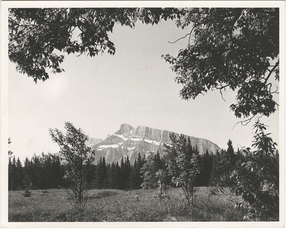
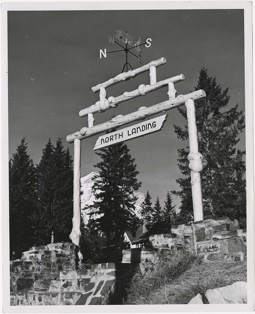
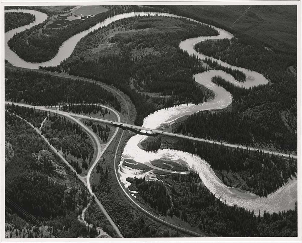
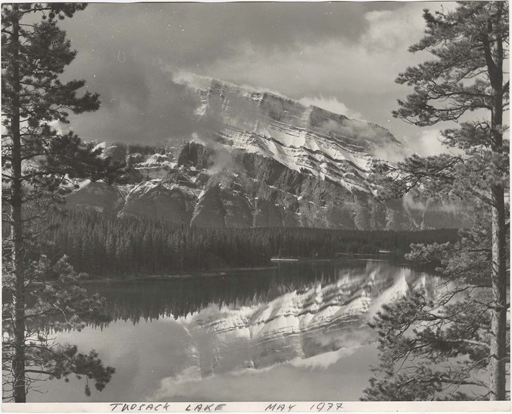
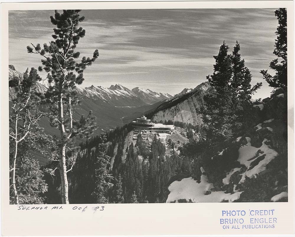
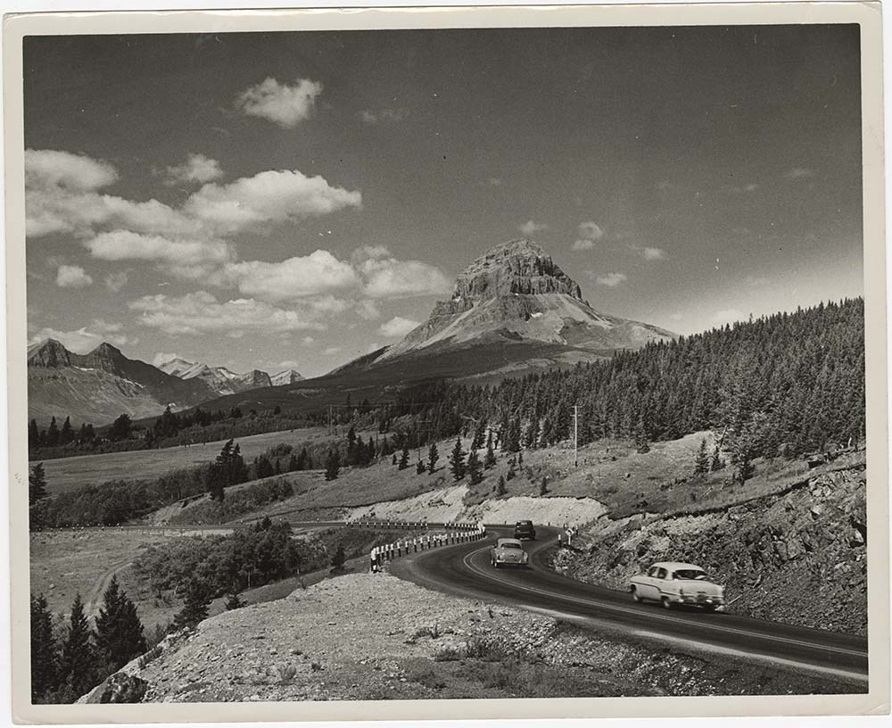
- Part Of
- Bruno Engler fonds
- Scope & Content
- File pertains to 40 b&w prints of various scenic views from throught the Canadian Rockies. Includes several mountains [including Rundle, Cascade, Mount Lougheed, Ha Ling, Sulphur ], lakes [including Two Jack, Vermillion, Bow, Peyto, and Waterton], and various other views like highways, rivers, hood…
- Date Range
- [ca. 1950-1988]
- Reference Code
- V190 / VI / S / i / PA - 01 to PA - 40
- Description Level
- 5 / File
- GMD
- Photograph
10 images
- Part Of
- Bruno Engler fonds
- Description Level
- 5 / File
- Fonds Number
- M323 / S40 / V190
- Series
- VI : Retained file, S : Alphabetical order
- Sous-Fonds
- V190
- Sub-Series
- i : Scenic Park
- Accession Number
- 7436
- Reference Code
- V190 / VI / S / i / PA - 01 to PA - 40
- GMD
- Photograph
- Date Range
- [ca. 1950-1988]
- Physical Description
- 40 photographs : b&w ; 25.2 x 20.2 cm or smaller
- History / Biographical
- See fonds level description
- Scope & Content
- File pertains to 40 b&w prints of various scenic views from throught the Canadian Rockies. Includes several mountains [including Rundle, Cascade, Mount Lougheed, Ha Ling, Sulphur ], lakes [including Two Jack, Vermillion, Bow, Peyto, and Waterton], and various other views like highways, rivers, hoodoos, tunnels, and valleys.
- Subject Access
- Automobiles
- Banff townsite
- Banff-Jasper Highway
- Bow River
- Bow Valley
- Cascade Mountain
- Cascades of Time Garden
- Fishing
- Glaciers
- Hoodoos
- Icefield Parkway
- Mountains
- North Saskatchewan River
- Rivers
- Roads
- Rundle Mountain
- scenic
- Sulphur Mountain
- Sulphur Mountain Gondola
- Trans-Canada Highway
- Two Jack Lake
- Geographic Access
- Banff
- Bow Lake
- Peyto Lake
- Banff National Park
- Jasper National Park
- Waterton
- Alberta
- Bugaboos
- British Columbia
- Language
- English
- Creator
- Engler, Bruno
- Title Source
- Original title kept
- Processing Status
- Processed
Images


This material is presented as originally created; it may contain outdated cultural descriptions and
potentially offensive content.
Read more.