Narrow Results By
Mount Deltaform Summit Note
https://archives.whyte.org/en/permalink/descriptions57779
- Part Of
- Alpine Club of Canada fonds
- Scope & Content
- File consists of a summit record from Mount Deltaform produced by the Alpine Club of Canada in 1983. Summit note by Hans Fuhrer and David Wilkinson depicting their route to the summit.
- Date Range
- 1983
- Reference Code
- M200 / V / A / 193
- Description Level
- 5 / File
- GMD
- Textual record
- Organization record
- Part Of
- Alpine Club of Canada fonds
- Description Level
- 5 / File
- Fonds Number
- M200
- V14
- S6
- Series
- M200 / V: Summit Records
- Sous-Fonds
- M200
- Sub-Series
- M200 / V / A: Identified Summit Records
- Accession Number
- accn. 8119
- Reference Code
- M200 / V / A / 193
- Responsibility
- Summit Registers and Notes produced by Alpine Club of Canada
- Date Range
- 1983
- Physical Description
- 0.5 cm of textual record 1 summit note
- History / Biographical
- Mount Deltaform is located in the Valley of the Ten Peaks, along the Continental Divide/Great Divide of the Canadian Rockies. Mount Deltaform is also on the border of Kootenay National Park, BC and Banff National Park, AB. Nearby are Hungabee Mountain, Mount Tuzo, and Mount Whymper.
- Scope & Content
- File consists of a summit record from Mount Deltaform produced by the Alpine Club of Canada in 1983. Summit note by Hans Fuhrer and David Wilkinson depicting their route to the summit.
- Name Access
- Alpine Club of Canada
- Subject Access
- Alberta
- Banff National Park
- British Columbia
- Climbing
- Description and travel
- Environment
- Environment and Nature
- Great Divide
- Hiking
- Mountain
- Mountaineering
- Mountaineers
- Mountains
- National parks and reserves
- Record keeping
- Sports and leisure
- Sports and recreation
- Summit
- Geographic Access
- Canada
- Canadian Rocky Mountains
- Rocky Mountains
- Continental Divide
- Great Divide
- Alberta
- British Columbia
- Banff National Park
- Kootenay National Park
- Valley of the Ten Peaks
- Hungabee Mountain
- Mount Whymper
- Mount Tuzo
- Mount Deltaform
- Access Restrictions
- Restrictions may apply
- Language
- English
- Related Material
- M235
- Biographical Source Notes
- Peak Finder: Deltaform Mountain, Canadian Rockies Database: https://cdnrockiesdatabases.ca/peaks/365
- Title Source
- Original title
- Processing Status
- Processed
This material is presented as originally created; it may contain outdated cultural descriptions and
potentially offensive content.
Read more.
Mount Victoria Summit Record
https://archives.whyte.org/en/permalink/descriptions57688
- Part Of
- Alpine Club of Canada fonds
- Scope & Content
- File consists of one summit register from Mount Victoria produced by the Alpine Club of Canada between 1998 and 2004. Summit record include entries from visitors to the various summits which pertain to individuals' hiking and climbing trips; details of specific events which occurred while at the su…
- Date Range
- September 1998 - August 2004
- Reference Code
- M200 / V / A / 81
- Description Level
- 5 / File
- GMD
- Textual record
- Organization record
- Part Of
- Alpine Club of Canada fonds
- Description Level
- 5 / File
- Fonds Number
- M200
- V14
- S6
- Series
- M200 / V: Summit Records
- Sous-Fonds
- M200
- Sub-Series
- M200 / V / A: Identified Summit Records
- Accession Number
- accn. 8002
- Reference Code
- M200 / V / A / 81
- Responsibility
- Summit Registers and Notes produced by Alpine Club of Canada
- Date Range
- September 1998 - August 2004
- Physical Description
- 1 cm of textual records 1 volume
- History / Biographical
- Mount Victoria is located in both Yoho National Park, B. C. and Banff National Park, AB in the Canadian Rockies. The mountain is part of the mountain range along the Continental Divide, between Alberta and B.C. Nearby are Lake O'Hara, Lake Louise, Abbot Pass and Mount Lefroy. Mount Victoria was named for Queen Victoria.
- Scope & Content
- File consists of one summit register from Mount Victoria produced by the Alpine Club of Canada between 1998 and 2004. Summit record include entries from visitors to the various summits which pertain to individuals' hiking and climbing trips; details of specific events which occurred while at the summit, wildlife sightings, trail updates, and related topics. File: M200 / V / A / 81: Summit - MT. Victoria, Sept. 1998 - Aug. 2004
- Name Access
- Alpine Club of Canada
- Subject Access
- Alberta
- Abbot Pass
- Alpine Club of Canada
- Backcountry skiing
- Backpacking
- Banff National Park
- Bow Valley
- British Columbia
- Climbing
- Club
- Cross-country skiing
- Description and travel
- Environment
- Environment and Nature
- Hiking
- Lake Louise
- Lake O'hara
- Mountain
- Mountaineering
- Mountaineers
- Mountains
- Parks Canada
- Record keeping
- Ski area
- Ski areas
- Ski mountaineering
- Ski touring
- Skiers
- Skiing
- Snowshoes and snowshoeing
- Sports and leisure
- Sports and recreation
- Summit
- Trails
- Winter sports
- Geographic Access
- Canada
- Alberta
- British Columbia
- Banff National Park
- Yoho National Park
- Lake O'Hara
- Lake Louise
- Lake Louise, AB
- Abbot Pass
- Abbott Pass
- Mount Lefroy
- Mount Victoria
- Access Restrictions
- Restrictions may apply
- Language
- English
- French
- German
- Japanese
- Related Material
- M235
- Biographical Source Notes
- Peak Finder: Mount Victoria, Canadian Rockies Database: https://cdnrockiesdatabases.ca/peaks/1459
- Title Source
- Title based on contents of file
- Processing Status
- Processed
This material is presented as originally created; it may contain outdated cultural descriptions and
potentially offensive content.
Read more.
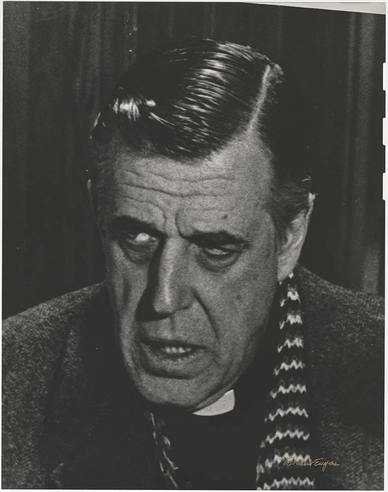
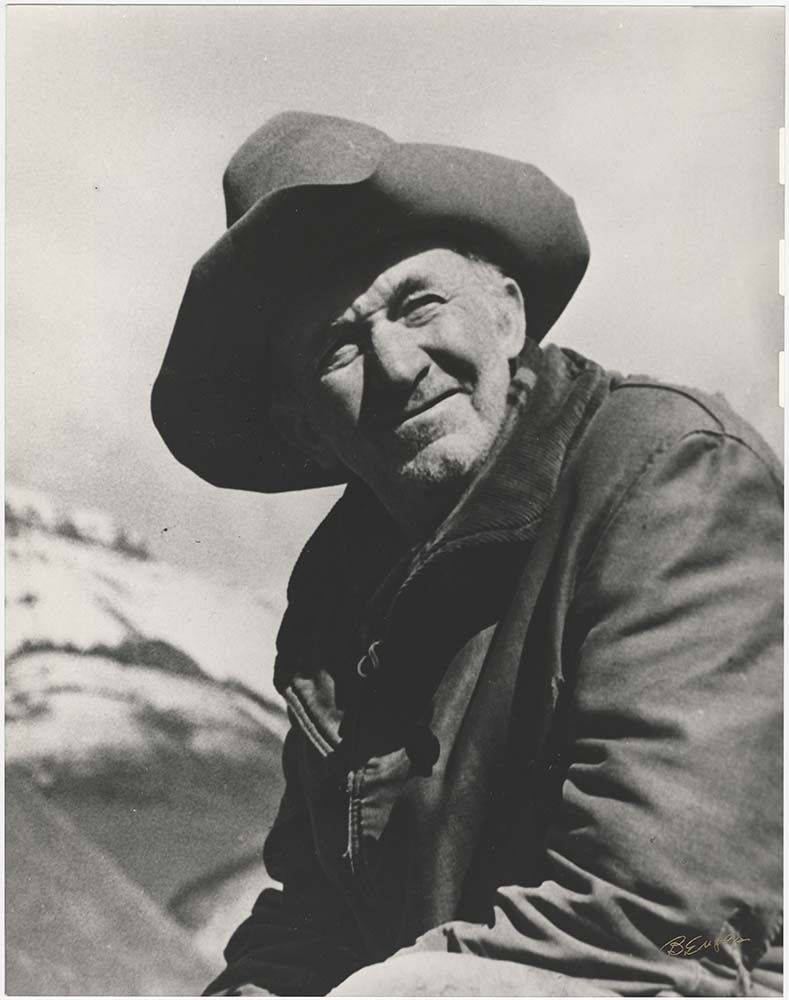
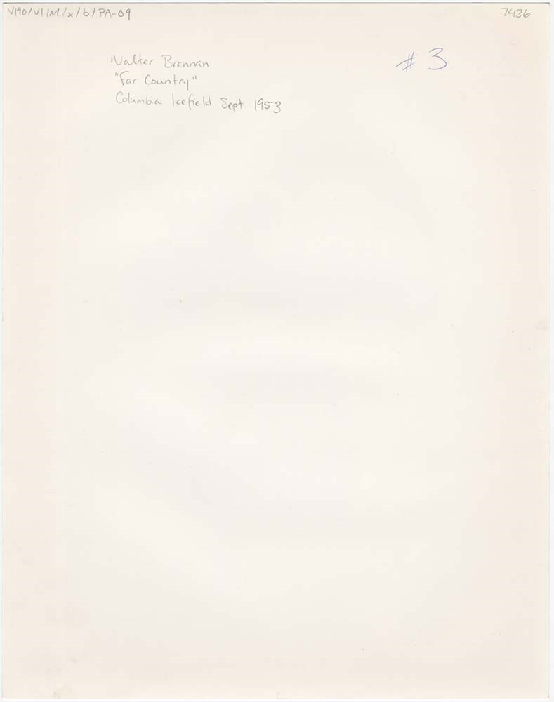
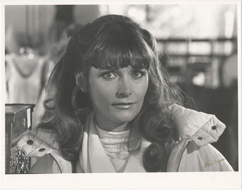
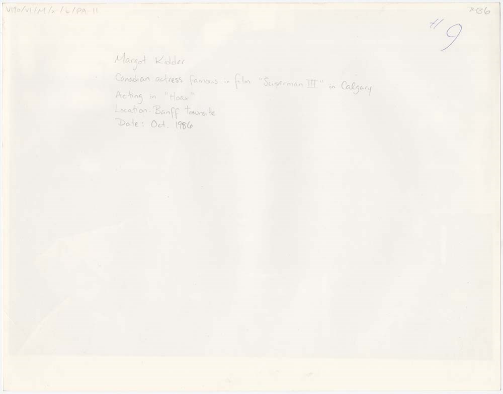
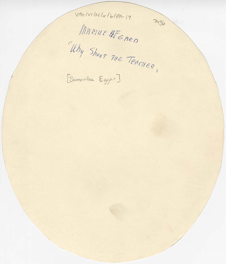
Movie Stars - o.s.
https://archives.whyte.org/en/permalink/descriptions57206
- Part Of
- Bruno Engler fonds
- Scope & Content
- File pertains to 25 b&w oversize prints of movie stars. Consisting of mostly head-shot-style portraits, some may have been enlarged from film stills. Not all are identified, one print is mounted on foamcore.
- Date Range
- 1953-1988
- Reference Code
- V190 / VI / M / x / b / PA - 01 to PA - 25 o.s.
- Description Level
- 5 / File
- GMD
- Photograph
11 images
- Part Of
- Bruno Engler fonds
- Description Level
- 5 / File
- Fonds Number
- M323 / S40 / V190
- Series
- VI : Retained file, M : Alphabetical order
- Sous-Fonds
- V190
- Sub-Series
- x : Movies, b : Movie Stars
- Accession Number
- 7436
- Reference Code
- V190 / VI / M / x / b / PA - 01 to PA - 25 o.s.
- GMD
- Photograph
- Date Range
- 1953-1988
- Physical Description
- 25 photographs : b&w ; 27.8 x 35.5 cm or smaller
- History / Biographical
- See fonds level description
- Scope & Content
- File pertains to 25 b&w oversize prints of movie stars. Consisting of mostly head-shot-style portraits, some may have been enlarged from film stills. Not all are identified, one print is mounted on foamcore.
- Subject Access
- Banff townsite
- Columbia Icefield
- Films and film making
- Horses
- Movie Stars
- Sulphur Mountain
- Winter
- Geographic Access
- Banff
- Banff National Park
- Alberta
- Language
- English
- Creator
- Engler, Bruno
- Title Source
- Original title kept
- Processing Status
- Processed
Images


This material is presented as originally created; it may contain outdated cultural descriptions and
potentially offensive content.
Read more.
Mt. Assiniboine Summit Records
https://archives.whyte.org/en/permalink/descriptions57697
- Part Of
- Alpine Club of Canada fonds
- Scope & Content
- Files consist of summit notes and summit registers from Mount Assiniboine produced by the Alpine Club of Canada between 1977 and 1998. Summit records include entries from visitors to the various summits which pertain to individuals' hiking and climbing trips; details of specific events which occurr…
- Date Range
- 1977-1998
- Reference Code
- M200 / V / A / 107 to 108
- Description Level
- 5 / File
- GMD
- Textual record
- Organization record
- Part Of
- Alpine Club of Canada fonds
- Description Level
- 5 / File
- Fonds Number
- M200
- V14
- S6
- Series
- M200 / V: Summit Records
- Sous-Fonds
- M200
- Sub-Series
- M200 / V / A: Identified Summit Records
- Accession Number
- accn. 5396
- accn. 7779
- Reference Code
- M200 / V / A / 107 to 108
- Responsibility
- Summit Registers and Notes produced by Alpine Club of Canada
- Date Range
- 1977-1998
- Physical Description
- 2 volumes 2 cm of textual records
- History / Biographical
- Mount Assiniboine is located along the Continental Divide, in the Rocky Mountains, in British Columbia. It was named in 1885, and it sits on the border of Mount Assiniboine Provincial Park, B. C. and Banff National Park, AB. In 1925, Lawrence Grassi became the first person to make a solo attempt of the mountain. Mount Assiniboine was first climbed in 1901 by James Outram, Christian Bohren and Christian Hasler.
- Scope & Content
- Files consist of summit notes and summit registers from Mount Assiniboine produced by the Alpine Club of Canada between 1977 and 1998. Summit records include entries from visitors to the various summits which pertain to individuals' hiking and climbing trips; details of specific events which occurred while at the summit, wildlife sightings, trail updates, and related topics. Files include: M200 / V / A / 107: [Mt. Assiniboine log book 1977-1987] M200 / V / A / 108: [Mt. Assiniboine Aug. 1978 - Aug. 1998]
- Notes
- File M200 / V / A / 108: [Mt. Assiniboine Aug. 1978 - Aug. 1998] contains a piece of engraved metal.
- Name Access
- Alpine Club of Canada
- Subject Access
- Alpine Club of Canada
- Backcountry skiing
- Backpacking
- Alberta
- Banff National Park
- Banff
- Bow Valley
- British Columbia
- Climbing
- Club
- Cross-country skiing
- Description and travel
- Environment
- Environment and Nature
- Hiking
- Mount Assiniboine
- Mountain
- Mountaineering
- Mountaineers
- Mountains
- National parks and reserves
- Parks Canada
- Parks
- Provincial parks and reserves
- Record keeping
- Ski area
- Ski areas
- Ski mountaineering
- Skiing
- Skis
- Sports and leisure
- Sports and recreation
- Summit
- Trails
- Winter sports
- Geographic Access
- Canada
- Canadian Rocky Mountains
- Rocky Mountains
- Continental Divide
- Alberta
- British Columbia
- Banff National Park
- Assiniboine Provincial Park
- Mount Assiniboine Park
- Bow Valley
- Mount Assiniboine
- Access Restrictions
- Restrictions may apply
- Reproduction Restrictions
- Contains personal information
- Language
- English
- Conservation
- Some materials have been placed in mylar. Some materials have water damage. File M200 / V / A / 108: [Mt. Assiniboine Aug. 1978 - Aug. 1998] contains a piece of engraved metal that has been placed in a conservation bag within the file.
- Related Material
- M235
- Biographical Source Notes
- Peak Finder: Mount Assiniboine, Canadian Rockies Database: https://cdnrockiesdatabases.ca/peaks/57#undefined1
- Title Source
- Title based on contents of file
- Processing Status
- Processed
This material is presented as originally created; it may contain outdated cultural descriptions and
potentially offensive content.
Read more.
- Part Of
- Alpine Club of Canada fonds
- Scope & Content
- File consists of a summit record from Mount Baker produced by the Alpine Club of Canada around 1988. Summit record includes entries from visitors to the various summits which pertain to individuals' hiking and climbing trips; details of specific events which occurred while at the summit, wildlife s…
- Date Range
- ca. 1988
- Reference Code
- M200 / V / A / 120
- Description Level
- 5 / File
- GMD
- Textual record
- Organization record
- Part Of
- Alpine Club of Canada fonds
- Description Level
- 5 / File
- Fonds Number
- M200
- V14
- S6
- Series
- M200 / V: Summit Records
- Sous-Fonds
- M200
- Sub-Series
- M200 / V / A: Identified Summit Records
- Accession Number
- accn. 2023.10
- Reference Code
- M200 / V / A / 120
- Responsibility
- Summit Registers and Notes produced by Alpine Club of Canada
- Date Range
- ca. 1988
- Physical Description
- 1 volume 1 cm of textual record
- History / Biographical
- Mount Baker is located on the Continental Divide of Alberta and British Columbia. It is part of the Waputik Mountains of the Canadian Rockies. Nearby are Yoho Provincial Park, Banff National Park, Mount Freshfield, Mount Forbes, Lake Louise, AB, and Field, B.C.
- Scope & Content
- File consists of a summit record from Mount Baker produced by the Alpine Club of Canada around 1988. Summit record includes entries from visitors to the various summits which pertain to individuals' hiking and climbing trips; details of specific events which occurred while at the summit, wildlife sightings, trail updates, and related topics. File: M200 / V / A / 120: Mt. Baker
- Name Access
- Alpine Club of Canada
- Subject Access
- Alberta
- Alpine Club of Canada
- Backcountry skiing
- Backpacking
- Banff
- Banff National Park
- Bow Valley
- British Columbia
- Climbing
- Club
- Cross-country skiing
- Description and travel
- Environment
- Environment and Nature
- Hiking
- Mountain
- Mountaineering
- Mountaineers
- Mountains
- National parks and reserves
- Record keeping
- Ski area
- Ski areas
- Ski mountaineering
- Skiers
- Skiing
- Skis
- Sports and leisure
- Sports and recreation
- Summit
- Trails
- Winter sports
- Geographic Access
- Canada
- Canadian Rocky Mountains
- Rocky Mountains
- Continental Divide
- Alberta
- British Columbia
- Banff National Park
- Yoho National Park
- Mount Freshfield
- Mount Forbes
- Lake Louise
- Lake Louise, AB
- Mount Baker
- Access Restrictions
- Restrictions may apply
- Language
- English
- Conservation
- Register placed in mylar due to evidence of mold. Evidence of water damage.
- Related Material
- M235
- Title Source
- Original title used
- Processing Status
- Processed
This material is presented as originally created; it may contain outdated cultural descriptions and
potentially offensive content.
Read more.
- Part Of
- Alpine Club of Canada fonds
- Scope & Content
- Files consists of the summit register from Mount Bosworth produced by the Alpine Club of Canada between approximately 2003 to 2022. Summit record includes entries from visitors to the various summits which pertain to individuals' hiking and climbing trips; details of specific events which occurred …
- Date Range
- ca. 2003-2022
- Reference Code
- M200 / V / A / 222
- Description Level
- 5 / File
- GMD
- Textual record
- Organization record
- Part Of
- Alpine Club of Canada fonds
- Description Level
- 5 / File
- Fonds Number
- M200
- V14
- S6
- Series
- M200 / V: Summit Records
- Sous-Fonds
- M200
- Sub-Series
- M200 / V / A: Identified Summit Records
- Accession Number
- accn. 2024.20
- Reference Code
- M200 / V / A / 222
- Responsibility
- Summit Registers and Notes produced by Alpine Club of Canada
- Date Range
- ca. 2003-2022
- Physical Description
- 1 cm of textual records
- History / Biographical
- Mount Bosworth is located in the Canadian Rocky Mountains along the Continental Divide, between Alberta and British Columbia. Nearby is Paget Peak and Kicking Horse Pass.
- Scope & Content
- Files consists of the summit register from Mount Bosworth produced by the Alpine Club of Canada between approximately 2003 to 2022. Summit record includes entries from visitors to the various summits which pertain to individuals' hiking and climbing trips; details of specific events which occurred while at the summit, wildlife sightings, trail updates, and related topics. File: M200 / V / A / 222: Mt. Bosworth
- Name Access
- Alpine Club of Canada
- Subject Access
- Administration
- Alpine Club of Canada
- Club
- Record keeping
- Records
- Alberta
- Backpacking
- British Columbia
- Climbing
- Description and travel
- Environment
- Environment and Nature
- Great Divide
- Hiking
- Mountain
- Mountaineering
- Mountaineers
- Mountains
- Sports and leisure
- Sports and recreation
- Summit
- Geographic Access
- Canada
- Canadian Rocky Mountains
- Rocky Mountains
- Great Divide
- Continental Divide
- Alberta
- British Columbia
- Banff National Park
- Yoho National Park
- Kicking Horse Pass
- Mount Bosworth
- Access Restrictions
- Restrictions may apply
- Reproduction Restrictions
- Contains personal information
- Language
- English
- Conservation
- Register placed in mylar due to mold.
- Related Material
- M235
- Biographical Source Notes
- Peak Finder: Mount Bosworth, Canadian Rockies Database: https://cdnrockiesdatabases.ca/peaks/156#undefined1
- Title Source
- Original title
- Processing Status
- Processed
This material is presented as originally created; it may contain outdated cultural descriptions and
potentially offensive content.
Read more.
Mt. Lefroy Summit Records
https://archives.whyte.org/en/permalink/descriptions57737
- Part Of
- Alpine Club of Canada fonds
- Scope & Content
- Files consist of summit notes and summit registers Mount Lefroy produced by the Alpine Club of Canada between 1985 and 2010. Summit records include entries from visitors to the various summits which pertain to individuals' hiking and climbing trips; details of specific events which occurred while a…
- Date Range
- 1985-2010
- Reference Code
- M200 / V / A / 148 to 149
- Description Level
- 5 / File
- GMD
- Textual record
- Organization record
- Part Of
- Alpine Club of Canada fonds
- Description Level
- 5 / File
- Fonds Number
- M200
- V14
- S6
- Series
- M200 / V: Summit Records
- Sous-Fonds
- M200
- Sub-Series
- M200 / V / A: Identified Summit Records
- Accession Number
- accn. 5631
- accn. 2023.19
- Reference Code
- M200 / V / A / 148 to 149
- Responsibility
- Summit Registers and Notes produced by Alpine Club of Canada
- Date Range
- 1985-2010
- Physical Description
- 2 volumes 3 cm of textual records
- History / Biographical
- Mount Lefroy is located in along the Continental/Great Divide, and is part of the Canadian Rocky Mountains. Nearby are Abbot Pass and Mount Victoria. Mount Lefroy is the site of the first fatal mountaineering accident in Canada.
- Scope & Content
- Files consist of summit notes and summit registers Mount Lefroy produced by the Alpine Club of Canada between 1985 and 2010. Summit records include entries from visitors to the various summits which pertain to individuals' hiking and climbing trips; details of specific events which occurred while at the summit, wildlife sightings, trail updates, and related topics. Files include: M200 / V / A / 148: [Mt. Lefroy register 1985-1987] M200 / V / A / 149: Mt. Lefroy. [ca. 1986-2010]
- Name Access
- Alpine Club of Canada
- Subject Access
- Alberta
- Alpine Club of Canada
- Backcountry skiing
- Backpacking
- Banff
- Banff National Park
- British Columbia
- Climbing
- Club
- Description and travel
- Environment
- Environment and Nature
- Great Divide
- Hiking
- Mountain
- Mountaineering
- Mountaineers
- Mountains
- National parks and reserves
- Provincial parks and reserves
- Record keeping
- Ski mountaineering
- Skiing
- Skiers
- Skis
- Sports and leisure
- Sports and recreation
- Summit
- Trails
- Geographic Access
- Canada
- Canadian Rocky Mountains
- Rocky Mountains
- Continental Divide
- Great Divide
- Alberta
- British Columbia
- Banff National Park
- Yoho National Park
- Abbott Pass
- Abbot Pass
- Mount Victoria
- Mount Lefroy
- Access Restrictions
- Restrictions may apply
- Language
- English
- Japanese
- French
- Conservation
- Register has evidence of rust damage and loose pages. Pages have tears and some water damage.
- Related Material
- M235
- Title Source
- Title based on contents of file
- Processing Status
- Processed
This material is presented as originally created; it may contain outdated cultural descriptions and
potentially offensive content.
Read more.
Mt. Little Summit Register
https://archives.whyte.org/en/permalink/descriptions57757
- Part Of
- Alpine Club of Canada fonds
- Scope & Content
- File consists of summit notes from Mount Little produced by the Alpine Club of Canada between 2001 and 2017. Summit notes include entries from visitors to the various summits which pertain to individuals' hiking and climbing trips; details of specific events which occurred while at the summit, wild…
- Date Range
- 2001-2017
- Reference Code
- M200 / V / A / 170
- Description Level
- 5 / File
- GMD
- Textual record
- Organization record
- Part Of
- Alpine Club of Canada fonds
- Description Level
- 5 / File
- Fonds Number
- M200
- V14
- S6
- Series
- M200 / V: Summit Records
- Sous-Fonds
- M200
- Sub-Series
- M200 / V / A: Identified Summit Records
- Accession Number
- accn. 2018.9010
- Reference Code
- M200 / V / A / 170
- Responsibility
- Summit Registers and Notes produced by Alpine Club of Canada
- Date Range
- 2001-2017
- Physical Description
- 1 volume 1 cm of textual records
- History / Biographical
- Mount Little is located on the Continental/Great Divide, and is part of the Canadian Rockies on the border of Alberta and British Columbia.
- Scope & Content
- File consists of summit notes from Mount Little produced by the Alpine Club of Canada between 2001 and 2017. Summit notes include entries from visitors to the various summits which pertain to individuals' hiking and climbing trips; details of specific events which occurred while at the summit, wildlife sightings, trail updates, and related topics. File: M200 / V / A / 170: Mt. Little Summit Register
- Name Access
- Alpine Club of Canada
- Subject Access
- Alberta
- Alpine Club of Canada
- Backpacking
- Banff National Park
- British Columbia
- Climbing
- Club
- Description and travel
- Environment
- Environment and Nature
- Great Divide
- Hiking
- Mountain
- Mountaineering
- Mountaineers
- Mountains
- National parks and reserves
- Record keeping
- Sports and leisure
- Sports and recreation
- Summit
- Trails
- Geographic Access
- Canada
- Great Divide
- Continental Divide
- Canadian Rocky Mountains
- Rocky Mountains
- British Columbia
- Alberta
- Kootenay National Park
- Banff National Park
- Lake Louise
- Valley of the Ten Peaks
- Mount Victoria
- Mount Temple
- Mount Babel
- Mount Bell
- Deltaform Mountain
- Mount Little
- Access Restrictions
- Restrictions may apply
- Language
- English
- Conservation
- Summit notes are written on sticky notes; some pages have stuck together. Glue from sticky notes has bled onto the pages.
- Related Material
- M235
- Biographical Source Notes
- Peak Finder: Mount Little, Canadian Rockies Database: https://cdnrockiesdatabases.ca/peaks/788
- Title Source
- Original title
- Processing Status
- Processed
This material is presented as originally created; it may contain outdated cultural descriptions and
potentially offensive content.
Read more.
Mt. McPhail Summit Register
https://archives.whyte.org/en/permalink/descriptions57711
- Part Of
- Alpine Club of Canada fonds
- Scope & Content
- File consists of a summit record from Mount McPhail produced by the Alpine Club of Canada around 1994. Summit record includes entries from visitors to the various summits which pertain to individuals' hiking and climbing trips; details of specific events which occurred while at the summit, wildlife…
- Date Range
- ca. 1994
- Reference Code
- M200 / V / A / 121
- Description Level
- 5 / File
- GMD
- Textual record
- Organization record
- Part Of
- Alpine Club of Canada fonds
- Description Level
- 5 / File
- Fonds Number
- M200
- V14
- S6
- Series
- M200 / V: Summit Records
- Sous-Fonds
- M200
- Sub-Series
- M200 / V / A: Identified Summit Records
- Accession Number
- accn. 2014.8293
- Reference Code
- M200 / V / A / 121
- Responsibility
- Summit Registers and Notes produced by Alpine Club of Canada
- Date Range
- ca. 1994
- Physical Description
- 1 volume 1 cm of textual record
- History / Biographical
- Mount McPhail is located in the Elk Range of the Park Ranges of the Canadian Rockies and is along the Continental Divide, between the Alberta and British Columbia border. It is within the Kananaskis Country Provincial Park boundary, Mount McPhail is also known as "The Pyramid" for its shape. The mountain was named for Corporal Norman RR. McPhail, a member of the Surveyor General staff, who fought and was killed in action in WWI.
- Scope & Content
- File consists of a summit record from Mount McPhail produced by the Alpine Club of Canada around 1994. Summit record includes entries from visitors to the various summits which pertain to individuals' hiking and climbing trips; details of specific events which occurred while at the summit, wildlife sightings, trail updates, and related topics. File: M200 / V / A / 121: Mt. McPhail Summit Register
- Name Access
- Alpine Club of Canada
- Subject Access
- Alberta
- Alpine Club of Canada
- Backcountry skiing
- Backpacking
- Banff
- Banff National Park
- Bow Valley
- British Columbia
- Climbing
- Club
- Cross-country skiing
- Description and travel
- Environment
- Environment and Nature
- Hiking
- Kananaskis Country
- Mountain
- Mountaineering
- Mountaineers
- Mountains
- National parks and reserves
- Provincial parks and reserves
- Record keeping
- Ski area
- Ski areas
- Ski mountaineering
- Skiing
- Skiers
- Sports and leisure
- Sports and recreation
- Summit
- Winter sports
- Geographic Access
- Canada
- Canadian Rocky Mountains
- Alberta
- British Columbia
- Banff National Park
- Yoho National Park
- Continental Divide
- Elk Range Mountains
- Mount McPhail
- Access Restrictions
- Restrictions may apply
- Language
- English
- Conservation
- Register contains black mold, water damage. Register is placed in mylar.
- Related Material
- M235
- Biographical Source Notes
- Peak Finder: Mount McPhail, Canadian Rockies Database: https://cdnrockiesdatabases.ca/peaks/889
- Title Source
- Original title used
- Processing Status
- Processed
This material is presented as originally created; it may contain outdated cultural descriptions and
potentially offensive content.
Read more.
Mt. Rhondda Summit Records
https://archives.whyte.org/en/permalink/descriptions57783
- Part Of
- Alpine Club of Canada fonds
- Scope & Content
- Files consist of summit notes and summit registers from Mount Rhondda produced by the Alpine Club of Canada between 1988 and 1998. Summit records include entries from visitors to the various summits which pertain to individuals' hiking and climbing trips; details of specific events which occurred w…
- Date Range
- 1988-1998
- Reference Code
- M200 / V / A / 197 to 198
- Description Level
- 5 / File
- GMD
- Textual record
- Organization record
- Part Of
- Alpine Club of Canada fonds
- Description Level
- 5 / File
- Fonds Number
- M200
- V14
- S6
- Series
- M200 / V: Summit Records
- Sous-Fonds
- M200
- Sub-Series
- M200 / V / A: Identified Summit Records
- Accession Number
- accn. 6396
- accn. 7779
- Reference Code
- M200 / V / A / 197 to 198
- Responsibility
- Summit Registers and Notes produced by Alpine Club of Canada
- Date Range
- 1988-1998
- Physical Description
- 2 volumes 2 cm of textual records
- History / Biographical
- Mount Rhondda is located along the Continental Divide/Great Divide, along the Canadian Rockies. It is in the centre of the Wapta Icefield. It also lies along the border of Banff National Park, Alberta and Yoho National Park, British Columbia.
- Scope & Content
- Files consist of summit notes and summit registers from Mount Rhondda produced by the Alpine Club of Canada between 1988 and 1998. Summit records include entries from visitors to the various summits which pertain to individuals' hiking and climbing trips; details of specific events which occurred while at the summit, wildlife sightings, trail updates, and related topics. Files include: M200 / V / A / 197: [Mt. Rhondda South register, 1988-1991] M200 / V / A / 198: [Mt. Rhondda summit register March 11, 1988 - July 6, 1998]
- Name Access
- Alpine Club of Canada
- Subject Access
- Alberta
- Alpine Club of Canada
- Banff
- Banff National Park
- Bow Valley
- British Columbia
- Climbing
- Club
- Description and travel
- Environment
- Environment and Nature
- Great Divide
- Hiking
- Mountain
- Mountaineering
- Mountaineers
- Mountains
- National parks and reserves
- Record keeping
- Sports and leisure
- Sports and recreation
- Summit
- Trails
- Geographic Access
- Canada
- Canadian Rocky Mountains
- Rocky Mountains
- Great Divide
- Continental Divide
- Alberta
- British Columbia
- Banff National Park
- Yoho National Park
- Wapta Icefield
- Mont des Pollus
- Arete Peak
- Mount Gordon
- Mount Rhondda
- Access Restrictions
- Restrictions may apply
- Reproduction Restrictions
- Both registers contain black mold
- Language
- English
- Conservation
- Both registers have been placed in mylar due to black mold.
- Related Material
- M235
- Biographical Source Notes
- Peak Finder: Mount Rhondda, Canadian Rockies Database: https://cdnrockiesdatabases.ca/peaks/1164
- Title Source
- Title based on contents of file
- Processing Status
- Processed
This material is presented as originally created; it may contain outdated cultural descriptions and
potentially offensive content.
Read more.