Narrow Results By
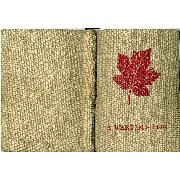
A wartime log : a remembrance from home through the Canadian Y.M.C.A.
https://archives.whyte.org/en/permalink/descriptions57447
- Part Of
- Bill Waterworth fonds
- Scope & Content
- Bill Waterworth enlisted in the Royal Canadian Air Force at the age of 18. On September 19, 1942, Waterworth was shot down over the French coast just short of completing his 33rd mission. Waterworth avoided capture by German patrols for two weeks before being captured and taken prisoner by the G…
- Date Range
- [ca.1940]-1999
- Reference Code
- M215 / LC 1 / accn 8066
- Description Level
- 6 / Item
- GMD
- Machine-readable data file
- Photograph
- Scrapbook
- Textual record
1 Electronic Resource
- Part Of
- Bill Waterworth fonds
- Description Level
- 6 / Item
- Fonds Number
- M 215
- S 54
- V 176
- Sous-Fonds
- M 215
- S 54
- V 176
- Accession Number
- 8066 - loan for copy
- Reference Code
- M215 / LC 1 / accn 8066
- Date Range
- [ca.1940]-1999
- Physical Description
- electronic record : 7.66 GB, 147 files
- 190 pages digitized from original
- Scope & Content
- Bill Waterworth enlisted in the Royal Canadian Air Force at the age of 18. On September 19, 1942, Waterworth was shot down over the French coast just short of completing his 33rd mission. Waterworth avoided capture by German patrols for two weeks before being captured and taken prisoner by the Gestapo. He was sent by boxcar to a Prisoner of War (POW) camp - Stalag VIIIB/344 - in Lamsdorf, Germany where he remained for three years. In 1943 the Red Cross issued each P.O.W. a blank 151 page logbook "A Wartime Log : A Remembrance from Home Through the Canadian Y.M.C.A." Waterworth treasured this log during his captivity and compiled it as a scrapbook collecting photographs, artwork by fellow prisoners, newsclippings, parcel lists and letters from home. In January 1945 the prisoners were forced to march from Poland to France, and he carried his log throughout the ordeal. His sense of history and purpose with the Wartime Log continued throughout his life, with follow-up stories of fellow POWs and of their reunions through to 1999.
- Loan for copy in 2009 and digitized.
- Name Access
- Waterworth, Bill
- Language
- Language is English
- Location (Original)
- Returned to Waterworth family
- Location (Copy)
- O:\m_textual\m215_waterworth_archivalmaster
- Location Copy Filename
- m215_lc_1_accn8006
- Related Material
- S1 / 162 - Whyte Museum Oral History Prograamme : Bill Waterworth's Wartime Log interview with Bill Waterworth by Head Archivist E. J. (Ted) Hart, May 28, 2009
- 08 M22a - Almost a lifetime / John McMahon
- Creator
- Waterworth, Bill
- Category
- Family and personal life
- Title Source
- Original title page
- Processing Status
- Unprocessed
Electronic Resources
This material is presented as originally created; it may contain outdated cultural descriptions and
potentially offensive content.
Read more.
Topographical maps
https://archives.whyte.org/en/permalink/descriptions56805
- Part Of
- Ben Gadd fonds
- Scope & Content
- Sub-sub series consists of topographical maps depicting various regions in Canada and the United States, which were collected by Ben Gadd. Includes ca.13 maps of regions in the United States (including Eagletail National Park in Arizona, Colorado Springs, and Montana); and ca.213 maps of regions in…
- Date Range
- [ca.1960-2005]
- Reference Code
- M590 / I / A / ii
- Description Level
- 4.1 / Sub-sub-series
- GMD
- Map
- Part Of
- Ben Gadd fonds
- Description Level
- 4.1 / Sub-sub-series
- Fonds Number
- M590
- V810
- S61
- Series
- M590 / I : Personal records
- Sous-Fonds
- M590
- Sub-Series
- M590 / I / A / ii : Travel guides and maps : Topographical maps
- Accession Number
- 2021.20
- Reference Code
- M590 / I / A / ii
- GMD
- Map
- Date Range
- [ca.1960-2005]
- Physical Description
- ca.226 topographical maps
- Scope & Content
- Sub-sub series consists of topographical maps depicting various regions in Canada and the United States, which were collected by Ben Gadd. Includes ca.13 maps of regions in the United States (including Eagletail National Park in Arizona, Colorado Springs, and Montana); and ca.213 maps of regions in Northern Canada, Western Canada and the Canadian Rockies (predominantly Alberta and British Columbia, as well as the Yukon).
- Notes
- Some maps include annotations by Ben Gadd
- Name Access
- Gadd, Ben
- Geographic Access
- Canada
- Alberta
- British Columbia
- Yukon
- Canadian Rocky Mountains
- Rocky Mountains
- Reproduction Restrictions
- Restrictions may apply
- Language
- English
- Category
- Exploration and travel
- Title Source
- Title based on contents of file
- Processing Status
- Processed
This material is presented as originally created; it may contain outdated cultural descriptions and
potentially offensive content.
Read more.
Travel guides and pocket maps
https://archives.whyte.org/en/permalink/descriptions56806
- Part Of
- Ben Gadd fonds
- Scope & Content
- Sub-sub-series consists of ca.30 travel maps and guides collected by Ben Gadd, primarily pertaining to regions in the United States. Includes regions in Colorado, Arizona, British Columbia, Alberta and Saskatchewan.
- Date Range
- [ca.1970-2005]
- Reference Code
- M590 / I / A / i
- Description Level
- 4.1 / Sub-sub-series
- GMD
- Map
- Part Of
- Ben Gadd fonds
- Description Level
- 4.1 / Sub-sub-series
- Fonds Number
- M590
- V810
- S61
- Series
- M590 / I : Personal records
- Sous-Fonds
- M590
- Sub-Series
- M590 / I / A / i : Travel guides and pocket maps
- Accession Number
- 2021.20
- Reference Code
- M590 / I / A / i
- GMD
- Map
- Date Range
- [ca.1970-2005]
- Physical Description
- ca.30 travel guides and maps
- Scope & Content
- Sub-sub-series consists of ca.30 travel maps and guides collected by Ben Gadd, primarily pertaining to regions in the United States. Includes regions in Colorado, Arizona, British Columbia, Alberta and Saskatchewan.
- Name Access
- Gadd, Ben
- Geographic Access
- Canada
- Alberta
- British Columbia
- Saskatchewan
- Canadian Rocky Mountains
- United States of America
- Colorado
- Arizona
- Reproduction Restrictions
- Restrictions may apply
- Language
- English
- Title Source
- Title based on contents of file
- Processing Status
- Processed
This material is presented as originally created; it may contain outdated cultural descriptions and
potentially offensive content.
Read more.
- Part Of
- Ben Gadd fonds
- Scope & Content
- Sub-sub-series consists of ca.50 maps of various regions in Western Canada and Alaska which were collected by Ben Gadd. Maps are arranged according to associated highways which the mapped regions depict.
- Date Range
- [ca.1970-2005]
- Reference Code
- M590 / I / A / iv
- Description Level
- 4.1 / Sub-sub-series
- GMD
- Map
- Part Of
- Ben Gadd fonds
- Description Level
- 4.1 / Sub-sub-series
- Fonds Number
- M590
- V810
- S61
- Series
- M590 / I : Personal records
- Sous-Fonds
- M590
- Sub-Series
- M590 / I / A / iv : Travel guides and maps : Highway maps
- Accession Number
- 2021.20
- Reference Code
- M590 / I / A / iv
- GMD
- Map
- Date Range
- [ca.1970-2005]
- Physical Description
- ca.50 maps -- 4 paper scans of maps
- Scope & Content
- Sub-sub-series consists of ca.50 maps of various regions in Western Canada and Alaska which were collected by Ben Gadd. Maps are arranged according to associated highways which the mapped regions depict.
- Notes
- Regions included in file: Highway 3 Highway 6 Highway 11 Highway 16 Highway 22 & 40 Highway 93 [To Jasper] Highway 93 [To Radium] Highway 97 [Pine Pass] Highway 97 [Alaska Highway]
- Name Access
- Gadd, Ben
- Geographic Access
- Canada
- Alberta
- British Columbia
- Canadian Rocky Mountains
- Alaska
- Reproduction Restrictions
- Restrictions may apply
- Language
- English
- Title Source
- Title based on contents of file
- Processing Status
- Processed
This material is presented as originally created; it may contain outdated cultural descriptions and
potentially offensive content.
Read more.