Narrow Results By
- 1930s 12671
- 1920s 12216
- 1940s 11942
- 1910s 8186
- 1900s 6662
- 1950s 6337
- 1970s 6233
- 1960s 6019
- 1980s 3887
- 1990s 2517
- 2000s 1759
- 1890s 1619
- 2010s 1194
- 1880s 1007
- 1870s 753
- 2020s 236
- 1850s 235
- 1860s 218
- 1800s
- 1840s 78
- 1820s 66
- 1830s 66
- 1810s 39
- 1780s
- 1790s
- 1750s 13
- 1770s 10
- 1700s 6
- 1720s 3
- 1740s 3
- 1760s 3
- 1570s 2
- 1600s 2
- 1080s 1
- 1300s 1
- 1500s 1
- 1530s 1
- 1550s 1
- 1560s 1
- 1610s 1
- 1620s 1
- 1680s 1
- 1690s 1
- 1710s 1
- 1730s 1
A map showing the communication of the lakes and rivers between Lake Superior and Slave Lake in North America
https://archives.whyte.org/en/permalink/catalogue24545
- Medium
- Library - Maps and blueprints (unannotated; published)
- Map
- Published Date
- 1790
- Publisher
- Gent. Mag.
- Call Number
- C11-1.7
- Publisher
- Gent. Mag.
- Published Date
- 1790
- Physical Description
- 1 map
- Scale
- Scale indeterminable
- Subjects
- Rivers
- The West, Canadian
- Accession Number
- 12,500
- Call Number
- C11-1.7
- Collection
- Archives Library
This material is presented as originally created; it may contain outdated cultural descriptions and
potentially offensive content.
Read more.
A map of America ... exhibiting Mackenzie's track from Montreal to Fort Chipewyan and from thence to the North Sea in 1789 & to the West Pacific Ocean in 1793
https://archives.whyte.org/en/permalink/catalogue24546
- Medium
- Library - Maps and blueprints (unannotated; published)
- Map
- Published Date
- 1801
- Publisher
- London : A.M.
- Call Number
- C11-1.8
- Publisher
- London : A.M.
- Published Date
- 1801
- Physical Description
- 1 map
- Scale
- Scale indeterminable
- Subjects
- Mackenzie, Alexander
- Accession Number
- 5241
- Call Number
- C11-1.8
- Collection
- Archives Library
This material is presented as originally created; it may contain outdated cultural descriptions and
potentially offensive content.
Read more.
Map showing the communication of the Lakes and Rivers between Lake Superior and Slave Lake in North America
https://archives.whyte.org/en/permalink/catalogue21338
- Medium
- Library - Maps and blueprints (unannotated; published)
- Map
- Published Date
- 1790
- Publisher
- Gent Mag.
- Call Number
- C5-5.8
- Publisher
- Gent Mag.
- Published Date
- 1790
- Subjects
- Hydrological Maps Canada
- Notes
- From a copy - Gent Mag. 1790
- Accession Number
- 11,500
- Call Number
- C5-5.8
- Collection
- Archives Library
This material is presented as originally created; it may contain outdated cultural descriptions and
potentially offensive content.
Read more.
Map of his discoveries presented to Congress by Peter Pond
https://archives.whyte.org/en/permalink/catalogue21479
- Medium
- Library - Maps and blueprints (unannotated; published)
- Map
- Published Date
- 1785
- Author
- Pond, Peter
- Call Number
- C12-1.6
- Author
- Pond, Peter
- Published Date
- 1785
- Subjects
- Peter Pond
- Notes
- Photostatic copy from Public Archives
- Accession Number
- 675
- Call Number
- C12-1.6
- Collection
- Archives Library
This material is presented as originally created; it may contain outdated cultural descriptions and
potentially offensive content.
Read more.
Map of his discoveries presented to Congress by Peter Pond
https://archives.whyte.org/en/permalink/catalogue21480
- Medium
- Library - Maps and blueprints (unannotated; published)
- Map
- Published Date
- 1785
- Author
- Pond, Peter
- Call Number
- C12-1.6(a)
- Author
- Pond, Peter
- Published Date
- 1785
- Subjects
- Peter Pond
- Notes
- Accompanies 02.5/P77w
- Accession Number
- 400
- Call Number
- C12-1.6(a)
- Collection
- Archives Library
This material is presented as originally created; it may contain outdated cultural descriptions and
potentially offensive content.
Read more.
Map of North America
https://archives.whyte.org/en/permalink/catalogue21481
- Medium
- Library - Maps and blueprints (unannotated; published)
- Map
- Published Date
- 1785
- Author
- Pond, Peter
- Call Number
- C12-1.7
- Author
- Pond, Peter
- Published Date
- 1785
- Subjects
- Peter Pond's Map
- Notes
- Photostatic copy from Public Archives
- Accession Number
- 675
- Call Number
- C12-1.7
- Collection
- Archives Library
This material is presented as originally created; it may contain outdated cultural descriptions and
potentially offensive content.
Read more.
Map of North America
https://archives.whyte.org/en/permalink/catalogue21482
- Medium
- Library - Maps and blueprints (unannotated; published)
- Map
- Published Date
- 1785
- Author
- Pond, Peter
- Call Number
- C12-1.7(a)
- Author
- Pond, Peter
- Published Date
- 1785
- Subjects
- Peter Pond's Map
- Notes
- Photostatic copy from Public Archives
- Accession Number
- 400
- Call Number
- C12-1.7(a)
- Collection
- Archives Library
This material is presented as originally created; it may contain outdated cultural descriptions and
potentially offensive content.
Read more.
North West Territories
https://archives.whyte.org/en/permalink/catalogue21483
- Medium
- Library - Maps and blueprints (unannotated; published)
- Map
- Published Date
- 1787
- Author
- Pond, Peter
- Call Number
- C12-1.8
- Author
- Pond, Peter
- Published Date
- 1787
- Subjects
- Peter Pond's Map
- Notes
- Photostatic copy from Public Archives
- three sections
- Accession Number
- 675
- Call Number
- C12-1.8
- Collection
- Archives Library
This material is presented as originally created; it may contain outdated cultural descriptions and
potentially offensive content.
Read more.
North West Territories
https://archives.whyte.org/en/permalink/catalogue21484
- Medium
- Library - Maps and blueprints (unannotated; published)
- Map
- Published Date
- 1787
- Author
- Pond, Peter
- Call Number
- C12-1.8(d)
- Author
- Pond, Peter
- Published Date
- 1787
- Subjects
- Peter Pond's Map
- Notes
- Accompanies 02.5/P77w
- Smaller scale of maps: C12-1.8 (a) (b) (c)
- Accession Number
- 400
- Call Number
- C12-1.8(d)
- Collection
- Archives Library
This material is presented as originally created; it may contain outdated cultural descriptions and
potentially offensive content.
Read more.
Travels through Western Canada from April, 1773 to March, 1790
https://archives.whyte.org/en/permalink/catalogue21485
- Medium
- Library - Maps and blueprints (unannotated; published)
- Map
- Published Date
- 1790
- Call Number
- C12-1.9
- Published Date
- 1790
- Subjects
- Peter Pond's Travels
- Notes
- Photostatic copy from Public Archives
- Accession Number
- 675
- Call Number
- C12-1.9
- Collection
- Archives Library
This material is presented as originally created; it may contain outdated cultural descriptions and
potentially offensive content.
Read more.
Chart of Lakes and Rivers
https://archives.whyte.org/en/permalink/catalogue21491
- Medium
- Library - Maps and blueprints (unannotated; published)
- Map
- Published Date
- c. 1780
- Call Number
- C12-1.16
- Published Date
- c. 1780
- Subjects
- North America
- Notes
- Photostatic copy from Public Archives
- two sections
- Accession Number
- 675
- Call Number
- C12-1.16
- Collection
- Archives Library
This material is presented as originally created; it may contain outdated cultural descriptions and
potentially offensive content.
Read more.
New discoveries in the Interior
https://archives.whyte.org/en/permalink/catalogue21493
- Medium
- Library - Maps and blueprints (unannotated; published)
- Map
- Published Date
- 1802
- Call Number
- C12-1.18
- Published Date
- 1802
- Subjects
- North America
- Notes
- four sections
- Photostatic copy from Public Archives
- Accession Number
- 675
- Call Number
- C12-1.18
- Collection
- Archives Library
This material is presented as originally created; it may contain outdated cultural descriptions and
potentially offensive content.
Read more.
Area of the Upper Missouri and Rocky Mts.
https://archives.whyte.org/en/permalink/catalogue21495
- Medium
- Library - Maps and blueprints (unannotated; published)
- Map
- Published Date
- 1801
- Call Number
- C12-1.20
- Published Date
- 1801
- Subjects
- Indian Map
- Notes
- Photostatic copy from Public Archives
- two sections
- Accession Number
- 675
- Call Number
- C12-1.20
- Collection
- Archives Library
This material is presented as originally created; it may contain outdated cultural descriptions and
potentially offensive content.
Read more.
Mercator's Projection showing new discoveries
https://archives.whyte.org/en/permalink/catalogue21531
- Medium
- Library - Maps and blueprints (unannotated; published)
- Map
- Published Date
- 1789
- Call Number
- C13-11.1
- Published Date
- 1789
- Subjects
- World
- Notes
- Photostatic copy from Public Archives
- C13-11.1(a), (b), (c), (d)
- Accession Number
- 675
- Call Number
- C13-11.1
- Collection
- Archives Library
This material is presented as originally created; it may contain outdated cultural descriptions and
potentially offensive content.
Read more.
Map from Tyrell Papers
https://archives.whyte.org/en/permalink/catalogue21558
- Medium
- Library - Maps and blueprints (unannotated; published)
- Map
- Published Date
- 1785
- Call Number
- C12-1.1
- Published Date
- 1785
- Subjects
- Western Canada
- Notes
- Photostatic copy from Public Archives
- Accession Number
- 675
- Call Number
- C12-1.1
- Collection
- Archives Library
This material is presented as originally created; it may contain outdated cultural descriptions and
potentially offensive content.
Read more.
"Skeleton plan showing location of 'Kootenae House' built by David Thompson, 1807"
https://archives.whyte.org/en/permalink/catalogue23292
- Medium
- Library - Maps and blueprints (unannotated; published)
- Map
- Published Date
- 1807
- Publisher
- J.B. Tyrrell papers
- Call Number
- C4-5.3
- Responsibility
- Basil G. Hamilton, Invermere, B.C.
- Publisher
- J.B. Tyrrell papers
- Published Date
- 1807
- Scale
- 606' - 1"
- Subjects
- Kootenae
- Notes
- Photostatistic copy from Public Archives From J.B. Tyrrell papers, transfered from the manuscript division Nov. 6, 1962
- Accession Number
- 675
- Call Number
- C4-5.3
- Collection
- Archives Library
This material is presented as originally created; it may contain outdated cultural descriptions and
potentially offensive content.
Read more.
The Columbia River highway : America's greatest scenic drive
https://archives.whyte.org/en/permalink/catalogue20084
- Medium
- Library - Book (including soft-cover and pamphlets)
- Published Date
- 1801
- Author
- Cross and Dimmitt
- Call Number
- 02.3 C87t
- Author
- Cross and Dimmitt
- Published Date
- 1801
- Physical Description
- Portland, Oregon : Cross and Dimmitt
- Subjects
- Columbia River
- Art
- Travel
- Tourism
- Abstract
- Pertains to a collection of hand colored images showcasing the beauty of Oregon in the United States of America. The publication follows the Columbia River highway, a stretch of road reaching west from Portland to the Pacific, and east to Central Oregon. The publication showcases various tourist locations in addition to other breathtaking hand-colored images.
- Accession Number
- 3069 a
- Call Number
- 02.3 C87t
- Collection
- Archives Library
This material is presented as originally created; it may contain outdated cultural descriptions and
potentially offensive content.
Read more.
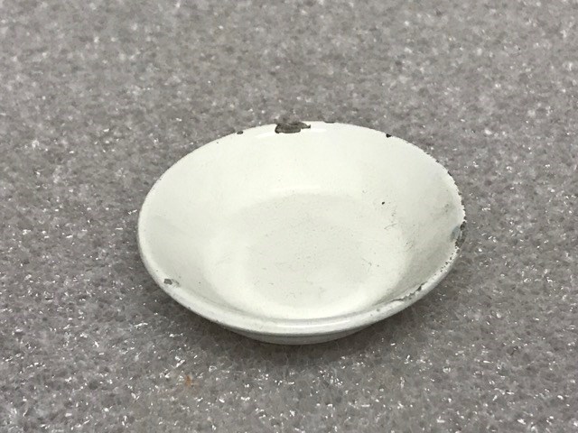
- Date
- 1800 – 1800
- Material
- porcelain
- Catalogue Number
- 104.20.1234
- Description
- Miniature plain white serving dish, with red and cream sticker on bottom that reads: “year 1800”.
1 image
- Title
- Serving Dish
- Date
- 1800 – 1800
- Material
- porcelain
- Dimensions
- 1.2 cm
- Description
- Miniature plain white serving dish, with red and cream sticker on bottom that reads: “year 1800”.
- Subject
- whyte home, miniature, small
- Credit
- Gift of Catharine Robb Whyte, O. C., Banff, 1979
- Catalogue Number
- 104.20.1234
Images
This material is presented as originally created; it may contain outdated cultural descriptions and
potentially offensive content.
Read more.
Miniature Sculpture
https://archives.whyte.org/en/permalink/artifactunk.06.12
- Artist
- Unknown
- Date
- 1800
- Catalogue Number
- UnK.06.12
- Description
- a miniature sculpture in the shape of a crab, made of brown metal.
1 image
- Artist
- Unknown
- Title
- Miniature Sculpture
- Date
- 1800
- Dimensions
- 1.2 x 3.0 cm
- Description
- a miniature sculpture in the shape of a crab, made of brown metal.
- Subject
- animal, crab
- Credit
- Gift of Catharine Robb Whyte, O. C., Banff, 1979
- Catalogue Number
- UnK.06.12
Images

This material is presented as originally created; it may contain outdated cultural descriptions and
potentially offensive content.
Read more.
Profile Relief
https://archives.whyte.org/en/permalink/artifactunk.16.03
- Artist
- Unknown
- Title
- Profile Relief
- Date
- 1800 – 1900
- Dimensions
- 17.5 x 17.5 cm
- Description
- Female profile.
- Subject
- portrait, female
- Credit
- Gift of Catharine Robb Whyte, O. C., Banff, 1979
- Catalogue Number
- UnK.16.03
Images

This material is presented as originally created; it may contain outdated cultural descriptions and
potentially offensive content.
Read more.