Narrow Results By
- Part Of
- Bert Riggall fonds
- Scope & Content
- File consists of 35 b&w, some captioned. The prints pertain to various views of mountains South Western Alberta, South Eastern British Columbia, and Montana. Views include Red Eagle, Little Chief, Citadel peaks, Heaven's peak, Reynold's peak, mount Canon, Logan's pass, Chief Mountain, and Wall Lak…
- Date Range
- 1912 to 1945
- Reference Code
- V26 / III / B17 / PA - 1 to 35
- Description Level
- 5 / File
- Part Of
- Bert Riggall fonds
- Description Level
- 5 / File
- Series
- III. Professional Photography: Topical Files
- Reference Code
- V26 / III / B17 / PA - 1 to 35
- Date Range
- 1912 to 1945
- Physical Description
- Photographs: 35 prints, b&w
- Scope & Content
- File consists of 35 b&w, some captioned. The prints pertain to various views of mountains South Western Alberta, South Eastern British Columbia, and Montana. Views include Red Eagle, Little Chief, Citadel peaks, Heaven's peak, Reynold's peak, mount Canon, Logan's pass, Chief Mountain, and Wall Lake.
- Subject Access
- Mountains
- Title Source
- Title based on contents of file
- Content Details
- This subseries contains 618 prints. They are not individually numbered.
- Processing Status
- Processed
This material is presented as originally created; it may contain outdated cultural descriptions and
potentially offensive content.
Read more.
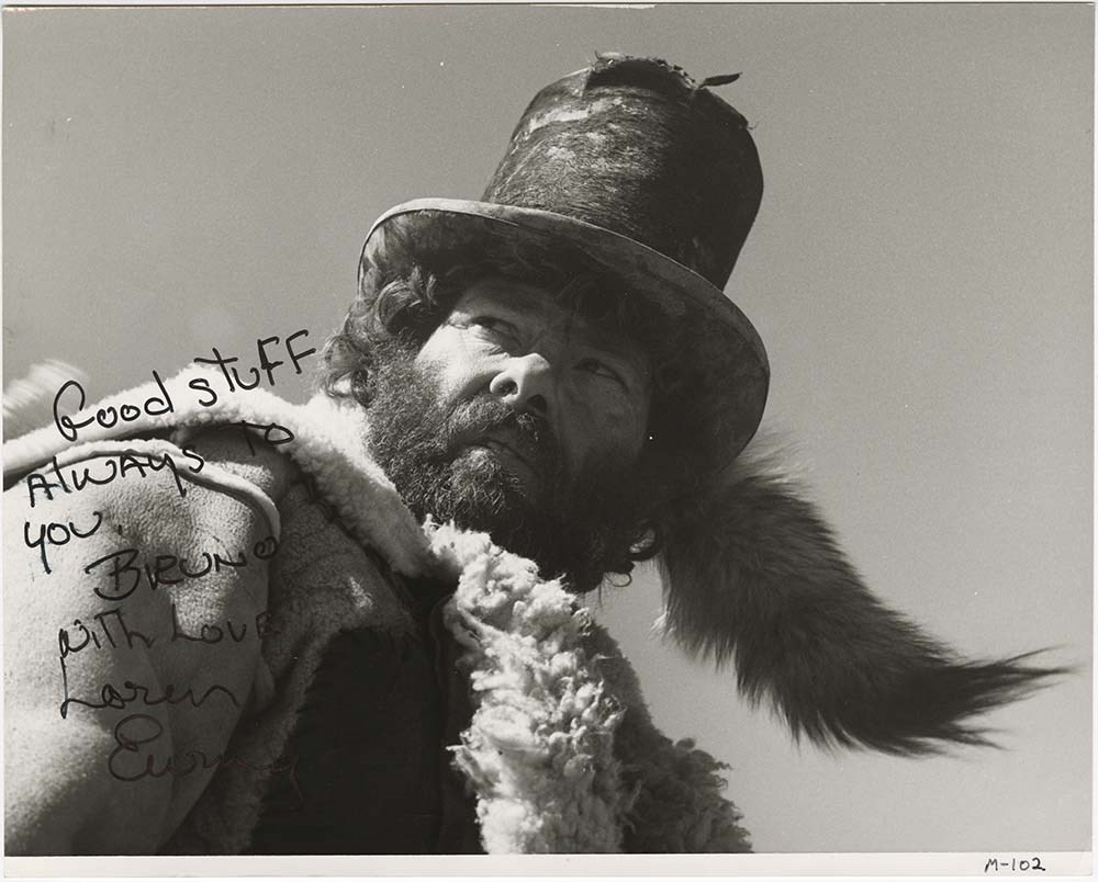
"Movie Actors" Prints
https://archives.whyte.org/en/permalink/descriptions54261
- Part Of
- Bruno Engler fonds
- Scope & Content
- File consists of 35 b&w print photographs (some mounted on cardboard, poster board or other paper backing). Content pertains to portraits of various film actors who were active between 1950 - 1990. Figures include Paul Newman, Bob Logan, Lorne Greene, Oliver Reed, Lee Majors, Leigh Ann Austin, Fred…
- Date Range
- 1953
- 1968
- [ca. 1970 - ca. 1980]
- 1975
- 1978
- 1979
- 1980
- [ca. 1980 - ca. 1990]
- 1985
- Reference Code
- V190 / I / F / 16 / PA - 1 to 35
- Description Level
- 5 / File
- GMD
- Photograph
- Photograph print
2 images
- Part Of
- Bruno Engler fonds
- Description Level
- 5 / File
- Fonds Number
- M323 / V190 / S40
- Sous-Fonds
- V190
- Sub-Series
- V190 / I / F / 16 : Films and Film Making : Movie Actors
- Accession Number
- 7436
- Reference Code
- V190 / I / F / 16 / PA - 1 to 35
- Responsibility
- Bruno Engler
- Date Range
- 1953
- 1968
- [ca. 1970 - ca. 1980]
- 1975
- 1978
- 1979
- 1980
- [ca. 1980 - ca. 1990]
- 1985
- Physical Description
- 35 Photographs: prints; b&w
- Scope & Content
- File consists of 35 b&w print photographs (some mounted on cardboard, poster board or other paper backing). Content pertains to portraits of various film actors who were active between 1950 - 1990. Figures include Paul Newman, Bob Logan, Lorne Greene, Oliver Reed, Lee Majors, Leigh Ann Austin, Fred Gwynne, Michael J. Reynolds, Linda Purl, and John McIntyre; also some unidentified actors. Several of the photographs in this file are signed by the actors depicted in them, with brief messages to Bruno Engler.
- Name Access
- Newman, Paul
- Logan, Bob
- Greene, Lorne
- Reed, Oliver
- Majors, Lee
- Austin, Leigh Ann
- Gwynne, Fred
- Reynolds, Michael J.
- Purl, Linda
- McIntyre. John
- Subject Access
- Film
- Filmaking
- Television
- Geographic Access
- Canada
- Alberta
- Canadian Rocky Mountains
- Access Restrictions
- Items in this file are not to be accessed or distributed without the explicit permission of their identified copyright owners.
- Reproduction Restrictions
- Items in this file are not to be reproduced without the explicit permission of their identified copyright owners.
- Language
- English
- Creator
- Bruno Engler
- Title Source
- Title based on contents of file
- Processing Status
- Processed
Images

This material is presented as originally created; it may contain outdated cultural descriptions and
potentially offensive content.
Read more.
Movie: Mountain Maverick - negatives
https://archives.whyte.org/en/permalink/descriptions57251
- Part Of
- Bruno Engler fonds
- Scope & Content
- File pertains to 73 b&w & colour negatives on 24 strips of film. Includes production photos from the shoot of "Mountain Maverick," consisting of portraits of cast members, action shots from filming, and shots of the sets (mostly mountain scenes).
- Date Range
- 1976-1977
- Reference Code
- V190 / VI / M / x / o / NA - 01 to NA - 24
- Description Level
- 5 / File
- GMD
- Film
- Negative
- Part Of
- Bruno Engler fonds
- Description Level
- 5 / File
- Fonds Number
- M323 / S40 / V190
- Series
- VI : Retained file, M : Alphabetical order
- Sous-Fonds
- V190
- Sub-Series
- x : Movies, o : Mountain Maverick
- Accession Number
- 7436
- Reference Code
- V190 / VI / M / x / o / NA - 01 to NA - 24
- Date Range
- 1976-1977
- Physical Description
- 73 photographs : b&w and col. negatives ; 18.5 x 6.2 cm or smaller
- History / Biographical
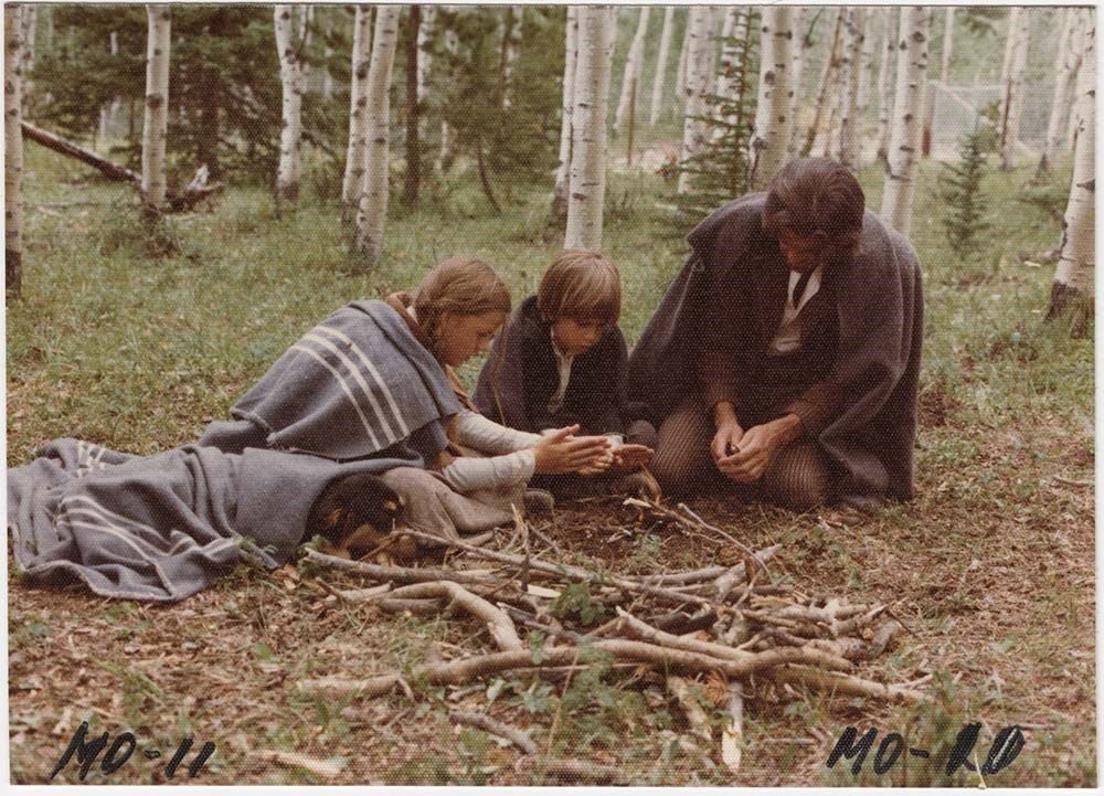
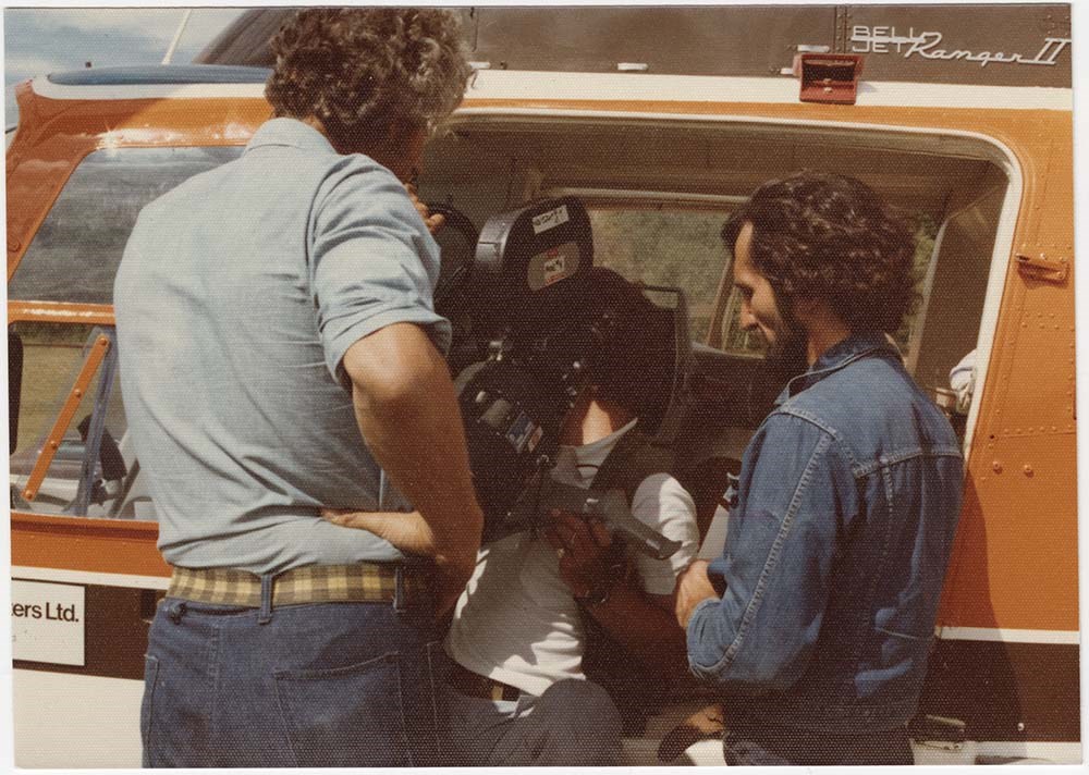
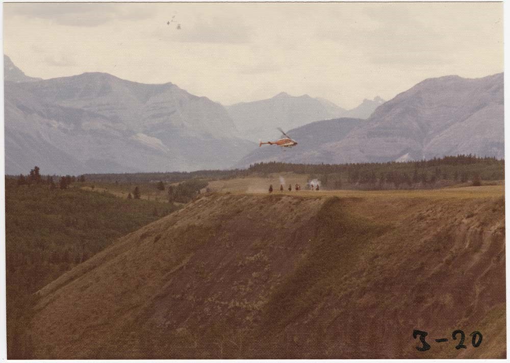
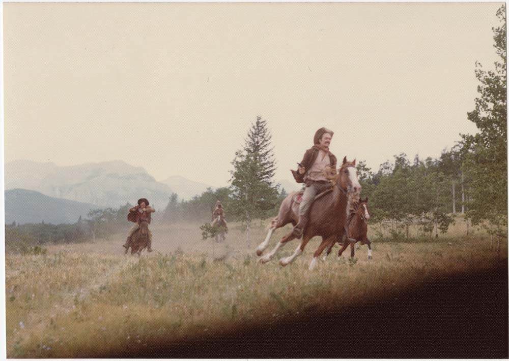
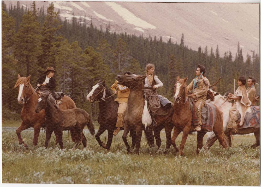
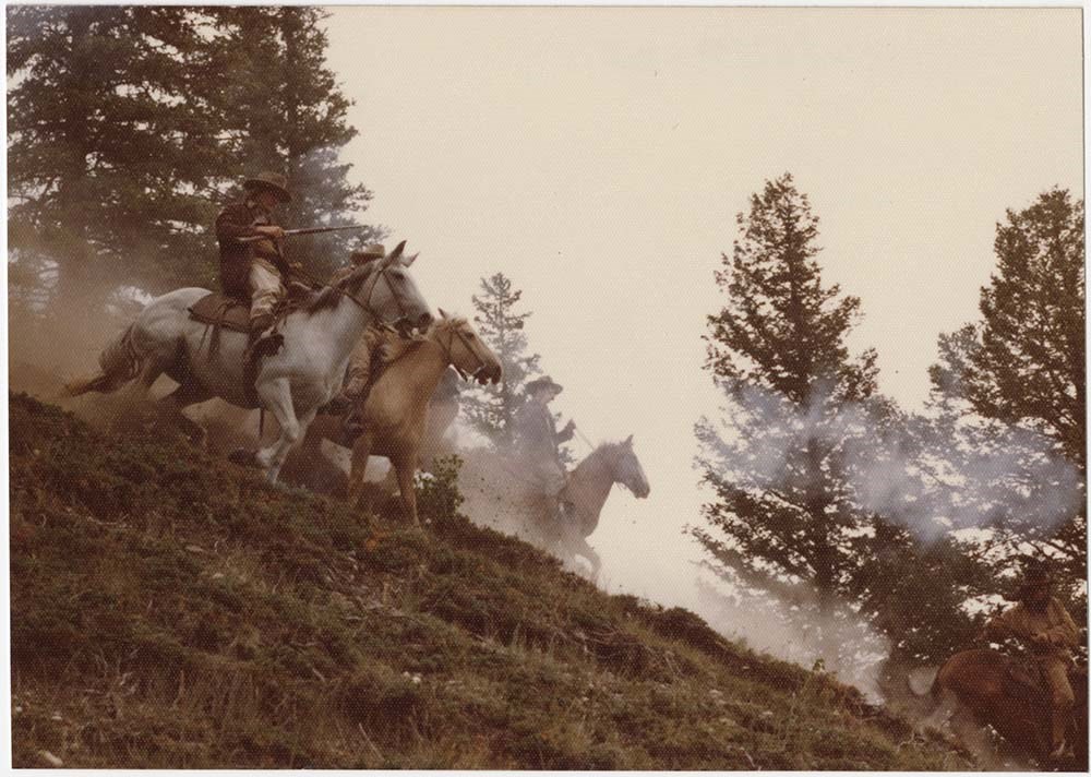
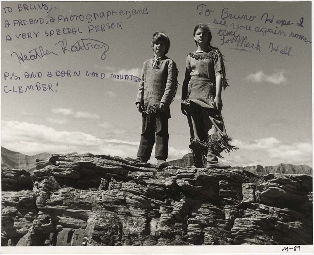
- "Across the Great Divide," called "Mountain Maverick" during production, 1977, directed by Stewart Raffill and starring Robert Logan, Heather Rattery, and Mark Edward Hall. Set in the American Rockies, 1876, a pair of orphans, aided by an itinerant gambler, make their way west through the wilderness to inherit a ranch in Oregon. Location filming primarily around the Seebe area, including Mickey Bailey's Wildlife Unlimited game farm at the base of Yamnuska, and the Mount Assiniboine area.
- Scope & Content
- File pertains to 73 b&w & colour negatives on 24 strips of film. Includes production photos from the shoot of "Mountain Maverick," consisting of portraits of cast members, action shots from filming, and shots of the sets (mostly mountain scenes).
- Subject Access
- Animals
- Children
- Coyote
- Dogs
- Films and film making
- Helicopters
- Hiking
- Horses
- Indigenous Peoples
- Mountains
- Mountain Goats
- Movie Stars
- Geographic Access
- Banff National Park
- Kananaskis Country
- Assiniboine Provincial Park
- Alberta
- British Columbia
- Language
- English
- Related Material
- V190 / VI / M / x / o / PA - 01 to PA - 120
- Creator
- Engler, Bruno
- Biographical Source Notes
- Hollywood in the Canadian Rockies, by Brian Patton, e-book.
- Title Source
- Original title kept
- Processing Status
- Processed
This material is presented as originally created; it may contain outdated cultural descriptions and
potentially offensive content.
Read more.
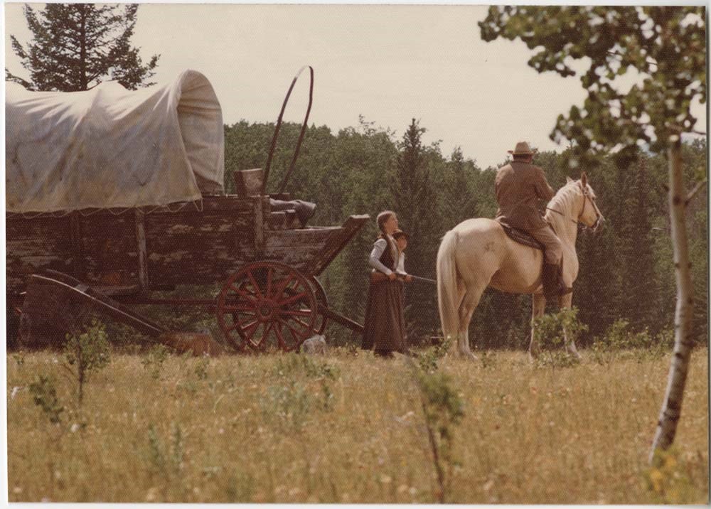
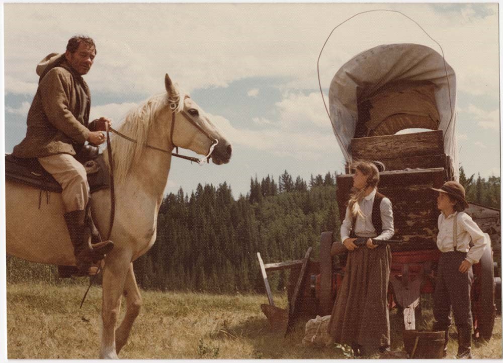
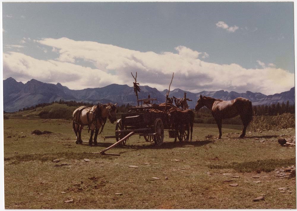
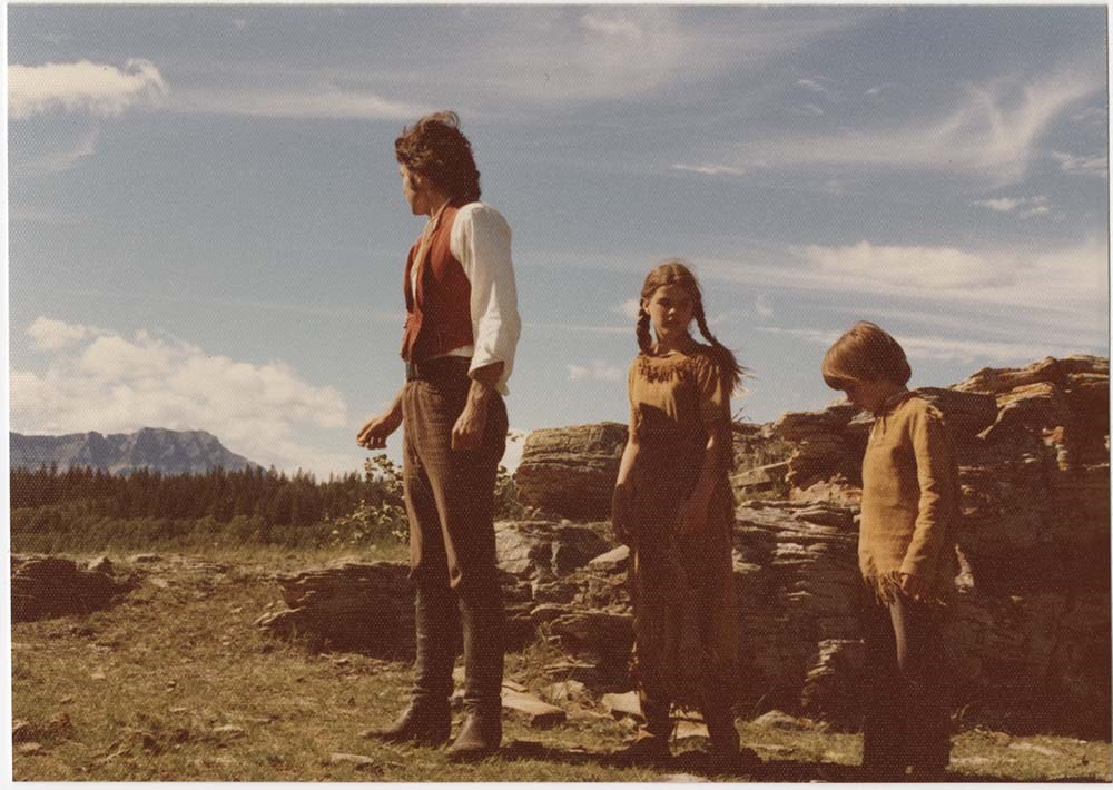
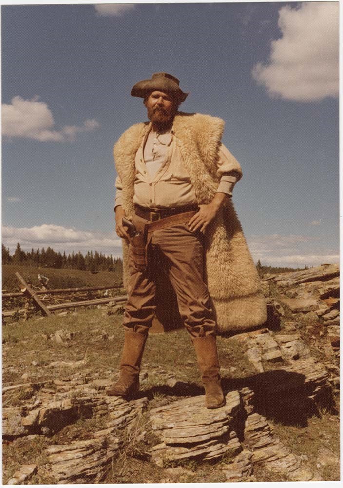
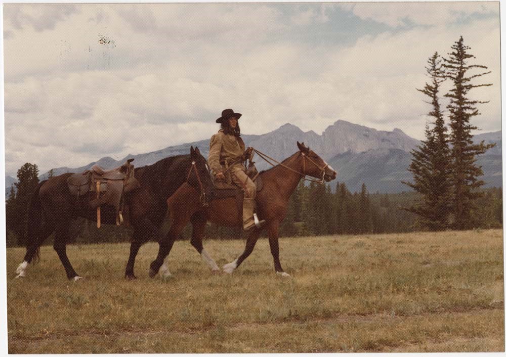
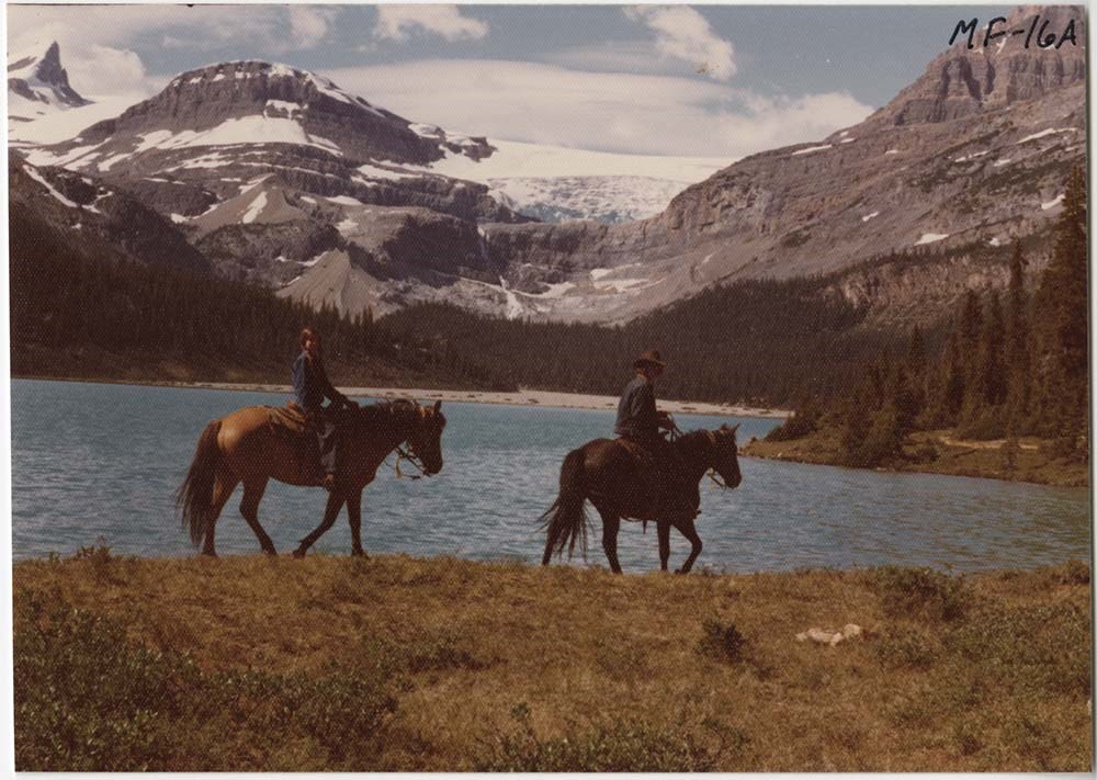
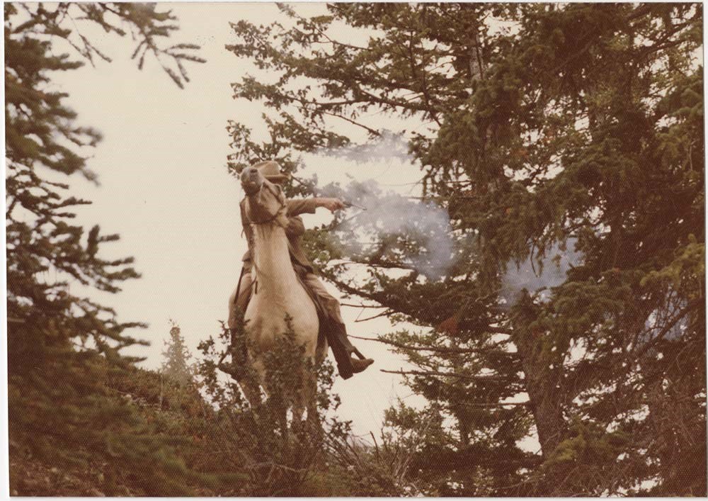
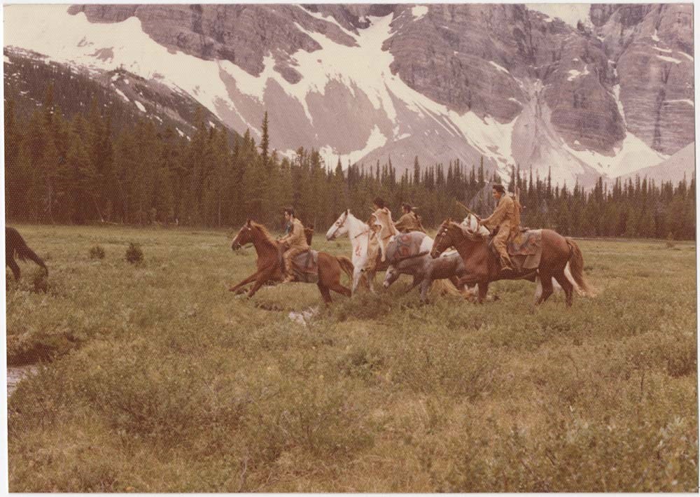
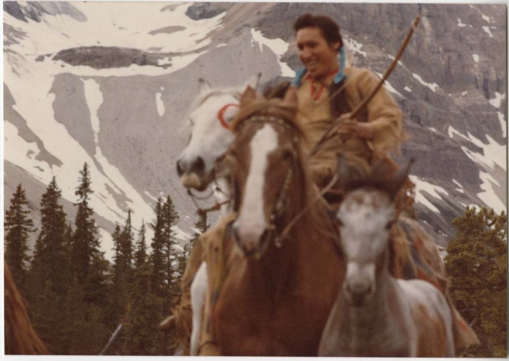
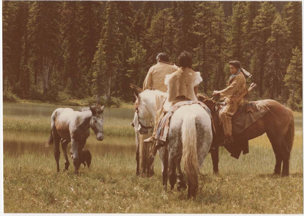
Movie: Mountain Maverick
https://archives.whyte.org/en/permalink/descriptions57250
- Part Of
- Bruno Engler fonds
- Scope & Content
- File pertains to 120 b&w & colour prints of production photos from the shoot of "Mountain Maverick," consisting of portraits of cast members, action shots from filming, shots of the sets (mostly mountain scenes), a few signed portraits from the stars, and contact sheets of negative proofs. Also inc…
- Date Range
- 1976-1977
- Reference Code
- V190 / VI / M / x / o / PA - 01 to PA - 120
- Description Level
- 5 / File
- GMD
- Photograph
28 images
- Part Of
- Bruno Engler fonds
- Description Level
- 5 / File
- Fonds Number
- M323 / S40 / V190
- Series
- VI : Retained file, M : Alphabetical order
- Sous-Fonds
- V190
- Sub-Series
- x : Movies, o : Mountain Maverick
- Accession Number
- 7436
- Reference Code
- V190 / VI / M / x / o / PA - 01 to PA - 120
- GMD
- Photograph
- Date Range
- 1976-1977
- Physical Description
- 120 photographs : b&w & col. ; 23.6 x 12.6 cm or smaller
- History / Biographical
- "Across the Great Divide," called "Mountain Maverick" during production, 1977, directed by Stewart Raffill and starring Robert Logan, Heather Rattery, and Mark Edward Hall. Set in the American Rockies, 1876, a pair of orphans, aided by an itinerant gambler, make their way west through the wilderness to inherit a ranch in Oregon. Location filming primarily around the Seebe area, including Mickey Bailey's Wildlife Unlimited game farm at the base of Yamnuska, and the Mount Assiniboine area.
- Scope & Content
- File pertains to 120 b&w & colour prints of production photos from the shoot of "Mountain Maverick," consisting of portraits of cast members, action shots from filming, shots of the sets (mostly mountain scenes), a few signed portraits from the stars, and contact sheets of negative proofs. Also includes some documents, mostly price lists.
- Subject Access
- Animals
- Children
- Coyote
- Dogs
- Films and film making
- Helicopters
- Hiking
- Horses
- Indigenous Peoples
- Mountains
- Mountain Goats
- Movie Stars
- Geographic Access
- Banff National Park
- Kananaskis Country
- Assiniboine Provincial Park
- Alberta
- British Columbia
- Language
- English
- Related Material
- V190 / VI / M / x / o / NA - 01 to NA - 24
- Creator
- Engler, Bruno
- Biographical Source Notes
- Hollywood in the Canadian Rockies, by Brian Patton, e-book.
- Title Source
- Original title kept
- Processing Status
- Processed
Images


This material is presented as originally created; it may contain outdated cultural descriptions and
potentially offensive content.
Read more.
Maps of the northern Montana to northern Rocky Mountains area
https://archives.whyte.org/en/permalink/descriptions16611
- Part Of
- Bert Riggall fonds
- Scope & Content
- Cartographic materials are holograph maps and annotated published maps concerning the area from northern Montana to the northern Rocky Mountains. Features marked on maps may include ranch properties, trails, routes, camps, game, local names, elevations, hunting and special licence areas, revised p…
- Date Range
- 1928-1943
- Reference Code
- M376 / 87, 88
- Description Level
- 5 / File
- Part Of
- Bert Riggall fonds
- Description Level
- 5 / File
- Series
- II. Business and financial series
- Reference Code
- M376 / 87, 88
- Date Range
- 1928-1943
- Physical Description
- ca.15 cartographic records
- Scope & Content
- Cartographic materials are holograph maps and annotated published maps concerning the area from northern Montana to the northern Rocky Mountains. Features marked on maps may include ranch properties, trails, routes, camps, game, local names, elevations, hunting and special licence areas, revised park boundaries, other
- Creator
- File includes undated maps
- Title Source
- Title based on contents of file
- Content Details
- LIST OF ITEMS :
- * Laurier Pass country. -- [ca.1930]. -- 4 cartographic records. -- Letters transferred to correspondence series (M376/87)
- * Halfway River / Department of the Interior, Surveyor General, Ottawa. -- 1928 April. -- Scale 4 miles : inch (M376/87)
- * Prophet River, British Columbia / Department of the Interior, Surveyor General, Ottawa. -- 1928 April. -- Scale 4 miles : inch (M376/87)
- * Report of an exploratory trip in the area covered by Halfway River and Prophet River, sheets of the National Topographic Series in the Province of British Columbia. -- 1928. -- [ n.s.]. By McCuster, K.F., D.L.S., F.A. Ackland, Printer. Ottawa (M376/87)
- * Hudson Hope British Columbia / Department of the Interior, Surveyor General, Ottawa. -- 1929 February. -- Scale 8 miles : inch (M376/87)
- * Hand-drawn map. -- [n.d.]. -- Map of the area located north-east of Jasper Park boundary on a fork of the Hay River, northwest of Solomon Creek, showing game locations of caribou and sheep. Map is drawn on reverse of published map: Jasper Park in the Province of Alberta (M376/88)
- * Hand-drawn map. -- [n.d.] -- Map of sheep hunting territory north of Jasper Park boundary, near Hay River (M376/88)
- * Jasper Park, Alberta, Mount Robson, British Columbia, Canadian Rocky Mountains, Grand Trunk Pacific Railway / compiled in part from the Topographical Surveys by the Alpine Club of Canada. -- [n.d.]. -- Annotation reads: Indicates route Bert Riggall took on his 1911 trip, trails and stops marked. Scale: 5 miles to an inch (M376/88)
- * Province of Alberta, Canada / Department of Lands of Mine, Canada. -- 1941. -- Annotated, showing areas near Clearwater River and north of Jasper as "special license". Scale 16 miles : inch (M376/88)
- * Midnapore, Alberta showing (C.W. Peterson's Ranch) Craighurst Farm / Department of Mines and Resources, Canada. -- 1940. -- Annotation shows 1904 location of ranch. Scale 1 : 63,360 or 1 mile : inch (M376/88)
- * Mundy's pocket map of northwest Canada and part of Alaska / Mundy Map Co., Edmonton, Alberta. -- 1943. -- Resources map annotated with highlight of Mt. Logan area. Scale 62 miles : inch (M376/88)
- Laurier Pass country. -- [ca.1930]. -- 4 cartographic records. -- Letters transferred to correspondence series
- Part of file: Maps of the northern Montana to northern Rocky Mountains area Halfway River / Department of the Interior, Surveyor General, Ottawa. -- 1928 April. -- Scale 4 miles : inch
- Part of file: Maps of the northern Montana to northern Rocky Mountains area Prophet River, British Columbia / Department of the Interior, Surveyor General, Ottawa. -- 1928 April. -- Scale 4 miles : inch
- Part of file: Maps of the northern Montana to northern Rocky Mountains area Report of an exploratory trip in the area covered by Halfway River and Prophet River, sheets of the National Topographic Series in the Province of British Columbia. -- 1928. -- [ n.s.]. By McCuster, K.F., D.L.S., F.A. Ackland, Printer. Ottawa
- Part of file: Maps of the northern Montana to northern Rocky Mountains area Hudson Hope British Columbia / Department of the Interior, Surveyor General, Ottawa. -- 1929 February. -- Scale 8 miles : inch
- Part of file: Maps of the northern Montana to northern Rocky Mountains area Hand-drawn map. -- [n.d.]. -- Map of the area located north-east of Jasper Park boundary on a fork of the Hay River, northwest of Solomon Creek, showing game locations of caribou and sheep. Map is drawn on reverse of published map: Jasper Park in the Province of Alberta
- Part of file: Maps of the northern Montana to northern Rocky Mountains area Hand-drawn map. -- [n.d.] -- Map of sheep hunting territory north of Jasper Park boundary, near Hay River
- Part of file: Maps of the northern Montana to northern Rocky Mountains area Jasper Park, Alberta, Mount Robson, British Columbia, Canadian Rocky Mountains, Grand Trunk Pacific Railway / compiled in part from the Topographical Surveys by the Alpine Club of Canada. -- [n.d.]. -- Annotation reads: Indicates route Bert Riggall took on his 1911 trip, trails and stops marked. Scale: 5 miles to an inch
- Part of file: Maps of the northern Montana to northern Rocky Mountains area Province of Alberta, Canada / Department of Lands of Mine, Canada. -- 1941. -- Annotated, showing areas near Clearwater River and north of Jasper as "special license". Scale 16 miles : inch
- Part of file: Maps of the northern Montana to northern Rocky Mountains area Midnapore, Alberta showing (C.W. Peterson's Ranch) Craighurst Farm / Department of Mines and Resources, Canada. -- 1940. -- Annotation shows 1904 location of ranch. Scale 1 : 63,360 or 1 mile : inch
- Part of file: Maps of the northern Montana to northern Rocky Mountains area Mundy's pocket map of northwest Canada and part of Alaska / Mundy Map Co., Edmonton, Alberta. -- 1943. -- Resources map annotated with highlight of Mt. Logan area. Scale 62 miles : inch
- Part of file: Maps of the northern Montana to northern Rocky Mountains area Maps held in oversize "F"
This material is presented as originally created; it may contain outdated cultural descriptions and
potentially offensive content.
Read more.