Narrow Results By
Bert Riggall fonds
https://archives.whyte.org/en/permalink/descriptions587
- Part Of
- Bert Riggall fonds
- Scope & Content
- Fonds includes seven series: I. Personal and professional, 1884-1959; II. Business and financial, ca.1910-1959; III. Professional photography, 1900-1955; IV. Writing, 1906-1957; V. Natural history, 1904-1954; VI. Other interests, 1913-1956; VII. Riggall family, ca.1865-1959. Personal and pro…
- Date Range
- [ca.1865]-1959, predominant [ca.1890]-1959
- Reference Code
- M376 / V26
- Description Level
- 1 / Fonds
- GMD
- Photograph
- Album
- Negative
- Photograph print
- Transparency
- Textual record
- Diary
- Map
- Private record
- Published record
- Part Of
- Bert Riggall fonds
- Description Level
- 1 / Fonds
- Fonds Number
- M 376
- V 26
- Sous-Fonds
- M 376
- V 26
- Accession Number
- 5777, 7200, 7201, 7772 (unproc)
- Reference Code
- M376 / V26
- GMD
- Photograph
- Album
- Negative
- Photograph print
- Transparency
- Textual record
- Diary
- Map
- Private record
- Published record
- Date Range
- [ca.1865]-1959, predominant [ca.1890]-1959
- Physical Description
- ca.13,100 photographs: ca.7080 prints, ca.5310 negatives, ca.700 transparencies. -- 9 photograph albums. -- ca.2 m textual records, print material and graphic records. -- 33 cartographic records
- History / Biographical
- Frederick Herbert (Bert) Riggall, 1884-1959, was a mountain guide, outfitter, hunter, trapper, rancher, naturalist, photographer, writer and gunsmith/loader in southern Alberta. Born in 1884 at Gayton-le-Wold Grange, Lincolnshire, his family moved to Grimsby where his father was an auctioneer and, in 1905, served as Mayor. In England, Riggall was an athlete, avid sportsman and naturalist. He was exposed to alpine country on school holidays in Switzerland and, determined to visit Canada, left for North America in 1904.
- Upon arriving in western Canada, Riggall worked for a year at Craighurst Farm near Calgary. There he met Dorothea (Dora) Williams, 1877-1951, an Irish Quaker ranch cook who had emigrated with her sister Anna in 1902. In 1905, Bert worked on the Correction Land Survey in southwestern Alberta and explored Waterton Lakes. Bert and Dora married in 1906 and until 1946 they homesteaded and ranched adjacent to Waterton Lakes National Park.
- Initially, Bert and partner Jack Hazzard built boats and guided fishing parties on Waterton Lakes. In 1909, with partner Cyril Watmough, the Riggalls began guiding and outfitting summer and fall hunting and fishing trips for numerous repeat clients, especially, after 1913, four Minneapolis, Minnesota families: Bovey, Crosby, Bennett and McKnight. Hunts involved Big Horn Sheep, goats, black and grizzly bears. Bert served as chief guide and Dora as camp cook. Prior to 1911, the Riggalls worked at Gloyne's oil camp and Oil City to supplement their income. In 1911, Bert and partner Cyril Watmough made a 1000 mile (1600 km) exploratory trip from Fort Steele, B.C. to the Yellowhead Pass and beyond. Following that trip, Riggall concentrated guiding activities on the continental divide as far north as the Highwood region, but primarily in the upper Oldman River Valley and Gap in the Livingstone Range. Their outfit grew to include numerous saddle and pack horses.
- Of five children, only two daughters survived infancy. Kay Riggall (Russell), 1909-1984, and Doris (Babe) Riggall (Burton), 1910-1999, were both able riders, markswomen and packtrain workers. They accompanied their parents on summer back country trips starting in 1918. Bert Riggall was renowned for his knowledge of botany, geology, zoology, wilderness life and lore as well as literature and current affairs. He was especially endeared to his clients for his skill as a raconteur and campfire storyteller. He wrote articles for magazines such as: Arms and the Man, American Rifleman, Field and Stream and the Boone and Crockett Club's book: North American Big Game. Riggall was an accomplished semi-professional photographer who specialized in wildlife studies, panoramic landscapes, Dufaycolor and later Kodachrome transparencies. His photographs appear in Department of Interior Reports and other publications.
- Bert's heart problems forced the Riggalls to move to Pincher Creek in 1947. Daughter Kay and son-in-law Andy Russell continued the packtrain and guiding business until 1960. After Dora's death, Bert experienced medical problems and lived with or close to Doris.
- Scope & Content
- Fonds includes seven series: I. Personal and professional, 1884-1959; II. Business and financial, ca.1910-1959; III. Professional photography, 1900-1955; IV. Writing, 1906-1957; V. Natural history, 1904-1954; VI. Other interests, 1913-1956; VII. Riggall family, ca.1865-1959.
- Personal and professional series consists of diaries and notes, correspondence and personal papers.
- Business and financial series consists of guiding and ranching records, gunsmithing, shooting and loading records; and legal and financial records.
- Professional photography series consists of standard photographs, panoramas, transparencies and textual records
- Writing series contains manuscripts, published magazines, book outlines, newspaper articles and letters to the editor
- Natural history series contains bird and plant records, and other natural history papers
- Other interests series consist of clippings, annotated books and collected material
- Riggall family series contains Bert and Dora Riggall family papers and photographs, Williams family photographs, Frederick W. and Fanny Riggall papers and photographs, and Allan Riggall papers and photographs. Negatives and transparencies pertain to Andy Russell as a young man with Bert Riggall.
- Notes
- Some transparencies in V110 Dick Russell are marked Andy Russell, some marked 64 dup; V110 - original transparencies have full set of duplicates (2 sets were made, 1 for Dick Russell and the other is part of this accession)
- Name Access
- Riggall, Bert
- Subject Access
- Arts
- Environment
- Exploration, discovery and travel
- Family and personal life
- Sports, recreation and leisure
- Access Restrictions
- Some restriction/s on access
- Copyright, privacy, commercial use and other restrictions may apply
- Language
- Language is English
- Finding Aid
- basic description for processed material
- Related Material
- Related to the Andy Russell fonds (M153/S43/V555) and the Kay Russell family fonds (M63/V63)
- Creator
- Riggall, Bert
- Category
- Arts
- Environment
- Exploration, discovery and travel
- Family and personal life
- Sports, recreation and leisure
- Title Source
- Title based on accession record and contents of fonds
- Processing Status
- Processed / Unprocessed
This material is presented as originally created; it may contain outdated cultural descriptions and
potentially offensive content.
Read more.
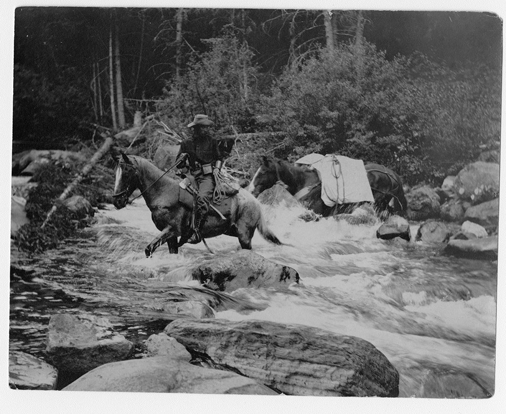
F.H. Riggall and packhourse crossing Boundary Creek
https://archives.whyte.org/en/permalink/descriptions53797
- Part Of
- Bert Riggall fonds
- Scope & Content
- Image depicts Bert Riggall and packhorse crossing Boundary Creek with Phillip R. Goodwin, artist of New York, in August, 1909.
- Date Range
- 1909
- Reference Code
- V26 / III / A1 / PA - 7
- Description Level
- 6 / Item
- GMD
- Photograph
- Photograph print
1 image
- Part Of
- Bert Riggall fonds
- Description Level
- 6 / Item
- Fonds Number
- M376 / V26
- Series
- III. Professional Photography: Guiding and Hunting Trips
- Sous-Fonds
- V26
- Sub-Series
- Goodwin and Proctor Trips
- Accession Number
- 7201
- Reference Code
- V26 / III / A1 / PA - 7
- Date Range
- 1909
- Physical Description
- 1 photograph : b&w print
- Scope & Content
- Image depicts Bert Riggall and packhorse crossing Boundary Creek with Phillip R. Goodwin, artist of New York, in August, 1909.
- Name Access
- Goodwin, Phillip R.
- Riggall, Bert
- Subject Access
- Environment and Nature
- Pack trips
- Exploration
- Horses
- Horse packing
- Geographic Access
- Canada
- British Columbia
- Boundary Creek
- Language
- N/A
- Title Source
- Title based on subject of item
- Processing Status
- Processed
Images
This material is presented as originally created; it may contain outdated cultural descriptions and
potentially offensive content.
Read more.
Maps of the northern Montana to northern Rocky Mountains area
https://archives.whyte.org/en/permalink/descriptions16611
- Part Of
- Bert Riggall fonds
- Scope & Content
- Cartographic materials are holograph maps and annotated published maps concerning the area from northern Montana to the northern Rocky Mountains. Features marked on maps may include ranch properties, trails, routes, camps, game, local names, elevations, hunting and special licence areas, revised p…
- Date Range
- 1928-1943
- Reference Code
- M376 / 87, 88
- Description Level
- 5 / File
- Part Of
- Bert Riggall fonds
- Description Level
- 5 / File
- Series
- II. Business and financial series
- Reference Code
- M376 / 87, 88
- Date Range
- 1928-1943
- Physical Description
- ca.15 cartographic records
- Scope & Content
- Cartographic materials are holograph maps and annotated published maps concerning the area from northern Montana to the northern Rocky Mountains. Features marked on maps may include ranch properties, trails, routes, camps, game, local names, elevations, hunting and special licence areas, revised park boundaries, other
- Creator
- File includes undated maps
- Title Source
- Title based on contents of file
- Content Details
- LIST OF ITEMS :
- * Laurier Pass country. -- [ca.1930]. -- 4 cartographic records. -- Letters transferred to correspondence series (M376/87)
- * Halfway River / Department of the Interior, Surveyor General, Ottawa. -- 1928 April. -- Scale 4 miles : inch (M376/87)
- * Prophet River, British Columbia / Department of the Interior, Surveyor General, Ottawa. -- 1928 April. -- Scale 4 miles : inch (M376/87)
- * Report of an exploratory trip in the area covered by Halfway River and Prophet River, sheets of the National Topographic Series in the Province of British Columbia. -- 1928. -- [ n.s.]. By McCuster, K.F., D.L.S., F.A. Ackland, Printer. Ottawa (M376/87)
- * Hudson Hope British Columbia / Department of the Interior, Surveyor General, Ottawa. -- 1929 February. -- Scale 8 miles : inch (M376/87)
- * Hand-drawn map. -- [n.d.]. -- Map of the area located north-east of Jasper Park boundary on a fork of the Hay River, northwest of Solomon Creek, showing game locations of caribou and sheep. Map is drawn on reverse of published map: Jasper Park in the Province of Alberta (M376/88)
- * Hand-drawn map. -- [n.d.] -- Map of sheep hunting territory north of Jasper Park boundary, near Hay River (M376/88)
- * Jasper Park, Alberta, Mount Robson, British Columbia, Canadian Rocky Mountains, Grand Trunk Pacific Railway / compiled in part from the Topographical Surveys by the Alpine Club of Canada. -- [n.d.]. -- Annotation reads: Indicates route Bert Riggall took on his 1911 trip, trails and stops marked. Scale: 5 miles to an inch (M376/88)
- * Province of Alberta, Canada / Department of Lands of Mine, Canada. -- 1941. -- Annotated, showing areas near Clearwater River and north of Jasper as "special license". Scale 16 miles : inch (M376/88)
- * Midnapore, Alberta showing (C.W. Peterson's Ranch) Craighurst Farm / Department of Mines and Resources, Canada. -- 1940. -- Annotation shows 1904 location of ranch. Scale 1 : 63,360 or 1 mile : inch (M376/88)
- * Mundy's pocket map of northwest Canada and part of Alaska / Mundy Map Co., Edmonton, Alberta. -- 1943. -- Resources map annotated with highlight of Mt. Logan area. Scale 62 miles : inch (M376/88)
- Laurier Pass country. -- [ca.1930]. -- 4 cartographic records. -- Letters transferred to correspondence series
- Part of file: Maps of the northern Montana to northern Rocky Mountains area Halfway River / Department of the Interior, Surveyor General, Ottawa. -- 1928 April. -- Scale 4 miles : inch
- Part of file: Maps of the northern Montana to northern Rocky Mountains area Prophet River, British Columbia / Department of the Interior, Surveyor General, Ottawa. -- 1928 April. -- Scale 4 miles : inch
- Part of file: Maps of the northern Montana to northern Rocky Mountains area Report of an exploratory trip in the area covered by Halfway River and Prophet River, sheets of the National Topographic Series in the Province of British Columbia. -- 1928. -- [ n.s.]. By McCuster, K.F., D.L.S., F.A. Ackland, Printer. Ottawa
- Part of file: Maps of the northern Montana to northern Rocky Mountains area Hudson Hope British Columbia / Department of the Interior, Surveyor General, Ottawa. -- 1929 February. -- Scale 8 miles : inch
- Part of file: Maps of the northern Montana to northern Rocky Mountains area Hand-drawn map. -- [n.d.]. -- Map of the area located north-east of Jasper Park boundary on a fork of the Hay River, northwest of Solomon Creek, showing game locations of caribou and sheep. Map is drawn on reverse of published map: Jasper Park in the Province of Alberta
- Part of file: Maps of the northern Montana to northern Rocky Mountains area Hand-drawn map. -- [n.d.] -- Map of sheep hunting territory north of Jasper Park boundary, near Hay River
- Part of file: Maps of the northern Montana to northern Rocky Mountains area Jasper Park, Alberta, Mount Robson, British Columbia, Canadian Rocky Mountains, Grand Trunk Pacific Railway / compiled in part from the Topographical Surveys by the Alpine Club of Canada. -- [n.d.]. -- Annotation reads: Indicates route Bert Riggall took on his 1911 trip, trails and stops marked. Scale: 5 miles to an inch
- Part of file: Maps of the northern Montana to northern Rocky Mountains area Province of Alberta, Canada / Department of Lands of Mine, Canada. -- 1941. -- Annotated, showing areas near Clearwater River and north of Jasper as "special license". Scale 16 miles : inch
- Part of file: Maps of the northern Montana to northern Rocky Mountains area Midnapore, Alberta showing (C.W. Peterson's Ranch) Craighurst Farm / Department of Mines and Resources, Canada. -- 1940. -- Annotation shows 1904 location of ranch. Scale 1 : 63,360 or 1 mile : inch
- Part of file: Maps of the northern Montana to northern Rocky Mountains area Mundy's pocket map of northwest Canada and part of Alaska / Mundy Map Co., Edmonton, Alberta. -- 1943. -- Resources map annotated with highlight of Mt. Logan area. Scale 62 miles : inch
- Part of file: Maps of the northern Montana to northern Rocky Mountains area Maps held in oversize "F"
This material is presented as originally created; it may contain outdated cultural descriptions and
potentially offensive content.
Read more.
Maps of the Waterton and upper Oldman River areas
https://archives.whyte.org/en/permalink/descriptions16603
- Part Of
- Bert Riggall fonds
- Scope & Content
- File consists of annotated published maps and holograph map pertaining to packtrain trips, expeditions and ranch properties, mainly in the Waterton and Upper Oldman River areas. Features marked on maps may include ranch properties, trails, routes, camps, game, local names, elevations, hunting and …
- Date Range
- [ca.1910]-1945
- Reference Code
- M376 / 84 to 86
- Description Level
- 5 / File
- Part Of
- Bert Riggall fonds
- Description Level
- 5 / File
- Series
- II. Business and financial series
- Reference Code
- M376 / 84 to 86
- Date Range
- [ca.1910]-1945
- Physical Description
- ca.23 cartographic records
- Scope & Content
- File consists of annotated published maps and holograph map pertaining to packtrain trips, expeditions and ranch properties, mainly in the Waterton and Upper Oldman River areas. Features marked on maps may include ranch properties, trails, routes, camps, game, local names, elevations, hunting and special licence areas, revised park boundaries, 1911 expedition to Jasper and Tete Jaune Cache, other
- Creator
- File includes undated maps
- Title Source
- Title based on contents of file
- Content Details
- LIST OF ITEMS (M376 / 84 to 86) :
- * Sketch map of s.e. BC, s.w. Alberta. -- 1913. -- 1 photograph : copy. -- Copy of hand-drawn map of area bounded by Kintla Peak, Montana; Waterton Lakes; Twin Butte; Oldman River. Original drawn by F. H. Riggall (M376/84)
- * Waterton Lakes Park, Alberta / Department of the Interior, Canada. -- 1918 January. -- Annotated showing location of Hawks Nest lodge and trails and elevations in the South Castle River area. -- Scale 1 : 100,000 or 1.58 miles : inch (M376/84)
- * Waterton, Alberta / Department of Mines and Resources. -- 1945. -- Annotated with F.H Riggall and A.K. Russell lands. * 2 copies (M376/84)
- * Waterton, Alberta / Department of Mines and Resources. -- 1945. -- Annotated with ranch locations, elevations and Hawks Nest lodge. * 2 copies.
- * Waterton Lakes Park Alberta from photographic surveys by M. P. Bridgland D.L.S. and A. O. Wheeler B.C.L.S. / Department of the Interior Canada. -- [n.d.]. -- Annotated, showing elevations, lake? and unidentified bounded area within park. Scale: 1/100000 or 1.58 miles to 1 inch (M376/84)
- * Waterton Lakes Park Alberta from photographic surveys by M. P. Bridgland D.L.S. and A. O. Wheeler B.C.L.S. / Department of the Interior Canada. -- [n.d.]. -- Annotated, showing cabin or campsites? and unidentified bounded area within park. Scale: 1/100000 or 1.58 miles to 1 inch (M376/84)
- * Waterton and north. -- [n.d.]. -- S.W. Alberta, Canada; South Castle River with trails and campsites marked. Annotated. Scale 1 : 40,000 (M376/84) (stored rolled)
- * Topographic map. -- [n.d.]. -- N.W. Montana, USA; Waterton Valley area between Flathead and St. Mary's rivers, south of Waterton Lake, Canada. Scale [1 : 50,000?]. -- Title based on map (M376/84) (stored rolled)
- * Northern part of the Crowsnest Forest Reserve, Alberta. -- 1913. -- Annotated, showing camps? near Coleman and Racehorse Creek. Scale 1: 40,000 ft. (M376/85)
- * South Castle River. --[n.d.]. -- Annotated with place names and elevations. Scale 4 miles : inch (M376/85)
- * Livingstone Range. -- [n.d.]. -- Annotated with place names, camps? and trails in North Boundary, Dutch Creek and north fork of Oldman River areas. Scale 1 mile : 1/2 inch (M376/85)
- * Lethbridge, west of fourth meridian / Office of the Surveyor General, Ottawa. -- 1924 May. -- S.W. Alberta, Canada, showing locations of Butcher Russell & Alberta Ranch. Scale 1 : 190,080 or 3 miles inch (M376/85)
- * Callum Creek / Department of Mines and Resources. -- 1943. --. Annotated with names of ranches and ranchers (M376/85)
- * Cowley, Alberta / Department of Mines and Resources. -- 1943 --. Annotated with names of ranches, ranchers and local schools (M376/85)
- * Beaver Mines, Alberta / Department of Mines and Resources. -- 1943. -- Annotated with location of Butcher's house and Cooks and Alberta ranches (M376/85)
- * Bow River Provincial Forest / Department of Lands and Mines, Forest Service, Government of the Province of Alberta. -- 1936 October 1. -- Camps, Crosby trip 1933, S.W. Alberta, Canada. Scale 3 miles : inch (M376/86)
- * Foothills of SW Alberta / Dept. of the Interior, Canada. -- [after 1910]. -- Map to accompany report of G.H. Edgecombe, BSc,B.Sc.F., on the Rocky Mountains Forest Reserve. SW Alberta, showing timber, woodland, open grazing, bare rock, coal seams, dwellings and sawmills. Annotated. Scale 6 miles : inch (M376/86)
- * Upper Elk and Upper Highwood Rivers, British Columbia and Alberta / Department of Mines, Canada. --1920 -- Annotated with place names, camps? and trails in Livingstone River and Upper Highwood River areas. Scale 4 miles : inch or 1 : 250,000 (M376/86)
- * British Columbia and Alberta Pincher Creek sheet west of fifth meridian / Surveyor General, Ottawa. -- 1916. -- Annotated with title: "Flathead Valley", campsites?, wells, games locations, personal contacts? (M376/86)
- * Boundary between Alberta and British Columbia / Surveyor General, Ottawa. -- 1914 (M376/86)
- * East and West Kootenay / British Columbia Dept. of Lands, Canada. -- 1911. -- Annotated with locations of camps? in Elk River Valley. Scale 8 miles : inch (M376/86)
- * Hand-drawn map. -- [n.d.]. -- Map shows camps and trails in the Kootenay area, SW British Columbia, indicates directions. Directions given on bottom (M376/86)
- Sketch map of s.e. BC, s.w. Alberta. -- 1913. -- 1 photograph : copy. -- Copy of hand-drawn map of area bounded by Kintla Peak, Montana; Waterton Lakes; Twin Butte; Oldman River. Original drawn by F. H. Riggall
- Part of file: Maps of the Waterton and upper Oldman River areas Waterton Lakes Park, Alberta / Department of the Interior, Canada. -- 1918 January. -- Annotated showing location of Hawks Nest lodge and trails and elevations in the South Castle River area. -- Scale 1 : 100,000 or 1.58 miles : inch
- Part of file: Maps of the Waterton and upper Oldman River areas Waterton, Alberta / Department of Mines and Resources. -- 1945. -- Annotated with F.H Riggall and A.K. Russell lands. * 2 copies
- Part of file: Maps of the Waterton and upper Oldman River areas Waterton, Alberta / Department of Mines and Resources. -- 1945. -- Annotated with ranch locations, elevations and Hawks Nest lodge. * 2 copies.
- Part of file: Maps of the Waterton and upper Oldman River areas Waterton Lakes Park Alberta from photographic surveys by M. P. Bridgland D.L.S. and A. O. Wheeler B.C.L.S. / Department of the Interior Canada. -- [n.d.]. -- Annotated, showing elevations, lake? and unidentified bounded area within park. Scale: 1/100000 or 1.58 miles to 1 inch
- Part of file: Maps of the Waterton and upper Oldman River areas Waterton Lakes Park Alberta from photographic surveys by M. P. Bridgland D.L.S. and A. O. Wheeler B.C.L.S. / Department of the Interior Canada. -- [n.d.]. -- Annotated, showing cabin or campsites? and unidentified bounded area within park. Scale: 1/100000 or 1.58 miles to 1 inch
- Part of file: Maps of the Waterton and upper Oldman River areas Waterton and north. -- [n.d.]. -- S.W. Alberta, Canada; South Castle River with trails and campsites marked. Annotated. Scale 1 : 40,000 (stored rolled)
- Part of file: Maps of the Waterton and upper Oldman River areas Topographic map. -- [n.d.]. -- N.W. Montana, USA; Waterton Valley area between Flathead and St. Mary's rivers, south of Waterton Lake, Canada. Scale [1 : 50,000?]. -- Title based on map
- Part of file: Maps of the Waterton and upper Oldman River areas Northern part of the Crowsnest Forest Reserve, Alberta. -- 1913. -- Annotated, showing camps? near Coleman and Racehorse Creek. Scale 1: 40,000 ft.
- Part of file: Maps of the Waterton and upper Oldman River areas South Castle River. -- [n.d.]. -- Annotated with place names and elevations. Scale 4 miles : inch
- Part of file: Maps of the Waterton and upper Oldman River areas Livingstone Range. -- [n.d.]. -- Annotated with place names, camps? and trails in North Boundary, Dutch Creek and north fork of Oldman River areas. Scale 1 mile : 1/2 inch
- Part of file: Maps of the Waterton and upper Oldman River areas Lethbridge, west of fourth meridian / Office of the Surveyor General, Ottawa. -- 1924 May. -- S.W. Alberta, Canada, showing locations of Butcher Russell & Alberta Ranch. Scale 1 : 190,080 or 3 miles inch
- Part of file: Maps of the Waterton and upper Oldman River areas Callum Creek / Department of Mines and Resources. -- 1943. --. Annotated with names of ranches and ranchers
- Part of file: Maps of the Waterton and upper Oldman River areas Cowley, Alberta / Department of Mines and Resources. -- 1943 -- Annotated with names of ranches, ranchers and local schools
- Part of file: Maps of the Waterton and upper Oldman River areas Beaver Mines, Alberta / Department of Mines and Resources. -- 1943. -- Annotated with location of Butcher's house and Cooks and Alberta ranches
- Part of file: Maps of the Waterton and upper Oldman River areas Bow River Provincial Forest / Department of Lands and Mines, Forest Service, Government of the Province of Alberta. -- 1936 October 1. -- Camps, Crosby trip 1933, S.W. Alberta, Canada. Scale 3 miles : inch
- Part of file: Maps of the Waterton and upper Oldman River areas Foothills of SW Alberta / Dept. of the Interior, Canada. -- [after 1910]. -- Map to accompany report of G.H. Edgecombe, BSc,B.Sc.F., on the Rocky Mountains Forest Reserve. SW Alberta, showing timber, woodland, open grazing, bare rock, coal seams, dwellings and sawmills. Annotated. Scale 6 miles : inch
- Part of file: Maps of the Waterton and upper Oldman River areas Upper Elk and Upper Highwood Rivers, British Columbia and Alberta / Department of Mines, Canada. --1920 -- Annotated with place names, camps? and trails in Livingstone River and Upper Highwood River areas. Scale 4 miles : inch or 1 : 250,000
- Part of file: Maps of the Waterton and upper Oldman River areas British Columbia and Alberta Pincher Creek sheet west of fifth meridian / Surveyor General, Ottawa. -- 1916. -- Annotated with title: "Flathead Valley", campsites?, wells, games locations, personal contacts?
- Part of file: Maps of the Waterton and upper Oldman River areas Boundary between Alberta and British Columbia / Surveyor General, Ottawa. -- 1914
- Part of file: Maps of the Waterton and upper Oldman River areas East and West Kootenay / British Columbia Dept. of Lands, Canada. -- 1911. -- Annotated with locations of camps? in Elk River Valley. Scale 8 miles : inch
- Part of file: Maps of the Waterton and upper Oldman River areas Hand-drawn map. -- [n.d.]. -- Map shows camps and trails in the Kootenay area, SW British Columbia, indicates directions. Directions given on bottom
- Part of file: Maps of the Waterton and upper Oldman River areas Maps held in oversize "F"
This material is presented as originally created; it may contain outdated cultural descriptions and
potentially offensive content.
Read more.
- Part Of
- Bert Riggall fonds
- Scope & Content
- File consists of 472 b&w negatives. The negatives pertain to breaking horses, packtrains and horses, the organizing of the Alberta Licensed Outfitters Association at Col. Snyder's ranch at Sundre, AB attended by Col. Henry Snyder, Major Fred Brewster, Raymond Patterson, Claude Brewster, Harold Ande…
- Date Range
- [ca.1904 to ca.1959]
- Reference Code
- V26 / IX / G / NA (G1 to G20)
- Description Level
- 5 / File
- GMD
- Photograph
- Negative
5 images
- Part Of
- Bert Riggall fonds
- Description Level
- 5 / File
- Fonds Number
- M376 / V26
- Series
- IX. Riggall Negatives Scanned and Described
- Sous-Fonds
- V26
- Accession Number
- 7102
- Reference Code
- V26 / IX / G / NA (G1 to G20)
- GMD
- Photograph
- Negative
- Date Range
- [ca.1904 to ca.1959]
- Physical Description
- 472 photographs : b&w negatives
- Scope & Content
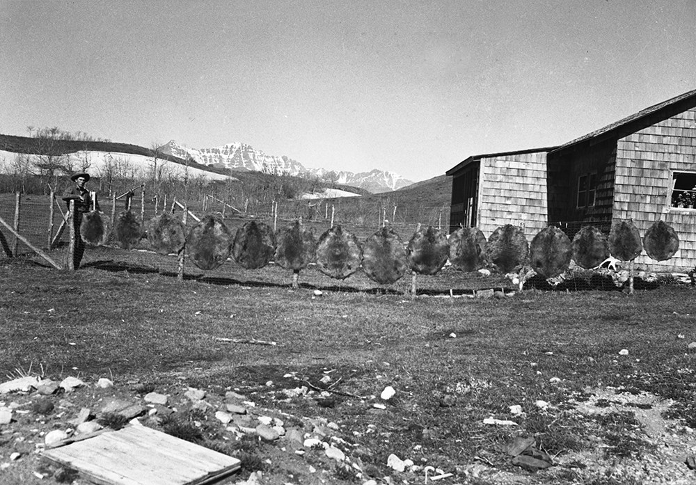
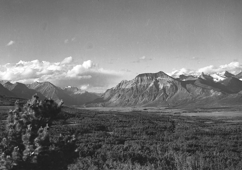
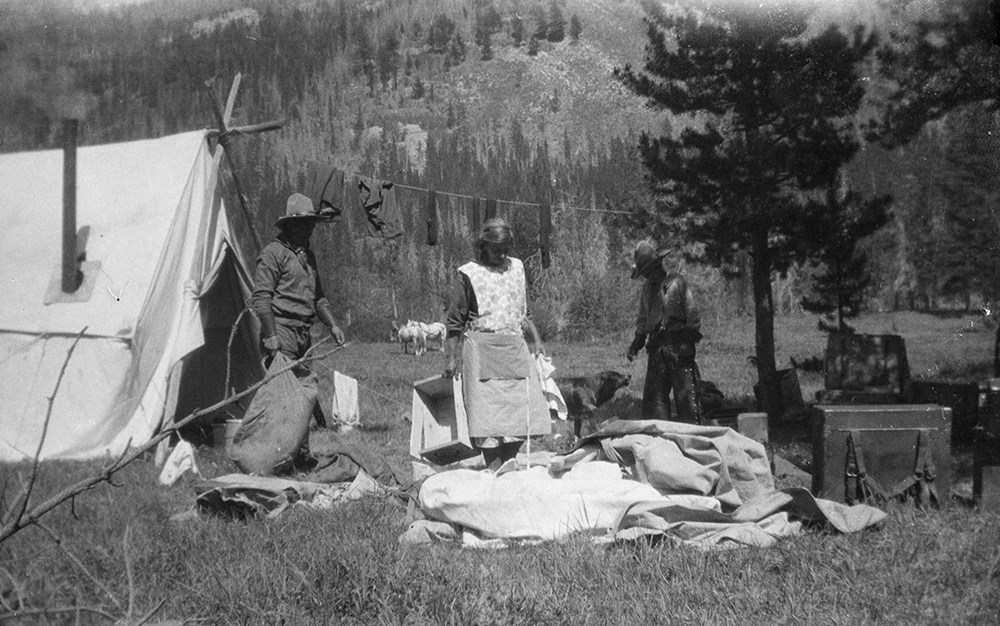
- File consists of 472 b&w negatives. The negatives pertain to breaking horses, packtrains and horses, the organizing of the Alberta Licensed Outfitters Association at Col. Snyder's ranch at Sundre, AB attended by Col. Henry Snyder, Major Fred Brewster, Raymond Patterson, Claude Brewster, Harold Anderson, Nick Nickerson, and Riggall, various landscapes, hunting and hunting trophies, hiking, fishing, camps, and various birds
- Name Access
- Snyder, Henry
- Brewster, Fred
- Brewster, Claude
- Anderson, Harold
- Nickerson, Nick
- Patterson, Raymond
- Subject Access
- Sports
- Recreation
- Fishing
- Hunting
- Family and personal life
- Animals
- Camping
- Birds
- Horses
- Horseback riding
- Pack trips
- Outfitters
- Geographic Access
- Canada
- Alberta
- Sundre
- Language
- N/A
- Title Source
- Title based on contents of file
- Content Details
- Reference scans available: V26 / IX / G / PA (G1) to V26 / IX / H / PA (H9)
- Processing Status
- Processed
Images


This material is presented as originally created; it may contain outdated cultural descriptions and
potentially offensive content.
Read more.
- Part Of
- Bert Riggall fonds
- Scope & Content
- File consists of 390 b&w negatives. The negatives pertain to Mount Chapman and Mount Custer; hunters checking slopes; hunters posed with a goat trophy; an unidentified man posed on slope of Belleview Hill; people on horses on Continental Divide North of Sage Pass; Cache Creek Falls; riders on a day…
- Date Range
- [ca.1904 to ca.1959]
- Reference Code
- V26 / IX / H / NA (H1-1) to V26 / IX / J / NA (J5-9)
- Description Level
- 5 / File
- GMD
- Photograph
- Negative
6 images
- Part Of
- Bert Riggall fonds
- Description Level
- 5 / File
- Fonds Number
- M376 / V26
- Series
- IX. Riggall Negatives Scanned and Described
- Sous-Fonds
- V26
- Accession Number
- 7102
- Reference Code
- V26 / IX / H / NA (H1-1) to V26 / IX / J / NA (J5-9)
- GMD
- Photograph
- Negative
- Date Range
- [ca.1904 to ca.1959]
- Physical Description
- 390 photographs :b&w negatives
- Scope & Content
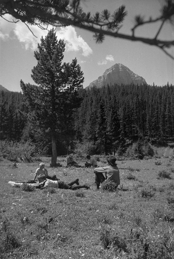
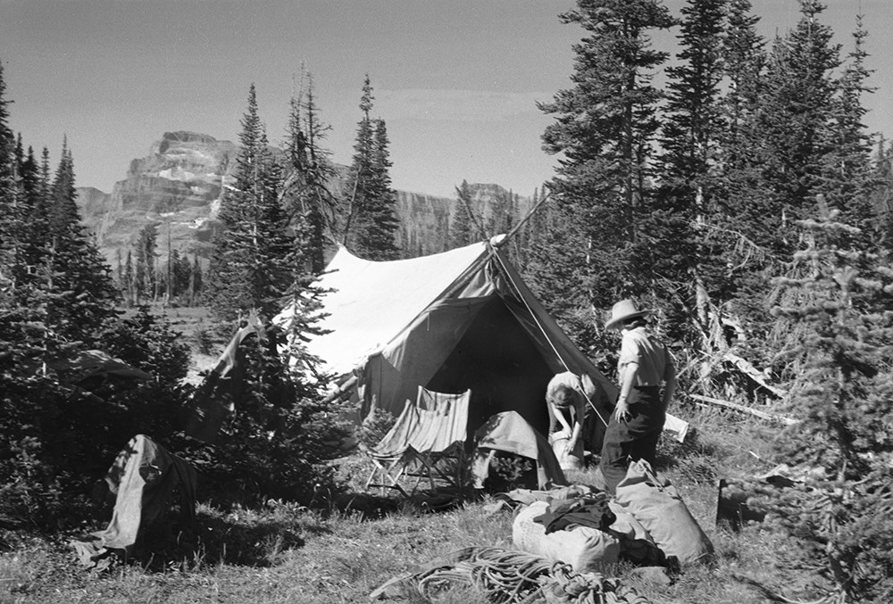
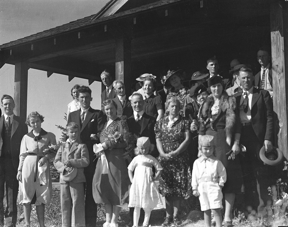
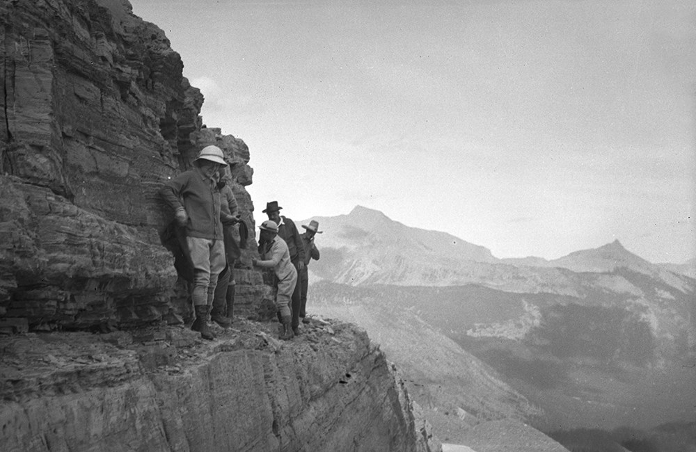
- File consists of 390 b&w negatives. The negatives pertain to Mount Chapman and Mount Custer; hunters checking slopes; hunters posed with a goat trophy; an unidentified man posed on slope of Belleview Hill; people on horses on Continental Divide North of Sage Pass; Cache Creek Falls; riders on a day trip; a camp scene of bedding being aired out; Mount Blackiston and Ruby Creek; the Beehive from Panorama Peak; various hunters; a red squirrel; fisherman, horses and tent at Crandell Lake; a mule deer on prairie part of Waterton Lakes National Park; two mule deer on slopes above Cameron Lake; woman on shore of Wall Lake; camp at Oyster Creek; Canadian two cent stamp; horses on ranch; hunters on vertical cliff; Summit Lake early in summer Mount Chapman; people and horses across from Beehive; two hunters in camp with deer trophy; packtrain below Broken Castle; Anderson Peak; mule deer buck; big horn ram on grassy slope; rams on a cliff; people on shore of Upper Kintla Lake, Long Knife Peak; rider at Oyster Creek camp; snow-covered camp scene; beaver dams and ponds on Dungarvin Creek; fisherman with large trout; McIntyre ranch buildings from Milk River Ridge; various camp scenes; Hawk's Nest cottage yard with trip supplies; packtrain wading up a river; packtrain in a meadow in the Oldman area; chicadee; gray-crowned rosy finches; downy woodpecker; columbia ground squirell; osprey nest near Oldman River; fisherman on Oldman River; A.O. Wheeler's mapping survey expeditions rock cairn; group on Tornado Pass; two people on Limestone Peak; Andy Russell and Jim Bennett on Tornado Mountain; andy Russell on top of cliff; Castle River rodeo; Sumner Crosby with a ram; lunch time on trip; Andy Russell field dressing a bull elk; guests on Mount Chimney; hunter on avalanche track; tents in snow; Lake Wurderman, Lake Nooney, and Mount Chapman; children eating on porch of Hawk's Nest; moving camp at Oyster Creek; limestone outcrop on corner of Lakeview Ridge; guest eatng at table in front of tent; Bert's car near Red Rock Canyon; saddle horses above South Kootenay Pass, Starvation Peak and King Edward; Mount Farquhar, Holcroft Mountain, Mount Scrimger; Jim Bennett with his movie camera near Beehive; Andy Russell and packtrain Oldman River valley; Lundbreck, Alberta; Pincher Creek and Castle Mountain; Upper Waterton Lake from Crandell; Andy and Kay Russell Wedding, 1938; Andy Russell snowshoeing; F.H.R's tipi; fishing at Wall Lake; Riggall's second Cottonwood Canyon house; Twin Lakes Camp; Kintla Lookout; Harwood Wedding.
- Subject Access
- Portraits
- Landscapes
- Hunting
- Guiding
- Pack trips
- Sports
- Recreation
- Wildlife
- Environment
- Snowshoes and snowshoeing
- Fishing
- Travel
- Geographic Access
- Canada
- Alberta
- Pincher Creek
- Canadian Rocky Mountains
- Waterton Lakes National Park
- Waterton
- Castle Mountain
- Language
- English
- Category
- Environment
- Exploration, discovery and travel
- Family and personal life
- Sports, recreation and leisure
- Title Source
- Title based on contents of file
- Content Details
- Reference scans available: V26 / IX / H / PA (H1) to V26 / IX / J / PA (J5)
- Processing Status
- Processed
Images

This material is presented as originally created; it may contain outdated cultural descriptions and
potentially offensive content.
Read more.