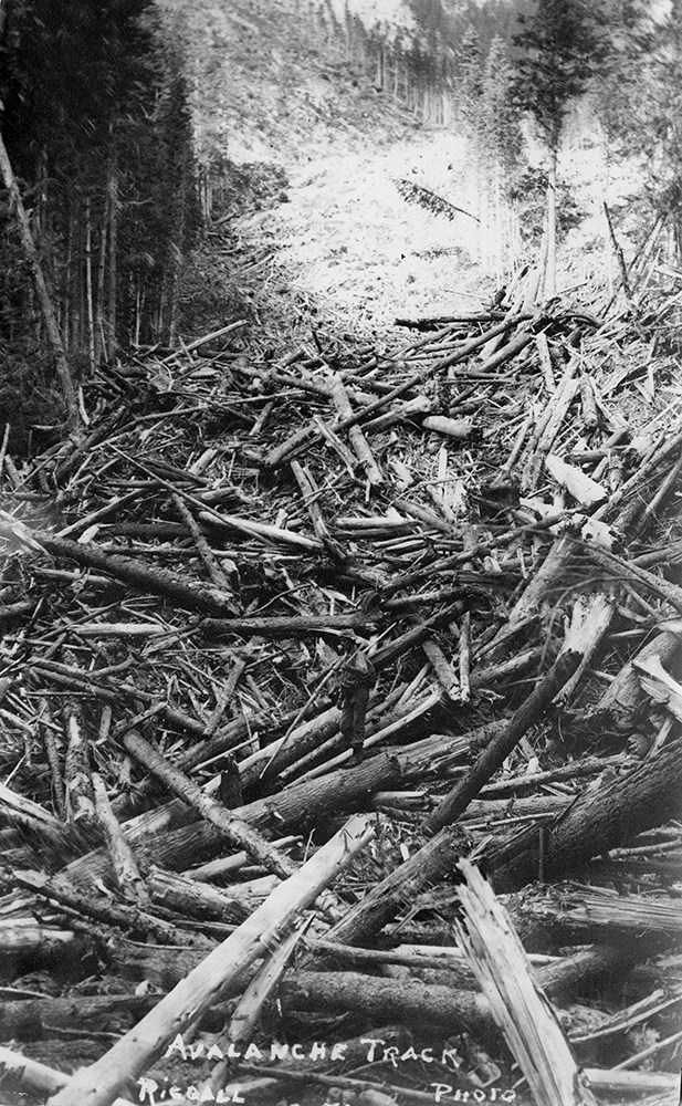
Narrow Results By
Waterton Lakes
https://archives.whyte.org/en/permalink/descriptions23552
- Part Of
- Bert Riggall fonds
- Scope & Content
- File consists of 17 b&w, some captioned. The prints pertain to panoramic aerial views of Waterton Lake, townsite, and surrounding mountains, as well as various views of Waterton Lakes (upper and lower) .
- Date Range
- 1915
- Reference Code
- V26 / III / B15 / PA - 79 to 96
- Description Level
- 5 / File
- Part Of
- Bert Riggall fonds
- Description Level
- 5 / File
- Series
- III. Professional Photography: Topical Files
- Reference Code
- V26 / III / B15 / PA - 79 to 96
- Date Range
- 1915
- Physical Description
- Photographs: 17 prints, b&w
- Scope & Content
- File consists of 17 b&w, some captioned. The prints pertain to panoramic aerial views of Waterton Lake, townsite, and surrounding mountains, as well as various views of Waterton Lakes (upper and lower) .
- Subject Access
- Waterton Lakes
- Title Source
- Title based on contents of file
- Content Details
- Riggall's Grandson John Russell provided idendifications on some photographs they are as follows: PA - 90 Looking South along East face of Lake view Ridge at Waterton Lakes.
- Processing Status
- Processed
This material is presented as originally created; it may contain outdated cultural descriptions and
potentially offensive content.
Read more.
Bert Riggall's 1000 Mile Pack trip
https://archives.whyte.org/en/permalink/descriptions23454
- Part Of
- Bert Riggall fonds
- Scope & Content
- File consists of 43 b&w photographs, some captioned. Photographs pertain to Riggall's 1911 1000 mile pack trip undertaken to seek out areas for hunting and outfitting following the enlargement of Waterton National Park and the reduction of available hunting area for Riggall's clients. The prints do…
- Date Range
- 1911
- Reference Code
- V26 / II / A7 / PA - 119 to 161
- Description Level
- 5 / File
- GMD
- Photograph
- Photograph print
1 image
- Part Of
- Bert Riggall fonds
- Description Level
- 5 / File
- Fonds Number
- M376 / V26
- Series
- II.Business and Financial: Bert Riggall's 1000 Mile Pack trip, 1911
- Sous-Fonds
- V26
- Accession Number
- 7201
- Reference Code
- V26 / II / A7 / PA - 119 to 161
- Date Range
- 1911
- Physical Description
- 43 photographs: b&w prints
- Scope & Content
- File consists of 43 b&w photographs, some captioned. Photographs pertain to Riggall's 1911 1000 mile pack trip undertaken to seek out areas for hunting and outfitting following the enlargement of Waterton National Park and the reduction of available hunting area for Riggall's clients. The prints document this pack trip from stops in Banff, AB and Cranbrook, BC, and the extent of his mountain exploration from Fort Steele to Edson. On this trip, approximately 150 miles of new trail was cut including portions of Roger's Pass.
- Subject Access
- Pack trips
- Exploration
- Trails
- Trail making
- Recreation
- Hunting
- Outfitters, trail guides and packers
- Geographic Access
- Canada
- Alberta
- Banff National Park
- Waterton National Park
- British Columbia
- Cranbrook
- Rogers Pass
- Language
- English
- Title Source
- Title based on contents of file
- Processing Status
- Processed
Images

This material is presented as originally created; it may contain outdated cultural descriptions and
potentially offensive content.
Read more.
Bert Riggall's 1000 Mile Pack trip
https://archives.whyte.org/en/permalink/descriptions23455
- Part Of
- Bert Riggall fonds
- Scope & Content
- File consists of 20 b&w photographs, some captioned. Photographs pertain to Riggall's 1911 1000 mile pack trip undertaken to seek out areas for hunting and outfitting following the enlargement of Waterton National Park and the reduction of available hunting area for Riggall's clients. The prints do…
- Date Range
- 1911
- Reference Code
- V26 / II / A7 / PA - 162 to 181
- Description Level
- 5 / File
- GMD
- Photograph
- Photograph print
1 image
- Part Of
- Bert Riggall fonds
- Description Level
- 5 / File
- Fonds Number
- M376 / V26
- Series
- II.Business and Financial: Bert Riggall's 1000 Mile Pack trip, 1911
- Sous-Fonds
- V26
- Accession Number
- 7201
- Reference Code
- V26 / II / A7 / PA - 162 to 181
- Date Range
- 1911
- Physical Description
- Photographs: 20 prints, b&w
- Scope & Content
- File consists of 20 b&w photographs, some captioned. Photographs pertain to Riggall's 1911 1000 mile pack trip undertaken to seek out areas for hunting and outfitting following the enlargement of Waterton National Park and the reduction of available hunting area for Riggall's clients. The prints document this pack trip from stops in Banff, AB and Cranbrook, BC, and the extent of his mountain exploration from Fort Steele to Edson. On this trip, approximately 150 miles of new trail was cut including portions of Roger's Pass.
- Subject Access
- Pack trips
- Exploration
- Trails
- Trail making
- Recreation
- Hunting
- Outfitters, trail guides and packers
- Geographic Access
- Canada
- Alberta
- Banff National Park
- Waterton National Park
- British Columbia
- Cranbrook
- Rogers Pass
- Language
- English
- Title Source
- Title based on contents of file
- Processing Status
- Processed
Images
This material is presented as originally created; it may contain outdated cultural descriptions and
potentially offensive content.
Read more.
Bert Riggall fonds
https://archives.whyte.org/en/permalink/descriptions587
- Part Of
- Bert Riggall fonds
- Scope & Content
- Fonds includes seven series: I. Personal and professional, 1884-1959; II. Business and financial, ca.1910-1959; III. Professional photography, 1900-1955; IV. Writing, 1906-1957; V. Natural history, 1904-1954; VI. Other interests, 1913-1956; VII. Riggall family, ca.1865-1959. Personal and pro…
- Date Range
- [ca.1865]-1959, predominant [ca.1890]-1959
- Reference Code
- M376 / V26
- Description Level
- 1 / Fonds
- GMD
- Photograph
- Album
- Negative
- Photograph print
- Transparency
- Textual record
- Diary
- Map
- Private record
- Published record
- Part Of
- Bert Riggall fonds
- Description Level
- 1 / Fonds
- Fonds Number
- M 376
- V 26
- Sous-Fonds
- M 376
- V 26
- Accession Number
- 5777, 7200, 7201, 7772 (unproc)
- Reference Code
- M376 / V26
- GMD
- Photograph
- Album
- Negative
- Photograph print
- Transparency
- Textual record
- Diary
- Map
- Private record
- Published record
- Date Range
- [ca.1865]-1959, predominant [ca.1890]-1959
- Physical Description
- ca.13,100 photographs: ca.7080 prints, ca.5310 negatives, ca.700 transparencies. -- 9 photograph albums. -- ca.2 m textual records, print material and graphic records. -- 33 cartographic records
- History / Biographical
- Frederick Herbert (Bert) Riggall, 1884-1959, was a mountain guide, outfitter, hunter, trapper, rancher, naturalist, photographer, writer and gunsmith/loader in southern Alberta. Born in 1884 at Gayton-le-Wold Grange, Lincolnshire, his family moved to Grimsby where his father was an auctioneer and, in 1905, served as Mayor. In England, Riggall was an athlete, avid sportsman and naturalist. He was exposed to alpine country on school holidays in Switzerland and, determined to visit Canada, left for North America in 1904.
- Upon arriving in western Canada, Riggall worked for a year at Craighurst Farm near Calgary. There he met Dorothea (Dora) Williams, 1877-1951, an Irish Quaker ranch cook who had emigrated with her sister Anna in 1902. In 1905, Bert worked on the Correction Land Survey in southwestern Alberta and explored Waterton Lakes. Bert and Dora married in 1906 and until 1946 they homesteaded and ranched adjacent to Waterton Lakes National Park.
- Initially, Bert and partner Jack Hazzard built boats and guided fishing parties on Waterton Lakes. In 1909, with partner Cyril Watmough, the Riggalls began guiding and outfitting summer and fall hunting and fishing trips for numerous repeat clients, especially, after 1913, four Minneapolis, Minnesota families: Bovey, Crosby, Bennett and McKnight. Hunts involved Big Horn Sheep, goats, black and grizzly bears. Bert served as chief guide and Dora as camp cook. Prior to 1911, the Riggalls worked at Gloyne's oil camp and Oil City to supplement their income. In 1911, Bert and partner Cyril Watmough made a 1000 mile (1600 km) exploratory trip from Fort Steele, B.C. to the Yellowhead Pass and beyond. Following that trip, Riggall concentrated guiding activities on the continental divide as far north as the Highwood region, but primarily in the upper Oldman River Valley and Gap in the Livingstone Range. Their outfit grew to include numerous saddle and pack horses.
- Of five children, only two daughters survived infancy. Kay Riggall (Russell), 1909-1984, and Doris (Babe) Riggall (Burton), 1910-1999, were both able riders, markswomen and packtrain workers. They accompanied their parents on summer back country trips starting in 1918. Bert Riggall was renowned for his knowledge of botany, geology, zoology, wilderness life and lore as well as literature and current affairs. He was especially endeared to his clients for his skill as a raconteur and campfire storyteller. He wrote articles for magazines such as: Arms and the Man, American Rifleman, Field and Stream and the Boone and Crockett Club's book: North American Big Game. Riggall was an accomplished semi-professional photographer who specialized in wildlife studies, panoramic landscapes, Dufaycolor and later Kodachrome transparencies. His photographs appear in Department of Interior Reports and other publications.
- Bert's heart problems forced the Riggalls to move to Pincher Creek in 1947. Daughter Kay and son-in-law Andy Russell continued the packtrain and guiding business until 1960. After Dora's death, Bert experienced medical problems and lived with or close to Doris.
- Scope & Content
- Fonds includes seven series: I. Personal and professional, 1884-1959; II. Business and financial, ca.1910-1959; III. Professional photography, 1900-1955; IV. Writing, 1906-1957; V. Natural history, 1904-1954; VI. Other interests, 1913-1956; VII. Riggall family, ca.1865-1959.
- Personal and professional series consists of diaries and notes, correspondence and personal papers.
- Business and financial series consists of guiding and ranching records, gunsmithing, shooting and loading records; and legal and financial records.
- Professional photography series consists of standard photographs, panoramas, transparencies and textual records
- Writing series contains manuscripts, published magazines, book outlines, newspaper articles and letters to the editor
- Natural history series contains bird and plant records, and other natural history papers
- Other interests series consist of clippings, annotated books and collected material
- Riggall family series contains Bert and Dora Riggall family papers and photographs, Williams family photographs, Frederick W. and Fanny Riggall papers and photographs, and Allan Riggall papers and photographs. Negatives and transparencies pertain to Andy Russell as a young man with Bert Riggall.
- Notes
- Some transparencies in V110 Dick Russell are marked Andy Russell, some marked 64 dup; V110 - original transparencies have full set of duplicates (2 sets were made, 1 for Dick Russell and the other is part of this accession)
- Name Access
- Riggall, Bert
- Subject Access
- Arts
- Environment
- Exploration, discovery and travel
- Family and personal life
- Sports, recreation and leisure
- Access Restrictions
- Some restriction/s on access
- Copyright, privacy, commercial use and other restrictions may apply
- Language
- Language is English
- Finding Aid
- basic description for processed material
- Related Material
- Related to the Andy Russell fonds (M153/S43/V555) and the Kay Russell family fonds (M63/V63)
- Creator
- Riggall, Bert
- Category
- Arts
- Environment
- Exploration, discovery and travel
- Family and personal life
- Sports, recreation and leisure
- Title Source
- Title based on accession record and contents of fonds
- Processing Status
- Processed / Unprocessed
This material is presented as originally created; it may contain outdated cultural descriptions and
potentially offensive content.
Read more.
Bennett Trips 1931 to 1936
https://archives.whyte.org/en/permalink/descriptions23415
- Part Of
- Bert Riggall fonds
- Scope & Content
- File consists of 22 b&w photographs, some captioned. Photographs pertain to the Bennett trips guided and outfitted by Riggall of 1931, 1933, 1934, 1935, and 1936. The photographs document packtrains, camp life, hiking, Herbst glacier, and fishing. Locations of photographs include: Wall Lake, Mount …
- Date Range
- 1931
- 1933-1936
- Reference Code
- V26 / II / A4 / PA - 130 to 152
- Description Level
- 5 / File
- GMD
- Photograph
- Photograph print
- Part Of
- Bert Riggall fonds
- Description Level
- 5 / File
- Fonds Number
- M376 / V26
- Series
- II.Business and Financial: Client Papers and Photographs
- Sous-Fonds
- V26
- Accession Number
- 7201
- Reference Code
- V26 / II / A4 / PA - 130 to 152
- Date Range
- 1931
- 1933-1936
- Physical Description
- Photographs: 22 b&w prints
- Scope & Content
- File consists of 22 b&w photographs, some captioned. Photographs pertain to the Bennett trips guided and outfitted by Riggall of 1931, 1933, 1934, 1935, and 1936. The photographs document packtrains, camp life, hiking, Herbst glacier, and fishing. Locations of photographs include: Wall Lake, Mount Festubert, Great Divide at South Kootenay Pass.
- Subject Access
- Guiding, Camping, Packtrains
- Hiking
- Camping
- Recreation
- Sports
- Fishing
- Geographic Access
- Canada
- Canadian Rocky Mountains
- British Columbia
- Kootenay National Park
- Great Divide
- Language
- N/A
- Title Source
- Title based on contents of file
- Processing Status
- Processed
This material is presented as originally created; it may contain outdated cultural descriptions and
potentially offensive content.
Read more.
Waterton Lakes
https://archives.whyte.org/en/permalink/descriptions23549
- Part Of
- Bert Riggall fonds
- Scope & Content
- File consists of 27 b&w, some captioned. The prints pertain to the Waterton Lakes area. The photographs document the Waterton/Glacier international peace park sign, international boundary line/border with the United States, Cameron Bay, Cameron Falls, a car on Belly River road, and Waterton main st…
- Date Range
- 1909 to 1947
- Reference Code
- V26 / III / B15 / PA - 1 to 27
- Description Level
- 5 / File
- Part Of
- Bert Riggall fonds
- Description Level
- 5 / File
- Series
- III. Professional Photography: Topical Files
- Reference Code
- V26 / III / B15 / PA - 1 to 27
- Date Range
- 1909 to 1947
- Physical Description
- Photographs: 27 prints, b&w
- Scope & Content
- File consists of 27 b&w, some captioned. The prints pertain to the Waterton Lakes area. The photographs document the Waterton/Glacier international peace park sign, international boundary line/border with the United States, Cameron Bay, Cameron Falls, a car on Belly River road, and Waterton main street.
- Subject Access
- Waterton Lakes
- Title Source
- Title based on contents of file
- Content Details
- Riggall's Grandson John Russell provided idendifications on some photographs they are as follows: PA - 22 to 24 All views of Mt. Anderson, no longer existing Red Rock Warden station in one.
- Processing Status
- Processed
This material is presented as originally created; it may contain outdated cultural descriptions and
potentially offensive content.
Read more.
Waterton Lakes
https://archives.whyte.org/en/permalink/descriptions23550
- Part Of
- Bert Riggall fonds
- Scope & Content
- File consists of 29 b&w, some captioned. The prints pertain to the Waterton Lakes area. The photographs document the Prince of Whales Hotel, the Waterton picnic shelter, historic Waterton saw mill, the first plane in Waterton, Waterton Lake with townsite and boat, and aerial views of Waterton Lake …
- Date Range
- 1907 to 1947
- Reference Code
- V26 / III / B15 / PA - 28 to 55
- Description Level
- 5 / File
- Part Of
- Bert Riggall fonds
- Description Level
- 5 / File
- Series
- III. Professional Photography: Topical Files
- Reference Code
- V26 / III / B15 / PA - 28 to 55
- Date Range
- 1907 to 1947
- Physical Description
- Photographs: 29 prints, b&w
- Scope & Content
- File consists of 29 b&w, some captioned. The prints pertain to the Waterton Lakes area. The photographs document the Prince of Whales Hotel, the Waterton picnic shelter, historic Waterton saw mill, the first plane in Waterton, Waterton Lake with townsite and boat, and aerial views of Waterton Lake and townsite.
- Subject Access
- Waterton Lakes
- Title Source
- Title based on contents of file
- Content Details
- Riggall's Grandson John Russell provided idendifications on some photographs they are as follows: PA - 32 to 35 This picnic is still in use in Waterton 53 years later. JR. PA - 37 This is an historic photo of tha saw mill accross Waterton R. from present new registration kiosks.
- Processing Status
- Processed
This material is presented as originally created; it may contain outdated cultural descriptions and
potentially offensive content.
Read more.
Waterton Lakes
https://archives.whyte.org/en/permalink/descriptions23551
- Part Of
- Bert Riggall fonds
- Scope & Content
- File consists of 29 b&w, some captioned. The prints pertain to aerial views of Waterton Lake and townsite.
- Date Range
- 1930 to 1947
- Reference Code
- V26 / III / B15 / PA - 56 to 78
- Description Level
- 5 / File
- Part Of
- Bert Riggall fonds
- Description Level
- 5 / File
- Series
- III. Professional Photography: Topical Files
- Reference Code
- V26 / III / B15 / PA - 56 to 78
- Date Range
- 1930 to 1947
- Physical Description
- Photographs: 29 prints, b&w
- Scope & Content
- File consists of 29 b&w, some captioned. The prints pertain to aerial views of Waterton Lake and townsite.
- Subject Access
- Waterton Lakes
- Title Source
- Title based on contents of file
- Content Details
- Riggall's Grandson John Russell provided idendifications on some photographs they are as follows: PA - 56 to 68 Shows development in Waterton from 1930 to 1937
- Processing Status
- Processed
This material is presented as originally created; it may contain outdated cultural descriptions and
potentially offensive content.
Read more.
Waterton Lakes
https://archives.whyte.org/en/permalink/descriptions23553
- Part Of
- Bert Riggall fonds
- Scope & Content
- File consists of 29 b&w and colour (tinted), some captioned. The prints pertain to various early views of Waterton Lakes (upper and lower).
- Date Range
- 1905, 1909
- Reference Code
- V26 / III / B15 / PA - 97 to 125
- Description Level
- 5 / File
- Part Of
- Bert Riggall fonds
- Description Level
- 5 / File
- Series
- III. Professional Photography: Topical Files
- Reference Code
- V26 / III / B15 / PA - 97 to 125
- Date Range
- 1905, 1909
- Physical Description
- Photographs: 29 prints, b&w, colour
- Scope & Content
- File consists of 29 b&w and colour (tinted), some captioned. The prints pertain to various early views of Waterton Lakes (upper and lower).
- Subject Access
- Waterton Lakes
- Title Source
- Title based on contents of file
- Content Details
- Riggall's Grandson John Russell provided idendifications on some photographs they are as follows:
- PA - 106 Taken from Bertha Trail looking up Waterton Lake. There is no untreed area like this now.
- PA - 109 Gauntlet Mt at head of Waterton Lakes from either the boat International or the one that is sunk in Emerald bay. JR
- Processing Status
- Processed
This material is presented as originally created; it may contain outdated cultural descriptions and
potentially offensive content.
Read more.
Waterton Lakes
https://archives.whyte.org/en/permalink/descriptions23554
- Part Of
- Bert Riggall fonds
- Scope & Content
- File consists of 25 b&w, some captioned. The prints pertain to various views of Waterton Lakes (upper and lower) including some aerial views.
- Date Range
- 1905 to 1936
- Reference Code
- V26 / III / B15 / PA - 126 to 150
- Description Level
- 5 / File
- Part Of
- Bert Riggall fonds
- Description Level
- 5 / File
- Series
- III. Professional Photography: Topical Files
- Reference Code
- V26 / III / B15 / PA - 126 to 150
- Date Range
- 1905 to 1936
- Physical Description
- Photographs: 25 prints, b&w
- Scope & Content
- File consists of 25 b&w, some captioned. The prints pertain to various views of Waterton Lakes (upper and lower) including some aerial views.
- Subject Access
- Waterton Lakes
- Title Source
- Title based on contents of file
- Content Details
- Riggall's Grandson John Russell provided idendifications on some photographs they are as follows:
- PA - 132 Middle and Lower Waterton Lake from top of Mt. Richards looking east.
- Processing Status
- Processed
This material is presented as originally created; it may contain outdated cultural descriptions and
potentially offensive content.
Read more.